web analytics

Tag: expedition updates

  • Mont Blanc Expedition Update 2026: Routes, the Permit Reality & the Grand Couloir

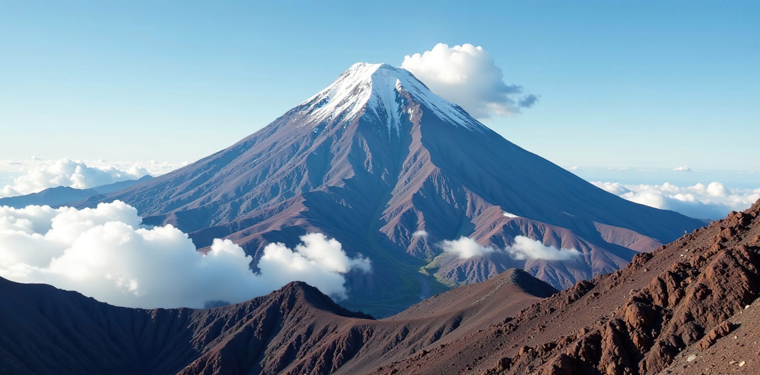
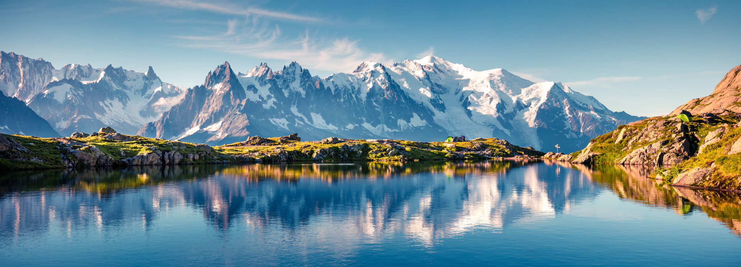
    Mont Blanc, the snow-capped highest peak of the Alps, above Chamonix
    Mont Blanc is about 4,808 m (15,774 ft), the highest peak in the Alps and Western Europe. Its royal-route reputation hides one of the deadliest mountains in Europe.
    Expedition Updates · Alps

    Mont Blanc expedition update

    The most-climbed major peak in the Alps, and one of the most underestimated. This page tracks the permit reality, the two main routes, the Grand Couloir, the cost, and where Mont Blanc fits your progression. A single-mountain page in our Expedition Updates directory. Elevations in metres (feet).

    Current status Summer season 4,808 m (15,774 ft)

    The Voie Royale that kills the unprepared.

    Mont Blanc is the highest mountain in the Alps and Western Europe, and the most climbed, with tens of thousands attempting it each summer. Its normal route is graded PD, low on the alpine scale, and that low grade is exactly the trap: in absolute numbers it is one of the deadliest mountains in Europe.

    There is no permit, but a hut reservation is now a legal requirement to climb the Gouter route with an overnight, checked by the Garde Blanche patrol. And the Grand Couloir, a rockfall gully on that route, has claimed over a hundred lives. For current Grand Couloir status and hut dates, see our Gouter route conditions page.

    4,808 m

    Summit (15,774 ft)

    Highest in the Alps and Western Europe; re-surveyed every couple of years.

    Hut booking

    Required on the Gouter

    No permit, but a mandatory reservation, enforced.

    Jun to Sep

    Prime season

    Timed around the Grand Couloir overnight freeze.

    Mont Blanc, the White Mountain, straddles the border of France and Italy above Chamonix and Courmayeur. It is the birthplace of modern mountaineering, first climbed in 1786, and it remains the great rite-of-passage 4,000 m peak for climbers stepping up from trekking and scrambling. That accessibility is its appeal and its danger. This page owns the mountain-level picture, the permit reality, the routes, and the progression. For live Grand Couloir status, refuge dates, and the 2026 season window, see our Gouter route conditions page, and for the full route detail, the Mont Blanc climb guide.

    Season and status

    A summer mountain, timed as much by temperature as by the calendar.

    Mont Blanc is climbed in summer, roughly late May or June through late September into early October, with the most stable conditions from mid-June to early September. But the calendar is only half the story. Because hot weather sharply increases rockfall in the Grand Couloir, the safe window is really defined by cold, frozen conditions, and heatwaves can make the normal route dangerous even in peak season. Rather than duplicate the live tracking, we keep the current hut opening dates and Grand Couloir status on our Gouter route conditions page.

    The permit reality

    No permit, but not a free-for-all either.

    This is the point most first-timers get wrong. Mont Blanc has no climbing permit; it is technically an open mountain. But to climb the Gouter route with an overnight stay, a hut reservation is now a legal requirement, and a dedicated patrol called the Garde Blanche checks for proof of a booking, usually near Nid d’Aigle or Tete Rousse. Climbers who cannot show a valid reservation can be turned back. Only a single-push speed ascent with no overnight avoids the requirement. In practice, planning a Mont Blanc climb means securing a hut booking months ahead, not simply turning up with crampons.

    What this means for you: book your hut, Tete Rousse or the Gouter Refuge, as far ahead as you can, because the spots are limited and they fill. A proposed climbing deposit or permit has been debated for years but is not in force; the real gate is the hut reservation, not a permit office.

    The two main routes

    The normal route, and the one that avoids the couloir.

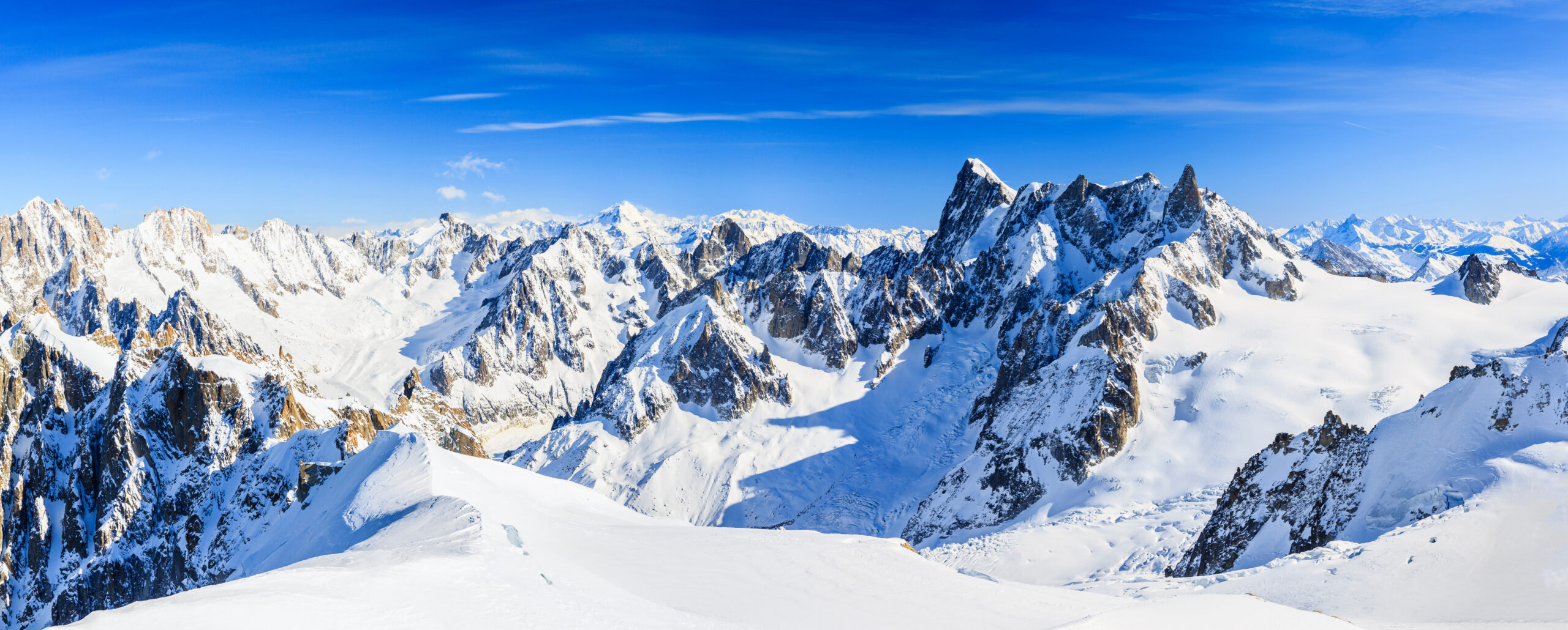
    Climbers on a snow ridge high on Mont Blanc in the French Alps
    High on Mont Blanc, above the huts. The normal Gouter route finishes over the Dome du Gouter and the Bosses Ridge; the Trois Monts route reaches the summit from the Aiguille du Midi side.
    The main Mont Blanc routes. All require crampon, ice-axe, and glacier-travel skills.
    RouteStartCharacterMain hazard
    Gouter (normal route)Nid d’Aigle (Mont Blanc Tramway)The most popular and least technical line, hut-based via Tete Rousse and the Gouter Refuge.The Grand Couloir rockfall crossing.
    Trois MontsAiguille du Midi cable carMore committing, crossing Mont Blanc du Tacul and Mont Maudit, and it avoids the Grand Couloir.Serac and avalanche hazard on the Tacul and Maudit slopes.
    Gonella (Italian)The Italian sideQuieter and more physically demanding, a longer and less trafficked approach.Length and remoteness.

    The Gouter is the route most people mean when they say they are climbing Mont Blanc: hut-based, less technical, and busy, but committed to crossing the Grand Couloir. The Trois Monts is the connoisseur’s line from the Aiguille du Midi, more committing and exposed to serac and avalanche hazard over Mont Blanc du Tacul and Mont Maudit, but free of the couloir. Neither is a walk, and both demand the same fundamental skills.

    The Grand Couloir

    The single most dangerous section of the normal route.

    ⚠ The couloir is where the normal route earns its reputation

    The Grand Couloir is a rockfall gully at around 3,340 m, a crossing of roughly 50 m equipped with fixed ropes, between the Tete Rousse and Gouter huts. It must be crossed early, before about 7am, while the overnight freeze still binds the loose rock; once the sun warms the slope, stones come down the gully with little warning. French mountain police recorded 347 rescues, 102 deaths, and 230 injuries here between 1990 and 2017, and hot summers make it markedly worse.

    Cross fast, cross early, wear a helmet, and do not linger. In dangerous heat the authorities have closed the Gouter Refuge to discourage the route entirely. Check the current status on our Gouter route conditions page before you go. This page is educational and is not a substitute for a guide.

    Cost and guiding

    Affordable by 4,000 m standards, with IFMGA guides the norm.

    A guided Gouter climb, usually three days and two nights with some acclimatization, runs roughly 1,200 to 2,000 euros or more, using an IFMGA-certified guide, the required standard in the Alps. On top of the guiding fee, budget the hut fees, the Mont Blanc Tramway to Nid d’Aigle, any gear rental, and travel to Chamonix. Climbing independently is cheaper, but it assumes you already have the crampon, glacier, and route-finding skills a guide would otherwise supply, and it still requires the same hut booking. Weigh the choice in our guided versus independent climbing guide, and vet teams with how to choose an operator.

    Altitude and difficulty

    Low grade, high seriousness.

    Mont Blanc is graded PD, non-technical by alpine standards, but that grade describes the moves, not the mountain. At about 4,808 m the altitude is a real factor, and climbers who arrive without acclimatization often struggle on the long summit day. Add crevasses on the glaciers, the Grand Couloir on the Gouter, and the notorious speed of Alpine weather, and a low-grade climb becomes a serious one. It is often a climber’s first 4,000 m peak, and it rewards proper acclimatization and fitness more than technical skill. Read our acclimatization guide and check your base against our fitness standards, and gauge your altitude risk with the AMS risk calculator.

    Weather and timing

    The live picture over the massif.

    Alpine weather changes fast, and Mont Blanc’s summit can be in cloud and high wind while Chamonix sits in sunshine. Summit day depends on catching a calm, cold window, which also keeps the Grand Couloir safer. The live map below shows current conditions; rely on the Chamonix mountain forecast and your guide or hut staff for the actual call.

    Live wind and weather for Mont Blanc. Source: Windy.com. For how to read a mountain forecast, see our weather guide.
    Mont Blanc, on the France-Italy border above Chamonix and Courmayeur. Map: OpenStreetMap contributors.

    Where Mont Blanc fits your progression

    The classic first big Alpine 4000er.

    For most climbers Mont Blanc is the first serious 4,000 m peak, the altitude and glacier milestone before more technical objectives. The natural step up in the Alps is the Matterhorn, which trades Mont Blanc’s altitude for sustained technical rock, and our Mont Blanc versus Matterhorn comparison lays out the difference. Track current conditions on the next objective in our Matterhorn expedition update, and see the wider range in our Alps Classics collection.

    Go or no-go checklist

    Work through these before you commit.

    Before you go

    • Book the hut early – a Tete Rousse or Gouter reservation is a legal requirement and the spots fill months ahead.
    • Acclimatize first – the altitude near 4,808 m turns back climbers who arrive straight from sea level.
    • Have the skills – crampons, ice axe, glacier travel, and roped movement, or climb guided.
    • Plan the Grand Couloir – cross before 7am, wear a helmet, and check the current status before you go.
    • Watch the heat – hot spells raise rockfall risk; a cold, frozen window is safer than a warm one.
    • Respect the PD grade – low technical difficulty does not mean low risk on this mountain.

    Mont Blanc update FAQ

    The questions climbers ask most about permits, routes, and the Grand Couloir.

    Do you need a permit to climb Mont Blanc?

    There is no climbing permit, but this is where people go wrong. To climb the Gouter route with an overnight stay, a hut reservation is now a legal requirement, and a patrol called the Garde Blanche checks for proof of a booking near Nid d’Aigle and Tete Rousse. If you cannot show a valid reservation, you can be turned back. Only a single-push speed ascent with no overnight avoids the booking requirement. So while Mont Blanc is technically an open mountain, the practical answer is that you plan around a mandatory hut reservation, not a free-for-all.

    What is the Grand Couloir?

    The Grand Couloir is the notorious rockfall gully on the Gouter route, at around 3,340 m, a crossing of roughly 50 m equipped with fixed ropes. It must be crossed early, before about 7am, while the overnight freeze still holds the loose rock in place; once the sun warms the slope, rockfall increases sharply. French mountain police recorded 347 rescues, 102 deaths, and 230 injuries in the couloir between 1990 and 2017. It is the single most dangerous section of the normal route. For its current status, see our Gouter route conditions page.

    Which Mont Blanc route should I climb?

    The Gouter, or normal, route is the most popular and least technically demanding, but it crosses the Grand Couloir. The Trois Monts route from the Aiguille du Midi avoids the couloir but is more committing, with serac and avalanche hazard over Mont Blanc du Tacul and Mont Maudit. The Italian Gonella route is quieter and longer. All of them require crampon and ice-axe skill, glacier travel, and roped movement; none is a walk-up.

    Is Mont Blanc dangerous?

    In absolute terms it is one of the deadliest mountains in Europe, though not because it is technically hard. It is graded PD, relatively low on the alpine scale, but it is climbed by huge numbers of people who underestimate it. The Grand Couloir rockfall, the altitude at 4,808 m, crevasses, and fast-changing weather are what cause accidents. The low technical grade and the Voie Royale nickname hide a serious high-altitude climb.

    When is the Mont Blanc climbing season?

    Summer, roughly late May or June through late September into early October, with the most stable conditions from mid-June to early September. Because hot weather sharply increases rockfall in the Grand Couloir, timing around cooler, frozen conditions matters as much as the calendar. Our Gouter route conditions page tracks the current 2026 hut opening and route dates.

    How much does it cost to climb Mont Blanc with a guide?

    A guided Gouter climb, typically three days and two nights including some acclimatization, runs roughly 1,200 to 2,000 euros or more, using an IFMGA-certified guide, which is the required standard in the Alps. On top of the guiding fee, budget hut fees, the Mont Blanc Tramway, gear rental if needed, and travel to Chamonix. Going independently is cheaper but assumes you bring the skills a guide would otherwise provide.

    How hard is Mont Blanc, and do I need experience?

    It is graded PD, meaning non-technical by alpine standards, but it is a serious undertaking. You need to be fluent with crampons and an ice axe, comfortable on a rope for glacier travel, fit enough for a long summit day, and able to handle the altitude near 4,808 m. Most first-timers climb it guided or after completing a mountaineering course. It is often a climber’s first serious 4,000 m peak.

    How high is Mont Blanc and where is it?

    Mont Blanc is about 4,808 m (15,774 ft), the highest mountain in the Alps and in Western Europe, on the border of France and Italy above Chamonix and Courmayeur. Its snow-capped summit is re-surveyed every couple of years, so the exact figure shifts slightly. It was first climbed in 1786 by Jacques Balmat and Michel-Gabriel Paccard, the ascent widely seen as the birth of modern mountaineering.

    📋 How this update is built

    This page is compiled by Travis Ludlow, Founder and Head of Research at Global Summit Guide, from Saint-Gervais and prefecture access rules, French mountain-police accident records, and IFMGA guiding information, with sources named below. It was reviewed for safety by Dawson Ludlow, our Climbing and Mountaineering Lead (Wilderness First Aid), whose highest first-hand summit is Kilimanjaro.

    Our team has not climbed Mont Blanc, so we report official rules and route records rather than personal experience, and we review this page through the Alpine season. Access rules and conditions change, so confirm the current hut-reservation requirement and Grand Couloir status on our conditions page and with the authorities before you commit.

    Planning a Mont Blanc climb?

    Start with our Mont Blanc climb guide, check the live Gouter route conditions, and compare it with the step up in Mont Blanc versus Matterhorn. Most climbers stage through Chamonix via Geneva, so for flights and lodging, browse travel on Expedia.

    Disclosure: the Expedia link above is a sponsored affiliate link. We may earn a commission at no extra cost to you.
    Was this helpful?

    Yes
    No
    Thanks for your feedback!
  • Mount Baker Climbing Update 2026: Routes, Season, Permits & Glacier Training

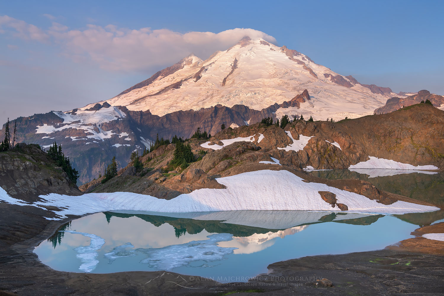
    Mount Baker, a heavily glaciated volcano in the North Cascades of Washington State
    Mount Baker is 10,781 ft (3,286 m), the second-most glaciated peak in the Lower 48. It is the classic first glaciated volcano and the Cascades’ great training ground.
    Expedition Updates · Cascades

    Mount Baker climbing update

    The Cascades’ glacier-mountaineering classroom, and the best first glaciated volcano in the Lower 48. This page tracks the season, the two standard routes, the permits and access, the cost, the hazards, and where Baker fits your progression. A single-mountain page in our Expedition Updates directory. Heights in feet (metres).

    Current status In season May to Sep 10,781 ft (3,286 m)

    The best classroom in the Cascades, with no climbing fee to get in.

    Baker is where climbers learn glacier travel, crevasse rescue, and roped movement before Rainier, Denali, and the Alps. Its two standard routes, the Coleman-Deming and the Easton Glacier, are moderate glacier climbs run heavily as skills-and-summit courses.

    Unlike Rainier, Baker charges no climbing permit or fee, just a Northwest Forest Pass to park and a free self-issued wilderness permit. What it does ask for is skill: over 7,000 ft of gain, a long summit day, and real crevasse and avalanche hazard. Beginner-friendly is not the same as easy.

    10,781 ft

    Summit (3,286 m)

    Third-highest in Washington, second-most glaciated in the Lower 48.

    No fee

    Climbing permit

    Just a Northwest Forest Pass to park; no climbing charge.

    May to Jul

    Prime season

    Best snow and firmest crevasse bridges.

    Mount Baker, known by its Indigenous name Kulshan, dominates the skyline north of Seattle and east of Bellingham. It is one of the snowiest places on earth, holding a world-record single-season snowfall, and its deep glaciation is exactly what makes it such a good place to learn. This page owns the current picture, the season, the routes, the access, and where Baker sits in a climbing progression. For the full history, route detail, and gear, see our Mount Baker climb guide.

    Season and status

    A long summer window, with the best conditions early.

    Baker is climbed from late spring through summer, roughly May to September. May to July usually brings the best snow cover and the firmest crevasse bridges, which is why the guided skills courses cluster there, while later in the summer the glaciers open up, route-finding gets harder, and crevasse hazard rises. Weather is the deciding factor on any given summit day, so teams build in flexibility rather than betting on a single date.

    The glacier classroom

    Why Baker is the peak climbers learn on.

    More than a summit in its own right, Baker is the Pacific Northwest’s teaching mountain. Its moderate, heavily glaciated routes are the ideal place to learn the core skills of glaciated mountaineering: roped glacier travel, crevasse rescue, cramponing, and self-arrest, in real terrain but without extreme technical difficulty. Guide services run constant skills-and-summit courses here for exactly that reason, and climbers routinely use Baker as the proving ground before Rainier, Denali, and bigger objectives in the Alps and the Andes. If you want one mountain to build glacier competence on, this is the one.

    The honest framing: treat Baker as a skills investment, not just a summit. The glacier-travel and crevasse-rescue habits you build here are what keep you safe on every bigger glaciated peak afterward. Pair it with our first glacier climb training and crevasse rescue basics guides.

    The two standard routes

    Coleman-Deming and Easton, plus a step up.

    Coleman-Deming (north side)

    The most popular and most guided route, from the Heliotrope Ridge trailhead. It climbs to Hogsback Camp around 6,000 ft, then up the Coleman Glacier, across the Deming Glacier, and finishes up the steep Roman Wall, the crux, to the summit plateau and Grant Peak. Expect over 7,000 ft of gain and a summit day near 5,000 ft.

    Easton Glacier (south side)

    From the Schriebers Meadow trailhead, a gentler, broad-glacier ascent that is popular for skills courses and ski descents. A slightly more forgiving introduction to the mountain, with its own long summit day.

    North Ridge (a step up)

    A steeper, more technical ice route for experienced climbers, and a natural next objective once the standard routes feel comfortable. Not an introductory line.

    Permits and access

    Simpler and cheaper than Rainier.

    Baker’s access is refreshingly straightforward. There is no climbing permit and no climbing fee for the mountain, which sets it apart from Rainier. What you need is a Northwest Forest Pass to park at the trailhead, at $30 for the year or $5 for the day, or an equivalent Interagency pass, plus a free self-issued wilderness permit that you fill out at the trailhead. The Mount Baker Wilderness rules apply: a maximum party size of 12, no campfires, and packing out all human waste. Passes and information are available at the Glacier Public Service Center on the Mount Baker Highway.

    Cost

    One of the most affordable big glaciated climbs anywhere.

    What a Mount Baker climb costs, per climber. Confirm current figures with the Forest Service and your guide service.
    ItemCostNotes
    Northwest Forest Pass (parking)$30 per year or $5 per dayRequired at the trailheads; an Interagency or America the Beautiful pass also works.
    Climbing permit or feeNoneUnlike Rainier, Baker charges no climbing fee; you self-issue a free wilderness permit at the trailhead.
    Guided climb or skills course$1,000 to $1,600A 2 to 3 day Coleman-Deming or Easton climb, usually including glacier training.
    Self-guided direct costPass, gear, and travelThe real requirement is not money but glacier-travel and crevasse-rescue skill.
    Guided or self-guided? If you do not yet have glacier skills, a guided skills-and-summit course is the safest and most useful way to climb Baker, and it doubles as training for everything after. If you do have the skills, Baker is one of the cheapest big glaciated climbs going. Either way, check your base against our fitness standards and pick a team with our how to choose an operator guide.

    Hazards

    A moderate climb with real, serious dangers.

    ⚠ Do not be fooled by the beginner rating

    Baker is rated as an introductory glacier climb, but that describes the technical difficulty, not the seriousness. The Coleman-Deming route gains over 7,000 ft with a summit day close to 5,000 ft, the glaciers are heavily crevassed, the Roman Wall is steep, avalanche hazard is real, and the weather changes fast enough to end summit bids without warning. Baker is also an active volcano, with steam venting from Sherman Crater and lahars as its greatest geologic hazard.

    It demands glacier-travel and crevasse-rescue competence, sound turnaround discipline, and respect for the forecast. Learn or refresh the fundamentals with our crevasse rescue basics guide. This page is educational and is not a substitute for training or a guide.

    Weather and timing

    A live look at one of the snowiest mountains on earth.

    Baker sits directly in the path of Pacific storms and collects extraordinary amounts of snow, and its weather can turn from clear to whiteout quickly. Summit day success hinges on catching a settled window. The live map below shows current conditions for the massif; use it as background and rely on the Northwest Avalanche Center and a mountain forecast for the actual go decision.

    Live wind and weather for Mount Baker. Source: Windy.com. For how to read a mountain forecast, see our weather guide.
    Mount Baker, in the North Cascades of Washington State, near Bellingham. Map: OpenStreetMap contributors.

    Where Baker fits your progression

    The rung below the bigger glaciated peaks.

    Baker’s real value is as a stepping-stone. It is the natural place to build glacier competence before stepping up to a bigger, more committing objective, and the skills transfer directly. Once Baker feels controlled, the usual next steps are its Cascades neighbour Mount Rainier, with its longer summit day and glacier complexity, and from there the far bigger commitment of Denali in Alaska. See how the pieces fit together in our progression plans, and track current conditions on the next objectives in our Rainier and Denali updates.

    Go or no-go checklist

    Work through these before you climb.

    Before you go

    • Have the glacier skills – roped travel, crevasse rescue, and self-arrest, or book a guide who teaches them.
    • Buy the Northwest Forest Pass – and self-issue the free wilderness permit at the trailhead.
    • Pick the route for the conditions – Coleman-Deming or Easton, based on snow, season, and crowds.
    • Check the forecast and avalanche report – weather is the main reason summit days fail here.
    • Respect the beginner rating – 7,000+ ft of gain and a long summit day are serious regardless of grade.
    • Pack it out – carry out all waste; the wilderness rules are strict for good reason.

    Mount Baker update FAQ

    The questions climbers ask most about permits, routes, and the season.

    Do you need a permit to climb Mount Baker?

    There is no climbing permit or climbing fee for Mount Baker itself. What you need is a Northwest Forest Pass to park at the trailhead, which costs $30 for the year or $5 for the day, or an Interagency or America the Beautiful pass, plus a free self-issued wilderness permit filled out at the trailhead. Wilderness rules apply: a maximum party size of 12, no campfires, and packing out all waste. This is simpler and cheaper than Rainier, which does charge a climbing pass.

    Is Mount Baker a good first glaciated peak?

    Yes. Baker is the classic first glaciated volcano and one of the best glacier-mountaineering training grounds in the Lower 48. Its two standard routes are ideal for learning roped glacier travel, crevasse rescue, cramponing, and self-arrest, which is why guide services run so many skills-and-summit courses on it and why it is standard preparation for Rainier, Denali, and the Alps. The one caveat is that beginner-friendly does not mean easy.

    Which Mount Baker route should I climb?

    The Coleman-Deming route, from the Heliotrope Ridge trailhead on the north side, is the most popular and most guided line, climbing the Coleman and Deming Glaciers to the steep Roman Wall crux and the summit. The Easton Glacier route, from Schriebers Meadow on the south side, is a gentler, broad-glacier climb popular for skills courses and ski descents. The North Ridge is a steeper, more technical ice route for experienced climbers.

    How hard is it to climb Mount Baker?

    It is a moderate glacier climb rather than technical rock, but it is a serious mountain day. Expect over 7,000 ft of elevation gain from the trailhead, a summit day of close to 5,000 ft, real crevasse and avalanche hazard, the steep Roman Wall, and famously fast-changing weather. It requires glacier-travel and crevasse-rescue skills, or a guide who has them. As the guide services put it, do not be fooled by the beginner rating.

    When is the Mount Baker climbing season?

    Late spring through summer, roughly May to September. May to July usually offers the best snow and the firmest crevasse bridges, while later summer opens more crevasses and makes route-finding harder. Weather is the single biggest factor in whether a summit day succeeds, so build in flexibility.

    How much does it cost to climb Mount Baker?

    A guided two or three day climb or a combined skills-and-summit course runs roughly $1,000 to $1,600. If you have the skills to go self-guided, the direct costs are just the Northwest Forest Pass, your gear, and travel, which makes Baker far cheaper and more accessible than Rainier or Denali. The real prerequisite is competence on a glacier, not a big budget.

    Is Mount Baker an active volcano?

    Yes. Baker is an active stratovolcano monitored by the USGS Cascades Volcano Observatory. Steam vents from Sherman Crater just south of the summit, activity that increased noticeably in 1975 and 1976, and lahars, volcanic mudflows, are considered its greatest geologic hazard. It is not currently erupting, and it is climbed routinely, but it is a living volcano rather than an inert peak.

    How high is Mount Baker and where is it?

    Mount Baker is 10,781 ft (3,286 m), the third-highest peak in Washington and the second-most glaciated mountain in the Lower 48 after Rainier. It stands in the North Cascades near Bellingham, about two and a half hours north of Seattle. Its Indigenous name is Kulshan, and it is one of the snowiest places on earth, holding a world-record single-season snowfall from the winter of 1998 to 1999.

    📋 How this update is built

    This page is compiled by Travis Ludlow, Founder and Head of Research at Global Summit Guide, from US Forest Service access rules, USGS Cascades Volcano Observatory monitoring, and guide-service route information, with sources named below. It was reviewed for safety by Dawson Ludlow, our Climbing and Mountaineering Lead (Wilderness First Aid), whose highest first-hand summit is Kilimanjaro.

    Our team has not climbed Mount Baker, so we report official rules and route information rather than personal experience, and we review this page through the climbing season. Passes, rules, and volcanic status can change, so confirm current access and conditions with the Forest Service and USGS before you plan around them.

    Planning a Baker climb?

    Start with our Mount Baker climb guide, build the skills with our first glacier climb training guide, and see where it leads in our progression plans. Most climbers stage through Bellingham or Seattle, so for flights and lodging, browse travel on Expedia.

    Disclosure: the Expedia link above is a sponsored affiliate link. We may earn a commission at no extra cost to you.
    Was this helpful?

    Yes
    No
    Thanks for your feedback!
  • Lhotse Expedition Update 2026: Permit, Season, the Everest Connection & Route

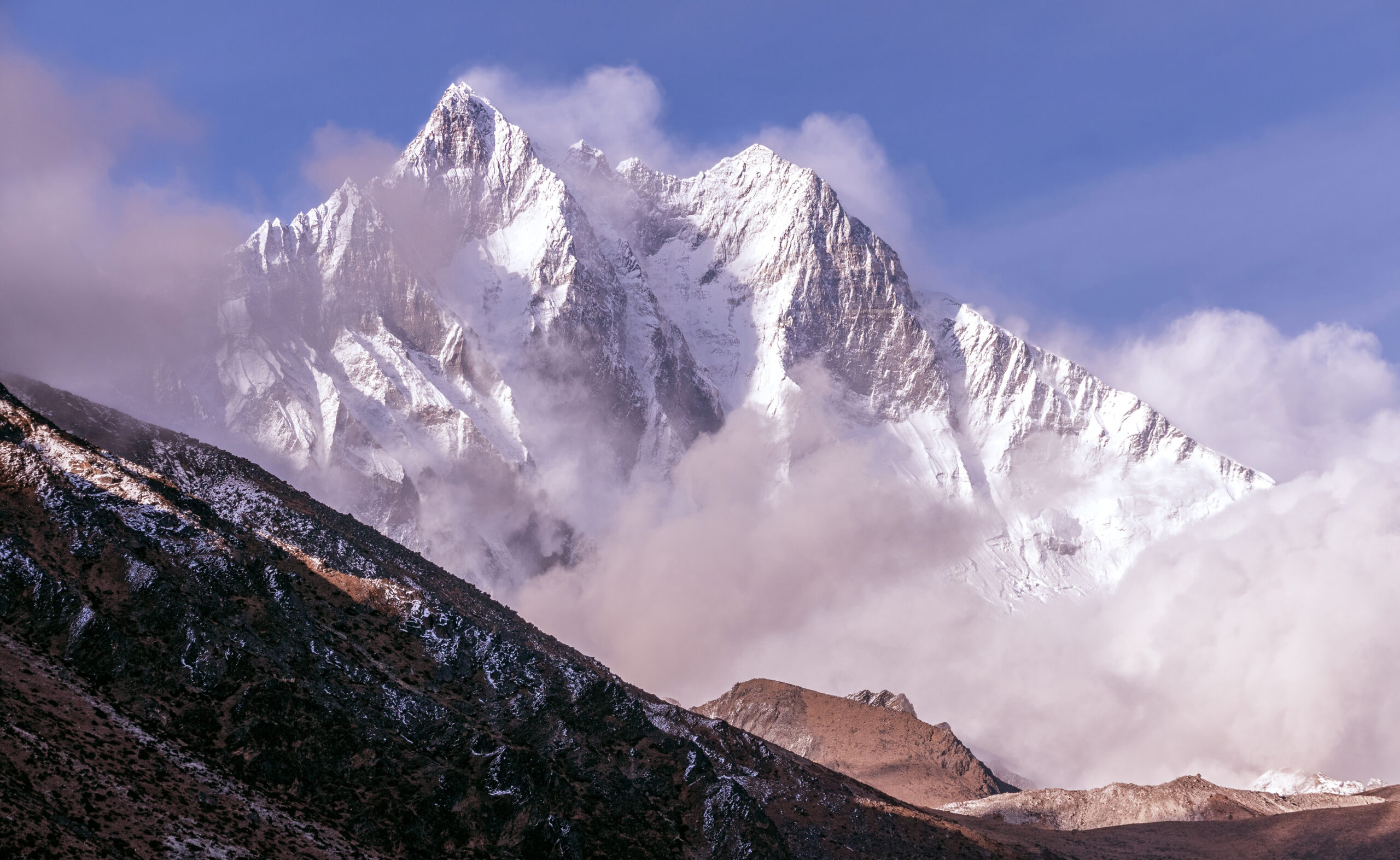
    Lhotse, the fourth-highest mountain in the world, rising beside Everest in the Nepal Himalaya
    Lhotse is 8,516 m (27,940 ft), the fourth-highest mountain on earth. It shares Everest’s route to Camp 3, then breaks off into the Lhotse Couloir.
    Expedition Updates · Himalaya

    Lhotse expedition update

    The 8000er next door to Everest, at a fraction of the permit. This page tracks the spring season, the 2026 Nepal permit, the shared Everest route, the Lhotse Couloir crux, full expedition cost, and a go or no-go checklist. A single-mountain page in our Expedition Updates directory. Elevations in metres (feet).

    Current status Spring season 8,516 m (27,940 ft)

    Everest’s neighbour, at one-fifth the permit, but not an easy Everest.

    Lhotse shares Everest’s line through the Khumbu Icefall, the Western Cwm, and up the Lhotse Face to around Camp 3 and Camp 4, in the same spring season, before the routes split. You climb a genuine 8000er with far less crowding high on the mountain.

    The 2026 spring permit is $3,000 per person, against $15,000 for Everest. That gap is the draw. The honest caveat is that Lhotse is still a full death-zone expedition, and its summit crux, the steep Lhotse Couloir, is a serious climb in its own right.

    8,516 m

    Summit (27,940 ft)

    The fourth-highest mountain on earth, south of Everest.

    $3,000

    Spring permit

    One-fifth of Everest’s $15,000 royalty for 2026.

    Apr to May

    Prime season

    Spring, on the same rhythm as Everest.

    Lhotse sits immediately south of Everest, joined to it by the South Col, and for much of the climb the two mountains are the same route. That connection is the key to understanding Lhotse: it offers a true Himalayan 8000er in Everest’s shadow, sharing its approach and its season but not its price or its crowds. This page owns the current picture, the season, the permit and rules, the cost, and the route. For the full history, the deeper route detail, and gear, see our Lhotse climb guide and its best-time-to-climb breakdown.

    Season and status

    Spring, and tied to Everest’s rhythm.

    Lhotse is a spring mountain, climbed in April and May, with summit pushes timed to the settled weather windows that usually open in May. Because it shares the route, the whole Lhotse season moves in step with Everest: the same teams fix the same lines through the Khumbu Icefall, the same forecasts govern the summit windows, and Base Camp is the shared Everest Base Camp. Autumn attempts happen but are uncommon, and winter or monsoon climbs are rare and far more serious.

    The Everest connection

    Why Lhotse is best understood as Everest’s neighbour.

    From Base Camp, the Lhotse route is the Everest route: up through the Khumbu Icefall, along the Western Cwm, and up the Lhotse Face toward the high camps. The two only part company high on the mountain, where Everest climbers traverse toward the South Col and southeast ridge, and Lhotse climbers head into the couloir that splits the face to the summit. This shared line is why combined Everest and Lhotse expeditions exist, with strong climbers attempting both within a day or two.

    The comparison that matters: same icefall, same cwm, same season, same objective hazards up to the high camps, but a $3,000 permit against Everest’s $15,000, and a fraction of the summit-ridge traffic. That is the honest case for Lhotse. The equally honest caveat is that everything dangerous about the shared route applies to Lhotse too, and the couloir adds its own difficulty on top.

    The 2026 permit and Nepal rules

    Higher than it was, but still far below Everest.

    Nepal revised its climbing royalties effective September 1, 2025, the first change in a decade. For Lhotse and the other 8000m peaks, the spring fee rose from $1,800 to $3,000 per person, with lower rates in the quieter seasons. Everest rose further, to $15,000 in spring, which is what opened the price gap that now defines Lhotse’s appeal.

    Lhotse climbing royalty by season, 2026, per person. Confirm current rates with your operator, who arranges the permit.
    SeasonLhotse royaltyNotes
    Spring (Mar to May)$3,000 per personUp from $1,800. The main Lhotse season, shared with Everest.
    Autumn (Sep to Nov)$1,500 per personUp from $900. A quieter, less common window.
    Winter and monsoon$750 per personUp from $450. Rarely attempted.
    Garbage deposit$3,000, refundableStandard for 8000m peaks, returned when waste is brought out.
    Everest, spring, for comparison$15,000Five times the Lhotse spring fee.
    New rules to know for 2026. Permit validity was cut from 75 to 55 days, and Nepal no longer allows solo or fully independent alpine-style attempts, so you must climb through a registered operator with support. Expeditions must carry out human waste in biodegradable bags, and death-repatriation insurance and higher cover for high-altitude workers are now required. Your operator handles most of this; vet them with our how to choose an operator guide, and confirm your own cover in our mountaineering insurance guide.

    Full expedition cost

    Cheaper than Everest, still a major commitment.

    The permit is only a small slice of the total. A guided Lhotse expedition typically runs in the region of $20,000 to $35,000 or more, depending on the operator, the level of support, oxygen, and Sherpa ratios. That sits well below a comparable Everest expedition, which commonly runs $45,000 to $65,000 or higher, and the lower permit is one reason, but the bulk of the cost on either mountain is logistics, staff, oxygen, and time. Budget for international flights to Kathmandu, the flight to Lukla, gear, and tips on top.

    The route and the Lhotse Couloir

    Shared hazards below, a distinct crux above.

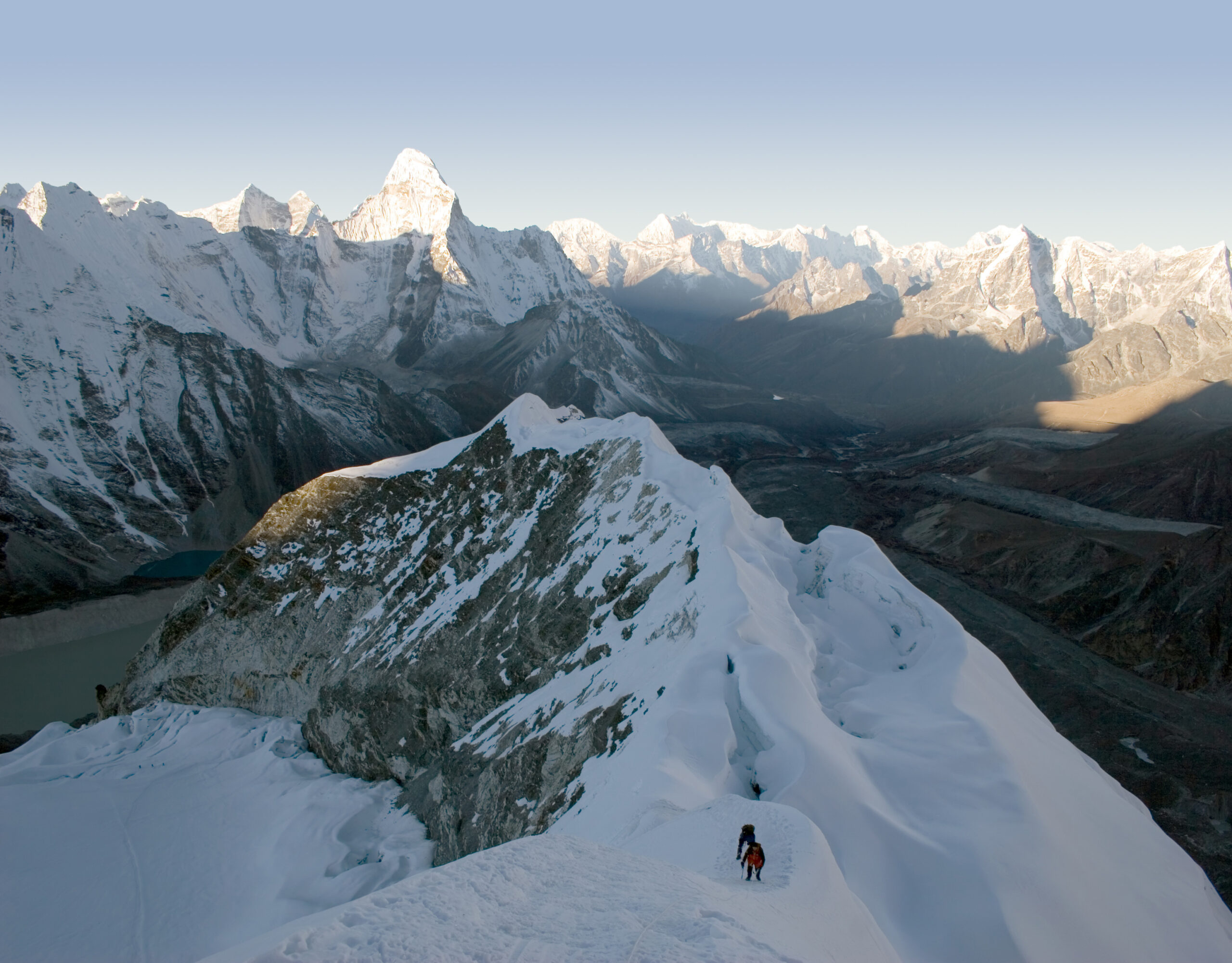
    The steep upper face and couloir of Lhotse high in the Nepal Himalaya
    High on Lhotse, the route enters the couloir that splits the face to the summit. It is a steep snow and ice gully, narrowing near the top, with a short, exposed final section.

    The normal route

    From Everest Base Camp the climb follows the Khumbu Icefall, the Western Cwm, and the Lhotse Face through the high camps, the same ground as Everest. Above the high camps it enters the Lhotse Couloir, a steep snow and ice gully of roughly 40 to 50 degrees that leads to the summit, narrowing toward the top with a short, exposed final section. Fixed lines are in place in season, and supplemental oxygen is standard. The climbing is not extreme in isolation, but it is sustained, at extreme altitude, with the same objective hazards as Everest on the shared lower route. See fixed lines and jumars explained for the techniques.

    Altitude and the death zone

    Above 8,000 m, the environment is the hazard.

    ⚠ A full 8000m expedition, not a discount Everest

    Lhotse’s summit is deep in the death zone above 8,000 m, where the body deteriorates and clear thinking is hard. The shared lower route carries the Khumbu Icefall, one of the most dangerous stretches in Himalayan climbing, and the couloir adds steep, exposed climbing at altitude. The lower permit does not make it a lower risk.

    It expects prior high-altitude experience, strong acclimatization, and disciplined turnaround judgment. Read our acclimatization guide and check your base against our fitness standards. This page is educational and is not medical advice.

    Weather and timing

    The same windows that govern Everest.

    Lhotse lives and dies by the spring jet stream, exactly as Everest does. For most of April the winds are too high on the summit, and teams acclimatize and wait; the climbable windows open when the jet lifts, usually in May, and everyone moves at once. The live map below shows current conditions for the massif; rely on your expedition’s forecasting for the actual summit call.

    Live wind and weather for Lhotse and the Everest massif. Source: Windy.com. For how to read a mountain forecast, see our weather guide.
    Lhotse, on the Nepal and Tibet border immediately south of Everest, in the Khumbu Himalaya. Map: OpenStreetMap contributors.

    Go or no-go checklist

    Work through these before you commit.

    Before you book

    • Have the 8000m base – prior high-altitude experience and strong acclimatization are expected, not optional.
    • Budget the whole expedition – the $3,000 permit is minor next to logistics, oxygen, staff, flights, and tips.
    • Choose a registered operator – solo and independent attempts are no longer allowed; vet the team’s Icefall and oxygen protocols.
    • Confirm the required insurance – death-repatriation cover is now mandatory; check the fine print.
    • Respect the couloir – the steep, exposed summit gully is a real crux at extreme altitude.
    • Decide on Everest-plus-Lhotse honestly – the combined climb is only for the strongest, most acclimatized climbers.

    Lhotse update FAQ

    The questions climbers ask most about the permit, the Everest link, and the climb.

    How much is the Lhotse climbing permit in 2026?

    The spring royalty is $3,000 per person, up from $1,800 after Nepal’s revision that took effect on September 1, 2025. Autumn is $1,500 and the winter and monsoon rate is $750. On top of that, expeditions post a refundable garbage deposit of $3,000 for an 8000m peak. For comparison, the spring Everest royalty is now $15,000, five times the Lhotse fee, which is a large part of why Lhotse draws climbers who want a Himalayan 8000er without the Everest price tag.

    Why climb Lhotse instead of Everest?

    Because for much of the climb they are the same mountain. Lhotse shares Everest’s approach through the Khumbu Icefall, the Western Cwm, and up the Lhotse Face to around Camp 3 and Camp 4, in the same spring season, before the two routes split. You get a genuine 8000m Himalayan expedition at roughly a fifth of the Everest permit and with far less crowding high on the mountain. What you do not get is an easy Everest, because Lhotse is still a full death-zone climb with its own steep summit crux.

    Can you climb Everest and Lhotse together?

    Yes, and combined Everest and Lhotse expeditions are a well-established option. Because the routes share the same line to the South Col area, climbers can attempt both within a day or two, going up the southeast ridge for Everest and into the Lhotse Couloir for Lhotse. It is a serious undertaking that only strong, acclimatized climbers should consider, but it is far more efficient than two separate trips.

    How hard and technical is Lhotse?

    Lhotse carries the same objective hazards as Everest on the shared lower route, the Khumbu Icefall and the death zone above 8,000 m, where supplemental oxygen is standard. Its distinct crux is the Lhotse Couloir, a steep snow and ice gully of roughly 40 to 50 degrees leading to the summit, narrowing near the top with a short, exposed final section. It is a demanding climb that expects prior high-altitude experience.

    When is the Lhotse climbing season?

    Spring, essentially April and May, matching Everest, with the summit pushes timed to the calm weather windows that usually open in May. The whole mountain runs on the same rhythm as Everest because they share the route. Autumn attempts happen but are uncommon, and winter or monsoon climbs are rare and far more dangerous.

    What are the 2026 Nepal climbing rules?

    Alongside the higher royalties, Nepal cut permit validity from 75 to 55 days, and it no longer allows solo or fully independent alpine-style attempts, so climbers must go through a registered operator with support. Expeditions must carry out human waste in biodegradable bags, and rules now require death-repatriation insurance and higher cover for high-altitude workers. Your operator handles most of the paperwork, but the requirements are stricter than they were a couple of years ago.

    How much does a full Lhotse expedition cost?

    A guided Lhotse expedition typically runs in the region of $20,000 to $35,000 or more, depending on the operator, the level of support, oxygen, and Sherpa ratios. That is well below a comparable Everest expedition, which commonly runs $45,000 to $65,000 or higher, but it is still a major financial commitment, and the permit is only a small slice of the total.

    How high is Lhotse and where is it?

    Lhotse is 8,516 m (27,940 ft), the fourth-highest mountain on earth, on the border of Nepal and Tibet immediately south of Everest and connected to it by the South Col. It was first climbed in 1956 by a Swiss team, and its main summit sits above two lower subsidiary tops, Lhotse Middle and Lhotse Shar.

    📋 How this update is built

    This page is compiled by Travis Ludlow, Founder and Head of Research at Global Summit Guide, from Nepal Department of Tourism royalty rules, reporting on the 2025 permit revision, and operator-published logistics, with sources named below. It was reviewed for safety by Dawson Ludlow, our Climbing and Mountaineering Lead (Wilderness First Aid), whose highest first-hand summit is Kilimanjaro.

    Our team has not climbed Lhotse, so we report official rules and operator logistics rather than personal experience, and we review this page before each spring season. Permit rates and rules change, so treat every figure here as a starting point and confirm current costs and requirements with your operator and the Department of Tourism before committing.

    Planning a Lhotse expedition?

    Start with our Lhotse climb guide, weigh it against its big neighbour in our Everest guide and the Everest expedition update, and compare teams in the operator directory. Every climb starts in Kathmandu, so for flights and hotels there, browse travel on Expedia.

    Disclosure: the Expedia link above is a sponsored affiliate link. We may earn a commission at no extra cost to you.
    Was this helpful?

    Yes
    No
    Thanks for your feedback!
  • Mount Fuji Climbing 2026: Fees, Reservations, Season Dates & Trails

    Mount Fuji, the symmetrical volcanic cone that is the highest mountain in Japan
    Mount Fuji is 3,776 m (12,388 ft), the highest mountain in Japan. In 2026 all four trails charge a 4,000-yen fee and require an advance online permit.
    Expedition Updates · Japan

    Mount Fuji climbing update

    The most-climbed big mountain in the world, and the rules changed again for 2026. This page tracks the 4,000-yen fee now on every trail, the two reservation systems, season dates by trail, the gate hours and bullet-climbing ban, and the four routes compared. A single-mountain page in our Expedition Updates directory. Elevations in metres (feet).

    Current status In season Jul to Sep 3,776 m (12,388 ft)

    More managed than the postcards. Your permit is now your trip plan.

    For 2026, every one of the four official trails charges a 4,000-yen fee and requires an advance online reservation that produces a QR-code permit. The Yoshida trail has a hard daily cap of 4,000 climbers, and gates close from 2 PM to 3 AM to anyone without a mountain hut booking.

    The season runs roughly July 1 to September 10, with the two Shizuoka trails opening July 10. Pick your date and trail, book the permit and a hut, and do it before you fly, because peak dates sell out.

    3,776 m

    Summit (12,388 ft)

    The highest mountain in Japan, and a UNESCO World Heritage site.

    4,000 yen

    Entry fee

    Mandatory on all four trails in 2026, booked online in advance.

    Jul to Sep

    Climbing season

    Roughly July 1 to September 10, when huts and buses run.

    Mount Fuji is not an expedition peak. It is a non-technical hike that around 200,000 people do every short summer, and its near-perfect cone is one of the most recognizable mountains on earth. What makes it worth a status page is how much the access rules have changed, and how much stale information is still circulating. This page covers the current 2026 picture: fees, reservations, season dates, the four trails, and the safety rules. For the history, the deeper route detail, and the evergreen how-to, see our Mount Fuji climb guide.

    What changed for 2026

    This is the first season the rules look the same across the whole mountain.

    Fuji’s access rules have tightened for three years running, in response to overtourism, litter, and unprepared hikers. The 2026 season is the point where those changes line up across all four trails. The headline is that the 4,000-yen fee, which started on the Yoshida trail, now applies to the three Shizuoka trails as well, and every route requires an online permit. If you read an older guide that says climbing Fuji is free, or that only the Yoshida side charges, or that you can simply turn up and walk, that information is out of date.

    The single most useful thing to know: on Fuji in 2026, your permit is your trip plan. Choose your date and trail, book and pay for the permit online, and lock a mountain hut if you want the sunrise, all before you leave home. Same-day slots are limited and the popular dates go early.

    Fees and reservations

    One fee, but two different booking systems depending on the trail.

    The fee is the same everywhere, but the way you book differs by side of the mountain, and this trips people up. The Yoshida trail, on the Yamanashi side, uses the prefecture’s online reservation system and enforces a daily cap of 4,000 climbers, so it can sell out on busy dates. The three Shizuoka trails, Subashiri, Fujinomiya, and Gotemba, use the FUJI NAVI smartphone app, which walks you through a short mandatory safety course before it issues your permit. Either way you end up with a QR code that becomes your entry pass at the trailhead.

    What a 2026 Mount Fuji climb costs, per person. Confirm current figures on the official climbing site before you book.
    ItemCostNotes
    Entry fee4,000 yen per personMandatory on all four trails in 2026, booked and paid online in advance.
    Mountain hut14,000 to 17,000 yen per personShared dorm space with dinner and a simple breakfast. Book well ahead.
    Shuttle busaround 3,900 yen round tripPrivate cars are banned on the 5th Station access roads in season.
    Cash on the mountainBring coins and notesHuts and toilets are cash only; withdraw yen before you leave the city.
    Book on the official site. Reserve and pay through the official Mount Fuji climbing site or the FUJI NAVI app, not a lookalike. A realistic all-in cost for an overnight climb, including transport, a hut, and meals, runs roughly 26,000 to 41,000 yen. Check your readiness against our fitness standards, and if altitude is new to you, our altitude-sickness risk calculator is worth a look.

    Season dates by trail

    A short window, and it is not the same date for every route.

    The official 2026 season has the Yoshida and Subashiri trails opening July 1 and the Fujinomiya and Gotemba trails opening July 10, with all four closing September 10. Subashiri moved earlier this year, to July 1, to line up with Yoshida. These dates can shift if late snow or poor conditions delay the opening, so treat them as scheduled rather than guaranteed and confirm before booking flights. The busiest stretch is the Japanese school holidays from late July through August, and the Obon week in mid-August is the peak of the peak.

    The four trails compared

    Which route suits which climber.

    Hikers on a Mount Fuji trail above the clouds during the summer climbing season
    Fuji’s trails climb above the cloud line from the 5th Stations. The Yoshida route carries most of the traffic; the Shizuoka trails are quieter but less served by transport and huts.
    The four official Mount Fuji trails. Times are for the ascent and vary with fitness and crowds.
    TrailSide5th StationTime upCharacter
    YoshidaYamanashi (north)~2,300 m5 to 7 hrThe most popular by far, with the most huts and the best transport from Tokyo and Kawaguchiko. Daily cap of 4,000 climbers. The practical choice for a first climb despite the crowds.
    SubashiriShizuoka (east)~2,000 m5 to 7 hrQuieter, with a forested lower section, and it merges with the Yoshida trail high up. Opens July 1 in 2026, aligned with Yoshida.
    FujinomiyaShizuoka (south)~2,400 m4 to 6 hrThe shortest and steepest route, with the highest trailhead and the most direct line to the summit crater. Popular from the Shinkansen side.
    GotembaShizuoka (southeast)~1,400 m7 to 10 hrThe longest and hardest, with the lowest trailhead and the fewest huts. The route for fit, experienced hikers who want solitude.
    For most first-timers, Yoshida is the practical pick. It has the most huts, the best transport from Tokyo and Kawaguchiko, and clear signage, which matters on a busy overnight climb. If you want solitude and have the fitness, Gotemba delivers it at the cost of a much longer day. Compare the routes in depth in our Fuji trails guide.

    Gate hours and bullet climbing

    The rule that most changes how you plan the climb.

    Trailhead gates are open from 3 AM to 2 PM. Between 2 PM and 3 AM, entry is restricted to climbers who hold a mountain hut reservation. The target is bullet climbing, the practice of racing up and down through the night without resting, which leaves people exhausted, cold, and prone to altitude illness and accidents near the summit in the dark. The rule effectively means that if you want to be on the summit for sunrise, the safe and now the required way to do it is to climb partway, sleep in a hut, and finish in the early morning.

    Altitude and safety

    The most underestimated mountain in this directory.

    ⚠ A hike, but a serious one

    At 3,776 m, Mount Fuji is high enough that altitude sickness is common, and people regularly underestimate it because it is a walk rather than a climb. Headache, nausea, and dizziness are frequent, and the summit can be cold, wet, and fiercely windy even in midsummer, when the valley below is hot.

    Climb at a slow, steady pace, spend time acclimatizing at the 5th Station and a hut rather than rushing up, carry warm and waterproof layers and proper footwear, and turn around if altitude symptoms worsen. Our acclimatization guide covers the physiology. This page is educational and is not medical advice.

    Huts and the sunrise

    The goraiko, and why the hut booking is the linchpin.

    Sunrise seen from high on Mount Fuji above a sea of clouds
    The goraiko, the sunrise seen from high on Fuji above a sea of cloud, is the reason most climbers go. Only a portion of climbers get a clear one, so treat it as a bonus rather than a guarantee.

    Mountain huts sit at intervals up all four trails, offering a shared dorm space, dinner, and a simple breakfast, usually for 14,000 to 17,000 yen a person. They are basic and crowded at peak times, and wake-up calls come as early as 1:30 AM so climbers can reach the summit for the sunrise, known as the goraiko. Booking a hut is close to essential in 2026: it is what lets you climb through the restricted overnight hours, and it turns a punishing single push into a paced, safer two-day trip. Reserve early, because the best dates around Obon sell out well ahead.

    Weather and timing

    A live look at conditions on the cone.

    Fuji’s weather changes fast, and the summit can be in cloud, rain, or strong wind while the base is clear and warm. Only a portion of climbers get a clear sunrise on any given morning. The live map below shows current conditions; use it as background and rely on the hut staff and the official forecast on the day for the real picture.

    Live wind and weather for Mount Fuji. Source: Windy.com. For how to read a mountain forecast, see our weather guide.
    Mount Fuji, on the Yamanashi and Shizuoka border, about 100 km southwest of Tokyo. Map: OpenStreetMap contributors.

    Know before you go

    The 2026 essentials in one place.

    Before you climb

    • Book the permit online first – all four trails require it; Yoshida via the Yamanashi system, the Shizuoka trails via the FUJI NAVI app.
    • Reserve a mountain hut – it is what lets you climb the overnight hours for the sunrise, and it makes the climb safer.
    • Pick your date off-peak if you can – avoid Obon in mid-August and weekends, when the Yoshida cap and crowds bite.
    • Carry cash – huts and toilets are cash only; bring yen and 100-yen coins.
    • Pack for cold and wet – waterproof layers, warm clothing, and proper footwear, whatever the forecast in the city.
    • Respect the altitude – pace slowly, acclimatize, and turn back if symptoms worsen.

    Mount Fuji update FAQ

    The questions climbers ask most about fees, reservations, and the season.

    How much does it cost to climb Mount Fuji in 2026?

    The mandatory entry fee is 4,000 yen per person, and in 2026 it applies to all four official trails, not just the Yoshida route. Once you add transport to the 5th Station, a mountain hut, meals, and any gear, a realistic all-in figure for an overnight climb runs roughly 26,000 to 41,000 yen, about 175 to 275 US dollars. The fee is paid online when you reserve, and huts and toilets on the mountain are cash only.

    Do I need a reservation to climb Mount Fuji?

    Yes. In 2026 all four trails require advance online registration and payment, which produces a QR-code permit you show at the trailhead. The Yoshida trail uses Yamanashi Prefecture’s booking system and has a daily cap of 4,000 climbers, so it can sell out on peak dates. The three Shizuoka trails, Subashiri, Fujinomiya, and Gotemba, use the FUJI NAVI app, which includes a short mandatory safety course before it issues your permit.

    When is the 2026 Mount Fuji climbing season?

    The Yoshida and Subashiri trails are scheduled to open July 1 and the Fujinomiya and Gotemba trails July 10, with all four closing September 10. Subashiri moved earlier to July 1 this year to align with Yoshida. Opening dates can shift if snow, weather, or trail conditions require, so confirm before you lock in flights. Climbing outside this window is strongly discouraged, because the huts close and transport stops.

    What are the gate hours, and what is bullet climbing?

    Trailhead gates are open from 3 AM to 2 PM. Entry between 2 PM and 3 AM is restricted to climbers who hold a mountain hut reservation. This targets bullet climbing, the practice of racing up and down overnight without resting in a hut, which leads to exhaustion, altitude illness, and accidents. To climb overnight for the sunrise, you need a hut booking, which is also the safer way to do it.

    Which Mount Fuji trail should I choose?

    For a first climb, the Yoshida trail is the practical pick, with the most huts, the best transport from Tokyo, and clear signage, though it is the busiest. Fujinomiya is the shortest and steepest and starts highest. Gotemba is the longest and hardest, with the fewest huts and the most solitude, suited to fit and experienced hikers. Subashiri is quieter and joins Yoshida high on the mountain.

    How hard is Mount Fuji, and do I need experience?

    It is a non-technical hike, but a serious one that people underestimate. At 3,776 m the altitude is real, and altitude sickness is common, the day is long, and the summit can be cold, wet, and windy even in midsummer. You do not need technical climbing skills, but you do need reasonable fitness, proper footwear, warm and waterproof layers, and a sensible pace. It is not a casual walk.

    Can I climb Mount Fuji outside the official season?

    It is strongly discouraged. Outside roughly July to early September the mountain huts are closed, the shuttle buses do not run, and there is snow and severe cold high up, which turns a manageable hike into a mountaineering undertaking with a real risk of serious accidents. The rules, staffing, and rescue support are all built around the official summer window.

    How high is Mount Fuji and where is it?

    Mount Fuji is 3,776 m (12,388 ft), the highest mountain in Japan and a UNESCO World Heritage cultural site. It straddles the border of Yamanashi and Shizuoka prefectures, about 100 km southwest of Tokyo, and its near-perfect cone is climbed by roughly 200,000 people each short summer season.

    📋 How this update is built

    This page is compiled by Travis Ludlow, Founder and Head of Research at Global Summit Guide, from the official Mount Fuji climbing site, the Yamanashi and Shizuoka prefectural rules, and current-season guidance, with sources named below. It was reviewed for safety by Dawson Ludlow, our Climbing and Mountaineering Lead (Wilderness First Aid), whose highest first-hand summit is Kilimanjaro.

    Our team has not climbed Mount Fuji, so we report official rules and published guidance rather than personal experience, and we review this page through the summer season. Fuji’s rules have changed every year lately, so treat the figures here as current at the time of writing and confirm fees, dates, and reservation steps on the official site before you travel.

    Planning a Fuji climb?

    Start with our Mount Fuji climb guide for the full how-to, check the timing in our best time to climb Fuji guide, and see where it fits for newer climbers in our best beginner mountains roundup. For flights and lodging around the Fuji Five Lakes and Tokyo, browse travel on Expedia.

    Disclosure: the Expedia link above is a sponsored affiliate link. We may earn a commission at no extra cost to you.
    Was this helpful?

    Yes
    No
    Thanks for your feedback!
  • Mount Vinson Expedition Update 2026: Cost, ALE Logistics, Season & Route

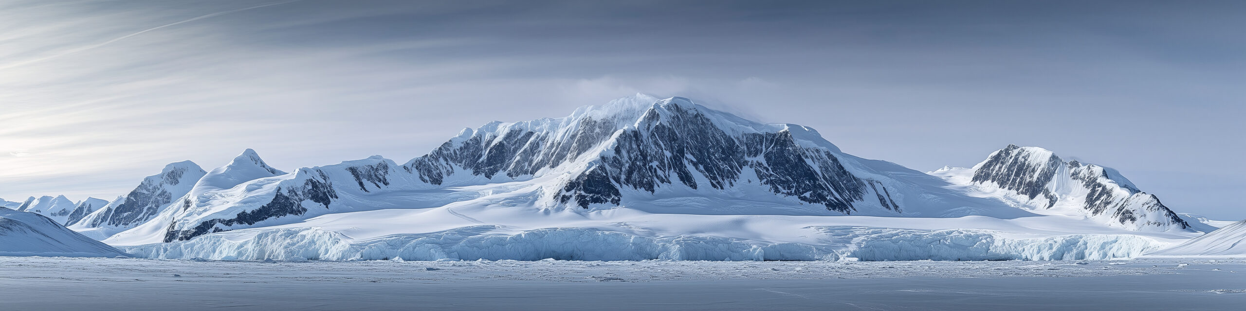
    Mount Vinson, the highest peak in Antarctica, rising from the ice of the Sentinel Range
    Mount Vinson is 4,892 m (16,050 ft), the highest peak in Antarctica. What gates it is logistics and cold, not technical difficulty.
    Expedition Updates · Antarctica

    Mount Vinson expedition update

    The most remote and most logistics-locked of the Seven Summits. This page tracks the December window, the ALE logistics reality, the real all-in cost, the Branscomb route, cold as the crux, and a go or no-go checklist. A single-mountain page in our Expedition Updates directory. Elevations in metres (feet).

    Current status Logistics-gated 4,892 m (16,050 ft)

    The climb is moderate. The logistics and the cold are the whole game.

    Vinson runs in the austral summer, roughly mid-November to late January, with most trips in December under 24-hour daylight. The Branscomb route is a non-technical glacier climb, and success rates are high when the weather cooperates.

    Two things define this mountain. Every expedition flies through one company, ALE, the only logistics provider on the continent, which sets a high price floor. And the cold, down to about -40 C (-40 F) even in summer, is what actually turns people back. Plan for the logistics and the cold, not the pitches.

    4,892 m

    Summit (16,050 ft)

    Highest in Antarctica, in the Sentinel Range of the Ellsworth Mountains.

    December

    Prime window

    Austral summer, mid-Nov to late Jan, under 24-hour daylight.

    $60k+

    Realistic all-in

    Among the most expensive Seven Summits, driven by logistics.

    Mount Vinson sits deep in the interior of Antarctica, about 1,200 km (750 miles) from the South Pole, and only a few hundred people attempt it in a year. It is usually one of the last of the Seven Summits climbers tackle, because reaching it is a bigger problem than climbing it. This page owns the current picture: the season, the logistics, the cost, and the permit rules. For elevation, history, and the full route breakdown, see our Mount Vinson climb guide.

    Season and status

    A short summer window, set by weather rather than a permit calendar.

    Vinson is climbable only in the austral summer, roughly mid-November to late January, when the sun never sets and temperatures are at their least severe. Most commercial expeditions run in December. There is no permit calendar to reserve against; instead the limiting factor is weather, and waiting at Union Glacier Camp for a flyable forecast to or from base camp is a normal part of the trip. Budget contingency days, because a fixed return flight is the enemy of a summit here.

    The ALE logistics reality

    The one fact that explains the price, the schedule, and everything else.

    Antarctic Logistics and Expeditions is the only logistics provider operating in this part of Antarctica, and every expedition depends on it. ALE runs the flights from Punta Arenas, Chile, to Union Glacier Camp on the blue-ice runway, and the ski-equipped aircraft on from there to Vinson Base Camp, and it built and maintains the camp infrastructure that makes climbing there possible at all. Guide operators run their own teams and guides, but they all move on ALE flights and through ALE camps.

    Why this matters to you. Because the logistics run through a single provider, the price floor is high and it does not move with shopping around. It also means schedules cluster in the same short window, and that a weather delay affecting ALE flights affects everyone at once. Understanding that ALE sits underneath every operator is the key to reading Vinson pricing and timelines honestly. Compare guide services on their guiding, ratios, and track record in our how to choose an operator guide, not on logistics they do not control.

    The real all-in cost

    The advertised fee is the start, not the total.

    Guide operators advertise the expedition fee, commonly in the range of $45,000 to $58,000, with one widely published 2026 price at $55,500. That figure already includes the ALE flights, which is most of why it is so high. But it is not the whole cost. Once the surrounding expenses are added, a realistic all-in figure lands closer to $60,000 to $75,000 or more.

    A realistic all-in Mount Vinson budget, per climber, in USD. Figures are approximate; confirm current pricing with your operator.
    CostTypical rangeNotes
    Guided expedition fee$45,000 to $58,000Includes the ALE flights from Punta Arenas to Union Glacier to base camp, guiding, and camp support.
    International flights to Punta Arenas$1,500 to $3,000Getting to the Chilean staging city, from wherever you start.
    Polar gear, if buying$3,000 to $6,000A -40 down suit, high-altitude boots, and the rest of an extreme-cold kit.
    Evacuation and expedition insurance$1,000 to $2,500Evacuation cover is mandatory for the flight service; standard travel policies do not qualify.
    Hotels, meals, contingency days$1,000 to $2,000Punta Arenas either side, plus the weather delays that are normal here.
    Guide and staff tips$1,000 to $2,500Customary on a guided expedition of this length.
    Realistic all-in$55,000 to $75,000+Among the most expensive of the Seven Summits.
    Where the money goes. Almost all of it is logistics, not guiding. See how Vinson compares against the other continental high points in our Seven Summits cost breakdown, and confirm that any policy you buy meets the mandatory evacuation-cover requirement in our mountaineering insurance guide.

    The route and difficulty

    Non-technical by Seven Summits standards, but not easy.

    The Branscomb (Shoulder) route

    The standard route climbs from Vinson Base Camp up the Branscomb Glacier through a series of camps, over slopes and a plateau to a final summit ridge, with some fixed lines on the steeper headwall. It is not technical climbing, but it demands solid mountaineering skills: self-arrest, roped glacier travel, and crevasse rescue, and climbers haul sleds on the lower glacier. Success rates are high when the weather allows, which is why the mountain rewards fitness, cold tolerance, and patience more than technical skill.

    Cold, the true crux

    The environment is the difficulty on this mountain.

    ⚠ The cold is what turns people back, not the terrain

    Temperatures on Vinson reach about -40 C (-40 F) even in the summer season, and wind drives the felt temperature far lower. In that environment, frostbite and cold injuries are the real hazard, and small mistakes with hands, feet, or face have outsized consequences.

    Cold management is the skill that matters most here: a -40-rated down suit, disciplined layering and vapor control, keeping water and batteries from freezing, and looking after your extremities relentlessly. Prepare for the cold as seriously as you would prepare for altitude on a higher peak. This page is educational and is not medical advice.

    Permits and Antarctic Treaty

    No park permit, but real obligations, and they vary by nationality.

    There is no national-park-style climbing permit for Vinson, but Antarctica is governed by the Antarctic Treaty and its environmental protocol, which impose strict rules: full self-sufficiency, minimal environmental impact, and removing all waste from the continent. On top of that, several countries require their own citizens to obtain authorization or a permit before travelling to Antarctica. The United Kingdom, for example, requires a permit under its Antarctic Act, while United States citizens notify the National Science Foundation. In practice your operator and ALE handle much of the compliance, but the obligation to check what your nationality requires rests with you.

    Weather and timing

    A live look at the coldest climb on the Seven Summits list.

    Vinson sits in the interior of Antarctica, where even summer conditions are extreme and weather can shut down flights and climbing for days. The live map below shows current conditions for the massif, set to temperature so the cold is visible; treat it as background, and rely on ALE and your guide team for the operational forecast that actually governs the climb.

    Live temperature and weather for the Mount Vinson area. Source: Windy.com. For how to read a mountain forecast, see our weather guide.
    Mount Vinson, in the Sentinel Range of the Ellsworth Mountains, deep in the Antarctic interior. Map: OpenStreetMap contributors.

    Go or no-go checklist

    Work through these before you commit money or dates.

    Before you book

    • Budget the real all-in – the expedition fee plus flights to Punta Arenas, polar gear, insurance, hotels, and tips, not the advertised number alone.
    • Confirm evacuation insurance – it is mandatory for the flight service, and standard travel policies do not qualify.
    • Check your nationality’s Antarctic rules – some countries require a permit or authorization to travel to Antarctica.
    • Build in contingency days – weather delays at Union Glacier are normal; a tight return flight costs summits.
    • Be honest about cold tolerance – this is a -40 C environment, and cold management is the real skill.
    • Have the mountaineering base – self-arrest, glacier travel, and crevasse rescue are expected before you arrive.

    Mount Vinson update FAQ

    The questions climbers ask most about cost, logistics, and the climb.

    How much does climbing Mount Vinson cost?

    The guided expedition fee alone runs roughly $45,000 to $58,000, with one widely published 2026 price at $55,500. Once you add international flights to Punta Arenas, polar gear, mandatory evacuation insurance, hotels, and tips, a realistic all-in figure lands closer to $60,000 to $75,000 or more. It is among the most expensive of the Seven Summits, and the cost sits in the logistics rather than the climbing.

    Why is Vinson so expensive?

    Because a single company, Antarctic Logistics and Expeditions, is the only logistics provider on the continent, and every expedition flies through it. ALE runs the flights from Punta Arenas to Union Glacier Camp and on to Vinson Base Camp on ski-equipped aircraft, and it built and maintains the infrastructure that makes climbing there possible. Guide operators are, in effect, reselling the same ALE logistics, which sets a high floor no amount of shopping around can move.

    When is the Mount Vinson climbing season?

    The austral summer, roughly mid-November to late January, when Antarctica has 24-hour daylight. Most commercial trips run in December. The window is set by weather and cold rather than a permit calendar, and delays waiting for a flyable forecast at Union Glacier are a normal part of the trip.

    How technical is the climb?

    The standard Branscomb, or Shoulder, route is a non-technical glacier climb: glaciers, slopes, a plateau, and a final ridge, with some fixed lines on the headwall. It still demands solid mountaineering skills, self-arrest, roped glacier travel, and crevasse rescue, and climbers haul sleds on the lower glacier. The difficulty is the environment, not the terrain.

    How cold does it get on Vinson?

    Temperatures reach about -40 C (-40 F) even in the summer season, and wind makes it feel far colder. Cold management is the real challenge: a -40-rated down suit, disciplined layering, protecting extremities, and avoiding frostbite and cold injuries matter more here than climbing difficulty. The extreme cold, not the route, is what turns most people back.

    Do I need a permit to climb Vinson?

    There is no park-style climbing permit, but Antarctic Treaty environmental rules apply, including strict self-sufficiency and removing all waste. Several countries also require their own citizens to obtain authorization or a permit before travelling to Antarctica, for example the United Kingdom under its Antarctic Act, while United States citizens notify the National Science Foundation. Your operator and ALE handle much of this, but confirm what your nationality requires.

    Can I climb Vinson independently?

    In practice, no. Access runs through ALE logistics, and Antarctic Treaty compliance and full self-sufficiency are mandatory. Effectively every climber goes either with a guide service or on an ALE-supported basis. The real decision is which operator, not whether to use the ALE system.

    How high is Mount Vinson and where is it?

    It stands at 4,892 m (16,050 ft) in the Sentinel Range of the Ellsworth Mountains, about 1,200 km (750 miles) from the South Pole. It is the highest peak in Antarctica and one of the Seven Summits, first climbed on December 18, 1966, and only a few hundred people attempt it each year.

    📋 How this update is built

    This page is compiled by Travis Ludlow, Founder and Head of Research at Global Summit Guide, from ALE logistics information, cross-checked 2026 operator pricing, and Antarctic Treaty guidance, with sources named below. It was reviewed for safety by Dawson Ludlow, our Climbing and Mountaineering Lead (Wilderness First Aid), whose highest first-hand summit is Kilimanjaro.

    Our team has not climbed Mount Vinson, so we report operator logistics and official guidance rather than personal experience, and we review this page before each austral summer season. Pricing and rules change, so treat every figure here as a starting point and confirm current costs, insurance requirements, and permit rules directly before committing.

    Planning a Vinson expedition?

    Start with the real numbers in our Seven Summits cost breakdown, compare guide services in the operator directory, and confirm your cover in our mountaineering insurance guide. Every climb stages through Punta Arenas, Chile, so for flights and hotels there, browse travel on Expedia.

    Disclosure: the Expedia link above is a sponsored affiliate link. We may earn a commission at no extra cost to you.
    Was this helpful?

    Yes
    No
    Thanks for your feedback!
  • Carstensz Pyramid Expedition Update 2026: Access, Permits, Security & Route

    Carstensz Pyramid, also called Puncak Jaya, the highest peak in Oceania, in Papua, Indonesia
    Carstensz Pyramid (Puncak Jaya) is 4,884 m (16,024 ft), the highest peak in Oceania. What gates it is access and security, not weather.
    Expedition Updates · Oceania

    Carstensz Pyramid expedition update

    The one Seven Summit where the climbing is the easy part. This page tracks current access, the Papua travel advisories, permit reality, helicopter logistics, cost, and a go or no-go checklist. A single-mountain page in our Expedition Updates directory. Elevations in metres (feet).

    Current status Access-gated 4,884 m (16,024 ft)

    Not open or closed. Access-gated, and under travel advisories.

    Carstensz is not reliably open or closed the way a national park is. Legal access depends on an Indonesian operating partner, the right permits, a working helicopter plan, and local security approval, and those can change after you pay. Commercial departures are running, so it is not universally closed, but it is not independently accessible either.

    Two governments currently advise against travel to the province. As of July 2026 the U.S. Department of State lists Level 4, Do Not Travel, for Central and Highland Papua, and the UK advises against all travel there. Read this page as a status briefing, not a booking nudge.

    4,884 m

    Summit (16,024 ft)

    Highest in Oceania and the highest island peak on earth.

    Level 4

    US advisory

    Do Not Travel, Central and Highland Papua, as of July 2026.

    1962

    First ascent

    A party led by Heinrich Harrer, of Seven Years in Tibet.

    Carstensz Pyramid, or Puncak Jaya, sits in the Sudirman Range of Central Papua, Indonesia, three degrees south of the equator. It is the most technical of the Seven Summits and the most complicated to reach, which is why it is usually the last one climbers attempt. This page owns the current picture: access, security, permits, and logistics. For elevation, history, the summit-day overview, and the full technical breakdown, see our Puncak Jaya climb guide.

    Current access status

    Why “is it open” is the wrong question for this mountain.

    On most mountains, open means a national park has published a season and the permit system is taking reservations. Carstensz has no equivalent. There is no stable public gate status that guarantees a foreign climber can reach the peak. Instead, access is assembled trip by trip: an Indonesian operating partner obtains permits and local authorizations, arranges a helicopter, and secures approval to proceed, and any one of those can shift after you have committed. At least one major operator has published sold-out 2026 departures and Indonesian-supported programs continue to market helicopter access, so the mountain is not universally closed. That is different from saying you can buy a ticket, fly to Timika, and walk to base camp.

    Travel advisories and security

    The part of this page that matters most before any booking.

    Central Papua has a long-running separatist conflict and a history of security incidents, and it is remote enough that consular and emergency assistance may be limited. Two national governments reflect that in their travel guidance, and their warnings are broader than any single climbing route.

    Government travel guidance for the Papua provinces, as of July 2026. Check the current advisory before making any decision.
    AuthorityGuidanceArea
    U.S. Department of StateLevel 4: Do Not TravelCentral Papua and Highland Papua
    UK FCDOAdvises against all travelPapua provinces
    Consular supportMay be very limitedRemote highland areas
    ⚠ Read the advisories first, and check them yourself

    A Level 4 Do Not Travel notice is the strongest category the U.S. government issues, and it applies to the whole province, not just a trekking corridor. Travel insurance often excludes destinations under such advisories, so a policy that looks valid may not pay out here. Verify the current U.S. State Department and UK FCDO advisories directly before you book anything, and confirm in writing what your insurer covers.

    This page reports that guidance and does not advise you to disregard it. The decision, and the risk, are yours.

    Permits and legal access

    Why an independent attempt is not realistic.

    Legal access to Carstensz runs through an Indonesian operating partner. Permits and local authorizations are arranged by that partner rather than issued to individuals over a public website, and climbers pass checkpoints where documents and approvals are checked. In practice this means you cannot reliably arrive in Timika alone and proceed to the mountain. The real decision is which operator to trust with that process, weighing their track record, their security arrangements, and how they handle a trip that has to be cancelled or turned back. Our guide on how to choose an expedition operator and the operator directory cover how to vet them.

    Helicopter logistics

    Why almost every current expedition flies in.

    The classic approach was a multi-day jungle trek from the Sugapa or Ilaga side, five to ten days through dense rainforest, rivers, and mud. For the 2026/27 season most operators have moved to helicopter-only access, because that approach is now considered too dangerous, on both the terrain and the security side. A helicopter lifts teams from the Timika area to a high base camp, cutting days of exposure down to a short flight, which is a large part of why the trip costs what it does. A few operators still arrange trekking approaches for experienced climbers who request them, but that choice carries much higher risk and a longer, less predictable timeline.

    The route and difficulty

    The only Seven Summit that is genuine rock climbing.

    The normal route

    From a high base camp near 4,200 m (13,800 ft), summit day climbs the north face and follows the limestone summit ridge. It is fifth-class rock on sharp, often wet limestone, protected by fixed lines, with a fixed Tyrolean traverse across a notch in the ridge and a few moves around 5.8. Climbers need to be fluent with jumars and rappelling and comfortable moving on exposed rock. For an experienced alpinist the grade is moderate, but it is real climbing, not a walk-up, and the wet rock and altitude add to it. See fixed lines and jumars explained for the techniques involved.

    What makes it hard is not the grade. The climbing itself is within reach of a competent alpine rock climber. The difficulty of Carstensz is everything around the climbing: reaching Papua legally, the weather, the remoteness, and a rescue picture that is far less developed than on the other Seven Summits. Prepare for the logistics and the environment as seriously as the pitches.

    Weather and timing

    There is no climbing season here. There is a live picture, though.

    Sitting almost on the equator, Carstensz is wet more or less year-round. Rain is close to guaranteed and snow is common on the summit rocks, and no month offers the settled window you would plan around on an alpine peak. That is why timing is set by operator schedules, permits, and security conditions rather than by weather. The live map below shows current conditions for the massif; treat it as background, not as a season signal.

    Live conditions for the Carstensz Pyramid massif, set to rain overlay. Source: Windy.com. For how to read it, see our weather guide.
    Carstensz Pyramid (Puncak Jaya), in the Sudirman Range of Central Papua, Indonesia. Map: OpenStreetMap contributors.

    Cost and timeline

    Among the most expensive Seven Summits, because of access.

    A guided Carstensz expedition is one of the most expensive of the Seven Summits, and the cost sits in the logistics rather than the climbing. Helicopter-access programs commonly run in the region of $15,000 to $25,000 or more per climber, before international flights and insurance, with most trips taking 8 to 14 days on the ground. Permits, local authorizations, helicopter charter, support staff, and the weather and logistics delays that are normal here all feed the price. For how it compares across the seven, see what the Seven Summits actually cost.

    Go or no-go checklist

    Work through these before you commit money or dates.

    Before you book

    • Read the current advisories – check the U.S. State Department and UK FCDO Papua guidance yourself, on the day.
    • Confirm insurance in writing – many policies exclude destinations under a Do Not Travel advisory; get the exclusion or cover confirmed.
    • Vet the operator hard – track record in Papua, security arrangements, and what happens if the trip is cancelled or turned back after payment.
    • Understand the access model – helicopter or trek, and what the plan is if the helicopter cannot fly.
    • Check the refund and delay terms – conditions can change after you pay; know where you stand.
    • Be honest about the rock – fixed lines, a Tyrolean traverse, and 5.8 moves on wet limestone need real competence.

    Carstensz update FAQ

    The questions climbers ask most about access, safety, and the climb.

    Is Carstensz Pyramid open to climb in 2026?

    Not in the way a national park is open or closed. There is no public gate status that guarantees a foreign climber can reach the mountain. Legal access depends on an Indonesian operating partner holding the right permits, a working helicopter plan, and local security approval, and those conditions can change after you have paid. Commercial departures are running, so the peak is not universally closed, but it is not independently accessible either.

    Is it safe, and what do the travel advisories say?

    As of July 2026 the U.S. Department of State lists Level 4, Do Not Travel, for Central Papua and Highland Papua, and the UK advises against all travel to those provinces. The region has a long-running separatist conflict and a history of security incidents, and consular or emergency help may be limited. These warnings are broader than any single climbing route and must be weighed before booking. This page reports that guidance; it does not advise you to disregard it.

    Can I climb Carstensz Pyramid independently?

    In practice, no. Legal access requires an Indonesian operating partner, government permits, and local authorizations, and climbers pass checkpoints where those documents are checked. You cannot reliably fly into Timika alone and proceed to base camp. The real question is which operator, not whether to use one.

    Do I need a helicopter to reach base camp?

    For the 2026/27 season, effectively yes. Most operators now run helicopter-only access because the multi-day jungle trek from the Sugapa or Ilaga side is considered too dangerous, on both the terrain and the security side. A few operators still arrange trekking approaches for experienced climbers, but that carries much higher risk and longer timelines.

    How technical is the climb itself?

    It is the most technical of the Seven Summits. The summit ridge is fifth-class climbing on sharp limestone with fixed lines, a fixed Tyrolean traverse across a gap in the ridge, and a few moves around 5.8. It needs real competence on rock, plus fluency with jumars and rappelling. The climbing is moderate for an experienced alpinist, but it is genuine climbing rather than a walk-up.

    Is there a best season to climb Carstensz?

    Not in the usual sense. The mountain sits three degrees south of the equator and is wet year-round, with rain close to guaranteed and snow common high up, so no month offers reliably settled weather. Unlike the other Seven Summits, the limiting factor is not weather but access and security, which is why timing is driven by operator schedules and current conditions on the ground rather than a climbing season.

    How much does a Carstensz expedition cost?

    It is among the most expensive of the Seven Summits, and the cost is driven by access rather than the climbing. Helicopter-access guided expeditions commonly run in the region of $15,000 to $25,000 or more, before international flights and insurance, with most trips taking 8 to 14 days on the ground. Permits, local authorizations, helicopter charter, and weather or logistics delays account for much of the price.

    How high is Carstensz Pyramid and where is it?

    It stands at 4,884 m (16,024 ft) in the Sudirman Range of Central Papua, Indonesia, the highest peak in Oceania and the highest island summit on earth. It was first sighted by the Dutch explorer Jan Carstenszoon in 1623, whose report of equatorial glaciers was long disbelieved, and first climbed in 1962 by a party led by Heinrich Harrer.

    📋 How this update is built

    This page is compiled by Travis Ludlow, Founder and Head of Research at Global Summit Guide, from current U.S. and UK government travel guidance, Indonesian immigration and permit information, and operator-published logistics, with sources named below. It was reviewed for safety by Dawson Ludlow, our Climbing and Mountaineering Lead (Wilderness First Aid), whose highest first-hand summit is Kilimanjaro.

    Our team has not climbed Puncak Jaya, so we report government guidance and operator logistics rather than personal experience, and we review this page monthly or immediately after a material access change. Because the situation in Papua can shift quickly, treat every figure here as a starting point and verify current advisories and operator terms directly before acting.

    Was this helpful?

    Yes
    No
    Thanks for your feedback!
  • Aconcagua Expedition Update 2026-27: Season, Routes, Permits & Conditions

    Aconcagua, the highest peak in the Americas, rising above the Andes
    Aconcagua is 6,961 m (22,838 ft), the highest peak in the Americas, in Argentina’s Mendoza Province. This page tracks its season, with live weather below.
    Expedition Updates · Andes

    Aconcagua expedition update

    Where Aconcagua stands this season, plus the Ruta Normal and its alternatives, the Mendoza permit rules, the Viento Blanco, and what the 30 to 40 percent summit rate really reflects. A single-mountain page in our Expedition Updates directory. Elevations in metres (feet).

    Current status Off-season 6,961 m (22,838 ft)

    Off-season now. The next window opens in December.

    July is the austral winter in the Andes, so Aconcagua is off-season and no commercial expeditions are running. The climbing season is the austral summer, December to February, with January and February the peak months and some operators running into early March.

    That makes this a planning page rather than a live-conditions one. If you are aiming at the 2026-27 season, now is the right time to be building fitness, booking an operator, and reading the permit rules.

    6,961 m

    Summit (22,838 ft)

    The highest peak in the Americas, and the highest outside Asia.

    Dec to Feb

    Climbing season

    Austral summer; off-season now, next window from December.

    30 to 40%

    Summit rate

    Driven by altitude, wind, and preparation rather than technical difficulty.

    Aconcagua stands alone on the Andean crest in Mendoza Province, close enough to the road that people underestimate it and high enough that the mountain regularly corrects them. This page is the update view: where the peak sits in its calendar, the routes and camps, and the rules that shape a trip. For the full how-to on operators, gear, and itineraries, see our Aconcagua climb guide, and for the wider picture across ranges, the Expedition Updates dashboard.

    Current status and next window

    Where the mountain is today, and what to do about it.

    Right now Aconcagua is out of season. The Southern Hemisphere winter brings deep cold and heavy wind to the high Andes, the park is outside its normal climbing season, and the operators who run the mountain are between years. The season opens as the austral summer arrives: December sees the first expeditions, January and February carry the bulk of the traffic and the best conditions, and a few trips run into early March before the window closes again. Because a full expedition runs 18 to 22 days, planning for the 2026-27 season means committing months ahead, both for operator places and for the training that decides whether you summit.

    Planning horizon. Work backwards from a January or February summit: book an operator, then build the altitude and endurance base. Start with our Aconcagua progression plan, altitude acclimatization, and fitness standards, and size the budget with our expedition budget calculator.

    Routes and camps

    One non-technical standard line, plus the quieter alternatives.

    Ruta Normal (standard)

    The classic line, approached through the Horcones valley to the Plaza de Mulas base camp at about 4,300 m (14,100 ft). From there teams work up through high camps in acclimatization rotations to Colera, then climb the long, punishing Canaleta to the summit ridge. No roped technical climbing is required, which is exactly why the peak is underestimated: the difficulty is altitude, wind, and endurance.

    Polish Glacier and the 360 Traverse

    The Polish Glacier route enters via the Vacas valley to the Plaza Argentina base camp on the eastern side, a longer and quieter approach. The 360 Traverse combines the two valleys, ascending one side and descending the other for a fuller circuit of the mountain. Both carry a different permit rate from the Ruta Normal. For the full breakdown, see the Aconcagua climb guide.

    A high Andean camp below snow-covered peaks
    Aconcagua expeditions run 18 to 22 days, most of it spent moving between camps on acclimatization rotations rather than climbing toward the summit.

    Weather and the Viento Blanco

    The wind is the mountain’s defining hazard. Here is a live read.

    Aconcagua sits high and isolated on the Andean crest, exposed to winds that arrive off the Pacific with nothing to slow them. The Viento Blanco, the white wind, is the local name for the violent storm that can strip a summit day out of an otherwise settled forecast, driving snow horizontally and dropping windchill to levels that end attempts within hours. Even in peak season, weather days are part of the itinerary rather than a contingency, and operators that build none into their schedule tend to report lower success. The live map below shows current wind and conditions for the massif; treat it as orientation, and rely on a dedicated expedition forecast in season.

    Live wind and weather for the Aconcagua massif. Source: Windy.com. For how to read it, see our mountain-weather guide.
    Aconcagua, in Mendoza Province, Argentina, near the Chilean border. Map: OpenStreetMap contributors.

    For a fuller explanation of reading a mountain forecast, see mountain weather for climbers.

    Permits and access

    Issued by Mendoza Province, priced by season and route.

    Every climber needs a permit from the Parque Provincial Aconcagua, issued by Mendoza Province and required to enter the park. It is mandatory, non-refundable, and priced by season, route, and nationality, with the high season commanding the top rate and unassisted climbers paying a surcharge over assisted ones. Rates are revised each year, and published figures vary between sources, so treat any number you read as indicative and confirm the current rate with the park before budgeting.

    Aconcagua permit, foreign climber, indicative only. Confirm current rates at aconcagua.mendoza.gov.ar.
    SourceReported high-season rate
    Our Aconcagua permits guide (2026)~$1,170 assisted / ~$1,640 unassisted
    Operator-reported figures~$800 to $1,000, higher on the Polish route
    Permit validityAround 20 days, enough for a full rotation schedule

    What the park expects

    • Permit before entry – bought through the Mendoza system, priced by season and route.
    • Minimum age and paperwork – climbers must be adults, with passport and any required medical documentation.
    • Authorised operators – assisted climbers work through companies licensed to operate in the park.
    • Rescue and conservation funding – the fee supports park facilities and the rescue service that covers the mountain.

    For the full permit picture, see our Aconcagua permits and fees guide, and for what a trip really costs once flights, gear, and tips are counted, our honest cost breakdown.

    What the summit rate reflects

    Roughly a third to two-fifths of climbers top out. The reason matters.

    Aconcagua’s overall summit rate sits around 30 to 40 percent, which surprises people who hear the Ruta Normal described as non-technical. The gap is not about difficulty of movement. It is about altitude and preparation: the summit stands at nearly 7,000 m, the Canaleta is a long grind on a body that has been at altitude for two weeks, and the wind can end a bid regardless of fitness. Compressed itineraries that cut acclimatization time correlate with lower success, so a cheap, short schedule is often a false economy. Climbers who arrive with prior high-altitude experience and a real training base do far better than the headline number suggests.

    ⚠ Non-technical is not the same as easy

    Aconcagua’s hazards are altitude illness, cold injury, and wind, not roped climbing. High-altitude cerebral and pulmonary oedema both occur here, and the descent from the Canaleta catches tired climbers. Build acclimatization time in, watch your team for symptoms, and be ready to go down. This page is not medical advice; check your risk with our AMS risk calculator and discuss altitude with a physician.

    Snow-covered Andean summits under a clear sky
    The summit stands near 7,000 m, and the last stretch through the Canaleta is where most attempts are decided.

    Aconcagua by the numbers

    The context behind a season, from grounded records.

    1897

    First ascent

    Matthias Zurbriggen, January 14, on the FitzGerald expedition.

    18 to 22

    Days on a trip

    Trek in, rotations, weather days, summit push, and descent.

    Seven Summits

    South America

    The continental high point, and a standard step before bigger peaks.

    Aconcagua is the usual proving ground before Himalayan objectives, and the natural comparison is with the other big introductory peaks. Our Aconcagua vs Denali vs Elbrus guide weighs them side by side, and the best mountains in South America covers the wider range. For a Peruvian objective at similar altitude, see Huascaran.

    Aconcagua update FAQ

    The questions planners ask most about timing, permits, and difficulty.

    When is the Aconcagua climbing season?

    December to February, the austral summer, with January and February the peak months. Some operators run into early March. July sits in the austral winter, so the mountain is off-season now and no commercial expeditions run. The next window is the 2026-27 season.

    How much is an Aconcagua permit?

    The permit is issued by the Parque Provincial Aconcagua in Mendoza Province and varies by season, route, and nationality. Our own permits guide puts the 2026 high-season rates at about $1,170 assisted and $1,640 unassisted, with an unassisted surcharge, while some operator sources quote figures nearer $800 to $1,000. Rates change every season, so confirm the current figure at aconcagua.mendoza.gov.ar before budgeting.

    What is the standard route on Aconcagua?

    The Ruta Normal, which climbs from the Horcones valley to the Plaza de Mulas base camp at about 4,300 m (14,100 ft), then through high camps to Colera and up the Canaleta to the summit. The Polish Glacier route from the Vacas valley via Plaza Argentina and the 360 Traverse are the main alternatives.

    How hard is Aconcagua?

    The Ruta Normal is non-technical, with no roped climbing required, but it is very high and very windy. The overall summit rate sits around 30 to 40 percent, and that gap reflects preparation and altitude rather than technical difficulty. Long days, thin air above 6,000 m, and the Viento Blanco turn most people back.

    How long does an Aconcagua expedition take?

    Typically 18 to 22 days, including the trek in, acclimatization rotations between camps, weather days, and the descent. Compressed schedules that cut acclimatization time correlate with lower success rates, so treat a short itinerary as a warning sign rather than a bargain.

    What is the current status of Aconcagua?

    As of July the mountain is off-season in the austral winter, and the park is outside its normal climbing season. Planning now means targeting the 2026-27 window from December onward. Check this page and the park authority for the latest before you book.

    📋 How this update is built

    This page is compiled by Travis Ludlow, Founder and Head of Research at Global Summit Guide, from Parque Provincial Aconcagua information, operator reporting, and published records, with sources named below. It was reviewed for safety by Dawson Ludlow, our Climbing & Mountaineering Lead (Wilderness First Aid), whose highest first-hand summit is Kilimanjaro. Our team has no first-hand ascent of Aconcagua, so we report cited records rather than personal anecdote. Where sources disagree, as they do on current permit rates, we show the range and point you to the park authority.

    Sources and further reading

    • Parque Provincial Aconcagua, Mendoza Province – permits, park regulations, and season dates.
    • Mendoza provincial park portal (aconcagua.mendoza.gov.ar) – official permit rates by season and route.
    • Authorised Mendoza operators – expedition itineraries, service levels, and 2026 pricing.
    • Published mountaineering records – the 1897 Zurbriggen first ascent on the FitzGerald expedition.
    • Our own Aconcagua climb guide, permits guide, and cost breakdown for full detail.
    • We report published figures and named sources rather than posting unverified live conditions.

    Planning the 2026-27 season?

    Start with the full Aconcagua climb guide, work through the progression plan, and read how to choose an expedition operator before you book, then compare teams in our operator directory. For flights and lodging around Mendoza, browse travel on Expedia.

    Disclosure: the Expedia link above is a sponsored affiliate link. We may earn a commission at no extra cost to you.
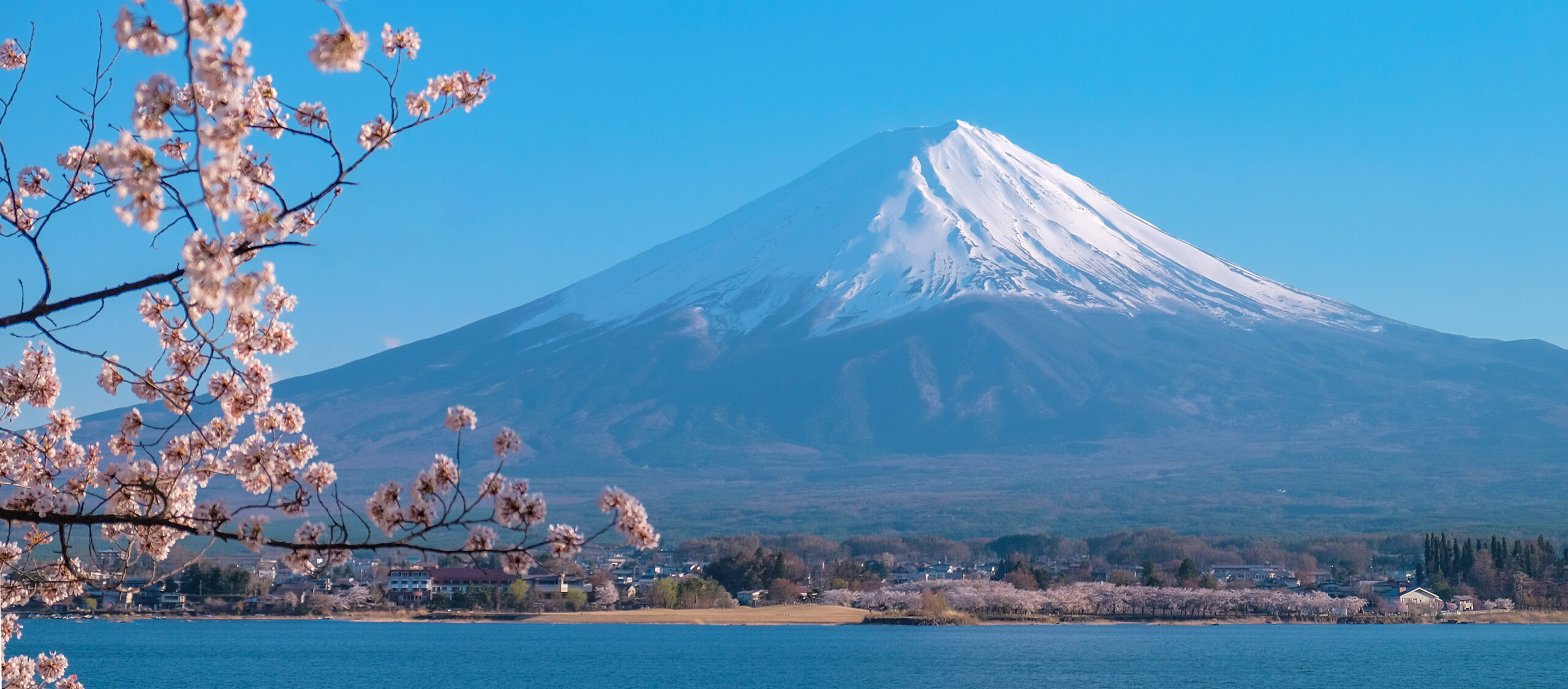
    Was this helpful?

    Yes
    No
    Thanks for your feedback!
  • Matterhorn 2026 Update: Rockfall, Guide Pauses & Season

    Matterhorn above Zermatt during the 2026 climbing season
    Matterhorn · 4,478 m · 2026 season · Hörnli Ridge · Lion Ridge · rockfall · rescue

    Matterhorn 2026 Expedition Update: Rockfall, Guide Pauses & Season Status

    The 2026 Matterhorn season remains active on the calendar, but August brought a major new warning signal. On August 5, a large rockfall occurred on the mountain’s south side, and reporting on August 6 said the Italian Società Guide del Cervino suspended guided Matterhorn ascents until further notice because of the rockfall and repeated unstable weather. That does not establish a Swiss-side Hörnli closure. ZERMATTERS still lists Matterhorn ascents from mid-July to mid-September when route and summit conditions permit, so Swiss-side operation must be confirmed directly for the intended day.

    Swiss and Italian sides separated Official accident reporting Dated season events No live-clearance claim

    Last reviewed August 19, 2026 · current-season news + ZERMATTERS + Valais Police + Air Zermatt

    Aug. 5Major south-side rockfall
    Italian pauseGuided ascents suspended after rockfall
    July 12Two climbers died on Hörnli descent
    Mid-Jul–Mid-SepZERMATTERS scheduled season
    03:30Hörnlihütte organized start
    By Travis Ludlow · Founder & Head of Research · Safety review: Dawson Ludlow
    Season-update page · current route clearance still requires same-day local confirmation
    Status as of August 19, 2026

    What is happening on the Matterhorn this season?

    The most important current development is the August 5 rockfall on the south/Italian side. German climbing publication ALPIN reported on August 6 that the Italian Società Guide del Cervino had suspended all guided Matterhorn ascents until further notice, citing both the rockfall and a run of unstable weather with repeated thunderstorms.

    That report applies to the Italian guide operation and should not be silently converted into a whole-mountain closure. On the Swiss side, ZERMATTERS continues to publish the Hörnli Ridge as a daily mid-July-to-mid-September objective when route and summit conditions permit. Its public booking page does not prove that a specific August 19 ascent is operating, so climbers must confirm same-day guide and ridge status in Zermatt.

    The season has also included a fatal July 12 accident on the Hörnli Ridge. Valais Cantonal Police confirmed that two climbers fell during descent at roughly 4,030 m; they were later identified as a 37-year-old Belarusian national and a 32-year-old Israeli national. Air Zermatt also reported additional Matterhorn rescues the same day involving climbers who could no longer continue under their own power.

    • Italian side: guided ascents reported suspended after Aug. 5 rockfall.
    • Swiss side: seasonal guide program remains published; confirm actual daily operation.
    • Hörnlihütte: inside its normal staffed summer season.
    • July 12: two fatal falls during Hörnli descent.
    • Weather: unstable episodes and thunderstorms remain operational concerns.
    • Final decision: local guide + hut + current forecast + route observation.
    This is a season update, not a route clearance. A rockfall report, an open hut, a published guide calendar and a favorable weather app are four different signals. For the technical Swiss-side route dashboard, use Matterhorn Hörnli Ridge Current Conditions.
    Dated status, not implied certainty

    Matterhorn 2026 Season Dashboard

    Each line has a different evidence level. Do not treat one side of the mountain as proof of the other.

    Italian guided ascentsReported suspended after the Aug. 5 south-side rockfall and unstable weather. Reconfirm before using the Lion Ridge.
    Swiss Hörnli scheduleZERMATTERS still publishes mid-July to mid-September ascents, subject to route and summit conditions.
    HörnlihütteInside its normal staffed summer season; hut operation does not establish route safety.
    Recent accident signalTwo climbers died July 12 during descent near 4,030 m on the Hörnli Ridge.
    Start systemZERMATTERS confirms the organized approximately 03:30 starting order from the Hörnlihütte.
    Guide ratioStandard Matterhorn product: one participant per mountain guide.
    Typical guided timingApproximately four hours up and four hours back to the Hörnlihütte in suitable conditions.
    Same-day ridge conditionNot safely inferable from public seasonal pages. Verify locally.
    Matterhorn at sunrise above Zermatt during the summer climbing season
    2026 season timeline

    The story of this season is changing route risk—not a simple “open” or “closed” label.

    Hut opening, fatal accidents, rescue activity and the August rockfall are separate milestones that affect how the season should be interpreted.

    Hörnlihütte enters the staffed summer season

    The Hörnlihütte opened for its 2026 summer operation, creating the normal Swiss-side base for Hörnli Ridge attempts. Hut opening establishes logistics—not whether the ridge itself is dry, stable or guided on a particular day.

    Two climbers die during descent on the Hörnli Ridge

    Valais Cantonal Police reported that a two-person rope team fell at approximately 4,030 m while descending the Hörnli Ridge. The two men were later identified as a 37-year-old Belarusian and a 32-year-old Israeli national.

    Air Zermatt handles multiple high-altitude rescue calls

    Air Zermatt reported several demanding rescue missions around Zermatt on the same day. After the fatal Matterhorn fall, a witness was evacuated; later, two more climbers stranded above 4,100 m on the Matterhorn were removed by longline after they could no longer continue and had run out of drinks.

    South-side rockfall triggers Italian guide suspension

    ALPIN reported that a major rockfall occurred on the Matterhorn’s south face on August 5. The next day it reported that the Italian Società Guide del Cervino had suspended guided ascents until further notice, citing the rockfall and repeated unstable weather with thunderstorms.

    Season remains active, but status must be checked by side

    ZERMATTERS still publishes the Swiss Hörnli ascent as a mid-July-to-mid-September objective when conditions permit. No public source reviewed here establishes that the Italian suspension automatically applies to the Swiss Hörnli Ridge.

    The August event changes the season narrative

    August 5 Rockfall: What We Know—and What We Do Not

    The key is to avoid turning an Italian-side guide decision into an unsupported whole-mountain closure claim.

    QuestionSupported answer
    Did a major rockfall occur?Yes. ALPIN reported a significant August 5 event on the Matterhorn’s south face.
    Did Italian guides respond?Yes. The Società Guide del Cervino was reported to have suspended guided ascents until further notice.
    Was weather also a factor?Yes. The report cited repeated unstable weather and thunderstorms.
    Does that prove the Hörnli Ridge is closed?No. The report concerns the Italian guide operation; Swiss-side status requires separate confirmation.
    Does the rockfall prove a permanent route change?No permanent route-change bulletin was located in the sources reviewed.

    Why this matters for climbers

    Rockfall on one face is not only a “route detail.” It is a season-level signal that warm cycles, unstable weather and mountain structure can change faster than a booking calendar. A professional guide pause should be treated as a reason to reassess—not as an opportunity to find an uncrowded route.

    July 12, 2026

    Fatal Hörnli Ridge Descent Accident

    The official police report confirms the location, direction of travel and identities; it does not establish a final causal explanation.

    Valais Cantonal Police reported that at about 11:00 on July 12, two climbers were descending the Hörnli Ridge when they fell at approximately 4,030 m. Rescue personnel reached the scene by Air Zermatt helicopter but could only confirm the deaths. A later police update identified the climbers as a 37-year-old Belarusian national and a 32-year-old Israeli national.

    Do not over-interpret the accident. The official report said the reason for the fall was not yet known. This page therefore does not attribute the deaths to weather, rockfall, exhaustion, equipment, guide status or a specific technical mistake unless a later official investigation establishes it.

    The event nevertheless reinforces one enduring Matterhorn planning fact: the descent is still technical, exposed and time-sensitive after the summit has already consumed much of the team’s physical and cognitive reserve. Use the Matterhorn Difficulty & Safety guide for the broader risk framework.

    Rescue activity is another season signal

    Air Zermatt’s July 12 Rescue Load

    A busy rescue day does not create a mortality rate, but it shows how quickly small operational failures can become helicopter problems.

    Matterhorn eventAir Zermatt reportingPlanning lesson
    Fatal rope-team fallTwo climbers died near the Solvay area; a witness was evacuated in shock.Descent terrain remains consequential even late in a successful summit day.
    Evening rescue above 4,100 mTwo climbers could no longer continue and had run out of drinks; both were evacuated by longline.Time, hydration and reserve capacity matter before the descent is finished.

    These are individual incidents, not evidence for a newly calculated “2026 Matterhorn rescue rate.” Exposure counts, route populations and rescue thresholds are not publicly synchronized well enough for that kind of percentage.

    One mountain · two operating systems

    Swiss Hörnli and Italian Lion Ridge status must be checked separately.

    The August guide suspension was reported on the Italian side. Do not infer an automatic Swiss closure without a Swiss source.

    SideMain routeAug. 19 evidenceWhat to do
    Switzerland / ZermattHörnli RidgeZERMATTERS continues to publish daily mid-July-to-mid-September ascents when conditions permit.Confirm actual guide operation, ridge surface, wind and rockfall status directly in Zermatt.
    Italy / CerviniaLion RidgeItalian guided Matterhorn ascents were reported suspended after the Aug. 5 south-face rockfall and unstable weather.Confirm whether the suspension has been lifted before making a Lion Ridge plan.

    ZERMATTERS currently describes the standard Swiss ascent as one climber per guide, approximately four hours from the Hörnlihütte to the summit and four hours back, with a fixed starting order around 03:30. Those are stable operating-framework facts; they are not proof of current rock or weather condition.

    What remains of the 2026 summer window

    Late August to Mid-September Outlook

    The scheduled season continues, but the margin changes as days shorten and the probability of fresh snow increases.

    PeriodSeason-level expectationCurrent-season caution
    Late AugustStill inside the core guided period; often strong summer rock climbing when dry.Reconfirm whether recent rockfall or unstable weather has changed guide operations.
    Early SeptemberStill inside ZERMATTERS’ normal guided season.Shorter daylight and fresh-snow episodes can change the ridge rapidly.
    Mid-SeptemberScheduled summer season approaches its end.Hut, lift and guide systems become less dependable after the core season.

    For climatology and month-by-month timing, use Matterhorn Weather & Best Season. For what the ridge is doing now, use Hörnli Ridge Current Conditions.

    Before you leave Zermatt or Cervinia

    Six Signals That Matter More Than “The Season Is Open”

    A useful current-season page should help the climber verify change rather than merely repeat the normal calendar.

    Guide operation

    Are local guides actually taking clients on your chosen ridge today?

    Recent rockfall

    Where did it occur, and have guides changed or paused the route because of it?

    Fresh snow / verglas

    Has a storm changed the ridge from dry rock to mixed climbing?

    Wind

    Is summit-ridge wind compatible with exposed movement and communication?

    Hut & lift status

    Are the logistical systems operating normally for the intended start?

    Preparation result

    Did the guide assessment confirm the required pace and technical readiness?

    Descent margin

    Can the team return before fatigue, weather and daytime warming increase exposure?

    Side-specific status

    Do not use an Italian guide decision as a Swiss status bulletin—or vice versa.

    Use the right page for the right decision

    Where to Get Each Matterhorn Answer

    The 2026 update, conditions report and evergreen weather guide now answer different questions.

    2026 Expedition UpdateSeason timeline, major incidents, guide pauses, rescue events and what changed this year.
    Hörnli Current ConditionsSwiss-side route status, snow/ice, rockfall, fixed equipment, guide operation and same-day verification questions.
    Weather & Best SeasonEvergreen month-by-month season timing, Föhn, thunderstorms, freezing level and trip planning.

    The update page should change only when the season changes.

    Use this URL for meaningful 2026 events—accidents, guide suspensions, major rockfall, route-opening changes or end-of-season developments—not for repeating every forecast cycle.

    Two useful next steps

    Check the Mountain, Then Check the Team

    Current route condition and climber readiness are separate go/no-go filters.

    Route status

    Hörnli Ridge Current Conditions

    Use the conditions report for snow, verglas, rockfall, guide operation and the latest route-verification questions.

    Open Conditions →
    Readiness

    Matterhorn Training Plan

    A favorable route cannot compensate for a climber who cannot maintain the pace or technical movement required for the descent.

    Open Training Plan →
    Direct 2026 answers

    Matterhorn 2026 Expedition FAQ

    These answers are date-sensitive and should be rechecked as the season changes.

    Is the Matterhorn open for climbing in August 2026?

    The mountain cannot be summarized with one whole-mountain “open” label. ZERMATTERS continues to publish Swiss Hörnli ascents from mid-July to mid-September when conditions permit. On the Italian side, guided Matterhorn ascents were reported suspended after an August 5 south-face rockfall and unstable weather. Confirm the status of your exact ridge before climbing.

    What happened on the Matterhorn on August 5, 2026?

    ALPIN reported a major rockfall on the Matterhorn’s south face. On August 6 it reported that the Italian Società Guide del Cervino had suspended guided Matterhorn ascents until further notice, citing both rockfall and unstable weather with repeated thunderstorms.

    Is the Hörnli Ridge closed?

    No whole-route Swiss closure is claimed here. The August guide suspension was reported on the Italian side. ZERMATTERS still publishes Hörnli ascents in its normal seasonal window, but actual daily operation and route condition must be confirmed directly in Zermatt.

    Have there been Matterhorn deaths in 2026?

    Yes. Valais Cantonal Police confirmed that two climbers died on July 12 after falling during descent on the Hörnli Ridge at about 4,030 m. The official report did not establish the cause of the fall.

    Were there other Matterhorn rescues in July 2026?

    Yes. Air Zermatt reported that later on July 12 two mountaineers stranded above 4,100 m could no longer continue and had run out of drinks; they were evacuated by longline.

    When does the 2026 Matterhorn season end?

    ZERMATTERS publishes its standard Matterhorn ascent season from mid-July to mid-September, depending on route and summit conditions. Hut, lift and guide operations become less dependable after the main summer window.

    What is the normal Hörnlihütte start time?

    ZERMATTERS describes an organized starting order at approximately 03:30, with Zermatt guides and guests first, outside guides with guests second, and unguided rope teams afterward.

    Where should I check the latest Matterhorn conditions?

    Use Global Summit Guide’s dated Hörnli Ridge Current Conditions report, then confirm the latest route status directly with ZERMATTERS or your guide, the Hörnlihütte, current mountain forecasts and local lift/webcam information.

    Sources & methodology

    How This 2026 Season Update Is Verified

    Official authorities establish accidents and standard operations; dated reporting describes temporary guide decisions and major season events.

    Primary/current sources

    Reporting rules

    • Keep Italian and Swiss guide operations separate.
    • Do not call hut opening a route-clearance bulletin.
    • Do not assign a cause to an accident when police have not established one.
    • Use this page for major 2026 events, not daily weather fluctuations.
    • Use the Hörnli conditions page for route-operation questions.
    • Recheck temporary guide suspensions before presenting them as current.

    Current reporting limit

    No public source reviewed on August 19 established a universal whole-Matterhorn closure or confirmed same-day Swiss Hörnli operation. The strongest accurate statement is therefore side-specific: Italian guided ascents were reported suspended after the August 5 rockfall; Swiss seasonal ascents remain published subject to conditions and need direct confirmation.

    The 2026 Matterhorn season takeaway

    The Calendar Is Still Open. The Mountain Has Sent New Warning Signals.

    The July fatal descent accident, rescue activity and August south-face rockfall make this a season that demands side-specific, same-day verification. Use the update history for context, the Hörnli conditions report for the Swiss route, and the local guide’s decision for the actual climb.

    Was this helpful?

    Yes
    No
    Thanks for your feedback!
  • Mount Rainier Expedition Update 2026: Season, Disappointment Cleaver, Permits & Conditions

    Mount Rainier, a glaciated volcano rising above the Cascades
    Mount Rainier is 14,411 ft (4,392 m), the most heavily glaciated peak in the contiguous US. This page tracks its season, with live weather below.
    Expedition Updates · Cascades

    Mount Rainier expedition update

    Where Rainier stands this season, plus the Disappointment Cleaver route, the NPS climbing permit, glacier hazards, and safety. A single-mountain page in our Expedition Updates directory. Elevations in feet (metres).

    Current status In season 14,411 ft (4,392 m)

    In season now. Peak summer conditions.

    Rainier’s climbing season runs late June through early September, and late July sits in the prime window. The standard Disappointment Cleaver route is being climbed and guided daily, though the exact line shifts week to week as crevasses open, so late-July conditions differ from late August.

    Rainier is a serious glacier climb, not a walk-up: a summit success rate near 50 percent, about 9,000 ft of gain, and its own violent weather. It is the classic first big glacier climb for American mountaineers, and the training ground for Denali and beyond.

    14,411 ft

    Summit (4,392 m)

    The most heavily glaciated peak in the contiguous US.

    Jun to Sep

    Climbing season

    In season now; the peak window is July and August.

    ~50%

    Summit rate

    Weather and crevasse conditions turn many teams back.

    Rainier rises alone above the Cascades southeast of Seattle, an active, ice-clad stratovolcano with more than two dozen glaciers. This page is the update view: where the mountain sits in its season, the route, and the rules that matter. For the full how-to on operators, cost, gear, and preparation, see our Mount Rainier climb guide and routes guide, and for the wider picture, the Expedition Updates dashboard.

    Current status and the season

    Where the mountain is today, and how the window works.

    Right now Rainier is in the heart of its season. Guide services are running Disappointment Cleaver programs daily, and independent teams are moving through Camp Muir for midnight summit pushes. The window runs from late June, once the upper mountain has consolidated, through early September, when opening crevasses, rockfall, and retreating snow bridges make the standard route harder and guide services begin winding down. The catch on Rainier is that the route is a living thing: the exact line through the Ingraham Glacier and over the Cleaver changes across the summer, so a report from late July is not a description of late August.

    Planning horizon. Reserve your climbing permit and any overnight camps through recreation.gov well ahead, and build glacier skills and fitness first. Start with our Rainier progression plan, fitness standards, and glacier travel basics.

    The Disappointment Cleaver

    The standard route, and the main alternative.

    Disappointment Cleaver (standard)

    From Paradise at 5,400 ft, the route climbs the Muir Snowfield to Camp Muir at 10,080 ft (3,072 m), where teams rest before a midnight start. Above Muir it crosses the Cowlitz Glacier, traverses the Ingraham Glacier, and climbs the rocky Cleaver rib to the upper mountain and the crater rim. Summit day is roughly 4,500 to 5,500 ft of gain. This is the most climbed and most guided line, and the exact path shifts as crevasses open through the season.

    Emmons Glacier (main alternative)

    On the northeast side, the Emmons-Winthrop route climbs from the White River trailhead to Camp Schurman, then up the broad Emmons Glacier. It is less crowded than the Cleaver and a fine objective for teams with solid glacier skills. For the full route breakdown, see the Mount Rainier routes guide.

    Climbers roped up on a glacier high on Mount Rainier
    Rainier is roped, crevassed glacier travel from Camp Muir up: crampons, ice axe, and rope-team skills are the price of entry.

    Weather and conditions

    Rainier makes its own weather. Here is a live read.

    Rainier is tall enough and close enough to the Pacific to generate its own storms, and the summit can be socked in while the lowlands are clear. Cloud caps over the peak are a classic warning sign. Even in peak season, a forecast window can close fast, which is one reason the summit rate stays near half. The live map below shows current wind and conditions for the massif; use it as a starting point and rely on the National Park Service ranger blog and a dedicated forecast for any real decision.

    Live wind and weather for the Mount Rainier massif. Source: Windy.com. For how to read it, see our mountain-weather guide.
    Mount Rainier, southeast of Seattle in the Washington Cascades. Map: OpenStreetMap contributors.

    For a fuller explanation of reading a mountain forecast, see mountain weather for climbers, and check avalanche awareness for climbers for early and late-season snow.

    Permits and access

    The NPS rules every Rainier climber works within.

    Mount Rainier is a national park, and climbing above the glaciers is permitted and reserved. A climbing permit is required for glacier travel or travel above about 10,000 ft, booked through recreation.gov, and overnight camps such as Camp Muir are managed through the wilderness reservation system. The permit funds the ranger and rescue program on the mountain.

    Mount Rainier climbing costs, 2026 (indicative; confirm current rates via recreation.gov).
    Item2026 cost
    Climbing permit (per climber)~$61
    Park entrance feeAdditional, per vehicle
    Guided Disappointment Cleaver program~$1,400 to $2,800

    What you need to climb

    • Climbing permit – reserved on recreation.gov for glacier travel or above ~10,000 ft.
    • Overnight reservation – Camp Muir, Ingraham Flats, or Camp Schurman via the wilderness system.
    • Glacier competence – crampons, ice-axe self-arrest, a rope team of three or more, and crevasse rescue.
    • A helmet – rockfall on the Cleaver is a real hazard, especially later in the day.

    Safety and hazards

    Why Rainier is respected, and where the risk sits.

    Rainier’s hazards are glacier and weather driven: crevasse falls, collapsing snow bridges, serac fall on the Disappointment Cleaver, rockfall as the day warms, avalanches early and late in the season, and storms that build fast. The mountain has caused around 100 deaths since 1897, averaging four to six climbers a year, and the 1981 serac collapse on the Cleaver killed 11, still the worst single mountaineering accident in US history. The protective habits are the usual ones: move early, rope up, carry rescue gear and know it, and turn around when the weather or the clock says so.

    ⚠ A glacier climb, not a hike

    Above Camp Muir, Rainier is crevassed glacier the whole way, with overhead serac hazard on the Cleaver. Roped travel and practiced crevasse rescue are non-negotiable, and helmets matter. This page is not medical or safety advice; build your skills with our glacier travel basics and acclimatization guides and a qualified guide.

    Mount Rainier at dawn above a sea of clouds and forest
    Rainier stands alone above the Cascades and is the standard first big glacier climb for American mountaineers, and a proving ground for bigger peaks.

    Rainier by the numbers

    The context behind a single season, from grounded records.

    1870

    First verified ascent

    Hazard Stevens and Philemon Van Trump, August 17.

    ~9,000 ft

    Route gain

    Paradise to summit via Camp Muir and the Cleaver.

    25+

    Glaciers

    The most heavily glaciated peak in the contiguous US.

    Rainier is the standard training peak for bigger glaciated objectives. Our Rainier progression plan lays out the build-up, the Cascade Volcanoes collection covers its neighbours, and for climbers eyeing Alaska, Rainier is the classic step before Denali.

    Rainier update FAQ

    The questions climbers ask most about timing, permits, and conditions.

    When is the Mount Rainier climbing season?

    Late June through early September, with July and August the peak window, and the mountain is in season now. The Disappointment Cleaver line shifts through the summer as crevasses open and guides re-route, so conditions in late July differ from late August. Early and late in the season carry more avalanche and rockfall risk.

    Do I need a permit to climb Mount Rainier?

    Yes. A climbing permit is required for glacier travel or travel above about 10,000 ft, reserved through recreation.gov, and it runs around $61 per climber for 2026 plus the park entrance fee. Overnight camps such as Camp Muir are managed through the wilderness reservation system. Fees and reservation rules change, so confirm current details with the National Park Service.

    What is the standard route on Rainier?

    The Disappointment Cleaver, climbed from Paradise at 5,400 ft up the Muir Snowfield to Camp Muir at 10,080 ft (3,072 m), then across the Cowlitz and Ingraham Glaciers and up the Cleaver to the crater rim. It is the most climbed and most guided line. The Emmons Glacier via Camp Schurman is the main alternative on the northeast side.

    How hard is Mount Rainier to climb?

    It is a serious glacier climb, not a hike: roughly 9,000 ft of gain over about 15 miles round trip, with a summit success rate near 50 percent because weather and conditions turn many teams back. It demands crampons, practiced ice-axe self-arrest, rope-team travel, and crevasse-rescue skill, which is why it is the classic first big glacier climb for American mountaineers.

    Do I need a guide for Mount Rainier?

    First-time climbers are strongly advised to go with a guide service such as RMI, IMG, or Alpine Ascents, or with an experienced team. Guided Disappointment Cleaver programs run three to five days and cost roughly $1,400 to $2,800, including guiding, group gear, and hut access. Independent climbers need proven glacier skills and their own rescue capability.

    What is the current status of Rainier?

    As of late July the 2026 season is in full swing and the mountain is in season. Conditions on the Disappointment Cleaver change week to week as crevasses open through the summer. Check the National Park Service ranger climbing blog and the Northwest Avalanche Center, plus this page, before you commit to a plan.

    📋 How this update is built

    This page is compiled by Travis Ludlow, Founder and Head of Research at Global Summit Guide, from US National Park Service data, the ranger climbing blog, and published season reporting, with sources named below. It was reviewed for safety by Dawson Ludlow, our Climbing & Mountaineering Lead (Wilderness First Aid), whose highest first-hand summit is Kilimanjaro. Where our team has no first-hand experience of Rainier, we report the cited records rather than personal anecdote, and we confirm fees and rules against the NPS.

    Sources and further reading

    • US National Park Service, Mount Rainier – climbing permits, the ranger climbing blog, and route conditions.
    • Recreation.gov – Mount Rainier climbing permit and wilderness camp reservations.
    • Northwest Avalanche Center – Cascade snowpack and avalanche forecasts.
    • Our own Mount Rainier climb guide and Mount Rainier routes guide.
    • We report published figures and named sources rather than posting unverified live conditions.

    Planning a Rainier climb?

    Start with the full Mount Rainier climb guide, work through the Rainier progression plan, and read how to choose an expedition operator before you book a guide service. For flights and lodging around Seattle and Ashford, browse travel on Expedia.

    Disclosure: the Expedia link above is a sponsored affiliate link. We may earn a commission at no extra cost to you.

    Was this helpful?

    Yes
    No
    Thanks for your feedback!
  • Denali Expedition Update 2026: Season, West Buttress, Permits & Conditions

    Denali, the highest peak in North America, under snow
    Denali is 20,310 ft (6,190 m), the highest peak in North America. This page tracks its season, with live weather below.
    Expedition Updates · Alaska

    Denali expedition update

    Where Denali stands this season, plus the West Buttress route, arctic weather, the NPS permit rules, and safety. A single-mountain page in our Expedition Updates directory. Elevations in feet (metres).

    Current status Winding down 20,310 ft (6,190 m)

    Season winding down. The 2026 window is closing.

    Denali’s climbing window runs May to early July, with most summits in late May and June. By late July the lower glacier softens, crevasses open, and the last teams come off, so the mountain is now near the end of its year. The next real window is spring 2027.

    Denali’s difficulty is arctic, not just high: a 63-degree-north latitude makes the air thinner than the same height near the equator, and the cold and storms are among the worst on any major peak. That is why the summit rate sits near 51 percent.

    20,310 ft

    Summit (6,190 m)

    The highest point in North America, and one of the coldest big peaks.

    May to Jul

    Climbing season

    Most summits fall in late May and June; the window closes by mid-July.

    ~51%

    Summit rate

    Driven by weather and cold far more than by altitude alone.

    Denali rises from the Alaska Range north of Talkeetna, and it is the classic North American expedition: a two-to-three-week, self-sufficient glacier climb where you haul and sled your own loads between camps. This page is the update view, with where the mountain sits in its calendar, the route, and the rules that matter. For the full how-to on operators, cost, and itinerary, see our Denali climb guide, and for the wider picture across ranges, the Expedition Updates dashboard.

    Current status and next window

    Where the mountain is today, and when it reopens.

    Right now Denali is at the tail of its season. The bulk of teams register for May and June, when the snowpack is firm and the glacier is easier to travel, and by mid-to-late July warming days weaken snow bridges on the Kahiltna and the flow of climbers drops off. There is no autumn or winter commercial season here: the cold and short daylight later in the year put the mountain out of reach for all but a handful of specialists. If you are planning, spring 2027 is the season to build toward, with registration opening well ahead of a May or June start.

    Planning horizon. Register with the NPS at least 60 days before your start date, and build fitness and glacier skills long before that. Start with our Denali progression plan, fitness standards, and first glacier-climb training.

    The 2026 season

    The window, the numbers, and what it means for planners.

    The 2026 season followed Denali’s usual arc: teams flew from Talkeetna onto the Kahiltna through May, worked up the West Buttress in load-carrying rotations, and waited out storms for the weather windows that make or break a summit. As always, the mountain’s summit rate reflects arctic weather more than altitude, hovering around the long-run figure near 51 percent, well below warmer peaks of similar height. Definitive registration and summit totals come from the National Park Service after the season, and we report those rather than early estimates. For the full statistical picture and how conditions drive it, see our Denali summit success rate analysis.

    Denali, in the Alaska Range north of Talkeetna. Map: OpenStreetMap contributors.

    Route and conditions

    The standard line, and the harder alternatives.

    West Buttress (standard)

    Used by roughly 85 to 90 percent of climbers and first climbed in 1951. From the Kahiltna Base Camp at about 7,200 ft (2,200 m), teams move through camps near 7,800, 11,200, and the 14,200 ft (4,330 m) basin, then up the headwall and fixed lines to high camp at 17,200 ft (5,240 m) and the summit ridge. It is a glacier and snow expedition, not a technical climb, but the altitude, cold, and load-hauling make it hard work.

    West Rib, Cassin Ridge and beyond

    The West Rib and the Cassin Ridge are far harder, committing technical lines climbed by a small number of experienced parties each year rather than guided teams. They demand a different level of skill and self-reliance than the West Buttress. For the full route breakdown, see the Denali climb guide.

    Weather and cold

    The real crux on Denali, plus a live forecast.

    Weather, not altitude, is what turns most Denali teams around. The mountain sits far enough north that storms roll in off the Gulf of Alaska with little warning, temperatures at the high camps can fall well below minus 30 degrees, and wind can pin climbers in their tents for days. Because the atmosphere is thinner at this latitude, 20,310 ft feels physiologically higher than the number suggests. The live map below shows current wind and conditions for the massif; treat it as a starting point and rely on a dedicated expedition forecast for any real decision.

    Live wind and weather for the Denali massif. Source: Windy.com. For how to read it, see our mountain-weather guide.

    For a fuller explanation of reading a mountain forecast, see mountain weather for climbers.

    Permits and access

    The NPS rules every Denali climber works within.

    Denali is managed by the National Park Service, and the mountaineering rules are strict and enforced. Every climber registers in advance, pays a use fee, attends an orientation, and packs out their own waste. The fee funds the ranger patrols and rescue infrastructure that have cut the fatality rate over the decades.

    NPS Denali mountaineering fee, per climber, 2026 (confirm current rates via Pay.gov).
    Climber ageMountaineering fee
    25 and over~$450
    24 and under~$350

    What the NPS requires

    • Register at least 60 days ahead – through Pay.gov, with an experience questionnaire.
    • Ranger orientation in Talkeetna – a mandatory briefing before you fly to the glacier.
    • Clean Mountain Cans – all human waste is carried out; the CMC is issued by the park.
    • Self-sufficiency – carry crevasse-rescue gear, know the skills, and be ready to manage emergencies; rescue is never guaranteed.

    Safety on Denali

    Where the risk sits on a glaciated arctic peak.

    Denali’s hazards are cold injury, weather, altitude, and crevasses, in roughly that order. Frostbite and hypothermia are the most common serious problems, driven by the extreme cold and wind. The lower Kahiltna and the route between camps cross crevassed glacier, so roped travel and crevasse-rescue competence are non-negotiable. Altitude illness affects climbers who move up too fast in the thinner northern air. The single most protective habit is patience: acclimatize properly, keep margin for weather, and be willing to turn around.

    ⚠ Cold and crevasses, not just height

    More Denali trips end in frostbite, exhaustion, and weather retreats than in altitude alone, and the glacier below camp is a real crevasse-fall risk. Rope up, carry rescue gear, and know how to use it. This page is not medical or safety advice; build your skills with our crevasse-rescue basics and acclimatization guides and a qualified guide.

    Climbers moving across a glacier below Denali under a clear sky
    Denali is a self-sufficient glacier expedition: teams haul and sled their own loads between camps over two to three weeks.

    Denali by the numbers

    The context behind a single season, from grounded records.

    1913

    First ascent

    Walter Harper led the first party to the summit on June 7, 1913.

    ~50%

    Climb unguided

    About half of Denali climbers organise their own expedition.

    6 operators

    NPS-permitted guides

    A small set of concessionaires run the guided West Buttress trips.

    Denali is one of the Seven Summits, and it fits a longer progression toward the world’s high peaks. Our Denali progression plan lays out the five stages to the summit, Denali operators compares the permitted guide services, and the mountains to climb before the Seven Summits guide shows where Denali sits in a sensible build-up.

    Denali update FAQ

    The questions planners ask most about timing, permits, and conditions.

    When is the Denali climbing season?

    May to early July, with most summits in late May and June. By late July, warming snow and opening crevasses on the lower glacier make travel harder and the season winds down. Denali is not climbed commercially in winter, when cold and darkness are extreme.

    How much is a Denali permit?

    The National Park Service mountaineering fee for 2026 is about $450 per climber aged 25 and over, and $350 for those 24 and under, paid through Pay.gov. Every climber must register at least 60 days before the start date. Fees change, so confirm the current figure with the NPS.

    What is the standard route on Denali?

    The West Buttress, used by roughly 85 to 90 percent of climbers and first climbed in 1951 by a team led by Bradford Washburn. It is a long glacier and snow route rather than a technical climb. The West Rib and Cassin Ridge are far harder and rarely guided.

    Why is Denali hard for its height?

    Its 20,310 ft (6,190 m) summit sits at 63 degrees north, so the air is thinner than the same height nearer the equator and the effective altitude feels higher. Combined with some of the coldest, stormiest weather of any major peak, that is why the summit rate sits near 51 percent.

    Do I need a guide for Denali?

    About half of Denali climbers go unguided, but that demands real prior glacier travel, crevasse rescue, and expedition experience. A guided team handles logistics and improves summit odds, and most first-timers benefit from one. Either way, the NPS registration and skills bar is the same.

    What is the current status of Denali?

    As of late July the 2026 season is winding down and most teams are off the mountain. The next window is spring 2027, from May to early July. Check this page for the season summary and the current picture before you plan.

    📋 How this update is built

    This page is compiled by Travis Ludlow, Founder and Head of Research at Global Summit Guide, from US National Park Service data and published season reporting, with sources named below. It was reviewed for safety by Dawson Ludlow, our Climbing & Mountaineering Lead (Wilderness First Aid), whose highest first-hand summit is Kilimanjaro. Where our team has no first-hand experience of Denali, we report the cited records rather than personal anecdote, and we confirm fees and rules against the NPS.

    Sources and further reading

    • US National Park Service, Denali National Park – mountaineering permits, fees, and regulations.
    • NPS annual Denali mountaineering summary – registration and summit statistics.
    • Denali air-taxi and NPS-permitted guide operators – logistics and season reporting.
    • Our own Denali climb guide and Denali summit success rate analysis.
    • We report published figures and named sources rather than posting unverified live conditions.

    Planning a Denali expedition?

    Choosing the right approach is the biggest decision you will make. Compare the permitted teams in our Denali operators guide, read how to choose an expedition operator, and work through the Denali progression plan. For flights and lodging around Anchorage and Talkeetna, browse travel on Expedia.

    Disclosure: the Expedia link above is a sponsored affiliate link. We may earn a commission at no extra cost to you.
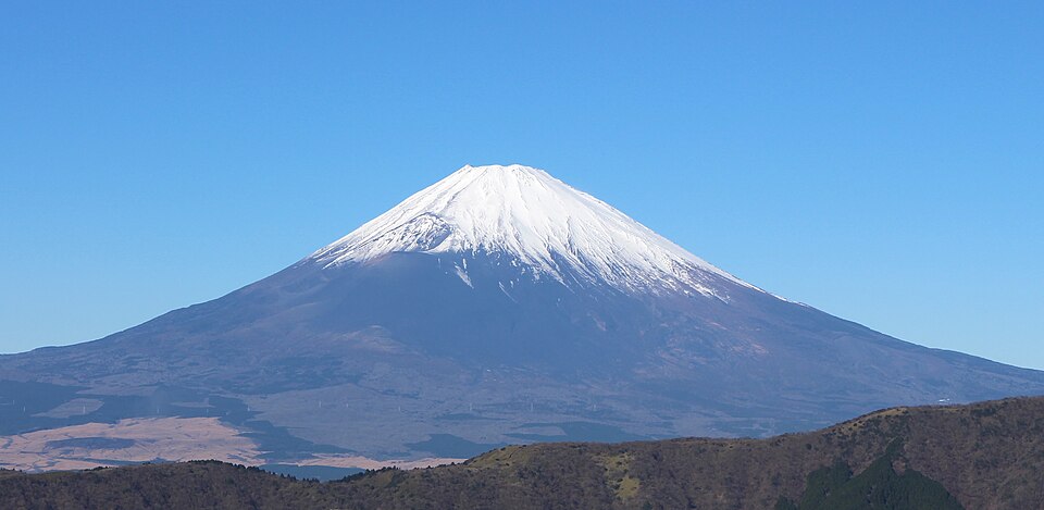
    Was this helpful?

    Yes
    No
    Thanks for your feedback!
Language »