
Last updated October 12, 2026
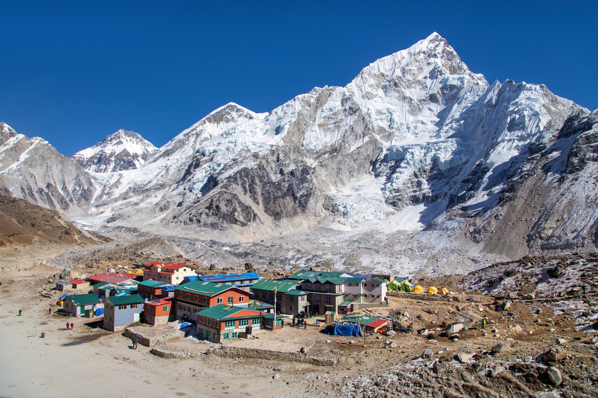
The 14 Eight-Thousanders: Complete 14 Peaks List by Height
There are 14 universally recognized mountains above 8,000 metres. This is the complete list from Mount Everest at 8,848.86 m to Shishapangma at 8,027 m, with countries, mountain ranges, first ascents, normal-route context and a direct guide for every peak.
Page reviewed August 15, 2026 · Elevations and identities checked against established 8,000m references
What are the 14 peaks above 8,000 meters?
The classic 14 eight-thousanders are Everest, K2, Kangchenjunga, Lhotse, Makalu, Cho Oyu, Dhaulagiri I, Manaslu, Nanga Parbat, Annapurna I, Gasherbrum I, Broad Peak, Gasherbrum II and Shishapangma.
All 14 are in Asia, within the Himalaya or Karakoram. They are the only mountains universally recognized by the mountaineering community as the classic 8,000-meter peaks.
- Highest: Mount Everest — 8,848.86 m.
- Second: K2 — 8,611 m.
- Lowest: Shishapangma — 8,027 m.
- Range split: 10 Himalaya, 4 Karakoram.
- First climbed: Annapurna I in 1950.
- Last first ascent: Shishapangma in 1964.
The 14 Eight-Thousanders, Ranked by Height
The table keeps to facts that do not depend on route or season: elevation, range, country and first-ascent year. Use the linked difficulty and risk guides for those separate comparisons.
| # | Mountain | Elevation | Feet | Range | Country / border | First ascent |
|---|---|---|---|---|---|---|
| 1 | Mount Everest | 8,848.86 m | 29,031.7 ft | Himalaya | Nepal / Tibet | 1953 |
| 2 | K2 | 8,611 m | 28,251 ft | Karakoram | Pakistan / China | 1954 |
| 3 | Kangchenjunga | 8,586 m | 28,169 ft | Himalaya | Nepal / India | 1955 |
| 4 | Lhotse | 8,516 m | 27,940 ft | Himalaya | Nepal / Tibet | 1956 |
| 5 | Makalu | 8,485 m | 27,838 ft | Himalaya | Nepal / Tibet | 1955 |
| 6 | Cho Oyu | 8,188 m | 26,864 ft | Himalaya | Nepal / Tibet | 1954 |
| 7 | Dhaulagiri I | 8,167 m | 26,795 ft | Himalaya | Nepal | 1960 |
| 8 | Manaslu | 8,163 m | 26,781 ft | Himalaya | Nepal | 1956 |
| 9 | Nanga Parbat | 8,126 m | 26,660 ft | Himalaya | Pakistan | 1953 |
| 10 | Annapurna I | 8,091 m | 26,545 ft | Himalaya | Nepal | 1950 |
| 11 | Gasherbrum I | 8,080 m | 26,509 ft | Karakoram | Pakistan / China | 1958 |
| 12 | Broad Peak | 8,051 m | 26,414 ft | Karakoram | Pakistan / China | 1957 |
| 13 | Gasherbrum II | 8,035 m | 26,362 ft | Karakoram | Pakistan / China | 1956 |
| 14 | Shishapangma | 8,027 m | 26,335 ft | Himalaya | Tibet, China | 1964 |
There are exactly 14 classic eight-thousanders.
The UIAA recognizes the “classic” 14 as the established list used by the international mountaineering community. There is continuing debate about subsidiary points above 8,000 metres, but those do not replace the historically recognized 14 principal mountains.
What Makes a Mountain an Eight-Thousander?
An eight-thousander is one of the principal mountains whose summit rises above 8,000 metres (26,247 feet) above sea level. The familiar list contains fourteen mountains, all in the high ranges of Asia.
The word is not merely a height category. In mountaineering, “the 8,000ers” refers to a specific historical collection: the fourteen main peaks that shaped high-altitude expedition climbing from the first ascent of Annapurna I in 1950 through the first ascent of Shishapangma in 1964.
Modern surveying and topographic analysis have identified additional subsidiary summits and points above 8,000 metres. That has led to a legitimate discussion about what should count as an independent mountain, a subsidiary summit or a top. The UIAA’s stated position is to retain the classic fourteen as the recognized mountaineering list while that broader topographic debate continues.
8,000 metres is also a physiological threshold.
The term “death zone” is commonly used for extreme altitude above roughly 8,000 metres, where sustained acclimatization is impossible and the body progressively deteriorates. The exact physiological response varies by climber, but every one of the 14 peaks requires exposure to this extreme-altitude environment.
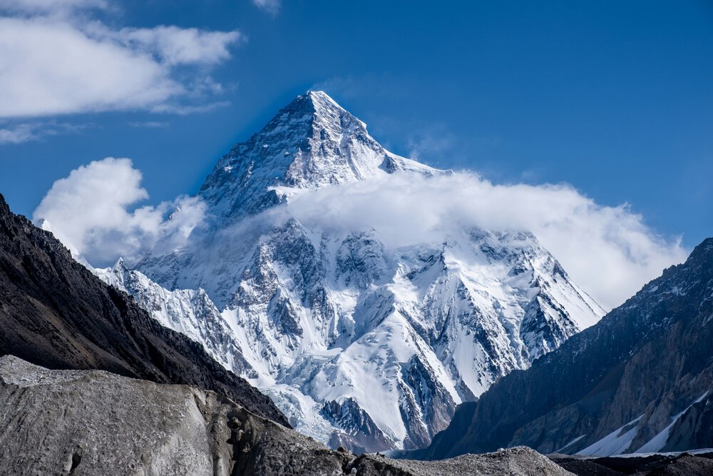
Ten of the 14 are in the Himalaya. Four are in the Karakoram.
The Karakoram four—K2, Gasherbrum I, Broad Peak and Gasherbrum II—sit in the Pakistan-China border region. The remaining ten belong to the Himalaya across Nepal, Tibet, India and Pakistan.
Himalaya vs Karakoram
The list is unified by altitude, but access, weather, season, logistics and rescue systems are not the same across the two ranges.
The Himalaya · 10 Peaks
Everest, Kangchenjunga, Lhotse, Makalu, Cho Oyu, Dhaulagiri I, Manaslu, Nanga Parbat, Annapurna I and Shishapangma form the Himalayan portion of the list.
- Nepal contains or borders more classic 8,000ers than any other country.
- Spring is the dominant season for several Nepal 8,000ers.
- Manaslu is also strongly associated with the autumn expedition season.
- Tibet access can materially affect Cho Oyu and Shishapangma planning.
The Karakoram · 4 Peaks
K2, Gasherbrum I, Broad Peak and Gasherbrum II form a compact but exceptionally serious group reached through Pakistan’s Baltoro Glacier system.
- Summer is the normal high-altitude expedition season.
- The Baltoro approach creates a shared logistical gateway.
- Weather windows are often short and difficult to forecast.
- K2 is the technical and objective-hazard outlier of the entire classic 14.
All 14 Eight-Thousanders, Peak by Peak
Use these short profiles to identify the mountain. Open the dedicated guide for routes, permits, operators, training, weather, cost and expedition planning.
Mount Everest
8,848.86 m · Nepal / Tibet
The highest point on Earth. Everest has the deepest commercial infrastructure of the 14, but altitude, the Khumbu Icefall, weather, oxygen systems and the long descent still make it a major expedition.
K2
8,611 m · Pakistan / China
The second-highest mountain and the hardest standard-route objective in the 14 for many climbers. The Abruzzi Spur combines steep mixed terrain, the Black Pyramid, the Bottleneck and a difficult descent.
Kangchenjunga
8,586 m · Nepal / India
The third-highest mountain is remote, less standardized and culturally significant. Modern expeditions commonly approach from Nepal, and many teams stop just short of the absolute summit out of respect for local tradition.
Lhotse
8,516 m · Nepal / Tibet
Lhotse shares Everest’s Khumbu Icefall, Western Cwm and much of the Lhotse Face before splitting toward the steep summit couloir. Shared infrastructure does not make the upper mountain easy.
Makalu
8,485 m · Nepal / Tibet
Makalu’s isolated pyramid becomes increasingly technical near the summit. The normal route involves steep snow, rock and mixed ground with less commercial redundancy than Everest or Manaslu.
Cho Oyu
8,188 m · Nepal / Tibet
When Tibet access is available, Cho Oyu is commonly described as one of the least technical normal routes among the 8,000ers. Extreme altitude, cold, crevasses and access rules still define the expedition.
Dhaulagiri I
8,167 m · Nepal
A remote western-Nepal expedition with serious avalanche and weather exposure. The Northeast Ridge is the normal route, but the mountain has far less fallback infrastructure than Everest.
Manaslu
8,163 m · Nepal
One of the more commercially supported 8,000ers and a frequent first death-zone expedition. Avalanche and serac exposure remain serious, and true-summit verification has changed how completions are documented.
Nanga Parbat
8,126 m · Pakistan
The western anchor of the Himalaya and one of the world’s great relief mountains. The Diamir-side normal route remains committing, with avalanche exposure, storms and difficult retreat.
Annapurna I
8,091 m · Nepal
The first 8,000-meter mountain ever climbed. Annapurna’s reputation is dominated by avalanche and serac exposure; its historic death-rate shorthand should be separated from newer published figures.
Gasherbrum I
8,080 m · Pakistan / China
Hidden Peak is a serious Karakoram objective reached after the long Baltoro approach. Its climbing history is closely associated with technical and alpine-style innovation.
Broad Peak
8,051 m · Pakistan / China
Broad Peak stands near K2 and is often combined with Karakoram expeditions. Its long summit ridge matters: reaching a fore-summit is not the same as reaching the true 8,051-meter summit.
Gasherbrum II
8,035 m · Pakistan / China
Often described as the most approachable Karakoram 8,000er by standard-route technical difficulty. It still requires a full Baltoro expedition, glacier travel, acclimatization and a narrow weather window.
Shishapangma
8,027 m · Tibet, China
The lowest of the classic 14 and the only one entirely within Tibet. Access depends on Chinese permissions, and true-summit geography has created important verification disputes.
Why the 14-Peak List Should Be Ranked by Height
For a master list, elevation is the cleanest ordering system because it does not depend on route choice, season, weather, support level or editorial judgment.
Everest is #1 because it is the highest, not because it is automatically the hardest. K2 is #2 by elevation but is commonly judged harder on its standard route. Annapurna I is #10 by height but has one of the most serious objective-hazard histories. Cho Oyu is #6 by height but is often considered among the least technical normal routes.
Ranking the mountains by height keeps the list objective. Difficulty and risk change with route, season, support and conditions, so those comparisons are more useful on the dedicated Eight-Thousanders Ranked by Difficulty and Death Rates by Mountain guides.
Three rankings, three different answers.
Highest: Everest. Hardest standard route: K2 in our difficulty framework. Highest newer published Nepal-Himalaya death-to-ascent ratio: Annapurna I in the current Guinness comparison. Those statements can all be true simultaneously because they measure different things.
The First-Ascent Era: 1950 to 1964
The classic 8,000er era opened with Annapurna and closed with Shishapangma.
| Year | Mountain | First-ascent context |
|---|---|---|
| 1950 | Annapurna I | Maurice Herzog and Louis Lachenal reached the first 8,000-meter summit ever climbed. |
| 1953 | Everest | Edmund Hillary and Tenzing Norgay reached the world’s highest summit via the South Col. |
| 1953 | Nanga Parbat | Hermann Buhl completed one of the defining first ascents of the era. |
| 1954 | K2 | Achille Compagnoni and Lino Lacedelli summited for the Italian expedition. |
| 1954 | Cho Oyu | Herbert Tichy, Joseph Jöchler and Pasang Dawa Lama made the first ascent. |
| 1955 | Kangchenjunga | Joe Brown and George Band reached the summit area while respecting local summit tradition. |
| 1955 | Makalu | Lionel Terray and Jean Couzy were first to the summit during a highly successful French expedition. |
| 1956 | Lhotse | Ernst Reiss and Fritz Luchsinger completed the first ascent. |
| 1956 | Manaslu | Toshio Imanishi and Gyalzen Norbu reached the summit for the Japanese expedition. |
| 1956 | Gasherbrum II | Fritz Moravec, Josef Larch and Hans Willenpart completed the first ascent. |
| 1957 | Broad Peak | An Austrian team completed the ascent without the large siege structure typical of the era. |
| 1958 | Gasherbrum I | Pete Schoening and Andy Kauffman completed the first ascent. |
| 1960 | Dhaulagiri I | A Swiss-Austrian-Nepali expedition completed the first ascent. |
| 1964 | Shishapangma | A Chinese expedition completed the last first ascent among the classic 14. |

14 Eight-Thousanders Guide: 8,000m Peaks, Safety & Routes
The master list should identify the 14 mountains. Specialized pages should answer difficulty and death-rate questions with their own methodology.
Easiest, Hardest, Deadliest and Most Supported
These are directional labels—not a replacement for the dedicated comparisons.
Cho Oyu
When Tibet access is available, its Northwest Ridge is widely considered among the least technical standard routes. Extreme altitude remains decisive.
K2
Sustained technical terrain, the Bottleneck, weather, limited rescue and the descent place K2 at the top of our difficulty model.
Annapurna I
Avalanche and serac exposure define the mountain. Historic ratios must be separated from newer published data.
Everest
The standard Nepal route has the deepest commercial infrastructure, but that support does not remove altitude, icefall or weather hazards.
Manaslu
Commercial support and a comparatively standardized normal route make Manaslu a common entry point into the death zone.
Gasherbrum II
Often used as a first Karakoram 8,000er before more technical or committing objectives in the range.
For the full 100-point comparison, open Eight-Thousanders Ranked by Difficulty. For denominator-safe risk comparisons, open Death Rates by Mountain.
A Responsible Progression Toward the Eight-Thousanders
Elevation order is useful for a list. It is not the order in which climbers should attempt these mountains.
Build Below 7,000 m
Develop expedition routines, glacier systems, cold management, acclimatization judgment and independent movement before entering the death zone.
Build a mountain progression →Choose a Supported First 8,000er
Manaslu, Cho Oyu when accessible, or another comparatively standardized objective may fit experienced climbers better than jumping directly to K2 or Annapurna.
Compare the 14 by difficulty →Stage 3 · Add a Different Expedition System
Move from one supported Himalayan system into a different range or a less standardized mountain. Learn how weather, route fixing, oxygen, staffing and rescue change when infrastructure is thinner.
Stage 4 · Reserve the Outliers
K2, Annapurna I and other high-objective-hazard peaks belong late in a mature résumé. The ability to turn around remains more valuable than completing a collection quickly.
Who Has Climbed All 14 Eight-Thousanders?
Reinhold Messner completed the classic 14 in 1986, creating one of mountaineering’s defining collection achievements. The verification story is more complicated today because historical summit claims have been re-evaluated using modern topographic and photographic evidence.
8000ers.com now maintains separate Legacy, Transition and New Era tables. Its April 2026 review reported 39 climbers in the New Era table, while broader legacy-style counts can be higher. That is why this page does not hard-code one universal “total completers” number into the hero.
For the complete record of climbers who finished all fourteen, open Climbers Who Summited All 14 Eight-Thousanders. That guide covers verification standards, firsts, women, oxygen use and speed records in far more detail.
Want the people rather than the mountains?
The climbers list follows the completion history from Reinhold Messner onward and explains why modern true-summit verification can produce different totals from older legacy lists.
Cost, Permits, Seasons and Access Vary by Peak
Once a climber moves from identifying the 14 peaks to planning one of them, the stable list gives way to rapidly changing logistics.
| Planning variable | Why it changes | Where to verify |
|---|---|---|
| Permit / royalty | National regulations and fee schedules change by country, season and mountain. | Dedicated peak guide + official permitting authority |
| Access | Tibet openings, border rules, permits, road conditions and political restrictions can change. | Current operator + official authority |
| Expedition season | Monsoon, jet-stream position and regional weather patterns differ between Nepal and the Karakoram. | Peak weather/season guide |
| Operator support | Fixed ropes, oxygen, high-altitude workers, camps and rescue planning vary by mountain and company. | Peak operator comparison |
| Cost | Permit, staffing, oxygen, transport, logistics and operator tier create very different budgets. | Peak cost guide + operator quote |
| Summit verification | True-summit geography matters on peaks such as Manaslu, Broad Peak and Shishapangma. | Expedition records + verification sources |

Fourteen names fit in one table. Becoming ready for them can take a climbing lifetime.
Use the master list to understand the collection, then move into the dedicated difficulty, risk, route and planning pages before choosing an objective.
Explore the Eight-Thousanders in More Detail
Use these guides when you want to move beyond names and heights into difficulty, climber records, risk, outcomes and expedition planning.
8,000ers Ranked by Difficulty
All 14 scored from easiest to hardest using a separate difficulty framework.
Compare difficulty → Climbers & recordsClimbers Who Completed All 14
Completers, verification systems, records, women, oxygen and historic milestones.
See the climbers → Risk researchDeath Rates by Mountain
Historical vs newer ratios with denominator-safe comparisons.
Compare fatality data → Global context10 Hardest Mountains
See how K2, Annapurna and other 8,000ers compare with technical peaks worldwide.
Compare hardest peaks → Summit outcomesSummit Success Rates
Separate summit-success questions from fatality and technical-difficulty questions.
Compare success → Flagship comparisonEverest vs K2
Height, technical terrain, risk, cost, support and expedition character.
Compare Everest & K2 → CollectionsMountain Collections
Place the 14 eight-thousanders beside the Seven Summits and regional climbing collections.
Explore collections → MethodologyMountaineering Truth Project
How Global Summit Guide handles disputed summits, changing numbers and uncertain mountain data.
Read methodology →Two Questions Worth Opening in Their Own Guides
The height list answers what the fourteen mountains are. These two guides answer the next questions most readers ask.
Eight-Thousanders Ranked by Difficulty
Height and difficulty are different rankings. Use the difficulty guide to compare normal-route technical demands, support, objective hazards and overall expedition challenge.
Open Difficulty Ranking →Climbers Who Summited All 14
The completers guide follows Reinhold Messner, later finishers, women, speed records, no-oxygen claims and the verification debates that changed modern completion lists.
Open Completers List →14 Peaks & Eight-Thousanders FAQ
Short answers to the questions most often asked about the classic fourteen. Detailed difficulty, risk and climber records are linked where they need more context.
What are the 14 peaks over 8,000 meters?
Everest, K2, Kangchenjunga, Lhotse, Makalu, Cho Oyu, Dhaulagiri I, Manaslu, Nanga Parbat, Annapurna I, Gasherbrum I, Broad Peak, Gasherbrum II and Shishapangma.
How many 8,000-meter peaks are there?
The mountaineering community and UIAA recognize the classic list of 14 principal mountains above 8,000 metres. Additional subsidiary points above 8,000 m exist, but they are not treated as replacements for the classic fourteen.
Which is the highest of the 14 peaks?
Mount Everest is the highest at 8,848.86 metres (29,031.7 feet), followed by K2 at 8,611 metres and Kangchenjunga at 8,586 metres.
Which is the lowest eight-thousander?
Shishapangma is the lowest of the classic 14 at 8,027 metres (26,335 feet). It is also the only classic eight-thousander entirely within Tibet, China.
Where are the 14 eight-thousanders?
All are in Asia. Ten are in the Himalaya and four—K2, Gasherbrum I, Broad Peak and Gasherbrum II—are in the Karakoram.
Which 8,000-meter mountain was climbed first?
Annapurna I was the first 8,000-meter mountain climbed, in 1950 by Maurice Herzog and Louis Lachenal. Shishapangma was the last of the classic 14 to receive a first ascent, in 1964.
Which is the hardest 8,000-meter peak?
Global Summit Guide ranks K2 as the hardest standard-route objective among the classic 14. See the dedicated Eight-Thousanders Ranked by Difficulty page for the full scoring model rather than using the height list as a difficulty ranking.
Which is the easiest 8,000-meter peak?
Cho Oyu is widely considered among the least technical standard-route 8,000ers when Tibet access is available. Manaslu and Gasherbrum II are also commonly discussed as comparatively approachable first 8,000-meter objectives for already-experienced expedition climbers.
Who was the first person to climb all 14 eight-thousanders?
Reinhold Messner completed the classic 14 in 1986. Modern verification systems distinguish legacy historical recognition from newer true-summit standards; the dedicated all-14 climbers page explains those systems.
Are the “14 Peaks” the same thing as the eight-thousanders?
In mountaineering, “the 14 peaks” commonly refers to the fourteen classic mountains above 8,000 metres. The phrase is also used in books, films and expedition projects that follow climbers trying to complete the full set.
How Global Summit Guide Maintains the 14-Peaks List
The identities and order of the classic 14 are stable. Summit verification, completer totals, permits, access and expedition statistics are not.
Primary list & verification references
- UIAA — 8000m Peaks for the recognized classic fourteen and the ongoing peak-definition discussion.
- 8000ers.com ascent lists for historical and modern completion/verification research.
- The Himalayan Database for Nepal Himalayan expedition records.
- Global Summit Guide Truth Project for the site’s uncertainty and source-handling framework.
What this guide covers
- The complete list of the classic fourteen, ranked by elevation.
- Countries, ranges and first-ascent years for every mountain.
- Short peak profiles with direct links to full mountain guides.
- Clear links to separate difficulty, death-rate and climber-record research.
- Source notes for summit verification and historical records.
- An update policy for details that can change over time.
Update policy
The core list rarely changes. Review elevations, access notes, summit-verification guidance and completer references when primary sources publish material updates. Permit, operator, cost and season details belong on the individual peak pages.
Start With the List. Then Choose the Right Mountain for the Next Step.
Use this page to identify all 14 eight-thousanders. Use the difficulty ranking to compare them, the risk hub to understand fatality data, and each mountain guide for actual expedition planning.
Climb the 14 eight-thousanders
Complete route, permit, season, and safety guides for every peak above 8,000 m — ranked by height.
Was this helpful?
🏔Peaks in this region
🧭Explore & compare
Global Summit Guide is an independent mountaineering resource founded in 2026. The team combines first-hand trekking and climbing experience with in-depth research and professional health and nutrition review to help climbers choose objectives, prepare properly, and stay safe.
Health, altitude, and nutrition content is reviewed by Taylor Ludlow (Registered Nurse) and Brigg Hoopes (Nutritionist).
What We Don't Know Yet
Mountain information changes quickly. This box explains the limits of what this page can responsibly promise.
- Visa, passport, vaccination, border, insurance, and local transportation rules may change before your trip.
- Route conditions, snowpack, closures, and weather can change quickly after this page is updated.
- Permit rules, fees, quotas, and reservation windows may change between review cycles.
- Operator availability, pricing, guide ratios, and cancellation terms can change by season.
- Your fitness, altitude response, risk tolerance, and experience level may change what is safe or realistic.
Verify current conditions with official land managers, guide services, local forecasts, and current route reports before booking or climbing.
Mountaineering, rock and ice climbing, glacier travel, and high-altitude activity are inherently dangerous and can result in serious injury or death. The information on Global Summit Guide is provided for general informational and educational purposes only and is not a substitute for professional instruction, qualified guiding, proper equipment, or your own judgment and experience.
Route conditions, weather, snowpack, permits, regulations, and hazards change constantly and may differ from what is described here. Details may be incomplete, out of date, or contain errors. Always verify current information with local authorities, certified guides, and official sources before making any decision in the mountains.
Nothing on this site is medical, legal, or financial advice. Our fitness, acclimatization, altitude, and nutrition content is general in nature; consult a qualified physician before beginning any strenuous exercise program or exposing yourself to high altitude.
You are solely responsible for your own safety and decisions. To the fullest extent permitted by law, Global Summit Guide and its team accept no liability for any loss, injury, damage, or expense arising from use of, or reliance on, this information. By using this site you acknowledge these risks and accept these terms.
Some links on this site may be affiliate links. If you buy through them we may earn a small commission at no extra cost to you; this never affects our recommendations.
Global Summit Guide recommendation path
Next Best Mountain to Research
Use these recommendations to continue the right planning path instead of stopping on one page.
Use current permit, weather, route, and operator information before booking or climbing.