
Last updated September 18, 2026
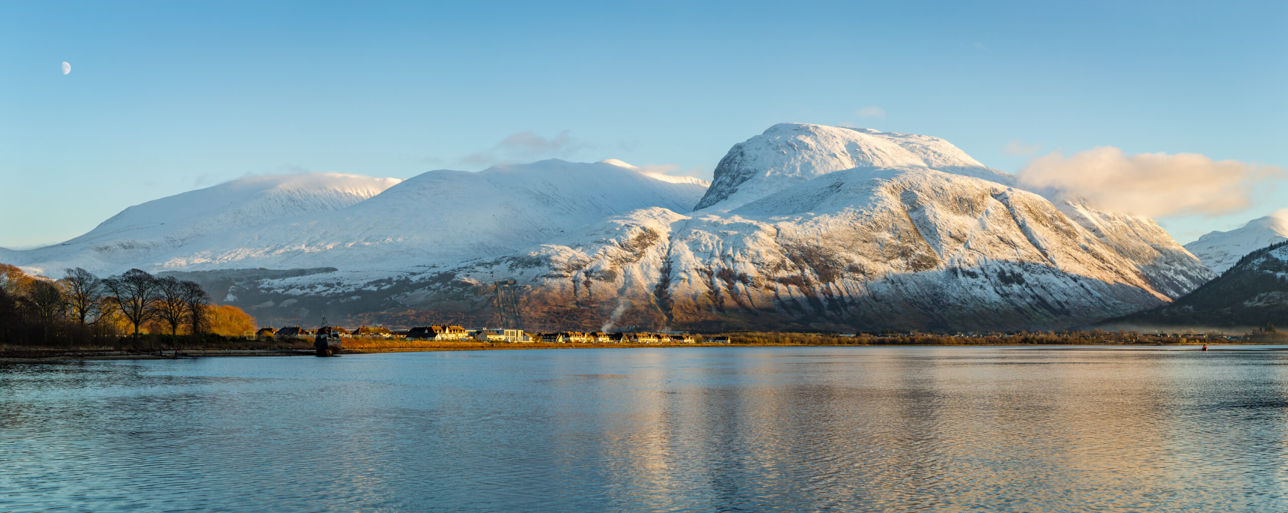
British Isles Peaks & Three Peaks Challenge Guide
Compare the National Three Peaks with the wider mountain traditions of Scotland, the Lake District, Wales and Ireland: Ben Nevis, Scafell Pike, Yr Wyddfa, Munros, Wainwrights, Carrauntoohil, Slieve Donard and the progression from straightforward hillwalking to exposed scrambling.
The Three Peaks are a challenge format, not a ranking of Britain’s three highest mountains.
The National Three Peaks Challenge links Ben Nevis, Scafell Pike and Yr Wyddfa because they are the highest mountains in Scotland, England and Wales. The classic target is to climb all three within 24 hours, including the road transfers between them. Current challenge guidance puts the walking at about 23 miles / 37 km, with 3,064 m of ascent and roughly 462 miles of driving.
That challenge is only one doorway into British and Irish mountain culture. Scotland’s 282 Munros, the Lake District’s 214 Wainwrights, exposed Welsh ridges, the MacGillycuddy’s Reeks in Ireland and the Mournes in Northern Ireland all offer very different mountain days.
British Isles mountain planning at a glance
The useful comparison is not simply height. These mountains differ in route character, navigation, exposure, weather, crowds and the reason people climb them. The same person may be well suited to a long Wainwright day and poorly prepared for a winter Munro or an exposed Welsh scramble.
| Objective | Height / scale | Best for | Main planning issue |
|---|---|---|---|
| Ben Nevis | 1,345 m | Britain’s highest summit, endurance hill day | Long ascent, severe weather, summit navigation |
| Scafell Pike | 978 m | England’s highest summit, Lake District day | Rocky terrain and complex mountain navigation |
| Yr Wyddfa | 1,085 m | Wales high point, route variety | Route choice changes the character dramatically |
| National Three Peaks | 23 mi / 37 km walking | Timed endurance + logistics challenge | Fatigue, night travel, driving and group pacing |
| Munros | 282 current peaks | Long-term Scottish peak-bagging | Remote terrain, navigation and weather |
| Wainwrights | 214 fells | Lake District progression and exploration | Route design and cumulative ascent |
| Carrauntoohil | 1,039 m | Ireland’s highest mountain | Steep terrain, erosion, cloud and route choice |
| Slieve Donard | 852 m | Northern Ireland high point | Steep ascent and rapidly changing coastal weather |
National Three Peaks
Three separate mountain walks linked by long road transfers. The challenge is as much about planning, pacing and driver safety as hill fitness.
Munros & Wainwrights
Lists turn mountain travel into a long-term progression. They reward navigation, route design and breadth more than one headline summit.
Scrambling & winter
Crib Goch, Aonach Eagach and winter Scottish terrain move far beyond ordinary path walking and require a different skill set.

Where the main British and Irish mountain objectives sit
Ben Nevis, Scafell Pike and Yr Wyddfa form a long north-to-south line across Great Britain. Carrauntoohil sits in County Kerry in southwest Ireland, while Slieve Donard rises directly above the County Down coast in Northern Ireland. The geography explains why a Three Peaks attempt includes far more driving than walking distance.
British Isles mountain orientation map
Use this for regional context only. Choose route-specific maps and current local guidance before any mountain day.
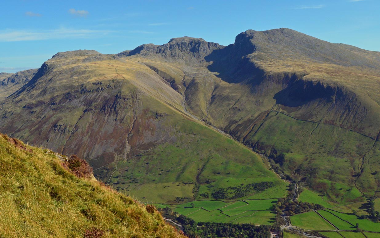
Ben Nevis, Scafell Pike and Yr Wyddfa in one 24-hour challenge
The classic National Three Peaks Challenge combines the highest mountain in Scotland, England and Wales. Current challenge guidance describes about 23 miles / 37 km of walking, 3,064 m of ascent and 462 miles of driving, with the traditional target of completing the full sequence inside 24 hours.
Usually climbed first. At 1,345 m, it is the highest summit and normally the longest single mountain stage. The standard mountain path is non-technical in summer conditions, but summit weather and navigation can be severe.
Typically approached from Wasdale for the challenge. It is shorter than Ben Nevis but rougher underfoot, and it is often climbed in darkness or after a long road transfer.
Usually the final summit. Established walking routes can be straightforward in good weather, but tired legs and overnight timing change the risk picture.
The challenge includes roughly 462 miles of driving between mountains. Dedicated rested drivers are a core safety decision, not an optional convenience.
The clock includes the climbs and the driving. Treat 24 hours as a challenge format, not as a reason to ignore weather, darkness, group fatigue or safe driving limits.

Choose the mountain day by type, not by name recognition
The most useful way to use this collection is to start with the kind of experience you want. A timed Three Peaks attempt, a single national high point, a list-completion project and an exposed scramble are different objectives even when they share the same mountain landscape.
| If you want… | Start with… | Why |
|---|---|---|
| A timed endurance challenge | National Three Peaks | Combines three mountain stages with overnight logistics and long transfers. |
| One iconic summit day | Ben Nevis, Yr Wyddfa, Scafell Pike or Carrauntoohil | Lets you spend the whole day understanding one mountain instead of racing between regions. |
| Long-term peak-bagging | Munros or Wainwrights | Builds navigation, route planning and mountain experience over many outings. |
| Exposed scrambling | Crib Goch or Aonach Eagach after progression | Adds hands-on movement and meaningful exposure; not equivalent to normal hillwalking. |
| Winter mountaineering | Scottish winter objectives with training | Snow, ice, avalanche hazard and short daylight create a separate discipline. |
| Irish high-point travel | Carrauntoohil + MacGillycuddy’s Reeks | Combines Ireland’s highest summit with steep ridges and distinctive Atlantic weather. |
Path-based summit days
Choose established routes, build navigation habits and learn how weather changes pace and turnaround decisions.
Collection-based progression
Munros and Wainwrights create a long runway for improving fitness, route choice and mountain judgment.
Scrambling and winter
Move into exposure, hands-on terrain and winter only after the underlying movement and navigation skills are reliable.
Scotland is much bigger than Ben Nevis
Ben Nevis is Britain’s highest mountain, but the Scottish mountain system is better understood through its ranges and hill lists. The Scottish Mountaineering Club currently maintains a list of 282 Munros: Scottish peaks at least 3,000 ft / 914.4 m high that meet the list’s separation criteria.
Munros
A full Munro round takes climbers from straightforward path days to remote Highlands, long ridge traverses, pathless terrain and serious navigation. The list is a progression system as much as a checklist.
Aonach Eagach, Cuillin and beyond
Scotland also contains exposed scrambling and technical climbing that cannot be inferred from elevation alone. Choose routes by grade and terrain, not by summit name.

The Lake District: Scafell Pike, Wainwrights and route-building
The Lake District National Park lists Scafell Pike at 978 m as England’s highest mountain. It also notes the 214 fells described by Alfred Wainwright, a collection that has become one of Britain’s best-known hillwalking projects.
| Objective | Character | What it develops |
|---|---|---|
| Scafell Pike from Wasdale | Rocky high-point route | Pacing, rough-ground movement, navigation |
| Helvellyn | High fell with optional ridge approaches | Route choice and introduction to exposure |
| Great Gable / Bowfell | Classic central fells | Longer mountain days and complex route design |
| Wainwright round | 214-fell collection | Consistency, navigation and regional knowledge |
Yr Wyddfa can be a walk, a scramble or part of a larger ridge day
Yr Wyddfa reaches 1,085 m and is the highest mountain in Wales. Established walking routes make the summit accessible to experienced hillwalkers in good conditions, while routes involving Crib Goch introduce significant exposure and scrambling.
Use a standard mountain path when the objective is the summit itself. Even on the most established lines, weather, visibility and crowding can materially affect the day.
An exposed Grade 1 scramble with real consequences for a slip. It should not be treated as a scenic variation for people who are uncomfortable with exposure.
Eryri offers a strong progression from ordinary hillwalking into scrambling and more technical mountain travel without requiring high altitude.
Carrauntoohil and Slieve Donard extend the collection beyond Great Britain
Carrauntoohil is the highest mountain in Ireland at about 1,039 m, rising in the MacGillycuddy’s Reeks of County Kerry. Slieve Donard is Northern Ireland’s highest mountain at about 852 m, rising above Newcastle in the Mourne Mountains.
Carrauntoohil
The standard approaches are steep and mountain conditions can change quickly. The objective is better treated as a full mountain day than as a simple national high-point tick.
Slieve Donard
The Mournes combine steep coastal relief, granite terrain and a compact group of peaks. Donard works well as an introduction, while wider Mourne circuits add route-finding and cumulative ascent.


Maritime weather is the common denominator
The British and Irish mountains are low by global standards but unusually exposed to fast-changing Atlantic weather. Wind, cloud, rain, cold, snow and limited visibility frequently matter more than elevation.
| Season | Planning role | Main advantages | Main tradeoffs |
|---|---|---|---|
| Late spring | Strong general window | Long daylight, improving ground conditions, fewer mid-summer crowds | Snow can linger on higher Scottish terrain; cold wind remains possible |
| Summer | Most accessible | Longest daylight and best public-transport/service availability | Crowds, heat on sheltered ascents, thunderstorms and still plenty of rain |
| Autumn | Excellent with shorter days | Quieter trails, often clear air and good hillwalking conditions | Rapidly shortening daylight and more frequent unsettled weather |
| Winter | Separate mountaineering season | Snow and ice can transform familiar hills into true mountaineering objectives | Requires winter skills, equipment, avalanche awareness and conservative daylight planning |
Plan the Three Peaks as a transport-and-fatigue problem
The National Three Peaks is unusual because the mountain stages are separated by hundreds of road miles. That creates a planning problem no single mountain has: walkers are tired, drivers can become tired, one mountain may be climbed in darkness, and the weather can be different in all three regions.
Use dedicated drivers who are not also completing every mountain stage. The challenge does not justify fatigued driving.
Choose the schedule around likely traffic, daylight, mountain conditions and the group’s actual pace rather than copying a generic timetable.
Assume at least one mountain may be climbed in darkness. Headlamps, navigation, batteries and group spacing need to be planned before the event.
One mountain being climbable does not mean all three are. Check separate forecasts and keep the option to change or stop the challenge.
Use appropriate parking, toilets and access arrangements, avoid unnecessary noise at night and keep the challenge from becoming a burden on small mountain communities.
The schedule has margin
Dedicated drivers, realistic hill times, food and hydration, spare batteries, weather alternatives and a clear stop rule.
The 24-hour number overrides everything
If weather, fatigue or road delays cannot change the plan, the challenge is being treated as a stopwatch exercise rather than a mountain objective.
Build skills across the same mountains
One of the strengths of the British Isles is that you can build a deep mountain skill set without high altitude. The terrain supports a progression from path walking to long mountain days, navigation in poor visibility, exposed scrambling, winter skills and technical climbing.
| Stage | Example objective | Primary skill | Move on when… |
|---|---|---|---|
| 1 | Established Lake District or Eryri path | Pacing, clothing, basic navigation | You can manage a full day in mixed weather without relying on phone signal |
| 2 | Ben Nevis / Scafell Pike / Carrauntoohil | Long ascent, descent discipline, summit navigation | You finish with enough reserve for safe navigation and descent |
| 3 | Multi-summit Munro or Wainwright day | Route design and cumulative fatigue | You can make conservative route changes during the day |
| 4 | Grade 1 scramble with appropriate instruction | Exposure, hands-on movement, route judgment | You remain controlled rather than rushed or frozen by exposure |
| 5 | Scottish winter with training | Ice axe, crampons, avalanche awareness, winter navigation | You have formal instruction and can apply it independently on appropriate terrain |
Use the mountain difficulty ratings guide to separate fitness difficulty from technical difficulty, and the mountain weather guide to improve forecast decisions.
Sources used for the core numbers
This guide uses current list maintainers, park authorities, challenge-planning sources and national tourism or land-management sources for the facts that change or are commonly misstated. Elevations can differ by a metre across mapping systems; where reputable official sources differ slightly, this page uses the current figure from the cited authority rather than implying false precision.
Primary and specialist references
- Scottish Mountaineering Club hill lists for the current 282 Munros and the SMC definition of a Munro.
- Lake District National Park facts and figures for Scafell Pike at 978 m and the 214 Wainwright fells.
- National Three Peaks Challenge planning page for the current 23-mile walking distance, 3,064 m ascent, 462-mile road distance and the clarification that the peaks are national high points rather than Britain’s three highest mountains.
- Discover Ireland – Carrauntoohil for Ireland’s highest mountain and current visitor guidance.
- National Trust – Mourne Mountains for Slieve Donard and the wider Mourne range.
Build the British Isles plan around the next decision
Use the parent collections for broad discovery, then move into individual mountain, weather, fitness and route-planning pages. The cream links are deep-recovery connections included deliberately in this rebuild.
British Isles peaks and Three Peaks FAQ
What are the three mountains in the National Three Peaks Challenge?
Ben Nevis in Scotland, Scafell Pike in England and Yr Wyddfa / Snowdon in Wales.
Are they the three highest mountains in Britain?
No. They are the highest mountains in Scotland, England and Wales. Many Scottish mountains are higher than Scafell Pike and Yr Wyddfa.
How long is the National Three Peaks Challenge?
Current planning guidance describes about 23 miles / 37 km of walking, 3,064 m of ascent and roughly 462 miles of driving, traditionally targeted within 24 hours.
How many Munros are there?
The Scottish Mountaineering Club’s current list contains 282 Munros.
How many Wainwrights are there?
Alfred Wainwright described 214 Lake District fells in his pictorial guides, and completing all 214 has become a major British hillwalking challenge.
What is the highest mountain in Ireland?
Carrauntoohil in County Kerry is Ireland’s highest mountain at about 1,039 m.
What is the highest mountain in Northern Ireland?
Slieve Donard in the Mourne Mountains is the highest mountain in Northern Ireland at about 852 m.
What is the best season for British Isles hillwalking?
Late spring through early autumn gives the longest daylight and the broadest access, but mountain weather can be severe in every month. Winter should be treated as a separate mountaineering season.
Is Crib Goch part of the normal Three Peaks route?
No. Crib Goch is an exposed scrambling ridge on Yr Wyddfa and should not be substituted into a timed Three Peaks attempt simply for variety.

About this research
Travis Ludlow leads Global Summit Guide’s mountain, route and planning research. This collection separates the National Three Peaks challenge format from the much broader mountain traditions of Scotland, England, Wales and Ireland. Read about the team and editorial approach.
Choose the mountain day before you choose the mountain name.
Use the Three Peaks for an endurance-and-logistics challenge, a single high point for a fuller mountain day, or the Munros and Wainwrights for a long-term progression through British mountain skills.
Explore Mountain Collections Read Mountain WeatherThe British Isles: Peaks & the Three Peaks Challenge
The National Three Peaks and the wider British hills sit within the European mountain system. Explore the peaks and neighbouring collections below.
Was this helpful?
🏔Peaks in this region
🧭Explore & compare
Global Summit Guide is an independent mountaineering resource founded in 2026. The team combines first-hand trekking and climbing experience with in-depth research and professional health and nutrition review to help climbers choose objectives, prepare properly, and stay safe.
Health, altitude, and nutrition content is reviewed by Taylor Ludlow (Registered Nurse) and Brigg Hoopes (Nutritionist).
What We Don't Know Yet
Mountain information changes quickly. This box explains the limits of what this page can responsibly promise.
- Visa, passport, vaccination, border, insurance, and local transportation rules may change before your trip.
- Route conditions, snowpack, closures, and weather can change quickly after this page is updated.
- Permit rules, fees, quotas, and reservation windows may change between review cycles.
- Operator availability, pricing, guide ratios, and cancellation terms can change by season.
- Your fitness, altitude response, risk tolerance, and experience level may change what is safe or realistic.
Verify current conditions with official land managers, guide services, local forecasts, and current route reports before booking or climbing.
Mountaineering, rock and ice climbing, glacier travel, and high-altitude activity are inherently dangerous and can result in serious injury or death. The information on Global Summit Guide is provided for general informational and educational purposes only and is not a substitute for professional instruction, qualified guiding, proper equipment, or your own judgment and experience.
Route conditions, weather, snowpack, permits, regulations, and hazards change constantly and may differ from what is described here. Details may be incomplete, out of date, or contain errors. Always verify current information with local authorities, certified guides, and official sources before making any decision in the mountains.
Nothing on this site is medical, legal, or financial advice. Our fitness, acclimatization, altitude, and nutrition content is general in nature; consult a qualified physician before beginning any strenuous exercise program or exposing yourself to high altitude.
You are solely responsible for your own safety and decisions. To the fullest extent permitted by law, Global Summit Guide and its team accept no liability for any loss, injury, damage, or expense arising from use of, or reliance on, this information. By using this site you acknowledge these risks and accept these terms.
Some links on this site may be affiliate links. If you buy through them we may earn a small commission at no extra cost to you; this never affects our recommendations.
Global Summit Guide recommendation path
Next Best Mountain to Research
Use these recommendations to continue the right planning path instead of stopping on one page.
Use current permit, weather, route, and operator information before booking or climbing.
Search Flights, Hotels & Rental Cars
Have the mountain or destination picked? Use Expedia to compare the flights, lodging and rental cars that fit your actual trip dates. For mountain travel, consider arriving early enough for delays and adding a buffer night after the climb before a fixed flight home.
Compare current flight, hotel and car options.
Affiliate disclosure: Global Summit Guide may earn a commission if you book through this link, at no additional cost to you.