Cascade Volcanoes: Climbing the Pacific Northwest’s Volcanic Arc
The Cascade Volcanoes form a 1,100-kilometer volcanic arc from British Columbia through Washington, Oregon, and Northern California — home to North America’s most heavily glaciated peaks outside Alaska and the continent’s premier glacier-climbing training ground. This guide covers the 10 major Cascade volcanoes, the Rainier-to-Denali progression path used by most American expedition climbers, and the glacier skills that make the Cascades mountaineering’s best classroom.
Cascades’ tallest
BC to California
Mount Rainier alone
Cascade volcanoes
The Cascade Volcanoes are where North American mountaineering is made. From Mount Baker’s forgiving glaciers (where countless climbers take their first rope team steps) to Mount Rainier’s committing glaciated ascent (the standard proving ground for Denali expeditions), the range offers a complete apprenticeship in glacier mountaineering. This guide covers all 10 major Cascade volcanoes in detail, maps the standard progression from beginner to Denali-ready, and explains why the Cascades produce more accomplished American alpinists than any other range in the lower 48 states.
What Are the Cascade Volcanoes?
The Cascade Volcanoes are a chain of approximately 20 major volcanic peaks and hundreds of smaller vents that stretch about 1,100 kilometers (680 miles) through the Pacific Northwest from British Columbia to Northern California. They form the Cascade Volcanic Arc, part of the Pacific Ring of Fire — the tectonically active rim surrounding the Pacific Ocean that produces most of the world’s earthquakes and volcanic activity. The Cascades are driven by the Juan de Fuca and Gorda plates subducting beneath the North American plate at approximately 3-4 cm per year, melting mantle rock into the magma that feeds each volcano.
Geologically, the arc includes 13 major stratovolcanoes plus numerous shield volcanoes, cinder cones, and volcanic fields. The most famous Cascade peaks — Rainier, Shasta, Hood, Baker, Adams, St. Helens, Glacier Peak, Jefferson, the Three Sisters, and Lassen Peak — are all active volcanoes by the standard geological definition, meaning they have erupted within the past 11,700 years and remain capable of future eruption. Mount St. Helens’ May 18, 1980 eruption was the most destructive volcanic event in US history, killing 57 people and causing over $1 billion in damage.
For climbers, what makes the Cascades special is not the volcanic activity (which is rare on any given peak) but the glacial systems that drape the major summits. Mount Rainier alone hosts 26 named glaciers covering approximately 90 square kilometers — more glacier mass than any peak in the contiguous US. Mount Baker, Glacier Peak, and others carry substantial glacier cover as well. These glaciers provide ideal training terrain for climbers learning rope team travel, crevasse rescue, and extreme-cold-weather camping — the core skills needed for Denali, the Karakoram, or any major expedition.
The Cascade Volcanic Arc: State by State
The Cascade Range spans four states and one Canadian province, with each section having its own gateway cities, weather patterns, and climbing character. Understanding which state or province holds your target peak is the first step in planning a Cascade climb — each region has different logistics, permit systems, and seasonal considerations.
🏔️ Washington State
Washington holds the highest concentration of major Cascade volcanoes: Mount Rainier, Mount Baker, Mount Adams, Mount St. Helens, and Glacier Peak. The state is the center of American glaciated mountaineering, home to the most heavily glaciated peak in the lower 48 (Rainier), the most popular first-glacier-climb destination (Baker), and the most famous volcanic eruption in US history (St. Helens 1980). Most American guide services base operations here.
🌲 Oregon
Oregon’s section of the Cascade Arc contains Mount Hood (the state’s highest peak and one of the most climbed mountains in North America), Mount Jefferson (Oregon’s second-highest and a genuine wilderness climb), and the Three Sisters (a volcanic trio near Bend). Oregon Cascades are generally shorter than Washington’s but still substantial — all three Sisters exceed 10,000 feet and Hood holds permanent glacier systems.
☀️ California
California’s Cascade Volcanoes are dominated by Mount Shasta — the second-highest peak in the range and California’s most significant glaciated climb. Lassen Peak, the southernmost major Cascade volcano, last erupted in 1914-1917 and is a significant geological site. California Cascades benefit from drier climate than the Washington/Oregon sections, with more stable summer weather but also more late-season rotten snow.
🍁 British Columbia
The northernmost Cascade Volcanoes extend into British Columbia, with Mount Garibaldi as the most significant peak near the BC Coast Range boundary. While geologically part of the Cascade Arc, BC’s volcanoes are typically grouped with the adjacent non-volcanic Coast Mountains in climbing parlance. Garibaldi Park offers spectacular scenery and moderate climbing objectives within easy reach of Vancouver and Whistler.
Washington and Oregon Cascades face the full Pacific maritime climate — wet, mild, and cloud-prone with 100+ inches of annual precipitation at mid-elevations. California Cascades are drier and sunnier, with more predictable summer weather but earlier seasonal snow melt. BC peaks sit in the transition zone. A climber who has climbed Mount Baker in July has not automatically trained for Mount Shasta in September — the peaks behave quite differently.
The 10 Major Cascade Volcanoes: Comparison Table
The table below lists the 10 Cascade volcanoes covered in detail in this guide, ranked by elevation. Difficulty shown reflects the standard (easiest) route; harder technical routes exist on every peak.
| # | Volcano | Elevation | State | Standard Route | Difficulty | Best Season |
|---|---|---|---|---|---|---|
| 1 | Mount Rainier | 4,392 m / 14,411 ft | Washington | Disappointment Cleaver | Hard | Jun–Sep |
| 2 | Mount Shasta | 4,322 m / 14,179 ft | California | Avalanche Gulch | Moderate | May–Jul |
| 3 | Mount Adams | 3,743 m / 12,281 ft | Washington | South Spur | Moderate | Jun–Sep |
| 4 | Mount Hood | 3,429 m / 11,250 ft | Oregon | South Side | Moderate | May–Jul |
| 5 | Mount Baker | 3,286 m / 10,781 ft | Washington | Easton Glacier | Moderate | Jun–Sep |
| 6 | Glacier Peak | 3,213 m / 10,541 ft | Washington | Sitkum Glacier | Hard | Jul–Sep |
| 7 | Mount Jefferson | 3,199 m / 10,497 ft | Oregon | Whitewater Glacier | Hard | Jul–Aug |
| 8 | Lassen Peak | 3,187 m / 10,457 ft | California | Main Trail | Easy | Jun–Sep |
| 9 | South Sister | 3,157 m / 10,358 ft | Oregon | Devil’s Lake Trail | Easy | Jul–Sep |
| 10 | Mount St. Helens | 2,549 m / 8,363 ft | Washington | Monitor Ridge | Easy | Apr–Oct |
The 10 Major Cascade Volcanoes: Detailed Breakdown
The sections below cover each of the 10 major Cascade volcanoes in detail, ranked from tallest to shortest. Each entry describes the volcano’s character, standard route, history, and practical climbing considerations. Links to our dedicated climb guides appear at the end of each section where available.
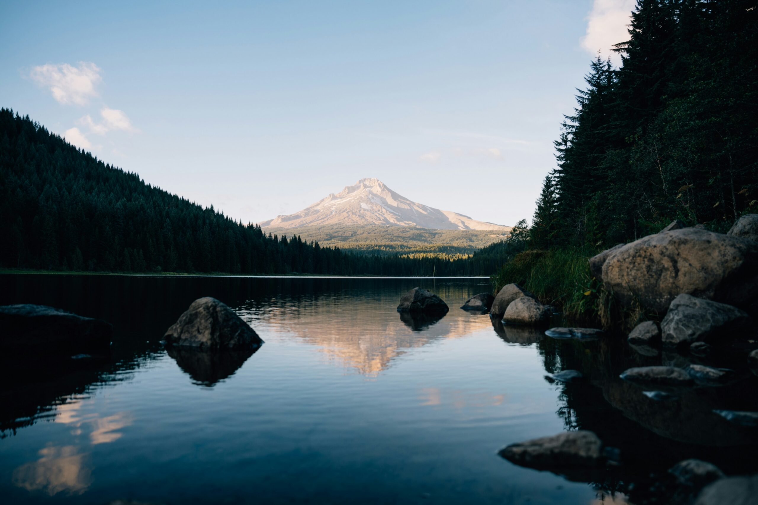
Mount Rainier
Mount Rainier is the highest peak in the Cascade Range, the most heavily glaciated peak in the contiguous United States, and arguably the most important training mountain in American mountaineering. With 26 named glaciers covering roughly 90 square kilometers, Rainier carries more glacier ice than the rest of the Cascade peaks combined. The mountain was first climbed on August 17, 1870 by Hazard Stevens and Philemon Beecher Van Trump via what is now known as the Gibraltar Ledges route, a historic line that has since been abandoned due to rockfall hazard.
The standard route today is the Disappointment Cleaver (DC) — a classic glaciated ascent from Paradise (1,646m) through Camp Muir (3,100m) to the summit via the Ingraham Glacier and the Cleaver itself. The climb involves full rope team glacier travel, crevasse navigation, snow climbing up to 45 degrees, and a committing summit day of 12-16 hours. Rainier is graded as moderate to hard by Cascade standards but serious for most climbers — the mountain kills 3-5 climbers per year on average, mostly from falls, weather exposure, and crevasse accidents.
For Seven Summits and Denali aspirants, Rainier serves as the premier American training peak. The two mountains share glacier travel demands, crevasse hazard, significant snow camping, and summit-day profiles (13,000+ foot summit days on both). Most American guide services explicitly recommend — and some require — a successful Rainier summit as prerequisite for Denali expeditions. A guided Rainier ascent via RMI Expeditions or International Mountain Guides runs $1,400-$2,600 for a 4-5 day program. Climbing permits cost $61 per person and are mandatory above 10,000 feet.
Full Mount Rainier climb guide →Mount Shasta
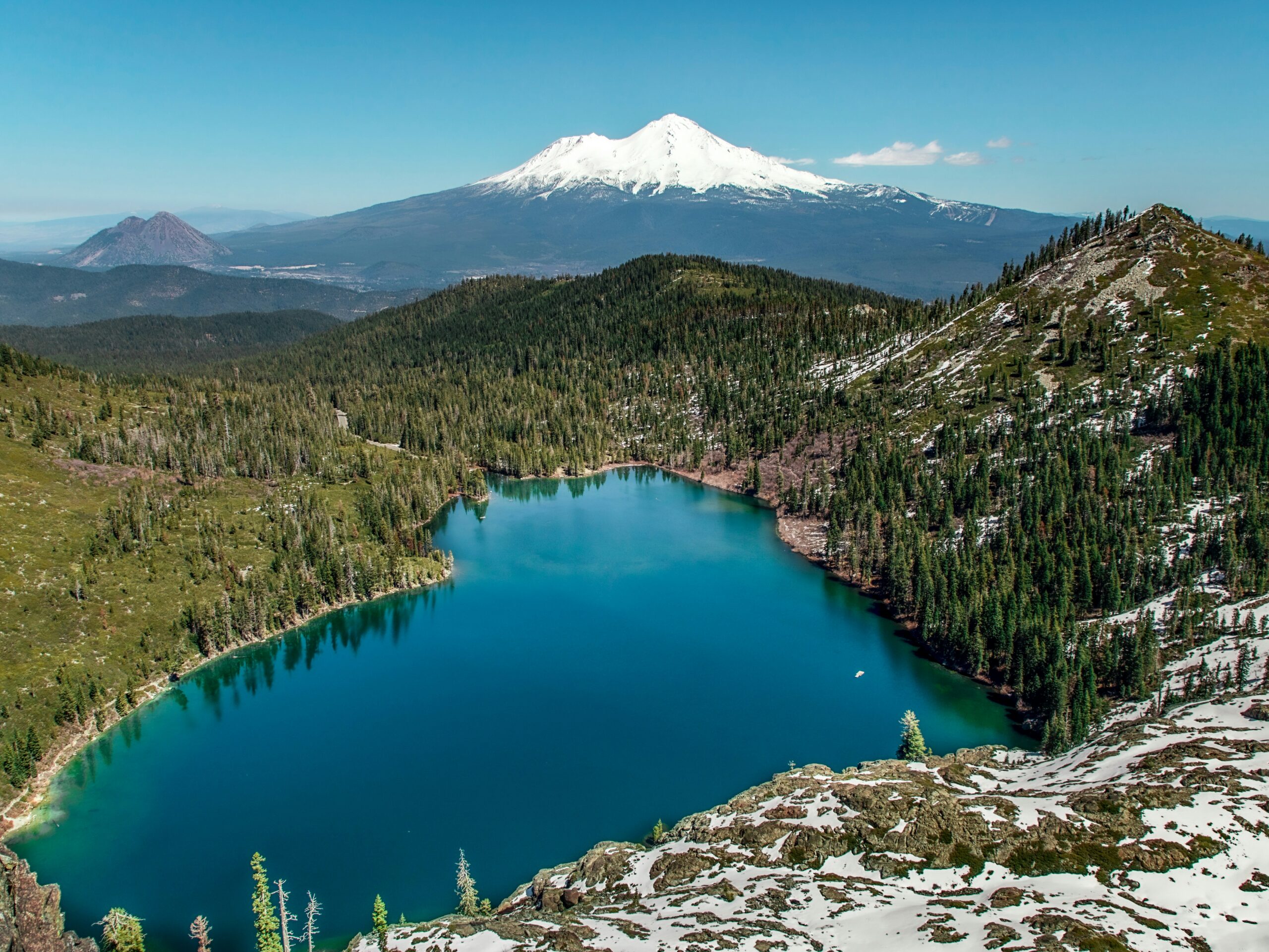
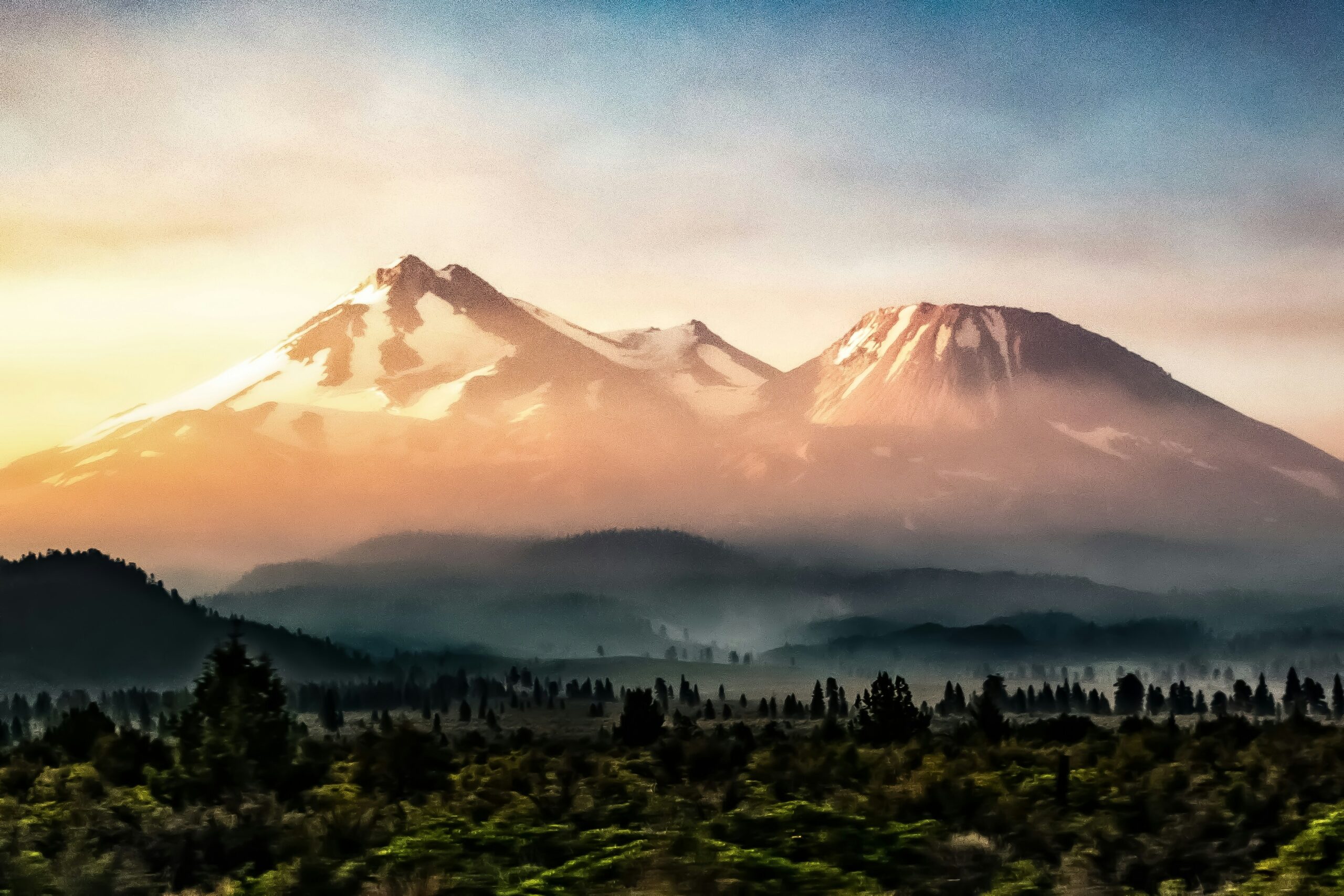
Mount Shasta is the second-highest peak in the Cascade Range and the fifth-highest peak in California. Rising as a solitary giant from the surrounding Shasta Valley — with no comparable peaks within 200 kilometers — Shasta has a presence that dominates Northern California in a way no other American volcano matches. The mountain has four separate summit cones; the main peak and its subsidiary Shastina (3,758m) together make Shasta the largest stratovolcano by volume in the Cascade Range. First ascent records go back to August 1854, when Elias D. Pearce led the first confirmed climb via the Avalanche Gulch route.
The standard Avalanche Gulch route from Bunny Flat (2,106m) is one of the most popular glaciated climbs in North America, with thousands of summit attempts per year. The climb ascends a direct line up the mountain’s southwest aspect, passing the Horse Camp hut (2,432m), climbing the Red Banks, and finishing via the Misery Hill ridge to the summit. The route involves substantial snow climbing but only minimal true glacier travel — making Shasta a natural progression step between Mount Baker’s glaciated ascent and Mount Rainier’s full glacier expedition.
Shasta’s climbing window is earlier than most Cascade peaks: May through mid-July offer the best conditions, with Avalanche Gulch becoming rotten snow and rockfall-prone by August. The mountain’s relatively dry climate (for the Cascades) produces more consistent weather than Rainier or Hood but also earlier seasonal deterioration. Climbing permits are simple — a self-registered summit pass at trailheads — but Shasta’s combination of elevation, weather, and objective hazard has killed climbers every year. Expect 2-3 days for a guided ascent at $500-$1,200.
Full Mount Shasta climb guide →Mount Adams
Mount Adams is the second-highest peak in Washington and the third-highest in the Cascades, but receives only a fraction of the attention given to its taller neighbor Mount Rainier. This obscurity is part of Adams’ appeal — the mountain offers high-altitude glaciated climbing without the bureaucratic complexity, permit quotas, or summit-day crowds of Rainier. Adams was first climbed on September 22, 1854 by A.G. Aiken and a small party via what is now the standard South Spur route. The mountain is also the tallest peak within the Yakama Nation reservation boundary, and the Yakama people hold Adams sacred.
The standard South Spur route from the Cold Springs Campground (1,832m) is widely considered the best introductory glaciated climb in the Cascades. The route is essentially a long snow and glacier hike with moderate slopes, manageable crevasse hazard, and no technical climbing required. Most parties make a high camp at the Lunch Counter (~2,900m) and summit the following morning. Round-trip time from Cold Springs runs 12-18 hours depending on conditions; many strong parties do the climb in a single long push.
What makes Adams particularly valuable is its role in Cascade progression. Climbers stepping up from hiking peaks or non-glaciated climbs often use Adams as their first glaciated summit, learning crampon technique, rope team travel, and self-arrest on moderate terrain before moving to harder peaks. Permits cost $15-$20 depending on season, and the trail sees moderate traffic — enough for safety coverage but far less than Baker or Hood. Guided climbs run $450-$700 for a 2-day ascent. Adams’ sulfur emissions from summit fumaroles are a visible reminder that this is still an active volcano.
Full Mount Adams climb guide →Mount Hood
Mount Hood is the highest peak in Oregon, the fourth-highest Cascade volcano, and one of the most climbed glaciated peaks in the world — with an estimated 10,000 summit attempts per year. Visible from Portland on clear days, Hood has been the Pacific Northwest’s iconic peak for generations. The mountain has 12 named glaciers covering roughly 32 square kilometers, making it the most heavily glaciated peak in Oregon. Hood’s first confirmed ascent was in August 1857 by a party led by Rev. T.A. Wood, though evidence suggests Native peoples and earlier climbers may have reached the summit decades before.
The standard South Side route from Timberline Lodge (1,819m) is one of the most accessible glaciated climbs in North America — the lodge is at 1,800m, served by a winter ski area, and the summit lies only 1,600m above. Climbers typically start at midnight from the lodge, ascend the Palmer Snowfield and Hogsback ridge, and pass through the Pearly Gates or Old Chute to the summit in 6-10 hours round trip. The crux is the final 500 feet below the summit — exposed snow and ice terrain with significant rockfall hazard during warming afternoon hours.
What makes Hood’s popularity problematic is that the mountain looks easier than it climbs. The accessible start and short summit day encourage underprepared climbers, and Hood kills an average of 2-4 climbers per year — several dramatic incidents have killed multiple climbers at once. The 1986 Oregon Episcopal School tragedy killed seven students and two adults in a weather event. Climbers planning Hood should have real winter mountaineering skills, not just fitness. Climbing is not permit-controlled, but climbers are strongly encouraged to register at Timberline. Guided ascents run $300-$600 for a 1-2 day program.
Full Mount Hood climb guide →Mount Baker
Mount Baker is the northernmost of Washington’s major Cascade Volcanoes and — by widespread consensus — the best introductory glaciated climb in North America. The mountain’s combination of accessible trailheads, forgiving standard routes, heavy glacier cover (12 named glaciers spanning roughly 40 square kilometers), and well-established guide infrastructure makes it the training ground where countless American climbers take their first steps onto a roped glacier. Baker was first climbed on August 17, 1868 by Edmund Coleman, John Tennant, Thomas Stratton, and David Ogilvy via what is now known as the Coleman Glacier route.
The standard Easton Glacier route from Schreiber’s Meadow (1,070m) is the most popular line — a 2-day climb involving a trail approach to a high camp at around 1,900m, then a summit push via the Easton Glacier and Roman Wall. The route involves classic glacier travel with moderate crevasse hazard, 35-45 degree snow slopes, and manageable route-finding. Success rates are high (~70%) for parties with basic skills and reasonable weather. Alternative routes including the Coleman-Deming Glacier offer different character but similar difficulty.
Baker’s role as the standard glacier skills classroom cannot be overstated. Every major American guide service runs multi-day skills courses here, teaching crampon technique, self-arrest, roped travel, crevasse rescue, and basic ice climbing. Climbers planning Denali, Aconcagua, or international expeditions commonly spend a week on Baker learning or refreshing these skills. Climbing permits are required ($15 wilderness permit plus day-use fees) but the system is straightforward. Guided climbs run $500-$900 for a 3-day program including skills instruction; skills-only courses run $400-$700.
Full Mount Baker climb guide →Glacier Peak
Glacier Peak is the fourth-highest peak in Washington and the most remote of the major Cascade Volcanoes. Hidden deep within the Glacier Peak Wilderness, the mountain sits more than 16 kilometers from the nearest road, making it the only Cascade volcano that cannot be reached in a single day’s approach. This inaccessibility has kept Glacier Peak relatively obscure despite its significant glaciation (11 named glaciers) and historical importance — it was first climbed in 1898 by Charles Meserve and Thomas Gerdine of the United States Geological Survey during a surveying expedition.
The standard Sitkum Glacier route from the White Chuck River Road (now often blocked by washouts) typically requires 4-5 days total: 2 days of approach hiking through old-growth forest, 1 day of high camp setup, and 1-2 days for the summit climb and return. The glaciated summit climb itself is moderate in technical difficulty, but the approach adds substantial burden. Parties carry 4-7 days of food and expedition-style loads, and river crossings on the approach can be dangerous during peak snowmelt.
For climbers seeking an authentic Cascade wilderness experience, Glacier Peak is unmatched. The absence of easy road access means fewer climbers, no permit crowding, and genuine solitude on the summit. The mountain also offers exceptional views of the Glacier Peak Wilderness, one of the largest roadless areas in Washington. The trade-off is commitment: Glacier Peak is not a weekend climb. Most successful parties allocate a full week from Seattle and have moderate prior Cascade experience. No dedicated guide service operates regularly on the mountain; parties are almost always independent.
Mount Jefferson
Mount Jefferson is Oregon’s second-highest peak and the state’s most technical major Cascade volcano. Named by Lewis and Clark in 1806 for President Thomas Jefferson, the mountain is set deep within the Mount Jefferson Wilderness and requires a minimum 4-6 hour approach hike — a fact that keeps Jefferson far less crowded than Mount Hood despite similar elevation. First summited on August 12, 1888 by E.C. Cross and Ray L. Farmer, Jefferson remained a challenging objective through much of the 20th century due to its combination of approach burden and technical summit block.
The standard Whitewater Glacier route from the Whitewater Trailhead (~1,050m) involves a 10-11 kilometer approach through forest and wilderness to a high camp at the base of the glacier, followed by a summit day that combines glacier travel, steep snow climbing, and exposed rock scrambling on the final summit pinnacle. The last 200 vertical feet are the crux — loose volcanic rock and exposure that rate Class 4 to low Class 5 (rock climbing territory, not glaciated peak terrain). Many parties turn back here due to conditions or technical concerns.
What distinguishes Jefferson from easier Oregon Cascades like Hood and the Sisters is the need for genuine mountaineering judgment. The route-finding on the Whitewater Glacier changes year to year, the summit pinnacle has killed climbers in rockfall incidents, and the approach adds a committing dimension that pressure-cooks decision-making when conditions deteriorate. Guided climbs are rare; most summits are made by experienced parties. The 2020 Lionshead Fire significantly affected access and the mountain’s forested approach — check current trail conditions before planning a trip.
Full Mount Jefferson climb guide →Lassen Peak
Lassen Peak is the southernmost major Cascade volcano and one of the most recently active — its 1914-1917 eruption sequence remains the most significant Cascade eruption of the 20th century prior to Mount St. Helens. The mountain produced over 400 eruptive events during that three-year period, with the May 22, 1915 eruption sending a 9-kilometer column of ash into the stratosphere. This modern volcanic history made Lassen the centerpiece of Lassen Volcanic National Park, established in 1916 specifically to protect the active volcanic landscape. First ascent records go back to 1851 with Grover Godfrey.
The standard Main Trail from the Lassen Peak Trailhead (2,593m) is the easiest major-volcano summit in the Cascades — a 7-kilometer round trip hike with 1,900 feet of elevation gain, completable in 4-5 hours by moderately fit hikers. The trail is a well-maintained dirt path with no technical sections, no glacier travel, and no route-finding challenges. Lassen’s summit offers exceptional views of the active hydrothermal areas in the surrounding park (Bumpass Hell, Sulphur Works, Devils Kitchen) that provide ongoing evidence of the volcano’s heat.
What makes Lassen valuable on this list is its accessibility and context rather than its climbing challenge. The mountain serves as an excellent first Cascade volcano for hikers building toward the bigger glaciated peaks, and the surrounding national park offers a unique window into active Cascade volcanism that you cannot see elsewhere in the range. Lassen requires only a park entrance fee ($30 per vehicle) — no climbing permit needed. The trail is typically snow-free from July through October. For climbers traveling through Northern California, Lassen pairs naturally with Mount Shasta (120 kilometers north) for a two-volcano trip.
South Sister (and the Three Sisters)
South Sister is the highest of Oregon’s Three Sisters — a trio of closely-spaced Cascade volcanoes (South, Middle, and North Sister) that dominate the Central Oregon landscape near Bend. South Sister is the youngest and highest, first climbed in 1883 and now one of the most summited major peaks in Oregon thanks to its accessibility and non-technical standard route. Middle Sister (3,063m) and North Sister (3,074m) are progressively more technical, with North Sister requiring genuine Class 4-5 rock climbing on its volcanic ridge traverse.
The standard Devil’s Lake Trailhead route to South Sister is a 19-kilometer round trip with 4,900 feet of elevation gain, completable as a long day hike by fit parties. The trail climbs through forest and meadow to treeline, then ascends moraine and scoria slopes to the summit crater, where a small year-round lake sits at the summit (Oregon’s highest). No technical skills are required and no crevasses exist on the standard route — South Sister is essentially a very long high-elevation hike with significant altitude at the top.
For climbers seeking to summit all Three Sisters in a single trip, the traverse is a classic Central Oregon objective. Middle Sister can be climbed from a high camp between South and Middle Sisters; North Sister adds technical rock scrambling to an exposed summit ridge called the “Terrible Traverse.” The complete Three Sisters traverse typically requires 3-5 days and legitimate mountaineering skills on North Sister. Permits via the Central Cascades Wilderness Permit system are required for overnight trips from June through October.
Mount St. Helens
Mount St. Helens is the most historically significant volcano in American history. Before its catastrophic May 18, 1980 eruption, St. Helens stood at 2,950 meters with a perfectly conical summit; after the eruption — the deadliest and most economically destructive volcanic event in US history — the peak had lost 400 meters of elevation, a 600-meter-wide horseshoe crater opened on its north face, and 57 people had died including volcanologist David Johnston. The current 2,549m elevation reflects the post-eruption dome building that has partially refilled the crater over four decades.
The standard Monitor Ridge route from the Climbers Bivouac trailhead (1,250m) is the only legal way to climb Mount St. Helens, and it is the easiest major Cascade volcano to summit. The 16-kilometer round trip ascends through forest, then rock and ash slopes, to the crater rim at 2,549m. The route involves no technical climbing but includes significant boulder hopping on the upper sections and loose pumice scree on the descent. Total round-trip times run 7-12 hours depending on conditions and party fitness. Some climbers complete the climb in 6 hours, others take a full day.
Climbing Mount St. Helens requires a permit — $15-$22 per person, limited to 100 permits per day from April 1 through October 31, and reserved well in advance via the Mount St. Helens Institute permit system. During prime summer months, permits sell out weeks ahead. The summit crater rim is the destination — descent into the crater is prohibited for safety reasons (the lava dome remains active). The volcano has been in a prolonged dome-building phase since 2004 and produces minor seismic activity; check USGS Cascades Volcano Observatory for current alert levels before your climb.
Why the Cascades Are North America’s Premier Glacier Training Ground
More American mountaineers learn glacier travel in the Cascades than in any other range on earth. This is not accidental — the Cascade Volcanoes offer a unique combination of accessibility, variety, and climbing culture that makes them functionally irreplaceable for building American alpine climbers.
The range’s strength as a training ground comes from four overlapping factors. First, progressive difficulty: a climber can start on Mount Baker learning basic rope team travel, move to Mount Adams for altitude exposure, practice technical ice on Mount Hood’s Pearly Gates, and build expedition fitness on Mount Rainier — all within a 500-kilometer radius and all within a single climbing season. No other American range offers this complete skill ladder on glaciated peaks. Second, urban access: Seattle, Portland, and San Francisco all sit within 5 hours’ drive of multiple Cascade volcanoes, dramatically lowering the time and cost barrier to weekend climbing trips that build skills cumulatively.
Third, guide infrastructure. The Cascades host the largest concentration of IFMGA-certified American mountain guides, with major services including RMI Expeditions (Rainier), International Mountain Guides (IMG, Rainier), Northwest Alpine Guides (Baker), Mountain Madness (various), and Timberline Mountain Guides (Hood). Most run multi-day skills courses specifically designed for climbers progressing toward Denali, Aconcagua, and international objectives. Fourth, reliable climbing windows: unlike Alaska’s short season or the Alps’ narrow weather windows, the Cascade summer season runs 4-5 months with generally predictable conditions — enough time to complete a full progression in a single year if a climber has the time and budget.
Rope Team Travel
The foundation of all glaciated mountaineering. Cascade routes teach proper rope spacing, snow bollard anchors, simul-climbing technique, and team communication under conditions that scale from forgiving (Baker) to serious (Rainier). Most climbers learn this over 2-3 weekend trips before attempting their first committed summit.
Crevasse Rescue Systems
The Cascades’ heavily crevassed glaciers make practicing rescue systems essential. Climbers learn Z-pulley mechanical advantage, prusik ascending, two-person hauling, and self-rescue techniques. Baker and Rainier both offer “crevasse training parks” — shallow, safe crevasses used specifically for practice.
Crampon and Ice Axe Technique
Cascade routes span every type of snow and ice a mountaineer encounters: firm morning neve, soft afternoon corn, bulletproof blue ice on summit ridges, and rotten late-season snow. Climbers develop the full range of crampon techniques (French, German, hybrid) and learn self-arrest under varied conditions.
Expedition Camping
Rainier’s multi-day expedition-style climb (with Camp Muir, Ingraham Flats, and summit push) replicates the routine of Denali, the Himalaya, and major international objectives. Climbers practice snow camping, high-altitude cooking, load management, and the physical pacing that distinguishes expedition mountaineering from day climbs.
A climber who has successfully summited Mount Baker (glacier skills), Mount Adams (altitude), and Mount Rainier (expedition routine) is prepared for Denali in a way that no other American training sequence matches. The Rainier-to-Denali pathway is so well-established that most commercial Denali operators explicitly reference Rainier summit experience as a screening criterion — the mountains share enough DNA that success on one reliably predicts readiness for the other.
Mount Rainier as the Standard Denali Training Peak
If the Cascades are American mountaineering’s training ground, Mount Rainier is specifically the entrance exam for Denali. No other single mountain serves this role — Rainier’s combination of elevation, glaciation, weather, and route character is the closest practical analog to a Denali expedition available in the lower 48 states.
The shared profile is striking. Both mountains involve full glacier travel with significant crevasse hazard — Rainier’s Ingraham Glacier and Denali’s Kahiltra Glacier demand identical rope team techniques. Both involve multi-day expedition-style camping on snow — Rainier’s Camp Muir and Camp Schurman teach the routine that Denali’s high camps (7,800′, 11,000′, 14,200′, 17,200′) require at greater scale. Both involve summit days of 12-16 hours with significant vertical gain — Rainier’s 4,500-foot summit push from Camp Muir is a smaller-scale analog to Denali’s 3,000-foot summit push from high camp with a longer overall day.
What Rainier cannot replicate is Denali’s extreme cold and altitude — Rainier tops out at 14,411 feet versus Denali’s 20,310, and Rainier’s maritime climate never reaches the -40°F temperatures Denali routinely produces. But these are the two additive challenges that climbers face when stepping up to Denali, not the skills they need to learn. The underlying mountaineering — rope team travel, crevasse navigation, snow camping, high-altitude decision-making under fatigue — is identical on both mountains, and Rainier teaches it at a cost and commitment level accessible to working climbers.
Most Denali guide services (RMI, Alpine Ascents, Mountain Trip, AMS) explicitly recommend or require a successful Rainier summit on the resume of prospective Denali clients. Some operators use Rainier-specific programs (“Rainier prep for Denali”) that teach the exact skills and conditioning climbers will apply the following summer in Alaska. The Rainier-to-Denali progression is so well-established that “I did Rainier last summer” is the standard answer when Denali operators ask about glaciated mountaineering experience.
Most climbers progressing to Denali follow a multi-year pathway: Year 1 — basic glacier skills on Mount Baker plus Mount Adams or Hood for altitude; Year 2 — Mount Rainier summit via a full expedition route; Year 3 — Denali. Compressing this into a single year is possible but risks skill gaps. Working climbers with the budget to climb Rainier twice (once for learning, once for real experience) often have higher Denali success rates than climbers who do Rainier only once.
Cascade Climbing Progression: Which Peak First?
The Cascade ladder is the most well-defined progression path in American mountaineering. The sequence below reflects what most guide services and experienced Cascade climbers recommend.
Mount St. Helens or Lassen Peak
Non-technical summit of a Cascade volcano, building general fitness and high-altitude exposure. St. Helens provides the historical context of active volcanism; Lassen offers an easier day hike. Both require no glacier skills and produce a first Cascade summit without committing to glaciated mountaineering.
Mount Baker (Easton Glacier) or Mount Adams (South Spur)
First real glacier climb with rope team travel, crampon use, and crevasse awareness. Baker is preferred if combined with a skills course (3 days of instruction + summit). Adams is preferred for climbers who learned skills elsewhere and want a forgiving first solo (unguided) glacier ascent.
Mount Hood (South Side) or Mount Shasta (Avalanche Gulch)
Step up to more technical terrain. Hood’s Pearly Gates section introduces steep snow/ice climbing at the grade appropriate for intermediate mountaineers. Shasta’s Avalanche Gulch builds altitude tolerance on a longer, more committing climb. Either peak prepares climbers for harder Cascade objectives.
Mount Rainier (Disappointment Cleaver)
The core expedition training peak. Rainier’s multi-day expedition style — with Camp Muir, summit day routine, and 13,000-foot summit day profile — teaches the pacing, decision-making, and endurance that international expeditions demand. Success on Rainier is the gateway to Denali and higher mountains.
Glacier Peak OR Mount Jefferson
Post-Rainier, climbers diverge based on interest. Glacier Peak adds wilderness expedition commitment without major technical jump — useful for building remote-area confidence. Jefferson adds technical rock scrambling at altitude — useful for climbers pursuing harder alpine routes.
Denali, Aconcagua, or Himalayan 7000ers
Cascade training converts to bigger objectives. Denali is the natural next step for climbers staying on the American continent; Aconcagua opens Andean mountaineering; Himalayan trekking peaks (Island Peak, Mera Peak) prepare for eight-thousander attempts. The Cascade foundation serves any of these paths.
Frequently Asked Questions About Cascade Volcanoes
What are the Cascade Volcanoes?
The Cascade Volcanoes are a chain of approximately 20 major volcanic peaks and hundreds of smaller vents stretching about 1,100 kilometers (680 miles) through the Pacific Northwest from British Columbia to Northern California. Part of the Pacific Ring of Fire, they form the Cascade Volcanic Arc and include Mount Rainier, Mount Shasta, Mount Hood, Mount Baker, Mount Adams, Mount St. Helens, Glacier Peak, Mount Jefferson, the Three Sisters, and Lassen Peak. All are geologically active, though eruption frequencies vary dramatically. Mount St. Helens famously erupted in 1980, the most costly volcanic disaster in US history.
What is the highest Cascade Volcano?
Mount Rainier in Washington State is the highest Cascade Volcano at 4,392 meters (14,411 feet). Mount Shasta in California is second at 4,322 meters (14,179 feet). Mount Adams (3,743m/12,281 ft) and Mount Hood (3,429m/11,250 ft) are the next tallest. Rainier is also the most heavily glaciated peak in the contiguous United States, with 26 named glaciers covering approximately 90 square kilometers of its flanks. The mountain serves as the primary training peak for North American climbers preparing for Denali expeditions.
Which Cascade Volcano is the easiest to climb?
Mount St. Helens (2,549m/8,363 ft) is generally considered the easiest major Cascade Volcano to climb — a non-technical 10-12 mile round-trip hike with 4,500 feet of elevation gain that requires only a permit and basic mountaineering fitness. Mount Adams (3,743m) is often cited as the easiest glaciated Cascade climb, offering a straightforward South Spur route suitable for climbers learning glacier travel. Mount Baker’s Easton Glacier route and Mount Hood’s South Side route are also frequently recommended as first glaciated Cascade climbs for trained climbers.
Which Cascade Volcano is the hardest to climb?
Mount Rainier’s Liberty Ridge is widely considered the hardest standard route in the Cascades — a serious, committed alpine climb with significant objective hazard that kills multiple climbers per year. Mount Jefferson’s standard route is the hardest of the easier-graded Cascade peaks, requiring exposed rock scrambling and often technical ice sections. For pure technical difficulty, Cascade routes like Mount Stuart’s North Ridge (a non-volcanic peak nearby) and Rainier’s Willis Wall rival routes found anywhere in North America.
How much does it cost to climb Mount Rainier?
A guided Mount Rainier expedition typically costs $1,400-$2,600 for a 4-5 day program via the Disappointment Cleaver route. The two main guide services — RMI Expeditions and International Mountain Guides (IMG) — maintain similar pricing. This includes guide fees, group equipment, tent rental, and mountain hut access; climbers provide personal gear. Climbing permits cost $61 per person in 2026 plus the park entrance fee. Independent climbers can summit Rainier for $100-$200 in permit costs alone, but the skills required make independent climbing appropriate only for experienced mountaineers.
Is Mount Rainier good training for Denali?
Yes — Mount Rainier is the single most recommended training peak for Denali expeditions. The two mountains share glacier travel demands, crevasse hazard, significant snow camping, and similar summit-day profiles (13,000-foot summit days are common on both). Rainier at 4,392m is lower than Denali at 6,190m, but the Cascade climate and glaciated terrain replicate Denali conditions more closely than any other accessible mountain. Most Denali guide services explicitly recommend a successful Rainier summit as prerequisite; some require it. The “Rainier-to-Denali” progression is the standard North American mountaineering pathway.
When is the best time to climb the Cascade Volcanoes?
The Cascade climbing season generally runs from late April through early October, with specific windows varying by peak. Mount Rainier and Mount Baker: mid-June through mid-September, with July being peak. Mount Hood and Mount Shasta: May through July — avoid August/September when rotten snow and loose rock hazard peaks. Mount Adams: June through September. Mount St. Helens: April through October. Winter climbs are possible on most Cascades but require significantly more skill; the Cascade range is known for extremely wet winters and heavy avalanche conditions.
Do you need a permit to climb Mount Rainier?
Yes — all climbers ascending above 10,000 feet on Mount Rainier require a climbing permit from Mount Rainier National Park. The permit costs $61 per person in 2026 and is valid for a single trip. Permits are available at ranger stations or online via the park’s reservation system. Climbers must also pay the standard park entrance fee. Other Cascade Volcanoes have varying permit requirements: Mount Adams and Mount St. Helens require paid climbing permits; Mount Hood, Mount Baker, and Mount Shasta currently require only a Wilderness Permit (free for day use, fees may apply for overnight).
Why are the Cascades good for learning glacier travel?
The Cascades are North America’s premier glacier-climbing training ground because they offer a unique combination of factors: accessible urban gateways (Seattle, Portland, San Francisco), a wide range of glaciated peaks from beginner-appropriate (Mount Baker, Mount Adams) to expert-level (Mount Rainier’s harder routes), reliable summer climbing windows with predictable conditions, and well-established guide services offering skills courses. The Cascades also produce the highest concentration of IFMGA-certified American guides, many of whom base training programs here. See our glacier travel basics for foundational skills.
Is Mount St. Helens still dangerous to climb?
Mount St. Helens is generally safe to climb under current monitoring and produces minor volcanic activity. The mountain has been in a prolonged dome-building phase since 2004, with magma gradually filling the 1980 eruption crater. Climbing permits are limited to 100 per day from April 1 to October 31 and must be purchased in advance. Climbers should check the USGS Cascades Volcano Observatory for current alert status before attempting the climb. The crater rim is closed to hikers for safety reasons — summit climbs end at the rim overlooking the active crater from a safe viewing distance.
Plan Your Cascade Climb
For detailed expedition planning on each peak, see our dedicated climb guides. Each covers routes, permits, gear, training, and logistics in depth.
Building Your Cascade Climbing Progression
Most climbers begin their Cascade journey with a glacier skills course on Mount Baker, then progress through Mount Adams or Mount Hood to Mount Rainier. Our glacier travel and intermediate climbing guides walk through the prerequisite skills and training needed at each progression step.
Mount Rainier
Mount Shasta
Mount Hood