
Last updated June 17, 2026
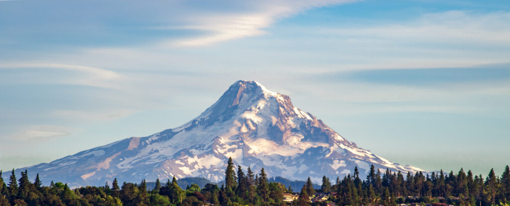
Mount Hood — Oregon
Complete climb guide: South Side / Hogsback route, Pearly Gates and Old Chute, year-round climbing permit, gear, guide companies, and live weather for Oregon’s highest peak.
Mount Hood is Oregon’s highest mountain and one of the most climbed glaciated volcanoes in North America. What makes Hood unique is the combination of a relatively short approach, steep upper mountain terrain, fast-changing route conditions, and serious objective hazards packed into a single summit day.
Standing at 11,249 feet in the Cascade Range east of Portland, Hood draws over 10,000 climbing attempts every year — a function of its accessibility from Timberline Lodge and its iconic status. But popularity does not remove consequence. The U.S. Forest Service explicitly states that every climbing route on Mount Hood is technical, including the South Side / Hogsback route. Crevasses, falling rock, rapidly changing snow structure on the upper mountain, and weather that can shift from clear to whiteout in an hour are all part of a Hood climb.
This page covers the main climbing routes, the year-round permit system, seasonal windows, essential gear, safety considerations, guide companies, and a live weather and 5-day forecast pulled directly from Hood’s summit coordinates.
Find Hotels, Flights & Trips for the World’s Best Hiking Destinations
The Global Summit Guide Travel Shop on Expedia — curated for outdoor adventurers, mountaineers, and serious hikers. Patagonia to the Alps. Nepal to the Rockies. Curated lodging for every region we cover.
Explore Travel Shop on Expedia →Mount Hood quick facts at a glance
| Category | Details |
|---|---|
| Elevation | 11,249 ft / 3,429 m |
| Location | Hood River, Clackamas & Multnomah Counties, northern Oregon, USA |
| Mountain Type | Glaciated Stratovolcano — Cascade Range |
| Status | Highest mountain in Oregon |
| Climbing Style | Steep snow climbing, glacier travel, route-dependent technical alpine mountaineering |
| Typical Duration | Long single summit day from Timberline (most common) or 1–2 days with strategic camp |
| Standard Route | South Side / Hogsback from Timberline Lodge → Pearly Gates or Old Chute finish |
| Permit Required | Year-round climbing permit for travel above 9,500 ft ($20 / 3-day or $50 / annual) |
| Primary Risks | Falling ice, rockfall, steep snow, crevasses, weather changes, route-condition shifts |
| Administration | Mt. Hood National Forest (USFS) / Mt. Hood Wilderness |
| Volcanic Status | Potentially active — last significant eruption ~1865; monitored by USGS Cascades Volcano Observatory |
Main Mount Hood climbing routes route overview
Mount Hood has multiple established routes, but for most climbers the practical choice is the South Side from Timberline Lodge with one of several upper-mountain finishes. Other routes — Cooper Spur, Sandy Glacier Headwall, and the various north-side technical lines — are serious alpine objectives reserved for experienced climbers.
An important framing point from the U.S. Forest Service: every route on Hood is technical. The South Side is the most accessible, but it is not a hike. Crampons, ice axe, helmet, harness, and rope-team competency are required on every summit attempt.
South Side / Hogsback Route
- Theme: The standard and most popular Mount Hood route. Starts at Timberline Lodge (~5,960 ft) and ascends past the Palmer ski lift, Triangle Moraine, Crater Rock, and the Hogsback to one of the upper-mountain chutes.
- Best for: Climbers with steep snow, crampon, ice axe, and self-arrest skills seeking the classic Hood summit experience. Not a beginner climb despite its popularity.
- Character: A fast-moving snow climb with a short approach by Cascade standards but a serious upper mountain. The relatively quick access to high elevation is part of what makes Hood feel approachable — and part of why it is regularly underestimated.
- Crater zone hazard: The route passes through the active Sherman Crater / Devil’s Kitchen fumarole area at around 10,500 ft. Hydrogen sulfide gas is present and can accumulate in calm conditions. Keep moving, stay upwind of vents, and do not linger.
- Upper-mountain decision point: Above the Hogsback the route splits to either the Pearly Gates or Old Chute finish, depending on current conditions (see next tabs). This decision often defines the day on Hood.
- Important note: The exact final line varies by season and current mountain conditions. A route that climbed cleanly two weeks ago may be very different today. Check the Mazamas, Portland Mountain Rescue, and recent trip reports before going.
Pearly Gates Finish
- Theme: The classic upper-mountain finish — a steep, narrow snow/ice chute directly above the Hogsback that leads to the summit ridge.
- Best for: Climbers with good steep-snow judgment and awareness of current conditions. Confident on 45–55° snow with crampons and ice axe.
- Character: Steep, exposed, and highly condition-dependent. When the chute is filled with consolidated spring snow it is the elegant finish. When it is icy, rimed, or has open bergschrund issues, parties pivot to the Old Chute.
- Decision factor: Some seasons favor Pearly Gates; others push most parties toward the Old Chute variation. The choice is made on the mountain that morning based on what climbers ahead are doing and visual assessment of the chute.
- Hazard: Falling ice and small rock from the gates above and from climbers higher in the chute. Helmet mandatory.
Old Chute Finish
- Theme: The alternate upper-mountain finish to the west of the Pearly Gates. In recent seasons it has become the more commonly used variation.
- Best for: Same skill set as Pearly Gates — steep snow climbing competency, helmet discipline, and the judgment to assess chute conditions on the fly.
- Character: Slightly wider and a little less direct than Pearly Gates, but in many seasons it offers a cleaner, safer line to the summit ridge.
- Why it gets chosen: When Pearly Gates is icy, rimed, has a wide bergschrund at its base, or has unstable rime towers above, parties shift west to the Old Chute.
- Summit ridge: Both Pearly Gates and Old Chute top out on the summit ridge. From there a short, exposed walk leads to the true summit. The descent often uses the Old Chute with picket protection or simul-belay, especially when the snow has softened.
North & More Technical Routes
- Theme: Steeper, more remote, and more serious climbing on Hood’s wilder north and west sides. Cooper Spur (NE ridge), Sandy Glacier Headwall (west face), Yocum Ridge (NW ridge), and the Reid Headwall are the most-discussed lines.
- Best for: Experienced alpinists with route-specific skills, mixed-terrain experience, glacier travel competency, and changing-condition awareness.
- Character: Much more technical and committing than the south-side standard climb. Crevasse navigation, route-finding, ice climbing on some lines, longer days, and significant objective hazard.
- Cooper Spur (NE ridge): The most-attempted of Hood’s non-standard routes. A long snow climb that reaches steep terrain near the summit. Multiple historic fatalities have occurred on Cooper Spur’s exposed upper slopes.
- Sandy Glacier Headwall, Yocum Ridge, Reid Headwall: Serious alpine objectives requiring full technical competence. Conditions vary year to year — research current trip reports on CascadeClimbers.com before committing.
- Theme: Mount Hood is widely used as a training mountain for snow and glacier skills before bigger objectives.
- Best for: Climbers building experience for Rainier, Shasta, Baker, Adams, Denali, and bigger glaciated summits. Hood compresses many of the same skill demands into a single day from a paved trailhead.
- Skills practiced on Hood: Crampon technique on hard snow, ice axe self-arrest, rope team movement, steep-snow climbing, alpine starts, route-finding in the dark, decision-making under fatigue.
- Important caveat: Hood can be a training mountain, but it is never a casual mountain. Multiple fatalities occur most years. The “training” framing should never become an excuse for under-preparation.
- Building toward Rainier: Many climbers use a successful Hood summit (combined with a glacier-skills course on Baker or with a guide service) as their qualifying experience for Rainier’s Disappointment Cleaver route.
Why Mount Hood is so respected
- It combines relatively quick access with genuinely serious upper-mountain hazard.
- It is often treated like a straightforward volcano climb, but accidents happen nearly every year.
- Success on Hood depends as much on timing and judgment as on fitness.
- The most successful Hood climbers turn around in poor conditions rather than push on. The summit will be there next weekend.
Permits & logistics year-round permit system
Mount Hood is one of the most heavily regulated climbing peaks in the Pacific Northwest. A climbing permit is required for travel above 9,500 feet — year-round — and the system is enforced. Plan your permits before you arrive at Timberline; do not assume you can sort it out at the trailhead.
Mount Hood climbing permit — the essentials
- Required for all climbers above 9,500 feet. No exceptions for guide groups, skiers, or speed attempts.
- Year-round requirement — not a seasonal permit. Winter ascents, summer climbs, and shoulder-season attempts all require it.
- 3-day climbing permit: $20 — covers one continuous 3-day window. This also counts as the South Side Wilderness Permit, so you do not need a separate wilderness permit on this route.
- Annual climbing permit: $50 — covers all your Hood climbs for the calendar year. Annual permit holders still need to separately complete the wilderness permit requirement on South Side climbs.
- Purchase via Recreation.gov — search for “Mt. Hood Climbing Permit” or use the direct link in the resources table below.
- WAG bag required — pack out all human waste from above 9,500 ft. Free WAG bags available at Timberline.
Timberline Lodge — climber logistics
- Timberline Lodge is the standard start for the South Side route. Most climbers move up past the Palmer ski area, Triangle Moraine, Crater Rock, and the Hogsback zone.
- Climber registration: Complete climber registration information at Timberline before departure. This is part of how rescue teams locate overdue parties.
- WAG bag pickup: Free WAG bags available at Timberline — pick one up before you head uphill.
- Self-rescue capacity: The Forest Service is explicit that there are no emergency medical services on the mountain and rescue may be hours or days out depending on weather. Parties must be equipped and prepared to self-rescue.
- The short approach is part of what makes Hood accessible — but easy logistics do not remove crevasses, rockfall, changing upper snow structure, or technical terrain.
Timberline ski area — uphill travel pass (2025/2026 winter)
New for the 2025/2026 winter season, a free uphill travel pass is required for travel within the Timberline ski area, including the climbers’ trail and other uphill or foot travel from Timberline lots. This is a free pass — but it must be obtained in advance and is part of the broader trend toward more structured Hood access. Verify current requirements on Timberline’s website before your trip.
| Resource | What It Covers | Link |
|---|---|---|
| Mt. Hood NF — Climbing Mt. Hood | Official permit page, fees, pack-out requirements | fs.usda.gov → |
| Mt. Hood NF — Plan Your Climb | Official climbing safety guidance, route planning, fitness expectations | Plan Your Climb → |
| Recreation.gov — Mt. Hood Climbing Permit | Official permit purchase: 3-day and annual | Buy permit → |
| NW Avalanche Center (NWAC) | Daily Mt. Hood avalanche forecasts | nwac.us → |
| USGS Cascades Volcano Observatory | Mount Hood volcanic monitoring data | USGS Hood → |
| Portland Mountain Rescue | Recent conditions reports, rescue context | pmru.org → |
Best time to climb Mount Hood seasonal planning
Hood often climbs best when the snowpack still supports a clean line. Once the upper mountain starts breaking down, the same route can feel dramatically more serious. Most successful summit days happen between late April and early June.
| Season | Window | Conditions | Watch-outs |
|---|---|---|---|
| Spring ★ Primary | Late April – early June | Most classic south-side climbing season. Continuous snow coverage, supportable snowpack, firm pre-dawn conditions, well-filled chutes, manageable bergschrund. | Storms still possible; avalanche risk on steeper variants; cold summit conditions; early morning starts essential |
| Early Summer | Mid-June – mid-July | Daylight is long; access easier; lower mountain melted out. Hogsback still climbable but breaking down. | Pearly Gates and Old Chute open up; rockfall increases; bergschrund grows; route quality drops noticeably |
| Late Summer | Late July – September | More melt-out, more exposed ice and rock, less forgiving upper mountain. Few parties climb the standard route in this window. | Falling ice, changing Pearly Gates shape, open bergschrund, rockfall in chutes, less predictable route quality. Switch to a different objective. |
| Winter | December – March | Serious winter mountaineering for experienced parties with stable weather windows. Climbing permit still required. | Severe Pacific NW storms, deep snow on approach, short daylight, extreme avalanche hazard, full winter conditions |
Season planning tip
- The window from late April through Memorial Day weekend is the most reliable for the South Side / Hogsback.
- Climb on a clear-weather day with a freezing level near or below the summit. Avoid days with strong winds or high freezing levels.
- Start at midnight to 2 AM from Timberline. The goal is to be on the summit at sunrise (~5:30–6:30 AM in spring) and down through the Pearly Gates / Old Chute before the snow softens and rockfall increases.
- Check NWAC the night before and read the most recent trip reports on Mazamas, Portland Mountain Rescue updates, and CascadeClimbers.
Essential gear for Mount Hood
Hood is a technical alpine snow climb. The standard gear list reflects the steep upper mountain terrain, falling-ice hazard, and Pacific NW weather — not just basic snow walking. Many first-time Hood climbers underestimate how much the mountain changes hour by hour. A route that feels reasonable at dawn can feel far more dangerous on descent.
Technical essentials
- Mountaineering boots (crampon-compatible, B2/B3)
- Crampons (12-point, step-in or strap)
- Ice axe (mountaineering, 60–70 cm)
- Helmet — mandatory for falling ice and rock
- Climbing harness
- Dynamic rope (30–50 m per team)
- 2–3 snow pickets per team
- Locking carabiners ×3–4
- Prussik cords for self-rescue
- Headlamp + spare batteries (midnight start)
Clothing systems
- Moisture-wicking base layer (top + bottom)
- Insulating mid-layer (fleece or down puffy)
- Full weather hardshell jacket + pants
- Warm hat + balaclava + sun hat
- Warm gloves + backup gloves + shell mitts
- Glacier sunglasses (UV rated, side shields)
- Goggles for storm conditions
- Gaiters (knee-high)
- Extra insulation for waiting and emergencies
Navigation & safety
- GPS device with Hood topo + waypoints loaded
- Map + compass (Hood gets whiteouts fast)
- Avalanche beacon + probe + shovel (all season)
- Personal first-aid kit
- Emergency bivy / space blanket
- Whistle
- Satellite communicator (Garmin inReach, Zoleo)
Pack / food / sun
- 30–40 L summit pack
- 2–3 L water in insulated bottles (no liquid water above lodge)
- Lightweight stove + fuel (optional for water + warmth)
- High-calorie food: 1,500–2,500 cal for summit day
- Sunscreen SPF 50+ (intense reflective glare)
- Lip protection
- WAG bag (free at Timberline — pack out waste)
The most underestimated factor
- Many first-time Hood climbers underestimate how much the mountain changes hour by hour.
- A Pearly Gates chute that climbs cleanly at 5 AM in firm spring snow can be a rockfall and ice-fall alley by 9 AM under direct sun.
- Build your turnaround time around descent conditions, not summit ambition.
Difficulty & safety notes risk and preparedness
What kind of climb is Mount Hood?
Mount Hood is rated AD- (Alpine Grade, Assez Difficile minus) on the standard South Side / Hogsback route — squarely in technical snow climbing territory. The Pearly Gates and Old Chute finishes push the grade higher in poor conditions. Hood is not a beginner mountaineering objective and not a hiking summit. The Forest Service is explicit: every climbing route on Hood is technical, including the easier south side.
What makes Mount Hood challenging
- Steep upper mountain: The final route sections (Hogsback ridge, Pearly Gates or Old Chute) are short but serious — 45–55° snow and ice with significant exposure.
- Falling hazard: Ice and rock can become major threats as the day warms. Multiple Hood fatalities involve climbers struck by ice or rock from above, often dislodged by climbers higher in the chute.
- Route change: Pearly Gates and Old Chute conditions can vary wildly between seasons and even within a single week. Pre-trip beta from two months ago can be irrelevant today.
- Weather: Wind, whiteouts, and storm systems can quickly raise the danger level. Hood sticks up alone in the Cascade Range and catches weather first.
- Crevasses: Above 10,000 ft on the standard route and significantly more on the north-side routes. The Hogsback area itself has bergschrund hazard especially later in the season.
- Volcanic gas: Hydrogen sulfide from the Devil’s Kitchen fumarole area. Stay upwind, keep moving, don’t camp in the crater.
- False security: The easy access from Timberline makes people underestimate the mountain. Roughly 10,000 people attempt the summit yearly; multiple fatalities occur most years.
- No emergency medical services on the mountain. Rescue may be hours to days out depending on weather and location. Parties must be self-sufficient and capable of self-rescue.
What climbers learned on Mount Hood in 2025
- The South Side stayed the defining climb, but it remained fully technical. Forest Service guidance continued to reject the idea that the standard route is a walk-up. All routes on Hood require technical gear and self-rescue ability.
- Climbing permits stayed central. The year-round permit requirement above 9,500 ft is enforced; serious summit attempts begin with organized planning, not by improvising at the trailhead.
- Timberline logistics matter. Climber registration, WAG bag pickup, and self-sufficient preparation are part of the climb system — not optional housekeeping.
- Hood access is becoming more structured. The new free uphill travel pass for the Timberline ski area (2025/2026 season) reinforces the broader trend toward more managed movement on and around the mountain.
- Familiarity still creates risk. The strongest 2025 lesson: Hood is dangerous precisely because it is so familiar. A common route is still a consequential technical climb.
- A successful Hood climb ends only after safe return below the upper mountain. Summit success depends on disciplined planning, technical competence, and a controlled descent.
Mount Hood guide services guided programs
Two established guide services run programs on Mount Hood. A guided climb is often the safest option for less experienced climbers — instruction on snow technique, route support on the upper mountain, and better real-time decision-making in changing conditions all contribute to safer summits.
Local Mount Hood guiding support with deep south-side route knowledge, snow-climbing instruction, and Timberline-based logistics. Their programs combine teaching and summit attempts and are well-suited to climbers building Pacific NW snow-climbing experience.
Visit Website →Guided Mount Hood climbs for climbers building volcano and steep-snow experience in Oregon’s signature alpine terrain. A good option for those wanting structured instruction on Hood’s technical reality before attempting it independently.
Visit Website →Frequently asked questions about Mount Hood
Map of Mount Hood & live weather live conditions
Summit location, Timberline Lodge trailhead, and live weather pulled from Hood’s summit coordinates (45.3735°N, 121.6959°W). Topographic tiles from OpenTopoMap.
Mount Hood — summit conditions
11,249 ft / 3,429 m · Live from mountain coordinates
How to use this map
Gold pin = summit (Grant Peak, 11,249 ft). Green pin = Timberline Lodge trailhead (~5,960 ft) — the start for the South Side / Hogsback route, which carries virtually all of Hood’s summit traffic. Most climbers move up past the Palmer ski lift, Triangle Moraine, Crater Rock, and the Hogsback to one of the upper-mountain chutes.
At-a-glance planning snapshot summary
| Mountain | Mount Hood |
| Elevation | 11,249 ft / 3,429 m |
| Location | Northern Oregon, USA — Mt. Hood National Forest |
| Standard Route | South Side / Hogsback from Timberline Lodge → Pearly Gates or Old Chute |
| Climbing Style | Technical Cascade volcano climb — steep snow, glacier travel, falling hazard |
| Best Season | Late April – early June (primary window) |
| Trip Length | Single long summit day, 8–12 hrs car-to-car from Timberline |
| Required Skills | Crampons, ice axe, self-arrest, steep-snow climbing, rope-team movement, route assessment |
| Permit | $20 / 3-day or $50 / annual climbing permit (Recreation.gov) — year-round above 9,500 ft |
| Guide Required | No, but strongly recommended for first-timers; not a beginner mountain |
| Primary Hazards | Falling ice and rock, steep snow, weather shifts, bergschrund, volcanic gas, route-condition change |
Related peaks Cascades & Pacific Northwest
Permits & Logistics for Climbing Mount Hood
Was this helpful?
🏔Related peaks nearby
🧭Explore & compare
Global Summit Guide is an independent mountaineering resource founded in 2026. The team combines first-hand trekking and climbing experience with in-depth research and professional health and nutrition review to help climbers choose objectives, prepare properly, and stay safe.
Health, altitude, and nutrition content is reviewed by Taylor Ludlow (Registered Nurse) and Brigg Hoopes (Nutritionist).
What We Don't Know Yet
Mountain information changes quickly. This box explains the limits of what this page can responsibly promise.
- Permit availability, reservation windows, quotas, and official fee rules may change after this page is updated.
- Weather, snowpack, avalanche risk, road access, and route conditions can change quickly and may be different on your climbing dates.
- Route conditions, trailhead access, crevasse exposure, stream crossings, and rescue access may vary from published planning guidance.
- Gear requirements can change by season, route variation, weather window, personal cold tolerance, and guide-service requirements.
- Visa, passport, vaccination, border, insurance, and local transportation rules may change before your trip.
Verify current conditions with official land managers, guide services, local forecasts, and current route reports before booking or climbing.
Part of this Global Summit Guide cluster
Explore the complete Mountains guide for more context, routes, planning links, and related resources.
Mountaineering, rock and ice climbing, glacier travel, and high-altitude activity are inherently dangerous and can result in serious injury or death. The information on Global Summit Guide is provided for general informational and educational purposes only and is not a substitute for professional instruction, qualified guiding, proper equipment, or your own judgment and experience.
Route conditions, weather, snowpack, permits, regulations, and hazards change constantly and may differ from what is described here. Details may be incomplete, out of date, or contain errors. Always verify current information with local authorities, certified guides, and official sources before making any decision in the mountains.
Nothing on this site is medical, legal, or financial advice. Our fitness, acclimatization, altitude, and nutrition content is general in nature; consult a qualified physician before beginning any strenuous exercise program or exposing yourself to high altitude.
You are solely responsible for your own safety and decisions. To the fullest extent permitted by law, Global Summit Guide and its team accept no liability for any loss, injury, damage, or expense arising from use of, or reliance on, this information. By using this site you acknowledge these risks and accept these terms.
Some links on this site may be affiliate links. If you buy through them we may earn a small commission at no extra cost to you; this never affects our recommendations.
Global Summit Guide recommendation path
Next Best Mountain to Research
Use these recommendations to continue the right planning path instead of stopping on one page.
Use current permit, weather, route, and operator information before booking or climbing.