
Last updated June 2, 2026
The Best Mountains to Climb in Colorado: All 53 Fourteeners & Best 14ers Guide (2026)
Colorado’s six mountain ranges contain 53 ranked 14ers — more than any other US state. From Mount Elbert (14,440ft, the highest peak in the Rockies) to the legendary Maroon Bells, Capitol Peak’s Knife Edge, and beginner-friendly Mount Bierstadt near Denver, this complete state guide ranks the 10 best Colorado 14ers across all difficulty levels with route details, range breakdowns, and the protocol for choosing your first fourteener.
Colorado is the undisputed capital of American 14er climbing — home to 53 ranked fourteeners (58 total peaks above 14,000 feet), more than any other US state, distributed across six distinct mountain ranges with character ranging from accessible Front Range walk-ups to the technical Class 4 Knife Edge of Capitol Peak. Generally, Colorado’s mountain landscape divides into six major ranges, each with distinct climbing character: the Sawatch Range in central Colorado containing the state’s highest peaks (Mount Elbert at 14,440ft, Mount Massive at 14,427ft, Mount Harvard at 14,424ft), the Elk Mountains near Aspen famous for the photogenic but treacherous Maroon Bells and hardest-14er Capitol Peak, the San Juan Mountains in southwest Colorado with Mount Sneffels and Wilson Peak rising above red mineralized terrain, the Sangre de Cristo Range hosting Blanca Peak (4th-highest in the Rockies) and the Crestones, the Mosquito and Tenmile Range near Breckenridge containing the most-climbed 14er Quandary Peak, and the Front Range nearest Denver with Longs Peak (Keyhole Route), Pikes Peak, and beginner-friendly Mount Bierstadt. Specifically, Colorado contains 78 of the top 100 highest peaks in the Rocky Mountains including the 30 highest summits. Notably, this guide ranks the 10 best mountains to climb in Colorado across all difficulty levels — from beginner Mount Bierstadt to expert Capitol Peak — with route details, the 4-step protocol for choosing your first 14er, common mistakes (underestimating altitude, ignoring afternoon thunderstorms, skipping acclimatization), and the surprising answer to how many 14ers exist in Colorado (53 ranked, 58 total).
Key Takeaways
- Mount Elbert (14,440ft) is Colorado’s highest peak — and the highest summit in the entire Rocky Mountain chain, second-highest in the contiguous USA after Mount Whitney (14,505ft).
- Colorado has 53 ranked 14ers (peaks above 14,000ft meeting the 300-foot prominence rule) — more than any other state. 58 total when including unranked subpeaks like North Maroon, El Diente, Mount Cameron.
- 6 major mountain ranges: Sawatch (15 14ers, highest peaks), San Juan (13 14ers), Sangre de Cristo (10 14ers), Elk (6 14ers including Maroon Bells), Front Range (6 14ers, closest to Denver), Mosquito/Tenmile (5 14ers).
- Maroon Bells (Maroon Peak 14,163ft + North Maroon 14,019ft) are the most photographed peaks in Colorado — and nicknamed the “Deadly Bells” for their notoriously poor hematite mudrock and frequent fatalities.
- Capitol Peak (14,136ft) is considered Colorado’s hardest 14er — Class 4 Knife Edge route with sustained exposure on solid Elk Mountains rock.
- Mount Bierstadt (14,060ft) is the easiest 14er near Denver — Class 2 from Guanella Pass, 7 miles RT, 4-6 hours, accessible to fit beginners with proper acclimatization.
- The 14er afternoon thunderstorm rule is non-negotiable — be off the summit by noon from July-August to avoid lightning exposure on Colorado’s exposed ridges.
- 4 difficulty tiers in Colorado: Beginner (Bierstadt, Quandary, Sherman), Moderate (Elbert, Grays, Torreys, Massive), Hard (Longs Keyhole, Sneffels, Wetterhorn), Expert (Capitol, Maroon, Little Bear, Pyramid).
- Best season July-August with mid-July through early September as the prime window — accounting for snow clearance, monsoon thunderstorm patterns, and pre-October weather changes.
Why Climb in Colorado?
Colorado is the undisputed capital of American 14er climbing — offering the most accessible high-altitude mountain experiences in the United States across six distinct mountain ranges, with 53 ranked peaks above 14,000 feet (58 total summits when including unranked subpeaks) supporting a uniquely structured climbing progression from beginner walk-ups to expert Class 4 technical climbs. Generally, Colorado’s combination of high-altitude peak density, well-developed trail systems, and proximity to major urban centers (Denver, Boulder, Colorado Springs) creates a climbing destination unmatched anywhere in America — fit hikers can reasonably target their first 14er within hours of arriving in Denver, while serious mountaineers can spend decades pursuing the complete 53-peak list or the harder 14ers like Capitol Peak, the Maroon Bells, and Little Bear. Specifically, the state’s climbing culture is built around the 14er concept — a peak above 14,000 feet that drops at least 300 feet to the saddle separating it from a higher neighbor (the standard prominence rule used by 14ers.com, the Colorado Mountain Club, and the Colorado Geological Survey). Notably, Colorado contains 78 of the top 100 highest peaks in the Rocky Mountains including the 30 highest summits — meaning the state isn’t just home to more 14ers than any other American state, it’s home to virtually all the highest mountains in the entire Rocky Mountain system from northern Montana to the Sangre de Cristos of New Mexico.
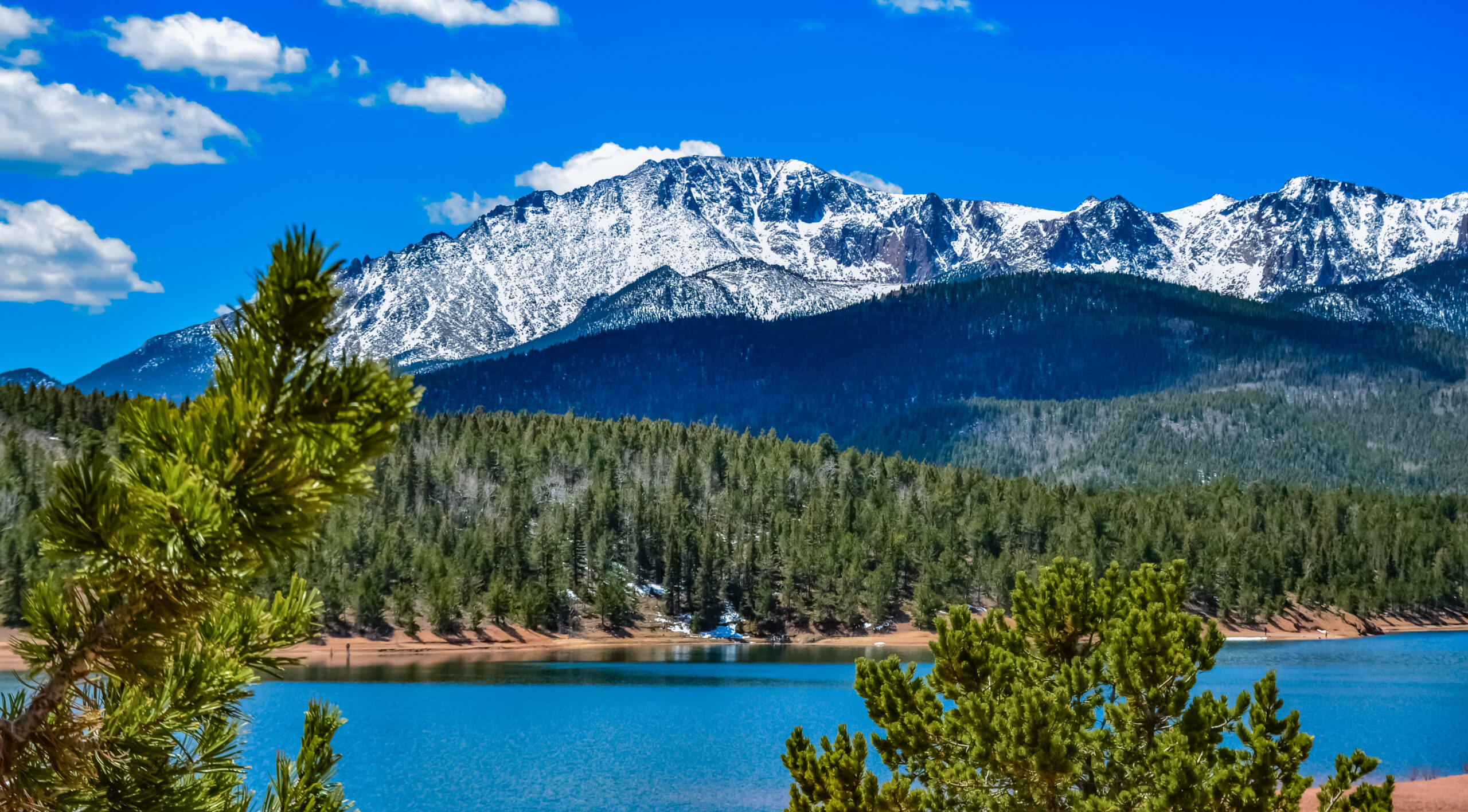
The 6 Colorado Mountain Ranges
Colorado’s 14ers organize across six major mountain ranges, each with distinct geological character, climbing culture, and peak selection. Generally, climbers should consider not just individual peaks but which range matches their travel base, aesthetic preferences, and technical experience. Specifically, the Sawatch holds the highest peaks, the Elk Mountains hold the most photographed (and dangerous) peaks, the San Juans hold the most remote peaks, the Sangre de Cristos hold the most committing peaks, the Mosquito/Tenmile holds the easiest peaks near Breckenridge, and the Front Range holds the peaks closest to Denver.
Find Hotels, Flights & Trips for the World’s Best Hiking Destinations
The Global Summit Guide Travel Shop on Expedia — curated for outdoor adventurers, mountaineers, and serious hikers. Patagonia to the Alps. Nepal to the Rockies. Curated lodging for every region we cover.
Explore Travel Shop on Expedia →The Sawatch Range is Colorado’s highest mountain range and contains the state’s three highest summits — Mount Elbert (14,440ft, Colorado’s highest), Mount Massive (14,427ft, second-highest), and Mount Harvard (14,424ft, third-highest). Generally, the range extends approximately 80 miles north-south in central Colorado, with Leadville and Buena Vista as the primary gateway towns, and contains 15 of Colorado’s 53 ranked 14ers. Specifically, the range includes the famous Collegiate Peaks subrange (Mount Harvard, Mount Yale, Mount Princeton, Mount Columbia, Mount Oxford, Mount Belford, Missouri Mountain, Huron Peak), plus La Plata Peak (14,336ft, 5th-highest in the Rockies), Mount Antero (14,269ft), Mount Shavano (14,229ft), Mount of the Holy Cross (14,005ft), and Tabeguache Peak (14,155ft). Notably, the Sawatch is famous for accessible non-technical 14ers — most peaks in the range are Class 1 walk-ups or Class 2 scrambles rather than the harder Class 3-4 climbs found in the Elk Mountains and San Juans, making it the prime destination for first-time 14er climbers attempting Mount Elbert as Colorado’s most prestigious accessible summit.
The Elk Mountains contain some of Colorado’s most photographed and most technically demanding 14ers — including the famous Maroon Bells (Maroon Peak 14,163ft and North Maroon Peak 14,019ft), Capitol Peak (14,136ft, considered the hardest 14er), Pyramid Peak (14,027ft), Castle Peak (14,279ft), Snowmass Mountain (14,098ft), and Conundrum Peak (14,065ft unranked). Generally, the range is centered near Aspen and characterized by dramatic glacially-carved peaks built on notoriously poor sedimentary mudstone — making the climbing technically demanding and the rock quality often dangerous. Specifically, the Maroon Bells earned their “Deadly Bells” nickname for the high fatality rate caused by loose rock, exposed Class 3-4 climbing, and rapid weather changes — multiple deaths occur in the range annually despite the peaks’ relatively modest elevations compared to the Sawatch. Notably, Capitol Peak’s Knife Edge ridge (a 150-foot section with 2,000-foot drops on both sides) represents Colorado’s most committing standard-route 14er climb at sustained Class 4 — the peak that most consistently appears on lists of America’s hardest non-technical mountain summits.
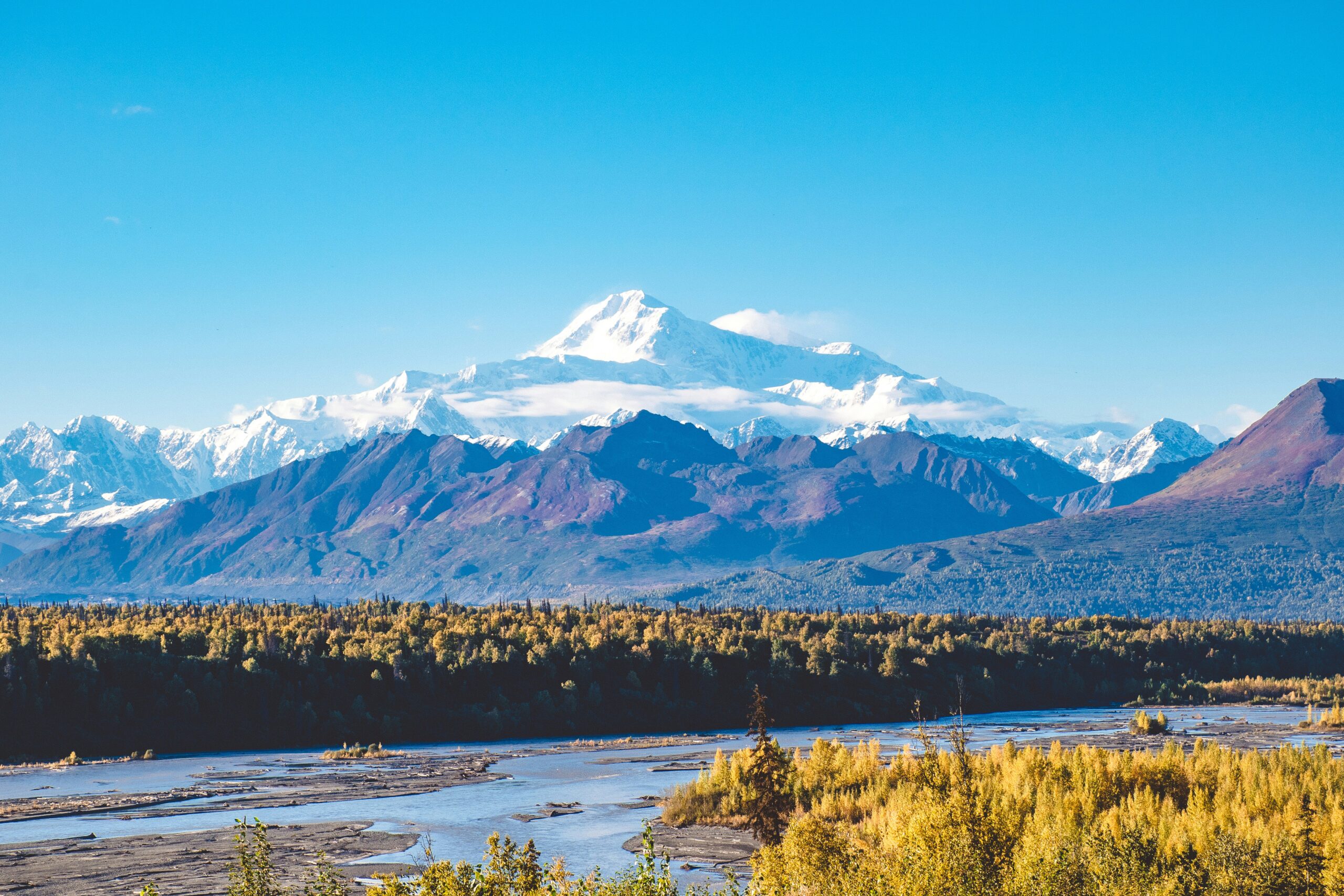
The San Juan Mountains in southwest Colorado contain 13 ranked 14ers and are widely considered the most scenically dramatic range in Colorado — characterized by heavily mineralized volcanic terrain that creates the dramatic colors and rugged profiles distinguishing the range. Generally, the San Juan 14ers include Mount Sneffels (14,158ft — the most photographed San Juan 14er), Wilson Peak (14,023ft), Mount Wilson (14,252ft), El Diente Peak (14,165ft unranked), Wetterhorn Peak (14,021ft), Uncompahgre Peak (14,321ft — 6th-highest in Colorado), Handies Peak (14,053ft), Redcloud Peak (14,041ft), Sunshine Peak (14,007ft), San Luis Peak (14,019ft), and the four Chicago Basin Needles (Windom Peak 14,093ft, Sunlight Peak 14,065ft, Mount Eolus 14,090ft, North Eolus 14,043ft unranked). Specifically, the gateway towns are Ouray (called the “Switzerland of America”), Telluride, and Silverton, with the Million Dollar Highway scenic route connecting the climbing centers. Notably, the Chicago Basin Needles require multi-day backpacking commitment via the Durango-Silverton train — making them the most remote 14ers in the lower 48 and one of America’s most distinctive climbing experiences.
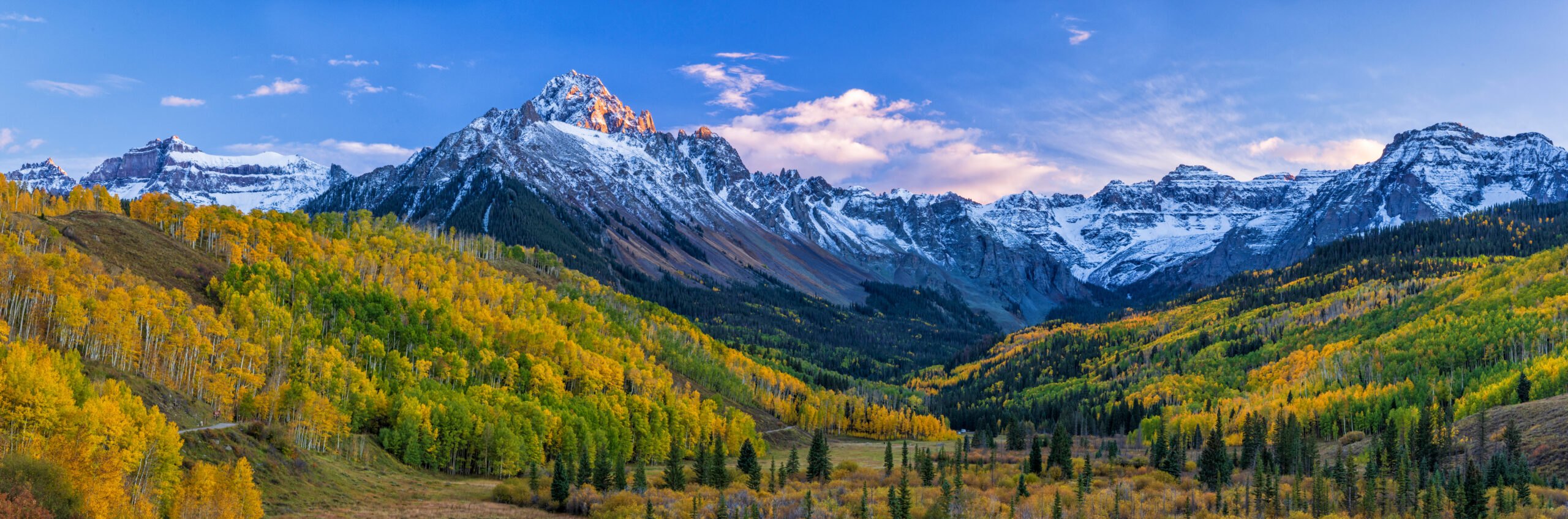
The Sangre de Cristo Range in south-central Colorado contains 10 ranked 14ers including some of the state’s most committing and historically significant peaks. Generally, the range extends from central Colorado south into New Mexico, with Blanca Peak (14,351ft) as the highest summit and the 4th-highest peak in the entire Rocky Mountains. Specifically, the range includes Crestone Peak (14,300ft) and Crestone Needle (14,197ft) — among the most technically demanding 14ers with their Class 3-4 routes on solid conglomerate rock that’s exceptional among Colorado 14ers, first climbed in 1916 by Albert Ellingwood and Eleanor Davis in what may represent the first belayed rock climbing in America. Notably, the range also contains Little Bear Peak (14,037ft) — widely considered the most dangerous Colorado 14er due to the deadly “Hourglass” rockfall corridor, plus Kit Carson Peak, Challenger Point, Ellingwood Point, Humboldt Peak, Mount Lindsey, and Culebra Peak (14,047ft) — Colorado’s only privately-owned 14er, requiring advance booking through Cielo Vista Ranch for legal access.
The Mosquito/Tenmile Range near Breckenridge contains 5 ranked 14ers but generates outsized climbing traffic due to its accessibility from Denver and the popularity of Quandary Peak as Colorado’s most-climbed 14er. Generally, the range includes Quandary Peak (14,265ft), Mount Lincoln (14,286ft), Mount Cameron (14,238ft unranked subpeak), Mount Democrat (14,148ft), Mount Bross (14,172ft), and Mount Sherman (14,036ft). Specifically, the famous DeCaLiBron Loop combines four 14ers (Democrat, Cameron, Lincoln, Bross) into a single 7-mile round-trip from the Kite Lake Trailhead — making it one of the most efficient 14er climbing days possible in Colorado, allowing fit climbers to summit four peaks in 6-8 hours. Notably, the Mosquito Range’s accessibility from Breckenridge (10,000ft base elevation) and Leadville (10,152ft) makes these peaks ideal for fit climbers who can stay at altitude for several nights before climbing — Quandary Peak in particular sees more annual ascents than any other Colorado 14er due to its accessible Class 1 standard route, well-marked trail, and 6.7-mile round-trip length.
The Front Range contains 6 ranked 14ers and is the most accessible mountain range from Denver — making these peaks Colorado’s most-climbed 14ers in terms of total annual visitors despite not being the easiest. Generally, the Front Range 14ers include Longs Peak (14,259ft — Front Range icon in Rocky Mountain National Park), Pikes Peak (14,115ft — “America’s Mountain”), Grays Peak (14,278ft — highest on the Continental Divide), Torreys Peak (14,272ft — typically climbed with Grays as a double-summit day), Mount Bierstadt (14,060ft — easiest 14er near Denver), and Mount Blue Sky (14,271ft — formerly Mount Evans, renamed in 2023). Specifically, Longs Peak’s standard Keyhole Route is a Class 3 climb of 15 miles round-trip with 5,100 feet of elevation gain — the most demanding day-hike 14er in Colorado, with significant exposure on the Narrows and Trough sections that has caused many deaths over the decades. Notably, Pikes Peak holds unique historical significance — it inspired Katharine Lee Bates to write “America the Beautiful” in 1893 after reaching the summit, and the Pikes Peak Cog Railway plus the Pikes Peak Highway make it the most-visited 14er in Colorado by total visitors (including non-climbers who drive or train to the summit).
The 10 Best 14ers to Climb in Colorado
The 10 14ers below represent the best climbing in Colorado across all six ranges and four difficulty levels. Generally, climbers should match peak selection to experience — Mount Bierstadt takes 4-6 hours from Guanella Pass while Capitol Peak demands serious mountaineering commitment with sustained Class 4 exposure. Specifically, the rankings consider summit prestige, route quality, range representation, and overall climbing significance within Colorado mountaineering culture.
Mount Elbert is Colorado’s highest summit and the highest peak in the entire Rocky Mountain system. Generally, the standard Northeast Ridge route via the North Mount Elbert Trail is a Class 1 walk-up of approximately 9 miles round-trip with 4,500 feet of elevation gain — accessible to fit hikers with proper altitude acclimatization. Specifically, the trailhead sits 12 miles southwest of Leadville in San Isabel National Forest, and the trail follows a well-marked path to the summit through aspen and conifer forest, then alpine tundra above treeline. Notably, despite being the highest 14er, Mount Elbert is one of the easier 14ers to climb — its non-technical trail makes it accessible to first-time 14er attempts with proper preparation, while peaks like Capitol Peak (14,136ft) and Maroon Peak (14,163ft) require Class 3-4 technical climbing despite being lower in elevation. Mount Elbert is also the highest summit in the Mississippi River drainage basin.
Mount Massive is Colorado’s second-highest peak and lives in the shadow of Mount Elbert just 13 feet away — close enough that 1970s climbers attempted to add cairns to make Massive higher (the cairns were repeatedly torn down by Elbert supporters until the effort was abandoned). Generally, the standard route is the East Slopes from the Halfmoon Trailhead — approximately 13.6 miles round-trip with 4,500 feet of elevation gain, slightly longer and somewhat harder than Mount Elbert via the standard routes. Specifically, the route involves Class 2 hiking on a maintained trail with some off-trail scree on the upper sections. Notably, Mount Massive is also the second-highest peak in the Rocky Mountains and the third-highest in the contiguous USA after Whitney and Elbert — making it one of America’s truly major summits despite often being overshadowed by its more famous neighbor. The summit ridge is broad and contains multiple subpeaks within the 14,000-foot contour.
Mount Harvard is Colorado’s third-highest peak and the highest summit in the Collegiate Peaks subrange. Generally, the standard route via the South Slopes from the North Cottonwood Trailhead is approximately 14 miles round-trip with 4,600 feet of elevation gain — a substantial Class 2 day comparable to Mount Massive in commitment. Specifically, the Collegiate Peaks subrange includes Mount Harvard plus Mount Yale, Mount Princeton, Mount Columbia, Mount Oxford, Mount Belford, Missouri Mountain, and Huron Peak — named for prestigious American universities by the Hayden Survey expedition. Notably, Mount Harvard can be combined with adjacent Mount Columbia (14,073ft) as a challenging double-summit day, though the connecting ridge between the two peaks is notoriously loose and difficult, making the traverse one of Colorado’s tougher 14er combinations. Many climbers prefer to climb Harvard and Columbia as separate days.
Quandary Peak is Colorado’s most-climbed 14er and one of the best first-14er objectives for beginners. Generally, the standard East Ridge route is approximately 6.75 miles round-trip with 3,450 feet of elevation gain — a Class 1 well-marked trail that most fit climbers complete in 4-6 hours. Specifically, the trailhead sits south of Breckenridge along Blue Lakes Road, making it extremely accessible from the Breckenridge resort area (which itself provides excellent acclimatization at 9,600ft base elevation). Notably, Quandary is so popular that Summit County implemented a paid parking system and shuttle service at the trailhead to manage crowds — climbers should check current parking and shuttle requirements on weekends in July-August. The peak features mountain goats that have become accustomed to hikers and frequently approach the summit area, providing one of Colorado’s most photographed 14er wildlife experiences.
Longs Peak is Colorado’s most demanding day-hike 14er and the iconic summit of Rocky Mountain National Park. Generally, the standard Keyhole Route is approximately 15 miles round-trip with 5,100 feet of elevation gain — a Class 3 climb with sustained exposure on the famous Narrows and Trough sections. Specifically, the route begins at the Longs Peak Trailhead (9,400ft) and climbs through Mills Glacier to the Boulder Field, then through the namesake Keyhole — a dramatic rock formation marking the transition from hiking to genuine alpine climbing. The technical sections include the Ledges, the Trough (a steep loose gully), the Narrows (exposed Class 3 traverse), and the Homestretch (final 500-foot Class 3 slab to the summit). Notably, Longs Peak has caused more climber deaths than any other Colorado 14er — the combination of length, elevation gain, technical difficulty, weather exposure, and high traffic creates conditions where multiple fatalities occur most years. Start by 3am to summit and descend before afternoon weather.
Maroon Peak is the higher of the two Maroon Bells (with North Maroon Peak at 14,019ft) and arguably the most photographed mountain in North America — the iconic peak that appears on Colorado tourism imagery, photography calendars, and Aspen postcards more than any other Colorado summit. Generally, the standard South Ridge route is approximately 12 miles round-trip with 4,800 feet of elevation gain — a sustained Class 3 climb on Elk Mountains hematite mudrock that ranks among Colorado’s most committing 14er objectives. Specifically, the route involves the “Green Monster” — a loose grass and rock slope leading to the south ridge — followed by sustained Class 3 scrambling on terrain that’s notoriously poor quality compared to other Colorado ranges. Notably, the Maroon Bells earned their “Deadly Bells” nickname from the high fatality rate caused by loose rock, exposed scrambling, and rapid weather changes — multiple deaths occur on the Bells annually. The Maroon Bells-Snowmass Wilderness requires shuttle access from Aspen Highlands (May-October).
Mount Sneffels is the most photographed San Juan 14er and one of Colorado’s most iconic peaks — appearing on more magazine covers and tourism materials than nearly any other Colorado mountain. Generally, the standard Lavender Couloir route from Yankee Boy Basin is approximately 2.5-3 miles round-trip with 2,100 feet of elevation gain — a Class 3 climb through loose scree, a steep couloir filled with “ball-bearing” rocks, and a final notch with exposed scrambling to the summit. Specifically, the upper Yankee Boy Basin trailhead at 12,460 feet requires 4×4 high-clearance vehicle access — 2WD vehicles park lower (adding 2-3 miles to the round trip). Notably, the wildflower-filled approach through Yankee Boy Basin in mid-July through August creates one of Colorado’s most photographed alpine scenes — Sneffels was named after Snæfell, the Icelandic volcano featured in Jules Verne’s “Journey to the Center of the Earth,” when surveyors thought the rugged volcanic-looking peak resembled the Icelandic mountain.
Capitol Peak is universally considered Colorado’s hardest non-technical 14er — the Class 4 Knife Edge route represents the most committing standard-route 14er climb in the state. Generally, the standard Northeast Ridge route via Capitol Creek is approximately 17 miles round-trip with 5,300 feet of elevation gain, typically completed as a multi-day backpacking trip with overnight at Capitol Lake. Specifically, the famous Knife Edge is a 150-foot section of exposed Class 4 ridgeline with 2,000-foot drops on both sides — climbers straddle the ridge or carefully edge along, knowing falls are likely fatal. Notably, despite the Maroon Bells’ fame for danger, Capitol Peak’s solid rock makes it less treacherous than the Bells per-attempt, but the sustained Class 4 exposure and remote position make it the most demanding Colorado 14er climb. K2 (the false summit) is known for being confused with the true Capitol Peak summit. Helmets, sustained Class 4 climbing comfort, and ideally rope skills are essential.
Pikes Peak is Colorado’s most-visited 14er (when including non-climbers who reach the summit via the Pikes Peak Highway or Cog Railway) and one of the most historically significant mountains in America. Generally, the standard Barr Trail climbing route is approximately 26 miles round-trip with 7,400 feet of elevation gain — one of Colorado’s longest 14er hikes despite being a Class 1 trail throughout. Specifically, most climbers complete Pikes Peak as a 2-day trip, camping at Barr Camp (10,200ft) or summiting via a long single push from Manitou Springs. Notably, Pikes Peak inspired Katharine Lee Bates to write “America the Beautiful” in 1893 after she reached the summit by horseback and train — making it the most culturally significant peak in Colorado. The summit can also be reached via the Pikes Peak Highway (an 18-mile paved road climbing to the summit), the Pikes Peak Cog Railway (the highest cog railway in the world), or by foot, making it America’s most accessible 14er for non-climbers.
Mount Bierstadt is Colorado’s most beginner-friendly 14er and the standard recommendation for first-time 14er attempts near Denver. Generally, the standard West Slopes route from Guanella Pass is approximately 7 miles round-trip with 2,800 feet of elevation gain — a Class 2 well-marked trail that most fit climbers complete in 4-6 hours. Specifically, the Guanella Pass Trailhead at 11,650 feet already sits above most of the elevation gain other 14ers require — climbers only need to gain 2,800 feet to reach the summit rather than the 4,500+ feet required from typical lower trailheads. Notably, Mount Bierstadt is named for Albert Bierstadt, the American landscape painter who made the first recorded summit of the mountain in 1863. The peak can be combined with adjacent Mount Blue Sky (14,271ft, formerly Mount Evans) via the famous Class 3 Sawtooth Traverse — a serious commitment requiring scrambling skills and weather awareness, making the two-14er day one of Colorado’s classic accessible objectives.
Quick Comparison Table
| # | Peak | Elevation | Range | Distance | Class |
|---|---|---|---|---|---|
| 1 | Mount Elbert | 14,440ft | Sawatch | 9 mi RT | Class 1 |
| 2 | Mount Massive | 14,427ft | Sawatch | 13.6 mi RT | Class 2 |
| 3 | Mount Harvard | 14,424ft | Sawatch | 14 mi RT | Class 2 |
| 4 | Quandary Peak | 14,265ft | Mosquito | 6.75 mi RT | Class 1 |
| 5 | Longs Peak | 14,259ft | Front Range | 15 mi RT | Class 3 |
| 6 | Maroon Peak | 14,163ft | Elk | 12 mi RT | Class 3 |
| 7 | Mount Sneffels | 14,158ft | San Juan | 2.5-3 mi RT | Class 3 |
| 8 | Capitol Peak | 14,136ft | Elk | 17 mi RT | Class 4 |
| 9 | Pikes Peak | 14,115ft | Front Range | 26 mi RT | Class 1 |
| 10 | Mount Bierstadt | 14,060ft | Front Range | 7 mi RT | Class 2 |
Want the complete Colorado 14er list? See our dedicated Colorado 14ers (Complete List) page for all 53 ranked 14ers with interactive checklist, difficulty ratings, and route details, plus the Colorado 14ers Progression Guide for systematically working through the list in optimal order.
How to Choose Your First Colorado 14er
Choosing the right Colorado 14er combines honest experience assessment, range preference, acclimatization planning, and seasonal timing. Generally, climbers should follow the 4-step protocol below rather than selecting peaks based on social media or convenience. Specifically, the protocol prevents the most common Colorado 14er mistakes: attempting peaks without acclimatization, ignoring the afternoon thunderstorm rule, underestimating Longs Peak as a hiking objective, and attempting Capitol Peak or the Maroon Bells without Class 3-4 experience.
The 4-Step Protocol for Choosing Your First Colorado 14er
- Identify your honest experience level. First-timers: Mount Bierstadt (Class 2, 7 mi RT from Guanella Pass), Quandary Peak (Class 1, 6.75 mi RT — most-climbed 14er), Mount Sherman (Class 1, 5.25 mi RT). Intermediate: Mount Elbert (Class 1, 9 mi RT — Colorado’s highest), Grays and Torreys (Class 2 double-summit), Mount Massive (Class 2). Hard: Longs Peak Keyhole (Class 3, 15 mi RT), Mount Sneffels Lavender Couloir (Class 3), Wetterhorn Peak (Class 3). Expert: Capitol Peak (Class 4 Knife Edge), Maroon Peak (Class 3 ‘Deadly Bells’), Little Bear (Class 4 Hourglass), Pyramid Peak (Class 4).
- Choose your range based on travel base. Front Range — closest to Denver (Longs, Pikes, Grays, Torreys, Bierstadt, Mount Blue Sky/Evans) — 1-2 hours from city center. Sawatch — central Colorado near Leadville and Buena Vista (Elbert, Massive, Harvard, Collegiate Peaks) — 2-3 hours from Denver. Elk — near Aspen (Maroon Bells, Capitol, Pyramid, Castle) — famous for dramatic peaks but notoriously poor rock. San Juan — southwest Colorado near Ouray/Telluride/Silverton (Sneffels, Wilson, Wetterhorn, Uncompahgre, Chicago Basin Needles) — most remote and dramatic range. Sangre de Cristo — south-central Colorado near Westcliffe (Blanca, Crestones, Little Bear, Kit Carson) — the most committing 14ers. Mosquito/Tenmile — near Breckenridge (Quandary, DeCaLiBron, Sherman).
- Acclimatize before attempting any 14er. Spend 1-3 nights at altitude before your summit attempt — Breckenridge (9,600ft), Leadville (10,152ft), Twin Lakes (9,200ft), Estes Park (7,522ft), or Aspen (7,908ft) are all excellent base camps. Sea-level visitors who attempt 14ers within 24 hours of arriving routinely fail to summit due to altitude sickness. Climb a 12,000-13,000ft peak first (Mount Wire, James Peak, Bald Mountain Breckenridge) before committing to a 14er. The 14er afternoon thunderstorm rule is non-negotiable: be off the summit by noon to avoid lightning exposure on Colorado’s exposed ridges and tundra.
- Plan around season, weather, and access logistics. Standard 14er season: June through September with peak conditions in July-August. Snow on north aspects can persist into late June. October brings rapid weather changes. Daily afternoon thunderstorms are routine from mid-July through early September — plan summit arrivals by 10am, descent by noon. Most Colorado 14ers require no special permits beyond standard trailhead access, with notable exceptions: Maroon Bells requires Aspen Highlands shuttle from May-October, Mount Blue Sky requires reservations for vehicles on the scenic byway, Culebra Peak requires advance booking via Cielo Vista Ranch (private land), and Quandary Peak now has paid parking at Breckenridge. Check current conditions through 14ers.com, Colorado Mountain Club, or USFS White River, San Isabel, Rio Grande, and Pike National Forests before climbing.
Common Mistakes Colorado 14er Climbers Make
Avoid These Common Colorado 14er Mistakes
- Attempting 14ers without altitude acclimatization. Sea-level visitors who attempt 14ers within 24 hours of arriving in Colorado routinely fail to summit due to altitude sickness. Spend 1-3 nights at altitude (Breckenridge 9,600ft, Leadville 10,152ft, Estes Park 7,522ft) before committing to a 14er — even Class 1 walk-ups like Mount Bierstadt and Quandary Peak feel substantially harder without acclimatization.
- Ignoring the 14er afternoon thunderstorm rule. From mid-July through early September, daily afternoon thunderstorms with lightning are routine across Colorado’s high peaks. The rule is non-negotiable: be off the summit by noon, ideally on the descent below treeline by 1pm. Lightning has killed multiple climbers on Class 1 14ers like Mount Bierstadt — easy peaks don’t mean safe peaks during monsoon thunderstorm season.
- Underestimating Longs Peak as a hiking objective. Longs Peak’s Keyhole Route is Class 3 with sustained exposure on the Narrows and Trough — not a hike despite being attempted by thousands of inexperienced climbers annually. Longs Peak has caused more climber deaths than any other Colorado 14er due to the combination of length (15 miles RT), elevation gain (5,100ft), technical difficulty, weather exposure, and traffic of underprepared climbers. Start by 3am to summit before afternoon weather.
- Attempting the Maroon Bells or Capitol Peak without Class 3-4 experience. The “Deadly Bells” (Maroon Peak, North Maroon, Pyramid Peak) and Capitol Peak’s Knife Edge are not appropriate for climbers without prior Class 3-4 scrambling experience. Build skills on easier Class 3 peaks first — Longs Peak Keyhole, Mount Sneffels Lavender Couloir, Wetterhorn Peak — before attempting the Elk Mountains’ hardest objectives.
- Confusing Mount Massive and Mount Elbert for being equally easy. Mount Massive at 14,427ft is harder than Mount Elbert despite being only 13 feet lower — longer route, more elevation gain, more challenging terrain. Climbers planning a “second-highest peak” attempt should expect a significant step up from Elbert in commitment.
- Skipping the Maroon Bells shuttle reservation. The Maroon Bells require Aspen Highlands shuttle access from May-October — climbers can’t drive personal vehicles to the trailhead during shuttle season. Make reservations weeks in advance during peak summer.
- Attempting Culebra Peak without advance booking. Culebra Peak (14,047ft) is Colorado’s only privately-owned 14er — access requires advance booking through Cielo Vista Ranch and a per-person fee. Climbers who arrive without booking will be turned away from this Sangre de Cristo summit.
- Confusing Class 1 with safe. Quandary Peak, Mount Bierstadt, and Mount Elbert are Class 1-2 walk-ups but they’re still 14,000+ feet of altitude exposure with afternoon weather risk. Altitude sickness and lightning kill climbers on these “easy” peaks every year.
What We Don’t Know
Honest limitations of any Colorado 14er guide
The 10 peaks featured represent a curated selection, not Colorado’s full 14er inventory. Colorado has 53 ranked 14ers (58 total with unranked subpeaks). The 10 peaks selected reflect range representation, difficulty progression, and historical/cultural significance — but the harder peaks for advanced climbers (Little Bear, Pyramid, Crestone Peak, Crestone Needle, Wilson Peak, the Chicago Basin Needles) deserve their own dedicated coverage that’s beyond this overview’s scope. Climbers planning systematic 14er progression should consult our dedicated Colorado 14ers (Complete List) and Colorado 14ers Progression Guide resources.
The 53 vs 58 vs 54 14er count is genuinely contested. Different sources use different counts: 14ers.com lists 53 ranked plus 5 unranked = 58 total. The Colorado Geological Survey occasionally cites 58 named summits above 14,000 feet. Some historical sources cite 54 (including or excluding specific subpeaks like Mount Cameron, El Diente, North Maroon). The 2025 GPS survey of East Crestone Peak (which appears to be marginally higher than the official Crestone Peak summit) may further complicate the count. The 53-ranked figure is the most commonly cited reference and the basis for completing “the 14ers list.”
Conditions change. Trail closures, permit requirements, shuttle schedules, and parking systems all change year-over-year. The Maroon Bells shuttle requirements, Quandary Peak paid parking, Mount Blue Sky vehicle reservations, and Culebra Peak booking systems all evolve. Information current as of June 2026 may shift — check current conditions through 14ers.com, USFS White River National Forest, USFS San Isabel National Forest, USFS Pike National Forest, USFS Rio Grande National Forest, or Rocky Mountain National Park before any specific climb.
Difficulty ratings reflect typical conditions. The Class 1-4 difficulty system reflects standard-route difficulty in good summer conditions. Actual difficulty shifts substantially with weather, snow conditions, group experience, and individual factors. Winter ascents of Colorado 14ers are common but require winter mountaineering skills and avalanche assessment — multiple climbers have died on Class 1 14ers like Quandary Peak attempting winter ascents without proper preparation. The afternoon thunderstorm rule shifts the apparent difficulty even of “easy” 14ers in monsoon season.
The Mount Elbert vs Mount Whitney ‘highest in lower 48’ relationship. Mount Elbert at 14,440 feet is the highest peak in the Rocky Mountains and the second-highest in the contiguous USA after California’s Mount Whitney (14,505 feet). The 65-foot difference is sometimes incorrectly reported — Whitney is genuinely higher, but Elbert dominates the Rockies. Both are achievable as non-technical climbs by fit hikers with proper acclimatization.
Colorado 14er FAQ
How many 14ers are in Colorado?
Colorado has 53 ranked 14ers — peaks above 14,000 feet that meet the standard 300-foot prominence rule. When counting all named summits above 14,000 feet including unranked subpeaks, Colorado has 58 total 14er summits. The 53 ranked 14ers are the standard reference list used by 14ers.com, the Colorado Mountain Club, and most climbing resources — the additional 5 unranked summits (Mount Cameron, Conundrum Peak, North Maroon Peak, North Eolus, El Diente Peak) don’t drop 300 feet to a saddle between them and a higher neighbor. Colorado has more 14ers than any other state in America: California has 12, Washington 3, Wyoming 2, and Alaska additional peaks above 14,000 feet. Colorado contains 78 of the top 100 highest peaks in the Rocky Mountains, including the 30 highest summits.
What is the highest mountain in Colorado?
Mount Elbert (14,440 feet / 4,401 meters) is the highest mountain in Colorado and the highest peak in the entire Rocky Mountain system. Mount Elbert is the second-highest peak in the contiguous United States behind only Mount Whitney in California (14,505ft). Mount Elbert is located in the Sawatch Range, 12 miles southwest of Leadville in San Isabel National Forest. The standard Northeast Ridge route via the North Mount Elbert Trail is a Class 1 walk-up of approximately 9 miles round-trip with 4,500 feet of elevation gain. Despite being the highest 14er, Mount Elbert is one of the easier 14ers to climb — its non-technical trail makes it accessible to fit hikers with proper acclimatization. Mount Elbert is the highest summit of the Mississippi River drainage basin.
What are the best mountains to climb in Colorado?
The best mountains to climb in Colorado span six ranges and all difficulty levels: Mount Elbert (14,440ft, Class 1 — highest), Mount Massive (14,427ft, Class 2), Mount Harvard (14,424ft, Class 2), Quandary Peak (14,265ft, Class 1 — most-climbed), Longs Peak (14,259ft, Class 3 — Keyhole Route), Maroon Peak (14,163ft, Class 3 — “Deadly Bells”), Mount Sneffels (14,158ft, Class 3 — San Juan icon), Capitol Peak (14,136ft, Class 4 — hardest 14er), Pikes Peak (14,115ft, Class 1 — “America’s Mountain”), and Mount Bierstadt (14,060ft, Class 2 — easiest near Denver). Climbers should match peak selection to experience — Bierstadt or Quandary for beginners, Elbert for moderate climbers, Longs or Sneffels for advanced, and Capitol or the Maroon Bells for experts only.
What are the six mountain ranges in Colorado?
Colorado’s 14ers are distributed across six major mountain ranges. The Sawatch Range in central Colorado contains 15 fourteeners and the state’s highest peaks — Mount Elbert (14,440ft), Mount Massive (14,427ft), Mount Harvard (14,424ft). The San Juan Mountains in southwest Colorado contain 13 ranked 14ers including Mount Sneffels, Wilson Peak, Wetterhorn, Uncompahgre, and the Chicago Basin Needles. The Sangre de Cristo Range contains 10 14ers including Blanca Peak (4th-highest in Rockies), Crestone Peak, Crestone Needle, and Little Bear. The Front Range nearest to Denver contains 6 14ers — Longs Peak, Pikes Peak, Grays, Torreys, Bierstadt, and Mount Blue Sky (formerly Mount Evans). The Elk Mountains contain 6 14ers including the Maroon Bells, Capitol Peak (hardest 14er), Pyramid Peak, Castle Peak. The Mosquito/Tenmile Range near Breckenridge contains 5 14ers including Quandary Peak (most-climbed) and the DeCaLiBron loop.
How hard are the Colorado 14ers?
Colorado 14ers span the full mountaineering difficulty spectrum from Class 1 walk-ups to Class 5 technical climbs using the Yosemite Decimal System: Class 1 (walk-up trails like Mount Bierstadt, Quandary, Elbert), Class 2 (off-trail rough hiking like Mount Massive, Grays, Torreys), Class 3 (scrambling with significant exposure like Longs Peak Keyhole, Mount Sneffels, Wetterhorn), Class 4 (climbing with major exposure like Capitol Peak Knife Edge, Maroon Peak, Little Bear Hourglass, Pyramid), and Class 5 (technical rock climbing). Of the 53 ranked Colorado 14ers, approximately 14 are Class 1, 22 are Class 2, 10 are Class 3, and 7 are Class 4 — with Capitol Peak universally considered the hardest non-technical 14er. Easy 14ers can still kill — afternoon thunderstorms on Class 1 peaks have caused multiple lightning deaths, and altitude sickness affects sea-level visitors regardless of technical rating.
What is the easiest 14er in Colorado?
Mount Bierstadt (14,060ft) is generally considered the easiest 14er to climb in Colorado for first-timers. The standard West Slopes route from Guanella Pass is approximately 7 miles round-trip with 2,800 feet of elevation gain on a well-marked Class 2 trail — most fit climbers complete the climb in 4-6 hours. The trailhead at Guanella Pass already sits at 11,650 feet, meaning the actual climbing only gains about 2,800 feet rather than the 4,500+ feet required from lower trailheads on peaks like Mount Elbert. While Mount Bierstadt is the most beginner-friendly 14er based on length and elevation gain, Quandary Peak (14,265ft) is the most-climbed 14er due to similar accessibility from Breckenridge — both peaks are excellent first 14er objectives.
Sources and Methodology
Numbered Source References
This Colorado 14er guide synthesizes data from federal land management authorities, USGS topographic records, the Colorado Geological Survey, and Colorado-specific climbing community resources.
- USGS topographic and elevation data. United States Geological Survey — official source for peak elevations referenced throughout this guide, including Mount Elbert (14,440ft) and all Colorado 14er elevations.
- 14ers.com climbing database. 14ers.com — the standard climbing community reference for Colorado 14ers, including route information, member ascent counts, and the 53-ranked / 58-total 14er classification.
- Colorado Geological Survey. Authoritative source for the 58 named peaks above 14,000 feet in Colorado, mountain range classifications, and geological characterizations of the Sawatch, Elk, San Juan, Sangre de Cristo, Mosquito, and Front Range geology.
- USFS White River, San Isabel, Pike, Rio Grande, and Uncompahgre National Forests. Official authorities for trail access, permit requirements, shuttle systems (Maroon Bells), and current closure information.
- Colorado Fourteeners Initiative. Conservation organization managing 14er trail systems, with route information and access updates for popular peaks like Mount Elbert and Mount Bierstadt.
- Rocky Mountain National Park (NPS). Official authority for Longs Peak Keyhole Route access, regulations, and current conditions.
- SummitPost climbing database. Community-driven climbing database with detailed route information, historical context, and first-ascent records for Colorado 14ers.
- Internal Global Summit Guide research. Cross-referenced with site coverage including Colorado 14ers complete list, Best Mountains Near Denver, Colorado 14ers Progression Guide, individual mountain pages (Mount Sneffels, Mount Elbert, Maroon Peak, Capitol Peak, Crestone Peak, Blanca Peak), and the USA Mountain Hub.
Methodology note. Quarterly review cycle — next review September 2026 (post-summer climbing season). Elevation data uses NAVD88 / NAPGD2022 standards.
Continue Your Colorado 14er Research
Colorado Offers America’s Most Accessible High-Altitude Climbing
Generally, Colorado’s six ranges offer complete 14er progression — beginner Mount Bierstadt and Quandary Peak, intermediate Mount Elbert and Mount Massive, hard Longs Peak Keyhole and Mount Sneffels, and expert Capitol Peak and the Maroon Bells. Specifically, with 53 ranked 14ers across the state, Colorado is the unmatched US destination for high-altitude climbing. Notably, the afternoon thunderstorm rule is non-negotiable — be off the summit by noon from July-August.
← Back to USA Mountain HubWas this helpful?
🏔Related peaks nearby
🧭Explore & compare
Global Summit Guide is an independent mountaineering resource founded in 2026. The team combines first-hand trekking and climbing experience with in-depth research and professional health and nutrition review to help climbers choose objectives, prepare properly, and stay safe.
Health, altitude, and nutrition content is reviewed by Taylor Ludlow (Registered Nurse) and Brigg Hoopes (Nutritionist).
What We Don't Know Yet
Mountain information changes quickly. This box explains the limits of what this page can responsibly promise.
- Weather, snowpack, avalanche risk, road access, and route conditions can change quickly and may be different on your climbing dates.
- Route conditions, trailhead access, crevasse exposure, stream crossings, and rescue access may vary from published planning guidance.
- Fitness and altitude response vary by person; no guide, itinerary, or training plan can guarantee acclimatization or summit success.
Verify current conditions with official land managers, guide services, local forecasts, and current route reports before booking or climbing.
Part of this Global Summit Guide cluster
Explore the complete Pick Your Mountain guide for more context, routes, planning links, and related resources.
Mountaineering, rock and ice climbing, glacier travel, and high-altitude activity are inherently dangerous and can result in serious injury or death. The information on Global Summit Guide is provided for general informational and educational purposes only and is not a substitute for professional instruction, qualified guiding, proper equipment, or your own judgment and experience.
Route conditions, weather, snowpack, permits, regulations, and hazards change constantly and may differ from what is described here. Details may be incomplete, out of date, or contain errors. Always verify current information with local authorities, certified guides, and official sources before making any decision in the mountains.
Nothing on this site is medical, legal, or financial advice. Our fitness, acclimatization, altitude, and nutrition content is general in nature; consult a qualified physician before beginning any strenuous exercise program or exposing yourself to high altitude.
You are solely responsible for your own safety and decisions. To the fullest extent permitted by law, Global Summit Guide and its team accept no liability for any loss, injury, damage, or expense arising from use of, or reliance on, this information. By using this site you acknowledge these risks and accept these terms.
Some links on this site may be affiliate links. If you buy through them we may earn a small commission at no extra cost to you; this never affects our recommendations.
Global Summit Guide recommendation path
Next Best Mountain to Research
Use these recommendations to continue the right planning path instead of stopping on one page.
Use current permit, weather, route, and operator information before booking or climbing.