Matterhorn vs Mont Blanc: which Alpine 4000er should you climb first?
If you have spent any time around alpine climbing forums or in the Chamonix and Zermatt valleys, you have heard the question dozens of times: Mont Blanc or Matterhorn first? Both are iconic Alpine 4000ers. Both are achievable for fit climbers with proper preparation. Both are bucket-list peaks that change how you think about mountains. But they are not the same climb. Mont Blanc is bigger, longer, and more about altitude tolerance and endurance. The Matterhorn is smaller, faster, and more about technical commitment and exposure. This is the direct comparison: difficulty, technical grade, training requirements, cost, and the honest answer to which one you should climb first. For the full deep-dive on each side, see our Mont Blanc vs Matterhorn master comparison.
The head-to-head at a glance
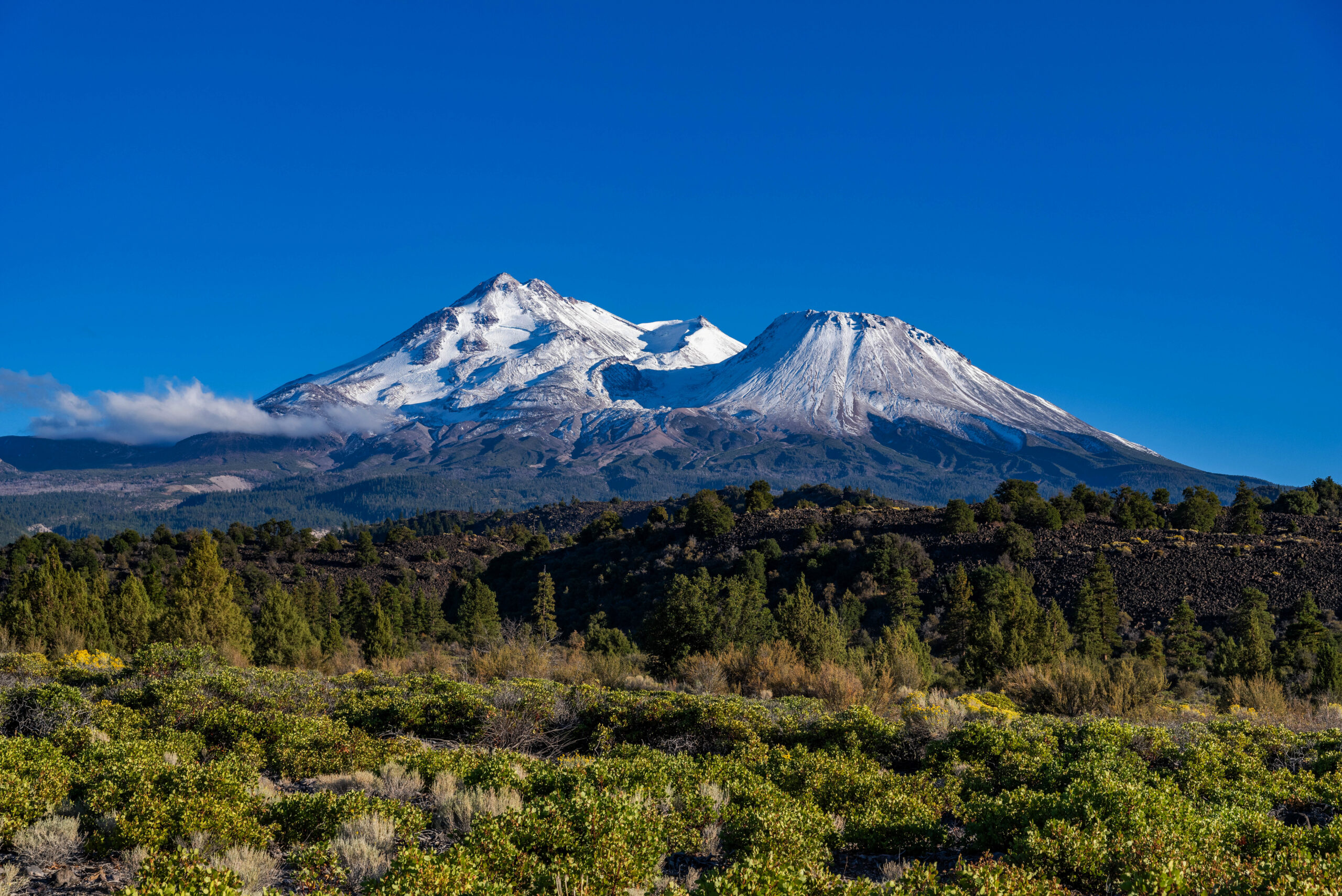
Mont Blanc
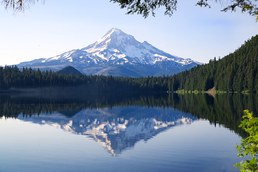
Matterhorn
Mont Blanc is bigger but easier. The Matterhorn is smaller but harder.
For nearly all climbers, the right answer is to climb Mont Blanc first, build the alpine fitness and skill base, then attempt the Matterhorn as the graduation peak. Reversing the order is possible but not recommended — the Matterhorn punishes climbers who underestimate it.
The difficulty comparison in detail
The single most important distinction between these two peaks is that they fall on different points of the alpine difficulty spectrum. Mont Blanc is rated PD (Peu Difficile) on the French alpine scale, which translates roughly to “moderate” alpine climbing. The Matterhorn Hörnli Ridge is rated AD (Assez Difficile), which is the next tier up — “fairly difficult.” That one-step grade difference matters more in practice than it sounds in writing.
What PD means on Mont Blanc
The Goûter route on Mont Blanc spends most of its time on glaciated terrain at moderate angles. The challenging sections are the Goûter couloir (a stonefall-exposed traverse), some short steep snow slopes, and the final summit ridge in thin air. The route is physically demanding because of distance and altitude, but the climbing itself is mostly walking on a rope team with crampons. A fit hiker with basic crampon and rope-team experience can succeed on Mont Blanc with appropriate guidance. The full breakdown of the Goûter route is in our Mont Blanc Goûter expedition breakdown, with the alternative route framework in our Goûter vs Three Monts comparison.
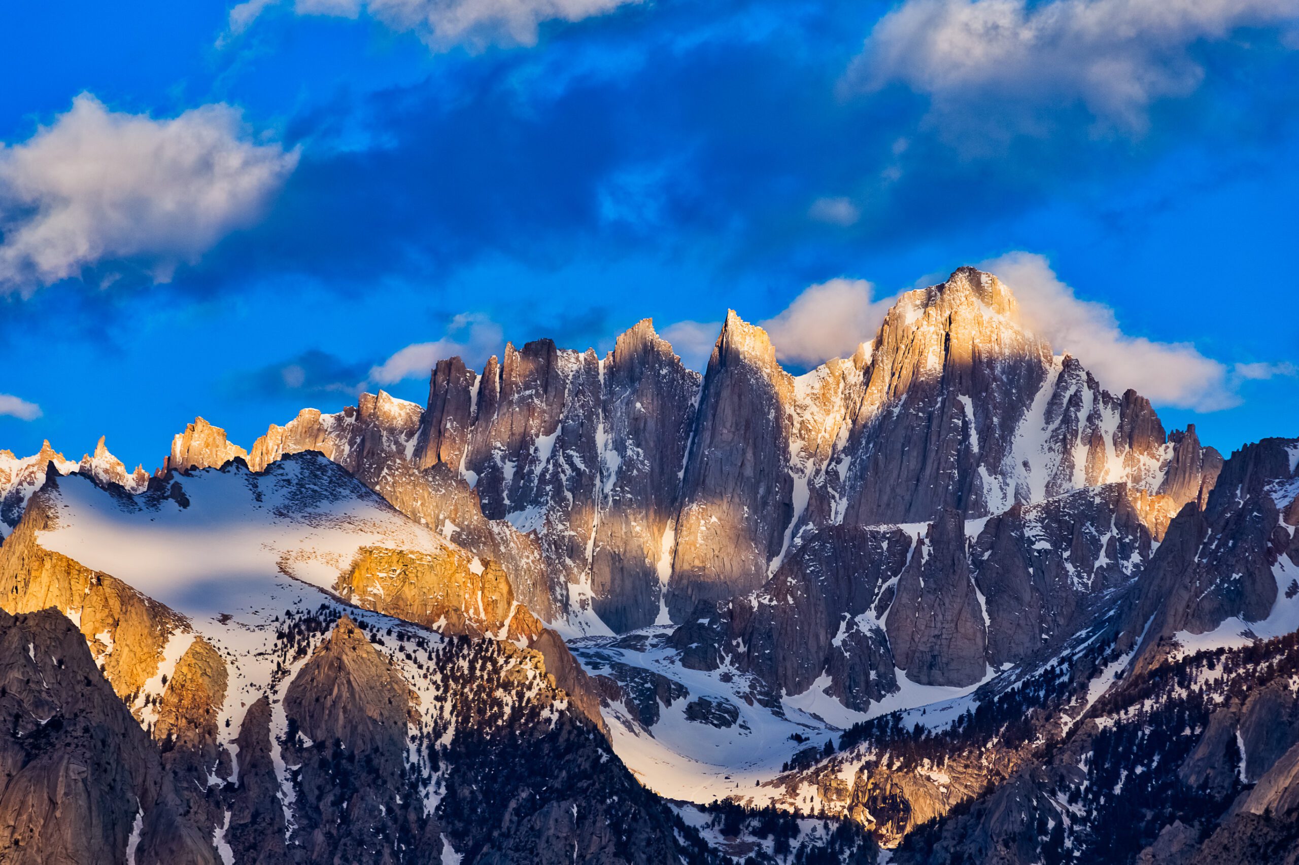
What AD means on the Matterhorn
The Hörnli Ridge is something else entirely. The route involves 1,200+ meters of sustained class 3 and class 4 climbing on loose rock, with fixed ropes and ladders at the technical crux sections, real exposure throughout, and route-finding challenges on the upper shoulder. The cumulative technical demand is substantially higher than Mont Blanc, the consequence of error is higher (falls are catastrophic on most of the route), and the time pressure is real (climbers must be off the upper mountain by 1 PM to avoid afternoon thunderstorms). The full route detail is in our Matterhorn training plan and our Matterhorn route comparison.
Climbers who complete Mont Blanc often describe it as “the hardest thing I have ever done” but rarely as “scary.” Climbers who complete the Matterhorn often describe it as both. The technical exposure and consequence of error on the Matterhorn put it in a different mental category than Mont Blanc, even though the absolute elevation is lower.
Training required for each
Both peaks reward serious preparation, but the training emphasis is meaningfully different.
| Training dimension | Mont Blanc focus | Matterhorn focus |
|---|---|---|
| Cardiovascular base | Critical — long days at altitude | High — sustained 7-10 hour effort |
| Strength training | Moderate — leg endurance | High — pulling, scrambling power |
| Altitude exposure | Very high — 4,810 m matters | Moderate — 4,478 m is manageable |
| Glacier travel skills | Essential — most of the route | Limited — short glacier sections |
| Rock scrambling | Minimal | Critical — most of the route |
| Rope team management | Essential | Essential plus short-roping |
| Crampon technique | Standard glacier walking | Mixed terrain transitions |
| Self-arrest with ice axe | Essential | Essential |
| Prior alpine experience | Helpful but not required | Required (real prior climbs) |
| Typical training period | 3-6 months | 12-18 months building base |
A reasonable summary: Mont Blanc rewards fitness. The Matterhorn rewards experience. You can train to climb Mont Blanc in 4-6 months from a moderately fit baseline. Training to climb the Matterhorn realistically means building 1-2 years of progressive alpine experience first, with multiple shorter alpine routes before the Matterhorn attempt. The full training framework for the Matterhorn is in our Matterhorn training plan.
Route character side by side
Mont Blanc Goûter route — the climber’s day
The standard Mont Blanc Goûter ascent typically unfolds over three days: drive or train to Chamonix, take the Mont Blanc Tramway to Nid d’Aigle (2,372 m), then hike up to the Tête Rousse refuge at 3,167 m for night one. Day two crosses the infamous Goûter couloir (a rockfall-exposed traverse that demands speed and timing), climbs steeply to the Goûter refuge at 3,835 m, and continues to the Dôme du Goûter and onto the Bosses Ridge for the final summit push at 4,810 m. Total summit day is 8-10 hours from the Goûter hut. Descent follows the same route. Most of the climbing is on snow and glaciated terrain at moderate angles, with rope team travel throughout the upper sections. The infrastructure context is in our Mont Blanc operators guide.
Matterhorn Hörnli Ridge — the climber’s day
The standard Matterhorn Hörnli ascent unfolds over a much more intense single day. Climbers stay at the Hörnlihütte at 3,260 m the night before, depart at 4:00 to 5:00 AM in headlamp light, and climb the ridge through sustained class 3-4 scrambling for 7-10 hours round trip. The route has named technical sections — the Moseleyplatte slabs, the step above the Solvay emergency hut at 4,003 m, the Roof traverse, the upper shoulder mixed terrain — each requiring focused attention and competent rope work. The summit register sits at 4,478 m. Descent is on the same route and must be completed before afternoon thunderstorms typically build around 1 PM. The pace is sustained the entire time. The full daily plan is detailed in our Matterhorn training plan.
Mont Blanc is a multi-day expedition where altitude is the main enemy. The Matterhorn is a single-day technical climb where commitment is the main enemy. These are different psychological experiences. Climbers who do well on long endurance objectives often struggle with the focused technical commitment of the Matterhorn. Climbers who excel at technical climbing sometimes underestimate the cumulative altitude exposure of Mont Blanc. Honest self-assessment matters here.
Cost comparison side by side
| Cost dimension | Mont Blanc | Matterhorn |
|---|---|---|
| Guide fee (typical) | €1,500-2,500 (3 days, 1:2 ratio) | CHF 1,400-1,800 per day (1:1) |
| Guide ratio | 1 guide : 2 clients | 1 guide : 1 client (required) |
| Total guide cost (typical climb) | €750-1,250 per person | CHF 2,800-3,600 per person |
| Hut accommodation | €80-120/night × 2 nights | CHF 100-150/night × 1 night |
| Tramway / lift access | ~€40 (Mont Blanc Tramway) | ~CHF 30 (Schwarzsee lift) |
| Equipment rental (if needed) | €100-200 for the trip | CHF 150-250 for the trip |
| Accommodation in valley | €100-180/night Chamonix | CHF 150-300/night Zermatt |
| Total for guided climb (per person) | €1,500-2,500 | CHF 4,000-5,500 |
The cost difference is substantial. A guided Matterhorn climb runs roughly 2-3x the cost of a guided Mont Blanc climb, primarily because the Matterhorn requires a 1-to-1 guide ratio while Mont Blanc allows 1-to-2 or sometimes 1-to-3. The other significant factor is the Zermatt valley being meaningfully more expensive than Chamonix for accommodation and food. Self-guided climbs (without a hired guide) are possible on both mountains for experienced parties but are not recommended for first-time visitors.
Safety comparison honest numbers
| Safety metric | Mont Blanc | Matterhorn |
|---|---|---|
| Approximate annual climbers (standard route) | ~25,000-30,000 | ~3,000-4,000 |
| Approximate annual fatalities | 10-15 | 5-10 |
| Death rate per climber | ~0.04% | ~0.2% |
| Most common fatal cause | Stonefall in Goûter couloir | Falls on upper ridge |
| Most common cause of failure | Altitude / weather turn-around | Conditions / weather turn-around |
| Helicopter rescue capability | Excellent (PGHM Chamonix) | Excellent (Air Zermatt) |
Both mountains have well-documented fatality histories. The Matterhorn has a higher per-climber death rate primarily because the technical exposure on the route means that the consequence of any error is severe. Mont Blanc has more total deaths annually because of the much larger number of climbers, but the per-climber risk is lower. The Goûter couloir is the most-discussed safety concern on Mont Blanc — French authorities have considered closing the route entirely due to stonefall risk and have issued increasingly strict access controls. The Matterhorn’s technical commitment is its primary risk factor — falls on the upper ridge are typically fatal regardless of party speed or gear. Both are objectively serious mountains. The mountaineering insurance framework that protects high-altitude climbs is in our mountaineering insurance comparison.
Success rates summit probabilities
Honest summit success rate data for both peaks:
- Mont Blanc Goûter route: Approximately 50-60% summit success rate on guided climbs in good conditions. Failure most commonly due to weather (afternoon storm turn-around), altitude sickness, or fitness. Climbers who turn around get a future window — the route stays accessible throughout the season.
- Matterhorn Hörnli Ridge: Approximately 50-65% summit success rate on guided climbs in good conditions. Failure most commonly due to route conditions (closed for snow, rockfall, fixed protection damage), weather, or fitness. The narrow climbing window (mid-July to mid-September) means a closed week can end an entire trip.
Both peaks have similar overall success rates on guided climbs, but the reasons for failure are different. Mont Blanc failures typically happen on summit day itself when the climber turns around. Matterhorn failures often happen before the climb starts — the route is closed when the climber arrives at Zermatt and stays closed for the trip duration. This is why experienced Matterhorn climbers build extra buffer days into the trip plan that Mont Blanc climbers do not need.
Who should climb each first honest assessment
Climb Mont Blanc first if…
— You have not yet climbed a 4,000 meter peak
— Your alpine experience is limited to single-day routes
— You want a confidence-building peak before the Matterhorn
— Your budget is closer to €2,000 than CHF 5,000
— You prefer endurance over technical commitment
— You are training toward the broader Alps 4000ers
Climb Matterhorn first if…
— You have multiple prior alpine routes at AD or harder
— You have led technical rock to 5.7 or higher
— You have done multi-day glacier travel in expedition style
— You have experience above 4,000 m without altitude issues
— You can afford the higher cost and time commitment
— The Matterhorn is the specific peak you want, not just any 4000er
The honest reality is that the climbers who climb the Matterhorn first without the Mont Blanc foundation often have one of two profiles: experienced rock climbers from other ranges who have the technical skills but lack alpine glacier experience, or under-prepared climbers who underestimate the Matterhorn’s commitment. The first group typically succeeds. The second group often does not, sometimes with serious consequences.
Where they sit in the broader Alps
| Peak | Elevation | Grade | Character |
|---|---|---|---|
| Mont Blanc | 4,810 m | PD | Endurance / altitude |
| Gran Paradiso | 4,061 m | F+ | Easiest 4000er, intro peak |
| Breithorn | 4,164 m | F | Easiest cable-car 4000er |
| Monte Rosa (Dufourspitze) | 4,634 m | PD | Endurance peer to Mont Blanc |
| Weisshorn | 4,506 m | AD+ | Harder than Matterhorn, less famous |
| Matterhorn | 4,478 m | AD | Technical / committed |
| Eiger Mittellegi Ridge | 3,967 m | AD | Peer to Matterhorn, lower elevation |
| Eiger North Face | 3,967 m | ED2 | Two grade tiers above Matterhorn |
The Alps have over 80 peaks above 4,000 meters, and the Mont Blanc / Matterhorn pairing is the most famous. But it is not the only pairing. Many climbers extend the progression to include Gran Paradiso (the easiest 4000er, a good warmup), Monte Rosa (a peer to Mont Blanc), and the Weisshorn (a harder alternative to the Matterhorn). The full Alps comparison framework is in our greatest Alps mountains compared guide and the broader collection is in our Alps classics collection.
Mont Blanc and Matterhorn vs bigger mountains
Two common questions climbers ask when researching these peaks:
Is the Matterhorn harder than Everest?
In pure technical difficulty, yes. The Matterhorn Hörnli Ridge involves more sustained technical climbing than Mount Everest via the standard commercial routes. The Hörnli Ridge has class 3-4 climbing throughout, while Everest’s standard routes are mostly snow travel on prepared fixed-rope sections at altitude. However, Everest is dramatically harder in absolute terms because of the altitude (8,849 m vs 4,478 m), the multi-week expedition logistics, and the death zone above 8,000 m where climbers must use supplemental oxygen and operate with severely diminished physical capability. The Matterhorn is a one-day technical climb. Everest is a 6-8 week expedition where altitude drives most of the difficulty.
Is the Matterhorn harder than K2?
K2 is dramatically harder than the Matterhorn. K2 is the second-highest mountain in the world at 8,611 meters with sustained technical climbing throughout the Abruzzi Spur and significantly higher objective danger than the Matterhorn. K2 has a death rate of roughly 1 in 4 historically. The Matterhorn is technically challenging at altitude but is climbed by thousands of people each season. K2 is the apex objective in modern mountaineering and is in an entirely different category from any Alps 4000er.
The natural progression that includes both peaks
For climbers building toward the full Alps experience or the Seven Summits, the typical progression incorporates both peaks in sequence:
- First 4000er: Gran Paradiso or Breithorn as the introduction to glaciated 4,000-meter terrain.
- Second 4000er: Mont Blanc as the first major Alps objective. Builds altitude tolerance and glacier travel skills.
- Third 4000er: Matterhorn as the technical graduation peak. Requires the prior alpine experience built on Mont Blanc.
- Beyond the Alps: Mount Elbrus (5,642 m) for the Seven Summits Europe peak, then Aconcagua or Denali. Elbrus framework in our Elbrus progression plan.
This four-peak Alps progression typically takes 2-4 years for working climbers and serves as the standard foundation for international high-altitude mountaineering. Climbers who skip Mont Blanc and attempt the Matterhorn first sometimes succeed but often turn around — the technical commitment of the Matterhorn without prior alpine fluency is meaningfully harder than the Matterhorn climbed after Mont Blanc.
The full Mont Blanc vs Matterhorn deep dive
Route options, training requirements, cost frameworks, and the full decision matrix for choosing between the two most iconic Alps 4000ers.
Read the master guide →The bottom line on Mont Blanc vs Matterhorn
Mont Blanc and the Matterhorn are the two most famous 4,000-meter peaks in the Alps, but they are not interchangeable objectives. Mont Blanc is the bigger mountain by elevation and total vertical gain, but it is technically easier — graded PD with mostly glaciated terrain accessible to fit climbers with basic alpine skills. The Matterhorn is shorter and lower but technically harder — graded AD with sustained class 3-4 rock climbing on exposed terrain that requires substantial prior alpine experience. For nearly all climbers, the right order is Mont Blanc first, Matterhorn second. The fitness and skills built on Mont Blanc translate directly to the Matterhorn, while the technical commitment of the Matterhorn punishes climbers who lack the prior foundation. The full decision framework with detailed route comparisons and cost breakdowns is in our Mont Blanc vs Matterhorn master guide, with the broader Alps context in our greatest Alps mountains compared.
Frequently asked questions
Is the Matterhorn harder than Mont Blanc?
Yes, the Matterhorn is significantly harder than Mont Blanc on the standard routes. The Matterhorn Hörnli Ridge is graded AD (Assez Difficile) with sustained class 3 to class 4 climbing for over 1,200 meters, while Mont Blanc via the Gouter route is graded PD (Peu Difficile) with predominantly glacier walking and short snow slopes. The Matterhorn requires technical alpine climbing skills, rope team work on exposed terrain, and significantly more prior experience. Mont Blanc is achievable for fit climbers with basic glacier travel skills; the Matterhorn is not.
Which should you climb first, Mont Blanc or Matterhorn?
Mont Blanc should be climbed first for nearly all climbers. The standard alpine progression treats Mont Blanc as the introduction to high-altitude glacier climbing in the Alps and the Matterhorn as the graduation peak. Most climbers complete Mont Blanc successfully on their first or second attempt, while the Matterhorn requires substantially more technical experience, fitness, and weather flexibility. Climbing Mont Blanc first builds the fitness baseline, glacier travel skills, and altitude tolerance you need for the Matterhorn.
What is the Matterhorn climb difficulty?
The Matterhorn Hörnli Ridge, the standard normal route, is graded AD (Assez Difficile) on the French alpine scale. The route involves sustained class 3 and class 4 climbing on loose rock for over 1,200 meters of vertical, with fixed ropes and ladders at the technical crux sections. The route is physically demanding (7 to 10 hours round trip from the Hörnlihütte at 3,260 m), technically committing (real consequence of error throughout), and weather-sensitive (afternoon thunderstorm risk). The other Matterhorn ridges (Italian, Zmutt, Furggen) are significantly harder.
What is the height of the Matterhorn in meters?
The Matterhorn summit elevation is 4,478 meters (14,692 feet). The mountain sits on the border between Switzerland (Zermatt valley) and Italy (Cervinia/Breuil), with the summit straddling the international boundary. The peak’s distinctive pyramidal shape and four prominent ridges make it one of the most recognizable mountains in the world. The Hörnli Ridge, the standard climbing route, starts at the Hörnlihütte at 3,260 m and climbs 1,218 m of vertical to the summit.
Is the Matterhorn harder than Everest?
In pure technical difficulty, yes — the Matterhorn Hörnli Ridge involves more sustained technical climbing than Mount Everest via the standard South Col or North Ridge commercial routes. However, Everest is dramatically harder in absolute terms because of the altitude (8,849 m vs 4,478 m), the multi-week expedition logistics, and the death zone above 8,000 m where climbers must use supplemental oxygen and operate with severely diminished physical capability. The Matterhorn is a one-day technical climb. Everest is a 6-8 week expedition where altitude and weather drive most of the difficulty and risk.
Is the Matterhorn harder than K2?
K2 is dramatically harder than the Matterhorn. K2 is the second-highest mountain in the world at 8,611 meters with technical climbing throughout the Abruzzi Spur and significantly higher objective danger (avalanche risk, weather, altitude) than the Matterhorn. K2 has a death rate of roughly 1 in 4 historically, making it one of the most dangerous peaks in the world. The Matterhorn is technically challenging at altitude but is climbed by thousands of people each season. K2 is the apex objective in modern mountaineering.
How much does it cost to climb the Matterhorn vs Mont Blanc?
A guided Matterhorn climb typically costs CHF 1,400 to 1,800 per day for a 1:1 guide-to-client ratio, with most parties booking 2 to 4 days for the climb plus training (CHF 3,000 to 6,000 total). A guided Mont Blanc climb typically costs EUR 1,500 to 2,500 for a 3-day program including a 1:2 guide ratio. Mont Blanc is materially cheaper because the guide ratio is lower and the climb takes less time. Both costs do not include travel, gear, accommodation in the valley, or insurance.