
Last updated September 19, 2026

Andes High-Altitude Giants: 8 Major Peaks Compared
The Andes offer one of the world’s clearest progressions from a first guided glacier climb to a nearly 7,000-meter expedition. Compare Aconcagua, Ojos del Salado, Huascarán, Sajama, Illimani, Chimborazo, Alpamayo and Cotopaxi by altitude, technical load, season, acclimatization burden and progression value.
Which Andes Peak Should You Climb?
Choose Cotopaxi when you need structured glacier experience, Chimborazo when you want to add a 6,000-meter summit to that Ecuador progression, Sajama or Illimani when you are ready for a more remote Bolivian objective, and Aconcagua when altitude endurance and expedition systems—not technical climbing—are the main test.
Huascarán belongs later because glacier and serac hazards make it a much bigger step than a simple normal-route label suggests. Alpamayo is different again: it is a technical ice objective for experienced alpinists. Ojos del Salado is the remote high-volcano capstone for climbers who already know they function well above 6,000 meters.
These are eight major Andean climbing objectives—not the eight highest summits by elevation.
The set is built around climbing significance, national high points, progression value and route diversity. Peaks such as Monte Pissis, Tres Cruces and Mercedario are higher than some mountains featured here, but they solve different climbing and search-intent questions.
The Andes Are One Range—but Five Different Climbing Systems
Ecuador, Peru, Bolivia, the Atacama and the Central Andes each have different seasons, acclimatization patterns and logistics.
Eight Major Objectives Across the Andes
Use the map for planning geography only. Current glacier lines, camps and access roads belong to the individual mountain guide and local operators.
Eight Peaks by Elevation, Technical Load and Progression Fit
Altitude, glacier complexity, technical climbing and remoteness do not increase in the same order.
| Peak | Country | Elevation | Primary character | Main season | Key burden | Best progression fit |
|---|---|---|---|---|---|---|
| Aconcagua | Argentina | 6,961 m | Non-technical altitude expedition on Normal Route | Nov–Mar | Altitude, wind, carries, duration | First near-7,000 m expedition |
| Ojos del Salado | Chile / Argentina | 6,893 m | Remote extreme-altitude volcano | Nov–Mar | Altitude, desert logistics, fast vehicle access | High-volcano capstone |
| Huascarán Sur | Peru | 6,768 m | Serious glaciated expedition | May–Sep | Crevasses, seracs, steep snow/ice | Advanced glacier objective |
| Sajama | Bolivia | 6,542 m | Remote glaciated volcano | May–Sep | Altitude, cold, glacier, remoteness | Bolivia 6,000 m progression |
| Illimani | Bolivia | 6,438 m | Glaciated alpine giant | May–Sep | Steep snow, glacier, route condition | Experienced glacier climbers |
| Chimborazo | Ecuador | 6,263 m | High-altitude glacier volcano | Drier windows vary | Large summit gain, glacier, altitude | Ecuador capstone |
| Alpamayo | Peru | 5,947 m | Technical fluted ice climb | Jun–Aug | Steep ice, pitches, summit ridge | Experienced alpinists |
| Cotopaxi | Ecuador | 5,897 m | Guided glaciated volcano | Drier windows vary | Crevasses, active volcano, altitude | Structured glacier introduction |

Aconcagua Is Technically Simpler Than Several Lower Peaks—and Still a Bigger Expedition.
The Normal Route avoids sustained technical climbing, but nearly 7,000 meters, load carries, dry cold, wind and a multi-week schedule make altitude management the central problem.
Four Skill Problems Hidden Inside One Mountain Range
Choose the mountain that trains the capability you actually need.
Altitude Expedition
Aconcagua. Comparatively straightforward climbing on the Normal Route, but a long expedition where altitude, carries and weather dominate.
High Volcano
Ojos del Salado. Technically modest relative to the elevation, but the Atacama creates a specialized acclimatization and logistics problem.
Glaciated Mountaineering
Cotopaxi, Chimborazo, Sajama, Illimani and Huascarán. Rope systems, crampons, crevasse judgment and changing glacier terrain matter as much as fitness.
Technical Alpine Ice
Alpamayo. Steep ice climbing, protection and belays make this a specialist objective rather than a normal altitude progression rung.
What Each Mountain Is Actually Good For
The order is by elevation, not by recommended climbing sequence.
Highest in the Andes
The region’s classic altitude expedition. It is the right goal when you already know how you respond high and now need a longer expedition with carries, camp moves and sustained exposure near 7,000 m.
Aconcagua GuideHighest Volcano on Earth
Vehicle access reaches unusually high elevations, which saves energy but can tempt climbers to ascend faster than their physiology allows.
Ojos del Salado GuidePeru’s Highest—and a Serious Glacier Route
The Garganta Route combines altitude with large crevasses, serac exposure and steep snow or ice. Current route condition matters more here than a static difficulty label.
Huascarán GuideBolivia’s High-Volcano Objective
Remote, cold and glaciated. It fits best after a lower Bolivian acclimatization sequence rather than as the first objective after arriving from low elevation.
Sajama GuideLa Paz’s Classic Glaciated Giant
Lower than Sajama but potentially the more technical climbing problem. Elevation is not a substitute for route difficulty.
Illimani GuideEcuador’s 6,000 m Capstone
A real glacier climb with a large overnight summit gain. It fits best after deliberate acclimatization and after basic rope/crampon systems are already familiar.
Chimborazo GuideThe Technical Outlier
Alpamayo’s fluted Southwest Face makes it an Andean giant but not a simple altitude progression peak. Technical ice competence is the gate.
Alpamayo GuideA Structured Glacier Introduction
Strong guiding infrastructure can make the systems easier to learn, but it does not remove crevasses, altitude, glacier change or the fact that Cotopaxi is an active volcano.
Cotopaxi Guide
Huascarán Is Higher. Alpamayo Is More Technical. Neither Is a Beginner Progression Peak.
Peru rewards climbers who already have glacier and alpine systems—not those looking for the quickest path to a famous summit.
Quito, Huaraz, La Paz, Copiapó and Mendoza Create Five Different Progression Trips
The city you fly into often tells you what kind of climbing program makes sense.
Structured Glacier Progression
Acclimatize on hiking peaks, then move to Cotopaxi and/or Chimborazo.
Alpine Skills Depth
Huaraz gives access to a broad Cordillera Blanca ladder toward serious glacier terrain.
6,000 m Density
La Paz starts high and the Cordillera Real offers multiple objectives before Illimani or Sajama.
Remote Volcano Program
Ojos is a desert expedition where vehicle access, hydration and acclimatization discipline define the trip.
Expedition Systems
Aconcagua is where carries, camps, high wind, long duration and near-7,000 m altitude become the main test.
Long-Term Andes Path
Ecuador → Peru or Bolivia → Aconcagua/Ojos increases both technical and altitude demands over time.

A Safer Andes Ladder Is Capability-Based, Not Height-Based
Do not climb the list from shortest to tallest. Build the missing skills in the right order.
| Stage | Example objective | What it should prove | Move on when… |
|---|---|---|---|
| 1 · Altitude base | 4,000–5,000 m hiking or trekking | Pacing, nutrition, recovery, altitude response | You can perform on consecutive mountain days |
| 2 · Intro glacier | Cotopaxi with qualified instruction/guiding | Crampons, rope-team movement, glacier systems | The systems feel routine rather than novel |
| 3 · 6,000 m glacier | Chimborazo or suitable Bolivia/Peru objective | Technical execution while profoundly hypoxic | You retain judgment and movement quality high |
| 4 · Advanced glacier/alpine | Illimani, Sajama, Huascarán depending skill | Complex terrain, remoteness, route judgment | You manage changing conditions well |
| 5 · Expedition altitude | Aconcagua | Carries, camps, long duration, weather patience | You can manage the expedition, not only summit day |
| 6 · Specialist capstone | Ojos or Alpamayo | Extreme-altitude desert system or technical ice | The specific prerequisite is already strong |

Chimborazo Is Lower Than Aconcagua—but It Demands Glacier Competence Aconcagua’s Normal Route Does Not.
A useful progression has to separate technical burden from altitude burden.
The Andes Do Not Have One Climbing Season
The range spans the equator to the dry Central Andes, so the main windows split by region.
| Region | Main planning window | Featured peaks | What changes the decision |
|---|---|---|---|
| Ecuador | Multiple drier windows | Cotopaxi, Chimborazo | Volcanic status, glacier condition, precipitation, wind |
| Peru | Broad dry season May–Sep | Huascarán, Alpamayo | Snowpack, seracs, crevasses, route condition |
| Bolivia | Broad dry season May–Sep | Sajama, Illimani | Cold, wind, glacier condition, access |
| Central Andes / Atacama | Southern Hemisphere summer, roughly Nov–Mar | Aconcagua, Ojos del Salado | High wind, storms, road access, expedition timing |
Season is only the first filter.
For glaciated peaks, current local information should override old route descriptions. Glacier recession, snow bridges, serac activity and storm cycles can change a route inside its normal season.
The Three Risk Axes Are Altitude, Technical Terrain and Objective Hazard
A mountain can be easy on one axis and severe on another.
Altitude risk
Aconcagua and Ojos del Salado can be technically modest on standard lines while remaining severe physiological objectives.
Technical risk
Alpamayo sits at the opposite extreme: lower than six other peaks in this set, yet substantially more technical because steep ice and alpine systems define the route.
Objective hazard
Huascarán, Illimani, Sajama, Cotopaxi and Chimborazo involve glacier systems whose crevasses, snow bridges and serac exposure can change independently of a climber’s ability.
“Non-technical” is not a synonym for safe.
Expedition length, altitude, remoteness, rescue limitations and changing glacier conditions can outweigh the pure climbing moves.

Cotopaxi Is Useful Because It Combines Structure With Real Consequences.
Guiding infrastructure can make the system easier to learn, but it does not remove crevasses, altitude, glacier change or active-volcano risk.
Five Questions to Answer Before Choosing the Mountain
The peak should come after the capability and logistics decision.
How high have you already slept and performed?
A summit record matters less than knowing how you recover after several nights high.
Are rope and crampon systems already familiar?
Do not use a 6,000 m summit night as the place to learn basic equipment.
Can you afford enough acclimatization?
A short climb package may still require a long lead-in before the mountain phase.
How condition-dependent is the route?
Glaciated Peru and Ecuador demand current local information.
What will this mountain prepare you for?
Cotopaxi and Aconcagua build different capabilities. Choose the peak that closes the next gap.
Does the itinerary protect acclimatization and descent margin?
Compare guide ratios, prior-experience screening, weather flexibility and rescue planning.
Andes Climbing FAQ
Direct answers to the main comparison questions.
What is the highest mountain in the Andes?
Aconcagua in Argentina is the highest mountain in the Andes at 6,961 meters and the highest summit outside Asia.
What is the highest volcano in the Andes?
Ojos del Salado on the Chile–Argentina border is the world’s highest volcano at 6,893 meters.
Which Andes peak is best for a first glacier climb?
Cotopaxi is a strong structured option because of its established guiding system and standard glacier route. Climbers still need proper acclimatization and hands-on instruction.
Is Aconcagua harder than Chimborazo?
They are difficult in different ways. Aconcagua’s Normal Route is less technical but much longer and higher. Chimborazo is lower but requires glacier systems, crampons and route judgment on changing ice.
Is Alpamayo a trekking peak?
No. Alpamayo is a technical alpine ice objective whose steep fluted faces and summit ridge require genuine technical competence.
Which Andes country is best for high-altitude progression?
Ecuador is especially efficient for a structured first glacier progression, Peru for technical alpine depth, Bolivia for multiple 6,000-meter objectives, and Argentina/Chile for expedition-scale altitude.
When is the main climbing season in the Andes?
There is no single season. Peru and Bolivia primarily use the austral dry season, while Aconcagua and Ojos del Salado are generally climbed during the Southern Hemisphere summer. Ecuador has multiple drier windows.
Do I need a guide for the Andes?
It depends on the mountain, local rules and competence. Glaciated routes require genuine rope, crampon and rescue skills whether guided or independent, and some protected areas impose operator or authorization requirements.
The Collection Compares Stable Mountain Facts; Each Peak Guide Owns the Current Details
Elevation, mountain type and broad season are comparatively stable. Permits, prices, glacier lines, access and route conditions require more frequent verification.
Method
The collection does not force the eight into one “easy-to-hard” order. It compares altitude burden, technical load, objective hazard, expedition scale and progression value, then sends current route questions to the individual mountain guide.
South America Collections, Peak Comparisons & Expedition Planning
Use this page for the eight major high-altitude objectives, then branch into the wider regional lists or planning tools below.

The Andes Are a Progression System—Not a Height Checklist.
Match the next mountain to your actual glacier skills, altitude history and expedition experience.
Aconcagua
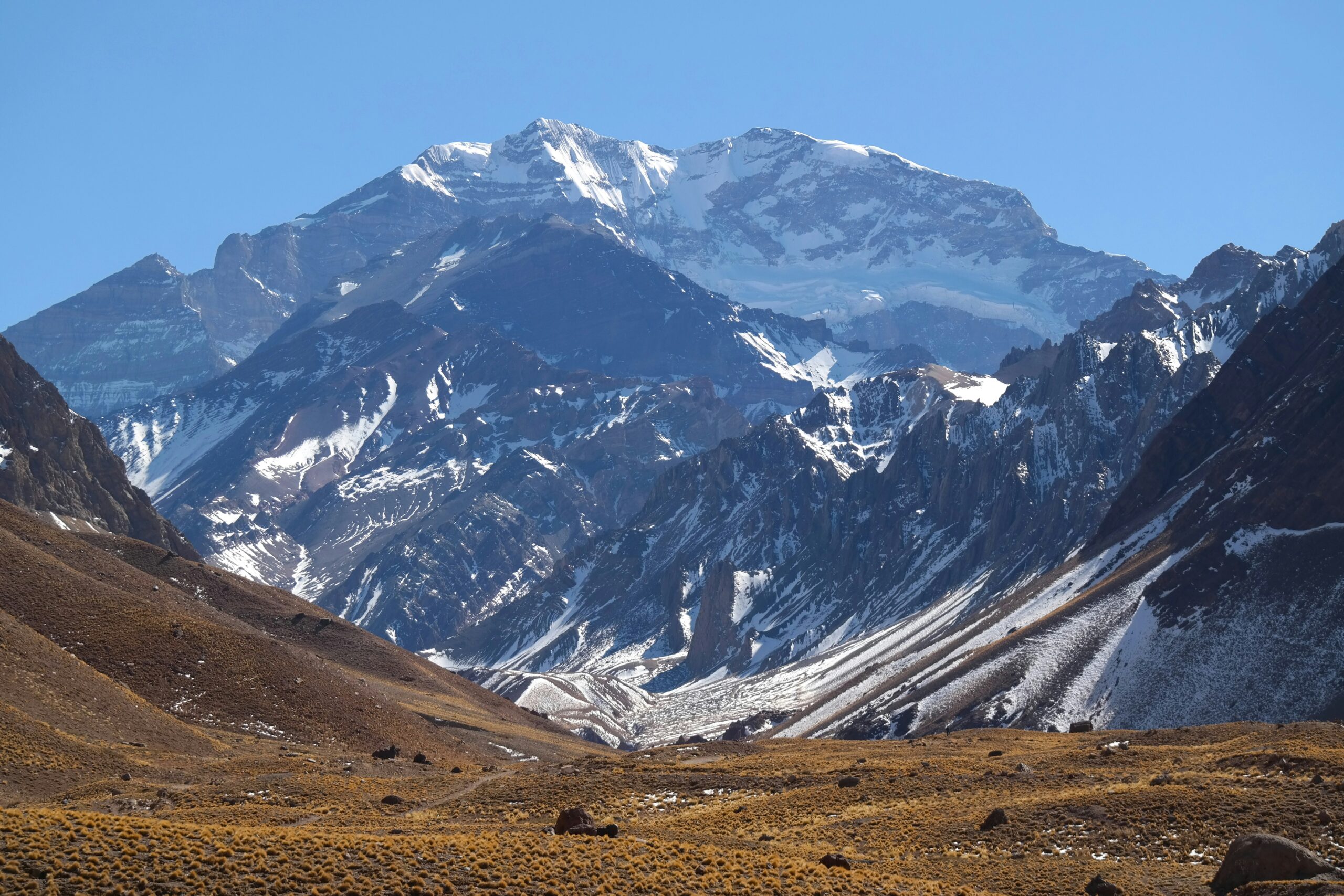

Ojos del Salado

Was this helpful?
🏔Related training
🧭Explore & compare
Global Summit Guide is an independent mountaineering resource founded in 2026. The team combines first-hand trekking and climbing experience with in-depth research and professional health and nutrition review to help climbers choose objectives, prepare properly, and stay safe.
Health, altitude, and nutrition content is reviewed by Taylor Ludlow (Registered Nurse) and Brigg Hoopes (Nutritionist).
What We Don't Know Yet
Mountain information changes quickly. This box explains the limits of what this page can responsibly promise.
- Route conditions, trailhead access, crevasse exposure, stream crossings, and rescue access may vary from published planning guidance.
- Fitness and altitude response vary by person; no guide, itinerary, or training plan can guarantee acclimatization or summit success.
- Comparisons simplify complex decisions; the better mountain depends on current conditions, skills, timing, budget, and risk tolerance.
- Visa, passport, vaccination, border, insurance, and local transportation rules may change before your trip.
Verify current conditions with official land managers, guide services, local forecasts, and current route reports before booking or climbing.
Mountaineering, rock and ice climbing, glacier travel, and high-altitude activity are inherently dangerous and can result in serious injury or death. The information on Global Summit Guide is provided for general informational and educational purposes only and is not a substitute for professional instruction, qualified guiding, proper equipment, or your own judgment and experience.
Route conditions, weather, snowpack, permits, regulations, and hazards change constantly and may differ from what is described here. Details may be incomplete, out of date, or contain errors. Always verify current information with local authorities, certified guides, and official sources before making any decision in the mountains.
Nothing on this site is medical, legal, or financial advice. Our fitness, acclimatization, altitude, and nutrition content is general in nature; consult a qualified physician before beginning any strenuous exercise program or exposing yourself to high altitude.
You are solely responsible for your own safety and decisions. To the fullest extent permitted by law, Global Summit Guide and its team accept no liability for any loss, injury, damage, or expense arising from use of, or reliance on, this information. By using this site you acknowledge these risks and accept these terms.
Some links on this site may be affiliate links. If you buy through them we may earn a small commission at no extra cost to you; this never affects our recommendations.
Global Summit Guide recommendation path
Next Best Mountain to Research
Use these recommendations to continue the right planning path instead of stopping on one page.
Use current permit, weather, route, and operator information before booking or climbing.
Explore Travel Options for Your Destination
Once your mountain, dates and route are taking shape, compare flights, hotels and other travel options that fit the trip.
Affiliate link. We may earn a commission at no additional cost to you.