web analytics

Last updated June 24, 2026

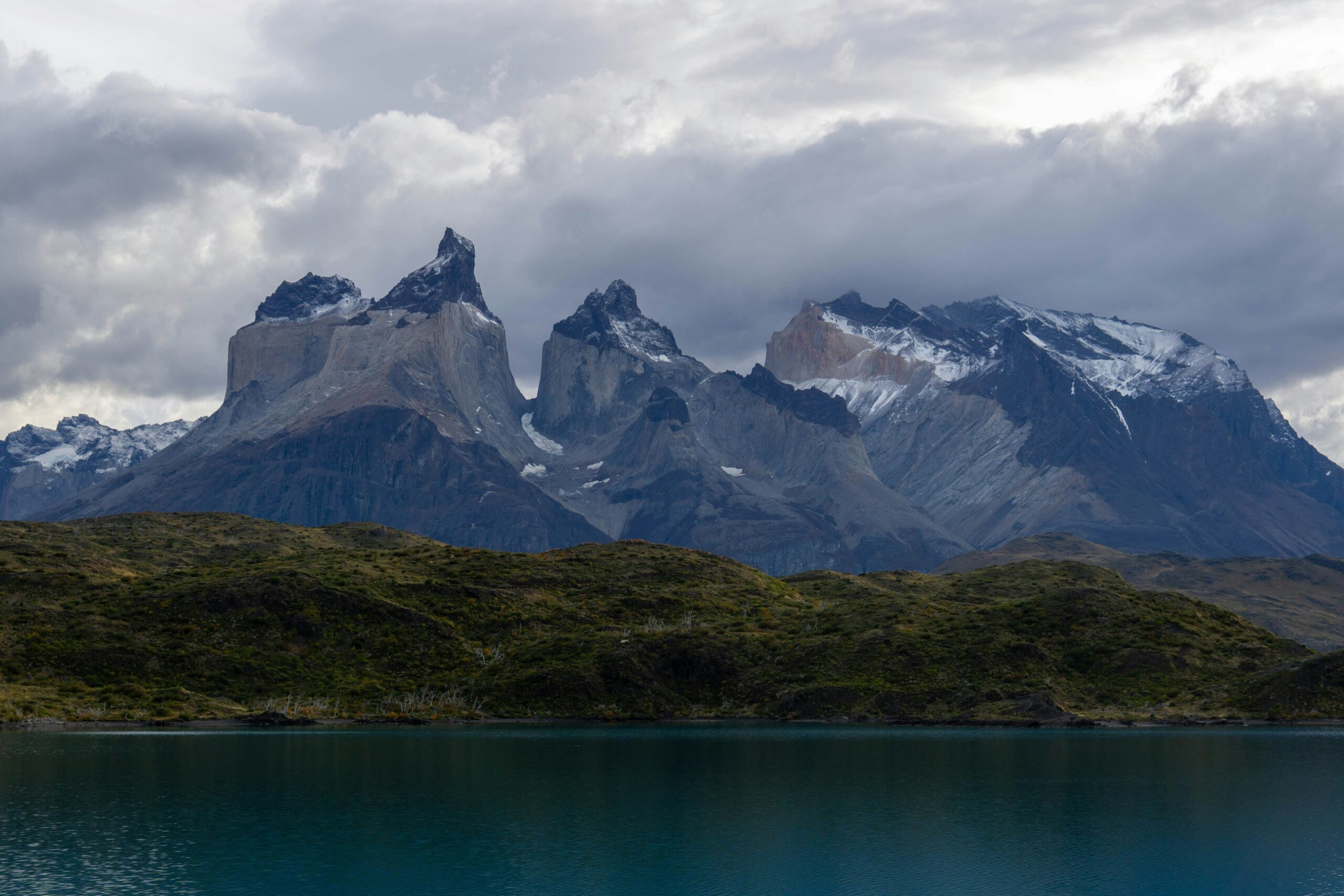
Patagonia Hiking Hub · 4 Regions · 2 Countries · 2026

The Best Hikes in Patagonia

The complete guide to Patagonia hiking — Torres del Paine’s iconic W Trek, the Laguna de los Tres trail to Mount Fitz Roy, the calving face of Perito Moreno Glacier, and the wild peaks of Northern Patagonia. Four regions, two countries, the wildest hiking landscape in South America. Field-tested by the Ludlow team in 2025.

4 Regions
Patagonia Hiking Areas
AR + CL
Argentina + Chile
80 km
W Trek (Torres del Paine)
3,405 m
Mt. Fitz Roy (El Chalten)

📍 Field-Tested by the Ludlow Family in 2025

This guide is built from firsthand experience. The Ludlow family (Travis, Dawson, Walker, and Deeann) traveled to Patagonia together in 2025. Walker and Dawson completed the Laguna de los Tres trail to the lake at the base of Mount Fitz Roy — the iconic Argentine day hike — though we did not attempt the technical summit climb. The trail and viewpoint observations, refugio impressions, weather encounters, and timing recommendations throughout this hub reflect what we actually experienced on the ground.

Where AI-generated and aggregator-style Patagonia guides homogenize on the same surface-level talking points, we’d rather tell you what the wind actually feels like at the moraine lookout above Laguna de los Tres, what the trail conditions are during the final 400-meter scree scramble, and how the Patagonian sky goes from clear blue to driving sleet in twenty minutes. That’s the difference firsthand experience makes — and why this hub exists.

🏔 The Four Patagonia Hiking Regions Framework

Patagonia hiking divides into four primary regions with significantly different character. First, Torres del Paine (Chilean Patagonia) features the iconic W Trek (80 km, 5 days), the longer O Circuit (130 km, 8-9 days), and signature day hikes including Mirador Las Torres and Glacier Grey. Refugio infrastructure with advance bookings required. Second, El Chalten (Argentine Patagonia) is the gateway to Mount Fitz Roy (3,405 m) and Cerro Torre — featuring free trail access to Laguna de los Tres, Laguna Torre, Loma del Pliegue Tumbado, and the technical Huemul Circuit.

📜 Disclosure: This page contains affiliate links to Expedia. If you click through and make a booking, Global Summit Guide may earn a small commission at no additional cost to you. Editorial recommendations are independent of commission rates. See our full affiliate disclosure for details.
✈ ⛰ 🏨
Plan Your Adventure

Find Hotels, Flights & Trips for the World’s Best Hiking Destinations

The Global Summit Guide Travel Shop on Expedia — curated for outdoor adventurers, mountaineers, and serious hikers. Patagonia to the Alps. Nepal to the Rockies. Curated lodging for every region we cover.

Explore Travel Shop on Expedia →
✓ Curated recommendations  ·  ✓ Same price as direct booking  ·  ✓ Supports our editorial

Third, the Perito Moreno Glacier and El Calafate region (Argentine Patagonia) features one of the world’s most spectacular calving glacier faces with boardwalk viewing, Big Ice trek, and Minitrekking experiences. Fourth, Bariloche and the Lake District (Northern Patagonia, both Argentina and Chile) features Mount Tronador, refugio-to-refugio hiking around Bariloche, and volcanic peaks like Villarrica and Lanin — content area coming in future expansion.

Patagonia is the wildest hiking landscape in South America — a region spanning both Argentine and Chilean territory across the southern Andes, featuring iconic granite spires, advancing glaciers, refugio-supported multi-day treks, and weather variability famous worldwide among trekkers. Generally, Patagonia hiking divides into four primary regions across two countries: Chilean Torres del Paine (the multi-day W Trek and O Circuit territory), Argentine El Chalten (the Mount Fitz Roy and Cerro Torre day-hike territory), Argentine Perito Moreno and El Calafate (the calving glacier and Big Ice territory), and Northern Patagonia (the Bariloche, Tronador, and volcanic peak territory). Specifically, no other South American hiking destination combines this range of objectives — from refugio-to-refugio luxury trekking to free-access day hikes beneath some of the world’s most-photographed granite spires. Notably, the Ludlow family completed the iconic Laguna de los Tres trail during their 2025 Patagonia trip — this hub reflects that firsthand experience throughout.

Key Takeaways

  • Patagonia spans Argentina and Chile across the southern Andes — most travelers visit both sides on a single trip.
  • Four primary hiking regions structure the destination — Torres del Paine, El Chalten, Perito Moreno, and Bariloche/Lake District.
  • The W Trek (80 km, 5 days) in Chilean Torres del Paine is Patagonia’s most-iconic multi-day trek — refugios must be booked 4-6 months in advance.
  • The Laguna de los Tres trail in Argentine El Chalten is the iconic day hike to Mount Fitz Roy’s base — 20-25 km round trip, free trail access.
  • Peak season is November-March (Southern Hemisphere summer) with December-February as the highest-crowd months.
  • Patagonia wind is notorious — sustained 60-100 km/h and gusts exceeding 150 km/h occur even in peak season.
  • Argentine and Chilean Patagonia have different access models — Chilean requires refugio bookings, Argentine offers flexible day-hike access.
  • Buffer days are essential — Patagonia weather can shut down trekking for 2-3 days at a time even in peak season.
  • Field-tested by the Ludlow family in 2025 — this hub reflects firsthand trail conditions, refugio impressions, and weather observations.
Hub launching June 2026 · All linked child pages live · Field-tested by the Ludlow family during their 2025 Patagonia trip · Updates each Patagonia season

Why Patagonia Is the Wildest Hiking Landscape in South America

Patagonia occupies a unique place in global hiking destinations — generally combining refugio-supported multi-day trekking infrastructure with free-access iconic day hikes beneath some of the most-photographed granite spires on Earth. Specifically, no other South American hiking destination matches the combination of: Mount Fitz Roy (3,405 m) and Cerro Torre (3,128 m) granite spires accessible from a single village (El Chaltén), the Torres del Paine W Trek’s refugio-to-refugio system supporting multi-day comfort trekking, Perito Moreno Glacier’s actively-advancing calving face accessible from boardwalks, and the wind-driven weather variability that has made Patagonia a byword for “extreme conditions” in trekking circles worldwide.

Notably, Patagonia hiking organizes around two national identities and four regional centers. Specifically, Chilean Patagonia (anchored by Torres del Paine National Park and the Puerto Natales gateway) operates as a structured multi-day trekking destination with park entry fees, refugio reservations 4-6 months in advance, and the W Trek and O Circuit as signature objectives. Argentine Patagonia (anchored by El Chaltén village, El Calafate gateway, and Los Glaciares National Park) operates with significantly more flexible access — free trail entry to most day hikes, no advance refugio bookings required, and trailheads within walking distance of village accommodations. Generally, most international visitors combine both sides in a single trip via the 5-hour Puerto Natales-to-El Calafate bus connection.

🏨

Planning a Trip? Find Lodging on Expedia

Hotels, flights, and vacation packages for the world’s great hiking and mountaineering destinations.

Visit Shop →

How to use this hub: This page serves as the directory and framework explainer for our Patagonia hiking content. Generally, each child page provides detailed trail-by-trail or region-by-region coverage with route descriptions, refugio booking guidance, safety considerations, and seasonal timing. This hub provides regional framework, cross-trail comparison, skill progression guidance, and the four-region organization that helps hikers choose the best Patagonia experience for their trip. Specifically, scroll to the Featured Trails Directory to navigate directly to your trail of interest, or use the Best by Category section to find trails matching specific hiking goals.

The Four Patagonia Hiking Regions

Patagonia hiking divides into four geographic regions with significantly different character, infrastructure, and signature objectives. Generally, hikers should understand the regional framework before choosing specific trail objectives — regional character affects every trip beyond just terrain.

Region 1

Torres del Paine (Chilean Patagonia)

The W Trek and O Circuit country · Refugio-supported multi-day trekking · Iconic granite towers · Puerto Natales gateway

Torres del Paine National Park in Chilean Patagonia is the multi-day trekking heart of Patagonia. Generally, the park’s signature objective is the W Trek — an 80 km, 5-day refugio-to-refugio trek through three primary valleys (Las Torres, French Valley, Glacier Grey) named for the shape the route traces on a map. Specifically, the longer O Circuit (130 km, 8-9 days) extends the W with a remote backside loop including the John Garner Pass. Day hikers without time for multi-day commitments can still experience the park’s iconic Mirador Las Torres viewpoint as an 18 km day hike from the Las Torres Hotel area.

Notably, Torres del Paine’s defining logistical feature is the refugio reservation system. Vertice Patagonia (operating Refugios Grey, Paine Grande, and Dickson) and Las Torres Patagonia (operating Refugios Chileno, Frances, Cuernos, Norte, and Central) handle separate booking systems and typically fill 4-6 months in advance for December-February peak season. Specifically, the W Trek cannot be done legally without confirmed accommodation each night — either refugio booking or camping reservation. Generally, this advance booking requirement is the single most-common Patagonia trip planning failure for first-time visitors who attempt to book within 2-3 months of travel.

Critical Torres del Paine timing: Book refugios as soon as you have confirmed travel dates — ideally 4-6 months ahead for peak season (December-February) or 2-3 months ahead for shoulder months (October, November, March, April). Generally, the most popular refugios (Chileno for sunrise Las Torres access, Paine Grande for catamaran connection) sell out first. Specifically, Vertice Patagonia and Las Torres Patagonia maintain separate websites and accounts — you’ll likely need bookings from both operators on a standard W Trek.

Featured Torres del Paine pages:

Region 2

El Chalten (Argentine Patagonia)

Mount Fitz Roy and Cerro Torre country · Free trail access · Day hikes from village · The granite spire heartland

El Chaltén in Argentine Patagonia is the granite spire heartland — and the destination where the Ludlow family did most of their on-the-ground hiking in 2025. Generally, El Chaltén operates as a small village (population approximately 3,000) at the trailhead of Los Glaciares National Park’s northern section, with most signature day hikes departing directly from the village edge. Specifically, the iconic Laguna de los Tres trail to the base of Mount Fitz Roy (3,405 m) departs from El Chaltén’s northern outskirts — a 20-25 km round trip, 8-10 hour day hike with the famous brutal 400-meter scree scramble during the final kilometer.

The lookout viewpoint at the base of Laguna de los Tres glacial lake in El Chalten Argentine Patagonia showing the iconic turquoise water of the lake fed by the glacier descending from Mount Fitz Roy with the surrounding moraine ridge providing the famous viewpoint that defines El Chalten as Argentina's signature hiking destination at the end of the 20 to 25 kilometer round trip day hike from El Chalten village through lenga forest gradually ascending past Laguna Capri and Mirador Fitz Roy viewpoints before the brutal final 400 meter scree scramble that delivers hikers to this lookout position above the glacial lagoon with views of Fitz Roy's 3405 meter granite spire and the surrounding Cerro Poincenot and other peaks of the Fitz Roy massif this being the iconic Patagonia image that appears in countless travel photos and the destination that the Ludlow family experienced firsthand during their 2025 Patagonia trip
The lookout at the base of Laguna de los Tres — what most hikers come to El Chaltén to see. Generally, the trail’s final viewpoint sits above the glacial lagoon at the base of Mount Fitz Roy’s eastern face. Specifically, the lake itself is fed by glaciers descending from the Fitz Roy massif, and the moraine ridge above the lake provides the most-photographed Patagonia viewpoint. The Ludlow family hiked to this lookout during their 2025 trip — the brutal final 400-meter scree scramble is no joke, but the view from the moraine ridge is what hikers come to El Chaltén for. Notably, this is the standard hiking objective — the technical climb to the Fitz Roy summit itself requires significant alpine experience and was not part of our family hike.

The El Chaltén day-hike network extends beyond Laguna de los Tres. Generally, the second most-popular trail is Laguna Torre — a 22 km round trip to a glacial lake at the base of Cerro Torre (3,128 m), the needle-like granite spire neighboring Fitz Roy. Specifically, additional El Chaltén day hikes include Loma del Pliegue Tumbado (a long day hike combining views of both Fitz Roy and Cerro Torre from a single viewpoint), Piedra del Fraile, and the technical Huemul Circuit (a 4-day trek with tyrolean traverses and views of the Southern Patagonian Ice Field — for advanced trekkers only).

Notably, El Chaltén’s access model differs significantly from Torres del Paine. Generally, trails have free access with no permit requirements, no refugio booking systems, and no significant advance planning required beyond accommodation in El Chaltén village itself. Specifically, this makes El Chaltén ideal for travelers who want hiking flexibility — you can decide each morning which trail to attempt based on weather, fitness, and motivation. The trade-off is that El Chaltén weather is even more variable than Torres del Paine due to its position closer to the Southern Patagonian Ice Field.

Featured El Chaltén pages:

Region 3

Perito Moreno Glacier & El Calafate (Argentine Patagonia)

The glacier country · Boardwalk viewing + Big Ice trek · El Calafate gateway · Argentine ice field access

The Perito Moreno Glacier near El Calafate is one of Earth’s most-spectacular glacier viewing destinations — and one of very few major glaciers globally that is actively advancing rather than retreating. Generally, the glacier face is approximately 5 km wide and 60 m tall, providing constant calving activity as ice tumbles into Lago Argentino. Specifically, the standard visitor experience combines boardwalk viewing platforms (extensive walkway network providing varied perspectives on the glacier face) with optional ice-walking experiences — Minitrekking (1.5-2 hour introductory glacier hike, suitable for most fitness levels) and Big Ice (5-7 hour advanced glacier traverse with deeper exploration of crevasses, blue ice features, and the glacier interior).

Notably, the Perito Moreno experience is fundamentally different from Torres del Paine and El Chaltén — it is more glacier-spectator and less trekking-intensive. Generally, most visitors spend 1-2 days based in El Calafate (a small city with full hotel, restaurant, and tourist infrastructure 80 km from the glacier) and visit the glacier as a half-day or full-day excursion. Specifically, the boardwalk visit requires no fitness level beyond walking, while Big Ice trek requires crampons and basic glacier-walking competence (provided by operator guides). Notably, El Calafate also serves as the primary fly-in gateway for southern Patagonia visits — the El Calafate airport (FTE) receives multiple daily flights from Buenos Aires and is the typical entry point for most Argentine Patagonia trips.

Featured Perito Moreno page:

  • Perito Moreno Glacier Complete Guide — Full glacier viewing guide covering boardwalks, Big Ice, Minitrekking, El Calafate gateway logistics, and bus connections to/from El Chaltén and Puerto Natales.
Region 4

Bariloche & the Lake District (Northern Patagonia)

Volcanic peaks · Refugio circuits · Argentine and Chilean sides · Expansion territory for this hub

Northern Patagonia (Bariloche on the Argentine side, Pucón on the Chilean side) represents the destination’s quieter character — volcanic peaks, refugio-to-refugio circuits, and significantly less-crowded alternatives to the southern Patagonia hot spots. Generally, this region remains the future expansion territory for our Patagonia content — dedicated trail and peak guides are in development. Specifically, the Bariloche area features Mount Tronador (a glaciated peak straddling the Argentine-Chilean border), Cerro Catedral (popular sport climbing destination with refugio access), Refugio Frey (a classic Bariloche refugio-to-refugio hike), and access to the Argentine Lake District. The Chilean side features Pucón as gateway to Volcán Villarrica (active stratovolcano with guided ice climb to the smoking crater rim) and Volcán Lanín on the Argentine border.

Notably, Northern Patagonia provides a fundamentally different hiking experience from southern Patagonia. Generally, the landscape is more forested, the weather slightly less aggressive, the crowds significantly smaller, and the cultural infrastructure (Bariloche is a substantial city with chocolate shops, breweries, and ski resort character) more developed than Puerto Natales or El Chaltén. Specifically, Northern Patagonia is increasingly attractive to repeat Patagonia visitors who have already completed Torres del Paine and El Chaltén on prior trips. Generally, this region is also gateway to the Carretera Austral road trip — the legendary Route 7 connecting Northern Patagonia to the wild Aysén region — and to Cerro Castillo Trek (a 4-5 day trek increasingly called “the new W Trek” for its dramatic scenery without TDP’s crowds).

Dedicated Northern Patagonia content (Mount Tronador, Volcán Villarrica, Cerro Castillo Trek, Carretera Austral road trip, Bariloche hiking guide) is planned for the next expansion phase of this hub — check back as these pages come online.

Featured Patagonia Trail Directory

The signature hiking objectives across all four Patagonia regions. Generally, each card links to a detailed trail or region guide where available. Specifically, the trails below represent the highest-leverage starting points for a Patagonia hiking trip — first-time visitors typically focus on 2-4 of these objectives within a single trip.

W Trek (Torres del Paine)

5 Days
80 kmDistance
~2,500 mTotal Gain
ChileanRegion

The iconic 5-day Patagonia trek. Three valleys (Las Torres, French Valley, Glacier Grey). Refugio-to-refugio comfort. Required advance booking 4-6 months ahead. The W Trek is the most-popular multi-day trek in Patagonia and most-iconic single hiking experience.

W Trek Complete Guide →

Laguna de los Tres / Fitz Roy

Day Hike
20-25 kmRound Trip
800-1,200 mGain
ArgentineRegion

The Mount Fitz Roy day hike. Free trail access from El Chaltén. 8-10 hours including time at the lake. Brutal final 400 m scree scramble. Reward: one of South America’s most spectacular viewpoints. Walker and Dawson Ludlow completed this trail during the family’s 2025 trip.

Fitz Roy Hike Guide →

Torres del Paine National Park

Region
3+ trailsMulti-Day + Day
RefugiosRequired Bookings
ChileanRegion

Full Torres del Paine region guide. Covers W Trek, O Circuit (full 130 km, 8-9 days), Mirador Las Torres day hike, Glacier Grey hike, Puerto Natales gateway logistics, refugio booking systems, and park entry. The Chilean Patagonia gateway resource.

TDP National Park Guide →

El Chaltén Hiking Guide

Region
5+ trailsDay Hikes
FreeTrail Access
ArgentineRegion

Full El Chaltén village and trail network guide. Covers Laguna de los Tres, Laguna Torre, Loma del Pliegue Tumbado, Piedra del Fraile, Huemul Circuit (technical), and village logistics. Free trail access throughout. Trailheads walking distance from village accommodation.

El Chaltén Guide →

Perito Moreno Glacier

Half/Full Day
5 km wideGlacier Face
60 m tallCalving Wall
ArgentineRegion

Boardwalk viewing + Big Ice trek + Minitrekking. The Argentine glacier country anchor. Active calving face. El Calafate gateway. Big Ice (5-7 hour crevasse traverse) and Minitrekking (1.5-2 hour intro ice walk) options for hikers wanting to walk on the ice.

Perito Moreno Guide →

Best Time to Visit Patagonia

Planning
Nov-MarPeak Season
Oct + AprShoulder
BothRegions

The single most-important Patagonia planning decision. Seasonal calendar across all four regions, monthly weather expectations, wind patterns, crowd levels, and refugio availability. Includes shoulder-month strategy for fewer crowds and acceptable weather.

Best Time Guide →

Patagonia Packing List

Gear
WindCritical Layer
RainSealed Seams
SunUV Protection

Complete packing list for Patagonia’s notorious weather variability. Layering strategy, waterproof shell requirements, boot selection for refugio-to-refugio days, day pack essentials. Cross-references our existing mountaineering boots, crampons, and layering gear guides.

Packing List →

Patagonia Icons (Granite Climbing)

Technical
5.10+Technical Rating
Fitz RoyCerro Torre
ArgentineRegion

Existing technical climbing reference. For advanced alpinists pursuing Mount Fitz Roy and Cerro Torre granite tower climbs. Covers Supercanaleta route, Compressor Route, geological context, weather windows, and technical climbing logistics. Most hikers should reference the Fitz Roy day hike instead.

Patagonia Icons →

Patagonia Trail Comparison Table

Quick-reference comparison of major Patagonia hiking objectives. Generally, the table organizes options by trip length — day hikes first, multi-day treks last. Specifically, use this for planning your Patagonia trip — whether a single signature objective or a comprehensive multi-region experience.

Trail / TrekRegionDurationDistanceDifficultyBooking RequiredGuide
Mirador Las TorresChilean (TDP)Day hike18 kmStrenuousPark entry onlyTDP Guide
Laguna de los Tres (Fitz Roy)Argentine (El Chaltén)Day hike20-25 kmStrenuousNone — free accessFitz Roy Hike
Laguna Torre (Cerro Torre)Argentine (El Chaltén)Day hike22 kmModerateNone — free accessEl Chaltén Guide
Loma del Pliegue TumbadoArgentine (El Chaltén)Day hike21 kmStrenuousNone — free accessEl Chaltén Guide
Perito Moreno BoardwalksArgentine (El Calafate)Half day~3 km walksEasyPark entryPerito Moreno
Big Ice Trek (Perito Moreno)Argentine (El Calafate)Full day~10 kmModerateOperator bookingPerito Moreno
W TrekChilean (TDP)5 days80 kmStrenuousRefugios 4-6 mo aheadW Trek Guide
O CircuitChilean (TDP)8-9 days130 kmExpertRefugios 4-6 mo aheadTDP Guide
Huemul Circuit (Technical)Argentine (El Chaltén)4 days~70 kmExpertNone (technical gear)El Chaltén Guide
Mount Fitz Roy Technical ClimbArgentine (El Chaltén)Multi-dayAlpineAlpine 5.10+None (alpine gear)Patagonia Icons

Best Patagonia Hikes By Category

Different hikers focus on different goals. Generally, no single Patagonia trail is the best for all purposes — match objectives to your trip style and skill level. Specifically, our category-specific recommendations help narrow your trip planning.

🏔 Best for Iconic Granite Views

Laguna de los Tres for Mount Fitz Roy. Laguna Torre for Cerro Torre. Loma del Pliegue Tumbado for both spires from a single viewpoint. All free-access El Chaltén day hikes.

El Chaltén Guide →

🥾 Best for Multi-Day Trekking

W Trek (5 days, refugio-supported) for first multi-day Patagonia experience. O Circuit (8-9 days) for the full Torres del Paine immersion. Huemul Circuit (4 days, technical) for advanced trekkers.

TDP Guide →

🌊 Best for Glaciers

Perito Moreno Glacier (Argentine El Calafate) for the world’s most accessible major glacier. Glacier Grey (within TDP W Trek) for trek-integrated glacier viewing. Big Ice trek for crevasse exploration.

Perito Moreno Guide →

📅 Best for Day Hike Flexibility

El Chaltén (Argentine Patagonia) for unmatched day-hike network with free trail access and trailheads walking distance from village accommodation. Decide each morning based on weather and motivation.

El Chaltén Guide →

🧗 Best for Technical Mountaineering

Mount Fitz Roy and Cerro Torre technical climbing routes. Huemul Circuit trekking with tyrolean traverses. Patagonia Icons climbing collection covers granite tower routes for advanced alpinists.

Patagonia Icons →

📷 Best for Photography

Sunrise Mirador Las Torres (early start from Refugio Chileno). Sunrise Laguna de los Tres (overnight camping at Poincenot or early start from El Chaltén). The famous Patagonia alpenglow.

Best Time Guide →

🌬 Best for Lowest Crowds

Shoulder months (October, November, March) across all regions. Northern Patagonia (Bariloche, future expansion) year-round. El Chaltén Loma del Pliegue Tumbado versus the more-popular Laguna de los Tres.

Best Time Guide →

Patagonia Hiking Skill Progression

Patagonia hiking accommodates a wide skill range — from boardwalk glacier viewing to technical alpine climbing. Generally, hikers should honestly assess their experience and match objectives accordingly. Specifically, our three-tier framework provides progression structure.

Tier 1: Day Hike Beginners

Generally appropriate for hikers without significant multi-day backpacking experience or technical scrambling background. Specifically, recommended Patagonia introductions: Perito Moreno Glacier boardwalk visits (the easiest Patagonia experience), Mirador Las Torres day hike (Torres del Paine’s accessible signature view), Laguna Torre day hike (El Chaltén’s moderate Cerro Torre view trail), and Glacier Grey day hike via catamaran from TDP. Notably, our Beginner Climbing Guide provides foundation-level skill framework relevant to Patagonia day hikers.

Tier 2: Multi-Day Trekkers

Generally appropriate for hikers with backpacking experience, fitness for 15-20 km hiking days, and comfort with weather variability. Specifically, recommended Patagonia progressions: W Trek (refugio-supported 5 days), O Circuit (full 8-9 day TDP circuit for hikers who’ve completed W Trek), Laguna de los Tres day hike with overnight at Poincenot campsite for sunrise (introduces multi-day camping in El Chaltén context). Notably, our Intermediate Climbing Guide provides skill-development relevant to multi-day Patagonia trekkers.

Tier 3: Technical Trekkers and Alpinists

Generally appropriate for experienced trekkers with technical scrambling, glacier travel, and alpine climbing skills. Specifically, recommended Patagonia objectives: Huemul Circuit (4-day technical trek with tyrolean traverses), Mount Fitz Roy technical climbing routes (multiple alpine grades requiring significant experience), Cerro Torre technical climbing (advanced alpine), and winter Patagonia trekking (specialized winter mountaineering). Notably, our Expert Mountaineering Guide covers advanced skill framework, and the Patagonia Icons climbing collection covers granite tower technical routes.

Patagonia Hiking Seasonal Calendar

Patagonia hiking season runs Southern Hemisphere summer (November-March) with shoulder months (October, April) increasingly attractive for lower crowds. Generally, hikers must plan around region-specific timing windows.

Oct-Nov · Shoulder Start

Fewer crowds, more variability. Some refugios still closed early Oct. Late Nov starts peak season. Wind significant. Wildflowers visible.

Dec-Feb · Peak Season

Best weather odds, highest crowds. Refugios fill 4-6 mo ahead. 16-18 hour daylight. Wind still strong but warmer (12-18°C). Most popular months.

Mar-Apr · Autumn Shoulder

Tapering crowds, fall colors. Lenga forest turns red/orange. Daylight shortening. Refugios still open through April. Excellent option for quieter trip.

May-Sep · Winter

Largely closed for trekking. Refugios closed. Specialized winter trekking only. El Chaltén quieter. Northern Patagonia (Bariloche) has winter sports.

The Patagonia wind reality: Patagonia is famous for wind, and the wind is real. Generally, sustained 60-100 km/h winds are common during peak season, with gusts occasionally exceeding 150 km/h. Specifically, the wind affects hiking decisions throughout the day — start times need to allow for slower pace into headwinds, ridge sections can become genuinely dangerous in extreme gusts, and exposed viewpoints (the Laguna de los Tres moraine, Mirador Las Torres summit) can be miserable or unhikable on bad-wind days. Notably, our Patagonia Packing List covers the wind-resistant clothing strategy that makes the difference between an enjoyable trip and a miserable one. The Ludlow family encountered multiple windy days during their 2025 trip — Patagonia wind is not metaphorical, it’s a physical force you adapt to.

The 8 Common Mistakes First-Time Patagonia Hikers Make

Avoid These Common Patagonia Planning Mistakes

  1. Booking Torres del Paine refugios too late. Generally the most-consequential Patagonia planning mistake. Refugios fill 4-6 months ahead for peak season. Without refugio bookings, the W Trek and O Circuit cannot be done legally. Book as soon as travel dates confirm.
  2. Confusing the Laguna de los Tres trail with technical Fitz Roy climbing. The trail is a day hike (strenuous but accessible to fit hikers). The technical climb requires significant alpine experience. The Ludlow family did the trail but did NOT attempt the technical summit. Many first-time visitors don’t understand the distinction.
  3. Underestimating Patagonia wind. Sustained 60-100 km/h winds are normal. Gusts can exceed 150 km/h. Ponchos blow inside out. Lightweight tents collapse. Wind-resistant gear is mandatory, not optional. The “we can handle some wind” assumption is the single most-common first-trip miscalculation.
  4. Tight itineraries without buffer days. Patagonia weather can shut down hiking for 2-3 days at a time even in peak season. Itineraries without buffer days lose entire activities (W Trek catamaran cancellation, Laguna de los Tres washouts) without recovery time.
  5. Skipping one Patagonia side to “save time”. The 5-hour Puerto Natales-to-El Calafate bus connection is straightforward. Skipping the Argentine side (El Chaltén + Fitz Roy + Perito Moreno) to “just do” Torres del Paine cuts the best Patagonia experiences in half. Most travelers regret not adding 4-5 days for the Argentine side.
  6. Wrong direction on the W Trek. East-to-west (starting Mirador Las Torres, ending Glacier Grey) versus west-to-east (starting Grey, ending Las Torres) is a real decision. Both work. Generally, east-to-west has the more-strenuous days early; west-to-east finishes with the iconic Las Torres sunrise view. Research the direction tradeoff before booking refugios.
  7. Inadequate boots and rain gear. Patagonia is rain-and-wind weather constantly. Hiking sneakers, non-waterproof boots, and casual rain jackets fail by Day 2. Mid-cut waterproof hiking boots (broken in before trip) and sealed-seam shell jackets are mandatory.
  8. Booking flights to/from El Calafate or Punta Arenas without buffer. Patagonia transit can fail — buses cancel, weather grounds flights, ferries get delayed. Build in a buffer day before international departure flights. Generally, returning to the major hub city (Buenos Aires, Santiago) the day before international departure rather than same-day is the safer strategy.
Walker Ludlow and Dawson Ludlow on the Mount Fitz Roy trail to Laguna de los Tres in El Chalten Argentine Patagonia during the Ludlow family's 2025 trip hiking the iconic 20 to 25 kilometer round trip day hike through lenga forest gradually ascending past Laguna Capri and Mirador Fitz Roy viewpoints toward the brutal final 400 meter scree scramble that delivers hikers to the lookout above the glacial lagoon at the base of Mount Fitz Roy's eastern granite face this being the standard hiking objective with the family not attempting the technical summit climb of Fitz Roy itself which requires significant alpine experience and equipment beyond what most family hikers would carry photographed during the Ludlow family's Patagonia trip
Walker and Dawson Ludlow on the Mount Fitz Roy trail to Laguna de los Tres during the family’s 2025 trip. Generally, this is the standard Patagonia day-hiking experience — fit family members on a strenuous but accessible trail to one of Earth’s most-photographed viewpoints. Specifically, the trail to the lake (Laguna de los Tres) is what most travelers think of when they say “we hiked Fitz Roy” — the technical summit climb of Fitz Roy itself requires significant alpine experience and was not part of our family hike. Notably, this distinction (trail to lake versus technical summit) is one of the most-common first-trip misconceptions about Patagonia hiking — and one we want to clarify clearly throughout our content.

What This Hub Doesn’t Cover Yet

Honest limitations of any Patagonia hiking hub

Northern Patagonia content is in expansion mode. Generally, this hub launches with comprehensive Tier 1 coverage (Torres del Paine, El Chaltén, Perito Moreno) plus a regional framework for Bariloche and the Lake District. Specifically, dedicated trail and peak guides for Mount Tronador, Volcán Villarrica, Volcán Lanín, Cerro Castillo Trek, Cerro Catedral, and the Carretera Austral road trip are planned for future hub expansion. Notably, Northern Patagonia content will follow the same firsthand-experience editorial standard as the Tier 1 pages.

Itinerary pages are coming. Dedicated 7-day, 10-day, and 14-day Patagonia itinerary pages with day-by-day planning are scheduled for the next content phase. Specifically, the 10-day itinerary (the sweet spot duration combining Torres del Paine W Trek with El Chaltén highlights) is the highest priority.

Comparison and decision-framework pages are in development. Generally, comparison pages like W Trek vs O Trek vs Huemul Circuit, Argentine vs Chilean Patagonia, and Self-Guided vs Guided Patagonia trekking are valuable decision aids. Specifically, these will publish over the coming weeks alongside the regional trail expansion.

Individual peak guides are limited. Generally, this hub covers regions and trails rather than peak-by-peak technical content. Specifically, our existing Patagonia Icons collection covers Mount Fitz Roy and Cerro Torre technical climbing routes, but other Patagonia peaks (Cerro Torre’s neighbors, Mount Tronador, the Cordon Olguin range) are not yet covered with peak-level depth.

Permit and fee information evolves. Park entrance fees, refugio booking systems, and operator regulations may change. Verify current information directly with park authorities and refugio operators within 2-4 weeks of your planned trip.

Patagonia Hiking FAQ

What is the best time of year to hike in Patagonia?

Patagonia hiking season runs November through March (Southern Hemisphere summer) with December-February as peak season and October-April as shoulder months. Peak season provides the longest daylight (16-18 hours at summer solstice), warmest temperatures (12-18°C daytime), and most reliable refugio access. NOVEMBER offers excellent conditions with manageable crowds and most refugios open. DECEMBER-FEBRUARY is peak season — best weather odds but highest crowds and earliest refugio booking requirements. MARCH provides good conditions with crowds tapering off. OCTOBER and APRIL are shoulder months with fewer crowds, more weather variability, and limited refugio availability. Patagonia’s notorious wind is a year-round phenomenon — sustained 60-100 km/h winds are common even in peak season, with gusts occasionally exceeding 150 km/h. The wind is generally strongest in summer months despite the warmer temperatures.

Do I need a guide for the W Trek?

No — the W Trek can be done self-guided by reasonably fit hikers with basic backcountry experience. The trail is clearly marked, refugio infrastructure provides accommodation and meals, and the route has no technical sections requiring guide expertise. Self-guided W Trekkers must book their own refugio reservations (Vertice Patagonia and Las Torres Patagonia booking systems), arrange park entry transport from Puerto Natales, navigate the catamaran connections across Lake Pehoe, and carry their own daily gear. Fully guided W Treks through operators like EcoCamp Patagonia or Cascada Expediciones provide porters, guides, meals, and group logistics at significantly higher cost (typically $2,500-5,000+ per person). The middle option is partial guiding — group bookings through travel agencies that handle refugio reservations and transport without on-trail guides. The W Trek is significantly more developed and supported than the more-remote O Circuit, where some climbers benefit from guide support.

How many days should I spend in Patagonia?

Minimum effective Patagonia trips run 7-10 days; 14-day trips allow comprehensive coverage of both Chilean and Argentine sides. Longer trips reduce weather-window risk significantly. 7-DAY TRIP forces single-region focus — either Torres del Paine W Trek (5 days trekking plus 2 days transit) OR El Chalten day hikes plus Perito Moreno (3-4 days each). 10-DAY TRIP allows W Trek + 2-3 day El Chalten extension covering Laguna de los Tres trail. 14-DAY TRIP allows W Trek + comprehensive El Chalten (Laguna de los Tres + Laguna Torre + rest day) + Perito Moreno + buffer days for weather. 21+ DAY TRIPS allow incorporation of Northern Patagonia (Bariloche), Carretera Austral road trip, or Tierra del Fuego. Buffer days are essential — Patagonia weather can shut down hiking for 2-3 days at a time, and tight itineraries lose entire activities to weather without buffer.

Argentine or Chilean Patagonia — which is better?

Most travelers visit both — they offer fundamentally different experiences and combining them within a single trip is straightforward via the 5-hour Puerto Natales-to-El Calafate bus route. Choosing between them depends on hiking style preference. CHILEAN PATAGONIA (Torres del Paine) features the multi-day W Trek and O Circuit refugio-to-refugio system with significant advance planning (refugio bookings 4-6 months ahead), park entry fees, organized infrastructure, and dramatic granite tower scenery. Best for hikers who want a structured multi-day trekking experience. ARGENTINE PATAGONIA (El Chalten + Perito Moreno) features free day-hike trails accessible from village base, no permit requirements, more flexible day-by-day planning, and the iconic Mount Fitz Roy and Cerro Torre granite spires. Best for hikers who want flexibility and lower planning friction. The Chilean side has a more-developed multi-day hiking infrastructure while the Argentine side has stronger single-day hiking with village amenities.

How hard is the Laguna de los Tres hike to Fitz Roy?

The Laguna de los Tres hike is strenuous but accessible to fit hikers — generally 20-25 km round trip with 800-1,200 m elevation gain over 8-10 hours total. The hike breaks into three sections of different character: the first 7-9 km gain gradually through lenga forest from El Chalten village (gentle, well-marked, family-friendly); the middle section continues climbing past Laguna Capri and Mirador Fitz Roy viewpoints (moderate, increasingly exposed to wind); the final 1 km gains 400 m on loose moraine rock requiring hands-on scrambling at points (brutal, the crux of the hike). The reward is one of South America’s most spectacular viewpoints — the glacial Laguna de los Tres directly beneath Fitz Roy’s eastern granite face. The trail is free with no permits required, accessible directly from El Chalten village (no shuttle needed), and the steep final section is where most hikers struggle — pace yourself for the moraine scramble. Walker and Dawson Ludlow completed the trail to the lake during the family’s 2025 Patagonia trip — the trail to Laguna de los Tres should not be confused with technical climbing on Fitz Roy itself, which requires significant alpine experience.

Do I need permits for Patagonia hiking?

Permit requirements vary significantly by region. Chilean Torres del Paine requires park entry fees and refugio reservations while Argentine El Chalten and most other regions have free trail access. TORRES DEL PAINE NATIONAL PARK (Chile) requires park entrance fee (currently around $35 USD high season, paid at park entrance), and refugio reservations are required for any overnight stays — Vertice Patagonia and Las Torres Patagonia operate the two refugio systems. EL CHALTEN / LOS GLACIARES NATIONAL PARK NORTHERN SECTION (Argentina) has free trail access to Laguna de los Tres, Laguna Torre, and most day hikes. No permits required. Camping at Poincenot and De Agostini campsites does require reservations as of recent regulation changes. PERITO MORENO GLACIER (Argentina) requires park entry fee for Los Glaciares National Park southern section (currently around $35 USD), plus separate tour operator fees for Big Ice or Minitrekking. NORTHERN PATAGONIA / BARILOCHE typically free trail access with refugio bookings recommended for popular routes. Permit and fee structures change periodically — verify current rates and booking systems within 2-4 weeks of your planned trip.

Sources and Methodology

Sources

This Patagonia hiking hub synthesizes data from official park authorities, refugio operators, peer-reviewed adventure travel research, and the Ludlow family’s firsthand 2025 trip experience.

  1. CONAF (Corporación Nacional Forestal de Chile). Official authority for Torres del Paine National Park entry, regulations, and seasonal access.
  2. APN (Administración de Parques Nacionales, Argentina). Official authority for Los Glaciares National Park (El Chaltén and Perito Moreno sections) and Nahuel Huapi National Park (Bariloche).
  3. Vertice Patagonia. Refugio operator for Grey, Paine Grande, and Dickson within Torres del Paine. Booking systems and capacity information.
  4. Las Torres Patagonia. Refugio operator for Chileno, Frances, Cuernos, Norte, and Central within Torres del Paine. Booking systems and capacity information.
  5. Ludlow family firsthand experience. The Ludlow family (Travis, Dawson, Walker, and Deeann) visited Patagonia in 2025. Trail observations, weather encounters, refugio impressions, and timing recommendations throughout this hub reflect on-the-ground experience.
  6. USGS and Argentine IGN topographic data. Elevation and trail mapping for all featured trails. Cross-referenced with current trail conditions.
  7. Adventure travel community reports. Cross-referenced with current condition reports from Stingy Nomads, Two for the World, Patagonia Hub, and other established Patagonia hiking sources for verification.
  8. Internal Global Summit Guide research. Cross-referenced with our existing Patagonia Icons climbing collection and forthcoming trail-by-trail child guides.

Methodology note. Quarterly review cycle — next review post-2026 austral summer (April 2026). Refugio booking systems, park entry fees, and operator regulations change seasonally; verify current information directly with operators within 2-4 weeks of your planned trip. The Ludlow family’s 2025 firsthand observations are the editorial anchor of this hub.

What’s Next?

The Patagonia Hiking Hub — Built From Real Experience

Generally, Patagonia is the wildest hiking landscape in South America — combining refugio-supported multi-day treks (Chilean side) with free-access iconic day hikes (Argentine side). Specifically, the Ludlow family (Travis, Dawson, Walker, and Deeann) field-tested this guide on the ground during their 2025 Patagonia trip — Walker and Dawson completed the Laguna de los Tres trail to the base of Mount Fitz Roy. Notably, this hub serves as the architectural keystone for our ongoing Patagonia content expansion — comprehensive Northern Patagonia, itinerary, and comparison pages are in development.

Browse Featured Trails Find by Category →

Was this helpful?

Yes
No
Thanks for your feedback!
About Global Summit Guide

Global Summit Guide is an independent mountaineering resource founded in 2026. The team combines first-hand trekking and climbing experience with in-depth research and professional health and nutrition review to help climbers choose objectives, prepare properly, and stay safe.

Travis LudlowFounder & Head of Research · Master's in Business
Dawson LudlowClimbing & Mountaineering Lead
Walker LudlowClimber & Contributor

Health, altitude, and nutrition content is reviewed by Taylor Ludlow (Registered Nurse) and Brigg Hoopes (Nutritionist).

What We Don't Know Yet

Mountain information changes quickly. This box explains the limits of what this page can responsibly promise.

  • Permit availability, reservation windows, quotas, and official fee rules may change after this page is updated.
  • Weather, snowpack, avalanche risk, road access, and route conditions can change quickly and may be different on your climbing dates.
  • Total trip cost can change with flights, lodging, guide pricing, permits, gear rentals, transportation, and exchange rates.
Confidence: Medium

Verify current conditions with official land managers, guide services, local forecasts, and current route reports before booking or climbing.

Safety, medical & liability disclaimer

Mountaineering, rock and ice climbing, glacier travel, and high-altitude activity are inherently dangerous and can result in serious injury or death. The information on Global Summit Guide is provided for general informational and educational purposes only and is not a substitute for professional instruction, qualified guiding, proper equipment, or your own judgment and experience.

Route conditions, weather, snowpack, permits, regulations, and hazards change constantly and may differ from what is described here. Details may be incomplete, out of date, or contain errors. Always verify current information with local authorities, certified guides, and official sources before making any decision in the mountains.

Nothing on this site is medical, legal, or financial advice. Our fitness, acclimatization, altitude, and nutrition content is general in nature; consult a qualified physician before beginning any strenuous exercise program or exposing yourself to high altitude.

You are solely responsible for your own safety and decisions. To the fullest extent permitted by law, Global Summit Guide and its team accept no liability for any loss, injury, damage, or expense arising from use of, or reliance on, this information. By using this site you acknowledge these risks and accept these terms.

Some links on this site may be affiliate links. If you buy through them we may earn a small commission at no extra cost to you; this never affects our recommendations.

Global Summit Guide recommendation path

Next Best Mountain to Research

Use these recommendations to continue the right planning path instead of stopping on one page.

Use current permit, weather, route, and operator information before booking or climbing.

Ready to Plan Your Adventure?

Find curated hotels, flights, and vacation packages for your next hiking or mountaineering trip through our Expedia Travel Shop.

Book Your Trip on Expedia →
Affiliate links to Expedia. Same price as direct booking. Disclosure.
Language »