
Last updated August 14, 2026

Laguna de los Tres Hike: The Complete Fitz Roy Day Hike Guide
Laguna de los Tres is the defining day hike of Argentine Patagonia: a full mountain day from El Chaltén through lenga forest and the Fitz Roy valley, finishing with a steep climb to a glacial lake directly beneath one of mountaineering’s most famous granite peaks.
Updated August 14, 2026 · Los Glaciares access checked · Current official trail information reviewed
Laguna de los Tres is the best single day hike in Argentine Patagonia for most first-time visitors.
Argentina’s National Parks authority currently lists the Fitz Roy hike at 25 kilometers and 8–9 hours, with medium-high difficulty.
Most of the route is a normal long mountain trail through forest, open valley and rolling terrain. The hike changes character near Río Blanco, where the final approach climbs approximately 400 vertical meters over steep, rocky terrain to the moraine above Laguna de los Tres.
If you have only one major hiking day in El Chaltén, save Laguna de los Tres for the clearest Fitz Roy forecast.
Laguna de los Tres should no longer be described as a free hike.
Argentina’s Administración de Parques Nacionales lists the Los Glaciares / El Chaltén general admission at ARS 50,000, effective June 1, 2026. Purchase requirements and prices can change, so check the live APN tariff immediately before travel.
From El Chaltén to the Base of the Fitz Roy Massif
The hike is more varied than the final Laguna de los Tres photograph suggests. The trail moves through several distinct Patagonian landscapes before reaching the glacial moraine.
The standard trail begins at the northern end of Avenida San Martín in El Chaltén, where the village gives way to Los Glaciares National Park.
The first hour gains elevation quickly above the Río de las Vueltas valley. The route then settles into a much more manageable rhythm, alternating between native forest, open mountain country and Fitz Roy viewpoints.
By the time you reach the Poincenot / Río Blanco area, the hike has already been substantial—but the hardest terrain is still ahead. The final slope rises abruptly toward the moraine that contains Laguna de los Tres.
At the top, Fitz Roy dominates the skyline at exceptionally close range. The viewpoint is not merely another distant mountain panorama; you are standing beneath the same granite massif that has shaped Patagonia’s modern climbing history.
Laguna de los Tres Trail — Section by Section
Breaking the route into terrain sections produces better pacing than staring at the full 25-kilometer number all day.
Town → Río de las Vueltas Viewpoint
The trail leaves the north edge of town and climbs immediately. This opening section is steeper than many hikers expect and can tempt you into starting too fast.
Valley View → Mirador Fitz Roy
The route transitions into native ñire and lenga vegetation before reaching one of the hike’s first major mountain viewpoints. Do not rush past it simply because Laguna de los Tres is farther on.
Mirador Fitz Roy → Poincenot
Long forest and open-country kilometers lead deeper into the massif. The terrain is much gentler here than the beginning or final climb.
Poincenot → Río Blanco
A comparatively straightforward section brings hikers to the river and the base of the final mountain slope. This is the place to reset before the hardest hour.
Río Blanco → Laguna de los Tres
The trail gains approximately 400 vertical meters through steep, rocky moraine terrain. This section requires more than an hour for many hikers and changes the character of the entire day.
Laguna de los Tres + Laguna Sucia
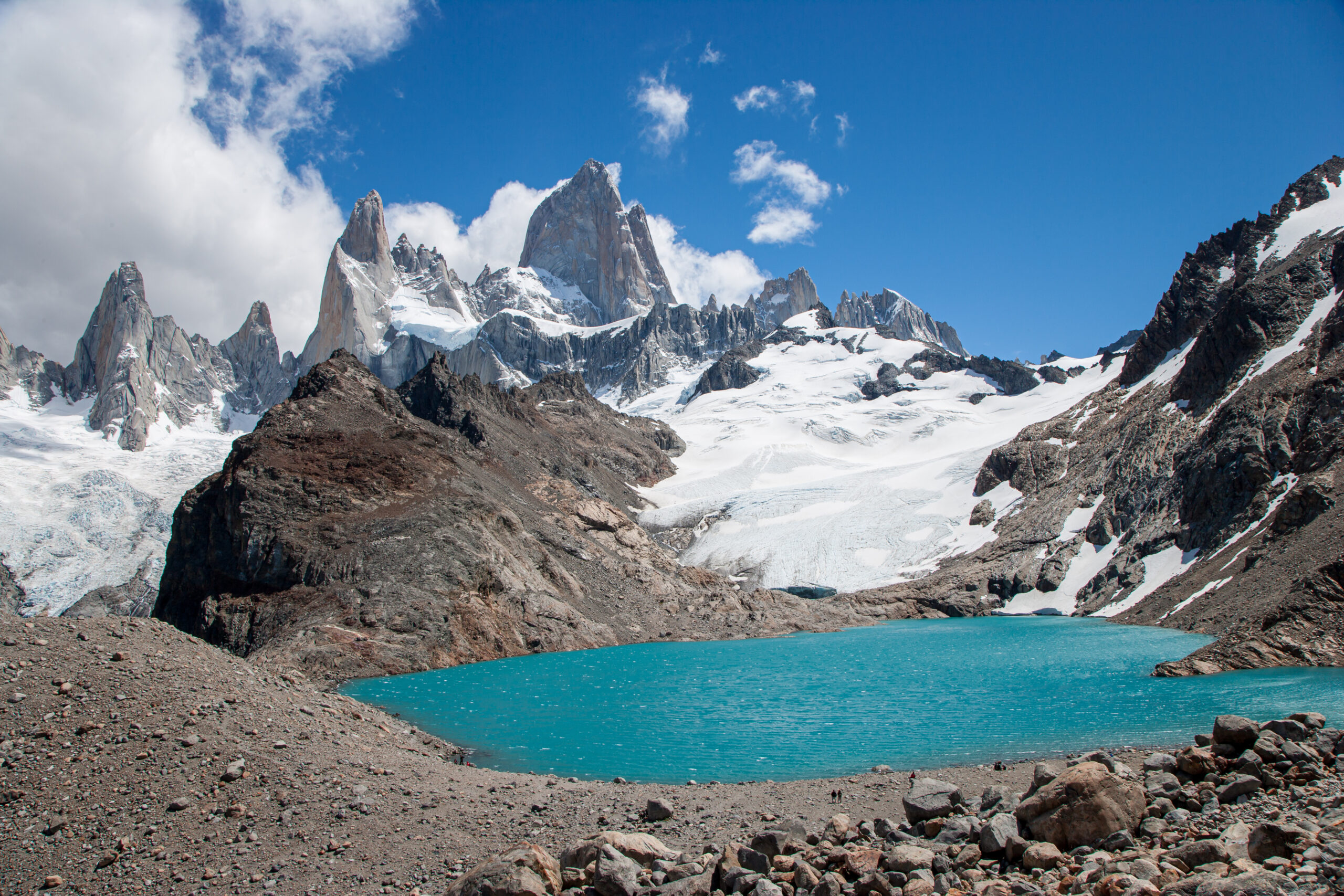
The moraine crest reveals Laguna de los Tres and the Fitz Roy massif. Hikers with time and safe conditions can also investigate the signed side viewpoint toward Laguna Sucia before descending.
The Last Kilometer Changes the Entire Hike
For hours the route feels like a long but manageable Patagonia day hike. Then the trail turns upward toward the moraine and asks for nearly all of the day’s concentrated climbing effort at once.
How Hard Is the Final Laguna de los Tres Climb?
It is not technical climbing in normal summer conditions, but it is steep enough to expose poor pacing, weak downhill legs and marginal weather decisions.
It Arrives Late
You tackle the steepest terrain only after several hours of hiking. Save more energy than the gentle middle trail suggests you need.
Rocky Moraine
Large steps, broken stone and steeper ground make pace slower than the distance implies.
More Exposed
You leave much of the forest protection behind as the trail approaches the upper basin.
Going Down Counts
The same steep rock must be descended before the long walk back to El Chaltén.
Season Changes It
Spring, autumn and winter snow can turn an ordinary summer hiking slope into a much more serious terrain problem.
Turning Back Is Valid
If the upper trail is icy, visibility collapses or wind becomes unsafe, the lower Fitz Roy viewpoints still make the day worthwhile.
Save your strongest legs for the final three hours, not the first three.
Many hikers pace the easy middle portion as though the hard work is already over. The better strategy is steady outbound movement, a deliberate reset near Río Blanco and enough leg strength left for both the moraine climb and descent.
Start in El Chaltén or Use the Río Eléctrico Approach?
The traditional town route wins on simplicity. The northern point-to-point variation adds Piedras Blancas and avoids repeating the entire trail.
| Option | Start | Main Advantage | Main Trade-Off | Best For |
|---|---|---|---|---|
| Classic El Chaltén | End of Avenida San Martín | Walk directly from town; no transportation coordination. | Out-and-back structure repeats most of the same trail. | First-time hikers and simplest logistics. |
| Río Eléctrico / El Pilar | Remote northern trailhead | Adds Piedras Blancas Glacier and creates a point-to-point day. | Requires advance taxi, remis or transfer coordination. | Hikers wanting more variety and a one-way route. |
Do not improvise the northern start on the morning of the hike.
The Río Eléctrico / El Pilar access is outside central El Chaltén. Arrange the transfer before the hiking day and confirm the exact drop point, park-entry requirements and current trail conditions.
Choose the Weather Day Before You Choose the Calendar Day
The real advantage of hiking from El Chaltén is flexibility. You do not need to force Fitz Roy onto Tuesday simply because Tuesday was written into the itinerary months earlier.
For a hiking-focused trip, plan 3–5 nights in El Chaltén rather than treating the town as a one-night stop.
That gives you multiple chances to use the clearest forecast for Laguna de los Tres while moving Laguna Torre, Laguna Capri or shorter hikes onto marginal-weather days.
This flexibility is one of Argentine Patagonia’s biggest advantages over reservation-heavy trekking systems. Your accommodation stays fixed while the day’s hike can move.
Wind matters, but for Laguna de los Tres the other critical question is Fitz Roy cloud cover. A hike can remain physically possible while the entire granite massif is hidden.
Build the broader trip with our complete El Chaltén hiking guide rather than planning each trail in isolation.
Is Laguna de los Tres Worth Hiking for Sunrise?
Yes for photographers and experienced night hikers—but sunrise should be treated as an optional strategy, not the only way Laguna de los Tres is worthwhile.
| Strategy | Best For | Advantage | Trade-Off |
|---|---|---|---|
| Normal early daylight start | Most hikers | Simple navigation and easier final-climb assessment. | More people at the viewpoint. |
| Pre-dawn town start | Experienced hikers / photographers | Chance of Fitz Roy alpenglow. | Several hours of headlamp hiking and colder conditions. |
| Backcountry overnight strategy | Prepared backpackers | Shorter pre-dawn approach. | Requires current APN camping-rule verification and more gear. |
Work backward from that day’s sunrise—do not memorize a universal “3:00 a.m.” start.
Sunrise time changes substantially through the Patagonia season. Estimate your own uphill pace, add a safety buffer, and plan to reach the upper viewpoint before first light only when weather and trail conditions make night travel reasonable.
Laguna de los Tres Park Fees & Trail Access
Older El Chaltén guides often say the town’s classic hikes are free. That information is now outdated.
| APN Category | Published 2026 Rate | Planning Note |
|---|---|---|
| General admission | ARS 50,000 | Current Los Glaciares / El Chaltén general rate effective June 1, 2026. |
| Argentine national | ARS 25,000 | National-resident category. |
| Santa Cruz provincial resident | ARS 8,000 | Provincial-resident category. |
| Student | ARS 15,000 | Eligibility documentation applies. |
Rates in Argentine pesos are time-sensitive.
The figures above are the APN tariffs published as effective June 1, 2026. Check the live National Parks ticket page before travel instead of budgeting from an old blog post or screenshot.
What to Carry for Laguna de los Tres
You do not need mountaineering equipment in normal summer trail conditions. You do need enough equipment to handle a long day and rapidly changing Patagonia weather.
Waterproof Shell
Carry real rain and wind protection even when Fitz Roy is clear above town in the morning.
Insulation
The upper basin and long photography stops can feel dramatically colder than the sheltered forest.
Reliable Trail Shoes
Good grip matters on the steep final approach and descent. Break footwear in before Patagonia.
Trekking Poles
Particularly useful on the final rocky slope after fatigue has accumulated.
Offline Map
The main trail is established, but offline navigation is useful in poor visibility and on alternative approaches.
Real Headlamp
Do not rely on a phone flashlight for several hours of pre-dawn Patagonia hiking.
Trekking poles matter most when you’re tired.
The steep final descent is exactly where a long hike exposes poor downhill mechanics. If poles are new to you, practice with them before Patagonia rather than carrying them unused on your pack.
Fitz Roy Changes With Every Kilometer
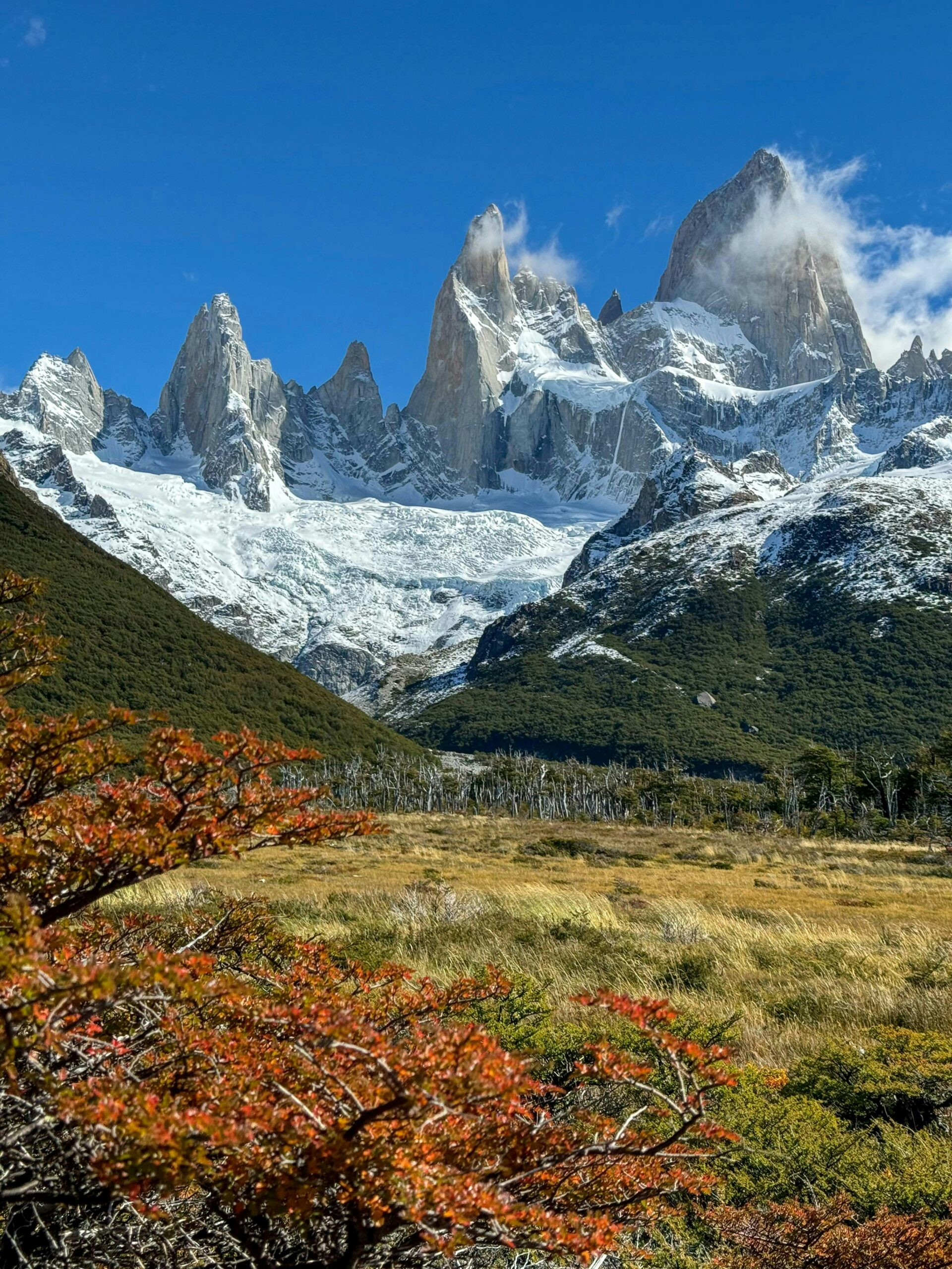
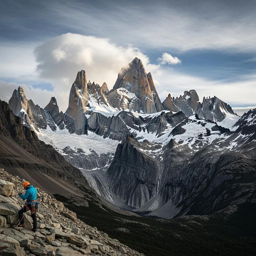
One reason Laguna de los Tres is such an effective mountain hike is the progressive reveal: distant skyline, forest framing, glacier basin and finally the granite massif at close range.
Laguna de los Tres vs Laguna Torre
These hikes are complements, not substitutes. One gives you the definitive Fitz Roy experience; the other introduces Cerro Torre.
| Factor | Laguna de los Tres | Laguna Torre |
|---|---|---|
| Main mountain | Mount Fitz Roy / Cerro Chaltén | Cerro Torre |
| Official APN distance | 25 km | 18 km |
| Typical official time | 8–9 hr | 3–4 hr each way |
| Hardest terrain | Steep final ~400 m climb | Much more gradual profile |
| Best for | Most iconic Fitz Roy view | Second major El Chaltén day |
| Priority | Best clear forecast | Next-best weather day |
The Trail Is Accessible. Mount Fitz Roy Is Not.
Understanding that distinction is part of what should separate Global Summit Guide from ordinary hiking sites.
Laguna de los Tres
A marked, non-technical day hike in normal summer conditions. Ordinary fit hikers can reach the lake with appropriate weather, footwear, fitness and pacing.
The goal is the viewpoint beneath Fitz Roy— not the summit of the mountain.
Explore the El Chaltén hiking network →Mount Fitz Roy · 3,405 m
Fitz Roy belongs to a completely different category. Its granite faces and severe Patagonia weather make the actual mountain an elite technical alpine-climbing objective.
A strong Laguna de los Tres hiker is not therefore prepared to climb Fitz Roy. Hiking access and mountaineering ability are separate progression tracks.
Open the Mount Fitz Roy mountain guide →This is where Global Summit Guide should own the category.
A hiking site can tell you how far it is to the lake. A mountain site can explain Fitz Roy’s climbing history. Our advantage is connecting both correctly: help the hiker execute the day well, then help that same reader understand the extraordinary mountain standing above them.
Build the Rest of Your El Chaltén Hiking Trip
Laguna de los Tres should be the strongest hiking child in the Fitz Roy cluster and distribute readers into the next relevant trail, mountain, lodging and itinerary decisions.
Best Hikes in Argentine Patagonia
Compare Fitz Roy with Cerro Torre, Huemul, Perito Moreno and northern Patagonia’s strongest hiking destinations.
Subregion hubEl Chaltén Hiking Guide
Build a weather-flexible stay around the full town-accessible trail network.
Second iconic dayLaguna Torre
The natural companion hike: a gentler approach into the Cerro Torre landscape.
Mountain entityMount Fitz Roy
Understand the granite mountain itself, its routes, climbing difficulty and place in Patagonia alpinism.
Mountain comparisonFitz Roy vs Cerro Torre
Compare El Chaltén’s two defining mountain icons from both hiking and technical-climbing perspectives.
Advanced trekkingW vs O vs Huemul
Move from El Chaltén day hiking into Patagonia’s serious multi-day trekking options.
LodgingWhere to Stay in Patagonia
Choose the right El Chaltén base and preserve the ability to move hikes around the forecast.
Trip styleGuided vs Self-Guided
Decide where independent hiking makes sense and when local support adds enough value to justify the cost.
First-hand trip10-Day Patagonia Field Report
See how El Chaltén, Fitz Roy, Perito Moreno and Torres del Paine fit together in a real two-country itinerary.
Global hiking pillarBest Hiking Regions
Compare Argentine Patagonia with the world’s strongest hiking destinations.
Planning skillMountain Weather
Learn to interpret wind, precipitation and cloud instead of relying on a single weather icon.
GearPatagonia Packing List
Build a clothing and day-hiking system around wind, rain, cold and variable conditions.
Sources, Field Context & What Can Change
Route geography is relatively stable. Fees, trail condition, snow, access systems and seasonal recommendations need regular rechecking.
What comes from current official sources
- 25 km official Fitz Roy / Laguna de los Tres distance.
- 8–9 hour official hiking estimate.
- Medium-high APN difficulty classification.
- Approximately 400 m final climb from the Río Blanco area.
- Paid entrance requirement.
- Current 2026 Los Glaciares admission rates.
- Seasonal snow warning for the final trail section.
What Global Summit Guide adds
- Route-selection strategy for a multi-day El Chaltén stay.
- Pacing framework for the final climb and descent.
- Town-start vs Río Eléctrico decision framework.
- Laguna de los Tres vs Laguna Torre comparison.
- Hiking-to-mountaineering context for Fitz Roy.
- Cluster links that place this trail inside a complete Patagonia trip.
Last substantive review: August 14, 2026.
Confidence: High for current official route distance, time, fee and route structure; variable for live weather, snow, trail condition and transportation availability.
Frequently Asked Questions
Direct answers for hikers trying to decide whether, when and how to make Laguna de los Tres their primary Fitz Roy day.
How long is the Laguna de los Tres hike?
Argentina’s National Parks authority currently lists the route at 25 kilometers total and 8–9 hours. GPS totals can vary depending on exact start location and side trips.
How hard is Laguna de los Tres?
APN classifies the hike as medium-high difficulty. Much of the route is moderate, but the final approach above Río Blanco gains roughly 400 vertical meters over steep rocky terrain.
Is Laguna de los Tres free in 2026?
No. Los Glaciares National Park now charges for the El Chaltén access sector. The general rate published as effective June 1, 2026 is ARS 50,000. Check APN for the live tariff.
Do I need a guide for Laguna de los Tres?
A guide is not normally required for the standard marked day-hike route. Hikers who want support can hire an authorized trekking guide or local agency.
What is the hardest part of the Fitz Roy hike?
The final climb from the Río Blanco / Poincenot area to Laguna de los Tres. It gains approximately 400 vertical meters and normally requires more than an hour of sustained steep hiking.
Can I start the hike at Río Eléctrico instead?
Yes. A northern approach can begin near Río Eléctrico / El Pilar, pass the Piedras Blancas Glacier viewpoint and join the main trail near Poincenot before finishing in El Chaltén. Arrange transportation to the remote start in advance.
Is Laguna de los Tres harder than Laguna Torre?
Yes for most hikers. Laguna Torre has a much gentler elevation profile, while Laguna de los Tres ends with a steep 400-meter climb. Laguna de los Tres is the priority for Fitz Roy; Laguna Torre is the natural second major El Chaltén hike.
Can I hike Laguna de los Tres for sunrise?
Yes, but it requires several hours of pre-dawn hiking from El Chaltén. Work backward from the actual sunrise time for your date, use a real headlamp and attempt the night approach only when trail and weather conditions are appropriate.
Can you hike Laguna de los Tres in winter?
Access can be possible outside summer, but April through October conditions depend heavily on snow accumulation, particularly on the steep final section. Check the National Park visitor information before starting.
How many nights should I spend in El Chaltén?
Three to five nights is a strong minimum for a hiking-focused visit. It gives you time for Laguna de los Tres, Laguna Torre and another hike while preserving at least one day of weather flexibility.
Hike the Trail. Understand the Mountain.
Laguna de los Tres is more than a famous photograph. Plan the 25-kilometer hiking day correctly, keep Fitz Roy flexible around the weather, then use the mountain and Patagonia guides to understand the extraordinary landscape surrounding the trail.
Was this helpful?
🏔Related guides
🧭Explore & compare
Global Summit Guide is an independent mountaineering resource founded in 2026. The team combines first-hand trekking and climbing experience with in-depth research and professional health and nutrition review to help climbers choose objectives, prepare properly, and stay safe.
Health, altitude, and nutrition content is reviewed by Taylor Ludlow (Registered Nurse) and Brigg Hoopes (Nutritionist).
What We Don't Know Yet
Mountain information changes quickly. This box explains the limits of what this page can responsibly promise.
- Route conditions, snowpack, closures, and weather can change quickly after this page is updated.
- Permit rules, fees, quotas, and reservation windows may change between review cycles.
- Operator availability, pricing, guide ratios, and cancellation terms can change by season.
- Your fitness, altitude response, risk tolerance, and experience level may change what is safe or realistic.
- Use this page for planning guidance, then verify current information with official sources and qualified local experts before committing.
Verify current conditions with official land managers, guide services, local forecasts, and current route reports before booking or climbing.
Mountaineering, rock and ice climbing, glacier travel, and high-altitude activity are inherently dangerous and can result in serious injury or death. The information on Global Summit Guide is provided for general informational and educational purposes only and is not a substitute for professional instruction, qualified guiding, proper equipment, or your own judgment and experience.
Route conditions, weather, snowpack, permits, regulations, and hazards change constantly and may differ from what is described here. Details may be incomplete, out of date, or contain errors. Always verify current information with local authorities, certified guides, and official sources before making any decision in the mountains.
Nothing on this site is medical, legal, or financial advice. Our fitness, acclimatization, altitude, and nutrition content is general in nature; consult a qualified physician before beginning any strenuous exercise program or exposing yourself to high altitude.
You are solely responsible for your own safety and decisions. To the fullest extent permitted by law, Global Summit Guide and its team accept no liability for any loss, injury, damage, or expense arising from use of, or reliance on, this information. By using this site you acknowledge these risks and accept these terms.
Some links on this site may be affiliate links. If you buy through them we may earn a small commission at no extra cost to you; this never affects our recommendations.
Global Summit Guide recommendation path
Next Best Mountain to Research
Use these recommendations to continue the right planning path instead of stopping on one page.
Use current permit, weather, route, and operator information before booking or climbing.