
Last updated September 9, 2026

Via Francigena: Walk the Pilgrimage from Canterbury to Rome
The Via Francigena is Europe’s great north-to-Rome pilgrimage: a route reconstructed from Archbishop Sigeric’s 990 journey, crossing England, France, Switzerland and Italy before entering St Peter’s Square. Walking the whole Canterbury-to-Rome route is a multi-month undertaking of more than 2,000 km. Most modern pilgrims sensibly choose a section: Tuscany for medieval towns and landscape, the Great St Bernard crossing for the strongest mountain experience, or the final 100+ km into Rome for a shorter pilgrimage that can qualify for the Testimonium.
Walk Tuscany First Unless the Whole Canterbury-to-Rome Journey Is the Goal.
The Via Francigena is not one uniform trail. A full journey from Canterbury to Rome changes character repeatedly: English lanes and the Channel crossing; long rural sections of France; Swiss valleys and the Great St Bernard Pass; the Aosta Valley and Po plain; the Cisa Pass; Tuscany’s hill towns; then Lazio and the final arrival at St Peter’s.
That diversity is the route’s strength and its planning problem. The Camino de Santiago has a more continuous pilgrim economy. The Via Francigena still asks you to manage different languages, accommodation systems, currencies, transport gaps and seasonal mountain constraints.
For a first trip, Tuscany is the strongest section. The official Tuscan itinerary covers about 394 km in 16 stages and connects the Cisa Pass, Pontremoli, Lucca, San Miniato, San Gimignano, Monteriggioni, Siena, Val d’Orcia and Radicofani before entering Lazio. It gives you a real long-distance pilgrimage without requiring a season-long absence from home.
If you want the most physically distinctive piece, choose the Swiss-to-Italian crossing over Great St Bernard. If your priority is the certificate and arrival in Rome, build a continuous final 100+ km pilgrimage with a stamped credential.
About 394 km in 16 official stages with the route’s strongest town-and-landscape sequence.
The defining Alpine crossing, normally dependent on a short summer snow-free window.
A practical one-week-scale journey that can satisfy the walking requirement for the Testimonium.
More than 2,000 km and a genuine multi-month European walking project.
Canterbury to Rome Is a Continental Journey, Not a Single Trail Experience.
These schematic maps show the planning logic. Use the official Via Francigena app and current GPX files for field navigation.
The Historic North-to-Rome Spine
Schematic only. Modern official routing contains many local variants and detailed stage lines. The English Channel is crossed by transport, not walked.
Lausanne → Great St Bernard → Aosta
The pass is the route’s main seasonal bottleneck. Official guidance says it is normally open to walkers only from roughly early June to early September because of snow.
Lucca → Siena → Viterbo → St Peter’s
The certificate requirement is based on continuous distance and credential stamps, not on this schematic threshold line. Build a route that safely exceeds 100 km and confirm current Basilica requirements before departure.
Five Ways to Experience the Via Francigena
The whole route is extraordinary, but it is not automatically the best first trip. Section choice should follow available time, season and what you most want from the pilgrimage.
| Trip | Scale | Best for | Main difficulty | Verdict |
|---|---|---|---|---|
| Canterbury → Rome | 2,000+ km · roughly 3 months | Full trans-European pilgrimage | Time, uneven lodging, four countries, Alpine season | Major project |
| Lausanne → Aosta | Multi-week Alpine section | Mountains + pilgrimage history | Great St Bernard snow window | Best mountain section |
| Tuscany | 394 km · 16 official stages | First Via Francigena trip | Heat, repeated hills, popular-town lodging | Best overall first trip |
| Siena → Rome | Roughly 2 weeks | Landscape + full arrival experience | Long rural stages and summer heat | Best 2-week trip |
| Final 100+ km | About 1 week | Short pilgrimage + Testimonium goal | Ensuring continuous qualifying distance | Best short trip |

Sigeric Gave the Via Francigena Its Historical Spine.
In 990, Sigeric, Archbishop of Canterbury, travelled to Rome to receive the pallium from Pope John XV. His surviving record of the return journey listed 79 stopping places and became one of the key documents used to reconstruct the medieval road between Canterbury and Rome. The route itself is older than Sigeric; his diary matters because it gives modern pilgrims a remarkably concrete historical thread through a far larger network of roads used by clergy, merchants, soldiers and travelers.
The Council of Europe certified the Via Francigena as a Cultural Route in 1994. Today the recognized itinerary has expanded beyond the classic Rome destination toward southern Italy and the Mediterranean, but Canterbury and St Peter’s remain the two symbolic anchors most walkers recognize.
The Via Francigena Is Usually Easy Technically—and Hard Logistically.
Most days are ordinary walking terrain. The challenge comes from repeated distance, seasonal heat, occasional long service gaps, pavement, uneven accommodation and two meaningful mountain crossings.
22–23 km Is a Typical Official Stage
The official association says stages average roughly 22–23 km and can reach about 32 km. That is manageable for a trained walker but becomes cumulative after weeks.
Mostly Walking, Not Technical Hiking
Expect lanes, farm tracks, forest paths, historic roads, gravel, city approaches and substantial pavement. Mountain footwear should prioritize comfort rather than technical stiffness.
One True High-Mountain Crossing
Great St Bernard reaches about 2,500 m. Snow can block the route for much of the year, making timing more important than raw technical difficulty.
Cisa Pass Adds a Second Mountain Chapter
The crossing into Tuscany is lower than Great St Bernard but can still receive snow in late autumn or early spring and includes demanding ascent/descent.
Po Valley and Central Italy Can Be Punishing
Summer heat and limited shade can make nominally easy road-and-field stages harder than a cooler mountain day.
The Network Is Improving but Not Uniform
Some towns have pilgrim hostels and strong route identity; other areas depend on ordinary hotels, B&Bs or careful pre-booking. France and Switzerland need more planning than Tuscany.

Great St Bernard Is the Section That Controls the Calendar.
The route climbs from the Valais toward Bourg-Saint-Pierre and then to the historic Great St Bernard Pass at roughly 2,500 m before descending into Italy’s Aosta Valley. This is not technical mountaineering in normal summer conditions, but it is genuine high-mountain travel.
The European Association’s current walking guidance says the pass is usually open from early June to early September and can be impassable because of snow outside that period. That means a spring or late-autumn full-route pilgrim cannot simply assume continuity. If crossing the pass on foot is essential to your journey, build the entire calendar around that window rather than around Tuscany weather alone.
Tuscany Gives You the Via Francigena in Its Most Complete Travel Form.
The official Tuscany route runs about 394 km in 16 stages from the Cisa Pass area through some of central Italy’s most important historic landscapes.
Cisa Pass → Pontremoli → Lunigiana
The Via enters Tuscany through forest, old stone roads and medieval settlements. This is the most mountain-shaped part of the regional route and a strong transition from the Apennines into lower country.
Lucca → Altopascio → San Miniato
Lucca is one of the best practical starting points for a shorter pilgrimage. The terrain becomes less alpine and more agricultural, while route history increasingly sits beside churches, bridges, canals and town centers.
San Gimignano → Monteriggioni → Siena
This is the visual center of the Francigena: hill towns, vineyards, cypress country, dirt roads and long views. It is also where summer exposure becomes obvious; beauty does not create shade.
Siena → Val d’Orcia → Radicofani
The route becomes broader, quieter and more demanding through open agricultural country. San Quirico d’Orcia and Radicofani create one of the strongest multi-day finales before the pilgrim leaves Tuscany for Lazio.


There Is No Single Perfect Month for the Whole Route.
The lowland sections prefer spring and autumn. The Great St Bernard crossing prefers a much narrower summer window.
| Period | England / France | Great St Bernard | Tuscany / Lazio | Verdict |
|---|---|---|---|---|
| April–May | Good spring walking | Normally snowbound | Excellent to warm | Section trips |
| June | Excellent | May open early month; verify conditions | Warm, increasingly hot | Strong full-route month |
| July–August | Generally workable | Best chance of snow-free crossing | Hot; exposed sections can be punishing | Alps good, Italy hot |
| September | Excellent | Often viable early; snow risk rises later | Excellent as heat fades | Best compromise |
| October | Cooler, shorter days | Usually unreliable / snow risk | Excellent in many lower sections | Tuscany / Lazio |
| Winter | Possible low sections | Not normal walking route | Short days, reduced pilgrim services | Specialist only |
The Biggest Difference From the Camino Is That Beds Are Less Uniform.
The Via Francigena has pilgrim hostels, religious hospitality, gîtes, B&Bs, agriturismi and ordinary hotels—but the balance changes by country and town.
Strongest Pilgrim Network
Italy has the densest network of ostelli, religious hospitality and credential-aware accommodation. Updated 2025–26 lists classify some beds as donation/low-cost, others €16–30, and many private options above €30.
Book More Deliberately
Gîtes, chambres d’hôtes and small hotels are often farther apart than Camino albergues. The French federation’s 2026 accommodation booklet is 100 pages because the route requires real service-by-service planning.
Budget for Higher Prices
Hostels and B&Bs can be substantially more expensive than Italy. Current pilgrim guidance commonly places hostel beds around 20–40 CHF and private B&B lodging much higher.
Do Not Use One Daily Number for Four Countries.
Accommodation is the biggest variable. A low-cost pilgrim bed in Italy and a private Swiss room solve the same overnight problem at very different prices.
| Area | Low-cost lodging examples | Private lodging reality | Planning note |
|---|---|---|---|
| Italy | Donation / roughly €10–30 pilgrim beds where available | B&B/agriturismo often €30+ per person and higher in tourist centers | Cheapest sustained section when pilgrim network is used |
| France | Some gîtes / pilgrim beds roughly €15–30 | Private rooms and half-board commonly much higher | Call ahead; service gaps create taxi costs |
| Switzerland | Hostel bed often around 20–40 CHF | B&B often 50–100 CHF per person or more | Most expensive core section for many walkers |
| Tuscany tourist towns | Pilgrim beds can remain economical | San Gimignano, Siena and Val d’Orcia can command tourist-market pricing | Book early if your itinerary depends on specific towns |
Carry the Credential Even if the Certificate Is Not Your Main Goal.
The credenziale turns a long walk into a documented pilgrimage and connects you to parts of the accommodation network built specifically for pilgrims.
A Stamped Record of the Journey
Carry the credential from the start of your section and collect stamps at accommodation, churches, tourist offices and other route points. The stamps create a simple chronological record of your movement along the route.
More Than a Souvenir
Some pilgrim accommodations use the credential to distinguish walkers from ordinary tourists; some participating businesses offer pilgrim conditions or discounts. Most importantly, Rome uses the stamped credential as proof for the Testimonium.
Official Association and Distribution Points
The European Association distributes the official credential through its network and online channels, with local issuing points along the route. Canterbury also has current pilgrim services and credential support.
Keep the Record Obvious
There is no need to chase decorative stamps all day. A clear daily record from overnight stops plus meaningful churches or route offices is simple and easy to verify.
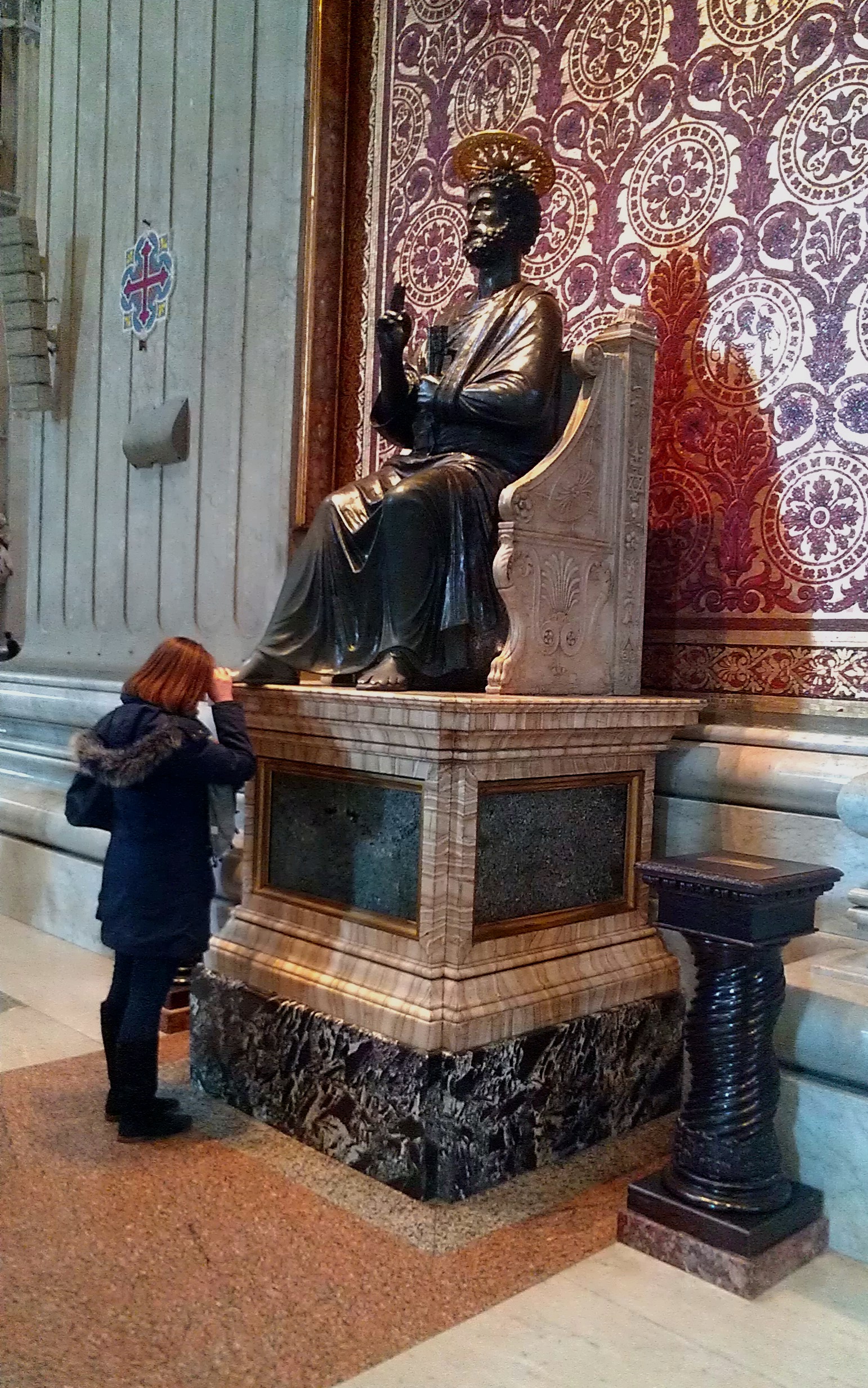
The Testimonium Is the Francigena’s Completion Certificate.
Saint Peter’s Basilica currently issues the Testimonium on request to pilgrims who have travelled at least 100 km on foot or 200 km by bicycle to Rome, with the journey verified by stamps in the pilgrim credential. The Basilica directs pilgrims through the special Percorso Oranti, beginning in St Peter’s Square, to the reception point.
Do not plan the absolute mathematical minimum. Route diversions, GPS differences and stage changes can create unnecessary uncertainty. Start far enough out that your continuous final walk clearly exceeds 100 km, keep the credential stamped, and verify the Basilica’s current reception instructions before arrival.
The Francigena Is Quieter, More Variable and More Logistically Independent.
Both are historic European pilgrimages, but the day-to-day experience is not interchangeable.
Camino Is More Social
The major Camino routes concentrate more walkers into a denser pilgrim ecosystem. The Francigena often has long stretches where you feel more like a long-distance traveler than part of a moving pilgrim village.
Francigena Needs More Booking
Camino albergues create flexibility. Francigena lodging exists, but the network is more uneven and expensive across France and Switzerland.
Francigena Has the Bigger Mountain Constraint
The Great St Bernard crossing introduces a true high-Alpine seasonal gate that has no close equivalent on the standard Camino Francés.
Pack Like a Long-Distance Walker, Then Add a Real Mountain Layer for the Alps.
The base system is simple. The main mistake is carrying enough equipment for every climate at once instead of using layers and shipping/replacing items when appropriate.
35–45 L Is Usually Enough
A light pilgrimage pack keeps repeated road and hill days comfortable. Full camping equipment changes the load substantially.
Comfort Beats Stiffness
Trail shoes or light hikers suit most of the route. Great St Bernard does not require mountaineering boots in ordinary snow-free summer conditions.
Waterproof the Sleep System
Use a reliable shell plus internal dry bags or liner. England, France and the Alps can deliver multi-hour wet days.
Insulation + Gloves + Hat
Even a hot Italian summer trip can include cold wind and rapidly changing weather near 2,500 m.
Official App + Offline Tracks
The Via Francigena official app supports offline maps and route navigation. Carry a battery strategy rather than assuming all-day reception.
Keep It Dry and Accessible
The passport is used repeatedly. Store it where you can stamp it without unpacking the entire bag.
The Francigena Crosses the Alps—but It Does Not Replace an Alps Hiking Trip.
The route passes through the Swiss/Italian Alpine corridor at Great St Bernard. Chamonix and the Dolomites are separate mountain destinations, not stops on the core Francigena.
Swiss Alps
The Francigena crosses Switzerland through Lausanne, the Rhône Valley and Great St Bernard. If you want additional Alpine hiking, start with the Best Hikes in the Swiss Alps.
French Alps
The Francigena does not pass Chamonix, but a separate Alps trip can pair well with the pilgrimage. Compare the Best Hikes in the French Alps.
Dolomites
The Dolomites are far east of the Francigena line. Treat them as a separate hiking trip rather than a route side trip. Use Best Hikes in the Italian Dolomites.
Use the Route Association for the Path and St Peter’s for the Certificate.
The Francigena crosses enough jurisdictions that one source cannot answer every question. These are the most useful anchors.
Via Francigena Cultural Route
History, certification and European route context.
Open Council of Europe →European Association of the Vie Francigene
Official route, app, stages, maps, GPX, accommodation and current route notices.
Open Via Francigena →Official Tuscany Francigena Portal
Sixteen regional stages, accommodation, signposting and route files.
Open Tuscany route →St Peter’s Basilica Testimonium
Current minimum distance, credential proof and pilgrim reception route.
Open current rules →2026 Accommodation Booklet
Current France-focused accommodation and service inventory for the historic route.
See 2026 booklet →Pilgrimage Trails of the World
Compare the Francigena with Camino, Kumano Kodo, Shikoku and other major pilgrimage systems.
Compare pilgrimage routes →Via Francigena FAQ
How long is the Via Francigena from Canterbury to Rome?
The modern official Canterbury-to-Rome line is more than 2,000 km, with exact mileage varying as routing and variants change. The wider cultural route continues past Rome to Santa Maria di Leuca and is roughly 3,200 km in total.
How long does it take to walk it?
Think roughly three months for a full Canterbury-to-Rome pilgrimage. Official stages average about 22–23 km, but a sustainable itinerary should reflect your recovery needs and actual accommodation rather than a fixed stage count.
What is the best time?
Spring and autumn are excellent for lower sections. A continuous full-route walk must hit the Great St Bernard Pass during its usual snow-free window, roughly early June to early September. That makes late June through early September the easiest broad window if walking the pass matters.
What is the hardest section?
Great St Bernard is the defining mountain section. It reaches about 2,500 m and has a real snow season. The Cisa Pass is another meaningful crossing, while Tuscany and Lazio create challenge mainly through repeated distance and heat.
Do I need a credential?
Carry one. It documents the pilgrimage, is recognized by parts of the pilgrim lodging network and provides the stamp record required when requesting the Testimonium in Rome.
How do I get the Testimonium?
Saint Peter’s Basilica currently requires at least 100 km on foot or 200 km by bicycle to Rome, verified by credential stamps. Pilgrims use the special Percorso Oranti in St Peter’s Square and the Basilica reception service.
What is the best short section?
For a first trip, Tuscany is the strongest overall section. For a one-week pilgrimage focused on Rome, walk a continuous final 100+ km with a stamped credential. For the most mountain-focused trip, choose the Great St Bernard crossing.
Is it harder than the Camino?
Usually not technically, but it can be harder to organize. The Via Francigena has more variable lodging, more expensive stretches in France and Switzerland, longer quiet sections and a high Alpine pass. The Camino is generally more flexible and social.
Place the Via Francigena Inside the Larger Pilgrimage Network.
Rome is one of the great historic pilgrimage destinations, but the best route for your trip depends on how much time, infrastructure and mountain terrain you want.
Start With Tuscany. Return for the Alps. Save Canterbury-to-Rome for When the Whole Journey Matters.
The Via Francigena rewards ambition, but it does not require a three-month pilgrimage to be meaningful. Tuscany gives most first-time walkers the strongest blend of route history, landscape, manageable logistics and pilgrimage rhythm. Great St Bernard gives mountain travelers the most distinctive physical section. The final walk into Rome gives a shorter trip a clear destination and, with sufficient continuous distance and credential stamps, the possibility of the Testimonium. Walk the whole route when crossing Europe itself is the objective—not because the shorter versions are somehow incomplete.
Was this helpful?
Global Summit Guide is an independent mountaineering resource founded in 2026. The team combines first-hand trekking and climbing experience with in-depth research and professional health and nutrition review to help climbers choose objectives, prepare properly, and stay safe.
Health, altitude, and nutrition content is reviewed by Taylor Ludlow (Registered Nurse) and Brigg Hoopes (Nutritionist).
What We Don't Know Yet
Mountain information changes quickly. This box explains the limits of what this page can responsibly promise.
- Visa, passport, vaccination, border, insurance, and local transportation rules may change before your trip.
- Route conditions, snowpack, closures, and weather can change quickly after this page is updated.
- Permit rules, fees, quotas, and reservation windows may change between review cycles.
- Operator availability, pricing, guide ratios, and cancellation terms can change by season.
- Your fitness, altitude response, risk tolerance, and experience level may change what is safe or realistic.
Verify current conditions with official land managers, guide services, local forecasts, and current route reports before booking or climbing.
Mountaineering, rock and ice climbing, glacier travel, and high-altitude activity are inherently dangerous and can result in serious injury or death. The information on Global Summit Guide is provided for general informational and educational purposes only and is not a substitute for professional instruction, qualified guiding, proper equipment, or your own judgment and experience.
Route conditions, weather, snowpack, permits, regulations, and hazards change constantly and may differ from what is described here. Details may be incomplete, out of date, or contain errors. Always verify current information with local authorities, certified guides, and official sources before making any decision in the mountains.
Nothing on this site is medical, legal, or financial advice. Our fitness, acclimatization, altitude, and nutrition content is general in nature; consult a qualified physician before beginning any strenuous exercise program or exposing yourself to high altitude.
You are solely responsible for your own safety and decisions. To the fullest extent permitted by law, Global Summit Guide and its team accept no liability for any loss, injury, damage, or expense arising from use of, or reliance on, this information. By using this site you acknowledge these risks and accept these terms.
Some links on this site may be affiliate links. If you buy through them we may earn a small commission at no extra cost to you; this never affects our recommendations.
Global Summit Guide recommendation path
Next Best Mountain to Research
Use these recommendations to continue the right planning path instead of stopping on one page.
Use current permit, weather, route, and operator information before booking or climbing.
Search Flights, Hotels & Rental Cars
Have the mountain or destination picked? Use Expedia to compare the flights, lodging and rental cars that fit your actual trip dates. For mountain travel, consider arriving early enough for delays and adding a buffer night after the climb before a fixed flight home.
Compare current flight, hotel and car options.
Affiliate disclosure: Global Summit Guide may earn a commission if you book through this link, at no additional cost to you.