
Last updated July 31, 2026
Ojos del Salado expedition update
The highest volcano on earth, and one you can nearly drive up, which is exactly the danger. This page tracks the season, the drive-up paradox, the DIFROL permit, the route, cost against Aconcagua, and a go or no-go checklist. A single-mountain page in our Expedition Updates directory. Elevations in metres (feet).
The highest volcano on earth, and the altitude sneaks up on you.
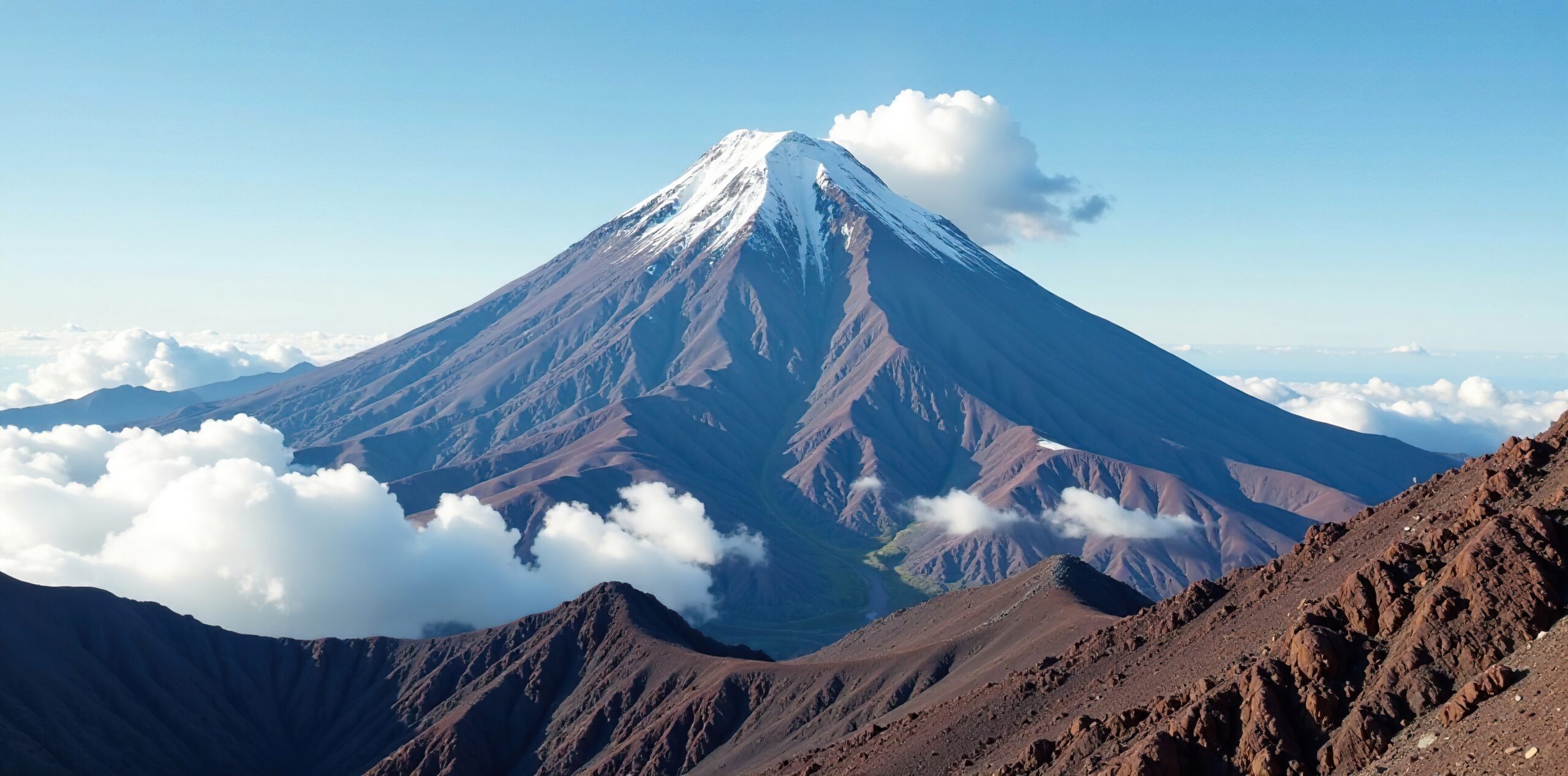
Ojos del Salado is the second-highest peak in the Americas, just 68 m below Aconcagua, in the Atacama Desert. It is technically easy, a scree walk with a short scramble near the top, and on the Chilean side a 4×4 reaches around 5,900 m at Refugio Tejos, within about 1,000 vertical metres of the summit.
That access is the appeal and the trap. Because you can gain altitude so fast, altitude sickness is the real hazard, not the climbing. You need a free DIFROL border permit, careful acclimatization, and respect for the cold and remoteness of the world’s driest desert.
Summit (22,615 ft)
Highest volcano on earth; second-highest peak in the Americas.
DIFROL permit
The border authorization, plus a modest local area fee.
Climbing season
Southern Hemisphere summer, December to February prime.
Ojos del Salado rises on the Chile-Argentina border east of Copiapo, in a stretch of the high Andes that holds the greatest concentration of 6,000 m peaks on earth. It is an active volcano in the driest desert on the planet, which is why it carries so little permanent snow, and it draws climbers as both a goal in its own right and the great quiet alternative to Aconcagua. This page owns the current picture, the access, the route, and the honest comparison. For the full history, route detail, and gear, see our Ojos del Salado climb guide.
Season and status
A Southern Hemisphere summer peak.
The official climbing season runs from November 1 to March 31, with December to February the prime window, matching Aconcagua and the rest of the high Andes. Climbing outside those dates requires a special permit. Even in season, summit success depends on catching a calm, clear window, because the Atacama can deliver ferocious wind and bitter cold at altitude despite its desert setting. Most expeditions build in spare days for weather and for the acclimatization the mountain demands.
The drive-up paradox
The easiest way to nearly 6,900 m, and why that is the danger.
Ojos del Salado is unlike almost any other peak of its height. On the Chilean side, a dirt road lets 4×4 vehicles reach around 5,900 m at Refugio Tejos, and in 2015 a heavily modified car set a world record by reaching 6,688 m on the mountain, the highest a car has ever driven. That means a vehicle can put you within roughly 1,000 vertical metres of one of the highest summits on the continent, turning what would be a multi-week expedition on another peak into a much shorter push.
Permits and DIFROL
Free at the border office, modest in Copiapo.
Because Ojos sits on the international border, non-Chilean climbers on the Chilean side need a DIFROL permit, the authorization issued by Chile’s foreign ministry for border-area peaks. It is free, applied for online at difrol.cl, and it is worth starting the paperwork about 20 business days ahead. On top of that, you obtain a local area permit in Copiapo for the Nevado Tres Cruces zone, whose fee varies and has been reported around $150 to $200, though it is sometimes waived, so confirm the current situation. The Argentine side needs no permit at all, but it is far more remote, with no refugios and no road to base camp.
| Item | Cost | Notes |
|---|---|---|
| DIFROL border permit | Free | Chilean foreign-ministry authorization for a border peak; apply online, about 20 business days ahead. |
| Local Copiapo area permit | Around $150 to $200 | For the Nevado Tres Cruces area; the fee varies and is sometimes waived, so confirm current. |
| Guided expedition | $2,500 to $4,200+ | Usually 12 to 14 days including acclimatization and 4×4 logistics. |
| Argentine side permit | None | But the Argentine route is far more remote, with no refugios and no road to base camp. |
The route and difficulty
Technically easy, seriously high.
The Chilean normal route
From Copiapo, 4x4s carry climbers up through the Atacama to Refugio Atacama around 5,200 m and Refugio Tejos around 5,800 m. From Tejos, summit day climbs gentle scree slopes with occasional snow patches, finishing with a short rock scramble near the top, graded around UIAA I to II and sometimes protected by a fixed rope. There is no sustained technical climbing. The difficulty is the altitude, the cold, and the length of the summit day, not the moves. Previous high-altitude experience is expected.
Altitude, cold and remoteness
The three real hazards of the Atacama.
At nearly 6,893 m, the altitude is the dominant hazard, made worse by the fast vehicle-driven ascent, and altitude sickness is the main reason climbers fail or get hurt here. Summit-day temperatures can reach around -25 C with fierce wind, and the mountain sits in the heart of the world’s driest desert, hours from help, with thin rescue infrastructure and no cell coverage beyond Copiapo.
Acclimatize properly, carry the cold-weather kit for an extreme day, move with reliable communications, and be willing to turn around. Gauge your altitude risk with our AMS risk calculator and read our acclimatization guide. This page is educational and is not medical advice.
Cost and the Aconcagua comparison
Cheaper than Aconcagua, but not by as much as you have read.
Ojos is often sold as a bargain alternative to Aconcagua, and it is cheaper, but the honest figure is around half the cost of a comparable guided Aconcagua trip, not the one-fifth some articles claim. The savings come mainly from the free DIFROL permit, where Aconcagua charges a steep climbing fee, and from lower operator prices, rather than from Ojos being a trivial undertaking. The real trade-off is remoteness and rescue: Ojos is quieter and wilder, which is part of its appeal and part of its risk. Weigh it against its neighbour in our Aconcagua climb guide, and estimate your own numbers with the expedition budget calculator.
Weather and timing
A live look at the high Atacama.
The Atacama is dry but not gentle at altitude, and wind is often the deciding factor on summit day. The live map below shows current conditions for the massif; rely on your expedition’s forecasting for the actual go decision.
Go or no-go checklist
Work through these before you commit.
Before you go
- Apply for the DIFROL permit early – it is free but start about 20 business days ahead, and arrange the local Copiapo area permit.
- Do not skip acclimatization – the road makes it possible to go too high too fast; spend days at the Atacama lakes and a warm-up peak first.
- Pack for extreme cold – summit day can hit -25 C with high wind in a desert setting.
- Plan for remoteness – carry reliable communications; there is no cell coverage beyond Copiapo and rescue is slow.
- Have the altitude base – previous high-altitude experience matters far more than technical skill here.
- Budget honestly – it is cheaper than Aconcagua, but around half, not a fifth.
Andes expedition updates
Ojos del Salado’s neighbours across the range, each with its own update page. Back to the full Expedition Updates dashboard.
Ojos del Salado update FAQ
The questions climbers ask most about permits, access, and the altitude.
Do you need a permit to climb Ojos del Salado?
On the standard Chilean side, yes, two of them. You need a free DIFROL permit, the Chilean foreign-ministry authorization required for peaks on the international border, which you apply for online at difrol.cl about 20 business days ahead. You also need a local area permit obtained in Copiapo for the Nevado Tres Cruces zone, whose fee varies and has been reported around $150 to $200, so confirm the current cost. The Argentine side needs no permit but is far more remote.
Can you really drive most of the way up Ojos del Salado?
Almost. On the Chilean side, 4×4 vehicles routinely reach around 5,900 m at Refugio Tejos, which sits within roughly 1,000 vertical metres of the summit, and in 2015 a modified car set a world record by reaching 6,688 m on the mountain. That vehicle access is the appeal, because it removes days of walking, and it is also the central danger, because it lets climbers gain altitude far faster than their bodies can adjust.
How hard is Ojos del Salado?
Technically it is easy: gentle scree slopes with occasional snow, and a short rock scramble near the summit, graded around UIAA I to II, sometimes with a fixed rope. There is no sustained technical climbing. The real difficulty is everything else, the altitude near 6,893 m, summit-day cold that can reach -25 C, high wind, and serious remoteness. It demands previous high-altitude experience and, above all, careful acclimatization.
Is Ojos del Salado a good alternative to Aconcagua?
It is a strong one. Ojos is the second-highest peak in the Americas, just 68 m below Aconcagua, far less crowded, and cheaper. But it is honestly around half the cost of a comparable guided Aconcagua trip, not the one-fifth some articles claim, and the savings come mainly from the free DIFROL permit and lower operator prices. The real trade-off is remoteness and thinner rescue infrastructure, so it is not simply an easier, cheaper Aconcagua.
When is the Ojos del Salado climbing season?
The official season runs from November 1 to March 31, the Southern Hemisphere summer, with December to February the prime window. Climbing outside those dates requires a special permit. The season matches Aconcagua and the rest of the high Andes, and summit success still hinges on catching a calm, clear weather window.
How much does it cost to climb Ojos del Salado?
A guided expedition typically runs from about $2,500 to $4,200 or more, depending on length and level of support, with most trips lasting 12 to 14 days to allow for acclimatization and 4×4 logistics from Copiapo. The permit costs are minor: the DIFROL authorization is free and the local area fee is modest. The bulk of the cost is guiding, vehicles, and time in the desert.
What is the Ojos del Salado acclimatization trap?
Because vehicles carry climbers to around 5,800 m quickly, many people arrive high without having acclimatized properly, and altitude sickness becomes the main reason expeditions fail or climbers get hurt. A sound itinerary spends days lower down at the Atacama lakes, around 3,000 to 4,300 m, and climbs a warm-up peak near 5,500 m before moving up for the summit. Rushing the altitude because the road makes it possible is the classic mistake here.
How high is Ojos del Salado and where is it?
It is 6,893 m (22,615 ft), the highest volcano in the world and the second-highest peak in the Americas, on the border of Chile and Argentina in the Atacama Desert east of Copiapo. It is an active volcano in the driest desert on earth, in a region that holds the highest concentration of 6,000 m peaks anywhere. It was first climbed in 1937 by a Polish expedition.
📋 How this update is built
This page is compiled by Travis Ludlow, Founder and Head of Research at Global Summit Guide, from Chilean DIFROL border-permit rules, area-permit information, and operator-published logistics, with sources named below. It was reviewed for safety by Dawson Ludlow, our Climbing and Mountaineering Lead (Wilderness First Aid), whose highest first-hand summit is Kilimanjaro.
Our team has not climbed Ojos del Salado, so we report official rules and operator logistics rather than personal experience, and we review this page before each Andes season. Permit fees and rules can change, so confirm current DIFROL and area-permit requirements before you plan around them.
Sources and further reading
- DIFROL, Direccion Nacional de Fronteras y Limites del Estado, Chile – border-area climbing authorization.
- Nevado Tres Cruces and Copiapo area permit information.
- Operator-published Ojos del Salado expedition logistics, pricing, refugio altitudes, and the Aconcagua cost comparison.
- Our own Ojos del Salado climb guide.
- We report official rules and operator logistics; our team has not climbed Ojos del Salado.
Planning an Ojos del Salado climb?
Start with our Ojos del Salado climb guide, weigh it against its taller neighbour in our Aconcagua climb guide and Aconcagua expedition update, and compare teams in the operator directory. Most climbs stage through Copiapo via Santiago, so for flights and lodging, browse travel on Expedia.
Disclosure: the Expedia link above is a sponsored affiliate link. We may earn a commission at no extra cost to you.
Was this helpful?
🏔Related peaks nearby
🧭Explore & compare
Global Summit Guide is an independent mountaineering resource founded in 2026. The team combines first-hand trekking and climbing experience with in-depth research and professional health and nutrition review to help climbers choose objectives, prepare properly, and stay safe.
Health, altitude, and nutrition content is reviewed by Taylor Ludlow (Registered Nurse) and Brigg Hoopes (Nutritionist).
What We Don't Know Yet
Mountain information changes quickly. This box explains the limits of what this page can responsibly promise.
- Permit availability, reservation windows, quotas, and official fee rules may change after this page is updated.
- Weather, snowpack, avalanche risk, road access, and route conditions can change quickly and may be different on your climbing dates.
- Route conditions, trailhead access, crevasse exposure, stream crossings, and rescue access may vary from published planning guidance.
- Total trip cost can change with flights, lodging, guide pricing, permits, gear rentals, transportation, and exchange rates.
- Fitness and altitude response vary by person; no guide, itinerary, or training plan can guarantee acclimatization or summit success.
Verify current conditions with official land managers, guide services, local forecasts, and current route reports before booking or climbing.
Mountaineering, rock and ice climbing, glacier travel, and high-altitude activity are inherently dangerous and can result in serious injury or death. The information on Global Summit Guide is provided for general informational and educational purposes only and is not a substitute for professional instruction, qualified guiding, proper equipment, or your own judgment and experience.
Route conditions, weather, snowpack, permits, regulations, and hazards change constantly and may differ from what is described here. Details may be incomplete, out of date, or contain errors. Always verify current information with local authorities, certified guides, and official sources before making any decision in the mountains.
Nothing on this site is medical, legal, or financial advice. Our fitness, acclimatization, altitude, and nutrition content is general in nature; consult a qualified physician before beginning any strenuous exercise program or exposing yourself to high altitude.
You are solely responsible for your own safety and decisions. To the fullest extent permitted by law, Global Summit Guide and its team accept no liability for any loss, injury, damage, or expense arising from use of, or reliance on, this information. By using this site you acknowledge these risks and accept these terms.
Some links on this site may be affiliate links. If you buy through them we may earn a small commission at no extra cost to you; this never affects our recommendations.
Global Summit Guide recommendation path
Next Best Mountain to Research
Use these recommendations to continue the right planning path instead of stopping on one page.
Use current permit, weather, route, and operator information before booking or climbing.