
Last updated October 13, 2026
American Peaks & Mountain Ranges: 50 Major Mountains Across the United States
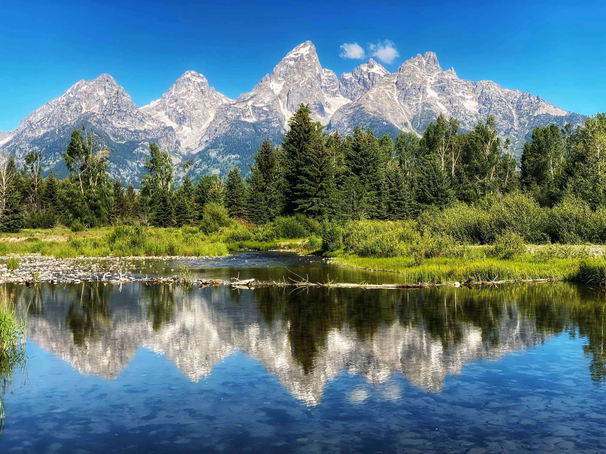
American mountains are not one western range with a few eastern outliers. They include Alaska expedition systems, Cascade volcanoes, Sierra granite, the Rockies and their many subranges, Tetons, desert sky islands, ancient Appalachian ridges, geologically distinct Adirondacks and Hawaiian hotspot volcanoes. This national atlas keeps the geography visible while helping you compare what each mountain system actually demands.
The United States Has Several Mountain Worlds, Not One Mountain Type.
Denali is the national high point at 20,310 feet, while Mount Whitney is the highest summit in the contiguous United States at 14,505 feet using the National Park Service elevation. But elevation explains only one dimension of American mountain geography.
The Cascades are the clearest national glacier and volcanic-snow classroom. The Sierra Nevada and Tetons concentrate granite alpine movement. The Rockies and Interior West supply altitude, scrambling and a huge peakbagging culture. Alaska changes the scale to glaciers, aviation and multi-week expedition logistics. The Eastern U.S. proves that weather and exposed ridge travel can matter more than elevation. Hawaii adds an entirely different volcanic system created over a Pacific hotspot.
This is a geography-first reference, not a ranking of the “best” U.S. mountains. Denali, Half Dome, Mount Washington and Mount Hood are included because they explain different parts of the American mountain landscape.
Choose a Mountain Region, Then See Its Peaks
This is a schematic discovery map, not a navigation map. Click a region to filter the 50-peak explorer below.
Seven Discovery Regions
The map groups mountains by the trip and skill questions they create, not by strict geologic province boundaries. Select a region to see its peak count, mountain character and skill emphasis, then jump straight into the filtered explorer.
How America’s Mountain Systems Relate
This is a reader-oriented geography tree, not a formal geologic taxonomy. It shows why “the Rockies” should never be used as a synonym for every western mountain.
Major U.S. Mountain Systems, Compared by What They Actually Feel Like
Each card uses the same four questions: what built it, what the terrain looks like, what it teaches and what kind of trip it creates.
Alaska Range
Huge glaciated relief centered on Denali and Foraker.
Cascade Range
Active volcanic arc with large snowfields and glaciers.
Sierra Nevada
High granitic batholith terrain, alpine basins and enormous east-side relief.
Rocky Mountains
A continental system made of many named subranges rather than one uniform ridge.
Teton Range
Steep local relief and concentrated alpine rock.
Wasatch & Uintas
Urban-access ridges in the Wasatch and broad wilderness high country in the Uintas.
Appalachian System
Ancient collision-built mountains deeply reshaped by erosion.
Olympic Mountains
Maritime relief combining rainforest approaches, glacier travel and rugged rock.
Hawaiian Volcanoes
Shield volcanoes built over a Pacific hotspot rather than a continental mountain belt.
Ten Secondary Mountain Systems That Explain the 50-Peak List
A national atlas becomes misleading if every important peak is forced into “Rockies,” “Sierra” or “Appalachians.” These smaller systems give several state high points their real geographic identity.
Wind River Range
Gannett Peak belongs to a granitic, glaciated wilderness range southeast of Yellowstone rather than the Teton Range. Long approaches and remote glacier travel are central to its identity.
Beartooth Mountains
Granite Peak rises in rugged high country northeast of Yellowstone. Its technical finish makes Montana’s state high point a very different project from Colorado’s trail-accessible Elbert.
Lost River Range
Mount Borah is the state high point and the range’s defining summit. Chickenout Ridge turns what looks like a moderate-elevation objective into exposed scrambling.
White Mountains
Boundary Peak represents the high desert ranges east of the Sierra. The experience is drier and more isolated than Sierra granite climbing despite the close geography.
San Francisco Peaks
Humphreys Peak rises from a volcanic complex above Flagstaff. It is Arizona’s state high point and a major Southwest altitude objective rather than a desert mountain in the usual sense.
Spring Mountains
Mount Charleston creates a forested alpine island above the Mojave near Las Vegas. Temperature and ecological change from valley floor to summit are part of the trip.
Guadalupe Mountains
Guadalupe Peak rises above the Chihuahuan Desert in a dramatic limestone range. The climbing problem is dry-country hiking and weather rather than snow, glacier or technical altitude.
Black Hills
Black Elk Peak sits in an isolated mountain uplift well east of the main Rocky Mountain chain. It belongs in the Interior West atlas without pretending it is simply another Rocky summit.
Adirondacks
Mount Marcy anchors the Adirondack High Peaks. The region is often grouped with northeastern mountain travel, but its geologic story is distinct from the Appalachian chain.
White & Green Mountains
Mount Washington and Mount Mansfield show two northeastern mountain problems: severe weather in New Hampshire and exposed alpine ridges in Vermont. Neither needs western elevation to be serious.
Wasatch Range
Mount Nebo and Timpanogos belong to an accessible mountain chain immediately east of Utah’s population corridor. Long day hikes and scrambling make the range a practical training ground.
Uinta Mountains
Kings Peak belongs to a broad east-west wilderness range rather than the Wasatch. Its difficulty comes more from distance, remoteness and backpacking logistics than technical climbing.
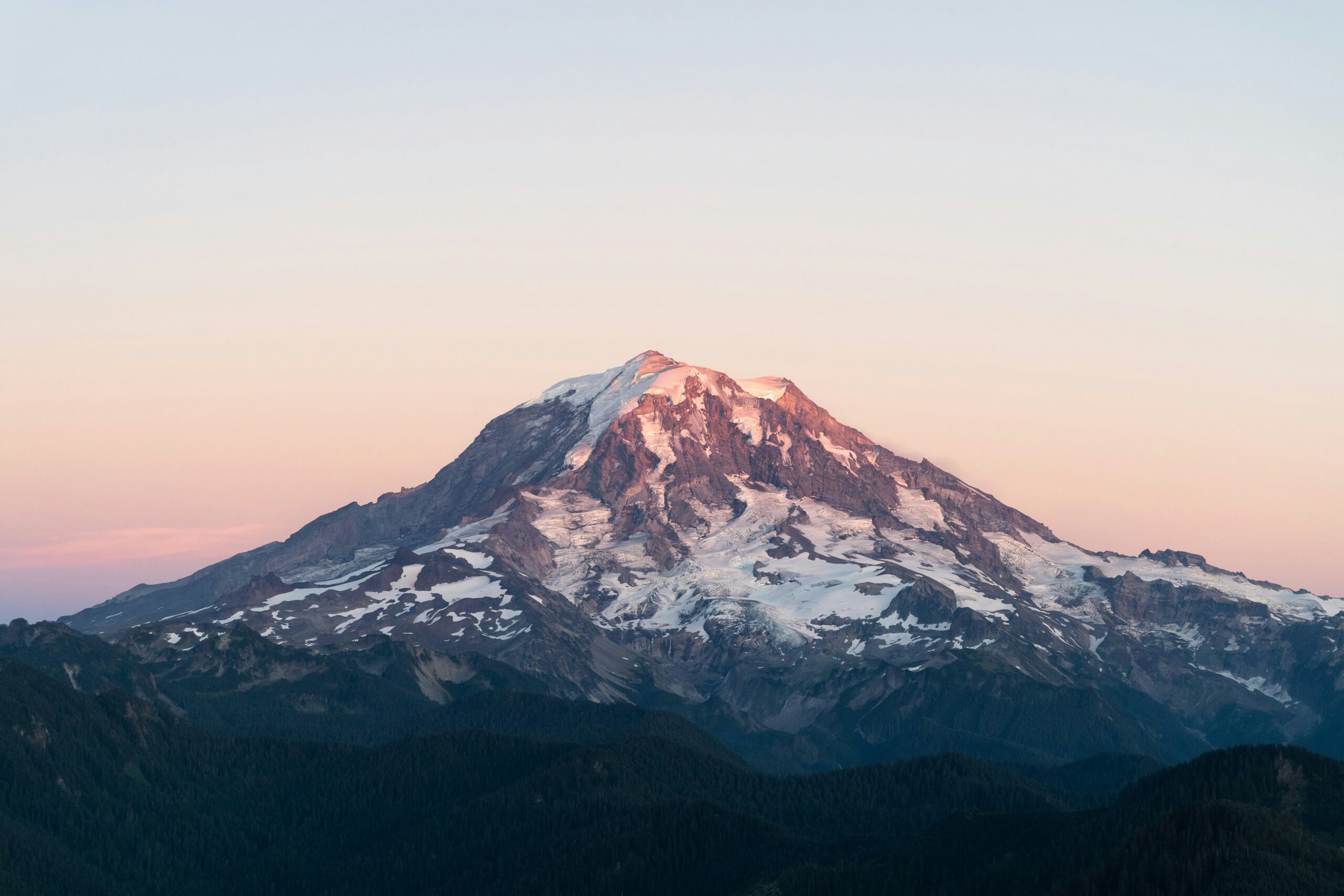
Same Elevation Band, Entirely Different Mountain Problem.
Rainier’s 14,410 feet requires glacier rope systems. Whitney’s 14,505-foot trail is primarily an altitude and endurance problem in summer. Grand Teton is lower than both but far more technical on its normal summit routes. Elevation is only one axis.
50 American Peaks, Organized for Discovery
Search by mountain, state, range or problem. Filter by region or mountain type, or show only state high points.
| # | Peak | State | Range / system | Elevation | Mountain problem | Why it belongs |
|---|---|---|---|---|---|---|
| 1 | DenaliState high point | Alaska | Alaska Range | 20,310 ft | Expedition glacier | Highest U.S. and North American summit; glacier expedition scale. |
| 2 | Mount Saint Elias | Alaska / Yukon | Saint Elias Mountains | 18,008 ft | Expedition glacier | Extreme relief, coastal storms and remote expedition terrain. |
| 3 | Mount Foraker | Alaska | Alaska Range | 17,400 ft | Expedition glacier | Denali’s enormous neighbor and a serious independent expedition peak. |
| 4 | Mount Bona | Alaska | Wrangell–Saint Elias | 16,550 ft | Glaciated volcano | One of the highest volcanoes in the United States. |
| 5 | Mount Blackburn | Alaska | Wrangell Mountains | 16,390 ft | Expedition glacier | Massive glaciated Wrangell summit with remote logistics. |
| 6 | Mount Sanford | Alaska | Wrangell Mountains | 16,237 ft | Glaciated volcano | Remote volcanic giant rising above the Copper River country. |
| 7 | Mount Fairweather | Alaska / British Columbia | Saint Elias Mountains | 15,325 ft | Expedition glacier | Coastal weather and extraordinary vertical relief. |
| 8 | Mount Hubbard | Alaska / Yukon | Saint Elias Mountains | 14,951 ft | Expedition glacier | Remote border summit with major alpine commitment. |
| 9 | Mount WhitneyState high point | California | Sierra Nevada | 14,505 ft | High-altitude hike | Highest summit in the contiguous United States. |
| 10 | Mount ElbertState high point | Colorado | Sawatch Range / Rockies | 14,438 ft | High-altitude hike | Colorado and Rocky Mountain high point; nontechnical normal route. |
| 11 | Mount RainierState high point | Washington | Cascade Range | 14,410 ft | Glacier volcano | Most heavily glaciated peak in the contiguous United States. |
| 12 | Mount Massive | Colorado | Sawatch Range / Rockies | 14,427 ft | High-altitude hike | One of the highest summits in the Rocky Mountains. |
| 13 | Mount Williamson | California | Sierra Nevada | 14,379 ft | Wilderness high point | Remote Sierra 14er with a major approach. |
| 14 | Blanca Peak | Colorado | Sangre de Cristo / Rockies | 14,350 ft | Exposed hike / scramble | Highest peak in the Sangre de Cristo Range. |
| 15 | La Plata Peak | Colorado | Sawatch Range / Rockies | 14,344 ft | High-altitude hike | Large Sawatch hiking objective with a high summit. |
| 16 | Uncompahgre Peak | Colorado | San Juan Mountains / Rockies | 14,318 ft | High-altitude hike | San Juan high point with distinctive volcanic-form terrain. |
| 17 | Longs Peak | Colorado | Front Range / Rockies | 14,259 ft | Exposed scramble | National-park 14er where route-finding, weather and exposure matter. |
| 18 | Crestone Needle | Colorado | Sangre de Cristo / Rockies | 14,196 ft | Exposed scramble | Serious hands-on scrambling and route-finding. |
| 19 | Pikes Peak | Colorado | Front Range / Rockies | 14,109 ft | High-altitude hike | Nationally recognized summit with road, rail and hiking access. |
| 20 | Capitol Peak | Colorado | Elk Mountains / Rockies | 14,138 ft | Expert scramble | One of Colorado’s most serious standard 14er routes. |
| 21 | Mount Shasta | California | Cascade Range | 14,179 ft | Snow climb | Major standalone Cascade volcano and snow-climbing objective. |
| 22 | North Palisade | California | Sierra Nevada | 14,248 ft | Alpine rock | One of the major technical Sierra 14ers. |
| 23 | Mount Sill | California | Sierra Nevada | 14,153 ft | Alpine rock | Classic Palisades alpine terrain. |
| 24 | Mount Russell | California | Sierra Nevada | 14,094 ft | Alpine rock | Known for exposed granite ridge climbing. |
| 25 | Grand Teton | Wyoming | Teton Range | 13,775 ft | Alpine rock | Defining American alpine-rock summit. |
| 26 | Gannett PeakState high point | Wyoming | Wind River Range | 13,804 ft | Remote glacier | Wyoming high point with a long, remote glacier approach. |
| 27 | Mauna KeaState high point | Hawaii | Hawaiian volcanoes | 13,803 ft | Volcanic landscape | Hawaii high point with extraordinary base-to-summit scale. |
| 28 | Mauna Loa | Hawaii | Hawaiian volcanoes | 13,679 ft | Volcanic landscape | One of Earth’s largest active shield volcanoes. |
| 29 | Wheeler PeakState high point | New Mexico | Sangre de Cristo / Rockies | 13,167 ft | High-altitude hike | New Mexico high point and useful altitude hike. |
| 30 | Kings PeakState high point | Utah | Uinta Mountains | 13,528 ft | Wilderness high point | Utah high point and a long wilderness outing. |
| 31 | Mount BorahState high point | Idaho | Lost River Range | 12,668 ft | Exposed scramble | Idaho high point with exposed ridge scrambling. |
| 32 | Boundary PeakState high point | Nevada | White Mountains | 13,140 ft | High-altitude hike | Nevada high point near the California border. |
| 33 | Granite PeakState high point | Montana | Beartooth Mountains | 12,807 ft | Alpine rock | One of the most technical U.S. state high points. |
| 34 | Humphreys PeakState high point | Arizona | San Francisco Peaks | 12,633 ft | High-altitude hike | Arizona high point and Southwest altitude hike. |
| 35 | Mount HoodState high point | Oregon | Cascade Range | 11,249 ft | Snow climb | Classic steep-snow Cascade volcano. |
| 36 | Mount Baker | Washington | Cascade Range | 10,781 ft | Glacier volcano | Major glacier-training mountain with a deep snowpack. |
| 37 | Mount Adams | Washington | Cascade Range | 12,281 ft | Snow climb | Popular snow-climbing progression volcano. |
| 38 | Mount Olympus | Washington | Olympic Mountains | 7,980 ft | Mixed alpine | Rainforest approach, glacier travel and a rock summit. |
| 39 | Mount WashingtonState high point | New Hampshire | White Mountains | 6,288 ft | Weather / winter | Low elevation with severe weather and a major winter-climbing tradition. |
| 40 | Mount KatahdinState high point | Maine | Katahdin massif / Appalachians | 5,269 ft | Exposed hike / scramble | Maine high point, Appalachian Trail terminus and Knife Edge terrain. |
| 41 | Mount MitchellState high point | North Carolina | Black Mountains / Appalachians | 6,684 ft | Mountain hike | Highest summit east of the Mississippi. |
| 42 | Mount MarcyState high point | New York | Adirondacks | 5,344 ft | Mountain hike | New York high point; Adirondacks are geologically distinct from the Appalachians. |
| 43 | Mount MansfieldState high point | Vermont | Green Mountains / Appalachians | 4,395 ft | Exposed hike / scramble | Vermont high point with open ridge terrain. |
| 44 | Haleakalā | Hawaii | Hawaiian volcanoes | 10,023 ft | Volcanic landscape | Maui shield volcano with a huge summit depression and alpine climate. |
| 45 | Guadalupe PeakState high point | Texas | Guadalupe Mountains | 8,751 ft | Desert high point hike | Texas high point above the Chihuahuan Desert. |
| 46 | Black Elk PeakState high point | South Dakota | Black Hills | 7,244 ft | Mountain hike | South Dakota high point and Black Hills summit. |
| 47 | Mount Charleston | Nevada | Spring Mountains | 11,916 ft | High-altitude hike | A high forested island above the Mojave near Las Vegas. |
| 48 | Mount Nebo | Utah | Wasatch Range | 11,928 ft | Exposed hike / scramble | Highest summit in the Wasatch Range. |
| 49 | Mount Timpanogos | Utah | Wasatch Range | 11,752 ft | Long mountain hike | One of Utah’s signature long mountain hikes. |
| 50 | Half Dome | California | Sierra Nevada | 8,839 ft | Cable hike / exposure | Yosemite summit combining long hiking, permits and exposed cables. |
What Kind of Mountain Problem Are You Looking At?
The labels are intentionally broad. Their job is to keep a 20,310-foot glacier expedition from being compared as though it were the same activity as a 6,288-foot winter mountain.
How America Built Several Kinds of Mountains
Climbing character begins with geology: ancient collisions, younger uplift, subduction volcanoes, granitic batholiths and hotspot shields create different terrain.
Appalachians
NPS describes the Appalachians as products of terrane accretion and continent collision as the Iapetus Ocean closed. Erosion later stripped the old range to the remnant mountains seen today.
Old ridges · deep erosionSierra Nevada
USGS describes the Sierra Nevada batholith as Mesozoic plutonic rock underlying much of the range. Uplift and erosion exposed the granite that now defines Sierra climbing.
Granite walls · alpine basinsRockies
USGS places the start of the Laramide Orogeny around 75 million years ago in the central Rockies, followed by later uplift, erosion and glacial carving.
High continental reliefCascades
The modern Cascades form where the Juan de Fuca Plate subducts beneath North America. That active tectonic setting explains the chain’s volcanoes.
Volcanoes · snow · glaciersHawaii
USGS describes Hawaiian volcanoes as a hotspot system formed as the Pacific Plate moved over a long-lived source of volcanism.
Shield volcano scaleHeight vs. Mountain Problem
The vertical bands are categories, not a danger score. Click a point to see why elevation alone misleads.
Start with Mount Washington
At 6,288 feet it sits far below western 14ers, yet severe weather and winter travel give it a very different risk profile from an ordinary low-elevation hike. The category axis prevents height from becoming a fake difficulty score.
The State-High-Point Lens
Many state high points already appear in the 50-peak list. The toggle in the explorer isolates them without turning this page into a separate 50-state-high-points article.
Denali · Whitney · Elbert · Gannett
These state high points span four entirely different trip models: a major Alaska expedition, a heavily permitted Sierra hike, a Colorado Class 1 high-altitude summit and a remote Wind River glacier objective.
Rainier · Hood · Mauna Kea
Washington, Oregon and Hawaii show three ways a volcano can define a state high point: technical glacier travel, steep snow and huge shield-volcano elevation scale.
Kings · Borah · Granite · Humphreys
Utah, Idaho, Montana and Arizona move from wilderness hiking to exposed scrambling and technical state-high-point terrain.
Washington · Katahdin · Mitchell · Marcy · Mansfield
They sit thousands of feet below western summits, but winter weather, long approaches and exposed ridge terrain keep the mountains meaningful.
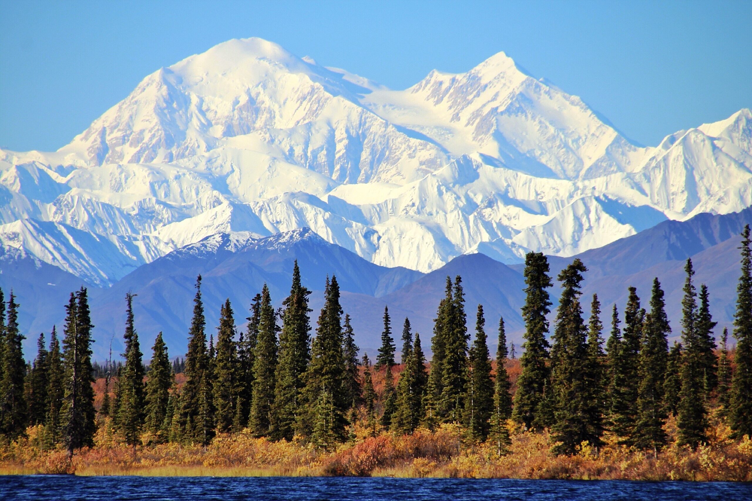
Alaska Changes the Scale of the American Mountain Problem.
Glacier camps, sled hauling, severe cold, crevasse systems, aviation access and weather days make Denali an expedition even though the West Buttress is not an elite technical route by world standards.
Build a U.S. Mountain Progression
Pick the skill you want to build. The examples are progression ideas, not universal prescriptions.
Mount Elbert → Mount Whitney → Longs Peak
Build pacing and weather discipline on non-glaciated high peaks before adding technical snow or glacier systems.
American Mountain Superlatives
Official modern USGS elevation.
NPS display used on this page.
NPS calls Rainier the most heavily glaciated peak in the contiguous U.S.
Current LiDAR-based Colorado display.
Technical alpine-rock identity despite lower elevation.
Long Uinta wilderness approach.
Southern Appalachian high point.
Why elevation is not a complete seriousness metric.
Four Peaks Where the Planning Rule Matters Before the Route
These are intentionally limited to high-impact national examples. Individual peak guides handle the full permit and access details.
60-Day Advance Registration
NPS requires climbers on Denali and Foraker to register at least 60 days before the start of the climb, with limited exceptions for climbers who qualify under the park’s prior-experience rule.
Check NPS mountaineering rules →Climbing Registration + Wilderness Permit System
NPS requires climbing registration and permits for glacier/high-camp climbing. Its current climbing page also lists an $82 per-person climbing registration fee for 2026.
Check Rainier NPS →Whitney Zone Permit Required
NPS states that all hikers entering the Mount Whitney Zone, including day hikers, must obtain a permit. East-side Whitney Portal permits are managed through Inyo National Forest.
Check Whitney NPS →Permit Required When Cables Are Up
Yosemite requires a permit seven days per week when the Half Dome cables are up. The park says no general Yosemite entrance reservation is required in 2026, but the Half Dome permit remains separate.
Check Half Dome permits →Use the National Atlas to Narrow the Country—Then Go Deeper
Greatest Mountains in the USA
Use this when the question is which U.S. mountains matter most to climbers, not where American peaks belong geographically.
Open the climber ranking → Selection hubBest Mountains to Climb in the USA
Choose by skill, trip type and objective after this national atlas has narrowed the landscape.
Choose a U.S. mountain → Regional databaseColorado 14ers
All 58 named Colorado fourteeners with route difficulty, range, access and checklist tools.
Open Colorado → Alaska deep diveDenali Climbing Guide
West Buttress planning, registration, expedition length, training, cost and readiness.
Open Denali → Deep recoveryLongs Peak
A strong bridge between Colorado hiking and consequential exposed scrambling.
Open Longs → Deep recoveryCrestone Needle
A more serious scrambling objective for readers moving beyond straightforward 14ers.
Open Crestone Needle → Deep recoveryMount Rainier
The country’s defining large-glacier progression mountain in the contiguous U.S.
Open Rainier → PlanningMy Climb
Once one peak becomes the objective, move out of national browsing and into access, weather, training and trip planning.
Open My Climb →American Peaks & Mountain Ranges FAQ
What are the major mountain ranges in the United States?
Major systems include the Rocky Mountains, Alaska Range, Saint Elias Mountains, Cascade Range, Sierra Nevada, Appalachian system, Teton Range, Wasatch and Uinta ranges, Olympic Mountains, Brooks Range and Hawaiian volcanoes. Many smaller ranges and subranges matter as well, including the Wind Rivers, Beartooths, Lost River Range, San Francisco Peaks, Spring Mountains and Guadalupe Mountains.
What is the highest mountain in the United States?
Denali in Alaska is the highest summit in the United States and North America. USGS gives its official modern elevation as 20,310 feet.
What is the highest mountain in the lower 48?
Mount Whitney in California’s Sierra Nevada is the highest summit in the contiguous United States. This page uses the National Park Service elevation of 14,505 feet.
Which U.S. mountain range is best for glacier-climbing progression?
The Cascade Range provides the clearest progression for many climbers. Mount Baker and Mount Rainier provide substantial glacier systems, while Hood, Adams and Shasta can build snow-climbing experience.
Are the Adirondacks part of the Appalachians?
They are often grouped with the Northeast for recreation and travel, but geologically the Adirondacks are distinct. This page keeps Mount Marcy in the Eastern U.S. discovery region while naming its actual Adirondack range.
Why is Mount Washington on a national mountain list at only 6,288 feet?
Because elevation is not the purpose of this list. Mount Washington demonstrates how severe weather, winter conditions and exposed terrain can create major mountain seriousness at comparatively low altitude.
Why isn’t this a ranking of the 50 best U.S. mountains?
Because national geography and climbing significance are different questions. This list shows range diversity and mountain types. The separate Greatest Mountains in the USA page makes the editorial ranking argument.
Choose the Mountain System Before You Choose the Summit.
A good U.S. mountain progression is not a march from low elevation to high elevation. It is a sequence of skills: altitude, snow, glacier travel, scrambling, alpine rock, weather judgment and expedition systems. The national atlas is useful when it helps you see which mountain world teaches the next missing skill.
What Are the Major Mountain Ranges in the United States?
The United States has many major mountain systems, including the Rocky Mountains, Appalachian Mountains, Sierra Nevada, Cascade Range, Alaska Range and Saint Elias Mountains. Other well-known ranges include the Tetons, Brooks Range, Olympic Mountains, Wasatch Range and Adirondacks.
They differ dramatically in geology, elevation, climate and the types of hiking or mountaineering they offer. The American West has enormous high-elevation systems, while the Eastern United States contains older, heavily eroded ranges and distinct uplifted mountain regions.
Rockies and Interior Ranges
The Rocky Mountain system spans much of the interior West. Its mountain landscapes include high Colorado summits and important subranges in Wyoming, Utah and Montana.
Cascades and Sierra Nevada
The Cascades contain major volcanoes such as Rainier and Shasta, while the Sierra Nevada is known for granite peaks, alpine lakes and Mount Whitney.
Alaska Range and Saint Elias
Alaska’s ranges contain the highest mountains in the United States, enormous glaciers and some of North America’s most remote expedition terrain.
Appalachian Mountains
A long mountain system that includes the Blue Ridge, Great Smoky Mountains and White Mountains of New Hampshire.
Adirondack Mountains
New York’s Adirondacks are a distinct geological mountain region, not simply another branch of the Appalachian system.
Desert and Interior Mountains
From the Ouachitas to the Guadalupe Mountains, regional ranges create markedly different landscapes from the nation’s snow-covered alpine peaks.
20 Major Mountain Ranges and Systems in the USA
This selected list includes both broad mountain systems and notable subranges. It is designed for geographic discovery, not as a formal geological classification or a list of every range in America.
| # | Mountain Range or System | States / Region | Recognizable Feature |
|---|---|---|---|
| 1 | Rocky Mountains | Western USA | Major interior mountain system; includes Colorado’s 14ers |
| 2 | Appalachian Mountains | Eastern USA | Extensive mountain system from the Southeast into the Northeast |
| 3 | Sierra Nevada | California / Nevada region | Mount Whitney, granite peaks and glaciated landscapes |
| 4 | Cascade Range | Washington, Oregon, California | Volcanoes including Rainier, Hood and Shasta |
| 5 | Alaska Range | Alaska | Denali and large expedition glaciers |
| 6 | Saint Elias Mountains | Alaska / Canada border region | High coastal mountains including Mount Saint Elias |
| 7 | Brooks Range | Northern Alaska | Remote Arctic mountains |
| 8 | Wrangell Mountains | Alaska | Large glaciated volcanic mountains |
| 9 | Aleutian Range | Alaska Peninsula | Volcanic mountain landscapes |
| 10 | Olympic Mountains | Washington | Mount Olympus and maritime glaciers |
| 11 | Pacific Coast Ranges | Pacific states | Coastal mountain systems and forested terrain |
| 12 | Teton Range | Wyoming | Grand Teton and steep alpine rock |
| 13 | Wind River Range | Wyoming | Remote granite mountains and Gannett Peak |
| 14 | Beartooth Mountains | Montana / Wyoming | Granite Peak and rugged alpine terrain |
| 15 | Wasatch Range | Utah / Idaho | Steep mountains along Utah’s Wasatch Front |
| 16 | Uinta Mountains | Utah / Wyoming | Distinctive east-west high mountain range |
| 17 | Adirondack Mountains | New York | Mount Marcy and the historic 46er peaks |
| 18 | White Mountains | New Hampshire / Maine | Mount Washington and Presidential Range |
| 19 | Ouachita Mountains | Arkansas / Oklahoma | Folded ridges in the south-central United States |
| 20 | Guadalupe Mountains | Texas / New Mexico | Guadalupe Peak and desert limestone terrain |
Where Should You Explore America’s Mountain Ranges?
Many of the mountain systems above contain world-class hiking and climbing objectives. These regional guides help you move from the names of mountain ranges to actual routes and peaks.
Colorado 14ers
Compare Colorado’s 14,000-foot mountains, including beginner hiking routes, exposed scrambling and technical climbs.
Explore Colorado 14ers →New York Mountains
Explore the Adirondacks, Catskills and other important New York mountain destinations.
Explore New York Mountains →Mount Whitney
Discover the highest mountain in the contiguous United States, in California’s Sierra Nevada.
Mount Whitney Guide →Cascade Volcanoes
Explore mountains including Rainier, Hood, Baker, Adams and Shasta.
Explore Cascade Mountain Guides →Denali
Research Alaska’s highest mountain, cold-weather expedition systems and glacier travel.
Denali Climbing Guide →500 Mountains Worldwide
Compare U.S. mountain objectives with summits on the other continents.
Browse the Mountains Hub →What Makes U.S. Mountain Ranges So Different?
Alaska Has the Highest Summits
Denali reaches 20,310 feet, making it the highest U.S. and North American mountain.
Not Every Range Formed the Same Way
Uplift, faulting, volcanic activity, folding and erosion shape America’s highly varied mountain landscapes.
Altitude Alone Doesn’t Set Difficulty
Mount Washington can have severe alpine weather, while Grand Teton requires technical skills despite being lower than some nearby peaks.
From Mountain Ranges to Your Next Summit.
The United States contains a remarkable variety of mountain landscapes, from Arctic expeditions to desert peaks and forested Appalachian ridges.
Use the existing 50-peak American atlas above to explore the mountains by location, range, elevation and climbing character. Then continue to the individual mountain guides.
Explore US Mountains
Every major American range, list and challenge in one place — pick your next one below.
Was this helpful?
Global Summit Guide is an independent mountaineering resource founded in 2026. The team combines first-hand trekking and climbing experience with in-depth research and professional health and nutrition review to help climbers choose objectives, prepare properly, and stay safe.
Health, altitude, and nutrition content is reviewed by Taylor Ludlow (Registered Nurse) and Brigg Hoopes (Nutritionist).
What We Don't Know Yet
Mountain information changes quickly. This box explains the limits of what this page can responsibly promise.
- Visa, passport, vaccination, border, insurance, and local transportation rules may change before your trip.
- Route conditions, snowpack, closures, and weather can change quickly after this page is updated.
- Permit rules, fees, quotas, and reservation windows may change between review cycles.
- Operator availability, pricing, guide ratios, and cancellation terms can change by season.
- Your fitness, altitude response, risk tolerance, and experience level may change what is safe or realistic.
Verify current conditions with official land managers, guide services, local forecasts, and current route reports before booking or climbing.
Mountaineering, rock and ice climbing, glacier travel, and high-altitude activity are inherently dangerous and can result in serious injury or death. The information on Global Summit Guide is provided for general informational and educational purposes only and is not a substitute for professional instruction, qualified guiding, proper equipment, or your own judgment and experience.
Route conditions, weather, snowpack, permits, regulations, and hazards change constantly and may differ from what is described here. Details may be incomplete, out of date, or contain errors. Always verify current information with local authorities, certified guides, and official sources before making any decision in the mountains.
Nothing on this site is medical, legal, or financial advice. Our fitness, acclimatization, altitude, and nutrition content is general in nature; consult a qualified physician before beginning any strenuous exercise program or exposing yourself to high altitude.
You are solely responsible for your own safety and decisions. To the fullest extent permitted by law, Global Summit Guide and its team accept no liability for any loss, injury, damage, or expense arising from use of, or reliance on, this information. By using this site you acknowledge these risks and accept these terms.
Some links on this site may be affiliate links. If you buy through them we may earn a small commission at no extra cost to you; this never affects our recommendations.
Global Summit Guide recommendation path
Next Best Mountain to Research
Use these recommendations to continue the right planning path instead of stopping on one page.
Use current permit, weather, route, and operator information before booking or climbing.
Explore Travel Options for Your Destination
Once your mountain, dates and route are taking shape, compare flights, hotels and other travel options that fit the trip.
Affiliate link. We may earn a commission at no additional cost to you.