
Last updated July 10, 2026
Climbing Mount Olympus, Washington: The Complete Guide
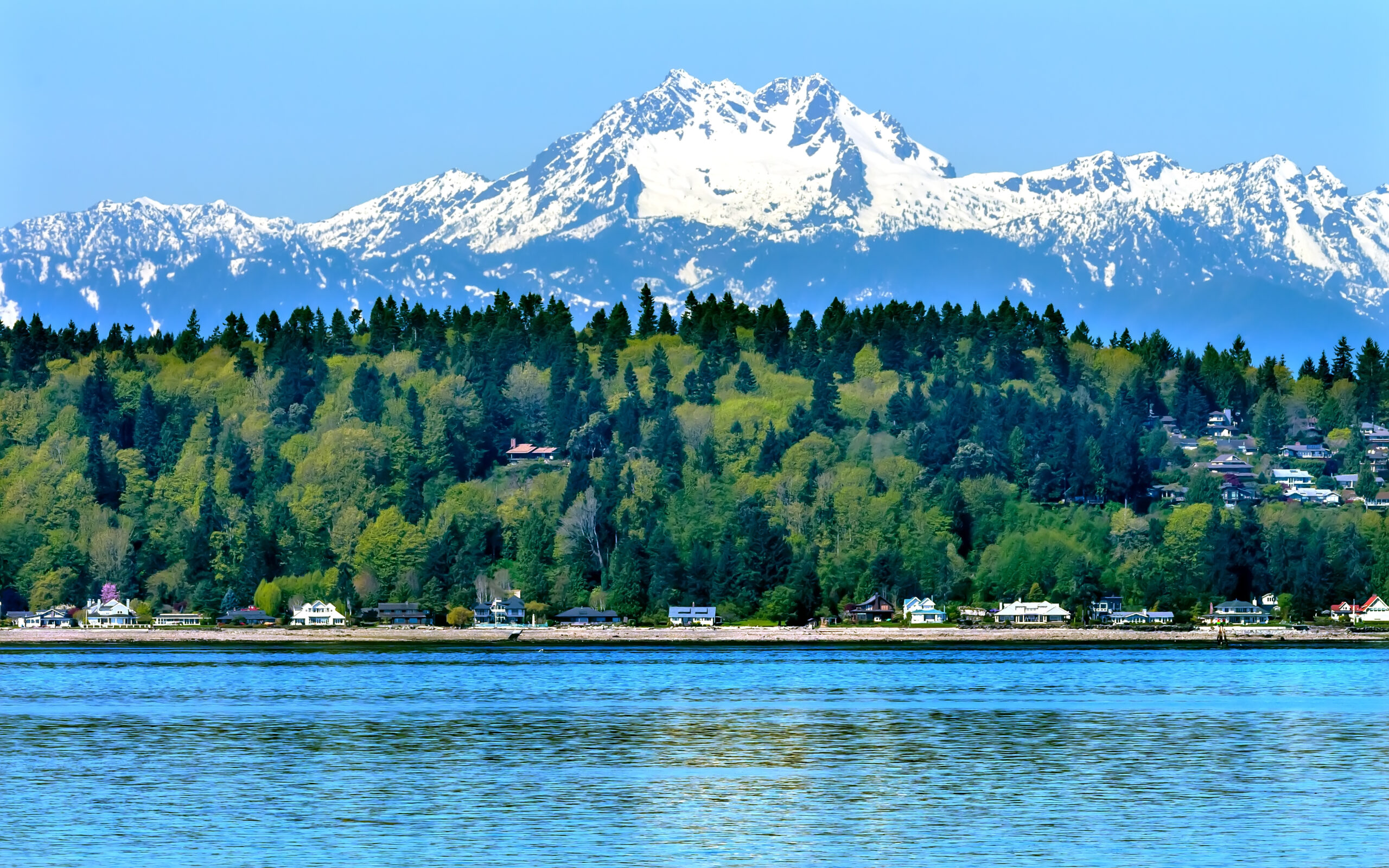
The highest and most heavily glaciated peak in the Olympics hides behind a 17.5-mile rainforest walk. Its summit is only 7,980 feet — yet reaching it demands glacier travel, a night on the ice, and a short, exposed rock finish. Here’s the route, the plan, and everything you need to climb it.
Mount Olympus (7,980 ft) is the crown of the Olympic Peninsula — a real mountaineering climb dressed up as a low peak. The standard Blue Glacier route is non-technical for most of its length but crosses a crevassed glacier and finishes with a short Class 4 scramble and a roped 5.3–5.4 rock pitch on the summit block.
Plan on 4–5 days and roughly 44 miles round trip. You’ll need a wilderness permit, glacier-travel and crevasse-rescue skills (or a guide), and a weather window. No guide is legally required — but this is not a peak to learn glacier travel on.
Find Hotels, Flights & Trips for the World’s Best Hiking Destinations
The Global Summit Guide Travel Shop on Expedia — curated for outdoor adventurers, mountaineers, and serious hikers. Patagonia to the Alps. Nepal to the Rockies. Curated lodging for every region we cover.
Explore Travel Shop on Expedia →On this page
Where it is & the approach
Dead-center in Olympic National Park — the walk in is half the climb.
Mount Olympus sits in the heart of Olympic National Park, roughly 20 miles southeast of Forks, Washington. There’s no road anywhere near it. Every practical ascent begins at the Hoh Rain Forest, at the end of the Upper Hoh Road, and follows the Hoh River Trail deep into the wilderness before the mountain even comes into view.
The mountain, in brief
A modest summit height that badly undersells the climb.
At 7,980 feet, Mount Olympus is far shorter than Rainier, Baker, or Adams — yet it is one of the most committing non-volcanic climbs in Washington. Three things explain the gap between its height and its reputation.
First, the approach. The climb starts near sea level, so you gain the whole mountain on foot: a 17.5-mile walk through genuine old-growth rainforest just to reach base camp, then the climb on top of that. Second, the ice. Olympus is the most heavily glaciated peak in the Olympics, and its Blue Glacier — fed by some of the heaviest precipitation of any glacier in the Lower 48 — must be crossed to reach the summit. Third, the finish. The true summit is a rock tower that requires scrambling and a short roped pitch, so a rope, harness, and a little hardware come out of the pack right at the top.
The peak actually has three summits along a short crest — West Peak (7,980 ft, the true and highest summit), Middle Peak (7,929 ft), and East Peak (7,762 ft). Nearly everyone climbs the West Peak; a fit, experienced team can link all three in a traverse.
The route & its variations
In practice there’s one way up, with a few choices near the top.
Unlike Kilimanjaro or Rainier, Olympus doesn’t offer a menu of approaches. With rare exceptions, everyone climbs the Blue Glacier route from the Hoh. The variations come high on the mountain: how you cross the glacier’s upper reaches, and which line you take up the summit block.
Blue Glacier via Crystal Pass
From Glacier Meadows, a short way-trail climbs onto a steep lateral moraine and drops to the edge of the Blue Glacier. Rope up, cross roughly a mile of crevassed ice, and climb snow to the broad plateau of the Snow Dome (~6,600 ft). From there the route curves east through crevasses to Crystal Pass, wraps around a rocky false summit, and reaches the base of the West Peak block. A short scramble and a roped pitch (a few low-fifth-class moves, usually protected with small cams) gain the summit. Most parties rappel the block on the descent.
The park generally recommends the Crystal Pass line as the safest option through most of the season. It’s a little longer than the alternatives, and that’s the point.
Three peaks via Glacier Pass
Fit parties with time and skill can link the West, Middle, and East peaks in a single push. Teams attempting the traverse usually go over Glacier Pass rather than Crystal Pass, especially if they’ve camped high on the Snow Dome. It’s a bigger, more committing day and best saved for climbers who already know the standard route.
Summit-block rock options
The standard summit line is a Class 4 scramble up loose rocky ramps with one short fifth-class step, and it’s the most common way up. Cleaner, steeper lines on more solid rock exist for those who prefer real climbing — generally in the 5.4–5.6 range, with more exposure. Whichever you choose, watch for rockfall from parties above, and be ready to belay the crux.
The approach, camp by camp
| Hoh Trailhead | ~578 ft · mile 0 · register & start |
| Olympus Guard Station | ~948 ft · mile 9 · common night 1 |
| Glacier Meadows | ~4,200 ft · mile 17.5 · base camp (quota) |
| Snow Dome (high camp) | ~6,600 ft · on the glacier · blue-bag site |
| West Peak summit | 7,980 ft · the true summit |
Day-by-day itinerary
A realistic five-day plan; strong parties compress it to four.
Day 1 — Trailhead to Olympus Guard Station (~9 mi)
An easy, nearly flat rainforest walk along the Hoh River, gaining only a few hundred feet. Cool your feet in the river, watch for elk, and settle in. Some parties push a couple of miles farther to Lewis Meadow.
Day 2 — Guard Station to Glacier Meadows (~8 mi, ~3,300 ft up)
The trail leaves the valley floor and climbs steadily out of the rainforest, crossing the High Hoh Bridge and negotiating the slide areas near the top. Make camp at Glacier Meadows, review glacier skills, and get to bed early.
Day 3 — Summit day (~4–6 mi to the top, 10–13+ hrs)
Pre-dawn start. Over the moraine, onto the Blue Glacier, rope up, and cross to the Snow Dome. Weave through Crystal Pass to the summit block, scramble and climb to the top, then rappel and reverse to camp. Long, spectacular, and the crux of the trip.
Day 4 — Glacier Meadows to Guard Station (~8 mi)
Pack up and retrace the climb down to the valley. Optional: a short morning walk to the Blue Glacier terminus before leaving.
Day 5 — Guard Station to trailhead (~9 mi)
The long, flat cruise back through the rainforest to the car — and, if you’re smart about it, a soak at Sol Duc Hot Springs on the drive out.
7-day mountain weather
Live forecast for the Olympus / Hoh area — updates automatically.
Weather makes or breaks an Olympus attempt. The Blue Glacier route needs a clear, stable window for safe glacier travel and for the summit-block rock to be dry and free of ice. The live forecast below refreshes each time the page loads.
Mount Olympus area — 7-day forecast
Loading live data…When to climb
A short prime window, and it moves with the snow.
The best season runs from late June through mid-August. Timing is a trade-off between snow cover and crevasse hazard:
| Window | Conditions | Verdict |
|---|---|---|
| Mid–late June | Consolidated snow, snow bridges intact, ramps often snow-covered | Prime |
| July | Warmer, crevasses opening, some snow bridges failing | Good |
| August | Glacier broken up, moats around summit ramps, more technical | Late but doable |
| Early June & earlier | Deep snow, avalanche risk on trail slopes, wet slides | Experts only |
| Winter/spring | Avalanche chutes above Elk Lake, route-finding, full conditions | Serious mountaineers |
Permits & regulations
The paperwork is straightforward if you plan ahead — and non-negotiable.
A wilderness camping permit is required year-round for any overnight trip in Olympic National Park, and Mount Olympus is no exception. Permits are reserved through Recreation.gov, and you book a specific campsite for each night, so you need your itinerary set in advance.
- Wilderness permit — reserve on Recreation.gov; summer-season permits (mid-May to mid-October) are released in spring, so book early.
- Glacier Meadows quota — the base-camp area is quota-limited; it can fill on prime summer dates.
- Park entrance pass — separate from the wilderness permit; buy ahead and print it, as connectivity in the park is poor.
- Bear canister — required for camping above Glacier Meadows and strongly advised throughout.
- Blue bags — mandatory for packing out human waste on Mount Olympus; available at the Hoh Visitor Center and the Port Angeles WIC.
Gear & skills
Glacier kit plus a light rock rack — and the training to use both.
Olympus asks for a full glacier-mountaineering kit on top of your multi-day backpacking setup. The rock at the top is short, so the technical rack is small, but you do need it.
The technical essentials
Ice axe, crampons, climbing helmet, and a glacier rope for the team; a harness and a personal crevasse-rescue kit (prusiks or ascenders, pulley, slings, locking carabiners); and a small rack for the summit block — a handful of small-to-medium cams, a few slings, and gear to build a rappel anchor. Add glacier glasses and serious sun protection: the Snow Dome is a reflector oven on a clear day. Late-season parties often want ice screws as well.
The skills that matter more than the gear
Roped glacier travel, self-arrest, and crevasse rescue are the baseline. You should be comfortable moving as a rope team, identifying and skirting crevasses, and getting a fallen partner out of a hole. On the summit block, you need to be steady on exposed low-fifth-class rock and able to set up a safe rappel. If any of that is unfamiliar, that’s the case for hiring a guide.
Guided vs independent
No guide is required — but plenty of good reasons to hire one.
Here’s a key difference from the big international trekking peaks: on Mount Olympus, a guide is not legally required. Any experienced, self-sufficient party can climb it on their own permit. The question is whether you have the glacier and rock skills — and the current-conditions knowledge — to do it safely.
Several permitted services run four- and five-day ascents, typically at low client-to-guide ratios (often 2:1 on summit day) because the terrain has genuinely changed with the glacier in recent years and demands close supervision. A guided trip buys you technical instruction, rope-team management, up-to-date route beta, and the permit logistics. Independent climbing saves money and offers more freedom — if you can bring the skills yourself.
Frequently asked questions
How hard is it to climb Mount Olympus?
It’s a serious multi-day mountaineering climb, not a hike. The 7,980-foot summit is modest, but the trip combines a 17.5-mile rainforest approach, roped travel across the crevassed Blue Glacier, steep snow, and a short exposed rock pitch (Class 4 with a 5.3–5.4 crux). Attempt it only with glacier and crevasse-rescue skills — or with a guide.
Do you need a permit?
Yes. A wilderness camping permit is required year-round via Recreation.gov, with a daily quota at Glacier Meadows. You also need a separate park entrance pass, a bear canister above Glacier Meadows, and blue bags for the mountain. No climbing guide is legally required.
How many days does it take?
Most parties take four to five days round trip — two days in to Glacier Meadows, a summit day, and one to two days out. Very fit, experienced teams sometimes do it in three; the 44-mile round trip rewards a patient plan.
When is the best time to climb?
Late June through mid-August. Mid-to-late June usually offers consolidated snow and intact snow bridges; later in summer the glacier opens up, moats form, and the route gets more technical. Winter and spring are for experienced parties only.
What’s the standard route?
The Hoh River Trail 17.5 miles to Glacier Meadows, over the lateral moraine onto the Blue Glacier, across the ice to the Snow Dome, then through Crystal Pass to the West Peak summit block, finishing with a short roped rock pitch. Climbers rappel the block and reverse the route.
Do I need mountaineering experience?
Yes — for an independent ascent you need roped glacier travel, self-arrest, and crevasse rescue, plus comfort on exposed low-fifth-class rock. Without those, join a guided trip; several services run four- to five-day ascents and teach the technical skills on the mountain.
How we built this
Research-based. This guide is compiled from the National Park Service (Olympic National Park’s official climbing, permit, and regulations pages), The Mountaineers and SummitPost route descriptions, Washington Trails Association trip reports, and the itineraries of permitted guide services, cross-checked for the 2026 season. Elevations, distances, and the route sequence were confirmed against multiple independent sources.
Mount Olympus conditions shift year to year and within a season, especially on the Blue Glacier and the summit block. Treat every figure here as a planning starting point and confirm current permits, quotas, and route conditions with the Hoh Visitor Center or the Olympic Wilderness Information Center before you commit.
Get the window right
On Olympus, the mountain is the easy part — the weather and the glacier decide your day. Lock your permit early, watch the forecast, and call the ranger station before you drive out.
Reserve a wilderness permit → NPS climbing page →Was this helpful?
🏔Related peaks nearby
🧭Explore & compare
Global Summit Guide is an independent mountaineering resource founded in 2026. The team combines first-hand trekking and climbing experience with in-depth research and professional health and nutrition review to help climbers choose objectives, prepare properly, and stay safe.
Health, altitude, and nutrition content is reviewed by Taylor Ludlow (Registered Nurse) and Brigg Hoopes (Nutritionist).
What We Don't Know Yet
Mountain information changes quickly. This box explains the limits of what this page can responsibly promise.
- Visa, passport, vaccination, border, insurance, and local transportation rules may change before your trip.
- Route conditions, snowpack, closures, and weather can change quickly after this page is updated.
- Permit rules, fees, quotas, and reservation windows may change between review cycles.
- Operator availability, pricing, guide ratios, and cancellation terms can change by season.
- Your fitness, altitude response, risk tolerance, and experience level may change what is safe or realistic.
Verify current conditions with official land managers, guide services, local forecasts, and current route reports before booking or climbing.
Part of this Global Summit Guide cluster
Explore the complete Mountains guide for more context, routes, planning links, and related resources.
Mountaineering, rock and ice climbing, glacier travel, and high-altitude activity are inherently dangerous and can result in serious injury or death. The information on Global Summit Guide is provided for general informational and educational purposes only and is not a substitute for professional instruction, qualified guiding, proper equipment, or your own judgment and experience.
Route conditions, weather, snowpack, permits, regulations, and hazards change constantly and may differ from what is described here. Details may be incomplete, out of date, or contain errors. Always verify current information with local authorities, certified guides, and official sources before making any decision in the mountains.
Nothing on this site is medical, legal, or financial advice. Our fitness, acclimatization, altitude, and nutrition content is general in nature; consult a qualified physician before beginning any strenuous exercise program or exposing yourself to high altitude.
You are solely responsible for your own safety and decisions. To the fullest extent permitted by law, Global Summit Guide and its team accept no liability for any loss, injury, damage, or expense arising from use of, or reliance on, this information. By using this site you acknowledge these risks and accept these terms.
Some links on this site may be affiliate links. If you buy through them we may earn a small commission at no extra cost to you; this never affects our recommendations.
Global Summit Guide recommendation path
Next Best Mountain to Research
Use these recommendations to continue the right planning path instead of stopping on one page.
Use current permit, weather, route, and operator information before booking or climbing.