<
Best Mountains Near Denver to Hike & Climb: Complete Guide (2026) | Global Summit Guide
Colorado Front Range snow-capped peak rising above pine forest, classic Denver-area mountain view
USA Peakbagging · Updated 2026

Best Mountains Near Denver: A Complete Guide for Hikers & Climbers

Denver sits at the eastern edge of the Colorado Front Range, with 50+ hikeable peaks rising directly above the Mile High City. From 7,000-foot foothill summits reachable on a weekday evening to iconic 14ers like Mount Blue Sky (formerly Mount Evans), Mount Bierstadt, Grays, Torreys, and Longs Peak — all within a 2-hour drive of downtown. This guide covers 15 of the best mountains near Denver organized by difficulty, with trail stats, permit requirements, and current naming (including the 2023 renaming of Mount Evans to Mount Blue Sky).

14,275ft
Torreys Peak
highest near Denver
15
Peaks covered
in this guide
6
Front Range
14ers nearby
2hr
Max drive
from Denver
Colorado Front Range · Adobe Stock

Denver’s access to mountains is unmatched by any major US city. 
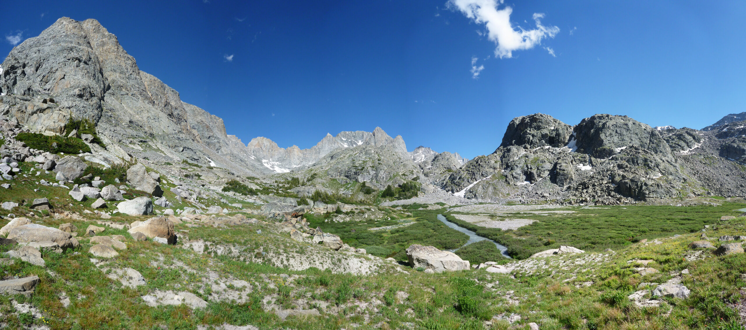
Six Front Range 14ers sit within a 2-hour drive of downtown. Dozens of accessible foothill summits line the western suburbs from Boulder to Castle Rock. Rocky Mountain National Park is 90 minutes north. Pikes Peak — “America’s Mountain” — is 90 minutes south. No other city in the United States offers this combination of high-altitude objectives and urban convenience. This guide covers 15 of the best mountains near Denver, organized across four difficulty tiers from 30-minute foothill hikes to technical Class 3 summit pushes on Longs Peak. Where mountain names have recently changed — Mount Evans officially became Mount Blue Sky in September 2023 — we use both names to help readers navigate the transition. Whether you’re a Denver newcomer looking for a first summit or a visitor planning a 14er attempt, there’s a peak here that fits your skill level, time budget, and available permits.

Denver’s Mountain Zones: Foothills to 14ers

Understanding Denver’s mountain geography helps pick the right peak for your available time and skill level. The mountains west of Denver organize into four distinct zones, each with different drive times, elevations, and difficulty ranges. Pick the zone first, then the specific peak.

Zone 1 · Immediate foothills

Jefferson County & Boulder Foothills

The first rise of mountains directly west of Denver — Jefferson County Open Space parks, Boulder OSMP trails, and Golden-area peaks. Accessible within 30-45 minutes of downtown, year-round hikeable, generally under 8,500 feet. Perfect for evening workouts, weekday morning hikes, and training before bigger objectives. Popular peaks: Mount Falcon, Green Mountain, Mount Sanitas, Mount Galbraith.

Mount Falcon7,851 ft
Green Mountain (Boulder)8,144 ft
Mount Sanitas6,863 ft
Zone 2 · Mid-elevation Front Range

Evergreen & Clear Creek County Peaks

The second rise of mountains — higher, more remote, but still within 60-90 minutes of Denver. Peaks sit between 9,000 and 12,000 feet, accessible from May through October for most objectives. Bergen Peak near Evergreen, Chief Mountain near Idaho Springs, Bear Peak above Boulder. These are the “real mountain” introductions — not foothills anymore, but not 14ers yet.

Bergen Peak9,708 ft
Bear Peak8,461 ft
Chief Mountain11,709 ft
Zone 3 · Front Range 14ers

14,000-foot Peaks within 90 Minutes

The famous Front Range 14ers. Mount Blue Sky (formerly Mount Evans), Mount Bierstadt, Grays Peak, Torreys Peak — all accessible within 90 minutes of downtown Denver. These are the classic Colorado fourteener objectives that bring tens of thousands of hikers to the Front Range each summer. July-September climbing window, Class 1-2 standard routes, requires real fitness and altitude tolerance but no technical climbing skills for most.

Mount Bierstadt14,065 ft
Grays & Torreys14,270 / 14,275 ft
Mount Blue Sky14,265 ft
Zone 4 · National Park peaks

Rocky Mountain NP & Pikes Peak

The iconic summit objectives that define Colorado mountain culture — requiring longer drives (90 minutes to 2 hours) but delivering the most memorable Front Range experiences. Longs Peak in Rocky Mountain National Park is Colorado’s most famous and dangerous hikeable 14er. Pikes Peak 90 minutes south anchors Colorado Springs. Both require timed-entry reservations and more planning than the closer 14ers.

Longs Peak14,259 ft
Pikes Peak14,115 ft
Estes Cone (RMNP)11,006 ft

15 Best Mountains Near Denver: Master Comparison Table

The table below lists the 15 mountains covered in this guide, organized by difficulty tier from beginner foothill summits to expert 14ers. Drive times are from downtown Denver without significant traffic.

#PeakElevationZoneDifficultyDrive from Denver
1Mount Sanitas6,863 ftBoulderBeginner45 min
2Mount Falcon7,851 ftJeffCoBeginner30 min
3Mount Galbraith7,260 ftGoldenBeginner30 min
4Green Mountain (Boulder)8,144 ftBoulderIntermediate45 min
5Bear Peak8,461 ftBoulderIntermediate45 min
6Bergen Peak9,708 ftEvergreenIntermediate45 min
7Chief Mountain11,709 ftClear CreekIntermediate75 min
8Estes Cone11,006 ftRMNPIntermediate100 min
9Mount Bierstadt14,065 ftGuanella PassAdvanced90 min
10Grays Peak14,270 ftI-70 CorridorAdvanced75 min
11Torreys Peak14,275 ftI-70 CorridorAdvanced75 min
12Mount Blue Sky (Mount Evans)14,265 ftI-70 CorridorAdvanced90 min
13Pikes Peak14,115 ftColorado SpringsExpert90 min
14Mount Bancroft13,250 ftJames Peak WildernessExpert75 min
15Longs Peak14,259 ftRMNPExpert100 min

Beginner Peaks: Your First Denver Summits

These three peaks are the ideal entry points for hikers new to the Denver mountain scene — short distances, modest elevation gains, well-marked trails accessible within 45 minutes of downtown. All three are hikeable year-round with traction devices in winter, making them excellent conditioning objectives and introductory summit experiences. Complete these before progressing to Bergen Peak, Bear Peak, or the 14ers.

01
Boulder’s signature training peak

Mount Sanitas

Boulder Open Space & Mountain Parks Trailhead: 5,720 ft (Sanitas Valley TH) Drive: 45 min from Denver
6,863 ft
2,092 m

Mount Sanitas is Boulder’s most iconic training peak — a 3.1-mile loop that gains 1,343 feet of elevation via a well-maintained trail system directly adjacent to downtown Boulder. The name derives from the historic Boulder Sanitarium that operated at the peak’s base in the early 1900s. The loop offers genuine summit experience (panoramic Flatirons views, views across Boulder Valley to the Continental Divide) without the time commitment of longer Front Range hikes.

The standard route ascends via the Mount Sanitas Trail (steep switchbacks through forest and open rock) and descends via the East Ridge Trail, creating the popular 3.1-mile loop. Most hikers complete it in 1.5-2.5 hours. The trail is busy — expect 50+ other hikers on weekend mornings. Year-round hikeable with traction devices in winter. Free parking at Sanitas Valley Trailhead (often crowded by 9 AM on weekends). For visitors to the Denver area with only a half-day to spare, Mount Sanitas delivers more bang-for-the-buck than any other peak in this guide.

Key Facts
Distance3.1 miles loop
Gain1,343 ft
Time1.5–2.5 hours
SeasonYear-round
ParkingFree (crowded)
Best forFirst summit
02
Jefferson County Open Space · Denver’s closest summit

Mount Falcon

Mount Falcon Park · JeffCo Open Space Trailhead: 7,742 ft (West TH) Drive: 30 min from Denver
7,851 ft
2,393 m

Mount Falcon is the closest genuine summit experience to downtown Denver — a 7,851-foot peak within Mount Falcon Park, just 30 minutes from the city. The park contains the ruins of John Brisben Walker’s 1909 “Walker Home” (a mansion destroyed by lightning fire in 1918) and the foundation of his proposed “Summer White House for US Presidents” (never built). For hikers, the peak’s appeal is straightforward: a genuine mountain summit experience in Denver’s backyard.

The most popular route starts from the West Trailhead (Parmalee Gulch Road) at 7,742 ft — making for a relatively modest 1,700-foot climb across 7.5 miles round trip. The longer East Trailhead approach (Morrison) adds significant elevation gain (2,500+ ft) and is popular with training hikers preparing for 14ers. The summit area includes interpretive signs at the Walker Home ruins and Castle Ruin, making the hike historically interesting as well as physically rewarding. Free parking, no permits required. Crowds are manageable most days except summer weekends.

Key Facts
Distance7.5 miles RT (West)
Gain1,700 ft (West)
Time3–4 hours
SeasonYear-round
HistoricalWalker ruins
Best forClosest summit
03
Golden foothills · Quieter alternative to Sanitas

Mount Galbraith

Mount Galbraith Park · JeffCo Open Space Trailhead: 6,255 ft Drive: 30 min from Denver
7,260 ft
2,213 m

Mount Galbraith sits above Golden, Colorado — just 30 minutes from downtown Denver via US-6 through Clear Creek Canyon. The 4.3-mile loop climbs 1,120 feet via the Cedar Gulch and Nightbird Gulch trails, passing through distinctive juniper-pinyon woodland typical of the Front Range foothills. Far less crowded than Mount Sanitas (across the valley in Boulder) despite offering a similar mountain experience, Galbraith is the “locals’ secret” beginner peak for Denver-area hikers.

The summit offers clear views of Golden, Table Mountain, and the Front Range peaks stretching north toward Boulder. The trail surface alternates between decomposed granite and compact dirt — generally good footing throughout. Free parking at the Mount Galbraith trailhead (small lot that fills by mid-morning on weekends). No permits required. Year-round hikeable with traction devices in winter snow. The trail is dog-friendly (leashed) and kid-friendly for the distance.

Key Facts
Distance4.3 miles loop
Gain1,120 ft
Time2–3 hours
SeasonYear-round
CrowdsLight
Best forQuiet alternative

Intermediate Peaks: Full-Day Denver-Area Classics

These five peaks represent the serious half-day to full-day hiking options within 100 minutes of Denver. All deliver genuine mountain experiences with significant elevation gain, real summit views, and legitimate challenge without requiring Class 2+ scrambling or 14er commitment. These are the peaks that build the fitness and mountain experience needed for 14er progression.

04
Boulder’s classic training summit

Green Mountain (Boulder)

Boulder OSMP · Chautauqua Park access Trailhead: 5,700 ft Drive: 45 min from Denver
8,144 ft
2,482 m

Boulder’s Green Mountain (distinct from the Green Mountain in Lakewood) is a Boulder hiking institution — the peak that sits directly above Chautauqua Park and the iconic Flatirons. The standard Gregory Canyon to Ranger Trail route climbs 2,415 feet over 5.4 miles round trip, a steep and sustained ascent through conifer forest and finally to the rocky summit. The peak’s proximity to Chautauqua makes it one of Boulder’s most-climbed summits.

The summit delivers panoramic views spanning the Continental Divide to the west and the entire Boulder Valley and plains to the east. Multiple alternative routes exist: Bear Canyon offers a longer, less-crowded approach; Green Bear Trail creates the popular “Green-Bear” combination loop with Bear Peak. Most hikers take 3-4 hours round trip. Parking at Chautauqua is limited during summer (arrive early or use the park-and-ride system). OSMP rules prohibit dogs in most areas of Green Mountain.

Key Facts
Distance5.4 miles RT
Gain2,415 ft
Time3–4 hours
SeasonYear-round
ParkingLimited summer
Best forBoulder icon
05
Above the Flatirons · Classic Boulder summit

Bear Peak

Boulder OSMP · South Mesa access Trailhead: 5,620 ft (South Mesa) Drive: 45 min from Denver
8,461 ft
2,579 m

Bear Peak is Boulder’s second iconic summit — paired with Green Mountain in the classic “Green-Bear” combination or climbed solo via the dramatic Fern Canyon Trail. The standard 7.4-mile round-trip route from South Mesa climbs 2,900 feet through rocky meadows, dense conifer forest, and finally up Fern Canyon’s steep switchbacks to the granite summit. The peak’s name comes from the distinctive bear-shape silhouette visible from Boulder. Class 2+ scrambling on the summit block adds genuine mountain character beyond the longer approach.

For experienced Boulder hikers, the Bear Peak / South Boulder Peak double adds the neighboring 8,549-ft summit via a ridge traverse — a 8.7-mile loop returning through Fern Canyon. Bear Peak is a common training objective for hikers preparing for Mount Bierstadt or Grays Peak, offering similar elevation gain (2,900 ft) with similar effort but at lower altitude. The 360-degree summit views include the Continental Divide to the west, Denver to the southeast, and the entire Front Range skyline.

Key Facts
Distance7.4 miles RT
Gain2,900 ft
Time4–6 hours
SummitClass 2+ granite
Combo option+ S. Boulder Peak
Best for14er prep
06
Evergreen · Year-round accessible high peak

Bergen Peak

Elk Meadow Park · JeffCo Open Space Trailhead: 7,690 ft Drive: 45 min from Denver
9,708 ft
2,959 m

Bergen Peak sits above Evergreen in Elk Meadow Park — a 9,708-foot summit with genuine alpine character despite being just 45 minutes from Denver. The standard loop covers 9.5 miles round trip with 2,100 feet of elevation gain via a gradual, well-graded trail that’s ideal for conditioning. The summit delivers expansive views of the Continental Divide, surrounding Jefferson County foothills, and Denver shimmering in the distance across the plains. Resident elk herds are often visible in Elk Meadow Park during dawn and dusk hours.

What makes Bergen Peak valuable in the Denver peak progression is its accessibility throughout much of the year. Unlike most high-elevation peaks that are snowbound November through May, Bergen Peak’s graduated elevation profile keeps most of the trail accessible in winter conditions with traction devices. For hikers building fitness toward 14ers, Bergen’s 2,100 ft of gain at 9,700 ft altitude is an ideal mid-year training objective. The trail system supports numerous loop variations for repeat visits.

Key Facts
Distance9.5 miles RT
Gain2,100 ft
Time4–5 hours
SeasonYear-round (traction in winter)
WildlifeElk herds
Best for14er training
07
Clear Creek County · First real high-altitude summit

Chief Mountain

Arapaho National Forest · Squaw Pass area Trailhead: 10,720 ft (Mount Blue Sky Rd) Drive: 75 min from Denver
11,709 ft
3,569 m

Chief Mountain is the underappreciated gem of Front Range beginner peakbagging — an 11,709-foot summit reached via a short 3-mile round-trip trail with just 1,000 feet of elevation gain. The trailhead sits at 10,720 feet along the Mount Blue Sky Scenic Byway (formerly Mount Evans Road), meaning the entire hike takes place in genuine alpine terrain above most of the Front Range foothills. Despite the short distance, the 1,000 feet of gain happens in 1.5 miles — meaningful steepness that creates real physical effort.

What makes Chief Mountain valuable is the combination of high altitude with low commitment. Most 11,000-foot peaks near Denver require 8+ mile approaches from much lower trailheads. Chief Mountain’s trailhead is already above treeline, meaning the climb happens in dramatic alpine terrain from step one. The summit offers simultaneous views of the high Front Range peaks (Mount Blue Sky looming directly to the west) and the Great Plains stretching east from Denver. An ideal stepping stone between foothill peaks (Mount Falcon, Sanitas) and serious 14er objectives — experience real altitude before committing to a 14er attempt.

Key Facts
Distance3 miles RT
Gain1,000 ft
Time2–3 hours
Trailhead elev10,720 ft
SeasonJun–Oct
Best forFirst altitude test
08
Rocky Mountain NP · Introductory national park peak

Estes Cone

Rocky Mountain National Park · Longs Peak TH area Trailhead: 9,400 ft (Longs Peak TH) Drive: 100 min from Denver
11,006 ft
3,355 m

Estes Cone is the ideal introduction to Rocky Mountain National Park peakbagging — a 11,006-foot summit that shares the Longs Peak Trailhead but requires only 6.6 miles round trip with 2,000 feet of elevation gain. For hikers who want the RMNP experience without committing to Longs Peak’s 14-mile, 5,100-ft, Class 3 expedition, Estes Cone delivers an authentic national park summit with genuine alpine character. The final summit push involves short Class 2 scrambling up the cone’s distinctive rocky top.

The summit overlook provides extraordinary views of Longs Peak, Meeker, and the surrounding RMNP high country — often a deciding vantage for hikers considering Longs Peak as their next objective. RMNP timed-entry reservations are required during summer (including for the Longs Peak Trailhead access). $30 park entrance fee plus $2 timed-entry reservation. Start before dawn for summer hikes to enjoy the early light on Longs Peak and avoid afternoon crowds. Year-round access possible in winter but requires serious cold-weather gear.

Key Facts
Distance6.6 miles RT
Gain2,000 ft
Time4–5 hours
Park fee$30 + $2 reservation
SummitClass 2 scramble
Best forRMNP intro

Advanced Peaks: Front Range 14ers

These four peaks represent the classic Front Range 14ers — 14,000-foot summits accessible within 90 minutes of Denver that form the heart of Colorado peakbagging culture. All four are Class 1-2 standard routes requiring genuine fitness and altitude tolerance but no technical climbing skills. Start these only after completing multiple intermediate peaks (Bergen Peak, Bear Peak, Chief Mountain) and with proper altitude acclimatization strategy.

09
Colorado’s easiest beginner 14er

Mount Bierstadt

Mount Evans Wilderness · Guanella Pass Trailhead: 11,670 ft (Guanella Pass) Drive: 90 min from Denver
14,065 ft
4,287 m

Mount Bierstadt is widely considered the easiest 14er in Colorado for first-time summit hikers — the ideal introduction to 14,000-foot peak climbing. The standard West Slopes Route from Guanella Pass covers just 7 miles round trip with 2,850 feet of elevation gain — achievable for most reasonably fit hikers as a single-day summit. The high-altitude trailhead at 11,670 feet (the highest starting point of any Front Range 14er trail) dramatically reduces the total climb required. The mountain is named for artist Albert Bierstadt, who first climbed it during his 19th-century Colorado landscape expeditions.

The route is well-marked and non-technical — Class 2 at the summit scramble with brief easy boulder-hopping. Willow meadows in the first mile can be boggy in early summer and require careful trail-following. Total hiking time runs 5-7 hours for most parties. Bierstadt is the most-climbed 14er in Colorado, meaning crowds can be significant on summer weekends — expect 300-500+ other hikers on a typical Saturday in July. Start at dawn to beat the crowds and afternoon thunderstorms (non-negotiable: off-summit by noon). For Denver visitors wanting to summit a 14er, Bierstadt is almost universally the first objective.

Key Facts
Distance7 miles RT
Gain2,850 ft
Time5–7 hours
DifficultyClass 2
SeasonJun–Sep
Best forFirst 14er
10
Highest point on the Continental Divide

Grays Peak

Arapaho National Forest · I-70 Bakerville exit Trailhead: 11,280 ft (Stevens Gulch) Drive: 75 min from Denver
14,270 ft
4,349 m

Grays Peak is the highest point on the Continental Divide and the highest mountain in Colorado’s Front Range proper — a distinction that gives Grays genuine geographic significance beyond its 14er status. The standard route covers 8 miles round trip with 3,000 feet of gain via a gentle, well-trodden Class 1 trail from the Stevens Gulch Trailhead. The trailhead access road (4.3 miles of 4WD-recommended dirt) can add significant drive time; vehicles without high clearance should park at the lower lot, adding 6 miles round trip to the hike.

Grays is commonly climbed in combination with its neighbor Torreys Peak (14,275 ft, just 0.5 miles away across a saddle) — the classic “two 14ers in one day” experience that makes this trailhead one of Colorado’s most popular. The combination adds only 560 vertical feet to the Grays-only effort, making it significantly more efficient than climbing the two peaks on separate days. After summiting Grays, continue north across the saddle to Torreys (see next entry), return via Torreys’s north ridge back to the saddle, then descend the shared trail. 9-mile round trip for the double.

Key Facts
Distance8 miles RT (solo)
Gain3,000 ft
Time6–8 hours
DifficultyClass 1
DistinctionCD highpoint
Pair withTorreys Peak
11
Highest peak near Denver · Class 2 summit

Torreys Peak

Arapaho National Forest · I-70 Bakerville exit Trailhead: 11,280 ft (shared with Grays) Drive: 75 min from Denver
14,275 ft
4,351 m

Torreys Peak is the highest mountain within 90 minutes of Denver — just 5 feet taller than its more famous neighbor Grays Peak, though typically climbed as the second objective in the Grays-Torreys double. The standard solo route from Stevens Gulch covers 8 miles round trip with 3,000 feet of gain and traverses Torreys’s distinctive Kelso Ridge saddle to reach the summit. For climbers doing only one peak from this trailhead, Torreys is slightly more dramatic than Grays — the summit offers better views of Loveland Pass, the Continental Divide range, and Summit County’s ski resorts spreading northward.

Torreys is officially a Class 2 peak (one grade harder than Grays’s Class 1), though the added difficulty is minor — occasional looser scree and slightly more exposed ridge walking. Most hikers find Torreys indistinguishable from Grays in terms of required skill. The Kelso Ridge route offers a more technical Class 3 alternative approach that’s popular with intermediate climbers seeking scrambling practice. When combined with Grays, the full double is typically completed in 6-8 hours — one of Colorado’s best single-day 14er experiences.

Key Facts
Distance8 miles RT (solo)
Distance (double)9 miles
Gain3,000 ft (solo)
DifficultyClass 2 standard
Alt routeKelso Ridge (Class 3)
Nearest peak to DenverYes (highest)
12
The drive-up 14er · Renamed from Mount Evans in 2023

Mount Blue Sky (formerly Mount Evans)

Mount Evans Wilderness · Mount Blue Sky Scenic Byway Trailhead: 10,600 ft (Echo Lake) or 14,130 ft (summit parking) Drive: 90 min from Denver
14,265 ft
4,348 m

Mount Blue Sky is the Denver-area 14er that almost every visitor considers — the mountain whose silhouette dominates the western Denver skyline. The peak was officially renamed from Mount Evans to Mount Blue Sky on September 15, 2023 by the US Board on Geographic Names. The previous name honored John Evans, second territorial governor of Colorado, but his involvement in the 1864 Sand Creek Massacre prompted years of advocacy for renaming. The new name was proposed by the Southern Cheyenne and Arapaho Tribes and references their cultural connections to the sky. Many maps, older trip reports, and local signage still use “Mount Evans” during the transition period.

Uniquely among 14ers, Mount Blue Sky offers two completely different summit experiences. The Mount Blue Sky Scenic Byway (the highest paved road in North America) reaches a parking area at 14,130 feet — just 135 feet below the summit. From there, a 200-foot walking trail reaches the summit. Hikers can also climb the full mountain via the Mount Spalding-West Ridge route from Summit Lake (6 miles round trip, 2,500 ft gain, Class 2) or the longer traverse from Mount Bierstadt via “The Sawtooth” (Class 3 exposed ridge). Timed-entry reservations and $15 vehicle fee required during the Byway’s operating season (typically Memorial Day through early September). The Byway has had recent closures for construction — verify current status before driving.

Key Facts
Drive to summitYes (Byway)
Hiking distance6 miles RT (Summit Lake)
RenamedSep 15, 2023
Vehicle fee$15 + reservation
SeasonMay–Sep (Byway)
DistinctionHighest paved road (NA)

Expert Peaks: Technical 14ers and Serious Objectives

The final three peaks in this guide represent the most demanding mountain objectives near Denver — a 14er with fatality risk (Longs), a national landmark with unique logistics (Pikes), and a technical 13er alternative to the crowded Front Range 14ers (Bancroft). These peaks require prior Front Range 14er experience, rigorous weather discipline, and — in Longs Peak’s case — comfort with exposed Class 3 terrain.

13
“America’s Mountain” · 14er with summit road

Pikes Peak

Pike National Forest · Colorado Springs area Trailhead: 6,550 ft (Manitou Springs) or 10,070 ft (Crags) Drive: 90 min from Denver
14,115 ft
4,302 m

Pikes Peak — “America’s Mountain” — is the most famous mountain in Colorado and one of the most recognized peaks in the United States. The mountain inspired Katharine Lee Bates to write “America the Beautiful” after her 1893 summit experience. Named for explorer Zebulon Pike, who sighted the peak in 1806 but failed to summit. The mountain offers multiple approach options: the Barr Trail from Manitou Springs (13.1 miles one-way, 7,500 ft gain — Colorado’s longest 14er standard route), the shorter Crags Trail from the west (13.1 miles round trip, 4,100 ft gain), or the Pikes Peak Highway (19 miles of paved toll road reaching the summit parking area).

For experienced hikers, the Barr Trail option represents one of Colorado’s most demanding single-day efforts — often described as “the second-most-grueling 14er in the Front Range” due to the sustained distance more than technical difficulty. Many hikers split the ascent into two days with a stop at Barr Camp (10,200 ft). Pikes Peak Highway charges $15 per person during summer and requires timed-entry reservations. The Cog Railway (closed for rebuilding 2017-2021, now reopened) offers a third summit-reaching option via train from Manitou Springs.

Key Facts
Barr Trail RT26.2 miles / 7,500 ft
Crags Trail RT13.1 miles / 4,100 ft
Drive optionYes (Pikes Peak Hwy)
Highway fee$15/person
NicknameAmerica’s Mountain
DifficultyClass 1 (hike)
14
Technical 13er · Crowd-free alternative

Mount Bancroft

James Peak Wilderness · Central City area Trailhead: 10,700 ft (St. Mary’s Glacier) Drive: 75 min from Denver
13,250 ft
4,038 m

Mount Bancroft is an under-appreciated 13,250-foot summit in the James Peak Wilderness — the crowd-free alternative to Front Range 14ers for experienced hikers. The standard route climbs via St. Mary’s Glacier Trail and the exposed west ridge to the summit, covering 7-8 miles round trip with 2,550 feet of elevation gain. The ridge traverse is Class 3 — involving some genuine scrambling and exposure — which separates Bancroft from the easier Class 1-2 standard 14ers at the same trailhead distance from Denver.

For climbers who’ve completed Bierstadt, Grays, and Torreys and want something with more technical character without the 14er crowds, Bancroft is the obvious choice. The peak is often connected with neighboring James Peak (13,294 ft) for a two-peak traverse. The approach through St. Mary’s Glacier adds scenic interest — a permanent snowfield that’s popular with visitors. Expect minimal summit crowds even on peak summer weekends. The peak is a good technical warmup before attempting Longs Peak’s more serious Class 3 terrain.

Key Facts
Distance7–8 miles RT
Gain2,550 ft
DifficultyClass 3 ridge
WildernessJames Peak WA
CrowdsLight
Pair withJames Peak
15
Colorado’s most dangerous hikeable 14er · Class 3

Longs Peak

Rocky Mountain National Park · Estes Park Trailhead: 9,400 ft (Longs Peak TH) Drive: 100 min from Denver
14,259 ft
4,346 m

Longs Peak is Colorado’s most iconic and most dangerous hikeable 14er — the crown jewel of Rocky Mountain National Park. The standard Keyhole Route covers 14-15 miles round trip with 5,100+ feet of elevation gain and involves genuine Class 3 scrambling with exposed sections including the Ledges, the Trough, the Narrows, and the Homestretch. Total time typically runs 10-15 hours with alpine starts at midnight or 2 AM being standard. The peak has recorded 76+ deaths over its climbing history with an average of approximately 2 fatalities per year — making it the deadliest 14er in Colorado.

Longs is not suitable for first-time 14er hikers. Climbers should have multiple prior 14er summits, comfort with exposed Class 3 terrain, and rigorous weather discipline — turn-around times are non-negotiable. The Keyhole Route involves committing sections where retreat becomes difficult in deteriorating conditions. Ice and snow can persist year-round in the Homestretch and Narrows, requiring microspikes or ice axes in many conditions. RMNP timed-entry reservations required plus $30 park fee plus $2 reservation fee. For prepared climbers, Longs Peak is a career-defining Front Range achievement — arguably the single most memorable 14er summit in Colorado.

Key Facts
Distance14–15 miles RT
Gain5,100+ ft
Time10–15 hours
DifficultyClass 3 exposed
Fatalities76+ / ~2/year
Start timeMidnight or 2 AM
Longs Peak climbing reality check

Longs Peak’s reputation as a beginner-hostile 14er is well-earned. The terrain above the Keyhole becomes genuinely serious — exposed ledges, unprotected Class 3 scrambling, significant rockfall risk, and no reasonable escape routes once committed. Climbers who “just want to try Longs” without prior 14er experience regularly contribute to the annual fatality statistics. The Keyhole Route should be approached only after completing at least 3-5 easier 14ers (Bierstadt, Grays, Torreys, Blue Sky, Elbert) and developing comfort with exposed scrambling terrain. No shame in choosing easier objectives — Longs will still be there.


When to Hike Mountains Near Denver

Denver’s mountain hiking calendar varies dramatically by elevation. Understanding the seasonal windows helps plan trips efficiently and avoid common visitor mistakes — like driving to Guanella Pass in May expecting snow-free conditions, or attempting Longs Peak in October without winter gear.

Front Range 14ers: July–Early September

Standard 14er season near Denver runs mid-June through early September, with July-August being the prime window. Snow lingers on north-facing slopes and in higher basins through June; early-summer (June/July) summits often require microspikes. Afternoon thunderstorms are common and dangerous from mid-July through September — be off summit by noon, below treeline by 2 PM. Weekend crowds peak mid-July through mid-August.

Mid-elevation Peaks: May–October

Peaks in the 9,000-12,000 ft range (Bergen Peak, Chief Mountain, Estes Cone) are accessible May through October, with June and September-early October delivering the best weather. Spring snowmelt creates muddy trail conditions in May; fall color peaks mid-September through early October in aspen zones. Weekend parking at popular trailheads fills by 8 AM during peak summer.

Foothill Peaks: Year-Round

Foothill peaks (Mount Sanitas, Mount Falcon, Mount Galbraith) are hikeable year-round with traction devices in winter. These peaks offer the best value for Denver-area hikers throughout the year — training hikes, sunset viewpoints, and rainy-day backup options when higher elevations are snowbound or weather-limited.

Reservation Systems & Road Closures

Three Denver-area mountains require timed-entry reservations: Mount Blue Sky Scenic Byway (summer), Pikes Peak Highway (summer), and Rocky Mountain National Park (May-October for peak access). Verify current road status and reservation requirements before driving. Guanella Pass (Mount Bierstadt access) closes to vehicles in winter. The Mount Blue Sky Byway has had recent construction closures — check status before trip planning.

Colorado’s most dangerous hiking condition: afternoon thunderstorms

Colorado’s high peaks receive regular afternoon thunderstorms from July through September — often developing rapidly between 1-4 PM. Being above treeline during a lightning storm on a 14er is genuinely life-threatening. The established safety rule for all Front Range 14er hikes: be off the summit by noon, back below treeline by 2 PM. This means alpine starts (4-5 AM trailhead departures for most Denver-area 14ers, midnight for Longs Peak) are standard. Lightning deaths on Colorado 14ers occur nearly every summer — weather discipline is non-negotiable.


Best Mountains Near Denver: Quick Picks by Time Available

For Denver-area residents and visitors with specific time budgets, these are the top recommendations organized by available hours and skill level.

If you have 2 hours: Mount Sanitas or Mount Galbraith

Mount Sanitas in Boulder (3.1-mile loop) or Mount Galbraith (4.3-mile loop) in Golden deliver genuine summit experiences in under 3 hours total including driving. Perfect for after-work exercise, visitors with afternoon availability, or morning hikes before a full day of Denver-area activities.

If you have a half day: Mount Falcon or Bergen Peak

Mount Falcon (7.5 miles, 3-4 hours plus 1 hour drive time) or Bergen Peak (9.5 miles, 4-5 hours plus 1.5 hours drive) work well for 5-7 hour total trip times. Both provide genuine mountain summits without full-day commitment.

If you have a full day: Mount Bierstadt or Grays & Torreys

Mount Bierstadt is the classic first-14er experience — genuine summit achievement with 10-12 hours total trip time including drive. For experienced hikers, Grays & Torreys together deliver two 14ers for near-Bierstadt effort.

If you have a full day and serious experience: Mount Blue Sky or Longs Peak

Mount Blue Sky (formerly Mount Evans) offers flexibility — drive to summit for casual visitors, or hike the full Summit Lake route for experienced hikers. Longs Peak is Colorado’s hardest hikeable 14er — only for climbers with prior Front Range 14er experience and comfort with Class 3 exposure.

If you want to drive to a summit: Mount Blue Sky or Pikes Peak

Two 14ers near Denver can be driven to — Mount Blue Sky via the highest paved road in North America (Mount Blue Sky Scenic Byway) or Pikes Peak via the Pikes Peak Highway. Both require timed-entry reservations and per-vehicle fees during summer.


Frequently Asked Questions About Mountains Near Denver

What are the best mountains to hike near Denver?

The best mountains to hike near Denver span three difficulty tiers. For beginners: Mount Falcon (7,851 ft), Mount Sanitas in Boulder (6,863 ft), and Chief Mountain (11,709 ft) offer accessible summits within a 45-minute drive. For intermediate hikers: Bergen Peak (9,708 ft), Green Mountain in Boulder (8,144 ft), and Bear Peak (8,461 ft). For experienced hikers targeting 14ers: Mount Bierstadt (14,065 ft), Grays Peak (14,270 ft) and Torreys Peak (14,275 ft), Mount Blue Sky (14,265 ft, formerly Mount Evans), and the challenging Longs Peak (14,259 ft) and Pikes Peak (14,115 ft). All within a 2-hour drive of downtown Denver.

What is the easiest 14er to climb near Denver?

Mount Bierstadt (14,065 ft) is widely considered the easiest 14er to climb near Denver and one of the easiest in all of Colorado. The standard West Slopes Route from Guanella Pass covers 7 miles round trip with 2,850 feet of elevation gain — achievable for most reasonably fit hikers as a single-day hike. The trailhead is 90 minutes from Denver, parking is straightforward, and the trail is well-marked. Grays Peak (14,270 ft) is a slightly longer alternative at 8 miles round trip with 3,000 feet of gain. Mount Blue Sky (formerly Mount Evans, 14,265 ft) offers an unusual option — a paved road reaches within 200 feet of the summit, making it the only 14er you can essentially drive to.

Is Mount Evans now called Mount Blue Sky?

Yes — Mount Evans was officially renamed Mount Blue Sky on September 15, 2023 by the US Board on Geographic Names. The mountain had been named for John Evans, the second territorial governor of Colorado, but his involvement in the 1864 Sand Creek Massacre (in which US soldiers under Evans’s command killed peaceful Cheyenne and Arapaho people) prompted years of advocacy for renaming. The new name ‘Blue Sky’ was proposed by the Southern Cheyenne and Arapaho Tribes and references both tribes’ cultural connections to the sky. Many maps, older articles, and local signage still use ‘Mount Evans’ during the transition period, but ‘Mount Blue Sky’ is the official current name. The 14,265-foot peak remains the most iconic 14er visible from the Denver skyline.

How far is Mount Bierstadt from Denver?

Mount Bierstadt is approximately 60 miles from Denver via I-70 west to Georgetown, then south on the Guanella Pass Scenic Byway to the trailhead at Guanella Pass (11,670 ft). Total drive time from downtown Denver is typically 90 minutes to 2 hours depending on traffic and weather conditions. I-70 mountain traffic on weekend mornings (especially during ski season and summer Fridays) can significantly extend the drive. Most Bierstadt climbers start driving from Denver at 3-4 AM to reach the trailhead by 5-6 AM, summiting by 9-10 AM and returning below treeline before afternoon thunderstorms develop.

Can you drive up a mountain near Denver?

Yes — two drivable mountain roads near Denver reach genuine 14er summits. The Mount Blue Sky Scenic Byway (formerly Mount Evans Scenic Byway) is the highest paved road in North America, reaching 14,130 feet — just 135 feet below the 14,265-foot summit of Mount Blue Sky. A short 200-foot hike reaches the summit. Pikes Peak Highway reaches the 14,115-foot summit of Pikes Peak via a 19-mile toll road. Both roads are open seasonally (typically Memorial Day through Labor Day) and both require timed-entry reservations during peak summer periods. For hikers, these mountains can be climbed entirely on foot or partially driven with a summit approach hike.

When is the best time to hike mountains near Denver?

For high-elevation peaks (12,000+ feet) near Denver, July through early September is the prime hiking window. Snow lingers on north-facing slopes through June, and afternoon thunderstorms intensify from mid-July. The established safety rule: summit by noon, below treeline by 2 PM. For mid-elevation mountains (8,000-11,000 ft), the window extends from May through October, with fall color peaking mid-September through early October in the aspen forests. Foothills hikes (below 8,000 ft) are accessible year-round with traction devices in winter. Weekend trailhead parking fills quickly at popular peaks — arrive at trailheads by 5-6 AM for summer weekends, or target weekday hikes when possible.

Is Longs Peak safe to climb?

Longs Peak is one of the most dangerous hikeable 14ers in Colorado — a total of 76+ documented deaths have occurred on the mountain, with roughly 2 fatalities per year on average. The standard Keyhole Route is a Class 3 scramble covering 14-15 miles round trip with 5,100+ feet of elevation gain, involving exposed sections with genuine fall hazard including the Narrows, the Trough, and the Homestretch. Longs is not suitable for first-time 14er hikers — climbers should have prior 14er experience, comfort with exposed Class 3 terrain, and rigorous weather discipline (turn-around times are non-negotiable). The peak is safely climbed thousands of times annually by prepared hikers, but the terrain unforgiving of poor preparation or decision-making.

What is the highest mountain near Denver?

Grays Peak (14,270 ft) and Torreys Peak (14,275 ft) are the highest mountains within 90 minutes of Denver, located directly off I-70 near Bakerville. Grays Peak is also the highest point on the Continental Divide. Torreys Peak sits just 0.5 miles away and is commonly climbed in the same outing via the saddle between the two peaks — a classic ‘two 14ers in one day’ experience. Both peaks are reached via a shared trailhead and 8-mile round-trip Class 1-2 hiking route. Mount Blue Sky at 14,265 feet is also within this elevation range and equally close to Denver. All three peaks are within 90 minutes of downtown Denver and are considered standard Front Range 14er objectives.

Do you need permits to hike mountains near Denver?

Permit requirements vary by mountain and access point near Denver. Mount Blue Sky Scenic Byway requires a timed-entry reservation during summer and a per-vehicle fee ($15 in 2026). Pikes Peak Highway requires a timed-entry reservation and charges a $15 per-person fee. Rocky Mountain National Park (Longs Peak access) requires a timed-entry reservation during summer ($2 processing fee plus $30 park entrance). Most other mountains — Bierstadt, Grays/Torreys, Bergen Peak, Chief Mountain, Mount Falcon — require no permits for day hikes, though Jefferson County Open Space parks may charge modest day-use fees. Overnight camping in designated wilderness areas requires free self-issued permits at trailheads.

What is the best beginner mountain near Denver?

Mount Falcon (7,851 ft) in Jefferson County is widely considered the best beginner mountain summit near Denver. The main summit loop is 7.5 miles round trip with 1,700 feet of elevation gain via well-maintained trails, accessible within 30 minutes of downtown Denver. The peak offers genuine summit views over the Denver metro area and the Front Range. For even easier options, Mount Sanitas in Boulder (6,863 ft, 3.1-mile loop), Mount Galbraith (7,260 ft, 4.3-mile loop), and Chief Mountain (11,709 ft, 3-mile round trip) are all ideal introductions. These peaks build the fitness and mountain experience needed before progressing to Bergen Peak, Green Mountain, and eventually 14ers like Mount Bierstadt.


Start Your Denver Peakbagging

Your First Colorado Summit Awaits

Complete beginners: Mount Sanitas or Mount Galbraith for quick introductory summits. Building fitness? Bergen Peak → Chief Mountain → Mount Bierstadt progression gets you to your first 14er in a single season. Ready for the real challenge? Grays and Torreys for two 14ers in a day, or Longs Peak for Colorado’s hardest hikeable summit.

Colorado 14ers guide →