
Last updated June 16, 2026
Best Beginner Mountains by US Region: 18 First-Summit Peaks Across America
18 curated first peaks across six regions — every peak Class 1-2, every peak chosen because it’s genuinely achievable, geographically accessible, and leaves beginners wanting more. The best first mountain isn’t the tallest peak you can reach — it’s the most achievable one within driving distance of home. Proximity removes every logistical excuse.
The best beginner mountain in the USA isn’t a single peak — it’s the most achievable Class 1-2 summit within driving distance of your home, chosen using the same five-factor test applied across all six major US regions. Generally, every peak on this 18-mountain list passes the same five-factor test: Class 1 or Class 2 difficulty (no technical gear required), under 700 feet of elevation gain per mile (gain ratio matters more than total elevation), no ropes/crampons/ice axes needed for the recommended season, a reliable summer climbing window with predictable weather, and a trailhead reachable by standard vehicle. Specifically, the 18 peaks divide three per region across six US regions: Pacific Northwest (Mount Si, Black Butte, Table Mountain), Rocky Mountains and Mountain West (Quandary Peak, Bald Mountain, Sacagawea Peak), Southwest (Humphreys Peak, Wheeler Peak, Charleston Peak), Southeast (Clingmans Dome, Mount LeConte, Brasstown Bald), Northeast (Mount Monadnock, Slide Mountain, Mount Greylock), and Midwest (Taum Sauk Mountain, Rib Mountain, Mount Arvon). Notably, choosing a peak in your home region matters more than chasing prestige objectives elsewhere — proximity removes every logistical excuse, lets you attempt the peak on a long weekend, allows you to return after a failed first attempt without a plane ticket, and builds local mountain knowledge that compounds over years of progressive experience.
Key Takeaways
- The best first mountain is in your region — not the tallest peak you can reach. Proximity removes logistical excuses and lets you build progressive experience across multiple seasons.
- Every peak passes the same 5-factor test: Class 1-2 difficulty, under 700ft gain per mile, no technical gear, reliable summer window, accessible trailhead.
- 18 peaks across 6 US regions: 3 peaks each in Pacific NW, Rocky Mountains, Southwest, Southeast, Northeast, Midwest.
- 14 Class 1 peaks (pure hiking) and 4 Class 2 peaks (light scrambling) — no peak on this list exceeds Class 2 difficulty.
- Gain ratio matters more than total elevation — a 4-mile peak with 1,800ft gain is harder than an 8-mile peak with 3,000ft gain.
- Quandary Peak is the easiest Colorado 14er but still requires acclimatization — appropriate as a “first 14er” rather than a “first summit ever.”
- Clingmans Dome is the easiest first summit nationally — 1-mile paved trail with 330ft gain, accessible to any fitness level.
- Each region has specific hazards: Pacific NW weather, Rocky Mountain altitude/thunderstorms, Southwest heat, Southeast humidity, Northeast above-treeline winds, Midwest as low-elevation training ground.
- The 50 State Highpoints challenge is the natural progression from regional beginner peaks — multi-year challenge spanning easy walk-ups to serious mountaineering.
The 5-Factor Test: Why These 18 Peaks Earned Their Place
Every peak on this list passes the same five-factor test. Generally, the test exists to filter out the dozens of “easy mountain” recommendations circulating online that aren’t actually beginner-appropriate — peaks listed as “beginner-friendly” in social media or hiking blogs often fail one or more of these criteria. Specifically, the five factors below were developed by analyzing what distinguishes successful first summits from failed first attempts across hundreds of beginner trip reports.
The Five Criteria Every Peak Must Meet
- Class 1 or Class 2 difficulty only. No ropes, crampons, ice axes, helmets, harnesses, or technical equipment required. Class 1 is pure hiking on a trail; Class 2 is light scrambling with occasional hand-use for balance — no peak on this list exceeds Class 2.
- Under 700 feet of elevation gain per mile. Gain ratio matters more than total elevation — a 4-mile peak with 1,800ft gain is harder than an 8-mile peak with 3,000ft gain. Most peaks on this list sit between 200-500 ft/mile gain ratio.
- No technical gear required for the route in the recommended season. All recommendations assume the standard summer climbing window when snow has cleared and conditions match the route descriptions. Winter or shoulder-season attempts may require technical equipment.
- Reliable summer climbing window. Each peak has a clear summer season with predictable weather, well-maintained trails, and stable trail conditions. Peaks with unpredictable summer weather (Mt. Washington’s deadly conditions, Pacific Northwest peaks above 6,000ft early season) are filtered out.
- Accessible trailhead by standard vehicle. No 4WD or high-clearance requirements, no charter flights, no multi-day backcountry approaches just to reach the trailhead. Every trailhead on this list is reachable in a standard sedan or compact SUV in the recommended season.
How to Read Each Peak Listing
| Data Point | What It Means | Why It Matters |
|---|---|---|
| Elevation | Summit elevation in feet | Sets the altitude context — peaks above 10,000ft require acclimatization for sea-level climbers |
| Total Gain | Round-trip elevation gain in feet | The actual work — more important than summit elevation for fitness planning |
| Distance | Round-trip miles | Sets total time commitment and energy reserves needed |
| Gain Ratio | Feet gained per mile (steepness) | The single most predictive difficulty metric — under 400ft/mile is comfortable, over 700ft/mile is steep |
| Class Rating | YDS difficulty (Class 1 or 2) | Tells you whether hands are needed (Class 1: no, Class 2: occasionally for balance) |
| Best Season | Reliable months for the route | The window when no technical gear is needed and weather is predictable |
Region 1: Pacific Northwest
Pacific Northwest
Washington · Oregon · Northern California · Gateway to Cascade Range mountaineering
Find Hotels, Flights & Trips for the World’s Best Hiking Destinations
The Global Summit Guide Travel Shop on Expedia — curated for outdoor adventurers, mountaineers, and serious hikers. Patagonia to the Alps. Nepal to the Rockies. Curated lodging for every region we cover.
Explore Travel Shop on Expedia →Mount Si
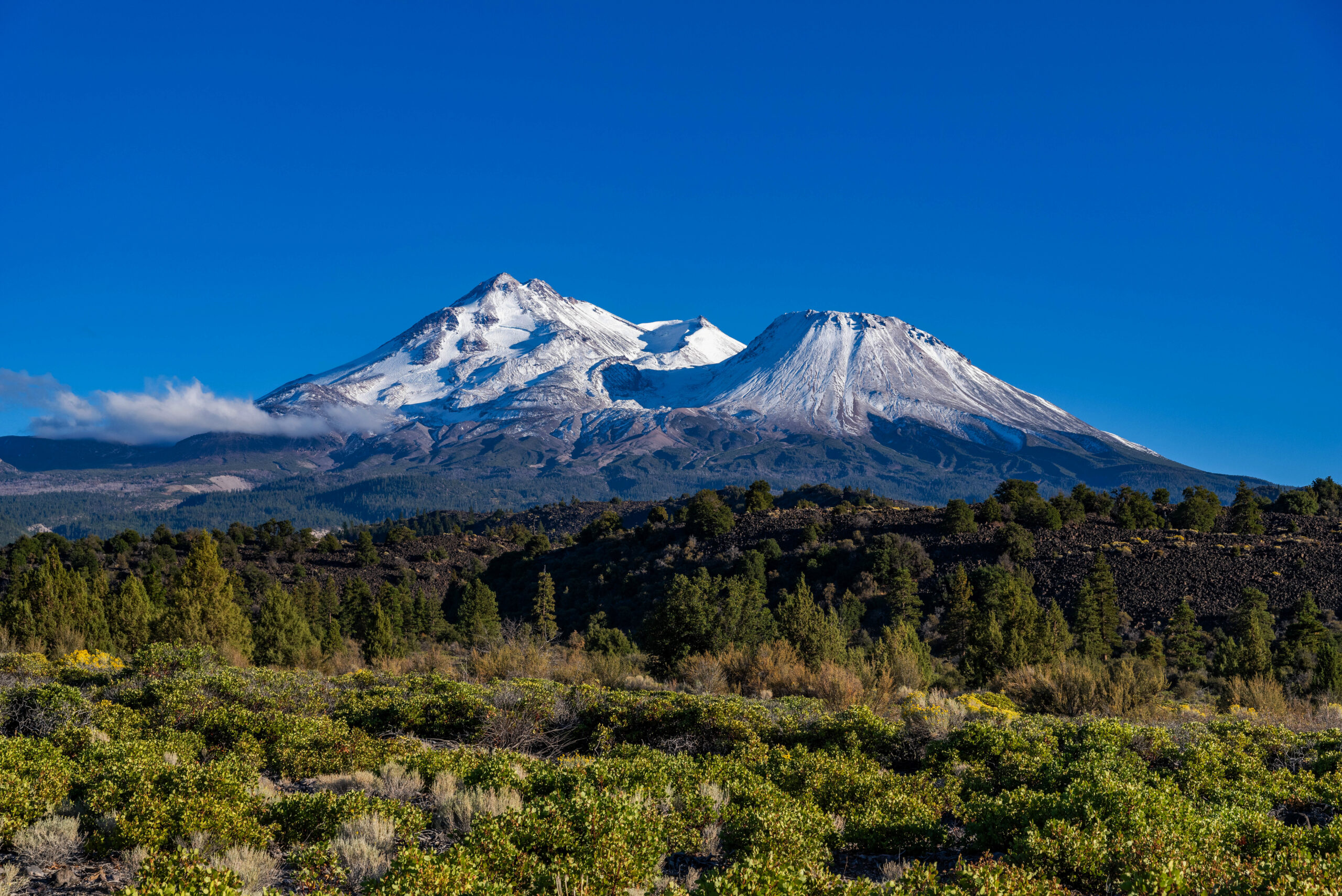
Black Butte
Table Mountain
PNW seasonal note: Pacific Northwest peaks are often hikeable year-round at lower elevations, but snow above 3,000 ft typically arrives by November and persists through May, requiring microspikes or full snow gear. Always check the Washington Trails Association (WTA) trip reports within 48 hours of your planned start date — conditions change rapidly in shoulder seasons.
Region 2: Rocky Mountains & Mountain West
Rocky Mountains & Mountain West
Colorado · Utah · Montana · Wyoming · Idaho · America’s high-altitude beginner training ground
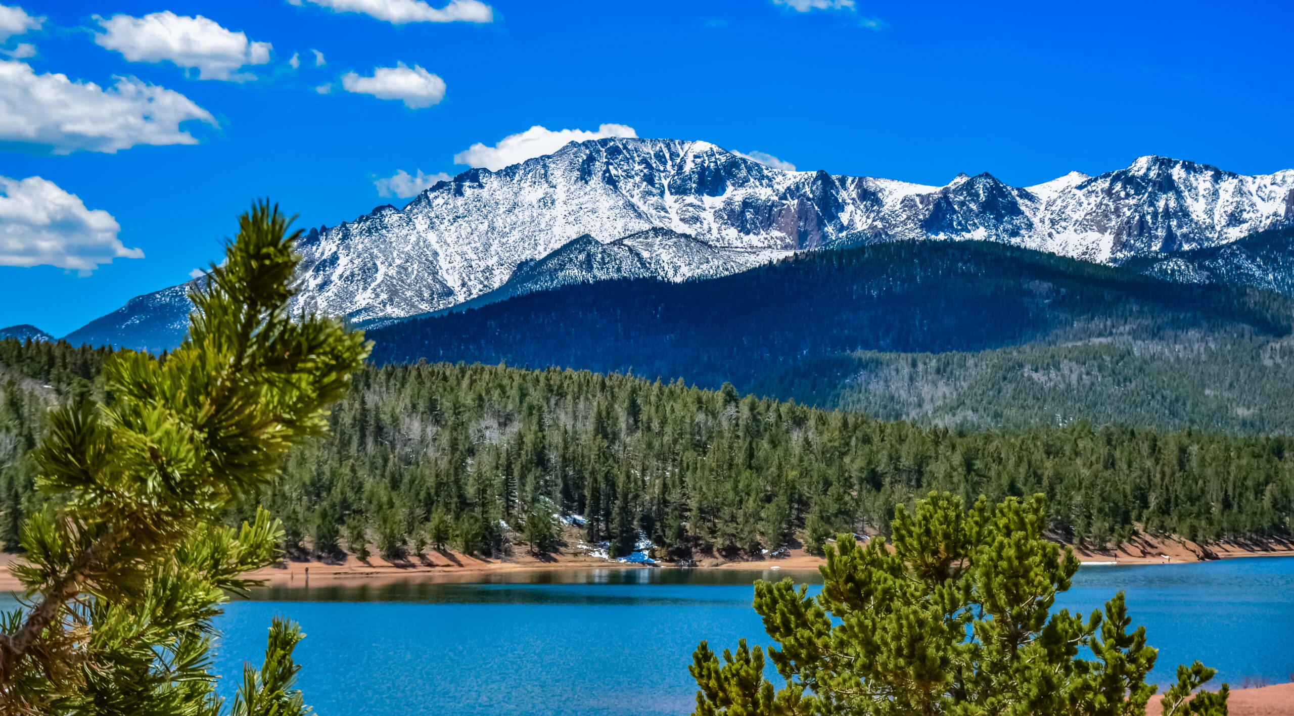
Quandary Peak
Bald Mountain
Sacagawea Peak
Rocky Mountain altitude warning: If you live below 5,000 ft, arrive at least one night before attempting any peak above 10,000 ft. Acute Mountain Sickness (AMS) can affect anyone regardless of fitness. The Colorado 14ers also have a strict unwritten rule — be off all exposed ridges before 1:00 PM due to afternoon lightning storms during summer monsoon season (July-August). Pre-dawn starts (3-5 AM) are standard for Colorado 14er attempts.
Region 3: Southwest
Southwest
Arizona · New Mexico · Nevada · Southern California · Desert-to-alpine ecosystem transitions
Humphreys Peak
Wheeler Peak
Charleston Peak
Southwest heat caution: Southwest peaks are best climbed early — leave the trailhead before 6 AM in summer. Desert heat at lower elevations can be extreme even when it’s cool at the summit. Carry at least 3 liters of water and plan to be descending by noon. Charleston Peak in particular benefits from very early starts due to its long 18-mile round trip.
Region 4: Southeast
Southeast
Tennessee · North Carolina · Georgia · Virginia · West Virginia · Appalachian gateway peaks
Clingmans Dome
Mount LeConte
Brasstown Bald
Southeast humidity note: Southeast mountains feel harder than their elevation suggests due to high humidity, which impairs the body’s ability to cool itself through sweating. Plan for slower times on the ascent than you’d expect, and carry more water than you think you need — at least 500ml per hour of hiking in summer. Spring (April-May) and fall (September-November) often provide more comfortable conditions than peak summer.
Region 5: Northeast
Northeast
New Hampshire · New York · Massachusetts · Vermont · Maine · Granite-summit Appalachian classics
Mount Monadnock
Slide Mountain
Mount Greylock
Northeast above-treeline warning: Northeast peaks above 4,000 ft are exposed to some of the most severe weather in North America. Mt. Washington has recorded the highest wind speed ever measured on Earth’s surface (231 mph in 1934). Any peak with above-treeline sections — including Mt. Monadnock’s exposed summit cone — requires a wind layer, extra insulation, and weather monitoring even on summer days. The Presidential Range (Mt. Washington, Mt. Adams, Mt. Jefferson) is NOT included on this beginner list specifically because of this weather risk.
Region 6: Midwest
Midwest
Missouri · Wisconsin · Michigan · Minnesota · Ohio · Low-elevation training ground for habits and systems
Taum Sauk Mountain
Rib Mountain
Mount Arvon
Midwest perspective: Midwest peaks won’t deliver the dramatic alpine scenery of the Rockies or Cascades — but they’re a completely legitimate starting point for building the habits, fitness, and gear systems that make those bigger mountains possible. Treat them as your training ground, not your ceiling. Many of the strongest American mountaineers started on Midwest peaks before progressing to Western 14ers and Cascade volcanoes.
All 18 Peaks Summary Table
| Region | Peak | Elevation | Gain | Distance | Class |
|---|---|---|---|---|---|
| PNW | Mount Si (WA) | 4,167 ft | 3,150 ft | 8 mi | Class 1 |
| PNW | Black Butte (OR) | 6,436 ft | 1,600 ft | 4 mi | Class 1 |
| PNW | Table Mountain (WA) | 6,389 ft | 2,200 ft | 7.2 mi | Class 1 |
| Rocky | Quandary Peak (CO) | 14,265 ft | 3,450 ft | 6.75 mi | Class 2 |
| Rocky | Bald Mountain (UT) | 11,943 ft | 1,025 ft | 2.7 mi | Class 1 |
| Rocky | Sacagawea Peak (MT) | 9,665 ft | 2,300 ft | 6 mi | Class 2 |
| SW | Humphreys Peak (AZ) | 12,637 ft | 3,460 ft | 9 mi | Class 2 |
| SW | Wheeler Peak (NM) | 13,161 ft | 2,800 ft | 8.4 mi | Class 1 |
| SW | Charleston Peak (NV) | 11,918 ft | 4,020 ft | 18 mi | Class 1 |
| SE | Clingmans Dome (TN/NC) | 6,643 ft | 330 ft | 1 mi | Class 1 |
| SE | Mount LeConte (TN) | 6,593 ft | 2,560 ft | 5 mi | Class 1 |
| SE | Brasstown Bald (GA) | 4,784 ft | 1,085 ft | 4 mi | Class 1 |
| NE | Mount Monadnock (NH) | 3,165 ft | 1,800 ft | 4 mi | Class 2 |
| NE | Slide Mountain (NY) | 4,180 ft | 1,680 ft | 5.4 mi | Class 1 |
| NE | Mount Greylock (MA) | 3,491 ft | 1,280 ft | 4.6 mi | Class 1 |
| MW | Taum Sauk Mountain (MO) | 1,772 ft | Minimal | 0.5 mi | Class 1 |
| MW | Rib Mountain (WI) | 1,924 ft | 640 ft | 3.5 mi | Class 1 |
| MW | Mount Arvon (MI) | 1,979 ft | Minimal | 1 mi | Class 1 |
How to Choose Your Regional First Mountain
The 4-Step Protocol for Choosing Your Regional First Mountain
- Identify your US region. Choose a peak in your home region to minimize travel complexity and maximize the number of seasons you can build progressive experience. Pacific Northwest (Washington, Oregon, Northern California), Rocky Mountains and Mountain West (Colorado, Utah, Montana, Wyoming, Idaho), Southwest (Arizona, New Mexico, Nevada, Southern California), Southeast (Tennessee, North Carolina, Georgia, Virginia, West Virginia), Northeast (New Hampshire, New York, Massachusetts, Vermont, Maine), Midwest (Missouri, Wisconsin, Michigan, Minnesota, Ohio).
- Apply the five-factor beginner test. Verify any potential first summit meets all five criteria: Class 1 or Class 2 difficulty, under 700ft elevation gain per mile, no technical gear required for the route in season, reliable summer window with predictable weather, and a trailhead reachable by standard vehicle.
- Match peak to honest fitness level. Beginners with limited hiking experience should start with the shortest, lowest-gain peaks (Clingmans Dome 330ft gain, Bald Mountain 1,025ft gain, Taum Sauk minimal gain). Beginners with consistent 5-8 mile hiking fitness can attempt mid-tier regional peaks (Black Butte, Brasstown Bald, Mt. Greylock). Beginners targeting first 14ers should treat Quandary Peak as a “first 14er” progression peak rather than a “first summit ever” objective.
- Plan around regional hazards and weather. Each region has specific safety considerations: Pacific NW persistent cloud cover and shoulder-season snow; Rocky Mountains altitude effects above 10,000ft and afternoon thunderstorm risk; Southwest extreme summer heat (start before 6 AM, carry 3+L water); Southeast high humidity slowing pace; Northeast severe above-treeline weather (Mt. Washington recorded highest wind speed ever measured); Midwest as low-elevation training ground for systems and habits.
The 8 Common Mistakes in Regional Beginner Peak Selection
Avoid These Common Regional Beginner Peak Selection Mistakes
- Chasing prestige peaks outside your region. Climbers in the Northeast or Midwest who travel to Colorado for their first 14er typically struggle with altitude they could have prevented with regional progression. Build experience on regional peaks first, then travel to harder objectives with skills already developed.
- Treating Quandary Peak as a “first summit ever.” Quandary is Colorado’s easiest 14er but still requires altitude acclimatization, Class 2 talus scrambling, and afternoon thunderstorm awareness. It’s appropriate as a “first 14er” after completing several easier Class 1-2 regional peaks — not as the first summit attempt.
- Ignoring regional weather windows. Pacific NW snow above 3,000ft persists through May; Rocky Mountain afternoon thunderstorms peak July-August; Southwest summer heat makes pre-dawn starts essential; Northeast above-treeline weather can be deadly even in summer. Match attempts to regional windows, not personal schedules.
- Underestimating gain ratio. A 4-mile peak with 1,800ft gain (450 ft/mile) is significantly harder than an 8-mile peak with 2,400ft gain (300 ft/mile). New climbers focus on total elevation gain or distance instead of the gain ratio that actually predicts difficulty.
- Skipping acclimatization for high-altitude regional peaks. Sea-level visitors attempting Wheeler Peak (13,161ft), Humphreys Peak (12,637ft), or Charleston Peak (11,918ft) without 1-2 nights at altitude first significantly increase AMS risk regardless of fitness level.
- Choosing Northeast above-treeline peaks without weather backup plans. Mt. Monadnock’s bare granite summit is one of the most popular New England peaks but offers no shelter from sudden weather. Always carry wind/rain shell, insulation layer, and headlamp for any Northeast above-treeline objective.
- Dismissing Midwest peaks as “not real climbing.” Midwest peaks are legitimate training ground for habits, fitness, and gear systems. Climbers who dismiss Taum Sauk, Rib Mountain, or Mt. Arvon as “fake mountains” miss the foundational experience that makes harder Western peaks safer later.
- Trying to climb multiple regional peaks in one weekend trip. A single peak with proper preparation produces better outcomes than three peaks rushed. The “one variable at a time” rule applies to peak selection — climb one peak well, learn from it, then plan the next.
What We Don’t Know
Honest limitations of any regional beginner peak guide
These 18 peaks are a curated selection, not an exhaustive list. The USA contains hundreds of Class 1-2 mountains appropriate for first-time climbers. The 18 peaks selected represent strong regional examples that pass the five-factor test, but climbers should also research state highpoints, regional climbing club recommendations, and local trip reports for additional options near home.
Regional climbing seasons are shifting. Climate change has affected traditional weather windows — Pacific Northwest summer fire smoke increasingly affects climbing visibility, Rocky Mountain monsoon thunderstorm patterns have become less predictable, Southwest summer heat extremes are intensifying, and Northeast extreme weather days have increased in frequency. The recommended seasons in this guide reflect 2026 averages but may need adjustment in future years.
Trail conditions and access can change. Mount Si’s North Bend Trailhead infrastructure, Quandary Peak’s trail erosion, Mount Monadnock’s increasing visitation, Clingmans Dome’s seasonal road closures, and various state park access requirements all change year-to-year. Verify current conditions through relevant land management agencies before any planned summit attempt.
The “best” beginner peak depends on individual factors. A 21-year-old varsity athlete and a 65-year-old returning to fitness shouldn’t choose the same first mountain. The peaks in this guide work for most beginners with consistent hiking fitness — but individual variation in altitude tolerance, weather sensitivity, descent comfort, and physical conditioning all affect which peak is right for any specific climber.
Some peaks have multiple route options. Mount LeConte alone has five major trail options (Alum Cave Trail, Trillium Gap, Rainbow Falls, Bullhead, Boulevard) with significantly different difficulty levels. The recommendations in this guide reflect the standard beginner-appropriate route for each peak — other routes may not match the beginner criteria.
The five-factor test doesn’t capture everything. Class 1-2 difficulty, gain ratio under 700ft/mile, no technical gear, reliable season, and accessible trailhead filter out clear non-beginner peaks — but they don’t capture every safety consideration. Exposure, route-finding, ranger presence, and consequence of mistakes all matter beyond the five-factor framework. Apply judgment, not just checklists.
Regional Beginner Mountains FAQ
What is the best beginner mountain in the USA?
There’s no single “best” beginner mountain in the USA — the best peak depends on your region, fitness, and accessibility. The strongest regional recommendations are: Mount Si (Washington, 4,167ft, Class 1) for the Pacific Northwest; Quandary Peak (Colorado, 14,265ft, Class 2) for first 14er attempts; Humphreys Peak (Arizona, 12,637ft, Class 2) for the Southwest; Mount Monadnock (New Hampshire, 3,165ft, Class 2) for the Northeast; Clingmans Dome (Tennessee, 6,643ft, Class 1) for the Southeast; and Taum Sauk Mountain (Missouri, 1,772ft, Class 1) for the Midwest. Each of these peaks passes the five-factor beginner test: Class 1-2 difficulty, manageable gain ratio under 700ft per mile, no technical gear, reliable summer window, and accessible trailhead. The best first mountain isn’t the tallest peak you can reach — it’s the most achievable one within driving distance of home.
What is the easiest mountain to climb in the United States?
The easiest mountain to climb in the United States is Clingmans Dome in the Great Smoky Mountains (Tennessee/North Carolina border, 6,643ft summit) — accessible via a paved one-mile round-trip walk with only 330 feet of elevation gain. Despite being the highest peak east of the Mississippi River, Clingmans Dome requires no hiking ability beyond walking up a paved trail. The trailhead has paved parking, restrooms, and visitor amenities; the summit features an iconic spiral observation tower with 360-degree views of the Appalachians. Other extremely easy USA mountains include Taum Sauk Mountain (Missouri, 1,772ft, minimal gain) and Mount Arvon (Michigan, 1,979ft, 1-mile trail) — both state highpoints accessible to climbers of any fitness level.
What is the best first 14er to climb?
Quandary Peak (14,265ft in Colorado) is the most commonly recommended first 14er. The standard East Ridge route is approximately 6.75 miles round-trip with 3,450 feet of elevation gain, Class 2 difficulty, completable in 5-8 hours by fit beginners. The trailhead starts at 10,850 feet which helps with acclimatization. Climbers attempting their first 14er should know that even Quandary’s accessible reputation doesn’t make it a casual hike — the 14,265-foot summit elevation requires altitude acclimatization (1-2 nights at 9,000ft+), Class 2 talus scrambling on the upper mountain, pre-dawn starts during summer monsoon season to avoid afternoon thunderstorms, and proper hiking fitness. Beginners should complete 2-3 successful Class 1-2 regional summits before attempting Quandary as their first 14er.
How do I choose a beginner mountain in my region?
Choosing a regional beginner mountain involves four steps: (1) Identify your US region from the six major regions, (2) Apply the five-factor beginner test to verify the peak qualifies (Class 1-2 difficulty, under 700ft gain per mile, no technical gear, reliable summer window, accessible trailhead), (3) Match the specific peak to your honest current fitness level — starting with the shortest and lowest-gain peaks if your hiking experience is limited, and (4) Plan around regional hazards (Pacific Northwest weather, Rocky Mountain altitude and afternoon thunderstorms, Southwest extreme heat, Southeast humidity, Northeast above-treeline weather, Midwest low-elevation perspective). The best first mountain is the most achievable peak within driving distance of home — proximity matters more than peak prestige.
Can beginners climb Quandary Peak?
Yes — Quandary Peak is commonly called the easiest Colorado 14er and is appropriate for fit beginners with some prior hiking experience. The standard route from the Quandary Peak Trailhead is 6.75 miles round-trip with 3,450 feet of elevation gain, Class 2 difficulty (no technical gear required), completable in 5-8 hours by fit beginners. The trailhead starts at 10,850 feet which helps with altitude acclimatization, the route is well-marked, and the ridge walk to the summit is straightforward in good conditions. Beginners attempting Quandary should first complete several easier Class 1-2 peaks in their home region, spend 1-2 nights at altitude in Colorado before the attempt, start hiking by 5-6 AM to avoid afternoon thunderstorms during summer monsoon season, and be off all exposed ridges before 1 PM. Quandary is appropriate as a “first 14er” rather than a “first summit ever” objective for true beginners with no prior hiking experience.
What is the highest mountain east of the Mississippi River?
Clingmans Dome (6,643 feet / 2,025 meters) is the highest peak east of the Mississippi River, located on the Tennessee/North Carolina border within Great Smoky Mountains National Park. Despite being the eastern USA’s highest summit, Clingmans Dome is accessible via a paved one-mile round-trip walk with only 330 feet of elevation gain — making it one of the easiest “first summit” experiences anywhere in the United States. The summit features the iconic Clingmans Dome Observation Tower (a 45-foot spiral concrete structure built in 1959), providing 360-degree views of the Appalachian Mountains. The access road is closed from approximately December through March due to winter weather. Mount Mitchell in North Carolina (6,684ft) is technically the highest peak in the eastern USA when measured from sea level, though Clingmans Dome ranks slightly higher in summit elevation depending on measurement methodology.
Sources and Methodology
Numbered Source References
This regional beginner mountains guide synthesizes data from federal land management authorities, state parks, USGS elevation records, and beginner climbing community resources.
- USGS topographic and elevation data. United States Geological Survey — official source for all peak elevations cited in this guide.
- National Park Service (NPS). Authority for Clingmans Dome and Mount LeConte (Great Smoky Mountains National Park) access, road closures, and trail conditions.
- USFS Region 6 (Pacific Northwest). Authority for Mount Si and Pacific Northwest peak access information.
- Washington Trails Association (WTA). WTA — premier source for Pacific Northwest trail conditions and trip reports.
- 14ers.com community database. 14ers.com — standard reference for Quandary Peak and Colorado 14er beginner route information.
- Coconino National Forest (USFS). Authority for Humphreys Peak (Arizona) access and trail conditions.
- USFS Carson National Forest. Authority for Wheeler Peak (New Mexico) and Williams Lake Trail.
- USFS Spring Mountains National Recreation Area. Authority for Charleston Peak and Spring Mountains access.
- Monadnock State Park (NH). Authority for Mount Monadnock route information and current trail conditions.
- State Park authorities for Bald Mountain (Utah Mirror Lake Highway), Sacagawea Peak (Custer Gallatin National Forest), Slide Mountain (Catskill Park), Mount Greylock (Mount Greylock State Reservation), Brasstown Bald (Chattahoochee National Forest), Rib Mountain (Wisconsin State Park), Taum Sauk Mountain (Missouri State Park), and Mount Arvon (Michigan State Forest).
- Internal Global Summit Guide research. Cross-referenced with our Beginner Climbing Guide hub, 50 State Highpoints challenge, and state-by-state mountain cluster pages.
Methodology note. Quarterly review cycle — next review September 2026 (post-summer climbing season). Peak data and recommended seasons verified current as of June 2026. Climbers should verify current trail conditions through relevant land management agencies before any planned summit attempt.
Continue Your Beginner Climbing Journey
The Best First Mountain Is the One Closest to Home
Generally, the most achievable peak within driving distance of home matters more than chasing prestige peaks elsewhere. Specifically, choose your region, apply the 5-factor test, match the peak to your honest current fitness, and plan around regional hazards. Notably, proximity removes every logistical excuse and lets you build progressive experience across multiple seasons without major travel commitments.
Find My First Mountain 50 State Highpoints →Was this helpful?
🏔Related peaks nearby
🧭Explore & compare
Global Summit Guide is an independent mountaineering resource founded in 2026. The team combines first-hand trekking and climbing experience with in-depth research and professional health and nutrition review to help climbers choose objectives, prepare properly, and stay safe.
Health, altitude, and nutrition content is reviewed by Taylor Ludlow (Registered Nurse) and Brigg Hoopes (Nutritionist).
What We Don't Know Yet
Mountain information changes quickly. This box explains the limits of what this page can responsibly promise.
- Weather, snowpack, avalanche risk, road access, and route conditions can change quickly and may be different on your climbing dates.
- Route conditions, trailhead access, crevasse exposure, stream crossings, and rescue access may vary from published planning guidance.
- Gear requirements can change by season, route variation, weather window, personal cold tolerance, and guide-service requirements.
- Fitness and altitude response vary by person; no guide, itinerary, or training plan can guarantee acclimatization or summit success.
Verify current conditions with official land managers, guide services, local forecasts, and current route reports before booking or climbing.
Part of this Global Summit Guide cluster
Explore the complete Pick Your Mountain guide for more context, routes, planning links, and related resources.
Mountaineering, rock and ice climbing, glacier travel, and high-altitude activity are inherently dangerous and can result in serious injury or death. The information on Global Summit Guide is provided for general informational and educational purposes only and is not a substitute for professional instruction, qualified guiding, proper equipment, or your own judgment and experience.
Route conditions, weather, snowpack, permits, regulations, and hazards change constantly and may differ from what is described here. Details may be incomplete, out of date, or contain errors. Always verify current information with local authorities, certified guides, and official sources before making any decision in the mountains.
Nothing on this site is medical, legal, or financial advice. Our fitness, acclimatization, altitude, and nutrition content is general in nature; consult a qualified physician before beginning any strenuous exercise program or exposing yourself to high altitude.
You are solely responsible for your own safety and decisions. To the fullest extent permitted by law, Global Summit Guide and its team accept no liability for any loss, injury, damage, or expense arising from use of, or reliance on, this information. By using this site you acknowledge these risks and accept these terms.
Some links on this site may be affiliate links. If you buy through them we may earn a small commission at no extra cost to you; this never affects our recommendations.
Global Summit Guide recommendation path
Next Best Mountain to Research
Use these recommendations to continue the right planning path instead of stopping on one page.
Use current permit, weather, route, and operator information before booking or climbing.