
Last updated June 3, 2026
How to Read Trail Ratings and Difficulty Scales: YDS Class 1-5 Explained
Class 1 through Class 5 decoded with everyday comparisons — so you can evaluate any mountain before you commit to it, and filter out the ones that aren’t right for your first season. Every mountain has a difficulty rating. Most beginners look at that number, nod, and move on — without actually knowing what it means in terms of what their feet, hands, and nerves will be doing. This guide fixes that.
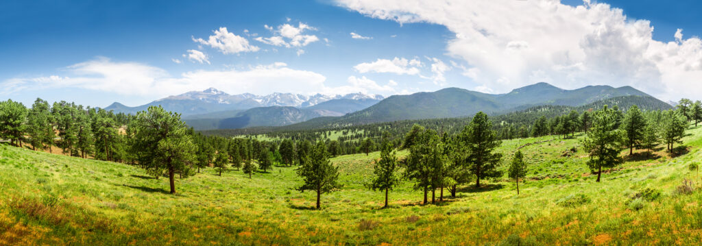
The Yosemite Decimal System (YDS) is the most widely used terrain classification system in the United States, dividing climbing and hiking terrain into five classes based on the type of movement required, the consequence of a fall, and whether technical equipment is needed. Generally, Class 1 is trail walking where hands are never needed, Class 2 is off-trail walking with occasional hand use for balance, Class 3 is active scrambling where hands grip and pull, Class 4 is sustained climbing with significant exposure (rope strongly advised), and Class 5 is technical rock climbing where rope and protection are mandatory. Specifically, the YDS is used throughout climbing guidebooks, ranger stations, hiking apps like Gaia GPS, and mountaineering club resources — beginners must learn this system because trail descriptions assume readers can interpret class ratings. Notably, AllTrails uses a separate algorithmic system (Easy/Moderate/Hard) that measures cardiovascular effort based on distance and elevation but completely ignores technical terrain — meaning a trail rated “Hard” on AllTrails may be a Class 1 walk that’s simply long and steep, while a trail rated “Moderate” may have a Class 3 summit scramble that the algorithm doesn’t capture. Use AllTrails to plan your day; use YDS to decide if you should go at all. The same mountain can be a different class depending on route and season — Mount Whitney via the Main Trail is Class 2 in summer, via the East Face it’s Class 5. For Year 1 beginners, target Class 1-2 only with Low to Mild exposure.
Key Takeaways
- YDS divides terrain into 5 classes based on movement type, fall consequence, and technical gear required.
- Class 1 = walking (hands never needed) · Class 2 = off-trail walking (hands for balance) · Class 3 = scrambling (hands grip and pull) · Class 4 = exposed climbing (rope advised) · Class 5 = technical (rope required).
- Same mountain can be different classes depending on route and season. Mt. Whitney is Class 2 (Main Trail) or Class 5 (East Face). Humphreys Peak is Class 2 in August, requires microspikes in April.
- “Exposure” is NOT the same as difficulty — it refers to height and fall consequence. A Class 2 ridge can be highly exposed; a Class 5 canyon route can feel sheltered.
- AllTrails ratings measure cardiovascular effort, NOT technical difficulty. A “Hard” AllTrails rating may be Class 1; a “Moderate” rating may have a Class 3 scramble.
- The one-sentence rule: Use AllTrails to plan your day, use YDS to decide if you should go at all.
- Trip reports: sort by most recent, not highest-rated. Apply the 48-hour rule for first summits — read at least one report from the past 48 hours.
- Year 1 target: Class 1-2 only. Year 2: select Class 3 with research and experience. Year 3+: Class 4-5 with formal instruction.
- Fear of heights is involuntary — many beginners discover their exposure response on the mountain. Build tolerance on Low-Mild exposure routes first.
Why Difficulty Ratings Matter Before You Pick a Mountain
A difficulty rating isn’t a bragging right — it’s a safety filter. Generally, the difference between a Class 1 trail and a Class 3 scramble isn’t just effort: it’s the presence of genuine fall risk, the need for hand holds, and the level of consequence if something goes wrong. Specifically, for a beginner, choosing the wrong class of terrain means arriving at a section of mountain they have no framework for navigating safely.
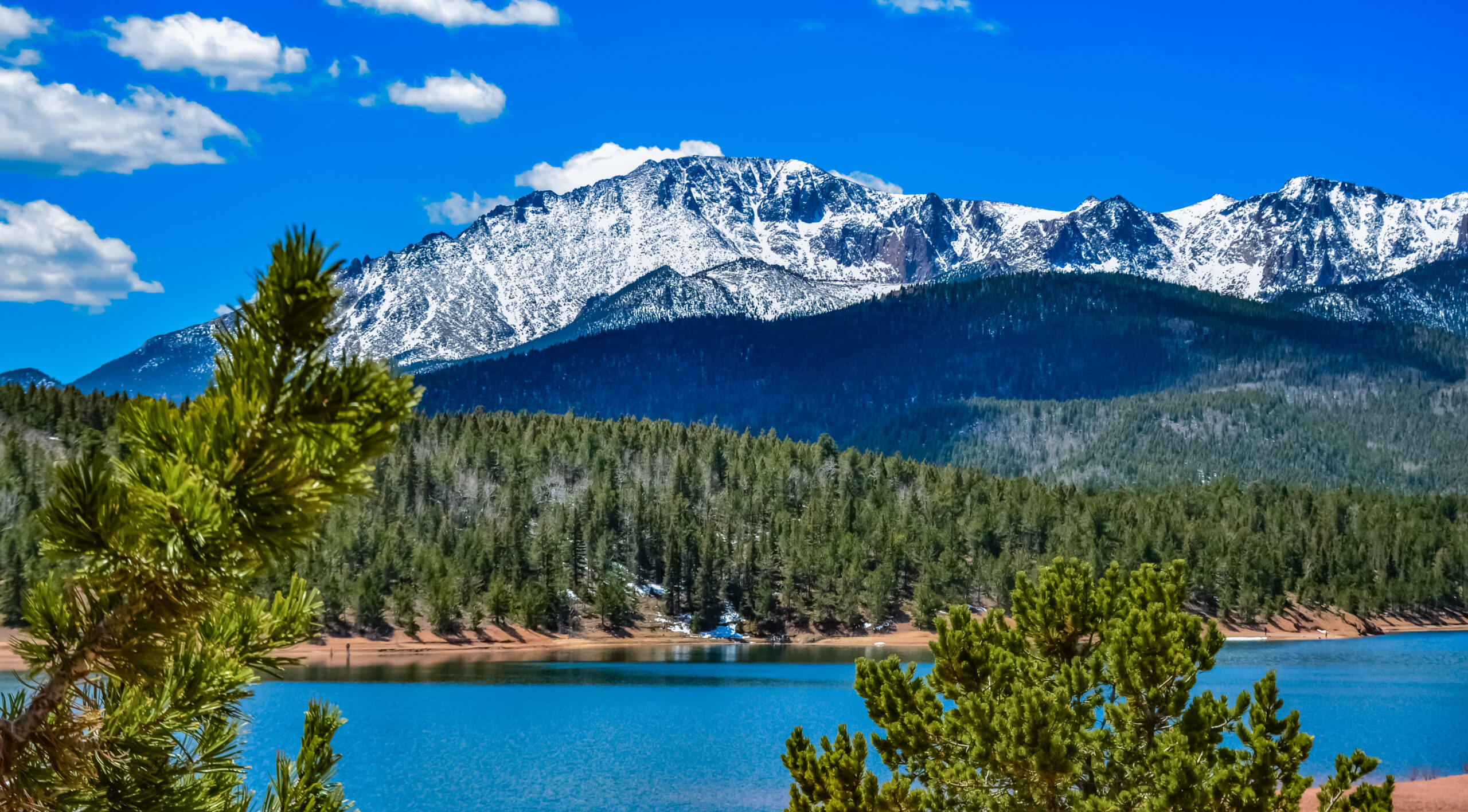
The other reason ratings matter: the same mountain can be a different class depending on the route and the season. Mount Whitney via the Main Trail is Class 2 in summer. Via the East Face it’s Class 5. Humphreys Peak is a Class 2 walk in August and requires microspikes in April. Notably, knowing how to read difficulty ratings means you can evaluate your specific route at your specific time — not just the mountain’s reputation.
Find Hotels, Flights & Trips for the World’s Best Hiking Destinations
The Global Summit Guide Travel Shop on Expedia — curated for outdoor adventurers, mountaineers, and serious hikers. Patagonia to the Alps. Nepal to the Rockies. Curated lodging for every region we cover.
Explore Travel Shop on Expedia →The rating system used throughout this guide. This guide uses the Yosemite Decimal System (YDS) — the most widely used classification system in the USA. It’s what you’ll see on climbing guidebooks, hiking apps like Gaia GPS, and the descriptions used by ranger stations and mountaineering clubs. AllTrails uses its own simpler algorithmic system, which we cover and compare later in this article.
The Yosemite Decimal System: Class 1 Through Class 5
The YDS divides terrain into five classes based on the type of movement required, the consequence of a fall, and whether technical equipment is needed. Generally, read each class below with its everyday comparison — then you’ll never need to guess what a rating means again. Specifically, the system is universal across US climbing resources, so learning these five categories applies to every mountain you might consider.
Class 1 — Walking on Trail
Class 2 — Off-Trail Walking with Scrambling
Class 3 — Scrambling, Hands Actively Used
Class 4 — Sustained Climbing, Significant Exposure
Class 5 — Technical Rock Climbing, Rope Required

What “Exposure” Means — and Why It Matters to Beginners
“Exposure” appears constantly in trail descriptions and trip reports. Generally, it’s one of the most misunderstood terms in the beginner vocabulary — and misunderstanding it is how people end up on terrain they’re not mentally or technically ready for. Specifically, exposure is NOT the same as difficulty. Notably, it refers specifically to the height and consequence of a fall, independent of how technically hard the climbing is. A Class 2 scramble on a narrow ridge can be highly exposed; a Class 5 route in a deep canyon can feel sheltered.
No Significant Drop
A slip results in a tumble on the same surface you’re on. The terrain below you is close to the terrain around you. Consequences are scrapes and bruises.
✓ Beginner OKNoticeable Drop Nearby
There’s a significant drop somewhere near the trail, but the trail itself is wide enough that you’d have to actively step off it. Like a hiking trail with a cliff edge 3 feet to one side.
ManageableDrop Is Part of the Route
The trail runs along a ridge or ledge where a fall to one side would be serious. You’re aware of the drop at all times. A slip in the wrong direction has severe consequences.
⚠ Evaluate CarefullyFatal Fall Potential
A slip anywhere on the section could result in a fatal fall. Both sides of a ridge may have fatal drops. This level appears on Class 3+ terrain and is not appropriate for beginners.
⛔ Expert TerrainThe hidden beginner danger: fear of heights discovered on the mountain. Many people discover their response to exposure for the first time on an actual mountain. The adrenaline response to a significant drop — elevated heart rate, shaky legs, tunnel vision, freezing — is involuntary and can be debilitating regardless of fitness or technical skill. If you’ve never tested your response to exposure, choose Class 1 peaks with Low to Mild exposure for Year 1. Deliberately build exposure tolerance on short, low-consequence terrain before committing to ridgelines or summits with significant drops.
AllTrails Difficulty vs YDS: How They Differ and Which to Trust
AllTrails is the most widely used hiking app in the USA with over 50 million users. Generally, its difficulty ratings (easy, moderate, hard) are calculated algorithmically based on distance and elevation gain — they measure cardiovascular effort, not technical difficulty. Specifically, a trail rated “hard” on AllTrails may be a Class 1 walk that’s simply long and steep. A trail rated “moderate” may have a Class 3 summit scramble that the algorithm doesn’t capture.
| System | What It Measures | Strength | Blind Spot |
|---|---|---|---|
| AllTrails Easy / Moderate / Hard | Distance + elevation gain formula | Quick cardiovascular difficulty gauge — useful for planning how long a hike will take | Completely ignores technical terrain. A “moderate” rating tells you nothing about whether hands are needed, whether there’s exposure, or whether the route is marked |
| Yosemite Decimal System Class 1-5 | Technical terrain type and fall consequence | Tells you exactly what your body will be doing and what the stakes are if something goes wrong | Tells you nothing about distance, elevation gain, or how long a route takes. Classifies the type of movement, not the volume of it |
| Used together | Full picture | AllTrails for planning your day (timing, water needs, pacing) · YDS for evaluating technical appropriateness | Neither system captures current conditions — trail reports from the past 7 days are your best supplement to both |
Star Ratings, User Reviews, and How to Interpret Trip Reports
Star ratings and user reviews on AllTrails, Gaia GPS, 14ers.com, and mountain forums are an underused resource. Generally, most beginners read the top review, see five stars, and assume all is well. Specifically, the actual information is buried in the text of the most recent reviews — and if you know what phrases to look for, you can build a very accurate picture of current conditions.
What You Want to See
- “Trail was well-marked throughout”
- “No snow or ice on the route” (in season)
- “Completed in X hours with kids / first-timers”
- “Clear views all the way to the summit”
- “Plenty of parking, busy but manageable”
- “Would recommend for anyone in reasonable shape”
- “Trail crews had been through recently”
- “Microspikes not needed” (early or late season)
What Should Give You Pause
- “Some exposure near the top”
- “Route-finding was tricky / we got off-trail”
- “Snow patches on the upper section”
- “Turned around before the summit”
- “Only recommended for experienced hikers”
- “Crampons / microspikes recommended”
- “The scramble to the summit was sketchy”
- “Lost the trail above the treeline”
One critical habit: always sort by most recent reviews, not highest-rated. Generally, a trail that was perfect in August may have a washed-out section in October. Specifically, the star rating averages years of reviews; the most recent text tells you what it’s like right now. Notably, for current conditions also check the Washington Trails Association (Pacific Northwest), 14ers.com (Colorado), and the local ranger district’s current conditions page.
What Beginners Should Target: Class 1-2 Only in Year One
This isn’t a conservative recommendation — it’s the framework that produces the best long-term outcomes. Generally, Class 1 and 2 terrain gives you everything you need to build confidence, learn your body, stress-test your gear, and develop the mountain instincts that make Class 3 and beyond genuinely safe when you eventually get there. Specifically, climbers who skip this progression and attempt Class 3+ routes in Year 1 have dramatically higher rates of failure, injury, and quitting the sport.
Year 1: Target
Class 1 and Class 2 peaks — any terrain where your hands aren’t actively required for upward movement and falls don’t have fatal consequences. Low to Mild exposure preferred.
Year 2: Explore
Class 2+ and select Class 3 terrain — with research, good conditions, a partner, and the experience from 5-8 Class 1-2 summits behind you. Build exposure tolerance progressively.
Year 3+: Avoid Until
Class 4 and Class 5 terrain — these require formal instruction (American Alpine Institute, NOLS, RMI), technical gear, and a partner who knows what they’re doing. Not beginner peaks regardless of online descriptions.
The 8 Common Mistakes in Reading Trail Ratings
Avoid These Common Beginner Rating Mistakes
- Treating AllTrails “Hard” as equivalent to technical difficulty. AllTrails Hard rating measures distance and elevation gain — it tells you the route is a long day but says nothing about whether you’ll need hands for climbing. A 12-mile Class 1 trail rates Hard. So does a 4-mile Class 3 scramble. Use YDS to evaluate technical difficulty separately.
- Assuming “moderate” means beginner-friendly. The opposite mistake — AllTrails Moderate can hide Class 3 sections in the algorithm. Always cross-reference with YDS Class before committing to any moderate-rated route. A moderate-rated peak with a Class 3 summit scramble is not beginner-appropriate regardless of total mileage.
- Ignoring exposure level when class rating seems beginner-friendly. A Class 2 ridge walk can have High exposure (fatal fall potential on both sides). Class 2 with Low exposure is appropriate for Year 1; Class 2 with High exposure may not be, especially for beginners who haven’t tested their fear-of-heights response.
- Failing to check the specific route, not just the mountain. Mount Whitney is Class 2 via the Main Trail and Class 5 via the East Face. Mount Hood South Side is Class 3-4 with snow/ice depending on season. Always identify the YDS rating for your specific intended route, not just the mountain’s general reputation.
- Sorting trip reports by highest-rated instead of most recent. Star ratings average years of reviews. The most recent text reports tell you current conditions. A trail that was perfect in August may have a washed-out section in October. Always sort by most recent.
- Reading only one trip report. A single recent positive report may reflect an unusually fit climber on an unusually good weather day. Cross-reference at least 2-3 recent reports for a complete picture of current conditions — and check official sources like ranger districts when reports conflict.
- Assuming a peak you’ve done before is the same class in different seasons. Mount Washington (NH) is Class 2 in summer, Class 4+ with rope-team weather in winter. Humphreys Peak is Class 2 in August, requires microspikes in April. Re-verify class and conditions for every shoulder-season or off-season attempt.
- Pushing into Class 3 in Year 1 because “it’s still considered scrambling, not climbing.” Class 3 is genuinely climbing. The “scrambling” terminology causes beginners to underestimate the consequences — a Class 3 fall can break bones and cause serious injury. Year 1 means Class 1-2 only, regardless of how Class 3 is described online.
What We Don’t Know
Honest limitations of any trail rating system
YDS ratings have subjective variation between sources. The Class 1-5 system is widely used but applied somewhat differently across guidebooks, websites, and trip reports. A peak rated “Class 2” in one source may be described as “Class 3” in another, especially in the borderline cases. Read multiple route descriptions, check current trip reports, and prefer conservative ratings when starting.
The class system doesn’t capture all mountain difficulty. Class 2 on loose talus with afternoon thunderstorm exposure can be more committing than Class 3 on solid rock in stable weather. Class ratings describe technical difficulty of movement but don’t fully capture weather, altitude, exposure, route-finding, or consequence factors. Combine class ratings with other route information rather than relying on numbers alone.
AllTrails algorithm continues to evolve. The Easy/Moderate/Hard categorization is recalculated periodically based on user data and route updates. A trail rated Moderate this year may be rated Hard next year based on algorithm refinements — and may also depend on user reporting patterns specific to that route.
Climate change affects traditional class boundaries. Routes that were reliable Class 2 summer climbs are increasingly affected by lingering snowpack, fire smoke, washouts, and weather extremes that effectively change their class characteristics. Pacific Northwest peaks, Colorado 14ers, and Northeast above-treeline objectives have all seen seasonal class profiles shift in recent years.
Individual climber variation matters. A Class 3 route that feels comfortable to one Year 2 climber may feel terrifying to another due to differences in fear-of-heights response, balance, comfort with exposure, and general mountain experience. Use class ratings as starting points for route evaluation, not as definitive judgments about whether you specifically can climb something.
The class system was developed for technical rock climbing. The YDS originated in Yosemite National Park for technical rock climbing and was later extended to hiking and scrambling terrain. Some inherent inconsistencies exist in how the system applies to mixed terrain (snow, ice, scree slopes, glaciated approaches) — particularly at the Class 2/3 borderline where definitions become subjective.
Trail Ratings FAQ
What is the Yosemite Decimal System (YDS)?
The Yosemite Decimal System (YDS) is the most widely used terrain classification system in the United States, dividing climbing and hiking terrain into five classes based on the type of movement required, the consequence of a fall, and whether technical equipment is needed. Class 1 is trail walking where hands are never needed, Class 2 is off-trail walking with occasional hand use for balance, Class 3 is active scrambling where hands grip and pull for upward movement, Class 4 is sustained climbing with significant exposure where rope is strongly advised, and Class 5 is technical rock climbing where rope and protection are required. Class 5 is further subdivided on a decimal scale from 5.0 (relatively straightforward) to 5.15d (the absolute frontier of human climbing performance). The YDS is the standard reference used by climbing guidebooks, mountain ranger stations, mountaineering clubs, and apps like Gaia GPS.
What is Class 3 hiking and is it dangerous?
Class 3 hiking is genuinely climbing rather than just hiking. On Class 3 terrain both hands and feet are actively engaged in moving upward — your hands are gripping rock holds, pulling your body upward, and searching for the next hold, not just steadying you for balance. Class 3 can include sections that feel exposed (a ledge with significant drops below, a narrow ridge with air on both sides) and a slip on Class 3 terrain can result in serious injury including broken bones. Class 3 is NOT appropriate for first-season beginners and is best reserved for Year 2 climbers who have completed 5-8 successful Class 1-2 summits across varied conditions. Helmet is recommended on most Class 3 routes, and rope is optional depending on exposure level. Examples of Class 3 USA terrain include Kings Peak (Utah), Capitol Peak approach (Colorado), and some Mount Washington routes (New Hampshire).
What does “exposure” mean in hiking and climbing?
Exposure refers specifically to the height and consequence of a fall, independent of how technically hard the climbing is. Exposure is NOT the same as difficulty — a Class 2 scramble on a narrow ridge can be highly exposed, while a Class 5 route in a deep canyon can feel sheltered. Four exposure levels exist: Low (slip results in tumble on same surface — scrapes and bruises only), Mild (noticeable drop nearby but trail is wide enough that you’d have to actively step off it), Moderate (drop is part of the route and you’re aware of it at all times — slip has severe consequences), and High (fatal fall potential anywhere on section, often both sides of a ridge with fatal drops). Many people discover their fear-of-heights response for the first time on an actual mountain — the adrenaline response (elevated heart rate, shaky legs, tunnel vision, freezing) is involuntary and can be debilitating regardless of fitness or technical skill. Beginners who have never tested their exposure response should choose Class 1 peaks with Low to Mild exposure for Year 1.
What’s the difference between AllTrails difficulty and YDS class?
AllTrails difficulty ratings (Easy/Moderate/Hard) measure cardiovascular effort calculated algorithmically based on distance and elevation gain — they completely ignore technical terrain. A trail rated “Hard” on AllTrails may be a Class 1 walk that’s simply long and steep, while a trail rated “Moderate” may have a Class 3 summit scramble that the algorithm doesn’t capture. YDS Class measures technical terrain type and fall consequence — telling you exactly what your body will be doing and what the stakes are if something goes wrong. The systems work together when used correctly: use AllTrails to plan your day (timing, water needs, pacing), and use YDS to decide if you should go at all. The one-sentence rule: If a peak is Class 1 on YDS, AllTrails will tell you how long and hard the day is. If it’s Class 3+ on YDS, AllTrails’s “moderate” label doesn’t override that — you need the YDS rating before the AllTrails rating.
Can beginners climb Class 3 routes?
Not in Year 1. Class 3 terrain is best reserved for Year 2+ climbers who have completed 5-8 successful Class 1-2 summits across varied conditions. Class 3 climbing requires active hand-and-foot coordination on terrain where falls have serious consequences — broken bones, significant injury, and in some cases fatal outcomes depending on exposure. The year-by-year progression is: Year 1 should target Class 1 and Class 2 peaks only; Year 2 can explore select Class 3 routes with research, good conditions, partner support, and the experience from previous beginner summits; Year 3+ may consider Class 4-5 terrain but only with formal mountaineering instruction, proper technical gear, and partner systems. This isn’t a conservative recommendation — it’s the framework that produces the best long-term outcomes, allowing climbers to build the mountain instincts that make Class 3 and beyond genuinely safe when they eventually get there.
How do I read trip reports for mountain conditions?
Always sort trip reports by most recent rather than highest-rated. The star rating averages years of reviews, while the most recent text tells you current conditions. Look for eight green-light phrases (what you want to see): “Trail was well-marked throughout,” “No snow or ice on the route” (in season), “Completed in X hours with kids/first-timers,” “Clear views all the way to the summit,” “Plenty of parking, busy but manageable,” “Would recommend for anyone in reasonable shape,” “Trail crews had been through recently,” and “Microspikes not needed” (early or late season). Watch for eight red-flag phrases (what should give you pause): “Some exposure near the top,” “Route-finding was tricky/we got off-trail,” “Snow patches on the upper section,” “Turned around before the summit,” “Only recommended for experienced hikers,” “Crampons/microspikes recommended,” “The scramble to the summit was sketchy,” and “Lost the trail above the treeline.” Apply the 48-hour rule for first summits — read at least one trip report from the past 48 hours before going.
Sources and Methodology
Numbered Source References
This trail ratings and difficulty guide synthesizes data from the Yosemite Decimal System standard, climbing education organizations, federal land management authorities, and trip report databases.
- Yosemite Decimal System (YDS) standard. Climbing difficulty rating system originated in Yosemite National Park, now the standard reference for North American climbing route ratings (Class 1 through Class 5 with decimal subdivision).
- American Alpine Club (AAC). AAC — national climbing organization providing class definitions, beginner education resources, and accident reporting (Accidents in North American Climbing).
- 14ers.com community database. 14ers.com — standard reference for Colorado 14er route descriptions, class ratings, and current trip reports.
- SummitPost.org community database. SummitPost — community-driven mountain database with class ratings and route descriptions across the United States.
- Washington Trails Association (WTA). WTA — premier source for Pacific Northwest trail conditions and trip reports.
- AllTrails. AllTrails — over 50 million user platform whose algorithmic difficulty system (Easy/Moderate/Hard) is referenced throughout this guide for comparison with YDS.
- National Park Service (NPS) and USFS. Federal land management authorities providing official route information for Mount Whitney, Mount Rainier, Grand Teton, Denali, and other major USA peaks referenced in class examples.
- The Mountaineers (Pacific Northwest). The Mountaineers — established climbing education organization whose Mountaineering: The Freedom of the Hills text remains the standard reference for class definitions and progression frameworks.
- Internal Global Summit Guide research. Cross-referenced with our Mountain Difficulty Ratings Guide, Beginner Climbing Guide hub, and Hiking vs Mountain Climbing.
Methodology note. Quarterly review cycle — next review September 2026 (post-summer climbing season). Class examples and progression recommendations verified current as of June 2026. Class ratings can have subjective variation between sources — climbers should cross-reference at least 2-3 sources before any first-summit attempt.
What’s Next?
Learn to Read Class Ratings Once — Apply Them to Every Mountain Forever
Generally, the YDS Class 1-5 framework is universal across US climbing — investing time to understand it now pays dividends across every future mountain decision. Specifically, target Class 1-2 only in Year 1, progress to select Class 3 in Year 2, and consider Class 4-5 only with formal instruction in Year 3+. Notably, this isn’t a conservative recommendation — it’s the framework that produces the best long-term outcomes.
Review the 5 Classes Choose Your First Mountain →Was this helpful?
🏔Related guides
🧭Explore & compare
Global Summit Guide is an independent mountaineering resource founded in 2026. The team combines first-hand trekking and climbing experience with in-depth research and professional health and nutrition review to help climbers choose objectives, prepare properly, and stay safe.
Health, altitude, and nutrition content is reviewed by Taylor Ludlow (Registered Nurse) and Brigg Hoopes (Nutritionist).
What We Don't Know Yet
Mountain information changes quickly. This box explains the limits of what this page can responsibly promise.
- Weather, snowpack, avalanche risk, road access, and route conditions can change quickly and may be different on your climbing dates.
- Route conditions, trailhead access, crevasse exposure, stream crossings, and rescue access may vary from published planning guidance.
- Gear requirements can change by season, route variation, weather window, personal cold tolerance, and guide-service requirements.
Verify current conditions with official land managers, guide services, local forecasts, and current route reports before booking or climbing.
Part of this Global Summit Guide cluster
Explore the complete Training guide for more context, routes, planning links, and related resources.
Mountaineering, rock and ice climbing, glacier travel, and high-altitude activity are inherently dangerous and can result in serious injury or death. The information on Global Summit Guide is provided for general informational and educational purposes only and is not a substitute for professional instruction, qualified guiding, proper equipment, or your own judgment and experience.
Route conditions, weather, snowpack, permits, regulations, and hazards change constantly and may differ from what is described here. Details may be incomplete, out of date, or contain errors. Always verify current information with local authorities, certified guides, and official sources before making any decision in the mountains.
Nothing on this site is medical, legal, or financial advice. Our fitness, acclimatization, altitude, and nutrition content is general in nature; consult a qualified physician before beginning any strenuous exercise program or exposing yourself to high altitude.
You are solely responsible for your own safety and decisions. To the fullest extent permitted by law, Global Summit Guide and its team accept no liability for any loss, injury, damage, or expense arising from use of, or reliance on, this information. By using this site you acknowledge these risks and accept these terms.
Some links on this site may be affiliate links. If you buy through them we may earn a small commission at no extra cost to you; this never affects our recommendations.
Global Summit Guide recommendation path
Next Best Mountain to Research
Use these recommendations to continue the right planning path instead of stopping on one page.
Use current permit, weather, route, and operator information before booking or climbing.