
Last updated September 10, 2026

12 Best Mountains Near Salt Lake City: Hikes by Drive Time & Difficulty
If you want one classic Salt Lake summit, choose Mount Olympus; if you want the best first substantial summit, start with Grandeur Peak. This guide compares the strongest mountain days near downtown by drive time, duration, difficulty and what kind of outing each one actually delivers.
Choose by the Day You Have—not by Which Peak Has the Biggest Number.
Mount Olympus is the signature Salt Lake City summit: steep, obvious from the valley, close to downtown and hard enough to feel like a real mountain day.
Grandeur Peak is the better first substantial summit for many hikers because it delivers real vertical gain without Olympus’s relentless steepness and upper scrambling.
Lake Blanche is the best scenery-first choice if the goal is an alpine basin rather than a summit. Sunset Peak is the best shorter high-elevation summit. Pfeifferhorn is the best progression into exposed scrambling, while Lone Peak is the endurance test.
Visitors with only an hour should use Ensign Peak for a city-and-mountain viewpoint rather than pretending a short outing is the same product as a full Wasatch summit.
12 Best Mountains & Summit Hikes Near Salt Lake City
This is not a county-boundary list. It is a practical “what can I do from Salt Lake City?” guide, which is why Timpanogos appears as a farther day-trip option while the county-list page remains separate.
| Mountain / hike | Approx. drive* | Typical outing | Difficulty | Best for | Decision |
|---|---|---|---|---|---|
| 1. Mount Olympus | 15–20 min | 6–8 hr | Strenuous | Iconic SLC summit | Best overall mountain day close to the city |
| 2. Grandeur Peak | 20–30 min | 3–5 hr | Moderate–strenuous | First substantial summit | Best all-around progression peak |
| 3. Lake Blanche | 25–35 min | 4–6 hr | Moderate–strenuous | Alpine scenery | Best scenery-first hike |
| 4. Mount Wire | 10–15 min | 2–4 hr | Moderate | Training / city views | Best bridge from foothills to bigger summits |
| 5. Sunset Peak | 35–45 min | 2–4 hr | Moderate | Short high-elevation summit | Best time-to-alpine payoff |
| 6. Mount Aire | 25–35 min | 3–5 hr | Moderate | Quieter summit | Good alternative when Grandeur is too obvious |
| 7. Raymond + Gobblers | 30–40 min | 6–9 hr | Strenuous | Long central-Wasatch day | Best linked-summit training day |
| 8. Pfeifferhorn | 35–45 min | 7–10 hr | Advanced | Exposed scrambling | Best progression into alpine scrambling |
| 9. Lone Peak | 30–45 min | 10–14 hr | Advanced | Endurance + commitment | Best hard local test piece |
| 10. South Twin Peaks | 35–45 min | Full day | Advanced | County high-point objective | Peakbagging significance + serious terrain |
| 11. Mount Timpanogos | 45–60+ min | 8–12 hr | Strenuous | Bucket-list Wasatch day | Best farther day trip from SLC |
| 12. Ensign Peak | 10 min | 30–60 min | Easy | Visitor viewpoint | Best one-hour city-and-mountain option |
*Approximate drive from central Salt Lake City outside peak traffic. Route, trailhead and duration figures are planning ranges; verify the exact route and current access before departure.
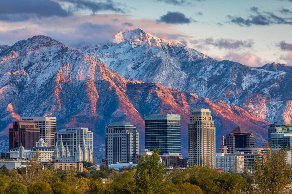
The Range Starts Where the City Ends.
A visitor can choose between a one-hour viewpoint, a half-day training summit, a classic full mountain day or a committing alpine objective without changing the home base.
Best Salt Lake Mountain by How Much Time You Have
Time is the fastest way to avoid choosing the wrong objective. A “best hike” that does not fit the day is not the best hike.
Ensign Peak
Use it when you have an airport-day, conference-day or sunset window. It is a viewpoint hike rather than a serious summit, and that is exactly why it belongs here.
Best for visitors with almost no spare time.Mount Wire
A more useful training objective than Ensign, with enough vertical and distance to feel like a workout while staying close to the city.
Best quick training mountain.Grandeur Peak
The best balance of summit feeling, accessibility and effort. Use it to judge whether your legs and pacing are ready for a steeper full-day peak.
Best half-day summit.Lake Blanche
Choose this when scenery matters more than checking off a summit. The basin beneath Sundial Peak delivers classic central-Wasatch terrain without exposed summit scrambling.
Best alpine hike without summit pressure.Mount Olympus
Relentless vertical directly above the valley makes Olympus feel much bigger than its elevation suggests. Do it after several substantial hikes, not simply because it looks close.
Best classic mountain day close to downtown.Lone Peak
When the goal is to test endurance, route management and all-day pacing without leaving the Wasatch Front, Lone Peak is the serious local objective.
Best full-day endurance test.A Simple Salt Lake Mountain Progression
The Wasatch makes progression easy because the next difficulty tier often sits only one canyon away.
Ensign → Mount Wire
Learn early-start routines, footwear, hydration and steady pacing on lower-consequence objectives.
Goal: finish with energy and consistent pacing.Grandeur → Mount Aire → Sunset
Add sustained vertical, longer descents and higher elevations. Grandeur is especially useful because it reveals pacing and fitness gaps before a bigger objective.
Goal: handle 3–5 hours comfortably.Lake Blanche → Olympus → Raymond/Gobblers
Now food, weather timing, descent strength and turnaround discipline become part of the day.
Goal: manage a 6–9 hour mountain day.Pfeifferhorn → Lone Peak → South Twin
These objectives require more than fitness. Exposure tolerance, route judgment, efficient movement and retreat decisions matter.
Goal: arrive with proven endurance and scrambling judgment.Which Wasatch Access Zone Fits Your Day?
This page no longer tries to be the definitive Wasatch geography article. Use the broader Wasatch parent for the range; use this section simply to choose where to drive from Salt Lake City.
Fastest Access
Mount Wire, Ensign Peak and Mount Olympus start close to the urban edge. Use these when driving time must stay minimal or the goal is training with a valley view.
Best fit: short-window and close-to-city summit days.Best Progression Canyon
Grandeur, Mount Aire, Mount Raymond and Gobblers Knob create a natural progression from moderate to long. Rules and seasonal road access can change, so check current county information before the trip.
Best fit: hikers building from moderate to strenuous.Best Scenery & Mid-to-High Wasatch Variety
Lake Blanche, Butler Fork objectives and Brighton-area summits provide everything from destination hikes to long summit days. Big Cottonwood is part of Salt Lake City’s protected watershed system.
Best fit: alpine lakes, fall color and higher-elevation hiking.Best Advanced Progression
Pfeifferhorn, Red Pine/Maybird approaches and other high Wasatch objectives create a natural next step for experienced hikers. It is also protected watershed terrain.
Best fit: advanced hiking and exposed scrambling progression.American Fork / Timpanogos
Timpanogos is not a Salt Lake County mountain, but it is close enough to function as a full-day objective from Salt Lake City. Treat it as a destination day rather than a local after-work hike.
Best fit: bucket-list Wasatch day from an SLC base.Use the Wasatch Regional Parent
The Wasatch Mountains hiking guide owns broader geography, range structure and progression.
This page stays focused on the Salt Lake decision.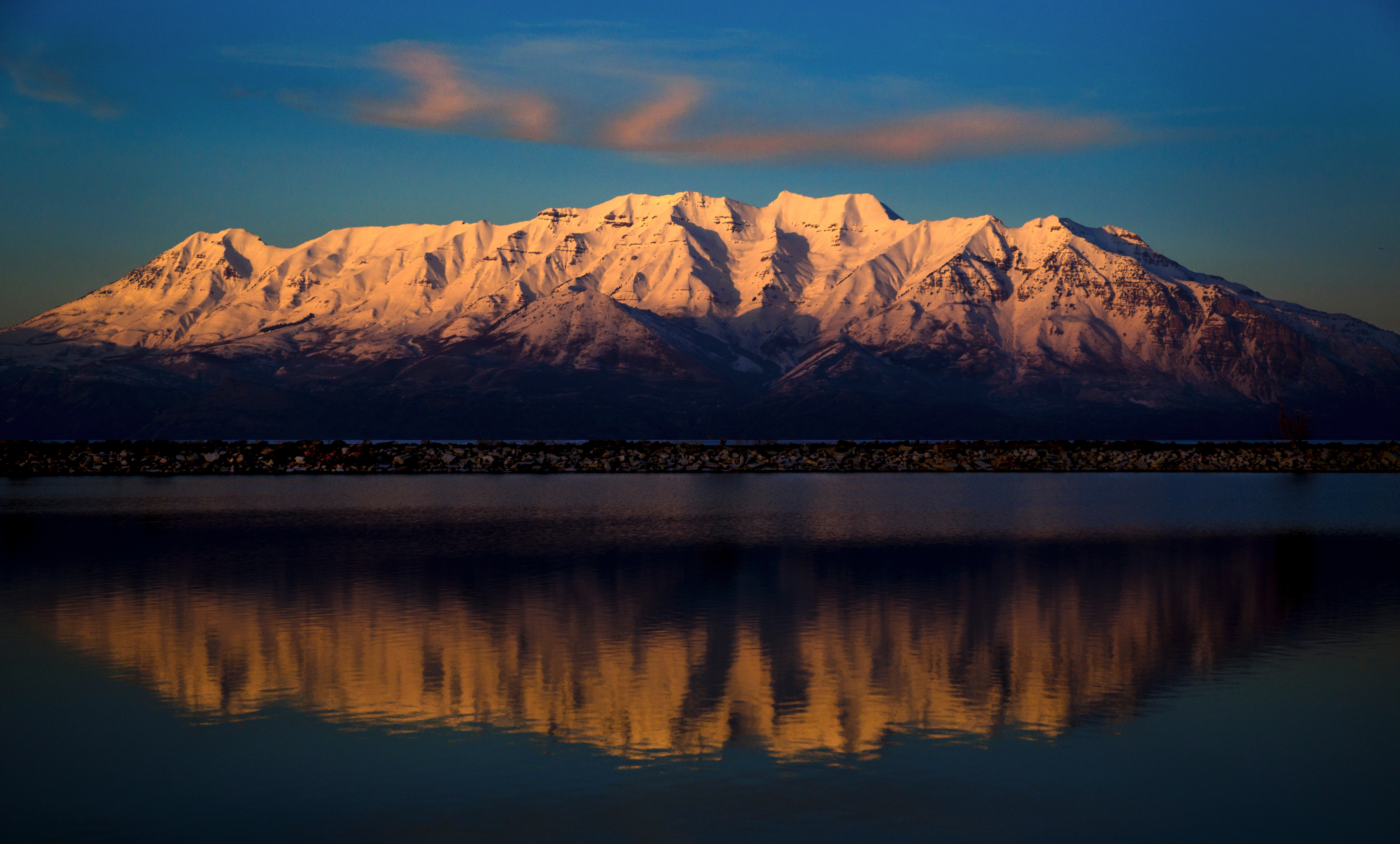
Timpanogos Is Worth the Longer Drive—but It Should Not Distort the Salt Lake List.
The question is not merely how many miles away the trailhead sits; it is whether the mountain still fits the day you have.
Repeated Wasatch Miles Change What “Best” Means.
A generic list overvalues summit elevation and famous names. Local mountain selection is more about repeatability, access, progression and what the peak teaches.
The Wasatch Is Our Home Training Range
Global Summit Guide’s documented climbing record includes repeat ascents across Mount Nebo, Mount Timpanogos, Lone Peak, Pfeifferhorn, Mount Olympus, Grandeur Peak, Mount Raymond, Gobblers Knob and other Wasatch objectives.
That lets us compare what the progression feels like rather than ranking peaks only from database statistics.
See the documented climbing experience →Olympus Is Better Than Timpanogos When You Only Have Six Hours.
Timpanogos may be the more complete alpine hike, but a mountain that needs a longer drive and trail day is the wrong recommendation for a short Salt Lake stay.
Time available is part of mountain difficulty.Grandeur Is More Valuable Than Its Elevation Suggests.
Grandeur is close, repeatable and steep enough to expose pacing and fitness problems before they appear on a bigger objective.
Training value matters in a local ranking.Not Every Nearby Summit Belongs on the “Best” List.
The Wasatch contains dozens of peaks accessible from the Salt Lake Valley. We would rather give a visitor twelve clearly different choices than inflate the page with thirty near-duplicates.
Use the peak inventory when completeness is the goal.Salt Lake Canyon Access: What to Verify Before You Drive
The old page contained oversimplified dog and fee guidance. This rebuild keeps volatile rules tied to the agencies that actually manage them.
| Check | Why it matters | Current source |
|---|---|---|
| Protected-watershed rules | Salt Lake City’s protected watershed system includes City Creek, Parleys, Big Cottonwood and Little Cottonwood; domestic animals are prohibited in protected watershed areas. | Salt Lake City Public Utilities |
| Trail and forest access | Closures, trail work, fire restrictions and seasonal access can change the practical route. | Uinta-Wasatch-Cache National Forest |
| Snow and avalanche hazard | A summer hike can become avalanche terrain when snow covers the route. | Utah Avalanche Center |
| Weather | Wind, lightning, heat and early-season snow can matter more than the trail rating. | National Weather Service Salt Lake City |
| Parking / road travel | Canyon traffic, ski operations, construction and crowded trailheads can add meaningful time. | Current canyon notice + live navigation on hike day |
When the Salt Lake Shortlist Turns Into Peakbagging
These pages continue three different intents without forcing this URL to absorb all Utah mountain content.
Wasatch Range Peaks
If twelve best-fit choices are not enough and you want the peak inventory, use the dedicated Wasatch list rather than turning this city guide into a database.
Explore Wasatch Range peaks →Best Peaks in Utah County
Once Timpanogos pulls your trip south, use the Utah County guide for Timpanogos, Provo Peak, Cascade, Loafer and the surrounding southern Wasatch.
Explore Utah County peaks →Utah Range High Points
Move from the Wasatch to the Uintas, La Sals, Tushars, Henry Mountains and west-desert ranges through the statewide high-point challenge.
Explore Utah range high points →Pick One Mountain Based on Time and Difficulty—Then Build the Day Around It.
Use this page to choose the objective, not to plan every detail. Once you have the mountain, move into the mountain-specific guide or My Climb: verify the exact route, trailhead, weather, current snow, water, turnaround time and skills required for the upper terrain.
Continue Your Utah Mountain Research
Each connected page owns a narrower job so Google does not have to choose between several broad Utah mountain pages.
Wasatch Mountains Hiking Guide
Range geography, progression and broader regional context.
Explore the Wasatch → State hiking parentBest Hikes in Utah
Salt Lake and the high country plus Zion, Bryce, Arches, Canyonlands and Capitol Reef.
Explore Utah hiking → State mountain discoveryBest Mountains in Utah
Choose among Utah’s strongest mountain objectives, not only those convenient from Salt Lake City.
Compare Utah mountains → County listSalt Lake County Top 10 Peaks
Use exact county boundaries when county peakbagging intent matters.
Open the county list → Mountain guideMount Timpanogos
Timpooneke vs Aspen Grove, parking/access, season and summit-day planning.
Plan Timpanogos → Mountain guideMount Nebo
The highest summit in the Wasatch and a quieter major objective south of Salt Lake.
Plan Mount Nebo → PreparationMountain Weather
Read wind, thunderstorms, freezing level and changing mountain conditions before the drive.
Use the weather framework → PreparationAltitude Acclimatization
Useful context for visitors arriving from low elevation before higher Wasatch objectives.
Understand acclimatization →How We Chose These 12
The ranking favors decision value for someone based in Salt Lake City—not completeness and not pure elevation.
Ranking factors
- Proximity: practical from a Salt Lake base.
- Distinct experience: city view, lake, summit, scramble or endurance.
- Progression value: whether it helps build toward the next tier.
- Scenic payoff: landscape quality relative to time and effort.
- Local significance: Salt Lake/Wasatch identity.
- Decision clarity: each entry must add a different choice.
Current sources & verification
- Visit Utah — Wasatch Mountains
- Uinta-Wasatch-Cache National Forest
- Salt Lake City Public Utilities
- Utah Avalanche Center
- National Weather Service Salt Lake City
- Global Summit Guide climbing record
Limit: trail mileage, drive time, snowline, parking and road access vary. Verify the exact route and current conditions before departure.
Mountains Near Salt Lake City FAQ
Short answers for the questions this local decision page should own.
What is the best mountain to hike near Salt Lake City?
Mount Olympus is the most iconic true summit immediately above the Salt Lake Valley, while Grandeur Peak is the best first substantial summit for many hikers. Choose Lake Blanche for alpine scenery without a summit objective.
What is the easiest mountain hike near Salt Lake City?
Ensign Peak is the easiest short viewpoint hike in this list. Mount Wire is the next useful progression step if you want a more substantial workout.
What is the best beginner summit near Salt Lake City?
Grandeur Peak is one of the best first substantial summits near Salt Lake City for a fit beginner who already has several shorter hikes behind them.
What is the hardest hike near Salt Lake City on this list?
Lone Peak and South Twin Peaks are among the most committing objectives because of long days, high vertical gain and more complex upper terrain. Pfeifferhorn is the clearest progression into exposed scrambling.
Which Salt Lake City hike has the best alpine scenery?
Lake Blanche is the strongest scenery-first choice for many visitors. For summit scenery, Olympus gives the Salt Lake Valley perspective while Sunset Peak provides a higher alpine experience with a shorter outing.
When is the best time to hike high mountains near Salt Lake City?
The higher Wasatch is most reliably snow-free in mid-to-late summer into early fall, but timing varies by year, aspect and elevation. Verify current conditions rather than relying on a calendar date.
Are dogs allowed in Big Cottonwood and Little Cottonwood Canyons?
Salt Lake City Public Utilities prohibits dogs and other domestic animals in protected watershed areas. Big Cottonwood, Little Cottonwood and Parleys are part of that protected system. Other areas have different rules.
What is the highest peak in Salt Lake County?
South Twin Peaks, commonly listed around 11,330 feet, is the county-high-point context used here. Mount Nebo is higher and is the highest summit in the Wasatch Range, but it lies farther south in Juab County.
Have Half a Day? Choose Grandeur. Have a Full Day? Choose Olympus.
If you want scenery instead of a summit, choose Lake Blanche. If you want exposure and progression, work toward Pfeifferhorn. If you want the biggest local endurance test, earn your way to Lone Peak. The best mountain near Salt Lake City is the one that fits the day and skill level you actually have.
More Utah Guides
More trips, peaks and planning guides from the same region.
Was this helpful?
🏔Related peaks nearby
🧭Explore & compare
Global Summit Guide is an independent mountaineering resource founded in 2026. The team combines first-hand trekking and climbing experience with in-depth research and professional health and nutrition review to help climbers choose objectives, prepare properly, and stay safe.
Health, altitude, and nutrition content is reviewed by Taylor Ludlow (Registered Nurse) and Brigg Hoopes (Nutritionist).
What We Don't Know Yet
Mountain information changes quickly. This box explains the limits of what this page can responsibly promise.
- Visa, passport, vaccination, border, insurance, and local transportation rules may change before your trip.
- Route conditions, snowpack, closures, and weather can change quickly after this page is updated.
- Permit rules, fees, quotas, and reservation windows may change between review cycles.
- Operator availability, pricing, guide ratios, and cancellation terms can change by season.
- Your fitness, altitude response, risk tolerance, and experience level may change what is safe or realistic.
Verify current conditions with official land managers, guide services, local forecasts, and current route reports before booking or climbing.
Mountaineering, rock and ice climbing, glacier travel, and high-altitude activity are inherently dangerous and can result in serious injury or death. The information on Global Summit Guide is provided for general informational and educational purposes only and is not a substitute for professional instruction, qualified guiding, proper equipment, or your own judgment and experience.
Route conditions, weather, snowpack, permits, regulations, and hazards change constantly and may differ from what is described here. Details may be incomplete, out of date, or contain errors. Always verify current information with local authorities, certified guides, and official sources before making any decision in the mountains.
Nothing on this site is medical, legal, or financial advice. Our fitness, acclimatization, altitude, and nutrition content is general in nature; consult a qualified physician before beginning any strenuous exercise program or exposing yourself to high altitude.
You are solely responsible for your own safety and decisions. To the fullest extent permitted by law, Global Summit Guide and its team accept no liability for any loss, injury, damage, or expense arising from use of, or reliance on, this information. By using this site you acknowledge these risks and accept these terms.
Some links on this site may be affiliate links. If you buy through them we may earn a small commission at no extra cost to you; this never affects our recommendations.
Global Summit Guide recommendation path
Next Best Mountain to Research
Use these recommendations to continue the right planning path instead of stopping on one page.
Use current permit, weather, route, and operator information before booking or climbing.
Search Flights, Hotels & Rental Cars
Have the mountain or destination picked? Use Expedia to compare the flights, lodging and rental cars that fit your actual trip dates. For mountain travel, consider arriving early enough for delays and adding a buffer night after the climb before a fixed flight home.
Compare current flight, hotel and car options.
Affiliate disclosure: Global Summit Guide may earn a commission if you book through this link, at no additional cost to you.