
Last updated September 10, 2026
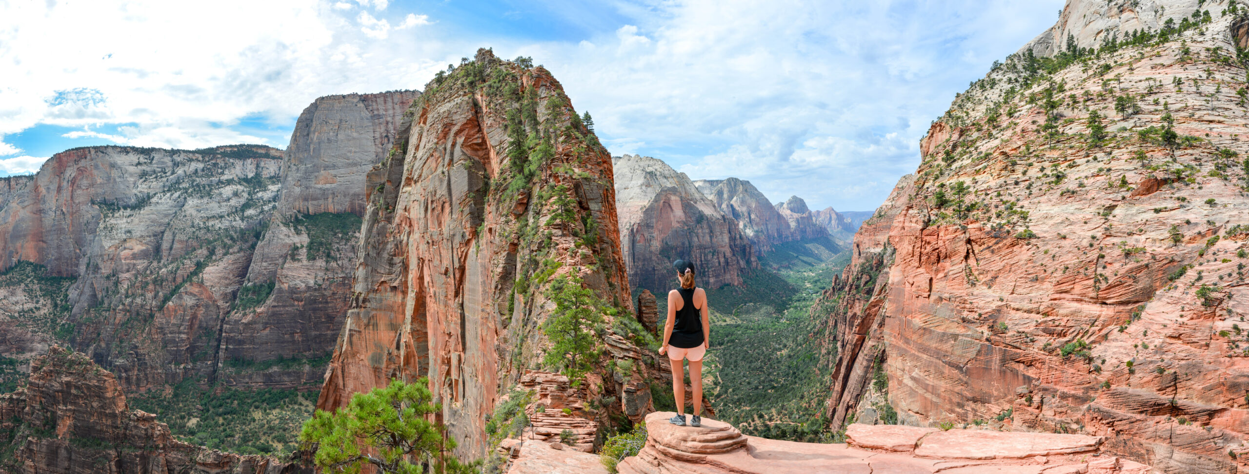
Best Hikes in Utah: 20 Trails from Zion & Bryce to Timpanogos and Kings Peak
Utah deserves its own hiking region because it is really two states in one: a spring-and-fall red-rock world of Zion, Bryce, Arches, Canyonlands and Capitol Reef, and a July-to-September alpine world of the Wasatch and Uintas. The Narrows is the most uniquely Utah hike; Timpanogos is the best mountain day; Kings Peak is the defining backpacking summit.
Updated August 12, 2026 · Current Zion, Arches, Bryce and Wasatch access information checked
Which Part of Utah Should You Hike?
Choose Zion for dramatic canyon hikes, Bryce for hoodoo loops, Moab for Arches and Canyonlands, Capitol Reef for quieter slickrock, the Wasatch for big day hikes near population centers, and the Uintas for high-elevation wilderness.
If you only have one Utah trip, do not force every region together. Southern Utah works best as a red-rock road trip. The Wasatch and Uintas work best as a separate summer mountain trip. The seasonal windows barely overlap at their best.
Choose the Utah Region That Fits Your Trip
Utah’s strength is not one landscape. It is how quickly the state changes from slot canyons to 13,000-foot tundra.
| Region | Best for | Signature hikes | Prime window | Gateway |
|---|---|---|---|---|
| Zion | Slot canyon, exposure, sandstone walls | Narrows, Angels Landing, Observation Point, Subway | Spring & fall | Springdale |
| Bryce Canyon | Hoodoos and compact loops | Queen’s/Navajo, Fairyland, Peekaboo | Spring–fall; winter possible | Bryce Canyon City / Tropic |
| Moab | Arches, slickrock, Needles backcountry | Delicate Arch, Devils Garden, Chesler Park | Mar–May & Sep–Nov | Moab |
| Capitol Reef / Escalante | Quieter desert, folds, waterfalls | Navajo Knobs, Cassidy Arch, Calf Creek | Spring & fall | Torrey / Boulder |
| Wasatch | Big alpine day hikes near cities | Timpanogos, Nebo, Lake Blanche, Olympus | Jul–Sep high country | Salt Lake / Provo / Nephi |
| Uintas | High wilderness, lakes, backpacking | Kings Peak, Bald Mountain, Highline Trail | Jul–Sep | Kamas / Evanston corridor |
The strongest first Utah trip depends on the month.
April: Zion + Bryce or Moab. August: Timpanogos + Uintas. October: southern Utah again. That seasonal rotation is why Utah belongs as a standalone hiking region rather than a footnote inside the Rockies or Southwest.
The 20 Best Hikes in Utah
The ranking intentionally mixes desert trails, high mountain days and backpacking because a statewide Utah list should represent the full state rather than only the Mighty Five.
The Narrows
Best for: Most uniquely Utah hike
No Utah trail feels more different from ordinary mountain hiking. On the bottom-up route, the Virgin River is the trail: hikers wade upstream between thousand-foot canyon walls and turn around whenever water, weather or time says they should. Bottom-up day hikers do not need a wilderness permit, but upstream travel stops at Big Spring and the route can close for high water or flash-flood danger.
Angels Landing
Best for: Most iconic exposed hike
Angels Landing combines a strong canyon approach with a final narrow ridge protected by chains. Every person continuing from Scout Lookout onto Angels Landing needs a permit. The route is not the right first hike for someone uncomfortable with exposure; Scout Lookout remains a strong non-permit alternative.
Mount Timpanogos
Best for: Best Utah mountain day
Timpanogos is the state’s most complete big mountain hike: waterfalls, alpine basins, Emerald Lake, mountain goats and a real 11,752-foot summit. Aspen Grove is shorter and steeper; Timpooneke is longer and more gradual. Summer weekends require careful parking and trailhead planning.
Delicate Arch
Best for: Best short iconic Utah hike
The trail to Delicate Arch is short compared with Utah’s mountain objectives, but few hikes anywhere deliver a more recognizable finish. Open slickrock, heat and a final ledge make the route feel bigger than the mileage suggests. Arches does not require timed-entry reservations in 2026.
Queen’s Garden + Navajo Loop
Best for: Best first Bryce hike
Bryce’s recommended first-timer loop descends through Queen’s Garden and climbs the Navajo side back to the rim. NPS recommends traveling clockwise so the broad amphitheater views stay ahead on the descent and hikers climb rather than descend the steeper Navajo section.
Kings Peak via Henrys Fork
Best for: Best Utah wilderness summit
Utah’s 13,528-foot high point is a backpacking objective rather than a quick summit day. The Henrys Fork approach crosses broad Uinta basins before the final Anderson Pass and boulder-field summit. Global Summit Guide’s first-hand three-day trip report is already live and should remain the anchor for this objective.
Chesler Park & Joint Trail
Best for: Best Canyonlands day hike
Chesler Park is the best single hiking expression of the Needles District: striped sandstone spires, open grassland and a narrow joint section that feels almost slot-like without becoming technical canyoneering. The remote drive and desert exposure are part of the day.
Mount Nebo
Best for: Best quieter Wasatch big day
Mount Nebo is the Wasatch high point at 11,928 feet and Global Summit Guide’s home mountain. The standard North Nebo route begins gently, then finishes with a steep loose push to the true summit. It is a stronger choice than Timpanogos for hikers who value solitude and a wilder ridge feel.
Observation Point via East Mesa
Best for: Best non-chain Zion viewpoint
Observation Point sits high above Zion Canyon and looks down toward Angels Landing. The East Mesa approach avoids the closed lower East Rim access from Weeping Rock and provides a less exposed way to reach one of the park’s greatest viewpoints.
Lake Blanche
Best for: Best Salt Lake alpine-lake day
Lake Blanche is a classic Salt Lake Wasatch hike because it compresses forest, steep climbing, granite peaks and a high lake basin into a half-day or full-day outing. Sundial Peak above the lake gives the basin one of the strongest mountain backdrops near the city.
Devils Garden Primitive Loop
Best for: Best long Arches hike
The full Devils Garden loop goes far beyond Landscape Arch into fins, slickrock, route-finding and multiple arches. It is the route to choose when Delicate Arch feels too short and you want a true half-day exploration of Arches terrain.
Navajo Knobs
Best for: Best Capitol Reef panorama
Navajo Knobs extends the Cohab Canyon / Rim Overlook experience into a long ridge-and-slickrock day with huge views over the Waterpocket Fold. Spring and fall are the strongest seasons; midsummer heat can turn exposed sandstone into the dominant challenge.
The Subway – Bottom Up
Best for: Best advanced nontechnical canyon day
The Subway is a wilderness route, not a maintained front-country trail. It requires a permit, route-finding, wet footing and flash-flood judgment. The bottom-up route avoids technical rappelling but still demands more planning and self-sufficiency than Zion’s ordinary day hikes.
Fairyland Loop
Best for: Best longer Bryce loop
Fairyland is the best Bryce hike for visitors who want more distance and fewer crowds than the Queen’s/Navajo combination. The trail repeatedly climbs and descends through hoodoo country instead of staying on the amphitheater rim.
Cassidy Arch
Best for: Best short Capitol Reef hike
Cassidy Arch climbs from Grand Wash to a broad sandstone arch with views across the park’s domes and cliffs. The route is short enough to combine with other Capitol Reef stops but steep enough to feel like a real hike rather than a roadside attraction.
Bald Mountain
Best for: Best beginner high-altitude summit
Bald Mountain reaches almost 12,000 feet from a very high Mirror Lake Highway trailhead. The distance is short, the standard route is straightforward in dry summer conditions and the summit gives a first-time hiker a genuine Uinta high-country experience.
Frary Peak
Best for: Best Great Salt Lake hike
Frary Peak rises from Antelope Island with an unusual combination of dry mountain terrain and enormous Great Salt Lake views. Spring and fall are much better than hot midsummer, and wildlife encounters make it unlike any other summit hike in the state.
Lower Calf Creek Falls
Best for: Best canyon waterfall
Lower Calf Creek Falls is one of southern Utah’s best contrasts: a sustained canyon walk ending at a tall waterfall and shaded pool. The route is more pleasant outside peak summer heat and pairs naturally with a Highway 12 road trip.
Kanarra Falls
Best for: Best compact slot-canyon hike
Kanarra Falls combines creek walking, narrow canyon walls and ladder-assisted waterfall sections in a compact outing near Cedar City. Access is permit-controlled, which makes advance planning part of the trip even though the hike itself is relatively short.
Mount Olympus
Best for: Best steep SLC test piece
Mount Olympus rises directly above Salt Lake City’s east bench and gains more than 4,000 feet in a relentlessly steep day. The upper route includes hands-on rocky terrain, making it a good benchmark before harder Wasatch objectives such as Lone Peak or exposed ridge scrambles.
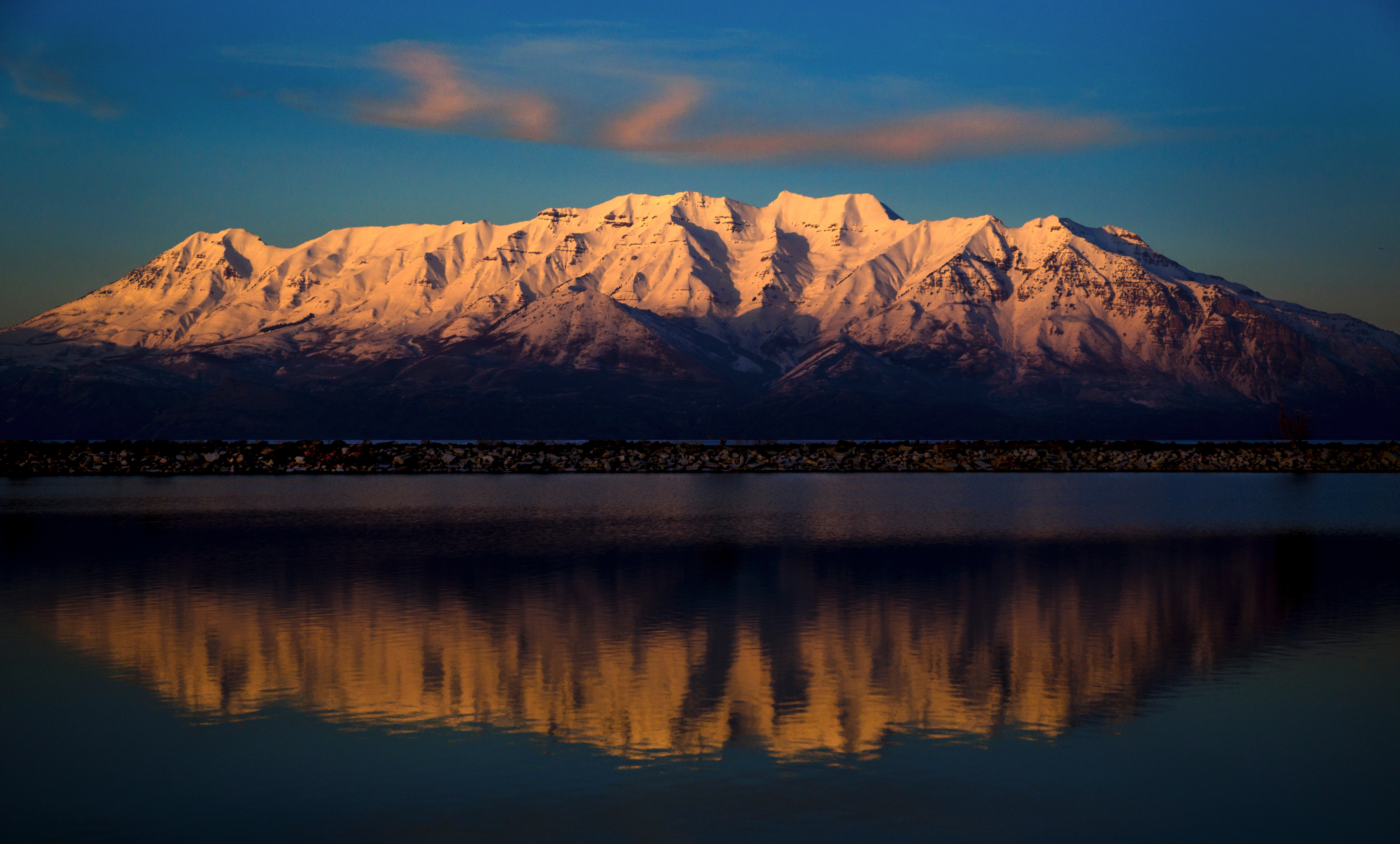
Southern Utah Gets the Postcards. The Wasatch Gives Utah Its Mountain-Hiking Culture.
Timpanogos is a rite of passage because it asks for a real mountain day—15-plus miles, nearly 12,000 feet of elevation and an early start—without requiring technical climbing on the standard summer trails.
Build the Utah Cluster Around These Six Pages
Three already have dedicated GSG resources. The other three are developed as full planning sections here until their dedicated children are published.
Zion National Park Hiking Guide
Narrows, Angels Landing, Observation Point, Subway, permit choices and canyon-season strategy.
Open guide / section → Wasatch · Utah ValleyMount Timpanogos
First-hand local guide to Aspen Grove vs Timpooneke, season, parking, difficulty and summit-day planning.
Open guide / section → Southern Wasatch · NephiMount Nebo
First-hand local guide to the Wasatch high point, North Nebo route, steep final ridge and seasonal access.
Open guide / section → High UintasKings Peak
First-hand three-day Henrys Fork trip to Utah’s 13,528-foot state high point.
Open guide / section → Eastern UtahMoab Hiking: Arches & Canyonlands
Delicate Arch, Devils Garden, Chesler Park, Needles heat strategy and 2026 Arches access.
Open guide / section → South-central UtahBryce Canyon & Capitol Reef Hiking
Hoodoo loops, Navajo Knobs, Cassidy Arch and how to combine Highway 12 hiking days.
Open guide / section →Zion National Park — Utah’s Most Concentrated Hiking Region
The route decision is exposure versus water versus viewpoint—not simply which trail is most famous.
The Narrows, Angels Landing and Observation Point are three different sports. The Narrows is a water-and-flash-flood problem. Angels Landing is an exposure-and-permit problem. Observation Point is a long-viewpoint hike with far less exposure.
For 2026, everyone continuing from Scout Lookout onto Angels Landing needs a permit. Zion uses both seasonal lotteries and a day-before lottery. Hikers who do not receive a permit can still hike the West Rim Trail to Scout Lookout without an Angels Landing permit.
The Narrows has two distinct systems. Bottom-up day hikers starting at the Temple of Sinawava do not need a wilderness permit and may travel upstream as far as Big Spring. The 16-mile top-down route from Chamberlain’s Ranch requires a wilderness permit. In both directions, high water and flash-flood risk can close the route regardless of what was planned months earlier.
For hikers who want the canyon view without the chains, Observation Point via East Mesa is the best answer. It gives a high look over Zion Canyon without making the trip depend on an Angels Landing lottery result.
Moab — Arches for Icons, Canyonlands for Bigger Hiking
Delicate Arch gets the photograph; the Needles gives the better full hiking day.
For a first Moab visit, hike Delicate Arch once—then spend more trail time elsewhere. Devils Garden Primitive Loop is the best long route inside Arches because it adds fins, slickrock and route-finding. Chesler Park and the Joint Trail in Canyonlands’ Needles District is the stronger all-day wilderness hike.
Arches National Park does not require advanced timed-entry reservations in 2026. That is a major change from recent years. Visitors can enter during normal operating hours, although the park may temporarily divert vehicles when congestion becomes severe. Reservations remain relevant for Fiery Furnace trips and Devils Garden Campground.
Moab’s limiting factor is often heat rather than permits. In late spring through early fall, start long exposed hikes at or before sunrise and carry more water than a mountain-hiking mileage comparison would suggest.
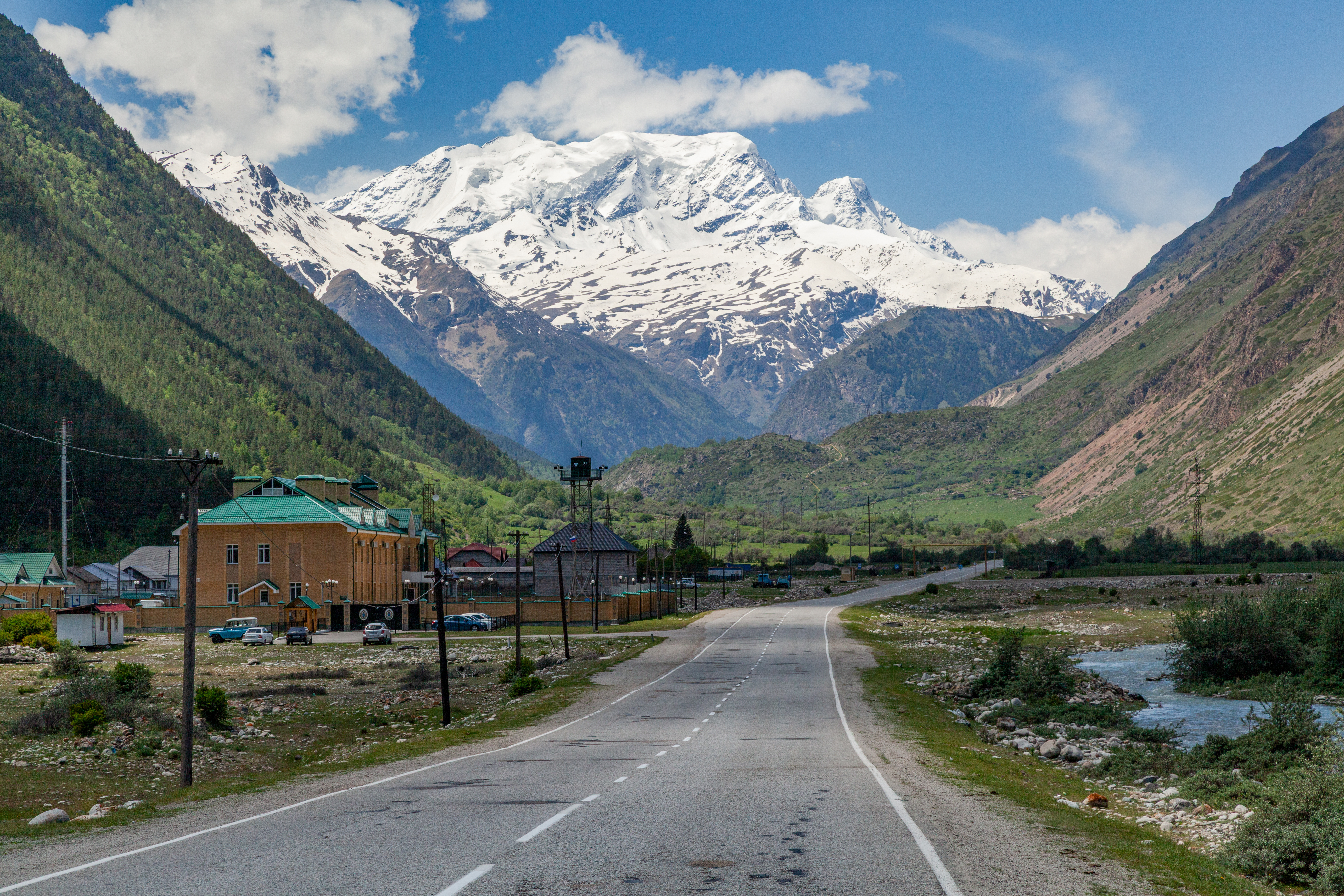
Utah’s Best Trick Is Putting Alpine Peaks Directly Above Red-Rock Desert.
A Moab trip can move from sandstone arches to 12,000-foot La Sal terrain in the same day. That desert-to-alpine contrast is one of the reasons a Utah parent belongs in the global hiking portfolio.
Bryce Canyon & Capitol Reef — Best for a Multi-Park Hiking Road Trip
Bryce is compact and trail-dense; Capitol Reef is broader, quieter and more exploratory.
Bryce Canyon’s best first hike is the Queen’s Garden + Navajo combination. NPS lists it at 2.9 miles with about 625 feet of gain and recommends hiking clockwise—down Queen’s Garden and up Navajo. For a longer day, Fairyland Loop extends the hoodoo experience to eight miles with fewer people.
Capitol Reef rewards a different style. Navajo Knobs is the major viewpoint day; Cassidy Arch is the compact slickrock hike; the Waterpocket District offers much more remote routes where road conditions matter as much as trail mileage. NPS specifically recommends spring and fall for Waterpocket hiking and notes that roads can become temporarily impassable after weather events.
For a statewide Utah trip, Bryce and Capitol Reef are natural partners because Highway 12 connects them through some of the strongest scenic country in the state. Add Lower Calf Creek Falls between the parks and the transfer day becomes another hiking day.
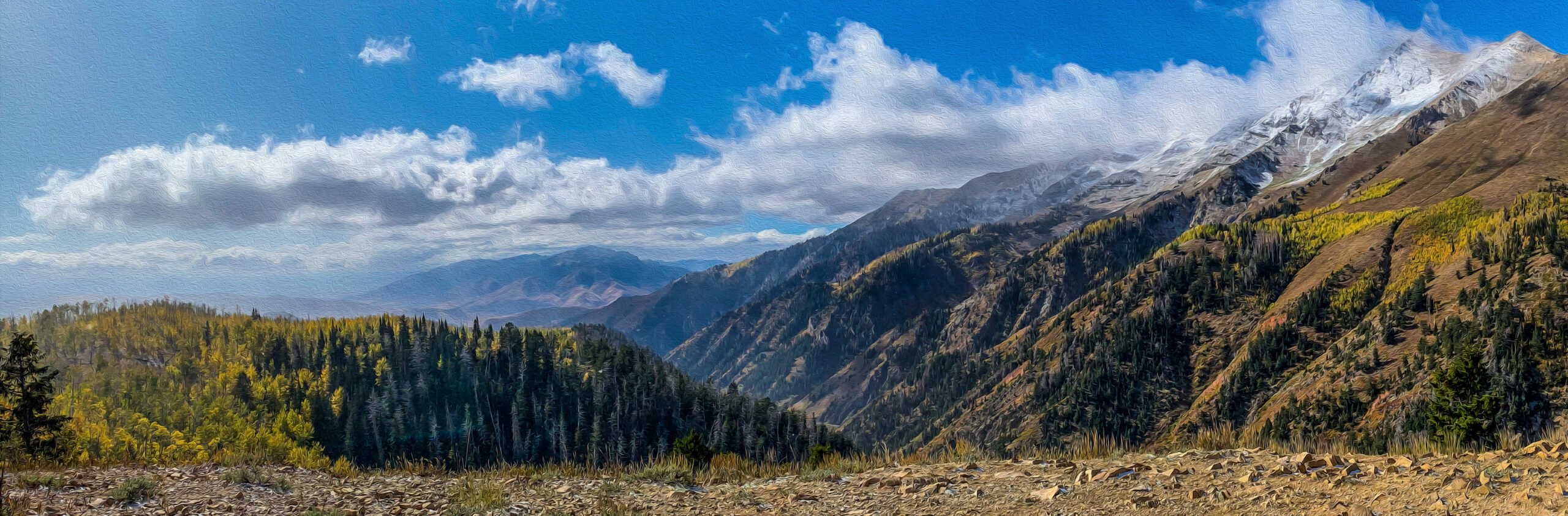
Utah’s Local Hiking Story Does Not End at the National Parks.
The Wasatch is where many Utah hikers build the fitness and judgment that later carries into Kings Peak, bigger backpacking routes and mountaineering objectives.
Utah Permits and Reservations That Actually Change the Trip
Most Utah trails do not use a single statewide system. Each park, forest and city-managed canyon has its own rules.
| Hike / area | 2026 rule | Planning implication |
|---|---|---|
| Angels Landing | Permit required for everyone beyond Scout Lookout; seasonal + day-before lottery. | Have Scout Lookout or Observation Point as a non-lottery alternative. |
| Narrows bottom-up | No wilderness permit; upstream travel limited to Big Spring. | Water level, flood risk and closure status matter more than reservation scarcity. |
| Narrows top-down | Wilderness permit required for all 16-mile Chamberlain’s Ranch trips. | Transport and permit both need to be solved before the trip. |
| Arches entrance | No timed-entry reservation required in 2026. | Arrive early anyway; temporary vehicle diversions can occur when parking fills. |
| Timpooneke Trailhead | Timed vehicle ticket required Saturday, Sunday and specified holidays during the midnight-to-noon morning window. | Timpanogos may be permit-free as a summit hike while the trailhead still controls vehicle access. |
| Kanarra Falls | Permit-controlled access. | Do not drive to Kanarraville assuming a walk-up start. |
Rules change. Always recheck the managing agency immediately before travel, especially for Zion wilderness routes, municipal slot canyons, trailhead parking and seasonal high-country roads.
Best Bases for Hiking in Utah
The right base is determined by the landscape. There is no useful single-city base for a statewide Utah hiking trip.
Springdale
Best for Zion Canyon shuttle access, Angels Landing, The Narrows and easy early starts.
Bryce Canyon City / Tropic
Best for sunrise access to Bryce Amphitheater and a Highway 12 road trip.
Moab
Best single base for Arches, Canyonlands, Dead Horse Point and La Sal mountain access.
Torrey
Best for Fruita, Navajo Knobs, Waterpocket access and the western end of Highway 12.
Salt Lake City / Provo
SLC serves the Cottonwoods; Provo/Orem is better for Timpanogos and Utah Valley trailheads.
Nephi / Kamas
Nephi is the local base beneath Mount Nebo; Kamas is the primary western gateway to Mirror Lake Highway and the Uintas.
Continue Through the Utah Hiking and Mountain Ecosystem
This page owns statewide hiking selection. These resources take over when the question becomes mountains, Wasatch progression, local peaks or high-point challenges.
Best Hiking Regions in the World
Compare Utah with the Rockies, Sierra, Pacific Northwest, Alps, Patagonia and other major hiking regions.
State mountain collectorBest Mountains in Utah
The statewide ranking of Timpanogos, Kings, Nebo, La Sal and Utah’s major summit objectives.
Regional mountain hubWasatch, Uintas & Utah Mountain Ranges
Understand Utah’s mountain geography before choosing a summit.
Local challengeThe Wasatch 7
Seven major Utah Valley summits form one of the state’s strongest long-term hiking challenges.
Statewide challengeUtah Range High Points
A peakbagging tour through the many mountain systems beyond the famous Wasatch and Uintas.
Utah ValleyBest Peaks in Utah County
Move from local waterfall hikes into Timpanogos, Nebo and the full southern-Wasatch progression.
Salt LakeBest Mountains Near Salt Lake City
Choose peaks by canyon and build a local Wasatch progression from the city.
First-hand local guideMount Timpanogos
Aspen Grove vs Timpooneke, season, parking and a complete summit-day framework.
Home mountainMount Nebo
The highest summit in the Wasatch and a quieter big-day alternative to Timpanogos.
Local comparisonTimpanogos vs Mount Nebo
Choose between Utah’s two defining high Wasatch hikes.
Uinta wildernessKings Peak 3-Day Trip Report
First-hand planning lessons from Utah’s 13,528-foot state high point.
Global progressionTop 50 Non-Technical Peaks
Compare Utah’s big hiking summits with other major non-technical objectives worldwide.
Two local pages deserve stronger contextual support.
If the statewide list makes you want a Wasatch progression, continue to Best Peaks in Utah County for the southern Wasatch and Best Mountains Near Salt Lake City for the central Wasatch canyon system.
How We Ranked and Verified the Utah Hikes
Local experience informs the ranking; land managers control the current rules.
Ranking factors
- Utah identity: does the hike represent a landscape or culture distinct to the state?
- Complete experience: scenery, route quality and the quality of the finish.
- Statewide representation: red rock, Wasatch, Uintas, Great Basin and Colorado Plateau.
- Progression value: does the route prepare hikers for bigger days without disguising technical terrain as ordinary hiking?
- Trip value: would we build a Utah itinerary around it?
Primary current sources
Frequently Asked Questions
Direct answers for choosing between red-rock and alpine Utah.
What is the best hike in Utah?
The Narrows is the most uniquely Utah hiking experience, while Mount Timpanogos is the best all-around mountain hike. Angels Landing is the most famous exposed trail, Kings Peak is the best backpacking summit, and Chesler Park is the best long desert loop.
When is the best time to hike in Utah?
Utah has two opposite prime seasons. Southern Utah desert hiking is strongest in spring and fall, while the Wasatch and Uinta high country is most reliable from July through September. That seasonal split is one reason Utah works as a year-round hiking state.
Do I need a permit for Angels Landing in 2026?
Yes. Everyone continuing from Scout Lookout onto Angels Landing needs a permit. Zion uses seasonal lotteries and a day-before lottery. You do not need an Angels Landing permit to hike to Scout Lookout.
Do I need a permit to hike The Narrows?
Bottom-up day hiking from the Temple of Sinawava does not require a wilderness permit, but hikers may not continue upstream beyond Big Spring. Top-down Narrows trips from Chamberlain's Ranch require a wilderness permit.
Does Arches National Park require timed entry in 2026?
No. Arches National Park removed the advanced timed-entry reservation requirement for 2026. Visitors can enter during operating hours, although temporary vehicle diversions may occur when congestion becomes severe. Fiery Furnace trips and Devils Garden Campground still use reservations.
What is the best Utah hike for a first-time visitor?
If the trip is centered on southern Utah, hike the Queen's Garden and Navajo Loop at Bryce and either The Narrows or Scout Lookout in Zion. If the trip is centered on Salt Lake or Utah Valley, choose Lake Blanche for a moderate alpine day or Mount Timpanogos for a major full-day objective.
What is the best high mountain hike in Utah?
Mount Timpanogos is the best single-day alpine mountain hike for most people. Mount Nebo is higher and quieter, Bald Mountain is easier, and Kings Peak is the state's highest summit but normally requires a multi-day backpack.
Is Mount Timpanogos permit-controlled in 2026?
The mountain itself does not use a summit permit, but Timpooneke Trailhead uses timed vehicle tickets on Saturdays, Sundays and specified holidays during the morning window. Aspen Grove has a different access setup. Always check current recreation and forest information before driving the Alpine Loop.
Where should I stay for hiking in Utah?
Use Springdale for Zion; Bryce Canyon City or Tropic for Bryce; Moab for Arches, Canyonlands and the La Sals; Torrey for Capitol Reef; Salt Lake City or Park City for the central Wasatch; Provo or Orem for Timpanogos; Nephi for Mount Nebo; and Kamas for western Uinta access.
How should Utah be organized in the Global Summit Guide hiking system?
Utah works best as its own regional parent because it combines five national parks, Wasatch and Uinta alpine hiking, Great Basin terrain and Colorado Plateau desert routes. It should link upward to the global hiking-regions pillar and sideways into Utah mountain, Wasatch, Uinta and national-park clusters.
Hike the Desert When the Mountains Are Snowed In. Hike the Mountains When the Desert Is Too Hot.
That simple seasonal rotation can produce a full year of exceptional hiking without leaving Utah—from Zion and Moab to Timpanogos, Nebo and Kings Peak.
More Utah Guides
More trips, peaks and planning guides from the same region.
Was this helpful?
Global Summit Guide is an independent mountaineering resource founded in 2026. The team combines first-hand trekking and climbing experience with in-depth research and professional health and nutrition review to help climbers choose objectives, prepare properly, and stay safe.
Health, altitude, and nutrition content is reviewed by Taylor Ludlow (Registered Nurse) and Brigg Hoopes (Nutritionist).
What We Don't Know Yet
Mountain information changes quickly. This box explains the limits of what this page can responsibly promise.
- Visa, passport, vaccination, border, insurance, and local transportation rules may change before your trip.
- Route conditions, snowpack, closures, and weather can change quickly after this page is updated.
- Permit rules, fees, quotas, and reservation windows may change between review cycles.
- Operator availability, pricing, guide ratios, and cancellation terms can change by season.
- Your fitness, altitude response, risk tolerance, and experience level may change what is safe or realistic.
Verify current conditions with official land managers, guide services, local forecasts, and current route reports before booking or climbing.
Mountaineering, rock and ice climbing, glacier travel, and high-altitude activity are inherently dangerous and can result in serious injury or death. The information on Global Summit Guide is provided for general informational and educational purposes only and is not a substitute for professional instruction, qualified guiding, proper equipment, or your own judgment and experience.
Route conditions, weather, snowpack, permits, regulations, and hazards change constantly and may differ from what is described here. Details may be incomplete, out of date, or contain errors. Always verify current information with local authorities, certified guides, and official sources before making any decision in the mountains.
Nothing on this site is medical, legal, or financial advice. Our fitness, acclimatization, altitude, and nutrition content is general in nature; consult a qualified physician before beginning any strenuous exercise program or exposing yourself to high altitude.
You are solely responsible for your own safety and decisions. To the fullest extent permitted by law, Global Summit Guide and its team accept no liability for any loss, injury, damage, or expense arising from use of, or reliance on, this information. By using this site you acknowledge these risks and accept these terms.
Some links on this site may be affiliate links. If you buy through them we may earn a small commission at no extra cost to you; this never affects our recommendations.
Global Summit Guide recommendation path
Next Best Mountain to Research
Use these recommendations to continue the right planning path instead of stopping on one page.
Use current permit, weather, route, and operator information before booking or climbing.
Search Flights, Hotels & Rental Cars
Have the mountain or destination picked? Use Expedia to compare the flights, lodging and rental cars that fit your actual trip dates. For mountain travel, consider arriving early enough for delays and adding a buffer night after the climb before a fixed flight home.
Compare current flight, hotel and car options.
Affiliate disclosure: Global Summit Guide may earn a commission if you book through this link, at no additional cost to you.