
Last updated September 10, 2026
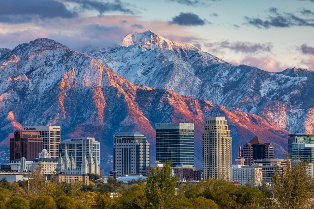
10 Best Peaks in Salt Lake County: A Local Peakbagging Progression
South Twin is the county high-point objective; Pfeifferhorn is the classic scramble; Grandeur is the right starting point. This page keeps the existing county-bounded Top 10 and turns it into a progression from accessible local summits to the central Wasatch’s most committing days.
What Counts on This Page?
This is a Salt Lake County peakbagging list, not a list of every mountain reachable from downtown Salt Lake City. That boundary matters.
Mount Nebo does not belong here even though it is the highest summit in the Wasatch; it lies in Juab County. Mount Timpanogos does not belong here because it lies in Utah County. Lone Peak and American Fork Twin Peaks complicate the county divide, so this page preserves the existing ten-peak Salt Lake County challenge rather than letting border peaks blur the intent.
If you want “which mountain should I hike near Salt Lake City?” use the dedicated Salt Lake City decision guide. Here the question is different: which ten county peaks form the strongest local progression?
The Salt Lake County Top 10
The order preserves the existing page’s editorial ranking. Distances and gain are planning estimates; different approach routes and GPS tracks can change the totals.
| Rank | Peak | Elevation | Primary access | Planning distance | Gain | Level | Role in progression |
|---|---|---|---|---|---|---|---|
| 1 | South Twin Peaks | ~11,330 ft | Broads Fork / central Wasatch approaches | ~13 mi RT | ~5,500 ft | Expert | County graduation objective |
| 2 | Pfeifferhorn | 11,326 ft | Red Pine Lake / Little Cottonwood | ~10 mi RT | ~4,500 ft | Expert | Classic exposed scramble |
| 3 | Sunrise Peak | 11,275 ft | Little Cottonwood high country | ~12 mi RT | ~5,000 ft | Expert | Long 11K objective |
| 4 | Mount Olympus | 9,026 ft | Wasatch Boulevard | ~7 mi RT | ~4,200 ft | Strenuous | Steep local test piece |
| 5 | Dromedary Peak | 11,107 ft | Broads Fork / Big Cottonwood | ~12 mi RT | ~5,000 ft | Expert | Route-finding / scramble step |
| 6 | Gobblers Knob | 10,246 ft | Mill Creek or Butler Fork | ~11 mi RT | ~3,500 ft | Strenuous | Long ridge day / Raymond pair |
| 7 | Mount Raymond | 10,241 ft | Butler Fork / Big Cottonwood | ~11 mi RT | ~3,600 ft | Strenuous | Bridge to bigger ridge days |
| 8 | Sunset Peak | 10,648 ft | Brighton / Catherine Pass | ~5 mi RT | ~1,600 ft | Moderate | Best first 10K summit |
| 9 | Mount Aire | 8,621 ft | Mill Creek | ~7 mi RT | ~2,000 ft | Moderate | Second-step local summit |
| 10 | Grandeur Peak | 8,299 ft | Mill Creek / west approaches | ~6 mi RT | ~2,500 ft | Moderate | Best entry point |
A Four-Tier County Progression
The ranking runs from the ultimate objective down to the entry point. The progression should run in the opposite direction.
Grandeur · Mount Aire · Sunset
- Learn Wasatch pacing.
- Build downhill durability.
- Practice early starts and weather checks.
- Move from 8K foothill summits to a 10K peak.
Raymond · Gobblers · Olympus
- Increase sustained vertical.
- Handle longer, steeper descents.
- Gain exposure to ridge movement and scrambling.
- Olympus is the local “am I ready for more?” test.
Dromedary · Sunrise
- Long 11K objectives.
- Greater route judgment.
- More talus and scrambling.
- Less margin for late starts or weather mistakes.
Pfeifferhorn · South Twin
- Exposure and serious scrambling.
- Full-day commitment.
- Strong route-finding judgment.
- Turnaround discipline matters more than completing a checklist.
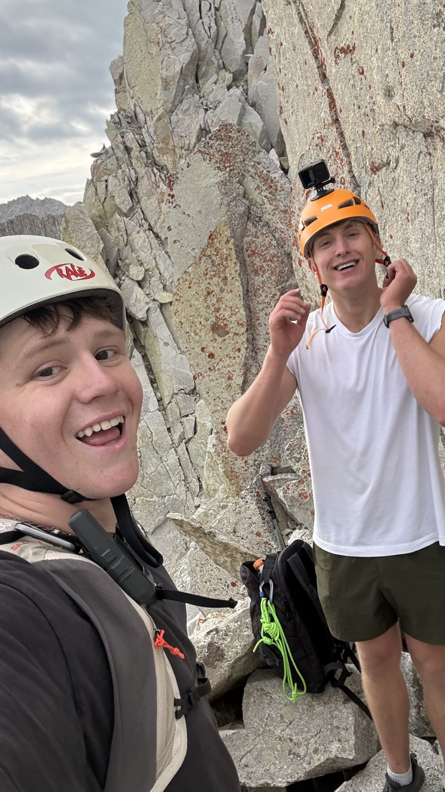
The Upper County Peaks Are Scrambling Objectives, Not Bigger Versions of Grandeur.
Distance and elevation gain matter, but the decisive change is terrain. Once exposure, route-finding and hands-on movement become part of the day, fitness alone stops being the qualification.
The Exact County Ranking, Peak by Peak
This section keeps the ranking narrow: county importance, peakbagging value and progression role—not “best hike near downtown.”
South Twin Peaks
South Twin stays #1 because the county high point should be the final objective in a county peakbagging list. The day combines major vertical, route-finding, talus and upper-mountain scrambling. It is not the right first high Wasatch objective simply because it sits at the top of the list.
Pfeifferhorn
Pfeifferhorn is the most recognizable scrambling progression on the list. The standard route climbs through Red Pine Lake country before the upper ridge forces deliberate movement and exposure management.
Sunrise Peak
Sunrise keeps its place because it delivers a long, high Wasatch day without the fame of Pfeifferhorn. That makes it a useful advanced objective for someone deliberately working through the county rather than chasing only the most famous names.
Mount Olympus
Olympus is lower than the Cottonwood giants but far steeper from the valley. It belongs near the top because the mountain is both a local landmark and one of the cleanest tests of whether a hiker can sustain vertical, manage a steep descent and remain composed on simple summit scrambling.
Dromedary Peak
Dromedary is valuable because it is not simply a long trail hike. The upper route introduces more complicated terrain, loose rock and hands-on movement, creating a bridge between strenuous hiking and the county’s most committing scramble peaks.
Gobblers Knob
Gobblers earns its place because it works as a single objective or as part of a Raymond double. The summit feels more exposed than its elevation suggests and rewards the transition from simple trail hiking to longer ridge days.
Mount Raymond
Raymond is one of the best progression mountains in the list because it adds a longer approach, ridge travel and a defined summit without immediately requiring the exposure of Pfeifferhorn. Pairing Raymond and Gobblers turns the day into a strong endurance benchmark.
Sunset Peak
Sunset is the cleanest way to experience a 10,000-foot county summit before attempting the longer Cottonwood peaks. The higher trailhead reduces the vertical bill while still teaching alpine weather awareness.
Mount Aire
Mount Aire keeps the progression from jumping too quickly from Grandeur into long 10,000-foot days. It is a useful second summit for hikers building time-on-feet, vertical gain and confidence on a more mountain-like route.
Grandeur Peak
Grandeur is #10 in the editorial ranking but #1 in the progression. It is the peak that lets a new Salt Lake hiker test pacing, descent durability and mountain weather without making route-finding or exposure the dominant problem.
Six of the Ten Have Documented GSG Ascents
The strongest local signal is not claiming every peak is first-hand. It is saying exactly which ones are.
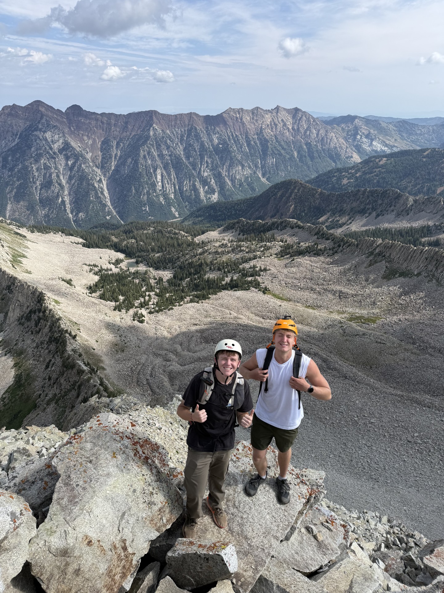
Route Judgment Becomes More Important Than a Ranking Number.
On Grandeur, the list mostly tests hiking. On Pfeifferhorn, Sunrise, Dromedary and South Twin, conditions and route selection can change the day enough that a one-line “Class 3” label is not a substitute for preparation.
Watershed, Dogs, Fees & Canyon Rules
The old page mixed rules from different canyons. This table separates them.
| Area | Peaks in this list | Dog rule | Fee / access note | Planning implication |
|---|---|---|---|---|
| Mill Creek Canyon | Grandeur, Mount Aire, Gobblers options | Leashed even days; off leash odd days outside developed areas | $5 daily vehicle fee on current Forest Service page | Different from protected Cottonwood watershed rules |
| Big Cottonwood | Raymond, Gobblers, Dromedary, South Twin approaches | Domestic animals prohibited in protected watershed | No simple “dog-friendly canyon” assumption | Check watershed and current trail/road status |
| Little Cottonwood | Pfeifferhorn, Sunrise, upper county objectives | Domestic animals prohibited in protected watershed | High-use canyon; parking/road conditions vary | Start with current access, not an old trail guide |
| Brighton basin | Sunset Peak | Protected watershed rules apply | High-elevation access; winter/snow season changes route | Best snow-free progression in summer/early fall |
| East bench | Mount Olympus | Trail-specific city/county rules rather than Cottonwood dog assumption | Urban trailhead; heat and parking matter | Early start still matters despite city proximity |
Where to Go for the Next Layer
Only link a dedicated peak page where one actually exists; otherwise send readers to the correct live regional or decision owner.
Pfeifferhorn North Ridge
First-hand climbing story and imagery from a technical line on the county’s #2 peak. It is not a replacement for standard-route planning.
Read the field report → Different search intentBest Mountains Near Salt Lake City
Use this when the question is drive time, duration and “what should I hike today?” rather than county completion.
Choose by time and difficulty → Deeper inventoryWasatch Range Peaks
White Baldy, Red Baldy, Clayton and other honorable mentions belong in the broader range inventory instead of expanding this Top 10 indefinitely.
Explore the Wasatch inventory → Neighboring countyBest Peaks in Utah County
Move south for Timpanogos, Provo Peak and the separate Utah Valley peakbagging system.
Explore Utah County → Statewide challengeUtah Range High Points
Once county completion feels too local, expand into the Core 17 across Utah’s ranges and highlands.
Start the Core 17 → Regional parentWasatch Mountains Hiking Guide
Use the Wasatch parent for regional geography and progression beyond county boundaries.
Explore the Wasatch →Turn the Top 10 Into a County Project.
Save one peak at a time in My Climb. Record the summit, note what felt hard, and only move into the next tier when your fitness and scrambling judgment—not the ranking number—say you are ready.
What We Changed From the Old Page
The goal was to preserve ranking equity while removing stale internal language and inaccurate canyon rules.
Editorial method
- Preserved the existing exact Top 10 and ranking order.
- Narrowed the page to county peakbagging.
- Separated ranking from safe progression.
- Used first-hand labels only for documented ascents.
- Kept border/neighbor peaks out of the core list.
- Moved generic “near SLC” decision intent to the separate city page.
Current primary sources
- Salt Lake City Public Utilities — Watershed Rules
- Salt Lake City Public Utilities — Protected Watershed
- Uinta-Wasatch-Cache NF — Mill Creek Canyon
- Global Summit Guide — Documented climbing record
- Current route conditions should be checked through the Forest Service, Utah Avalanche Center and live weather sources before departure.
Salt Lake County Peaks FAQ
These questions reinforce the county-bounded intent rather than the generic Salt Lake City hiking intent.
What is the highest peak in Salt Lake County?
South Twin Peaks, commonly listed around 11,330 feet, is the county high-point objective used in this guide. Mount Nebo is higher but lies in Juab County.
What is the best first peak in Salt Lake County?
Grandeur Peak is the best first substantial peak in this Top 10. It provides meaningful gain and a real summit without the route complexity or exposure of the upper Cottonwood peaks.
What is the best scrambling peak in Salt Lake County?
Pfeifferhorn is the classic progression scramble. Its upper ridge demands prior mountain experience and comfort with exposure; it should not be a first Wasatch summit.
Are dogs allowed on Salt Lake County canyon trails?
Rules depend on the canyon. Dogs and other domestic animals are prohibited in Salt Lake City’s protected watersheds, including Big and Little Cottonwood. Mill Creek uses different alternating-day dog rules.
Is Mount Olympus in Salt Lake County?
Yes. Mount Olympus rises directly above the east side of the Salt Lake Valley and is one of the county’s most recognizable summit objectives.
Why is Lone Peak not in this Top 10?
Lone Peak sits on or near the Salt Lake-Utah County divide depending on the exact boundary interpretation. This page preserves its existing county-bounded Top 10 rather than allowing border peaks to blur the intent.
When is the best season for these peaks?
Mid-summer through early fall is the most reliable normal snow-free window for the highest peaks. Grandeur and Olympus have longer hiking seasons, but snow and winter avalanche conditions can radically change their seriousness.
How should I progress through the Top 10?
Start with Grandeur, Mount Aire and Sunset; move to Raymond, Gobblers and Olympus; then build into Dromedary or Sunrise before considering Pfeifferhorn and South Twin.
Start With Grandeur. Earn Your Way Toward South Twin.
The best Salt Lake County challenge is not climbing the Top 10 as fast as possible. It is using each mountain to build the fitness, judgment and familiarity that make the next one a better decision.
More Utah Guides
More trips, peaks and planning guides from the same region.
Was this helpful?
🏔Related guides
🧭Explore & compare
Global Summit Guide is an independent mountaineering resource founded in 2026. The team combines first-hand trekking and climbing experience with in-depth research and professional health and nutrition review to help climbers choose objectives, prepare properly, and stay safe.
Health, altitude, and nutrition content is reviewed by Taylor Ludlow (Registered Nurse) and Brigg Hoopes (Nutritionist).
What We Don't Know Yet
Mountain information changes quickly. This box explains the limits of what this page can responsibly promise.
- Route conditions, trailhead access, crevasse exposure, stream crossings, and rescue access may vary from published planning guidance.
- Route conditions, snowpack, closures, and weather can change quickly after this page is updated.
- Permit rules, fees, quotas, and reservation windows may change between review cycles.
- Operator availability, pricing, guide ratios, and cancellation terms can change by season.
- Your fitness, altitude response, risk tolerance, and experience level may change what is safe or realistic.
Verify current conditions with official land managers, guide services, local forecasts, and current route reports before booking or climbing.
Mountaineering, rock and ice climbing, glacier travel, and high-altitude activity are inherently dangerous and can result in serious injury or death. The information on Global Summit Guide is provided for general informational and educational purposes only and is not a substitute for professional instruction, qualified guiding, proper equipment, or your own judgment and experience.
Route conditions, weather, snowpack, permits, regulations, and hazards change constantly and may differ from what is described here. Details may be incomplete, out of date, or contain errors. Always verify current information with local authorities, certified guides, and official sources before making any decision in the mountains.
Nothing on this site is medical, legal, or financial advice. Our fitness, acclimatization, altitude, and nutrition content is general in nature; consult a qualified physician before beginning any strenuous exercise program or exposing yourself to high altitude.
You are solely responsible for your own safety and decisions. To the fullest extent permitted by law, Global Summit Guide and its team accept no liability for any loss, injury, damage, or expense arising from use of, or reliance on, this information. By using this site you acknowledge these risks and accept these terms.
Some links on this site may be affiliate links. If you buy through them we may earn a small commission at no extra cost to you; this never affects our recommendations.
Global Summit Guide recommendation path
Next Best Mountain to Research
Use these recommendations to continue the right planning path instead of stopping on one page.
Use current permit, weather, route, and operator information before booking or climbing.
Search Flights, Hotels & Rental Cars
Have the mountain or destination picked? Use Expedia to compare the flights, lodging and rental cars that fit your actual trip dates. For mountain travel, consider arriving early enough for delays and adding a buffer night after the climb before a fixed flight home.
Compare current flight, hotel and car options.
Affiliate disclosure: Global Summit Guide may earn a commission if you book through this link, at no additional cost to you.