
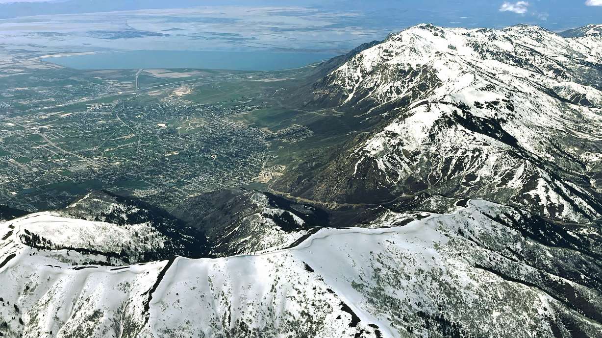
10 Best Peaks to Climb in Salt Lake County This Summer
The definitive 2026 ranked list of Salt Lake County’s ten finest summits — from the accessible Grandeur Peak to the iconic Pfeifferhorn scramble and Twin Peaks, the county’s highest point. Each peak earns its rank through a combination of scenic reward, technical interest, and the distinctive hiking experience it offers in the central Wasatch.
peaks
range
range
season
Salt Lake County contains some of North America’s most accessible mountain peaks — trailheads 20-35 minutes from downtown, 30+ distinct summits, and elevation gains of 5,000+ feet available on the same day as office work. This ranked list covers ten peaks that deserve your attention, ordered by overall hiking experience quality. The ranking weighs scenic reward, technical interest, accessibility, iconic status, and fitness challenge — not just elevation. Serious hikers might re-rank these, and that’s part of the fun. Work through this list over a summer and you’ll have experienced the full range of what the central Wasatch offers.
Ranking weighs five factors equally: scenic reward (summit views and trail aesthetics), technical interest (scrambling variety and route-finding), accessibility (drive time from SLC and trailhead logistics), iconic status (local reputation and hiking community recognition), and fitness challenge balance (reasonable commitment for reward). Elevation data from US Geological Survey topographic database. Trail statistics confirmed against Uinta-Wasatch-Cache National Forest management records. Reviewed by Wasatch hiking guides and Wasatch Mountain Club members. Geographic boundaries follow Salt Lake County limits — see our Utah County peak guide for peaks in the neighboring southern Wasatch. Fact-check date: April 19, 2026.
Before the List: How to Use This Ranking
This ranking is designed as a progressive journey, not a difficulty scale. Peak #10 (Grandeur) is ranked lower because it’s the easiest entry point — but that doesn’t mean it’s less worthwhile. Peak #1 (Twin Peaks South) is the ultimate Salt Lake County achievement for most hikers, but it requires experience developed through peaks 4-9 first.
How to work through the list
- First-time SLC hikers: Start at #10 (Grandeur Peak). Build progressively.
- Experienced hikers new to SLC: Jump in at #7-8 (Sunset, Raymond) to match your fitness level.
- Salt Lake veterans: Work on peaks you haven’t done, especially the higher-ranked ones.
- Seven Peaks Challenge participants: Mix and match — many SLC Seven Peaks overlap with this list.
- Fitness progression: Never jump more than 3-4 rank spots without appropriate training. Pfeifferhorn (#2) as your first serious hike is a common dangerous mistake.
Each peak profile includes ranked position, elevation, difficulty tier, stats, and why it earned its rank. Complete them systematically and you’ll develop the full skill set the Wasatch demands.
The Ranking: Counting Down from 10 to 1
Grandeur Peak
Grandeur earns #10 by being the perfect first-mountain peak for Salt Lake hikers — challenging enough to feel like a real accomplishment, accessible enough to do before work. Multiple approaches from Mill Creek Canyon offer flexibility. The Church Fork approach is most popular; West Ridge offers a longer, more scenic option.
Why we love it: the summit delivers panoramic views of Salt Lake Valley and the central Wasatch. Grandeur is many local hikers’ first big peak — the natural entry point to the ranked list. It’s lower-ranked only because the experience feels familiar to experienced hikers; for newcomers, it’s essential.
Mount Aire
Mount Aire takes #9 for being the natural progression from Grandeur — slightly higher, slightly longer, with a more varied approach. The Elbow Fork trailhead in Mill Creek Canyon leads up through forest and meadows to a definitive summit with outstanding central Wasatch views.
What distinguishes Aire: the meadow sections in the middle of the climb feel like true alpine terrain rather than Wasatch foothills. Wildflower display in July-August is excellent. The summit itself is a grassy dome rather than a rocky peak, offering easy summit lounging. Perfect second mountain peak for progressing hikers.
Sunset Peak
Sunset Peak ranks #8 for being the easiest path to a 10,000+ foot summit in Salt Lake County. Starting from Brighton at 8,755 ft eliminates most of the elevation gain other high peaks demand. Wildflower meadows throughout the approach, three alpine lakes (Lake Catherine, Lake Martha, Lake Mary) on the traverse, gentle ridge walking to the summit.
The magic: you stand on a 10,648-foot summit with panoramic views of Park City, Brighton basin, and the central Wasatch after only 2.5 miles of moderate hiking. Sunset Peak delivers high-altitude reward for intermediate effort. Perfect introduction to the sensation of real altitude hiking without the commitment of peaks 1-7.
Mount Raymond
Mount Raymond earns #7 by offering genuine Wasatch ridge hiking without the commitment of expert-tier peaks. The Butler Fork approach from Big Cottonwood Canyon winds through forest to a high ridge, then traverses along increasingly dramatic exposures to Raymond’s defined summit. Classic central Wasatch hiking.
Why it ranks strong: the ridge walk between forest and summit delivers one of SLC’s best mountaineering-like experiences without technical scrambling. Many hikers combine Raymond with neighboring Gobblers Knob (#6) on a single loop, creating a full-day adventure that captures the Wasatch’s intermediate personality. This pair represents the transition from moderate to serious hiking in our ranking.
Gobblers Knob
Gobblers Knob ranks #6 for offering a more dramatic summit experience than its near-twin Mount Raymond. Only 5 feet taller but considerably more exposed — Gobblers has a narrower, more distinctive summit with prominent views in all directions. Approach via Mill Creek (Alexander Basin) or Big Cottonwood (Butler Fork).
What distinguishes Gobblers: the final summit approach involves real exposure and a sense of mountaineering commitment. The peak’s name (“Gobblers”) supposedly refers to turkeys, though local lore varies. Either way, standing on the knob with Mount Raymond’s pyramid visible across the valley delivers a classic Wasatch moment. Pair this with Raymond for a comprehensive double-summit day.
Dromedary Peak
Dromedary crosses the threshold into expert territory as our #5 pick. This genuinely technical peak in Broads Fork (Big Cottonwood) requires class 3 scrambling, route-finding skills, and sustained commitment. The camel-hump summit profile (hence the name) creates the distinctive dromedary shape visible from across the valley.
Why it earns rank #5: Dromedary delivers the first taste of real mountaineering on our ranked list — the approach through Broads Fork, the technical summit scramble, the sense of route-finding through talus fields. Unlike Pfeifferhorn’s exposed knife edge, Dromedary’s scrambling is more compact but technically demanding. Essential preparation peak before attempting #1-3.
Mount Olympus
Mount Olympus ranks #4 despite its modest 9,026 ft elevation because it’s the most iconic peak in Salt Lake County — visible from virtually every part of the valley, accessible from the east bench in 15 minutes, and achievable on a long day. The Olympus Trail delivers a relentless 4,200 ft grade to the summit scramble.
What pushes Olympus to #4 (not lower): the scramble to the summit is the first real technical challenge most SLC hikers encounter. Class 2-3 moves with moderate exposure, summit views sweeping from Great Salt Lake to the Uintas, and the satisfaction of topping out on the mountain you’ve looked at from the valley for years. The local rite of passage peak. Lower-ranked only because the difficulty-to-elevation ratio feels heavy.
Sunrise Peak
Sunrise Peak earns #3 for being the connoisseur’s Little Cottonwood peak — less-trafficked than Pfeifferhorn or Twin Peaks, equally spectacular, and named for optimal sunrise viewing angles. The White Pine Lake approach winds through classic alpine terrain to a summit that aligns dramatically with dawn light across the valley.
Why #3: Sunrise Peak delivers nearly all the reward of the top two peaks with slightly less commitment. Strong hikers who’ve completed Dromedary and Olympus are ready for Sunrise as their first 11,000+ foot scramble. Plan a pre-dawn start for sunrise at the summit — watching the sun emerge over the Uintas while Lone Peak and Twin Peaks catch first light is one of Utah’s finest mountain experiences. The hiking community’s quiet favorite.
Pfeifferhorn
Pfeifferhorn ranks #2 as the most iconic scramble peak in Salt Lake County — the hike that serious SLC hikers dream about, train for, and remember forever. The Red Pine Lake approach, the knife-edge summit ridge, the exposed final scramble combine for one of Utah’s most memorable mountain experiences.
Why #2 and not #1: Pfeifferhorn is 4 feet shorter than Twin Peaks South — an utterly trivial technical difference, but relevant for the “highest peak in SLC County” ranking. Experientially, many hikers rank Pfeifferhorn #1 for its sustained class 3 scrambling and dramatic summit. The ridge traverse demands composure with significant exposure on both sides. Do not attempt Pfeifferhorn as your first SLC scramble — complete Dromedary, Olympus scramble, and ideally Sunrise first. The Red Pine Lake basin views and summit panorama reward the commitment.
Twin Peaks (South)
Twin Peaks South ranks #1 as the highest peak entirely within Salt Lake County and one of the most committing hikes in the central Wasatch. The Deaf Smith Canyon or Broads Fork approach climbs through increasingly dramatic terrain to a summit that represents the county’s true high point.
Why it earns #1: Twin Peaks South combines elevation supremacy, sustained difficulty, and route-finding challenge in the ultimate SLC County package. 5,500 ft of gain across 13 miles with class 2-3 scrambling through talus and ridge terrain. The summit view encompasses the entire Wasatch panorama, Great Salt Lake to the west, Uintas east, and Park City range north. Most hikers complete Twin Peaks only after years of Wasatch experience — this is the graduation peak. The achievement carries significant local prestige among Utah hiking community. Serious preparation essential: complete the lower-ranked peaks first, choose weather wisely, plan for 12+ hours, start before dawn.
Honorable Mentions: Peaks That Nearly Made the List
Several Salt Lake County peaks deserve recognition even though they didn’t earn a top-10 slot. These are excellent additions for hikers working through the list who want variety beyond the ranking:
Mount Wire
Excellent beginner mountain. Lower rank only because it’s more of a foothill than a true peak. Great for first-time SLC hikers.
White Baldy
Near-equal to top peaks but less iconic. Class 2-3 ridge from Red Pine Lake basin. Often combined with Red Baldy.
Red Baldy
Ridge traverse peak near White Baldy. Moderately technical, less trafficked than primary peaks.
Ensign Peak
Historical significance (first Pioneer view of Salt Lake Valley). Too short for list ranking but essential SLC hiking experience.
Clayton Peak
Brighton basin peak accessible from ski area. Similar experience to Sunset Peak but slightly higher.
Lone Peak
Spans SLC/Utah county boundary. Ultimate ultra challenge. See Utah County peaks.
Top 10 Quick Comparison
| Rank | Peak | Elevation | Distance | Difficulty | Duration |
|---|---|---|---|---|---|
| 1 | Twin Peaks (South) | 11,330 ft | 13 mi | Expert | 11-14 hrs |
| 2 | Pfeifferhorn | 11,326 ft | 10 mi | Expert | 10-13 hrs |
| 3 | Sunrise Peak | 11,275 ft | 12 mi | Expert | 9-12 hrs |
| 4 | Mount Olympus | 9,026 ft | 7 mi | Strenuous | 6-8 hrs |
| 5 | Dromedary Peak | 11,107 ft | 12 mi | Expert | 9-12 hrs |
| 6 | Gobblers Knob | 10,246 ft | 11 mi | Strenuous | 7-9 hrs |
| 7 | Mount Raymond | 10,241 ft | 11 mi | Strenuous | 7-9 hrs |
| 8 | Sunset Peak | 10,648 ft | 5 mi | Moderate | 3-4 hrs |
| 9 | Mount Aire | 8,621 ft | 7 mi | Moderate | 4-5 hrs |
| 10 | Grandeur Peak | 8,299 ft | 6 mi | Moderate | 4-5 hrs |
The ranking represents a progression of skill and commitment. Starting with Pfeifferhorn (#2) as your first SLC peak is a common dangerous mistake — the exposure, altitude, and sustained class 3 scrambling requires foundations built on lower-ranked peaks. Recommended progression: complete at least 3-4 peaks in tiers moderate/strenuous (#6-10) before attempting any expert-tier peak (#1-3, 5). Pfeifferhorn and Twin Peaks South require multiple prior Wasatch experiences. See our mountaineering for beginners guide for skill progression fundamentals.
Salt Lake County Peaks FAQ: Your Common Questions Answered
What is the highest peak in Salt Lake County?
The highest peak entirely within Salt Lake County is Twin Peaks (South), at 11,330 feet (3,453 meters). Located in the Twin Peaks Wilderness above Little Cottonwood Canyon, it’s a challenging class 2-3 scramble peak requiring significant fitness and commitment. Key details about Twin Peaks (South): (1) Elevation: 11,330 feet. (2) Location: Twin Peaks Wilderness, accessible from Little Cottonwood Canyon (Deaf Smith Canyon or Broads Fork approaches). (3) Distance: Approximately 13 miles round trip via most routes. (4) Elevation gain: Approximately 5,500 feet. (5) Duration: 10-14 hours typical. (6) Technical rating: Class 2-3 scrambling required, no roped climbing. (7) Difficulty: Expert-level due to length, elevation gain, and exposure. Other high peaks in or accessible from SLC County: (8) Pfeifferhorn (11,326 ft) — Class 3 scramble peak. (9) Sunrise Peak (11,275 ft) — Little Cottonwood accessed. (10) Lone Peak (11,253 ft) — Spans Salt Lake and Utah counties, often attributed to SLC. (11) American Fork Twin Peaks (11,433 ft) — Technically on SLC/Utah county border. (12) White Baldy (11,321 ft) — Little Cottonwood ridge peak. (13) Dromedary Peak (11,107 ft) — Little Cottonwood, notably technical. The southern Wasatch has higher peaks (Mount Nebo 11,928 ft, Mount Timpanogos 11,752 ft) but these sit in Juab and Utah counties respectively, not Salt Lake County. Twin Peaks (South) holds the SLC County elevation crown by a narrow margin over Pfeifferhorn.
What are the top 10 best peaks in Salt Lake County?
The top 10 best peaks in Salt Lake County, ranked by overall hiking experience combining accessibility, scenic reward, difficulty variety, and iconic status: (1) Twin Peaks (South) — 11,330 ft. Highest peak in SLC County, challenging scramble, ultimate bragging rights. (2) Pfeifferhorn — 11,326 ft. Iconic class 3 scramble, dramatic narrow summit, elite Wasatch achievement. (3) Sunrise Peak — 11,275 ft. Little Cottonwood gem, spectacular sunrise views, less crowded alternative to Twin Peaks. (4) Mount Olympus — 9,026 ft. SLC’s iconic east bench peak, short scramble summit, most popular major peak. (5) Dromedary Peak — 11,107 ft. Technical scramble, central SLC County, dramatic ridge route. (6) Gobblers Knob — 10,246 ft. Classic Mill Creek peak, often paired with Raymond. (7) Mount Raymond — 10,241 ft. Butler Fork access, excellent ridge hike with loop options. (8) Sunset Peak — 10,648 ft. Brighton basin peak, wildflower meadows, achievable high peak. (9) Mount Aire — 8,621 ft. Mill Creek accessible summit, solid mid-tier challenge. (10) Grandeur Peak — 8,299 ft. Beloved SLC classic, multiple approach options, excellent starter mountain. This ranking weighs: scenic reward, technical interest, access convenience, iconic status, and fitness challenge balance. Individual rankings vary — serious hikers might rank Pfeifferhorn or Sunrise above Twin Peaks for experience quality over pure elevation.
How do Salt Lake County peaks rank by difficulty?
Salt Lake County peaks span from easy 1-hour hikes to 14-hour expert scrambles. Difficulty ranking from easiest to hardest: Beginner-friendly: (1) Ensign Peak (5,417 ft) — 1 mile RT, 400 ft gain, 1 hour. (2) Living Room (6,200 ft) — 2.5 miles RT, 1,000 ft gain, 2 hours. (3) Mount Wire (7,143 ft) — 6 miles RT, 1,800 ft gain, 3-4 hours. Moderate: (4) Grandeur Peak (8,299 ft) — 6 miles RT, 2,500 ft gain, 4-5 hours. (5) Mount Aire (8,621 ft) — 7 miles RT, 2,000 ft gain, 4-5 hours. (6) Sunset Peak (10,648 ft) — 5 miles RT, 1,600 ft gain, 3-4 hours. Strenuous: (7) Mount Olympus (9,026 ft) — 7 miles RT, 4,200 ft gain, 6-8 hours. (8) Mount Raymond (10,241 ft) — 11 miles RT, 3,600 ft gain, 7-9 hours. (9) Gobblers Knob (10,246 ft) — 11 miles RT, 3,500 ft gain, 7-9 hours. Expert: (10) Dromedary Peak (11,107 ft) — 12 miles RT, 5,000 ft gain, class 3 scrambling, 9-12 hours. (11) Sunrise Peak (11,275 ft) — 12 miles RT, 5,000 ft gain, 9-12 hours. (12) Pfeifferhorn (11,326 ft) — 10 miles RT, 4,500 ft gain, class 3 exposed scramble, 10-13 hours. (13) Twin Peaks South (11,330 ft) — 13 miles RT, 5,500 ft gain, 11-14 hours. (14) Lone Peak (11,253 ft, straddles counties) — 15 miles RT, 5,700 ft gain, 11-14 hours. Key difficulty factors: distance, elevation gain, technical scrambling, altitude effects, route-finding complexity. Start with lower tiers and progress upward as your fitness and experience grow.
Is Pfeifferhorn harder than Mount Olympus?
Yes, Pfeifferhorn is significantly harder than Mount Olympus — a notable step up in commitment, technical scrambling, and exposure. Side-by-side comparison: Mount Olympus: (1) Elevation 9,026 ft. (2) Distance 7 miles RT. (3) Gain 4,200 ft. (4) Duration 6-8 hours. (5) Technical: Class 2-3 scramble on final 0.3 miles. (6) Exposure: Moderate near summit. (7) Route-finding: Well-marked trail, summit scramble obvious. Pfeifferhorn: (1) Elevation 11,326 ft (2,300 ft higher). (2) Distance 10 miles RT. (3) Gain 4,500 ft. (4) Duration 10-13 hours. (5) Technical: Sustained class 3 scrambling along exposed ridgeline for final 0.5 miles. (6) Exposure: Significant exposure on narrow ridge sections with dropoffs on both sides. (7) Route-finding: Red Pine Lake approach, then off-trail ridge scramble to summit. Why Pfeifferhorn is much harder: (8) Altitude effects — The 2,300 ft elevation difference creates meaningful thin-air conditions on Pfeifferhorn. (9) Sustained exposure — Olympus scramble is brief (0.3 miles); Pfeifferhorn exposure extends nearly 0.5 miles along the summit ridge. (10) Route-finding challenge — Pfeifferhorn requires following sometimes-faint boot paths across talus fields. (11) Time commitment — Pfeifferhorn is typically 10-13 hours vs. 6-8 for Olympus. (12) Mental challenge — Pfeifferhorn’s ‘knife edge’ sections near summit require composure with significant fall potential. Recommended progression: Complete Mount Olympus first to gauge your comfort with summit scrambling and exposure. If Olympus feels comfortable, you’re ready to train toward Pfeifferhorn. If Olympus scramble felt concerning, do not attempt Pfeifferhorn — the exposure is dramatically greater.
Which Salt Lake County peak has the best views?
Multiple Salt Lake County peaks offer extraordinary views — ‘best’ depends on which direction and which landmarks you prioritize. Top view-awarded peaks: (1) Mount Olympus (9,026 ft) — The iconic valley view. Summit directly overlooks Salt Lake Valley with the entire Salt Lake City spread below, Great Salt Lake visible west, Oquirrh Mountains across the valley. Closest major peak to downtown SLC creates dramatic urban-nature juxtaposition. Best sunset peak. (2) Pfeifferhorn (11,326 ft) — Wasatch high-country panorama. 360-degree views of Little Cottonwood Canyon, Snowbird basin, Alta basin, and entire central Wasatch ridge. Red Pine Lake visible directly below. Advanced peak earns dramatic reward. (3) Twin Peaks South (11,330 ft) — Eastern Wasatch views. Highest peak entirely in SLC County, views include Park City mountain range east, central Wasatch north and south. (4) Grandeur Peak (8,299 ft) — Mill Creek Canyon and valley views. Best balance of accessibility and scenic reward. Sunrise and sunset spectacular. (5) Sunrise Peak (11,275 ft) — Dawn photography perfection. Named for its optimal sunrise viewing — Lone Peak, Twin Peaks, and valley sunrise align dramatically. (6) Mount Wire (7,143 ft) — Urban panorama. Direct city views with Wasatch Front context. Best for understanding SLC geography. (7) Lone Peak (11,253 ft) — Commanding central Wasatch view. Remote-feeling summit despite urban proximity. Great Salt Lake visible in distance. Photography recommendations: Bring telephoto for distant landmarks, wide angle for summit panorama, sunrise timing for best light on west-facing views, sunset timing for east-facing views. Most hikers discover their favorite view-peak after hiking 4-5 SLC peaks.
Are Salt Lake County peaks safe to hike?
Salt Lake County peaks are generally safe for prepared hikers but contain real mountain hazards that cause injuries and fatalities annually. Primary safety considerations: (1) Afternoon thunderstorms — The #1 summer hazard. Lightning above treeline kills hikers in the Wasatch most years. Summit before 11 AM, descend below treeline by noon in summer. (2) Loose rock and scree — Class 3 peaks (Pfeifferhorn, Twin Peaks, Dromedary) have sections of loose rock causing falls. Descents particularly hazardous. (3) Exposure — Several peaks have sections with significant fall potential. Pfeifferhorn’s ridge scramble and Twin Peaks saddle are notable. (4) Altitude effects — Peaks above 10,000 ft cause breathing difficulty for sea-level visitors. Headaches, nausea, fatigue possible. Descend if symptoms worsen. (5) Weather changes — Wasatch weather shifts rapidly. Hot valley mornings can become stormy summit afternoons. (6) Navigation on scramble routes — Off-trail sections of Pfeifferhorn, Twin Peaks require route-finding skills. (7) Wildlife — Mountain lions, black bears, moose all present. Moose most commonly aggressive. (8) Remoteness — Cell coverage spotty; rescue takes hours if needed. Annual SLC hiking incident patterns: (9) 20-30 search and rescue operations annually in Salt Lake County mountains. (10) 2-5 hiking fatalities most years, typically from falls, lightning, or cardiac events. (11) Most incidents involve inadequately prepared hikers rather than experienced ones. Safety recommendations: (12) Never hike alone on technical peaks. (13) File trip plan with someone before departure. (14) Carry Garmin inReach or PLB for emergency communication beyond cell coverage. (15) Match peak choice to actual skill level, not aspiration. (16) Turn around if conditions deteriorate — summit will remain for return attempt. (17) Read trip reports from recent hikers for current conditions. Prepared hikers complete thousands of Wasatch peaks safely annually; unprepared hikers create most of the incidents.
Can I hike Salt Lake County peaks year-round?
Most Salt Lake County peaks are seasonal — summer-only for general hikers, while winter requires mountaineering skills for any attempt. Seasonal guidelines by peak category: Year-round accessible (with proper gear): (1) Ensign Peak — Accessible in all seasons with appropriate footwear. Snow/ice conditions in winter. (2) Mount Wire — Lower elevation, year-round hiking viable. (3) Living Room Trail — Snow-covered in winter but hikeable. Spring-fall only (mid-April to October): (4) Grandeur Peak — Generally accessible April-November. Microspikes helpful in shoulder seasons. (5) Mount Aire — Similar to Grandeur. (6) Mount Olympus — Mid-June through early October. Snow summit scramble extremely dangerous. Summer-only (mid-June to September): (7) Gobblers Knob — Snow lingers until mid-June. (8) Mount Raymond — Similar timing. (9) Sunset Peak — Mid-June through October. (10) Sunrise Peak — Mid-June through early October. (11) Dromedary Peak — July through September. (12) Twin Peaks — July through September. (13) Pfeifferhorn — Late June through September. Typically not hiked outside season. Winter conditions specifics: (14) November-April: Most high peaks require mountaineering skills, avalanche awareness, winter camping abilities. (15) Avalanche terrain: Most Cottonwood Canyon peaks cross avalanche-prone slopes. Check Utah Avalanche Center forecast. (16) Cold weather: Summit temperatures regularly below 0°F. (17) Canyon road closures: Little Cottonwood sometimes closed for avalanche control. Winter/spring warnings: (18) The ‘shoulder seasons’ (April-May and late October-November) are deceptively dangerous — spring avalanche conditions peak as snowpack melts, early winter storms arrive suddenly. (19) Summer hiking of Pfeifferhorn, Twin Peaks, Dromedary is hazardous — they become technical mountaineering peaks. Check utahavalanchecenter.org before any winter/spring higher-elevation hikes.
What should I know before hiking Salt Lake County peaks?
Before hiking Salt Lake County peaks, several practical factors significantly affect your experience and safety. Essential pre-hike knowledge: (1) Canyon fees vary — Mill Creek Canyon $5, American Fork Canyon $10, Big Cottonwood and Little Cottonwood no fee. No hiking permits required. (2) Dog regulations by canyon — Little Cottonwood NO dogs (watershed), Parleys NO dogs (watershed), Mill Creek dogs on alternating days, Big Cottonwood dogs permitted, American Fork dogs on leash. (3) Water restrictions — Little Cottonwood and Parleys stream water is drinking supply — don’t touch or contaminate. (4) Start times — 4:00-6:00 AM during summer to beat heat and afternoon thunderstorms. (5) Parking reality — Popular trailheads (Mount Olympus, Grandeur Church Fork, Lake Blanche) fill by 7-8 AM summer Saturdays. (6) Altitude considerations — SLC Valley is 4,226 ft; peaks climb to 11,330 ft. Sea-level visitors should arrive 1-2 days early. (7) Thunderstorm awareness — Lightning fatalities occur annually. Summit by 11 AM in summer. Logistics specifics: (8) Phone coverage — Spotty throughout mountains. Download offline maps from AllTrails or Gaia GPS before hiking. (9) Parking theft — Trailhead break-ins occur. Leave no valuables visible in vehicles. (10) Water sources — Most streams are watershed-protected. Carry 2-4 liters per person. (11) Sun protection — UV intense at altitude. Full sunscreen, UV 400 sunglasses, hat required. (12) Temperature range — Summit can be 30°F cooler than trailhead. Always carry warm layer even in July. (13) Bear-aware etiquette — Store food properly if camping. Make noise on trail. (14) Moose awareness — More aggressive than bears; keep 100+ feet minimum distance. Training recommendations: (15) Progressive buildup from Tier 1 through Tier 4 peaks over months. (16) Don’t skip tiers — Pfeifferhorn as first SLC peak is a common dangerous mistake. (17) Train with weighted pack for 2+ months before attempting expert-tier peaks. (18) Learn basic wilderness navigation before technical peaks. (19) See our mountaineering for beginners guide for skill progression. Most important pre-hike preparation: research current conditions via recent trail reports, check weather 24 hours ahead, tell someone your plan, turn around early if conditions deteriorate.
Authoritative Sources & Further Reading
Content reflects authoritative Utah and national forest sources:
- Uinta-Wasatch-Cache National Forest — fs.usda.gov — Official trail management
- US Geological Survey — usgs.gov — Topographic data and peak elevations
- Twin Peaks Wilderness — Congressional designation 1984
- Mount Olympus Wilderness — Congressional designation 1984
- Utah Division of Wildlife Resources — wildlife.utah.gov — Wildlife safety
- Utah Avalanche Center — utahavalanchecenter.org — Winter conditions
- Wasatch Mountain Club — wasatchmountainclub.org — Community trip reports
- Reference texts: Hiking Utah’s Wasatch, Wasatch Tours series, AllTrails Wasatch collection
Related Guides Across the Hub
Companion guides for Utah hiking, Japan, and broader mountain context.
Back to the Master Hub
This guide is one of 71 across 12 thematic clusters on Global Summit Guide. The master hub organizes every guide by experience tier, specific peak, skill area, and region.