
Last updated September 10, 2026

10 Best Peaks in Utah County: A Local Wasatch Peakbagging Guide
Mount Timpanogos is the best overall Utah County summit, Kyhv is the right entry point, Provo Peak is the steep local fitness test, and Cascade is the advanced route-finding objective. This rebuild separates strict county peakbagging from the broader Wasatch Seven tradition.
Which Peak Should You Climb First?
If you are new to Utah Valley peakbagging, start with Kyhv Peak. Then build into Spanish Fork Peak, Loafer/Santaquin and Box Elder before treating Provo Peak, Cascade or Timpanogos as routine days.
For the single best mountain experience, choose Mount Timpanogos. It is the county’s defining landmark, has two established summit approaches, and combines a major endurance day with unusually rich scenery.
For the steepest fitness test, choose Provo Peak. The short upper-road route is brutally direct, while full valley approaches can turn it into a much larger vertical day.
For specialist peakbagging, Provo East and Roberts Horn are here because this page is about county peaks—not only the seven names that dominate the Utah Valley skyline.
The 10 Best Peaks in Utah County
This is an editorial “best peakbagging experience” ranking—not an elevation-only list. Planning elevations follow established GSG values where available; modern LiDAR databases sometimes differ by several feet.
| Rank | Peak | Planning elev. | County status | Typical commitment | Difficulty role | Why it belongs |
|---|---|---|---|---|---|---|
| 1 | Mount Timpanogos | 11,752 ft | Utah | ~14–16 mi · 8–12 hr | Long strenuous day | Best overall county mountain experience |
| 2 | Provo Peak | 11,068 ft | Utah | Highly route-dependent | Very steep / strenuous | Best compressed vertical test |
| 3 | Cascade Mountain | ~10,905 ft | Utah | ~10–12 mi class | Advanced route judgment | Most complex major county objective |
| 4 | Box Elder Peak | 11,101 ft | Utah | ~7–10 mi class | Strenuous high summit | Best quieter 11,000-footer |
| 5 | Spanish Fork Peak | 10,193 ft | Utah | ~9 mi class | Big vertical day | Strong southern Wasatch trainer |
| 6 | Loafer Mountain | 10,687 ft | Utah | ~10–12 mi class | Long moderate/strenuous | Prominent south-county mountain |
| 7 | Santaquin Peak | 10,685 ft | Utah | Often paired with Loafer | Long mountain day | Classic Wasatch Seven member |
| 8 | Provo East Peak | ~11,040 ft | Utah | Usually extension/traverse | Specialist peakbagging | Adds depth beyond the skyline seven |
| 9 | Roberts Horn | ~10,990 ft | Utah | Route-dependent | Advanced high-country peak | Timpanogos-massif specialist objective |
| 10 | Kyhv Peak | ~7,880 ft | Utah | Route-dependent short/moderate | Best starter | Local progression anchor above Provo |
Why Each Peak Makes the County Top 10
Each profile owns a decision—not a full route guide. Route-level details stay on dedicated children when they exist.
Mount Timpanogos
Timpanogos is the most complete Utah County mountain experience: a huge landmark, two established summit approaches, waterfalls and alpine basins, sustained high-country travel and a summit that feels earned without requiring the route ambiguity of the county’s specialist peaks.
Provo Peak
Provo Peak’s difficulty depends enormously on the approach. From the upper Kyhv Peak Road side it can be a short, brutally steep climb; from Slate Canyon or valley-level approaches the vertical can become an entirely different endurance day. That variability makes it more interesting than a single “3-mile hike” statistic suggests.
Cascade Mountain
Cascade earns a top-three spot because it demands more than fitness. Depending on route and conditions, loose terrain, ridge navigation, scrambling and major seasonal avalanche exposure can all matter. This is the peak where “I can hike Timpanogos” does not automatically mean “I am ready for Cascade.”
Box Elder Peak
Box Elder gives you an 11,000-foot summit and a superb view of Timpanogos without the same trail volume. It is a better progression mountain than its reputation suggests: long enough to matter, high enough for real weather exposure, and less psychologically crowded than the county icon.
Spanish Fork Peak
Spanish Fork Peak adds sustained vertical without making scrambling the entire point. It is the kind of mountain that tells you whether your uphill engine and descent durability are ready for the larger southern Wasatch objectives.
Loafer Mountain
Loafer is the more prominent summit of the Loafer/Santaquin pair and deserves to be treated as a real peakbagging objective rather than merely a footnote to the Wasatch Seven. Many hikers combine the pair, but the mountain has enough topographic identity to stand on its own.
Santaquin Peak
Santaquin Peak is only slightly lower than Loafer but has stronger challenge-list recognition. Together they create one of the most logical two-summit days in the county, especially for hikers progressing toward the higher Wasatch Seven objectives.
Provo East Peak
Provo East is included because a county peakbagging page should go deeper than the famous skyline list. It is commonly approached as part of the Provo Peak ridge system rather than as a standalone beginner objective, so mileage and difficulty depend on the chosen linkup.
Roberts Horn
Roberts Horn gives experienced local peakbaggers a way to keep exploring the Timpanogos system after the main summit is familiar. It is not a first-time visitor recommendation; its value is precisely that it deepens a county completion project.
Kyhv Peak
Kyhv is #10 in the editorial ranking but #1 in the progression. It rises immediately above Provo, gives a genuine summit and Utah Lake view, and has enough route variation to remain useful even after your first ascent.
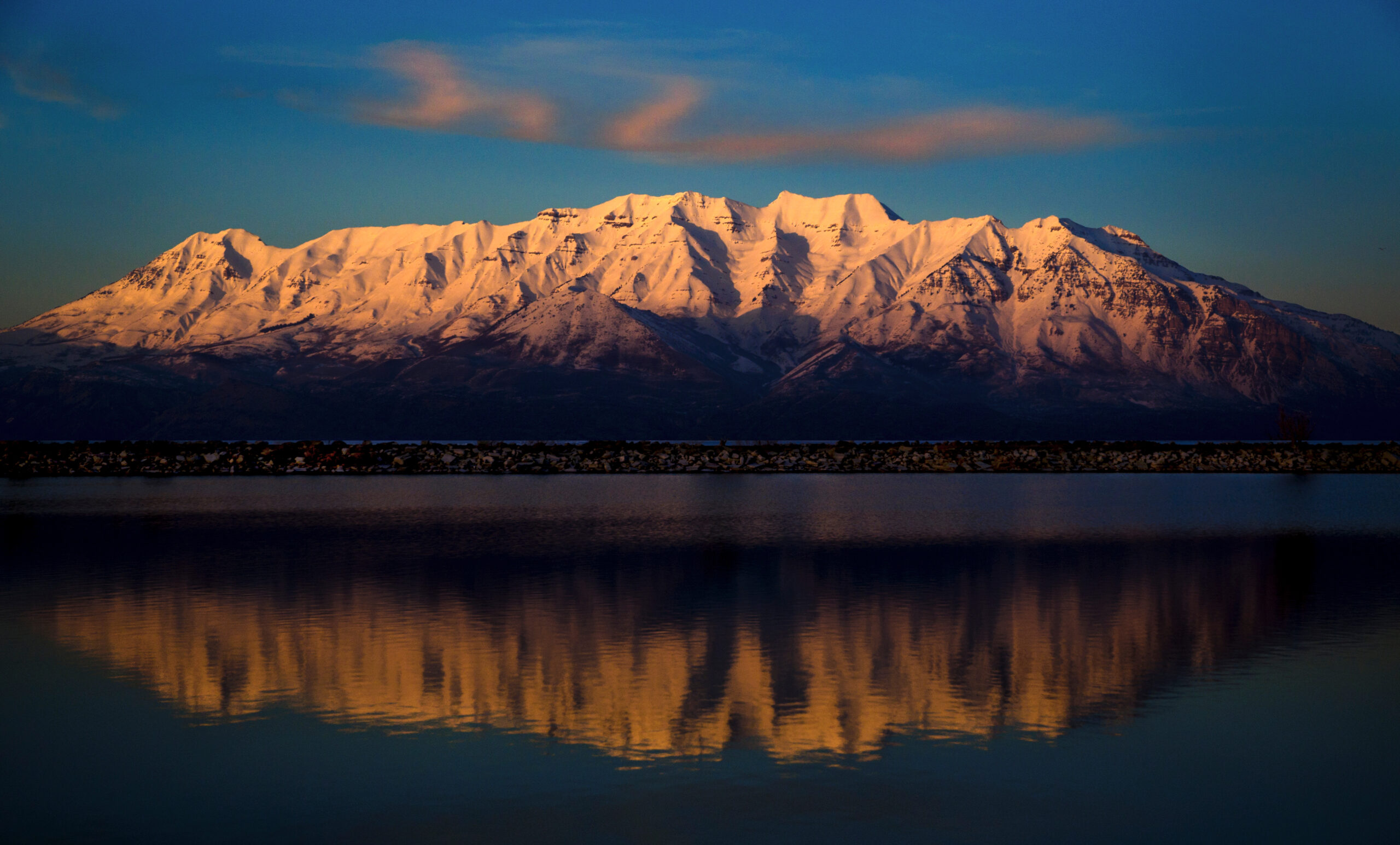
Timpanogos Is the County Icon—but It Should Not Be Your First Big Wasatch Day.
The strongest Utah County progression begins on shorter local peaks, builds sustained vertical on south-county mountains, and reaches Timpanogos after long-day pacing is already familiar.
A Four-Tier Utah County Progression
Use the list to choose peaks; use the tiers to decide when you are ready.
Kyhv Peak
- Learn Wasatch heat and pacing.
- Build descent durability.
- Practice weather and turnaround habits.
Repeat it from different approaches rather than rushing upward after one summit.
Spanish Fork · Loafer · Santaquin
- Long sustained climbing.
- Higher summer exposure.
- More time on feet.
These are the best fitness-building bridge between foothills and the county’s 11,000-foot peaks.
Box Elder · Provo · Timpanogos
- 11,000-foot altitude.
- Major vertical or duration.
- Early-start discipline.
Provo tests grade, Box Elder tests quieter high-country judgment, and Timp tests endurance.
Cascade · Provo East · Roberts Horn
- Route choice matters more.
- Scrambling/navigation can matter.
- Conditions alter difficulty rapidly.
These are peakbagging objectives, not default tourist hikes.
How This Page Relates to the Wasatch Seven
The old page let the challenge dictate the county list. The rebuild makes the relationship explicit instead.
The five direct overlaps
The standard Peakbagger Wasatch Seven includes Mount Timpanogos, Provo Peak, Cascade Mountain, Santaquin Peak and Spanish Fork Peak—all directly relevant to this county ranking.
Loafer Mountain is commonly treated as the higher, more prominent companion/alternative around Santaquin, and Peakbagger explicitly notes that many hikers visit both.
The two boundary peaks
Mount Nebo and Lone Peak remain essential to the Wasatch Seven tradition, but they are not Utah County-only summits. Nebo is listed as Juab/Utah boundary in Peakbagger data; Lone as Salt Lake/Utah.
That is why they stay in the dedicated Wasatch 7 Peaks guide instead of occupying two of the ten county ranking slots.

Mount Nebo Still Matters. It Just Belongs in the Right Module.
Nebo is the highest summit in the Wasatch and an essential Utah Valley challenge peak. The geographic correction is not a demotion—it is a cleaner separation between a county ranking and a regional skyline tradition.
Seven of the New Top 10 Have Documented GSG Ascents
The county page can lean much harder into first-hand experience than the old generic editorial-team version.
Mount Timpanogos: The One Peak With Its Own Planning System
This parent should answer “which Utah County peak?” and then hand route ownership to the dedicated Timp guide.
Timpooneke vs Aspen Grove
The rebuilt Timpanogos guide owns parking, route comparison, season, snow, distance, summit-day timing and 2026 Timpooneke ticket rules.
Open the Timpanogos guide →Timpooneke Weekend Mornings
Recreation.gov currently requires Timpooneke Trailhead vehicle tickets on Saturdays, Sundays and specified holidays during the seasonal morning window. Ticket inventory is split between 30-day and two-day booking releases.
Verify current Timpooneke tickets →Utah Peakbagging Paths From Here
These links carry decisions that should not be duplicated inside the Utah County ranking.
Mount Timpanogos
Route comparison, parking, current access, snow and summit-day plan.
Plan Timpanogos → Challenge ownerWasatch Seven
Nebo, Timp, Lone, Provo, Cascade, Santaquin and Spanish Fork in the challenge context.
Open the Wasatch Seven → Boundary relationshipMount Nebo
First-hand planning for the highest peak in the Wasatch; keep its route content out of this county parent.
Plan Mount Nebo → Statewide challengeUtah Range High Points
Expand from a county project into the statewide Core 17 challenge.
Start the Core 17 → Neighboring countySalt Lake County Top 10
South Twin, Pfeifferhorn, Olympus and the central Salt Lake County progression.
Cross into Salt Lake County → Range inventoryWasatch Range Peaks
Use the broader inventory for subpeaks and specialist objectives beyond either county Top 10.
Explore the Wasatch inventory →Make Utah County a Progression, Not a Checklist Race.
Save one mountain in My Climb, record what the day exposed—fitness, heat, pacing, altitude, scrambling confidence—then choose the next tier based on that evidence rather than the ranking number.
How This Rebuild Fixed the Old Page
The SEO opportunity is not more words. It is a clearer geographic promise and better trust signals.
Ranking method
- County relevance: Utah County-only peaks take priority in the main Top 10.
- Peakbagging value: each summit should add a distinct mountain experience.
- Progression: the list needs an entry point, fitness builders, major summits and specialist peaks.
- Local identity: Provo/Orem/Utah Valley relevance matters.
- First-hand depth: documented GSG ascents are labeled, not implied.
- Intent separation: Wasatch Seven, Timpanogos and Nebo keep their own page ownership.
Source framework
- Peakbagger — Utah County peak/county data
- Peakbagger — Wasatch Seven
- Recreation.gov — Timpooneke 2026 ticket rules
- Global Summit Guide — first-hand summit record
- GSG — current Timpanogos route/planning owner
Data note: elevation values can differ by a few feet among legacy topo maps, LiDAR and older guidebook values. For this page, the practical distinction is route character and county ownership, not a three-foot argument.
Utah County Peaks FAQ
Answers tuned to the exact county queries already reaching this URL.
What is the best peak to hike in Utah County?
Mount Timpanogos is the best overall Utah County mountain experience for most prepared hikers because it combines a major summit, established routes, alpine scenery and strong Utah Valley identity. It is a long strenuous day, not a beginner hike.
What is the best first peak in Utah County?
Kyhv Peak is the best entry point in this Top 10. It rises directly above Provo and can be approached in several ways, making it useful for learning Wasatch pacing before moving to longer 10,000- and 11,000-foot objectives.
Is Mount Nebo in Utah County?
Mount Nebo sits on the Juab-Utah county boundary in peak databases, while Global Summit Guide’s current Timpanogos Hiking Co. challenge page labels Nebo as Juab County. It remains part of the Wasatch Seven tradition but is kept outside this strict county-focused Top 10.
Is Lone Peak in Utah County?
Lone Peak is a Salt Lake-Utah county boundary peak. It remains a core Wasatch Seven challenge objective but is kept outside this county-focused Top 10.
Which Utah County peaks are part of the Wasatch Seven?
Mount Timpanogos, Provo Peak, Cascade Mountain, Santaquin Peak and Spanish Fork Peak are direct Wasatch Seven members that also belong in this Utah County ranking. Loafer Mountain is a common companion or alternative in versions of the challenge.
What is the hardest peak in Utah County?
Cascade Mountain is one of the hardest county-focused objectives because route choice, long elevation gain, scrambling and avalanche terrain can all matter. Provo Peak is the steepest compressed fitness test, while Timpanogos is the biggest mainstream endurance day.
What is the best season for Utah County peaks?
For normal snow-free hiking on the high peaks, July through September is the most dependable window. Kyhv has a longer season. Snow, avalanche conditions, wildfire, road closures and thunderstorms can change the appropriate window.
Does Mount Timpanogos require a permit in 2026?
There is not a general hiking permit for the standard summit routes, but Timpooneke Trailhead uses timed vehicle tickets during specified weekend and holiday morning periods in 2026. Check Recreation.gov and the dedicated Timpanogos guide for the current dates and booking windows.
Start Above Provo. Build South. Earn Timpanogos. Then Go Deeper.
A strong Utah County project begins with repeatable local mountains, builds sustained vertical on the southern Wasatch, and only then treats the county’s 11,000-foot and specialist peaks as normal days.
More Utah Guides
More trips, peaks and planning guides from the same region.
Was this helpful?
🏔Related guides
🧭Explore & compare
Global Summit Guide is an independent mountaineering resource founded in 2026. The team combines first-hand trekking and climbing experience with in-depth research and professional health and nutrition review to help climbers choose objectives, prepare properly, and stay safe.
Health, altitude, and nutrition content is reviewed by Taylor Ludlow (Registered Nurse) and Brigg Hoopes (Nutritionist).
What We Don't Know Yet
Mountain information changes quickly. This box explains the limits of what this page can responsibly promise.
- Route conditions, trailhead access, crevasse exposure, stream crossings, and rescue access may vary from published planning guidance.
- Comparisons simplify complex decisions; the better mountain depends on current conditions, skills, timing, budget, and risk tolerance.
- Route conditions, snowpack, closures, and weather can change quickly after this page is updated.
- Permit rules, fees, quotas, and reservation windows may change between review cycles.
- Operator availability, pricing, guide ratios, and cancellation terms can change by season.
Verify current conditions with official land managers, guide services, local forecasts, and current route reports before booking or climbing.
Mountaineering, rock and ice climbing, glacier travel, and high-altitude activity are inherently dangerous and can result in serious injury or death. The information on Global Summit Guide is provided for general informational and educational purposes only and is not a substitute for professional instruction, qualified guiding, proper equipment, or your own judgment and experience.
Route conditions, weather, snowpack, permits, regulations, and hazards change constantly and may differ from what is described here. Details may be incomplete, out of date, or contain errors. Always verify current information with local authorities, certified guides, and official sources before making any decision in the mountains.
Nothing on this site is medical, legal, or financial advice. Our fitness, acclimatization, altitude, and nutrition content is general in nature; consult a qualified physician before beginning any strenuous exercise program or exposing yourself to high altitude.
You are solely responsible for your own safety and decisions. To the fullest extent permitted by law, Global Summit Guide and its team accept no liability for any loss, injury, damage, or expense arising from use of, or reliance on, this information. By using this site you acknowledge these risks and accept these terms.
Some links on this site may be affiliate links. If you buy through them we may earn a small commission at no extra cost to you; this never affects our recommendations.
Global Summit Guide recommendation path
Next Best Mountain to Research
Use these recommendations to continue the right planning path instead of stopping on one page.
Use current permit, weather, route, and operator information before booking or climbing.
Search Flights, Hotels & Rental Cars
Have the mountain or destination picked? Use Expedia to compare the flights, lodging and rental cars that fit your actual trip dates. For mountain travel, consider arriving early enough for delays and adding a buffer night after the climb before a fixed flight home.
Compare current flight, hotel and car options.
Affiliate disclosure: Global Summit Guide may earn a commission if you book through this link, at no additional cost to you.