
Last updated October 17, 2026
Best Time to Climb Mount Rainier
Late June to mid-July is often the sweet spot for a first Disappointment Cleaver climb. But Rainier is not a calendar mountain: cold spring storms, summer glacier melt and changing route lines can make the same week excellent one year and a poor choice the next.
Research-based seasonal guide · Original route analysis · Last reviewed October 16, 2026 · 2027 rules and conditions require reconfirmation
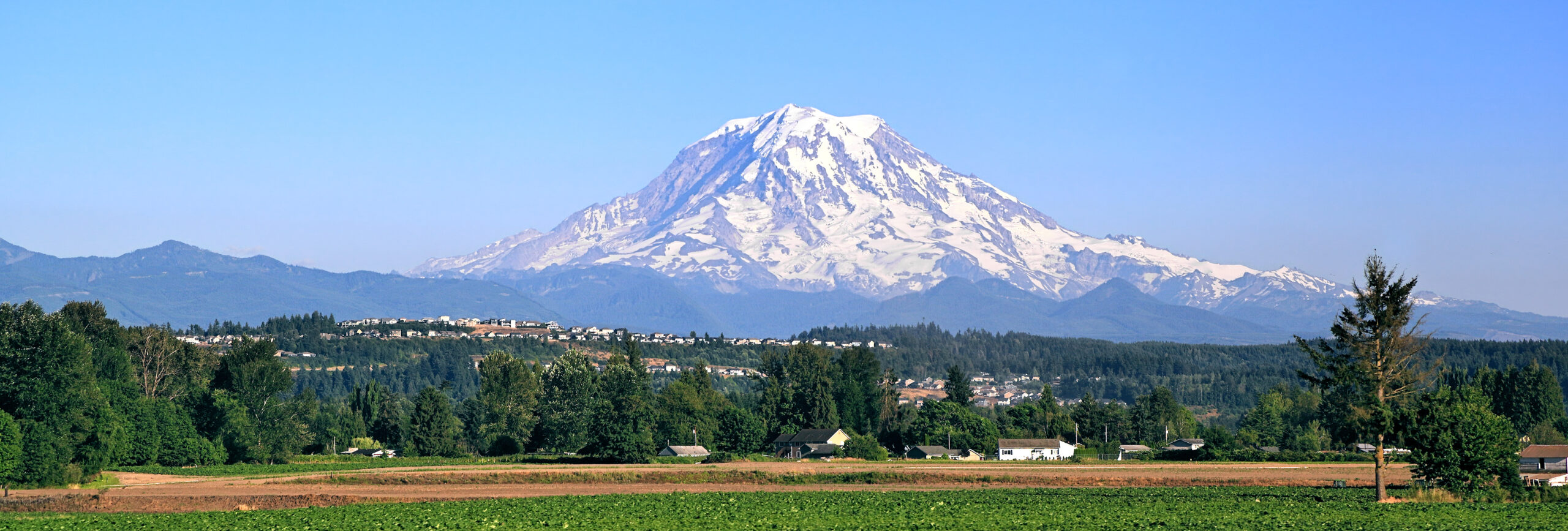
When is the best time to climb Rainier?
For most first-time guided climbers on the Disappointment Cleaver route, aim for late June through mid-July. This is often the best practical compromise among established guide operations, snow-covered glacier travel, relative weather stability and sunlight. July and August are generally the sunniest months in Mount Rainier National Park, according to the National Park Service, but the driest park weather does not automatically produce the safest late-season glacier route.
Choose by route: May–June is often more suitable for highly experienced teams targeting technical routes such as Liberty Ridge; Emmons–Winthrop frequently favors earlier summer; the standard DC route may remain usable into late summer when current rangers and guides report safe passage. Every recommendation depends on that season’s snowpack and active route.
Sources: NPS mountain weather · NPS climbing rules. Seasonal interpretation is Global Summit Guide editorial guidance, not an NPS safety guarantee.
Mount Rainier weather by month
A month determines the kind of problems you are most likely to face—not whether the mountain is safe. Spring preserves snow coverage but brings storms and avalanche questions. Later summer has more stable weather on average, but glacier breaks and rockfall may force a longer, more complex route.
| When | Likely weather & snow | Route tradeoff | Who it generally fits |
|---|---|---|---|
| April–early May | Winter-to-spring transition, deep snow, unsettled systems and sometimes substantial new snowfall. | Routes may be unestablished; storm, avalanche and overnight cold exposure dominate. | Experienced independent alpinists, not most first Rainier clients. |
| Mid-May–early June | Cold nights, extensive coverage and potentially stronger bridges after good refreezes; Pacific fronts still arrive. | Earlier technical lines can be favorable; snow instability, crevasses and navigation still demand expert judgment. | Skilled glacier teams and appropriate guided programs. |
| Late June–mid-July | Increasing summer high-pressure opportunities, long days and substantial remaining snow. | Popular routes usually established; bridges can be better than in late summer but are not guaranteed. | Best general first-climb planning window. |
| Late July | Often relatively dry, warm at lower elevations and variable above 12,000 feet. | Wider crevasses, snow bridge change, added ladders/detours, rockfall and exposed ice. | Teams using very current route reports. |
| August | Often the driest park weather, yet summit wind and freezing temperatures remain possible. | Glacier breakup becomes the limiting variable; even clear weather cannot guarantee an intact route. | Flexible teams comfortable with route changes. |
| September | Cooler nights, reduced daylight and return of early winter systems. | Fresh snow can hide open crevasses; fewer teams, changing guide schedules and access. | Experienced climbers with flexible logistics. |
| October–March | Winter conditions, strong storms, frequent snow and severe wind chill. | Specialized winter systems and self-reliant retreat capability needed. | Expert winter mountaineering teams. |
Two different “best months.” The NPS says late July and August are generally the warmest, driest part of the park’s year. For a glaciated summit climb, the best window often comes earlier because later melting damages crevasse crossings. This is why an August vacation recommendation and a late-June climbing recommendation can both be correct.
May: more coverage, more instability
Firm snow and cooler air can preserve glacier surfaces, but major Pacific storms, avalanche cycles and sparse route infrastructure increase the skill requirement. Favor the date only when your team is prepared for spring alpine conditions.
Build the preparation planJune: snow-cover advantage
June brings longer days and growing guide operations. Strong overnight refreeze and well-covered glaciers may improve movement; wind, deep snow and whiteouts remain common enough to stop otherwise prepared teams.
Compare guided programsJuly: often the best compromise
Early July frequently combines active route maintenance and comparatively reliable summer weather. Later July can become an entirely different crevasse problem after prolonged warmth.
Choose a routeAugust–September: go by route report
A clean sky at Paradise is not evidence of sound ladders or snow bridges above Camp Muir. Recheck the line, guide calendar, freezing level, navigation and the ability to return.
See the dated 2026 case studyWhy a warm, clear August day can be the wrong day
Rainier is an active glacier climb. In a cool, snowy spring, snow may temporarily bridge crevasses and conceal rocky sections. Repeated warm nights and hot days can erode those bridges, expose ice and widen the distance between safe glacier crossings. On routes like Disappointment Cleaver, ladders and fixed lines may be relocated as the season advances.
The central decision is therefore not just “Will it be sunny?” but “Will the route and return still work safely when we descend?” That is why the correct late-season plan may be a new line or no summit attempt, even with excellent visibility.

The best season depends on the line you climb
Four famous routes share a summit but not a calendar. Their exposure to the sun, snowpack, crevasses, loose rock and remoteness creates different ideal windows. Conditions vary year to year; the dates below are planning tendencies, not route-opening announcements.
| Route | General window | Why that window? | Non-negotiable check |
|---|---|---|---|
| Disappointment Cleaver / Ingraham | Late May–mid-July generally; possible later | Managed guide corridor, established camps, early-summer glacier coverage. | Live ladder/crevasse line and ranger observations. |
| Emmons–Winthrop | May–June into July, conditions permitting | Longer glacier approach where early coverage can simplify navigation and crossings. | Crevasse map, current Camp Schurman reports, ability to navigate independently. |
| Kautz Glacier | Often June–July | Conditions of snow and steep ice steps matter as much as seasonal temperature. | Ice-step quality, rockfall exposure and current technical assessment. |
| Liberty Ridge | Frequently May–June for expert teams | Early snow can protect loose terrain while avoiding the worst melt-driven hazard. | Serac and avalanche hazard, fast-changing weather and limited retreat. |

Disappointment Cleaver
The most established and heavily guided route, through Paradise, Camp Muir and the Ingraham glacier systems. Later summer can mean ladders and complicated detours.
Full route contextEmmons Glacier
A long, relatively quiet glacier experience from White River and Camp Schurman. Requires route-finding and a team that can act independently when tracks vanish.
DC vs EmmonsKautz & Liberty Ridge
Season selection becomes a technical hazard-management decision. Neither is simply an off-peak alternative to the standard route.
Assess readinessImportant correction: The standard route is commonly guided, but a guided ascent is not automatically safe. Every climber still needs the fitness, clothing, judgment and rope-team participation appropriate to the program. Independent climbers need competent glacier systems, not just tracks to follow.
Paradise weather is not summit weather
From a mild parking lot to a subfreezing crater rim, Rainier crosses multiple environments in one trip. The National Weather Service point forecast linked below is at roughly 12,762 feet, not the exact summit; read its stated forecast elevation before interpreting it.
| Zone | Approx. elevation | Common conditions | Planning implication |
|---|---|---|---|
| Paradise | 5,400 ft | Cloud and rain may obscure the upper mountain; sun may create very warm approach conditions. | Use for road and approach layers; not summit decisions. |
| Muir Snowfield | 7,000–10,000 ft | Bright reflected sunlight, wet snow, wind and whiteout risk. | Navigation, snow travel and overheating/cold management. |
| Camp Muir | About 10,080 ft | Cold nights, gusts, exposed camp and fast cloud changes. | Compare observed conditions with forecasts before an alpine start. |
| Upper glaciers | 11,000–13,500 ft | Exposed wind, hard ice or drifted snow; limited shelter. | Weather, pace and glacier route must allow a controlled descent. |
| Columbia Crest | 14,410 ft | Below-freezing weather and powerful wind chill possible even midsummer. | Use high-elevation forecast and full summit clothing. |

Does the summit drop below freezing in summer?
Yes. The air temperature aloft depends on the incoming weather system, not a fixed monthly average. When you add wind, damp clothing or a slow descent, cold stress can become serious even if you started in a T-shirt at Paradise. Do not publish a fake “average summit temperature” as a go/no-go threshold.
Carry waterproof protection, insulation kept dry, summit mitts and an emergency layer. Review the Rainier medical guide and the dedicated gear list before departure.
The storm is only part of the danger
Forecasts must be translated into conditions on the ground: snow stability, glacier bridges, rockfall, communication, visibility, cold exposure and the ability to reverse the route.
Rapid weather arrival
Marine systems can replace a clear morning with snow, cloud and powerful wind. Winter-like weather is possible in summer, and a favorable outlook days earlier is not permission to continue.
Wind chill and pace
Wind can destroy balance, dexterity and communication. A team moving more slowly than expected spends longer on exposed glacier terrain.
Whiteouts
The Muir Snowfield and upper glaciers can become featureless in cloud. Teams cannot depend on old boot packs or GPS tracks that may lead away from the active route.
Crevasse & bridge changes
Repeated warm nights and hot days weaken bridges and widen crevasses, changing routes even with clear weather.
Thunder and lightning
Building clouds can turn exposed snowfields, ridges and glacier terrain into an unsafe place to linger. An early start reduces but never eliminates the exposure.
Signals of upper wind
A wind-shaped summit cap can be evidence of strong airflow and moisture. Treat it as a cue to examine high-level wind and pressure, not a forecast on its own.

How to read the Mount Rainier forecast
No forecast widget knows whether this week’s glacier ladder, snow bridge or camp access remains usable. Build a layered forecast, then compare it with current ground truth.
| Source | Look for | Limitation |
|---|---|---|
| NWS Rainier point forecast | Upper-mountain wind, gusts, temperatures, snow/precipitation and timing. | The linked point may be around 12,762 ft, not 14,410 ft. Verify elevation. |
| NWS Seattle discussion | Pacific fronts, pressure systems and timing uncertainty. | Regional pattern rather than exact summit/crevasse conditions. |
| Northwest Avalanche Center | Snowpack and avalanche danger when seasonal forecasts are issued. | No glacier crossing verification; reports may be inactive outside forecast season. |
| National Park Service | Permits, official climbing guidance, current alerts and access. | Published guidance cannot replace a live route inspection. |
| Rainier climbing rangers’ blog | Camp Muir, DC and Emmons reports; route changes and observed hazards. | Posts may not describe overnight changes after publication. |
| Guide or ranger briefing | Current wind, cloud, bridge/ladders, track, turnaround data from people on the mountain. | Still requires your team to evaluate its own skills and pace. |
Start with the sequence: first storm arrival and precipitation timing; second summit wind/gusts; third freezing level and overnight refreeze; fourth cloud base and visibility; fifth route changes and retreat options. A forecast without the latest route information is incomplete.
What to watch at Camp Muir
Camp Muir is a decision point, not a green light. Compare actual wind, cloud and temperature with the forecast issued the day before. Ask descending teams what changed on the upper mountain, especially around ladders, bridges or exposed ice.
Conditions that surprise the team at 10,000 feet often become harder to manage near 13,000 feet. The best weather decisions are usually made with enough margin to turn around before the route becomes committing.

The 72-hour summit decision
Choose a season months ahead. Choose whether to climb in the final days and hours. Planning remains reversible until the safety margin is gone; a paid trip never makes a forecast safer.
7–10 days out
Watch regional trends. Hold flexible travel or weather days without overinterpreting exact wind speeds this far ahead.
72 hours out
Read summit point forecast, regional NWS discussion, NPS alerts, NWAC if active and recent route reports.
48 hours out
Evaluate fronts, wind gusts, precipitation timing, freezing level, refreeze and changes in route viability.
24 hours out
Confirm with the guide or ranger, check camp access and formulate a written turnaround time and condition list.
At high camp
Compare reality with forecast: actual wind, visibility, temperature, snow condition and reports from teams descending.
On summit day
Keep reassessing cold, pace, crevasses, route-finding and descent daylight; turn back when the decision margin fails.
There are no universal wind-speed or temperature thresholds that make every team safe. This workflow complements professional instruction, current land-manager rules and the team’s own ability to retreat.

A straightforward judgment framework
Go: the forecast, actual high-camp observations, glacier conditions, pace and retreat plan all retain substantial margin.
Hold: the arrival of a front shifts, high-altitude wind increases, overnight refreeze is weaker than expected, or new route hazards emerge. Wait for better data rather than rationalize uncertainty.
Turn back: deteriorating weather, impaired navigation, cold stress, route damage, teammate symptoms or a missed turnaround deadline removes the margin. The distance remaining to the summit is irrelevant to the safety decision.
For route-specific risk, read the complete Rainier guide and its safety section.
Gear and logistics for the weather you actually get
Rainier is an unusually good illustration of why equipment must be chosen for the worst credible conditions, not the warmest afternoon at Paradise. Your gear list should match your route, guide program and current glacier forecast.

Do not buy gear as a substitute for instruction. If this is your first glacier route, choose a skills-focused Rainier program or take a snow-and-glacier course before an independent climb. For 2027, recheck each guide’s packing list and NPS permit instructions when scheduling opens.
Build a Rainier-ready weather layering system
Compare waterproof shells, insulation, technical gloves and alpine footwear by fit and performance—not by advertised summit success. This retailer link is optional and may earn Global Summit Guide a commission at no additional cost to you.
Use the official GSG mountaineering gear guide to make your checklist first.
Understand rescue coverage before you leave home
Backcountry evacuation and high-altitude assistance can be complicated by weather, location and program restrictions. Read the actual membership terms and geographic exclusions; no rescue service can promise to reach a stormbound glacier.
This links to the provider’s official site; no affiliate tracking parameters are invented.
For the booking decision: compare guide services by actual mountain nights, practice time, contingency policy and the route they intend to use—not only by headline program length or a “summit package” label.
A practical 2027 Rainier planning checklist
As of October 2026, it is sensible to choose a target window for 2027. It is not sensible to imply next year’s exact fees, quotas, closures or glacier routes are already confirmed. Preserve flexibility and verify all operational details directly with the National Park Service and your guide before booking.
Pick a route and a capability level
First-time climbers usually begin with a guided Disappointment Cleaver program. Experienced glacier climbers may prefer the Emmons; technical routes require higher skills.
Compare route choicesReserve with cancellation terms in mind
Ask what happens if storms, route damage or ranger closures prevent climbing. Look beyond the travel window to the actual time and nights on the mountain.
Compare operatorsCheck registration and camp access
NPS requires climbing permits for glacier travel or climbing above normal high camps. Summer permits, winter registration and camp reservations vary by season. Verify the current park instructions.
Open permit guideRecheck conditions in the last 72 hours
Use the upper mountain forecast, recent ranger report, NWAC if active, route conditions and guide assessment. Reassess at camp and throughout the climb.
Full climb guideMount Rainier weather & climbing season FAQ
What is the best month to climb Mount Rainier?
For many first-time Disappointment Cleaver climbers, late June into early or mid-July offers a strong general balance of route support, snow coverage and weather opportunity. Individual conditions may favor an earlier or later date.
Is June or July better for Rainier?
June often has deeper snow coverage and stronger bridges after cold refreezes but more unsettled spring weather. July is often warmer and more settled; later July may bring greater crevasse exposure and route detours. Choose the team and route first.
Can you climb Rainier in August?
Yes, if the current route remains open and viable, the weather cooperates and your team meets the technical demands. August’s generally drier park weather cannot compensate for broken glacier crossings.
What months are the Rainier climbing season?
Many guide and standard-route programs operate from late May through summer, often wrapping up by September. Experts sometimes climb in other months, but winter conditions dramatically change the risk. Rainier does not have a universal officially safe climbing season.
What is the best season for the Emmons Glacier?
Earlier summer—often May through June or into July when snow conditions cooperate—is a common starting point because later melt complicates this long glacier route. Current Schurman and NPS condition reports govern the final decision.
What is the best time for Liberty Ridge?
Commonly May through June for highly competent alpinists, when snow coverage may better protect some loose terrain. Liberty Ridge remains a serious alpine undertaking with avalanche, icefall and limited retreat concerns.
How cold is Mount Rainier’s summit in July?
Below-freezing temperature and severe wind chill are possible in any summer month. Do not use a single average temperature to pack or decide; use the current high-elevation National Weather Service forecast for the expected hours of ascent and descent.
Does Rainier get thunderstorms?
Yes. Afternoon convective weather can threaten exposed snowfields and ridges. Early summit starts are common, but lightning and storms still require a conservative decision based on current conditions.
Which weather report is best for Rainier?
Cross-check the NWS Rainier point forecast, NWS Seattle forecast discussion, Northwest Avalanche Center when active, NPS updates and current climbing-ranger route reports. The NWS point elevation may be lower than the 14,410-foot summit.
Does a lenticular cloud mean bad weather?
A lens-shaped cloud near the summit can signal strong wind and moist airflow. It is a reason to investigate high-level conditions, not a standalone proof that a climb is safe or unsafe.
Do I need permits to climb Rainier in 2027?
National Park Service permit and climbing-registration rules apply to glacier and high-mountain climbs; overnight stays have separate wilderness-permit procedures. Verify exact 2027 fees, dates and reservation rules on the official NPS climbing page before booking.
Can I do Rainier without a guide?
Qualified independent teams can climb within NPS rules, but must be fully capable of glacier rope travel, crevasse rescue, navigation, and weather/retreat decisions. A guide is often a better starting point for climbers without these skills.
Should I add a weather day?
If your travel and operator program allow it, one or more flexible days improves the ability to avoid poor weather without pressure to continue. Flexibility does not mean crossing unstable glacier terrain just because skies clear.
Is the forecast at the summit?
Check the point forecast elevation. The commonly linked Rainier NWS point is approximately 12,762 feet, below Columbia Crest at 14,410 feet; upper-wind and temperature differences can matter greatly.
Sources, authorship and what remains uncertain
This page is an evergreen planning guide, not a real-time weather report or climbing clearance. Seasonal patterns follow National Park Service climate descriptions and Global Summit Guide’s analysis of published route and guiding seasons. Any actual weather forecast, avalanche bulletin, camp access, registration procedure or glacier line can change after this page is published.
- National Park Service — Mount Rainier Weather. The park’s July–August sunshine/dryness and year-round hazard guidance.
- NPS Mount Rainier Climbing. Climbing regulations, registration and season-dependent permit requirements.
- NPS Wilderness Permits. Current camp and overnight use procedures.
- National Weather Service — Mount Rainier Point Forecast. Weather data; verify displayed forecast elevation and update date.
- NWS Seattle Forecast Office and Northwest Avalanche Center. Regional fronts and seasonal snowpack conditions.
- Rainier Climbing Rangers’ Blog. Dated route observations; use with same-day ranger briefings.
- GSG 2026 late-season case study. Documents route changes, late-summer new snow and guide-calendar variation; archive, not 2027 conditions.
Editorial: Global Summit Guide · Travis Ludlow, founder and research editor. This page makes no claim of a personal Rainier summit. It preserves the existing research-based seasonal framework. Review exact 2027 regulations, guide availability and route condition again when the coming season approaches.
Image provenance: hero © Adobe Stock (GSG licensed site media). Remaining named landscape, climbing and high-camp photographs have individual Wikimedia Commons source and Creative Commons attribution beneath each image. The historic NPS aerial is explicitly labeled archival.
Advertising disclosure: some outbound partner links are affiliate/sponsored; this never determines route and weather recommendations. Display advertising, where enabled, is inserted independently by the site’s advertising platform.
Safety notice: Mountaineering on glaciated terrain carries serious risk of injury or death. The information here is educational, cannot evaluate a climber’s skills or today’s snowpack, and is not a substitute for instruction, current National Park Service conditions or conservative team judgment.
You have a season in mind. Now build the climb.
The best next page is not another weather forecast. Choose a route, confirm how the program handles weather delays, and build the equipment and glacier skills to come home safely.
Explore the wider Cascade Volcanoes collection or compare Mount Baker and Rainier.
Mount Rainier: Plan the Whole Climb
Permits, routes, difficulty, weather and logistics all decide the day. Start with the main guide, then go deeper below.
Was this helpful?
🏔Related conditions
🧭Explore & compare
Global Summit Guide is an independent mountaineering resource founded in 2026. The team combines first-hand trekking and climbing experience with in-depth research and professional health and nutrition review to help climbers choose objectives, prepare properly, and stay safe.
Health, altitude, and nutrition content is reviewed by Taylor Ludlow (Registered Nurse) and Brigg Hoopes (Nutritionist).
What We Don't Know Yet
Mountain information changes quickly. This box explains the limits of what this page can responsibly promise.
- Weather, snowpack, avalanche risk, road access, and route conditions can change quickly and may be different on your climbing dates.
- Route conditions, trailhead access, crevasse exposure, stream crossings, and rescue access may vary from published planning guidance.
- Visa, passport, vaccination, border, insurance, and local transportation rules may change before your trip.
Verify current conditions with official land managers, guide services, local forecasts, and current route reports before booking or climbing.
Mountaineering, rock and ice climbing, glacier travel, and high-altitude activity are inherently dangerous and can result in serious injury or death. The information on Global Summit Guide is provided for general informational and educational purposes only and is not a substitute for professional instruction, qualified guiding, proper equipment, or your own judgment and experience.
Route conditions, weather, snowpack, permits, regulations, and hazards change constantly and may differ from what is described here. Details may be incomplete, out of date, or contain errors. Always verify current information with local authorities, certified guides, and official sources before making any decision in the mountains.
Nothing on this site is medical, legal, or financial advice. Our fitness, acclimatization, altitude, and nutrition content is general in nature; consult a qualified physician before beginning any strenuous exercise program or exposing yourself to high altitude.
You are solely responsible for your own safety and decisions. To the fullest extent permitted by law, Global Summit Guide and its team accept no liability for any loss, injury, damage, or expense arising from use of, or reliance on, this information. By using this site you acknowledge these risks and accept these terms.
Some links on this site may be affiliate links. If you buy through them we may earn a small commission at no extra cost to you; this never affects our recommendations.
Global Summit Guide recommendation path
Next Best Mountain to Research
Use these recommendations to continue the right planning path instead of stopping on one page.
Use current permit, weather, route, and operator information before booking or climbing.