
Last updated September 17, 2026
Best Mountains in Hawaii: Choose the Right Island, Elevation & Challenge
Hawaii has three very different mountain problems. Mauna Kea and Mauna Loa create serious altitude and upper-mountain exposure. Haleakalā is a volcanic high-country objective. Oʻahu and Kauaʻi shift the challenge toward tropical ridge exposure, mud, heat, rain and access. This guide helps you choose the right island and mountain instead of treating every Hawaii summit as the same kind of hike.
Which Hawaii Mountain Should You Choose?
Choose Mauna Kea if you want Hawaii’s high point and are prepared for rapid altitude gain, cold summit conditions and current upper-mountain access rules. Choose Mauna Loa if you want the state’s strongest wilderness-volcano objective. Choose Haleakalā for Maui and a major volcanic landscape without the same 13,000-foot altitude.
On Oʻahu, Mount Kaʻala is the true island high-point objective, while Kōnāhuanui and Olomana shift the challenge toward tropical ridges and exposure. Koko Crater is a training objective. Diamond Head is a visitor landmark rather than a major statewide mountain achievement.
The correct Hawaii question is usually which island and which mountain problem—altitude, volcanic wilderness or tropical ridge exposure.
Which Hawaii Mountain Experience Fits You?
Hawaii’s best objective changes dramatically depending on island, altitude tolerance and appetite for ridge exposure.
Mauna Kea
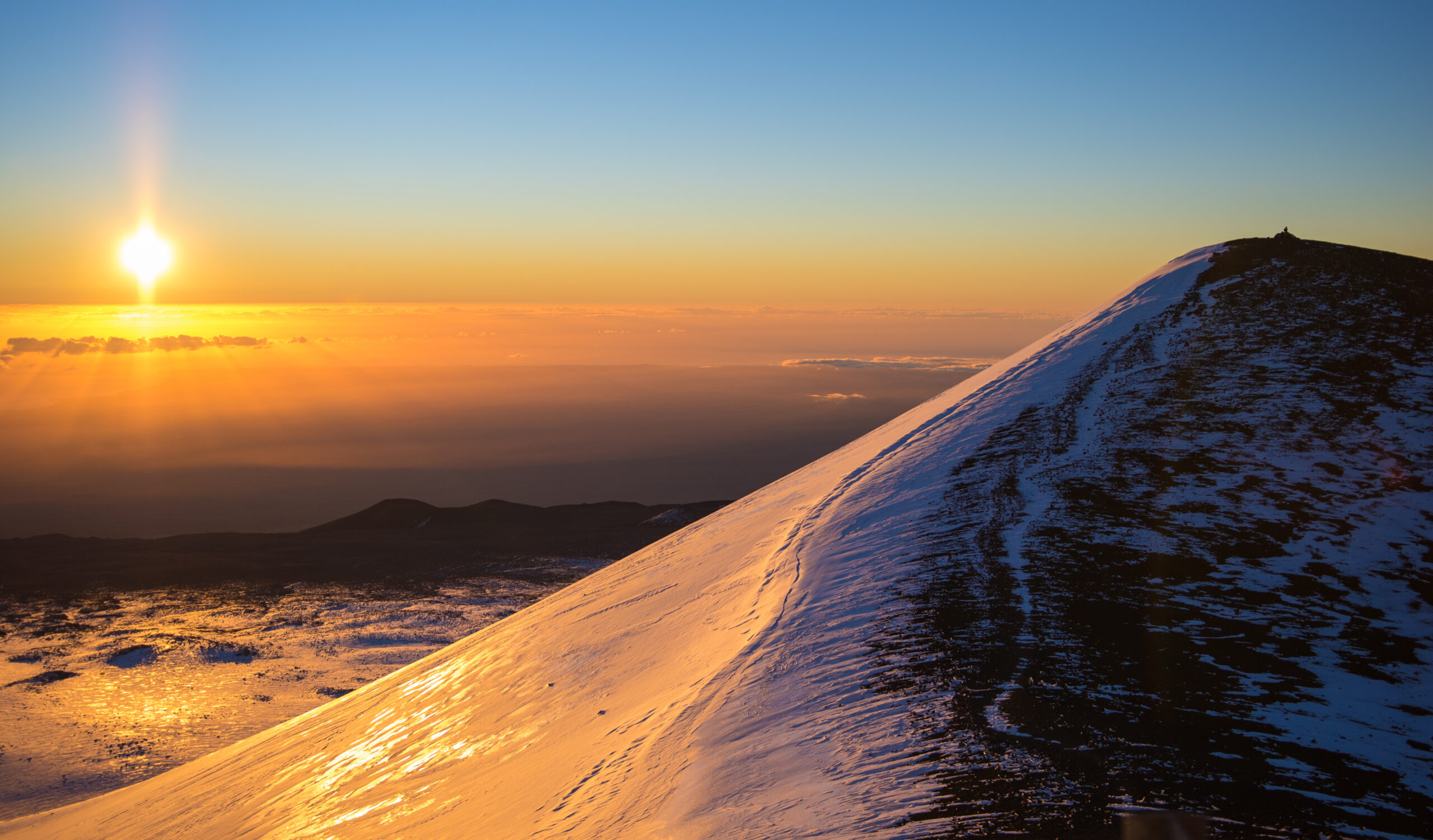
Choose Mauna Kea for the state high point, alpine desert, astronomy landscape and altitude. The mountain is culturally sacred and should be approached as a place to visit respectfully, not merely “conquer.”
Mauna Loa
Choose Mauna Loa for a longer, more committing volcanic journey where navigation, weather, water, altitude and park status matter more than technical climbing.
Haleakalā
Choose Haleakalā for a major summit district, volcanic landscape and enormous island relief with straightforward national-park logistics.
Kaʻala / Kōnāhuanui / Olomana
Choose Oʻahu when tropical ridge terrain is the goal. Exposure, mud, rain and route judgment replace the altitude problem of the Big Island volcanoes.
The Hawaii Mountain Portfolio
Some Hawaii “mountains” are straightforward public objectives; others have restricted or complex access. This parent makes those differences explicit rather than presenting every summit as equally accessible.
| Mountain / objective | Island | Type | Difficulty band | Main problem | Best for |
|---|---|---|---|---|---|
| Mauna Kea | Hawaii Island | 13,803-ft shield volcano | Strenuous high-altitude hiking | Altitude + access + cold/wind | Best overall / state high point |
| Mauna Loa | Hawaii Island | 13,681-ft active volcano | Advanced nontechnical wilderness | Distance + navigation + volcano status | Best wilderness volcano |
| Haleakalā | Maui | 10,023-ft shield volcano | Route-dependent | Altitude + park logistics | Best Maui mountain |
| Mount Kaʻala | Oʻahu | Island high point | Strenuous tropical hike | Mud + steep terrain + weather | Best Oʻahu high point |
| Kōnāhuanui | Oʻahu | Koʻolau ridge high point | Advanced ridge hike | Mud + exposure + route conditions | Best Koʻolau high-point experience |
| Puʻu Kukui | Maui | West Maui high point | Restricted / conservation access | Access + fragile watershed | Best West Maui high-country context |
| Kawaikini / Waiʻaleʻale high country | Kauaʻi | Island high country | Complex access | Rain + mud + route/access limits | Best Kauaʻi high-elevation environment |
| Hualālai | Hawaii Island | 8,271-ft volcano | Access-dependent | Private land / route permission | Best lesser-known Big Island volcano |
| Olomana | Oʻahu | Exposed ridge peaks | Advanced scramble | Exposure + wet rock | Best exposed ridge progression |
| Koko Crater | Oʻahu | Steep crater climb | Very steep training hike | Heat + repetitive steepness | Best training objective |
| Diamond Head / Lēʻahi | Oʻahu | Volcanic tuff cone | Accessible visitor hike | Reservation + crowds + heat | Best visitor landmark |
| Puʻu Manamana | Oʻahu | Exposed ridge | Expert only | Severe exposure + route consequences | Expert ridge objective |
The 12 Best Mountain Objectives in Hawaii
The order balances statewide significance, mountain quality, island representation, access and how clearly each objective serves a distinct trip goal.
Mauna Kea / Mauna a Wākea
Mauna Kea is the strongest statewide answer because it combines the Hawaii high point, extraordinary base-to-summit relief, alpine desert and one of the world’s most important astronomical landscapes.
The challenge is not technical climbing. It is rapid altitude gain, cold and wind, long hiking distance from the VIS and current upper-mountain access rules. Cultural context also matters: this is a sacred mountain in Native Hawaiian tradition.
Mauna Loa
Mauna Loa is the more committing mountain journey. Long lava routes, minimal shade, altitude, navigation and dynamic park/volcano status make it one of the most substantial nontechnical wilderness objectives in the state.
Access must never be treated as static. Severe weather, road damage and volcanic activity can alter what is open.
Haleakalā
Haleakalā is the best Maui mountain because it combines a major summit elevation with one of the most distinctive volcanic landscapes in the United States. It is accessible enough for ordinary visitors yet high enough for cold, wind and altitude to matter.
Mount Kaʻala
Kaʻala is the correct Oʻahu summit for a statewide mountain list because it is the island high point and takes visitors into a very different mountain environment from the volcanic Big Island.
Kōnāhuanui
Kōnāhuanui represents the wet, steep Koʻolau mountain system. Mud, rain and route conditions can make the day more serious than the elevation suggests.
Puʻu Kukui
Puʻu Kukui belongs for geographic completeness, but the access caveat is central. It is a fragile conservation landscape rather than a casual public summit objective.
Kawaikini / Waiʻaleʻale High Country
Kauaʻi’s high country is globally distinctive, but it should not be marketed as a straightforward peakbagging objective. Rainfall, terrain and access complexity are part of the experience.
Hualālai
Hualālai adds depth to the Big Island story, but summit access is far more constrained than Mauna Kea or national-park portions of Mauna Loa.
Olomana
Olomana belongs because it is a true progression objective rather than another viewpoint hike. Exposure increases as the route continues, and wet conditions materially change the risk.
Koko Crater
Koko Crater is not one of Hawaii’s great alpine mountains, but it is one of the state’s best steep training objectives. It is especially useful for visitors and local hikers building uphill tolerance.
Diamond Head / Lēʻahi
Diamond Head is one of Hawaii’s most recognizable volcanic landforms and an excellent visitor experience, but its role is tourism and accessible geology—not advanced mountain progression.
Puʻu Manamana
Puʻu Manamana belongs only as an expert-endpoint example. A statewide guide should not normalize Hawaii’s most exposed ridges as casual tourist objectives.
Hawaii’s Mountain Difficulty Comes From the Environment, Not Just the Grade.
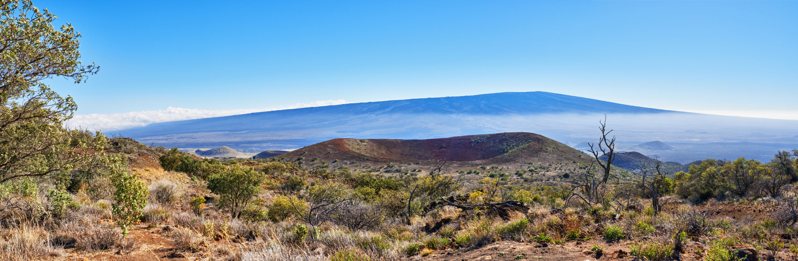
Mauna Loa is nontechnical but committing. Oʻahu ridges are lower but can be far more exposed. Mauna Kea is straightforward terrain but creates a serious altitude jump. One difficulty label cannot describe all three.
What Actually Makes Hawaii Mountains Hard?
Elevation alone misses most of Hawaii’s risk structure.
Mauna Kea + Mauna Loa
Visitors can move from sea level to more than 13,000 feet in a few hours. That creates rapid physiological stress even when the terrain is technically straightforward.
Mauna Loa + Haleakalā
Lava terrain, sparse water, wind, navigation and dynamic park/volcano conditions matter more than conventional climbing grades.
Oʻahu + Kauaʻi
Wet roots, mud, steep drop-offs, sudden rain and eroded ridge terrain can turn relatively low elevations into serious mountain travel.
Do Not Compare Only by Elevation
A 3,000-foot Oʻahu ridge can demand better footwork and exposure tolerance than a 13,000-foot volcanic trail.
Mauna Kea: The Main Planning Problem Is Rapid Altitude Gain
The mountain is accessible enough to underestimate and high enough to punish that mistake.
Roughly 13 Miles Round Trip
The Humuʻula Trail from the Visitor Information Station is roughly 13 miles round trip with about 4,600 feet of gain—far more substantial than the old “6-mile” framing.
About 9,200 Feet
The Visitor Information Station is already at significant altitude. Current upper-mountain visitor guidance recommends acclimatization there before proceeding higher.
4WD Above the VIS
Current access rules require appropriate four-wheel drive for upper-mountain driving. Rental contracts can impose additional restrictions even when the vehicle itself is capable.
Visit With Respect
Mauna a Wākea is a sacred Native Hawaiian landscape. The statewide parent should frame the experience as respectful visitation and planning rather than conquest language.
Hawaii Mountain Access, Reservations & Restrictions
There is no single statewide mountain permit system.
| Objective | Current planning issue | What it means |
|---|---|---|
| Mauna Kea | Upper-road access / 4WD / VIS acclimatization / group rules | Check current Maunakea stewardship guidance and rental-car contract before driving higher |
| Mauna Loa | National park + volcano + storm status | Never assume summit routes are open; verify NPS and USGS status |
| Haleakalā sunrise | Reservation required 3–7 a.m. | Reservation is separate from normal park entrance |
| Diamond Head | Nonresident reservation system | Advance booking plus current entry/parking fees |
| Hualālai / Puʻu Kukui / some high-country routes | Private or conservation access | Do not treat as open public summit hikes without current authorization |
When Should You Climb Mountains in Hawaii?
Weather changes by elevation, island and wind exposure.
| Conditions | Big Island high summits | Maui high country | Oʻahu / Kauaʻi ridges | Main issue |
|---|---|---|---|---|
| Dry / stable trade-wind pattern | Often favorable | Often favorable | Better ridge footing | Wind can still be severe aloft |
| Winter storm / summit snow | Cold, snow/ice possible | Cold summit conditions | Rain-driven mud / slick ridges | Do not assume tropical = warm everywhere |
| Heavy rain | Road / visibility concerns | Cloud and rain | Major ridge hazard | Wet rock, mud, runoff, flash flooding |
| Hot / sunny lowlands | Cooler high summit | Cooler summit | Heat can dominate crater/city hikes | Heat + dehydration at lower elevations |
| Volcanic unrest / closure | Check USGS / stewardship | Not a primary issue | Not a primary issue | Mauna Loa / Kīlauea status can alter plans |
A Hawaii Mountain Progression
Hawaii is useful for progression if you stop treating every mountain as the same kind of hiking.
Diamond Head / Koko Crater
Build steep uphill tolerance, heat management and basic pacing on short, accessible objectives.
Kaʻala / Haleakalā
Add longer mountain days, tropical terrain or higher-elevation weather without jumping directly to 13,000 feet.
Mauna Kea
Add rapid altitude gain and upper-mountain cold while keeping terrain technically straightforward.
Mauna Loa / exposed Oʻahu ridges
Add multi-day volcanic wilderness or serious ridge exposure—but recognize these are different skill branches, not a single ladder.
Build a Hawaii Mountain Day Around the Environment.
Choose the island first, then identify the variable that can break the plan: altitude, access, volcanic closure, tropical rain, ridge exposure or heat. Hawaii rewards climbers who understand the environment before chasing the summit.
Build steep uphill tolerance and heat management.
Move from training vertical into a real island high-point day.
Experience 10,000 feet before jumping to 13,800 feet.
Add distance, backcountry systems and active-volcano planning.
How This Hawaii Parent Is Maintained
Access rules and cultural/land-management context are treated as part of the mountain—not as footnotes after the ranking.
What this page evaluates
- Statewide mountain identity and island representation.
- Altitude, volcanic wilderness and ridge exposure as separate problems.
- Public access versus restricted/private/conservation access.
- Progression value for visitors and developing hikers.
- Current reservation and land-manager rules.
- Cultural respect on sacred Hawaiian mountain landscapes.
It does not replace current agency, stewardship or landowner information.
Primary current sources
- Maunakea Visitor Information / Stewardship
- Hawaiʻi Volcanoes National Park — Mauna Loa access
- USGS Hawaiian Volcano Observatory — Mauna Loa status
- Haleakalā National Park — summit hours / sunrise
- Hawaii State Parks — Diamond Head
Maintenance rule: volcano status, storm closures, summit-road conditions, reservation systems and restricted-access areas should be checked before travel.
Hawaii Mountains FAQ
Answers written for statewide mountain selection and Hawaii summit-planning queries.
What is the best mountain to climb in Hawaii?
Mauna Kea is the best overall Hawaii mountain for visitors who want the state high point and can manage rapid altitude gain, summit-access rules and cold upper-mountain conditions. Mauna Loa is the stronger wilderness volcano objective, while Haleakalā is the best major mountain on Maui.
What is the highest mountain in Hawaii?
Mauna Kea, properly Mauna a Wākea, is the highest point in Hawaii at about 13,803 feet above sea level.
How long is the Mauna Kea hike?
The Humuʻula Trail from the Visitor Information Station is roughly 13 miles round trip with about 4,600 feet of elevation gain. It is not a short 6-mile summit hike.
Do you need 4WD for Mauna Kea?
Visitors driving above the Visitor Information Station need a suitable four-wheel-drive vehicle under current upper-mountain access rules. Rental-car contracts may impose additional restrictions.
Do you need a reservation for Haleakalā sunrise?
Yes. Haleakalā National Park requires a sunrise reservation for entry to the Summit District from 3:00 a.m. to 7:00 a.m. The reservation is separate from normal park entrance.
Do you need a reservation for Diamond Head?
Non-Hawaii residents need advance reservations for Diamond Head State Monument. Check current entry and parking fees with Hawaii State Parks before travel.
Is Mauna Loa always open for hiking?
No. Mauna Loa access can change because of volcanic activity, severe weather, road damage, wildfire or park closures. Check Hawaiʻi Volcanoes National Park and the USGS Hawaiian Volcano Observatory before planning.
When is the best time to climb mountains in Hawaii?
Hawaii has year-round mountain opportunities, but not one universal climbing season. Big Island summit access depends on wind, snow, storms and volcano status; tropical ridge routes can become dangerous in heavy rain; and lower-elevation island hikes can be much hotter than summit areas.
Choose the Island First. Then Choose the Mountain Problem.
Mauna Kea is altitude. Mauna Loa is volcanic wilderness. Haleakalā is Maui high country. Oʻahu is tropical ridge exposure. The best Hawaii mountain is the one whose environment matches the experience and skills you actually want.
Best Mountains in Hawaii: Volcanoes & Summits
Hawaii’s peaks range from a drive-up observatory summit to a leg-burning stair climb. Go deeper on each, or compare with the other US states.
Mountains in Hawaii
Full climbing guides for every major peak in this region — routes, permits, difficulty and season.
Best Mountains in Hawaii at a Glance
Use this condensed table when you already know your island or trip style. The full rankings above explain the deeper access, cultural and difficulty context.
| Trip goal | Best choice | Island | Why choose it | Main planning issue |
|---|---|---|---|---|
| State high point | Mauna Kea / Mauna a Wākea | Hawaiʻi Island | Highest point in Hawaii and the clearest statewide summit objective | Rapid altitude gain, cold, upper-road rules, cultural respect |
| Volcanic wilderness | Mauna Loa | Hawaiʻi Island | Longer, more remote and more committing than Mauna Kea | Route access, storm damage, volcano status, water, navigation |
| Maui high country | Haleakalā | Maui | Major volcanic summit landscape with straightforward park access | Sunrise reservation if entering 3–7 a.m.; wind and cold |
| True Oʻahu high point | Mount Kaʻala | Oʻahu | Island-high-point objective and a real tropical mountain day | Mud, weather and steep tropical terrain |
| Short steep training | Koko Crater | Oʻahu | Repeatable uphill conditioning without a full-day mountain commitment | Heat, crowds and steep repetitive climbing |
| Iconic visitor hike | Diamond Head / Lēʻahi | Oʻahu | Easy-to-plan volcanic landmark for a short outing | Nonresident entry/parking reservation and heat |
| Exposed ridge progression | Olomana | Oʻahu | Much more exposure and route consequence than urban summit walks | Wet rock, exposure and turnaround judgment |
| Kauaʻi high-country context | Kawaikini / Waiʻaleʻale high country | Kauaʻi | Distinctive wet high-country environment | Current lawful access, storm impacts, mud and route complexity |
Six Ways to Build a Hawaii Mountain Trip
The most useful comparison is not simply highest to lowest. Hawaii’s mountains divide into very different types of days.
High Volcano Summit
Mauna Kea is the clearest choice when the goal is elevation, Hawaii’s high point and an alpine-desert summit environment.
Remote Volcano
Mauna Loa is the better objective when you want distance, backcountry systems, navigation and a more committing volcanic journey.
Volcanic High Country
Haleakalā gives you a 10,000-foot summit district and major volcanic landscape without the same 13,000-foot altitude jump.
Island High Point
Mount Kaʻala is the correct objective when the trip is about reaching Oʻahu’s true high point rather than a city workout.
Steep Fitness Day
Koko Crater is short, steep and repeatable—useful for vertical conditioning rather than wilderness progression.
Tropical Ridge Day
Olomana and other advanced Oʻahu ridges trade altitude for wet rock, narrow terrain and much greater fall consequence.
Hawaii Mountain Geography Changes by Island.
The Big Island carries the high volcanoes; Maui adds Haleakalā and the West Maui Mountains; Oʻahu is ridge country; Kauaʻi is wet, steep and access-sensitive high country.