<

Category: current conditions

  • Denali West Buttress Conditions 2026: NPS Permits, Camps, Weather Windows & Recent Climber Reports

    Denali West Buttress Conditions 2026: NPS Permits, Camps, Weather Windows & Recent Climber Reports

    Home · Mountains · Denali · West Buttress Conditions

    Denali West Buttress Conditions 2026: NPS Permits, Camps, Weather Windows & Recent Climber Reports

    Everything you need to know about climbing North America’s highest peak via the West Buttress route in the active 2026 season. NPS permit costs, camp progression from Kahiltna Glacier base camp to 14 Camp and High Camp, current weather windows, recent ranger station reports, and 2026 regulations for the standard route used by 90% of Denali climbers.

    20,310 ft
    Summit Elevation (6,190m)
    May 1
    2026 Season Active
    $450
    2026 NPS Permit (Adult)
    18-24
    Expedition Days (Typical)
    2026 Climbing Season Active May 1 – July 15 · NPS Permit $450 Adult / $350 Under 24 · 60-Day Pre-Registration Required · West Buttress Standard Route · Denali Full Guide →
    Last updated May 24, 2026 — verified for the active 2026 climbing season (May 1 – July 15)

    If you’re planning to climb Denali via the West Buttress this season, you need to understand the current state of the mountain. The 2026 season is currently active. NPS rangers are in their high camps. Several patrols are working the Kahiltna Glacier and the 14,200-foot camp. Climbers are flying in daily from Talkeetna. The peak window opens now and runs through late June. This page covers everything from current NPS permit costs to camp-by-camp conditions, weather patterns, and what climbers should know before flying onto the Kahiltna.

    The 2026 Denali season runs May 1 through approximately July 15. Peak conditions on the West Buttress fall between mid-May and late June, when daylight reaches 20+ hours, temperatures are warmest by Alaska Range standards, and stable high-pressure systems produce the most reliable summit windows. NPS registration for the 2026 season opened January 1, 2026, with the mandatory 60-day pre-registration period enforced strictly. Climbers without permits cannot fly into the Kahiltna Glacier base camp.

    The West Buttress is the standard route on Denali, used by approximately 90% of climbers. The route is technically moderate by world mountaineering standards but the cold, altitude, and self-sufficient logistics make it genuinely difficult. Climbers haul approximately 100-120 pounds of gear, food, and fuel for the entire expedition. The route uses six camps from base camp at 7,200 feet to High Camp at 17,200 feet, with the summit at 20,310 feet (6,190 m).

    Denali West Buttress Live Conditions Snapshot

    Here’s the current state of the West Buttress route as of May 24, 2026, verified against NPS field reports, Talkeetna Ranger Station updates, and recent climber communications.

    2026 Season Status — Updated May 24, 2026

    Climbing Season
    Active. May 1 – July 15, 2026. Peak conditions mid-May to late June. NPS rangers patrolling 14 Camp and 17 Camp.
    Active
    NPS Permit Fee 2026
    $450 USD adults (25+) / $350 USD climbers 24 and under. Plus $15 park entrance fee. Combined total $465 adult.
    Required
    60-Day Pre-Registration
    Mandatory. Two-step process: Pay.gov fee payment + email Special Use Permit application. Non-refundable after Feb 15.
    Required
    Walter Harper Ranger Station
    Mandatory pre-climb orientation in Talkeetna. Climbers pick up Clean Mountain Can (CMC) and receive current conditions briefing.
    Operating
    Bush Plane Access
    K2 Aviation, Talkeetna Air Taxi, Sheldon Air Service flying climbers to Kahiltna Glacier (7,200 ft). Weather-dependent.
    Active
    14 Camp (14,200 ft)
    NPS ranger camp established. Medical tent operational. Standard waypoint for acclimatization. Cell coverage limited but functional.
    Operational
    Fixed Lines (Headwall)
    Installed annually between 14 Camp and 16,200-foot ridge. Critical infrastructure. Verify status with NPS rangers at 14 Camp.
    Installed
    17 Camp / High Camp (17,200 ft)
    Wind-exposed launch point for summit day. Temperatures -30 to 0°F. Most exposed camp on the route.
    Open
    CMC Waste Management
    Mandatory. All climbers issued Clean Mountain Cans at Talkeetna. Human waste packed out from all camps above 14,200 ft.
    Required
    Solo Climbing
    Permitted but strongly discouraged by NPS. Solo climbers face additional scrutiny and required experience verification.
    Discouraged

    Daily NPS updates during the season. The Walter Harper Talkeetna Ranger Station maintains an automated statistics phone line at (907) 733-9127 with current registration numbers and climbing statistics. NPS Field Reports publish updates from patrol rangers at 14 Camp and the high camps. MountainWeather.com aggregates the 7K and 14K weather station telemetry, NWS Denali Climbing Forecasts, and FAA webcam feeds. Climbers should monitor all three sources before flying into the Kahiltna and again before any summit attempt.

    Denali Location & Kahiltna Glacier Live Weather

    Denali sits in the Alaska Range, approximately 150 miles north of Anchorage and 100 miles west of Fairbanks. The West Buttress route begins at the Kahiltna Glacier Base Camp (7,200 ft), reached only by bush plane from Talkeetna (358 ft). Summit coordinates: 63.0692°N, 151.0070°W. The mountain straddles Denali National Park and Preserve, a 6-million-acre wilderness larger than the state of New Hampshire.

    Talkeetna Temp
    Loading…
    Wind
    Conditions
    Tomorrow

    Live weather data from Open-Meteo at Talkeetna (358 ft / 109m), the bush-plane departure point. Kahiltna Glacier (7,200 ft) typically runs 20-30°F colder than Talkeetna. Summit-day temperatures at 20,310 ft average -30 to -40°F with wind chill below -60°F not uncommon. Always cross-reference with the NPS Denali Climbing Forecast and MountainWeather.com before flying in.

    Denali West Buttress At a Glance

    Summit elevation20,310 ft (6,190 m) — North America’s highest peak; one of the Seven Summits
    LocationDenali National Park and Preserve, Alaska Range, Alaska, USA
    Coordinates63.0692°N, 151.0070°W
    RouteWest Buttress — standard route, ~90% of all Denali climbers
    Technical gradeAlaska Grade 2; moderate glacier and snow climbing with sustained altitude and cold exposure
    Total distance~13 miles horizontal; 13,500 ft vertical gain from base camp to summit
    Camps6: Base Camp 7,200 ft → 7,800 → 9,500 → 11,000 → 14,200 (14 Camp) → 17,200 (High Camp) → Summit
    2026 climbing seasonMay 1 – July 15, 2026 (peak: mid-May to late June)
    NPS permit fee 2026$450 USD adults (25+) / $350 USD climbers 24 and under
    Park entrance fee$15 USD per person, valid 7 days
    Combined 2026 fees$465 USD adult / $365 USD under 24
    Registration deadline60 days before climb start; non-refundable after Feb 15
    Expedition length18-24 days from Talkeetna to summit and back
    ApproachTalkeetna → Kahiltna Glacier via bush plane (K2 Aviation, Talkeetna Air Taxi, Sheldon Air Service)
    2026 guided cost$12,900-$19,000 USD (NPS-authorized concessions only)
    Authorized guide concessions7 federally-licensed companies on Denali
    Summit success rate~50% average (range: 28-60%+ by season and weather)
    Guided success rate55-70% typical; better than independent climber average
    Summit-day temperatures-30 to -40°F with wind chill below -60°F not uncommon
    Critical hazardsCrevasses on Kahiltna, Windy Corner, Headwall fixed lines, Autobahn, Denali Pass, Summit Ridge
    Waste managementClean Mountain Cans (CMCs) mandatory; all waste packed out
    Self-sufficient~100-120 lbs of gear, food, fuel per climber for the expedition
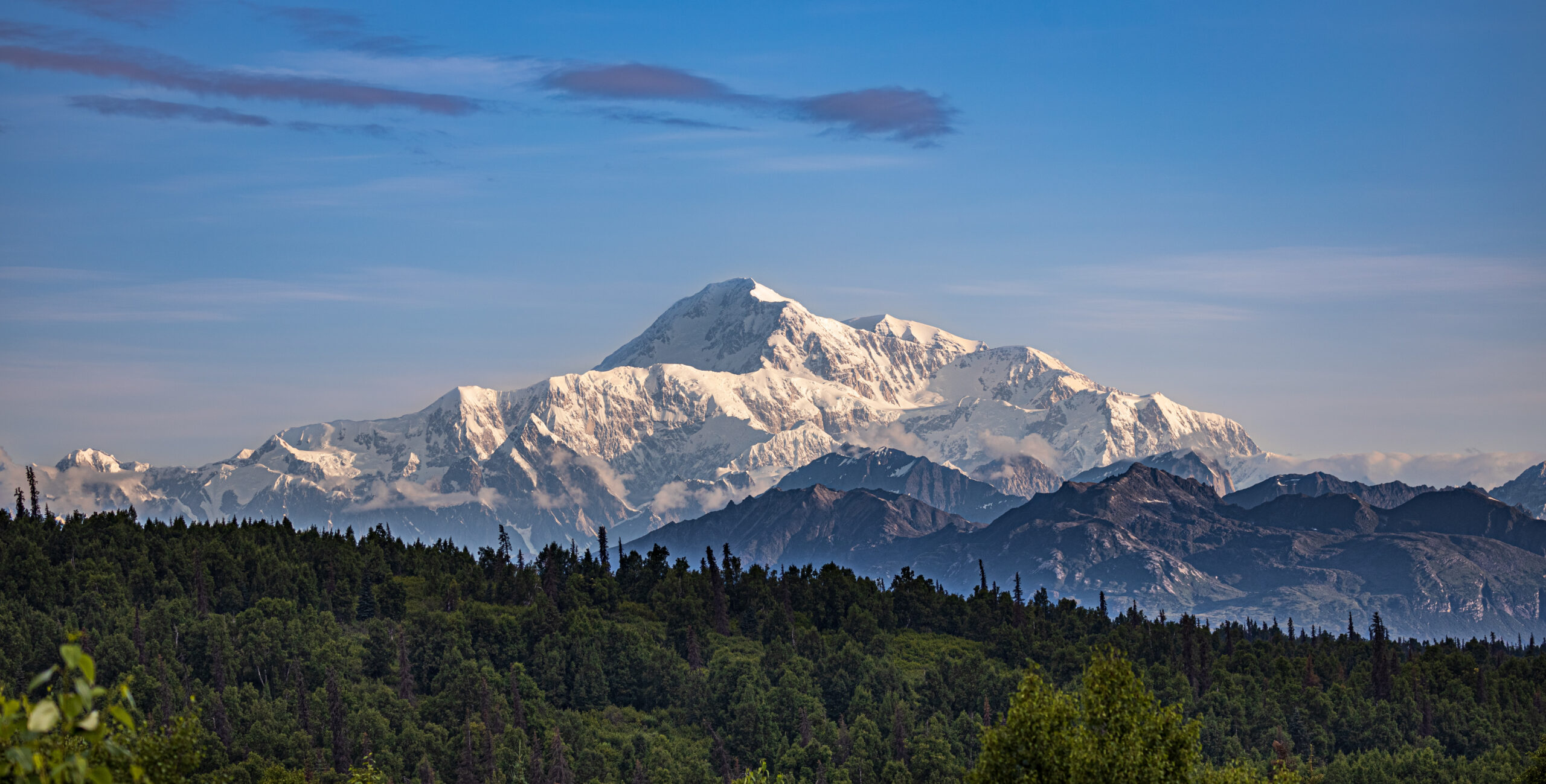
    Denali West Buttress route showing the 20310 foot summit of North America highest peak with Kahiltna Glacier base camp and the climbing route through 14 Camp and High Camp during the active 2026 season
    Denali’s West Buttress route — the standard path used by approximately 90% of climbers attempting North America’s highest peak. The route covers 13 miles horizontal and 13,500 feet of vertical gain through six camps from Kahiltna Glacier Base Camp at 7,200 ft to High Camp at 17,200 ft. The 2026 climbing season is currently active from May 1 through July 15.

    The West Buttress Camp Progression: 7,200 ft to Summit

    The West Buttress uses six camps over 13 miles of horizontal distance, gaining 13,500 vertical feet from the Kahiltna Glacier base camp to the summit. Most expeditions use a carry-and-cache pattern — moving gear progressively higher while climbers acclimatize, sleeping low and carrying high. Here’s the standard camp-by-camp breakdown for the 2026 season.

    CampElevationDistance from BCTypical StayKey Feature
    Base Camp7,200 ft (2,195 m)0 mi1-2 nightsBush plane landing on Kahiltna Glacier
    Camp 1 (Ski Hill)7,800 ft (2,378 m)~4 mi1 nightBase of Ski Hill climb; sled hauling
    Camp 2 (Kahiltna Pass)9,500 ft (2,896 m)~5 mi0-1 night (often skipped)Base of Kahiltna Pass climb
    Camp 3 (Motorcycle Hill)11,000 ft (3,353 m)~7 mi1-2 nightsLast camp before upper mountain
    14 Camp (Genet Basin)14,200 ft (4,328 m)~9 mi4-7 nightsNPS ranger camp + medical tent
    17 Camp (High Camp)17,200 ft (5,242 m)~11 mi1-3 nightsSummit launching point; wind-exposed
    Summit20,310 ft (6,190 m)~13 miSummit day onlyAutobahn → Denali Pass → Summit Ridge

    Below: detailed camp-by-camp breakdown with what to expect at each stop.

    Base Camp — Kahiltna Glacier

    7,200 ft (2,195 m) · ~2-3 days here at start

    The Kahiltna Glacier Base Camp sits at 7,200 feet at the base of the southwest fork of the Kahiltna. Bush planes from Talkeetna (K2 Aviation, Talkeetna Air Taxi, Sheldon Air Service) land here on skis. The base camp has a small NPS ranger presence and a base camp manager who coordinates incoming and outgoing flights. Climbers cache equipment, organize sleds, and prepare for the haul up the glacier. Most teams spend 1-2 nights here before starting the climb. Weather at base camp can shift rapidly — incoming flights are weather-dependent and can delay arrivals by days.

    Camp 1 — Ski Hill

    7,800 ft (2,378 m) · ~4 miles from Base Camp

    Camp 1 sits at the base of “Ski Hill,” a steeper section of the Kahiltna Glacier. The hike from Base Camp follows the southeast fork down to the main Kahiltna Glacier and then up — paradoxically, you lose 1,000 feet from base camp before climbing back up to Camp 1. Climbers haul approximately 60 pounds per person on sleds plus 40-50 pounds in packs. Crevasse risk is high in this section; teams travel roped up at all times.

    Camp 2 — Kahiltna Pass Base

    9,500 ft (2,896 m) · ~5 miles from Base Camp

    Camp 2 sits at the base of Kahiltna Pass, the major climb to the upper mountain. Some teams skip this camp and continue directly to Camp 3 at 11,000 feet. The decision depends on team strength and acclimatization needs. Crevasse risk remains high. Weather windows for this section are reliable in May-June.

    Camp 3 — Motorcycle Hill

    11,000 ft (3,353 m) · ~7 miles from Base Camp

    Camp 3 sits at 11,000 feet just above the steep “Motorcycle Hill” climb. This is the last camp before the major terrain change to the upper mountain. Climbers cache food and equipment here for the descent. Most teams spend 1-2 nights at Camp 3 for acclimatization before continuing. The view from Camp 3 toward Mount Foraker and the Kahiltna becomes one of the route’s iconic visual moments.

    Camp 4 — 14 Camp (Genet Basin)

    14,200 ft (4,328 m) · ~9 miles from Base Camp · NPS ranger camp

    The 14,200-foot camp — commonly called “14 Camp” or “Genet Basin” — is the main acclimatization camp on Denali. The NPS Talkeetna rangers establish a patrol camp here each season with a medical tent, weather station, and emergency communications. Climbers typically spend 4-7 days here for acclimatization, weather waits, and equipment preparation for the upper mountain. 14 Camp has a small wall of snow blocks around individual tent sites for wind protection. Cell coverage is limited but functional with the right networks. Temperatures at 14 Camp range from -20 to 10°F during the climbing season.

    The Headwall & Fixed Lines

    14,200 ft → 16,200 ft · Fixed ropes installed annually

    The Headwall is the steep section between 14 Camp and the West Buttress ridge at 16,200 feet. NPS rangers install fixed ropes here at the start of each season for safety. This is the most technical section of the West Buttress route — 40-45 degree snow and ice with significant exposure. Climbers clip into the fixed lines with ascenders for protection. The Headwall typically takes 4-6 hours to climb from 14 Camp. Most teams do a carry day to High Camp first, then move and sleep at High Camp on a subsequent day.

    Camp 5 — 17 Camp / High Camp

    17,200 ft (5,242 m) · ~11 miles from Base Camp · Summit launching point

    The 17,200-foot camp is the highest established camp on the West Buttress route. Climbers typically spend 1-3 nights here before summit day, waiting for a weather window. High Camp is significantly more wind-exposed than 14 Camp, with sustained winds frequently above 40 mph. Temperatures range from -30 to 0°F. Tent placements are bounded by snow walls for wind protection. Most teams launch their summit attempt from High Camp at 04:00-06:00 depending on weather forecasts.

    Summit Day — Autobahn, Denali Pass, Summit Ridge

    17,200 ft → 20,310 ft · 3,110 ft gain on summit day

    Summit day from High Camp covers several distinct sections. First, the “Autobahn” — a 40-degree slope traverse from 17,200 to 18,200 feet that has been the site of multiple historical fatalities due to climbers sliding on hard snow without crampons engaged. Next, Denali Pass at 18,200 feet, the saddle between the South and North summits of Denali. From Denali Pass, the route ascends gradually to the Football Field at 19,500 feet, then up the final Summit Ridge to the South Summit (the true summit) at 20,310 feet. Total summit day is typically 10-14 hours round trip.

    Denali West Buttress Headwall fixed lines climbing from 14 Camp at 14200 feet to the West Buttress ridge at 16200 feet showing the steep snow and ice section during 2026 climbing season
    The Headwall fixed lines — the most technical section of the West Buttress route. NPS rangers install fixed ropes between 14 Camp (14,200 ft) and the West Buttress ridge (16,200 ft) at the start of each season. Climbers clip into the fixed lines with ascenders for safety on the 40-45 degree snow and ice slope. The Headwall typically takes 4-6 hours to climb from 14 Camp.

    Critical Hazards on the West Buttress

    Despite being the standard route, the West Buttress has multiple dangerous sections that contribute to Denali’s overall fatality history. Climbers should understand each before attempting the route.

    HazardElevationRisk LevelPrimary DangerMitigation
    Kahiltna Crevasses7,200-11,000 ftHighHidden crevasse fallsRope team travel; crevasse rescue gear
    Windy Corner12,500-13,500 ftHigh60+ mph winds; frostbiteCross in morning calm before afternoon winds
    Headwall Fixed Lines14,200-16,200 ftModerateFalls on 40-45° snow/iceProper ascender technique; back up fixed rope
    The Autobahn17,200-18,200 ftCriticalFatal slides on hard snowCrampons engaged; ice axe self-arrest ready
    Denali Pass18,200 ftCritical100+ mph storm windsWeather window discipline; turn back early
    Football Field19,500 ftHighWhiteout disorientationGPS waypoints; team navigation protocols
    Summit Ridge19,500-20,310 ftHighCornice exposure; fallsStay climber’s right of corniced edge
    Frostbite (all camps)14,200+ ftCriticalTissue loss on hands/feetVapor barrier liners; expedition mittens; hand warmers

    Kahiltna Glacier Crevasses

    The Kahiltna Glacier has extensive crevasse fields, particularly in the lower sections between Base Camp and Camp 3. Climbers must travel roped up at all times on the glacier. Late-season climbers (late June, July) face more open crevasses as snow bridges deteriorate from warming temperatures. The 2025 season saw two crevasse rescue events on the Kahiltna; the patterns continue in 2026.

    Windy Corner

    Windy Corner is a notorious wind-channel section between 12,500 and 13,500 feet on the climb from Camp 3 to 14 Camp. Wind speeds frequently exceed 60 mph here, and the section has limited shelter. Climbers traversing Windy Corner in bad weather face exposure that has caused multiple frostbite injuries in recent seasons. Most teams aim to cross Windy Corner in early morning calm before afternoon winds build.

    The Headwall & Fixed Lines

    The Headwall fixed ropes are critical safety infrastructure but require active management. Climbers must clip ascenders correctly, manage rope drag, and avoid creating bottlenecks. The 2025 season saw several falls on the Headwall, most without serious injury due to the fixed line catch. Always back up the fixed rope when conditions allow.

    The Autobahn

    The Autobahn is the traverse from 17,200 to 18,200 feet, named for the dangerous “fast slide” potential. The route crosses a 40-degree snow slope with significant exposure below. Climbers must keep crampons engaged and ice axe in proper self-arrest position. Multiple Denali fatalities have occurred here when climbers slipped on hard wind-packed snow. The section is short — typically 30-45 minutes — but demands focus throughout.

    Denali Pass and the Football Field

    Denali Pass at 18,200 feet sits in a wind tunnel between the South and North summits. Wind speeds here can reach 100+ mph in storm conditions. Multiple climbers have died at or near Denali Pass when caught in unexpected weather changes. The Football Field at 19,500 feet is a broad snow plateau where teams typically pause before the final summit ridge. Weather decisions made here are critical — climbers who continue in marginal weather face descent challenges as conditions deteriorate.

    Summit Ridge

    The final Summit Ridge from the Football Field to the South Summit is exposed on both sides with significant drop-offs. The ridge is typically corniced, requiring careful navigation to stay on the safe (climber’s right) side. Wind exposure here is severe — even on calm summit days, sustained winds of 30-50 mph are common. The final 200-300 feet to the summit demand focus and quick movement.

    Frostbite is the most common Denali injury. The combination of severe cold (-30 to -40°F summit day), high wind, and the inability to safely remove gloves at altitude makes frostbite the leading injury on Denali. The NPS reports frostbite cases nearly every season — most on hands and feet during summit day or descent. Vapor barrier liners in boots, expedition mittens (not gloves) above 14 Camp, and chemical hand warmers as backup are essential. Multiple climbers have lost fingers or toes to Denali frostbite. This is a real risk, not a theoretical one.

    2026 NPS Permits & Registration

    Denali permits are issued by the National Park Service through a strict 60-day pre-registration system. Here’s the current 2026 process.

    2026 Permit Costs

    FeeAdult (25+)Climbers 24 & Under
    Mountaineering Special Use Fee$450 USD$350 USD
    Denali NP Entrance Fee$15 USD$15 USD
    Combined 2026 total$465 USD$365 USD

    Two-Step Registration Process

    The 2026 registration is a two-step process per the current NPS protocol:

    1. Pay.gov fee payment: Pay the Mountaineering Special Use Fee through the official Pay.gov website. The fee is non-refundable after February 15 of your climbing year.
    2. Special Use Permit Application: Submit the Application for Special Use Permit via email to the Talkeetna Ranger Station, including detailed climbing experience, proposed route, group member information, and emergency contacts.

    Both steps must be completed at least 60 days before your intended climb start date. The 60-day rule is strict — climbers attempting to register inside the 60-day window are typically declined. The pre-registration period exists so NPS mountaineering rangers can review applications, contact climbers for any clarifications, and ensure all climbers are properly prepared before they fly into the Kahiltna.

    Walter Harper Talkeetna Ranger Station

    All Denali climbers must check in at the Walter Harper Talkeetna Ranger Station before flying in. The station is named after Walter Harper, the first person to reach the summit of Denali in 1913. Climbers receive a pre-climb orientation, current conditions briefing, and their Clean Mountain Can (CMC) for waste management. The orientation typically takes 30-60 minutes and covers route-specific hazards, current weather patterns, and emergency protocols.

    Guided vs. Independent Climbing

    The NPS authorizes seven mountain guide concessions for Denali. Guided expeditions handle the entire registration and logistics process, including fee payment, permit submission, and pre-climb orientation. Independent climbers complete all steps themselves but pay the same fees. The 2026 guided expedition costs run $12,900-$19,000 USD for the standard 18-24 day West Buttress program. Major operators include RMI Expeditions, International Mountain Guides (IMG), Alpine Ascents International, Mountain Trip, and Mountain Madness.

    Denali Talkeetna bush plane K2 Aviation flight over the Alaska Range delivering 2026 climbers to Kahiltna Glacier base camp at 7200 feet for the West Buttress route ascent
    Bush plane access to Denali — the only way onto the West Buttress route. K2 Aviation, Talkeetna Air Taxi, and Sheldon Air Service fly climbers from Talkeetna (358 ft) to the Kahiltna Glacier base camp (7,200 ft) in approximately 45 minutes. Flights are weather-dependent — climbers should plan 1-3 days of buffer in Talkeetna for flight delays, particularly early in the May season when storms commonly ground bush planes.

    2026 Climbing Season Month-by-Month Conditions

    PeriodConditionsDaylightClimber VolumeBest For
    Late AprilCold; firm snow; minimal crevasses; some rangers arriving~17 hoursMinimal (~50 on mountain)Experienced cold-weather climbers; quiet route
    Early MayStable cold; building climber volume; rangers establish camps~18 hoursBuilding (~200)Cold-tolerant climbers; first season window
    Mid-MayPeak window opens; warmer days; reliable weather~19 hoursHeavy (~400-600)Most climbers; established weather patterns
    Late May – Early JunePrime conditions; longest daylight; warmer camps~20+ hoursMaximum (~600-800)Standard guided expedition window
    Mid-JunePeak window continuing; warmer base camp~20+ hoursMaximum (~600-800)Optimal balance of conditions and crowds
    Late June – Early JulyCrevasses opening; warmer weather; reduced firm snow~20 hoursHeavy (~400-500)Late-season climbers willing to accept softer conditions
    Mid-JulySeason closing; rangers departing; significant crevasses~19 hoursReducing (~100-200)End of season; experienced teams only

    Late May – Mid June 2026: The Sweet Spot

    The May 25 – June 15 window represents the optimal Denali climbing conditions. Daylight reaches its maximum (20+ hours of usable light), temperatures are warmest by Alaska Range standards, weather windows open more frequently than at any other point in the season, and the trail through 14 Camp is well-established by NPS rangers and earlier climbers. Most major guided expeditions schedule departures in this window.

    Mid-June – Early July 2026: Late Window

    Late June and early July offer continued strong conditions but with developing concerns. Crevasses on the lower Kahiltna Glacier open as snow bridges weaken. Temperatures warm enough to make heavy expedition clothing uncomfortable on the lower mountain. The headwall fixed lines see significant wear. NPS ranger patrols begin transitioning out of 14 Camp by July 5-10.

    Mid-July: Season Closing

    By mid-July, the climbing season is effectively over. Most operators have completed their final summit windows. NPS ranger camps are being dismantled. Climbers attempting July ascents face deteriorating snow conditions, increased crevasse exposure, and reduced infrastructure. The official permitting season extends through July 15, but very few climbers attempt summits in the final two weeks.

    Recent Denali Trip Reports & NPS Ranger Updates

    NPS rangers publish field reports throughout the Denali climbing season. These provide ground-truth context for climbers planning trips. Here’s a synthesis of recent patterns relevant to 2026 planning.

    2025 Season Summary

    The 2025 Denali climbing season ran from April 28 (first NPS patrol assembling) through July 12. Total registered climbers: approximately 1,100. Summit success rate for the season: approximately 52%, slightly above the long-term average. The May 24 – June 10 window produced the highest concentration of summits, with several reliable weather windows of 24-72 hours each.

    2025 Ranger Reports — Key Patterns

    • Early May 2025: First NPS West Buttress patrol assembled in Talkeetna on April 28. Rangers reported variable snow conditions with crusts on solar slopes and dry cold snow on north faces.
    • Mid-May 2025: Fixed lines on the Headwall installed by NPS patrols. Trail through Kahiltna established. Crevasse bridges intact.
    • Late May 2025: Upper mountain reported “busy” with approximately 100 climbers ascending to High Camp on multiple days. Fixed line steps improving with use.
    • June 2025: Multiple weather windows produced strong summit numbers. Several frostbite incidents reported on summit day, particularly hands and toes.
    • July 2025: Season winding down. Final NPS patrols departing 14 Camp. Crevasses on Kahiltna opening significantly.

    2026 Pre-Season Observations

    The 2026 NPS season opened with rangers arriving in Talkeetna in late April. The first West Buttress patrol assembled in early May with rangers and VIPs (Volunteers in Park) packing for their upcoming climb. Initial flights to the Kahiltna Glacier began in early May as weather permitted. Climbers booked for early-May start dates faced typical weather delays in Talkeetna; one to three days of waiting for flyable conditions is standard.

    Independent Climber Notes from 2025

    • Cell coverage at 14 Camp: Limited but functional on Verizon and AT&T. Useful for non-emergency communication.
    • Garmin InReach: The standard satellite communicator on Denali. Battery life is the limiting factor at cold temperatures — keep devices warm in inner pockets.
    • Bush plane reliability: K2 Aviation, Talkeetna Air Taxi, and Sheldon Air Service are the primary operators. All three are reliable when weather allows. Plan 1-3 days of buffer in Talkeetna for flight delays.
    • Food caching: Climbers cache food and fuel at each camp for the descent. Cache locations should be marked clearly with wands and GPS coordinates.
    • Equipment failures: The cold breaks gear that performs fine in lower-altitude conditions. Test stoves, sleeping bags, and fuel systems in cold conditions before traveling to Alaska.
    Denali 14 Camp at 14200 feet showing the NPS ranger station Genet Basin tent platforms snow walls and climbers acclimatizing during 2026 climbing season on the West Buttress route
    14 Camp at 14,200 ft (Genet Basin) — the main acclimatization camp on Denali’s West Buttress route. The NPS Talkeetna rangers maintain a patrol camp here with a medical tent, weather station, and emergency communications. Climbers typically spend 4-7 days at 14 Camp acclimatizing before pushing to High Camp at 17,200 ft.

    Required Gear for 2026 Denali West Buttress

    Denali demands the most extensive personal equipment list of any standard climbing route on Earth. Cold, altitude, and self-sufficient logistics make every gear choice consequential. Most guided operators provide group equipment (tents, stoves, ropes); climbers bring their own personal gear.

    Footwear

    ItemSpec / ExampleNotes
    Double mountaineering bootsLa Sportiva G2 SM, Scarpa Phantom 8000, Millet Everest Summit GTX-40°F rated; built-in gaiter
    OverbootsForty Below or similarWarmth multiplier for summit day
    Crampons12-point steelSemi-automatic or step-in binding
    Camp bootiesInsulated down bootiesFor camp evenings
    Expedition socksWool or wool-synthetic blend5-6 pairs minimum
    Liner socksThin syntheticBlister prevention
    Vapor barrier linersRBH Designs or similarReduces sweat → frostbite

    Clothing System

    LayerItemRating / Notes
    BaseTop and bottom (merino or synthetic)2-3 sets
    MidFleece or wool topMid-weight
    Active insulationSynthetic insulated jacket (Patagonia DAS Parka)Working layer for climbing
    Heavy insulationDown parka800-fill, -40°F minimum
    Insulated pantsDown pantsCamp and summit day
    Hardshell jacketGore-Tex ProGenerous cut for layering
    Hardshell pantsFull side-zipFor crampon transitions
    Soft shell pantsSchoeller or similarLower mountain wear
    Hat / balaclava / buffWool or syntheticFrostbite protection
    Gloves (3 pairs)Liner + insulated + expedition mittensMittens -40°F rated
    Chemical warmersHand + toe warmers10-15 pairs minimum

    Technical Equipment

    ItemSpecPurpose
    Ice axe60-70cm general mountaineeringSelf-arrest; cramponing
    Climbing harnessAdjustable leg loopsRope team travel
    HelmetClimbing-ratedRequired on the route
    Ascenders / jumarsPetzl Ascension or similarHeadwall fixed lines
    Trekking polesAdjustable, 3-sectionGlacier travel
    Climbing rope60m half rope per teamUsually group equipment
    Carabiners5-6 locking + 5-6 non-lockingAnchor + rope work
    Prusik cord6mm × 2 lengthsCrevasse self-rescue
    Slings / runners3-4 60cm + 2-3 120cmAnchor building
    Belay deviceATC-Guide or similarRope work
    Snow pickets24″ aluminum2-3 per team (shared)

    Hauling, Camp & Sleeping

    ItemSpecNotes
    Pulk / sledParis Expedition or customFor 60+ lb hauls on lower glacier
    Sled riggingRope + carabiners + drag strapsAttaches sled to harness
    Expedition backpack90-100LUpper mountain (above 14 Camp)
    4-season tentThe North Face VE-25 or similarUsually group equipment
    Sleeping bag-40°F rated (WM Puma, FF Snowy Owl)800+ fill down
    Sleeping pads (2)Closed-cell foam + inflatable insulatedCritical insulation from ground
    StoveWhite gas (MSR XGK EX)Group equipment
    Fuel~0.5 liters per person per dayPlan for 9-12L per climber
    Snow shovel + sawAluminum shovel; collapsible sawBuilding wind walls
    Water bottles (3L total)Insulated NalgenesBladder hoses freeze unreliably
    Wide-mouth pee bottle1L NalgeneTent use during cold nights

    Personal Safety & Required NPS Equipment

    ItemSpecNotes
    Clean Mountain Can (CMC)Issued at Talkeetna Ranger StationNPS mandatory waste pack-out
    Biodegradable bagsProvided with CMCNPS issued
    Headlamp + spare batteriesLithium batteries for cold2 spare battery sets minimum
    Glacier glasses (Cat 4)+ backup pairUV at altitude is severe
    GogglesStorm-ratedWhiteout + summit ridge
    Sunscreen + lip balmSPF 50+ with SPF lip balmReapply throughout day
    First aid kitBlister care, ibuprofen, electrolytes, AMS medsCustomize to team needs
    Diamox / acetazolamide250mg twice daily (typical)Discuss with doctor
    Satellite communicatorGarmin InReach or sat phoneCell signal limited above BC
    NPS Permit + Park Entrance receiptPrint + digital copiesVerify at base camp
    Travel insuranceHigh-altitude rescue coverageHeli-evac coverage essential
    Cash (USD)$200-500Tips, fuel surcharges, emergencies
    Denali expedition gear and equipment laid out at Kahiltna Glacier Base Camp 7200 feet including pulk sleds expedition tents climbing harnesses crampons ice axes and Clean Mountain Cans for the 2026 West Buttress climbing season
    Denali expedition gear staged at Kahiltna Glacier Base Camp (7,200 ft). Climbers haul approximately 100-120 pounds of gear, food, and fuel for the entire 18-24 day expedition. Group equipment (tents, stoves, ropes) is typically split among team members. The pulk sled is essential for the lower-glacier hauls before climbers transition to backpack-only loads above 14 Camp.

    2026 Booking Strategy

    Denali expeditions have a unique booking timeline driven by the 60-day NPS pre-registration rule and the limited authorized guide concessions.

    For Remaining 2026 Season (May-July)

    If you haven’t booked yet for the 2026 season, your options are limited:

    • May 2026 departures: Likely fully booked with authorized guide concessions. NPS 60-day rule eliminates last-minute registrations.
    • Early June 2026: Limited availability with some guide services. Independent climbers can still register if exactly 60 days from start date.
    • Late June 2026: Some availability remaining. Late-season conditions but still within climbing window.
    • Early July 2026: End-of-season departures available. Higher weather risk; reduced infrastructure.

    For 2027 Booking

    Climbers planning 2027 Denali expeditions should:

    • July-September 2026: Research authorized guide concessions, compare itineraries and pricing
    • October 2026: Make initial bookings with deposits to guide services
    • January 2027: NPS registration opens January 1; complete Pay.gov fee payment
    • February 2027: Submit Special Use Permit application; non-refundable after Feb 15
    • March 2027: Complete training requirements; verify gear; book travel to Anchorage
    • May 2027: Travel to Talkeetna for orientation and climb

    The 7 Authorized Guide Concessions

    NPS authorizes seven mountain guide companies to operate on Denali. Climbers wanting guided expeditions must use one of these. The standard list includes RMI Expeditions, International Mountain Guides (IMG), Alpine Ascents International, Mountain Trip, Mountain Madness, NOLS, and AAI/American Alpine Institute. Each operates under specific NPS permits with established itineraries and guide ratios. Independent climbers can climb without a guide service but handle all logistics themselves.

    Denali summit day climbing the Autobahn traverse from High Camp 17200 feet toward Denali Pass with crampons ice axe and expedition gear in -30 degree temperatures during 2026 season
    Summit day on Denali — the Autobahn traverse from High Camp (17,200 ft) toward Denali Pass at 18,200 ft. The 40-degree snow slope has been the site of multiple historical fatalities when climbers slipped without crampons properly engaged. Summit-day temperatures average -30 to -40°F with wind chill below -60°F not uncommon during the 2026 climbing season.

    Frequently Asked Questions About Denali West Buttress Conditions

    When is the 2026 Denali climbing season?

    The 2026 Denali climbing season is currently active, running from approximately May 1 through July 15, 2026. Peak conditions on the West Buttress route fall between mid-May and late June, when daylight is maximum (up to 20+ hours), temperatures are warmest by Alaska Range standards, and stable high-pressure systems produce the most reliable summit windows. NPS registration for the 2026 season opened January 1, 2026, with climbers required to register at least 60 days before their planned start date.

    How much does the Denali permit cost in 2026?

    The 2026 Denali mountaineering permit costs $450 USD for climbers aged 25 and older, or $350 USD for climbers aged 24 and younger. This is the NPS Mountaineering Special Use Fee paid through Pay.gov when you register. Additionally, the Denali National Park entrance fee is $15 per person, valid for 7 days. Combined fees total $465 for adult climbers in 2026. The fee is non-refundable after February 15 of your climbing year. Guided expedition prices range from $12,900 to $19,000 USD for the standard 18-24 day West Buttress program.

    What is the camp progression on the Denali West Buttress route?

    The Denali West Buttress route uses six camps over approximately 13 miles of horizontal distance and 13,500 feet of vertical gain. Camp 1 is the Kahiltna Glacier Base Camp at 7,200 feet, reached by bush plane from Talkeetna. The standard progression then runs to Camp 2 at 7,800 feet (Ski Hill), Camp 3 at 9,500 feet, Camp 4 at 11,000 feet, Camp 5 at 14,200 feet (commonly called 14 Camp), and Camp 6 at 17,200 feet (High Camp). The summit at 20,310 feet sits 3,110 feet above High Camp via the Autobahn, Denali Pass, and Summit Ridge.

    What are current Denali West Buttress weather conditions?

    Base camp temperatures in late May range from -10 to 25°F. The 14,200-foot camp typically runs -20 to 10°F. The 17,200-foot High Camp ranges from -30 to 0°F with significant wind. Summit-day temperatures average -30 to -40°F with wind chill below -60°F not uncommon. Weather windows on Denali open every 5-10 days during the climbing season, lasting 24-72 hours each. The NPS posts daily weather observations from 7K and 14K weather stations. Climbers should have 5-7 days of weather buffer built into their itinerary.

    What is the Denali summit success rate?

    The long-term average across all Denali climbers is approximately 50%, but individual seasons range from 28% (poor weather years) to over 60% (excellent weather years). Guided expeditions typically achieve higher success rates of 55-70% due to experienced leaders, established camp infrastructure, and better weather decision-making. Independent climbers average 35-45% success. The biggest factors in summit success are weather windows, acclimatization quality, and team fitness. Compressed 14-16 day attempts produce lower summit rates than the standard 18-24 day expeditions.

    How long does a Denali expedition take?

    A standard Denali West Buttress expedition runs 18-24 days from Talkeetna to summit and back. Bush flight from Talkeetna to Kahiltna Glacier base camp takes 1-2 days due to weather windows. The climb itself uses a carry-and-cache pattern: 2-4 days from base camp to 14 Camp, 4-7 days at 14 Camp for acclimatization, 1-2 days to High Camp, 1-3 days at High Camp waiting for weather, summit day, and 2-4 days descent back to base camp. Some experienced climbers complete the route in 14-16 days, but this compresses acclimatization and reduces success rates.

    Can I climb Denali without a guide in 2026?

    Yes, independent climbing is permitted on Denali. Unlike some peaks where solo or unguided climbing is banned, Denali allows independent climbers. However, you must complete the full NPS registration process (60-day advance, Pay.gov fee payment, Special Use Permit application), attend the Walter Harper Talkeetna Ranger Station orientation, and follow all NPS regulations including CMC waste management. Solo climbers face additional scrutiny and may need to demonstrate prior high-altitude experience. The NPS strongly discourages solo climbing due to the rescue and self-rescue challenges. Most climbers travel in teams of 2-4 minimum.

    What is the most dangerous part of the West Buttress route?

    Multiple sections of the West Buttress have caused fatalities. The Autobahn — the 40-degree snow traverse from 17,200 to 18,200 feet — has been the site of multiple climber slides resulting in deaths. Denali Pass and the Football Field at 18,200-19,500 feet sit in a wind tunnel where multiple climbers have died caught in unexpected storms. The Kahiltna Glacier crevasses cause injuries throughout the season. The Headwall fixed lines see falls but rarely fatalities. Frostbite is the most common Denali injury due to summit-day cold. Statistically, the Autobahn and Denali Pass area produce the most fatalities per climber-day exposed.

    What fitness do I need to climb Denali?

    Denali demands more sustained fitness than virtually any other guided peak. The standard benchmark: capable of carrying 60-100 pounds for 8-10 hours per day for multiple consecutive days, with strong recovery overnight. Aerobic capacity should support sustained effort at altitude. Most climbers train for 6-12 months before Denali with heavy backpack hikes, weighted stair climbing, and progressive endurance work. Beyond aerobic fitness, climbers need cold tolerance, mental resilience for sustained discomfort, and prior glacier travel experience. Most guide services require climbers to demonstrate prior high-altitude experience (Mount Rainier, Aconcagua, or equivalent) before accepting Denali clients.

    Where do I fly into for Denali?

    The primary airport is Ted Stevens Anchorage International Airport (ANC). From Anchorage, climbers typically drive 2 hours north to Talkeetna, where the Walter Harper Talkeetna Ranger Station and bush plane operators are located. Some climbers fly from Anchorage to Talkeetna via small aircraft instead of driving. From Talkeetna, bush planes operated by K2 Aviation, Talkeetna Air Taxi, and Sheldon Air Service fly climbers to the Kahiltna Glacier base camp at 7,200 feet. The bush plane flight takes approximately 45 minutes and is the only access to the West Buttress route.

    Denali Planning Resources

    Sources & Further Reading

    • National Park Service — Denali National Park & Preserve mountaineering page (nps.gov/dena)
    • Walter Harper Talkeetna Ranger Station — official 2026 climbing registration and conditions
    • Pay.gov — Denali Climbing Registration Form
    • NPS Denali Dispatches — 2025 season field reports and ranger updates
    • Mountain Trip — 2026 pre-trip information and NPS fee documentation
    • RMI Expeditions — Denali permitting regulations and 2025-2026 program details
    • International Mountain Guides (IMGD) — 2026 NPS fee structure and West Buttress program
    • Explore-Share — Denali climbing facts, routes, climate, equipment overview
    • U.S. Highpoint Guide — Denali camp progression and route details
    • Ian Taylor Trekking — 2026 24-day Denali expedition program
    • MesoWest — 7K and 14K weather station telemetry
    • National Weather Service Denali Climbing Forecast
    • MountainWeather.com — Denali weather aggregator
    • FAA webcams — Kahiltna Glacier visibility monitoring
    • Wikipedia — Denali, West Buttress route references

    Last updated: May 24, 2026. Next scheduled update: June 30, 2026 (mid-season conditions verification).

    Planning a 2026 Denali Expedition?

    For the full Denali expedition guide including training plans, complete gear lists, cost breakdowns, and route comparisons, see our pillar guide.

    Read the Full Denali Guide →
  • Kilimanjaro Routes Current Conditions 2026: Best Time to Climb, Route Comparison & What to Expect This Season

    Kilimanjaro Routes Current Conditions 2026: Best Time to Climb, Route Comparison & What to Expect This Season

    Home · Mountains · Kilimanjaro · Routes Current Conditions

    Kilimanjaro Routes Current Conditions 2026: Best Time to Climb, Route Comparison & What to Expect This Season

    Everything you need to know about climbing Mount Kilimanjaro in the 2026 season. Current conditions across all seven routes (Lemosho, Machame, Marangu, Rongai, Northern Circuit, Umbwe, Shira). The June-October dry season opens now. TANAPA fees, summit success rates, recent climber reports, and the new 2026 Leave No Trace regulations.

    5,895m
    Uhuru Peak Summit
    Jun-Oct
    Long Dry Season 2026
    85-95%
    Dry Season Success Rate
    7 routes
    Climbing Paths to Summit
    2026 Long Dry Season Opens · Lemosho 8-Day Best Conditions · TANAPA Park Fees $1,000-$1,400 · Leave No Trace Mandate Active · Full Kilimanjaro Guide →
    Last updated May 24, 2026 — verified for the 2026 long dry season (June-October) climbing window

    If you’re planning to climb Kilimanjaro this season, several specific things have changed for 2026. TANAPA has implemented strict Leave No Trace regulations, including a ban on plastic packaging and digital waste tracking. Park fees now total $1,000-$1,400 USD per climber depending on route length. The long dry season opens in June, with peak conditions running through October. Routes vary significantly in their current state — some handle the upcoming shoulder season better than others. This page covers all seven climbing routes, current 2026 conditions on each, recent climber reports, and what to expect for the rest of the season.

    Kilimanjaro climbing in 2026 happens primarily in two dry windows. The long dry season runs late June through October — July and August represent peak conditions with the most reliable weather, the firmest trails, and the clearest summit views. The short dry season runs January through early March, with February typically the driest month. The April-May long rains and the November short rains are the wet seasons; first-time climbers should avoid both. Success rates during the dry seasons average 85-95% on 7-9 day routes, dropping to 60-70% during the wet seasons.

    The Tanzania National Parks Authority (TANAPA) maintains seven climbing routes to the summit. Lemosho, Machame, Marangu, Rongai, and Northern Circuit are the standard options. Umbwe and Shira see less traffic and serve specific climber profiles. Mweka is descent-only — no operator offers ascents on Mweka. Each route has its own current condition profile that climbers should understand before booking the 2026 season.

    Kilimanjaro Live Conditions Snapshot

    Here’s the current status of Kilimanjaro climbing conditions as of May 24, 2026, verified against TANAPA, recent operator advisories, and the Kilimanjaro Porters Assistance Project (KPAP).

    2026 Season Status — Updated May 24, 2026

    Long Dry Season
    Opens late June, runs through October. July-August peak conditions. Booked operators report 90%+ summit success during this window.
    Opens Jun
    Park Fees (TANAPA)
    $70/day conservation + $50/night camping ($60/night Marangu hut) + $20 one-time rescue + 18% VAT. Roughly $1,000-$1,400 per climber.
    Required
    Lemosho Route
    Best overall 2026 conditions. 7-8 day options. 85-90% success rate. Western start, joins Machame at Shira Plateau.
    Optimal
    Machame Route
    Most popular route (35% of climbers). 6-7 day options. 80-85% success. Can become very muddy during wet season transitions.
    Good
    Northern Circuit
    Longest route (9 days). Highest success rate (95%+). All four slopes traversed. Quietest of the popular routes.
    Excellent
    Marangu Route
    5-6 day options. 50-70% success rate. Hut accommodation only. Coca-Cola route. Lower success but cheaper, weather-protected huts.
    Open
    Rongai Route
    Drier northern approach. 6-7 day options. 75-80% success rate. Best for shoulder season and rainy periods.
    Good
    Umbwe Route
    Steepest, most technical route. 5-6 days. 50-65% success. Dry season only. Experienced climbers seeking solitude.
    Limited
    Leave No Trace 2026
    Plastic packaging banned. Digital waste tracking active. 70% campsites solar-powered. KPAP partner verification required.
    Enforced
    Solo Climbing
    Illegal. All climbers must book through licensed operator. Standard crew: guide, assistant guide, cook, 2-3 porters per climber.
    Prohibited

    2026 booking timing matters. Lemosho and Machame routes during the prime July-August window typically book out 6-8 months in advance. Climbers planning peak-season 2026 trips should already have operator reservations confirmed. Last-minute bookings (1-3 months out) are possible for September-October dates and for less popular routes (Rongai, Northern Circuit). Avoid booking through any operator that cannot demonstrate KPAP partnership — porter welfare violations have triggered TANAPA enforcement actions in recent seasons.

    Kilimanjaro Location & Live Weather

    Mount Kilimanjaro sits in northeastern Tanzania near the Kenyan border, about 300 km south of the equator. Uhuru Peak coordinates: 3.0674°S, 37.3556°E. The climbing routes start from various gates around the base: Londorossi (Lemosho), Machame Gate (Machame), Marangu Gate (Marangu and Mweka exit), Rongai (northern side), and Lemosho Gate for Shira. Climbers fly into Kilimanjaro International Airport (JRO) near Moshi or Arusha, then drive 1-2 hours to the trailhead.

    Moshi (Base) Temp
    Loading…
    Wind
    Conditions
    Tomorrow

    Live weather data from Open-Meteo at Moshi, Tanzania (910m). Summit-night temperatures at Uhuru Peak (5,895m) typically run -15°F to -20°F (-26 to -29°C) with significant wind chill, regardless of base camp conditions. Always check your operator’s pre-climb weather briefing.

    Kilimanjaro At a Glance

    Summit elevation5,895 m (19,341 ft) — Uhuru Peak; Africa’s highest peak; one of the Seven Summits
    LocationNortheastern Tanzania, near Kenyan border
    Coordinates3.0674°S, 37.3556°E
    Park authorityTanzania National Parks Authority (TANAPA) / Kilimanjaro National Park (KINAPA)
    Climbing routes7 ascent routes: Lemosho, Machame, Marangu, Rongai, Northern Circuit, Umbwe, Shira (Mweka is descent-only)
    Technical gradeNon-technical trek; no climbing equipment required; altitude is the primary challenge
    2026 dry seasonsLong: late June through October; Short: January through early March
    2026 wet seasonsLong rains: April-May; Short rains: November
    Peak seasonJuly-August (most stable weather, maximum crowds)
    Expedition length5-9 days depending on route; 7-9 days strongly recommended
    2026 TANAPA park fees$70/day + $50/night camping ($60 hut) + $20 rescue + 18% VAT = $1,000-$1,400 per climber
    2026 guided trip cost$2,200-$6,000+ USD per climber (group budget to private premium)
    Summit success rate85-95% on 7-9 day routes during dry season; 50-70% on 5-6 day routes or wet season
    Solo climbingIllegal — all climbers must book through licensed operator with registered guide team
    Required crew per climber1 guide + 1 assistant guide + 1 cook + 2-3 porters (4-5 team members standard)
    2026 regulationsLeave No Trace mandate; plastic packaging banned; KPAP partner verification
    Summit night temperatures-15°F to -20°F (-26 to -29°C) with wind chill regardless of season
    First ascentOctober 6, 1889 — Hans Meyer, Ludwig Purtscheller, and Chagga guide Yohani Lauwo
    AirportKilimanjaro International (JRO), 1-2 hours from trailheads via Moshi or Arusha
    Crew tipping$250-350 USD per climber, split among guides, cook, and porters
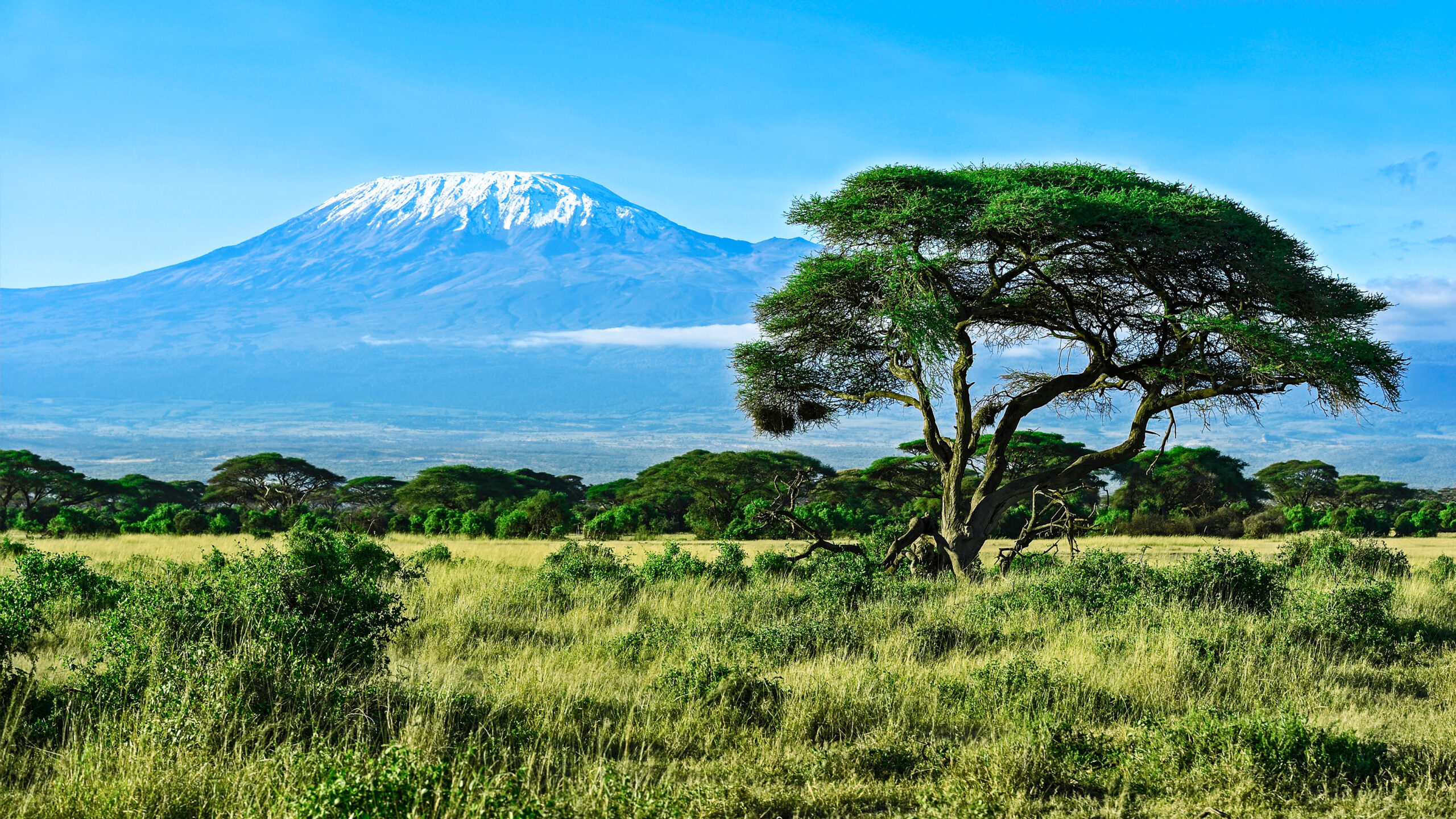
    Mount Kilimanjaro Uhuru Peak summit 5895 meters showing Africa highest peak with snow glaciers and the 2026 climbing routes from base in Moshi Tanzania
    Mount Kilimanjaro and Uhuru Peak (5,895 m) — Africa’s highest summit and one of the Seven Summits. The 2026 climbing season uses seven established routes ranging from the 5-day Marangu (lowest success rate) to the 9-day Northern Circuit (highest success rate). The long dry season opens late June and runs through October.

    The 7 Kilimanjaro Routes: Current 2026 Conditions on Each

    Each Kilimanjaro route offers a different climbing experience, different success rate, and different current conditions for the 2026 season. Here’s the breakdown of all seven routes with what climbers should expect right now.

    RouteDays2026 Success RateCost RangeBest Season
    Lemosho7-885-90%$2,700-$4,500Jun-Oct, Jan-Mar (year-round capable)
    Machame6-780-85%$2,400-$4,000Jun-Oct, Jan-Mar (avoid wet season)
    Northern Circuit995%+$3,800-$6,000Jun-Oct (peak season optimal)
    Marangu5-650-70%$2,200-$3,500Year-round (huts provide weather protection)
    Rongai6-775-80%$2,500-$4,000Year-round; best in shoulder seasons
    Umbwe5-650-65%$2,400-$3,800Dry season only (Jun-Oct, Jan-Mar)
    Shira7-880-85%$2,700-$4,200Dry season; merges with Lemosho

    Lemosho Route — Best Overall 2026 Conditions

    7-8 days · Western approach · 85-90% summit success · $2,700-$4,500 · Best balance of scenery and acclimatization

    The Lemosho route starts on Kilimanjaro’s western side at the Londorossi Gate (2,250 m), traversing through pristine montane rainforest before reaching the Shira Plateau. The first two days are notably quieter than the more popular Machame route, with climbers often having stretches of trail to themselves. After crossing the Shira Plateau, Lemosho merges with the Machame route at Lava Tower, then continues to the dramatic Barranco Wall and the summit approach via Barafu Camp.

    Current 2026 conditions: Excellent. Lemosho handles rain well thanks to good drainage, making it the most reliable route across seasons. The 8-day variant adds an extra acclimatization day that pushes summit success rates to 85-90%. The 7-day variant remains popular but cuts acclimatization tight for some climbers. Lemosho campsites have transitioned to 70%+ solar-powered lighting under the 2026 TANAPA mandate.

    Days
    7-8
    Success rate
    85-90%
    Cost
    $2,700-$4,500
    2026 status
    Best overall

    Machame Route — Most Popular (“The Whiskey Route”)

    6-7 days · Southern approach · 80-85% summit success · $2,400-$4,000 · Camping only, scenic, well-supported

    The Machame route handles approximately 35% of all Kilimanjaro climbers and offers the most varied scenery of any route. The trail passes through five distinct ecological zones from rainforest at the base to alpine desert near the summit. The famous Barranco Wall, Lava Tower, and Karanga Valley are all on this route. Camping only — no hut accommodation. Standard 7-day version follows the “climb high, sleep low” pattern that aids acclimatization.

    Current 2026 conditions: Good but crowded. Machame is the most heavily used route on the mountain, and July-August traffic reaches 100+ climbers starting per day. The route becomes very muddy during the wet season transitions (early April, early November), making it less pleasant in shoulder periods. The 7-day Machame is the standard recommendation for budget-conscious climbers seeking strong success rates. The 6-day Machame compresses acclimatization to a margin many climbers can’t sustain.

    Days
    6-7
    Success rate
    80-85%
    Cost
    $2,400-$4,000
    2026 status
    Standard

    Northern Circuit — Highest Success Rate

    9 days · Northern circumnavigation · 95%+ summit success · $3,800-$6,000 · Longest route, fewest crowds

    The Northern Circuit is Kilimanjaro’s longest route and offers the highest summit success rate of any climbing path. Starting from the Londorossi Gate, the route traverses to the Shira Plateau, then continues around the northern slopes of the mountain — passing through terrain that 95% of Kilimanjaro climbers never see. The summit approach uses Pofu, Third Cave, and School Hut camps before joining the Barafu summit route.

    Current 2026 conditions: Excellent. The Northern Circuit’s 9-day length provides exceptional acclimatization, which is why success rates exceed 95% during the dry season. Crowds are minimal compared to Machame and Marangu. The northern side stays drier in shoulder seasons. Cost is higher due to additional park fees (9 days × $70 + 8 nights × $50 = significant), but the success rate justifies the premium for climbers committed to summiting.

    Days
    9
    Success rate
    95%+
    Cost
    $3,800-$6,000
    2026 status
    Best success

    Marangu Route — “The Coca-Cola Route”

    5-6 days · Southeast approach · 50-70% summit success · $2,200-$3,500 · Only route with hut accommodation

    The Marangu route is the only path on Kilimanjaro with hut accommodation instead of tents. Mandara Hut, Horombo Hut, and Kibo Hut provide weather-protected sleeping with shared dormitories for 4-8 climbers. The route uses the same trail for ascent and descent (the “Coca-Cola” nickname comes from this directness and the soft-drink stand at Marangu Gate). The 5-day version is the cheapest and shortest Kilimanjaro option, which explains its persistent popularity despite the low success rates.

    Current 2026 conditions: Open year-round due to hut protection, but with caveats. The 5-day Marangu has a 50-60% summit success rate due to compressed acclimatization — many climbers attempt it and fail. The 6-day Marangu adds an acclimatization day at Horombo and improves success to 65-70%. The huts can be very crowded in peak season. Hut fees are $60/night (vs $50 camping on other routes). Marangu is best for climbers with weather concerns who need hut shelter or for those genuinely on a tight schedule. Most experienced trekkers recommend choosing Lemosho or Machame instead.

    Days
    5-6
    Success rate
    50-70%
    Cost
    $2,200-$3,500
    2026 status
    Open, cheap

    Rongai Route — The Drier Northern Side

    6-7 days · Northern approach · 75-80% summit success · $2,500-$4,000 · Year-round capability

    The Rongai route is the only path that approaches Kilimanjaro from the northern side, near the Kenyan border. The northern slope receives less rainfall than the southern side, making Rongai the most reliable route during shoulder seasons (March-April transition, late October-November) when other routes turn muddy. The route is quieter than Machame or Marangu and offers wilderness terrain reminiscent of the African plains rather than the cloud forest of southern routes.

    Current 2026 conditions: Reliable. Rongai handles shoulder seasons better than any other Kilimanjaro route. The 7-day variant offers 75-80% success rates with good acclimatization. The 6-day version compresses acclimatization but is still competitive with the standard Machame timing. The route’s lower-altitude approach is gentler than Machame’s early rainforest climb, which some climbers prefer for their first day. Crowds are moderate but never reach Machame levels.

    Days
    6-7
    Success rate
    75-80%
    Cost
    $2,500-$4,000
    2026 status
    Shoulder season pick

    Umbwe Route — Steepest & Most Technical

    5-6 days · Southwestern approach · 50-65% summit success · $2,400-$3,800 · Experienced climbers only

    The Umbwe route is the steepest and most direct path to Kilimanjaro’s summit. The first two days involve a relentless climb up a narrow, forested ridge with significant elevation gain. Some sections require hands-on scrambling, and the early acclimatization is aggressive compared to other routes. Umbwe joins the Machame route at Barranco Camp before continuing to the summit via the standard southern approach.

    Current 2026 conditions: Dry season only. Umbwe is not recommended during wet season due to safety concerns on the steep early sections. The route attracts experienced trekkers seeking solitude — daily climber counts are a small fraction of Machame or Marangu numbers. Success rates are lower because the route compresses acclimatization. Only climbers with previous high-altitude trekking experience should consider Umbwe.

    Days
    5-6
    Success rate
    50-65%
    Cost
    $2,400-$3,800
    2026 status
    Dry season only

    Shira Route — Plateau Start (Less Common)

    7-8 days · Western plateau approach · 80-85% summit success · $2,700-$4,200 · Drives to high start

    The Shira route is similar to Lemosho but starts higher — climbers drive directly to the Shira Plateau (3,500 m) rather than hiking up from Londorossi Gate. This high start saves a day of trekking but compresses acclimatization significantly during the early route. Shira eventually merges with Lemosho at Shira Camp 2 and continues identically to the summit. Most operators have phased out Shira in favor of Lemosho due to the acclimatization concerns.

    Current 2026 conditions: Decreasing operator support. Some operators still offer Shira as a budget alternative for climbers without time for the full Lemosho ascent. The high-altitude vehicle start can trigger altitude symptoms earlier than other routes. Success rates depend heavily on the climber’s pre-trip acclimatization plan. If your operator offers Lemosho at similar price, choose Lemosho instead.

    Days
    7-8
    Success rate
    80-85%
    Cost
    $2,700-$4,200
    2026 status
    Less common

    Month-by-Month 2026 Kilimanjaro Conditions

    MonthSeasonConditionsCrowdsBest For
    JanuaryShort dryMild days (20-25°C), clear mornings, freezing summit nightsModerateFirst-timers, photographers, balanced trip
    FebruaryShort dryWarm, dry, clear weather; typically driest monthModeratePhotography, clear summit views, prime conditions
    Early MarchEnd short dryStable early; transitions to rain late monthModerateEarly-month climbers; avoid late March
    AprilLong rainsHeavy rainfall; muddy trails; only Lemosho/Machame remain openMinimalNot recommended for first-time climbers
    MayLong rainsContinued heavy rainfall; safety concernsMinimalExperienced climbers only with proper gear
    JuneStart long dryConditions stabilize; trails dry out; cooler temperaturesBuildingClimbers wanting quieter routes before peak crowds
    JulyLong dry peakMost reliable weather; firm trails; clearest viewsMaximumFirst-time climbers seeking highest success
    AugustLong dry peakContinued stable conditions; warmest dry season monthMaximumPeak conditions; book 6-8 months ahead
    SeptemberLong dryStable; thinning crowds; excellent visibilityBuilding downClimbers wanting prime conditions with fewer crowds
    OctoberEnd long dryConditions remain stable through mid-monthReducingLast reliable month before short rains
    NovemberShort rainsLighter rains than April-May but still risky; trails muddyMinimalSolitude seekers; success rates drop to 60-70%
    DecemberEnd short rainsStabilizing late month; holiday-season climbing beginsBuildingLate-December climbers riding the dry-season opening

    July-August 2026: Peak Season

    July and August are statistically the most reliable months for Kilimanjaro summits. Weather windows are consistent, trails are firm, and summit-day temperatures remain manageable. The trade-off is maximum crowding — Machame route can see 100+ climbers starting per day. Operator packages for these months frequently sell out by January 2026. Climbers planning peak-season trips should already have reservations confirmed.

    September-October 2026: Quieter Prime Window

    September and early October offer dry-season conditions with significantly reduced crowds. The Northern Circuit and Rongai routes particularly benefit from this window — fewer climbers at remote camps and clearer trail conditions. Operator pricing during September-October is often 10-15% lower than July-August peak. Late October transitions toward the short rains; book early to mid-October dates for the best balance of conditions and crowds.

    January-March 2026: Short Dry Season

    The short dry season in early 2026 produced stable conditions for climbers with several operators reporting 85%+ summit success during the prime February window. Crowds are moderate, weather is reliable, and temperatures are warmer than during the long dry season. The trade-off is summit nights are colder than July-August in absolute terms despite warmer daytime temperatures. Equipment selection matters more in January-February than in July-August.

    Recent Kilimanjaro Trip Reports (2025 Season Synthesis)

    The 2025 Kilimanjaro season followed standard dry-season patterns with several notable trends that carry forward to 2026 planning.

    2025 Operator Recap

    Major operators (Ultimate Kilimanjaro, Altezza Travel, Tanzania Trail, African Scenic Safaris, Climbing Kilimanjaro) reported strong booking volumes throughout the 2025 dry seasons. KPAP partner verification became a stronger selection factor for climbers, with non-KPAP operators losing bookings to certified competitors. Operator packages with crew-tip transparency saw increased market share. The trend continues into 2026.

    2025 Trail Condition Patterns

    The 2025 dry seasons saw exceptionally firm trail conditions, particularly on Lemosho and Northern Circuit. Mid-July through mid-September provided continuous good weather windows with few rain interruptions. The April-May long rains were heavier than the 5-year average, with some operators reporting Machame and Marangu route closures for 2-3 days during the peak rainy periods.

    2025 Summit Success Patterns

    Successful climber reports from 2025 emphasized several common patterns: 7-9 day routes performed much better than 5-6 day routes regardless of operator, “climb high, sleep low” acclimatization profiles worked even on shorter trips, and Diamox (acetazolamide) prescribed before the climb (rather than in response to altitude symptoms) improved success rates among first-time high-altitude trekkers.

    Independent Climber Notes from 2025

    • Summit night timing: Most operators depart Barafu Camp (4,673m) at midnight for the 6-7 hour push to Uhuru Peak. Some operators have shifted to 23:00 departures during peak season to manage trail congestion.
    • Kosovo Camp option: Some climbers stay at Kosovo Camp (4,870m) instead of Barafu, shortening summit day by roughly 30 minutes but at the cost of less rest at lower altitude.
    • Cell signal: Inconsistent above 4,000m. Most camps have spotty coverage. Garmin InReach is the reliable communication method.
    • Helicopter rescue: Kilimanjaro Search and Rescue Trust (KILISAR) operates helicopter evacuations. Travel insurance with high-altitude rescue coverage is essential.
    • WAG bags not yet required: Unlike the Matterhorn in 2026, Kilimanjaro does not require WAG bags. Operators handle waste management through TANAPA-approved methods, but a personal waste-bag protocol may be added in future seasons.
    • Drone restrictions: Drone use requires TCAA + TANAPA permits, applied 4-6 weeks before climb dates. Casual drone use is prohibited.
    Kilimanjaro Machame Route Barranco Wall climbing 2026 dry season showing climbers ascending the steep section between Karanga Valley and Barafu Camp on the way to Uhuru Peak summit
    The Machame Route — most popular path on Kilimanjaro — handles about 35% of all climbers. The route passes through five ecological zones and crosses the famous Barranco Wall. The 2026 dry season (June-October) offers peak conditions on this route with 80-85% summit success rates on the 7-day variant.

    Required Gear for the 2026 Kilimanjaro Climb

    Kilimanjaro is a non-technical trek but the altitude and summit-night cold demand quality gear. Most operators provide tents, sleeping pads, cooking equipment, and dining gear, so the personal kit you bring focuses on clothing, footwear, and altitude essentials. Here’s the standard 2026 equipment list.

    Footwear

    ItemSpecNotes
    Waterproof hiking bootsB0 or B1 rated; ankle supportBroken in; no technical boots needed
    Camp shoesLightweight sneakers or sandalsFor evenings at camp
    Hiking socksMerino wool4-5 pairs for trek
    Liner socksThin syntheticBlister prevention
    GaitersLight to mid-weightKeep dust and snow out

    Clothing System

    LayerItemNotes
    BaseTop and bottom (merino or synthetic)2-3 sets
    MidFleeceChilly camp evenings
    Light insulationSynthetic or down sweaterActive climbing layer
    Heavy insulationDown parka-10°C rated minimum for summit night
    Hardshell jacketGore-Tex or equivalentWind + rain protection
    Hardshell pantsFull side-zip or rain pantsRain + summit night
    Soft shell pants2 pairs for the trekActive hiking days
    Hiking shortsQuick-dryWarm rainforest days
    Hat + buffWarm hat + buff + neck gaiterFrostbite protection
    Sun hat or capLight + breathableUV severe at altitude
    Gloves (2 pairs)Light + insulated/mittensActive vs summit night

    Sleeping Gear

    ItemSpecNotes
    Sleeping bag-10°C rated or colderOperator rental usually available
    Sleeping bag linerSilk or syntheticAdds warmth + protects bag
    Inflatable pillowCompressible camp pillowOptional but improves sleep

    Backpacks & Bags

    ItemSpecNotes
    Daypack30-35LWater, layers, rain gear, snacks
    Duffel bag75-90LPorters carry; gear + sleeping bag
    Dry bags / stuff sacksWaterproofOrganize gear inside duffel
    Rain coverFor daypackRainforest section + storms

    Hydration & Food

    ItemSpecNotes
    Water capacity3L totalSplit bladder + bottle
    Insulated bottlesNalgenes with insulating sleevesBladder hoses freeze summit night
    Water purificationTablets or filterBackup; operators provide treated water
    Snacks + energy barsReusable containers only2026 plastic ban enforced
    Electrolyte tablets / mixNuun, Liquid IV, or similarHydration + altitude support

    Personal Items & Safety

    ItemSpecNotes
    Headlamp + spare batteriesLithium for coldEssential for midnight summit start
    Sunscreen + lip balmSPF 50+ with SPF lip balmUV severe at altitude
    SunglassesCat 3 minimum, Cat 4 idealUV + glare protection
    First aid kitBlister care, ibuprofen, electrolytes, AMS medsCustomize to team needs
    Diamox / acetazolamide250mg twice daily typicalDiscuss with doctor; common preventive
    Hand + toe warmersChemical warmers5-10 pairs for summit night
    Trekking polesAdjustable, 3-sectionEssential for steep Mweka descent
    Passport + Tanzania visaVisa on arrival availableRequired at JRO entry
    Travel insuranceMountain rescue coverageRequired for high-altitude evac
    Yellow fever certificateIf arriving from yellow fever zoneMost US/EU direct flights exempt
    Cash (USD)$400-600Tips, drinks, emergencies

    2026 TANAPA Regulations & New Requirements

    The Tanzania National Parks Authority implemented several new regulations for the 2026 climbing season, primarily focused on environmental protection and porter welfare.

    Leave No Trace Mandate

    The 2026 season operates under strict Leave No Trace rules enforced at every gate and campsite:

    • Plastic packaging ban: All plastic packaging is prohibited on the mountain. Snacks must be packed in reusable containers. Disposable water bottles are confiscated at gates. Operators provide reusable food containers as part of standard service.
    • Digital waste tracking: Operators log all waste brought on and off the mountain using TANAPA digital tracking systems. Verification at gates ensures waste accounting matches climber count.
    • Solar power transition: Over 70% of campsites have transitioned to solar-powered lighting and lithium-rechargeable systems. Diesel generators are being phased out, reducing campsite carbon emissions by approximately 40%.

    Porter Welfare Standards (KPAP)

    The Kilimanjaro Porters Assistance Project (KPAP) sets ethical standards that TANAPA increasingly enforces. Key 2026 requirements:

    • Maximum porter load: 20 kg per porter, verified digitally at the gate
    • Minimum daily wage: Operators must pay the KPAP-recommended minimum
    • Required equipment: Porters must have boots, sleeping bag, and adequate clothing — climbers should verify this with their operator
    • Climber-to-porter ratio: Reasonable ratios enforced; over-loading is penalized

    Climbers should verify their operator is a KPAP partner before booking. The Ultimate Kilimanjaro KPAP partner designation has become a key trust signal for 2026 bookings.

    Drone Restrictions

    Drone use on Kilimanjaro requires both Tanzania Civil Aviation Authority (TCAA) and TANAPA permits, applied 4-6 weeks before climb dates. Casual drone use is prohibited and aggressively enforced. Drones brought to the gate without permits are confiscated. Most operators advise leaving drones at home unless you have a specific commercial need with permits processed in advance.

    Solo Climbing Prohibition

    Solo climbing remains illegal on Kilimanjaro. Every climber must book through a licensed operator with a registered guide team. Standard crew sizes run 4-5 local team members per climber, including one guide, one assistant guide, one cook, and 2-3 porters. The 2026 enforcement is stricter than previous years, with TANAPA verifying licensed operator registration at every gate.

    2026 Booking Strategy

    Kilimanjaro permits are arranged through licensed operators — climbers cannot pay TANAPA directly. Here’s the practical booking timeline for the 2026 season.

    For Remaining 2026 Dates (June-December)

    If you haven’t booked yet for 2026, your options depend on your target month:

    • June 2026: Wide operator availability. Some shoulder-season pricing remaining.
    • July-August 2026: Largely fully booked. Limited availability with premium operators. Check 1-2 weeks out for cancellations.
    • September 2026: Moderate availability. Strong conditions with fewer crowds.
    • October 2026: Wide availability through mid-month. Late October becomes risky due to short rains transition.
    • December 2026: Holiday-season climbers face premium pricing. Avoid Christmas-New Year peak unless willing to pay 30-50% premium.

    For 2027 Booking

    Climbers planning 2027 trips should start research in October-November 2026, with operator deposits typically locked in 6-9 months ahead of climb dates. Peak 2027 season (July-August 2027) will sell out by January-February 2027.

    Guide Service Selection

    The Kilimanjaro guide service market is large and quality varies significantly. Standard 2026 selection criteria:

    • KPAP partnership: Verify on the official KPAP partner list
    • License verification: TANAPA-licensed operators only
    • Crew transparency: Operator should disclose crew size and tip recommendations
    • Insurance coverage: Operator should provide expedition insurance documentation
    • Track record: Operator should publish summit success rates by route and year
    • Reviews: Recent verified reviews on TripAdvisor, Trustpilot, and climbing-specific forums

    Frequently Asked Questions About Kilimanjaro Routes Current Conditions

    When is the best time to climb Kilimanjaro in 2026?

    The two dry seasons offer the best Kilimanjaro climbing conditions in 2026. The long dry season runs late June through October, with July and August representing peak conditions. The short dry season runs January through early March, with February typically the driest month. June-October generally has the most reliable weather, the firmest trails, and the clearest summit views. April-May (long rains) and November (short rains) are the wet seasons and are not recommended for first-time climbers. Success rates during the dry season average 85-95% on 7-9 day routes, dropping to 60-70% during the wet seasons.

    Which Kilimanjaro route has the best conditions right now?

    For the 2026 dry season, Lemosho 8-day offers the best overall conditions: 85-90% summit success rate, excellent scenery, good acclimatization, and lower crowds than Machame for the first two days. Northern Circuit 9-day has the highest summit success rate (95%+) at premium cost. Machame 7-day remains the most popular route with 80-85% success at moderate cost. Rongai is the best option for shoulder seasons because the northern side stays drier when other routes are wet. Avoid Marangu 5-day — the lower success rate (50-60%) is not worth the price advantage. Umbwe is recommended only for experienced climbers seeking solitude.

    How much do Kilimanjaro park fees cost in 2026?

    TANAPA park fees for the 2026 Kilimanjaro climbing season run approximately $1,000 to $1,400 USD per person depending on route length. Daily breakdown: conservation fee $70 per person per day, camping fee $50 per night (or $60 hut fee on Marangu), one-time rescue fee $20 per climber, plus 18% VAT on all fees. A 7-day Machame or Lemosho climb generates roughly $1,210 in park fees alone. The 9-day Northern Circuit exceeds $1,400 in fees. Park fees represent 30-50% of your total trip cost and are non-negotiable.

    Can I climb Kilimanjaro independently in 2026?

    No. Solo climbing is illegal on Kilimanjaro. The Tanzania National Parks Authority requires every climber to book through a licensed operator with a registered guide team. The 2026 regulations are strictly enforced at the park gates. Your operator handles permit applications, fee payments, equipment, food, porters, and guides. Standard crew sizes run 4-5 local team members per climber. Tipping the crew is customary and adds $250-350 per climber to your total trip cost.

    What 2026 regulations changed on Kilimanjaro?

    TANAPA implemented strict Leave No Trace regulations for the 2026 season. Three key changes affect every climber. First, a waste-free mandate bans all plastic packaging on the mountain. Climbers must pack snacks in reusable containers. Second, 70% of campsites have transitioned to solar-powered lighting and lithium-rechargeable systems, reducing carbon emissions by 40%. Third, porter welfare standards are tighter, with KPAP-partner operators carrying digital crew weight checks. Climbers should verify their operator is a KPAP partner before booking.

    How much does climbing Kilimanjaro cost in 2026?

    Climbing Kilimanjaro in 2026 typically costs $2,200-$6,000 USD per climber for the trek itself. Budget group climbs (large operators, basic service) run $2,200-$3,000. Mid-range operators with KPAP certification and good crew ratios run $3,000-$4,500. Private premium expeditions with experienced guides run $4,500-$6,000+. Park fees ($1,000-$1,400) and crew tips ($250-350) are typically included in operator package pricing. International flights to Kilimanjaro International Airport (JRO) add $800-$2,000. Total trip budget including flights, gear, vaccinations, and tips typically runs $4,000-$8,000 per climber.

    How many days do I need to climb Kilimanjaro?

    Climbing Kilimanjaro takes 5-9 days on the mountain plus 2-3 days for travel, briefing, and recovery. Most operators recommend 7-9 day routes for the highest success rates. The 5-day Marangu has a 50-60% summit success rate due to compressed acclimatization. The 7-day Lemosho or Machame route delivers 80-90% success. The 9-day Northern Circuit produces 95%+ success rates. Climbers should plan their total Tanzania trip for 9-13 days including arrival, climbing, and recovery before flights home.

    Do I need to be in great shape to climb Kilimanjaro?

    You need to be reasonably fit, but Kilimanjaro is a non-technical trek rather than a technical climb. The standard fitness benchmark: hike 6-8 hours per day with a daypack for multiple consecutive days. Cardio fitness equivalent to running 5K in 30-35 minutes provides solid base. Most climbers train with hill walking, stair climbing, and weighted backpack hikes for 8-12 weeks before the climb. The challenge is altitude rather than physical difficulty — even fit climbers can fail to summit if their body doesn’t acclimatize. Diamox prescription before the climb helps many climbers succeed.

    What is summit night like on Kilimanjaro?

    Summit night is the hardest part of the Kilimanjaro climb. Most groups depart Barafu Camp (4,673 m) at midnight for the 6-7 hour push to Uhuru Peak. Temperatures drop to -15°F to -20°F (-26 to -29°C) with significant wind chill. Your water bottle freezes. The trail switchbacks endlessly up loose scree to Stella Point (5,756 m) on the crater rim, then traverses 45-60 minutes to Uhuru Peak. Most climbers reach the summit between 06:00 and 08:00 for sunrise. Descent to Barafu takes 3-4 hours. Total summit day is typically 14-16 hours.

    What vaccinations do I need for Kilimanjaro in 2026?

    Standard Tanzania vaccinations apply for Kilimanjaro climbers. Yellow fever vaccination certificate is required only if you’re arriving from a yellow fever zone (most travelers from the US and Europe do not need it for direct flights). Routine vaccinations (MMR, DTaP, polio) should be current. Recommended for Tanzania travel: typhoid, hepatitis A, hepatitis B, and rabies. Malaria prophylaxis is recommended for the trip — Kilimanjaro itself is above the malaria zone, but base towns Moshi and Arusha are not. Consult a travel medicine specialist 6-8 weeks before your trip for personalized recommendations.

    Kilimanjaro Planning Resources

    Kilimanjaro summit night climbing Barafu Camp to Uhuru Peak with headlamps and warm gear in -20 Celsius temperatures during 2026 dry season midnight summit push
    Summit night on Kilimanjaro — the hardest part of the climb. Most groups depart Barafu Camp (4,673 m) at midnight for the 6-7 hour push to Uhuru Peak. Summit-night temperatures drop to -15°F to -20°F (-26 to -29°C) with wind chill. The 2026 climbing season operates under TANAPA Leave No Trace rules with mandatory KPAP porter welfare standards.

    Sources & Further Reading

    • Tanzania National Parks Authority (TANAPA) — official 2026 park fees, regulations, and route information
    • Kilimanjaro National Park (KINAPA) — current conditions and entry requirements
    • Kilimanjaro Porters Assistance Project (KPAP) — partner operator list and porter welfare standards
    • Ultimate Kilimanjaro — 2026 trip pricing and route success rate data
    • Altezza Travel — 2026 itinerary recommendations and TANAPA fee breakdowns
    • Tanzania Trail — 2026-2027 climbing season cost analysis
    • African Scenic Safaris — month-by-month climbing condition analysis
    • Climbing Kilimanjaro — TANAPA fee structure documentation
    • Mount Kilimanjaro Climb — 2026 permit cost analysis
    • Blessing Safaris — month-by-month route condition guidance
    • Duma Explorer — 2026 route guide with TANAPA regulation details
    • AJ Kenya Safaris — 2026 climbing route comparison
    • Kilimanjaro Climb Guide (kilimanjaropark.org) — first ascent history and park overview
    • Wikipedia — Mount Kilimanjaro, Uhuru Peak references

    Last updated: May 24, 2026. Next scheduled update: June 30, 2026 (long dry season opening verification).

    Planning a 2026 Kilimanjaro Climb?

    For the complete Kilimanjaro climbing guide including route comparisons, training plans, costs, and operator selection, see our pillar guide.

    Read the Full Kilimanjaro Guide →
  • Mont Blanc Goûter Route Conditions 2026: Grand Couloir Status, Refuge Reservations, May Closure & What to Expect This Season

    Mont Blanc Goûter Route Conditions 2026: Grand Couloir Status, Refuge Reservations, May Closure & What to Expect This Season

    Home · Mountains · Mont Blanc · Goûter Route Conditions

    Mont Blanc Goûter Route Conditions 2026: Grand Couloir Status, Refuge Reservations, May Closure & What to Expect This Season

    Everything you need to know about climbing Mont Blanc via the Goûter Route in the 2026 season. Refuge du Goûter opens May 30. Tête Rousse Refuge opens May 29. A 2-day Normal Route closure is confirmed for the second half of May for old refuge dismantling preparation. Current Grand Couloir status, crampon requirements, gear lists, and recent trip reports.

    4,808.7m
    Summit Elevation
    May 30
    Refuge du Goûter Opens 2026
    PD+ / AD-
    Alpine Grade
    3 days
    Standard Program
    2026 Season Open · Refuge du Goûter Opens May 30 · 2-Day Route Closure Confirmed Mid-Late May · Grand Couloir Cross Before 06:00 · Full Expedition Guide →
    Last updated May 24, 2026 — verified for the 2026 climbing season opening late May 2026

    If you’re planning to climb Mont Blanc via the Goûter Route this season, several specific things have changed for 2026. The Refuge du Goûter opens May 30 and the Tête Rousse Refuge opens May 29 — both confirmed by the FFCAM. A 2-day closure of the Normal Route is scheduled in the second half of May for preliminary ice and rock-purge operations in the Grand Couloir. This work prepares for the dismantling of the old 1960s Goûter refuge (June 1 through August 15). Reservations at both refuges are mandatory and sell out fast. This page covers all of it, with information verified against the Haute-Savoie prefecture, FFCAM, Chamoniarde mountain conditions service, and recent climber reports.

    The 2026 Mont Blanc Goûter Route season runs from approximately May 29 (Tête Rousse opening) through October 4 (Goûter Refuge closing). The peak window is mid-June through early September, when weather is most stable and the route is in optimal condition. Climbers planning ascents in late May should consult the prefecture for the confirmed 2-day closure dates, as exact dates will be announced just a few days before based on weather. The dismantling work itself (June 1 to August 15) does not close the route — climbing continues normally during the construction.

    The Grand Couloir remains the single most dangerous section of the route. French mountain police records document 347 rescue operations, 102 deaths, and 230 injuries in the couloir between 1990 and 2017. Hot summer conditions sharply increase rockfall — the Goûter Hut was temporarily closed in 2015 by prefectural order during the heatwave. The 2020 Petzl Foundation study confirmed there’s no safer alternative path. The current protocol is to cross the couloir before 06:00 in the early morning, when rock temperatures are coldest and rockfall is minimal.

    Goûter Route Live Conditions Snapshot

    Here’s the current status of the Mont Blanc Goûter Route as of May 24, 2026, verified against FFCAM, the Haute-Savoie prefecture, and the Chamoniarde mountain conditions service.

    2026 Season Status — Updated May 24, 2026

    Refuge du Goûter (3,835m)
    Opens to public May 30, 2026. Closes October 4 at 7 a.m. 120-place capacity. Reservations mandatory via FFCAM portal.
    Opens May 30
    Tête Rousse Refuge (3,167m)
    Opens to public May 29, 2026. Closes October 3 at 7 a.m. 72 places summer. Base camp area allows 50 tents (reservation required).
    Opens May 29
    2-Day Normal Route Closure
    Confirmed for second half of May 2026 (dates TBD). Ice and rock purges in Grand Couloir ahead of old refuge dismantling. Enforced by gendarmes at both refuges.
    Closure
    Old Goûter Refuge Dismantling
    June 1 – August 15, 2026. Does NOT close the Normal Route. Old 1960s building (closed since 2013) will be moved to Saint-Gervais thermal park.
    Ongoing
    Grand Couloir (3,340m)
    Active rockfall hazard. Cross before 06:00 in early morning. Helmet mandatory. Historical: 102 deaths between 1990-2017.
    Hazard
    Crampons Required
    Above Goûter Refuge (3,835m) on Bosses Ridge for entire season. Early season may require them on upper Aiguille du Goûter scramble.
    Required
    Helmet Required
    Mandatory from Tête Rousse onwards. Grand Couloir traverse demands helmet. Some guide services require EPP-rated helmets for 2026.
    Required
    Refuge Reservation Verification
    Paper or electronic confirmation + valid ID required at refuge arrival. Enforced by Haute-Savoie prefecture. FFCAM prohibits resale of reservations.
    Required
    Camping/Bivouac
    Banned in the entire Mont-Blanc classified site by ministerial decree. Only Tête Rousse base camp area allows tents (50 spots, reservation required).
    Prohibited

    The May closure matters for your booking. If you’re planning a late May 2026 ascent, the 2-day Normal Route closure could fall on your dates. The Haute-Savoie prefecture will announce exact dates only a few days before the closure based on weather conditions. The Prefect of Haute-Savoie has formally advised climbers to either postpone late-May ascents or use an alternative route (Trois Monts via Cosmiques Hut). Check the FFCAM booking portal and the Chamoniarde mountain conditions service before your scheduled climb dates.

    Goûter Route Location & Live Weather

    The Goûter Route ascends Mont Blanc from the Saint-Gervais side via the Tête Rousse and Goûter refuges. The approach starts at the Tramway du Mont-Blanc from Saint-Gervais, which deposits climbers at the Nid d’Aigle station (2,372 m). From there, climbers hike on foot to Tête Rousse Refuge (3,167 m). The route then crosses the Grand Couloir and ascends the Aiguille du Goûter scramble to the Goûter Refuge (3,835 m). The final ascent follows the Bosses Ridge to the summit. Mont Blanc summit coordinates: 45.8326°N, 6.8642°E.

    Goûter Refuge Temp
    Loading…
    Wind
    Conditions
    Tomorrow

    Live weather data from Open-Meteo at Goûter Refuge coordinates (3,835m). Summit temperatures at 4,808.7m typically run 5-8°C colder than the refuge with significantly higher wind. Always check Météo-France high-altitude forecasts and the Chamoniarde mountain conditions service before your summit day.

    Mont Blanc Goûter Route At a Glance

    Summit elevation4,808.7 m (15,777 ft) — Western Europe’s highest peak
    LocationMont Blanc massif, Haute-Savoie (France) / Aosta Valley (Italy) border
    Coordinates45.8326°N, 6.8642°E
    RouteGoûter Route (Voie Normale) from Saint-Gervais via Nid d’Aigle, Tête Rousse, and Goûter refuges
    Alpine gradePD+ to AD- (moderate technical; sustained snow/ice with one rockfall-hazard couloir)
    ApproachTramway du Mont-Blanc (Saint-Gervais) to Nid d’Aigle station (2,372 m)
    Refuges (must reserve)Tête Rousse 3,167 m → Goûter 3,835 m → Vallot Hut 4,362 m (emergency only)
    2026 Refuge du GoûterOpens May 30, closes October 4 (07:00). 120 places.
    2026 Tête Rousse RefugeOpens May 29, closes October 3 (07:00). 72 places summer.
    2-day Normal Route closureSecond half of May 2026 (exact dates TBD; weather-dependent)
    Old refuge dismantlingJune 1 – August 15, 2026 (route remains open during construction)
    Grand Couloir hazard3,340 m gully; 347 rescues, 102 deaths, 230 injuries (1990-2017)
    Standard program length3 days (Day 1: approach to Tête Rousse; Day 2: to Goûter; Day 3: summit and descent)
    Total vertical gain~3,773 m from Nid d’Aigle (2,372m) to summit (4,808.7m); ~1,000m summit day from Goûter
    Crampons requiredAbove Goûter Refuge through summit; early season may need them on upper Aiguille du Goûter
    Best climbing windowMid-June through early September; July-August peak conditions
    2026 guided cost€1,400-€3,500 EUR (3-day Chamonix-based program with Compagnie des Guides)
    Camping/bivouacBanned in classified Mont Blanc site (ministerial decree)
    Fitness benchmarkHike 4-6 hours/day with 250-400 m/h vertical for multiple consecutive days
    Mont Blanc Goûter Route 2026 season showing the approach from Saint-Gervais via Tête Rousse Refuge across the Grand Couloir to the Refuge du Goûter and the Bosses Ridge to the 4808.7-meter summit
    The Mont Blanc Goûter Route from Saint-Gervais to the 4,808.7-meter summit. The Tête Rousse Refuge (3,167 m) sits at the base of the Grand Couloir crossing — the deadliest single section on the route. Above the Goûter Refuge (3,835 m), the route follows the Bosses Ridge to the summit. The 2026 season opens May 29 (Tête Rousse) and May 30 (Goûter) with a confirmed 2-day route closure in late May for old refuge dismantling preparation.

    The 2026 2-Day Route Closure: What You Need to Know

    On April 7, 2026, the Haute-Savoie prefecture issued a press release announcing a confirmed closure of the Normal Route in the second half of May 2026. This is the most consequential operational change for the 2026 season, and any climber with a late-May reservation needs to understand what it means.

    Why the Closure Is Happening

    The closure is preparatory work for the dismantling of the old Goûter refuge — the 1960s building at 3,817 m that has been closed since 2013. Before the dismantling itself can begin in June, the Haute-Savoie prefecture requires ice and rock-purge operations in the Grand Couloir. These purges deliberately trigger rockfall and ice release to clear unstable material from the route. The work creates serious rockfall hazard during the operation, which is why the route closes entirely for those two days.

    When Exactly Will the Route Close?

    The prefecture has confirmed the closure will happen in the second half of May 2026, but exact dates depend on weather. The prefect’s announcement states that dates will be communicated only a few days before the operation. Climbers planning ascents between May 16 and May 31 should monitor the Haute-Savoie prefecture website and the FFCAM booking portal for updates.

    What’s Closed and What’s Open

    • Closed: The route between Tête Rousse Refuge and the Refuge du Goûter (the Grand Couloir traverse section)
    • Closed: Winter (unguarded) shelters at both refuges during the entire second half of May 2026
    • Open: The Refuge du Goûter from May 30 onwards (after the closure window)
    • Open: The Tête Rousse Refuge from May 29 onwards (after the closure window)
    • Open: The Trois Monts route via Cosmiques Hut (alternative)
    • Open: All other Chamonix valley climbing routes

    How the Closure Is Enforced

    The prefecture has confirmed that gendarmes will be present at both the Tête Rousse and Goûter refuges during the closure period. Climbers attempting to ascend during the closure will be turned back. The closure applies regardless of whether you have a guide, regardless of your prior summits, and regardless of weather. This is not a guideline — it’s a legal restriction.

    Prefect’s official advisory. Emmanuelle Dubée, the prefect of Haute-Savoie, has formally invited climbers planning Mont Blanc ascents during the second half of May 2026 to either postpone their project or take an alternative route. This applies to both the ascent and descent. The Trois Monts route via the Cosmiques Hut is the standard alternative during the closure period.

    The Grand Couloir: Why It’s the Most Dangerous Section

    The Grand Couloir is a 3,340-meter gully on the Aiguille du Goûter that climbers must cross on foot to reach the scramble between Tête Rousse and the Goûter refuge. Despite being only about 30 meters wide, this single section accounts for the majority of fatalities on the Mont Blanc Goûter Route.

    The Numbers

    French mountain police records document the following statistics for the Grand Couloir:

    • 1990-2011: 291 rescue operations, 74 deaths, 180 injuries
    • 1990-2017 (cumulative): 347 rescue operations, 102 deaths, 230 injuries
    • Average: Roughly 4-5 deaths per year over a 27-year period

    These numbers come from French gendarmerie de haute montagne records and are the most reliable data available on Alpine climbing fatality statistics. The actual count is likely higher when near-misses and minor injuries are included.

    Why Rockfall Is the Hazard

    The Grand Couloir channels falling rocks from the upper Aiguille du Goûter face. When the rock is bound together by ice and snow (cold conditions), rockfall is minimal. When temperatures rise and the ice melts, surface rocks become loose and the couloir becomes a natural rockfall funnel. The 2003 European heatwave saw a dramatic spike in Grand Couloir accidents. The 2015 summer was so dangerous that the Goûter Hut was temporarily closed by prefectural order to dissuade climbers from attempting the route.

    The Modern Crossing Protocol

    Guided parties cross the Grand Couloir before sunrise, typically between 03:00 and 05:00. At this hour, rock temperatures are coldest, ice is most consolidated, and rockfall is at its statistical minimum. The crossing itself takes 2-5 minutes for an experienced team moving efficiently. The protocol is:

    1. Approach the couloir from Tête Rousse side
    2. Wait for the team ahead to be fully across before starting
    3. Move continuously — no stopping in the couloir
    4. Helmets mandatory; keep looking up
    5. If you hear rockfall, drop and shelter against the safer side of the gully

    The 2020 alternative route study. The Petzl Foundation funded a 2020 study exploring whether an alternative path could replace the Grand Couloir crossing. The study concluded that any alternative route would be more dangerous than the current path. The Grand Couloir remains the route — there is no safer way around it. This is why early-morning crossing discipline matters so much.

    The 2026 Camp Progression: Nid d’Aigle to Summit

    The standard 3-day program for the Mont Blanc Goûter Route uses a deliberate progression. The schedule allows acclimatization, breaks the Grand Couloir crossing into the safest hours, and positions the summit attempt for optimal conditions. Here’s the camp-by-camp breakdown.

    Day 1: Saint-Gervais → Nid d’Aigle → Tête Rousse Refuge (3,167 m)

    Most climbers start in Chamonix or Saint-Gervais. Take the Tramway du Mont-Blanc from Saint-Gervais up to the Nid d’Aigle station at 2,372 m. From there, follow the well-marked trail uphill to the Tête Rousse Refuge at 3,167 m. The hike covers about 800 meters of elevation gain in approximately 3-4 hours.

    The Tête Rousse Refuge sleeps 72 in summer plus 16 in winter, with 50 tent spots in the adjacent base camp area (reservation required for tents). Most climbers stay one night here for acclimatization before continuing to the Goûter the following morning. Some choose to stay 2 nights at Tête Rousse instead of moving to the Goûter. The trade-off is an extra 2-3 hours on summit day. The benefit is avoiding the most crowded refuge and reducing Grand Couloir exposure to a single crossing.

    Day 2: Tête Rousse → Grand Couloir → Goûter Refuge (3,835 m)

    This is the technical day. Depart Tête Rousse at first light to cross the Grand Couloir before the sun hits the upper rock faces. The traverse itself takes 2-5 minutes. Above the couloir, the route climbs a 600-meter scramble up the Aiguille du Goûter — exposed Class 3-4 terrain with some fixed rope sections in the steeper bits. Total time from Tête Rousse to the Goûter Refuge is 3-5 hours depending on conditions and team speed.

    The Refuge du Goûter at 3,835 m is the highest staffed mountain hut in France. The ovoid-shaped 2013 building sleeps 120 in dormitories. Its stainless steel cladding is rated for wind speeds up to 300 km/h. Climbers typically arrive by mid-morning, eat lunch, rest in the afternoon, and have an early dinner before sleeping for 5-6 hours ahead of the summit day. The atmosphere in the refuge is particularly intense — most climbers are mentally preparing for the next morning’s ascent.

    Day 3: Goûter → Bosses Ridge → Summit (4,808.7 m) → Descent

    Summit day starts between 02:00 and 03:00 depending on group size and conditions. Headlamps on, climbers depart the Goûter Refuge for the Bosses Ridge — the long snow-and-ice ridge that runs from the refuge to the summit. The route climbs the Dôme du Goûter (4,304 m), then follows a corniced ridge to the Vallot bivouac shelter (4,362 m, emergency only). From there it continues up the Bosses Ridge to the summit.

    Total summit day from the Goûter Refuge is typically 8-12 hours round trip: 5-7 hours to the summit, 3-5 hours back to the refuge. From the refuge, most climbers descend the same day all the way back to Tête Rousse and onward to Nid d’Aigle. That makes it a long day with significant total elevation loss — about 2,400 meters from summit to Nid d’Aigle.

    Are Crampons Necessary on the Mont Blanc Goûter Route Right Now?

    Yes. Crampons are required equipment on the Mont Blanc Goûter Route for the entire 2026 season. The question is when you put them on — and that varies meaningfully by season window.

    Late May – Mid-June 2026 (Early Season)

    Early-season climbers find more snow on the route than mid-season climbers. The upper Aiguille du Goûter scramble can have residual snow patches that warrant crampons earlier than peak-season climbers experience. The Bosses Ridge above the Goûter Refuge is consistently snow-covered.

    Early-season protocol: Carry crampons from Tête Rousse. Be ready to put them on partway up the Aiguille du Goûter if snow patches persist. Use them continuously from the Goûter Refuge to the summit. The descent is often faster but still requires crampons through the Bosses Ridge.

    Mid-June – Early September 2026 (Peak Season)

    Peak season offers the driest rock on the lower route. Most climbers won’t need crampons below the Goûter Refuge. The standard transition point is at or just above the refuge, where the route enters the Bosses Ridge for the final ascent to the summit.

    Peak-season protocol: Carry crampons from Tête Rousse. Put them on at or just above the Goûter Refuge. Keep them on continuously through the Bosses Ridge to the summit and back. The Vallot Hut to summit section consistently requires crampons.

    Mid-September – October 4, 2026 (Late Season)

    Late-season conditions vary year to year. The lower route is typically dry, but autumn cold fronts can deposit fresh snow on the upper Bosses Ridge between climbing days. Watch the Chamoniarde mountain conditions service for current snow line data.

    Late-season protocol: Always carry crampons. Use them above the Goûter Refuge by default. Check overnight forecasts — autumn snow events can shift the snow line significantly.

    Crampons aren’t optional even on dry days. Multiple Mont Blanc fatalities involve climbers who left crampons at the refuge because the route looked dry on the ascent. The Bosses Ridge is consistently snowy and icy regardless of how the lower mountain looks. Always have crampons, ice axe, and helmet with you on every summit attempt. The descent is not the same surface as the ascent.

    Month-by-Month 2026 Conditions: What to Expect

    MonthRefuge StatusRoute ConditionsCrowdsBest/Worst For
    Late MayTête Rousse opens May 29; Goûter opens May 30Snowier upper route; 2-day closure for purgesMinimalBest: cooler, less crowded. Worst: 2-day closure, partial refuge access.
    JuneBoth refuges open; dismantling work begins June 1Stabilizing; consolidated snowBuildingBest: fresh ice, fewer crowds. Worst: weather variability.
    JulyBoth refuges fully operationalBest route conditions; Grand Couloir crossings managedMaximumBest: most reliable weather. Worst: crowded refuges, queue at Grand Couloir.
    AugustBoth refuges fully operational; dismantling continues through Aug 15Warm; rockfall risk peaks; afternoon thunderstormsMaximumBest: warmest temps. Worst: peak rockfall season, congestion.
    SeptemberBoth refuges open; thinning crowdsCooler nights; route consolidates againReducingBest: less crowded, decent weather. Worst: variable autumn fronts.
    Early OctoberGoûter closes Oct 4 (07:00); Tête Rousse Oct 3Season closing; cold conditionsMinimalBest: empty refuges. Worst: season closing, infrastructure reducing.

    July 2026: Peak Season Sweet Spot

    July is statistically the most reliable month for Mont Blanc summits. Weather windows open every 3-5 days, the Grand Couloir crossings are managed by guide services with clear protocols, and the route is in optimal condition. The trade-off is maximum refuge crowding — Refuge du Goûter is at 120-person capacity on virtually every July night, and reservations released in April 2026 sold out within hours. Climbers booking in July typically need to either work through a guide service (which has block reservations) or grab last-minute cancellations.

    August 2026: Rockfall Risk Peaks

    August brings the warmest temperatures of the year, which means peak rockfall risk in the Grand Couloir. Hot days like those in summer 2003 and 2015 trigger far more rockfall events than cooler periods. Some guide services have shifted August departures to earlier 02:00 starts (instead of 03:00) to ensure the Grand Couloir crossing happens before any sun hits the upper rock face. Climbers booking August trips should expect this earlier departure pattern.

    September 2026: Quieter Late Season

    September brings reduced crowds, cooler temperatures, and a quieter overall experience. Weather remains generally favorable through mid-month before autumn fronts increase risk. The Refuge du Goûter remains at capacity for the first two weeks but loosens up by late September. Climbers willing to accept slightly more weather risk often find September preferable to August for the lower crowds alone.

    Recent Mont Blanc Trip Reports (2025 Season Synthesis)

    The 2025 Mont Blanc season produced over 25,000 ascent attempts via the Goûter Route, with mixed results across the season. Here’s a synthesis of patterns from climber reports, guide service summaries, and Chamoniarde data.

    2025 Season Summary

    The 2025 season ran from late May through early October following standard FFCAM dates. The Refuge du Goûter operated at near-capacity throughout July and August. Grand Couloir rockfall events were elevated during the late-July heat wave, with three documented serious incidents requiring helicopter evacuation. The 03:00 standard departure was strictly enforced by all major guide services during the hot weather window.

    2025 Refuge Reservation Patterns

    The 2025 booking experience set the precedent for 2026: reservations opened in early April, with prime July dates selling out within hours. Independent climbers without guide service reservations reported significant difficulty securing both Tête Rousse and Goûter dates for the same trip. Guide services with block bookings had advantage. The Compagnie des Guides de Saint-Gervais (which has guided the Goûter Route since 1864) reported their full 2025 season was booked by mid-February.

    2025 Climber Notes from Trip Reports

    Independent climbers on SummitPost, UKClimbing, and trip-report sites shared several common 2025 observations relevant to 2026 planning:

    • Tramway du Mont-Blanc timing: Last departure from Nid d’Aigle is approximately 17:30 in summer. Plan descent to make this train or face overnight at refuge.
    • Refuge food quality: Mostly positive. €85-€110 half-board reflects French alpine pricing. The €10 mandatory bag sheet is sold at the refuge.
    • Grand Couloir queues: July-August saw queues of 20-40 climbers waiting to cross the couloir at peak hours. Crossings happen in pulses to minimize exposure time per climber.
    • Vallot Hut overnighting: Officially emergency only, but used by some climbers as planned bivouac in fast-and-light style. Guide services discourage this — only use for genuine emergencies.
    • Cell signal: Variable above Tête Rousse. Goûter Refuge has wifi during operating season. The summit and Bosses Ridge generally have no signal.
    • Helicopter rescue: PGHM (Peloton de Gendarmerie de Haute Montagne) operates from Chamonix. Rescues are typically free for emergencies in France, but travel insurance with mountain rescue coverage is strongly recommended.

    2026 Operational Changes

    For 2026, the dismantling of the old Goûter refuge represents the only major operational change to the route. The new Refuge du Goûter (the modern ovoid building) continues to operate normally. The Tête Rousse Refuge continues to operate normally. The Trois Monts alternative route remains available for climbers affected by the May closure.

    Refuge du Goûter at 3835 meters with the Bosses Ridge leading to the Mont Blanc summit during the 2026 climbing season showing the ovoid stainless steel hut and the snow ridge above
    The Refuge du Goûter (3,835 m) — the highest staffed mountain hut in France. Capacity: 120 places. The ovoid stainless-steel building (2013) sits at the start of the Bosses Ridge, the snowy ridge climbers follow to the 4,808.7-meter summit. The old 1960s refuge — visible at 3,817 m about 200 meters from the new building — will be dismantled June 1 through August 15, 2026 and rebuilt in the Saint-Gervais thermal park.

    Required Gear for the 2026 Mont Blanc Goûter Route

    Mont Blanc’s Goûter Route is not technically difficult, but the combination of altitude, weather exposure, and the Grand Couloir hazard demands quality gear. Here’s the standard 2026 equipment list.

    Footwear

    ItemSpec / ExampleNotes
    Mountaineering bootsLa Sportiva Trango Tech, Scarpa Phantom Tech HD, Manta ProB2 or B3 rated; accept semi-automatic crampons
    Crampons12-point steelBinding matched to boot rating
    GaitersLightweight to mid-weightKeep snow out on Bosses Ridge
    Approach shoesTrail runners or light hikersTramway + Nid d’Aigle to Tête Rousse
    Hut shoesCrocs provided at refugesRequired inside the refuges
    Mountaineering socksMerino wool, 3-4 pairsFor the multi-day trip

    Clothing System

    LayerItemNotes
    BaseTop and bottom (merino or synthetic)Moisture management
    MidFleece or light insulated jacketActive climbing range
    Light insulationSynthetic or down sweaterRefuges + active climbing
    Heavy insulationDown parka-15°C rated; summit day cold
    Hardshell jacketGore-Tex Pro or equivalentWind + precipitation
    Hardshell pantsFull side-zip preferredFor crampon transitions
    Soft shell pantsSchoeller or similarLower mountain wear
    Hat + buffWarm hat + buffFrostbite protection
    Sun hat or capLight + breathableUV severe at 4,000m+
    Gloves (3 pairs)Light climbing + insulated + expedition mittensMittens for early-season summit

    Technical Equipment

    ItemSpecNotes
    Ice axe50-60cm general mountaineeringSingle tool sufficient
    HelmetEPP-rated recommended for 2026Mandatory from Tête Rousse onwards
    Climbing harnessAlpine, adjustable leg loopsFor rope team + belay
    Climbing rope30-50m half ropeProvided by guide; independents bring own
    Locking carabiners3-4 lockingAnchor + rope work
    Slings / runners2-3 60cm slingsAnchor building
    Belay deviceATC-Guide or similarFor Aiguille du Goûter scramble
    Trekking polesAdjustable, 3-sectionUseful for approach + descent
    Via ferrata lanyardPetzl Connect Adjust or Mammut WorkhorseFor fixed-rope sections
    Mont Blanc Bosses Ridge summit day route from Refuge du Goûter to 4808.7 meter summit showing the Vallot emergency bivouac at 4362 meters and the corniced snow ridge to Western Europe highest peak
    The Bosses Ridge — the final ascent from the Refuge du Goûter (3,835 m) to the Mont Blanc summit (4,808.7 m). The Vallot Hut at 4,362 m sits midway as emergency-only bivouac. Summit day from the Goûter Refuge runs 8-12 hours round trip. Crampons are required for this entire section regardless of conditions on the lower route.

    Camping & Hut Equipment

    ItemSpecNotes
    Backpack35-50L climbing packSummit day kit + refuge gear
    Sleeping bag liner€10 bag sheetMandatory at FFCAM refuges
    Lightweight sleeping bagOptionalRefuges provide blankets
    Water bottles1.5-2L totalRefilled at refuges
    Thermos0.5L vacuum insulatedHot drinks at Goûter Refuge

    Personal Items & Safety

    ItemSpecNotes
    Headlamp + spare batteriesLithium for coldEssential for 02:00-03:00 summit start
    Sunscreen + lip balmSPF 50+ with SPF lip balmUV severe at 4,000m+
    Glacier glasses (Cat 4)+ backup pair recommendedSnow glare protection
    First aid kitBlister care, ibuprofen, electrolytes, AMS medsCustomize to team needs
    Satellite communicatorGarmin InReach or sat phonePGHM rescues coordinated by sat-comm
    PassportValid Schengen entry stampRequired for refuge check-in
    Travel insuranceMountain rescue coverageRequired by most guide services
    Cash (Euros)€200-400Refuge purchases, tramway, tips
    Refuge reservationPaper or electronic + valid IDEnforced by Haute-Savoie prefecture

    2026 Booking Strategy

    Reservations at the Tête Rousse and Goûter refuges are mandatory and competitive. The FFCAM booking portal opened in early April 2026 and prime July-August dates sold out within hours. Here’s how to approach booking for the rest of the 2026 season and for 2027.

    For Remaining 2026 Dates (Late May – Early October)

    If you haven’t booked yet for 2026, your options are limited. Check the FFCAM portal regularly for cancellations — they do happen, particularly 1-2 weeks before climb dates as climbers reassess weather. Late September dates are typically still available even in May for booking. Guide services often have block reservations they can release to clients on shorter notice.

    For 2027 Booking

    The 2027 booking window will open in approximately April 2027 on the FFCAM portal. Climbers planning 2027 summits should:

    • Set calendar reminders for early April 2027 to monitor the FFCAM portal
    • Have backup dates ready (the system fills in real time)
    • Consider booking through a guide service like the Compagnie des Guides de Chamonix, which has block reservations
    • Avoid resale markets — FFCAM prohibits reservation resales and verification at the refuge will turn you away if the reservation is in someone else’s name

    Guide Service Booking

    Standard 3-day Mont Blanc programs from Chamonix-based guide services run €1,400-€3,500 EUR per climber depending on operator and group size. The Compagnie des Guides de Chamonix (founded 1821, the oldest mountain guide company in the world) and the Compagnie des Guides de Saint-Gervais are the standard choices. Both have block reservations at the refuges and handle the FFCAM booking on behalf of their clients.

    Frequently Asked Questions About Mont Blanc Goûter Route Conditions

    When does the Mont Blanc Goûter Route 2026 season open?

    The Refuge du Goûter (3,835 m) opens to the public on May 30, 2026 and closes on October 4, 2026 at 7 a.m. The Tête Rousse Refuge (3,167 m) opens earlier on May 29, 2026 and closes on October 3, 2026 at 7 a.m. These dates are set by the FFCAM. The Normal Route via the Goûter is climbable from late May through early October, with peak conditions running from mid-June through early September. Reservations at both refuges are mandatory and frequently sell out for prime dates within hours of becoming available.

    Will the Mont Blanc Normal Route be closed in 2026?

    Yes. The Normal Route via the Goûter will be closed for two days during the second half of May 2026. The Haute-Savoie prefecture confirmed on April 7, 2026 that the dismantling of the old Goûter refuge requires preliminary ice and rock-purge operations in the Grand Couloir. Gendarmes will enforce the closure at both Tête Rousse and Goûter refuges. The exact dates will be confirmed a few days before the operation based on weather conditions. The dismantling work itself runs June 1 through August 15, 2026 but does not close the Normal Route — climbing continues normally during the construction.

    How dangerous is the Grand Couloir on the Mont Blanc Goûter Route?

    The Grand Couloir is the most dangerous single section of the Mont Blanc Goûter Route and one of the deadliest places in Alpine mountaineering. French mountain police records show 347 rescue operations, 102 deaths, and 230 injuries in the couloir between 1990 and 2017. The 3,340-meter altitude gully must be traversed on foot. Rockfall is the primary hazard, with the risk highest in dry conditions when minimal snow binds the loose surface rocks. Modern guided protocol is to cross the couloir before 06:00 in the early morning, when temperatures are coldest and rockfall is at its statistical minimum.

    Do I need crampons on the Mont Blanc Goûter Route right now?

    Yes. Crampons are required on the Mont Blanc Goûter Route for the entire 2026 season. The standard transition point is above the Goûter Refuge at 3,835 m, where the route enters the Bosses Ridge for the final ascent. Early-season climbers (late May through mid-June) may need crampons earlier on the route. Late-season climbers (September) typically find the lower mountain dry but still need crampons from the Goûter onwards. The Bosses Ridge is consistently snowy and icy throughout the season.

    How much does it cost to climb Mont Blanc via the Goûter Route in 2026?

    A guided Mont Blanc Goûter Route climb in 2026 typically costs €1,400-€3,500 EUR per climber. Standard 3-day programs from Chamonix with an IFMGA guide run €1,500-€2,000 per person. Premium private guiding runs €2,500-€3,500. Refuge costs add €85-€110 per night for half-board, totaling €170-€220 for the two-night stay. The Tramway du Mont-Blanc round trip costs approximately €40-€50. Mandatory bag sheet at the refuges costs €10. Total trip budget including international flights to Geneva or Lyon typically runs €2,500-€5,000 EUR per climber.

    How long does it take to climb Mont Blanc?

    The standard guided Mont Blanc Goûter Route program runs 3 days from Chamonix or Saint-Gervais. Day 1 covers the approach via Tramway du Mont-Blanc and the hike to the Tête Rousse Refuge. Day 2 ascends through the Grand Couloir and up the Aiguille du Goûter scramble to the Goûter Refuge. Day 3 is summit day from the Goûter via the Bosses Ridge to the summit and back to Chamonix. Some climbers add a fourth day for acclimatization or weather buffer. Fast experienced parties can do single-push ascents in 12-18 hours from Tête Rousse, but this is not recommended for first-time Mont Blanc climbers.

    Can I camp or bivouac on the Mont Blanc Goûter Route?

    No. Camping and bivouac are banned in the entire classified Mont-Blanc site by ministerial decree. The only exception is the Tête Rousse base camp area, which allows 50 tent spots — reservations required through the FFCAM portal, same as the refuge. The Vallot bivouac shelter at 4,362 m is emergency only and cannot be planned as overnight accommodation. The ban is actively enforced; climbers caught bivouacking outside designated areas face fines and may be turned away from refuges.

    What fitness is required for the Mont Blanc Goûter Route?

    The Mont Blanc Goûter Route requires solid mountain fitness but not elite-level cardio. Standard benchmarks: hike 4-6 hours per day with 250-400 vertical meters per hour for multiple consecutive days. Summit day from the Goûter Refuge covers approximately 1,000 m of vertical gain over 5-7 hours of climbing — a sustained 150-200 m/h pace at altitude. Climbers should have prior 3,000m+ experience and be comfortable using crampons and ice axes on moderate terrain. The route is graded PD+ to AD- in the Alpine grading system. Guide services typically require fitness verification via a test climb on a smaller peak before accepting clients for Mont Blanc.

    What is the Refuge du Goûter like?

    The Refuge du Goûter at 3,835 m is the highest staffed mountain hut in France. The current ovoid-shaped building was completed in 2013 and replaced the old 1960s refuge that is being dismantled in 2026. It sleeps 120 climbers in dormitories across four floors, with a stainless steel exterior cladding designed to withstand winds up to 300 km/h. Reservations are mandatory through the FFCAM portal. Half-board (dinner, bed, breakfast) costs €85-€110 per night. The €10 bag sheet is mandatory and sold at the refuge if you don’t bring one. Crocs are provided as hut shoes. The atmosphere is intense — most climbers are mentally preparing for the next morning’s summit attempt.

    Should I climb Mont Blanc by the Goûter Route or the Trois Monts?

    The Goûter Route handles roughly 80% of Mont Blanc ascents and is the standard choice for first-time climbers. It’s more straightforward, has more established refuge infrastructure, and the Compagnie des Guides has been guiding the route since 1864. The Trois Monts route (via Cosmiques Hut and the Aiguille du Midi cable car) is more technical. It involves the Tacul and Mont Maudit traverses. The trade-off is that it avoids the Grand Couloir rockfall hazard entirely. Most climbers choose the Goûter for their first attempt. The Trois Monts becomes the standard alternative during 2026 closure periods (the 2-day late-May closure) or for climbers seeking less crowded terrain.

    Mont Blanc Planning Resources

    Sources & Further Reading

    • FFCAM (Fédération Française des Clubs Alpins et de Montagne) — official refuge booking portal and 2026 dates
    • Haute-Savoie Prefecture — April 7, 2026 press release confirming old Goûter refuge dismantling and 2-day May route closure
    • Compagnie des Guides de Chamonix — guide service operating Mont Blanc since 1821
    • Compagnie des Guides de Saint-Gervais — guide service operating the Goûter Route since 1864
    • Chamoniarde mountain conditions service — Office de Haute Montagne (OHM), Chamonix
    • Météo-France high-altitude forecasts — Mont Blanc massif weather
    • Wikipedia — Grand Couloir, Goûter Hut, Tête Rousse Hut, Mont Blanc references
    • French gendarmerie de haute montagne (PGHM) — rescue operation statistics 1990-2017
    • Petzl Foundation — 2020 alternative route study findings
    • SummitPost, UKClimbing, AlpineZone — independent climber trip reports 2025 season
    • France3 Régions, France Bleu, France Info — April 2026 reporting on refuge dismantling
    • Groupe Ecomedia, NosAlpes.eu — 2026 dismantling project details and timeline
    • Office de Tourisme Saint-Gervais Mont-Blanc — Refuge du Goûter facilities and history

    Last updated: May 24, 2026. Next scheduled update: June 1, 2026 (post-closure verification and refuge opening confirmation).

    Planning a 2026 Mont Blanc Climb?

    For the complete Mont Blanc expedition guide including training, costs, route comparisons, and operator details, see our pillar guide.

    Read the Full Mont Blanc Guide →
  • Aconcagua Normal Route Conditions 2026-2027: Permits, Camps, Weather & What to Expect This Season

    Aconcagua Normal Route Conditions 2026-2027: Permits, Camps, Weather & What to Expect This Season

    Home · Mountains · Aconcagua · Normal Route Conditions

    Aconcagua Normal Route Conditions 2026-2027: Permits, Camps, Weather & What to Expect This Season

    Everything you need to know about climbing Aconcagua’s Normal Route from Plaza de Mulas in the 2026-2027 austral summer. Permit costs, camp-by-camp status, weather windows, gear requirements, and recent climber reports for South America’s highest peak. Season opens November 1, 2026.

    6,961m
    Summit Elevation
    Nov 1
    2026-2027 Season Opens
    $1,640
    2026-27 Permit (Unassisted)
    14-18
    Expedition Days (Typical)
    2026-2027 Season Opens November 1 · Plaza de Mulas Base Camp 4,260m · Normal Route from Horcones · Aconcagua Full Guide →
    Last updated May 24, 2026 — verified for the 2026-2027 austral summer season opening November 1, 2026

    If you’re planning to climb Aconcagua’s Normal Route this season, you need answers to specific questions. When does the 2026-2027 season open? How much do permits cost now? What’s the status at Plaza de Mulas base camp? Do I need crampons all the way from there, or only on summit day? This page answers those questions for the current season, with information verified against Mendoza Province park advisories, recent climber reports, and 2026-2027 operator updates.

    The 2026-2027 Aconcagua season opens on November 1, 2026 and runs through March 31, 2027. The peak window is mid-December through end of January — that’s when weather is statistically most stable and base camp infrastructure is fully operational. November and late February through March are shoulder periods with cheaper permits but greater weather risk.

    Two key changes affect 2026-2027 climbers. First, permit costs have risen sharply: international climbers pay $1,640 USD unassisted (up from $1,400 in 2024-2025) or $1,170 USD assisted. Second, all major local operators have removed minimum logistics packages — the “minimum mule service” option that climbers used to qualify for the assisted rate has been replaced with a “basic” package that includes 7 days of full board at base camp. Some operators are trialling these new packages for 2026 specifically, so 2027-2028 pricing may shift.

    Aconcagua Normal Route Live Conditions Snapshot

    Here’s the current status as of May 24, 2026, ahead of the November season opening. This snapshot will update through the 2026-2027 season as conditions evolve.

    2026-2027 Season Status — Updated May 24, 2026

    Park & Permits
    Aconcagua Provincial Park opens November 1, 2026. Permit office at Mendoza issues climbing permits. Book by August 2026 for prime December-January dates.
    Opens Nov 1
    Plaza de Mulas Base Camp
    4,260m. Full operational from November 1 through end of February. Operator camps (Inka, Aconcagua Express, Grajales, etc.) establish through October.
    Opens Nov 1
    High Camps
    Camp Canada (5,050m), Nido de Cóndores (5,400m), Plaza Cólera/Berlin (5,950m). All operational during peak season.
    Operational
    Permits (Non-Latin American)
    $1,640 USD unassisted / $1,170 USD assisted on Normal Route. 20-day permit limit. Possible early-bird discount through August 2026.
    Required
    Permits (Latin American)
    $1,050 USD unassisted / $660 USD with local logistics on Normal Route. Mexican through Argentine nationals qualify.
    Required
    Crampons Required
    Summit day from Plaza Cólera and on the Canaleta gully. Early-season climbers may need them on Nido de Cóndores slopes too.
    Required
    Mule Services
    All gear hauled from Horcones to Plaza de Mulas by muleteers. Cost included in operator packages or ~$400 USD independently.
    Active
    Ranger Stations
    Permits signed at Horcones entrance, Confluencia (3,300m), and Plaza de Mulas. Daily check-ins required during expedition.
    Active

    Plan your booking timeline. Permits don’t sell out, but operator packages and high-season base camp infrastructure do. Climbers targeting prime December-January 2026-2027 dates should book operator services by July or August 2026. Last-minute bookings for late February or March are possible but often face limited tent availability at Plaza de Mulas and reduced muleteer support as the season winds down.

    Aconcagua Location & Plaza de Mulas Live Weather

    Aconcagua sits in Mendoza Province, Argentina, in the central Andes about 112 km west of Mendoza city and 15 km east of the Chilean border. The Normal Route starts at Horcones Valley entrance (2,950 m) and reaches the summit at 6,961 m via Plaza de Mulas base camp. Summit coordinates: 32.6532°S, 70.0109°W.

    Plaza de Mulas Temp
    Loading…
    Wind
    Conditions
    Tomorrow

    Live weather data from Open-Meteo at Plaza de Mulas coordinates (4,260m). Summit temperatures at 6,961m typically run 25-30°C colder than base camp. The Viento Blanco — sustained 80-150 km/h winds — is the dominant weather hazard on summit day. Always check MeteoBlue or Mountain-Forecast 24-48 hours before any summit attempt.

    Aconcagua Normal Route At a Glance

    Summit elevation6,961 m (22,841 ft) — South America’s highest peak; one of the Seven Summits
    LocationMendoza Province, Argentina (15 km from Chilean border)
    Coordinates32.6532°S, 70.0109°W
    RouteNormal Route from Horcones Valley via Plaza de Mulas
    Technical gradeF+ to PD (non-technical at altitude; scrambling on scree)
    Base camp (Plaza de Mulas)4,260 m / 13,976 ft
    High campsCamp Canada 5,050m → Nido de Cóndores 5,400m → Plaza Cólera/Berlin 5,950m
    Vertical gain (BC → summit)~2,700 m (8,858 ft)
    Total expedition length14-18 days from Mendoza to summit and back
    2026-2027 season datesNovember 1, 2026 through March 31, 2027
    Peak windowMid-December 2026 through end of January 2027
    ParkAconcagua Provincial Park (Mendoza Province)
    Permits (non-Latin American)$1,640 USD unassisted / $1,170 USD assisted on Normal Route (20-day limit)
    Permits (Latin American)$1,050 USD unassisted / $660 USD with logistics
    Crampons requiredSummit day from Plaza Cólera and the Canaleta gully
    Mule serviceStandard ~$400 USD round trip Horcones to Plaza de Mulas
    2026-2027 guided cost$5,500-$8,500 USD typical (16-21 day program with IFMGA-certified guide)
    Summit success rate~40% historically; varies 30-60% by season and operator
    Children restrictionUnder 14 cannot enter past Quebrada del Durazno (3,100 m); 14-21 needs notarized parental consent
    Aconcagua Normal Route 2026-2027 season showing the route from Horcones Valley through Plaza de Mulas base camp at 4,260 meters to the 6,961-meter summit of South America's highest peak
    Aconcagua’s Normal Route from Horcones Valley to the 6,961-meter summit. Plaza de Mulas base camp (4,260 m) sits in the foreground, with the route ascending through Camp Canada, Nido de Cóndores, and Plaza Cólera before the final summit push via the Canaleta gully. The 2026-2027 season runs November 1 through March 31.

    2026-2027 Permit Costs & Booking Strategy

    Aconcagua permits have risen sharply for the 2026-2027 season. The Mendoza Province permit office sets prices, and they vary by your nationality, your route, and whether you hire local logistics. Here’s the breakdown.

    Normal Route Permits (Horcones Valley)

    Climber CategoryUnassistedAssisted (with local logistics)Notes
    International (non-Latin American)$1,640 USD$1,170 USDMost common category; 20-day permit limit
    Latin American (Mexican through Argentine)$1,050 USD$660 USDRequires proof of nationality
    Argentine nationalsReduced rate (varies)Reduced rateConfirmed at permit office

    Polish Glacier & 360° Traverse Permits (Vacas Valley)

    Climber CategoryUnassistedAssisted
    International$1,900-$2,000 USD$1,400-$1,600 USD
    Latin American$1,300 USD$820 USD

    How the Assisted Discount Works

    The Mendoza permit office gives you the cheaper “assisted” rate if you hire any local services on the mountain. Historically that meant climbers could buy a basic mule service for ~$300-$400 USD and immediately qualify for the $470 USD permit discount — making the assistance essentially pay for itself.

    For 2026-2027, this calculation has shifted. All major operators (Inka, Aconcagua Express, Grajales, Mendoza Expeditions) have removed the “minimum” logistics packages from their offerings. The new “basic” package with Inka now includes 7 days of full board at Plaza de Mulas plus a few nights of accommodation, running $1,400-$2,000 USD instead of the old $300-$400 mule-only price. The permit discount still applies, but the logistics no longer pays for itself the same way.

    Early-Bird Pricing

    The Mendoza permit office traditionally offers an early-bird rate through end of August for next-season permits. For 2025-2026, the early-bird rate was $980 USD (vs $1,520 main season). For 2026-2027, similar discounts are likely but not yet confirmed. Climbers planning a January 2027 summit should monitor the Mendoza Province park website (mendoza.gov.ar/aconcagua) starting July 2026.

    Permit Validation Requirements

    • Mendoza office: Permit purchase and initial validation at the Mendoza Province park office in Mendoza city
    • Horcones ranger station: Permit signed before park entrance; passport and yellow fever certificate may be checked
    • Confluencia camp (3,300m): Ranger signature required; route plan confirmed
    • Plaza de Mulas (4,260m): Ranger signature required; medical check available; expedition timeline reviewed

    The 20-day permit limit is real. International climbers on the Normal Route have a strict 20-day window inside the park, counted from the day you check in at Horcones. The clock doesn’t stop for weather delays. Plan your buffer days carefully — if your acclimatization runs slow and you push the 20-day limit, rangers can require you to descend before your summit window. Most operator itineraries are designed for 16-18 days inside the park to maintain 2-4 days of weather buffer.

    The Camp Progression: Plaza de Mulas to Summit

    The Normal Route uses a four-camp progression above Plaza de Mulas. Each camp serves a specific acclimatization purpose, and most expeditions use a carry-and-return pattern to move equipment progressively higher while sleeping at lower altitudes. Here’s how the standard sequence works.

    Plaza de Mulas Base Camp (4,260 m)

    Plaza de Mulas is the operational hub for every Normal Route expedition. Operator camps cluster on the moraine, with major outfits running heated mess tents, dining services, basic medical checkpoints, and gear storage. The base camp is genuinely comfortable by mountaineering standards — most climbers spend 4-5 days here for acclimatization between arriving from Confluencia and starting carries to the high camps.

    What to expect: Daytime temperatures of 0-15°C depending on season; nights down to -10°C in early or late season. Strong UV. Limited running water for hygiene. Operator camps serve hot meals and have charging stations. The Plaza de Mulas medical tent operates during peak season and can address altitude-related issues. Cell coverage is generally non-existent; satellite phones and InReach devices are the standard for communication.

    Camp Canada (5,050 m)

    Camp Canada sits roughly 800 meters above Plaza de Mulas on a moraine bench. The route from base camp climbs steady scree slopes for 3-5 hours, with the camp emerging on a small flat plateau just above the first major rise.

    Most expeditions do a carry day to Camp Canada (drop gear, return to Plaza de Mulas to sleep), then move and sleep at Canada the following day or two days later. The camp is bare-bones — your tent only, no operator infrastructure. Temperatures drop notably from Plaza de Mulas, with summit-evening lows of -15 to -20°C even in peak season.

    Nido de Cóndores (5,400 m)

    Nido de Cóndores is the second high camp and a major acclimatization waypoint. The route from Camp Canada climbs through a steep scree section before traversing a broad shoulder to reach the camp at 5,400 m. Time from Canada to Nido is 3-5 hours.

    Some operators use Nido de Cóndores as their primary summit-launching camp, skipping Plaza Cólera entirely. This is a common pattern for groups with limited time inside the 20-day window — summit attempts from Nido add roughly 90 minutes to summit day compared to launching from Plaza Cólera, but eliminate one camp setup. The terrain at Nido is exposed; tents need to be anchored against wind.

    Plaza Cólera / Berlin Camp (5,950 m)

    Plaza Cólera (also called Berlin Camp or Cólera in earlier guidebooks) sits at 5,950 m and serves as the highest camp on the Normal Route. Most expeditions spend 1-2 nights here before summit day. Temperatures at this elevation routinely hit -25 to -30°C overnight, even in peak season.

    The camp area is rocky and exposed, with limited flat ground for tent placement. Wind is the dominant factor — sustained winds of 40-80 km/h are common, and the Viento Blanco (sustained 100-150 km/h) can pin teams down for multiple days. Most climbers use this camp for the final acclimatization push and the launching point for the summit attempt at 4:00-5:00 AM.

    Summit Day from Plaza Cólera

    Summit day from Plaza Cólera typically runs 8-12 hours up and 4-6 hours down. The route ascends the broad south flank of the upper mountain via a series of switchbacks, gaining roughly 1,000 vertical meters to reach the Canaleta — the final 300-meter gully below the summit. Most climbers reach the Canaleta entrance around 11:00 AM if they departed Plaza Cólera by 5:00 AM.

    The Canaleta is the crux of the summit day. The gully holds snow and ice on cold days, requiring crampons and an ice axe for safe ascent. On warmer days, the Canaleta becomes loose scree that climbers describe as “two steps up, one slide back.” Either condition is tiring at 6,800+ meters where every breath delivers less than half the oxygen of sea level. Above the Canaleta, the summit ridge runs north for 100 meters to the summit cross.

    Are Crampons Necessary on the Aconcagua Normal Route Right Now?

    Yes, crampons are required equipment on every Aconcagua Normal Route expedition, regardless of season. The question is when you put them on. Here’s how that breaks down across the 2026-2027 climbing window.

    November 2026 (Season Opening)

    Early-season climbers find more snow on the route than mid-season climbers. Fresh November snow can persist on the slopes between Camp Canada and Nido de Cóndores, requiring crampons earlier on the route than peak-season climbers experience. The Canaleta is typically icy in November mornings, with afternoon sun softening conditions.

    November protocol: Carry crampons from Plaza de Mulas. Put them on at Camp Canada or Nido de Cóndores depending on snow conditions. Use them continuously from Plaza Cólera through the Canaleta and back to high camp. Early-season teams should expect 1-2 extra days of weather delays from late-spring storms.

    December 2026 – January 2027 (Peak Season)

    Peak season offers the most consistent route conditions. Most climbers wear crampons only on summit day from Plaza Cólera, with the rest of the route accessible in approach shoes and trekking poles. The Canaleta is typically a mix of consolidated snow patches and loose scree, with crampons useful for the snow sections and tricky on the scree.

    Peak-season protocol: Crampons on at Plaza Cólera or just above. Stay on through the Canaleta. Remove for the final scree to the summit if the terrain is dry. Most guided parties use this approach.

    February-March 2027 (Late Season)

    Late-season conditions vary year to year. Some seasons see the Canaleta become almost entirely scree by mid-February, with crampons useful only for occasional ice patches. Other seasons see early autumn snow returning by late February, requiring full crampon use from Plaza Cólera again. Watch the Plaza de Mulas radio updates and operator reports for current conditions.

    Late-season protocol: Always carry crampons. Plan to use them above Plaza Cólera. Be prepared for variable conditions on the Canaleta — some teams take crampons off and on multiple times during the summit push as the terrain changes.

    The Canaleta is where things go wrong. Multiple Aconcagua fatalities involve climbers who reached the Canaleta exhausted, in worse weather than the start of summit day, with degrading conditions on the descent. Even if you didn’t need crampons on the ascent, conditions can change before you descend. Always have your crampons, ice axe, and helmet with you on every summit attempt. The Canaleta has a reputation for breaking summit dreams — climbers who turn around here often have made the right call.

    Month-by-Month 2026-2027 Conditions: What to Expect

    MonthConditionsWeather StabilityCrowdsBest/Worst For
    NovemberCold, snowier routeVariable; spring stormsLowBest: cheaper permits, fewer climbers. Worst: weather risk.
    DecemberStabilizing conditionsImprovingBuildingBest: route consolidating, decent weather. Worst: holiday crowding.
    JanuaryPeak season — best routeMost stableMaximumBest: prime weather windows. Worst: crowded camps, queues.
    FebruaryDrier route, more screeDecent; Viento Blanco returnsReducingBest: less crowded. Worst: late-season wind events.
    MarchLate-season; variableRisky; season closingMinimalBest: quiet route. Worst: declining infrastructure, more weather risk.

    November 2026: Season Opening

    November opens cool and unpredictable. Plaza de Mulas operators are still setting up infrastructure during the first two weeks. Weather windows are shorter than mid-season — three to four good days then a storm cycle. Permit costs may include early-bird discounts. Recommended for experienced climbers comfortable with weather flexibility and willing to accept lower summit probability for fewer crowds.

    December 2026: Building Toward Peak

    December sees the route stabilize and crowds begin building. The first two weeks remain quieter; mid-December onwards fills up rapidly. Holiday-season climbers (Christmas and New Year) face maximum operator pricing and peak base camp crowding. The weather typically improves through the month, with January conditions usually starting by Christmas.

    January 2027: Peak Season

    January is the most reliable month for Aconcagua summits. Weather windows open every 3-5 days, base camp infrastructure is fully operational, and most successful expeditions schedule for this window. The trade-off is maximum crowding — Plaza de Mulas can have 100+ climbers at peak, and summit day on a calm-weather day can see 50+ climbers on the upper mountain simultaneously.

    February 2027: Quieter Window

    February brings reduced crowds as the holiday season ends. Weather remains generally favorable through mid-February, then becomes increasingly unpredictable in the final week. Some operators end their fixed-date programs by February 15-20, with later trips becoming custom departures. The Viento Blanco events that struck the 2025-2026 season in early February are a recurring late-season pattern.

    March 2027: Season Closing

    March is the end of the climbing window. Operator camps begin breaking down by mid-March. Park infrastructure reduces. Weather risk increases significantly. Climbers booking March departures should expect a very different experience than peak-season climbers — quieter, colder, with less support infrastructure. The park officially closes March 31, 2027.

    Recent Aconcagua Trip Reports (2025-2026 Season Synthesis)

    The 2025-2026 season ran November 1, 2025 through March 31, 2026. Here’s a synthesis of patterns reported by climbers, operators, and guide services during the season — useful context for 2026-2027 planning.

    Permit Price Shock

    The 2025-2026 season saw the largest single-year permit increase in Aconcagua history. Permits jumped from $800 USD (2024-2025) to $1,520 USD (2025-2026) — nearly doubling. The shock left many climbers scrambling to budget. The 2026-2027 increase to $1,640 USD is less dramatic but continues the upward trend that began with Argentina’s currency reforms in 2023-2024.

    Operator Package Consolidation

    All major operators removed minimum logistics packages during the 2025-2026 season. The “basic mule service for $300” option that climbers historically used to qualify for assisted permit rates disappeared. Inka, Aconcagua Express, Grajales, and Mendoza Expeditions all moved to packages starting around $1,400-$2,000 USD that include full base camp board and accommodation. Some operators told climbers these new packages were “trial pricing for 2025-2026” with the possibility of reverting in 2026-2027. As of May 2026, the consolidated packages remain the standard.

    2025-2026 Weather Patterns

    The 2025-2026 season had relatively stable mid-January weather with several productive summit windows. Many climbers reached the summit during a 5-day high-pressure system from January 16-20, 2026. Early February brought sustained Viento Blanco events that pinned multiple parties at Plaza Cólera for 3-4 days. Late February conditions were variable but reasonable for experienced parties willing to accept weather risk.

    Summit Success Rates

    Operator success rates for the 2025-2026 season averaged 35-50%, in line with historical norms. The major guide services reported the following ranges: Inka Expeditions ~40-45%, Aconcagua Express ~45-50%, Grajales ~35-40%. Independent climbers (no operator) saw lower success rates around 25-35%, reflecting the typically less-experienced solo and small-team profile. The Viento Blanco events in early February affected late-season summit rates significantly.

    Equipment and Logistics Notes from 2025-2026

    • Mule service capacity: Standard 60 kg per climber; additional loads cost extra. Some climbers reported muleteer load limits being enforced more strictly than in previous seasons.
    • Plaza de Mulas medical tent: Operational during peak season but with limited supplies. Climbers with serious altitude issues are typically descended rather than treated on-site.
    • Communication: Garmin InReach devices became the dominant communication method, with operator-provided satellite phones used as backup. No cell coverage above Confluencia.
    • Trash management: Strict pack-out rules enforced. Rangers check trash inventory at Plaza de Mulas before approving descent.
    • Heliport status: Mendoza Province operates a helicopter rescue service from Plaza de Mulas during peak season. Costs ~$8,000-$12,000 USD without insurance coverage.
    Aconcagua high camp Plaza Cólera Berlin Camp at 5,950 meters with climbers preparing for summit day on South America's highest peak during 2026-2027 austral summer season
    Plaza Cólera (Berlin Camp) at 5,950 meters — the highest camp on Aconcagua’s Normal Route and the launching point for summit day. The 2026-2027 season runs November 1, 2026 through March 31, 2027, with peak weather windows opening December through January. Wind exposure here is severe — sustained 40-80 km/h is typical, with Viento Blanco events reaching 100-150 km/h.

    Required Gear for the 2026-2027 Aconcagua Normal Route

    Aconcagua’s Normal Route is technically non-difficult (F+ grade) but the altitude makes gear matter enormously. Cold, wind, and UV at 6,961 meters punish every weak link in your kit. Here’s the standard 2026-2027 equipment list.

    Footwear

    ItemSpec / ExampleNotes
    Double mountaineering bootsLa Sportiva G2 SM, Scarpa Phantom 6000, Millet Everest SummitB3-rated with built-in gaiter
    Crampons12-point steelSemi-automatic or step-in binding
    Approach shoesTrail runners or light hikersHorcones to Plaza de Mulas trek
    Camp bootiesInsulated down bootiesBase camp and high camps
    Mountaineering socksWool/synthetic blend4-5 pairs for multi-week expedition
    Vapor barrier sock linersRBH Designs or similarRecommended for summit day

    Clothing System

    LayerItemNotes
    BaseTop and bottom (merino or synthetic)2-3 sets
    MidFleeceActive climbing range
    Light insulationSynthetic or down sweaterWorking layer
    Heavy insulationDown parka-20°C rated; high camp + summit day
    Hardshell jacketGore-Tex Pro or equivalentWind + precipitation protection
    Hardshell pantsFull side-zip preferredFor crampon transitions
    Soft shell pantsSchoeller or similarLower mountain + base camp
    Hat + balaclavaWarm hat + balaclavaFrostbite protection
    Sun hat or capLight + breathableUV at altitude severe
    Gloves (3 pairs)Light climbing + insulated + expedition mittensMittens -30°C rated minimum

    Technical Equipment

    ItemSpecNotes
    Ice axe50-60cm general mountaineeringSingle tool sufficient
    HelmetClimbing-ratedRequired on Canaleta
    Climbing harnessAlpine, adjustable leg loopsFor rope work if needed
    Trekking polesAdjustable, 3-sectionEssential for approach + descent
    Belay deviceATC-Guide or similarFor rope work if needed
    Locking carabiners2-3 lockingAnchor + rope work
    Prusik cord6mm × 1-2 lengthsEmergency self-rescue

    Camping & Expedition Equipment

    ItemSpecNotes
    Expedition backpack70-90LCapacity for high camp moves
    4-season tentBombproof for high windUsually provided by operator
    Sleeping bag-20 to -30°C rated800+ fill down preferred
    Sleeping bag linerSilk or syntheticAdds warmth, protects bag
    Sleeping pads (2)Closed-cell foam + inflatable insulatedCritical insulation from cold ground
    Stove + fuelWhite gas (MSR XGK)Provided by operator at base; carried up
    Cooking pots + utensilsGroup equipmentProvided by operator
    Water bottles2-3L total, insulated NalgenesInsulating sleeves required
    Thermos1L vacuum insulatedFor hot drinks at high camp
    Water purificationFilter or tabletsRequired above base camp water
    Aconcagua summit Canaleta gully crampons crux 300-meter final ascent to 6,961 meter peak of South America with ice axe and trekking poles
    The Canaleta — the 300-meter gully below Aconcagua’s summit and the crux of the Normal Route. Crampons are required here when the gully holds snow and ice; on warmer days the terrain becomes loose scree that climbers describe as “two steps up, one slide back.” Either condition is exhausting at 6,800+ meters, where every breath delivers less than half the oxygen of sea level.

    Personal Items & Safety

    ItemSpecNotes
    Headlamp + spare batteriesLithium for coldEssential for 4:00-5:00 AM summit start
    Sunscreen + lip balmSPF 50+ with SPF lip balmUV burns fast at altitude
    Glacier glasses (Cat 4)+ backup pairEssential snow glare protection
    First aid kitBlister care, ibuprofen, electrolytes, AMS medsCustomize to team needs
    Diamox / acetazolamide250mg twice daily typicalDiscuss with doctor; common preventive
    Satellite communicatorGarmin InReach or sat phoneNo cell above Confluencia
    Passport + visaValid Argentine entry stampRequired at park entrance
    Travel insuranceHelicopter evacuation coverageRequired by most operators
    CashUSD and Argentine pesosTips, snacks, emergencies

    2026-2027 Booking Strategy

    Aconcagua doesn’t require advance reservations the way Denali or Vinson Massif do, but operator capacity and prime dates fill rapidly. Here’s the practical booking timeline for 2026-2027.

    July-August 2026: Early-Bird Window

    This is the optimal window to book. Major operators publish 2026-2027 departures by mid-2026 with early-bird incentives. Some offer 20-30% discounts on permits when booked through their packages before August. Andes Specialists, Inka Expeditions, Aconcagua Express, and major international operators (Adventure Consultants, Alpine Ascents, Mountain Madness) typically have full 2026-2027 schedules published by July 2026.

    September-October 2026: Standard Booking

    By September 2026, prime mid-January dates are largely booked. Climbers booking in this window typically find availability in early December or late February. Operator pricing is at standard 2026-2027 rates with no early-bird discounts. Equipment rental shops in Mendoza begin accepting reservations for crampons, expedition tents, and other gear.

    November 2026: Last-Minute Bookings

    The season opens November 1, 2026. Climbers booking after this date face limited operator availability. Some last-minute spots open as cancellations occur, particularly 2-3 weeks before climb dates. Independent climbers without operator services can secure permits and arrange mule services in Mendoza, but should expect longer lead times and reduced flexibility.

    December 2026 – January 2027: In-Season Bookings

    Booking during peak season is possible but increasingly difficult. Operator camps at Plaza de Mulas are at capacity, and last-minute climbers may need to camp on the moraine outside the operator zones. This is not recommended for first-time Aconcagua climbers.

    Frequently Asked Questions About Aconcagua Normal Route Conditions

    When does the Aconcagua 2026-2027 season open?

    The Aconcagua climbing season opens on November 1, 2026 and runs through March 31, 2027. Mendoza Province’s Aconcagua Provincial Park enforces these dates for permits and ranger station access. The peak window is mid-December 2026 through end of January 2027, when weather is statistically most stable. November and late February through March are shoulder periods with cheaper permits but greater weather risk.

    How much do Aconcagua permits cost for the 2026-2027 season?

    International climbers (non-Latin Americans) pay $1,640 USD unassisted or $1,170 USD assisted on the Normal Route from Horcones Valley. Latin American climbers pay $1,050 USD unassisted from Horcones or $660 USD with local logistics. Polish Glacier and 360-degree Traverse routes from Vacas Valley cost more: $1,640 to $2,000 USD depending on assistance level. Early-bird permit discounts may be available through August 2026, with prices potentially dropping to $1,200 range.

    What is the route from Plaza de Mulas to the Aconcagua summit?

    The Normal Route from Plaza de Mulas Base Camp (4,260 m) ascends through four progressively higher camps to the 6,961-meter summit. The standard camp sequence runs Camp Canada (5,050 m), then Nido de Cóndores (5,400 m), then Plaza Cólera also called Berlin Camp (5,950 m), and finally summit day. Total vertical gain from Plaza de Mulas to summit is approximately 2,700 meters. Most expeditions take 14-18 days from Mendoza to summit and back.

    Do I need crampons on the Aconcagua Normal Route?

    Yes, crampons are required for summit day and on the Canaleta gully at high altitude. The standard transition point is at Plaza Cólera (5,950 m) or just above, where the terrain becomes scree mixed with snow patches. The Canaleta — the final 300-meter gully below the summit — is consistently icy on cold days and requires crampons and an ice axe for safe ascent. Early-season climbers (November to mid-December) often need crampons earlier on the route due to fresh snow.

    What weather should I expect on Aconcagua in 2026-2027?

    December and January represent peak conditions, with Plaza de Mulas daytime temperatures of 10-15°C and summit-day temperatures averaging -20 to -30°C with wind. The Viento Blanco — the white wind — is the dominant weather hazard. Sustained winds above 80 km/h on summit day are common in late November and again in February. Most successful summit attempts occur in calm weather windows that open every 4-7 days. Plan for 2-3 days of weather buffer at high camp.

    How long does it take to climb Aconcagua?

    A standard guided Aconcagua expedition runs 16-21 days door-to-door from Mendoza. The breakdown is approximately: 1-2 days in Mendoza for permit processing and gear prep, 3-4 days trek to Plaza de Mulas via Confluencia, 4-5 days at Plaza de Mulas for acclimatization, 4-6 days moving through high camps with carry-and-return cycles, 1 summit day with weather buffer, then 2-3 days descent to Horcones. Total expedition days inside the park typically run 16-19 days. Independent climbers sometimes complete the round trip in 12-14 days; rapid-ascent specialists can do it in 7-10 days with significant altitude risk.

    What is the Aconcagua summit success rate?

    Historical Aconcagua summit success rates average around 40%, with significant variation by operator and season. Top operators with strong itineraries and IFMGA-certified guides see rates of 50-60%. Less-experienced operators run 25-35%. Independent climbers without operator support typically see 25-35% success. The Normal Route is statistically the easiest route on Aconcagua, but the combination of altitude, cold, and Viento Blanco wind events explains why so many strong climbers don’t summit. Weather is the dominant variable — climbers who get a good summit window during their 20-day permit usually succeed.

    How much does a guided Aconcagua expedition cost in 2026-2027?

    Guided Aconcagua expeditions in 2026-2027 typically cost $5,500-$8,500 USD for the standard 16-21 day Normal Route program. Andes Specialists lists $6,750 USD for their 17-day Normal Route trip. International operators like Adventure Consultants or Alpine Ascents charge $8,000-$11,000 USD with IFMGA-certified guides. Local Mendoza-based operators offer trips from $4,500-$6,000 USD. Total trip budget including international flights to Mendoza, gear, tips, and insurance typically runs $7,500-$13,000 USD.

    What is the Viento Blanco?

    The Viento Blanco — Spanish for “white wind” — is the dominant weather hazard on Aconcagua. It’s a sustained high-altitude wind event that can last 2-7 days, with wind speeds reaching 100-150 km/h at Plaza Cólera and higher on summit day. The wind picks up loose snow and creates whiteout conditions that make summit attempts impossible. Multiple Aconcagua fatalities involve climbers attempting summit pushes during Viento Blanco events. Standard procedure is to wait it out at Plaza Cólera or descend to Plaza de Mulas. Pre-trip weather forecasting (MeteoBlue, Mountain-Forecast) is essential.

    Can I climb Aconcagua independently without a guide?

    Yes, Aconcagua’s Normal Route is one of the most popular peaks in the world for independent climbing. The Mendoza Province permit system allows unassisted climbing. Independent climbers need to handle their own permit purchase, mule service contracts (~$400 USD round trip), base camp logistics, and route navigation. Success rates for independent climbers run lower than for guided parties — typically 25-35% vs 45-60% for guided trips — reflecting the higher experience requirement. First-time 6,000m climbers should strongly consider hiring a guide service, at minimum for the high-camp progression. Experienced 6,000m climbers can usually self-organize successfully.

    Aconcagua Planning Resources

    Sources & Further Reading

    • Mendoza Province Aconcagua Provincial Park — official permit office and 2026-2027 season information
    • Inka Expediciones — 2026-2027 operator packages and current Plaza de Mulas conditions
    • Aconcagua Express — base camp and high camp operations for 2026-2027
    • Grajales Expediciones — Mendoza-based operator with 2026-2027 trip schedules
    • Andes Specialists — 2026-2027 Normal Route program ($6,750 USD) and itinerary
    • Adventure Consultants — international operator with 2026-2027 Aconcagua program
    • SummitClimb — 2026-2027 Normal Route expedition planning and cost analysis
    • Andesport Aconcagua Expeditions — official permit pricing reference
    • Ian Taylor Trekking — Aconcagua season analysis and 2026 climbing observations
    • ExplorersWeb — 2024-2025 and 2025-2026 season opening coverage
    • Brooke Beyond — independent climbing trip report and 2026-2027 permit pricing research
    • MeteoBlue, Mountain-Forecast — Aconcagua summit weather forecasting
    • Wikipedia — Aconcagua (route descriptions, elevation references, first ascent history)

    Last updated: May 24, 2026. Next scheduled update: October 31, 2026 (pre-season verification before November 1 opening).

    Planning a 2026-2027 Aconcagua Expedition?

    For the complete Aconcagua climbing guide including training plans, permit details, route comparisons, and operator selection, see our pillar guide.

    Read the Full Aconcagua Guide →
  • Language »