web analytics

Category: Mountain Collections

  • Colorado 14ers Late-August Weather 2026: Monsoon, Frost & Summit Timing

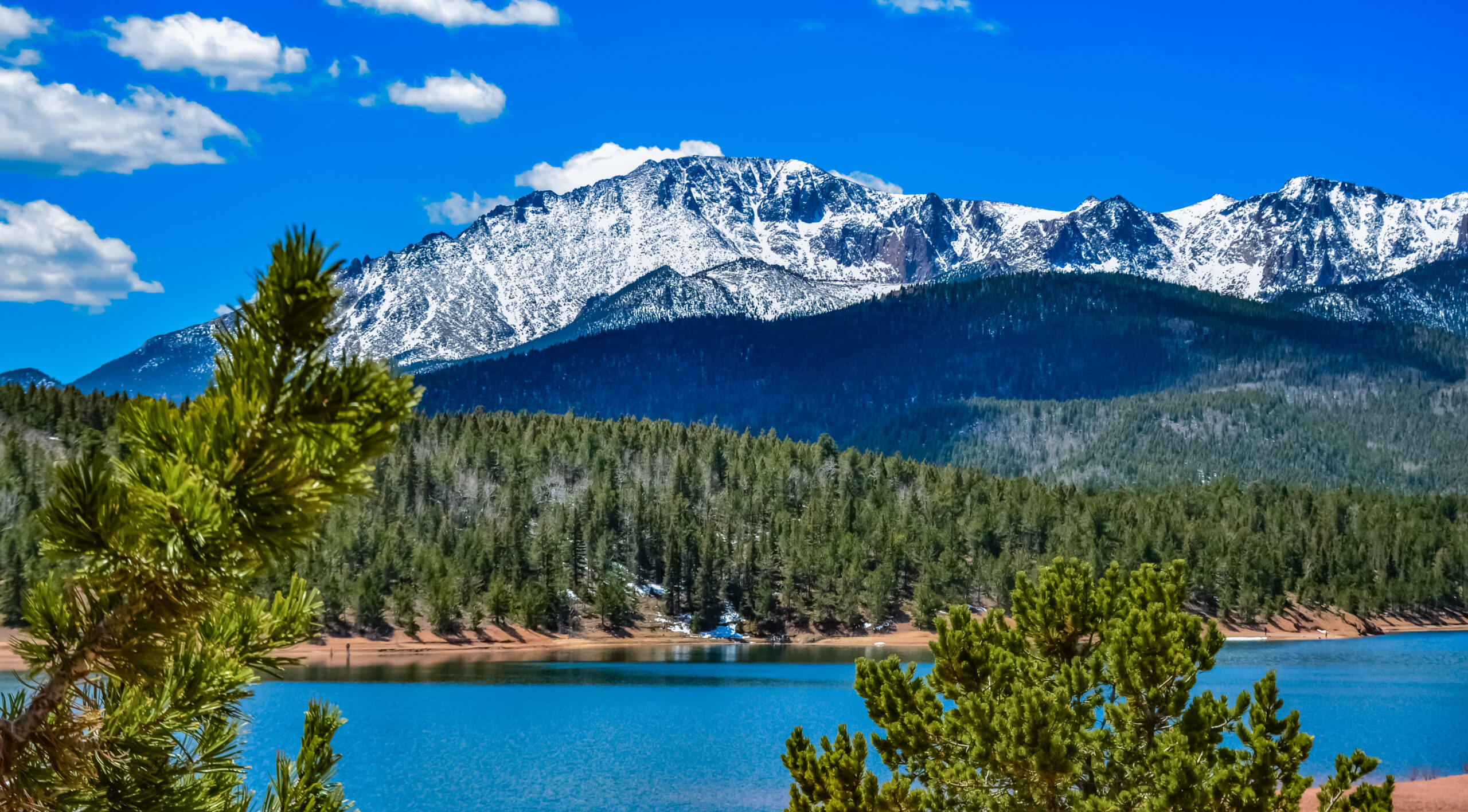
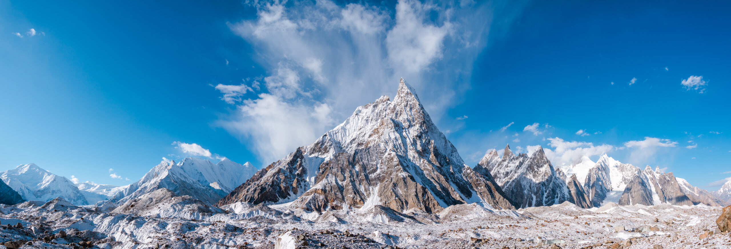
    Colorado 14er ridgeline and high alpine terrain
    Weather Watch · August 19, 2026 · Colorado High Country · 10-Day Timely Window

    Colorado 14ers Weather Shift — Late August 2026: Monsoon Mornings, First Frost & Summit Timing

    Late August is not the end of Colorado’s 14er thunderstorm problem. The weather pattern is shifting: monsoon moisture can still produce afternoon storms while colder dawn temperatures, frost and occasional early-season snow become increasingly plausible at elevation. That means hikers now need to manage both lightning timing and cold exposure on the same summit day.

    Monsoon not overColder dawnsFrost possibleAlpine start still matters
    Aug 19Original weather-watch date
    Early AMBest summit window
    NoonNot a guaranteed safe cutoff
    14,000 ftCold + lightning exposure
    10 daysTimely-content lifespan
    The late-August shift

    What Changed for Colorado 14er Hikers?

    The practical answer: start just as early as you did in July, but pack warmer. NWS Pueblo’s mid-August forecasts still showed monsoon moisture, mountain thunderstorms and periods of heavy rain, while later-August forecasts continued to show daily thunderstorm chances across parts of the Colorado mountains.

    For evergreen route choice, difficulty and peak planning, use our Colorado 14er Hiking Routes guide. This dated post only owns the August 2026 weather transition: storm timing, colder mornings, frost risk and what those changes mean for summit-day decisions.

    MorningColder now
    AfternoonStorm risk remains
    Summit planEarlier is better
    Pack changeAdd warmth
    ForecastCheck NOAA/NWS
    DecisionWatch the sky
    Do not interpret a cold morning as a stable-weather signal. Late August can deliver frost at dawn and thunderstorms later the same day. If clouds begin building vertically, bases darken or thunder is audible, descend rather than waiting for the forecast’s advertised storm hour.
    Monsoon + early fall overlap

    Late August Is a Transition, Not a Clean Seasonal Break

    Weather signalMid-summer patternLate-August implication
    Morning temperatureMilder starts commonFrost and colder wind chill increasingly plausible
    ThunderstormsClassic monsoon concernStill possible; do not relax summit timing
    DaylightLong summer windowShortening; dark-start logistics matter more
    Precipitation typeMostly rain/hail at lower elevationsCold rain, graupel or brief high-elevation snow become more plausible
    Wind chillCold possibleGreater consequence when temperatures drop

    NWS Pueblo’s August 15 discussion described active monsoon moisture and thunderstorms capable of heavy rain, followed by somewhat drier periods but continued isolated mountain storms. On August 21, forecasters again described strengthening monsoon moisture and daily thunderstorm chances. The important hiking takeaway is that late August does not switch abruptly from “monsoon” to “fall.”

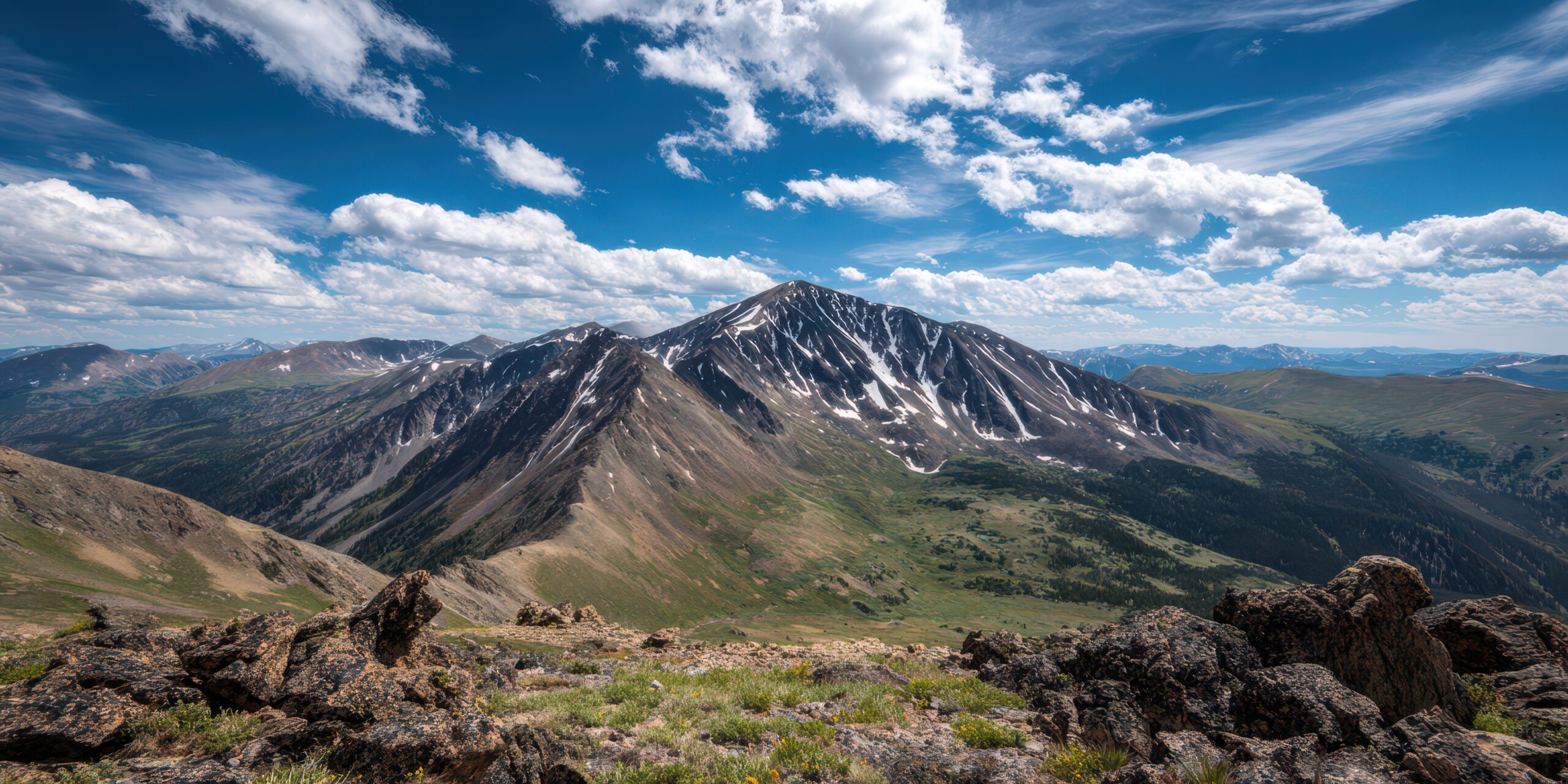
    Mount Elbert and Colorado high country in summer conditions
    Late summer rule

    Keep the Alpine Start. Add the Fall Layer.

    The same early departure that reduces lightning exposure also means colder hours before sunrise, especially above treeline.

    Summit-day timing

    Should You Start Later Because Mornings Are Cooler?

    No. Colorado Fourteeners Initiative still uses alpine starts because summer monsoon storms tend to develop later in the day. Its 2026 safety material emphasizes getting back toward treeline before storm activation and retreating when thunder is heard.

    Route lengthPlanning biasWhy
    Short Class 1/2Early morning startPreserve a large margin for storm development
    Long Sawatch dayPre-dawnDistance can keep you exposed well after the summit
    Longs / exposed Class 3Very early / route-specificRetreat from technical terrain takes longer
    Elk / San Juan technical routesConservative start + turnaroundLoose/complex terrain makes fast descent less realistic
    Noon is not a magic number. Some days destabilize earlier; some stay quiet longer. Use the forecast to set a plan, then use actual cloud growth, wind, visibility and thunder to update it.
    First frost season

    What First Frost Changes Above Treeline

    Hands

    Cold Fingers Arrive Earlier

    Light summer gloves may stop being sufficient during a windy pre-dawn ascent.

    Rock

    Thin Ice Changes Scrambling

    A small amount of overnight moisture can make shaded rock or timber slick before sunrise.

    Water

    Hydration Can Chill

    Cold starts reduce thirst cues but not hydration demand at altitude.

    Turnaround

    Weather Windows Shrink

    Shorter daylight and slower movement in layers mean less room for schedule drift.

    CFI has documented mid-August high-country freezes in past field seasons, including frozen water buckets and lingering snow around August 12–14. That does not predict a specific 2026 frost date, but it demonstrates why late-August hikers should treat subfreezing dawn conditions as plausible rather than exceptional.

    Small pack changes, large margin

    What to Add for Late-August 14ers

    Keep from summerAdd / upgrade nowReason
    Waterproof shellWarmer midlayerColder starts and wind
    Sun hat + SPFWarm hat / buffPre-dawn exposure
    Light glovesWarmer backup glovesCold hands reduce dexterity
    HeadlampFresh batteries / backupMore dark-start hiking
    Normal hiking footwearCheck for frost/ice before committingShaded sections can change character
    Lightning planDo not relax itMonsoon moisture can persist
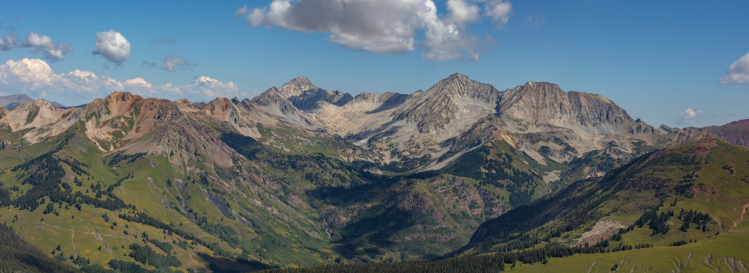
    Capitol Peak and rugged Colorado alpine terrain
    Exposed peaks amplify small forecast errors

    On Technical 14ers, Weather Margin Matters More Than Forecast Precision.

    If retreat takes hours, a “30% afternoon storm chance” is not a small planning detail.

    Not all Colorado 14ers behave the same

    How the Late-August Shift Feels by Range

    RangeMain late-August concernPlanning emphasis
    Front RangeLightning + exposed long routesEarly timing, especially Longs Peak
    SawatchLong mileage + cold dawnsLayering and time-on-feet
    Elk MountainsComplex terrain + slow retreatLarge weather margin
    San JuanMonsoon moisture + technical terrainWatch localized storm development closely
    Sangre de CristoWind / exposure / variable moistureForecast by exact peak and valley

    This is intentionally not a route guide. For peak difficulty, routes and first-14er selection, return to Colorado 14er Hiking Routes.

    Night-before + trailhead routine

    A Better Late-August Forecast Check

    Night before

    Read the NWS Discussion

    Do not stop at the weather-app icon. Look for timing, moisture trend, fronts, wind and flood language.

    Peak-specific

    Check the Exact Mountain

    Colorado ranges can differ substantially on the same day.

    Trailhead

    Look at the Sky

    Forecast confidence does not override visible vertical cloud growth or nearby thunder.

    Turnaround

    Pre-decide the Trigger

    Define what sends you down before summit fever becomes part of the decision.

    Late-August search answers

    Colorado 14er Weather FAQ — August 2026

    Are afternoon thunderstorms still a risk in late August?

    Yes. Late August can bring colder mornings while monsoon moisture still produces daily mountain thunderstorm chances.

    What time should I summit?

    There is no universal safe clock time. CFI emphasizes alpine starts and descending before storm activation; use route length, current forecast and actual cloud development.

    Does first frost mean monsoon season is over?

    No. Cold mornings and thunderstorm moisture can overlap during the seasonal transition.

    What should I add to my pack?

    Warmer gloves, a hat or buff, a stronger insulating layer and reliable lighting, while keeping the normal shell, sun protection and lightning plan.

    Where do I find the actual Colorado 14er routes?

    Use the evergreen Colorado 14er Hiking Routes page; this article is intentionally limited to the August 2026 weather shift.

    Late-August 2026 takeaway

    Start Early Like It Is Monsoon Season. Pack Warm Like Fall Is Arriving.

    That is the late-August Colorado 14er transition in one sentence: lightning risk can persist even as the first cold mornings begin changing the feel of summit day.

    Was this helpful?

    Yes
    No
    Thanks for your feedback!
  • El Chaltén August 2026 Alert: Fees & Spring Bookings

    Mount Fitz Roy and Cerro Torre near El Chaltén in Argentine Patagonia
    Planning Alert · August 24, 2026 · El Chaltén

    El Chaltén August Planning Alert: 2026 Entry Fees, Spring Bookings & What Changed

    The old “show up and hike for free” assumption is no longer safe for El Chaltén planning. Los Glaciares now lists paid North Zone access, three popular backcountry camps require reservations, and late August is still inside APN’s winter trail period. Here is what spring travelers need to change now.

    APN fee schedule checked Aug. 24 Municipal tourism data checked Dated planning alert Evergreen hiking intent protected
    ARS 50,000General daily entry
    ARS 100,000General 3-day Flexipass
    3 campsReservation required
    May–SepAPN winter trail period
    The August planning answer

    Budget for Park Entry, Reserve Camps, and Treat Early Spring as a Transition Season.

    Three planning assumptions have changed for El Chaltén in 2026. First, Argentina’s Administración de Parques Nacionales now lists paid access for Los Glaciares – Portada El Chaltén: ARS 50,000 general daily admission, ARS 100,000 for a general 3-day Flexipass, and ARS 175,500 for a general 7-day Flexipass, under rates effective June 1, 2026.

    Second, APN currently lists De Agostini, Laguna Capri and Poincenot as administered camps that require reservations. Third, late August remains inside APN’s May–September winter period, when the agency warns of ice, mud and snow and says trekking poles and crampons are mandatory.

    If you still need to decide which trail belongs in your trip, use the evergreen Best Hikes in Argentine Patagonia guide. This page does not repeat its route rankings, itineraries, lodging guide or permanent best-season advice; it only records what changed for August 2026 planning.

    Biggest changeNorth Zone now has entry fees
    Camping changeCapri · Poincenot · De Agostini reserved
    Book nowSpecific spring lodging you care about
    Do not claimSpring is “sold out”
    Late-Aug statusStill winter rules
    Archive roleAugust 2026 only
    Important correction for older Patagonia content: articles that still describe El Chaltén’s main Los Glaciares trails as universally free are now stale. APN’s current national tariff page explicitly includes Los Glaciares – Portada El Chaltén. The evergreen owner should be corrected separately, but this dated alert should remain the archive of the 2026 change.
    August 2026 snapshot

    Four Changes That Matter Before the 2026–27 Hiking Season

    The key is separating a verified rule change from a planning inference. Fees and campsite reservation status are official. Accommodation pressure is real historically, but there is no official destination-wide live sellout count.

    01 · Entry fee

    El Chaltén Is Now Explicitly in APN’s Paid-Access Table

    The June 1 national fee schedule lists both Los Glaciares and Los Glaciares – Portada El Chaltén. For international/general admission, one day is ARS 50,000.

    Planning impact: park access is now a real trip-budget line.
    02 · Multi-day passes

    Three- and Seven-Day Flexipasses Now Matter

    APN lists the El Chaltén entrance at ARS 100,000 for a general 3-day Flexipass and ARS 175,500 for a general 7-day Flexipass. That changes the economics of a multi-day El Chaltén hiking stay.

    Planning impact: compare the pass to your actual park-entry pattern.
    03 · Backcountry camping

    Three Familiar Camps Are No Longer “Just Arrive” Options

    APN lists De Agostini, Laguna Capri and Poincenot as administered camps with reservations required. Laguna Toro remains a remote-area objective with mandatory registration.

    Planning impact: camping is a booking dependency, not a fallback assumption.
    04 · Lodging verification

    El Chaltén Is Tightening the Formal Accommodation System

    Since March 2026, the municipality says Booking.com requires municipal and provincial commercial authorization from El Chaltén properties. The local tourism office also maintains a current 2026 accommodation guide and licensed-accommodation registry.

    Planning impact: use registered properties and verify the actual operator.
    Hiking beneath Mount Fitz Roy near El Chaltén in Argentine Patagonia
    The planning model changed

    El Chaltén Is Still Flexible—but It Is No Longer a Zero-Reservation Destination.

    The famous day hikes remain village-based and relatively simple to organize, but 2026 adds a real park-entry budget, reserved backcountry camps and more reason to lock specific spring lodging before airfare determines the entire trip.

    Effective June 1, 2026

    What Does Los Glaciares Cost at the El Chaltén Entrance Now?

    These are the current APN-published Argentine-peso rates as checked August 24. Exchange rates can move quickly, so this post keeps the official ARS amounts rather than publishing a stale USD conversion.

    Pass / categoryGeneralArgentine national residentSanta Cruz provincial residentStudent
    1-day passARS 50,000ARS 25,000ARS 8,000ARS 15,000
    3-day FlexipassARS 100,000ARS 50,000ARS 16,000See current APN eligibility
    7-day FlexipassARS 175,500ARS 87,500ARS 28,000See current APN eligibility
    Do not calculate the trip from old “free El Chaltén trails” articles. The national APN fee page is the stronger current source and explicitly lists the El Chaltén entrance. Buy through APN’s official ticket channel and recheck rates before travel because Argentine peso pricing can be revised.
    Backcountry booking alert

    Poincenot, Laguna Capri and De Agostini Require Reservations

    This is the second planning change most likely to surprise hikers who built their expectations from older El Chaltén trip reports.

    Camp / areaCurrent APN statusWhat to do nowDo not assume
    PoincenotAdministered · reservation requiredSecure the camp before designing an overnight Fitz Roy plan around it.That a tent can simply be added because the day trail is open.
    Laguna CapriAdministered · reservation requiredReserve if your plan uses a formal overnight rather than a village base.That its proximity to El Chaltén makes it walk-in camping.
    De AgostiniAdministered · reservation requiredReserve before building an overnight Cerro Torre plan.That older free-camp descriptions are still current.
    Laguna Toro / remote areasMandatory remote-area registrationRegister with the park visitor center or approved virtual process and verify current conditions.That a normal day-hike planning model applies.

    This alert does not replace the route-specific hiking guides. It only records the reservation status that changes whether a backcountry itinerary can be treated as spontaneous.

    October–November planning

    Should You Book El Chaltén Spring Accommodation in August?

    Yes if a particular property, room type or village location matters. No if the argument is “everything is already selling out”—there is not enough official live inventory data to support that claim.

    Verified demand signal

    Last Season Reached Nearly 90% at Peak Times

    El Chaltén’s municipal tourism department reported 67% average occupancy across the October 2025–March 2026 season, with peaks near 90%. The report covered 270 licensed lodging businesses and roughly 5,100 beds.

    Inference: desirable properties can become constrained even when the town is not universally full.
    Current supply signal

    The 2026 Licensed Accommodation Directory Is Active

    The municipal tourism site is publishing a current 2026 accommodation guide and its PUDA registry of regularized properties. That gives travelers a better way to verify lodging before paying.

    Use the official directory to validate the property.
    Book now

    Reserve the Hotel You Would Be Disappointed to Lose

    If you want a particular hotel, breakfast setup, private room, apartment, or walkable position near your preferred trail departure, August is a sensible time to protect October–November dates with flexible terms.

    Scarcity is property-specific before it becomes town-wide.
    Keep flexible

    Do Not Let Lodging Eliminate Weather Buffer

    El Chaltén works best when the best-weather day goes to the most important hike. A rigid two-night stay can cost more experiential value than a slightly higher flexible room rate.

    Book enough nights to move the objective around the forecast.
    Commercial booking rule: after you know the number of nights you want, lodging becomes a reasonable travel-booking task. But the editorial decision comes first: protect weather flexibility and the specific room you care about; do not create false urgency from unsupported “selling out now” language.
    Patagonia mountain landscape illustrating the changing spring planning window
    August is still winter planning

    “Spring Trip” Does Not Mean Spring Trail Conditions Yet.

    Late August is still inside APN’s winter operating guidance. The useful planning move is to reserve flexible spring travel now while continuing to treat actual trail condition as a final-prep question.

    Late-August condition rule

    APN Still Treats May Through September as Winter on the North-Zone Trails

    This matters because a traveler booking October travel from summer trail photos can easily underestimate how slowly winter conditions unwind at elevation.

    Official warning

    Ice, Mud and Snow Are Part of the Current Trail Picture

    APN’s North Zone recommendations say that from May through September the trails can become extremely complex because of ice, mud and snow.

    Do not extrapolate August conditions into October—but do not ignore them either.
    Required equipment

    APN Says Poles and Crampons Are Mandatory in the Winter Period

    The park specifically calls for trekking poles and crampons during the May–September period to reduce falls. The right equipment in early spring should then be based on the actual condition report near departure.

    Final gear is a conditions decision, not a calendar assumption.
    Frozen water

    Do Not Walk on Frozen Lagoons

    APN explicitly prohibits walking or skating on frozen lagoons because the surface is unstable and failure can create severe hypothermia risk.

    A frozen lake is not a shortcut or viewing platform.
    Remote areas

    Registration Still Matters Beyond the Standard Day-Hike System

    Climbing and remote-area itineraries require park registration. That is a different planning category from walking the standard village-based day trails.

    Move remote objectives into Final Prep with an official recheck.
    What to act on now

    The August Booking Order for an October–November El Chaltén Trip

    Reserve what can constrain the trip, but leave weather-dependent decisions flexible. This is the difference between planning early and overcommitting early.

    Step 1 · Now

    Choose the El Chaltén objective and trip length

    Use the evergreen Argentine Patagonia guide to decide whether your trip is mostly Fitz Roy day hiking, a broader El Chaltén stay or a technical/multi-day objective. This alert does not own that route decision.

    Step 2 · Now

    Protect the lodging you actually care about

    Reserve a preferred licensed property with reasonable change terms, especially if you need a private room, apartment, breakfast, specific location or longer stay.

    Step 3 · If camping

    Secure Capri, Poincenot or De Agostini before building around them

    The current APN accommodation page says all three are administered and require reservations. Treat the camp as a route dependency.

    Step 4 · Budget

    Add APN park access to the real trip cost

    Compare daily admission against the current three- and seven-day Flexipass structure based on how many days your plan actually enters paid park access.

    Final prep

    Recheck trail surface, weather and access close to departure

    Spring conditions are not knowable from August. Keep the trip structure, but update footwear, traction, route order and turnaround assumptions from current official information.

    Climber Journey · Plan → Book → Final Prep

    Next Best Step: Save El Chaltén and the New Fee Assumptions to My Climb.

    If this alert changes a trip you were already planning, do not leave the correction in a browser tab. Put the destination, spring dates, accommodation, campsite dependency and current APN fee assumptions into the same plan—then schedule the trail-condition recheck for Final Prep.

    DreamChoosePrepare PlanBook Final PrepClimbReturnRemember
    Official-source maintenance

    Sources & What Is Verified vs Inferred

    The purpose of a Planning Alert is to separate a current rule from a planning recommendation. The official facts below were checked August 24, 2026.

    Verified current facts

    • APN rates effective June 1, 2026 list Los Glaciares – Portada El Chaltén at ARS 50,000 general daily admission.
    • APN lists general 3-day and 7-day Flexipasses at ARS 100,000 and ARS 175,500 for El Chaltén.
    • Poincenot, Laguna Capri and De Agostini are administered camps requiring reservation.
    • APN defines May–September as the winter trail period and warns of ice, mud and snow.
    • APN says poles and crampons are mandatory during that winter period.
    • El Chaltén municipality maintains a current lodging registry and 2026 accommodation guide.

    Planning inferences—not official guarantees

    • August is a sensible time to reserve a specific October–November lodging if losing it would materially change the trip.
    • There is no official destination-wide live spring sellout tracker; do not publish “El Chaltén is selling out” as a verified fact.
    • Last season’s near-90% peak occupancy shows potential pressure, not a guarantee that the same dates will behave identically in 2026–27.
    • October trail conditions cannot be predicted reliably from August winter status and require a fresh official check near departure.
    Archive rule: keep this URL indexed as the August 2026 planning record. Correct a factual error or a materially changed 2026 official rule if necessary, but do not roll it into the permanent Argentine Patagonia guide. A future season should receive a new dated Planning Alert unless this URL is intentionally redesignated as a permanent tracker.
    August 2026 El Chaltén questions

    Frequently Asked Questions

    These answers are limited to the changing 2026 planning facts, not the permanent route or itinerary questions.

    Do hikers now pay an entry fee in El Chaltén?

    Yes. APN’s national fee schedule effective June 1, 2026 explicitly includes Los Glaciares – Portada El Chaltén. The general one-day rate is ARS 50,000, with lower categories for Argentine residents, Santa Cruz provincial residents and qualifying students.

    How much is the 2026 Los Glaciares entrance fee at El Chaltén?

    As of August 24, APN lists ARS 50,000 for general one-day admission, ARS 100,000 for the general 3-day Flexipass and ARS 175,500 for the general 7-day Flexipass. Recheck the official fee page before paying because rates can change.

    Do Poincenot, Laguna Capri and De Agostini require campsite reservations?

    Yes. APN currently lists all three as administered camps with reservation required. This is one of the most important corrections to older El Chaltén planning advice.

    Are the trails still in winter conditions in late August?

    APN’s North Zone guidance treats May through September as the winter season and warns that ice, mud and snow can make the trails extremely complex. It says trekking poles and crampons are mandatory during this period.

    Should I book El Chaltén accommodation now for October or November?

    If a specific property, room type or location matters, August is a reasonable time to reserve with flexible terms. Municipal data from last season showed 67% average occupancy with peaks near 90%, but there is no official live destination-wide inventory report supporting a claim that spring 2026 is already broadly sold out.

    Where should I keep the new fee and reservation details?

    Save El Chaltén in My Climb and record the lodging, campsite reservation status, APN fee assumptions and a final-prep task to recheck current trail conditions before departure.

    Next Best Step

    Protect the Spring Trip Now. Leave the Trail-Day Decisions Flexible.

    Reserve the lodging or campsite that can constrain the trip, add the new park-entry cost to the budget, then keep the exact hiking order open until the current weather and trail condition are known.

    Was this helpful?

    Yes
    No
    Thanks for your feedback!
  • Mount Fuji Late-Season Watch 2026: September 10 Deadline

    Mount Fuji rising above Yamanashi, Japan
    Season Watch · August 14, 2026 · Post-Obon to September 10

    Mount Fuji Late-Season Watch 2026: Trail Deadlines, Weather & What Changes After Obon

    The post-Obon window can mean fewer crowds—but it also starts the countdown toward September 10, when Fuji’s official summit season ends. Huts, toilets and first-aid support can thin before the trails themselves close.

    Official 2026 Fuji dates Dated seasonal transition report Evergreen route intent protected Official-source links included
    Sep 10Summit trails close
    ¥4,0002026 hiking fee
    2 PM–3 AMRestricted entry window
    Late AugSupport begins thinning
    The late-season answer

    After Obon, Fuji Gets Quieter—But the Operating Window Starts Shrinking.

    Mount Fuji remains in its official 2026 climbing season after Obon, but climbers are entering the final four weeks before the September 10 summit-trail closures. The official portal specifically warns that huts and public toilets can begin closing before the trails do, particularly from late August onward.

    That means the late-August / early-September opportunity is not simply “the same Fuji with fewer people.” Crowds may ease, while cold, weather sensitivity and reduced support become more important. For permanent route selection, distances and trail comparisons, use our Mount Fuji Routes Guide; this post only owns the 2026 late-season transition.

    Best post-Obon advantageLower crowd pressure
    Main tradeoffLess infrastructure
    Hard deadlineSeptember 10
    Weather watchCold + wind + storms
    Do not assumeHuts stay open to Sep 10
    Archive role2026 only
    Critical distinction: September 10 is the official trail-closing deadline—not a guarantee that every hut, toilet, first-aid station, bus or summit service operates at full peak-season capacity until that date. Check the exact route and facility immediately before climbing.
    The post-Obon transition

    Six Things That Change as Fuji Moves Toward September

    The mountain does not suddenly change on August 17. The transition is gradual: crowd pressure eases, the remaining season shortens, and operational margins become less forgiving.

    01 · Crowds

    The Obon Surge Starts to Pass

    The official Mount Fuji portal identifies weekends, public holidays and the Obon holiday period as the major congestion windows. Late-August weekdays can therefore offer a better chance of avoiding the summit queues associated with peak dates.

    Tradeoff: fewer crowds do not mean fewer mountain hazards.
    02 · Countdown

    September 10 Stops Being Abstract

    All four official summit routes end their 2026 climbing season on September 10. By late August, every weather cancellation consumes a meaningful share of the remaining legal summer window.

    Build flexibility into late-season dates.
    03 · Facilities

    Huts and Toilets Can Close Early

    The official route guidance specifically warns that public toilets and mountain huts may close before the mountain season ends, especially from late August onward. Some descent routes can therefore lose services before September 10.

    Verify the exact facility—not just the trail.
    04 · Medical support

    Some First-Aid Coverage Ends Before Trail Closure

    Fujinomiya’s 8th-station first-aid center is scheduled through September 6. Yoshida’s 8th-station center is scheduled through September 7, with the published schedule also showing a temporary closure on September 2.

    The final days are not operationally identical to August.
    05 · Temperature

    Pre-Dawn Cold Becomes Harder to Ignore

    The official weather guidance says summit temperatures can approach 0°C even in summer, and Fuji’s own safety material notes that temperatures may fall below freezing even around Obon. Late-August mornings can bring icicles and stronger cold stress.

    Warm layers remain essential even after a hot approach.
    06 · Weather margin

    A Bad Forecast Costs More Late in the Season

    Fuji’s exposed summit is vulnerable to wind, heavy rain, lightning and dense fog. In July, a climber may have weeks to reschedule. In early September, the September 10 closure makes weather flexibility more valuable.

    Do not force a summit because the season is ending.
    August 14 → September 11

    The 2026 Late-Season Countdown

    This is the most useful way to think about the post-Obon window: not as one block of time, but as a sequence of infrastructure and access deadlines.

    Mid-August

    Obon Crowd Pressure Peaks

    The official portal warns that Obon, weekends and holidays are among the most congested periods, especially near the summit before sunrise.

    Late August

    Facilities Can Begin Closing

    Official route guidance warns that mountain huts and public toilets may start ending operations before the official season closes. Descending-trail toilet availability deserves special attention.

    Sep 2

    Yoshida 8th-Station First-Aid Center Scheduled Temporary Closure

    The official 2026 facility schedule notes a temporary September 2 closure for the Yoshida 8th-station first-aid center.

    Sep 6

    Fujinomiya 8th-Station First-Aid Center Ends

    The Mt. Fuji Hygiene Center at Fujinomiya’s 8th station is scheduled to operate through September 6.

    Sep 7

    Yoshida 8th-Station First-Aid Center Ends

    The published 2026 operating period ends September 7, several days before the official trail closure.

    Sep 10

    Official Summit Season Ends

    Yoshida, Subashiri, Gotemba and Fujinomiya all reach their published 2026 summit-trail closing date. The Shizuoka routes specify 5 PM for the main climbing routes.

    Sep 11

    Yoshida Descent Wraps Up

    The Yoshida descent route remains open into September 11, with the 7th-station descent toilet scheduled to noon. This is a descent accommodation—not an extra summit-climbing day.

    Mount Fuji Yoshida Trail on the upper mountain
    Late-season trail conditions

    Late Season Is a Trade: Less Congestion for Less Operational Margin.

    The post-Obon advantage is real on the right weekday, but by late August every weather day matters more and the mountain’s operating system begins moving toward shutdown.

    Photo: Wikimedia Commons · CC0 · source
    Official 2026 dates

    What Is the Final Climbing Day on Each Mount Fuji Route?

    The date converges on September 10, but the exact route schedule and descent details still differ.

    Route2026 summit seasonLate-season detailWhat not to assume
    YoshidaJuly 1–September 10Descent route remains open into the morning of Sept. 11.Do not interpret Sept. 11 descent access as permission for another summit ascent.
    SubashiriJuly 1, 9 AM–September 10, 5 PMPrivate-vehicle restrictions run through Sept. 10.Do not assume toilets and huts remain fully available until closing hour.
    GotembaJuly 10, 9 AM–September 10, 5 PMFewer huts and no route first-aid center listed in the official facility table.Late season does not make this long route operationally easier.
    FujinomiyaJuly 10, 9 AM–September 10, 5 PM8th-station first-aid center ends Sept. 6.Trail-open status does not mean full medical infrastructure is still operating.
    Summit rim / OhachimeguriJuly 10–September 10Exposed to high wind, rain, lightning and dense fog.Do not add the crater loop automatically when weather is marginal.
    Evergreen route choice belongs elsewhere: distances, starting elevations, hut density and which trail is “best” are intentionally not duplicated here. See the Mount Fuji Routes Guide: All Four Trails Compared.
    The hidden late-season issue

    Trail Open Does Not Mean Fully Supported

    For the final two weeks, facility calendars matter almost as much as the trail calendar.

    Fuji’s official site is unusually explicit about this: public toilets and mountain huts may close before the formal mountain-closing date, especially from late August onward. That warning is particularly important on descent, where a climber can be tired, dehydrated and several hours from the trailhead.

    The 2026 operating calendar also shows route-specific reductions. The Fujinomiya 8th-station first-aid center is scheduled through September 6. Yoshida’s 8th-station first-aid center runs through September 7, with a temporary closure on September 2. Some lower facilities remain open beyond the summit season, but that does not extend legal summit-trail access.

    What to verify 24–48 hours before a late-season climb

    Check the exact trail opening status, your specific hut’s operating date, descent-toilet availability, first-aid-center schedule, trailhead transport and current weather warnings. A screenshot or itinerary saved in July is not enough for a September climb.

    Late-August weather watch

    The Mountain Can Feel Like Winter Before the Season Is Over

    The key late-season mistake is looking at hot weather in Tokyo or at the 5th station and underestimating the summit environment.

    Temperature

    Near-Freezing Before Sunrise

    The official weather page warns that summit temperatures can approach 0°C before sunrise even during summer. Fuji’s safety guidance notes that below-freezing temperatures can occur even around Obon.

    Cold protection is not optional.
    Wind chill

    Wind Magnifies the Temperature Drop

    Official guidance uses roughly 1°C of additional apparent cooling for each 1 m/s of wind speed as a practical reference. A summit wait can therefore feel substantially colder than the thermometer suggests.

    Standing still for sunrise is colder than climbing.
    Thunderstorms

    Summer Convective Weather Still Matters

    The official Fuji portal warns that thunderstorms are common in summer and that sudden weather change can occur quickly on the isolated volcano.

    Check warnings before leaving the trailhead.
    Summit rim

    Ohachimeguri Is Optional

    The Ministry of the Environment’s 2026 opening notice warns that strong wind, heavy rain, lightning and dense fog can make the crater-rim route dangerous.

    A successful summit does not require forcing the crater circuit.
    After Obon

    The Crowd Advantage Is Real—But Do Not Overstate It

    The official site supports the logic: Obon, weekends and holidays are major congestion periods. That does not make every late-August day quiet.

    The strongest reason to consider the post-Obon window is straightforward: the official crowd guidance says climbers concentrate on weekends, public holidays and the Obon period, particularly near the summit before sunrise. A non-holiday weekday after Obon can therefore avoid some of the peak-season queue effect.

    But “after Obon” should not become a new best-season claim. Weather still determines the climb, weekends can remain busy, and late-season infrastructure starts to contract. This is why the permanent Best Time to Climb Mount Fuji article remains the evergreen owner of seasonal recommendations.

    Sunrise seen from the summit of Mount Fuji on September 2
    September on the summit

    September 10 Is a Closure Line, Not a Target Date.

    This September 2 summit sunrise illustrates the narrow final-season window: spectacular conditions are possible, but they should never be assumed simply because the official trail calendar still says open.

    Photo: Photos of Japan / Wikimedia Commons · CC0 · source
    September 1–10

    Should You Plan Fuji in the Final Ten Days?

    The right question is not whether the trail is technically open—it is whether weather, support and logistics still line up for your specific date.

    Good reason

    You Have Flexible Weekday Dates

    If you can move the climb around weather and verify huts, toilets and transport, early September can still sit inside the official season.

    Flexibility is the advantage.
    Bad reason

    You Want to “Beat the Deadline”

    A closing date should never become pressure to climb in poor wind, lightning, heavy rain or dense fog. The official portal explicitly advises cancelling when bad weather is expected.

    The deadline never outranks conditions.
    Check twice

    Your Hut and Descent Services

    Verify accommodation and toilet availability directly because official guidance warns that facilities can close before September 10.

    Do not infer services from trail status.
    Hard stop

    After September 10 Is Off-Season

    The official Mount Fuji site states that summit trails are closed outside the designated climbing season and warns of severe weather, rockfall, avalanche and reduced rescue support.

    Do not convert a late-season climb into an off-season ascent.
    Late-season perspective

    What Mount Fuji Looks Like as the Summer Window Narrows

    These final images reinforce the actual seasonal story: a still-hikeable volcanic mountain inside a shrinking operating window—not an invitation to continue after official closure.

    Official-source maintenance

    Sources & What Should Be Rechecked

    This post is intentionally dated because facility schedules, emergency closures and weather can change inside the remaining climbing season.

    Recheck before climbing

    • Emergency trail closure or warning on your route.
    • Specific mountain-hut closing date and reservation.
    • Public-toilet availability on ascent and descent.
    • First-aid-center operating dates.
    • Trailhead bus / shuttle operating schedule.
    • JMA warnings, summit weather, wind and thunderstorms.
    Photo sources: the four photographs used in this version are reusable CC0/public-domain images from Wikimedia Commons. For maximum performance, download them into the WordPress Media Library and replace the Commons URLs with your site-hosted copies after upload.
    Archive rule: keep this page indexed as the 2026 late-season record. Correct factual errors or an official 2026 schedule revision if necessary, but do not roll this URL into a 2027 article. Next season should receive its own dated Season Watch.
    Late-season Fuji questions

    Frequently Asked Questions

    Answers are deliberately limited to the post-Obon / closing-window intent.

    When do Mount Fuji trails close in 2026?

    The official 2026 summit climbing season ends September 10 on Yoshida, Subashiri, Gotemba and Fujinomiya. Exact closing times and descent arrangements vary, so verify your route before travel.

    Can I climb Mount Fuji after September 10, 2026?

    The official Mount Fuji portal states that summit trails are closed outside the climbing season. Huts, toilets, maintenance and normal summer rescue support are also reduced or unavailable, and off-season hazards are substantially greater.

    Does Mount Fuji get less crowded after Obon?

    It can. The official portal identifies weekends, public holidays and Obon as major congestion periods and encourages less crowded weekdays. But late August still attracts climbers and weather remains the dominant decision factor.

    Do huts and toilets stay open until September 10?

    Not necessarily. Official guidance warns that huts and public toilets may begin closing before the mountain season ends, particularly from late August onward.

    How cold is Mount Fuji after Obon?

    Summit temperatures can approach 0°C before sunrise even in summer, and official Fuji safety guidance notes that freezing temperatures can occur around Obon. Wind makes the effective temperature colder.

    Late season is still season—until it isn’t

    After Obon, Watch the Calendar as Closely as the Forecast.

    The reward can be lower crowd pressure. The cost is a narrowing weather window and gradually shrinking mountain support. Choose the route in the evergreen guide, then verify the exact late-season operating status before you climb.

    Was this helpful?

    Yes
    No
    Thanks for your feedback!
  • Mountain & Hiking Brief: 8 Changes for Aug. 14, 2026

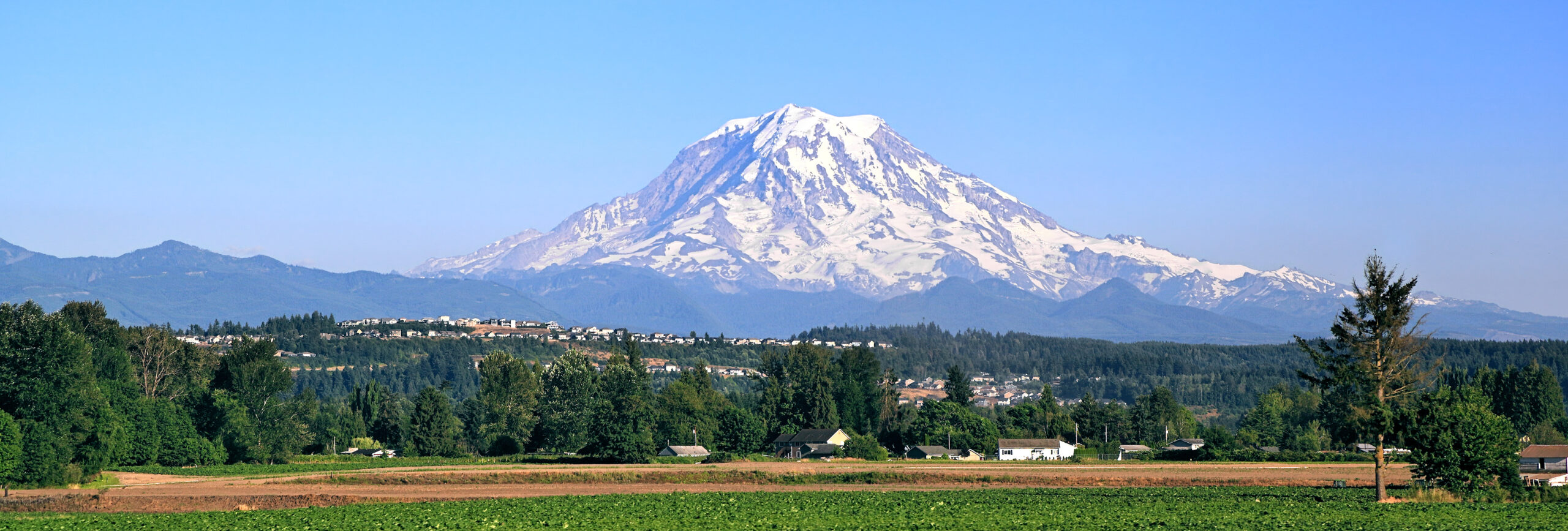
    Mount Rainier above Washington, one of the mountain areas affected by August 2026 access changes
    New dated post · Friday, August 14, 2026 · 48–72 hour horizon

    Global Mountain & Hiking Brief — August 14, 2026: 8 Changes Worth Watching This Weekend

    Wildfire closures in Washington and Alberta, a wildlife closure in the Yukon, changing winter access in Patagonia, and a newly restored New Zealand classic headline this weekend’s verified mountain-and-hiking changes.

    Official land-manager sourcesDated conditions onlySource dates shownKeep indexed as archive
    8Verified changes
    6Countries / regions
    48–72 hrPlanning horizon
    Aug. 14Brief date
    By Travis Ludlow · Global Summit Guide
    6.6 Timely Post · Coverage date August 14, 2026
    What changed

    Fire, Wildlife and Winter Rules Are Moving Faster Than the Guidebooks.

    This is a dated weekend brief, not a new evergreen hiking guide. For long-term destination selection, use Best Hiking Regions in the World; that page remains the evergreen owner. This August 14 post only captures short-lived changes that can affect a trip over the next 48–72 hours.

    The biggest immediate changes are in the Pacific Northwest, where fire has closed major access at Mount Rainier and North Cascades. Jasper and Kluane also have consequential closures, while Torres del Paine remains under winter rules. The positive change: New Zealand’s Hooker Valley Track is connected through to Hooker Lake again after the opening of its new suspension bridge.

    August 14 weekend watchlist

    The Eight Verified Changes

    Each item answers one narrow question: what changed, why it matters this weekend, and where to verify it before leaving the trailhead.

    01 · Washington, USAMajor closure
    Mount Rainier · Grand Park 2 Fire

    Sunrise and White River Are Closed

    Mount Rainier National Park closed the Sunrise and White River areas effective August 13 because of the Grand Park 2 Fire. Sunrise Road and White River Road are closed, along with trails originating from those roads that travel into the northeast area and trails in the Grand Park area.

    The August 14 trail report lists closures affecting Mt. Fremont, Palisades Lakes, Grand Park and portions of the Northern Loop, while some routes remain reachable only through longer Wonderland Trail approaches.

    Why it matters: a normal “drive to Sunrise and hike” plan may no longer exist. Rebuild the day around an open district instead of improvising around a fire closure.
    Effective Aug. 13; trail conditions updated Aug. 14, 2026.
    02 · Washington, USAFire + smoke
    North Cascades · Border 2 + Luna fires

    Trail, Camp and Area Closures Are Expanding the Planning Problem

    The park’s August 14 fire update keeps trail, camp and area closures in effect for the Border 2 and Luna fires. Hozomeen-area access, multiple Ross Lake camps, sections of the Eastbank system, Big Beaver, Little Beaver and Sourdough Mountain are among the affected places.

    The same update warned of a Red Flag period for lightning and gusty outflow winds, while the park described mid-August conditions as hot, dry and hazy with variable smoke and some water sources beginning to dry.

    Why it matters: this is not merely a visibility problem. Routes, camps and emergency aviation can be affected. Check the exact trail and camp—not only the park headline.
    Official NPS update: August 14, 2026.
    03 · Alberta, CanadaArea closure
    Jasper National Park · wildfire-impacted landscape

    Edith Cavell and Parts of Maligne Canyon Remain Off-Limits

    A Jasper closure taking effect August 14 keeps several wildfire-impacted areas closed. Edith Cavell Road and the Edith Cavell area remain closed, including Path of the Glacier and Cavell Meadows. Access to Maligne Canyon trails and surrounding land is prohibited from First Bridge to the Fifth Bridge junction.

    The bulletin also separates corridors that have reopened from those that remain closed, making older saved itineraries unreliable.

    Why it matters: two famous Jasper hiking stops can still appear in old itineraries when current access is prohibited.
    Issued Aug. 13; effective Aug. 14, 2026.
    04 · Yukon, CanadaWildlife closure
    Kluane · Ä’äy Chù Valley

    A Bold Wolf Triggered a New Valley Closure

    Parks Canada closed the Ä’äy Chù Valley beginning August 14 after reports of a young lone wolf displaying unusually bold behavior, including following people and making contact with a visitor and property. The closure includes Bullion Plateau, Sheep Creek, Shepherd’s Knoll, Ä’äy Chù East and Ä’äy Chù West trails.

    Why it matters: this is an until-further-notice wildlife closure, not a weather advisory. Remove these trails from the weekend plan until the order is lifted.
    Closure starts August 14, 2026.
    05 · California, USAFire watch
    Yosemite · lightning fires

    Eight New Lightning Fires Put Fire Conditions Back Into the Itinerary

    Yosemite reported eight new wildfire starts on August 13 after early-morning lightning on August 12. At that update, no site closures or evacuations had been implemented because of the fires, but several were still being staffed or monitored.

    Separately, fire restrictions below 8,000 feet remain in effect, and Bridalveil Creek Campground was scheduled to close for the season on August 14 after a lightning strike affected potable-water and restroom infrastructure.

    Why it matters: Yosemite is not broadly closed, but fire starts, restrictions and campground logistics are changing. Verify the specific overnight plan.
    Fire update Aug. 13; campground change Aug. 14, 2026.
    06 · Alberta, CanadaRestrictions
    Banff · fire danger + berry season

    Open Trails Still Come With a Fire Ban and Bear-Season Constraints

    Banff’s park-wide fire ban, effective July 30, remains in force heading into the weekend. The August 14 trail report also shows bear warnings on Lake Minnewanka-area trails and wet or muddy conditions across many routes. The Bryant Creek seasonal hiking restriction is active through September 30 to reduce disturbance to bears feeding on berries.

    Why it matters: “open” is not the same as “normal.” Fire and bear notices should shape route selection before hikers leave town.
    Fire ban effective July 30; trail conditions updated Aug. 14.
    07 · Chilean PatagoniaWinter rules
    Torres del Paine · W / Base Torres / O

    The W Is Easier to Access Again—But Winter Rules Still Matter

    CONAF removed the exceptional June–July permit requirement for the W beginning August 1. The park still recommends specialized-guide accompaniment and registration at control points for winter travel. Base Torres continues to require an authorized guide through August 30, while the O / Macizo Paine circuit remains closed through October 31 unless CONAF announces a change.

    Why it matters: an August W plan, Base Torres day and O Circuit plan are three different access decisions. Verify the exact route before booking around it.
    W change effective Aug. 1; winter rules current Aug. 14.
    08 · New ZealandAccess restored
    Aoraki / Mount Cook · Hooker Valley

    Hooker Valley Is Again Connected Through to Hooker Lake

    New Zealand’s Department of Conservation opened the new 189-metre second suspension bridge on the Hooker Valley Track on July 28. DOC now describes the full track through to Hooker Lake, restoring the upper route that had been cut off after erosion forced the former bridge closure in 2025.

    DOC also warns that winter conditions can be icy and extremely cold, with solid footwear and warm clothing still necessary.

    Why it matters: a major classic is fully connected again, but August visitors still need to plan it as a winter sub-alpine walk.
    Bridge opened July 28; material for Aug. 14 trip planning.
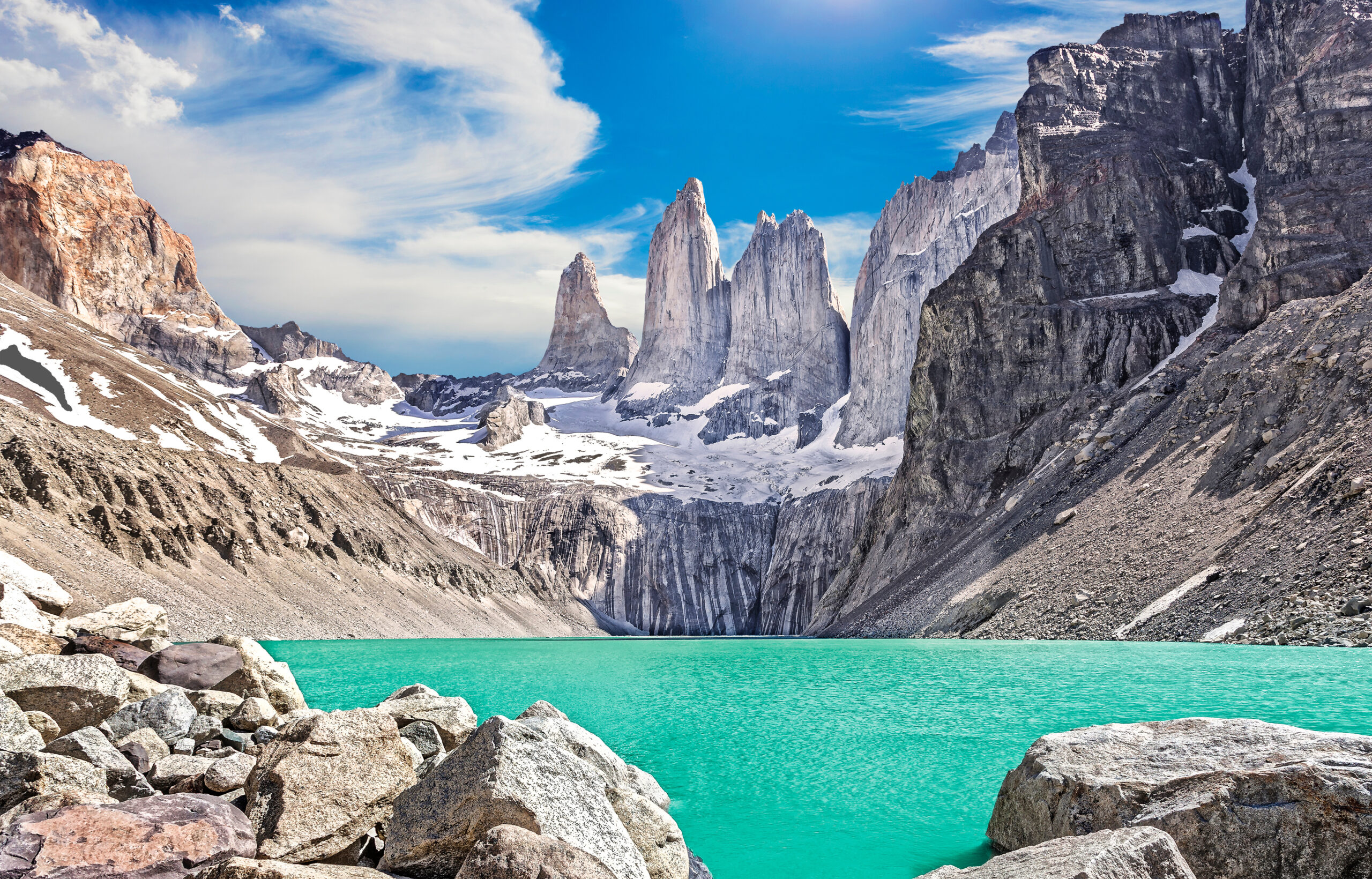
    Torres del Paine towers in Chilean Patagonia during winter access season
    The pattern behind the updates

    “Open” and “Closed” Are Too Simple for Mountain Travel.

    One district closes while another remains reachable, one trail needs a guide while a neighboring route does not, and one classic reopens while winter hazards remain.

    Use this brief correctly

    What to Do Before a Mountain Weekend Right Now

    The point of a dated brief is not to replace planning—it is to identify what needs to be re-checked.

    01 · Verify the route

    Do Not Stop at the Park Alert

    Rainier and North Cascades show why a park can be open while your road, trailhead, camp or route is not.

    02 · Check the date

    Yesterday Beats Last Month

    A dated land-manager notice outranks an evergreen article when the two conflict on current access.

    03 · Build a backup

    Choose Another District

    Fire and wildlife closures are not route-finding puzzles. Move the trip to a legitimately open alternative.

    04 · Separate access

    Open Does Not Mean Summer-Normal

    Aoraki is connected again, but August is still winter. Torres del Paine’s W is operating, but winter rules still shape the trip.

    05 · Re-check smoke

    Conditions Move Within Hours

    Fire behavior, smoke and thunderstorms change faster than a weekly roundup. Check current weather and air quality before departure.

    06 · Archive it

    Do Not Roll the Date Forward

    After the weekend, keep this indexed as an August 14 record. A future weekend gets a new dated brief.

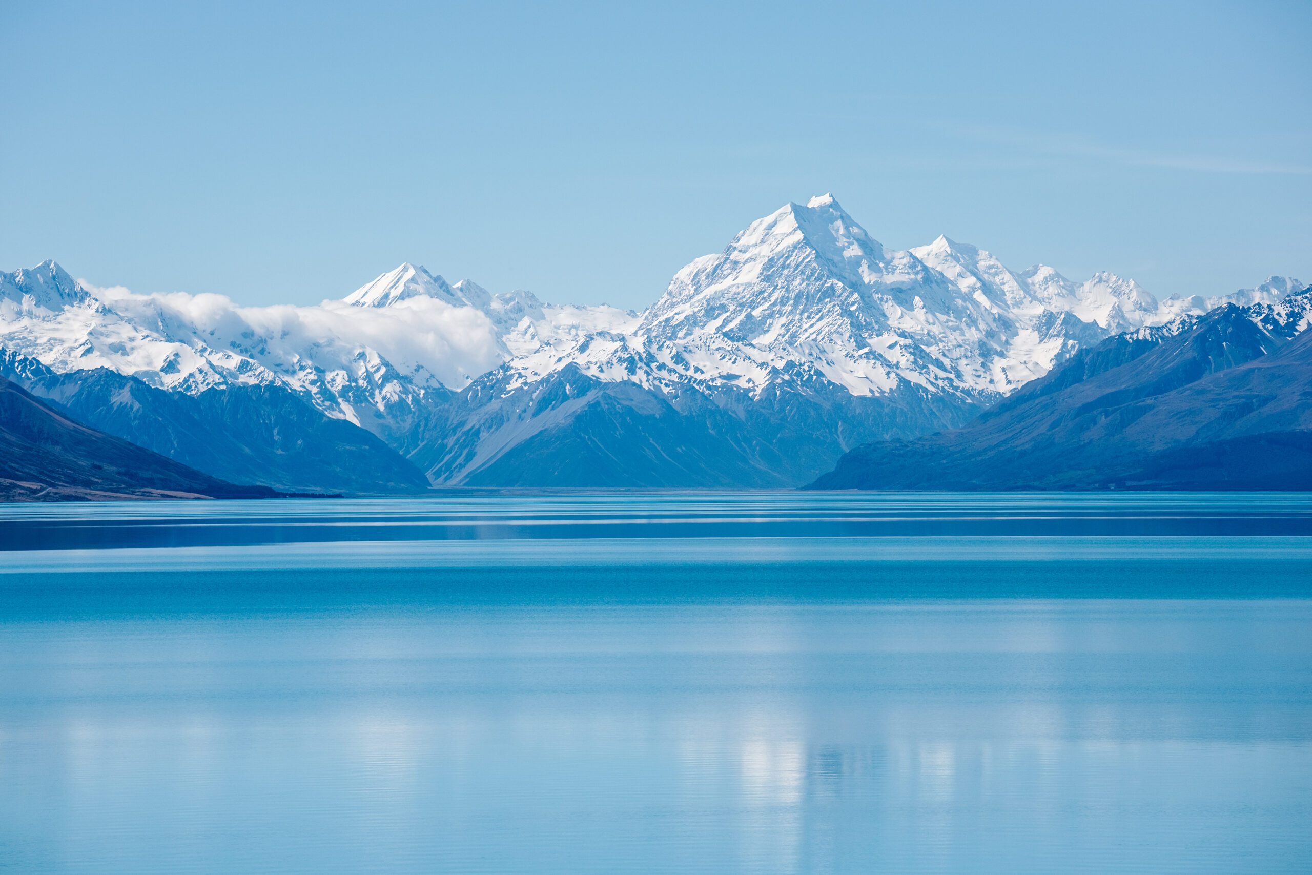
    Aoraki Mount Cook and the Southern Alps, where Hooker Valley access was restored in July 2026
    A positive access change

    Not Every Update Is a Closure.

    The new Hooker Valley suspension bridge is exactly the kind of infrastructure change a dated brief should surface—important now, but still subordinate to the evergreen Aoraki guide.

    Verification standard

    How This August 14 Brief Was Built

    Only changes with an official land-manager source or current park-operations page were included.

    Included

    • Official NPS fire, trail, campground and closure notices.
    • Parks Canada area closures, trail conditions and fire restrictions.
    • CONAF winter-access and route-status notices.
    • New Zealand DOC track and infrastructure updates.
    • Changes that materially affect access, route choice, safety or logistics.

    Not included

    • Generic “best hikes” lists.
    • Unverified social-media reports.
    • Detailed route beta belonging in evergreen guides.
    • Lodging, permit or itinerary sections copied from the evergreen hubs.
    • Speculation about reopening dates not published by the land manager.
    Archive rule: keep this article indexed as a dated August 14, 2026 record. Correct factual errors if an official agency revises a notice, but do not continually roll the date forward.
    Quick questions

    Frequently Asked Questions

    Short answers for readers arriving after the original weekend.

    Is this an evergreen hiking guide?

    No. It is a dated August 14, 2026 brief. Best Hiking Regions in the World remains the evergreen owner.

    What is the biggest U.S. hiking change for this weekend?

    Mount Rainier’s Sunrise and White River closures and the North Cascades fire closures are the most consequential Pacific Northwest changes.

    Is the O Circuit in Torres del Paine open in August 2026?

    No. CONAF lists the Macizo Paine / O Circuit as closed through October 31, 2026 unless it announces a modification.

    Is the Hooker Valley Track open in August 2026?

    Yes. DOC says the new 189-metre second suspension bridge opened July 28, restoring the route through to Hooker Lake. Winter ice and cold still require preparation.

    Evergreen planning lives elsewhere

    Use the Brief for This Weekend. Use the Hubs for the Trip.

    When the immediate fire, wildlife or winter-access question is resolved, return to the regional hiking system for long-term route comparison and planning.

    Was this helpful?

    Yes
    No
    Thanks for your feedback!
  • K2 Expedition Update 2026: The Savage Mountain, the Bottleneck & the Commercial Era

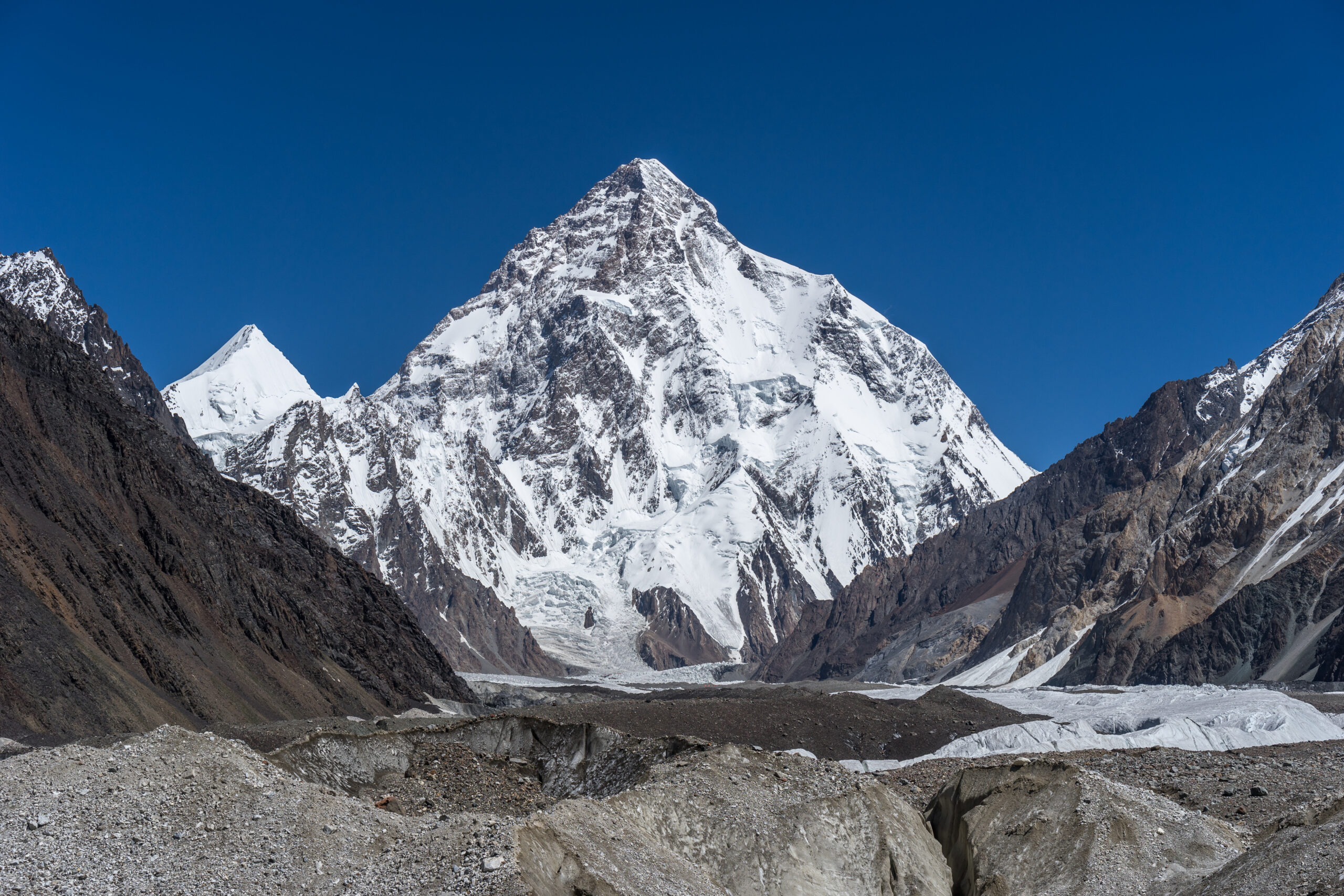
    K2, the Savage Mountain, the world's second-highest peak, rising in the Karakoram
    8,611 m (28,251 ft) · Karakoram · Pakistan-China border

    K2: the Savage Mountain, now in the commercial era

    The world’s second-highest peak is far harder and deadlier than Everest, with no easy route and the infamous Bottleneck serac hanging over every summit day. Its historic fatality rate of roughly one in four earned its name; a commercial surge since 2021 has cut the modern rate, but not the hazard. This update covers the route, the numbers, and the ethics. Heights in metres (feet).

    Research-based updateSafety and medical reviewLive status on the season trackerOur team has not climbed K2

    Updated 27 July 2026 · Compiled by Travis Ludlow · Safety review by Dawson Ludlow · Medical review by Taylor Ludlow, RN

    8,611 mSummit (28,251 ft)
    2ndHighest on Earth
    ~1 in 4Historic death-to-summit
    ~9-13%Modern-era rate
    2021First winter ascent
    Jun-AugSeason

    Single-mountain expedition update, compiled from published expedition records, fatality datasets, operator information, and current-season reporting. Our team has not climbed K2; the only first-hand summit anyone on our team claims is Kilimanjaro. This is a planning briefing for experienced climbers, not a how-to and not a substitute for a licensed operator. For live season status, see our K2 tracker.

    The mountaineer’s mountain, and it is not Everest.

    K2 is steeper, more technical, and far more dangerous than the world’s highest peak, with no easy line and no infrastructure. Its historic death-to-summit ratio, around one in four, earned it the name the Savage Mountain. Commercial expeditions since 2021 have put record numbers on top and cut the modern rate to roughly 9 to 13 percent, but the Bottleneck serac still hangs over every summit, and above 7,000 m there is no rescue.

    • Second-highest, and the hardest 8000er to climb.
    • Standard route: the Abruzzi Spur.
    • The Bottleneck serac is the defining hazard.
    • Last 8000er climbed in winter, in 2021.
    • Commercial, crowded, and ethically contested.
    The mountain

    What K2 involves

    The hardest of the eight-thousanders: a sustained technical climb at extreme altitude, with a killer serac above the final slopes.

    K2 rises to 8,611 m in the Karakoram, on the Pakistan-China border, the second-highest mountain on Earth and, by common agreement, the hardest of the fourteen 8000ers. It is reached by a week-long trek up the Baltoro Glacier, past the Trango Towers to Concordia, which filters out most aspirants before the climbing even begins. There is no teahouse infrastructure and no easy route: the standard Abruzzi Spur is a serious technical climb from bottom to top.

    The mountain’s signature hazard is the Bottleneck, a couloir at about 8,200 m overhung by a huge, unstable serac, where the 2008 disaster killed eleven climbers. Teams try to pass it before dawn and before the day warms. Above 7,000 m there is effectively no rescue, so a climber must be able to descend under their own power. For the full route, permit, and cost detail, see our K2 climb guide.

    The current story

    The commercial era, and its ethics

    K2 has changed more in the last few years than in the previous fifty, and not everyone agrees it is for the better.

    For most of its history K2 was the preserve of small, elite teams, and it stayed deadly: its fatality rate ran around 23 to 25 percent, roughly one death for every four summits. Since about 2021, that has shifted. Operators now fix ropes along the whole Abruzzi Spur and support clients with strong Sherpa teams and supplemental oxygen, mirroring the model that transformed Everest. Record numbers have reached the top, and the modern cumulative death rate has fallen to roughly 9 to 13 percent. Our K2 death-rate analysis breaks down how those figures are built.

    That safety gain has come with hard questions. Crowds now compress through the Bottleneck in the few good windows, recreating the traffic-jam hazard seen on Everest, beneath a serac no amount of support can control. High camps accumulate waste. And the ethics came to a head in 2023, when a porter died in the Bottleneck as other climbers continued past him to the summit, a moment that forced the community to confront what the commercial era asks of the people who make it possible. Lower numbers do not mean K2 has become safe, or simple.

    Live status lives on the tracker

    Conditions, fixing progress, and summit windows change day to day. We keep the real-time picture on our K2 season tracker rather than on this evergreen page, so check there for the current season.

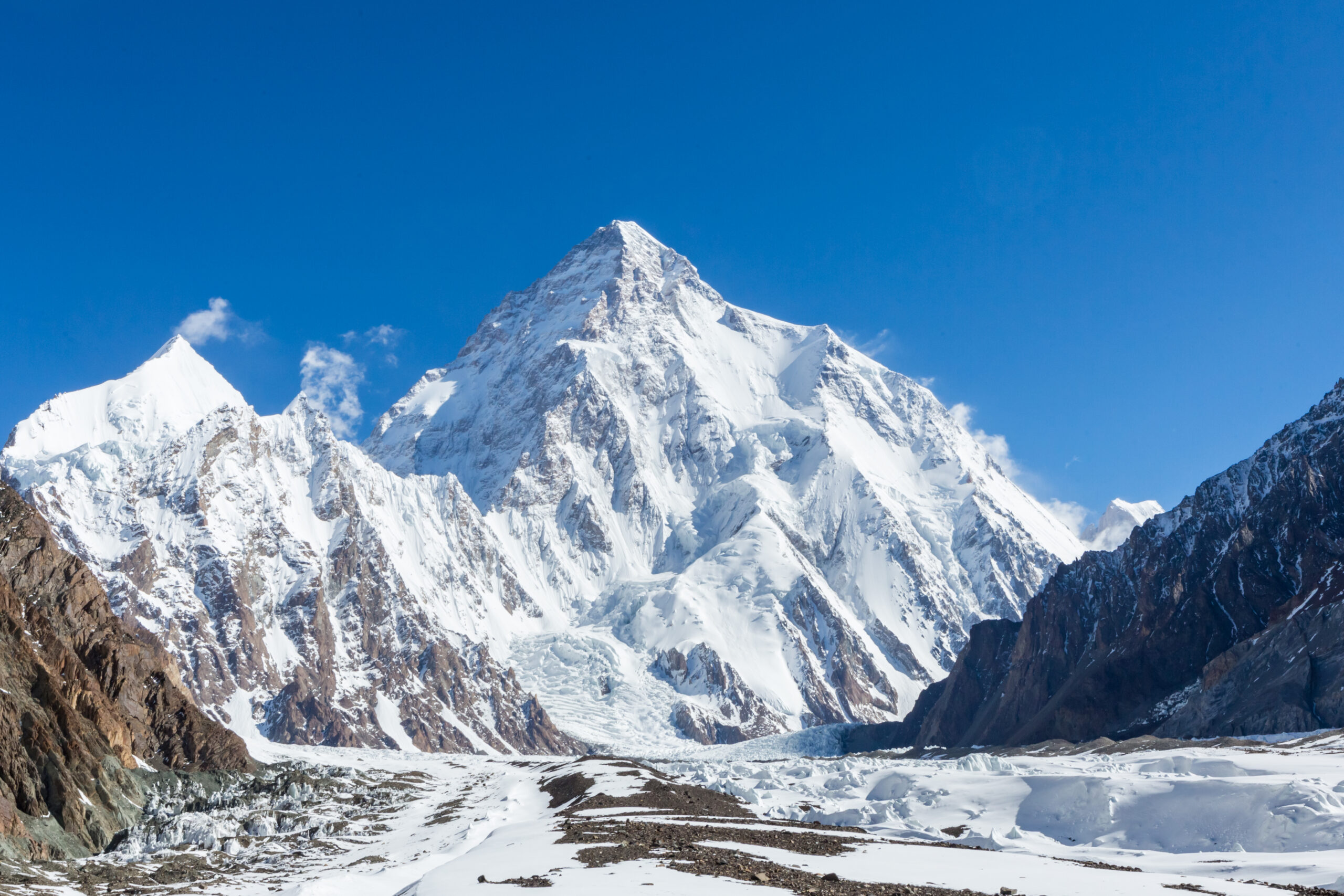
    A wide panorama of K2 and the Karakoram giants

    A savage mountain that tries to kill you

    The name is not marketing. It comes from a climber who nearly died in a six-man fall in 1953, and the mountain has honored it ever since. Steeper than Everest, battered by Karakoram storms, and crowned by a hanging serac, K2 remains, even in the commercial era, one of the most serious objectives in mountaineering.

    Honest self-assessment

    Are you ready for K2?

    Commercial support does not lower the bar as far as people think. K2 is an expert’s mountain, and the prerequisites are real.

    Elite technical skill

    Steep Rock And Ice

    K2 demands expert mixed climbing. House’s Chimney and the Black Pyramid turn back anyone who is not fluent on steep, exposed ground.

    Evidence: prior hard technical alpine routes.
    8000er experience

    Not A First Big Peak

    This is not where you learn altitude. Operators expect prior 8,000-metre experience and proven performance in the death zone.

    Evidence: a prior 8000er summit.
    Self-sufficiency

    No Rescue Up High

    Above 7,000 m there is effectively no rescue. You must be able to care for yourself and descend under your own power.

    Evidence: self-reliance at extreme altitude.
    Serac and crowd judgment

    Time The Bottleneck

    Passing the Bottleneck fast and early, and avoiding traffic beneath the serac, is a decision that saves lives.

    Evidence: sound calls under objective hazard.
    RequirementBaselineWhy it matters
    Technical gradeFluent on steep rock, ice and mixedThe Abruzzi is a sustained technical climb, not a plod.
    Altitude recordPrior 8000er experienceThe death zone here is unforgiving of a first-timer.
    Self-sufficiencyAble to descend unaidedNo helicopter rescue reaches the upper mountain.
    Rope skillsFluent on fixed linesEven supported ascents move fast on fixed ropes throughout.
    Hazard judgmentDisciplined on the BottleneckTiming and traffic under the serac are life-or-death.
    FitnessStrong for a long Karakoram tripThe Baltoro trek and the climb are a cumulative test.

    Build the essentials first with fixed lines and jumars and the acclimatization guide, and read the risk honestly in the K2 death-rate analysis.

    The routes

    The Abruzzi Spur and the Cesen

    Two serious lines converge on the same crux. Neither is a walk, and both end at the Bottleneck.

    The standard line

    Abruzzi Spur – the Southeast Ridge

    The 1954 first-ascent route and the line taken by more than three-quarters of climbers, on the Pakistani side. It is a serious, sustained technical climb with named obstacles, House’s Chimney and the Black Pyramid, leading to the shoulder and the Bottleneck beneath the summit serac.

    • House’s Chimney and the Black Pyramid
    • The shoulder, then the Bottleneck couloir
    • Fixed and stocked by commercial teams
    • Technical throughout; no easy ground
    Best fit: expert alpinists with prior 8000er experience.
    The other line

    The Cesen Route

    The Cesen, or SSE spur, is the main alternative to the Abruzzi, joining the standard line higher up. It is sometimes used to avoid particular hazards on the lower Abruzzi, but it is no less serious, and it converges on the same Bottleneck crux below the summit.

    • A steeper alternative lower down
    • Joins the Abruzzi high on the mountain
    • Used to manage specific hazards
    • Still an expert, committing line
    Best fit: experienced teams choosing by conditions.
    FactorAbruzzi SpurCesen Route
    AspectSoutheast ridge, Pakistani sideSouth-southeast spur
    RoleThe standard route, 1954 first ascentThe main alternative
    Key featuresHouse’s Chimney, Black PyramidSteeper lower spur; joins high
    CruxThe Bottleneck seracThe Bottleneck serac
    Who it suitsMost expert teamsExperienced teams, by conditions

    The K2 climb guide covers the Abruzzi camps, permit, and gear in full.

    Route profile

    The Abruzzi Spur, base to summit

    An overview of the standard route, from Skardu to the summit. For the full detail, see the climb guide.

    Gateway

    Skardu

    The Gilgit-Baltistan town where the road ends and the trek is staged.

    The approach

    Baltoro Glacier trek

    About a week up the glacier, past the Trango Towers to Concordia.

    Base Camp ~5,150 m

    Below The Spur

    The expedition base at the foot of the Abruzzi Spur.

    House’s Chimney

    ~6,600 m

    A famous steep crack, one of the first hard obstacles on the route.

    The Black Pyramid

    ~7,000 m

    A long, exposed section of steep rock and mixed ground.

    The Shoulder ~7,900 m

    High Camp

    The launch point for the summit push toward the Bottleneck.

    The Bottleneck ~8,200 m

    Under The Serac

    The crux and the killer: a couloir beneath a huge hanging serac.

    Summit ~8,611 m

    The Second-Highest

    Above the Bottleneck and the traverse lies the summit of K2.

    The Bottleneck decides the day

    Everything on summit day is arranged around passing the Bottleneck fast and early, while the serac is coldest and the couloir least crowded. It is the single feature that most shapes how, and whether, a team reaches the top and returns.

    How a trip runs

    A K2 expedition timeline

    A K2 expedition runs the better part of two months, most of it trekking, acclimatizing, and waiting for a narrow summit window.

    1

    Fly to Islamabad and Skardu

    Reach Pakistan and travel to Skardu, the gateway to the Karakoram.

    2

    Trek up the Baltoro

    Walk about a week up the glacier past the Trango Towers to Concordia and base camp.

    3

    Establish base camp

    Set up below the Abruzzi Spur at around 5,150 m and organize the climb.

    4

    Acclimatization rotations

    Climb to the high camps and back to build acclimatization over weeks.

    5

    Fix and stock the route

    Fixed ropes go in along the spur, and camps are stocked toward the shoulder.

    6

    Wait for a window

    Rest at base and watch for one of the few safe summit windows.

    7

    Summit push

    Move to the shoulder, pass the Bottleneck before dawn, and climb to the top.

    8

    Descend and trek out

    Reverse the spur and the Baltoro back to Skardu.

    Money and access

    Cost and access

    K2 is a premium 8000er, priced for fixed ropes, oxygen, Sherpa support, and a long Karakoram approach.

    ComponentFigureNote
    Guided expeditionPremium 8000er pricingCostly: fixed ropes, Sherpa support, oxygen, and Karakoram logistics.
    Pakistan permitGilgit-Baltistan feesA climbing permit and liaison requirements apply on the Pakistani side.
    Baltoro logisticsPorters and the trekA week-long glacier approach adds porters, food, and time.
    Oxygen and supportUsually includedMost commercial ascents use oxygen and a high climbing-Sherpa ratio.
    InsuranceHigh-altitude, remoteCover for a peak with no realistic high-altitude rescue.

    The Baltoro is part of the climb

    The week-long trek up the Baltoro Glacier from Skardu, past the Trango Towers to Concordia and base camp, is one of the great mountain approaches on Earth, and a real filter. It adds porters, time, and cost, but it also builds acclimatization and commitment before the Abruzzi even begins.

    Choosing a team

    Choosing a K2 operator

    On K2 the operator’s track record, screening, and ethics matter as much as the price. These are the questions that separate them.

    K2 track record

    Proven On This Peak

    Ask how many times the operator has fixed and summited K2 itself.

    Bottleneck plan

    Timing And Traffic

    How they schedule the summit push to pass the serac early and clear.

    Client screening

    Vetted, Experienced

    Serious teams require prior 8000er experience, not just a deposit.

    Ratio and oxygen

    Support That Matches

    Climbing-Sherpa ratio and oxygen plan for the summit day.

    Ethics

    People Over Summits

    How the team treats porters and handles emergencies on the route.

    Live status

    Current Season

    For the real-time picture, pair the operator with the season tracker.

    Compare the field in our K2 operators comparison, pair it with the season tracker, and see the wider vetting in how to choose an operator.

    A rescue helicopter, a reminder that no aircraft can reach K2's upper mountain

    Above the shoulder, there is no rescue

    Helicopters cannot operate under rescue load near the top of K2, and the Bottleneck sits at 8,200 m. A climber in trouble high on the mountain is, in practice, on their own or dependent on exhausted teammates. Self-sufficiency is not a virtue here. It is the entire premise of the climb.

    The numbers

    The death rate, honestly

    K2’s statistics tell two stories at once: a mountain made safer by support, and a hazard that has not changed at all.

    FigureWhat it isHow to read it
    Historic ~25%One death per four summitsThe record that earned the Savage Mountain name.
    Modern ~9-13%Commercial-era averageLower, but the objective hazard is unchanged.
    The Bottleneck seracHangs over every summitUncontrollable by skill or support; pass it fast and early.
    No high rescueAbove 7,000 m, on your ownHelicopters cannot reach the upper mountain under load.

    Our K2 death-rate analysis sets out the historic and modern numbers, and why the fall in the rate does not mean the mountain is safe.

    Timing and place

    Season and location

    K2 is a summer-only climb with only a few safe windows a year. For live conditions, we point to the season tracker, not a static forecast.

    The season is roughly June to August, and each year offers only a handful of settled summit windows. Because those windows, the fixing progress, and conditions shift constantly, the honest place for real-time weather and status is our K2 season tracker, which we keep current through the season rather than freezing a forecast onto this page.

    K2, in the Karakoram on the Pakistan-China border, reached by the Baltoro Glacier from Skardu. Map: OpenStreetMap contributors.
    History

    A short history of K2

    From an Italian first ascent to the last great winter prize in the Himalaya and Karakoram.

    K2 was first climbed in 1954 by an Italian expedition led by Ardito Desio, with Achille Compagnoni and Lino Lacedelli reaching the summit by the Abruzzi Spur and returning with severe frostbite. The spur itself carries the name of the Duke of the Abruzzi, who reconnoitered it in 1909. A second ascent did not follow until 1977, a measure of how hard the mountain resisted.

    For decades one prize remained: a winter ascent. K2 turned back every winter attempt for over thirty years, and it was the last of the fourteen 8000ers left unclimbed in the cold season. On 16 January 2021, an all-Nepali team reached the summit together in winter, singing their national anthem on top, and closed one of mountaineering’s last great chapters. The commercial transformation of the peak followed in the same few years.

    Questions

    K2 FAQ

    The questions climbers ask most about the difficulty, the danger, the commercial era, and the season.

    How high is K2, and where is it?

    K2 is 8,611 m (28,251 ft), the second-highest mountain on Earth after Everest. It stands in the Karakoram range on the Pakistan-China border, in Gilgit-Baltistan, and is reached by a multi-day trek up the Baltoro Glacier. Its name comes from a nineteenth-century survey; it has no widely used local name, though Chogori is sometimes cited.

    Why is K2 called the Savage Mountain, and is it harder than Everest?

    Yes, far harder. K2 is steeper, more technical, and more exposed to objective hazard than Everest, with no easy route and no teahouse infrastructure. The nickname dates to 1953, when the American climber George Bell said it was a savage mountain that tries to kill you. Its historic fatality rate, roughly one death for every four summits, earned the name; Everest’s is a fraction of that.

    How dangerous is K2 now?

    Its historic fatality rate ran around 23 to 25 percent, but a surge of commercial, fixed-rope, oxygen-supported ascents since 2021 has pulled the modern cumulative rate down to roughly 9 to 13 percent. That does not make it safe. The objective hazards are unchanged, above all the hanging serac over the Bottleneck, and above 7,000 m there is effectively no rescue. Our K2 death-rate analysis breaks the numbers down.

    What is the Bottleneck?

    The Bottleneck is a narrow, steep couloir at about 8,200 m, roughly 400 m below the summit, overhung by a huge unstable serac. It is the most dangerous place on the mountain and the site of the 2008 disaster that killed eleven climbers. Teams try to pass it in the dark, before the day warms, and crowding there in busy seasons has become a serious concern.

    What is the standard route?

    The Abruzzi Spur, the southeast ridge on the Pakistani side, is the standard route and the 1954 first-ascent line, taken by more than three-quarters of climbers. It is a serious technical climb, with named obstacles including House’s Chimney and the Black Pyramid, before the Bottleneck high on the mountain. The Cesen route is the other main line. Neither is a walk.

    When was K2 first climbed, and first climbed in winter?

    The first ascent was in 1954 by an Italian expedition led by Ardito Desio, with Achille Compagnoni and Lino Lacedelli reaching the summit by the Abruzzi Spur. K2 was the last of the fourteen 8000ers to be climbed in winter: an all-Nepali team summited on 16 January 2021, sixty-seven years after the first ascent, in one of mountaineering’s last great firsts.

    Has K2 really been commercialized?

    Yes, and it is contested. Since around 2021, operators have fixed ropes along the whole Abruzzi Spur and supported clients with Sherpa teams and oxygen, mirroring Everest. That has cut the death rate and put record numbers on top, but it has also brought crowding in the Bottleneck, waste at high camps, and hard ethical debate, sharpened by the 2023 death of a porter in the Bottleneck as others continued to the summit.

    When is the season, and is there real-time information?

    K2 is a summer-only climb, roughly June to August, with only a few safe summit windows each year. Because conditions and summit pushes change day to day, we keep live status on the K2 season tracker rather than on this evergreen page; check there for the current picture.

    What experience do you need for K2?

    K2 demands expert technical rock and ice skill, prior 8000er experience, and full self-sufficiency; it is not a first or second big mountain. Even with commercial support, climbers must move competently on steep, exposed, mixed ground at extreme altitude, with no realistic rescue high on the peak. Most who lack the skills do not get past the Black Pyramid.

    Transparency

    How we built this update

    What this page is based on, who reviewed it, and what we do not claim to know.

    Sources

    • Published expedition records and fatality datasets for K2, historic and modern.
    • Operator route, cost, and support information for the Abruzzi Spur.
    • Current-season reporting, which feeds our live K2 tracker.
    • Reporting on the commercial era, crowding, and the 2023 ethics debate.
    • Our own K2 climb guide, death-rate analysis, and operators comparison.

    Review and standards

    Compiled by Travis Ludlow and reviewed for safety by Dawson Ludlow, our Climbing and Mountaineering Lead (Wilderness First Aid), whose highest first-hand summit is Kilimanjaro. Health and medical points were reviewed by Taylor Ludlow, RN. We do not fabricate summit experience, quotes, or credentials, and we say plainly when we are reporting rather than recounting.

    What we do not claim to know

    K2 is a fast-changing, high-consequence climb, and no evergreen page can replace live status and a team’s own judgment. In particular:

    • Season conditions and summit windows change daily; see the live tracker.
    • Fatality and summit figures vary by source and are updated over time.
    • Operator offerings, ratios, and pricing shift year to year.
    • Our team has not climbed K2, so we report records and current reporting, not personal experience.
    Global Summit Guide research team

    Global Summit Guide research

    We compile mountain updates from records, datasets, and current reporting, review them for safety and medical accuracy, and refresh them each season. We are transparent about what we have and have not climbed, and K2 is a research-based briefing, paired with our live season tracker.

    About our team and standards ->
    Plan a Karakoram expedition

    Know the mountain. Respect the numbers.

    Start with the full route in our K2 climb guide, follow the season on the K2 tracker, compare teams in the operators comparison, and read the risk in the death-rate analysis. Trips stage through Islamabad and Skardu, so for flights and lodging, browse travel on Expedia.

    Disclosure: the Expedia link above is a sponsored affiliate link, and we may earn a commission at no extra cost to you. It is the only affiliate link on this page; our route, risk, and safety guidance is independent.

    Was this helpful?

    Yes
    No
    Thanks for your feedback!
  • Kilimanjaro Expedition Update 2026: Routes, Success by Days & a First-Hand Summit Take

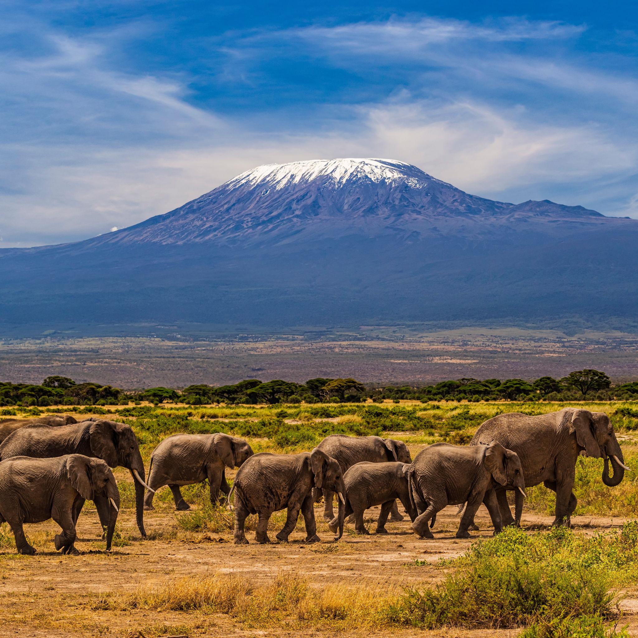
    Mount Kilimanjaro, the snow-capped roof of Africa, rising above the plains of Tanzania
    5,895 m (19,341 ft) · Tanzania · Highest in Africa

    Kilimanjaro: the roof of Africa, and the one we have climbed

    Kilimanjaro is the highest peak in Africa, the highest free-standing mountain on Earth, and one of the Seven Summits. On the standard routes it is a non-technical trek, which is exactly why it is underestimated: the challenge is altitude, not terrain. This is the one mountain in this series our own team has summited, so this update is written with first-hand experience. Heights in metres (feet).

    Written with first-hand summit experienceSafety and medical reviewReviewed each seasonFair-treatment operator guidance

    Updated 27 July 2026 · Compiled by Travis Ludlow · First-hand experience from Dawson Ludlow · Medical review by Taylor Ludlow, RN

    5,895 mUhuru Peak (19,341 ft)
    HighestIn Africa
    Seven SummitsMember
    TrekNon-technical
    AltitudeThe real challenge
    Jan-Mar / Jun-OctDry seasons

    Unlike the other mountains in this series, Kilimanjaro is one our team has climbed: Dawson Ludlow, our Climbing and Mountaineering Lead, reached Uhuru Peak. This update pairs that first-hand experience with current route, cost, and safety research. It is still a planning briefing, not a substitute for a licensed operator, but on this mountain we write from having stood on top.

    A trek, not a technical climb – and that is the trap.

    Kilimanjaro needs no ropes, crampons, or ice axe on its standard routes. That makes it approachable, and it makes people underestimate it. The real difficulty is altitude: you walk from around 1,800 m to 5,895 m in a handful of days, and thin air, not terrain, turns most people back. The levers you control are the number of days you take, a slow pace, and a good operator.

    • Highest in Africa; a Seven Summit.
    • Non-technical trek; altitude is the challenge.
    • Days on the mountain decide your summit odds.
    • Guides and porters are required; ethics matter.
    • The one peak here our team has summited.
    The mountain

    What Kilimanjaro involves

    A walk-up in name, an altitude endurance test in reality, on the highest free-standing mountain on Earth.

    Kilimanjaro rises to 5,895 m at Uhuru Peak, on the Kibo cone, standing alone above the Tanzanian plains as the highest free-standing mountain on Earth and the highest point in Africa. Its standard routes cross four worlds in a few days, from humid rainforest, through moorland and alpine desert, to the arctic cold of the summit. There is no technical climbing, which is why so many attempt it, and why so many underestimate it.

    The difficulty is the speed of the ascent. Climbing from around 1,800 m to nearly 5,900 m in a handful of days pushes the body hard, and altitude sickness is the reason most who fail turn back. Success comes down to choosing enough days to acclimatize, walking slowly, pole pole in Swahili, and going with a licensed operator whose team looks after both you and its porters. For the full routes, days, and cost, see our Kilimanjaro climb guide.

    Experience

    Our first-hand take on the climb

    This is the one mountain in this series we can write about from the summit, not only from research.

    Dawson Ludlow, our Climbing and Mountaineering Lead, reached Uhuru Peak, and that experience shapes how we describe the climb. The lasting lesson is simple: Kilimanjaro is an altitude and endurance test, not a technical one. The walking is steady and achievable for a fit trekker, but the thin air is relentless, and the mountain rewards patience over strength.

    Summit night is the part that surprises people. You leave high camp around midnight, in deep cold, and climb slowly by headlamp up long switchbacks toward the crater rim, aiming to reach Uhuru Peak near dawn. It is cold, dark, and mentally hard, and the pace feels absurdly slow, which is exactly the point. Then comes a very long descent the same day, when tired legs do most of the day’s real work. Our practical takeaways run through this page: take more days than you think you need, go slowly, layer properly for the summit, and choose an operator who will turn you around if altitude sickness sets in.

    Why this matters for trust

    Across this series we are transparent that our team has not climbed most of these peaks, and we say so plainly. Kilimanjaro is the exception. Where this update speaks about the feel of summit night or the reality of the altitude, it is grounded in having been there, alongside current research reviewed for safety and medical accuracy.

    The glaciated summit of Kilimanjaro, the roof of Africa, above the clouds

    The roof of Africa, above the clouds

    From the plains, Kilimanjaro rises nearly five kilometres in a single sweep, its glaciated summit floating above the tropics. Standing on Uhuru Peak at dawn, with the ice fields catching the first light and the shadow of the mountain thrown across Tanzania, is one of the great rewards in trekking, and one worth earning honestly, with the days and the patience the altitude demands.

    Honest self-assessment

    Are you ready for Kilimanjaro?

    You do not need technical skills. You need fitness, respect for altitude, enough days, and the right team.

    Endurance, not technique

    Long Days On Foot

    Kilimanjaro asks for walking fitness and stamina over many days, not ropes or ice skills. Build a base of long hikes with a pack.

    Evidence: comfortable multi-day trekking.
    Altitude tolerance

    Respect The Thin Air

    The mountain is won or lost on acclimatization. Choose enough days, climb slowly, and know the signs of altitude sickness.

    Evidence: prior time at altitude helps.
    Enough days

    Time Buys Success

    Do not rush it. Seven or eight days on the mountain far outperforms a five-day dash for summit odds.

    Evidence: a route with real acclimatization.
    The right operator

    Ethics And Safety

    Your operator sets your safety, your acclimatization plan, and how the porters are treated. Choose on quality, not price.

    Evidence: a fair-treatment, well-reviewed team.
    RequirementBaselineWhy it matters
    FitnessComfortable on long back-to-back hiking daysThe climb is a multi-day walk at altitude, not a sprint.
    Days on the mountainSeven or eight, not fiveMore days means better acclimatization and higher success.
    PaceSlow and steady, pole poleGoing slowly is the proven way to acclimatize and summit.
    Altitude awarenessKnow the signs of AMSRecognizing and acting on altitude sickness keeps it safe.
    OperatorLicensed, fair-treatment, well-reviewedSafety, acclimatization and porter welfare all ride on this.
    KitProper cold-weather layers for summit nightSummit night is bitterly cold despite the equatorial setting.

    The one thing worth studying before you go is altitude: our acclimatization guide explains why days and pace, more than fitness alone, decide your summit.

    The routes

    The routes, and why days matter more

    The route matters, but the number of days on the mountain matters more for your summit chances.

    The popular camping routes

    Machame, Lemosho and the Northern Circuit

    The most rewarding way up for most climbers. Machame and Lemosho are scenic camping routes with good acclimatization profiles, and the Northern Circuit is the longest, with among the highest success rates. More days on these routes means better acclimatization and a stronger summit chance.

    • Camping routes with strong acclimatization
    • Seven to nine days; higher success
    • Scenic, varied, and well-supported
    • The best odds for most trekkers
    Best fit: most climbers who want the highest summit chance.
    The hut route and the shortcuts

    Marangu, Rongai and Umbwe

    Marangu, the hut route, is often sold as a cheaper, shorter climb, but its short profile gives lower success. Rongai approaches from the drier north. Umbwe is steep and direct, for strong, experienced trekkers. None of the short options acclimatizes as well as a longer camping route.

    • Marangu: huts, but often too short
    • Rongai: drier northern approach
    • Umbwe: steep and demanding
    • Shorter profiles mean lower success
    Best fit: specific needs, but usually not the best odds.
    RouteStyle and daysNotes
    LemoshoCamping, 7 to 9 daysScenic, high success, gradual acclimatization.
    MachameCamping, 6 to 7 daysPopular and rewarding; climb-high, sleep-low profile.
    Northern CircuitCamping, 8 to 9 daysLongest route; among the highest success rates.
    RongaiCamping, 6 to 7 daysDrier northern approach; quieter trail.
    MaranguHuts, 5 to 6 daysOften too short; lower success despite the huts.

    The Kilimanjaro climb guide covers each route, day by day, in full.

    The journey

    From rainforest to the roof of Africa

    An overview of the climb through Kilimanjaro’s ecological zones, up to the summit and back. For the full detail, see the climb guide.

    Gateway

    Moshi / Arusha

    The towns below the mountain, reached via Kilimanjaro International Airport.

    Rainforest

    Lower Slopes

    Days one and two climb through lush, humid montane forest.

    Moorland

    Heather And Giant Plants

    The trail rises into open moorland with Kilimanjaro’s strange flora.

    Alpine desert

    High And Barren

    A cold, dry, high-altitude zone leads toward the high camps.

    High camp

    Barafu / Kibo ~4,600 m

    The launch point for the midnight summit push.

    Summit night

    Midnight Start

    A cold, dark, slow climb up scree and switchbacks to the crater rim.

    Uhuru Peak ~5,895 m

    The Roof Of Africa

    The highest point in Africa, usually reached around dawn.

    Descent

    Down And Off

    A long descent the same day, then out through the forest.

    Summit night is the crux

    The midnight start from high camp to Uhuru Peak is the hardest part of the whole climb: cold, dark, and slow, at the thinnest air of the trip. Pace, warmth, and a steady head carry you through it far more than raw fitness.

    How a trip runs

    A Kilimanjaro trek timeline

    A strong itinerary runs seven or eight days on the mountain, with the extra days spent acclimatizing rather than resting at home.

    1

    Arrive in Moshi or Arusha

    Fly into Kilimanjaro International Airport, meet the team, and check gear.

    2

    Into the rainforest

    Start the chosen route, climbing through humid montane forest.

    3

    Through the moorland

    Gain height into open moorland, walking slowly to acclimatize.

    4

    Acclimatization day

    On longer routes, climb high and sleep low to prepare the body.

    5

    Into the alpine desert

    Cross the cold, barren high slopes toward the summit base camp.

    6

    Summit night

    Start near midnight and climb in the cold to reach Uhuru Peak by dawn.

    7

    Descend to a lower camp

    Come off the summit and descend far the same day to recover.

    8

    Exit and celebrate

    Walk out through the forest and return to Moshi.

    Money and ethics

    Cost, and the ethics of porters

    On Kilimanjaro, price and ethics are linked: the cheapest climbs are usually cheap because someone on the mountain is being underpaid.

    ComponentFigureNote
    Reputable climbA few thousand dollars upSet by route, days, group size, and operator quality.
    Park feesSteep and includedKilimanjaro National Park fees are a large part of any fair price.
    Guides and portersMandatory teamPark rules require a licensed operator with a guide and porters.
    Porter welfareA real cost, and a dutyFair pay, loads, food and gear for porters must be built into the price.
    Beware the cheapestA false economyRock-bottom prices usually mean cut corners on safety and porters.

    Climb on the backs of well-treated porters

    Every Kilimanjaro climb relies on a team of porters carrying loads for modest pay. Fair wages, sensible load limits, proper food, shelter, and gear are the mark of a responsible operator, and the aim of fair-treatment efforts like the Kilimanjaro Porters Assistance Project. Choosing such an operator is part of climbing the mountain well, and it usually signals a safer trip for you too.

    Choosing a team

    Choosing a Kilimanjaro operator

    The operator decides your acclimatization plan, your safety on summit night, and how the porters are treated. Choose on quality.

    Fair treatment

    Porters First

    Ask if the operator follows recognized fair-treatment standards for porters.

    Days on the mountain

    Enough To Acclimatize

    A good operator recommends seven or eight days, not the shortest option.

    Guide ratio and medics

    Support On Summit Night

    Ask about guide-to-client ratio, oxygen, and pulse-oximeter checks.

    Safety record

    Turnaround Culture

    The best operators turn people around when altitude sickness appears.

    Group size

    Not A Crowd

    Very large groups move slowly and impersonally; ask how big yours is.

    Reviews and transparency

    Real Track Record

    Look for detailed, verifiable reviews rather than only a low price.

    Compare the field in our Kilimanjaro operators comparison, and see the wider vetting in how to choose an expedition operator.

    A rescue helicopter, a reminder that descent is the treatment for altitude

    The cure for altitude is down

    Kilimanjaro’s danger is not a fall but the thin air. The treatment for serious altitude sickness is immediate descent, which is why a good guide watches for the signs and is willing to turn a client around. Respect the symptoms, tell your guide the truth about how you feel, and never push a headache higher.

    The numbers

    Altitude and success, honestly

    Kilimanjaro’s risks and its success rate come down to the same thing: how well you manage the altitude.

    FactorWhat it isHow to treat it
    Altitude sicknessThe real dangerAMS is common; serious forms are rare but can be fatal if ignored.
    Summit night coldBitter despite the equatorDeep cold and wind on the summit push; layers and pace matter.
    Rushed itinerariesThe success killerToo few days is the most common reason climbers fail to summit.
    Descent fatigueLong day downThe summit day is huge; most stumbles happen tired, descending.
    Timing

    Season and weather

    Kilimanjaro is best in its two dry seasons, when skies are clear and the trails are firm.

    Jan to early Mar

    Prime, Warmer

    Clear, warmer, and popular; excellent summit views.

    Jun to Oct

    Prime, Drier

    The long dry season, cooler and very reliable.

    Apr-May

    Long Rains

    Muddy trails and cloud; best avoided by most climbers.

    November

    Short Rains

    Wetter and quieter; a gamble on the weather.

    Summit cold

    Below Freezing

    Summit night is bitterly cold in any season.

    Live wind and weather for Kilimanjaro. Source: Windy.com. For how to read a mountain forecast, see our weather guide.
    Kilimanjaro, in northern Tanzania near Moshi, with Uhuru Peak on the Kibo cone. Map: OpenStreetMap contributors.
    A changing mountain

    The vanishing glaciers

    The ice that crowns Kilimanjaro is one of its defining sights, and it is disappearing.

    Kilimanjaro’s summit glaciers and ice fields have shrunk sharply over the past century, and scientists expect them to largely disappear within the coming decades. For a climber today, the ice near Uhuru Peak is a striking and slightly melancholy sight, a feature that earlier generations of climbers knew as far more extensive. It is a reminder that even the roof of Africa is changing, and a reason many people want to see it while it lasts.

    History

    A short history of Kilimanjaro

    From an 1889 first ascent to Freedom Peak and a place among the Seven Summits.

    The first recorded ascent of Kibo, Kilimanjaro’s highest cone, was made in 1889 by the German geographer Hans Meyer and the Austrian climber Ludwig Purtscheller, guided by the local Yohani Kinyala Lauwo. The highest point was later named Uhuru Peak, uhuru meaning freedom in Swahili, marking Tanzanian independence, and it has stood ever since as a symbol as much as a summit.

    In the modern era Kilimanjaro became the African member of the Seven Summits, the highest peak on each continent, and one of the most sought-after treks in the world. Tens of thousands of people now attempt it each year. Its accessibility is a gift and a risk: it welcomes ordinary trekkers to a genuine high-altitude experience, and it punishes those who treat 5,895 m as a casual walk.

    Questions

    Kilimanjaro FAQ

    The questions climbers ask most about the difficulty, the routes, the ethics, and the season.

    How high is Kilimanjaro, and where is it?

    Kilimanjaro reaches 5,895 m (19,341 ft) at Uhuru Peak, on the Kibo cone, the highest point in Africa and the highest free-standing mountain on Earth. It stands in Kilimanjaro National Park in northern Tanzania, near the town of Moshi, and is one of the Seven Summits, the highest peak on each continent.

    Is Kilimanjaro a technical climb?

    No. On the standard routes it is a high-altitude trek, with no ropes, crampons, or ice axe required. That is exactly why it is underestimated: the difficulty is not technical but the altitude. You walk from around 1,800 m to 5,895 m in a matter of days, and altitude, not terrain, is what turns most people back.

    How hard is it, really?

    Hard in a specific way. The walking is within reach of a fit, determined trekker, but the thin air is relentless: headaches, nausea, and exhaustion are common, and altitude sickness can become dangerous. Summit night, a midnight start in deep cold to reach the crater rim by dawn, is the crux. Our Climbing Lead, Dawson Ludlow, who reached Uhuru Peak, describes it as an endurance and altitude test, not a climb in the technical sense.

    Which route should I choose, and how many days?

    Days matter more than the route. Longer itineraries acclimatize you better and raise your summit chances, so a seven or eight-day route beats a rushed five-day one. Machame and Lemosho are popular, scenic camping routes with good acclimatization; the Northern Circuit is the longest and has among the highest success rates; Marangu, the hut route, is often short and has lower success. Rongai approaches from the drier north.

    What is the summit success rate?

    It varies widely by route and days. Rushed five-day trips can see roughly half the group summit, while well-run seven and eight-day itineraries commonly reach 85 to 95 percent. The single biggest lever you control is choosing enough days to acclimatize, followed by a steady, slow pace, pole pole in Swahili.

    Do I have to use a guide and porters?

    Yes. Park rules require every climber to go with a licensed operator, with guides and a porter team. That makes the ethics of porter treatment a real choice: fair pay, reasonable loads, proper food and shelter, and gear. Choosing an operator that follows fair-treatment standards, such as those promoted by the Kilimanjaro Porters Assistance Project, is part of climbing the mountain responsibly.

    When is the best time to climb?

    The two dry seasons: January to early March, and June to October. These bring the most stable weather and the clearest summit views. The long rains of April and May and the short rains of November are best avoided, as trails turn to mud and clouds hide the mountain.

    Are Kilimanjaro’s glaciers really disappearing?

    Yes. The famous ice fields on the summit have shrunk sharply over the last century and are projected to vanish within the coming decades. They are a striking, and sobering, feature for climbers today, and a visible sign of a changing climate on the roof of Africa.

    How much does it cost, and where do trips start?

    A reputable, fair-treatment climb usually runs from a few thousand dollars upward, depending on route, days, and operator, with steep park fees included. Beware of the cheapest offers, which often cut corners on safety and porter welfare. Trips stage through Moshi or Arusha, reached via Kilimanjaro International Airport.

    Transparency

    How we built this update

    What this page is based on, who wrote and reviewed it, and what we do and do not claim.

    Sources and experience

    • First-hand summit experience from our Climbing Lead, Dawson Ludlow, who reached Uhuru Peak.
    • Operator route, days, and pricing information, and park-fee schedules.
    • Published success-rate data by route and itinerary length.
    • Porter-welfare standards, including the Kilimanjaro Porters Assistance Project.
    • Our own Kilimanjaro climb guide and operators comparison.

    Review and standards

    Compiled by Travis Ludlow, with first-hand input from Dawson Ludlow, our Climbing and Mountaineering Lead (Wilderness First Aid), who summited Kilimanjaro. Health and medical points were reviewed by Taylor Ludlow, RN. We are transparent about experience: this is the one mountain in the series our team has climbed, and we say so plainly rather than implying first-hand knowledge we lack elsewhere.

    What we do not claim to know

    First-hand experience is not a substitute for current, personalized planning. In particular:

    • Conditions, fees, and operator offerings change; confirm current details before booking.
    • Success rates vary by operator, route, and year; treat figures as guidance.
    • Altitude affects everyone differently; medical advice should come from a doctor.
    • One summit is experience, not omniscience; we pair it with ongoing research.
    Global Summit Guide research team

    Global Summit Guide research

    We compile mountain updates from operator data, records, and, where we have it, first-hand experience, review them for safety and medical accuracy, and refresh them each season. Kilimanjaro is the mountain in this series we have climbed, and this update is written accordingly.

    About our team and standards ->
    Plan your Kilimanjaro climb

    Take the days. Choose the team. Stand on the roof of Africa.

    Start with the full routes and days in our Kilimanjaro climb guide, choose well with the operators comparison, and prepare for the altitude with our acclimatization guide. Trips stage through Moshi and Arusha, so for flights and lodging, browse travel on Expedia.

    Disclosure: the Expedia link above is a sponsored affiliate link, and we may earn a commission at no extra cost to you. It is the only affiliate link on this page; our route, ethics, and safety guidance is independent.

    Was this helpful?

    Yes
    No
    Thanks for your feedback!
  • Mount Foraker Expedition Update 2026: Denali’s Wife, Permit, Season & Routes

    Mount Foraker, the second-highest peak in the Alaska Range, rising in snow and ice near Denali
    Mount Foraker is 17,400 ft (5,304 m), the second-highest peak in the Alaska Range. Known as Denali’s Wife, it shares Denali’s access but climbs like a far more serious mountain.
    Expedition Updates · Alaska

    Mount Foraker expedition update

    Denali’s Wife, and a far wilder objective than the neighbour it stands beside. This page tracks the season, the Denali connection, why Foraker is not Denali, the routes, the shared permit, the cost, and a go or no-go checklist. A single-mountain page in our Expedition Updates directory. Heights in feet (metres).

    Current status Expert alpine 17,400 ft (5,304 m)

    Denali’s neighbour, Denali’s permit, nothing like Denali’s climb.

    Foraker sits 14 miles from Denali and shares its access, its National Park Service permit, and its May-to-June season. On paper it looks like a companion objective. On the mountain it is a different sport.

    There are no fixed camps, no ranger patrols on the route, no fixed lines, and almost no other climbers. Even the most common line, the Sultana Ridge, is a long, corniced, self-sufficient expedition, and the Infinite Spur is a world-class hard route. Foraker is for experienced alpine teams only.

    17,400 ft

    Summit (5,304 m)

    Second-highest in the Alaska Range, third-highest in the US.

    ~$450

    NPS permit

    Same permit as Denali; 60-day advance registration.

    May to Jun

    Climbing season

    Kahiltna Glacier access, with 24-hour daylight.

    Mount Foraker, called Sultana, the woman, in Dena’ina and long known as Denali’s Wife, is the great overlooked giant of the Alaska Range. It is higher than all but a couple of peaks in the United States, yet in a typical year only a handful of climbers stand on its summit, against hundreds on Denali. That gap is the whole story of the mountain. This page owns the current picture, the season, the Denali contrast, the permit, and the routes. For the full history, route detail, and gear, see our Mount Foraker climb guide.

    Season and status

    A short spring window, on Denali’s calendar.

    Foraker is climbed in spring and early summer, roughly May to early July, the same window as Denali. That is when the Kahiltna Glacier is flyable, the snowpack is workable, and the near 24-hour daylight gives long climbing days. Outside that window the ski-plane service stops and the mountain becomes far more severe. Because so few teams attempt Foraker, there is no season tracker in the sense a trade-route peak has; the status that matters is simply whether conditions and your team are ready.

    The Denali connection

    Everything up to the base of the mountain is shared.

    Foraker and Denali share their entire approach. You fly from Anchorage to Talkeetna, take a ski-equipped bush plane onto the Kahiltna Glacier at around 7,200 ft, and use the same base-camp area that Denali’s West Buttress climbers use. You register on the same National Park Service permit, on a form that literally covers Denali and Mount Foraker together, and you climb in the same season. That shared logistics chain is why Foraker is often described as Denali’s neighbour, and why climbers who have done Denali sometimes look across the Kahiltna and wonder about the bigger, quieter peak on the far side. Compare the trade-route giant in our Denali expedition update.

    Why Foraker is not Denali

    The contrast that defines the mountain.

    Here the two mountains part company completely. Denali’s West Buttress is a supported trade route: fixed camps, a wanded trail, ranger patrols and a medical camp, fixed lines on the steep sections, and, in a busy year, hundreds of other climbers. Roughly half of Denali climbers use a guide service. Foraker has none of that. There are no fixed camps, no rangers on the route, no fixed lines, and in most years only a few teams on the whole mountain. Its ridges are long, corniced, and committing, retreat is slow and serious, and there is no infrastructure to fall back on.

    The honest takeaway: sharing Denali’s permit and airstrip does not make Foraker a Denali-grade climb. It is a serious, self-sufficient alpine expedition that expects a strong background of prior technical and expedition climbing. Treat the proximity as a logistics convenience, not a difficulty comparison.

    The routes

    From the committing standard line to a legendary test-piece.

    Sultana Ridge (Southeast Ridge)

    The most frequently climbed line and the closest thing Foraker has to a standard route, though standard is relative. It is a long, corniced ridge with serious objective hazard and no infrastructure, a full self-sufficient expedition in its own right.

    Northwest Ridge

    The line of the 1934 first ascent by Charles Houston, T. Graham Brown, and Chychele Waterston. A long, remote, historically important route.

    The Infinite Spur

    On the south face, one of the most respected hard alpine routes in North America, a sustained, committing line for elite climbers. It is the route that gives Foraker its reputation among serious alpinists, and it is emphatically not an objective for a first big expedition.

    The permit and registration

    The same National Park Service system as Denali.

    Foraker uses the identical National Park Service mountaineering special-use permit as Denali. For 2026 the fee is $450 for climbers aged 25 and over and $350 for those 24 and under, and registration must be completed at least 60 days before your climb through a two-step Pay.gov process, followed by a mandatory orientation at the Talkeetna Ranger Station. You also pay the $15 park entrance fee unless you hold a pass, and you must carry a Clean Mountain Can to remove human waste from the mountain. Climbers who have summited Denali or Foraker since 1995 can register with only 7 days notice, but first-timers need the full 60 days.

    Access and cost

    No guided package, so the budget looks different.

    What a Mount Foraker expedition costs, per climber. There is no guided trade price; this is a self-organized budget.
    ItemCostNotes
    NPS mountaineering fee, age 25+$450Covers Denali and/or Mount Foraker for 2026, on the same permit.
    NPS mountaineering fee, age 24 and under$350The same permit at the younger rate.
    Park entrance$15 per personWaived with an Interagency or Denali annual pass.
    Talkeetna ski-plane to the Kahiltna$800 to $1,200+ round tripThe only way in; there is no road or trail.
    Guided packageNone, in practiceForaker is climbed by self-sufficient expert teams, not guided clients.
    The real cost is not money. Foraker is cheaper than a guided Denali climb because there is no guide to pay, but that is the point: the mountain assumes you bring the expertise a guide would otherwise provide. Build the base with our fitness standards and acclimatization guide, and go in only with a team that has the technical alpine background to be self-sufficient. Talkeetna air taxis and logistics are in our operator directory.

    Objective hazards

    Cornices, avalanche, and a long way from help.

    ⚠ A committing mountain with no safety net

    Foraker’s ridges are heavily corniced, its slopes are avalanche-prone, and its routes are long enough that a party can be days from the glacier at any point. There are no rangers on the route and no nearby teams to assist, so self-rescue is often the only option, and weather can pin a party high on the mountain for days.

    This is expert terrain. It demands fluent glacier travel and crevasse rescue, avalanche judgment, cornice awareness, and the experience to make hard turnaround calls alone. Refresh the fundamentals with our crevasse rescue basics and avalanche awareness guides. This page is educational and is not a substitute for training and experience.

    Weather and timing

    Alaska Range weather, with no camps to wait it out in comfort.

    The Alaska Range makes its own weather, and Foraker sits high enough to catch the worst of it. Storms roll in fast, summit temperatures run far below zero with severe wind chill, and a settled spell can vanish within hours. The live map below shows current conditions for the massif; rely on the NPS Denali climbing forecast and your own read for the actual go decision.

    Live wind and weather for the Mount Foraker area. Source: Windy.com. For how to read a mountain forecast, see our weather guide.
    Mount Foraker, about 14 miles southwest of Denali in the central Alaska Range. Map: OpenStreetMap contributors.

    Go or no-go checklist

    Work through these before you commit.

    Before you go

    • Have the alpine resume – prior committing, self-sufficient expeditions, not just a guided Denali.
    • Register 60 days out – the NPS permit and Talkeetna orientation are the same as Denali and the deadline is strict.
    • Build the whole team’s self-rescue – crevasse rescue, cornice and avalanche judgment, and hard turnaround discipline.
    • Plan for no help on route – assume self-rescue and days of storm; carry the margins to survive being pinned high.
    • Pick the route honestly – the Sultana Ridge is committing enough; the Infinite Spur is for elite teams only.
    • Confirm evacuation cover – rescue in the range is limited, weather-dependent, and slow.

    Mount Foraker update FAQ

    The questions climbers ask most about the permit, the Denali contrast, and the routes.

    How hard is Mount Foraker compared to Denali?

    Much harder and far more committing, despite sharing Denali’s access, permit, and season. Denali’s standard West Buttress is a guided trade route with fixed camps, ranger patrols, and a wanded trail. Foraker has none of that: no fixed camps, no ranger presence on the route, no fixed lines, and almost no other climbers. Even its most common line, the Sultana Ridge, is a long, corniced, self-sufficient alpine expedition, and the Infinite Spur on the south face is one of the hardest routes in North America. Foraker is essentially an expert-only mountain.

    Do you need a permit for Foraker?

    Yes, and it is the same National Park Service mountaineering special-use permit as Denali. For 2026 the fee is $450 for climbers aged 25 and over and $350 for those 24 and under, and the Pay.gov registration form covers Denali and Mount Foraker together. You must register at least 60 days in advance, complete a two-step process, attend a Talkeetna ranger orientation, pay the $15 park entrance unless you hold a pass, and carry a Clean Mountain Can to remove waste.

    When is the Foraker climbing season?

    Spring and early summer, roughly May to early July, the same window as Denali. That is when the Kahiltna Glacier is flyable, the snowpack is workable, and there is close to 24-hour daylight. Outside that window the glacier flights stop and conditions become far more severe.

    How do you get to Mount Foraker?

    The same way you reach Denali. You fly from Anchorage to Talkeetna, then take a ski-equipped bush plane onto the Kahiltna Glacier at around 7,200 ft, sharing the base-camp area with Denali climbers, and approach the route from there. There is no road and no trail to the mountain.

    Can you climb Foraker with a guide?

    In practice, rarely. Foraker is too committing and too low in traffic for the commercial guiding trade, so it is almost always climbed by self-organized teams of experienced alpinists rather than guided clients. This is not a mountain to attempt without a strong background of prior expedition and technical alpine climbing.

    What are the main routes on Foraker?

    The Sultana Ridge, the southeast ridge, is the most frequently climbed line and the nearest thing to a standard route, though it is still long and committing. The Northwest Ridge was the 1934 first-ascent route. The Infinite Spur on the south face is a legendary hard alpine route, one of the most respected test-pieces in North American mountaineering, and strictly for elite climbers.

    How much does a Foraker expedition cost?

    There is no guided package price, because it is a self-organized expedition. The direct costs are the $450 permit, the Talkeetna ski-plane at roughly $800 to $1,200 or more round trip, plus food, fuel, gear, and travel to Alaska. It is far cheaper than a guided Denali climb, but the real cost is the experience and self-sufficiency the mountain demands, which cannot be bought.

    How high is Foraker and where is it?

    Mount Foraker is 17,400 ft (5,304 m), the second-highest peak in the Alaska Range and the third-highest in the United States, about 14 miles southwest of Denali in Denali National Park. Its Dena’ina name, Sultana, means the woman, and it has long been known as Denali’s Wife. It was first climbed in 1934 by Charles Houston, T. Graham Brown, and Chychele Waterston.

    📋 How this update is built

    This page is compiled by Travis Ludlow, Founder and Head of Research at Global Summit Guide, from National Park Service mountaineering rules, the Denali and Foraker registration system, and published route records, with sources named below. It was reviewed for safety by Dawson Ludlow, our Climbing and Mountaineering Lead (Wilderness First Aid), whose highest first-hand summit is Kilimanjaro.

    Our team has not climbed Mount Foraker, so we report official rules and route records rather than personal experience, and we review this page before each Alaska season. Fees and rules can change, so confirm the current NPS permit and registration requirements before you plan around them.

    Planning a Foraker expedition?

    Start with our Mount Foraker climb guide, weigh it against the trade-route giant in our Denali climb guide, and confirm your evacuation cover in our mountaineering insurance guide. Every trip stages through Anchorage and Talkeetna, so for flights and lodging, browse travel on Expedia.

    Disclosure: the Expedia link above is a sponsored affiliate link. We may earn a commission at no extra cost to you.

    Was this helpful?

    Yes
    No
    Thanks for your feedback!
  • Broad Peak Expedition Update 2026: Permit, Season, the K2 Link & the False Summit

    Broad Peak, the twelfth-highest mountain in the world, rising beside K2 in the Karakoram
    Broad Peak is 8,051 m (26,414 ft), the twelfth-highest mountain on earth, right beside K2 above the Baltoro Glacier. Its long summit ridge hides a notorious false summit.
    Expedition Updates · Karakoram

    Broad Peak expedition update

    K2’s neighbour, and its classic stepping-stone. This page tracks the Karakoram summer season, the 2026 permit, the K2 connection, the false summit that catches climbers out, the cost, and a go or no-go checklist. A single-mountain page in our Expedition Updates directory. Elevations in metres (feet).

    Current status Karakoram summer 8,051 m (26,414 ft)

    The attainable 8000er next to K2, with one very sharp catch.

    Broad Peak shares K2’s approach, base-camp area, and summer season, and is more attainable than K2 on its normal route, which is why it is climbed as a K2 warm-up or as a first Karakoram 8000er. The 2026 permit is $2,500 per person, held flat by Pakistan, below K2, Everest, and even Nepal’s other 8000ers.

    The catch is the summit. Broad Peak’s rocky fore-summit fools tired climbers into thinking they have finished, while the true summit lies a further exposed traverse beyond it. Pushing on too late has been fatal. Attainable is not the same as easy.

    8,051 m

    Summit (26,414 ft)

    The twelfth-highest mountain on earth, beside K2.

    $2,500

    Summer permit

    Held flat for 2026; below K2 and Everest.

    Jun to Aug

    Karakoram season

    Summer, with July the prime window.

    Broad Peak, known locally as Falchan Kangri, stands about 8 km from K2 above the Baltoro Glacier, in the Karakoram on the Pakistan and China border. Its enormous, broad summit massif gives it its name and its central hazard, a long summit ridge with a false top. It is one of the more approachable 8000ers to reach a summit attempt on, and one of the easier to underestimate. This page owns the current picture, the season, the permit, the K2 link, and the false summit. For the full history, route detail, and gear, see our Broad Peak climb guide.

    Season and status

    A Karakoram summer peak, on K2’s calendar.

    Broad Peak is climbed in the Karakoram summer, June to August, with July the prime window. That is the opposite of Nepal’s spring 8000m season, and it is the same window as K2 and the Gasherbrums, which is why the peaks are so often paired. Karakoram weather is famously fickle, with long unsettled spells broken by short summit windows, so expeditions plan for six weeks or more and a lot of patience. Base Camp and the fixing effort are shared with the wider Baltoro crowd in a busy year.

    The K2 connection

    Why Broad Peak is best understood as K2’s stepping-stone.

    Broad Peak and K2 sit about 8 km apart, and they share almost everything below the mountains: the flight to Skardu, the jeep to Askole, the week-long trek up the Baltoro Glacier, and the Concordia base-camp area. They run in the same season. That proximity is why Broad Peak is the classic K2 preparation climb, used to acclimatize and to test systems before turning to the harder, more dangerous neighbour, and why many operators sell a combined K2 and Broad Peak package for a single summer. If K2 is the goal, Broad Peak is often the first move. Compare the two in our K2 expedition update.

    The false summit

    The single most important thing to understand about this mountain.

    The long, broad, corniced summit ridge of Broad Peak in the Karakoram
    Broad Peak’s long summit ridge. The rocky fore-summit near 8,030 m looks like the top; the true main summit is a further exposed, corniced traverse beyond it.
    ⚠ The fore-summit is not the summit

    Broad Peak has a broad, mile-long summit ridge. The rocky fore-summit at around 8,030 m looks and feels like the top after a long, exhausting climb, but the true main summit is a further exposed, corniced traverse of roughly 30 to 45 minutes beyond it. Many climbers turn around at the fore-summit, some believing they have summited when they have not.

    The real danger is the climber who presses on to the true summit too late in the day and is caught by darkness, cold, and exhaustion on the long descent. This pattern has cost lives on Broad Peak. Set a hard turnaround time, know exactly where the true summit is, and be willing to accept the fore-summit and go down. This page is educational and is not a substitute for a guide.

    The 2026 permit and cost

    One of the best-value 8000ers in the world.

    Pakistan held its climbing fees flat for 2026 rather than raising them, after a proposed hike drew strong pushback from operators. That keeps Broad Peak among the best-value 8000m peaks anywhere. The summer royalty is $2,500 per person, below K2’s $3,500 and far below Everest’s $15,000, and even under Nepal’s $3,000 fee for its other 8000ers. The permit is a small part of the overall cost, but it sets the tone: the Karakoram remains a relative bargain for high-altitude climbing.

    What a Broad Peak climb costs, per climber. Confirm current figures with your operator, who arranges the permit.
    ItemCostNotes
    Climbing royalty (summer)$2,500 per personPakistan held its 2026 fees flat; an individual permit since the 2025 change.
    Rescue bondAround $10,000, refundableReturned if a rescue is not needed.
    Environmental and garbage feesSeveral hundred dollarsPlus a mandatory government liaison officer for the team.
    Full guided expedition$12,000 to $20,000+Well below a comparable K2 or Everest trip; combos with K2 are common.
    Everest, spring, for comparison$15,000Six times the Broad Peak royalty.
    Vet the operator, not just the price. The low permit does not lower the mountain’s risk, and support quality matters more here than the headline fee. Choose a team with a Karakoram track record using our how to choose an operator guide, confirm the mandatory rescue and evacuation cover in our insurance guide, and compare Broad Peak with its neighbour in the K2 climb guide.

    The route and difficulty

    Attainable by 8000m standards, and easy to underestimate.

    The normal route (West Spur)

    The standard line climbs the West Spur and West Face through a series of camps to the col at around 7,800 m, then follows the long summit ridge to the top. It is mostly snow and mixed slopes with fixed lines in season rather than sustained technical climbing, which is why Broad Peak is rated among the more attainable 8000ers. But the summit day from the col is very long, the ridge is corniced and exposed, and the altitude is extreme. It is climbed both with and without supplemental oxygen. See fixed lines and jumars explained for the techniques on the fixed sections.

    Altitude and the death zone

    A full 8000m climb, whatever its reputation.

    ⚠ The reputation is the risk

    Broad Peak’s name as an approachable 8000er leads people to underestimate it. Its summit is deep in the death zone above 8,000 m, the summit day is one of the longest of any 8000er relative to the technical grade, and the combination of altitude, cold, cornices, and the false summit has produced a death toll out of step with its friendly reputation. The remoteness of the Karakoram means rescue is limited and slow.

    It expects prior high-altitude experience, strong acclimatization, and the discipline to turn around on time. Read our acclimatization guide and check your base against our fitness standards. This page is educational and is not medical advice.

    Weather and timing

    A live look at the Karakoram summer.

    Karakoram weather governs everything on Broad Peak. Summit windows in July and early August are short and can be separated by long spells of storm and heavy snow, so teams acclimatize and wait, then move fast when the forecast opens. The live map below shows current conditions for the massif; rely on your expedition’s forecasting for the actual summit call.

    Live wind and weather for Broad Peak and the Baltoro. Source: Windy.com. For how to read a mountain forecast, see our weather guide.
    Broad Peak, above the Baltoro Glacier beside K2, in the Karakoram of Gilgit-Baltistan, Pakistan. Map: OpenStreetMap contributors.

    Go or no-go checklist

    Work through these before you commit.

    Before you book

    • Have the 8000m base – prior high-altitude experience and strong acclimatization are expected.
    • Plan the false summit – know where the true summit is, set a turnaround time, and be willing to stop at the fore-summit.
    • Budget the whole expedition – the $2,500 permit is minor next to logistics, staff, and the week-long Baltoro trek.
    • Vet the operator – a Karakoram track record and sound fixing and oxygen plans matter more than price.
    • Confirm rescue and evacuation cover – the Karakoram is remote and rescue is slow; insurance is mandatory.
    • Decide on the K2 combo honestly – only strong, well-acclimatized climbers should attempt both in one season.

    Broad Peak update FAQ

    The questions climbers ask most about the permit, the K2 link, and the summit.

    How much is the Broad Peak permit in 2026?

    The summer climbing royalty is $2,500 per person, after Pakistan held its 2026 fees flat rather than raising them. On top of the royalty, expeditions post a refundable rescue bond of around $10,000, pay environmental and garbage fees, and cover a government liaison officer. Even with those extras, Broad Peak is a bargain by 8000m standards: the royalty is below K2’s $3,500, well below Everest’s $15,000, and even under Nepal’s $3,000 fee for its other 8000ers.

    Is Broad Peak a good first 8000er or a K2 warm-up?

    It is the classic K2 stepping-stone. Broad Peak sits about 8 km from K2, shares the Baltoro Glacier approach and the Concordia base-camp area, and runs in the same summer season, so many climbers pair the two in one trip or use Broad Peak to acclimatize before K2. It is also more attainable than K2 on its normal route. What it is not is easy: the long summit day and the false summit make it a serious death-zone climb in its own right.

    What is the Broad Peak false summit?

    Broad Peak has a broad, mile-long summit ridge, and the rocky fore-summit at around 8,030 m fools tired climbers into thinking they have topped out. The true main summit is a further exposed, corniced traverse of roughly 30 to 45 minutes beyond it. Many people turn around at the fore-summit, and climbers who push on to the true summit too late in the day have been caught by darkness and cold on the descent, with fatal results. Knowing the difference and holding a turnaround time is one of the most important things on this mountain.

    When is the Broad Peak climbing season?

    The Karakoram summer, June to August, with July the prime window. This is the opposite of Nepal’s spring 8000m season, and it is the same window as K2 and the Gasherbrums, which is part of why the peaks are climbed together. Weather in the Karakoram is famously unpredictable, so expeditions build in long summit windows and plenty of contingency time.

    How hard and technical is Broad Peak?

    On its normal route, the West Spur, Broad Peak is considered one of the more attainable 8000ers, mostly snow slopes with fixed lines rather than sustained technical climbing. But that reputation is dangerous. The summit day is very long, the ridge is corniced and exposed, the altitude is extreme, and the weather and remoteness are serious. It is climbed both with and without supplemental oxygen. Treat it as a full 8000m expedition, not a soft option.

    How much does a full Broad Peak expedition cost?

    A guided Broad Peak expedition typically runs in the region of $12,000 to $20,000 or more, depending on the operator, oxygen, and Sherpa or guide ratios. That is well below a comparable K2 or Everest trip, and the low permit is one reason. Many operators offer a combined K2 and Broad Peak package for a single summer. Budget international flights, the Islamabad to Skardu leg, gear, tips, and mandatory insurance on top.

    How do you get to Broad Peak?

    The approach is the same as K2. You fly from Islamabad to Skardu, take a jeep to Askole, and then trek for roughly seven to eight days up the Baltoro Glacier to Concordia and Broad Peak Base Camp, at around 4,900 m. The trek itself is one of the great walks in the mountaineering world, passing beneath the Trango Towers, Gasherbrum IV, and K2.

    How high is Broad Peak and where is it?

    Broad Peak is 8,051 m (26,414 ft), the twelfth-highest mountain in the world, in the Karakoram on the border of Pakistan and China, immediately beside K2 above the Baltoro Glacier. It was first climbed in 1957 by an Austrian team, Fritz Wintersteller, Marcus Schmuck, Kurt Diemberger, and Hermann Buhl, without supplemental oxygen or high-altitude porters.

    📋 How this update is built

    This page is compiled by Travis Ludlow, Founder and Head of Research at Global Summit Guide, from Pakistan and Gilgit-Baltistan royalty rules, current reporting on the 2026 fee decision, and operator-published logistics, with sources named below. It was reviewed for safety by Dawson Ludlow, our Climbing and Mountaineering Lead (Wilderness First Aid), whose highest first-hand summit is Kilimanjaro.

    Our team has not climbed Broad Peak, so we report official rules and operator logistics rather than personal experience, and we review this page before each Karakoram season. Permit rates and rules can change, so treat every figure here as a starting point and confirm current costs and requirements with your operator before committing.

    Planning a Broad Peak expedition?

    Start with our Broad Peak climb guide, weigh the bigger objective in our K2 climb guide and K2 season tracker, and compare teams in the operator directory. Every climb starts in Islamabad and Skardu, so for flights and hotels there, browse travel on Expedia.

    Disclosure: the Expedia link above is a sponsored affiliate link. We may earn a commission at no extra cost to you.

    Was this helpful?

    Yes
    No
    Thanks for your feedback!
  • Mount Fuji Climbing Season Is Open: 2026 Trail Status & Crowds

    Mount Fuji rising above the clouds in the summer climbing season
    🇯🇵 Mount Fuji · Season Status · 2026

    Mount Fuji Climbing Season Is Open: 2026 Trail Status & Crowds

    Japan’s highest peak is open for the summer — and 2026 brings a stricter, pricier, more organised mountain. Here’s which trails are running right now, the new rules that govern every climber, and exactly how to time your ascent to dodge the crowds.

    Season status · Jul 15, 2026

    Mount Fuji is open — all four trails are now running. The Yoshida and Subashiri trails opened July 1; the Fujinomiya and Gotemba trails and the summit crater-rim walk opened July 10. Every route stays open until September 10.

    Right now, in mid-July, you’re in a sweet spot: the trails are fully open but the Japanese school-holiday surge (from about July 20) hasn’t hit yet. A weekday climb this week means fewer crowds and better hut availability than almost any other time in the season — if you’ve handled the new fee, reservation, and gate rules below.

    This is a live dispatch. Trail status can change with weather or typhoons; confirm the latest on the official Mt. Fuji portal before you go.

    📌 This is the season-status update — the deep guides are one click awayThis page covers what’s happening this season. For the full trail-by-trail breakdown, itineraries, and costs, see our Mount Fuji routes guide; and for summit wind, typhoons, and timing, our Mount Fuji weather & best season guide.
    3,776 m
    Summit (12,388 ft)
    Jul 1–Sep 10
    2026 season
    ¥4,000
    Fee (all trails)
    4,000/day
    Yoshida cap

    Which trails are open

    All four — but they opened on two different dates.

    Fuji has four official trails, each from its own 5th Station, and in 2026 they opened in two waves. All close together on September 10.

    TrailSide · 5th Station2026 open dateCharacter
    YoshidaYamanashi · 2,305 mJuly 1Most popular (~60%), most huts, easiest from Tokyo — and busiest
    SubashiriShizuoka · 2,000 mJuly 1Forested, quieter; famous “sand run” descent; merges with Yoshida up high
    FujinomiyaShizuoka · 2,400 mJuly 10Shortest but steepest; shared ascent/descent path
    GotembaShizuoka · 1,450 mJuly 10Longest and quietest; for fit, experienced hikers

    The new 2026 rules

    Fuji is now a gated, fee-paying, reservation-based mountain.

    The days of just showing up and walking to the summit are over. The overtourism rules first rolled out in 2024 are now unified across all four trails, and they shape every part of your plan.

    Rule2026 detail
    Hiking fee¥4,000 (~US$27) per person on all four trails — doubled from the original ¥2,000 and now uniform
    Gate hoursGates close 2:00 PM–3:00 AM; no entry in that window unless you hold a mountain-hut reservation
    Yoshida cap4,000 climbers/day (~3,000 advance + ~1,000 same-day); book at fujisan-climb.jp
    Shizuoka trailsPre-register via the FUJI NAVI app + complete a short safety e-learning module for a QR code
    Bullet climbingEffectively banned — the 2 PM gate closure stops the overnight straight-to-summit push
    Gear checkRangers may inspect packs; proper boots, rain gear, and cold-weather clothing are required to pass
    Book in the right orderThe trail fee is separate from your mountain-hut booking — and the hut is what lets you pass the 2 PM gate for a sunrise climb. Huts for 2026 opened between April and June and popular 8th-station huts sell out fast, with Obon week already gone. Sequence it: book the hut first, then the trail slot, then the bus.

    Beating the crowds

    When you climb matters as much as which trail you pick.

    Fuji’s crowds are famous — queues form near the summit before dawn on busy days. The season has a clear rhythm, and timing your climb around it is the single biggest lever you control.

    WindowCrowdsVerdict
    Early–mid July weekdaysLightestBest crowd-to-access balance — where we are now. Weather can be less settled.
    ~July 20 – late AugPeakSchool holidays; busiest of the season. Book everything far ahead.
    Mid-August (Obon)MaximumThe single busiest week — huts and slots sell out first. Avoid if you can.
    Early SeptemberLighterQuieter again — but watch the typhoon season ramping up.
    The wildcard: weatherFuji’s exposed cone concentrates wind, and late summer overlaps Japan’s typhoon season — a system tracking toward Honshu can close every trail with 24–48 hours’ notice. Summit-rim winds of 40–60+ km/h are common even on clear-looking days. Plan a contingency day, and read summit wind (not valley) forecasts — our Fuji weather & best season guide explains how.

    How to plan your climb

    The safe, sunrise-friendly template — and where to get the detail.

    Fuji (3,776 m) is a strenuous hike, not a technical climb — no ropes or ice axe, just well-marked volcanic gravel. What catches people is altitude (about 30% feel some altitude sickness), cold (near-freezing at the summit before dawn, even in August), and the crowds up high. The standard, safest plan is a two-day climb: up to a 7th- or 8th-station hut on day one, a pre-dawn push on day two to catch goraikō — the sunrise — from the rim.

    Mount Fuji's classic conical summit above a sea of clouds
    Goraikō — “the arrival of light.” Watching the sun break over the sea of clouds from Fuji’s crater rim is, for many climbers, the whole point. A mountain-hut reservation is what makes it possible — it’s the only way past the 2 PM gate for a pre-dawn summit push.
    🗻 Plan the details

    Fuji is one of 500+ peaks in our mountain database — compare it and plan your next summit.

    Frequently asked questions

    Is Mount Fuji open right now?

    Yes — the 2026 season is open. Yoshida and Subashiri opened July 1; Fujinomiya, Gotemba, and the crater rim opened July 10. All close September 10. Off-season climbing above the 5th stations is prohibited and dangerous.

    How much does it cost in 2026?

    A mandatory ¥4,000 (~$27) fee on all four trails, plus transport (~¥3,900 round-trip shuttle) and a hut stay (~¥10,000–17,600). Budget roughly ¥20,000–40,000 total. Full costs are in our routes guide.

    Do I need a reservation?

    Effectively yes. Yoshida is capped at 4,000/day (book at fujisan-climb.jp); the three Shizuoka trails need FUJI NAVI pre-registration plus a safety e-learning QR code. A hut booking is separate and essential for a sunrise climb.

    When are the crowds worst?

    The school holidays, ~July 20 to end of August, with mid-August Obon the busiest. Weekdays in early July or early September are the quietest. Mid-July weekdays — right now — are a sweet spot.

    Can I do a one-day bullet climb?

    No — the 2 PM–3 AM gate closure (unless you hold a hut reservation) effectively bans it. A two-day climb with a hut stay is the recommended, safer plan.

    How hard is it?

    A strenuous hike, not technical — no ropes or scrambling. The challenges are altitude (~30% feel it), cold (near-freezing summit at dawn), and wind (40–60+ km/h at the rim). A steady two-day pace manages all three.

    How we track this

    This dispatch is compiled from the official Mt. Fuji climbing portal (fujisan-climb.jp), the Yamanashi and Shizuoka prefectural governments, and the FUJI NAVI registration system, cross-checked against our evergreen Fuji guides. Open dates, fees, and gate rules are stated as published for 2026 and can change with weather or policy.

    This is an educational planning aid, not the official source — always confirm the current trail status, reservations, and any closures on the official portal before you travel.

    Travis Ludlow

    Founder & Head of Research, Global Summit Guide

    Travis leads research at Global Summit Guide, where the team tracks climbing seasons worldwide and maintains guides to more than 500 peaks, with safety content reviewed by Taylor Ludlow, RN. This Fuji dispatch is a live season update; for the full trail and weather detail, it points you to our evergreen Fuji guides.

    Climb it in the quiet window

    The season’s open and the crowds haven’t peaked. Sort your fee, reservation, and hut, pick your trail, and stand above the clouds for the sunrise of a lifetime.

    Compare the 4 trails → Weather & best season →

    Was this helpful?

    Yes
    No
    Thanks for your feedback!
  • Mount Kazbek Fixed Ropes: Gergeti Glacier & Summit Slope

    Mount Kazbek (5,033 m) above the Gergeti Glacier in the Caucasus, Georgia
    🧗 Mount Kazbek · Gergeti Glacier & Bergschrund · Route Detail · Updated July 2026

    Are There Fixed Ropes on Mount Kazbek?

    It’s one of the most common questions climbers ask before Kazbek — and the answer isn’t a simple yes or no. Kazbek is not a fixed-rope mountain the way Everest is, but a fixed rope does sometimes appear in one specific place. Here’s exactly where, when, and what it means for your climb.

    ⚡ The short answer

    No — not as a fixed system. The standard Gergeti Glacier route is never permanently fixed; the glacier shifts daily, so guides re-read the line on every climb. You travel roped as a team for crevasse protection, which is not the same as clipping fixed lines. The one exception: on the steep 35–45° final summit slope and the bergschrund below it, a guide will often fix a short rope if the snow or ice is hard — but it is situational, not guaranteed. Build the skills to climb that slope without one.

    “Fixed rope” means different things to different climbers, and that’s the root of the confusion around Kazbek. Before you plan, it helps to separate three very different things — because Kazbek involves two of them, and specifically does not involve the third.

    Three kinds of “rope” on a mountain

    • A fixed-line system (Everest-style): continuous ropes pre-installed up the route that you clip and ascend with a jumar. Kazbek does not have this.
    • Rope-team / glacier travel: your own party roped together so a crevasse fall can be arrested and the climber rescued. Kazbek requires this across the Gergeti Glacier.
    • A situational fixed rope: a short line a guide anchors on one steep section when conditions demand it. Kazbek sometimes has this on the summit slope and bergschrund.

    The Gergeti Glacier: roped, but never fixed

    The heart of the standard route is the crossing of the Gergeti Glacier from the Betlemi (Meteo Station) hut up onto the plateau at around 4,400 metres. This is glaciated terrain with real crevasse exposure, and there is no fixed rope and no reliable fixed path across it. The reason is simple: the glacier is alive. New crevasses open daily and snow bridges collapse without warning, so even experienced guides don’t trust a previous track — they route-find fresh each time based on the day’s conditions.

    What protects you here is rope-team travel. Your group ropes together at correct spacing so that if one climber breaks through a snow bridge, the others can arrest the fall and haul them out. That’s why competence with roped glacier travel and crevasse rescue is non-negotiable for Kazbek — it’s the protection system the mountain actually uses, and it’s entirely different from clipping a fixed line.

    The bergschrund and the steep summit slope

    This is where fixed ropes actually enter the picture. Above the plateau and the saddle (around 4,900 m), the route steepens into the final summit slope — roughly 35–45° of snow and ice — and at its base you cross the bergschrund, the crevasse where the moving glacier pulls away from the steeper headwall. This crossing and the slope above it are the technical crux of the standard route.

    When the snow here is soft and stable, a strong roped team simply climbs it. But when it’s icy or hard — which is common early in the season, late in the day, or in a cold year — a guide will commonly fix a short rope across the bergschrund and up the steep slope to secure the crossing. So the honest answer to “is there a fixed rope at the Kazbek bergschrund?” is: sometimes, when conditions call for it. It is a judgement the guide makes on the day, not a permanent installation you can count on.

    What this means for your climb

    The practical takeaway is straightforward: prepare as if there will be no fixed rope, and treat any fixed rope as a bonus. The skills that actually get you up Kazbek are roped glacier travel, crevasse rescue, confident cramponing, ice-axe self-arrest, and the ability to climb a 35–45° snow-and-ice slope. If your guide fixes a rope at the bergschrund, you should be comfortable using it — but your safety cannot depend on one being there, because on any given day it may not be.

    If fixed-rope security on the steep ground matters to you, ask your operator directly how they handle the summit slope and bergschrund in the conditions expected for your dates. And before you commit, read the full picture of the route, seasons, and skill requirements in our complete Mount Kazbek climbing guide.

    Frequently asked questions

    Are there fixed ropes on Mount Kazbek?

    Not as a permanent system. The Gergeti Glacier route is never fixed — the glacier changes constantly, so guides re-assess the line every climb. You travel roped as a team for crevasse protection. The one place a fixed rope may appear is the steep final summit slope (about 35–45°) and the bergschrund below it, where a guide will sometimes fix a short rope if the snow or ice is hard — but it’s situational, not guaranteed.

    Is there a fixed rope on the Gergeti Glacier?

    No. The Gergeti Glacier is crossed using rope-team travel, not fixed ropes. Your party ropes together so a crevasse fall can be arrested and the climber rescued. Because the crevasses shift daily, there’s no fixed line and no reliable fixed path — route-finding is done fresh each time.

    Is there a fixed rope at the Kazbek bergschrund?

    Sometimes. The bergschrund sits at the base of the 35–45° summit slope, the crux of the standard route. When conditions there are icy or hard, guides commonly fix a short rope across the bergschrund and up the slope. In good soft snow it may not be fixed at all — never assume one will be in place.

    Do you need fixed-rope skills for Mount Kazbek?

    You need glacier and steep-snow skills more than fixed-rope skills: roped glacier travel, crevasse rescue, crampons, ice axe, self-arrest, and the ability to climb a 35–45° slope. If a guide fixes a rope you should be comfortable using it, but you can’t rely on one being there.

    Is Mount Kazbek technical like Everest with fixed lines?

    No. Kazbek has no continuous fixed-line system like Everest’s commercial routes. It’s a glaciated alpine ascent where you travel roped as a team, with at most a short situational fixed rope on the summit slope. “Non-technical” only means no rock or ice pitches — it still demands real glacier travel and steep-snow competence.

    How we built this

    This is a research-based detail page — our team has not climbed Kazbek. It synthesizes current operator route documentation and established descriptions of the standard Gergeti Glacier route, focusing on how rope protection is actually used on the mountain. Safety content is reviewed by Dawson Ludlow. Glacier conditions, the bergschrund, and the summit slope change constantly and year to year — always confirm the current situation with your guide before you climb.

    Planning a Kazbek climb?

    Get the full route, season, gear, and safety picture — and go prepared to climb that summit slope with or without a fixed rope.

    Read the full Mount Kazbek guide →

    Was this helpful?

    Yes
    No
    Thanks for your feedback!
Language »