
Last updated September 13, 2026

Mount Fuji Routes Guide: All Four Trails Compared
Yoshida, Fujinomiya, Subashiri or Gotemba? Every route reaches the same 3,776-meter summit, but the starting elevation, distance, hut support, transport and character of the climb are dramatically different. This guide helps you choose the right Fuji trail before you book transportation or a mountain hut.
Updated August 14, 2026 · Research-based guide · Official Mount Fuji sources reviewed
Yoshida is best for most first-time hikers. Fujinomiya is shortest. Subashiri is quieter low down. Gotemba is the big endurance route.
Choose Yoshida if this is your first Mount Fuji climb, especially if you are arriving from Tokyo or want the strongest mountain-hut network.
Choose Fujinomiya if shortest distance matters most. Choose Subashiri for a forested beginning and a quieter lower mountain. Choose Gotemba only when its long approach and approximately 2,300 meters of elevation gain are deliberate parts of the objective.
The Official Mount Fuji Routes Compared
The difference is driven largely by where each route starts. Fujinomiya begins almost 1,000 vertical meters higher than Gotemba, creating two fundamentally different climbing days.
| Trail | Trailhead | Ascent | Official Up | Descent | Official Down | Best Fit |
|---|---|---|---|---|---|---|
| Yoshida | 2,305 m | 6.8 km | ~6 hr 10 min | 7.0 km | ~3 hr 35 min | First climb, Tokyo access, huts |
| Fujinomiya | 2,400 m | 4.3 km | ~5 hr 10 min | 4.3 km | ~2 hr 40 min | Shortest route, Shizuoka side |
| Subashiri | 2,000 m | 6.9 km | ~6 hr 25 min | 6.2 km | ~3 hr 20 min | Forest, quieter lower slopes |
| Gotemba | 1,440 m | 10.5 km | ~8 hr 40 min | 8.4 km | ~3 hr 30 min | Endurance and solitude |
Official time is not itinerary time.
Published walking times exclude meaningful acclimatization, extended breaks, congestion, mountain-hut stays, poor weather and crater-rim exploration. Use them for comparing routes—not for promising yourself a summit time.
Which Mount Fuji Trail Fits Your Trip?
Start with transportation, fitness and the experience you actually want. Do not choose a route only because one mileage number looks smaller.
Choose Yoshida
Strongest hut coverage, developed visitor infrastructure and the simplest overall route choice for many Tokyo-based international hikers.
Choose Fujinomiya
The highest trailhead and shortest official summit distance. Short does not mean flat—the route climbs steeply.
Choose Subashiri
A forested lower mountain separates Subashiri from Fuji’s more exposed volcanic starts before it joins Yoshida high on the peak.
Choose Gotemba
Lowest start, greatest vertical gain and longest ascent. Best when you specifically want a long endurance objective.
Favor Yoshida
The Fuji Subaru Line side integrates naturally with Kawaguchiko, the Fuji Five Lakes and Tokyo-area visitor itineraries.
Consider Fujinomiya
Its Shizuoka-side access can align more naturally with a trip approaching Fuji from Japan’s Tokaido corridor.

The Trailhead Changes the Entire Mount Fuji Experience
Fujinomiya begins at about 2,400 meters. Gotemba begins at only 1,440 meters. That difference matters more than simply comparing four colored lines on a map.
What Each Mount Fuji Route Is Actually Like
All four routes eventually enter exposed volcanic terrain, but their lower sections, hut networks, elevation profiles and descent systems differ substantially.
Yoshida Trail
Yoshida begins at the Fuji Subaru Line 5th Station and has the mountain’s largest concentration of huts. That combination of transport, facilities and support is why it remains the natural first choice for many visitors.
The lower approach is relatively gradual before the route reaches volcanic switchbacks and steeper rocky terrain. Higher up, Yoshida merges with Subashiri, and congestion can become significant around the Original 8th Station and during the pre-sunrise summit push.
Strengths
- Best-established first-time logistics
- Highest concentration of mountain huts
- Convenient for Tokyo and Kawaguchiko itineraries
- Excellent sunrise positioning
Limitations
- Fuji’s busiest route
- Can develop summit queues
- Separate ascent and descent systems
- Daily-entry cap requires planning
Fujinomiya Trail
Fujinomiya begins at approximately 2,400 meters—the highest trailhead on the mountain—and reaches the summit in only about 4.3 kilometers.
The attraction is obvious, but short distance should not be confused with an easy day. The route becomes steep and rocky, and the high start compresses the altitude gain into a relatively short period.
If you are arriving from near sea level, review our altitude acclimatization guide and give yourself real time at the trailhead before climbing.
Strengths
- Shortest official route
- Highest trailhead
- Same basic trail used for descent
- Logical fit from western Japan
Limitations
- Steep direct climbing
- Rapid altitude gain
- Rocky descent
- Less gradual acclimatization
Subashiri Trail
Subashiri starts around 2,000 meters and initially travels through a forest zone, giving the first stage of the climb more shade and a much different feel from Fuji’s exposed volcanic terrain.
Above the forest the trail becomes volcanic sand, gravel and rock. It eventually merges with Yoshida near the Original 8th Station, where the quiet character of the lower route disappears into upper-mountain traffic.
The descent is famous for the Sunabashiri sandy section. Fine volcanic dust makes gaiters, sunglasses and a face covering useful.
Strengths
- Forested lower climb
- Quieter below the merger
- Distinctive sand-run descent
- Upper-route hut access after joining Yoshida
Limitations
- Longer than Yoshida
- Joins Yoshida’s upper crowds
- Wrong-descent potential
- More complex transport for many visitors
Gotemba Trail
Gotemba starts at only 1,440 meters, almost 1,000 meters lower than Fujinomiya. That creates approximately 2,300 meters of elevation gain before the summit.
The lower mountain crosses broad volcanic gravel with fewer huts and fewer obvious landmarks. Gotemba should be selected because you deliberately want a long mountain day—not simply because you dislike crowds.
The reward is space and the long Osunabashiri volcanic-sand descent, one of the most distinctive downhill experiences on Fuji.
Strengths
- Most solitude
- Major endurance objective
- Long volcanic-sand descent
- Expansive volcanic landscape
Limitations
- Longest ascent
- Greatest elevation gain
- Fewest huts
- Less margin if weather deteriorates
Do Not Take the Wrong Yoshida–Subashiri Descent
Yoshida and Subashiri merge high on Mount Fuji and then separate. Following the crowd instead of your route signs can put you at an entirely different fifth station.
Yoshida uses yellow route signs. Subashiri uses red. Every member of your group should know the intended trail, trailhead and route color before leaving the summit.
This is not simply an inconvenience. The Yoshida and Subashiri trailheads connect to different transportation systems. Descending the wrong side can leave you far from the bus, accommodation or vehicle you planned to use.
Fuji is heavily signed, but this junction illustrates why route-finding and mountain navigation still matter on developed hiking mountains. Save the route color, intended fifth station and return transportation on every group member’s phone.
Simple rule: know your color before you descend.
Yellow returns toward Yoshida. Red returns toward Subashiri. Do not assume the group in front of you is going to the same trailhead.
One-Day Fuji or Overnight Mountain Hut?
Route selection and itinerary selection are one decision. The shortest route is not automatically the best route for a rushed schedule.
| Format | When It Can Work | Main Limitation | Best Route Fit |
|---|---|---|---|
| Daylight one-day climb | Strong fitness, early legal entry, good weather and workable return transportation. | Less acclimatization and almost no schedule buffer. | Route-specific; Fujinomiya or Yoshida are generally more practical than Gotemba. |
| Two-day hut climb | First-time climbers, sunrise plans and hikers wanting more recovery time. | Requires a mountain-hut reservation and route-specific entry planning. | Particularly strong on Yoshida or Fujinomiya, with options elsewhere subject to hut operations. |
| Gotemba one-day plan | Exceptionally fit and experienced hikers with a complete transport and weather plan. | Approximately 10.5 km of ascent and ~2,300 m vertical gain. | Usually the weakest one-day choice. |
| Unsupported night entry | Not a normal legal workaround during the restricted entry period. | 2026 entry restrictions specifically target unsupported overnight bullet climbing. | None. |
The summit sunrise should not drive you into a bad itinerary.
A high mountain-hut overnight is the classic way to build a Fuji sunrise climb while adding rest and altitude time. Check the individual hut’s operating dates rather than assuming every hut remains open for the entire official trail season.
Mount Fuji Route Rules for 2026
All four trails now have a ¥4,000 hiking fee, but Yoshida and the three Shizuoka routes do not use identical administrative systems.
Yoshida
Scheduled July 1–September 10. ¥4,000 fee. Mountain entry is restricted from 2 p.m. to 3 a.m. for hikers without qualifying mountain-lodge arrangements.
4,000 Climbers
Yoshida has a 4,000-person daily limit, excluding specified mountain-lodge guests. Advance booking is recommended and especially important on high-demand dates.
FUJI NAVI
Fujinomiya, Gotemba and Subashiri use the Shizuoka FUJI NAVI process for pre-learning, climber details and fee payment. On-site registration is also available.
Subashiri Changed
Subashiri is scheduled from July 1 in 2026, aligning it with Yoshida. Fujinomiya and Gotemba are scheduled from July 10.
2 PM–3 AM
The regulations are designed in part to reduce unsupported overnight or “bullet climbing.” Hut status matters if entering during restricted hours.
September 10
The published season runs through September 10, but trails, toilets and individual huts can be affected by conditions or facility schedules.
How Your Trail Choice Changes Fuji Access
Do not book a generic “Mount Fuji bus” and choose the trail later. Each route begins from a different access system.
| Trail | Primary Trailhead | Best Geographic Fit | Planning Issue |
|---|---|---|---|
| Yoshida | Fuji Subaru Line 5th Station | Tokyo / Shinjuku / Kawaguchiko | High demand; align entry, hut and return-bus timing. |
| Fujinomiya | Fujinomiya 5th Station | Shizuoka / Nagoya / Kyoto / Osaka | Seasonal road and private-vehicle restrictions affect access. |
| Subashiri | Subashiri 5th Station | Eastern Shizuoka / Gotemba area | Confirm seasonal shuttle arrangements and return connection. |
| Gotemba | Gotemba New 5th Station | Gotemba / eastern Shizuoka | The long hiking day must work with transport or hut strategy. |
Book in route order, not trip order.
Choose the trail first. Then choose the hut, transportation, lodging base and route-specific entry process. Changing trails later can mean changing every one of those reservations.
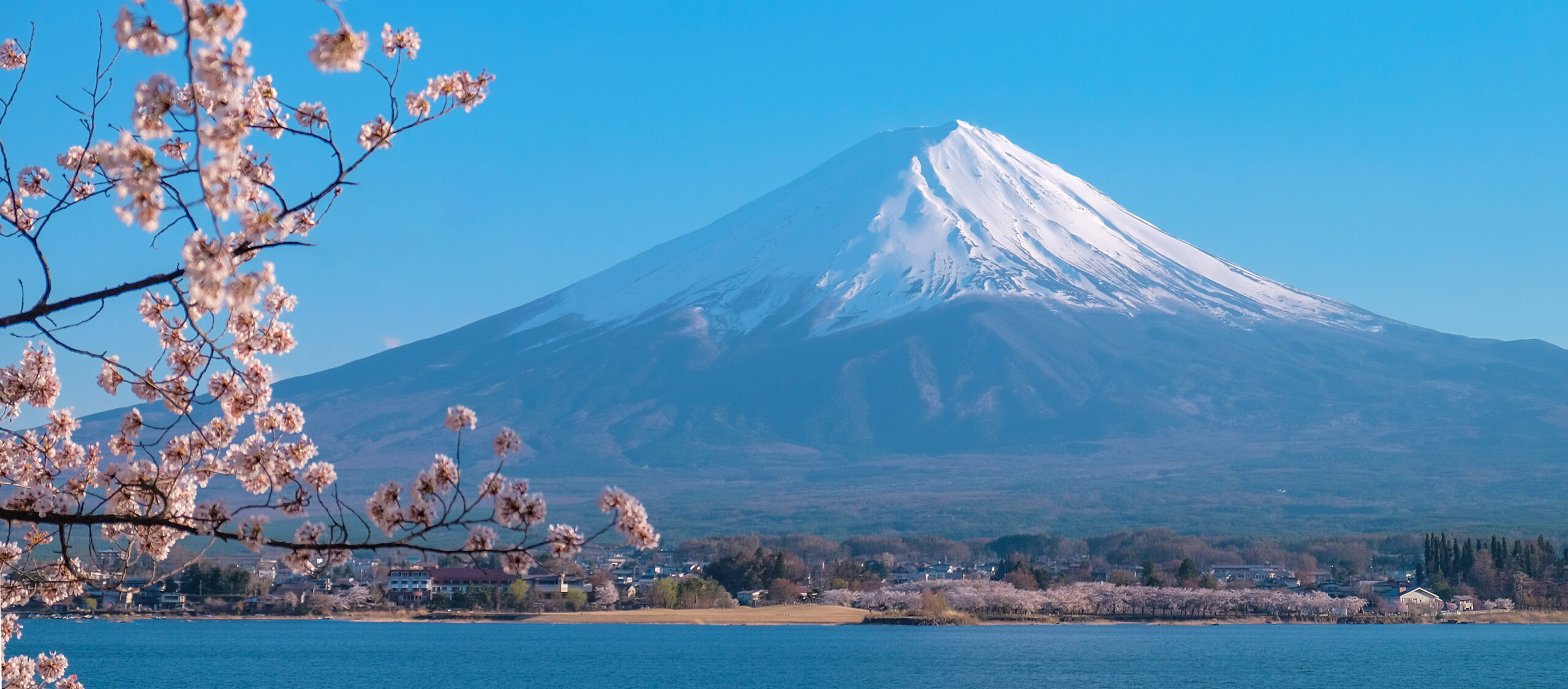
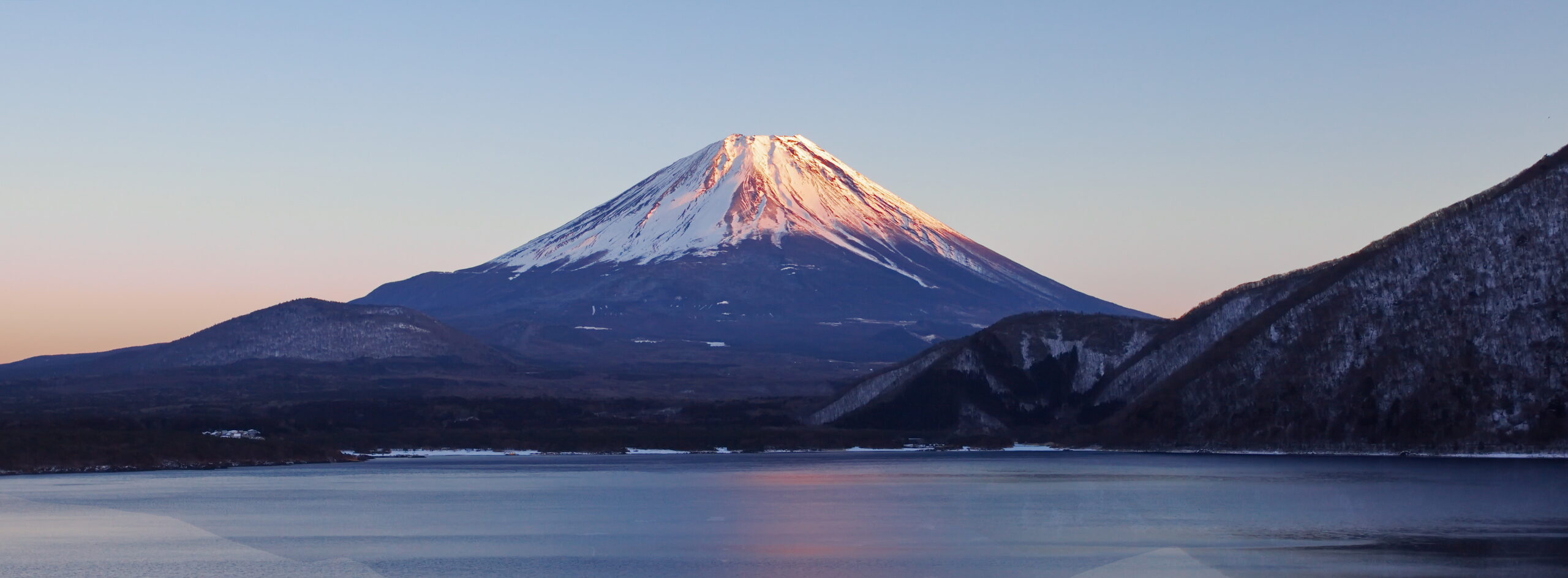
Mount Fuji From the Foothills to First Light
Fuji’s symmetry hides a practical truth: climbers enter the mountain from different sides, elevations and transportation systems.
Build the Rest of Your Mount Fuji Plan
This page should answer one question well: which trail? Use the dedicated Fuji cluster for permits, weather, safety, equipment, training and current-season information.
Mount Fuji Complete Guide
Return to the main Mount Fuji climbing hub for the complete mountain-planning overview.
Live season2026 Trail Status
Check the current season, opening status, crowd rules and administrative changes.
BookingPermits & Logistics
Work through fees, route registration, transportation and entry procedures.
TimingWeather & Best Season
Compare seasonal weather and identify the strongest climbing windows inside Fuji’s short official season.
Guided optionMount Fuji Guides & Tours
Compare guided operators with the independent hiking option.
PreparationMount Fuji Gear List
Build the clothing, rain protection, lighting and trail kit needed for a summer Fuji ascent.
RiskDifficulty & Safety
Understand the physical difficulty, weather exposure and mountain-specific hazards.
FitnessTraining for Mount Fuji
Prepare your aerobic base, uphill endurance and fueling strategy before arriving in Japan.
AltitudeMedical & Altitude Guide
Learn how Fuji’s rapid altitude gain can affect hikers and when descending becomes the correct decision.
ComparisonFuji vs Kilimanjaro
Compare two iconic trekking mountains by altitude, commitment, logistics and difficulty.
Planning skillMountain Weather
Understand forecasts, wind, precipitation and rapid mountain weather changes before committing to a summit day.
Planning hubTrip Planning
Connect the mountain decision with transportation, lodging, insurance and broader adventure planning.
Mount Fuji Is Only One Part of Hiking Japan
Strengthen the child-to-parent architecture by connecting Fuji directly to the larger Japan hiking system instead of leaving the page isolated inside the mountain database.
Best Hikes in Japan
Compare Mount Fuji with the Kumano Kodo, Nakasendo, Japanese Alps, Yakushima and other standout hikes.
Mountain clusterJapanese Alps Guide
Move beyond Fuji into Japan’s higher alpine ranges and multi-day mountain objectives.
Lodging clusterWhere to Stay in Japan
Compare trekker-friendly bases for Mount Fuji, the Japanese Alps, Kumano Kodo, Nakasendo and Yakushima.
Global collectionBest Hiking Regions
Place Japan inside the broader Global Summit Guide hiking-region system and compare it with destinations worldwide.
Sources, Methodology & What Can Change
The route geometry is relatively stable. Entry rules, hut openings, transportation and current conditions are not.
What this route comparison uses
- Official Mount Fuji trailhead elevations and route distances.
- Official standard ascent and descent estimates.
- Current 2026 Yamanashi restrictions for Yoshida.
- Current 2026 Shizuoka restrictions for Fujinomiya, Gotemba and Subashiri.
- Official descriptions of terrain, mountain-hut distribution and route junctions.
What we intentionally keep elsewhere
- Current trail opening and temporary closure information.
- Individual mountain-hut availability and prices.
- Changing bus schedules and transportation fares.
- Detailed weather forecasts.
- Operator pricing and availability.
- Detailed equipment and medical guidance.
Last reviewed: August 14, 2026 · Confidence: High for official route geometry and published 2026 rules; variable for live conditions and availability.
Frequently Asked Questions
Direct answers to the route-selection questions most likely to matter before booking the climb.
Which Mount Fuji route is best for first-time hikers?
Yoshida is the strongest default for most first-time Mount Fuji hikers because it combines straightforward Tokyo-area logistics with the highest concentration of mountain huts and support infrastructure.
What is the easiest Mount Fuji route?
There is no universally easiest route. Fujinomiya is shortest, but it is steep and begins high. Yoshida is longer but usually offers the most forgiving combination of transportation, huts and support for a first climb.
What is the shortest Mount Fuji trail?
Fujinomiya is the shortest official summit route, climbing about 4.3 kilometers from the approximately 2,400-meter 5th Station.
What is the longest Mount Fuji trail?
Gotemba is the longest. Its official ascent is approximately 10.5 kilometers from a trailhead around 1,440 meters, producing roughly 2,300 meters of vertical gain.
Which Mount Fuji route has the most mountain huts?
Yoshida has the highest concentration of mountain huts and support infrastructure, which is one reason it is commonly the best choice for a first Mount Fuji ascent.
Which Mount Fuji route is least crowded?
Gotemba generally provides the greatest sense of solitude because its low start creates a much longer climb. Subashiri is the stronger compromise for hikers wanting a quieter lower mountain without committing to Gotemba’s full distance.
When do the Mount Fuji trails open in 2026?
Yoshida and Subashiri are scheduled from July 1 through September 10. Fujinomiya and Gotemba are scheduled from July 10 through September 10. Opening or access can still be affected by weather, remaining snow or trail conditions.
How much does it cost to enter Mount Fuji in 2026?
The published 2026 hiking fee is ¥4,000 per person per climb on all four routes. Transportation, mountain huts, food and other travel costs are separate.
Do Yoshida and Subashiri join together?
Yes. The routes merge near the Original 8th Station on the upper mountain. They separate again during descent, which is why hikers must follow the correct yellow Yoshida or red Subashiri signs.
Can I climb Mount Fuji in one day?
A daylight one-day climb can be possible for appropriately fit hikers when trail, transportation, weather and legal entry timing all align. For most first-time climbers, an overnight hut itinerary gives more time for rest, altitude adjustment and schedule margin.
Choose the Route First. Build the Trip Around It.
Your Fuji trail determines the fifth station, transportation, mountain-hut options, entry system and the character of the climb. Once you know the route, finish the planning through the Mount Fuji and Japan hiking clusters.
Which Mount Fuji Trail Should You Actually Choose?
All four official summer routes are non-technical hiking routes. The real decision is the combination of distance, vertical gain, altitude rate, terrain, hut support, crowding and access. Difficulty labels below are Global Summit Guide relative hiking comparisons—not official Japanese technical grades.
| Trail | Relative difficulty | Technicality | Altitude profile | Main objective hazard | 2026 fee / restriction | Logistics burden | Who should choose it? |
|---|---|---|---|---|---|---|---|
| Yoshida Best first Fuji | Moderate–strenuous 6.8 km ascent from 2,305 m. Official walking estimate is about 6 hours up. | Non-technical summer hiking. Volcanic gravel, rocky upper sections and sustained uphill walking. | Start: 2,305 m Net summit gain: about 1,471 m. More gradual than Fujinomiya, but altitude is still abrupt for hikers arriving from sea level. | Congestion + altitude. Upper-route queues, cold/wind before sunrise and the possibility of taking the wrong descent after the Yoshida/Subashiri split. | ¥4,000. 2 PM–3 AM entry restriction unless staying in a hut. 4,000-climber daily cap applies to Yoshida. | Lowest for many visitors. Best-connected with Tokyo, Kawaguchiko and the Fuji Five Lakes; strongest hut network. | First-time Fuji climbers, sunrise hikers, international visitors prioritizing support and straightforward logistics. |
| Fujinomiya Shortest | Moderate–strenuous Only 4.3 km up, but the trail is steeper than the mileage suggests. | Non-technical summer hiking. Rough, rocky terrain becomes steeper from the 6th station upward. | Start: 2,400 m Net summit gain: about 1,376 m. Highest start creates the fastest altitude compression of the four routes. | Steep rock + rapid altitude gain. Official guidance also highlights falling-rock risk and a steep, knee-intensive descent on the same trail. | ¥4,000. Shizuoka registration/e-learning procedures apply. No Yoshida-style daily climber cap. | Moderate. Strong geographic fit from Shizuoka, Nagoya, Kyoto or Osaka. Seasonal road/private-car controls affect trailhead access. | Fit hikers who want the shortest official line and understand that short does not mean easiest. |
| Subashiri Quieter start | Strenuous 6.9 km ascent, starting 305 m lower than Yoshida. | Non-technical summer hiking. Forest first, then volcanic gravel, sand and rocky upper terrain. | Start: 2,000 m Net summit gain: about 1,776 m. | Navigation + descent dust. Route merges with Yoshida high on the mountain and later splits. The Sunabashiri descent is fast, dusty and easy to mismanage. | ¥4,000. Shizuoka registration/e-learning procedures apply. No daily climber cap. | Moderate. More route-specific transport planning than Yoshida. Seasonal private-vehicle restrictions apply. | Hikers who want a forested, quieter lower mountain but still want access to upper Fuji infrastructure after joining Yoshida. |
| Gotemba Biggest endurance day | Very strenuous 10.5 km ascent and roughly nine official walking hours before breaks. | Non-technical summer hiking. No rope or climbing moves, but enormous quantities of volcanic gravel and sustained uphill walking. | Start: 1,440 m Net summit gain: about 2,336 m— by far the largest of the four routes. | Fatigue + exposure. Long open terrain, limited hut support, few early landmarks and much less schedule margin if weather deteriorates. | ¥4,000. Shizuoka registration/e-learning procedures apply. No daily climber cap. | Highest hiking burden. Route access itself is manageable, but the very long climbing day must align with transportation, hut and turnaround planning. | Experienced, very fit hikers specifically seeking solitude and a major endurance objective. Not the default first Fuji route. |
Yoshida
Pick it for the strongest combination of huts, access and first-time support.
Fujinomiya
Pick it when distance matters, but arrive prepared for a steeper climb and rapid altitude gain.
Subashiri
Pick it for the forest start and quieter lower slopes before joining Fuji’s upper traffic.
Gotemba
Pick it because you want 2,300+ vertical metres and a genuinely long mountain day.
The 2026 Mount Fuji Summit Season Has Ended
The route comparison above remains useful for choosing a future Fuji itinerary, but the official summit trails are now closed. Do not treat a 2026 fee, gate or reservation rule as a confirmed 2027 rule until the prefectures publish the next climbing season.
The official Mount Fuji site states that the 2026 climbing season has ended and the summit routes are closed outside the designated season.
All four routes used the ¥4,000 hiking fee. Entry between 2 PM and 3 AM required qualifying mountain-hut accommodation.
Shizuoka explicitly states that Fujinomiya, Subashiri and Gotemba did not have a daily climber limit in 2026.
Turn the Route Choice Into a Complete Fuji Plan
The existing page already contains the full Fuji and Japan link cluster. These four links are repeated here only because they are the immediate next decision after choosing a route.
Was this helpful?
🏔Related guides
🧭Explore & compare
Global Summit Guide is an independent mountaineering resource founded in 2026. The team combines first-hand trekking and climbing experience with in-depth research and professional health and nutrition review to help climbers choose objectives, prepare properly, and stay safe.
Health, altitude, and nutrition content is reviewed by Taylor Ludlow (Registered Nurse) and Brigg Hoopes (Nutritionist).
What We Don't Know Yet
Mountain information changes quickly. This box explains the limits of what this page can responsibly promise.
- Route conditions, trailhead access, crevasse exposure, stream crossings, and rescue access may vary from published planning guidance.
- Comparisons simplify complex decisions; the better mountain depends on current conditions, skills, timing, budget, and risk tolerance.
- Visa, passport, vaccination, border, insurance, and local transportation rules may change before your trip.
Verify current conditions with official land managers, guide services, local forecasts, and current route reports before booking or climbing.
Mountaineering, rock and ice climbing, glacier travel, and high-altitude activity are inherently dangerous and can result in serious injury or death. The information on Global Summit Guide is provided for general informational and educational purposes only and is not a substitute for professional instruction, qualified guiding, proper equipment, or your own judgment and experience.
Route conditions, weather, snowpack, permits, regulations, and hazards change constantly and may differ from what is described here. Details may be incomplete, out of date, or contain errors. Always verify current information with local authorities, certified guides, and official sources before making any decision in the mountains.
Nothing on this site is medical, legal, or financial advice. Our fitness, acclimatization, altitude, and nutrition content is general in nature; consult a qualified physician before beginning any strenuous exercise program or exposing yourself to high altitude.
You are solely responsible for your own safety and decisions. To the fullest extent permitted by law, Global Summit Guide and its team accept no liability for any loss, injury, damage, or expense arising from use of, or reliance on, this information. By using this site you acknowledge these risks and accept these terms.
Some links on this site may be affiliate links. If you buy through them we may earn a small commission at no extra cost to you; this never affects our recommendations.
Global Summit Guide recommendation path
Next Best Mountain to Research
Use these recommendations to continue the right planning path instead of stopping on one page.
Use current permit, weather, route, and operator information before booking or climbing.
Explore Travel Options for Your Destination
Once your mountain, dates and route are taking shape, compare flights, hotels and other travel options that fit the trip.
Affiliate link. We may earn a commission at no additional cost to you.