web analytics

Category: Expedition Updates

  • Mount Hunter (Begguya) Expedition Update 2026: The Hardest 14er in North America

    Mount Hunter, Begguya, rising steep and corniced above the Kahiltna Glacier in the Alaska Range
    14,573 ft (4,442 m) · Alaska Range · Denali National Park

    Mount Hunter: Denali’s Child, and the hardest of the three

    Begguya is the smallest of the Alaska Range’s big three, and the hardest. This expedition update covers why it is the most technical 14,000-foot climb in North America, the West Ridge and the Moonflower Buttress, the permit distinction from Denali and Foraker, and an honest readiness view. Heights in feet (metres).

    Research-based updateSafety and medical reviewReviewed each Alaska Range seasonOur team has not climbed Hunter

    Updated 27 July 2026 · Compiled by Travis Ludlow · Safety review by Dawson Ludlow · Medical review by Taylor Ludlow, RN

    14,573 ftSummit – north (4,442 m)
    3rdIn the Alaska Range
    Under 40%Summit success
    West RidgeStandard route (AK Grade 4)
    Apr-JunSeason
    KahiltnaBase glacier

    Single-mountain expedition update, compiled from National Park Service registration rules, operator route information, and published alpine records. Our team has not climbed Mount Hunter; the only first-hand summit anyone on our team claims is Kilimanjaro. This is a planning briefing for experienced alpinists, not a how-to and not a substitute for training or a guide.

    The technical test of the range, not the tallest.

    Hunter is lower than Denali and Foraker, yet it is widely called the most difficult 14,000-foot climb in North America. The standard West Ridge is a long, corniced, Alaska Grade 4 climb; the north face’s Moonflower Buttress is a world-class mixed testpiece. Fewer than 40 percent of attempts on the peak succeed. It stages from the same Kahiltna Glacier as Denali, but it asks for technical skill the West Buttress never does.

    • Standard route: the West Ridge, Alaska Grade 4.
    • Signature hard route: the Moonflower Buttress.
    • Success: under 40 percent of attempts.
    • Permit: the Denali and Foraker special fee does not apply.
    • Name: Begguya, Denali’s Child, in Dena’ina.
    The mountain

    What climbing Hunter involves

    A technical alpine climb staged from a familiar glacier, but with none of the trade-route support that makes its taller neighbour approachable.

    Mount Hunter rises about 8 miles south of Denali, towering some 7,000 feet above the Kahiltna Glacier, the longest in the Alaska Range at 44 miles. Climbers fly in by ski-plane from Talkeetna to the same glacier base camp used for Denali and Foraker, and from there the resemblance ends. Where Denali’s West Buttress is a walk-up by alpine standards, Hunter’s standard West Ridge is a sustained, corniced Alaska Grade 4 climbed on snow and ice throughout, with a mixed step low down and huge cornices high on the crest.

    The peak has two summits, a north top at 14,573 ft, which is the true and higher one, and a south top at 13,966 ft, joined by a long corniced ridge. Because Hunter is lower than its neighbours, the upper mountain is not as brutally cold as Denali’s high camps, but that is scant comfort: the difficulty here is technical and sustained, not a matter of altitude. Fewer than 40 percent of the small number who attempt it each year reach the top. For the full route detail, camps, and gear, see our Mount Hunter climb guide.

    Honest self-assessment

    Are you ready for Hunter?

    Hunter is not a peak to grow into. Read these as prerequisites, and if any is a stretch, build toward it on smaller objectives first.

    Technical ability

    Steep Ice and Mixed

    You must be fluent on steep alpine ice and mixed ground, not only glacier walking. The West Ridge is Alaska Grade 4; the Moonflower is far above that.

    Evidence: prior AI3-plus and mixed routes.
    Alaska Range record

    Cold, Storms, Self-Rescue

    Prior Alaska Range or comparable big-range experience: crevassed glaciers, storm days pinned at camp, and self-sufficiency far from any help.

    Evidence: prior expeditions in a big range.
    Cornice judgment

    Read the Ridge

    The West Ridge traverses enormous cornices with huge exposure. Knowing where it is safe to walk is a survival skill, not a detail.

    Evidence: sound decisions on corniced terrain.
    Self-sufficiency

    No Trade-Route Support

    Unlike Denali’s West Buttress, Hunter has no fixed lines, ranger camps, or crowds to follow. Your team solves every problem itself.

    Evidence: an independent expedition record.
    RequirementBaselineWhy it matters
    Technical gradeFluent to Alaska Grade 4 (AI3, ~5.8)The route is sustained steep snow, ice and mixed, not a walk.
    Alaska Range recordPrior range or comparable big-alpine experienceWeather, glaciers and remoteness punish the underprepared.
    Cornice judgmentComfortable on heavily corniced ridgesThe West Ridge crest is exposed and cornice-laden.
    Self-sufficiencyFull independent expedition capabilityNo trade-route infrastructure or crowds to follow.
    Fitness and loadStrong for 12 to 14 days under loadThe approach and ridge demand endurance with weight.
    Turnaround disciplineWilling to retreat from technical groundReversing the ridge is as serious as climbing it.

    The self-selection trap

    Hunter’s low success rate is not softened by an inexperienced crowd dragging the average down. The field is small and expert, and it still turns back more often than not. If strong alpinists fail here regularly, an honest look at your own record matters more than ambition.

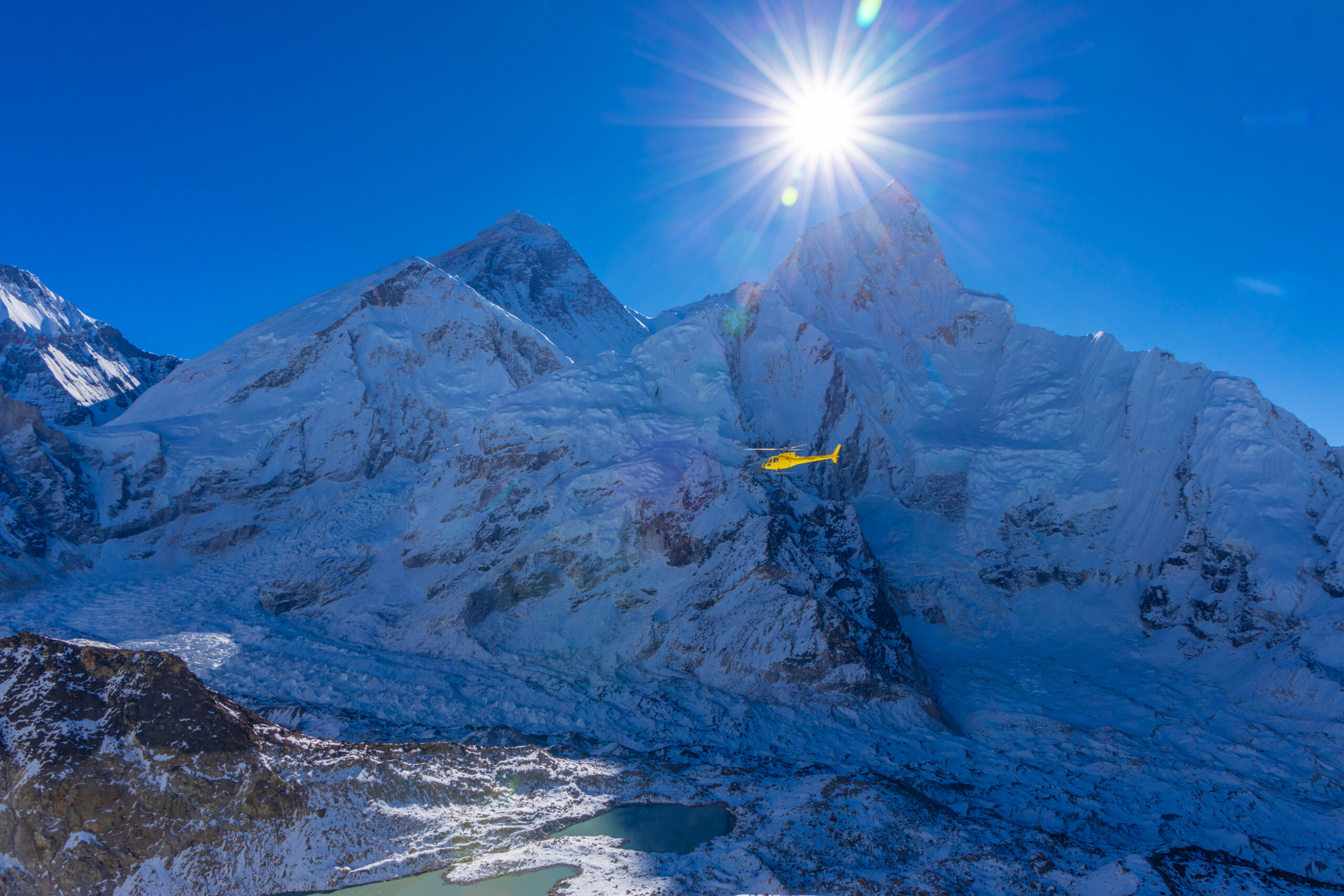
    A helicopter over a glaciated range, a reminder that rescue is limited and slow

    Rescue is limited, and self-rescue is the plan

    Deep in the Alaska Range, help is distant and weather-dependent. Bush planes fly only when conditions allow, and a rescue can be days away. On Hunter your team is the first and often the only responder, which is why self-sufficiency is a prerequisite, not a virtue.

    The two routes

    The West Ridge and the Moonflower

    Two very different climbs share the mountain: a serious guided ridge, and one of the continent’s hardest mixed walls.

    Standard route

    West Ridge

    The standard and original line, first climbed in 1954 by Fred Beckey, Heinrich Harrer, and Henry Meybohm. It is a long ridge on snow and ice throughout, with a mixed step low down at the rabbit ears and enormous cornices high on the crest.

    • Alaska Grade 4 (AI3, around 5.8 rock)
    • Sustained snow, ice and one mixed step
    • Huge, exposed cornice traverses
    • One of the 50 Classic Climbs; 12 to 14 days guided
    Best fit: strong alpinists ready for a sustained Grade 4.
    North face testpiece

    Moonflower Buttress

    A route on the north face, first climbed by Bibler and Klewin in 1983, and one of the hardest mixed climbs in North America. It is far above the West Ridge in difficulty and is a personal objective for elite alpinists, not a guided trip.

    • Sustained vertical ice, mixed and rock
    • Among the hardest mixed lines on the continent
    • The nearby Mini Moonflower is used as training
    • An elite testpiece, rarely guided
    Best fit: elite technical alpinists only.
    FactorWest RidgeMoonflower Buttress
    AspectSouth-west and west ridgeNorth face
    GradeAlaska Grade 4 (AI3, ~5.8)Among the hardest mixed climbs in North America
    StyleLong ridge, snow and ice, one mixed stepSustained vertical ice, mixed and rock
    First ascent1954: Beckey, Harrer, Meybohm1983: Bibler and Klewin
    Who it suitsStrong alpinists ready for Grade 4Elite technical alpinists only
    Guided?Occasionally, 12 to 14 daysRarely; a personal objective
    Route profile

    The West Ridge, section by section

    An overview of the standard line, from the glacier to the north summit and back. For the full detail, see the climb guide.

    Fly-in

    Kahiltna Base ~7,200 ft

    Ski-plane base camp, shared with Denali and Foraker traffic.

    Approach

    Toe of the West Ridge

    Gain the ridge from the glacier; the Northwest Basin variation is shorter but harder.

    Mixed step

    The Rabbit Ears

    A rock feature low on the ridge with a mixed climbing step.

    The crux character

    The Corniced Crest

    Enormous cornices; teams stay off the crest, usually to the south.

    Between the tops

    The Plateau

    A broad glacier plateau links the terrain toward the summits.

    Main summit

    North Summit 14,573 ft

    The true, higher summit and the objective of the climb.

    Lower top

    South Summit 13,966 ft

    Joined to the north by a long corniced ridge.

    Descent

    Reverse the Ridge

    The corniced ridge must be down-climbed; the descent stays committing.

    The Northwest Basin variation

    In stable snow, many parties gain the ridge by the Northwest Basin, which is shorter and more direct than the toe of the ridge, but also harder. The choice depends on conditions, and it is one your guide or team makes on the ground.

    How a trip runs

    A Hunter expedition timeline

    A guided West Ridge attempt runs about 12 to 14 days on the mountain, weather permitting, plus travel and contingency.

    1

    Talkeetna, briefing and flight

    Ranger check-in, gear and food sorting, weather, and the ski-plane charter to the Kahiltna.

    2

    Fly to the Kahiltna Glacier

    Land near 7,200 ft, build base camp, and wait out weather if the planes cannot fly.

    3

    Acclimatize and prepare

    Shorter climbs, skills, and load carries; the lower summit means less extreme cold than Denali.

    4

    Gain the West Ridge

    Climb from the glacier onto the ridge, or take the steeper Northwest Basin variation.

    5

    Climb the corniced ridge

    Sustained snow and ice, the mixed step at the rabbit ears, and the long cornice traverses.

    6

    Summit push to the north top

    Move over the plateau to the true north summit and turn around without lingering.

    7

    Descend the ridge

    Reverse the technical ground carefully; the descent remains the serious half of the climb.

    8

    Fly out

    Return to base camp and wait for the ski-plane window back to Talkeetna.

    Money and rules

    Cost and the permit distinction

    Hunter costs less than Denali to guide and skips the special mountaineering fee, but the barrier here was never the paperwork.

    ComponentFigureNote
    Guided West Ridge~$10,000-$15,000+12 to 14 days; far fewer operators than Denali.
    Ski-plane charterIncluded or ~$700-$900Talkeetna to the Kahiltna Glacier, weather permitting.
    Park registrationNo special feeThe Denali and Foraker mountaineering fee does not apply to Hunter.
    Personal gear$5,000-$10,000+Technical alpine kit and a serious ice and mixed rack.
    InsurancePolicy-dependentVerify activity, altitude, evacuation and repatriation cover.

    The Denali and Foraker fee does not apply

    The National Park Service requires climbers on Denali and Foraker to register at least 60 days in advance and pay a special mountaineering fee. Those rules apply to those two peaks only. Hunter climbers register as backcountry climbers flying into the range and fly with an authorized air-taxi concessionaire, but they skip the 60-day pre-registration and the fee. Confirm the current requirements with Denali National Park before you plan.

    Choosing a team

    Choosing a Hunter operator

    Only a handful of operators guide Hunter, and the right questions separate a serious team from an optimistic brochure.

    Hunter experience

    Specific to This Peak

    Ask how many times the guide has climbed Hunter itself, not just the range.

    Honest route match

    Grade Matched to You

    A good operator matches the West Ridge to your real record, or turns you away.

    Team ratio

    Small Rope Teams

    Technical terrain needs tight ratios and strong rope-team management.

    Flight contingency

    Bush-Plane Delays

    Ask how weather delays to and from the glacier are handled and costed.

    Screening

    Willing to Say No

    The best sign is an operator who screens hard and declines the underqualified.

    Rescue reality

    Limited, Self-First

    Understand that rescue is limited and self-rescue is the expectation.

    How to choose an expedition operator covers the vetting in full, and the operator directory is a place to start the search.

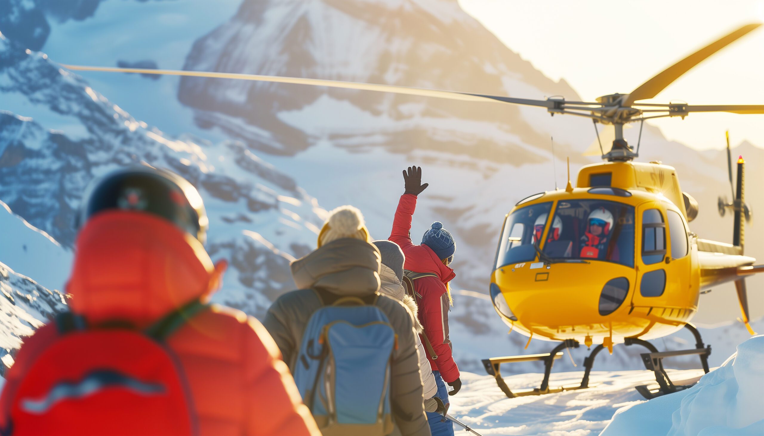
    A mountain rescue helicopter against a cold sky, symbolizing weather-bound evacuation

    Weather runs the whole trip

    From the flight in to the summit window and the flight out, Alaska Range weather decides everything. Teams routinely wait days for a break, and a plan that does not build in patience is a plan to fail. Read the sky, and set your turnaround before you leave camp.

    The numbers

    Difficulty and success, read honestly

    Use the statistics as a mirror, not a dare. They describe an elite objective with a stubbornly low success rate.

    StatisticWhat it measuresHow to use it
    Under 40% successShare of attempts reaching the topThe hardest 14er in North America; treat it as elite.
    Few annual attemptsA small, self-selected fieldMost climbers here are experienced alpinists.
    Alaska Grade 4The West Ridge technical gradeSustained, not a single crux; the whole ridge tests you.
    Two summitsNorth (main) and SouthThe higher north summit is the true objective.
    Timing

    Season and weather

    Hunter is a spring and early-summer climb, on the same calendar as Denali and Foraker, and always at the mercy of the sky.

    Early April

    Season Opens

    Cold, more stable snow, and fewer teams on the glacier.

    Late April-May

    Prime

    The core of the Alaska Range climbing window.

    June

    Late Season

    Warmer, with more objective hazard as the snow thaws.

    Weather

    The Deciding Factor

    Storms and bush-plane delays shape every single trip.

    Winter

    Extreme

    Rare, elite ascents only, in brutal cold and dark.

    Live wind and weather for Mount Hunter. Source: Windy.com. For how to read a mountain forecast, see our weather guide.
    Mount Hunter (Begguya), about 8 miles south of Denali, above the Kahiltna Glacier. Map: OpenStreetMap contributors.
    Begguya

    Denali’s Child, and the family of three

    The Dena’ina names for these peaks tell a family story, and Hunter is the youngest and fiercest of them.

    In Dena’ina, Denali is the high one, the great parent of the range. Foraker is Sultana, often rendered as Denali’s Wife. Hunter is Begguya, Denali’s Child. The three stand together above the Kahiltna, and the naming captures something true about them: the child is the smallest, but it is also the most difficult to climb, steeper and more technical than either elder. We cover its neighbours in our Denali and Foraker updates.

    The English name is an accident of history. It was transferred from a nearby peak that an early climber named after a relative who helped fund his travels, and it stuck to this mountain by mistake. Begguya is the older name, and the more fitting one for a peak so bound up with its towering parent.

    History

    A short history of climbing Hunter

    From a corniced first ascent to a north-face testpiece, Hunter’s story is one of technical ambition.

    The West Ridge was first climbed in 1954 by Fred Beckey, Heinrich Harrer, and Henry Meybohm, following a corniced line proposed a year earlier by the great range surveyor Bradford Washburn. It remains the standard route and a coveted objective, listed among the 50 Classic Climbs of North America. Even today, gaining the higher north summit is hard by any route and turns back most who try.

    In 1983, Mugs Stump’s era of hard alpine climbing found its Hunter landmark when Todd Bibler and Doug Klewin climbed the north face’s Moonflower Buttress, a route that became one of the most respected mixed climbs on the continent. The peak has since drawn elite alpinists to its steep faces, while the West Ridge continues to test strong mountaineers as the mountain’s classic line.

    Questions

    Mount Hunter FAQ

    The questions climbers ask most about the difficulty, the name, the permit, and the season.

    Why is Mount Hunter called the hardest 14er in North America?

    Because difficulty is about terrain, not height. Hunter is the third-highest peak in the Alaska Range, lower than Denali and Foraker, but its routes are steeper and more technical than either. The standard West Ridge is a long, corniced, Alaska Grade 4 climb of sustained snow and ice with a mixed step, and fewer than 40 percent of attempts on the peak succeed. Alpinists widely regard it as the most difficult 14,000-foot climb on the continent.

    What does Begguya mean?

    Begguya is the Dena’ina name for the mountain and means Denali’s Child. It fits a family of three: Denali, the high one, the parent of the range; Foraker, called Sultana or Denali’s Wife; and Hunter, Begguya, the child. The English name Hunter came from a historical mix-up, transferred from a nearby peak that an early climber named after a relative, so Begguya is the older and truer name.

    How hard is the West Ridge?

    The West Ridge is rated Alaska Grade 4, with crux difficulties around 5.8 on rock and AI3 on ice, but the grade understates it because the challenge is sustained rather than a single crux. It is a long corniced ridge climbed on snow and ice throughout, with a mixed step low down at a rock feature known as the rabbit ears, and huge cornices higher up where teams stay off the crest. Guided ascents run about 12 to 14 days, and it is one of the 50 Classic Climbs of North America.

    What is the Moonflower Buttress?

    The Moonflower Buttress is a route on Hunter’s north face, first climbed by Bibler and Klewin in 1983, and it is one of the hardest mixed climbs in North America. It is far more difficult than the West Ridge, a sustained wall of vertical ice, mixed ground, and rock that draws elite alpinists as a personal testpiece rather than a guided objective. A shorter nearby route, the Mini Moonflower, is used as training.

    Do you need a permit, or the Denali and Foraker fee?

    You do not pay the special Denali and Foraker mountaineering fee on Hunter. The National Park Service requires climbers on Denali and Foraker to register at least 60 days in advance and pay that fee, but those rules apply only to those two peaks. Hunter climbers register as backcountry climbers flying into the range, fly with an authorized air-taxi concessionaire, and follow park rules, but they skip the 60-day pre-registration and the special fee. Confirm the current requirements with Denali National Park before you plan around them.

    What is the success rate on Mount Hunter?

    Fewer than 40 percent of attempts on Mount Hunter reach the summit, and only a small number of climbers attempt it in a given year. The field is self-selected and experienced, which makes the low success rate all the more telling: even strong alpinists turn back often. Treat the number as confirmation that this is an elite objective, not a peak to grow into.

    When is the climbing season?

    April to June, the Alaska Range spring and early-summer window, the same season as Denali and Foraker. Because Hunter is lower, the upper mountain is not as brutally cold as Denali’s high camps, but the weather is still fierce and unpredictable, and bush-plane flights to and from the glacier depend entirely on it. Late April through May is the core of the season.

    What experience do you need for Mount Hunter?

    Fluency on steep alpine ice and mixed ground to at least Alaska Grade 4, prior experience in the Alaska Range or a comparable big-alpine setting, sound judgment on heavily corniced ridges, and full self-sufficiency. Unlike Denali’s West Buttress, Hunter has no fixed lines, ranger camps, or crowds to follow, so your team must solve everything itself. It is not a first big mountain.

    How high is Mount Hunter and where is it?

    Mount Hunter is 14,573 ft (4,442 m) at its north summit, the main top, with a lower south summit at 13,966 ft (4,257 m) joined to it by a long corniced ridge. It stands in the Alaska Range in Denali National Park and Preserve, about 8 miles south of Denali, rising some 7,000 feet above the 44-mile Kahiltna Glacier, the longest glacier in the range.

    Transparency

    How we built this update

    What this page is based on, who reviewed it, and what we do not claim to know.

    Sources

    • National Park Service, Denali National Park backcountry climbing registration and mountaineering fee rules.
    • Operator and guide-service route information for the West Ridge and the Northwest Basin variation.
    • Published alpine records for the first ascent and the Moonflower Buttress.
    • Alaska Mountaineering School and range guidebooks for grade, success rate, and character.
    • Our own Mount Hunter climb guide for the detailed route and cost.

    Review and standards

    Compiled by Travis Ludlow and reviewed for safety by Dawson Ludlow, our Climbing and Mountaineering Lead (Wilderness First Aid), whose highest first-hand summit is Kilimanjaro. Health and medical points were reviewed by Taylor Ludlow, RN. We do not fabricate summit experience, quotes, or credentials, and we say plainly when we are reporting rather than recounting.

    What we do not claim to know

    Conditions on Hunter change from year to year and within a season, and no web page can substitute for current route reports and a guide’s judgment. In particular:

    • Success rates and attempt numbers are approximate and vary by source and year.
    • Park registration rules and fees change; confirm the current requirements with Denali National Park.
    • Guided pricing shifts with operators, dates, and fuel; treat figures as a planning range.
    • Our team has not climbed Mount Hunter, so we report official rules and published records, not personal experience.
    Global Summit Guide research team

    Global Summit Guide research

    We compile mountain updates from official rules and published expedition records, review them for safety and medical accuracy, and refresh them each season. We are transparent about what we have and have not climbed, and Mount Hunter is a research-based briefing, not a personal account.

    About our team and standards ->
    Plan your Alaska Range season

    Hunter rewards the prepared, and only them.

    Start with the full route in our Mount Hunter climb guide, weigh yourself against our fitness standards, and read the neighbours in the Denali and Foraker updates. Expeditions stage through Anchorage and Talkeetna, so for flights and lodging there, browse travel on Expedia.

    Disclosure: the Expedia link above is a sponsored affiliate link, and we may earn a commission at no extra cost to you. It is the only affiliate link on this page; our route, permit, and safety guidance is independent.

    Was this helpful?

    Yes
    No
    Thanks for your feedback!
  • Mount Hood Expedition Update 2026: The Most-Underestimated Climb, Permit & Route Timing

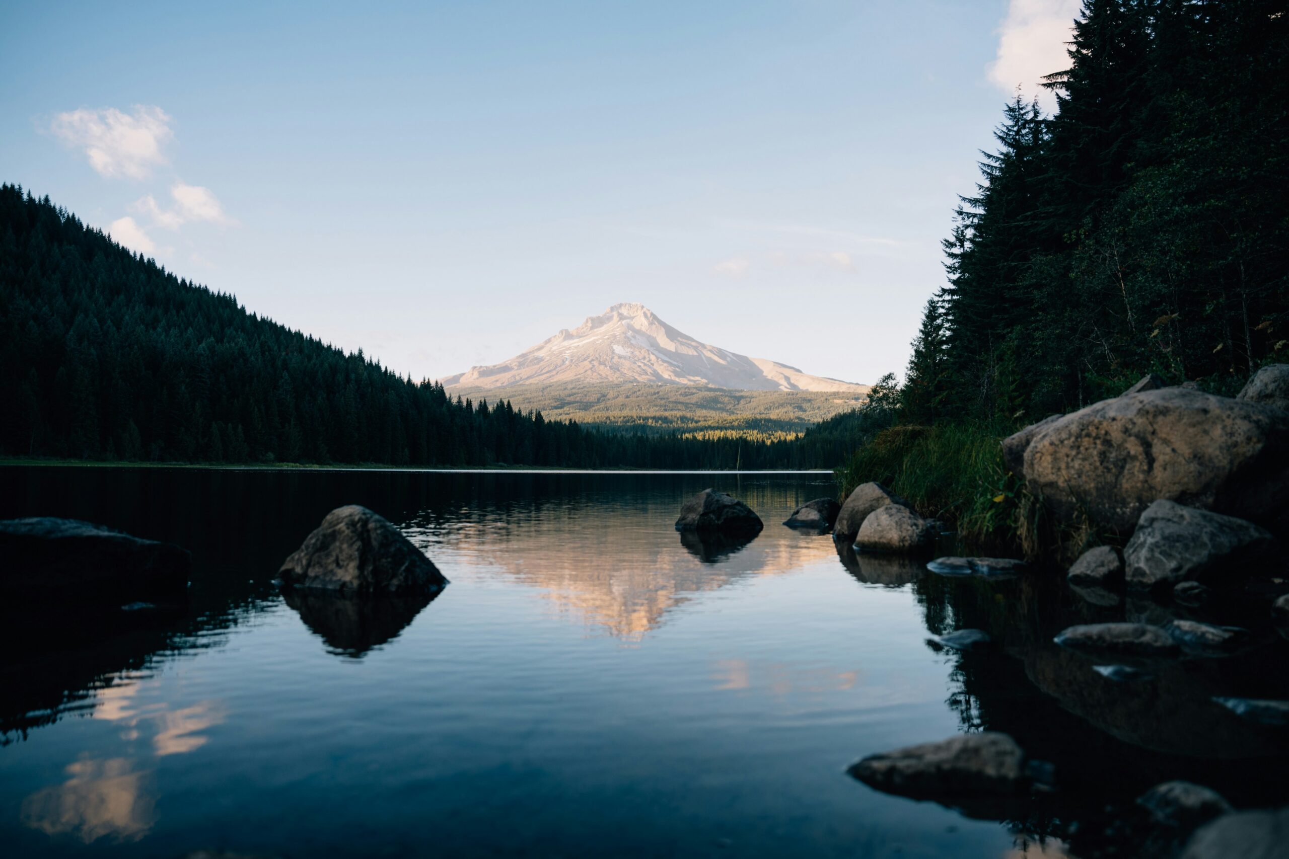
    Mount Hood, the glaciated Cascade stratovolcano and highest peak in Oregon, above Timberline
    Mount Hood is 11,249 ft (3,429 m), Oregon’s highest peak. One of the most-climbed glaciated volcanoes in North America, and one of the most underestimated.
    Expedition Updates · Cascades

    Mount Hood expedition update

    One of the most-climbed glaciated peaks on the continent, and one of the most underestimated. This page tracks the new year-round permit, the South Side hazards, why it is a spring climb with a midnight start, and a go or no-go checklist. A single-mountain page in our Expedition Updates directory. Heights in feet (metres).

    Current status Spring climb 11,249 ft (3,429 m)

    An accessible mountain is not the same as an easy one.

    Mount Hood is Oregon’s highest peak and one of the most-climbed glaciated volcanoes in North America, an hour from Portland with a lodge at 6,000 feet. That accessibility is exactly why it is so underestimated: it is a real technical snow climb, with steep icy chutes, a crevasse below the summit, toxic fumaroles, rockfall, and fast weather, and it has a serious accident record.

    Two current-state points matter most. A climbing permit is now required year-round above 9,500 feet, and Hood is a spring climb with a near-midnight start, not a summer stroll. For the full route detail, see our Mount Hood climb guide.

    11,249 ft

    Summit (3,429 m)

    Oregon’s highest; a glaciated Cascade volcano.

    May to Jun

    Prime season

    A spring climb, not a summer one.

    Permit

    Above 9,500 ft

    New year-round; $20 for 3 days or $50 a year.

    Mount Hood is a potentially active stratovolcano with eleven named glaciers, about 50 miles east-southeast of Portland, monitored by the USGS. Its standard South Side route from Timberline Lodge is short and non-technical by alpine standards, which draws thousands of climbers a year, from first-timers to those training for bigger peaks. This page owns the current picture, the permit, the timing, and the honest hazards. For the full South Side route, the Pearly Gates and Old Chute variations, gear, and guide companies, see our Mount Hood climb guide.

    Season and status

    A spring snow climb, best before summer melts it out.

    Mount Hood is climbed year-round, but the prime window is roughly May to early July, with early May to late June the best for solid snow and ice. It is a spring mountain: by mid-summer the snow melts back, rockfall picks up, and the summit chutes can turn to bare ice or loose rock. The mountain is open and busy through the season, with the main current change being the year-round climbing permit now required above 9,500 feet. Whatever the month, conditions on the upper mountain shift from year to year, so current information matters more than any fixed description.

    Most-climbed, most-underestimated

    The gap between how it looks and what it is.

    Few big mountains are as easy to reach as Mount Hood. A paved road runs to Timberline Lodge at 6,000 feet, the standard route is under three miles to the summit, and the peak sits an hour from a major city, so it draws thousands of climbers a year and a reputation as a walk-up. The reputation is misleading. Above the Hogsback the route steepens into snow and ice chutes of 35 to 45 degrees with serious exposure, past a crevasse and active fumaroles, and the weather can turn from clear to whiteout in an hour. Hood has a long accident and fatality record, and most of it comes down to climbers treating an accessible mountain as an easy one.

    The mindset that keeps you safe: approach Hood as a real mountaineering objective that happens to be convenient, not a hike that happens to be tall. Carry and know how to use an ice axe, crampons, and a helmet, travel with experienced partners or a guide, and be as willing to turn around here as you would be on a remote peak.

    The new year-round permit

    The current-state change many climbers have missed.

    Mount Hood used to be a free self-registration. It is not anymore. A Mount Hood Climbing Permit is now required year-round for all travel above 9,500 feet, bought on Recreation.gov, and on the South Side route the three-day permit doubles as the required wilderness permit. There is also a new free uphill travel pass for moving within the Timberline ski area. It is a small cost, but an easy one to overlook, and rangers do check.

    Mount Hood permits and passes, 2026. Confirm current requirements on Recreation.gov before you go.
    ItemCostNotes
    Climbing Permit, 3-day$20Required above 9,500 ft, year-round, via Recreation.gov; on the South Side it also serves as the wilderness permit.
    Climbing Permit, annual$50Annual holders complete the wilderness permit requirement separately.
    Timberline uphill travel passFreeNew for the 2025/2026 winter season, for travel within the ski area.
    ParkingSno-Park or NW Forest PassSeasonal, for the Timberline Lodge lot.

    The South Side hazards

    Three things the upper mountain will test you on.

    ⚠ The fumaroles, the Bergschrund, and the chutes

    The Devil’s Kitchen fumaroles, on the upper mountain, vent toxic, oxygen-depleting gas, and climbers have fallen into them; move through quickly and do not linger or breathe the fumes. The Bergschrund, a large crevasse below the summit headwall, must be crossed, and its snow bridges weaken and collapse as the day warms. Above it, the Pearly Gates and Old Chute finishes are steep snow or ice at 35 to 45 degrees, exposed to rock and ice fall from the buttresses above.

    The choice between the two chutes is made on the mountain from the day’s conditions, and either can be bare ice in a lean year. Wear a helmet, move fast through the fall zones, keep spacing so you do not endanger climbers below, and watch for the summit cornice on the far side. Our climb guide covers the variations in detail. This page is educational and is not a substitute for training.

    Timing and the alpine start

    Why you leave the lodge near midnight.

    The single most important tactic on Mount Hood is the early start, closer to midnight than to dawn. The mountain grows more dangerous as it warms: the sun loosens rock in the chutes above the Hogsback, softens the snow, and weakens the snow bridges over the Bergschrund. A midnight or 1am departure lets a party climb and descend the hazardous upper sections while everything is still frozen, and the standard advice is to be clear of the rockfall zones by around 10am. Climbing late, or lingering on the summit into a warm afternoon, is how people get hurt.

    Difficulty and the Cascades progression

    A fine first glaciated peak, with a warning attached.

    Mount Hood is often a climber’s first glaciated summit, and it is a good one for it: short, accessible, and a real introduction to steep snow, crampon work, and glacier hazards. But it belongs in the same conversation as Mount Baker and Mount Rainier, not below them, because its hazards are real and its accident record is long. Many climbers use it alongside Mount Baker to build glacier skills before the bigger commitment of Mount Rainier. Test your base against our fitness standards, and brush up on glacier travel and avalanche awareness before you go.

    Weather and timing

    A mountain that makes its own fast weather.

    Mount Hood builds cloud and storm quickly, and whiteouts on the featureless upper snowfields have led climbers astray on descent, a factor in some of its worst accidents. A settled, clear forecast and a hard turnaround time matter as much as fitness. The live map below shows current conditions; rely on a mountain forecast and current route reports for the summit-day call.

    Live wind and weather for Mount Hood. Source: Windy.com. For how to read a mountain forecast, see our weather guide.
    Mount Hood, about 50 miles east-southeast of Portland, climbed from Timberline Lodge. Map: OpenStreetMap contributors.

    Go or no-go checklist

    Work through these before you go.

    Before you go

    • Buy the climbing permit – it is required year-round above 9,500 ft; get it on Recreation.gov before you leave.
    • Time it for spring – May to June is prime; summer melts the route out and raises rockfall.
    • Start near midnight – be off the rockfall zones and across the Bergschrund by mid-morning.
    • Carry axe, crampons, and helmet – all are effectively mandatory on the upper mountain.
    • Avoid the fumaroles – do not linger in or breathe the Devil’s Kitchen gases.
    • Respect the weather – whiteouts on descent have killed here; set a hard turnaround time.

    Mount Hood update FAQ

    The questions climbers ask most about the permit, the hazards, and the timing.

    Do you need a permit to climb Mount Hood?

    Yes, and the rule is recent. A Mount Hood Climbing Permit is now required year-round for all travel above 9,500 feet, costing $20 for three days or $50 for an annual pass, bought on Recreation.gov. On the South Side route the three-day permit also serves as the required wilderness permit, while annual holders complete the wilderness permit separately. There is also a new free uphill travel pass for the Timberline ski area. Confirm the current rules before you go, as they have changed from the old free self-registration.

    How hard is it to climb Mount Hood?

    It is a technical snow climb, not a hike. The standard South Side route gains about 5,000 feet from Timberline Lodge and finishes with steep snow or ice chutes of 35 to 45 degrees with serious exposure, on top of glacier hazards, volcanic fumaroles, and rockfall. An ice axe, crampons, and a helmet are mandatory. It suits climbers with basic mountaineering skills and is often a first glaciated peak, but its accessibility leads many people to underestimate it.

    Why is Mount Hood dangerous if it is so popular?

    Because accessibility and difficulty are not the same thing. Hood is one of the most-climbed glaciated volcanoes in North America, an hour from Portland with a lodge at 6,000 feet, so many people arrive treating it as an easy day. The upper mountain, though, has real hazards, the Bergschrund, the fumaroles, steep icy chutes, rockfall, and fast-moving weather, and it carries a serious accident and fatality record. The danger on Hood is underestimating it.

    What are the main hazards on the South Side route?

    Three stand out. The Devil’s Kitchen fumaroles emit toxic, oxygen-depleting gas, and climbers have fallen into them. The Bergschrund is a large crevasse below the summit headwall whose snow bridges collapse as the day warms. And the Pearly Gates and Old Chute finishes are steep snow or ice with rock and ice fall from above. The choice between the two chutes is made on the mountain according to the day’s conditions.

    When is the best time to climb Mount Hood?

    Roughly May to early July, with early May to late June the prime window for solid snow and ice. It is a spring climb, not a summer one. By mid-summer the route melts out, rockfall increases, and the chutes can turn to bare ice or rock. Whatever the date, start extremely early, closer to midnight than dawn, to be off the rockfall zones by around 10am while the mountain is still frozen.

    Why do you start so early on Mount Hood?

    Because the mountain grows more dangerous as the day warms. The sun loosens rock in the chutes above the Hogsback, softens the snow underfoot, and weakens the snow bridges over the Bergschrund. A midnight or 1am start lets a party climb and descend the hazardous upper sections while everything is still frozen and stable, which is why the standard advice is to be clear of the rockfall zones by mid-morning.

    Pearly Gates or Old Chute, which finish should I take?

    Both are steep snow or ice at 35 to 45 degrees, and the choice is made on the day from conditions rather than in advance. The Pearly Gates is the most direct line but can be a wall of ice, or congested with other climbers; the Old Chute is the common alternative when the Gates are in poor shape. Either way you must navigate around the Bergschrund. Our Mount Hood climb guide covers the route and the variations in full.

    How high is Mount Hood and where is it?

    Mount Hood is 11,249 feet (3,429 m), the highest mountain in Oregon, a glaciated and potentially active Cascade stratovolcano about 50 miles east-southeast of Portland. It has eleven named glaciers and perennial snowfields, and it is monitored by the USGS as a potentially active volcano, with the Devil’s Kitchen fumaroles a visible reminder of the heat still beneath it.

    📋 How this update is built

    This page is compiled by Travis Ludlow, Founder and Head of Research at Global Summit Guide, from US Forest Service and Recreation.gov permit rules, Mazamas and Mountaineers route information, and USGS volcano monitoring, with sources named below. It was reviewed for safety by Dawson Ludlow, our Climbing and Mountaineering Lead (Wilderness First Aid), whose highest first-hand summit is Kilimanjaro.

    Our team has not climbed Mount Hood, so we report official rules and route information rather than personal experience, and we review this page for the spring climbing season. Permit rules and route conditions change from year to year, so confirm the current requirements on Recreation.gov and check recent route reports before you go.

    Planning a Mount Hood climb?

    Start with our Mount Hood climb guide for the full route and gear, build glacier skills alongside our Mount Baker and Mount Rainier updates, and choose a team in the operator directory. Most climbers stage through Portland, so for flights and lodging, browse travel on Expedia.

    Disclosure: the Expedia link above is a sponsored affiliate link. We may earn a commission at no extra cost to you.

    Was this helpful?

    Yes
    No
    Thanks for your feedback!
  • Gasherbrum I (Hidden Peak) Expedition Update 2026: The Harder Gasherbrum Twin

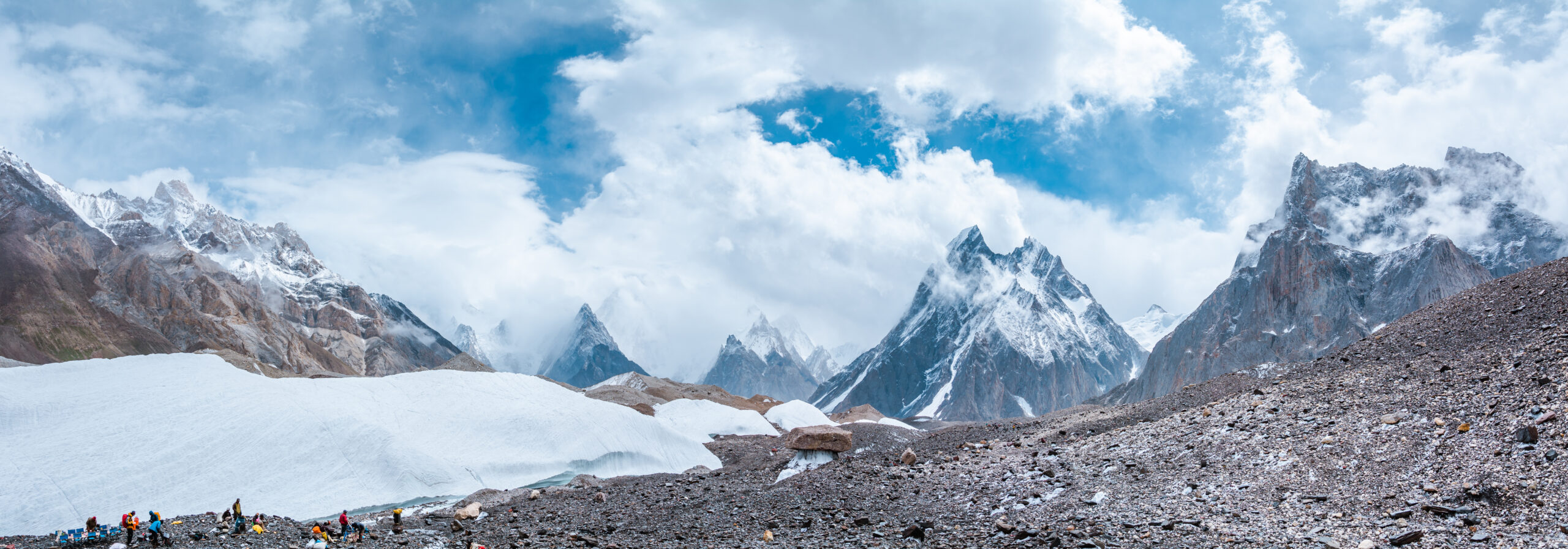
    Gasherbrum I, Hidden Peak, the eleventh-highest mountain in the world, in the Karakoram of Pakistan
    Gasherbrum I is 8,080 m (26,509 ft), the eleventh-highest mountain on earth. Known as Hidden Peak, it is the harder and less-visited of the two Gasherbrum 8000ers.
    Expedition Updates · Karakoram

    Gasherbrum I expedition update

    Hidden Peak, the harder of the Gasherbrum twins. This page tracks why it earned the name, how it compares to Gasherbrum II, the Japanese Couloir route, its honest safety record, the Karakoram summer season, and a go or no-go checklist. A single-mountain page in our Expedition Updates directory. Elevations in metres (feet).

    Current status Karakoram summer 8,080 m (26,509 ft)

    The hidden one, and the harder one.

    Gasherbrum I is the eleventh-highest mountain in the world, tucked so deep in the Karakoram that a British surveyor named it Hidden Peak in 1892. It is the harder of the two Gasherbrum 8000ers, steeper and more technical than its twin Gasherbrum II, and the least-visited of all fourteen 8000-metre peaks.

    It carries history out of proportion to its fame: the only 8000er first climbed by an American team, in 1958, and the site of the first alpine-style ascent of an 8000er, in 1975. For the full route, camps, and cost, see our Gasherbrum I climb guide.

    8,080 m

    Summit (26,509 ft)

    Eleventh-highest in the world; Hidden Peak, or K5.

    Jun to Aug

    Karakoram season

    Summer, the opposite of the Himalayan seasons.

    Least-visited

    Of the 8000ers

    Remote, technical, and for experienced climbers.

    Gasherbrum I stands at the head of the Baltoro Glacier, on the Pakistan and China border, part of a cluster of high peaks that includes its twin Gasherbrum II. It is a serious mountaineer’s objective rather than a commercial trophy, drawing far fewer climbers than K2 or Everest, and rewarding those who make the long journey with solitude as well as difficulty. This page owns the current picture, the twins comparison, and the honest safety record. For the Japanese Couloir route detail, camps, gear, and cost breakdown, see our Gasherbrum I climb guide.

    Season and status

    A Karakoram summer peak.

    Gasherbrum I is climbed from June to August, the Karakoram summer, which is the opposite of the spring and autumn seasons used across the Nepalese Himalaya. Every one of Pakistan’s 8000ers is a summer peak. A full expedition runs 45 to 60 days, taking in the trek, several acclimatization rotations, and a long wait at base camp for a safe summit window. Each year the mountain hosts only a handful of teams, often alongside climbers on its twin, so the status that matters is simply whether a season’s weather opens a window at all.

    Why it is called Hidden Peak

    A name earned by remoteness.

    The British surveyor William Martin Conway gave Gasherbrum I the name Hidden Peak in 1892, because the mountain is set so far back in the range, screened behind Gasherbrum IV and II, that it cannot be seen from the lower Baltoro Glacier where expeditions approach. Its survey label was K5. The word Gasherbrum, often mistranslated as shining wall, actually comes from the Balti rgasha, meaning beautiful, and brum, meaning mountain. Hidden and beautiful is a fair description of a peak most people, even many climbers, would struggle to point to.

    The Gasherbrum twins

    Two 8000ers, one base camp, very different climbs.

    Gasherbrum I against its twin, Gasherbrum II. The two share a base camp and Camp 1.
    AspectGasherbrum IGasherbrum II
    Height8,080 m (26,509 ft), 11th-highest8,035 m (26,362 ft), 13th-highest
    DifficultySteeper and more technicalThe easier, safer twin
    Normal routeThe Japanese Couloir, north-east faceThe south-west ridge
    Typical roleThe harder prizeOften a climber’s first 8000er
    Objective hazardRelatively low, few seracsLow
    Base campShared with Gasherbrum IIShared with Gasherbrum I

    The two Gasherbrum 8000ers sit side by side and share the same base camp, but they are not the same climb. Gasherbrum II is one of the more approachable 8000ers and is often a climber’s first, while Gasherbrum I is steeper, more technical, and the bigger prize. Because they share the lower mountain, many strong climbers attempt both in a single season, a challenge known as the Gasherbrum Double, first achieved as a traverse by Reinhold Messner and Hans Kammerlander in 1984. If you are eyeing GI, its twin is worth understanding too.

    The Japanese Couloir route

    A direct line, but a technical one.

    From the Gasherbrum La to the summit

    The normal route climbs the north-east face via the Japanese Couloir, reached from the Gasherbrum La, the col between GI and GII. It shares base camp and Camp 1 with Gasherbrum II, then works up crevassed glacial slopes to the col before the steeper couloir and face above, with three high camps to reach the summit. It is a direct line to the top, but the couloir and the upper face are genuine technical climbing at extreme altitude. For the full camp-by-camp detail, see our Gasherbrum I climb guide.

    How dangerous it really is

    A low death rate that needs explaining.

    ⚠ Hard, not safe

    Gasherbrum I carries one of the lower fatality records among the 8000ers, which sounds reassuring until you look at why. Part of the reason is that only experienced climbers attempt a peak this technical and this remote, so the pool is self-selected. The other part is that the normal route has relatively few of the objective hazards, such as collapsing seracs, that make neighbours like K2 and Broad Peak so lethal.

    In other words, the statistic reflects who climbs Gasherbrum I and the character of its route, not a forgiving mountain. Crevasses, avalanches, severe storms, extreme cold, and altitude remain ever-present. Treat the low death rate as a fact about the climbers, not an invitation to underestimate the peak. This page is educational and is not a substitute for experience.

    Access, cost and the Baltoro trek

    The great glacier highway, away from the K2 crowds.

    The approach is one of the finest in mountaineering. From Islamabad you fly to Skardu, drive to the village of Askole, then trek six to eight days up the Baltoro Glacier, past Paiju and Urdukas to Concordia, before branching away from the K2 crowds into the quieter Gasherbrum sanctuary and base camp. A guided expedition runs roughly $15,000 to $25,000, less than K2, and the permit sits in Pakistan’s 8000er band below K2, broadly in line with Broad Peak and Gasherbrum II; climbers doing the Gasherbrum Double often arrange a custom combined royalty. Confirm the current figures with your operator, and vet teams with how to choose an operator.

    Weather and timing

    A live look at the Gasherbrum massif.

    Karakoram weather is fierce and fast-moving, and a summit push depends on a settled window in the short summer season. The live map below shows current conditions for the massif; a real attempt relies on expedition forecasting for every move above base camp.

    Live wind and weather for Gasherbrum I. Source: Windy.com. For how to read a mountain forecast, see our weather guide.
    Gasherbrum I, at the head of the Baltoro Glacier on the Pakistan-China border. Map: OpenStreetMap contributors.

    Go or no-go checklist

    Work through these before you commit.

    Before you go

    • Bring 8000er experience – GI expects solid 7,000 m ability and ideally a previous 8000er, not a first trip to extreme altitude.
    • Respect the couloir – the Japanese Couloir and upper face are technical ground high on the mountain.
    • Do not misread the low death rate – it reflects who climbs it, not a safe peak; the hazards are real.
    • Consider the Double – if strong, pairing GII from the shared base camp is efficient, but plan the royalty and time.
    • Plan the long trek – six to eight days up the Baltoro before the climb, and 45 to 60 days total.
    • Carry proper cover – helicopter evacuation and high-altitude rescue insurance are essential in this remote range.

    Gasherbrum I update FAQ

    The questions climbers ask most about the name, the twins, and the difficulty.

    Why is Gasherbrum I called Hidden Peak?

    The British surveyor William Martin Conway gave it the name in 1892 because the mountain is tucked deep in the Karakoram, hidden behind Gasherbrum IV and II and not visible from the lower Baltoro Glacier. Its survey designation was K5. The name Gasherbrum itself comes from the Balti words rgasha, meaning beautiful, and brum, meaning mountain, so it means beautiful mountain, not shining wall as is often wrongly claimed.

    How does Gasherbrum I compare to Gasherbrum II?

    They are twins that share a base camp, but Gasherbrum I is the harder of the two. Gasherbrum II, at 8,035 m, is regarded as one of the easier and safer 8000ers and is often a climber’s first, taken on the south-west ridge. Gasherbrum I, at 8,080 m, is steeper and more technical, the bigger prize of the pair. Many strong climbers attempt both in a single season from the shared base camp, a challenge known as the Gasherbrum Double.

    What is the normal route on Gasherbrum I?

    Most climbers take the Japanese Couloir on the north-east face, reached from the Gasherbrum La, the col that separates Gasherbrum I and II. The route shares base camp and Camp 1 with Gasherbrum II, then climbs crevassed glacial slopes up to the col before the steeper couloir and face above, with three high camps used to reach the summit. It is a direct line, but a technical one at extreme altitude.

    How dangerous is Gasherbrum I?

    It is technically demanding and remote, yet it carries one of the lower fatality records among the 8000ers, and the reason matters. Part of it is that only experienced climbers attempt a peak this hard and this far from help, and part of it is that the normal route has relatively few objective hazards such as seracs. So the low death rate reflects who climbs it and the character of the route, not that the mountain is forgiving. It is hard, not safe.

    When is the Gasherbrum I climbing season?

    June to August, the Karakoram summer, which is the opposite of the spring and autumn seasons used in the Nepalese Himalaya. All of Pakistan’s 8000ers are summer peaks. A full expedition usually runs 45 to 60 days including the trek in, acclimatization rotations, and waiting at base camp for a safe summit window, so it is a long commitment as well as a hard one.

    What experience do you need for Gasherbrum I?

    Prior high-altitude experience is essential: solid ability on 7,000 m peaks and ideally a previous 8000er. Gasherbrum I is an advanced expedition peak, not a first 8000er, and its steeper, more technical ground at extreme altitude is unforgiving of climbers who arrive underprepared. It is often climbed by mountaineers working through the fourteen 8000ers rather than by those new to the death zone.

    How do you get there, and what does it cost?

    From Islamabad you fly to Skardu, drive to the village of Askole, then trek six to eight days up the Baltoro Glacier past Concordia to base camp, branching away from the K2 crowds into the quieter Gasherbrum sanctuary. A guided expedition runs roughly $15,000 to $25,000, less than K2, and the Gasherbrum Double with GII is a popular value option, often arranged with a custom combined royalty.

    How high is Gasherbrum I and where is it?

    Gasherbrum I is 8,080 m (26,509 ft), the 11th-highest mountain in the world and the second-highest in the Karakoram after K2, on the Pakistan-China border at the head of the Baltoro Glacier. It was first climbed in 1958 by an American team, the only 8000er with an American first ascent, and in 1975 it became the first 8000er climbed in pure alpine style, by Reinhold Messner and Peter Habeler.

    📋 How this update is built

    This page is compiled by Travis Ludlow, Founder and Head of Research at Global Summit Guide, from Pakistan Ministry of Tourism permit rules, route guides for the Japanese Couloir, and operator-published expedition records, with sources named below. It was reviewed for safety by Dawson Ludlow, our Climbing and Mountaineering Lead (Wilderness First Aid), whose highest first-hand summit is Kilimanjaro.

    Our team has not climbed Gasherbrum I, so we report official rules and expedition records rather than personal experience, and we review this page before each Karakoram season. Permit fees and rules change, so confirm the current royalty and requirements with your operator and the Ministry of Tourism before planning around them.

    Planning a Gasherbrum expedition?

    Start with our Gasherbrum I climb guide for the full route and cost, compare the giant next door in our K2 climb guide and K2 update, and follow the range live in the K2 2026 season tracker. Every expedition stages through Islamabad and Skardu, so for flights and hotels, browse travel on Expedia.

    Disclosure: the Expedia link above is a sponsored affiliate link. We may earn a commission at no extra cost to you.

    Was this helpful?

    Yes
    No
    Thanks for your feedback!
  • Makalu Expedition Update 2026: The Fifth-Highest & One of the Hardest 8000ers

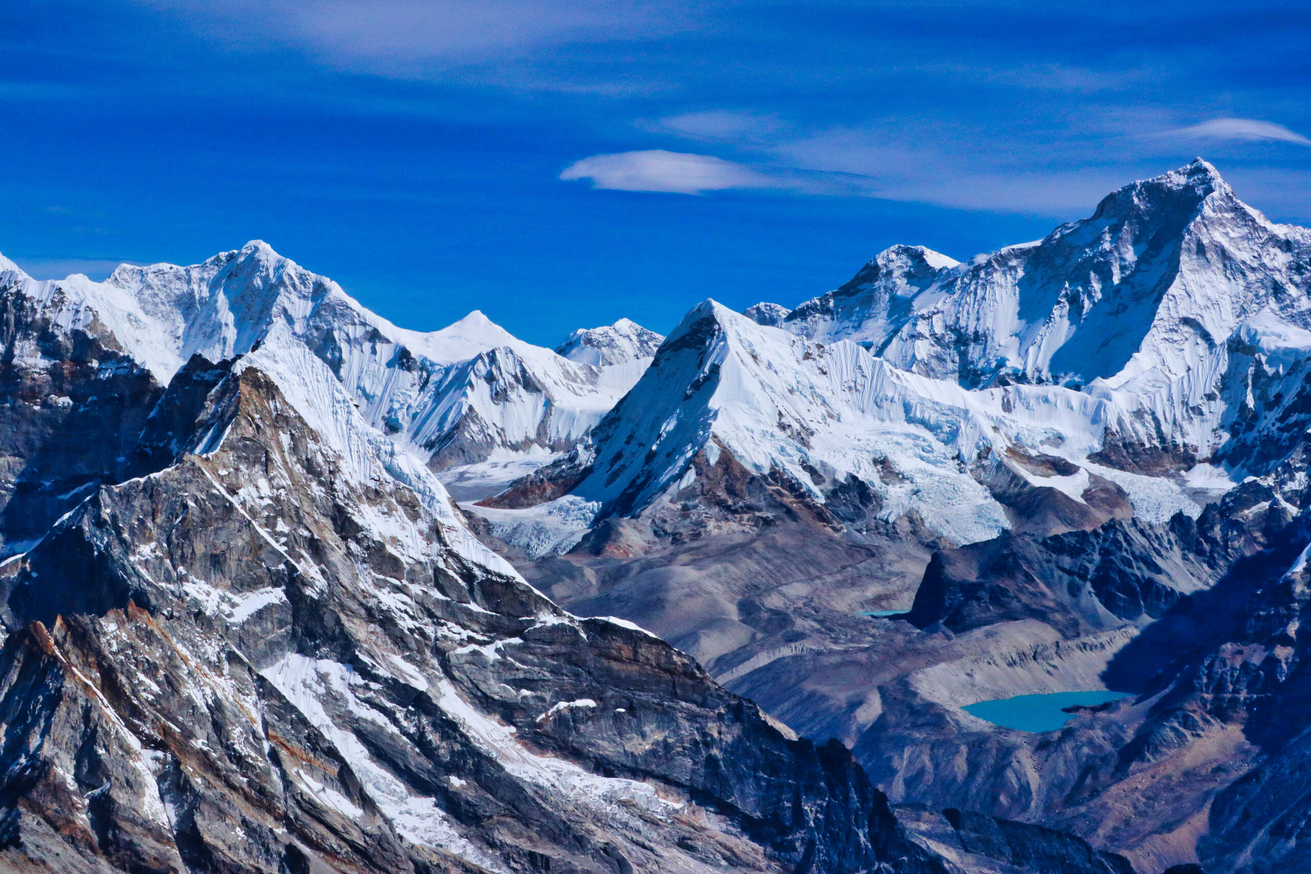
    Makalu, the four-sided pyramid of the world's fifth-highest mountain, in the Mahalangur Himalaya
    Makalu is 8,485 m (27,838 ft), the fifth-highest mountain on earth. Its four-sided pyramid, 19 km from Everest, is one of the hardest of the 8000ers to climb.
    Expedition Updates · Himalaya

    Makalu expedition update

    The fifth-highest mountain in the world, and one of the hardest. This page tracks why Makalu is a technical 8000er, the permit-and-difficulty mismatch, the French Couloir, the wild Barun approach, and a go or no-go checklist. A single-mountain page in our Expedition Updates directory. Elevations in metres (feet).

    Current status Technical 8000er 8,485 m (27,838 ft)

    Fifth by height, near the top for difficulty.

    Makalu is the world’s fifth-highest mountain, a clean four-sided pyramid 19 km from Everest, but its rank undersells it. Where Everest, Cho Oyu, and Manaslu are fixed-line climbs within reach of well-supported commercial teams, Makalu is a technical mountain, with a summit pyramid that demands real rock and ice climbing above 8,400 m and a summit rate near 30 percent.

    Its permit tells the opposite story: at around $3,000 for spring, a fifth of Everest’s $15,000, it looks like a bargain. It is not. On Makalu the barrier is not the price, it is the climbing. For the full route and cost detail, see our Makalu climb guide.

    8,485 m

    Summit (27,838 ft)

    Fifth-highest in the world, 19 km from Everest.

    ~30%

    Summit success

    One of the hardest of the 8000ers.

    Spring

    Main season

    And autumn; permit around $3,000.

    Makalu stands in the Mahalangur Himalaya, on the Nepal and China border in Makalu-Barun National Park, an isolated giant whose name comes from a Sanskrit word for the great black one. It was first climbed in 1955 by a French team on which every member reached the summit, and it has stayed a climber’s mountain ever since, far from the commercial crowds. This page owns the current picture and the honest difficulty. For the Northwest Ridge route detail, camps, gear, and cost breakdown, see our Makalu climb guide.

    Season and status

    A spring and autumn 8000er, for experienced teams.

    Makalu is climbed in spring, from April to May, and in a shorter autumn window in September and October, the same seasons as the other Himalayan 8000ers. It sees a small number of serious expeditions rather than the crowds of Everest, and in any given season the mountain may host only a handful of teams. Summit pushes hinge on catching a calm, clear weather window on an exposed, wind-scoured summit, and the short list of successful climbers each year reflects how often the mountain simply does not allow it.

    Fifth-highest, one of the hardest

    Why the height rank misleads.

    Height is the headline, but it is a poor guide to difficulty among the 8000ers. Makalu is far harder than Everest, Cho Oyu, or Manaslu, not because it is taller, it is not, but because its normal route keeps a genuine technical challenge to the very top. The upper mountain is a steep pyramid of rock and ice, graded around III to IV, climbed at an altitude where every move is slow and the margin for error is thin. That is why its summit rate sits near 30 percent while the commercial giants run far higher, and why Makalu is grouped with the hardest 8000ers rather than the accessible ones.

    The permit and difficulty mismatch

    Cheap to permit, hard to climb.

    Makalu against Everest, to show how permit price and rank hide the real difficulty. Figures for spring; confirm current permit costs.
    AspectMakaluEverest
    Height rankFifth in the worldFirst in the world
    Spring permitAround $3,000 (2025 revision)$15,000
    Summit successRoughly 30%Much higher, heavily supported
    Summit terrainTechnical: the French Couloir, Grade III to IVFixed-line snow and ice
    CrowdsRemote and uncommercialHeavily commercial
    Typical climberExperienced 8000er mountaineersA broad commercial range

    Under Nepal’s 2025 fee revision, the spring permit for Makalu is around $3,000, up from $1,800, and still a fraction of Everest’s $15,000. A climber comparing only the permit might conclude Makalu is the easier, cheaper option. The opposite is true. Everest’s higher price buys a fixed-line trade route and heavy commercial support; Makalu’s lower price comes with a technical summit, a remote approach, and far thinner infrastructure. Read the low permit as a warning, not an invitation.

    The French Couloir and summit pyramid

    Where the climb is won or lost.

    ⚠ The crux is at the very top, at the worst possible altitude

    The final barrier on the normal route is the French Couloir, a steep gully on the summit pyramid named for the 1955 first-ascent team, leading to a narrow, exposed summit ridge. It is real technical climbing at over 8,400 m, in extreme cold and wind, where a body is already failing from lack of oxygen. Many attempts end here, turned back by the difficulty, the weather, or the clock.

    This is what separates Makalu from the fixed-line 8000ers: the hardest climbing comes last, when climbers have least to give. It demands technical skill that carries over to the summit, not just endurance. Brush up on the systems in our fixed lines and jumars guide, though Makalu asks for more than a trade-route skill set. This page is educational and is not a substitute for experience.

    The wild Barun approach

    One of the last uncrowded expeditions in Nepal.

    Reaching Makalu is an expedition in itself. Base camp lies at the end of an 18 to 22 day trek through the Barun valley in Makalu-Barun National Park, one of the most isolated and unspoiled corners of Nepal, with camping, high passes, dense forest, and almost none of the lodges or crowds of the Everest and Annapurna trails. For many climbers the wildness of the approach is a large part of the appeal, a throwback to how Himalayan expeditions once felt. It also means self-sufficiency and time, well before the climbing begins.

    Who should attempt it

    An experienced climber’s 8000er.

    Makalu is not a first 8000er. It is usually climbed by mountaineers who have already succeeded on peaks such as Manaslu, Cho Oyu, Lhotse, or Everest, and it is widely used as Everest preparation and as an early objective in a fourteen-eight-thousanders project, because its technical terrain and extreme altitude build directly transferable skills. Arriving without that background is how climbers end up turning around low on the mountain, or worse. Weigh your experience honestly against our fitness standards, plan acclimatization with our acclimatization guide, and see where Makalu sits among the giants in our Nepal peaks gateway.

    Weather and timing

    A live look at the Mahalangur.

    Makalu’s summit is high enough to sit in the jet stream outside the short seasonal windows, and even in spring a summit push depends on a break in the wind. The live map below shows current conditions for the massif; a real attempt relies on expedition forecasting for every move above base camp.

    Live wind and weather for Makalu. Source: Windy.com. For how to read a mountain forecast, see our weather guide.
    Makalu, in the Mahalangur Himalaya on the Nepal-China border, 19 km southeast of Everest. Map: OpenStreetMap contributors.

    Go or no-go checklist

    Work through these before you commit.

    Before you go

    • Bring 8000er experience – Makalu expects a technical and high-altitude background, not a first attempt at extreme altitude.
    • Respect the summit pyramid – the French Couloir is real technical climbing above 8,400 m, and it decides most attempts.
    • Do not be lured by the permit – the low fee reflects demand, not difficulty; budget the full $25,000 to $45,000 expedition.
    • Plan for the approach – the Barun trek is 18 to 22 days of remote, self-sufficient travel before the climb.
    • Carry proper cover – helicopter evacuation and high-altitude rescue insurance are essential and often required.
    • Wait for the window – the summit is exposed to the jet stream; patience beats ambition.

    Makalu update FAQ

    The questions climbers ask most about the difficulty, the permit, and the approach.

    How hard is Makalu compared to other 8000ers?

    It is one of the hardest. Despite ranking fifth by height, Makalu is far more technical than the fixed-line commercial 8000ers such as Everest, Cho Oyu, or Manaslu. The summit pyramid involves real rock and ice climbing, around Grade III to IV, through the French Couloir and along an exposed summit ridge above 8,400 m, and summit success rates sit near 30 percent. It is usually attempted only by climbers who have already succeeded on easier 8000ers.

    What is the French Couloir on Makalu?

    The French Couloir is the steep, technical gully on Makalu’s summit pyramid, named after the 1955 French team that made the first ascent. It leads to a narrow, exposed summit ridge and is the crux of the normal route, demanding real technical climbing at extreme altitude in fierce cold and wind. It is the single feature that makes Makalu so much harder than its taller, more commercial neighbours, and it is where most summit attempts are decided.

    How much does the Makalu permit cost?

    Nepal’s climbing royalty for Makalu falls in the other-8000ers tier, around $3,000 for the spring season under the 2025 fee revision, up from $1,800, and a fraction of Everest’s $15,000. But the low permit price is misleading. The barrier to Makalu is not the cost, it is the difficulty, and a cheap permit does not make it an easier mountain. Fees change, so confirm the current figure with the Department of Tourism or your operator.

    How much does a Makalu expedition cost?

    A full guided Makalu expedition runs roughly $25,000 to $45,000, less than Everest but still a major undertaking, reflecting the remote approach, the technical support required, and the long duration on the mountain. Far fewer operators run Makalu than Everest, and the expeditions tend to be smaller and more serious. Our Makalu climb guide breaks the costs down in detail.

    What is the approach to Makalu like?

    Wild and remote. Makalu base camp is reached by an 18 to 22 day trek through the Barun valley in Makalu-Barun National Park, one of Nepal’s most isolated and unspoiled regions, a long way from the lodges and crowds of Everest or Annapurna. It is a genuine wilderness expedition rather than a teahouse trek, with camping, high passes, and minimal services, which is part of the mountain’s appeal to experienced climbers.

    When is the Makalu climbing season?

    Spring, from April to May, is the main climbing season, with a shorter autumn window in September and October. The seasons match the other Himalayan 8000ers, and summit pushes still depend on catching a calm, clear weather window on an exposed, wind-blasted summit. Winter ascents have been made, but they are an extreme undertaking reserved for elite alpinists.

    Who should attempt Makalu?

    Experienced high-altitude climbers, typically after peaks such as Manaslu, Cho Oyu, Lhotse, or Everest. Makalu is widely used as Everest preparation and as an early objective in a fourteen-eight-thousanders project, because its technical terrain and extreme altitude build skills that transfer directly to harder peaks. It is emphatically not a first 8000er, and arriving without a technical and high-altitude background is a recipe for turning back or worse.

    How high is Makalu and where is it?

    Makalu is 8,485 m (27,838 ft), the fifth-highest mountain in the world, in the Mahalangur Himalaya on the border of Nepal and China, 19 km southeast of Everest. It is a striking, isolated four-sided pyramid, first climbed in 1955 by a French team on which, remarkably, every member reached the summit, one of the most successful first ascents of any 8000er.

    📋 How this update is built

    This page is compiled by Travis Ludlow, Founder and Head of Research at Global Summit Guide, from Nepal Department of Tourism permit rules, the 2025 fee revision, and operator-published expedition records, with sources named below. It was reviewed for safety by Dawson Ludlow, our Climbing and Mountaineering Lead (Wilderness First Aid), whose highest first-hand summit is Kilimanjaro.

    Our team has not climbed Makalu, so we report official rules and expedition records rather than personal experience, and we review this page before each Himalayan season. Permit fees and rules change, so confirm the current royalty and requirements with the Department of Tourism or your operator before planning around them.

    Planning a Makalu expedition?

    Start with our Makalu climb guide for the full route, camps, and cost, compare the neighbours in our Everest and Lhotse updates, and vet specialist teams in the operator directory. Every expedition stages through Kathmandu, so for flights and hotels there, browse travel on Expedia.

    Disclosure: the Expedia link above is a sponsored affiliate link. We may earn a commission at no extra cost to you.

    Was this helpful?

    Yes
    No
    Thanks for your feedback!
  • Mount Yari (Yarigatake) Expedition Update 2026: Routes, the Summit Block & the Daikiretto

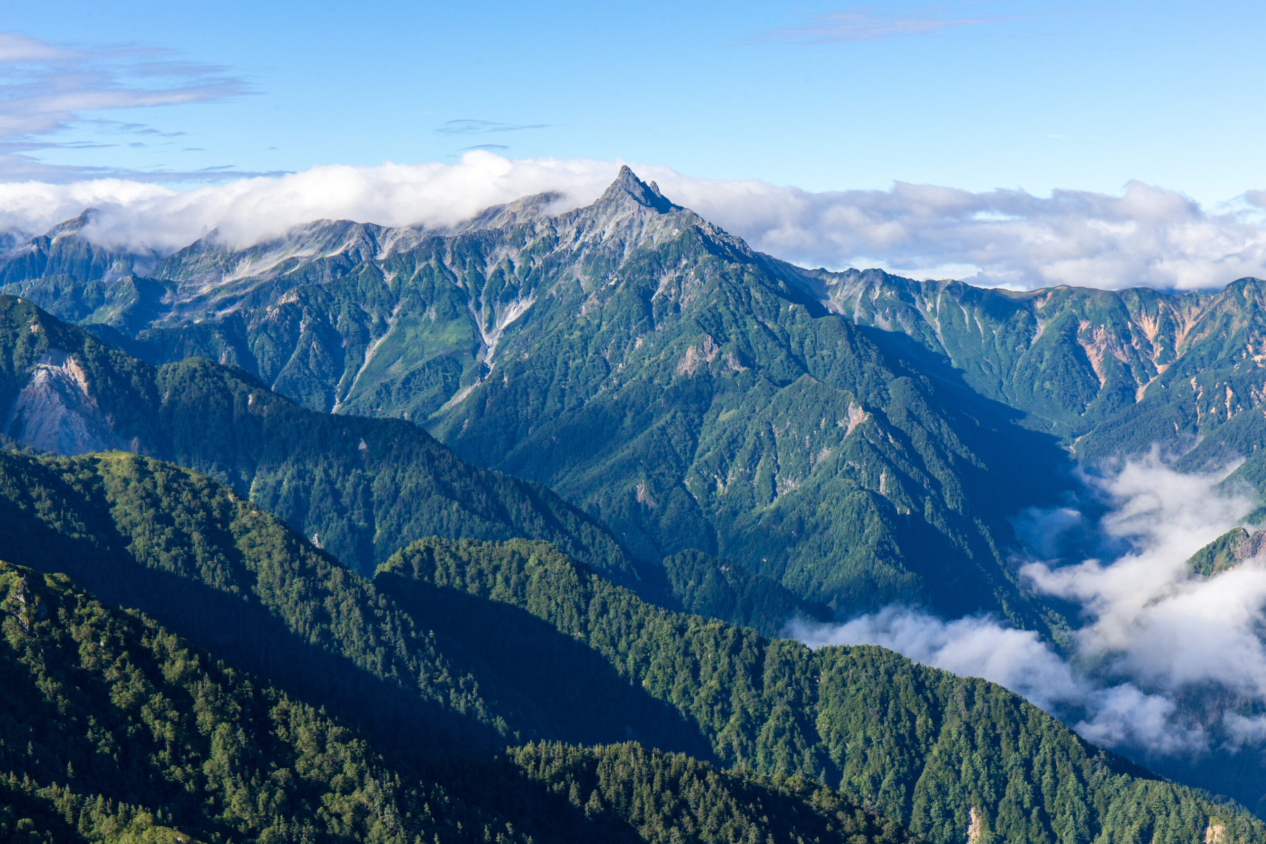
    Yarigatake, the spear-shaped summit of the Northern Japan Alps, the fifth-highest mountain in Japan
    Yarigatake is 3,180 m (10,433 ft), the fifth-highest mountain in Japan. Its spear-shaped summit, climbed on iron chains and ladders, is one of the country’s most beloved peaks.
    Expedition Updates · Japan

    Mount Yari expedition update

    The Matterhorn of Japan, a long hut-based hike with a sharp sting in the tail. This page tracks the routes, the chained summit block, the notorious Daikiretto, the huts and hiking-plan system, the season, and a go or no-go checklist. A single-mountain page in our Expedition Updates directory. Elevations in metres (feet).

    Current status Summer hut season 3,180 m (10,433 ft)

    The spear you climb on chains and ladders.

    Yarigatake is the fifth-highest mountain in Japan and one of its most loved, a sharp rock spear at the head of the Northern Alps. The normal route is a long, multi-day hut-based walk, but it ends with a short, steep, exposed scramble up the summit spire on fixed iron chains and near-vertical ladders. It is not a beginner mountain.

    There is no permit, but you should file a hiking plan, book huts ahead, and carry cash. And from Yari’s summit runs the Daikiretto, a knife-edge traverse to the Hotaka range that is one of the most dangerous trails in Japan. For the full route detail, see our Yarigatake guide.

    3,180 m

    Summit (10,433 ft)

    The fifth-highest mountain in Japan.

    Jul to Sep

    Main season

    Early August the sweet spot; huts run to late October.

    No permit

    File a hiking plan

    Hut-based and cash only; reserve ahead.

    Yarigatake stands in the Hida Mountains of the Northern Japan Alps, on the Nagano and Gifu border in Chubu-Sangaku National Park. Its name means spear peak, and the pyramid of rock at its summit has made it a rite of passage for Japanese climbers since the monk Banryu first climbed it in 1828. This page owns the current picture, the routes, the summit block, and the logistics. For the full history, day-by-day route detail, and gear, see our Yarigatake climb guide.

    Season and status

    A summer hut mountain, with a real early-season catch.

    The main season runs from July to September, with early August widely regarded as the sweet spot for stable afternoon weather and alpine wildflowers, and late September into October bringing the famous autumn colours. The huts open around the spring Golden Week holiday and close in late October, after which the route shuts to general hikers. The catch is early July, when the upper Yarisawa can still hold snow and ice, and an ice axe and crampons may be needed; Yarisawa Lodge has posted signs warning less-equipped hikers to turn back. Check current conditions before you commit to an early-season attempt.

    Why climbers love the spear

    The Matterhorn of Japan, and a rite of passage.

    Yarigatake earns its Matterhorn of Japan nickname from the clean rock spire that crowns it, visible from ridgelines across the range and instantly recognisable. For Japanese hikers it is one of the great aspirational peaks, a summit you work up to after easier mountains, and reaching the top of the spear on chains and ladders is a milestone in a climbing life. Walter Weston, the English missionary who helped bring alpinism to Japan, climbed and championed it, and it has anchored the culture of the Northern Alps ever since. The appeal is the combination: a long, beautiful valley and ridge walk, and a genuine bit of exposed climbing to finish.

    The routes and the summit block

    A long walk in, and a sharp climb out.

    The main ways up Yarigatake, all finishing with the chained summit block. Confirm current conditions before you go.
    RouteFromCharacterNotes
    Kamikochi / YarisawaKamikochiThe classic and most popular line, following the Azusa River up the Yarisawa gorge.About 39 km and 2,130 m of gain; two to four days.
    Omote-Ginza traverseNakabusa OnsenA spectacular high ridge over Tsubakuro and along the range to Yari.More committing; a multi-day traverse.
    Summit blockYarigatake SansoThe final 200 m of near-vertical rock on heavy iron chains and ladders.Short but steep and exposed; 20 to 30 minutes, with queues in season.
    DaikirettoToward HotakadakeA knife-edge traverse linking Yari to the Hotaka range, for experienced climbers only.One of the most dangerous stretches of trail in Japan.

    Most climbers take the Kamikochi and Yarisawa approach, a non-technical but long walk up the valley with one or more nights in huts before the summit push. Whatever the approach, the mountain saves its difficulty for the end: the final 200 m to the top is a near-vertical scramble on heavy iron chains and ladders, taking twenty to thirty minutes, with real exposure and, in season, queues both up and down. Wet or icy chains make it far more serious, so many climbers go for the summit at first light before the afternoon weather builds.

    The Daikiretto

    The knife-edge that starts where the easy climbing ends.

    ⚠ A separate mountain, and a far more dangerous one

    From Yari’s summit, a ridge runs south toward the Hotaka range and drops into the Daikiretto, a knife-edge traverse widely regarded as one of the most dangerous stretches of maintained trail in Japan. It is a long, highly exposed scramble on chains, ladders, and bolts, with sheer drops on both sides, and it would be graded a technical climb in many other countries. Climbers wear helmets, move deliberately, and pick settled weather.

    The Daikiretto is not part of the normal Yari ascent and should not be attempted on the strength of it. It is for experienced climbers with a head for extreme exposure only, and it is unforgiving of a slip or a lapse in concentration. This page is educational and is not a substitute for the skills the traverse demands.

    Huts, the hiking plan and access

    The logistics visitors most often get wrong.

    Yarigatake Sanso and the hut system

    Yarigatake Sanso, a large classic mountain hut just below the summit at around 3,000 m, is the usual base, providing dinner, breakfast, and a futon, with more huts along the approach such as Yarisawa Lodge. Budget roughly 10,000 to 15,000 yen a night with two meals, bring cash because the huts do not take cards, and reserve ahead in peak season. Designated tent sites are available at some huts for a small fee.

    No permit, but file a plan. Yarigatake needs no climbing permit or fee, but you should submit a hiking plan, a tozan-todoke, through the Nagano Police online system or an app such as Compass or Yamap, or on paper at the Kamikochi bus terminal, so rescuers know your route. Reach the mountain via Matsumoto and Kamikochi; private cars cannot enter Kamikochi, so park at Sawando or Hirayu and take the bus or a taxi in. Download offline maps, because phone signal is unreliable high on the mountain.

    Difficulty and altitude

    A serious hike with an exposed finish.

    Yarigatake is not a technical climb on its normal route, but it is a demanding one, with a long approach, a big height gain, an exposed chained summit at 3,180 m, and weather that turns quickly. It rewards real hill fitness and a head for heights rather than rope skills, and it sits well beyond a beginner day-hike. The altitude is enough to affect some hikers, so build the walk-in over a couple of days rather than racing up. Check your base against our fitness standards and gauge your altitude response with the AMS risk calculator.

    Weather and timing

    Fast-changing weather on an exposed summit.

    Weather at 3,180 m changes faster than many hikers expect, and the chained summit and the ridges become hazardous when wet or icy, so an early start and a settled forecast matter. The live map below shows current conditions; rely on a mountain forecast and the hut staff for the summit-day call.

    Live wind and weather for Yarigatake. Source: Windy.com. For how to read a mountain forecast, see our weather guide.
    Yarigatake, in the Northern Japan Alps on the Nagano-Gifu border, reached from Kamikochi. Map: OpenStreetMap contributors.

    Where Yari fits your progression

    A step up in the Japan Alps.

    Yarigatake is a mountain most Japanese hikers reach after building up on gentler peaks, and it makes a fine step beyond a walk-up like Mount Fuji into terrain with real exposure and hut-to-hut travel. From here the range opens up, whether along the ridges to the Hotaka peaks or, for the very experienced, across the Daikiretto itself. See the country’s most famous climb in our Mount Fuji expedition update, and weigh guiding against going alone in our guided versus independent climbing guide.

    Go or no-go checklist

    Work through these before you go.

    Before you go

    • File a hiking plan – submit a tozan-todoke online or on paper so rescuers know your route.
    • Book huts and carry cash – the huts fill in season and do not take cards.
    • Time the season – July to September, ideally early August; expect snow in the upper Yarisawa in early July.
    • Respect the summit block – the chains and ladders are exposed and dangerous when wet or icy.
    • Leave the Daikiretto alone unless expert – it is a separate, far more serious undertaking.
    • Download offline maps – phone signal is unreliable high on the mountain.

    Yarigatake update FAQ

    The questions climbers ask most about the summit block, the Daikiretto, and the huts.

    How hard is it to climb Mount Yari?

    Yarigatake is a long, demanding hike rather than a technical climb, but it is not a beginner mountain. The normal route is a multi-day approach, usually two to four days, with a big height gain to 3,180 m, and it finishes with a short, steep, exposed scramble up the summit spire on fixed iron chains and near-vertical ladders. Fit hikers with a head for heights can do it without ropes, though the chain sections become hazardous when wet or icy, and the summit block can bottleneck with queues in peak season.

    What is the Daikiretto?

    The Daikiretto is a notorious knife-edge ridge traverse linking Yarigatake to the Hotaka range, widely regarded as one of the most dangerous sections of maintained trail in Japan. It is a long, highly exposed scramble on chains, ladders, and bolts, with big drops on both sides, and it would be graded a technical climb in many countries. It is a separate and far harder undertaking than the normal Yari ascent, for experienced climbers with a helmet and steady nerves only.

    Do you need a permit or a guide for Yarigatake?

    There is no climbing permit and no fee, and no guide is required on the normal route, though guiding is available. Japan does ask climbers to file a hiking plan, called a tozan-todoke, which you can submit online through the Nagano Police system or apps like Compass and Yamap, or on paper at the Kamikochi bus terminal, so rescuers know your route if something goes wrong. Hut reservations are strongly advised in peak season.

    Which route should I take?

    The classic and most popular is the Kamikochi and Yarisawa valley approach, a long but non-technical walk-in that most hikers spread over two to four days with hut stays. The Omote-Ginza ridge traverse from Nakabusa Onsen is a spectacular multi-day alternative over the high ridgeline. Both finish with the chained summit block. Only experienced climbers should take on the Daikiretto to the Hotaka range.

    When is the Yarigatake climbing season?

    The main hiking season is July to September, with early August widely regarded as the sweet spot for stable weather and wildflowers, and late September into October bringing the famous autumn colours. The huts run from around the Golden Week holiday in spring until late October, and by November the route is closed to general hikers. Early July can still hold snow and ice in the upper Yarisawa, where an ice axe and crampons may be needed, so check conditions before you go.

    Where do you stay on Yarigatake?

    Yarigatake Sanso, a large classic mountain hut just below the summit at around 3,000 m, is the usual base, providing dinner, breakfast, and a futon; there are more huts along the approach, such as Yarisawa Lodge. Budget roughly 10,000 to 15,000 yen a night with two meals, and bring cash, because the huts do not take cards. Designated tent sites are available at some huts for a small fee. Book ahead in peak season, as the huts fill.

    How do you get to Yarigatake?

    The gateway is Kamikochi in the Northern Japan Alps, reached from Tokyo via Matsumoto by train, then a bus into the valley. Private cars cannot drive into Kamikochi, so you park at Sawando or Hirayu and take a bus or taxi in. From the Kamikochi bus terminal it is a long valley walk up the Azusa River and the Yarisawa gorge to the mountain.

    How high is Mount Yari and where is it?

    Yarigatake is 3,180 m (10,433 ft), the fifth-highest mountain in Japan, in the Hida Mountains of the Northern Japan Alps on the border of Nagano and Gifu prefectures. Its sharp, spear-like summit, which gives the mountain its name, spear peak, makes it one of the most recognisable and beloved mountains in the country. It was first climbed in 1828 by the Buddhist monk Banryu.

    📋 How this update is built

    This page is compiled by Travis Ludlow, Founder and Head of Research at Global Summit Guide, from Chubu-Sangaku National Park and Nagano Prefecture safety guidance, mountain-hut information, and the prefectural hiking-plan systems, with sources named below. It was reviewed for safety by Dawson Ludlow, our Climbing and Mountaineering Lead (Wilderness First Aid), whose highest first-hand summit is Kilimanjaro.

    Our team has not climbed Yarigatake, so we report official information and route records rather than personal experience, and we review this page for the summer hut season. Hut prices, transport, and conditions change, so confirm current details and file your hiking plan before you go.

    Planning a Yarigatake climb?

    Start with our Yarigatake guide for the full route detail, pair it with the country’s most famous climb in our Mount Fuji update, and choose a team in the operator directory. Most climbers stage through Tokyo and Matsumoto to Kamikochi, so for flights and lodging, browse travel on Expedia.

    Disclosure: the Expedia link above is a sponsored affiliate link. We may earn a commission at no extra cost to you.

    Was this helpful?

    Yes
    No
    Thanks for your feedback!
  • Mount Tyree Expedition Update 2026: Antarctica’s Second Summit

    Mount Tyree, the second-highest and one of the hardest peaks in Antarctica, in the Sentinel Range
    Mount Tyree is 4,852 m (15,919 ft), Antarctica’s second-highest peak. Just 40 m below Vinson and 13 km away, it has been climbed by only about 20 people.
    Expedition Updates · Antarctica

    Mount Tyree expedition update

    Antarctica’s second-highest peak, and far harder than the highest. This page tracks the Second Summits challenge, the contrast with neighbouring Vinson, the technical climb, the logistics, and a go or no-go checklist. A single-mountain page in our Expedition Updates directory. Elevations in metres (feet).

    Current status Expert alpine 4,852 m (15,919 ft)

    Forty metres lower than Vinson, and a different sport entirely.

    Mount Tyree is Antarctica’s second-highest peak, just 40 m below Vinson and only 13 km away, reached through the same Union Glacier logistics. On paper it looks like a companion climb. In reality it is one of the hardest and least-climbed major mountains on earth.

    Vinson has been climbed well over 1,200 times on a non-technical trade route. Tyree has been climbed by about 20 people, with no standard route and no guided trips. It is the clearest proof that the second-highest peaks can be far harder than the highest. See the easier neighbour in our Vinson update.

    4,852 m

    Summit (15,919 ft)

    Second-highest in Antarctica, 40 m below Vinson.

    ~20

    People ever on top

    Against well over 1,200 on neighbouring Vinson.

    Nov to Jan

    Climbing season

    The short Antarctic summer window.

    Mount Tyree stands in the Sentinel Range of the Ellsworth Mountains, 13 km northwest of Vinson, rising between the Patton and Cervellati glaciers. Discovered from the air in 1958 and first climbed in 1967, it has stayed almost untouched ever since, a peak for a tiny number of elite expeditions rather than the commercial trade. This page owns the current picture, the Second Summits context, the Vinson contrast, and what the climb actually involves. For the full history and route records, see our Mount Tyree guide.

    Season and status

    A short Antarctic summer window, for a very few teams.

    Tyree is climbed, when it is climbed at all, in the Antarctic summer from November to January, the same window as Vinson, when there is 24-hour daylight and the least severe conditions. But where Vinson sees dozens of climbers a season, Tyree may see none at all in a given year. There is no season tracker in the usual sense; the status that matters is simply whether a capable team, with the logistics arranged, is attempting it.

    The Second Summits angle

    The harder game beyond the Seven Summits.

    The Seven Summits, the highest peak on each continent, are a famous goal. The Seven Second Summits, the second-highest peak on each continent, are a far tougher and much rarer one, first completed by Hans Kammerlander. The reason is that on several continents the second peak is harder than the highest, and Antarctica is the sharpest example. Tyree, alongside K2 in Asia, is one of the two hardest summits on the Second list, and its tiny number of ascents is a large part of why so few people ever finish the challenge.

    The pattern in one line: the highest peak is often the popular, achievable one, while the second-highest is the mountaineer’s test. It holds for Kilimanjaro and Mount Kenya, for Elbrus and Dychtau, and most of all for Vinson and Tyree. Explore the full set in our Seven Summits hub.

    Tyree versus Vinson

    Same range, same access, opposite mountain.

    Mount Tyree compared with its higher, far easier neighbour, Mount Vinson.
    AspectMount TyreeMount Vinson
    Height4,852 m (15,919 ft), second4,892 m (16,050 ft), highest
    Ascents everAbout 20 people, a handful of timesWell over 1,200
    DifficultyTechnical, steep and exposedNon-technical snow plod
    RouteNo standard routeAn established trade route
    Guided climbsNoneGuided commercially every season
    ListSeven Second SummitsOne of the Seven Summits

    The two mountains share the flight to Union Glacier, the season, and the brutal Antarctic climate. Everything else diverges. Vinson is the achievable, guided, non-technical Seven Summit that has never recorded a climber fatality and boasts a near-total success rate. Tyree is a committing technical climb with no trade route to follow and no guides to hire, attempted only by the most capable and self-sufficient teams. Reaching one does not prepare you for the other.

    The climb and difficulty

    Technical ground, and a great unclimbed face.

    No standard route

    Tyree has been climbed by only about three lines in its history, mostly via ridges such as the northeast ridge, all of them technical, steep, and exposed. Because so few teams have been there, route knowledge is thin and every attempt is close to pioneering. The enormous south face, roughly 2,000 m high, has never been climbed at all, and is considered one of the greatest unclimbed objectives left in Antarctica. This is a mountain for climbers comfortable with uncertainty and commitment, not for following tracks.

    Access and logistics

    The Vinson chain, without the trade-route safety net.

    Getting to Tyree begins exactly as it does for Vinson: a flight from Punta Arenas, Chile, to Union Glacier Camp with Antarctic Logistics and Expeditions, then a ski-plane toward the Sentinel Range. From there the resemblance ends. There is no guided programme, no fixed camps, and no other teams to lean on, so a Tyree attempt is a custom, self-organized expedition of 20 days or more, put together by climbers who bring their own technical competence. Because ALE controls the logistics, the cost is high before the climbing even begins.

    Cold, remoteness and rarity

    The environment is the adversary.

    ⚠ One of the most committing summits on earth

    Antarctic summer temperatures on Tyree run around -20 to -30 C, and colder with wind, and the peak sits deep in the Sentinel Range far from any help. There is no rescue infrastructure on the mountain and, in most seasons, no one else nearby. A team must be entirely self-sufficient and able to solve serious problems alone, in one of the harshest environments any climber will face.

    That is why so few have stood on top: more people have flown on the International Space Station than have climbed Mount Tyree. It demands elite technical skill, deep polar experience, and sound judgment. Refresh the fundamentals with our crevasse rescue basics guide. This page is educational and is not a substitute for experience.

    Weather and timing

    A live look at the Sentinel Range.

    Tyree sits in the interior of Antarctica, where even summer conditions are extreme and weather can pin a team down or ground the ski-planes for days. The live map below shows current conditions for the massif; a real attempt relies on ALE and the team’s own forecasting for every move.

    Live temperature and weather for the Mount Tyree area. Source: Windy.com. For how to read a mountain forecast, see our weather guide.
    Mount Tyree, 13 km northwest of Vinson in the Sentinel Range of the Ellsworth Mountains. Map: OpenStreetMap contributors.

    Go or no-go checklist

    Work through these before you commit.

    Before you go

    • Bring elite alpine experience – Tyree expects technical competence and deep polar background, not a Vinson resume.
    • Plan a custom expedition – there is no guided programme; you build the trip and the team yourselves.
    • Arrange ALE logistics early – the flight chain to the Sentinel Range must be booked well ahead.
    • Be fully self-sufficient – assume no rescue and no other teams; carry the margins to survive alone.
    • Expect no beaten path – route knowledge is thin, so plan for pioneering and uncertainty.
    • Confirm evacuation cover – rescue in the range is limited, weather-dependent, and slow.

    Mount Tyree update FAQ

    The questions climbers ask most about the difficulty, the rarity, and the Vinson comparison.

    How does Mount Tyree compare to Mount Vinson?

    Tyree is Antarctica’s second-highest peak at 4,852 m, only 40 m below Vinson and just 13 km away, but it is a completely different climb. Vinson is a non-technical glacier plod with an established trade route and well over 1,200 ascents. Tyree is a steep, exposed, technical climb with no standard route, no guided trips, and only around 20 people ever on its summit. The second-highest peak is far harder than the highest, which is the whole point of the mountain.

    How many people have climbed Mount Tyree?

    Very few. Since the first ascent in 1967, only about 20 people have reached the summit, in a handful of successful ascents along roughly three routes. To put that in perspective, more people have been aboard the International Space Station than have stood on top of Mount Tyree, while neighbouring Vinson has been climbed well over a thousand times. It is one of the least-climbed major mountains on earth.

    Why is Tyree so much harder than Vinson if it is lower?

    Because in Antarctica height is not the main difficulty; the cold and the terrain are. Vinson’s normal route is straightforward snow at a moderate angle, while Tyree’s upper sections demand technical climbing on steep, exposed ground, and it has no trade route or guided infrastructure to fall back on. That combination makes it a far more committing expedition despite being 40 m lower. It is the clearest example of why the second-highest peaks are often the harder climbs.

    What are the Seven Second Summits?

    The Seven Second Summits are the second-highest peaks on each of the seven continents, a challenge widely considered tougher than the Seven Summits and first completed by Hans Kammerlander. Tyree in Antarctica and K2 in Asia are the hardest on the list, which is why far fewer climbers attempt it than the famous Seven Summits. Tyree, with only around 20 summiters, is one of the biggest obstacles to finishing it.

    How do you get to Mount Tyree?

    The approach is the same as Vinson: fly from Punta Arenas, Chile, to Union Glacier Camp with Antarctic Logistics and Expeditions, then take a ski-plane toward the Sentinel Range. From there the similarity ends. Unlike Vinson there is no trade route and no commercial guided climb, so reaching and climbing Tyree is a custom, self-sufficient expert expedition, typically 20 days or more.

    What is the route on Mount Tyree?

    There is no standard route. The mountain has been climbed by only about three lines, mostly via ridges such as the northeast ridge, all of them technical. The enormous south face, roughly 2,000 m high, has never been climbed and is considered one of the greatest unclimbed objectives on the entire continent. Any team attempting Tyree is close to pioneering territory rather than following a beaten path.

    How cold and remote is Mount Tyree?

    Antarctic summer temperatures run around -20 to -30 C, and far colder with wind, and Tyree sits deep in the Sentinel Range, a long way from any help. There is no rescue infrastructure on the mountain and, in most seasons, no other climbers anywhere near it. A team has to be entirely self-sufficient and prepared to solve any problem on its own, which is a large part of what makes the peak so serious.

    How high is Mount Tyree and where is it?

    Mount Tyree is 4,852 m (15,919 ft), the second-highest mountain in Antarctica, in the Sentinel Range of the Ellsworth Mountains, 13 km northwest of Mount Vinson. It was discovered from the air in 1958 and first climbed in January 1967 by Barry Corbet and John Evans, members of the same American expedition that made the first ascent of Vinson.

    📋 How this update is built

    This page is compiled by Travis Ludlow, Founder and Head of Research at Global Summit Guide, from ALE logistics information, published expedition and ascent records, and Seven Second Summits references, with sources named below. It was reviewed for safety by Dawson Ludlow, our Climbing and Mountaineering Lead (Wilderness First Aid), whose highest first-hand summit is Kilimanjaro.

    Our team has not climbed Mount Tyree, so we report expedition records and official logistics rather than personal experience, and we review this page before each Antarctic season. Because so few ascents exist, details are drawn from a small body of published accounts; confirm current logistics with ALE and specialist operators before planning around them.

    Chasing the Second Summits?

    Start with our Mount Vinson update for the accessible neighbour, see the whole picture in our Seven Summits hub and real-cost breakdown, and vet specialist teams in the operator directory. Every Antarctic climb stages through Punta Arenas, so for flights and hotels there, browse travel on Expedia.

    Disclosure: the Expedia link above is a sponsored affiliate link. We may earn a commission at no extra cost to you.

    Was this helpful?

    Yes
    No
    Thanks for your feedback!
  • Ojos del Salado Expedition Update 2026: Permit, Season, Routes & the Drive-Up Paradox

    Ojos del Salado, the world's highest volcano, rising from the Atacama Desert on the Chile-Argentina border
    Ojos del Salado is 6,893 m (22,615 ft), the highest volcano on earth and the second-highest peak in the Americas. On the Chilean side, a 4×4 reaches within about 1,000 m of the top.
    Expedition Updates · Andes

    Ojos del Salado expedition update

    The highest volcano on earth, and one you can nearly drive up, which is exactly the danger. This page tracks the season, the drive-up paradox, the DIFROL permit, the route, cost against Aconcagua, and a go or no-go checklist. A single-mountain page in our Expedition Updates directory. Elevations in metres (feet).

    Current status Season Nov to Mar 6,893 m (22,615 ft)

    The highest volcano on earth, and the altitude sneaks up on you.

    Ojos del Salado is the second-highest peak in the Americas, just 68 m below Aconcagua, in the Atacama Desert. It is technically easy, a scree walk with a short scramble near the top, and on the Chilean side a 4×4 reaches around 5,900 m at Refugio Tejos, within about 1,000 vertical metres of the summit.

    That access is the appeal and the trap. Because you can gain altitude so fast, altitude sickness is the real hazard, not the climbing. You need a free DIFROL border permit, careful acclimatization, and respect for the cold and remoteness of the world’s driest desert.

    6,893 m

    Summit (22,615 ft)

    Highest volcano on earth; second-highest peak in the Americas.

    Free

    DIFROL permit

    The border authorization, plus a modest local area fee.

    Nov to Mar

    Climbing season

    Southern Hemisphere summer, December to February prime.

    Ojos del Salado rises on the Chile-Argentina border east of Copiapo, in a stretch of the high Andes that holds the greatest concentration of 6,000 m peaks on earth. It is an active volcano in the driest desert on the planet, which is why it carries so little permanent snow, and it draws climbers as both a goal in its own right and the great quiet alternative to Aconcagua. This page owns the current picture, the access, the route, and the honest comparison. For the full history, route detail, and gear, see our Ojos del Salado climb guide.

    Season and status

    A Southern Hemisphere summer peak.

    The official climbing season runs from November 1 to March 31, with December to February the prime window, matching Aconcagua and the rest of the high Andes. Climbing outside those dates requires a special permit. Even in season, summit success depends on catching a calm, clear window, because the Atacama can deliver ferocious wind and bitter cold at altitude despite its desert setting. Most expeditions build in spare days for weather and for the acclimatization the mountain demands.

    The drive-up paradox

    The easiest way to nearly 6,900 m, and why that is the danger.

    Ojos del Salado is unlike almost any other peak of its height. On the Chilean side, a dirt road lets 4×4 vehicles reach around 5,900 m at Refugio Tejos, and in 2015 a heavily modified car set a world record by reaching 6,688 m on the mountain, the highest a car has ever driven. That means a vehicle can put you within roughly 1,000 vertical metres of one of the highest summits on the continent, turning what would be a multi-week expedition on another peak into a much shorter push.

    The trap in one sentence: the road lets you gain altitude far faster than your body can adapt, so the thing that makes Ojos accessible is also what makes it dangerous. Climbers who ride high and go for the summit without proper acclimatization are the ones who get altitude sickness or worse. Treat the easy access as a convenience to be managed, not a shortcut to be taken.

    Permits and DIFROL

    Free at the border office, modest in Copiapo.

    Because Ojos sits on the international border, non-Chilean climbers on the Chilean side need a DIFROL permit, the authorization issued by Chile’s foreign ministry for border-area peaks. It is free, applied for online at difrol.cl, and it is worth starting the paperwork about 20 business days ahead. On top of that, you obtain a local area permit in Copiapo for the Nevado Tres Cruces zone, whose fee varies and has been reported around $150 to $200, though it is sometimes waived, so confirm the current situation. The Argentine side needs no permit at all, but it is far more remote, with no refugios and no road to base camp.

    Ojos del Salado permits and cost, per climber. Fees vary; confirm current figures with your operator and DIFROL.
    ItemCostNotes
    DIFROL border permitFreeChilean foreign-ministry authorization for a border peak; apply online, about 20 business days ahead.
    Local Copiapo area permitAround $150 to $200For the Nevado Tres Cruces area; the fee varies and is sometimes waived, so confirm current.
    Guided expedition$2,500 to $4,200+Usually 12 to 14 days including acclimatization and 4×4 logistics.
    Argentine side permitNoneBut the Argentine route is far more remote, with no refugios and no road to base camp.

    The route and difficulty

    Technically easy, seriously high.

    The Chilean normal route

    From Copiapo, 4x4s carry climbers up through the Atacama to Refugio Atacama around 5,200 m and Refugio Tejos around 5,800 m. From Tejos, summit day climbs gentle scree slopes with occasional snow patches, finishing with a short rock scramble near the top, graded around UIAA I to II and sometimes protected by a fixed rope. There is no sustained technical climbing. The difficulty is the altitude, the cold, and the length of the summit day, not the moves. Previous high-altitude experience is expected.

    Altitude, cold and remoteness

    The three real hazards of the Atacama.

    ⚠ Easy climbing does not mean low risk

    At nearly 6,893 m, the altitude is the dominant hazard, made worse by the fast vehicle-driven ascent, and altitude sickness is the main reason climbers fail or get hurt here. Summit-day temperatures can reach around -25 C with fierce wind, and the mountain sits in the heart of the world’s driest desert, hours from help, with thin rescue infrastructure and no cell coverage beyond Copiapo.

    Acclimatize properly, carry the cold-weather kit for an extreme day, move with reliable communications, and be willing to turn around. Gauge your altitude risk with our AMS risk calculator and read our acclimatization guide. This page is educational and is not medical advice.

    Cost and the Aconcagua comparison

    Cheaper than Aconcagua, but not by as much as you have read.

    Ojos is often sold as a bargain alternative to Aconcagua, and it is cheaper, but the honest figure is around half the cost of a comparable guided Aconcagua trip, not the one-fifth some articles claim. The savings come mainly from the free DIFROL permit, where Aconcagua charges a steep climbing fee, and from lower operator prices, rather than from Ojos being a trivial undertaking. The real trade-off is remoteness and rescue: Ojos is quieter and wilder, which is part of its appeal and part of its risk. Weigh it against its neighbour in our Aconcagua climb guide, and estimate your own numbers with the expedition budget calculator.

    Weather and timing

    A live look at the high Atacama.

    The Atacama is dry but not gentle at altitude, and wind is often the deciding factor on summit day. The live map below shows current conditions for the massif; rely on your expedition’s forecasting for the actual go decision.

    Live wind and weather for Ojos del Salado. Source: Windy.com. For how to read a mountain forecast, see our weather guide.
    Ojos del Salado, on the Chile-Argentina border in the Atacama Desert east of Copiapo. Map: OpenStreetMap contributors.

    Go or no-go checklist

    Work through these before you commit.

    Before you go

    • Apply for the DIFROL permit early – it is free but start about 20 business days ahead, and arrange the local Copiapo area permit.
    • Do not skip acclimatization – the road makes it possible to go too high too fast; spend days at the Atacama lakes and a warm-up peak first.
    • Pack for extreme cold – summit day can hit -25 C with high wind in a desert setting.
    • Plan for remoteness – carry reliable communications; there is no cell coverage beyond Copiapo and rescue is slow.
    • Have the altitude base – previous high-altitude experience matters far more than technical skill here.
    • Budget honestly – it is cheaper than Aconcagua, but around half, not a fifth.

    Ojos del Salado update FAQ

    The questions climbers ask most about permits, access, and the altitude.

    Do you need a permit to climb Ojos del Salado?

    On the standard Chilean side, yes, two of them. You need a free DIFROL permit, the Chilean foreign-ministry authorization required for peaks on the international border, which you apply for online at difrol.cl about 20 business days ahead. You also need a local area permit obtained in Copiapo for the Nevado Tres Cruces zone, whose fee varies and has been reported around $150 to $200, so confirm the current cost. The Argentine side needs no permit but is far more remote.

    Can you really drive most of the way up Ojos del Salado?

    Almost. On the Chilean side, 4×4 vehicles routinely reach around 5,900 m at Refugio Tejos, which sits within roughly 1,000 vertical metres of the summit, and in 2015 a modified car set a world record by reaching 6,688 m on the mountain. That vehicle access is the appeal, because it removes days of walking, and it is also the central danger, because it lets climbers gain altitude far faster than their bodies can adjust.

    How hard is Ojos del Salado?

    Technically it is easy: gentle scree slopes with occasional snow, and a short rock scramble near the summit, graded around UIAA I to II, sometimes with a fixed rope. There is no sustained technical climbing. The real difficulty is everything else, the altitude near 6,893 m, summit-day cold that can reach -25 C, high wind, and serious remoteness. It demands previous high-altitude experience and, above all, careful acclimatization.

    Is Ojos del Salado a good alternative to Aconcagua?

    It is a strong one. Ojos is the second-highest peak in the Americas, just 68 m below Aconcagua, far less crowded, and cheaper. But it is honestly around half the cost of a comparable guided Aconcagua trip, not the one-fifth some articles claim, and the savings come mainly from the free DIFROL permit and lower operator prices. The real trade-off is remoteness and thinner rescue infrastructure, so it is not simply an easier, cheaper Aconcagua.

    When is the Ojos del Salado climbing season?

    The official season runs from November 1 to March 31, the Southern Hemisphere summer, with December to February the prime window. Climbing outside those dates requires a special permit. The season matches Aconcagua and the rest of the high Andes, and summit success still hinges on catching a calm, clear weather window.

    How much does it cost to climb Ojos del Salado?

    A guided expedition typically runs from about $2,500 to $4,200 or more, depending on length and level of support, with most trips lasting 12 to 14 days to allow for acclimatization and 4×4 logistics from Copiapo. The permit costs are minor: the DIFROL authorization is free and the local area fee is modest. The bulk of the cost is guiding, vehicles, and time in the desert.

    What is the Ojos del Salado acclimatization trap?

    Because vehicles carry climbers to around 5,800 m quickly, many people arrive high without having acclimatized properly, and altitude sickness becomes the main reason expeditions fail or climbers get hurt. A sound itinerary spends days lower down at the Atacama lakes, around 3,000 to 4,300 m, and climbs a warm-up peak near 5,500 m before moving up for the summit. Rushing the altitude because the road makes it possible is the classic mistake here.

    How high is Ojos del Salado and where is it?

    It is 6,893 m (22,615 ft), the highest volcano in the world and the second-highest peak in the Americas, on the border of Chile and Argentina in the Atacama Desert east of Copiapo. It is an active volcano in the driest desert on earth, in a region that holds the highest concentration of 6,000 m peaks anywhere. It was first climbed in 1937 by a Polish expedition.

    📋 How this update is built

    This page is compiled by Travis Ludlow, Founder and Head of Research at Global Summit Guide, from Chilean DIFROL border-permit rules, area-permit information, and operator-published logistics, with sources named below. It was reviewed for safety by Dawson Ludlow, our Climbing and Mountaineering Lead (Wilderness First Aid), whose highest first-hand summit is Kilimanjaro.

    Our team has not climbed Ojos del Salado, so we report official rules and operator logistics rather than personal experience, and we review this page before each Andes season. Permit fees and rules can change, so confirm current DIFROL and area-permit requirements before you plan around them.

    Planning an Ojos del Salado climb?

    Start with our Ojos del Salado climb guide, weigh it against its taller neighbour in our Aconcagua climb guide and Aconcagua expedition update, and compare teams in the operator directory. Most climbs stage through Copiapo via Santiago, so for flights and lodging, browse travel on Expedia.

    Disclosure: the Expedia link above is a sponsored affiliate link. We may earn a commission at no extra cost to you.

    Was this helpful?

    Yes
    No
    Thanks for your feedback!
  • Mont Blanc Expedition Update 2026: Routes, the Permit Reality & the Grand Couloir

    Mont Blanc, the snow-capped highest peak of the Alps, above Chamonix
    Mont Blanc is about 4,808 m (15,774 ft), the highest peak in the Alps and Western Europe. Its royal-route reputation hides one of the deadliest mountains in Europe.
    Expedition Updates · Alps

    Mont Blanc expedition update

    The most-climbed major peak in the Alps, and one of the most underestimated. This page tracks the permit reality, the two main routes, the Grand Couloir, the cost, and where Mont Blanc fits your progression. A single-mountain page in our Expedition Updates directory. Elevations in metres (feet).

    Current status Summer season 4,808 m (15,774 ft)

    The Voie Royale that kills the unprepared.

    Mont Blanc is the highest mountain in the Alps and Western Europe, and the most climbed, with tens of thousands attempting it each summer. Its normal route is graded PD, low on the alpine scale, and that low grade is exactly the trap: in absolute numbers it is one of the deadliest mountains in Europe.

    There is no permit, but a hut reservation is now a legal requirement to climb the Gouter route with an overnight, checked by the Garde Blanche patrol. And the Grand Couloir, a rockfall gully on that route, has claimed over a hundred lives. For current Grand Couloir status and hut dates, see our Gouter route conditions page.

    4,808 m

    Summit (15,774 ft)

    Highest in the Alps and Western Europe; re-surveyed every couple of years.

    Hut booking

    Required on the Gouter

    No permit, but a mandatory reservation, enforced.

    Jun to Sep

    Prime season

    Timed around the Grand Couloir overnight freeze.

    Mont Blanc, the White Mountain, straddles the border of France and Italy above Chamonix and Courmayeur. It is the birthplace of modern mountaineering, first climbed in 1786, and it remains the great rite-of-passage 4,000 m peak for climbers stepping up from trekking and scrambling. That accessibility is its appeal and its danger. This page owns the mountain-level picture, the permit reality, the routes, and the progression. For live Grand Couloir status, refuge dates, and the 2026 season window, see our Gouter route conditions page, and for the full route detail, the Mont Blanc climb guide.

    Season and status

    A summer mountain, timed as much by temperature as by the calendar.

    Mont Blanc is climbed in summer, roughly late May or June through late September into early October, with the most stable conditions from mid-June to early September. But the calendar is only half the story. Because hot weather sharply increases rockfall in the Grand Couloir, the safe window is really defined by cold, frozen conditions, and heatwaves can make the normal route dangerous even in peak season. Rather than duplicate the live tracking, we keep the current hut opening dates and Grand Couloir status on our Gouter route conditions page.

    The permit reality

    No permit, but not a free-for-all either.

    This is the point most first-timers get wrong. Mont Blanc has no climbing permit; it is technically an open mountain. But to climb the Gouter route with an overnight stay, a hut reservation is now a legal requirement, and a dedicated patrol called the Garde Blanche checks for proof of a booking, usually near Nid d’Aigle or Tete Rousse. Climbers who cannot show a valid reservation can be turned back. Only a single-push speed ascent with no overnight avoids the requirement. In practice, planning a Mont Blanc climb means securing a hut booking months ahead, not simply turning up with crampons.

    What this means for you: book your hut, Tete Rousse or the Gouter Refuge, as far ahead as you can, because the spots are limited and they fill. A proposed climbing deposit or permit has been debated for years but is not in force; the real gate is the hut reservation, not a permit office.

    The two main routes

    The normal route, and the one that avoids the couloir.

    Climbers on a snow ridge high on Mont Blanc in the French Alps
    High on Mont Blanc, above the huts. The normal Gouter route finishes over the Dome du Gouter and the Bosses Ridge; the Trois Monts route reaches the summit from the Aiguille du Midi side.
    The main Mont Blanc routes. All require crampon, ice-axe, and glacier-travel skills.
    RouteStartCharacterMain hazard
    Gouter (normal route)Nid d’Aigle (Mont Blanc Tramway)The most popular and least technical line, hut-based via Tete Rousse and the Gouter Refuge.The Grand Couloir rockfall crossing.
    Trois MontsAiguille du Midi cable carMore committing, crossing Mont Blanc du Tacul and Mont Maudit, and it avoids the Grand Couloir.Serac and avalanche hazard on the Tacul and Maudit slopes.
    Gonella (Italian)The Italian sideQuieter and more physically demanding, a longer and less trafficked approach.Length and remoteness.

    The Gouter is the route most people mean when they say they are climbing Mont Blanc: hut-based, less technical, and busy, but committed to crossing the Grand Couloir. The Trois Monts is the connoisseur’s line from the Aiguille du Midi, more committing and exposed to serac and avalanche hazard over Mont Blanc du Tacul and Mont Maudit, but free of the couloir. Neither is a walk, and both demand the same fundamental skills.

    The Grand Couloir

    The single most dangerous section of the normal route.

    ⚠ The couloir is where the normal route earns its reputation

    The Grand Couloir is a rockfall gully at around 3,340 m, a crossing of roughly 50 m equipped with fixed ropes, between the Tete Rousse and Gouter huts. It must be crossed early, before about 7am, while the overnight freeze still binds the loose rock; once the sun warms the slope, stones come down the gully with little warning. French mountain police recorded 347 rescues, 102 deaths, and 230 injuries here between 1990 and 2017, and hot summers make it markedly worse.

    Cross fast, cross early, wear a helmet, and do not linger. In dangerous heat the authorities have closed the Gouter Refuge to discourage the route entirely. Check the current status on our Gouter route conditions page before you go. This page is educational and is not a substitute for a guide.

    Cost and guiding

    Affordable by 4,000 m standards, with IFMGA guides the norm.

    A guided Gouter climb, usually three days and two nights with some acclimatization, runs roughly 1,200 to 2,000 euros or more, using an IFMGA-certified guide, the required standard in the Alps. On top of the guiding fee, budget the hut fees, the Mont Blanc Tramway to Nid d’Aigle, any gear rental, and travel to Chamonix. Climbing independently is cheaper, but it assumes you already have the crampon, glacier, and route-finding skills a guide would otherwise supply, and it still requires the same hut booking. Weigh the choice in our guided versus independent climbing guide, and vet teams with how to choose an operator.

    Altitude and difficulty

    Low grade, high seriousness.

    Mont Blanc is graded PD, non-technical by alpine standards, but that grade describes the moves, not the mountain. At about 4,808 m the altitude is a real factor, and climbers who arrive without acclimatization often struggle on the long summit day. Add crevasses on the glaciers, the Grand Couloir on the Gouter, and the notorious speed of Alpine weather, and a low-grade climb becomes a serious one. It is often a climber’s first 4,000 m peak, and it rewards proper acclimatization and fitness more than technical skill. Read our acclimatization guide and check your base against our fitness standards, and gauge your altitude risk with the AMS risk calculator.

    Weather and timing

    The live picture over the massif.

    Alpine weather changes fast, and Mont Blanc’s summit can be in cloud and high wind while Chamonix sits in sunshine. Summit day depends on catching a calm, cold window, which also keeps the Grand Couloir safer. The live map below shows current conditions; rely on the Chamonix mountain forecast and your guide or hut staff for the actual call.

    Live wind and weather for Mont Blanc. Source: Windy.com. For how to read a mountain forecast, see our weather guide.
    Mont Blanc, on the France-Italy border above Chamonix and Courmayeur. Map: OpenStreetMap contributors.

    Where Mont Blanc fits your progression

    The classic first big Alpine 4000er.

    For most climbers Mont Blanc is the first serious 4,000 m peak, the altitude and glacier milestone before more technical objectives. The natural step up in the Alps is the Matterhorn, which trades Mont Blanc’s altitude for sustained technical rock, and our Mont Blanc versus Matterhorn comparison lays out the difference. Track current conditions on the next objective in our Matterhorn expedition update, and see the wider range in our Alps Classics collection.

    Go or no-go checklist

    Work through these before you commit.

    Before you go

    • Book the hut early – a Tete Rousse or Gouter reservation is a legal requirement and the spots fill months ahead.
    • Acclimatize first – the altitude near 4,808 m turns back climbers who arrive straight from sea level.
    • Have the skills – crampons, ice axe, glacier travel, and roped movement, or climb guided.
    • Plan the Grand Couloir – cross before 7am, wear a helmet, and check the current status before you go.
    • Watch the heat – hot spells raise rockfall risk; a cold, frozen window is safer than a warm one.
    • Respect the PD grade – low technical difficulty does not mean low risk on this mountain.

    Mont Blanc update FAQ

    The questions climbers ask most about permits, routes, and the Grand Couloir.

    Do you need a permit to climb Mont Blanc?

    There is no climbing permit, but this is where people go wrong. To climb the Gouter route with an overnight stay, a hut reservation is now a legal requirement, and a patrol called the Garde Blanche checks for proof of a booking near Nid d’Aigle and Tete Rousse. If you cannot show a valid reservation, you can be turned back. Only a single-push speed ascent with no overnight avoids the booking requirement. So while Mont Blanc is technically an open mountain, the practical answer is that you plan around a mandatory hut reservation, not a free-for-all.

    What is the Grand Couloir?

    The Grand Couloir is the notorious rockfall gully on the Gouter route, at around 3,340 m, a crossing of roughly 50 m equipped with fixed ropes. It must be crossed early, before about 7am, while the overnight freeze still holds the loose rock in place; once the sun warms the slope, rockfall increases sharply. French mountain police recorded 347 rescues, 102 deaths, and 230 injuries in the couloir between 1990 and 2017. It is the single most dangerous section of the normal route. For its current status, see our Gouter route conditions page.

    Which Mont Blanc route should I climb?

    The Gouter, or normal, route is the most popular and least technically demanding, but it crosses the Grand Couloir. The Trois Monts route from the Aiguille du Midi avoids the couloir but is more committing, with serac and avalanche hazard over Mont Blanc du Tacul and Mont Maudit. The Italian Gonella route is quieter and longer. All of them require crampon and ice-axe skill, glacier travel, and roped movement; none is a walk-up.

    Is Mont Blanc dangerous?

    In absolute terms it is one of the deadliest mountains in Europe, though not because it is technically hard. It is graded PD, relatively low on the alpine scale, but it is climbed by huge numbers of people who underestimate it. The Grand Couloir rockfall, the altitude at 4,808 m, crevasses, and fast-changing weather are what cause accidents. The low technical grade and the Voie Royale nickname hide a serious high-altitude climb.

    When is the Mont Blanc climbing season?

    Summer, roughly late May or June through late September into early October, with the most stable conditions from mid-June to early September. Because hot weather sharply increases rockfall in the Grand Couloir, timing around cooler, frozen conditions matters as much as the calendar. Our Gouter route conditions page tracks the current 2026 hut opening and route dates.

    How much does it cost to climb Mont Blanc with a guide?

    A guided Gouter climb, typically three days and two nights including some acclimatization, runs roughly 1,200 to 2,000 euros or more, using an IFMGA-certified guide, which is the required standard in the Alps. On top of the guiding fee, budget hut fees, the Mont Blanc Tramway, gear rental if needed, and travel to Chamonix. Going independently is cheaper but assumes you bring the skills a guide would otherwise provide.

    How hard is Mont Blanc, and do I need experience?

    It is graded PD, meaning non-technical by alpine standards, but it is a serious undertaking. You need to be fluent with crampons and an ice axe, comfortable on a rope for glacier travel, fit enough for a long summit day, and able to handle the altitude near 4,808 m. Most first-timers climb it guided or after completing a mountaineering course. It is often a climber’s first serious 4,000 m peak.

    How high is Mont Blanc and where is it?

    Mont Blanc is about 4,808 m (15,774 ft), the highest mountain in the Alps and in Western Europe, on the border of France and Italy above Chamonix and Courmayeur. Its snow-capped summit is re-surveyed every couple of years, so the exact figure shifts slightly. It was first climbed in 1786 by Jacques Balmat and Michel-Gabriel Paccard, the ascent widely seen as the birth of modern mountaineering.

    📋 How this update is built

    This page is compiled by Travis Ludlow, Founder and Head of Research at Global Summit Guide, from Saint-Gervais and prefecture access rules, French mountain-police accident records, and IFMGA guiding information, with sources named below. It was reviewed for safety by Dawson Ludlow, our Climbing and Mountaineering Lead (Wilderness First Aid), whose highest first-hand summit is Kilimanjaro.

    Our team has not climbed Mont Blanc, so we report official rules and route records rather than personal experience, and we review this page through the Alpine season. Access rules and conditions change, so confirm the current hut-reservation requirement and Grand Couloir status on our conditions page and with the authorities before you commit.

    Planning a Mont Blanc climb?

    Start with our Mont Blanc climb guide, check the live Gouter route conditions, and compare it with the step up in Mont Blanc versus Matterhorn. Most climbers stage through Chamonix via Geneva, so for flights and lodging, browse travel on Expedia.

    Disclosure: the Expedia link above is a sponsored affiliate link. We may earn a commission at no extra cost to you.

    Was this helpful?

    Yes
    No
    Thanks for your feedback!
  • Mount Baker Climbing Update 2026: Routes, Season, Permits & Glacier Training

    Mount Baker, a heavily glaciated volcano in the North Cascades of Washington State
    Mount Baker is 10,781 ft (3,286 m), the second-most glaciated peak in the Lower 48. It is the classic first glaciated volcano and the Cascades’ great training ground.
    Expedition Updates · Cascades

    Mount Baker climbing update

    The Cascades’ glacier-mountaineering classroom, and the best first glaciated volcano in the Lower 48. This page tracks the season, the two standard routes, the permits and access, the cost, the hazards, and where Baker fits your progression. A single-mountain page in our Expedition Updates directory. Heights in feet (metres).

    Current status In season May to Sep 10,781 ft (3,286 m)

    The best classroom in the Cascades, with no climbing fee to get in.

    Baker is where climbers learn glacier travel, crevasse rescue, and roped movement before Rainier, Denali, and the Alps. Its two standard routes, the Coleman-Deming and the Easton Glacier, are moderate glacier climbs run heavily as skills-and-summit courses.

    Unlike Rainier, Baker charges no climbing permit or fee, just a Northwest Forest Pass to park and a free self-issued wilderness permit. What it does ask for is skill: over 7,000 ft of gain, a long summit day, and real crevasse and avalanche hazard. Beginner-friendly is not the same as easy.

    10,781 ft

    Summit (3,286 m)

    Third-highest in Washington, second-most glaciated in the Lower 48.

    No fee

    Climbing permit

    Just a Northwest Forest Pass to park; no climbing charge.

    May to Jul

    Prime season

    Best snow and firmest crevasse bridges.

    Mount Baker, known by its Indigenous name Kulshan, dominates the skyline north of Seattle and east of Bellingham. It is one of the snowiest places on earth, holding a world-record single-season snowfall, and its deep glaciation is exactly what makes it such a good place to learn. This page owns the current picture, the season, the routes, the access, and where Baker sits in a climbing progression. For the full history, route detail, and gear, see our Mount Baker climb guide.

    Season and status

    A long summer window, with the best conditions early.

    Baker is climbed from late spring through summer, roughly May to September. May to July usually brings the best snow cover and the firmest crevasse bridges, which is why the guided skills courses cluster there, while later in the summer the glaciers open up, route-finding gets harder, and crevasse hazard rises. Weather is the deciding factor on any given summit day, so teams build in flexibility rather than betting on a single date.

    The glacier classroom

    Why Baker is the peak climbers learn on.

    More than a summit in its own right, Baker is the Pacific Northwest’s teaching mountain. Its moderate, heavily glaciated routes are the ideal place to learn the core skills of glaciated mountaineering: roped glacier travel, crevasse rescue, cramponing, and self-arrest, in real terrain but without extreme technical difficulty. Guide services run constant skills-and-summit courses here for exactly that reason, and climbers routinely use Baker as the proving ground before Rainier, Denali, and bigger objectives in the Alps and the Andes. If you want one mountain to build glacier competence on, this is the one.

    The honest framing: treat Baker as a skills investment, not just a summit. The glacier-travel and crevasse-rescue habits you build here are what keep you safe on every bigger glaciated peak afterward. Pair it with our first glacier climb training and crevasse rescue basics guides.

    The two standard routes

    Coleman-Deming and Easton, plus a step up.

    Coleman-Deming (north side)

    The most popular and most guided route, from the Heliotrope Ridge trailhead. It climbs to Hogsback Camp around 6,000 ft, then up the Coleman Glacier, across the Deming Glacier, and finishes up the steep Roman Wall, the crux, to the summit plateau and Grant Peak. Expect over 7,000 ft of gain and a summit day near 5,000 ft.

    Easton Glacier (south side)

    From the Schriebers Meadow trailhead, a gentler, broad-glacier ascent that is popular for skills courses and ski descents. A slightly more forgiving introduction to the mountain, with its own long summit day.

    North Ridge (a step up)

    A steeper, more technical ice route for experienced climbers, and a natural next objective once the standard routes feel comfortable. Not an introductory line.

    Permits and access

    Simpler and cheaper than Rainier.

    Baker’s access is refreshingly straightforward. There is no climbing permit and no climbing fee for the mountain, which sets it apart from Rainier. What you need is a Northwest Forest Pass to park at the trailhead, at $30 for the year or $5 for the day, or an equivalent Interagency pass, plus a free self-issued wilderness permit that you fill out at the trailhead. The Mount Baker Wilderness rules apply: a maximum party size of 12, no campfires, and packing out all human waste. Passes and information are available at the Glacier Public Service Center on the Mount Baker Highway.

    Cost

    One of the most affordable big glaciated climbs anywhere.

    What a Mount Baker climb costs, per climber. Confirm current figures with the Forest Service and your guide service.
    ItemCostNotes
    Northwest Forest Pass (parking)$30 per year or $5 per dayRequired at the trailheads; an Interagency or America the Beautiful pass also works.
    Climbing permit or feeNoneUnlike Rainier, Baker charges no climbing fee; you self-issue a free wilderness permit at the trailhead.
    Guided climb or skills course$1,000 to $1,600A 2 to 3 day Coleman-Deming or Easton climb, usually including glacier training.
    Self-guided direct costPass, gear, and travelThe real requirement is not money but glacier-travel and crevasse-rescue skill.
    Guided or self-guided? If you do not yet have glacier skills, a guided skills-and-summit course is the safest and most useful way to climb Baker, and it doubles as training for everything after. If you do have the skills, Baker is one of the cheapest big glaciated climbs going. Either way, check your base against our fitness standards and pick a team with our how to choose an operator guide.

    Hazards

    A moderate climb with real, serious dangers.

    ⚠ Do not be fooled by the beginner rating

    Baker is rated as an introductory glacier climb, but that describes the technical difficulty, not the seriousness. The Coleman-Deming route gains over 7,000 ft with a summit day close to 5,000 ft, the glaciers are heavily crevassed, the Roman Wall is steep, avalanche hazard is real, and the weather changes fast enough to end summit bids without warning. Baker is also an active volcano, with steam venting from Sherman Crater and lahars as its greatest geologic hazard.

    It demands glacier-travel and crevasse-rescue competence, sound turnaround discipline, and respect for the forecast. Learn or refresh the fundamentals with our crevasse rescue basics guide. This page is educational and is not a substitute for training or a guide.

    Weather and timing

    A live look at one of the snowiest mountains on earth.

    Baker sits directly in the path of Pacific storms and collects extraordinary amounts of snow, and its weather can turn from clear to whiteout quickly. Summit day success hinges on catching a settled window. The live map below shows current conditions for the massif; use it as background and rely on the Northwest Avalanche Center and a mountain forecast for the actual go decision.

    Live wind and weather for Mount Baker. Source: Windy.com. For how to read a mountain forecast, see our weather guide.
    Mount Baker, in the North Cascades of Washington State, near Bellingham. Map: OpenStreetMap contributors.

    Where Baker fits your progression

    The rung below the bigger glaciated peaks.

    Baker’s real value is as a stepping-stone. It is the natural place to build glacier competence before stepping up to a bigger, more committing objective, and the skills transfer directly. Once Baker feels controlled, the usual next steps are its Cascades neighbour Mount Rainier, with its longer summit day and glacier complexity, and from there the far bigger commitment of Denali in Alaska. See how the pieces fit together in our progression plans, and track current conditions on the next objectives in our Rainier and Denali updates.

    Go or no-go checklist

    Work through these before you climb.

    Before you go

    • Have the glacier skills – roped travel, crevasse rescue, and self-arrest, or book a guide who teaches them.
    • Buy the Northwest Forest Pass – and self-issue the free wilderness permit at the trailhead.
    • Pick the route for the conditions – Coleman-Deming or Easton, based on snow, season, and crowds.
    • Check the forecast and avalanche report – weather is the main reason summit days fail here.
    • Respect the beginner rating – 7,000+ ft of gain and a long summit day are serious regardless of grade.
    • Pack it out – carry out all waste; the wilderness rules are strict for good reason.

    Mount Baker update FAQ

    The questions climbers ask most about permits, routes, and the season.

    Do you need a permit to climb Mount Baker?

    There is no climbing permit or climbing fee for Mount Baker itself. What you need is a Northwest Forest Pass to park at the trailhead, which costs $30 for the year or $5 for the day, or an Interagency or America the Beautiful pass, plus a free self-issued wilderness permit filled out at the trailhead. Wilderness rules apply: a maximum party size of 12, no campfires, and packing out all waste. This is simpler and cheaper than Rainier, which does charge a climbing pass.

    Is Mount Baker a good first glaciated peak?

    Yes. Baker is the classic first glaciated volcano and one of the best glacier-mountaineering training grounds in the Lower 48. Its two standard routes are ideal for learning roped glacier travel, crevasse rescue, cramponing, and self-arrest, which is why guide services run so many skills-and-summit courses on it and why it is standard preparation for Rainier, Denali, and the Alps. The one caveat is that beginner-friendly does not mean easy.

    Which Mount Baker route should I climb?

    The Coleman-Deming route, from the Heliotrope Ridge trailhead on the north side, is the most popular and most guided line, climbing the Coleman and Deming Glaciers to the steep Roman Wall crux and the summit. The Easton Glacier route, from Schriebers Meadow on the south side, is a gentler, broad-glacier climb popular for skills courses and ski descents. The North Ridge is a steeper, more technical ice route for experienced climbers.

    How hard is it to climb Mount Baker?

    It is a moderate glacier climb rather than technical rock, but it is a serious mountain day. Expect over 7,000 ft of elevation gain from the trailhead, a summit day of close to 5,000 ft, real crevasse and avalanche hazard, the steep Roman Wall, and famously fast-changing weather. It requires glacier-travel and crevasse-rescue skills, or a guide who has them. As the guide services put it, do not be fooled by the beginner rating.

    When is the Mount Baker climbing season?

    Late spring through summer, roughly May to September. May to July usually offers the best snow and the firmest crevasse bridges, while later summer opens more crevasses and makes route-finding harder. Weather is the single biggest factor in whether a summit day succeeds, so build in flexibility.

    How much does it cost to climb Mount Baker?

    A guided two or three day climb or a combined skills-and-summit course runs roughly $1,000 to $1,600. If you have the skills to go self-guided, the direct costs are just the Northwest Forest Pass, your gear, and travel, which makes Baker far cheaper and more accessible than Rainier or Denali. The real prerequisite is competence on a glacier, not a big budget.

    Is Mount Baker an active volcano?

    Yes. Baker is an active stratovolcano monitored by the USGS Cascades Volcano Observatory. Steam vents from Sherman Crater just south of the summit, activity that increased noticeably in 1975 and 1976, and lahars, volcanic mudflows, are considered its greatest geologic hazard. It is not currently erupting, and it is climbed routinely, but it is a living volcano rather than an inert peak.

    How high is Mount Baker and where is it?

    Mount Baker is 10,781 ft (3,286 m), the third-highest peak in Washington and the second-most glaciated mountain in the Lower 48 after Rainier. It stands in the North Cascades near Bellingham, about two and a half hours north of Seattle. Its Indigenous name is Kulshan, and it is one of the snowiest places on earth, holding a world-record single-season snowfall from the winter of 1998 to 1999.

    📋 How this update is built

    This page is compiled by Travis Ludlow, Founder and Head of Research at Global Summit Guide, from US Forest Service access rules, USGS Cascades Volcano Observatory monitoring, and guide-service route information, with sources named below. It was reviewed for safety by Dawson Ludlow, our Climbing and Mountaineering Lead (Wilderness First Aid), whose highest first-hand summit is Kilimanjaro.

    Our team has not climbed Mount Baker, so we report official rules and route information rather than personal experience, and we review this page through the climbing season. Passes, rules, and volcanic status can change, so confirm current access and conditions with the Forest Service and USGS before you plan around them.

    Planning a Baker climb?

    Start with our Mount Baker climb guide, build the skills with our first glacier climb training guide, and see where it leads in our progression plans. Most climbers stage through Bellingham or Seattle, so for flights and lodging, browse travel on Expedia.

    Disclosure: the Expedia link above is a sponsored affiliate link. We may earn a commission at no extra cost to you.

    Was this helpful?

    Yes
    No
    Thanks for your feedback!
  • Lhotse Expedition Update 2026: Permit, Season, the Everest Connection & Route

    Lhotse, the fourth-highest mountain in the world, rising beside Everest in the Nepal Himalaya
    Lhotse is 8,516 m (27,940 ft), the fourth-highest mountain on earth. It shares Everest’s route to Camp 3, then breaks off into the Lhotse Couloir.
    Expedition Updates · Himalaya

    Lhotse expedition update

    The 8000er next door to Everest, at a fraction of the permit. This page tracks the spring season, the 2026 Nepal permit, the shared Everest route, the Lhotse Couloir crux, full expedition cost, and a go or no-go checklist. A single-mountain page in our Expedition Updates directory. Elevations in metres (feet).

    Current status Spring season 8,516 m (27,940 ft)

    Everest’s neighbour, at one-fifth the permit, but not an easy Everest.

    Lhotse shares Everest’s line through the Khumbu Icefall, the Western Cwm, and up the Lhotse Face to around Camp 3 and Camp 4, in the same spring season, before the routes split. You climb a genuine 8000er with far less crowding high on the mountain.

    The 2026 spring permit is $3,000 per person, against $15,000 for Everest. That gap is the draw. The honest caveat is that Lhotse is still a full death-zone expedition, and its summit crux, the steep Lhotse Couloir, is a serious climb in its own right.

    8,516 m

    Summit (27,940 ft)

    The fourth-highest mountain on earth, south of Everest.

    $3,000

    Spring permit

    One-fifth of Everest’s $15,000 royalty for 2026.

    Apr to May

    Prime season

    Spring, on the same rhythm as Everest.

    Lhotse sits immediately south of Everest, joined to it by the South Col, and for much of the climb the two mountains are the same route. That connection is the key to understanding Lhotse: it offers a true Himalayan 8000er in Everest’s shadow, sharing its approach and its season but not its price or its crowds. This page owns the current picture, the season, the permit and rules, the cost, and the route. For the full history, the deeper route detail, and gear, see our Lhotse climb guide and its best-time-to-climb breakdown.

    Season and status

    Spring, and tied to Everest’s rhythm.

    Lhotse is a spring mountain, climbed in April and May, with summit pushes timed to the settled weather windows that usually open in May. Because it shares the route, the whole Lhotse season moves in step with Everest: the same teams fix the same lines through the Khumbu Icefall, the same forecasts govern the summit windows, and Base Camp is the shared Everest Base Camp. Autumn attempts happen but are uncommon, and winter or monsoon climbs are rare and far more serious.

    The Everest connection

    Why Lhotse is best understood as Everest’s neighbour.

    From Base Camp, the Lhotse route is the Everest route: up through the Khumbu Icefall, along the Western Cwm, and up the Lhotse Face toward the high camps. The two only part company high on the mountain, where Everest climbers traverse toward the South Col and southeast ridge, and Lhotse climbers head into the couloir that splits the face to the summit. This shared line is why combined Everest and Lhotse expeditions exist, with strong climbers attempting both within a day or two.

    The comparison that matters: same icefall, same cwm, same season, same objective hazards up to the high camps, but a $3,000 permit against Everest’s $15,000, and a fraction of the summit-ridge traffic. That is the honest case for Lhotse. The equally honest caveat is that everything dangerous about the shared route applies to Lhotse too, and the couloir adds its own difficulty on top.

    The 2026 permit and Nepal rules

    Higher than it was, but still far below Everest.

    Nepal revised its climbing royalties effective September 1, 2025, the first change in a decade. For Lhotse and the other 8000m peaks, the spring fee rose from $1,800 to $3,000 per person, with lower rates in the quieter seasons. Everest rose further, to $15,000 in spring, which is what opened the price gap that now defines Lhotse’s appeal.

    Lhotse climbing royalty by season, 2026, per person. Confirm current rates with your operator, who arranges the permit.
    SeasonLhotse royaltyNotes
    Spring (Mar to May)$3,000 per personUp from $1,800. The main Lhotse season, shared with Everest.
    Autumn (Sep to Nov)$1,500 per personUp from $900. A quieter, less common window.
    Winter and monsoon$750 per personUp from $450. Rarely attempted.
    Garbage deposit$3,000, refundableStandard for 8000m peaks, returned when waste is brought out.
    Everest, spring, for comparison$15,000Five times the Lhotse spring fee.
    New rules to know for 2026. Permit validity was cut from 75 to 55 days, and Nepal no longer allows solo or fully independent alpine-style attempts, so you must climb through a registered operator with support. Expeditions must carry out human waste in biodegradable bags, and death-repatriation insurance and higher cover for high-altitude workers are now required. Your operator handles most of this; vet them with our how to choose an operator guide, and confirm your own cover in our mountaineering insurance guide.

    Full expedition cost

    Cheaper than Everest, still a major commitment.

    The permit is only a small slice of the total. A guided Lhotse expedition typically runs in the region of $20,000 to $35,000 or more, depending on the operator, the level of support, oxygen, and Sherpa ratios. That sits well below a comparable Everest expedition, which commonly runs $45,000 to $65,000 or higher, and the lower permit is one reason, but the bulk of the cost on either mountain is logistics, staff, oxygen, and time. Budget for international flights to Kathmandu, the flight to Lukla, gear, and tips on top.

    The route and the Lhotse Couloir

    Shared hazards below, a distinct crux above.

    The steep upper face and couloir of Lhotse high in the Nepal Himalaya
    High on Lhotse, the route enters the couloir that splits the face to the summit. It is a steep snow and ice gully, narrowing near the top, with a short, exposed final section.

    The normal route

    From Everest Base Camp the climb follows the Khumbu Icefall, the Western Cwm, and the Lhotse Face through the high camps, the same ground as Everest. Above the high camps it enters the Lhotse Couloir, a steep snow and ice gully of roughly 40 to 50 degrees that leads to the summit, narrowing toward the top with a short, exposed final section. Fixed lines are in place in season, and supplemental oxygen is standard. The climbing is not extreme in isolation, but it is sustained, at extreme altitude, with the same objective hazards as Everest on the shared lower route. See fixed lines and jumars explained for the techniques.

    Altitude and the death zone

    Above 8,000 m, the environment is the hazard.

    ⚠ A full 8000m expedition, not a discount Everest

    Lhotse’s summit is deep in the death zone above 8,000 m, where the body deteriorates and clear thinking is hard. The shared lower route carries the Khumbu Icefall, one of the most dangerous stretches in Himalayan climbing, and the couloir adds steep, exposed climbing at altitude. The lower permit does not make it a lower risk.

    It expects prior high-altitude experience, strong acclimatization, and disciplined turnaround judgment. Read our acclimatization guide and check your base against our fitness standards. This page is educational and is not medical advice.

    Weather and timing

    The same windows that govern Everest.

    Lhotse lives and dies by the spring jet stream, exactly as Everest does. For most of April the winds are too high on the summit, and teams acclimatize and wait; the climbable windows open when the jet lifts, usually in May, and everyone moves at once. The live map below shows current conditions for the massif; rely on your expedition’s forecasting for the actual summit call.

    Live wind and weather for Lhotse and the Everest massif. Source: Windy.com. For how to read a mountain forecast, see our weather guide.
    Lhotse, on the Nepal and Tibet border immediately south of Everest, in the Khumbu Himalaya. Map: OpenStreetMap contributors.

    Go or no-go checklist

    Work through these before you commit.

    Before you book

    • Have the 8000m base – prior high-altitude experience and strong acclimatization are expected, not optional.
    • Budget the whole expedition – the $3,000 permit is minor next to logistics, oxygen, staff, flights, and tips.
    • Choose a registered operator – solo and independent attempts are no longer allowed; vet the team’s Icefall and oxygen protocols.
    • Confirm the required insurance – death-repatriation cover is now mandatory; check the fine print.
    • Respect the couloir – the steep, exposed summit gully is a real crux at extreme altitude.
    • Decide on Everest-plus-Lhotse honestly – the combined climb is only for the strongest, most acclimatized climbers.

    Lhotse update FAQ

    The questions climbers ask most about the permit, the Everest link, and the climb.

    How much is the Lhotse climbing permit in 2026?

    The spring royalty is $3,000 per person, up from $1,800 after Nepal’s revision that took effect on September 1, 2025. Autumn is $1,500 and the winter and monsoon rate is $750. On top of that, expeditions post a refundable garbage deposit of $3,000 for an 8000m peak. For comparison, the spring Everest royalty is now $15,000, five times the Lhotse fee, which is a large part of why Lhotse draws climbers who want a Himalayan 8000er without the Everest price tag.

    Why climb Lhotse instead of Everest?

    Because for much of the climb they are the same mountain. Lhotse shares Everest’s approach through the Khumbu Icefall, the Western Cwm, and up the Lhotse Face to around Camp 3 and Camp 4, in the same spring season, before the two routes split. You get a genuine 8000m Himalayan expedition at roughly a fifth of the Everest permit and with far less crowding high on the mountain. What you do not get is an easy Everest, because Lhotse is still a full death-zone climb with its own steep summit crux.

    Can you climb Everest and Lhotse together?

    Yes, and combined Everest and Lhotse expeditions are a well-established option. Because the routes share the same line to the South Col area, climbers can attempt both within a day or two, going up the southeast ridge for Everest and into the Lhotse Couloir for Lhotse. It is a serious undertaking that only strong, acclimatized climbers should consider, but it is far more efficient than two separate trips.

    How hard and technical is Lhotse?

    Lhotse carries the same objective hazards as Everest on the shared lower route, the Khumbu Icefall and the death zone above 8,000 m, where supplemental oxygen is standard. Its distinct crux is the Lhotse Couloir, a steep snow and ice gully of roughly 40 to 50 degrees leading to the summit, narrowing near the top with a short, exposed final section. It is a demanding climb that expects prior high-altitude experience.

    When is the Lhotse climbing season?

    Spring, essentially April and May, matching Everest, with the summit pushes timed to the calm weather windows that usually open in May. The whole mountain runs on the same rhythm as Everest because they share the route. Autumn attempts happen but are uncommon, and winter or monsoon climbs are rare and far more dangerous.

    What are the 2026 Nepal climbing rules?

    Alongside the higher royalties, Nepal cut permit validity from 75 to 55 days, and it no longer allows solo or fully independent alpine-style attempts, so climbers must go through a registered operator with support. Expeditions must carry out human waste in biodegradable bags, and rules now require death-repatriation insurance and higher cover for high-altitude workers. Your operator handles most of the paperwork, but the requirements are stricter than they were a couple of years ago.

    How much does a full Lhotse expedition cost?

    A guided Lhotse expedition typically runs in the region of $20,000 to $35,000 or more, depending on the operator, the level of support, oxygen, and Sherpa ratios. That is well below a comparable Everest expedition, which commonly runs $45,000 to $65,000 or higher, but it is still a major financial commitment, and the permit is only a small slice of the total.

    How high is Lhotse and where is it?

    Lhotse is 8,516 m (27,940 ft), the fourth-highest mountain on earth, on the border of Nepal and Tibet immediately south of Everest and connected to it by the South Col. It was first climbed in 1956 by a Swiss team, and its main summit sits above two lower subsidiary tops, Lhotse Middle and Lhotse Shar.

    📋 How this update is built

    This page is compiled by Travis Ludlow, Founder and Head of Research at Global Summit Guide, from Nepal Department of Tourism royalty rules, reporting on the 2025 permit revision, and operator-published logistics, with sources named below. It was reviewed for safety by Dawson Ludlow, our Climbing and Mountaineering Lead (Wilderness First Aid), whose highest first-hand summit is Kilimanjaro.

    Our team has not climbed Lhotse, so we report official rules and operator logistics rather than personal experience, and we review this page before each spring season. Permit rates and rules change, so treat every figure here as a starting point and confirm current costs and requirements with your operator and the Department of Tourism before committing.

    Planning a Lhotse expedition?

    Start with our Lhotse climb guide, weigh it against its big neighbour in our Everest guide and the Everest expedition update, and compare teams in the operator directory. Every climb starts in Kathmandu, so for flights and hotels there, browse travel on Expedia.

    Disclosure: the Expedia link above is a sponsored affiliate link. We may earn a commission at no extra cost to you.

    Was this helpful?

    Yes
    No
    Thanks for your feedback!
Language »