
Last updated September 7, 2026
Middle Teton + South Teton in One Day: Dawson’s 15.2-Mile Double Summit
Two major Teton summits, 15.20 miles, 7 hours 22 minutes and 7,546 feet of recorded elevation gain. Dawson’s Middle Teton–South Teton day was fast, steep and far harder than the mileage alone suggests.
Climbed August 9, 2026 · Field report prepared the same day · Global Summit Guide
This was a huge alpine day disguised as a 15-mile outing.
Fifteen miles sounds manageable until more than 7,500 feet of vertical gain, two 12,000-foot summits, steep rock, route-finding and the long descent are stacked into the same day. The striking part of Dawson’s outing is not simply that he reached Middle Teton and South Teton—it is that he linked both peaks in 7 hours 22 minutes.
- Middle Teton: first summit of the day.
- South Teton: second summit.
- Strava: 15.20 miles / 7:22 / 7,546 ft gain.
- Effort: roughly 7,800 vertical feet by Dawson’s estimate.
- Takeaway: endurance, mountain efficiency and descent strength mattered as much as raw uphill fitness.
Dawson’s Middle Teton + South Teton Day
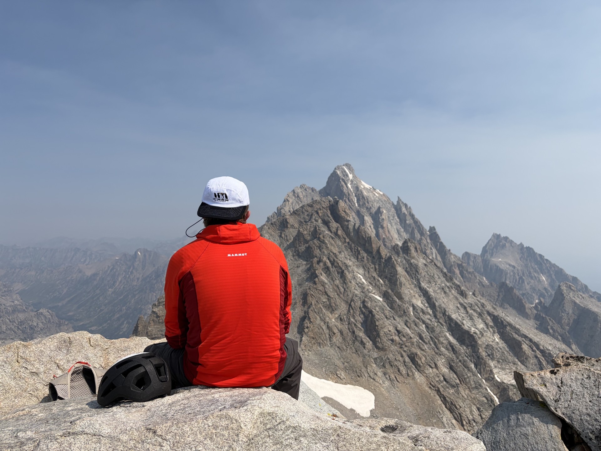
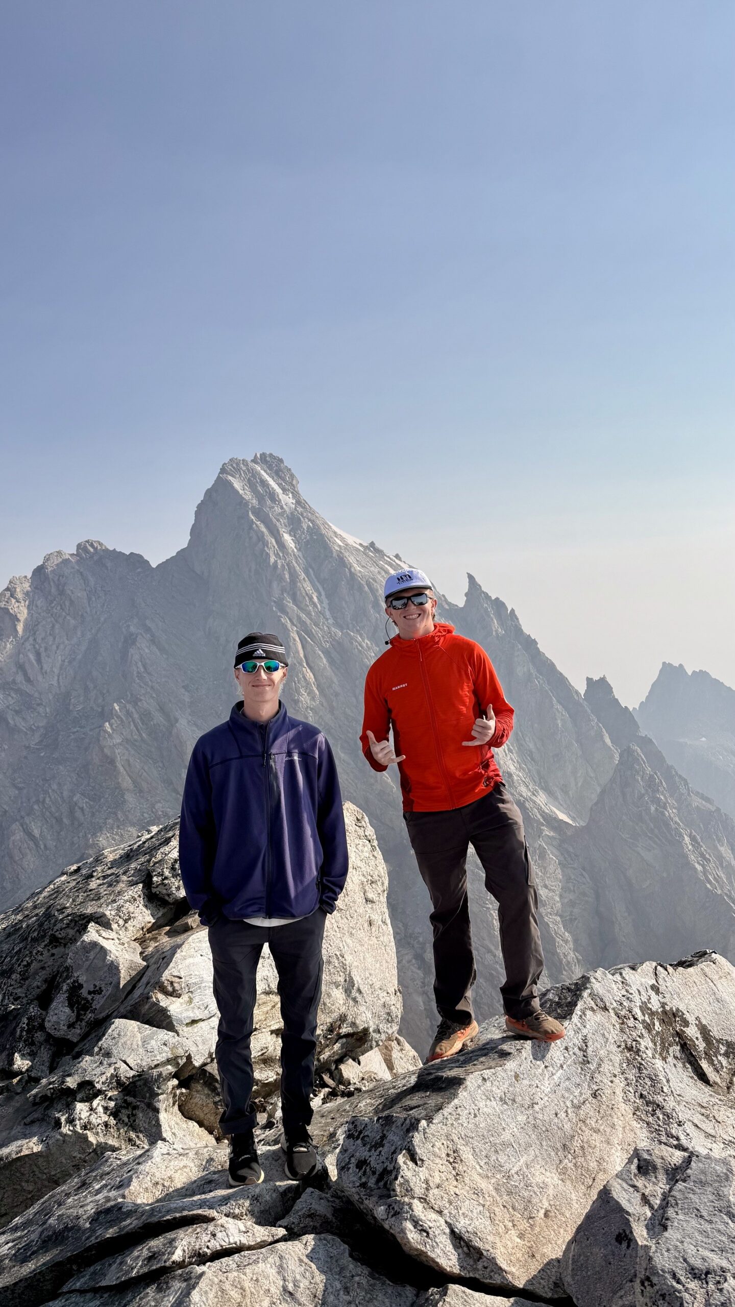
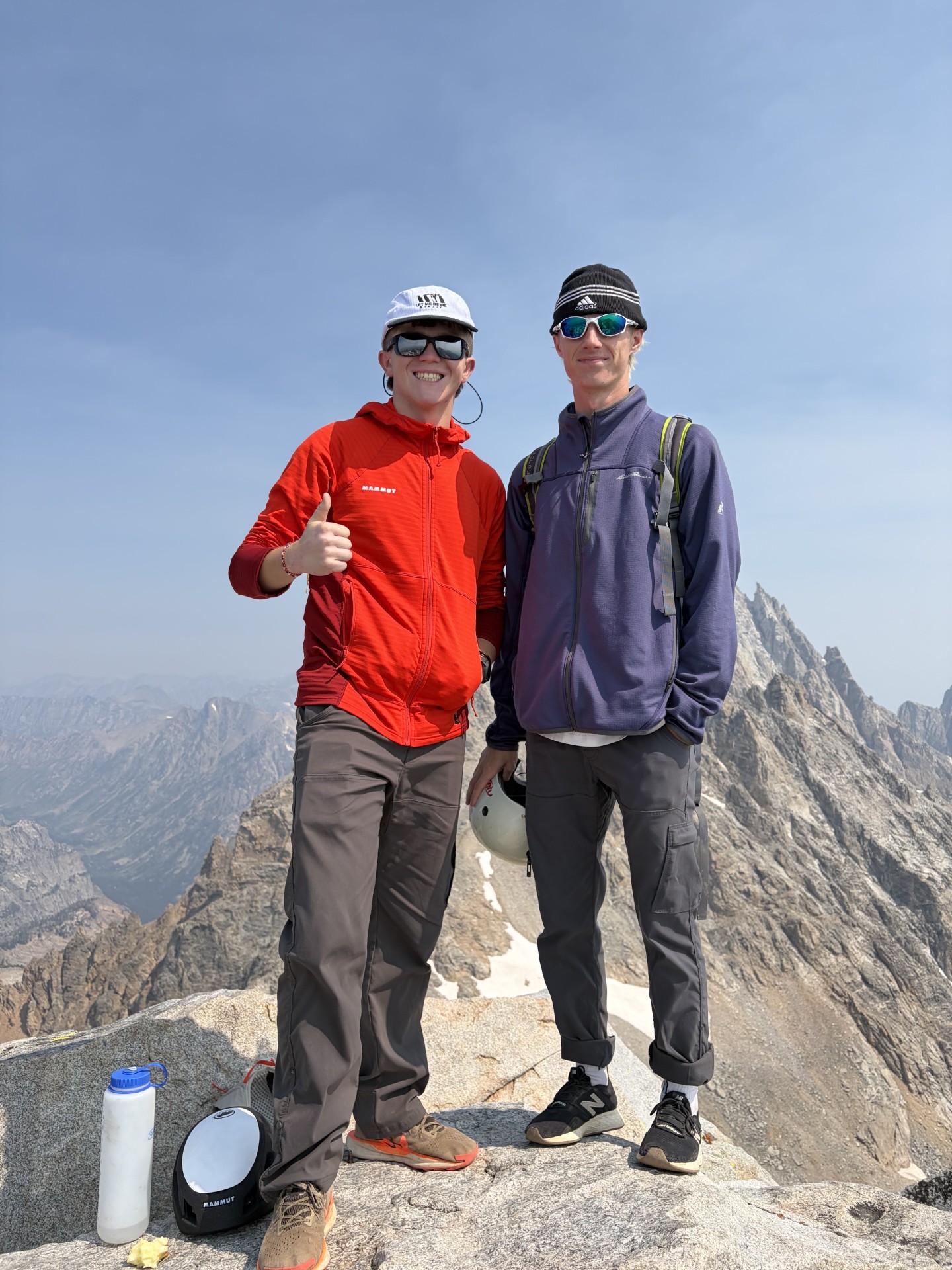
The photos tell the story almost as clearly as the GPS numbers: dry high-country rock, huge relief, open sky and the central Teton skyline filling the background.
Dawson headed into the Tetons on August 9 with an ambitious plan: climb Middle Teton, continue to South Teton and bring the entire day back to the trailhead in one push.
By the time the activity stopped, the Strava screenshot showed 15.20 miles, 7 hours 22 minutes and 7,546 feet of elevation gain. Dawson described the effort as roughly 7,800 vertical feet. Either way, it was a major mountain day.
The two summits sit in the heart of the Teton skyline. Grand Teton National Park lists Middle Teton at 12,804 feet, while the park’s backcountry map lists South Teton at 12,514 feet. Their proximity makes a two-peak day look obvious on a map. In practice, adding a second summit means adding another climb after the legs have already absorbed thousands of feet of ascent.
Middle Teton first
Middle Teton is one of the most popular climbing peaks in the range. NPS notes that it is often reached by the Southwest Couloir, although this field report does not claim or teach Dawson’s exact line. What matters from the day is that the first summit did not represent the finish—it represented the midpoint of the major climbing effort.
Then South Teton
Once Middle Teton was complete, Dawson continued to South Teton rather than descending directly. That decision changes the character of the outing. The second summit asks for another block of uphill work when fueling, hydration, footwork and concentration are already becoming more important.
The descent still counts
Big mountain days are often judged by the summit. The actual performance includes getting down efficiently. After two high summits, thousands of feet of descent remain. Tired legs on boulders and steep trail can turn a successful climb into a slow finish, so the 7:22 total time says as much about descent efficiency as it does climbing speed.
What 15.20 Miles and 7,546 Feet Really Mean
The ratio of vertical gain to mileage is what makes the day stand out.
| Metric | Dawson’s activity | Why it matters |
|---|---|---|
| Distance | 15.20 miles | Long enough to demand real endurance, but the vertical makes the mileage much harder than a normal trail day. |
| Recorded time | 7 hours 22 minutes | A very efficient pace for a two-summit Teton day with more than 7,500 feet of gain. |
| Recorded gain | 7,546 feet | Nearly a vertical mile and a half of climbing accumulated in one outing. |
| Field estimate | About 7,800 vertical feet | A useful round-number description; the Strava screenshot remains the exact recorded figure. |
| Summits | Middle Teton + South Teton | The second summit adds meaningful ascent after the first major objective is already complete. |
Why the 7:22 time is impressive
This was not 15 flat trail miles. The day combined sustained uphill travel, high elevation, rock and boulder movement, two separate summit pushes and a long descent. The pace reflects fitness, but also efficient transitions, route decisions, fueling and the ability to keep moving after the first summit.
High in the Central Tetons
These are the original images supplied from Dawson’s day and are packaged with this post in web-optimized form.
The hardest miles usually come after the goal already feels close.
Linking Middle Teton and South Teton means choosing to climb again instead of simply beginning the descent. That is where endurance becomes mountain efficiency.
More Than a Long Hike
Dawson called it a great, hard trip. The numbers support that description, but the real difficulty comes from how the components stack together.
1. Vertical density
More than 7,500 feet of gain across 15.2 miles creates a very different workload than a rolling trail of the same distance. Every mile is carrying a large share of vertical work.
2. Two summit pushes
The body never gets the psychological simplicity of “summit and descend.” After Middle Teton, another high point remains. That means another commitment to climbing while fatigue is already accumulating.
3. Teton terrain
Grand Teton National Park describes the Garnet Canyon approach as strenuous and notes boulder fields that require boulder hopping and wayfinding. Higher on the mountains, route choice and surface conditions matter even more. This is why a fast GPS time should never be read as evidence that the outing is easy.
4. High-elevation decision making
Middle Teton reaches 12,804 feet and South Teton 12,514 feet. The elevations are below the great expedition ranges but high enough that weather exposure, altitude, hydration and pacing can compound the physical effort.
5. The descent
After two summits, the legs still have to absorb thousands of feet downward. Good mountain fitness is not just about climbing speed; it is the ability to keep precise footwork and steady concentration on the way home.
Middle Teton and South Teton in Context
This field report intentionally stops short of being a turn-by-turn climbing guide.
| Peak | Elevation | Planning context | GSG role |
|---|---|---|---|
| Middle Teton | 12,804 ft | NPS identifies it as one of the range’s popular climbing peaks and notes the Southwest Couloir as a common route. Conditions can change substantially with snow, rock and weather. | Dedicated GSG mountain pillar is planned; this post does not replace it. |
| South Teton | 12,514 ft | Shares the central Teton approach environment and can be combined with Middle Teton by strong parties, depending on route, conditions and experience. | This post documents Dawson’s double summit rather than attempting full route ownership. |
| Grand Teton | 13,775 ft | A separate, more technical objective on its standard climbing routes. | Existing full GSG parent guide. |
Do not copy Dawson’s time as a planning target.
This is one person’s fast field result, not a recommended schedule. NPS advises climbers to use current route information and conditions. Stronger or slower teams, lingering snow, route-finding errors, thunderstorms or loose rock can change the day dramatically.
Four Lessons From a Fast Double Summit
The useful part of a field report is not copying the athlete—it is understanding what made the day work.
Vertical beats mileage
When evaluating a mountain day, look at gain per mile and terrain—not distance alone.
Efficiency compounds
Small savings in transitions, navigation, fueling and pacing add up across seven-plus hours.
Save legs for descent
A second summit is only successful when the team still has enough strength and attention to descend well.
Conditions own the plan
A dry August photo should never be treated as permanent route beta. Check NPS conditions for the day you climb.
Planning a Teton Objective
The best internal path is from inspiration to the appropriate route, safety and planning resources.
Grand Teton Climbing Guide
Use the established Teton parent for routes, permits, season, gear and planning context.
Open Grand Teton →Route planningGrand Teton Routes
Understand the broader technical climbing character of the range.
Compare routes →Gear systemGrand Teton Gear List
Use a Teton-specific gear framework instead of copying what appears in one photograph.
Open gear guide →Wyoming clusterBest Mountains in Wyoming
Compare the Tetons with Gannett Peak and other major Wyoming objectives.
Explore Wyoming →DifficultyMountain Difficulty Ratings
Separate hiking fitness, scrambling, technical climbing and alpine commitment.
Open difficulty guide →SafetyGear & Safety Hub
Build the protection, emergency and terrain systems appropriate to your route.
Open safety hub →PlanningTrip Planning Hub
Weather, timing, permits, logistics, gear and training in one planning system.
Plan the trip →Primary sourceNPS Climbing Information
Use current National Park Service guidance before entering Teton climbing terrain.
Open NPS →Middle + South Teton FAQ
Direct answers based on the supplied activity record and official park context.
Can Middle Teton and South Teton be climbed in one day?
Yes, strong and experienced mountain athletes sometimes combine the two in a single long day, but the effort is substantial. Dawson’s August 9, 2026 activity recorded 15.20 miles, 7 hours 22 minutes and 7,546 feet of gain.
How much elevation gain did Dawson record?
The Strava screenshot records 7,546 feet of elevation gain. Dawson described the day as roughly 7,800 vertical feet, which is a reasonable round-number description of the effort.
How long did the double summit take?
The Strava activity screenshot shows 7 hours 22 minutes for the 15.20-mile day.
How high is Middle Teton?
Grand Teton National Park identifies Middle Teton at 12,804 feet. It is one of the most popular climbing objectives in the Teton Range.
How high is South Teton?
The National Park Service backcountry map lists South Teton at 12,514 feet.
Is this a route guide for Middle Teton or South Teton?
No. This is a field report documenting one strong double-summit day. Use current National Park Service climbing information, backcountry conditions and detailed route resources before attempting either mountain.
What is the main lesson from this trip?
The distance alone understates the day. Stacking more than 7,500 feet of gain with two high Teton summits, boulder travel, route finding and a long descent makes this a serious endurance and mountain-efficiency test.
What This Post Is Based On
First-hand evidence is separated from general planning information.
- First-hand source: Dawson’s August 9, 2026 photographs supplied to Global Summit Guide.
- Activity source: supplied Strava story showing 15.20 mi, 7h 22m and 7,546 ft elevation gain.
- Middle Teton elevation: Grand Teton National Park identifies Middle Teton at 12,804 ft.
- South Teton elevation: NPS backcountry mapping lists South Teton at 12,514 ft.
- Access context: Lupine Meadows / Garnet Canyon is the primary climbing approach corridor for the central Tetons.
- Current conditions: always check Grand Teton backcountry and trail conditions before attempting a similar objective.
Boundary: the supplied activity did not include a permanent public GPX or a written route-by-route account, so this post does not invent Dawson’s exact couloir, traverse line or turn-by-turn route.
15.2 Miles. Two Teton Summits. More Than 7,500 Feet Up.
Dawson’s day is exactly the kind of field experience Global Summit Guide can use to connect research with what mountain effort actually feels like.
Middle + South Teton: More First-Hand Mountain Days
Continue with field reports and summit stories from mountains our team has actually climbed.
Was this helpful?
🏔Related peaks nearby
🧭Explore & compare
Global Summit Guide is an independent mountaineering resource founded in 2026. The team combines first-hand trekking and climbing experience with in-depth research and professional health and nutrition review to help climbers choose objectives, prepare properly, and stay safe.
Health, altitude, and nutrition content is reviewed by Taylor Ludlow (Registered Nurse) and Brigg Hoopes (Nutritionist).
What We Don't Know Yet
Mountain information changes quickly. This box explains the limits of what this page can responsibly promise.
- Visa, passport, vaccination, border, insurance, and local transportation rules may change before your trip.
- Route conditions, snowpack, closures, and weather can change quickly after this page is updated.
- Permit rules, fees, quotas, and reservation windows may change between review cycles.
- Operator availability, pricing, guide ratios, and cancellation terms can change by season.
- Your fitness, altitude response, risk tolerance, and experience level may change what is safe or realistic.
Verify current conditions with official land managers, guide services, local forecasts, and current route reports before booking or climbing.
Mountaineering, rock and ice climbing, glacier travel, and high-altitude activity are inherently dangerous and can result in serious injury or death. The information on Global Summit Guide is provided for general informational and educational purposes only and is not a substitute for professional instruction, qualified guiding, proper equipment, or your own judgment and experience.
Route conditions, weather, snowpack, permits, regulations, and hazards change constantly and may differ from what is described here. Details may be incomplete, out of date, or contain errors. Always verify current information with local authorities, certified guides, and official sources before making any decision in the mountains.
Nothing on this site is medical, legal, or financial advice. Our fitness, acclimatization, altitude, and nutrition content is general in nature; consult a qualified physician before beginning any strenuous exercise program or exposing yourself to high altitude.
You are solely responsible for your own safety and decisions. To the fullest extent permitted by law, Global Summit Guide and its team accept no liability for any loss, injury, damage, or expense arising from use of, or reliance on, this information. By using this site you acknowledge these risks and accept these terms.
Some links on this site may be affiliate links. If you buy through them we may earn a small commission at no extra cost to you; this never affects our recommendations.
Global Summit Guide recommendation path
Next Best Mountain to Research
Use these recommendations to continue the right planning path instead of stopping on one page.
Use current permit, weather, route, and operator information before booking or climbing.