web analytics

Tag: Dawson Ludlow

  • Koko Head Hike: 1,048 Stairs, Time & Summit Guide

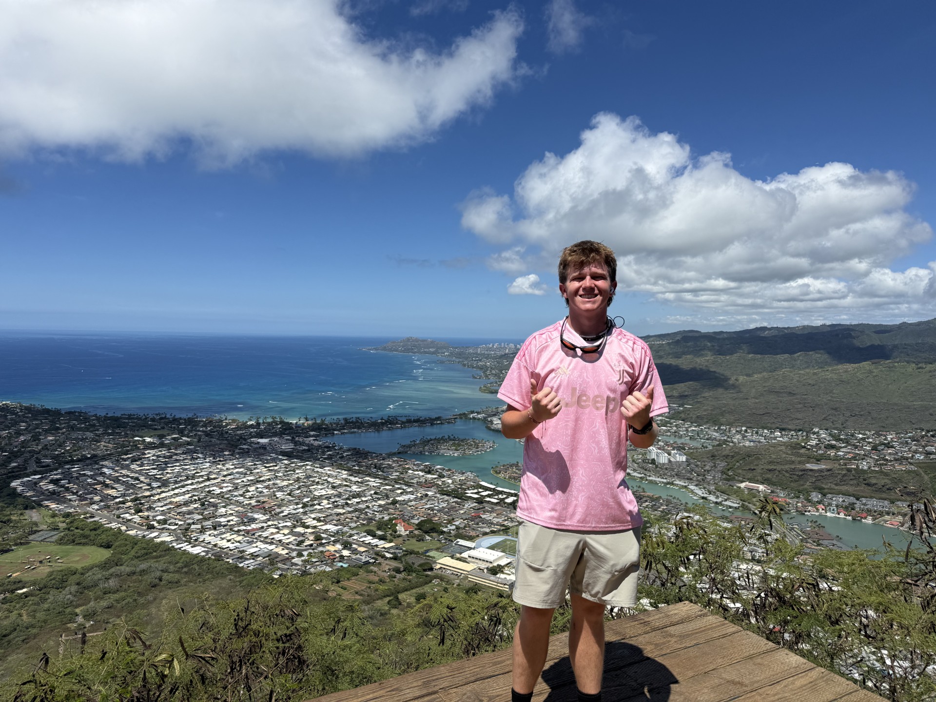
    Dawson Ludlow standing at the Koko Crater summit above Hawaii Kai on Oahu
    Oahu · First-hand GSG climb · Updated August 26, 2026

    Koko Head Hike: 1,048 Stairs to Koko Crater Summit

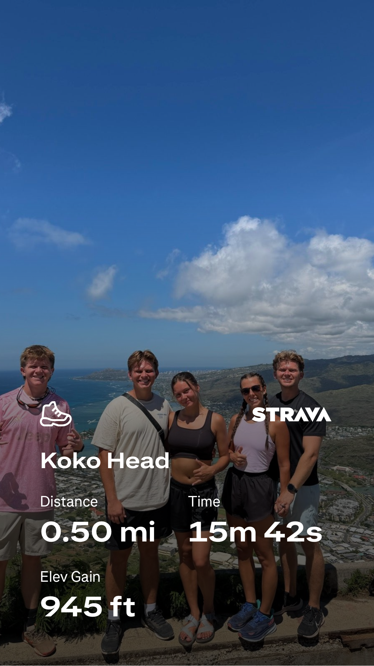
    Koko Head is short enough to fit into a Honolulu morning and steep enough to feel like a concentrated mountain workout. The historic Koko Crater Tramway climbs almost straight up the crater flank on old railway ties. On Global Summit Guide’s 2026 visit, Dawson Ludlow recorded the uphill in 15:42 on Strava—0.50 mile with 945 feet of gain. That is a performance effort, not the pace most visitors should try to match.

    First-hand 2026 ascentStrava-backed field dataHonolulu access checked3 original GSG images
    1,048Common stair count
    15:42Dawson ascent
    0.50 miStrava uphill
    945 ftStrava gain
    WWIIHistoric tramway
    By Travis Ludlow · Field experience: Dawson Ludlow
    Published August 26, 2026 · Current access checked August 26, 2026
    The direct answer

    Is the Koko Head Hike Worth It?

    Yes—if you want a short, very steep Oahu summit workout with a huge view payoff. The Koko Crater Tramway is not a long wilderness hike. Its appeal is the opposite: the route wastes almost no distance. Once the railway ties begin, you climb directly toward the rim, gaining roughly a thousand vertical feet in a compact line.

    The route is technically simple compared with exposed ridge hikes elsewhere on Oahu, but the physical demand is real. Irregular ties, tropical sun and a steep descent make pacing more important than the mileage suggests. If you are visiting primarily for scenery, move steadily and save enough legs for the descent. If you use mountains as fitness tests, Koko Head is one of the clearest uphill benchmarks on the island.
    Best forFitness + summit views
    Route styleRailway-tie staircase
    Main challengeRelentless steepness
    Biggest variableHeat + pacing
    NavigationVery straightforward
    DescentSteep; stay controlled
    Do not use 15:42 as a target. Dawson’s time reflects a fast, fitness-oriented ascent. Honolulu Fire Department rescues on Koko Head regularly involve hikers who become injured or medically distressed; on August 20, 2026, HFD airlifted a visitor who became dizzy and could not continue. Treat heat, hydration and your own fitness as real route factors.
    Strava screenshot from Dawson Ludlow's Koko Head ascent showing 0.50 mile, 15 minutes 42 seconds and 945 feet of elevation gain
    First-hand GSG field note

    Dawson’s Koko Head Ascent: 15 Minutes, 42 Seconds

    The most useful original data on this page is simple: we actually climbed it. Dawson’s Strava screenshot records the steep uphill effort as 0.50 mile, 945 feet of elevation gain and 15:42 elapsed time.

    0.50Mile recorded
    15:42Uphill time
    945Feet gained

    Those numbers explain Koko Head better than the word “stairs.” Half a mile with nearly 1,000 feet of climbing is brutally efficient. The climb does not give you long flat sections to reset your breathing. You keep stepping upward until the summit structures and coastal panorama finally replace the railway line in front of you.

    Why our Strava numbers differ from published route figures: GPS distance and gain depend on exactly where an activity starts and stops, device smoothing and the geometry of a very steep route. The Kokonut Koalition describes the tramway as about 0.8 mile with roughly 1,100 feet of gain. We use Dawson’s screenshot only for his recorded uphill effort, not to redefine the official/public route.

    The route

    A Straight-Line Climb With Almost No Wasted Motion

    The trail is famous because the route profile is obvious from the bottom: the old tramway rises directly toward the crater rim.

    1 · Approach

    Walk From the District Park to the Railway

    From the Koko Head District Park area, follow the obvious approach toward the base of the tramway. The mountain is directly ahead and the line of ties is visible climbing the slope.

    2 · Lower stairs

    Find a Sustainable Rhythm Early

    The lower ties make it tempting to start too fast. The grade keeps steepening, so an early red-line effort can make the upper section unnecessarily difficult.

    3 · Middle section

    Irregular Ties Demand Attention

    The railway ties are not uniform gym stairs. Step height, spacing and surface vary. Keep your eyes on foot placement even when you are tired or distracted by the views.

    4 · Upper push

    The Steepness Is the Whole Point

    Near the top, the climb feels compressed: lungs, legs and heat all arrive at once. Maintain your own pace rather than matching locals who may use Koko Head as a repeat training route.

    5 · Summit

    Step Off the Line and Take In Hawaii Kai

    The summit area opens onto broad views over Hawaii Kai, Maunalua Bay, the Pacific and the surrounding crater landscape. Old military structures remain part of the summit environment.

    6 · Descent

    Save Enough Control for the Way Down

    The descent is not an afterthought. Fatigued legs, high steps and awkward spacing can make downward travel feel more technical than the ascent. Do not sprint the descent unless that is a movement pattern you already train.
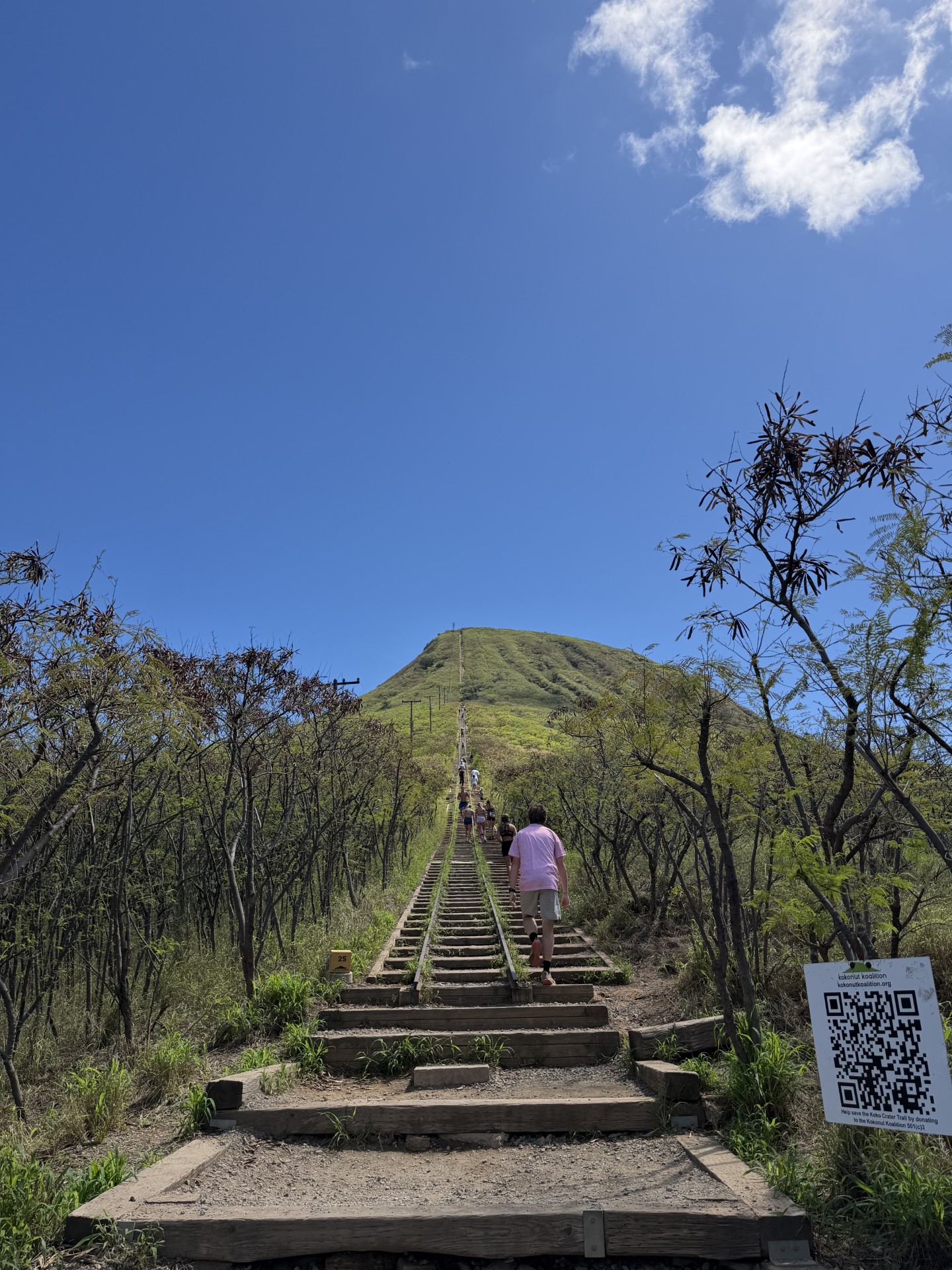
    Hikers ascending the wooden railway ties of the Koko Crater Tramway under a blue Oahu sky
    What the climb actually looks like

    The Staircase Is the Trail.

    There is no long approach hiding the vertical. The historic tramway points almost straight at the summit, which is why Koko Head works equally well as a tourist hike, a leg-burning workout and a simple benchmark for uphill fitness.

    Access & timing

    Plan Around Heat Before You Plan Around Speed

    Koko Head is easy to fit into an Oahu itinerary, but its exposed slope makes time of day matter.

    Planning questionWhat to knowGSG recommendation
    Where do I park?Koko Head District Park is the normal access area for the tramway.Use designated park parking and avoid pushing parking impacts into nearby residential streets.
    How early can I drive in?Honolulu DPR says the time-activated vehicular gate follows established park closure hours of 11 p.m.–4 a.m.Verify current gate/access information if planning a pre-dawn start.
    Best time of day?The slope is open and sun-exposed.Early morning is usually the most comfortable choice; avoid building a heat-of-day fitness test into a vacation.
    Water?The climb is short but very intense and exposed.Arrive hydrated and carry water rather than assuming short distance means low heat stress.
    Footwear?Wooden ties, dirt, uneven steps and a steep descent.Use secure athletic or hiking footwear with reliable traction.
    Current-access note: Koko Crater Tramway has had temporary safety closures in the past. A 2025 closure after a child fell into a summit bunker was followed by reopening with warnings around bunker access. Stay on the established tramway/summit route, obey barriers and signage, and check current Honolulu DPR information before you go.
    Difficulty

    Technically Simple. Cardiovascularly Unforgiving.

    Koko Head is a useful reminder that “short” and “easy” are not synonyms.

    Fitness

    High for the Distance

    The vertical is compressed into a short climb. If you are accustomed to flat walking but not stairs, the route may feel far harder than its mileage suggests.

    Technique

    Low, but Footwork Still Matters

    No mountaineering technique is required on the standard tramway line, but irregular ties and the steep descent reward deliberate steps.

    Exposure

    Open and Sun-Exposed

    The route offers little natural shade once you are committed to the staircase. Heat can turn a manageable climb into a poor decision quickly.

    Consequences

    Do Not Underestimate the Descent

    Falls and medical incidents happen here. HFD has repeatedly responded to injuries and hikers unable to continue. Carry enough reserve to descend under control.

    New to summit hikes? Start with the Beginner Gear Guide →

    The payoff

    Why the Summit Feels Bigger Than a 15-Minute Fitness Test

    Dawson’s ascent was quick; the reason to linger is the landscape.

    South + west

    Hawaii Kai and Maunalua Bay

    The urban shoreline, marina and blue Pacific spread immediately below the summit. The steepness of the climb becomes obvious when you look back down at how quickly the city dropped away.

    Crater landscape

    Koko Crater From Above

    The rim perspective turns a workout into a volcanic-landscape experience. The crater form, dry vegetation and surrounding coastal terrain read much more clearly from the summit.

    Why there are railway ties here

    A WWII Tramway Became One of Oahu’s Most Famous Workouts

    The route exists because this was infrastructure before it was recreation.

    The tramway was constructed by the U.S. military during World War II to move cargo and personnel to a summit radar station. Honolulu’s 2021 account of the restoration says the system was built in 1942, the station was deactivated in 1947, and the remaining structures and tramway were transferred to the City and County of Honolulu in 1966.

    Decades of recreational use eventually wore the route down. The Kokonut Koalition organized a major volunteer rehabilitation with City support, replacing and repairing hundreds of ties. The result is unusual: a historic military utility line preserved through community labor and now used daily as a public fitness climb.

    Respect the summit structures. Old military bunkers are part of the history, not an invitation to enter restricted openings. Follow current signs and barriers around the summit complex.
    Training value

    Koko Head Is a Great Benchmark—If You Use It Correctly

    The clean vertical profile makes progress easy to feel without pretending a staircase is the same as a big mountain.

    Useful for

    Uphill Economy

    A steady ascent teaches rhythm: step height, breathing, cadence and how quickly you recover when the gradient never disappears.

    Useful for

    Leg Endurance

    The stairs load quads, glutes and calves repeatedly. The descent adds eccentric loading that can expose weak downhill control.

    Not equivalent to

    Mountain Endurance

    One short hard climb does not reproduce hours of trail time, pack carry, altitude, weather or technical terrain. Koko Head is a component, not a complete training plan.

    Build from here

    8-Week First Summit Training Plan

    Use stairs as one training tool inside a broader program that also builds hiking volume, recovery and real elevation gain.

    See the training progression →
    Put it in context

    Where Koko Head Fits in a Hawaii Mountain Trip

    This is an Oahu fitness summit, not Hawaii’s biggest mountain objective.

    Global Summit Guide’s Best Mountains to Climb in Hawaii guide places Koko Head among the state’s accessible day-hike summits. That is the right role for it. Koko Head delivers steepness and views without altitude, glacier travel or a long backcountry commitment. If you are building toward bigger objectives, use it as a leg-and-lung test—not as evidence that you are automatically ready for Mauna Kea, Mauna Loa or technical ridges.

    For a hot, exposed climb like this, combine route planning with the broader Mountain Weather framework and basic hydration/gear preparation rather than relying only on the forecast icon.

    Climber Journey · Choose → Prepare → Plan → Hike → Remember

    Use Koko Head as a Checkpoint, Not a Finish Line.

    If Koko Head is part of a larger hiking progression, save the climb in My Climb and record what mattered: your uphill time, how your breathing felt, how the heat affected you, and whether your legs stayed controlled on the descent. Those observations are more useful than simply checking off the summit.

    ChoosePreparePlanHikeRemember
    Sources & methodology

    What Comes From Dawson—and What Comes From Official Sources

    We separate field evidence from public route facts so a fast personal effort is not mistaken for a universal trail benchmark.

    First-hand GSG

    Dawson’s 2026 Ascent

    • Strava screenshot: 0.50 mi
    • Elapsed ascent: 15m 42s
    • Recorded elevation gain: 945 ft
    • GSG-hosted summit and route photography on this page

    These are Dawson’s recorded activity values and should not be substituted for a surveyed route measurement.

    Editorial limit: route conditions, gate operations, repairs and safety barriers can change. Recheck City and County of Honolulu information before your hike. This page describes the standard tramway experience and Dawson’s recorded 2026 climb; it is not a guarantee of current trail condition.
    Quick answers

    Koko Head Hiking FAQ

    Use these answers for trip planning, then verify current access before departure.

    How many stairs are on the Koko Head hike?

    The most widely used count is 1,048 railway ties or steps. Honolulu used the 1,048 figure in its description of the major volunteer repair effort, while the Kokonut Koalition describes the historic tramway as having approximately 1,055 cross-ties. Either way, this is roughly a thousand steep, irregular steps—not a normal staircase.

    How long did Dawson Ludlow take to climb Koko Head?

    Dawson’s Strava screenshot records 15 minutes 42 seconds for 0.50 mile and 945 feet of elevation gain. That is his personal recorded uphill effort and is not presented as a normal visitor time or a speed recommendation.

    How difficult is Koko Head?

    Technically, the standard tramway climb is straightforward. Physically, it is demanding because the vertical gain is compressed into a short distance with little shade. The steep descent on tired legs is also part of the difficulty.

    Is Koko Head good for beginners?

    A fit beginner who is comfortable on steep stairs can consider it with conservative pacing, water and an early start. Someone with limited stair fitness, balance concerns or poor heat tolerance should choose a gentler Oahu hike first.

    What time should I hike Koko Head?

    Early morning is generally the better planning choice because the route is highly exposed to sun. Honolulu DPR says the district park vehicular gate follows established closure hours of 11 p.m. to 4 a.m. Verify current access before a pre-dawn start.

    Is Koko Head the same as Koko Crater?

    The names are often mixed in visitor usage. “Koko Head hike” and “Koko Head stairs” commonly refer to the historic Koko Crater Tramway, which climbs the crater rim/summit area of Kohelepelepe.

    The GSG verdict

    Short Hike. Serious Vertical. Huge Oahu View.

    Koko Head earns its reputation because it strips a summit climb down to the essentials: climb, breathe, keep stepping, then look back at how quickly the island fell away below you. Dawson’s 15:42 ascent shows how fast the route can be moved by a strong athlete. Most visitors should take the opposite lesson—respect the grade, manage the heat, and arrive at the summit with enough control left for the descent.

    Was this helpful?

    Yes
    No
    Thanks for your feedback!
  • Pfeifferhorn North Ridge Climb: Utah Wasatch Field Report (2026)

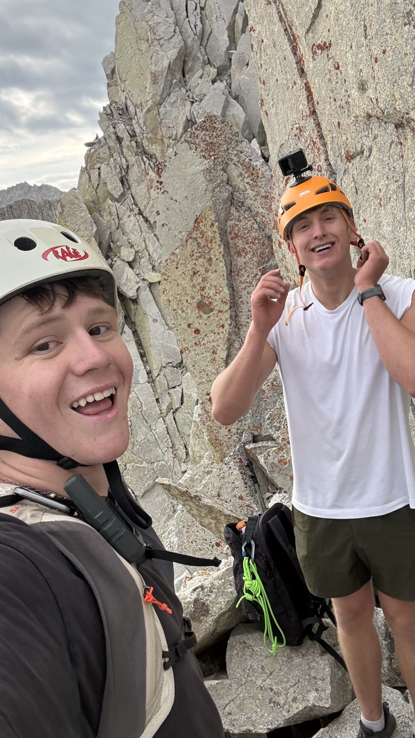
    Pfeifferhorn North Ridge field photo from Sawyer Shawd and Dawson Ludlow's Utah climb
    Utah field report · Wasatch Range · North Ridge · August 2026

    Pfeifferhorn North Ridge: Sawyer Shawd & Dawson Ludlow Climb a Utah Classic

    Pfeifferhorn is famous as one of the Wasatch’s great scrambling summits. Sawyer Shawd and Dawson Ludlow chose the other side of the mountain: the technical North Ridge, an aesthetic alpine line above the Red Pine–Maybird country of Little Cottonwood Canyon.

    First-hand climber field report4 original trip imagesPublished route context separated from field factsUtah + Wasatch clusters connected

    Published August 12, 2026 · Global Summit Guide Trip Reports

    11,326 ftPfeifferhorn
    North RidgeTechnical alpine line
    ~5.5Published route grade
    WasatchLittle Cottonwood area
    The field note

    A Different Pfeifferhorn Than Most Utah Hikers See

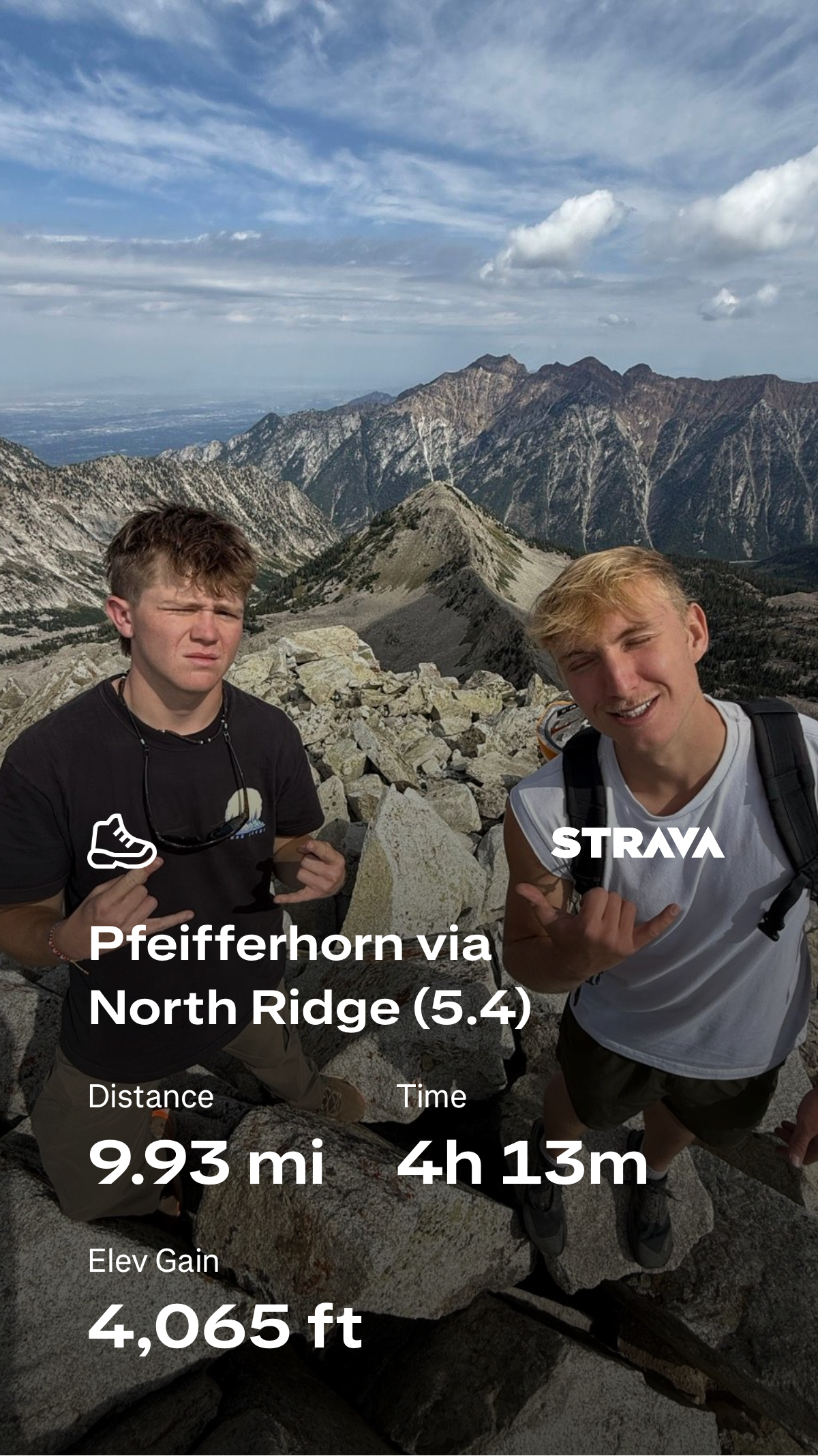
    Sawyer Shawd and Dawson Ludlow climbed Pfeifferhorn by the North Ridge, choosing a technical alpine-rock line rather than the mountain’s standard Red Pine / East Ridge hiking route.

    That distinction matters. The familiar Pfeifferhorn summit day is already one of the Wasatch’s classic strenuous hikes and scrambles. The North Ridge adds technical climbing, route-finding, exposure and a much more serious alpine character.

    MountainPfeifferhorn
    RouteNorth Ridge
    ClimberSawyer Shawd
    ClimberDawson Ludlow
    RangeWasatch
    StateUtah
    Field-report boundary: this article records the climb and explains the route’s character. It does not invent a pitch-by-pitch account, exact equipment list, total ascent time or move-by-move beta that the climbers did not provide. Published route information is labeled as such.
    August 2026 · Utah

    Sawyer Shawd & Dawson Ludlow on Pfeifferhorn’s North Ridge

    A local Wasatch objective with much bigger alpine character than its proximity to Salt Lake City suggests.

    Pfeifferhorn has a silhouette that makes it look like it belongs much farther from a major city. Rising to roughly 11,326 feet in the central Wasatch, it is sometimes called the “Little Matterhorn,” and the standard East Ridge scramble is one of northern Utah’s most recognizable summit days.

    But the North Ridge is a different objective. Instead of approaching the summit primarily as a strenuous hike with scrambling, the route follows the mountain’s sharper northern architecture through technical rock, exposed ridge terrain and sections where alpine judgment matters as much as fitness.

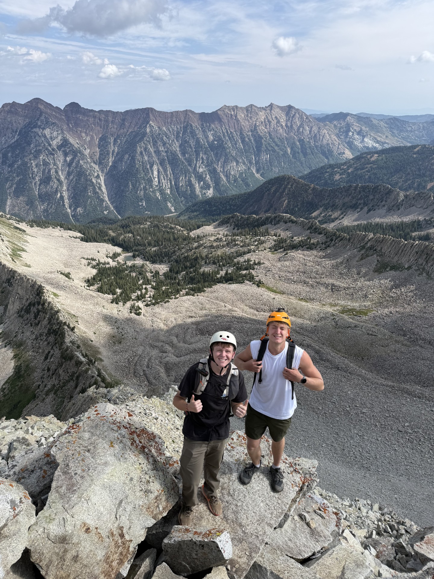
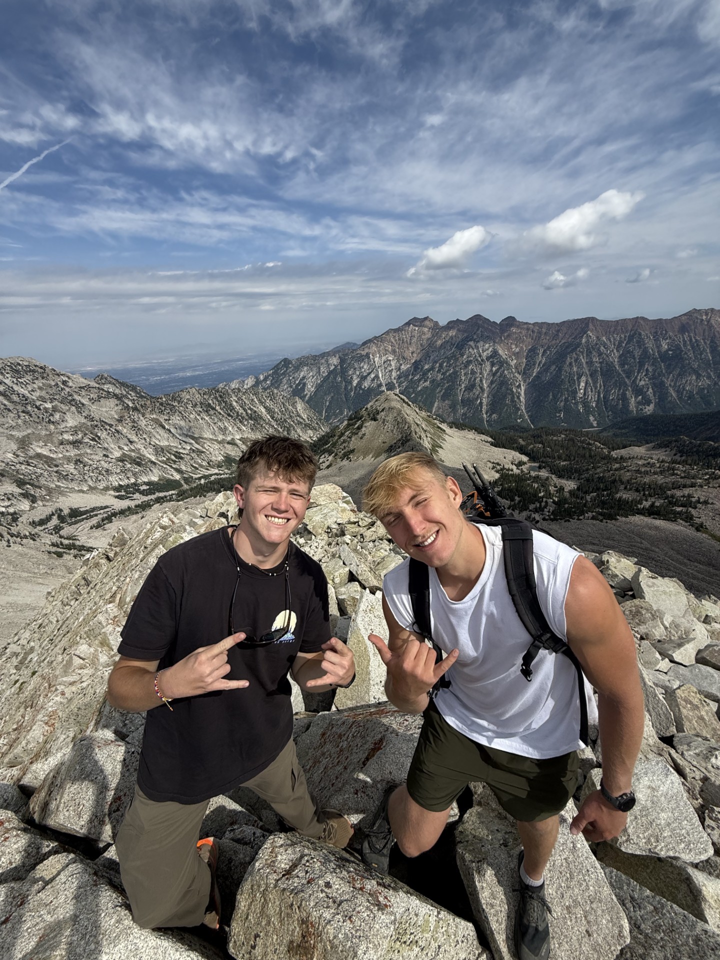
    That is the line Sawyer Shawd and Dawson Ludlow chose. The photographs from the climb show the kind of field experience Global Summit Guide wants to preserve in its Trip Reports collection: local climbers moving beyond a familiar hiking summit and seeing the same mountain through a much more technical lens.

    The value of a report like this is not that every climber should immediately try to duplicate the route. It is that Pfeifferhorn demonstrates how quickly the Wasatch progression changes. A peak that can be reached by a strong hiker on one side can become a legitimate technical alpine climb on another.

    ObjectivePfeifferhorn North Ridge
    LocationWasatch Range, Utah
    Field climbersShawd + Ludlow
    Report typePhoto field report
    The climbers

    Follow Sawyer & Dawson

    Link the climb back to the climbers who were actually on the mountain.

    Climber

    Sawyer Shawd

    Sawyer Shawd joined Dawson Ludlow for the Pfeifferhorn North Ridge climb featured in this report.

    @sawyershawd on Instagram →
    Climber · Global Summit Guide

    Dawson Ludlow

    Dawson Ludlow is part of the Global Summit Guide climbing team and contributes first-hand field experience from Utah and beyond.

    @daws_lud on Instagram →
    Published route context

    Why Pfeifferhorn’s North Ridge Is a Serious Wasatch Route

    The route’s published character helps explain why this ascent is different from the normal summit hike.

    Long-standing North Ridge descriptions classify the route as a technical rock / mixed alpine climb, commonly around 5.5 and Grade II–III. Published descriptions also emphasize loose rock, exposure and the fact that parties can encounter substantially different conditions depending on season.

    One route source describes the full ridge as roughly a mile of technical ridge terrain with about 1,300 feet of climbing from the lower route, while older Utah climbing coverage describes a longer technical experience when the full approach and ridge are considered together. Those differences are exactly why numbers should be treated as route-context estimates rather than a substitute for current local beta.

    Historically, the North Ridge has also been climbed as a winter mountaineering objective because cold conditions can freeze some of the loose rock in place. That does not make winter automatically safer: snow, ice and avalanche terrain add entirely different hazards. A dry-season ascent and a winter ascent can feel like different routes.

    The common thread is the ridge itself—an aesthetic line that turns Pfeifferhorn from a hiking summit into a technical Wasatch alpine objective.

    Do not confuse proximity with simplicity.

    Pfeifferhorn is close to Salt Lake City, but the North Ridge belongs in the technical-climbing category. It should be evaluated by route conditions, protection, exposure and party competence—not by how quickly you can drive to the trailhead.

    Original field images

    Pfeifferhorn North Ridge Photo Story

    Four images supplied from Sawyer Shawd and Dawson Ludlow’s climb.

    Same summit · very different day

    North Ridge vs the Standard Pfeifferhorn Route

    Understanding the difference keeps this field report from being mistaken for normal hiking beta.

    FeatureStandard East Ridge / Red PineNorth Ridge
    Primary activityStrenuous hiking + scramblingTechnical alpine rock climbing
    Published difficultyShort Class 3 section on normal routeCommonly described around 5.5, Grade II–III
    Typical approach systemRed Pine Lakes to East RidgeRed Pine / Maybird access to north-side ridge
    Primary skillsFitness, scrambling, route judgmentTechnical climbing, protection, route-finding, alpine judgment
    Best use in progressionMajor Wasatch scrambleTechnical Wasatch alpine objective

    The standard route is already substantial. Utah trail sources commonly put the normal Pfeifferhorn day around 9–10 miles round trip with roughly 3,700–3,900 feet of gain. The ridge above Red Pine includes boulder scrambling and a short Class 3 section before the summit.

    The North Ridge changes the category. A climber who is comfortable hiking the normal Pfeifferhorn should not assume that experience automatically transfers to a technical line on the other side of the mountain.

    Wasatch progression

    Where Pfeifferhorn Fits in Utah Climbing

    One of the best things about the Wasatch is the density of progression: hiking, scrambling and technical climbing can exist on neighboring peaks—or the same peak.

    Pfeifferhorn belongs in the conversation with the Wasatch’s best local mountains because it can meet climbers at multiple levels. The standard East Ridge introduces strong hikers to exposed scrambling; the North Ridge pushes into technical alpine climbing; neighboring Little Cottonwood and Lone Peak terrain can extend that progression much farther.

    For the statewide view, start with Best Mountains in Utah. For the immediate geography around Salt Lake City, use Best Mountains Near Salt Lake City and Salt Lake County Top 10 Peaks. Those pages place Pfeifferhorn in the larger Wasatch system instead of treating it as an isolated objective.

    The new Best Hikes in Utah parent serves a different purpose: it compares statewide hiking, from Zion and Moab to Timpanogos, Nebo and Kings Peak. This field report sits on the technical-climbing side of that Utah ecosystem.

    Planning context

    What Future North Ridge Parties Should Take From This Report

    The lesson is route selection and preparation—not imitation of an undocumented pitch sequence.

    01

    Know which Pfeifferhorn you are climbing

    East Ridge and North Ridge are not interchangeable descriptions. Confirm the line before using any distance, difficulty or equipment information.

    02

    Conditions can change the route category

    Dry rock, snow, ice, thawing rock and avalanche terrain create very different North Ridge problems. Current conditions outrank old trip reports.

    03

    Loose rock is part of the reputation

    Published North Ridge descriptions repeatedly warn about loose rock. Helmets, spacing and protection decisions should reflect that reality.

    04

    Have a descent plan before starting

    A summit is only the midpoint. Know the intended descent and how changing weather or darkness affects the route home.

    05

    Use technical progression, not summit familiarity

    Having hiked Pfeifferhorn does not qualify someone for the North Ridge. Build climbing systems and alpine judgment on appropriate objectives first.

    06

    Keep route reports current

    Wasatch conditions move quickly. Local reports, forecasts and current route observations are essential before committing to technical terrain.

    Field facts vs published beta

    Sources, Attribution & What We Don’t Know

    A trip report is strongest when it distinguishes first-hand facts from route information gathered elsewhere.

    What comes from this field report

    • Sawyer Shawd and Dawson Ludlow climbed Pfeifferhorn’s North Ridge.
    • The four images on this page were supplied for this climb.
    • The climber names and Instagram handles were supplied directly to Global Summit Guide.

    What comes from published route references

    • Pfeifferhorn elevation around 11,326 feet.
    • The standard Red Pine / East Ridge route is a strenuous hike with Class 3 scrambling.
    • The North Ridge is commonly described around 5.5 and Grade II–III.
    • Published accounts warn about loose rock and season-dependent mixed conditions.
    What we do not claim: this article does not state Sawyer and Dawson’s exact climb date, car-to-car time, rack, rope system, pitch count, exact variation, weather, protection strategy or descent timing because those details were not supplied with the field report. Add those later only if the climbers confirm them.
    Pfeifferhorn North Ridge questions

    Frequently Asked Questions

    Keep the technical North Ridge distinct from the mountain’s standard hiking route.

    Is the Pfeifferhorn North Ridge the standard hiking route?

    No. The normal summer route approaches through Red Pine Lake and uses the East Ridge, with a short Class 3 scrambling section. The North Ridge is a technical alpine-rock route and should not be confused with the standard Pfeifferhorn hike.

    How high is Pfeifferhorn?

    Published route references place Pfeifferhorn at roughly 11,326 feet in Utah's Wasatch Range.

    How difficult is the North Ridge?

    Published North Ridge descriptions commonly place the route around 5.5 and Grade II–III. Conditions, exact variation, loose rock, snow or ice, and party experience can materially change the seriousness.

    Where does the usual Pfeifferhorn approach begin?

    The standard summit approach uses the White Pine / Red Pine trail system in Little Cottonwood Canyon. North Ridge parties commonly use the Red Pine–Maybird area to reach the technical ridge.

    Who climbed the route in this report?

    Sawyer Shawd and Dawson Ludlow are the climbers featured in this August 2026 Global Summit Guide field report.

    Is this post a pitch-by-pitch route guide?

    No. It is a field report and photo story. It gives enough route context to understand why the North Ridge is significant while directing climbers to current route-specific sources and their own judgment for technical planning.

    Utah field report

    One Mountain. Two Very Different Ways to Experience It.

    Pfeifferhorn’s standard route is a Wasatch hiking classic. The North Ridge shows what happens when the same summit becomes a technical alpine objective.

    Was this helpful?

    Yes
    No
    Thanks for your feedback!
  • Middle Teton + South Teton in One Day: 15.2-Mile Double Summit

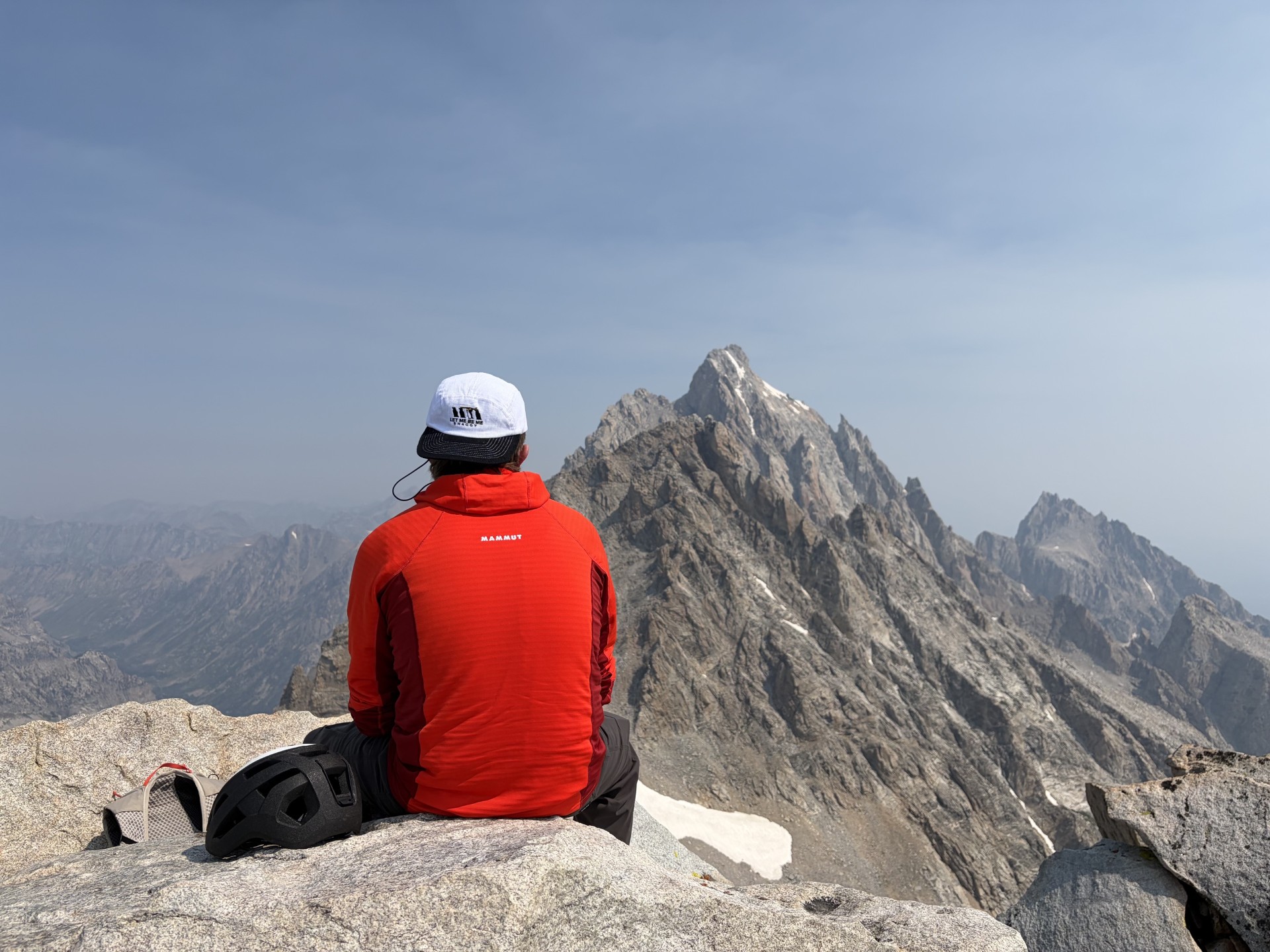
    Dawson looking toward the Teton skyline after climbing Middle Teton and South Teton
    Field report · August 9, 2026 · Grand Teton National Park

    Middle Teton + South Teton in One Day: Dawson’s 15.2-Mile Double Summit

    Two major Teton summits, 15.20 miles, 7 hours 22 minutes and 7,546 feet of recorded elevation gain. Dawson’s Middle Teton–South Teton day was fast, steep and far harder than the mileage alone suggests.

    First-hand photosStrava activity screenshotTwo summitsTrip report, not route instruction

    Climbed August 9, 2026 · Field report prepared the same day · Global Summit Guide

    15.20 miRecorded distance
    7h 22mRecorded time
    7,546 ftStrava elevation gain
    ~7,800 ftDawson’s vertical estimate
    2Teton summits
    Field report: Dawson · Edited for Global Summit Guide
    Middle Teton 12,804 ft · South Teton 12,514 ft
    First-hand authority: this post documents Dawson’s actual August 9, 2026 outing using his photographs and Strava activity screenshot. It is intentionally different from a formal route guide. Route conditions, snow, loose rock, weather and exact line choice can change quickly in the Tetons.
    The short version

    This was a huge alpine day disguised as a 15-mile outing.

    Fifteen miles sounds manageable until more than 7,500 feet of vertical gain, two 12,000-foot summits, steep rock, route-finding and the long descent are stacked into the same day. The striking part of Dawson’s outing is not simply that he reached Middle Teton and South Teton—it is that he linked both peaks in 7 hours 22 minutes.

    • Middle Teton: first summit of the day.
    • South Teton: second summit.
    • Strava: 15.20 miles / 7:22 / 7,546 ft gain.
    • Effort: roughly 7,800 vertical feet by Dawson’s estimate.
    • Takeaway: endurance, mountain efficiency and descent strength mattered as much as raw uphill fitness.
    Two summits before the descent was over

    Dawson’s Middle Teton + South Teton Day

    The photos tell the story almost as clearly as the GPS numbers: dry high-country rock, huge relief, open sky and the central Teton skyline filling the background.

    Dawson headed into the Tetons on August 9 with an ambitious plan: climb Middle Teton, continue to South Teton and bring the entire day back to the trailhead in one push.

    By the time the activity stopped, the Strava screenshot showed 15.20 miles, 7 hours 22 minutes and 7,546 feet of elevation gain. Dawson described the effort as roughly 7,800 vertical feet. Either way, it was a major mountain day.

    The two summits sit in the heart of the Teton skyline. Grand Teton National Park lists Middle Teton at 12,804 feet, while the park’s backcountry map lists South Teton at 12,514 feet. Their proximity makes a two-peak day look obvious on a map. In practice, adding a second summit means adding another climb after the legs have already absorbed thousands of feet of ascent.

    Middle Teton first

    Middle Teton is one of the most popular climbing peaks in the range. NPS notes that it is often reached by the Southwest Couloir, although this field report does not claim or teach Dawson’s exact line. What matters from the day is that the first summit did not represent the finish—it represented the midpoint of the major climbing effort.

    Then South Teton

    Once Middle Teton was complete, Dawson continued to South Teton rather than descending directly. That decision changes the character of the outing. The second summit asks for another block of uphill work when fueling, hydration, footwork and concentration are already becoming more important.

    The descent still counts

    Big mountain days are often judged by the summit. The actual performance includes getting down efficiently. After two high summits, thousands of feet of descent remain. Tired legs on boulders and steep trail can turn a successful climb into a slow finish, so the 7:22 total time says as much about descent efficiency as it does climbing speed.

    Distance understates the effort

    What 15.20 Miles and 7,546 Feet Really Mean

    The ratio of vertical gain to mileage is what makes the day stand out.

    MetricDawson’s activityWhy it matters
    Distance15.20 milesLong enough to demand real endurance, but the vertical makes the mileage much harder than a normal trail day.
    Recorded time7 hours 22 minutesA very efficient pace for a two-summit Teton day with more than 7,500 feet of gain.
    Recorded gain7,546 feetNearly a vertical mile and a half of climbing accumulated in one outing.
    Field estimateAbout 7,800 vertical feetA useful round-number description; the Strava screenshot remains the exact recorded figure.
    SummitsMiddle Teton + South TetonThe second summit adds meaningful ascent after the first major objective is already complete.

    Why the 7:22 time is impressive

    This was not 15 flat trail miles. The day combined sustained uphill travel, high elevation, rock and boulder movement, two separate summit pushes and a long descent. The pace reflects fitness, but also efficient transitions, route decisions, fueling and the ability to keep moving after the first summit.

    Photos from August 9

    High in the Central Tetons

    These are the original images supplied from Dawson’s day and are packaged with this post in web-optimized form.

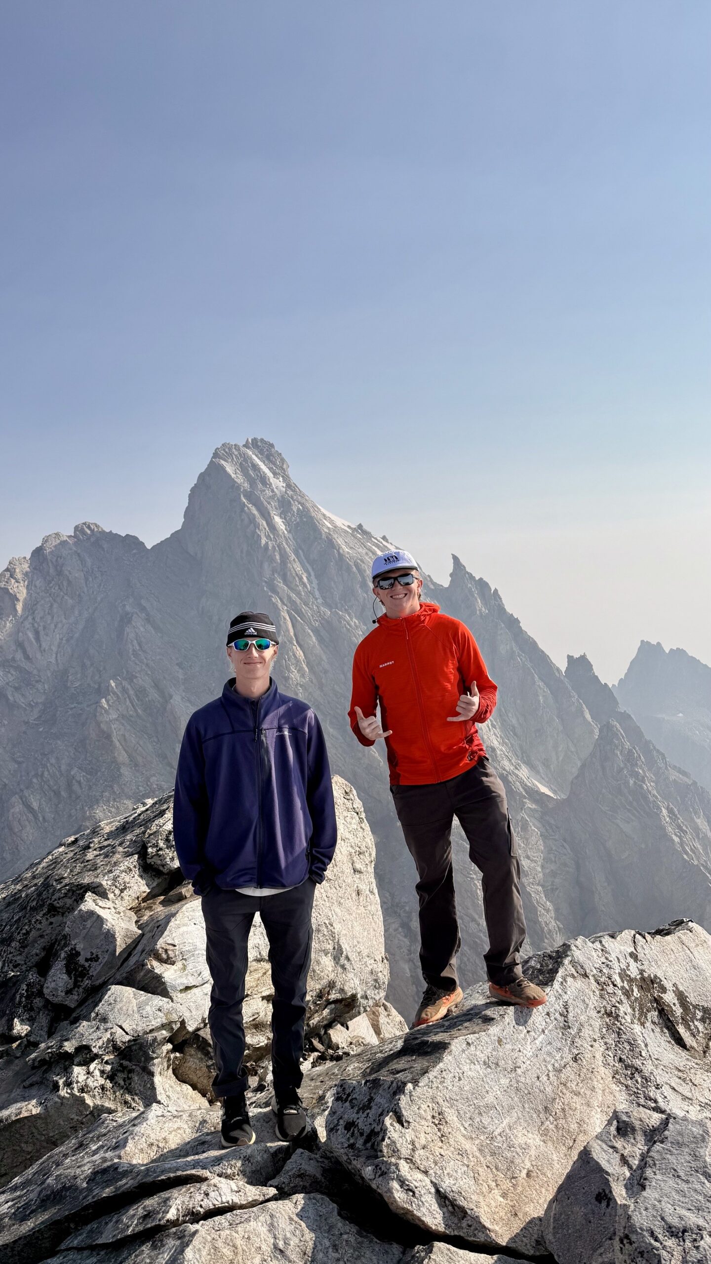
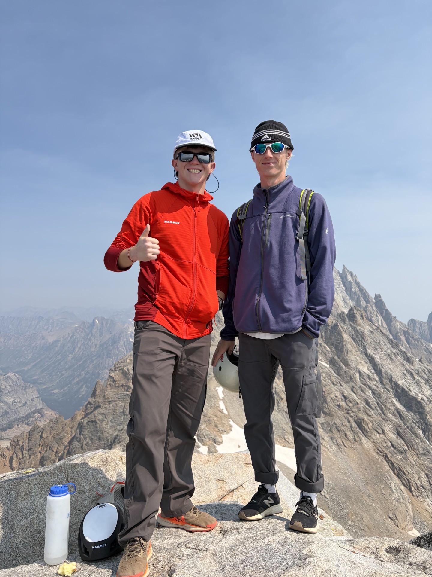
    Dawson and climbing partner above the Teton valleys on a clear summer day
    A second summit changes the day

    The hardest miles usually come after the goal already feels close.

    Linking Middle Teton and South Teton means choosing to climb again instead of simply beginning the descent. That is where endurance becomes mountain efficiency.

    What made the day hard

    More Than a Long Hike

    Dawson called it a great, hard trip. The numbers support that description, but the real difficulty comes from how the components stack together.

    1. Vertical density

    More than 7,500 feet of gain across 15.2 miles creates a very different workload than a rolling trail of the same distance. Every mile is carrying a large share of vertical work.

    2. Two summit pushes

    The body never gets the psychological simplicity of “summit and descend.” After Middle Teton, another high point remains. That means another commitment to climbing while fatigue is already accumulating.

    3. Teton terrain

    Grand Teton National Park describes the Garnet Canyon approach as strenuous and notes boulder fields that require boulder hopping and wayfinding. Higher on the mountains, route choice and surface conditions matter even more. This is why a fast GPS time should never be read as evidence that the outing is easy.

    4. High-elevation decision making

    Middle Teton reaches 12,804 feet and South Teton 12,514 feet. The elevations are below the great expedition ranges but high enough that weather exposure, altitude, hydration and pacing can compound the physical effort.

    5. The descent

    After two summits, the legs still have to absorb thousands of feet downward. Good mountain fitness is not just about climbing speed; it is the ability to keep precise footwork and steady concentration on the way home.

    Two neighboring peaks, one big day

    Middle Teton and South Teton in Context

    This field report intentionally stops short of being a turn-by-turn climbing guide.

    PeakElevationPlanning contextGSG role
    Middle Teton12,804 ftNPS identifies it as one of the range’s popular climbing peaks and notes the Southwest Couloir as a common route. Conditions can change substantially with snow, rock and weather.Dedicated GSG mountain pillar is planned; this post does not replace it.
    South Teton12,514 ftShares the central Teton approach environment and can be combined with Middle Teton by strong parties, depending on route, conditions and experience.This post documents Dawson’s double summit rather than attempting full route ownership.
    Grand Teton13,775 ftA separate, more technical objective on its standard climbing routes.Existing full GSG parent guide.

    Do not copy Dawson’s time as a planning target.

    This is one person’s fast field result, not a recommended schedule. NPS advises climbers to use current route information and conditions. Stronger or slower teams, lingering snow, route-finding errors, thunderstorms or loose rock can change the day dramatically.

    What this day teaches

    Four Lessons From a Fast Double Summit

    The useful part of a field report is not copying the athlete—it is understanding what made the day work.

    Lesson 01

    Vertical beats mileage

    When evaluating a mountain day, look at gain per mile and terrain—not distance alone.

    Lesson 02

    Efficiency compounds

    Small savings in transitions, navigation, fueling and pacing add up across seven-plus hours.

    Lesson 03

    Save legs for descent

    A second summit is only successful when the team still has enough strength and attention to descend well.

    Lesson 04

    Conditions own the plan

    A dry August photo should never be treated as permanent route beta. Check NPS conditions for the day you climb.

    Trip-report questions

    Middle + South Teton FAQ

    Direct answers based on the supplied activity record and official park context.

    Can Middle Teton and South Teton be climbed in one day?

    Yes, strong and experienced mountain athletes sometimes combine the two in a single long day, but the effort is substantial. Dawson’s August 9, 2026 activity recorded 15.20 miles, 7 hours 22 minutes and 7,546 feet of gain.

    How much elevation gain did Dawson record?

    The Strava screenshot records 7,546 feet of elevation gain. Dawson described the day as roughly 7,800 vertical feet, which is a reasonable round-number description of the effort.

    How long did the double summit take?

    The Strava activity screenshot shows 7 hours 22 minutes for the 15.20-mile day.

    How high is Middle Teton?

    Grand Teton National Park identifies Middle Teton at 12,804 feet. It is one of the most popular climbing objectives in the Teton Range.

    How high is South Teton?

    The National Park Service backcountry map lists South Teton at 12,514 feet.

    Is this a route guide for Middle Teton or South Teton?

    No. This is a field report documenting one strong double-summit day. Use current National Park Service climbing information, backcountry conditions and detailed route resources before attempting either mountain.

    What is the main lesson from this trip?

    The distance alone understates the day. Stacking more than 7,500 feet of gain with two high Teton summits, boulder travel, route finding and a long descent makes this a serious endurance and mountain-efficiency test.

    Sources and boundaries

    What This Post Is Based On

    First-hand evidence is separated from general planning information.

    • First-hand source: Dawson’s August 9, 2026 photographs supplied to Global Summit Guide.
    • Activity source: supplied Strava story showing 15.20 mi, 7h 22m and 7,546 ft elevation gain.
    • Middle Teton elevation: Grand Teton National Park identifies Middle Teton at 12,804 ft.
    • South Teton elevation: NPS backcountry mapping lists South Teton at 12,514 ft.
    • Access context: Lupine Meadows / Garnet Canyon is the primary climbing approach corridor for the central Tetons.
    • Current conditions: always check Grand Teton backcountry and trail conditions before attempting a similar objective.

    Boundary: the supplied activity did not include a permanent public GPX or a written route-by-route account, so this post does not invent Dawson’s exact couloir, traverse line or turn-by-turn route.

    A real mountain day, not a theoretical one

    15.2 Miles. Two Teton Summits. More Than 7,500 Feet Up.

    Dawson’s day is exactly the kind of field experience Global Summit Guide can use to connect research with what mountain effort actually feels like.

    Was this helpful?

    Yes
    No
    Thanks for your feedback!
  • Our Mountaineering Experience: The Global Summit Guide Summit Record

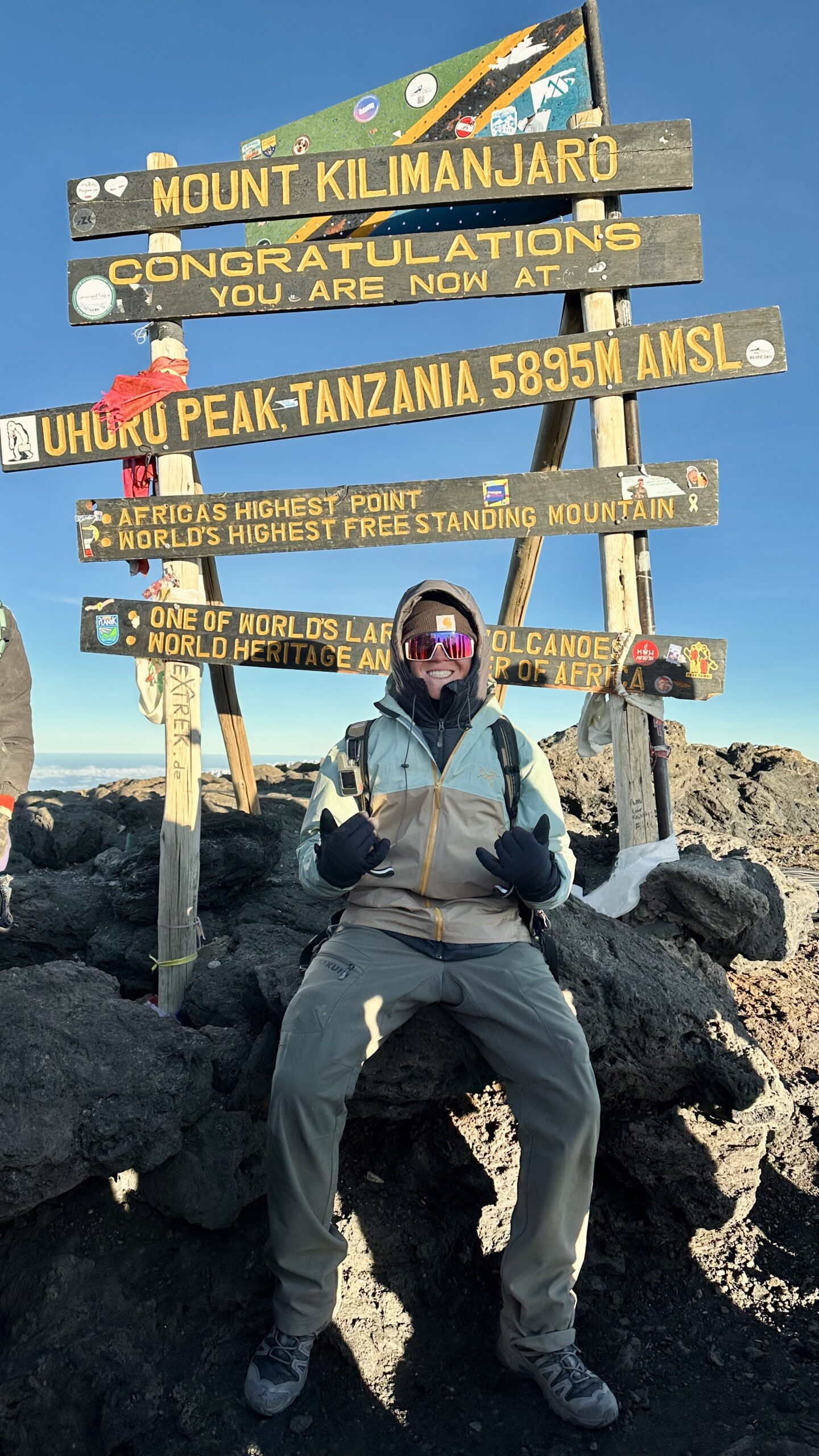
    The Global Summit Guide team on Kilimanjaro, the highest summit in the team's first-hand record
    Kilimanjaro, 19,341 ft (5,895 m), via Lemosho. The roof of Africa and the highest point we have reached.
    About · Our Field Experience

    The real climbs behind our guides

    Anyone can write about mountains. We think you deserve to know who is actually doing the climbing. This is our honest first-hand record: two dozen summits and more than forty ascents from Utah’s Wasatch Range to the roof of Africa, climbs in Patagonia and Iceland, and the high-altitude progression we are on right now. Where our guides go beyond what we have personally climbed, we tell you, and we cite our sources.

    24Distinct summits
    42Total ascents
    19,341 ftHigh point (Kilimanjaro)
    4Continents climbed
    The honest summary

    Deep experience up to 19,000 feet, and honest about the rest.

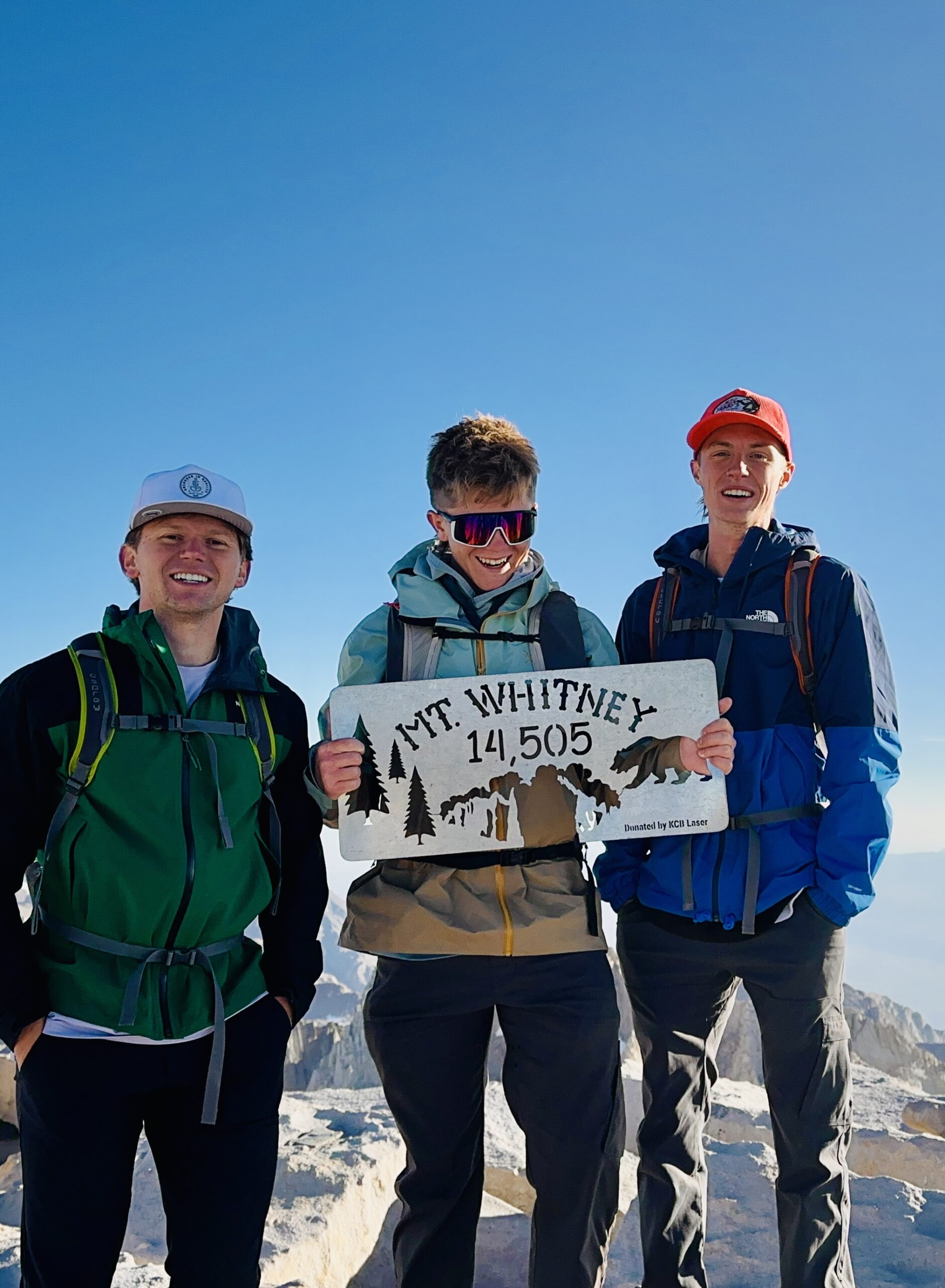
    Our Climbing & Mountaineering Lead, Dawson Ludlow, has summited more than twenty distinct peaks across more than forty ascents, from repeated Wasatch classics to Kilimanjaro (19,341 ft), Mount Whitney (14,505 ft), and the glaciated Mount Hood.

    With founder Travis Ludlow he has also climbed Pikes Peak, climbed in Patagonia and Iceland, and stood at the foot of Mount Fuji.

    We have not summited Everest or any 8,000-meter peak, and we never pretend otherwise. Next up is a deliberate high-altitude progression: Orizaba, Cotopaxi, and Chimborazo.

    Signature & high-altitude summits

    The climbs that anchor our altitude and glacier experience, and inform how we write about the bigger peaks.

    Kilimanjaro · via the Lemosho route

    19,341 ft (5,895 m) · Tanzania · our highest summit

    The roof of Africa and the highest point we have reached. A non-technical but serious high-altitude trek that taught us first-hand how altitude, pacing, and multi-day fatigue actually feel above 15,000 feet, lessons that shape our Kilimanjaro and altitude guides.

    Mount Whitney

    14,505 ft (4,421 m) · California · highest in the lower 48

    The highest summit in the contiguous United States, a long, demanding day at altitude on the classic route.

    Pikes Peak · Travis and Dawson

    14,115 ft (4,302 m) · Colorado

    A Colorado 14er climbed together, one of several climbs Travis and Dawson have done side by side.

    Mount Hood · via Timberline

    11,249 ft (3,429 m) · Oregon · glaciated volcano

    Our introduction to a glaciated Cascade volcano: crampons, an alpine start, and real snow-and-ice terrain, and a direct stepping stone toward the volcanoes we are climbing next.

    The Wasatch record

    Utah’s Wasatch Range is our home range and the foundation of everything else. Repeated ascents in every season are where judgment is actually built.

    The bulk of our experience is earned close to home, on the peaks of Utah’s Wasatch Range, climbed and re-climbed across seasons and conditions. This is where the unglamorous work of mountaineering happens: learning to read weather, pace a long climb, move on snow, and turn around when a day goes wrong. Highlights include Mount Nebo, the highest peak in the Wasatch, climbed six times; Mount Timpanogos by two different routes including the Everest Ridge; Lone Peak three times via the committing Jacob’s Ladder approach; and Kyhv Peak above Provo four times. These are not exotic objectives, but the accumulated mileage across dozens of ascents is exactly the kind of experience that makes the difference between writing about mountains and knowing them.

    A scene from the team's climbs
    Out on the mountain. First-hand time in real terrain, across seasons and conditions, is where the judgment behind our guides is actually built.

    The full summit table

    Every peak in our first-hand record, with verified elevations and the number of ascents. Grouped by elevation band.

    PeakRoute(s)ElevationAscents
    High-altitude & signature
    KilimanjaroLemosho19,341 ft (5,895 m)1
    Mount WhitneyStandard route14,505 ft (4,421 m)1
    Mount HoodTimberline11,249 ft (3,429 m)1
    Wasatch & Utah 11,000-ft peaks
    Mount NeboNorth Peak Trail11,928 ft6
    Mount TimpanogosTimpooneke; Everest Ridge11,752 ft3
    American Fork Twin PeaksStandard11,489 ft1
    PfeifferhornStandard11,326 ft2
    Lone PeakJacob’s Ladder11,253 ft3
    Mount SuperiorCardiff Pass11,132 ft1
    Box Elder PeakStandard11,101 ft1
    Provo PeakThe Y; Slate Canyon; normal11,068 ft3
    Wasatch & Utah 10,000-ft peaks
    Loafer MountainStandard10,687 ft1
    Santaquin PeakLoafer Mountain Trail10,685 ft1
    Sunset PeakCatherine Pass10,648 ft1
    Gobblers KnobStandard10,246 ft1
    Mount RaymondStandard10,241 ft1
    Spanish Fork PeakStandard10,193 ft2
    Utah peaks under 10,000 ft
    Ben LomondCutler9,712 ft1
    Notch PeakStandard9,655 ft1
    Mount OlympusStandard9,026 ft2
    Y MountainStandard~8,568 ft1
    Grandeur PeakStandard8,299 ft1
    Kyhv PeakRock Canyon7,865 ft4
    Big BaldyStandardWasatch2
    How to read this table

    Twenty-four distinct summits, forty-two total ascents. The repeated climbs matter as much as the list: six trips up Mount Nebo and four up Kyhv Peak represent real, seasonal familiarity, not a one-time tick. Elevations are verified against current records; Big Baldy is listed without a precise figure rather than guess at which of Utah’s several Big Baldys applies.

    International climbing

    Beyond the summits above, Travis and Dawson have sought out mountain terrain around the world.

    Our experience is not confined to North America. Together, Travis and Dawson have climbed in Patagonia, the wild, weather-battered mountains at the southern end of South America, and in Iceland, a landscape of glaciers, volcanoes, and fast-changing conditions. They have also spent time at the base of Mount Fuji in Japan. We are precise about that last one on purpose: we explored Fuji’s lower slopes rather than standing on its summit, and it matters to us to describe experience exactly as it happened. Time in these ranges, on very different rock, ice, and weather than Utah’s, broadens the judgment we bring to writing about mountains everywhere.

    What we are climbing next

    Our experience is not a finished list. We are on a deliberate progression toward higher, glaciated, high-altitude volcanoes, and we will document it as it happens.

    The high-altitude progression, 2026 to 2027

    December 2026

    Pico de Orizaba

    18,491 ft (5,636 m) · Mexico

    North America’s highest volcano and our next high-altitude glacier objective, building on Mount Hood.

    2027

    Cotopaxi

    19,347 ft (5,897 m) · Ecuador

    A classic glaciated Andean volcano and a step up in sustained altitude and glacier travel.

    2027

    Chimborazo

    20,548 ft (6,263 m) · Ecuador

    Ecuador’s highest peak and the farthest point from the center of the Earth, our first objective above 20,000 feet.

    These are goals, not achievements, and we will report honestly on how the preparation and the climbs actually go. Follow the same path in our progression plans and expedition training guides.

    Our honesty policy

    Global Summit Guide covers mountains far higher and more technical than we have personally climbed, including Everest, K2, and the 8,000-meter peaks. We will never blur the line between what we have done and what we have researched. Our first-hand summits top out at Kilimanjaro; everything above that is research-based synthesis drawn from the Himalayan Database, the American Alpine Club, expedition operators, and published accounts, and we cite those sources.

    We believe this honesty makes us more useful, not less. It means you can trust that when we describe how something feels, we have felt it, and when we are working from research, we say so. That is the standard we hold every page on this site to.

    Experience FAQ

    The questions readers ask about who is behind the guides.

    Has the team summited Everest or the 8,000-meter peaks?

    No, and we say so plainly. Our highest summit is Kilimanjaro at 19,341 feet. Our 8,000-meter guides are research-based syntheses from the Himalayan Database, the American Alpine Club, operators, and published accounts, with sources cited.

    What is the team’s highest summit?

    Kilimanjaro, 19,341 feet (5,895 m), via Lemosho. Then Mount Whitney (14,505 ft), Pikes Peak (14,115 ft), and Mount Hood (11,249 ft), plus more than twenty Wasatch summits.

    How does this experience make your guides more reliable?

    First-hand time teaches what no database can: how altitude feels, how fast weather turns, how fatigue erodes judgment on descent. That shapes how we frame difficulty, training, and risk, even for peaks higher than we have climbed, where we are transparent that the work is research-based.

    What are you climbing next?

    A high-altitude progression: Pico de Orizaba (18,491 ft) in December 2026, then Cotopaxi (19,347 ft) and Chimborazo (20,548 ft) in 2027. Glaciated volcanoes that build directly on Kilimanjaro and Mount Hood.

    Who does the climbing?

    Primarily Dawson Ludlow, our Climbing & Mountaineering Lead, with founder Travis Ludlow climbing alongside him, including Pikes Peak and climbs in Patagonia and Iceland. Health and altitude content is reviewed by Taylor Ludlow, RN.

    About Global Summit Guide

    Dawson Ludlow, Climbing & Mountaineering Lead · Travis Ludlow, Founder & Head of Research

    Global Summit Guide is an independent mountaineering resource built on a simple principle: earn trust by being honest about what we know first-hand and what we have researched. This page is our experience record, and we keep it current as we climb. Health and altitude content is reviewed by Taylor Ludlow (Registered Nurse), and gear by Walker Ludlow. Read more about the team and mission.

    Was this helpful?

    Yes
    No
    Thanks for your feedback!
Language »