
Last updated September 7, 2026
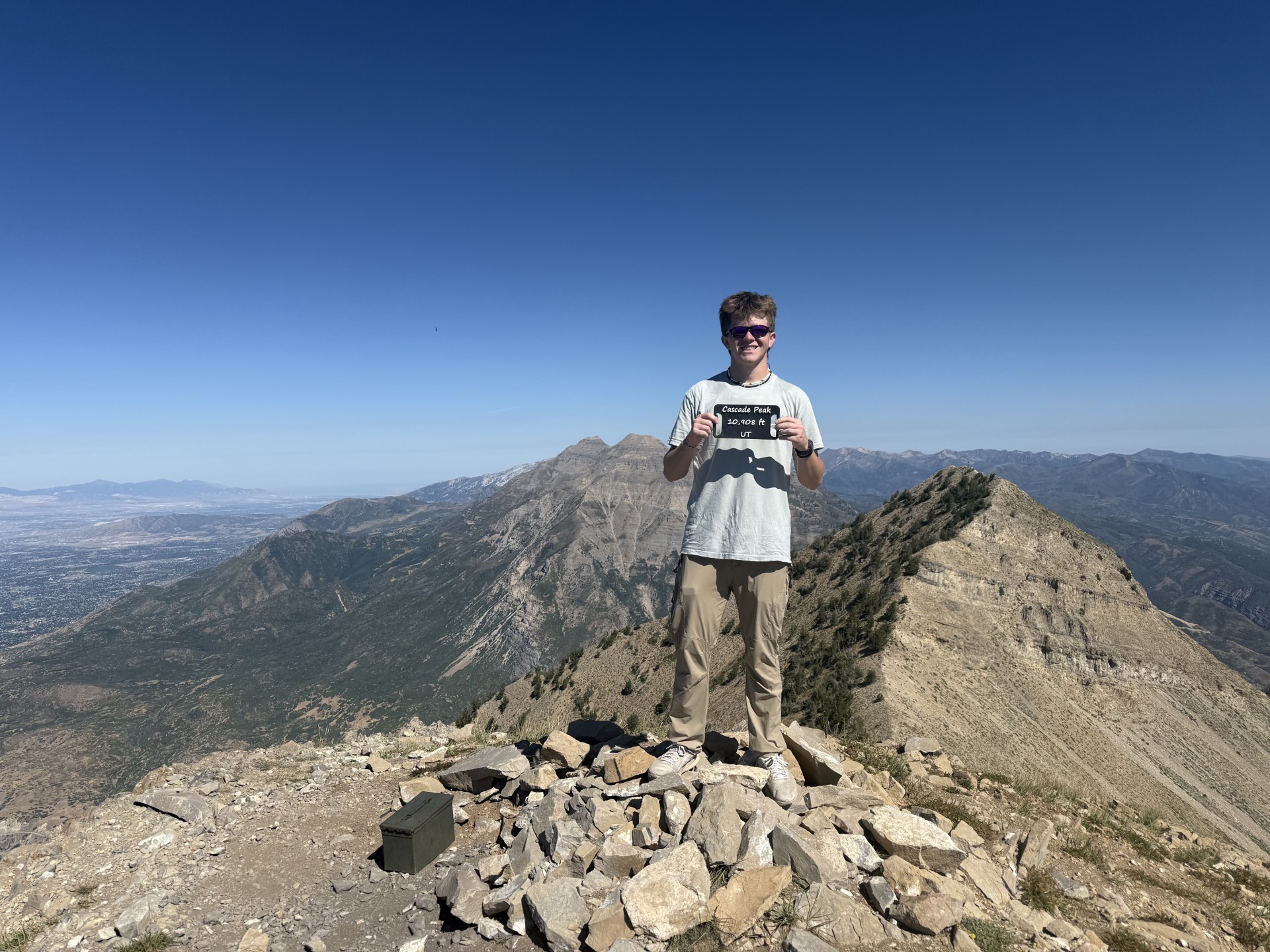
Cascade Mountain Utah: Dawson & Chandler’s Long Climb Above Provo Canyon
Mount Timpanogos gets the crowds. Cascade Mountain gets the long ridge, route-finding and the feeling that the summit keeps moving away from you. Dawson Ludlow and Chandler recently climbed Cascade’s 10,908-foot summit, adding a first-hand ascent to Global Summit Guide’s Utah County coverage—and reinforcing why this peak should never be treated as simply a lower version of Timpanogos.
Is Cascade Mountain Worth Climbing?
Yes—if you already like long Wasatch days and want something quieter and less straightforward than Mount Timpanogos. Cascade is a serious Utah County peak whose difficulty comes from more than its 10,908-foot elevation.
The mountain rises immediately south of Provo Canyon and forms one of the dominant walls above Orem and Provo. Its summit sits lower than Timpanogos, Provo Peak and several other Wasatch giants, but the most common routes require a long approach, substantial vertical, repeated ridge gains and losses, navigation and sections of scrambling.
Dawson and Chandler described the climb as a super-long day. That matches the mountain’s reputation. Published South Ridge/Dry Fork route estimates vary from roughly 12 to 15 miles depending on the start, road access, exact line and tracking method, while total gain varies substantially because the ridge repeatedly gives elevation back.
Until their GPX is logged, this field post does not assign an exact mileage or elevation-gain number to their climb. The summit is firsthand. The route statistics below are reference ranges.
A Summit That Does Not Come Cheap
Cascade looks close from Utah Valley. Once you are on the mountain, the geometry feels completely different.
The Mountain Looks Almost Too Accessible
Cascade dominates the east side of Orem and Provo. From below, it is easy to see the summit ridge and mentally compress the mountain into one continuous climb. The reality is more complicated: access starts behind the obvious front face, and the ridge system stretches much farther than it appears from town.
Distance Becomes the Story
Dawson and Chandler’s description was simple: super long. That matters because Cascade does not give the psychological rhythm of a highly developed trail such as Timpanogos. You make progress, lose elevation, climb again, traverse, negotiate rougher terrain—and still have another piece of ridge ahead.
The Terrain Opens Up
The upper mountain is broad, pale and exposed. The summit photographs show the open limestone ridge, Utah Valley dropping away to the west and a long line of Wasatch terrain extending behind the climbers. There is very little visual shelter on the final mountain.
The Summit Makes the Day Make Sense
The reward is the perspective. Cascade sits between the urban Wasatch Front and the high country around Timpanogos, giving a summit view that feels much more isolated than the cities visible below would suggest.
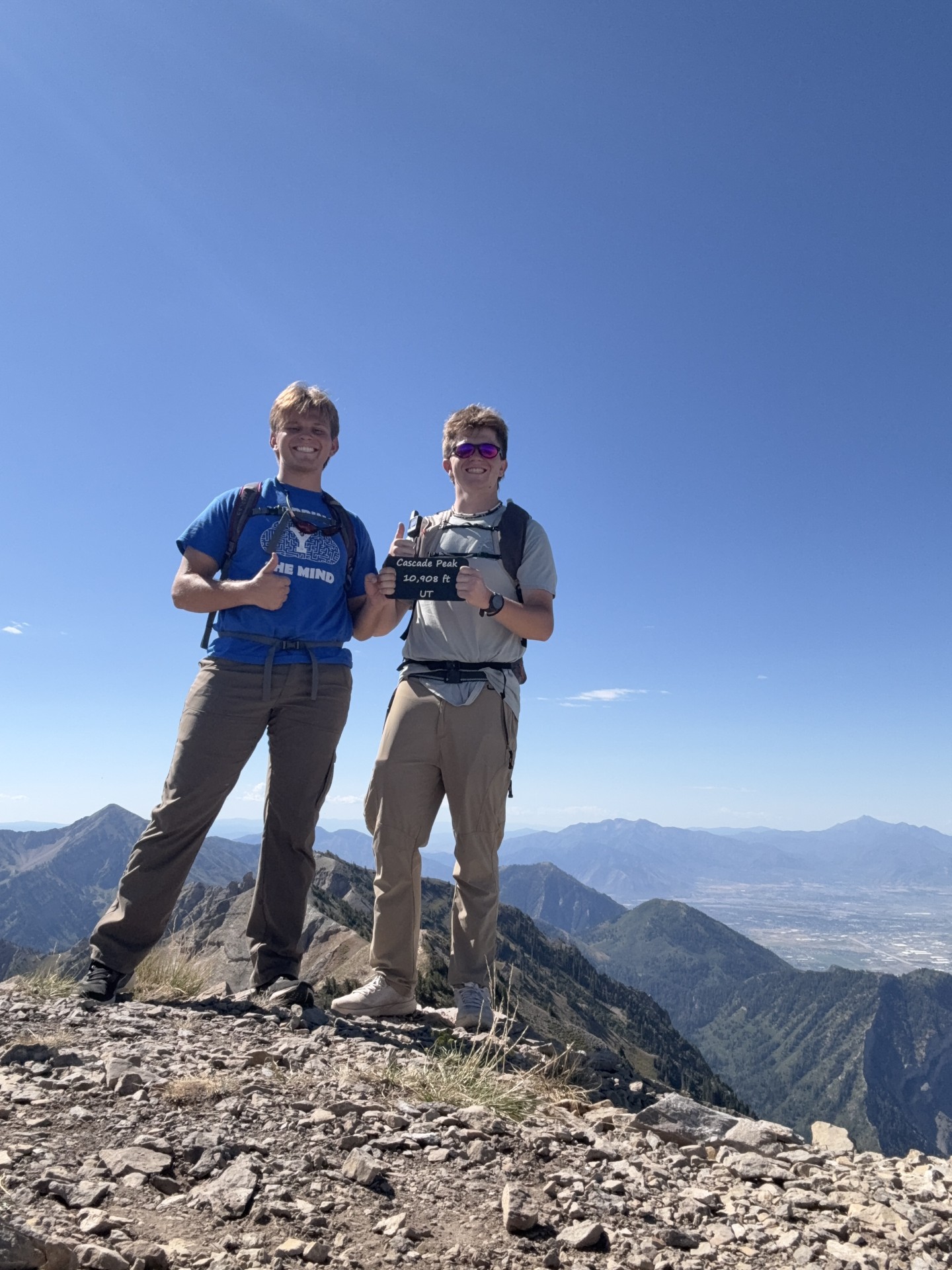
Dawson and Chandler on Cascade Mountain.
The summit sign reads 10,908 feet. Behind them, Utah Valley and the central Wasatch make clear why Cascade belongs in the Wasatch Seven even though it falls just short of 11,000 feet.
The Common Dry Fork / South Ridge Route
Until the climb track is logged, use this section as route context rather than a reconstruction of Dawson and Chandler’s exact line.
| Route element | Published range / character | Why it matters |
|---|---|---|
| Summit elevation | 10,908 ft | Utah County Atlas and summit marker agree |
| Common approach | Dry Fork → South Ridge | Frequently described as one of the more straightforward Cascade routes |
| Published distance | ~12–15 mi RT depending start | Road access and route choice change the total materially |
| Published gain | ~3,700–5,500 ft accumulated | Ridge ups and downs make net elevation misleading |
| Terrain | Trail → ridge travel → scrambling | Navigation becomes more important beyond the saddle |
| Commitment | Full-day objective | Early start and turnaround planning matter even in good weather |
Dry Fork to the High Saddle
Published accounts describe a long approach from the Kyhv Peak Road / Rock Canyon high-country side toward the saddle south of Cascade. The lower miles can feel like ordinary Wasatch trail hiking, which makes it easy to underestimate what remains.
The Mountain Starts Taking Elevation Back
From the saddle, the route turns into a long northward ridge journey. Intermediate rises and dips mean the summit is not reached by one clean final climb. Total accumulated gain is therefore higher than a simple trailhead-to-summit calculation.
Do Not Stop at the Wrong High Point
Cascade has more than one significant summit point. The true 10,908-foot summit is the higher northern objective. A long day can make the nearer high point feel psychologically final before the route actually is.
The Ridge Has to Be Re-Climbed
The same undulations that make the approach deceptive remain on the way home. This is one reason Cascade can feel dramatically longer than its net elevation profile suggests.
Why Cascade Feels So Long
The summit elevation is not the right measure of this mountain’s difficulty.
Repeated Elevation
You do not simply climb from trailhead to summit. Ridge travel repeatedly spends and re-earns vertical feet.
Navigation Load
A less-developed route requires constant small decisions. That adds mental fatigue to physical fatigue.
False-Finish Psychology
Ridge points look like they should be the end. Then another section appears. Cascade can feel longer than the map says.
Loose Terrain
Every mile on rough limestone and scree costs more energy than a mile on smooth trail.
Exposure to Weather
The high ridge provides little shelter. Wind, heat and thunderstorms have more opportunity to influence a long day.
The Descent Is Still Long
The summit is only the midpoint. Fatigue arrives before the technical and navigation decisions are finished.
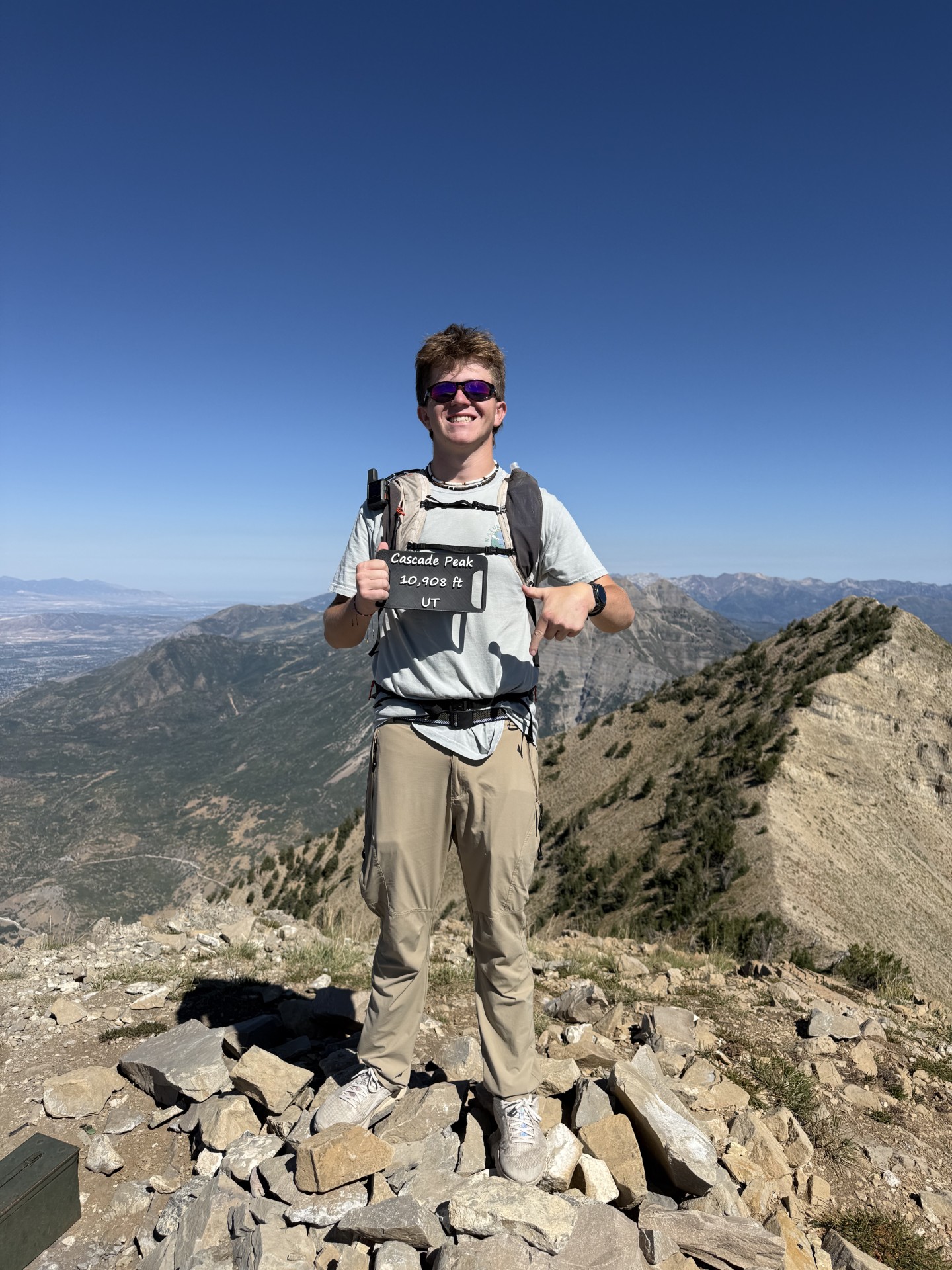
10,908 Feet—and a Lot More Mountain Than the Elevation Suggests.
Cascade falls 844 feet below Timpanogos, but the route character can make it feel like the more complicated day.
Cascade Mountain vs Mount Timpanogos
The peaks are neighbors, but they solve very different hiking goals.
| Question | Cascade Mountain | Mount Timpanogos |
|---|---|---|
| Elevation | 10,908 ft | 11,752 ft |
| Trail character | Rougher, route-dependent, ridge travel | Established high-use summit trails |
| Navigation | More important | Usually straightforward in summer |
| Crowds | Generally much lower | One of Utah’s busiest major summit hikes |
| Best for | Experienced local peakbaggers | Classic Utah mountain experience |
| Psychological challenge | Long ridge / repeated false finishes | Long sustained endurance day |
Field Lessons We Can Use on the Utah County Page
This ascent changes Cascade from research-only coverage to a first-hand GSG peak.
“Long” Belongs in the Opening
The biggest planning mistake is treating Cascade as a compact hike because it is below 11,000 feet. The mountain’s length and ridge geometry are defining characteristics, not secondary details.
The Summit Is Not the Only Difficulty
Peak profiles often over-focus on final scrambling. Cascade’s accumulated fatigue begins much earlier. Approach length and repeated gains are part of the technical decision-making problem.
Route Statistics Need a Range
Published mileage varies widely. That is not automatically bad data; different trailhead positions and route choices can produce genuinely different Cascade days.
It Is a Progression Peak
Cascade belongs after hikers have already learned long-day pacing, offline navigation and basic scrambling. It should never be presented as a normal “best hike near Provo” recommendation for everyone.
A Cascade Readiness Test
If several of these are new to you, build another step before Cascade.
Long Wasatch Days Are Normal
You should already know how your body responds after 6–8 hours of continuous mountain movement and several thousand feet of climbing.
You Can Follow More Than a Trail
Carry an offline route and know how to use it. The ability to identify that you are off-route early is more valuable than finding the perfect GPX track online.
Loose Rock Does Not Change Your Composure
Simple scrambling, unstable rock and uneven ridge travel should slow you down—not make you freeze or rush.
You Can Turn Around After Investing Hours
Long approaches create sunk-cost pressure. Cascade is exactly the kind of mountain where a weather or timing turnaround can happen after you’ve already worked hard.
Use the Mountain Readiness Assessment before moving into specialist Wasatch objectives →
Build the Local Peakbagging Journey Around It
Cascade now has a first-hand field story. The surrounding guides should keep the broader search intent.
Best Peaks in Utah County
Use the county ranking to compare Cascade with Timpanogos, Provo Peak, Box Elder and the southern Utah Valley peaks.
Compare Utah County peaks → Challenge ownerThe Wasatch Seven
Cascade is one piece of the seven-peak Utah Valley challenge. Track it there rather than turning this field report into the challenge hub.
Open the Wasatch Seven → Deep recoveryWasatch Range Peaks
Zoom out to the broader summit inventory and see how Cascade fits among the central Wasatch peaks.
Explore Wasatch peaks → Neighboring entityMount Timpanogos
Choose Timpanogos when you want the iconic, established-trail version of a big Utah County summit day.
Plan Timpanogos →Make Cascade a Deliberate Progression Peak.
Add Cascade to My Climb only after you can explain which route you are using, how long your specific starting point makes the day, where the route-finding begins and what time you will turn around. Then record the track after the climb so the next decision becomes better than the last one.
What Is First-Hand—and What Is Reference Data
The distinction matters more on Cascade than on a trail with one universally measured route.
Dawson + Chandler
- Successful Cascade summit.
- 10,908-foot summit photographs.
- First-hand characterization: a very long climb.
- Three original GSG-hosted photos from the summit.
Not yet logged: exact GPX, elapsed time, route name, accumulated gain and precise distance.
Route Context
- Utah County Atlas — 10,908-foot summit.
- SummitPost — South Ridge / Dry Fork route context.
- Multiple historic Dry Fork reports — route-length variation by starting point.
- Utah Avalanche Center — use whenever snow is present.
Planning the 10,908-Foot Utah County Peak
Short answers without pretending this field post owns every route variation.
How high is Cascade Mountain in Utah?
Cascade Mountain in Utah County reaches 10,908 feet. The Utah County Atlas lists that elevation, and the summit marker visible in Dawson and Chandler’s photographs also reads 10,908 feet.
Is Cascade Mountain near Mount Timpanogos?
Yes. Cascade rises immediately south of Provo Canyon near Mount Timpanogos in the central Wasatch. Timpanogos is the better-known neighbor, while Cascade is generally rougher, quieter and more route-dependent.
How long is the Cascade Mountain hike?
It depends on route and starting point. Published South Ridge/Dry Fork routes commonly fall in roughly the 12–15 mile range, and gain estimates vary because of road access and repeated ridge climbs. We will not assign an exact number to Dawson and Chandler’s climb until their GPX is logged.
Is Cascade Mountain harder than Mount Timpanogos?
Cascade can feel harder even though it is lower. Timpanogos has established high-use trails and is usually a larger mainstream endurance hike. Cascade adds navigation, ridge undulations, loose terrain and scrambling.
Is Cascade Mountain part of the Wasatch Seven?
Yes. Cascade is one of the seven major peaks in the Wasatch Seven challenge around Utah Valley, alongside Nebo, Timpanogos, Lone Peak, Provo Peak, Loafer Mountain and Spanish Fork Peak.
What is the standard route on Cascade Mountain?
The South Ridge reached from the Dry Fork area is commonly described as one of the more straightforward routes, though it remains a long, rugged mountain day with navigation and scrambling. Other approaches can materially change the statistics.
Who should attempt Cascade Mountain?
Experienced hikers who already know how they perform on long Wasatch days, several thousand feet of gain, loose terrain, navigation and basic scrambling. It is not an ideal first Utah County summit.
What is the best season for Cascade Mountain?
For normal hiking and scrambling, the most reliable period is generally mid-summer through early fall after lingering snow is gone. Snow changes the mountain dramatically because Cascade contains serious avalanche terrain; use current avalanche and access information whenever winter conditions remain.
Cascade Is the Peak You Climb After “Long” Stops Scaring You.
It is lower than Timpanogos, less famous than Timpanogos and far less straightforward than Timpanogos. That is exactly the appeal. Dawson and Chandler reached the 10,908-foot summit after a very long Wasatch day—and Cascade now moves from research-only coverage into Global Summit Guide’s first-hand Utah County experience.
Cascade Mountain: Keep Exploring the Wasatch
Continue with nearby summits and field reports built from Global Summit Guide’s own time in the Utah mountains.
Was this helpful?
Global Summit Guide is an independent mountaineering resource founded in 2026. The team combines first-hand trekking and climbing experience with in-depth research and professional health and nutrition review to help climbers choose objectives, prepare properly, and stay safe.
Health, altitude, and nutrition content is reviewed by Taylor Ludlow (Registered Nurse) and Brigg Hoopes (Nutritionist).
What We Don't Know Yet
Mountain information changes quickly. This box explains the limits of what this page can responsibly promise.
- Route conditions, snowpack, closures, and weather can change quickly after this page is updated.
- Permit rules, fees, quotas, and reservation windows may change between review cycles.
- Operator availability, pricing, guide ratios, and cancellation terms can change by season.
- Your fitness, altitude response, risk tolerance, and experience level may change what is safe or realistic.
- Use this page for planning guidance, then verify current information with official sources and qualified local experts before committing.
Verify current conditions with official land managers, guide services, local forecasts, and current route reports before booking or climbing.
Mountaineering, rock and ice climbing, glacier travel, and high-altitude activity are inherently dangerous and can result in serious injury or death. The information on Global Summit Guide is provided for general informational and educational purposes only and is not a substitute for professional instruction, qualified guiding, proper equipment, or your own judgment and experience.
Route conditions, weather, snowpack, permits, regulations, and hazards change constantly and may differ from what is described here. Details may be incomplete, out of date, or contain errors. Always verify current information with local authorities, certified guides, and official sources before making any decision in the mountains.
Nothing on this site is medical, legal, or financial advice. Our fitness, acclimatization, altitude, and nutrition content is general in nature; consult a qualified physician before beginning any strenuous exercise program or exposing yourself to high altitude.
You are solely responsible for your own safety and decisions. To the fullest extent permitted by law, Global Summit Guide and its team accept no liability for any loss, injury, damage, or expense arising from use of, or reliance on, this information. By using this site you acknowledge these risks and accept these terms.
Some links on this site may be affiliate links. If you buy through them we may earn a small commission at no extra cost to you; this never affects our recommendations.
Global Summit Guide recommendation path
Next Best Mountain to Research
Use these recommendations to continue the right planning path instead of stopping on one page.
Use current permit, weather, route, and operator information before booking or climbing.
Explore Travel Options for Your Destination
Once your mountain, dates and route are taking shape, compare flights, hotels and other travel options that fit the trip.
Affiliate link. We may earn a commission at no additional cost to you.