Global Summit Guide logo featuring mountain imagery, symbolizing hiking and mountaineering resources for trip planning and safety.

Tag: mount timpanogos

  • Our Mountaineering Experience: The Global Summit Guide Summit Record

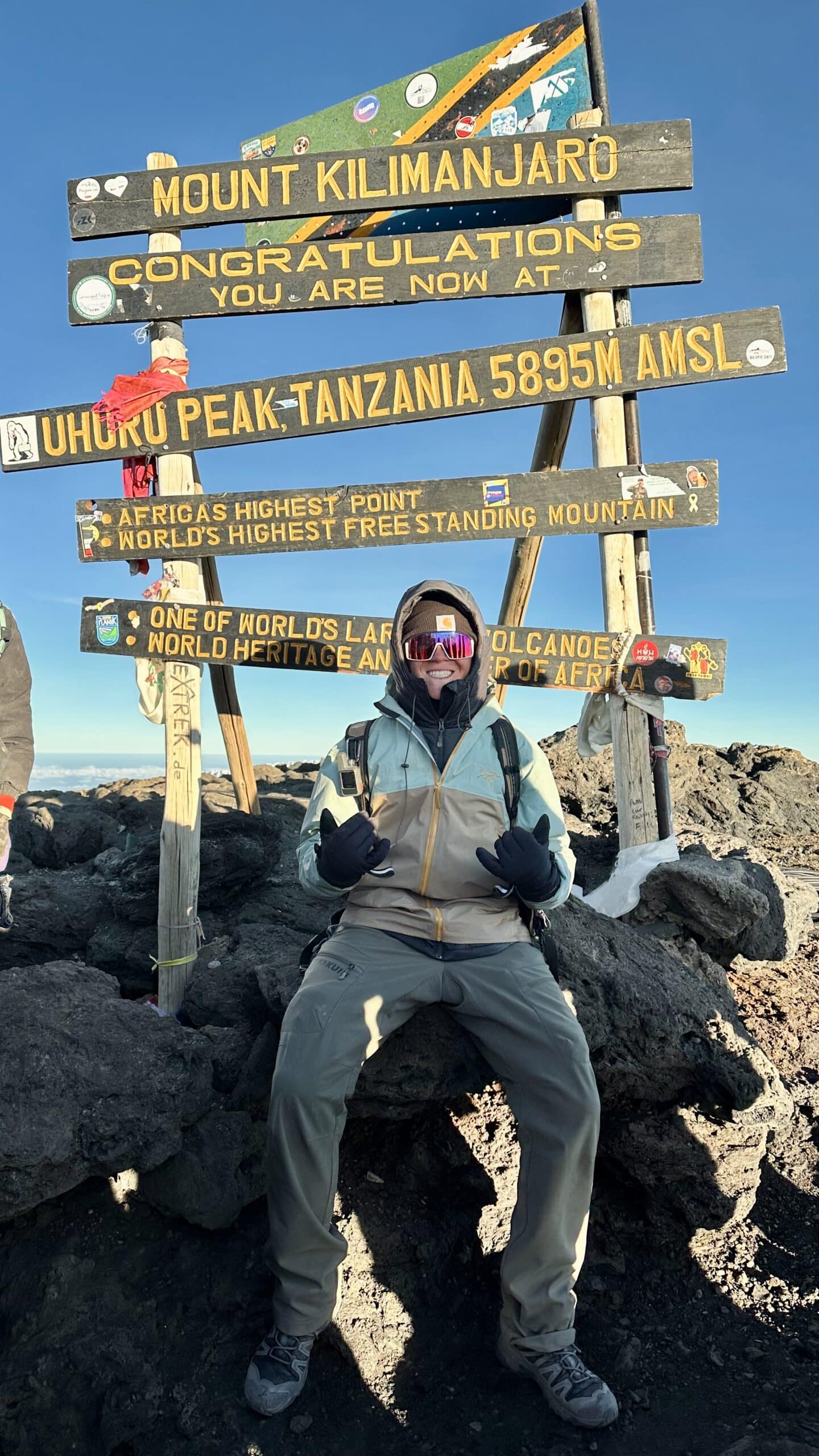
    Person celebrating at Uhuru Peak, Mount Kilimanjaro, with summit sign displaying altitude and notable features, showcasing a triumphant moment in a guided expedition.
    Kilimanjaro, 19,341 ft (5,895 m), via Lemosho. The roof of Africa and the highest point we have reached.
    About · Our Field Experience

    The real climbs behind our guides

    Anyone can write about mountains. We think you deserve to know who is actually doing the climbing. This is our honest first-hand record: two dozen summits and more than forty ascents from Utah’s Wasatch Range to the roof of Africa, climbs in Patagonia and Iceland, and the high-altitude progression we are on right now. Where our guides go beyond what we have personally climbed, we tell you, and we cite our sources.

    24Distinct summits
    42Total ascents
    19,341 ftHigh point (Kilimanjaro)
    4Continents climbed
    The honest summary

    Deep experience up to 19,000 feet, and honest about the rest.

    Our Climbing & Mountaineering Lead, Dawson Ludlow, has summited more than twenty distinct peaks across more than forty ascents, from repeated Wasatch classics to Kilimanjaro (19,341 ft), Mount Whitney (14,505 ft), and the glaciated Mount Hood.

    With founder Travis Ludlow he has also climbed Pikes Peak, climbed in Patagonia and Iceland, and stood at the foot of Mount Fuji.

    We have not summited Everest or any 8,000-meter peak, and we never pretend otherwise. Next up is a deliberate high-altitude progression: Orizaba, Cotopaxi, and Chimborazo.

    Signature & high-altitude summits

    The climbs that anchor our altitude and glacier experience, and inform how we write about the bigger peaks.

    Kilimanjaro · via the Lemosho route

    19,341 ft (5,895 m) · Tanzania · our highest summit

    The roof of Africa and the highest point we have reached. A non-technical but serious high-altitude trek that taught us first-hand how altitude, pacing, and multi-day fatigue actually feel above 15,000 feet, lessons that shape our Kilimanjaro and altitude guides.

    Mount Whitney

    14,505 ft (4,421 m) · California · highest in the lower 48

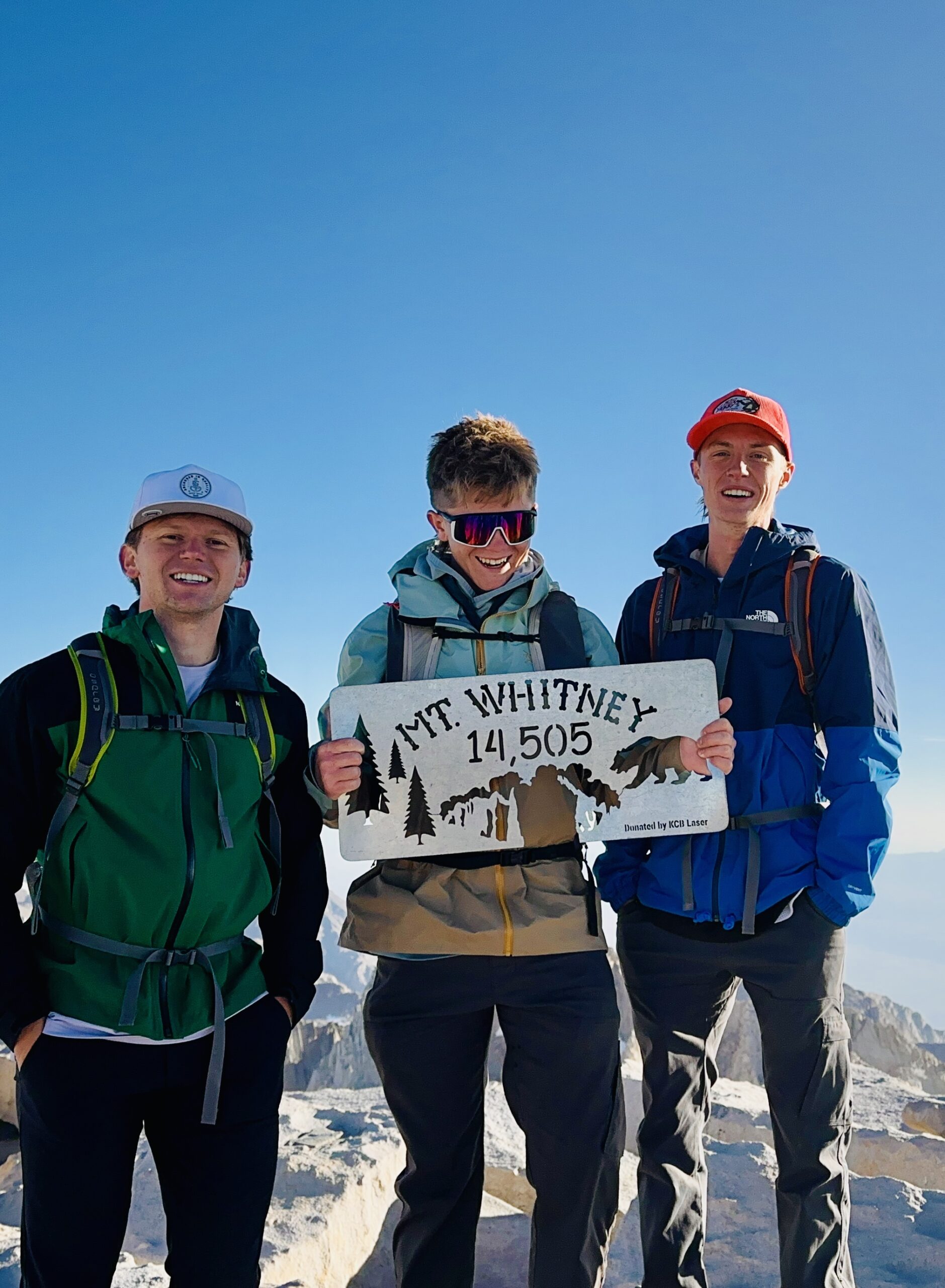
    The highest summit in the contiguous United States, a long, demanding day at altitude on the classic route.

    Pikes Peak · Travis and Dawson

    14,115 ft (4,302 m) · Colorado

    A Colorado 14er climbed together, one of several climbs Travis and Dawson have done side by side.

    Mount Hood · via Timberline

    11,249 ft (3,429 m) · Oregon · glaciated volcano

    Our introduction to a glaciated Cascade volcano: crampons, an alpine start, and real snow-and-ice terrain, and a direct stepping stone toward the volcanoes we are climbing next.

    The Wasatch record

    Utah’s Wasatch Range is our home range and the foundation of everything else. Repeated ascents in every season are where judgment is actually built.

    The bulk of our experience is earned close to home, on the peaks of Utah’s Wasatch Range, climbed and re-climbed across seasons and conditions. This is where the unglamorous work of mountaineering happens: learning to read weather, pace a long climb, move on snow, and turn around when a day goes wrong. Highlights include Mount Nebo, the highest peak in the Wasatch, climbed six times; Mount Timpanogos by two different routes including the Everest Ridge; Lone Peak three times via the committing Jacob’s Ladder approach; and Kyhv Peak above Provo four times. These are not exotic objectives, but the accumulated mileage across dozens of ascents is exactly the kind of experience that makes the difference between writing about mountains and knowing them.

    Three hikers celebrating at the summit of Mt. Whitney, holding a sign that reads "Mt. Whitney 14,505" against a clear blue sky, showcasing the triumph of their climb on June 26, 2025.
    Out on the mountain. First-hand time in real terrain, across seasons and conditions, is where the judgment behind our guides is actually built.

    The full summit table

    Every peak in our first-hand record, with verified elevations and the number of ascents. Grouped by elevation band.

    PeakRoute(s)ElevationAscents
    High-altitude & signature
    KilimanjaroLemosho19,341 ft (5,895 m)1
    Mount WhitneyStandard route14,505 ft (4,421 m)1
    Mount HoodTimberline11,249 ft (3,429 m)1
    Wasatch & Utah 11,000-ft peaks
    Mount NeboNorth Peak Trail11,928 ft6
    Mount TimpanogosTimpooneke; Everest Ridge11,752 ft3
    American Fork Twin PeaksStandard11,489 ft1
    PfeifferhornStandard11,326 ft2
    Lone PeakJacob’s Ladder11,253 ft3
    Mount SuperiorCardiff Pass11,132 ft1
    Box Elder PeakStandard11,101 ft1
    Provo PeakThe Y; Slate Canyon; normal11,068 ft3
    Wasatch & Utah 10,000-ft peaks
    Loafer MountainStandard10,687 ft1
    Santaquin PeakLoafer Mountain Trail10,685 ft1
    Sunset PeakCatherine Pass10,648 ft1
    Gobblers KnobStandard10,246 ft1
    Mount RaymondStandard10,241 ft1
    Spanish Fork PeakStandard10,193 ft2
    Utah peaks under 10,000 ft
    Ben LomondCutler9,712 ft1
    Notch PeakStandard9,655 ft1
    Mount OlympusStandard9,026 ft2
    Y MountainStandard~8,568 ft1
    Grandeur PeakStandard8,299 ft1
    Kyhv PeakRock Canyon7,865 ft4
    Big BaldyStandardWasatch2
    How to read this table

    Twenty-four distinct summits, forty-two total ascents. The repeated climbs matter as much as the list: six trips up Mount Nebo and four up Kyhv Peak represent real, seasonal familiarity, not a one-time tick. Elevations are verified against current records; Big Baldy is listed without a precise figure rather than guess at which of Utah’s several Big Baldys applies.

    International climbing

    Beyond the summits above, Travis and Dawson have sought out mountain terrain around the world.

    Our experience is not confined to North America. Together, Travis and Dawson have climbed in Patagonia, the wild, weather-battered mountains at the southern end of South America, and in Iceland, a landscape of glaciers, volcanoes, and fast-changing conditions. They have also spent time at the base of Mount Fuji in Japan. We are precise about that last one on purpose: we explored Fuji’s lower slopes rather than standing on its summit, and it matters to us to describe experience exactly as it happened. Time in these ranges, on very different rock, ice, and weather than Utah’s, broadens the judgment we bring to writing about mountains everywhere.

    What we are climbing next

    Our experience is not a finished list. We are on a deliberate progression toward higher, glaciated, high-altitude volcanoes, and we will document it as it happens.

    The high-altitude progression, 2026 to 2027

    December 2026

    Pico de Orizaba

    18,491 ft (5,636 m) · Mexico

    North America’s highest volcano and our next high-altitude glacier objective, building on Mount Hood.

    2027

    Cotopaxi

    19,347 ft (5,897 m) · Ecuador

    A classic glaciated Andean volcano and a step up in sustained altitude and glacier travel.

    2027

    Chimborazo

    20,548 ft (6,263 m) · Ecuador

    Ecuador’s highest peak and the farthest point from the center of the Earth, our first objective above 20,000 feet.

    These are goals, not achievements, and we will report honestly on how the preparation and the climbs actually go. Follow the same path in our progression plans and expedition training guides.

    Our honesty policy

    Global Summit Guide covers mountains far higher and more technical than we have personally climbed, including Everest, K2, and the 8,000-meter peaks. We will never blur the line between what we have done and what we have researched. Our first-hand summits top out at Kilimanjaro; everything above that is research-based synthesis drawn from the Himalayan Database, the American Alpine Club, expedition operators, and published accounts, and we cite those sources.

    We believe this honesty makes us more useful, not less. It means you can trust that when we describe how something feels, we have felt it, and when we are working from research, we say so. That is the standard we hold every page on this site to.

    Experience FAQ

    The questions readers ask about who is behind the guides.

    Has the team summited Everest or the 8,000-meter peaks?

    No, and we say so plainly. Our highest summit is Kilimanjaro at 19,341 feet. Our 8,000-meter guides are research-based syntheses from the Himalayan Database, the American Alpine Club, operators, and published accounts, with sources cited.

    What is the team’s highest summit?

    Kilimanjaro, 19,341 feet (5,895 m), via Lemosho. Then Mount Whitney (14,505 ft), Pikes Peak (14,115 ft), and Mount Hood (11,249 ft), plus more than twenty Wasatch summits.

    How does this experience make your guides more reliable?

    First-hand time teaches what no database can: how altitude feels, how fast weather turns, how fatigue erodes judgment on descent. That shapes how we frame difficulty, training, and risk, even for peaks higher than we have climbed, where we are transparent that the work is research-based.

    What are you climbing next?

    A high-altitude progression: Pico de Orizaba (18,491 ft) in December 2026, then Cotopaxi (19,347 ft) and Chimborazo (20,548 ft) in 2027. Glaciated volcanoes that build directly on Kilimanjaro and Mount Hood.

    Who does the climbing?

    Primarily Dawson Ludlow, our Climbing & Mountaineering Lead, with founder Travis Ludlow climbing alongside him, including Pikes Peak and climbs in Patagonia and Iceland. Health and altitude content is reviewed by Taylor Ludlow, RN.

    About Global Summit Guide

    Dawson Ludlow, Climbing & Mountaineering Lead · Travis Ludlow, Founder & Head of Research

    Global Summit Guide is an independent mountaineering resource built on a simple principle: earn trust by being honest about what we know first-hand and what we have researched. This page is our experience record, and we keep it current as we climb. Health and altitude content is reviewed by Taylor Ludlow (Registered Nurse), and gear by Walker Ludlow. Read more about the team and mission.

    Was this helpful?

    Yes
    No
    Thanks for your feedback!
  • What Mountain Was Your Biggest Mistake?

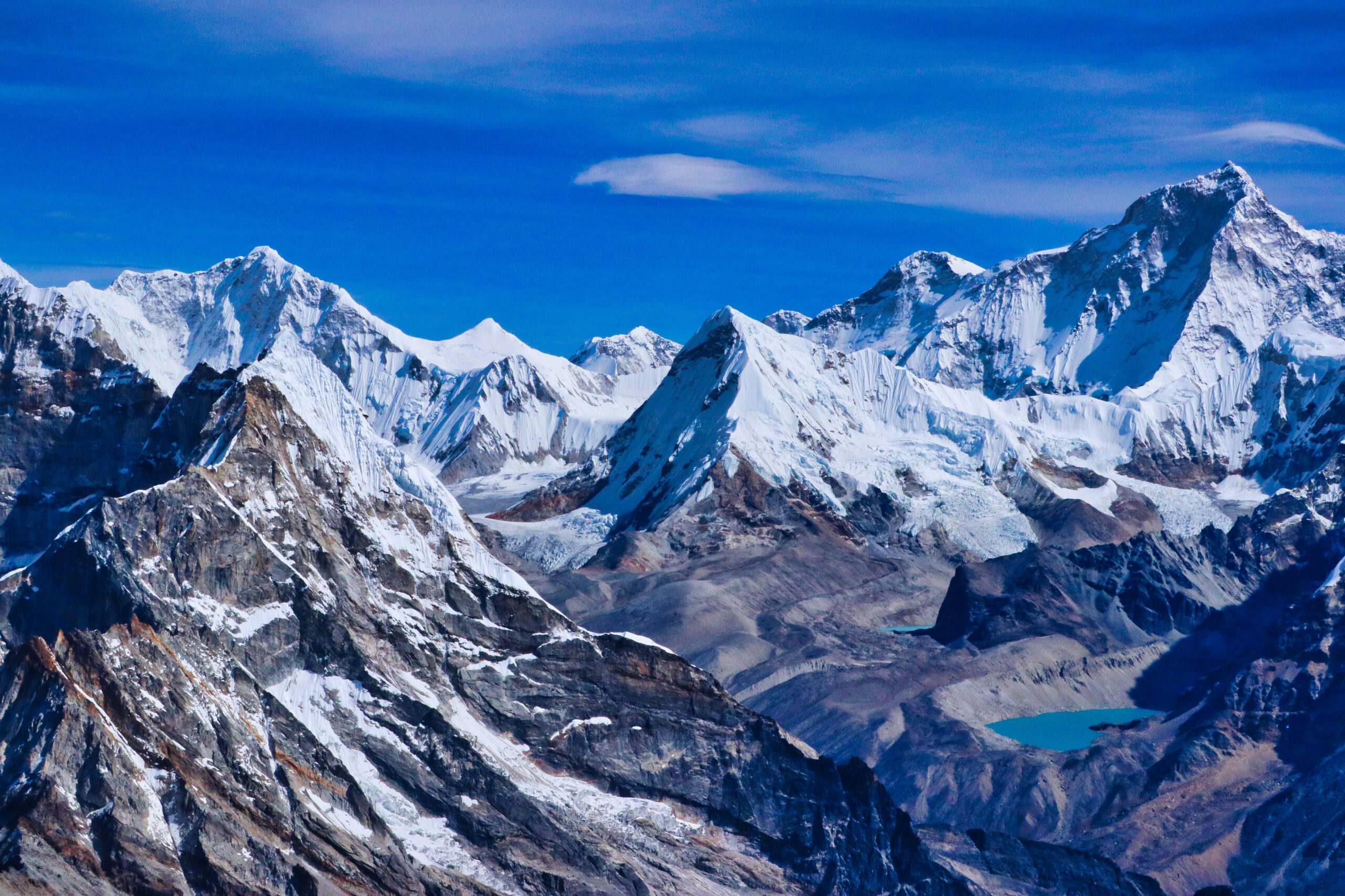
    Snow-capped mountain range under a bright blue sky, showcasing rugged terrain and alpine scenery, relevant to climbing and hiking guides.
    💬 Reader Stories · Tier A Engagement · Wasatch Wisdom

    What Mountain Was Your Biggest Mistake?

    I made a serious mistake on a Wasatch peak a few years back. Here’s what happened, what I learned, and the question I want you to answer in the comments.

    It was 1:47pm when I realized I had made a serious mistake.

    The sky over the Wasatch had been clear blue all morning — and then, in the span of about twenty minutes, it wasn’t anymore. Cumulus clouds piled up over the summit ridge while I was still a quarter mile below it, and I could already feel the static in the air. The kind of static that means lightning is building somewhere I couldn’t yet see.

    I had three choices. Turn around and descend. Push hard for the summit and gamble on outrunning the storm. Find shelter and wait it out.

    I made the wrong choice.

    The Mistake

    I started Mount Timpanogos from the Aspen Grove trailhead that morning at 7am. The standard advice for Timp in summer is a 4am or 5am start — get to the summit by 10am, off the ridge by noon. I knew this rule. Every Utah hiker knows this rule. But the weather forecast looked clean, my friend and I had been talking about climbing Timp for months, and we figured a 7am start would still get us to the top by 11am or noon.

    We were wrong about the time. The Aspen Grove route is about 15 miles round trip with nearly 5,000 feet of gain — and we were both more tired than we expected. By 1pm we were still half a mile below the summit ridge.

    That’s when the clouds started building.

    Snow-capped Torres del Paine massif and glacial lake, Patagonian hiking viewpoint.
    Cumulus clouds over a Wasatch summit ridge are not “maybe” thunderstorms. They are “definitely, within the next hour” thunderstorms. The discipline most Utah climbers eventually learn is to treat a single cumulus cloud over the ridge as a turnaround signal — not a “let me push another 15 minutes and see” signal.

    What Summit Fever Sounds Like in Your Head

    Here’s the part I want to be honest about. When you’re 500 feet below the summit of a peak you’ve been planning for months, your brain stops thinking clearly. It starts running internal arguments that sound reasonable but aren’t:

    “We’re so close — just push to the top.”

    “The storm might not actually break here.”

    “We can outrun it on the descent.”

    “This far up, turning around feels worse than the risk.”

    None of these arguments are real arguments. They are summit fever — the cognitive bias that makes climbers throw away good judgment because they’ve invested time and effort and want the reward. Summit fever has killed more people than any other psychological factor in mountaineering. It killed climbers on Everest in 1996. It kills hikers in the Wasatch every summer. And it almost cost me that day.

    We pushed on. We made the summit at 1:30pm. By 1:47pm we were on the descent and the first real thunder cracked maybe two ridges to our north.

    ⚠ The Storm — What Happened Next

    We got caught above treeline on the exposed ridge for about 25 minutes. The storm itself was brief but intense — hail, wind, lightning striking somewhere I couldn’t see but could feel in the static and hear in the thunder cracks 4-7 seconds away. We hunkered down behind a cluster of boulders, crouched low with feet together, kept distance from each other. The storm moved through. We descended fast. We got down safely.

    It could have ended very differently. The standard fatality scenario in the Wasatch is one I narrowly avoided. People die on these peaks every summer doing exactly what I did.

    What I Should Have Done

    Lesson 1

    Started Three Hours Earlier

    A 4am start with headlamps for the first hour would have put us on the summit at 9am — well before the cloud buildup began. Headlamps are uncomfortable. Storms are dangerous. The trade is obvious in retrospect.

    Lesson 2

    Turned Around at the First Cloud

    The Wasatch summer thunderstorm cycle is one of the most predictable weather patterns in North American mountaineering. When cumulus clouds appear over the ridge, you have maybe 60-90 minutes before the storm breaks. Treat the first cloud as a hard turnaround signal — not a “let me see how the next 20 minutes goes” signal.

    Lesson 3

    Recognized Summit Fever as a Bias

    The “we’re so close” argument is the most dangerous sentence in mountaineering. The mountain will be there next weekend. The mountain will be there next year. There is no mountain worth dying for, and there is no summit worth crossing the line where a 25-minute thunderstorm above treeline could end the climb permanently.

    Lesson 4

    Built in a Hard Turnaround Time

    The discipline I now apply is to set a turnaround time before the climb starts. If we haven’t summited by 11am on a Wasatch peak, we turn around no matter how close we are. Hard rule. No exceptions for “I feel fine” or “the weather looks ok.” Turnaround times work because they remove the decision from the moment when summit fever is loudest. The decision was made hours earlier when you were thinking clearly.

    Snow-capped Chilean Patagonia mountains and prayer flags along a remote expedition route.
    Pre-dawn starts mean watching the sunrise from a high vantage instead of from below. The discipline trade-off in Wasatch climbing is a few hours of sleep against the lightning that builds three to four hours later. The trade favors the early starters every single time.

    Five Common Mountain Mistakes I See Other Climbers Making

    My Timpanogos mistake fits a pattern. Talk to enough climbers and you start hearing the same handful of mistakes repeated across different mountains, different conditions, and different experience levels. Here are five I’ve seen most often:

    1. Starting Too Late

    The universal beginner mistake. Especially in the Wasatch, the Colorado Rockies, and any peak with predictable afternoon weather. The fix is the cheapest one in mountaineering: set the alarm earlier.

    2. Ignoring the First Weather Signal

    The first cumulus cloud. The first wind shift. The first temperature drop. Experienced climbers treat early signals as hard data. Newer climbers treat them as “we’ll see how this develops.” The data wins more often than the wait-and-see approach.

    3. Underestimating Water and Food

    Most people carry about 30% less water than they actually need. Bonking at 12,000 feet on a Wasatch peak turns a manageable climb into a desperate descent. Carry more than you think you need. Drink more than you think you should.

    4. Going Without a Map and Compass

    Phones run out of battery. GPS apps lose signal in canyon shadows. Smartwatch trails disappear behind a cracked screen. A paper map and a compass weigh almost nothing and don’t fail. Carry both. Know how to use them.

    5. Climbing With the Wrong Partner

    The partner who pushes when you should turn around. The partner whose ego won’t accept a retreat. The partner whose fitness level is so different from yours that one of you suffers the whole way up. Climbing partners matter more than gear, more than fitness, sometimes more than experience. Choose carefully.

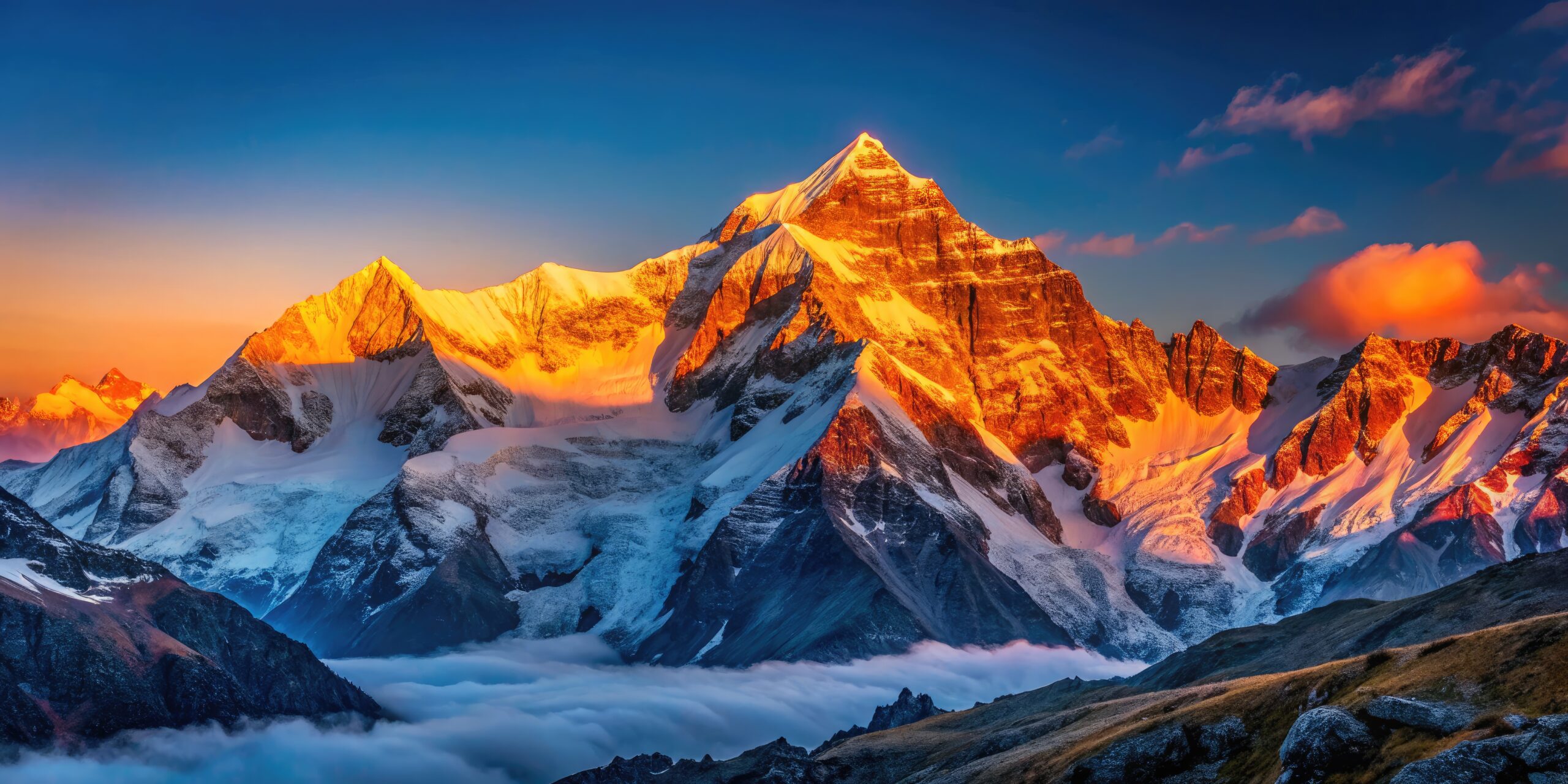
    Snow-covered mountain peak illuminated by golden sunset, mountaineering fundamentals and safety training.
    Most mountain mistakes are not gear mistakes — they are judgment mistakes. The five common patterns above repeat across every range, every difficulty level, and every experience tier. Climbers who learn to recognize their own patterns improve faster than climbers who blame their equipment.

    A Word From Dawson

    I asked my brother Dawson (the Wilderness First Aid certified one in our family, with first-hand Kilimanjaro Lemosho 2024 and Mount Hood 2026) what his biggest mountain mistake was. His answer:

    — Dawson Ludlow, on Kilimanjaro

    “My mistake on Kilimanjaro was pushing through mild AMS symptoms on Day 4 instead of telling the guides. I had a headache and some nausea but figured I could tough it out. I summited, but I felt worse than I had to for the next two days. The smarter move would have been a quick word to the guide, an extra dose of Diamox earlier in the day, and slower pacing on the next climb segment. AMS is a system you negotiate with, not a system you tough out.”

    Two very different mistakes — mine was time and judgment, his was communication and ego. Both classic. Both fixable. Both stories thousands of other climbers will recognize from their own climbs.

    Now — What’s Your Story?

    What was your biggest mountain mistake? The peak that nearly broke you. The bad call you got away with. The lesson you learned the hard way.

    Drop it in the comments below. Specific is better than general. Honest is better than polished. The best comments here will become an entire follow-up post in two weeks — and we want yours in it.

    📝 Tell us: the mountain, what happened, what you should have done, and what you learned. Two paragraphs is plenty.

    Common Questions

    What is the biggest mistake beginners make on mountains?

    The single biggest mistake beginners make is starting too late. Afternoon weather windows close fast on alpine peaks — Wasatch summer thunderstorms typically build between noon and 2pm, and getting caught above treeline with lightning building is the most dangerous situation a Utah hiker can be in. Pre-dawn starts solve most of this. The second biggest mistake is summit fever: continuing toward the summit when conditions clearly say turn around. Mountains will be there next weekend. Climbers who develop the discipline to turn around live longer than climbers who do not.

    Why are Utah Wasatch peaks dangerous in summer afternoons?

    Utah Wasatch peaks are dangerous in summer afternoons because of the predictable thunderstorm cycle. Warm air rises from the valley floor through the morning hours. By late morning, cumulus clouds start building over the Wasatch crest. Between noon and 2pm those cumulus clouds become thunderstorms with lightning, hail, and sometimes brief but intense rainfall. Hikers caught above treeline (around 10,000 feet in the Wasatch) face direct lightning exposure with limited shelter. The standard discipline is summit by 10am, off the ridge by noon. Climbers who ignore this rule sometimes get away with it. Sometimes they do not.

    How early should I start a Wasatch peak in summer?

    Start a Wasatch peak between 4am and 6am in summer depending on the route length. Mount Timpanogos via Aspen Grove (about 15 miles round trip with 4,900 feet of gain) demands a 4am-5am start to summit by 10am. Mount Nebo (about 8 miles with 3,500 feet of gain via North Peak) can start at 5am-6am. Pfeifferhorn from White Pine trailhead (about 10 miles with 4,000 feet of gain) needs a 5am start. The principle is consistent: be off the exposed ridge before noon. Headlamps for the first hour of the climb are a small inconvenience compared to the alternative.

    What should I do if I get caught in a thunderstorm on a mountain?

    If you get caught in a thunderstorm above treeline, immediately descend below ridgelines and summits. Lightning strikes the highest point in the area — your job is to no longer be that point. Find a low spot if possible. Crouch low with feet together to minimize ground contact in case of a nearby strike. Stay away from metal objects (trekking poles, ice axes, climbing gear). Do not shelter under isolated trees, in shallow caves, or against rock walls. Spread out from your group so that a single strike cannot incapacitate everyone. Wait for the storm to pass — most Wasatch summer thunderstorms move through in 20-40 minutes — then descend immediately. Do not attempt to resume the climb.

    About The Author

    Travis Ludlow

    Editor, Global Summit Guide · Nephi, Utah · First-hand: Pico de Orizaba 5,636m + Iztaccíhuatl 5,230m + Utah-Wasatch alpine

    Travis Ludlow edits Global Summit Guide from Nephi, Utah, where the Wasatch and surrounding ranges have provided most of his first-hand climbing education — including the mistake described in this post. He has first-hand mountaineering experience on Pico de Orizaba (Mexico’s highest peak, 5,636m), Iztaccíhuatl (5,230m), and Utah-Wasatch alpine rock and snow climbing. The editorial team includes Dawson Ludlow (Wilderness First Aid certified, Kilimanjaro Lemosho 2024 first-hand, Mount Hood South Side 2026 first-hand) and Walker Ludlow (gear reviewer), plus the Ludlow family Torres del Paine W Trek east-to-west 2025 first-hand Patagonia coverage.

    Related Reading

    What Mountain Was Your Biggest Mistake? · Tier A engagement post · v4.0 build · Published July 1, 2026 · Travis Ludlow, Editor · First-person voice with reader comment invitation · Plan a follow-up post in 2 weeks featuring the best reader stories from this comment thread

    Was this helpful?

    Yes
    No
    Thanks for your feedback!
  • Wasatch Mountains Hiking Guide 2026: Best Trails, Peaks & Canyons

    Mount Timpanogos and the Wasatch Mountains above autumn foliage in Utah
    Utah-local guide · Wasatch Range · Hiking & Mountains · 2026

    Wasatch Mountains Hiking Guide: Best Trails, Peaks & Canyons

    The Wasatch rises directly above Utah’s population corridor but quickly becomes real mountain country: alpine lakes, steep canyon trails, 11,000-foot summits, scrambling ridges and technical alpine objectives. This guide covers the range from the northern Wasatch through Salt Lake and Utah Valley to Mount Nebo—using first-hand local mountain experience and current 2026 access information.

    Utah-based first-hand experience 2026 Forest Service access checked 4 GSG-hosted images Hiking + mountain authority

    Updated August 14, 2026 · Current access rules reviewed · Check live Forest Service conditions before departure

    11,928 ft Mount Nebo high point
    6 zones Useful hiking regions
    Jul–Sep High-country season
    Hike → Climb Full progression
    First-hand Wasatch experience: The Ludlow / Global Summit Guide climbing record includes repeated ascents throughout the range: Mount Nebo (6), Mount Timpanogos (3), Lone Peak (3), Pfeifferhorn (2), Mount Olympus (2), Provo Peak (3), Kyhv Peak (4), and ascents of American Fork Twin Peaks, Mount Superior, Box Elder, Ben Lomond, Grandeur, Gobblers Knob, Mount Raymond and additional Wasatch summits. Current access rules and trailhead information are separately verified against official agencies.
    The direct answer

    For most hikers, the Wasatch is Utah’s best range for serious mountain day hikes.

    Mount Timpanogos is the best all-around big mountain day for a first major Wasatch summit. Lake Blanche is the classic alpine-lake hike close to Salt Lake City.

    Mount Nebo is the range high point and a quieter major summit day. Pfeifferhorn is one of the best next-step objectives for hikers ready to add scrambling.

    Beginners should build through lower summits such as Grandeur Peak before jumping directly into Timpanogos, Nebo or the steeper Wasatch scrambles.

    Best big hike Mount Timpanogos
    Best alpine lake Lake Blanche
    Range high point Mount Nebo
    Best scramble Pfeifferhorn
    Beginner summit Grandeur
    Primary bases SLC + Utah Valley
    Current access · August 14, 2026

    Upper Mill Creek Canyon remains closed to vehicle access through December 15, 2026.

    The Uinta-Wasatch-Cache National Forest road-status page currently lists the upper Mill Creek Canyon road as closed during the reconstruction project. Big Cottonwood, Little Cottonwood, Guardsman Pass, Cardiff Fork and Albion Basin are currently listed open, but mountain access can change quickly. Recheck official road and trail alerts on the day of travel.

    Utah’s backyard mountains

    What Is the Wasatch Range?

    The Wasatch is often treated as “the mountains by Salt Lake,” but the hiking range extends far beyond the Cottonwood Canyons.

    The Wasatch forms Utah’s dramatic mountain wall beside the population corridor from northern Utah through Salt Lake and Utah Valley and south toward the Mount Nebo massif.

    That geography gives the range an unusual advantage: genuinely substantial mountain objectives begin within minutes of major communities. You can leave Salt Lake City before sunrise, climb thousands of vertical feet and return to the city the same day.

    But proximity should not be mistaken for ease. Many Wasatch hikes are steep by national hiking standards. The range rises abruptly from the valleys, producing routes where 3,000 to 5,000 feet of climbing can fit into a single day.

    The range also creates an unusually clear progression from straightforward hiking to scrambling and eventually technical climbing. That progression is one reason the Wasatch is such a useful mountain-development range—not merely a collection of trails.

    Understand the range before choosing the trail

    Six Wasatch Hiking Zones

    Different parts of the range work for different trips. Salt Lake gives immediate canyon access; Utah Valley owns Timpanogos; the southern Wasatch becomes quieter around Nebo.

    01 · Northern Wasatch

    Ogden & Ben Lomond

    Long foothill-to-summit routes and expansive views above the Ogden Valley. A useful northern extension of a trip focused primarily on Salt Lake.

    02 · Salt Lake Foothills

    Olympus & Grandeur

    Steep, efficient training mountains directly above the city. Grandeur is a useful progression summit; Olympus is substantially harder and finishes with scrambling.

    03 · Big Cottonwood

    Lake Blanche & Sunset

    Alpine lakes, high meadows and easier access to classic Wasatch scenery. Big Cottonwood is also a protected watershed with strict pet rules.

    04 · Little Cottonwood

    Red Pine & Pfeifferhorn

    Steeper granite-and-quartzite mountain terrain, high cirques and some of the range’s strongest transitions from hiking into scrambling and technical climbing.

    05 · Utah Valley

    Timpanogos & Box Elder

    The center of the Wasatch big-mountain hiking experience. Mount Timpanogos is one of Utah’s signature long summit days.

    06 · Southern Wasatch

    Mount Nebo

    The range reaches its highest point above Juab and Utah Counties. Nebo gives hikers a quieter, less urban-feeling big summit day.

    Looking specifically for Salt Lake City trailheads?

    Use the dedicated Best Mountains Near Salt Lake City guide for the narrower city-access problem. This page stays broader so the two resources support rather than compete with each other.

    Start with the experience you want

    10 Wasatch Hikes Worth Building a Trip Around

    These are not simply the ten highest summits. They cover alpine lakes, major mountain days, introductory summits and the progression into Wasatch scrambling.

    HikeApprox. ScaleDifficultyWhy Choose ItGSG Verdict
    Mount Timpanogos ~15–18 mi · ~4,400–4,900 ft gainStrenuous Meadows, high basin, Emerald Lake and a major 11,000-foot summit.Best overall big day
    Lake Blanche ~7.3 mi RT · 2,560 ft gainModerate–strenuous Classic Big Cottonwood alpine lake beneath Sundial Peak.Best alpine lake day
    Mount Nebo ~9 mi · ~3,600 ft gainStrenuous The 11,928-foot Wasatch high point with a quieter, more remote feel.Best high-point hike
    Pfeifferhorn ~9–10 mi · ~3,700–3,900 ft gainHard / scrambling Red Pine Lakes plus one of the Wasatch’s classic introductory summit scrambles.Best scramble progression
    Mount Olympus ~7 mi · ~4,200 ft gainVery strenuous Relentless climbing directly above Salt Lake with Class 2–3 terrain near the top.Best steep city summit
    Sunset Peak ~6 mi classModerate Brighton-area high country, lakes and excellent reward without a full Timpanogos-scale day.Best intermediate alpine summit
    Lone Peak Full mountain dayHard Granite terrain and one of the Wasatch’s most dramatic city-visible massifs.Best advanced hiking objective
    Grandeur Peak ~6 mi · ~2,500 ft gainModerate–strenuous Efficient summit training close to Salt Lake City.Best first Wasatch summit
    Ben Lomond Long northern Wasatch dayStrenuous A different perspective over Ogden Valley and northern Utah.Best northern summit
    Red Pine Lake Moderate alpine-lake dayModerate Enter the Pfeifferhorn cirque without committing to the summit scramble.Best Little Cottonwood stepping stone
    Mount Timpanogos reflected in an alpine lake in Utah's Wasatch Mountains
    Build range experience, not just a checklist

    The Wasatch Is One of the Best Places in America to Progress as a Mountain Hiker

    The same range offers foothill summits, alpine lakes, 11,000-foot hiking peaks, exposed scrambles and technical ridges. Choose the next objective by skills—not by which summit looks best on a map.

    Trail → summit → scramble → alpine climbing

    A Practical Wasatch Hiking Progression

    You do not need to jump from a short canyon walk directly onto the Pfeifferhorn or Lone Peak. The range gives you a logical progression ladder.

    1

    Build Vertical Fitness

    Grandeur, Kyhv and lower canyon trails develop the ability to climb continuously without introducing serious exposure.

    2

    Enter Alpine Terrain

    Lake Blanche, Red Pine Lake and Sunset Peak add longer days, elevation and changing high-country weather.

    3

    Do a Big Summit Day

    Timpanogos and Nebo demand stronger endurance and better pacing across most of a day.

    4

    Add Scrambling

    Pfeifferhorn and comparable objectives introduce hands-on movement, route judgment and greater exposure.

    5

    Technical Alpine Terrain

    Technical ridges require climbing systems, protection, rope management and a completely different risk framework.

    Not sure where you belong on the progression ladder?

    Use the mountain fitness self-assessment before choosing a large Wasatch summit solely from mileage. Elevation gain, sustained uphill pace and downhill durability matter more here than flat-ground distance.

    2026 canyon rules matter

    Wasatch Trailheads, Fees, Watersheds & Current Access

    The Wasatch is unusually accessible, but “close to the city” does not mean every canyon has identical parking, dog or fee rules.

    AreaCurrent Planning RuleWhy It Matters
    Big Cottonwood Canyon Protected watershed. Pets prohibited, including inside vehicles. Do not bring a dog expecting normal National Forest pet rules.
    Little Cottonwood Canyon Protected watershed. Pets prohibited, including inside vehicles. Applies to Red Pine / Pfeifferhorn access as well as other Little Cottonwood trailheads.
    Mill Creek Canyon $5 current daily vehicle fee; special alternating-day dog rules. Dogs leashed on even days; off-leash trail access is allowed on odd days subject to current rules.
    Upper Mill Creek — 2026 Current Forest Service road-status page lists closure through December 15, 2026. Do not plan upper-canyon trail access from historical maps without checking the construction status.
    Mill B / Lake Blanche Developed-site fee currently $10 per vehicle for three days. Big Cottonwood does not have one blanket canyon toll, but individual developed sites can charge fees.
    Timpooneke / Aspen Grove Developed trailhead fees apply; weekend / holiday access systems can also apply at Timpooneke. Check current Forest Service trailhead instructions before a Timpanogos weekend.

    Big Cottonwood and Little Cottonwood are drinking-water watersheds.

    Salt Lake City’s protected-watershed rules prohibit domestic animals and also prohibit swimming or wading in protected watershed waters. Treat these as resource-protection rules, not optional hiking etiquette.

    One range · several useful gateways

    Where to Base a Wasatch Hiking Trip

    Do not assume every good Wasatch hike should be approached from downtown Salt Lake City.

    BaseBest AccessBest ForTrade-Off
    Salt Lake City Olympus, Grandeur, Mill Creek, Big Cottonwood, Little Cottonwood Largest variety of close day hikes. Longer drive south for Timpanogos and Nebo.
    Sandy / Cottonwood Heights Big and Little Cottonwood Fastest access to Lake Blanche, Red Pine, Pfeifferhorn and canyon hiking. Less convenient for northern or southern Wasatch.
    Orem / Provo / American Fork Timpanogos, Box Elder and Utah County peaks Timpanogos-focused hiking trip. Longer drive to Cottonwood Canyon objectives.
    Payson / Nephi Mount Nebo and southern Wasatch Quieter southern-range hiking and Nebo access. Farther from the major Salt Lake canyon network.
    Ogden Ben Lomond and northern Wasatch Northern peaks and fewer Salt Lake crowds. Far from Timpanogos and Nebo.
    Three different versions of the range

    A 3-Day First-Time Wasatch Hiking Sampler

    This is deliberately not three enormous summit days in a row. The goal is to experience the range rather than turn the trip into a recovery problem.

    Day 1 Salt Lake

    Lake Blanche

    Start with Big Cottonwood’s classic alpine-lake hike. It introduces the steep Wasatch profile without requiring a summit scramble or an all-day 11,000-foot objective.

    Alternative: Grandeur Peak for a summit-focused first day.
    Day 2 Utah Valley

    Mount Timpanogos

    Make the centerpiece day a genuine big Wasatch mountain. Begin early, carry enough water and weather layers, and leave room in the schedule for an 8–12 hour mountain day.

    Highest-priority clear-weather day.
    Day 3 Choose by skill

    Nebo or Pfeifferhorn

    Choose Mount Nebo for another strenuous hiking summit. Choose Pfeifferhorn only when your group is comfortable adding exposed scrambling and rougher terrain.

    Easier recovery alternative: Sunset Peak / Brighton high country.

    Five days is much better if this is a dedicated hiking trip.

    Add one weather-flex day and one easier canyon or lake day. That lets you put Timpanogos, Nebo or Pfeifferhorn on the strongest mountain forecast instead of forcing the itinerary.

    Elevation changes the calendar

    Best Time to Hike the Wasatch

    There is no single Wasatch hiking season. Foothills and 11,000-foot summits can be in completely different conditions on the same day.

    SeasonBest UseMain Issues
    March–May Lower foothills and selected dry trails High mountains remain snow-covered; avalanche terrain can persist well into spring.
    June Transition into high-country hiking Snowfields and muddy upper trails can remain.
    July–August Prime high-Wasatch hiking Heat at lower elevations, afternoon thunderstorms, crowded marquee trailheads.
    September Excellent high-country hiking and cooler conditions Shorter daylight and possibility of early storms.
    October Foothills, fall color and selected alpine objectives First significant snow can rapidly change higher routes.
    Winter Winter recreation with appropriate skills Avalanche hazard changes the nature of many normal summer trails completely.

    A Salt Lake weather icon is not a Timpanogos forecast.

    High Wasatch terrain can be colder, windier and much more exposed than the valleys below. Use our mountain weather guide to evaluate wind, precipitation, cloud and thunderstorm timing rather than relying on a city forecast.

    Where hiking becomes mountaineering

    The Same Wasatch Peak Can Hold Very Different Objectives

    This is where Global Summit Guide’s hiking and mountain coverage should meet rather than compete.

    Standard mountain route

    Pfeifferhorn via Red Pine

    The standard hiking route is roughly 9–10 miles with about 3,700–3,900 feet of gain. It progresses from maintained trail into rougher alpine terrain and a short hands-on scrambling section.

    For a strong hiker with appropriate scrambling comfort, this is a logical Wasatch progression objective.

    Technical alpine route

    Pfeifferhorn North Ridge

    The North Ridge reaches the same mountain through technical exposed terrain requiring ropes, protection, climbing movement and route-finding.

    Same summit. Entirely different risk profile and skill requirement.

    Read the first-hand Pfeifferhorn North Ridge field report →

    Do not infer technical readiness from hiking fitness.

    Someone who can hike Timpanogos quickly may still have no experience with exposure, rope systems, protection placement or alpine route-finding. Treat those as separate skills.

    Preserve the old URL’s Utah mountain context

    Wasatch or Uintas: Which Utah Range Fits Your Trip?

    The legacy version of this page covered both ranges. We now separate their search intent while keeping the connection useful for readers planning Utah mountains.

    FactorWasatchUinta Mountains
    Best trip style Big day hikes and short mountain objectives Backpacking and remote high-country trips
    City access Exceptional — SLC, Ogden, Provo, Utah Valley Much more remote
    Peak elevations Mostly below 12,000 ft Utah’s 13,000-foot summits
    Highest iconic objective Mount Nebo · 11,928 ft Kings Peak · Utah high point
    Terrain character Steep, abrupt relief, narrow canyons Broad high plateaus, basins and long approaches
    Best for first Utah hiking trip Usually the Wasatch Better when backpacking / highpointing is the goal
    Utah hiking + mountain cluster

    Continue Planning the Wasatch & Utah

    This Full guide sits between the statewide Utah hiking parent and the individual canyon, peak and mountain guides.

    State parent

    Best Hikes in Utah

    Compare the Wasatch with the Uintas, Zion, Bryce, Capitol Reef, Moab and Utah’s other major hiking regions.

    Regional parent

    Best Hikes in the Southwest USA

    Put Utah’s alpine hiking beside Arizona, Nevada, New Mexico and the larger Southwest trail system.

    Local Salt Lake hub

    Mountains Near Salt Lake City

    Choose between the five major canyon and foothill access systems closest to Salt Lake.

    Local peak collection

    Salt Lake County Peaks

    Compare the leading summit objectives around the central Salt Lake Wasatch.

    Utah Valley

    Best Peaks in Utah County

    Extend the range south toward Timpanogos, Box Elder, Provo Peak and the Utah Valley mountains.

    Signature hike

    Mount Timpanogos

    Plan the range’s best all-around long mountain day through Timpooneke or Aspen Grove.

    Range high point

    Mount Nebo

    Hike the 11,928-foot Wasatch high point above Utah and Juab Counties.

    Peak collection

    The Wasatch 7

    Use seven major Wasatch summits as a mountain-progression and peak-bagging framework.

    Comparison

    Timpanogos vs Nebo

    Decide between the more varied marquee hike and the quieter Wasatch high point.

    First-hand field report

    Pfeifferhorn North Ridge

    See how a familiar Wasatch hiking mountain changes when approached by a technical alpine ridge.

    Mountain collection

    Best Mountains in Utah

    Compare the Wasatch’s iconic summits with Utah’s Uinta, desert and plateau mountain objectives.

    Next mountain range

    Utah 13ers

    Move east into the Uintas for Utah’s highest and most remote major peaks.

    Local experience + current verification

    Sources, Methodology & What Can Change

    Trail geography and summit elevations change slowly. Road projects, watershed rules, parking systems, fees, snow and wildfire conditions require current verification.

    First-Hand Wasatch Record

    • Mount Nebo — 6 documented ascents.
    • Mount Timpanogos — 3 ascents.
    • Lone Peak — 3 ascents.
    • Pfeifferhorn — 2 ascents.
    • Mount Olympus — 2 ascents.
    • Provo Peak — 3 ascents.
    • Additional ascents include American Fork Twin Peaks, Mount Superior, Box Elder, Ben Lomond, Grandeur, Mount Raymond, Gobblers Knob and other Wasatch peaks.

    Current Agency Verification

    • Uinta-Wasatch-Cache National Forest trail and road information.
    • Official Lake Blanche / Mill B trailhead data.
    • Salt Lake City protected-watershed rules.
    • Current Mill Creek Canyon fees and pet rules.
    • Mount Timpanogos trail and trailhead information.
    • Current Forest Service alerts and seasonal access notices.
    What can change: canyon-road closures, trailhead fees, weekend access systems, parking availability, fire restrictions, snowfields, avalanche conditions, watershed restrictions and temporary wildlife closures. Check official agency information immediately before hiking.

    Last substantive review: August 14, 2026.
    Confidence: High for range geography, peak relationships and current official access information reviewed on this date; variable for live weather, fire activity, parking and temporary closures.
    Wasatch hiking questions

    Frequently Asked Questions

    Direct answers for hikers deciding where the Wasatch fits into a Utah trip.

    What is the best hike in the Wasatch Mountains?

    Mount Timpanogos is our best all-around major Wasatch day hike for most first-time visitors. Lake Blanche is the classic alpine-lake option near Salt Lake, Mount Nebo is the range high point, and Pfeifferhorn is the stronger choice for hikers ready to add scrambling.

    What is the highest mountain in the Wasatch Range?

    Mount Nebo is the Wasatch high point at about 11,928 feet. Its standard hiking route is a strenuous mountain day with substantial elevation gain but typically fewer crowds than Mount Timpanogos.

    What is a good beginner summit in the Wasatch?

    Grandeur Peak is a useful first summit close to Salt Lake City. It still requires meaningful climbing, but it is a more logical progression objective than jumping immediately to Timpanogos, Nebo, Olympus or Pfeifferhorn.

    What is the best hike close to Salt Lake City?

    Lake Blanche is one of the strongest complete mountain-hiking experiences close to Salt Lake. Grandeur works better for a quicker summit, while Mount Olympus provides a much steeper and harder city-visible objective.

    When is the best time to hike the high Wasatch?

    July through September is the most reliable high-mountain hiking period. Snow can linger into summer, and early-season conditions should be checked before committing to Timpanogos, Pfeifferhorn, Nebo or other high routes.

    Are dogs allowed in Big or Little Cottonwood Canyon?

    No. Both are protected drinking-water watersheds. Current Forest Service guidance prohibits pets in the canyons, including inside vehicles.

    Are dogs allowed in Mill Creek Canyon?

    Yes, under specific rules. Current Forest Service guidance requires leashes throughout the canyon on even-numbered days. Dogs may be off leash on trails on odd-numbered days, but developed recreation areas retain leash requirements.

    Does Lake Blanche have a trailhead fee?

    Yes at the developed Mill B trailhead complex. The Forest Service currently lists a $10 vehicle fee covering three days. Check the current recreation-site information before travel.

    Is upper Mill Creek Canyon open in 2026?

    As of August 14, 2026, the Forest Service road-status page lists upper Mill Creek Canyon closed for vehicle access through December 15, 2026 during the reconstruction project. Check again before planning an upper-canyon trailhead.

    Do I need a permit for Mount Timpanogos?

    There is not generally a quota permit required simply to hike the summit, but trailhead fees and weekend or holiday access controls can apply—particularly around Timpooneke. Check the current Forest Service trailhead page before hiking.

    Should I hike the Wasatch or the Uintas?

    Choose the Wasatch for steep, accessible mountain day hikes close to Salt Lake City and Utah Valley. Choose the Uintas when you want remote backpacking, higher elevations and Utah’s 13,000-foot peaks such as Kings Peak.

    Utah · Wasatch Mountains · Global Summit Guide

    Start With a Trail. Build Toward the Range.

    The Wasatch can be a one-day Lake Blanche hike, a first summit, an all-day ascent of Timpanogos or the beginning of a progression into scrambling and alpine climbing. Choose the objective that fits your current skills—and let the range give you somewhere to go next.

    Was this helpful?

    Yes
    No
    Thanks for your feedback!
Language »