
Last updated August 10, 2026
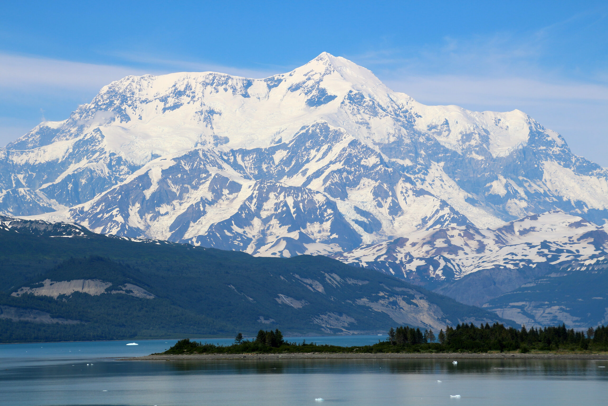
Mount Saint Elias: from the sea to 18,000 feet, and one of the hardest peaks in North America
The second-highest mountain in both the United States and Canada rises almost straight from the ocean at Icy Bay, one of the greatest vertical reliefs on Earth. Storm-hammered by the Gulf of Alaska, hugely glaciated, and climbed only about fifty times since 1897, it is a lower peak than Denali but, for many teams, a more committing one. Heights in feet (metres).
Updated 27 July 2026 · Compiled by Travis Ludlow · Safety review by Dawson Ludlow · Medical review by Taylor Ludlow, RN
Single-mountain expedition update, compiled from National Park Service and published mountaineering records, expedition reports, and route accounts. Our team has not climbed Mount Saint Elias; the only first-hand summit anyone on our team claims is Kilimanjaro. This is a planning briefing for experienced expedition climbers, not a how-to and not a substitute for training or current route research.
Lower than Denali, and for many teams more committing.
Mount Saint Elias is the second-highest peak in both the US and Canada, on the border in the Saint Elias Mountains. Its fame is its vertical relief: the summit stands only about 10 miles from the sea, so the mountain rises nearly its full 18,008 ft from tidewater. Add the worst coastal storms of any major North American peak, no infrastructure, and only about fifty ascents since 1897, and you have one of the continent’s hardest objectives.
- Second-highest in the US and in Canada.
- Rises ~18,000 ft from the sea in ~10 miles.
- Gulf of Alaska storms dominate every attempt.
- First climbed 1897; second ascent not until 1946.
- Around fifty ascents in total; no fixed infrastructure.
On this page
- What Saint Elias involves
- The sea-to-summit rise, and the weather
- Are you ready for Saint Elias?
- The routes
- Logistics and route profile
- An expedition timeline
- Cost and access
- Planning the expedition
- Difficulty and rarity
- Season and weather
- Saint Elias history
- The Alaska and Yukon cluster
- FAQ
- How we built this
What Saint Elias involves
A remote, self-supported expedition on a huge coastal peak, where the weather, not the grade, usually decides the outcome.
Mount Saint Elias stands 18,008 ft on the Alaska-Yukon border, the second-highest peak in both countries, in the heavily glaciated Saint Elias Mountains. It carries a Tlingit name, Yas’eit’aa Shaa, the mountain behind Icy Bay, and it was among the first parts of Alaska sighted by Europeans, named after Vitus Bering saw it in 1741. What sets it apart is not height but relief: the summit rises nearly its full height from tidewater only about 10 miles away.
That position, hard against the Gulf of Alaska, makes it one of the stormiest major peaks in North America. There are no fixed ropes, established camps, or ranger presence. A team flies onto a glacier, hauls its own loads for miles, climbs steep snow, ice, and mixed ground, and plans to sit out long storms on both the ascent and the descent. Denali is higher, but Saint Elias has more route complexity, far less support, and stronger coastal weather. For the full route and expedition detail, see our Mount Saint Elias climb guide.
The sea-to-summit rise, and the weather
The same thing that makes Saint Elias spectacular, its wall of relief above the ocean, is what makes it so dangerous.
Saint Elias is often called the highest peak in the world standing so close to the sea. Its summit is only about 10 miles from tidewater at Icy Bay, so the mountain presents nearly 18,000 ft of vertical relief in a very short horizontal distance, a rise comparable to Denali or to Himalayan giants. That relief is why the mountain is the subject of a documentary about an attempt at the planet’s longest ski descent, from high on the peak toward the Gulf of Alaska.
It is also why the climbing is so serious. Rising straight out of the ocean puts Saint Elias directly under the Aleutian Low storm systems that sweep in off the Gulf of Alaska, bringing prolonged storms, extreme snowfall, and hurricane-force winds. That snowfall loads slopes heavily and feeds active icefall, and the storms can pin a team for days at a time. The forecast, more than the technical grade, is what usually decides a Saint Elias attempt.
Plan around the weather, not the calendar
Every realistic Saint Elias plan builds in long weather holds and flexible flight windows. Teams that schedule tightly, or treat a fair forecast as a promise, are the ones the mountain turns back, or worse.
Eighteen thousand feet, straight from the sea
Few mountains on Earth rise so far, so fast, from the ocean. From the tidewater of Icy Bay to the summit is barely ten miles horizontally and nearly the mountain’s full height vertically. It is a wall of ice and storm that has been climbed only about fifty times, and skied, in part, by a daring few.
Are you ready for Saint Elias?
This is an expert, self-supported expedition, not a guided trade-route peak. These are the prerequisites, not aspirations.
Self-Sufficient, No Support
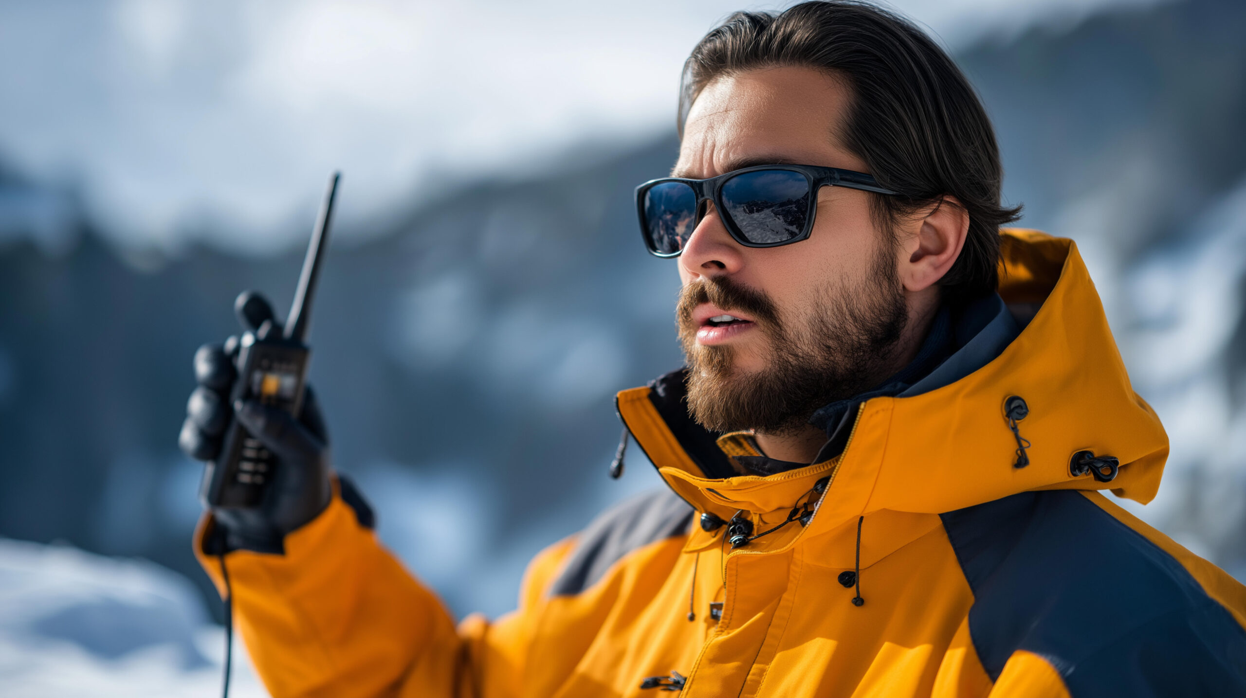
There are no fixed ropes, camps, or rangers. Your team hauls, camps, navigates, and rescues itself on a huge, complex mountain.
Evidence: prior self-supported expeditions.Steep Snow, Ice, Mixed
The routes combine expedition hauling with steep snow, ice, and mixed ground. This is well beyond a glacier walk-up.
Evidence: prior technical alpine routes.Wait Out The Weather
Gulf of Alaska storms bring long holds. You need the supplies, patience, and camp craft to sit safely for days.
Evidence: prior long storm-bound expeditions.Icefall And Avalanche
Coastal snowfall loads slopes heavily and feeds active icefall. Reading and timing that hazard is a survival skill.
Evidence: sound decisions on loaded snow.| Requirement | Baseline | Why it matters |
|---|---|---|
| Expedition experience | Prior self-supported big-range trips | No infrastructure exists; the team provides everything. |
| Technical grade | Steep snow, ice, and mixed competence | Routes are complex and variable, not a set line. |
| Storm readiness | Supplies and craft for long holds | Weather holds of many days are normal here. |
| Hazard judgment | Fluent on icefall and avalanche terrain | Coastal snow loads and active ice are the main killers. |
| Fitness and hauling | Strong for heavy loads over distance | The approach and route demand endurance under weight. |
| Flight logistics | Buffer days for bush flights | Weather delays flights in and out at both ends. |
Build the foundation with glacier travel basics and crevasse rescue basics, and study the coastal hazard in avalanche awareness for climbers.
The Harvard Route and the Abruzzi Ridge
No maintained trade route exists. The choice is between a serious modern line and a storied but hazardous historic one.
Southwest Ridge – the Harvard Route
The principal modern Alaska-side line, first climbed by the 1946 Harvard Mountaineering Club party and named in their honor. It is a serious, variable expedition route from the coastal glaciers, combining long hauling with steep snow, ice, and mixed ground, and no fixed infrastructure of any kind.
- The main modern Alaska-side line
- Long glaciated approach from the coast
- Steep snow, ice, and mixed ground
- No fixed ropes, camps, or ranger support
Abruzzi Ridge (Yukon side)
The 1897 first-ascent route by the Duke of the Abruzzi, dropping to the Yukon side, and one of the 50 Classic Climbs of North America. It is rarely climbed today because glacial change has made its icefall and avalanche hazard severe. A storied line, but not a safe default.
- The 1897 first-ascent route
- One of the 50 Classic Climbs
- Rarely climbed now: severe icefall
- Historic significance, high objective hazard
| Factor | Southwest Ridge (Harvard) | Abruzzi Ridge (1897) |
|---|---|---|
| Side | Alaska, from the coast | Yukon, north side |
| Role | The principal modern route | The historic first-ascent line |
| First climbed | 1946, Harvard Mountaineering Club | 1897, Duke of the Abruzzi |
| Status | Serious, variable, current | Rarely climbed; severe icefall |
| Who it suits | Self-supported expedition teams | History-minded experts, hazard permitting |
The Mount Saint Elias climb guide covers both route systems and the logistics in full.
From the coast to the summit
An overview of a Saint Elias expedition, from the coastal staging town to the border summit. For the full detail, see the climb guide.
Yakutat
The small Gulf-of-Alaska town where most Alaska-side trips fly from.
Ski-plane to the glacier
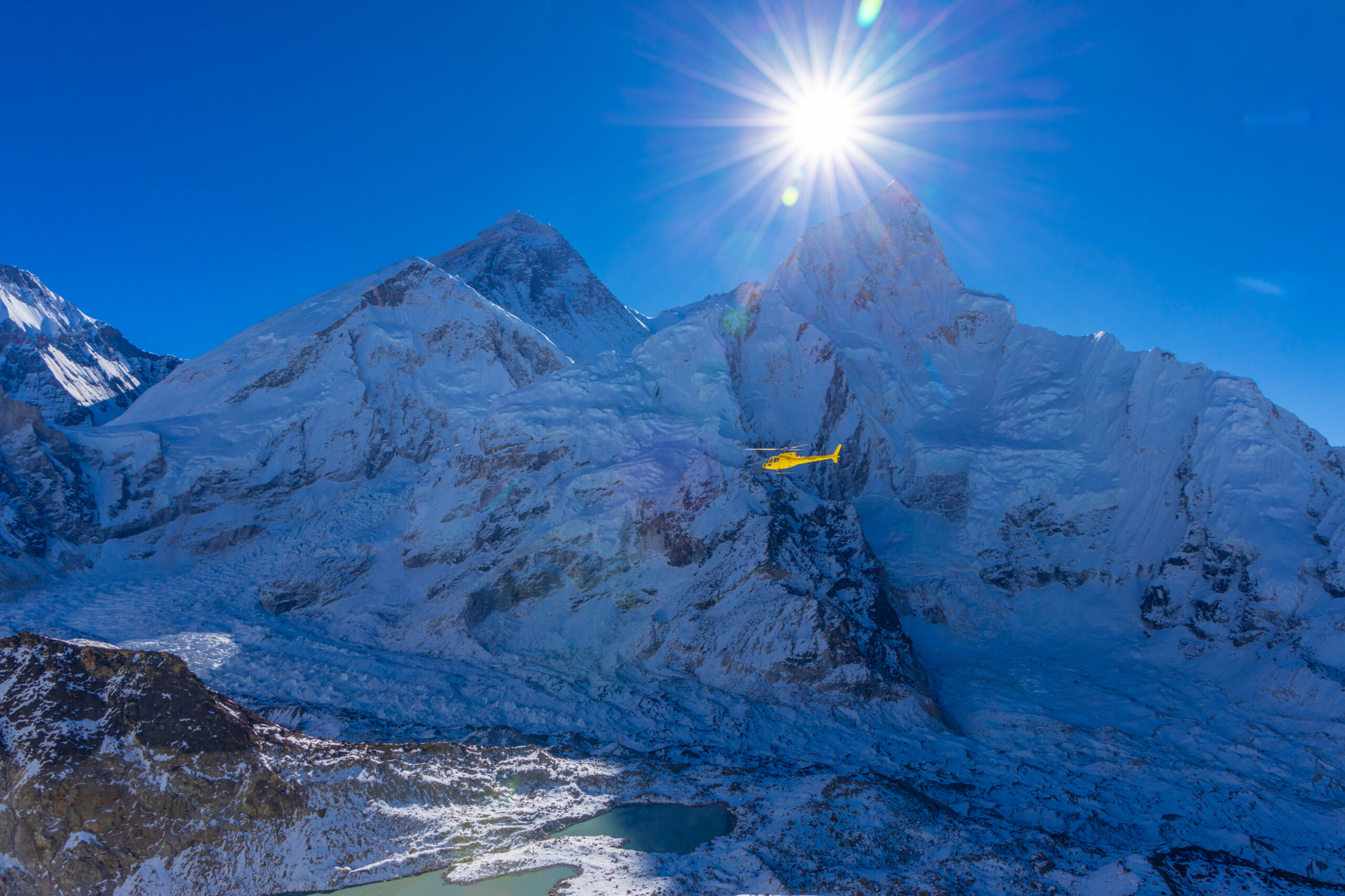
A bush flight lands the team on a glacier such as the Tyndall.
On The Ice
Near sea level to low elevation, the start of a long glaciated approach.
Miles Of Glacier
Expedition hauling across crevassed glaciers toward the route.
Southwest Ridge
A series of exposed camps up the principal Alaska-side line.
Wait For Weather
Days pinned in camp are a normal, planned part of the climb.
The Second-Highest
Steep, exposed ground leads to the US-Canada border summit.
Reverse Everything
The full route and glacier must be reversed, storms and all.
The approach is half the climb
Long, crevassed glacier travel from near sea level, with heavy hauling and full self-support, is a defining part of Saint Elias. The team must be as ready for the miles of glacier and the storm holds as for the steep ground high on the ridge.
A Saint Elias expedition timeline
There is no fixed itinerary. A realistic plan allows several weeks, most of it approach, hauling, and waiting out weather.
Reach Yakutat or the Yukon side
Travel to the coastal staging town and stage food, fuel, and the flight.
Fly onto the glacier
A weather-dependent ski-plane lands the team on the ice at low elevation.
Establish base and haul in
Set base camp and begin the long, crevassed glacier approach to the route.
Work up the ridge
Climb the Southwest Ridge in stages, carrying and stocking exposed camps.
Sit out storms
Build in and take the weather holds that Gulf of Alaska systems force.
Summit push
Take a rare settled window to climb the steep upper mountain to the top.
Descend the route
Reverse the ridge and glacier, still exposed to weather and hazard.
Fly out
Return to the glacier strip and wait for the flight window back to Yakutat.
Cost and access
Saint Elias is rarely a packaged trip. Most teams build their own logistics around a bush pilot and a long weather buffer.
| Component | Figure | Note |
|---|---|---|
| Private expedition | Self-organized or bespoke | Rarely a set commercial trip; teams build their own logistics. |
| Bush flights | Ski-plane charter | Glacier landings from Yakutat or the Yukon side, weather permitting. |
| Park context | Wrangell-St. Elias / Kluane | Climbing within the US and Canadian protected-area system. |
| Personal gear | Full expedition kit | Technical alpine and expedition gear for weeks of self-support. |
| Insurance | Remote-evacuation cover | Rescue is distant and weather-bound; verify remote cover. |
Yakutat, the coastal gateway
Most Alaska-side attempts stage through the small Gulf-of-Alaska town of Yakutat, where a ski-equipped bush pilot flies the team onto a glacier. The pilot and the weather together set the whole schedule, so a reliable flight operator and buffer days matter as much as the climbing plan.
Planning a Saint Elias expedition
This is a peer expedition, not a guided queue. The questions are about logistics, weather, and partners, not a brochure.
This Season’s Route
Base any plan on recent route reports, not the historic line.
Days For Holds
Build a schedule that survives long storm and flight delays.
Expedition Peers
This is a peer expedition or bespoke trip, not a guided queue.
Reliable Bush Pilot
Your glacier pilot and their weather judgment are critical.
Icefall Timing
How the team routes around and times icefall and loaded slopes.
Remote And Slow
Understand that outside help is distant and never assured.
For the rare guided or bespoke option, how to choose an expedition operator still applies, and the operator directory is a starting point.
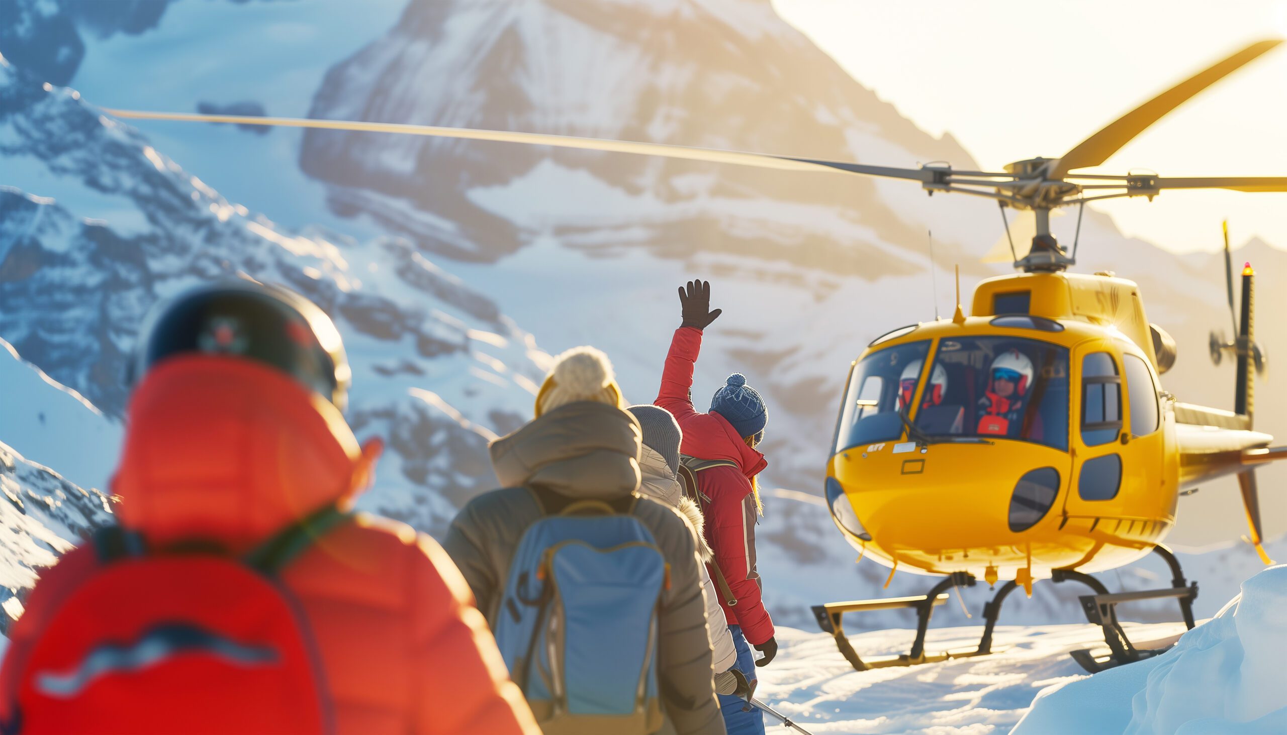
A very long way from help
On a mountain climbed only about fifty times, in some of the worst weather in North America, rescue is a distant and uncertain thing. Bad weather grounds aircraft for days, and the nearest help is far away. A Saint Elias team must be built to solve its own problems, from a crevasse fall to a multi-day storm, without counting on anyone else.
Difficulty and rarity
Saint Elias is hard for reasons that do not show up in a single grade: relief, weather, remoteness, and the absence of any support.
| Factor | What it is | How to treat it |
|---|---|---|
| Coastal storms | The main enemy | Gulf of Alaska systems bring holds, snow, and hurricane winds. |
| Vertical relief | Immense, complex ground | Nearly 18,000 ft from the sea means long, committing terrain. |
| Icefall and avalanche | Heavy snow loading | Coastal snowfall feeds active ice and loads slopes. |
| Rarity | ~50 ascents, no infrastructure | Little recent beta; the team is on its own throughout. |
Season and weather
Spring is the window, but on this coast the weather is difficult in every month, and it rules the climb.
Cold, Early
Colder and more stable snow, but deep winter conditions linger.
The Window
The workable spring season, such as it is on this coast.
Warm, Unstable
Warmer, wetter, and more hazardous as snow rots and ice moves.
The Deciding Factor
Storms, not the calendar, control every attempt here.
Delay-Prone
Bush flights in and out hinge entirely on the weather.
A short history of Mount Saint Elias
From a royal Italian first ascent to a nearly fifty-year gap before the second, and a legendary ski descent.
Mount Saint Elias was first climbed on 31 July 1897 by an Italian expedition led by Prince Luigi Amedeo, Duke of the Abruzzi, who would later reconnoiter the standard route on K2, the Abruzzi Spur that still bears his name. His party, which included the great mountain photographer Vittorio Sella, started from tidewater and worked for weeks up the glaciers to the summit by the Yukon-side ridge. It was a landmark of early Alaskan mountaineering.
Then the mountain was left alone. The second ascent did not come until 1946, nearly half a century later, when a Harvard Mountaineering Club party climbed the Southwest Ridge from the coast, the line still known as the Harvard Route. The first winter ascent waited until 1996. In total the peak has been climbed only around fifty times. In the modern era it became a magnet for extreme skiing, and the subject of a documentary about an attempt to ski its immense relief from high on the mountain down toward the sea.
The Alaska and Yukon cluster
Saint Elias sits among the great northern giants, its Saint Elias Mountains neighbours, and the skills a coastal expedition demands.
Mount Logan
Canada’s highest peak, the giant next door in the Saint Elias Mountains.
See the guide ->Coastal siblingMount Fairweather
Another storm-battered Alaska-Yukon coastal peak, remote and hard.
See the guide ->The comparisonDenali
Higher and better known, but with more support than Saint Elias.
Read the update ->Core skillGlacier travel basics
The roped-glacier skills every Saint Elias approach demands.
Learn the skill ->Mount Saint Elias climb guide
The full Southwest Ridge and Abruzzi route detail.
->Mount Hunter expedition update
A technical Alaska Range companion objective.
->Crevasse rescue basics
Essential practice for the crevassed coastal glaciers.
->Avalanche awareness for climbers
Reading the heavy coastal snow loading.
->Mountaineering insurance above 6000m
Remote evacuation and rescue cover.
->Mountain weather for climbers
Reading the Gulf of Alaska storm windows.
->Back to the full Expedition Updates dashboard for every mountain we track.
Where Saint Elias fits
The Saint Elias Mountains, the northern giants, and the higher but more supported Denali.
Saint Elias Mountains
Logan, Fairweather, Hubbard and the great coastal giants.
Explore the range ->Alaska and YukonThe northern giants
Where Saint Elias sits among the highest peaks of the north.
Read the updates ->The comparisonDenali
Higher, but more supported than the committing Saint Elias.
See the guide ->Mount Saint Elias FAQ
The questions climbers ask most about the difficulty, the weather, the routes, and the rarity.
How high is Mount Saint Elias, and where is it?
Mount Saint Elias is 18,008 ft (5,489 m), the second-highest mountain in both the United States and Canada, behind Denali and Mount Logan. Its summit sits directly on the Alaska-Yukon border, in the Saint Elias Mountains, within the Wrangell-St. Elias and Kluane protected-area system. Its Tlingit name is Yas’eit’aa Shaa, the mountain behind Icy Bay.
What makes Mount Saint Elias special?
Its vertical relief. The summit stands only about 10 miles from tidewater at Icy Bay, so the mountain rises nearly its full 18,008 ft almost straight from the sea, one of the greatest base-to-summit rises on Earth, comparable to Denali or Himalayan peaks. That relief, and its position in the path of Gulf of Alaska storms, are what make it so dramatic and so hard.
Is Saint Elias harder than Denali?
It is lower, but for many teams more committing. Denali is higher and brings greater altitude, but Saint Elias has more technical route complexity, far less infrastructure, and much stronger coastal-storm influence. There are no fixed ropes, established camps, or ranger presence, and prolonged storms can pin a team on the ascent or the descent. Lower does not mean easier here.
How often is Mount Saint Elias climbed?
Rarely. It was first climbed in 1897, and the second ascent did not come until 1946, nearly half a century later. In total it has been summited only on the order of fifty times. Severe weather, a remote and complex approach, and the absence of any commercial infrastructure keep the traffic to a trickle of experienced expedition teams.
What is the weather like?
Among the most severe of any major peak in North America. Its position beside the Gulf of Alaska places it directly under Aleutian Low storm systems, which bring prolonged storms, extreme snowfall, and hurricane-force winds. Long weather holds are a normal part of any attempt, and the forecast, not the climbing grade, is usually what decides success.
What are the routes?
There is no easy or maintained route. The Southwest Ridge, sometimes called the Harvard Route after the 1946 second-ascent party, is the principal modern Alaska-side line, a serious and variable expedition route. The historic Abruzzi Ridge on the Yukon side, the 1897 first-ascent line and one of the 50 Classic Climbs of North America, is rarely climbed now because of icefall and avalanche danger. All routes combine expedition hauling with steep snow, ice, and mixed ground.
How do you get there, and when do people climb?
Access is by ski-equipped bush flight, usually from the coastal town of Yakutat onto a glacier such as the Tyndall, or from the Yukon side. The climbing season is the spring, roughly May and June, when conditions are most workable, though Saint Elias weather is difficult in any month. Expect to build in extra days for storms and flight delays at both ends.
Is there a famous ski descent?
Yes. Mount Saint Elias is the subject of a documentary about an attempt at the planet’s longest ski descent, skiing from high on the peak toward the Gulf of Alaska, nearly 18,000 ft of vertical to the sea. The team summited on their second attempt and skied to about 13,000 ft. The mountain’s relief makes it a legendary, and extremely dangerous, objective for extreme skiing.
What experience do you need?
This is an expert, self-sufficient expedition, not a guided trade-route peak. It demands strong glacier and technical mountaineering skills, expedition experience with hauling and storm camps, sound avalanche and icefall judgment, and the patience to sit out long weather holds. It is a mountain for experienced alpine teams researching current route reports, not a first big peak.
How we built this update
What this page is based on, who reviewed it, and what we do not claim to know.
Sources
- National Park Service records and the preserved 1897 first-ascent history.
- Published mountaineering records for the 1946 second ascent and 1996 winter ascent.
- Expedition reports and route accounts for the Southwest and Abruzzi ridges.
- Weather and geography references for the Gulf of Alaska storm setting.
- Our own Mount Saint Elias climb guide for the detailed route and logistics.
Review and standards
Compiled by Travis Ludlow and reviewed for safety by Dawson Ludlow, our Climbing and Mountaineering Lead (Wilderness First Aid), whose highest first-hand summit is Kilimanjaro. Health and medical points were reviewed by Taylor Ludlow, RN. We do not fabricate summit experience, quotes, or credentials, and we say plainly when we are reporting rather than recounting.
What we do not claim to know
Saint Elias is a remote, rarely climbed, and changing peak, and no web page can replace current route reports and a team’s own judgment. In particular:
- Route conditions and glacier hazard change; recent reports matter more than any fixed description.
- Ascent totals are approximate, drawn from published records over many decades.
- There is no set commercial itinerary; logistics vary by team, pilot, and season.
- Our team has not climbed Saint Elias, so we report records and accounts, not personal experience.

Global Summit Guide research
We compile mountain updates from park and historical records, expedition reports, and route accounts, review them for safety and medical accuracy, and refresh them each season. We are transparent about what we have and have not climbed, and Saint Elias is a research-based briefing, not a personal account.
About our team and standards ->Respect the weather. Build the expedition.
Start with the full route in our Mount Saint Elias climb guide, weigh yourself against our fitness standards, and read the neighbours in the Mount Logan and Denali pages. Trips stage through Anchorage and Yakutat, so for flights and lodging, browse travel on Expedia.
Disclosure: the Expedia link above is a sponsored affiliate link, and we may earn a commission at no extra cost to you. It is the only affiliate link on this page; our route, weather, and safety guidance is independent.
Was this helpful?
🏔Related peaks nearby
🧭Explore & compare
Global Summit Guide is an independent mountaineering resource founded in 2026. The team combines first-hand trekking and climbing experience with in-depth research and professional health and nutrition review to help climbers choose objectives, prepare properly, and stay safe.
Health, altitude, and nutrition content is reviewed by Taylor Ludlow (Registered Nurse) and Brigg Hoopes (Nutritionist).
What We Don't Know Yet
Mountain information changes quickly. This box explains the limits of what this page can responsibly promise.
- Weather, snowpack, avalanche risk, road access, and route conditions can change quickly and may be different on your climbing dates.
- Visa, passport, vaccination, border, insurance, and local transportation rules may change before your trip.
- Route conditions, snowpack, closures, and weather can change quickly after this page is updated.
- Permit rules, fees, quotas, and reservation windows may change between review cycles.
- Operator availability, pricing, guide ratios, and cancellation terms can change by season.
Verify current conditions with official land managers, guide services, local forecasts, and current route reports before booking or climbing.
Mountaineering, rock and ice climbing, glacier travel, and high-altitude activity are inherently dangerous and can result in serious injury or death. The information on Global Summit Guide is provided for general informational and educational purposes only and is not a substitute for professional instruction, qualified guiding, proper equipment, or your own judgment and experience.
Route conditions, weather, snowpack, permits, regulations, and hazards change constantly and may differ from what is described here. Details may be incomplete, out of date, or contain errors. Always verify current information with local authorities, certified guides, and official sources before making any decision in the mountains.
Nothing on this site is medical, legal, or financial advice. Our fitness, acclimatization, altitude, and nutrition content is general in nature; consult a qualified physician before beginning any strenuous exercise program or exposing yourself to high altitude.
You are solely responsible for your own safety and decisions. To the fullest extent permitted by law, Global Summit Guide and its team accept no liability for any loss, injury, damage, or expense arising from use of, or reliance on, this information. By using this site you acknowledge these risks and accept these terms.
Some links on this site may be affiliate links. If you buy through them we may earn a small commission at no extra cost to you; this never affects our recommendations.
Global Summit Guide recommendation path
Next Best Mountain to Research
Use these recommendations to continue the right planning path instead of stopping on one page.
Use current permit, weather, route, and operator information before booking or climbing.