Global Summit Guide logo featuring mountain imagery, symbolizing hiking and mountaineering resources for trip planning and safety.

Tag: mount saint elias

  • Mount Saint Elias Expedition Update 2026: North America’s Sea-to-Summit Giant

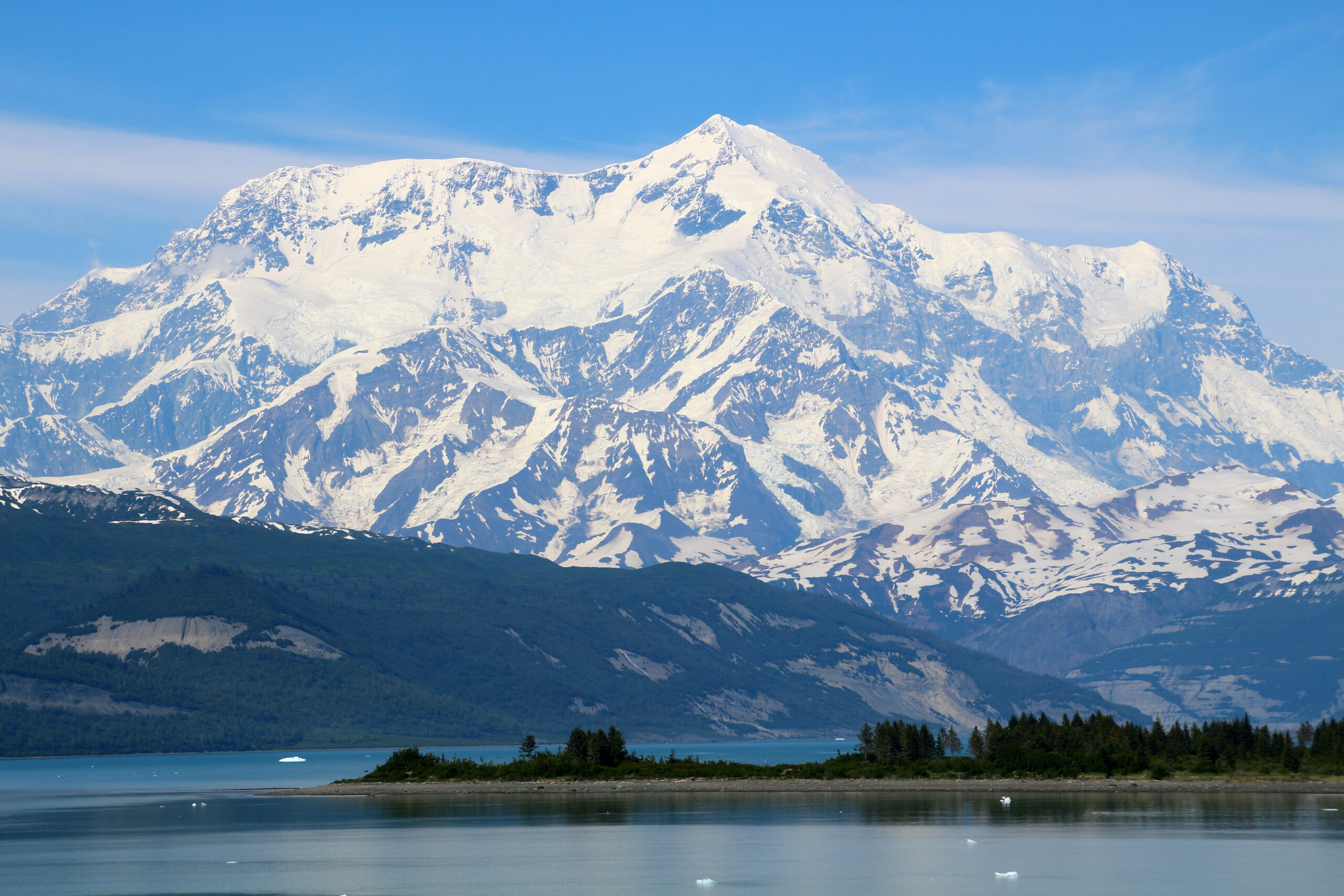
    Mount Saint Elias rising in glaciated relief above the Gulf of Alaska coast
    18,008 ft (5,489 m) · Alaska-Yukon border · Saint Elias Mountains

    Mount Saint Elias: from the sea to 18,000 feet, and one of the hardest peaks in North America

    The second-highest mountain in both the United States and Canada rises almost straight from the ocean at Icy Bay, one of the greatest vertical reliefs on Earth. Storm-hammered by the Gulf of Alaska, hugely glaciated, and climbed only about fifty times since 1897, it is a lower peak than Denali but, for many teams, a more committing one. Heights in feet (metres).

    Research-based updateSafety and medical reviewReviewed each Alaska seasonOur team has not climbed Saint Elias

    Updated 27 July 2026 · Compiled by Travis Ludlow · Safety review by Dawson Ludlow · Medical review by Taylor Ludlow, RN

    18,008 ftSummit (5,489 m)
    2ndHighest in US and Canada
    ~10 miFrom sea to summit
    ~50Total ascents since 1897
    May-JunSeason
    1897First ascent – Abruzzi

    Single-mountain expedition update, compiled from National Park Service and published mountaineering records, expedition reports, and route accounts. Our team has not climbed Mount Saint Elias; the only first-hand summit anyone on our team claims is Kilimanjaro. This is a planning briefing for experienced expedition climbers, not a how-to and not a substitute for training or current route research.

    Lower than Denali, and for many teams more committing.

    Mount Saint Elias is the second-highest peak in both the US and Canada, on the border in the Saint Elias Mountains. Its fame is its vertical relief: the summit stands only about 10 miles from the sea, so the mountain rises nearly its full 18,008 ft from tidewater. Add the worst coastal storms of any major North American peak, no infrastructure, and only about fifty ascents since 1897, and you have one of the continent’s hardest objectives.

    • Second-highest in the US and in Canada.
    • Rises ~18,000 ft from the sea in ~10 miles.
    • Gulf of Alaska storms dominate every attempt.
    • First climbed 1897; second ascent not until 1946.
    • Around fifty ascents in total; no fixed infrastructure.
    The mountain

    What Saint Elias involves

    A remote, self-supported expedition on a huge coastal peak, where the weather, not the grade, usually decides the outcome.

    Mount Saint Elias stands 18,008 ft on the Alaska-Yukon border, the second-highest peak in both countries, in the heavily glaciated Saint Elias Mountains. It carries a Tlingit name, Yas’eit’aa Shaa, the mountain behind Icy Bay, and it was among the first parts of Alaska sighted by Europeans, named after Vitus Bering saw it in 1741. What sets it apart is not height but relief: the summit rises nearly its full height from tidewater only about 10 miles away.

    That position, hard against the Gulf of Alaska, makes it one of the stormiest major peaks in North America. There are no fixed ropes, established camps, or ranger presence. A team flies onto a glacier, hauls its own loads for miles, climbs steep snow, ice, and mixed ground, and plans to sit out long storms on both the ascent and the descent. Denali is higher, but Saint Elias has more route complexity, far less support, and stronger coastal weather. For the full route and expedition detail, see our Mount Saint Elias climb guide.

    What makes it hard

    The sea-to-summit rise, and the weather

    The same thing that makes Saint Elias spectacular, its wall of relief above the ocean, is what makes it so dangerous.

    Saint Elias is often called the highest peak in the world standing so close to the sea. Its summit is only about 10 miles from tidewater at Icy Bay, so the mountain presents nearly 18,000 ft of vertical relief in a very short horizontal distance, a rise comparable to Denali or to Himalayan giants. That relief is why the mountain is the subject of a documentary about an attempt at the planet’s longest ski descent, from high on the peak toward the Gulf of Alaska.

    It is also why the climbing is so serious. Rising straight out of the ocean puts Saint Elias directly under the Aleutian Low storm systems that sweep in off the Gulf of Alaska, bringing prolonged storms, extreme snowfall, and hurricane-force winds. That snowfall loads slopes heavily and feeds active icefall, and the storms can pin a team for days at a time. The forecast, more than the technical grade, is what usually decides a Saint Elias attempt.

    Plan around the weather, not the calendar

    Every realistic Saint Elias plan builds in long weather holds and flexible flight windows. Teams that schedule tightly, or treat a fair forecast as a promise, are the ones the mountain turns back, or worse.

    Mount Saint Elias rising from the coastal glaciers toward its summit

    Eighteen thousand feet, straight from the sea

    Few mountains on Earth rise so far, so fast, from the ocean. From the tidewater of Icy Bay to the summit is barely ten miles horizontally and nearly the mountain’s full height vertically. It is a wall of ice and storm that has been climbed only about fifty times, and skied, in part, by a daring few.

    Honest self-assessment

    Are you ready for Saint Elias?

    This is an expert, self-supported expedition, not a guided trade-route peak. These are the prerequisites, not aspirations.

    Expedition skill

    Self-Sufficient, No Support

    There are no fixed ropes, camps, or rangers. Your team hauls, camps, navigates, and rescues itself on a huge, complex mountain.

    Evidence: prior self-supported expeditions.
    Technical ability

    Steep Snow, Ice, Mixed

    The routes combine expedition hauling with steep snow, ice, and mixed ground. This is well beyond a glacier walk-up.

    Evidence: prior technical alpine routes.
    Storm tolerance

    Wait Out The Weather

    Gulf of Alaska storms bring long holds. You need the supplies, patience, and camp craft to sit safely for days.

    Evidence: prior long storm-bound expeditions.
    Hazard judgment

    Icefall And Avalanche

    Coastal snowfall loads slopes heavily and feeds active icefall. Reading and timing that hazard is a survival skill.

    Evidence: sound decisions on loaded snow.
    RequirementBaselineWhy it matters
    Expedition experiencePrior self-supported big-range tripsNo infrastructure exists; the team provides everything.
    Technical gradeSteep snow, ice, and mixed competenceRoutes are complex and variable, not a set line.
    Storm readinessSupplies and craft for long holdsWeather holds of many days are normal here.
    Hazard judgmentFluent on icefall and avalanche terrainCoastal snow loads and active ice are the main killers.
    Fitness and haulingStrong for heavy loads over distanceThe approach and route demand endurance under weight.
    Flight logisticsBuffer days for bush flightsWeather delays flights in and out at both ends.

    Build the foundation with glacier travel basics and crevasse rescue basics, and study the coastal hazard in avalanche awareness for climbers.

    The routes

    The Harvard Route and the Abruzzi Ridge

    No maintained trade route exists. The choice is between a serious modern line and a storied but hazardous historic one.

    The modern route

    Southwest Ridge – the Harvard Route

    The principal modern Alaska-side line, first climbed by the 1946 Harvard Mountaineering Club party and named in their honor. It is a serious, variable expedition route from the coastal glaciers, combining long hauling with steep snow, ice, and mixed ground, and no fixed infrastructure of any kind.

    • The main modern Alaska-side line
    • Long glaciated approach from the coast
    • Steep snow, ice, and mixed ground
    • No fixed ropes, camps, or ranger support
    Best fit: experienced self-supported expedition teams.
    The historic line

    Abruzzi Ridge (Yukon side)

    The 1897 first-ascent route by the Duke of the Abruzzi, dropping to the Yukon side, and one of the 50 Classic Climbs of North America. It is rarely climbed today because glacial change has made its icefall and avalanche hazard severe. A storied line, but not a safe default.

    • The 1897 first-ascent route
    • One of the 50 Classic Climbs
    • Rarely climbed now: severe icefall
    • Historic significance, high objective hazard
    Best fit: history-minded expert teams, hazard permitting.
    FactorSouthwest Ridge (Harvard)Abruzzi Ridge (1897)
    SideAlaska, from the coastYukon, north side
    RoleThe principal modern routeThe historic first-ascent line
    First climbed1946, Harvard Mountaineering Club1897, Duke of the Abruzzi
    StatusSerious, variable, currentRarely climbed; severe icefall
    Who it suitsSelf-supported expedition teamsHistory-minded experts, hazard permitting

    The Mount Saint Elias climb guide covers both route systems and the logistics in full.

    Logistics and profile

    From the coast to the summit

    An overview of a Saint Elias expedition, from the coastal staging town to the border summit. For the full detail, see the climb guide.

    Coastal staging

    Yakutat

    The small Gulf-of-Alaska town where most Alaska-side trips fly from.

    Fly-in

    Ski-plane to the glacier

    A bush flight lands the team on a glacier such as the Tyndall.

    Base Camp

    On The Ice

    Near sea level to low elevation, the start of a long glaciated approach.

    The approach

    Miles Of Glacier

    Expedition hauling across crevassed glaciers toward the route.

    Ridge camps

    Southwest Ridge

    A series of exposed camps up the principal Alaska-side line.

    Storm holds

    Wait For Weather

    Days pinned in camp are a normal, planned part of the climb.

    Summit ~18,008 ft

    The Second-Highest

    Steep, exposed ground leads to the US-Canada border summit.

    Descent

    Reverse Everything

    The full route and glacier must be reversed, storms and all.

    The approach is half the climb

    Long, crevassed glacier travel from near sea level, with heavy hauling and full self-support, is a defining part of Saint Elias. The team must be as ready for the miles of glacier and the storm holds as for the steep ground high on the ridge.

    How a trip runs

    A Saint Elias expedition timeline

    There is no fixed itinerary. A realistic plan allows several weeks, most of it approach, hauling, and waiting out weather.

    1

    Reach Yakutat or the Yukon side

    Travel to the coastal staging town and stage food, fuel, and the flight.

    2

    Fly onto the glacier

    A weather-dependent ski-plane lands the team on the ice at low elevation.

    3

    Establish base and haul in

    Set base camp and begin the long, crevassed glacier approach to the route.

    4

    Work up the ridge

    Climb the Southwest Ridge in stages, carrying and stocking exposed camps.

    5

    Sit out storms

    Build in and take the weather holds that Gulf of Alaska systems force.

    6

    Summit push

    Take a rare settled window to climb the steep upper mountain to the top.

    7

    Descend the route

    Reverse the ridge and glacier, still exposed to weather and hazard.

    8

    Fly out

    Return to the glacier strip and wait for the flight window back to Yakutat.

    Money and access

    Cost and access

    Saint Elias is rarely a packaged trip. Most teams build their own logistics around a bush pilot and a long weather buffer.

    ComponentFigureNote
    Private expeditionSelf-organized or bespokeRarely a set commercial trip; teams build their own logistics.
    Bush flightsSki-plane charterGlacier landings from Yakutat or the Yukon side, weather permitting.
    Park contextWrangell-St. Elias / KluaneClimbing within the US and Canadian protected-area system.
    Personal gearFull expedition kitTechnical alpine and expedition gear for weeks of self-support.
    InsuranceRemote-evacuation coverRescue is distant and weather-bound; verify remote cover.

    Yakutat, the coastal gateway

    Most Alaska-side attempts stage through the small Gulf-of-Alaska town of Yakutat, where a ski-equipped bush pilot flies the team onto a glacier. The pilot and the weather together set the whole schedule, so a reliable flight operator and buffer days matter as much as the climbing plan.

    Planning the expedition

    Planning a Saint Elias expedition

    This is a peer expedition, not a guided queue. The questions are about logistics, weather, and partners, not a brochure.

    Current conditions

    This Season’s Route

    Base any plan on recent route reports, not the historic line.

    Weather buffer

    Days For Holds

    Build a schedule that survives long storm and flight delays.

    Team, not clients

    Expedition Peers

    This is a peer expedition or bespoke trip, not a guided queue.

    Flight operator

    Reliable Bush Pilot

    Your glacier pilot and their weather judgment are critical.

    Hazard plan

    Icefall Timing

    How the team routes around and times icefall and loaded slopes.

    Rescue reality

    Remote And Slow

    Understand that outside help is distant and never assured.

    For the rare guided or bespoke option, how to choose an expedition operator still applies, and the operator directory is a starting point.
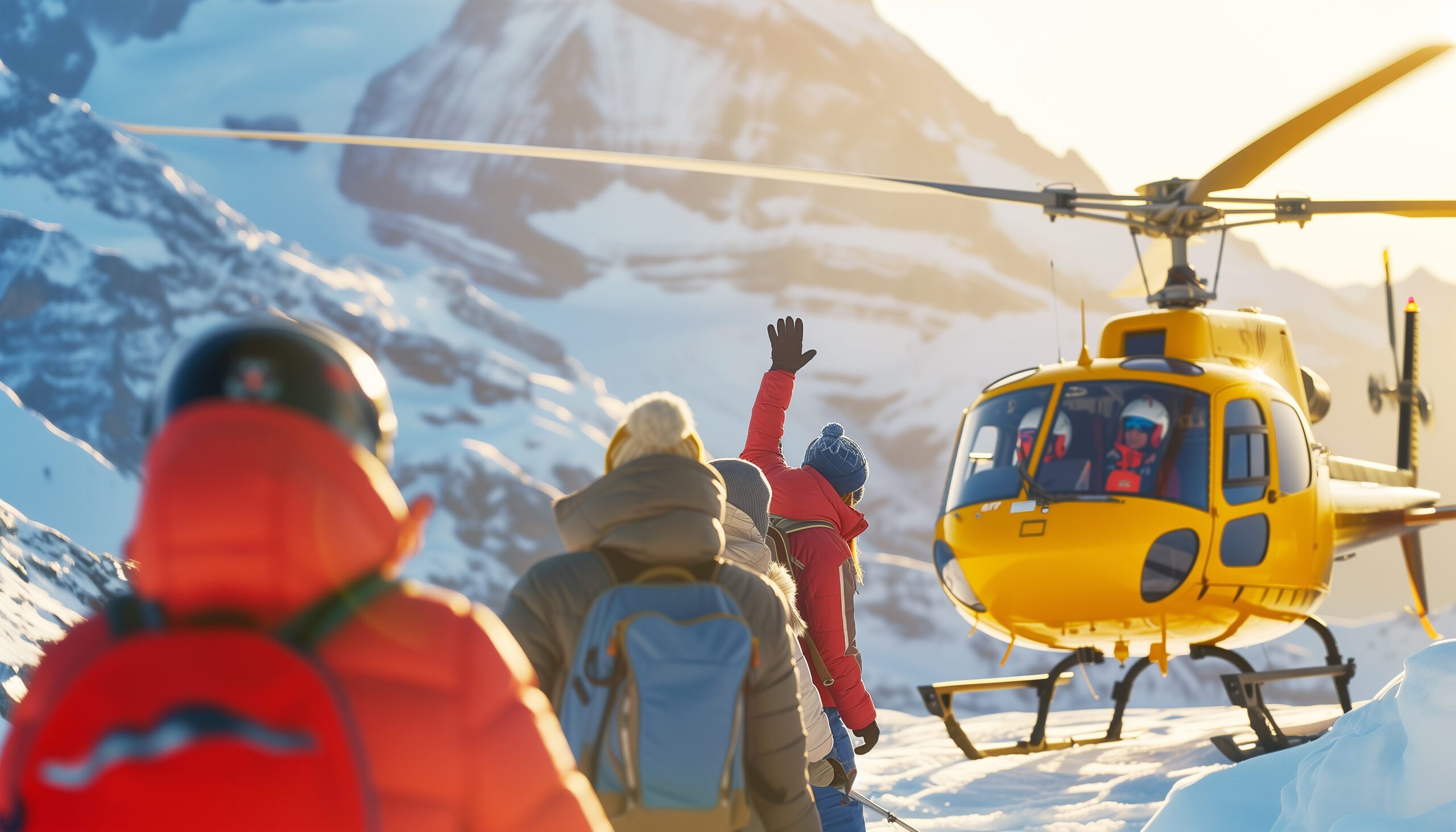
    A rescue helicopter against a stormy northern sky

    A very long way from help

    On a mountain climbed only about fifty times, in some of the worst weather in North America, rescue is a distant and uncertain thing. Bad weather grounds aircraft for days, and the nearest help is far away. A Saint Elias team must be built to solve its own problems, from a crevasse fall to a multi-day storm, without counting on anyone else.

    The hazards

    Difficulty and rarity

    Saint Elias is hard for reasons that do not show up in a single grade: relief, weather, remoteness, and the absence of any support.

    FactorWhat it isHow to treat it
    Coastal stormsThe main enemyGulf of Alaska systems bring holds, snow, and hurricane winds.
    Vertical reliefImmense, complex groundNearly 18,000 ft from the sea means long, committing terrain.
    Icefall and avalancheHeavy snow loadingCoastal snowfall feeds active ice and loads slopes.
    Rarity~50 ascents, no infrastructureLittle recent beta; the team is on its own throughout.
    Timing

    Season and weather

    Spring is the window, but on this coast the weather is difficult in every month, and it rules the climb.

    Late April

    Cold, Early

    Colder and more stable snow, but deep winter conditions linger.

    May-June

    The Window

    The workable spring season, such as it is on this coast.

    Summer

    Warm, Unstable

    Warmer, wetter, and more hazardous as snow rots and ice moves.

    Weather

    The Deciding Factor

    Storms, not the calendar, control every attempt here.

    Flights

    Delay-Prone

    Bush flights in and out hinge entirely on the weather.

    Live wind and weather for Mount Saint Elias. Source: Windy.com. For how to read a mountain forecast, see our weather guide.
    Mount Saint Elias, on the Alaska-Yukon border above Icy Bay and the Gulf of Alaska. Map: OpenStreetMap contributors.
    History

    A short history of Mount Saint Elias

    From a royal Italian first ascent to a nearly fifty-year gap before the second, and a legendary ski descent.

    Mount Saint Elias was first climbed on 31 July 1897 by an Italian expedition led by Prince Luigi Amedeo, Duke of the Abruzzi, who would later reconnoiter the standard route on K2, the Abruzzi Spur that still bears his name. His party, which included the great mountain photographer Vittorio Sella, started from tidewater and worked for weeks up the glaciers to the summit by the Yukon-side ridge. It was a landmark of early Alaskan mountaineering.

    Then the mountain was left alone. The second ascent did not come until 1946, nearly half a century later, when a Harvard Mountaineering Club party climbed the Southwest Ridge from the coast, the line still known as the Harvard Route. The first winter ascent waited until 1996. In total the peak has been climbed only around fifty times. In the modern era it became a magnet for extreme skiing, and the subject of a documentary about an attempt to ski its immense relief from high on the mountain down toward the sea.

    Questions

    Mount Saint Elias FAQ

    The questions climbers ask most about the difficulty, the weather, the routes, and the rarity.

    How high is Mount Saint Elias, and where is it?

    Mount Saint Elias is 18,008 ft (5,489 m), the second-highest mountain in both the United States and Canada, behind Denali and Mount Logan. Its summit sits directly on the Alaska-Yukon border, in the Saint Elias Mountains, within the Wrangell-St. Elias and Kluane protected-area system. Its Tlingit name is Yas’eit’aa Shaa, the mountain behind Icy Bay.

    What makes Mount Saint Elias special?

    Its vertical relief. The summit stands only about 10 miles from tidewater at Icy Bay, so the mountain rises nearly its full 18,008 ft almost straight from the sea, one of the greatest base-to-summit rises on Earth, comparable to Denali or Himalayan peaks. That relief, and its position in the path of Gulf of Alaska storms, are what make it so dramatic and so hard.

    Is Saint Elias harder than Denali?

    It is lower, but for many teams more committing. Denali is higher and brings greater altitude, but Saint Elias has more technical route complexity, far less infrastructure, and much stronger coastal-storm influence. There are no fixed ropes, established camps, or ranger presence, and prolonged storms can pin a team on the ascent or the descent. Lower does not mean easier here.

    How often is Mount Saint Elias climbed?

    Rarely. It was first climbed in 1897, and the second ascent did not come until 1946, nearly half a century later. In total it has been summited only on the order of fifty times. Severe weather, a remote and complex approach, and the absence of any commercial infrastructure keep the traffic to a trickle of experienced expedition teams.

    What is the weather like?

    Among the most severe of any major peak in North America. Its position beside the Gulf of Alaska places it directly under Aleutian Low storm systems, which bring prolonged storms, extreme snowfall, and hurricane-force winds. Long weather holds are a normal part of any attempt, and the forecast, not the climbing grade, is usually what decides success.

    What are the routes?

    There is no easy or maintained route. The Southwest Ridge, sometimes called the Harvard Route after the 1946 second-ascent party, is the principal modern Alaska-side line, a serious and variable expedition route. The historic Abruzzi Ridge on the Yukon side, the 1897 first-ascent line and one of the 50 Classic Climbs of North America, is rarely climbed now because of icefall and avalanche danger. All routes combine expedition hauling with steep snow, ice, and mixed ground.

    How do you get there, and when do people climb?

    Access is by ski-equipped bush flight, usually from the coastal town of Yakutat onto a glacier such as the Tyndall, or from the Yukon side. The climbing season is the spring, roughly May and June, when conditions are most workable, though Saint Elias weather is difficult in any month. Expect to build in extra days for storms and flight delays at both ends.

    Is there a famous ski descent?

    Yes. Mount Saint Elias is the subject of a documentary about an attempt at the planet’s longest ski descent, skiing from high on the peak toward the Gulf of Alaska, nearly 18,000 ft of vertical to the sea. The team summited on their second attempt and skied to about 13,000 ft. The mountain’s relief makes it a legendary, and extremely dangerous, objective for extreme skiing.

    What experience do you need?

    This is an expert, self-sufficient expedition, not a guided trade-route peak. It demands strong glacier and technical mountaineering skills, expedition experience with hauling and storm camps, sound avalanche and icefall judgment, and the patience to sit out long weather holds. It is a mountain for experienced alpine teams researching current route reports, not a first big peak.

    Transparency

    How we built this update

    What this page is based on, who reviewed it, and what we do not claim to know.

    Sources

    • National Park Service records and the preserved 1897 first-ascent history.
    • Published mountaineering records for the 1946 second ascent and 1996 winter ascent.
    • Expedition reports and route accounts for the Southwest and Abruzzi ridges.
    • Weather and geography references for the Gulf of Alaska storm setting.
    • Our own Mount Saint Elias climb guide for the detailed route and logistics.

    Review and standards

    Compiled by Travis Ludlow and reviewed for safety by Dawson Ludlow, our Climbing and Mountaineering Lead (Wilderness First Aid), whose highest first-hand summit is Kilimanjaro. Health and medical points were reviewed by Taylor Ludlow, RN. We do not fabricate summit experience, quotes, or credentials, and we say plainly when we are reporting rather than recounting.

    What we do not claim to know

    Saint Elias is a remote, rarely climbed, and changing peak, and no web page can replace current route reports and a team’s own judgment. In particular:

    • Route conditions and glacier hazard change; recent reports matter more than any fixed description.
    • Ascent totals are approximate, drawn from published records over many decades.
    • There is no set commercial itinerary; logistics vary by team, pilot, and season.
    • Our team has not climbed Saint Elias, so we report records and accounts, not personal experience.
    Global Summit Guide research team

    Global Summit Guide research

    We compile mountain updates from park and historical records, expedition reports, and route accounts, review them for safety and medical accuracy, and refresh them each season. We are transparent about what we have and have not climbed, and Saint Elias is a research-based briefing, not a personal account.

    About our team and standards ->
    Plan a northern expedition

    Respect the weather. Build the expedition.

    Start with the full route in our Mount Saint Elias climb guide, weigh yourself against our fitness standards, and read the neighbours in the Mount Logan and Denali pages. Trips stage through Anchorage and Yakutat, so for flights and lodging, browse travel on Expedia.

    Disclosure: the Expedia link above is a sponsored affiliate link, and we may earn a commission at no extra cost to you. It is the only affiliate link on this page; our route, weather, and safety guidance is independent.
    Was this helpful?

    Yes
    No
    Thanks for your feedback!
  • 20 Greatest Mountains in the USA, Ranked for Climbers

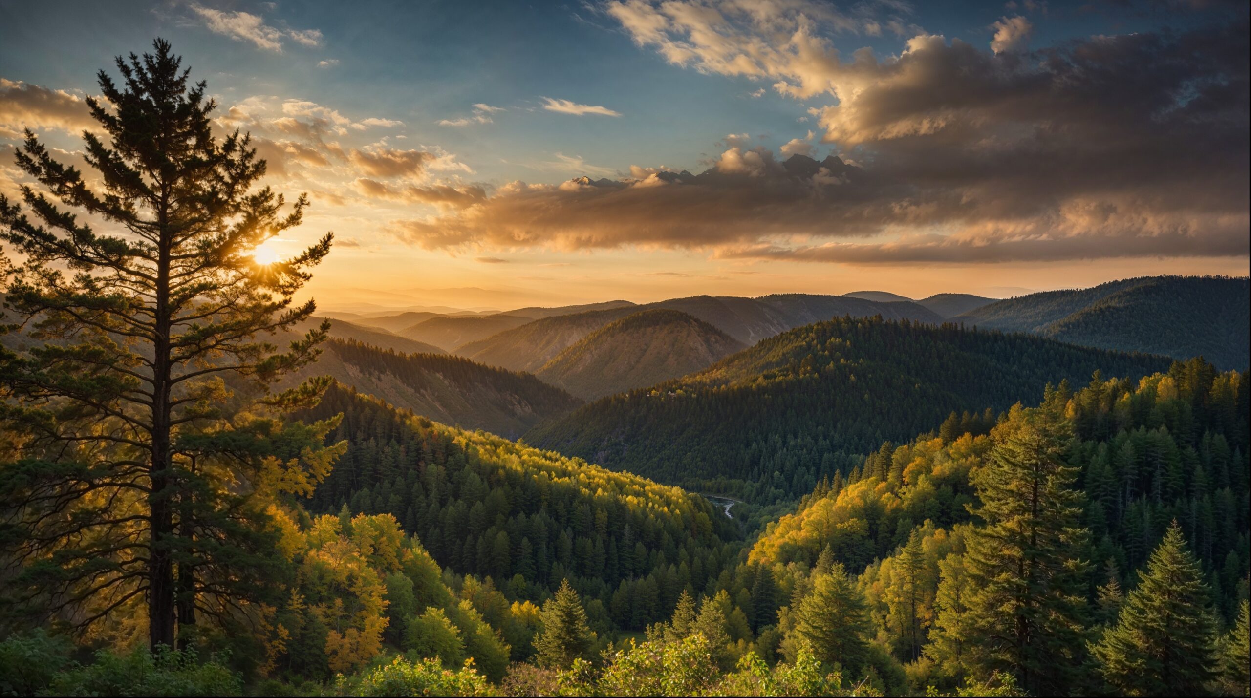
    Mountain range landscape at sunset, showcasing American peaks and US mountaineering.
    🇺🇸 USA · 20-Peak Editorial Ranking · Denali to Rainier to Whitney

    20 Greatest Mountains in the USA, Ranked for Climbers

    Which American mountains matter most to climbers? This ranking scores 20 iconic US peaks and mountain objectives by climbing significance, history, technical challenge, stature, route quality, and the skills each one helps climbers build.

    ◆ Ranking page vs USA master guide

    This page owns the editorial ranking. It answers “Which American mountains are greatest for climbers, and why?” The separate USA mountain master guide is the browsing hub for choosing peaks by state, region, skill level, mountain type, and trip goal.

    ⚡ The Quick Answer

    Denali ranks #1 because no other American mountain combines comparable altitude, glacier logistics, cold, weather, heavy-load travel, self-sufficiency, and multi-week expedition commitment.

    Mount Rainier ranks #2 as America’s most important glacier classroom. Mount Whitney ranks #3 because it is the lower-48 high point and the most accessible major altitude milestone. Grand Teton follows as the country’s defining alpine-rock icon.

    20
    Ranked mountains
    97/100
    Denali editorial score
    20,310 ft
    Highest ranked summit
    8
    US mountain regions

    How the Ranking Works

    “Greatest” is not the same as tallest, easiest, most popular, or most beautiful. This page ranks the mountains that have the greatest overall importance to American climbers. The score is editorial rather than scientific, but the same six factors are applied to every mountain.

    Ranking factorWeightWhat earns points
    American climbing significance25 pointsInfluence on US mountaineering, training, progression, or climbing culture
    History & cultural importance20 pointsHistoric ascents, national recognition, and importance beyond specialist climbers
    Skill-development value20 pointsTransferable altitude, snow, glacier, rock, weather, or expedition skills
    Stature & visual prominence15 pointsElevation, relief, dominance, and the mountain’s physical presence
    Route quality & variety10 pointsClassic routes, multiple difficulty levels, and enduring climbing value
    Progression value10 pointsHow well the objective prepares climbers for a logical next mountain
    How to read the scoresA score is a transparent editorial judgment, not a claim that one mountain is objectively “better” than another. Denali wins on expedition stature; Rainier wins as a glacier classroom; Whitney wins on accessible altitude; Grand Teton and El Capitan dominate different forms of American rock climbing.

    The Complete 20-Mountain Ranking

    This table gives the entire answer before the longer profiles. The “defining value” column explains why each mountain holds its position.

    RankMountainStateElevationClimbing styleDefining valueScore
    1DenaliAlaska20,310 ftGlacier expeditionAmerica’s ultimate expedition mountain97/100
    2Mount RainierWashington14,410 ftGlacier mountaineeringThe national glacier classroom94/100
    3Mount WhitneyCalifornia14,505 ftHigh-altitude hiking / alpine routesThe lower-48 altitude gateway88/100
    4Grand TetonWyoming13,775 ftAlpine rockAmerica’s defining alpine-rock icon87/100
    5Mount HoodOregon11,249 ftSteep snowAccessible early mountaineering test84/100
    6Longs PeakColorado14,259 ftExposed scramblingColorado’s serious standard-route classic82/100
    7Mount WashingtonNew Hampshire6,288 ftSevere-weather alpineWeather seriousness beyond elevation81/100
    8Mount ShastaCalifornia14,179 ftSnow climbThe bridge from hiking to mountaineering80/100
    9Mount Saint EliasAlaska / Yukon18,008 ftRemote expeditionExceptional relief, weather, and commitment79/100
    10Mount ForakerAlaska17,400 ftTechnical alpineThe advanced Alaska objective beyond Denali78/100
    11El CapitanCalifornia7,573 ftBig-wall rockThe defining American big wall77/100
    12Half DomeCalifornia8,839 ftHike, cables, and rockYosemite’s broadest mountain icon75/100
    13Mount BakerWashington10,781 ftGlacier climbThe leading first rope-team glacier peak74/100
    14Mount AdamsWashington12,281 ftSnow climbLarge Cascade progression mountain72/100
    15Mount ElbertColorado14,440 ftHigh-altitude hikingColorado and Rocky Mountains high point70/100
    16Pikes PeakColorado14,115 ftLong hiking / public accessNational recognition and accessible altitude68/100
    17Mauna KeaHawaii13,803 ftVolcanic high pointExtraordinary base-to-summit scale and culture67/100
    18Mount KatahdinMaine5,269 ftExposed ridge hikingKnife Edge and Appalachian Trail significance66/100
    19Humphreys PeakArizona12,633 ftHigh-altitude hikingThe Southwest’s major state-high-point objective64/100
    20Kings PeakUtah13,528 ftWilderness backpackingA substantial multi-day high-point journey62/100
    Looking for a mountain rather than a ranking? Use the USA master guide to browse by state, region, climbing style, and experience level.

    The Top 10 Greatest USA Mountains Ranked

    #1 · The crown

    Denali — Alaska

    Elevation
    20,310 ft
    Range
    Alaska Range
    Style
    Expedition glacier
    Season
    May–early July

    Denali is the highest peak in the United States, the highest peak in North America, and the most important American expedition mountain. It is not merely taller than the rest of the country — it is colder, more remote, more self-sufficient, and more physically demanding than the standard objectives below it.

    The standard West Buttress route is not highly technical by elite Alaska standards, but it demands glacier travel, sled hauling, heavy packs, snow camping, crevasse awareness, fixed-line movement, and disciplined weather patience over a three-week itinerary. For American climbers, Denali is the great divider between weekend mountaineering and expedition mountaineering.

    Best for: experienced glacier climbers ready for a major expedition. Start with the Denali climbing guide, then compare Rainier vs Denali and the Denali progression plan.

    #2 · The proving ground

    Mount Rainier — Washington

    Elevation
    14,410 ft
    Range
    Cascades
    Style
    Glacier climb
    Season
    May–Sep

    Mount Rainier is the most important training mountain in American mountaineering. It has the visibility of an icon, the glacier systems of a serious alpine objective, and the access that lets thousands of climbers test themselves on rope-team terrain every year.

    Rainier teaches the skills that transfer directly to Denali and beyond: cramponing, self-arrest, roped glacier travel, crevasse risk, heavy-pack movement, early alpine starts, and the discipline to turn around when weather or route conditions deteriorate. It is beautiful, accessible, and serious — a rare combination.

    Best for: aspiring mountaineers building toward Denali, Aconcagua, or international expeditions. See the Mount Rainier guide, what to climb before Rainier, and best peaks after Rainier.

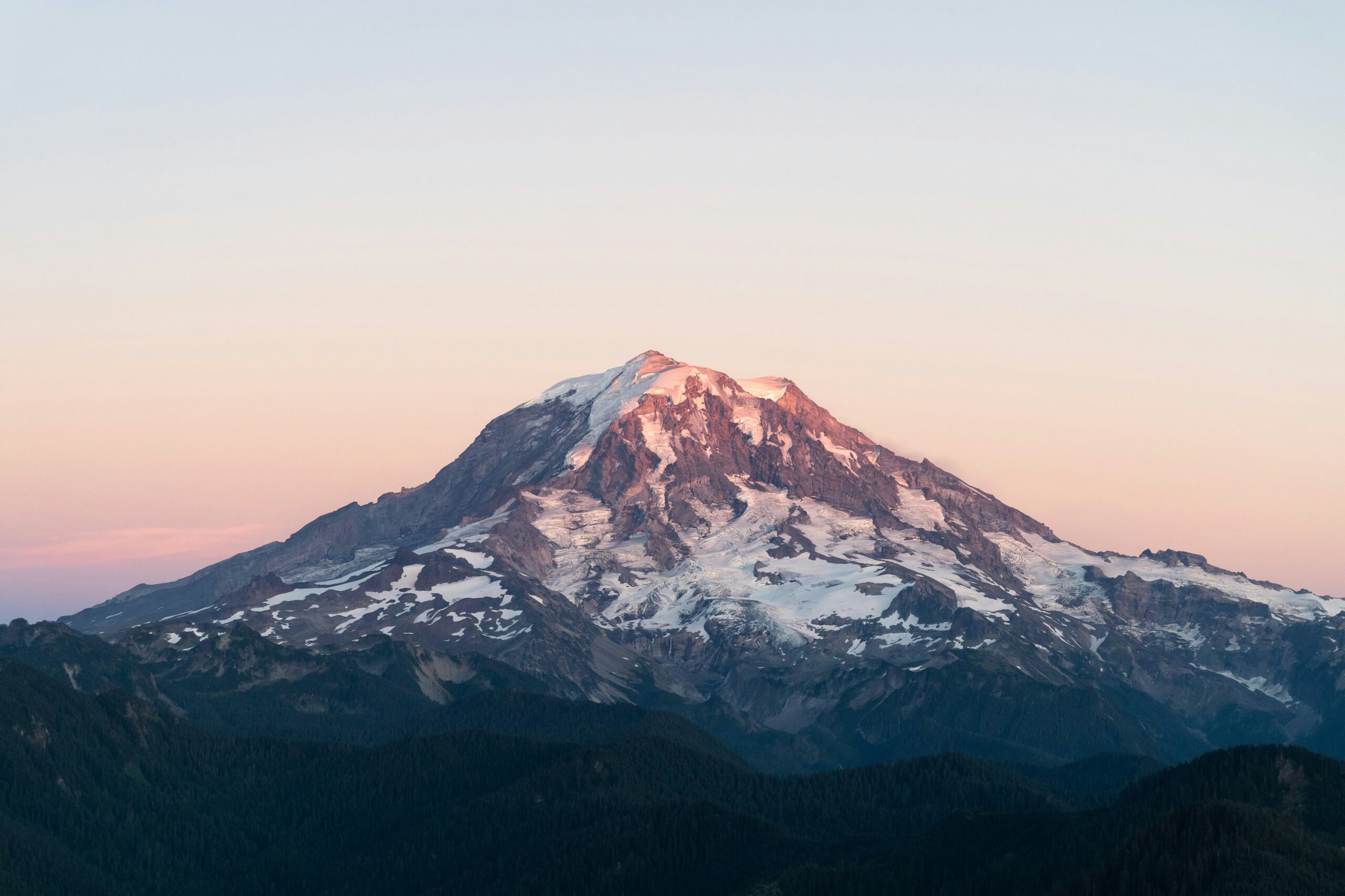
    Mount Rainier glacier mountain training for mountaineering and alpine objectives
    Mount Rainier is the American glacier classroom. Its beauty makes it famous; its crevasses, weather, heavy packs, and route conditions make it useful preparation for larger peaks.
    #3 · The lower 48 high point

    Mount Whitney — California

    Elevation
    14,505 ft
    Range
    Sierra Nevada
    Style
    High-altitude hike
    Season
    Jul–Sep

    Mount Whitney is the highest mountain in the contiguous United States and the great California gateway to altitude. The standard trail is not a technical climb, but the mountain still demands fitness, acclimatization, weather awareness, and a permit.

    Whitney’s greatness is access to height. A fit hiker can stand on the lower-48 high point by walking rather than roped climbing, while more advanced climbers can move to the Mountaineers Route, East Buttress, or surrounding Sierra alpine objectives.

    Best for: fit hikers seeking a first serious high summit. Compare Mount Whitney vs Mount Rainier and Half Dome vs Mount Whitney.

    #4 · The alpine-rock icon

    The Grand Teton — Wyoming

    Elevation
    13,775 ft
    Range
    Tetons
    Style
    Alpine rock
    Season
    Jul–Sep

    The Grand Teton is one of the most visually powerful mountains in North America: a clean granite pyramid rising above Jackson Hole. The standard Owen-Spalding route is not a simple hike; it involves exposed scrambling and a short technical section. The Exum Ridge adds one of America’s classic moderate alpine rock climbs.

    Best for: climbers who want exposure, scrambling, and classic alpine-rock character without Alaska-scale expedition logistics. Read the complete Grand Teton climbing guide.

    #5 · The accessible snow classroom

    Mount Hood — Oregon

    Elevation
    11,249 ft
    Range
    Cascades
    Style
    Snow climb
    Season
    May–July

    Mount Hood is one of the most accessible serious snow climbs in the United States. It is close to Portland, starts high from Timberline, and gives climbers real crampon-and-ice-axe terrain without requiring a long expedition.

    Its accessibility is also the trap: many accidents happen when climbers underestimate descent conditions, warming snow, icefall, rockfall, or a route that feels straightforward on the way up and less forgiving when tired.

    Best for: early mountaineering skill building before Rainier. Start with the complete Mount Hood climbing guide, then strengthen the skills with microspikes vs crampons and how to use an ice axe.

    #6 · Colorado’s serious classic

    Longs Peak — Colorado

    Elevation
    14,259 ft
    Range
    Front Range
    Style
    Class 3 scramble
    Season
    Jul–Sep

    Longs Peak is the most famous 14er in Rocky Mountain National Park and one of the most serious standard-route experiences in Colorado. The Keyhole Route includes the Ledges, Trough, Narrows, and Homestretch — a progression of exposed terrain where weather, fatigue, route-finding, and altitude matter.

    Best for: hikers moving from walk-up 14ers toward exposed scrambling. Build context in the complete Mount Elbert guide.

    Snow-capped peaks of the Rocky Mountains and a turquoise lake, Colorado 14ers reference
    Colorado gives American climbers a complete altitude classroom. The 14ers range from simple walk-ups to loose, exposed, dangerous scrambles that teach judgment before larger objectives.
    #7 · The weather mountain

    Mount Washington — New Hampshire

    Elevation
    6,288 ft
    Range
    Presidentials
    Style
    Weather alpine
    Season
    Summer / winter

    Mount Washington proves that elevation alone does not define danger. At barely over 6,000 feet, it has some of the harshest and most unpredictable mountain weather in the country. The summit’s 1934 wind record became part of American mountain history, and winter conditions can feel Arctic despite the modest altitude.

    Best for: East Coast hikers and winter climbers who want serious weather lessons without western elevation. Read the complete Mount Washington guide.

    #8 · California’s snow volcano

    Mount Shasta — California

    Elevation
    14,179 ft
    Range
    Cascades
    Style
    Snow climb
    Season
    May–July

    Mount Shasta is one of the best first serious snow climbs in the United States. Avalanche Gulch gives fit climbers a big day or two-day climb with crampons, ice axe, snow travel, and altitude — but usually without the complex glacier system that defines Rainier.

    Best for: climbers preparing for Rainier or a bigger Cascade progression. Start with the complete Mount Shasta guide, then compare Mount Shasta vs Mount Rainier.

    Mount Shasta towering over a vibrant blue lake surrounded by lush green forests and snow-capped peaks, showcasing the natural beauty of the Cascade Volcanoes in the Pacific Northwest.
    Mount Shasta is often the bridge between hiking and mountaineering. It is big, high, snowy, and serious enough to teach early starts, snow conditions, and descent discipline.
    #9 · The remote giant

    Mount Saint Elias — Alaska / Yukon

    Elevation
    18,008 ft
    Range
    Saint Elias
    Style
    Remote expedition
    Season
    Alaska window

    Mount Saint Elias is one of the wildest major peaks in North America. It rises from near sea level to 18,000 feet in a spectacular coastal wall of ice, weather, and remoteness. It is not a common climber’s objective; that scarcity is part of the seriousness.

    Best for: advanced expedition climbers beyond Denali who want a remote, storm-prone, committing objective. Read the complete Mount Saint Elias guide.

    #10 · The advanced Alaska test

    Mount Foraker — Alaska

    Elevation
    17,400 ft
    Range
    Alaska Range
    Style
    Technical alpine
    Season
    May–June

    Foraker is Denali’s neighbor, but not Denali’s understudy. Its standard routes are more technical, less traveled, and more committing than Denali’s West Buttress. For elite American alpinists, Foraker represents the step beyond the famous summit.

    Best for: advanced Alaska Range climbers with Denali-level experience and stronger technical alpine skills. Read the complete Mount Foraker guide.

    Ranks 11–20: The Mountains That Complete the American Story

    These ten objectives broaden the list beyond expedition peaks. They include Yosemite rock history, first-glacier training, state high points, exposed ridges, volcanic scale, and wilderness travel.

    #11 · El Capitan — California

    77/100
    Yosemite · Big-wall rock · Spring and autumn

    El Capitan belongs because American climbing history cannot be explained without it. The granite wall transformed big-wall technique, speed climbing, free climbing, aid climbing, and public understanding of what rock climbers can accomplish.

    Why #11: It is not a conventional summit objective, but its climbing significance is greater than that of many independent mountains.

    #12 · Half Dome — California

    75/100
    Yosemite · Cables, hiking, and rock · Late spring to autumn

    Half Dome connects several audiences: permit hikers on the cables, climbers on historic face routes, and visitors who recognize its profile instantly. Its influence reaches far beyond elevation.

    Why #12: Few American objectives combine cultural recognition, exposure, access, hiking ambition, and climbing history so completely. Read the complete Half Dome guide, then compare Half Dome vs Mount Whitney.

    #13 · Mount Baker — Washington

    74/100
    North Cascades · Glacier climb · May to July

    Mount Baker is one of the strongest first-glacier objectives in the United States. Standard routes teach rope-team travel, crevasse awareness, snow camping, crampon movement, and early starts without Rainier’s full scale.

    Why #13: Its progression value is exceptional. It is the logical bridge between snow climbing and a major glaciated volcano. Explore the complete Mount Baker guide.

    #14 · Mount Adams — Washington

    72/100
    Cascades · Long snow climb · Late spring to midsummer

    Mount Adams gives climbers a large volcanic objective with significant vertical gain, snow travel, altitude, and descent management, but generally less glacier complexity than Rainier or Baker on its standard south-side line.

    Why #14: It is one of America’s most useful progression mountains for moving from hiking into sustained snow climbing. Read the complete Mount Adams guide.

    #15 · Mount Elbert — Colorado

    70/100
    Sawatch Range · High-altitude hike · July to September

    Mount Elbert is the highest mountain in Colorado and the Rocky Mountains. Its standard routes are non-technical, making it an accessible way to test pacing, acclimatization, weather judgment, and endurance above 14,000 feet.

    Why #15: Height, state-high-point status, and beginner progression value give it national importance. Start with the Colorado 14ers guide.

    #16 · Pikes Peak — Colorado

    68/100
    Front Range · Long hike and public summit · Summer to early autumn

    Pikes Peak is among America’s most recognizable high mountains. Roads and rail access reduce its wilderness character, but the Barr Trail remains a long, serious altitude day and the mountain has shaped public imagination for generations.

    Why #16: Cultural recognition and accessible altitude outweigh its limited technical climbing value. Read the complete Pikes Peak guide.

    #17 · Mauna Kea — Hawaii

    67/100
    Hawaii Island · Volcanic high point · Year-round with conditions

    Mauna Kea is often described as Earth’s tallest mountain when measured from its seafloor base. Its summit is also culturally sacred and scientifically important, so visitors should approach access, altitude, and local stewardship with respect.

    Why #17: Its scale, cultural importance, volcanic geography, and unusual altitude experience make it nationally distinctive. Read the complete Mauna Kea guide.

    #18 · Mount Katahdin — Maine

    66/100
    Appalachians · Exposed ridge hiking · Summer to early autumn

    Katahdin is the northern terminus of the Appalachian Trail and home to the Knife Edge, one of the most memorable exposed hiking ridges in the eastern United States. Weather and park access rules add seriousness.

    Why #18: It combines national trail history, eastern mountain culture, and genuine exposure despite modest elevation. Explore Mount Katahdin in the Maine mountain guide.

    #19 · Humphreys Peak — Arizona

    64/100
    San Francisco Peaks · High-altitude hike · Summer to early autumn

    Humphreys Peak is Arizona’s high point and an important Southwest altitude objective. The route is non-technical in normal summer conditions, but elevation, wind, lightning, and seasonal snow can change the day quickly.

    Why #19: It gives desert-region hikers a genuine alpine summit and a clear introduction to altitude judgment. Explore Humphreys Peak in the Arizona mountain guide.

    #20 · Kings Peak — Utah

    62/100
    Uinta Mountains · Wilderness backpacking · July to September

    Kings Peak is Utah’s high point and usually requires a multi-day wilderness approach. The summit itself is not highly technical, but distance, weather, navigation, loose rock, and backpacking logistics make the complete journey meaningful.

    Why #20: It represents the American wilderness-summit tradition better than a roadside or short-trail high point. Read the complete Kings Peak guide.

    Why This Order?

    The ranking becomes more useful when the close decisions are explained directly.

    Why Rainier ranks above Whitney

    Rainier teaches more transferable mountaineering skills: glacier travel, rope teams, crevasse awareness, crampons, camp systems, and alpine weather judgment. Whitney is higher, but its standard trail is non-technical.

    Why Whitney ranks above Grand Teton

    Grand Teton is the stronger technical climb, but Whitney’s lower-48 high-point status, accessibility, altitude value, and national recognition give it broader significance.

    Why Mount Washington ranks #7

    Its modest elevation hides extraordinary weather seriousness. It has taught generations of eastern climbers that wind, cold, visibility, and rapid change matter more than summit height alone.

    Why El Capitan counts

    This is a climber-focused ranking of mountains and defining mountain objectives. El Capitan’s influence on American climbing history is too large to exclude simply because the wall is not an independent summit.

    A ranking is an argument, not a measurementA technical rock climber may place El Capitan or Grand Teton higher. A high-point hiker may favor Whitney or Elbert. The value of this list is the transparent method—not the claim that every climber must agree with every position.

    Which Mountain Fits Each Climbing Goal?

    The ranking answers overall significance; this section answers a different question: which mountain most directly develops the skill you need next?

    First high summit

    Mount Whitney

    Highest in the lower 48, non-technical by the standard trail, but long enough and high enough to feel serious.

    First 14er

    Mount Elbert

    A strong Colorado starting point for altitude, pacing, early starts, and Rocky Mountain weather.

    First snow climb

    Mount Hood or Mount Shasta

    Both teach crampon and ice-axe judgment, with Shasta usually the bigger wilderness-feeling climb.

    First glacier climb

    Mount Baker

    The most common first rope-team glacier classroom before Rainier.

    Denali prep

    Mount Rainier

    The best American bridge from weekend climbing to expedition objectives.

    Major expedition

    Denali

    The American crown and the peak that proves expedition readiness.

    USA Mountains by Region

    The strength of American mountaineering is regional variety. A climber can build a deep skill portfolio by moving between ranges rather than repeating the same kind of peak.

    RegionClimbing characterSignature peaksBest season
    Alaska RangeExpedition glacier climbing, cold, remotenessDenali, Foraker, Hunter, Mooses ToothMay–early July
    Cascade RangeGlaciated volcanoes, snow travel, rope teamsRainier, Baker, Hood, Adams, ShastaMay–July
    Sierra NevadaGranite peaks, long approaches, alpine rockWhitney, Russell, Muir, Half Dome, El CapitanJuly–September
    Rocky Mountains14ers, scrambling, altitude, thunderstormsElbert, Longs, Pikes, Maroon Bells, CapitolJuly–September
    Teton RangeExposed alpine rock and classic ridgesGrand Teton, Middle Teton, Mount OwenJuly–September
    White MountainsSevere weather at modest elevationMount Washington, Adams, Jefferson, MadisonSummer / winter
    Utah Wasatch & UintasAccessible training hikes and backpacking high pointsKings Peak, Timpanogos, Nebo, Lone PeakJuly–September
    Hawaii volcanoesVolcanic high points and island altitudeMauna Kea, Mauna Loa, HaleakalaYear-round with weather checks
    Mount Rainier at sunrise, showcasing glaciated peaks and surrounding forested landscape, representing the Cascade Volcanoes in the Pacific Northwest.
    The Cascades are America’s glacier classroom. Mount Baker, Mount Hood, Mount Adams, Mount Shasta, and Mount Rainier create the most useful progression for climbers who eventually want Denali.

    A Practical American Climbing Progression

    The smartest way to use this list is not to chase the biggest name first. Build the next skill, then the next mountain. A safe progression usually looks like this:

    StageObjective typeGood US peaksSkill gained
    1Fitness hiking and altitudeWhitney, Elbert, Pikes, Kings PeakPacing, altitude, long days
    2Intro snow travelSt. Helens, Adams, Shasta, HoodCrampons, ice axe, snow timing
    3Roped glacier travelBaker, Rainier, OlympusRope teams, crevasse risk, glacier movement
    4Major glacier objectiveRainier, Shasta harder routes, Baker north-side routesHeavy packs, camps, weather patience
    5Expedition preparationRainier repeat, Alaska prep course, winter skillsCold systems, self-sufficiency
    6Major expeditionDenali West ButtressThree-week expedition competence
    7Advanced alpineForaker, Saint Elias, Hunter, technical TetonsAdvanced risk and technical judgment
    Best internal pathFor a complete step-by-step plan, start with what to climb before Rainier, move into the Rainier progression plan, then use the Denali progression plan when expedition climbing becomes realistic.

    Cost & Season Framework for USA Peaks

    American peaks are often cheaper than international equivalents, but the cost range is wide. A permit-based day hike is not the same kind of budget as a guided Rainier program or a Denali expedition.

    Trip typeTypical cost rangeExample peaksNotes
    Self-guided high hike$100–$500Whitney, Elbert, Kings PeakPermits, fuel, lodging, food, gear gaps
    Colorado 14er weekend$200–$700Elbert, Bierstadt, LongsHigher if flying in or staying near resorts
    Intro guided snow climb$800–$1,800Hood, Shasta, BakerUsually 2–3 days with instruction
    Guided glacier climb$1,800–$3,500Rainier, Grand TetonCommon entry point for serious climbers
    Major US expedition$9,000–$25,000+DenaliDepends heavily on guided vs independent style
    Elite remote expedition$15,000–$30,000+Saint Elias, advanced AlaskaFlights, pilots, logistics, weather buffers
    RegionBest windowPrimary issue
    Alaska RangeMay–early JulyCold, storms, glacier travel, expedition duration
    CascadesMay–JulySnow condition, crevasse bridges, rockfall later in season
    Colorado 14ersJuly–SeptemberAfternoon thunderstorms and loose rock
    Sierra NevadaJuly–SeptemberPermits, altitude, lightning, lingering snow
    TetonsJuly–SeptemberDry rock, lightning, exposure, route-finding
    White MountainsJune–September / Jan–MarExtreme weather and rapid temperature swings

    Methodology: How We Ranked These Peaks

    Editorial scoring, not false precision

    Each mountain was scored across the six categories shown near the top of the page. The numbers make the reasoning visible, but they are not a scientific measure of beauty, danger, or personal meaning.

    • Climbing significance receives the greatest weight. This keeps the page focused on climbers rather than sightseeing popularity.
    • History and culture matter. El Capitan, Half Dome, Pikes Peak, Mount Washington, and Mauna Kea rank partly because they shaped national understanding of mountains.
    • Skill transfer separates close choices. Rainier, Baker, Hood, Shasta, and Grand Teton teach skills that change what a climber can attempt next.
    • Stature is broader than elevation. Relief, prominence, visual dominance, remoteness, and commitment all contribute.
    • Current conditions are not part of the permanent score. Snowpack, route access, permits, closures, and hazards must be checked for each trip.

    Editorial limitation: Global Summit Guide has not climbed every mountain on this list. The ranking synthesizes established mountain significance, route character, progression value, and the site’s broader US mountain research. Readers should use official land-management and forecasting sources for current access and safety decisions.

    Greatest Mountains in the USA FAQ

    What is the greatest mountain in the USA?

    For climbers, Denali is the greatest mountain in the United States. It is the highest peak in North America, the highest in the USA, and the country’s premier expedition mountaineering objective. It demands glacier travel, high-latitude cold management, crevasse awareness, fixed-line movement, heavy loads, and multi-week expedition judgment.

    Why does Mount Rainier rank above Mount Whitney?

    Rainier ranks higher because it has greater mountaineering significance and teaches more transferable glacier, rope-team, crampon, crevasse, camp, and weather-management skills. Whitney remains the more accessible major high point and the strongest first altitude milestone for many hikers.

    What is the hardest mountain to climb in the United States?

    Denali is the hardest mainstream objective because of its altitude, cold, expedition duration, glacier travel, heavy packs, and weather. For more advanced technical climbers, Foraker, Saint Elias, Mount Hunter, and Alaska Range technical routes may be harder than Denali’s standard West Buttress.

    What is the most famous mountain in America?

    Denali, Mount Rainier, Mount Whitney, Grand Teton, Mount Hood, Mount Washington, Pikes Peak, Half Dome, El Capitan, and Mauna Kea are among the most famous mountains or mountain objectives in America. Climbers tend to place Denali and Rainier at the top because of their role in mountaineering progression.

    Which US mountain is best preparation for Denali?

    Mount Rainier is the best standard preparation peak for Denali. It teaches roped glacier travel, crampon movement, crevasse awareness, heavy packs, alpine starts, camp systems, and weather decisions. Most climbers should also build through Mount Baker, Mount Hood, Mount Adams, Mount Shasta, or an alpine course first.

    How were the 20 mountains ranked?

    The ranking uses a 100-point editorial framework: 25 points for American climbing significance, 20 for history and cultural importance, 20 for skill development, 15 for stature and prominence, 10 for route quality and variety, and 10 for progression value.

    About Global Summit Guide

    Travis Ludlow — Editor · Reviewed by Dawson Ludlow, Safety & Altitude

    Global Summit Guide is an independent mountain planning resource based in Nephi, Utah. Our USA coverage helps climbers move from first high hikes to glaciated peaks, route comparisons, operator research, weather planning, and expedition progression.

    For corrections, updated permit information, or operator feedback, contact info@globalsummitguide.com.

    Choose the mountain that builds the next skill

    Use the ranking for context, then choose the mountain that builds your next missing skill: altitude, snow travel, glacier systems, rock exposure, weather judgment, or expedition self-sufficiency.

    Browse the USA mountain master guide → Denali progression → Colorado 14ers →

    Was this helpful?

    Yes
    No
    Thanks for your feedback!
Language »