
Half Dome vs Mount Whitney: Which California Classic Is Harder?
The complete 2026 comparison between Half Dome (Yosemite National Park, 8,839 ft) and Mount Whitney (Sierra Nevada, 14,505 ft — Lower 48’s highest peak) — covering difficulty, distance, altitude sickness risk, the famous Half Dome cables, Mount Whitney’s 99 switchbacks, Recreation.gov permit lottery logistics, and the question every California hiker asks: which one should you do first?
This comparison synthesizes information from authoritative U.S. land management sources including the Yosemite National Park Service for Half Dome data and the Inyo National Forest and Sequoia National Park for Mount Whitney data, Recreation.gov permit system documentation, and published trip reports from established hiking community sources. Trail mileages, elevation figures, and permit specifics are cross-referenced with multiple sources. No affiliate partnerships influence recommendations.
⚡ The Verdict in One Sentence
Mount Whitney is harder overall — much higher (14,505 ft vs 8,839 ft), longer (22 miles vs 14-16 miles), more elevation gain (6,100 ft vs 4,800 ft), and presents real altitude sickness risk above 12,000 feet. Half Dome is harder for hikers afraid of heights — the cables section is genuinely intimidating regardless of fitness or altitude tolerance.
The default recommendation: climb Half Dome first. Half Dome is shorter, lower altitude, and presents one focused challenge (the cables) that you can mentally prepare for. Completing it builds the long-day-hike endurance, big-elevation-gain experience, and granite exposure familiarity that transfer to Mount Whitney. The exception is hikers with significant fear of heights — for them, Mount Whitney’s non-exposed Class 1 trail is the better first big hike.
HALF DOME
Yosemite National Park · California
- Standard route
- Mist Trail/JMT
- Round trip
- 14-16 mi
- Elevation gain
- ~4,800 ft
- Time
- 10-14 hours
- Class
- Class 3+ (cables)
- Permit
- $10 + $10 reservation
- Daily quota
- ~300 hikers
- Season
- May-Oct (cables up)
- Special feature
- The Cables
- Altitude risk
- Minimal
MOUNT WHITNEY
Sierra Nevada · California · Lower 48 Highest
- Standard route
- Mt Whitney Trail
- Round trip
- 22 mi
- Elevation gain
- ~6,100 ft
- Time
- 12-18 hours
- Class
- Class 1 (standard)
- Permit
- $6 + $15 reservation
- Daily quota
- 100 day + 60 overnight
- Season
- May 1 – Nov 1
- Special feature
- 99 switchbacks
- Altitude risk
- Significant 12,000+ ft
📑 On This Page
- The Fundamental Difference
- Side-by-Side Comparison Table
- Half Dome — Yosemite Granite Icon
- Mount Whitney — Lower 48 Highest
- Difficulty Comparison
- Altitude Sickness Considerations
- The Half Dome Cables Explained
- Permit Systems Compared
- Best Season for Each
- Gear Requirements
- Which Prepares You for the Other?
- Choose Half Dome If…
- Choose Mount Whitney If…
- Common Mistakes
- California Big Hike Progression
- FAQ
- Methodology + Sources
⚡ Quick Answer: Half Dome vs Mount Whitney
Which is harder? Mount Whitney is harder overall (higher altitude, longer distance, more elevation gain). Half Dome is harder for hikers with fear of heights (the cables section).
Which to do first? Half Dome first as default — shorter, lower altitude, builds California big-hike experience. Mount Whitney first if you have fear of heights.
Permits: Both require Recreation.gov lottery permits. Half Dome: Preseason lottery March 1-31, $10+$10 fees, ~300 daily quota. Mount Whitney: Preseason lottery Feb 1-March 15, $6+$15 fees, 100 day hikers + 60 overnight daily. Best season: Both peak June-September; Half Dome cables installed May-October.
How This Comparison Was Built — Honest Editorial Framing
This Half Dome vs Mount Whitney comparison is built on comprehensive cross-referenced research rather than personal first-hand ascent of either peak. Specifically, neither Half Dome nor Mount Whitney is in our editorial team’s direct hiking experience to date — both are objectives outside the peaks we have personally climbed (Mount Kilimanjaro, Pico de Orizaba, Iztaccíhuatl, Mount Rainier-class peaks, and Utah peaks including Kings Peak). We are explicit about this distinction.
Notably, this comparison synthesizes authoritative data sources: the National Park Service for Yosemite (Half Dome) and Sequoia/Kings Canyon (Mount Whitney access), the Inyo National Forest for the Mount Whitney Trail, Recreation.gov for permit system specifics, and published trip reports from established hiking community sources. Where data sources differ — for instance on exact mileage estimates for Half Dome (14 vs 16 miles depending on route variation) — we present the range and explain the reasoning. This research-based approach is the same standard we apply to other major peaks outside our direct experience.
🏔 The Half Dome vs Mount Whitney Decision Framework
The Half Dome vs Mount Whitney decision sits across five primary dimensions. First, altitude: Mount Whitney’s 14,505 ft creates real AMS risk; Half Dome’s 8,839 ft does not. Second, distance and gain: Mount Whitney is longer (22 vs 14-16 mi) and gains more vertical (6,100 vs 4,800 ft). Third, exposure: Half Dome’s cables section is psychologically difficult; Mount Whitney’s trail is non-exposed Class 1. Fourth, permit competition: Both lotteries are competitive but with different timing and quotas. Fifth, preparation value: Each builds different skills useful for the other.
Generally, the right question isn’t “which is harder” in absolute terms — both are major California day hikes that demand respect — but “which fits my current fitness, altitude experience, fear tolerance, and permit timing.” Specifically, hikers comfortable with altitude often find Mount Whitney straightforward; hikers comfortable with exposure find Half Dome straightforward. Notably, many California hikers eventually complete both peaks as part of their hiking development, often in the order suggested by their initial fear/altitude profile.
Half Dome and Mount Whitney are California’s two most iconic big-day hikes — Half Dome a 14-16 mile day hike in Yosemite National Park ending at the famous 8,839-foot granite dome via a steel-cable section, and Mount Whitney a 22-mile day hike in the Sierra Nevada ending at 14,505 feet, the highest peak in the contiguous United States. Generally, both peaks attract hundreds of thousands of permit applications annually through the Recreation.gov system, both feature in nearly every “California hikes bucket list” article, and both offer the prestige of a notable summit beyond the typical day hike. Specifically, Half Dome offers the iconic Yosemite Valley views and the psychological challenge of the cables section; Mount Whitney offers the Lower 48 highpoint bragging rights and the high-altitude experience of climbing a 14,000+ foot peak. Notably, the two peaks complement each other — Half Dome rewards exposure tolerance and offers visual icons; Mount Whitney rewards altitude tolerance and offers high-alpine character. Many California hikers eventually complete both, often using one as preparation for the other.
Key Takeaways
- Mount Whitney is higher: 14,505 ft vs 8,839 ft — a 5,666 ft difference.
- Mount Whitney is longer: 22 miles vs 14-16 miles round trip.
- Half Dome has the cables: 400-foot Class 3+ exposed section.
- Both require Recreation.gov permits via competitive lottery.
- Altitude sickness on Whitney is real; minimal risk on Half Dome.
- Best season June-September for both peaks.
- Half Dome cables installed May-October; removed in winter.
- Default first hike: Half Dome (shorter, lower altitude).
- Exception: hikers afraid of heights should do Whitney first.
- Both are Class 1 (Whitney) / Class 3+ (Half Dome cables) — hiking, not climbing.
✓ Editorial Trust Signals
- Research-based: Honest framing on both peaks
- Independent: No affiliate sponsorship
- Cross-referenced: NPS, USFS, Recreation.gov
- Last verified: June 9, 2026
- Review cycle: Quarterly
- Safety review: Dawson Ludlow (WFA)
- Gear review: Walker Ludlow
- 700+ source pages: Cross-linked
The Fundamental Difference Between These Two California Classics
Half Dome and Mount Whitney are California’s two most iconic day hikes, but they offer fundamentally different experiences. Generally, the comparison comes down to a single observation: Mount Whitney is harder physically; Half Dome is harder psychologically. Specifically, Mount Whitney’s 14,505-foot summit demands altitude tolerance and endurance over 22 miles, while Half Dome’s 400-foot cable section demands comfort with serious exposure on steep granite. Neither is technical mountain climbing in the alpine sense — both are hikes, with the right preparation accessible to motivated hikers — but they test different aspects of what makes a “hard” day in the mountains.
What distinguishes them most clearly is where the difficulty lives. Generally, Mount Whitney’s difficulty is distributed across the entire trail — fatigue accumulates over 12-18 hours of hiking, altitude effects build above 12,000 feet, and the final 2 miles of switchbacks at 14,000+ feet are where most aborted attempts happen. Specifically, Half Dome’s difficulty concentrates almost entirely in the final 400 feet — the approach to the subdome is a strenuous but conventional hike, then the cables present a defined challenge that you either commit to or turn back from. Notably, this difference shapes the entire planning calculus: Mount Whitney requires endurance and altitude conditioning; Half Dome requires fitness plus the ability to manage exposure psychologically.
Side-by-Side Comparison Table
The complete comparison across every dimension that matters when choosing between Half Dome and Mount Whitney:
| Dimension | Half Dome | Mount Whitney |
|---|---|---|
| Summit elevation | 8,839 ft (2,694 m) | 14,505 ft (4,421 m) |
| Trailhead elevation | ~4,000 ft (Happy Isles) | 8,360 ft (Whitney Portal) |
| Location | Yosemite National Park | Inyo NF / Sequoia NP boundary |
| State significance | Iconic Yosemite landmark | California state highpoint + Lower 48 highest |
| Standard route | Mist Trail or JMT to subdome + cables | Mount Whitney Trail from Whitney Portal |
| Round-trip distance | 14-16 miles | 22 miles |
| Total elevation gain | ~4,800 ft | ~6,100 ft |
| Typical hike time | 10-14 hours | 12-18 hours (day hike) |
| Difficulty class | Class 3+ on cables; Class 1 below | Class 1 (standard trail) |
| Defining challenge | The 400-foot cable section | Altitude + endurance |
| Altitude sickness risk | Minimal (below ~8,200 ft threshold) | Significant (above 12,000 ft) |
| Exposure to heights | Severe on cables | Minimal on standard trail |
| Permit system | Recreation.gov lottery | Recreation.gov lottery |
| Preseason lottery | March 1-31 | February 1 – March 15 |
| Application fee | $10 | $6 |
| Reservation fee (if awarded) | $10 per person | $15 per person |
| Daily permit quota | ~225 day hikers + 75 backpackers | 100 day hikers + 60 overnight |
| Best season | June-September | July-September |
| Cables / trail season | Cables late May – early October | Permit season May 1 – November 1 |
| Backpack option | Yes (Little Yosemite Valley) | Yes (Trail Camp at 12,000 ft) |
| Annual summits typical | ~50,000 | ~30,000 |
| Annual fatalities typical | 1-3 (mostly cables-related) | 1-2 (mostly altitude/falls) |
| Trailhead drive (LA) | ~6 hours to Yosemite Valley | ~4 hours to Whitney Portal |
| Trailhead drive (SF) | ~4 hours to Yosemite Valley | ~7 hours to Whitney Portal |
| First ascent / opening | 1875 (George Anderson, cables 1919) | 1873 (Lucas-Begole-Johnson) |
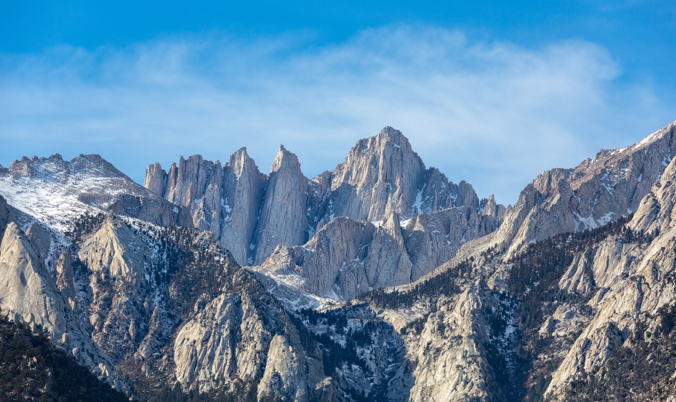
Mount Whitney: The Lower 48’s Highest Peak
Mount Whitney rises to 14,505 feet (4,421 meters), making it the highest peak in the contiguous United States and one of the most-hiked 14,000-foot peaks in North America. Generally, the mountain sits on the boundary of Inyo National Forest and Sequoia National Park in California’s eastern Sierra Nevada, with the standard route ascending from Whitney Portal (8,360 feet) above the town of Lone Pine. Specifically, Mount Whitney is California’s state highpoint and is the southernmost terminus of the John Muir Trail — a position that makes it a bucket-list objective for state highpointers, John Muir Trail finishers, and California hikers building toward more serious mountaineering.
What makes Mount Whitney distinctive among 14ers is its accessibility as a hike. Generally, the Mount Whitney Trail is a Class 1 well-graded path that does not require technical climbing skills — no rope, no helmet, no exposed scrambling on the standard route. Specifically, the trail’s famous 99 switchbacks above Trail Camp climb from approximately 12,000 feet to Trail Crest at 13,600 feet, then traverse the long backbone ridge to the summit. Notably, this Class 1 character is one reason Mount Whitney attracts hikers without prior mountaineering experience — and one reason its annual rescue numbers stay relatively high (the Class 1 trail rating doesn’t communicate the altitude challenge to first-timers).
How Long Does It Take to Hike Mount Whitney?
Most hikers take 12-18 hours to hike Mount Whitney as a day hike via the standard Mount Whitney Trail from Whitney Portal, covering 22 miles round trip with 6,100 feet of elevation gain. Specifically, fit hikers in good condition typically complete the round trip in 12-14 hours; average fit hikers take 15-18 hours; less-conditioned hikers may take 18+ hours and risk being on the trail in darkness. Generally, the breakdown of typical day-hike timing is: 3-4 hours from Whitney Portal to Outpost Camp (10,360 ft), 2-3 hours from Outpost Camp to Trail Camp (12,000 ft), 3-4 hours from Trail Camp through the 99 switchbacks to the summit, and 5-7 hours back down to the trailhead. Notably, the descent often takes nearly as long as the ascent due to knee fatigue, altitude effects persisting, and the need for careful footing on tired legs.
| Trail Segment | Distance | Elevation | Typical Time |
|---|---|---|---|
| Whitney Portal → Outpost Camp | ~3.8 miles | 8,360 → 10,360 ft | 3-4 hours |
| Outpost Camp → Trail Camp | ~2.2 miles | 10,360 → 12,000 ft | 2-3 hours |
| Trail Camp → Trail Crest (99 switchbacks) | ~2.2 miles | 12,000 → 13,600 ft | 2-3 hours |
| Trail Crest → Summit | ~1.9 miles | 13,600 → 14,505 ft | 1-1.5 hours |
| Summit → Whitney Portal (descent) | ~11 miles | 14,505 → 8,360 ft | 5-7 hours |
| TOTAL ROUND TRIP | 22 miles | 6,100 ft gain | 12-18 hours |
Generally, most successful day hikes start between 2-4 AM to ensure summit by mid-morning and complete descent by sunset. Specifically, the typical “alpine start” approach gets hikers above tree line during the cool early morning hours, reaches the summit before noon thunderstorms typically develop, and allows descent in daylight. Notably, two-day backpacking attempts with an overnight at Trail Camp split the elevation gain over two days and reduce altitude sickness risk substantially — many hikers prefer this approach over the long day-hike push.
Mount Whitney Permits — How the Lottery Works
Mount Whitney permits are required from May 1 through November 1 each year and are distributed via a competitive Recreation.gov lottery. Generally, the system separates day hikers from overnight backpackers with separate daily quotas. Specifically, here’s how the Mount Whitney permit system works:
| Permit Element | Detail |
|---|---|
| Permit required | Yes — May 1 to November 1 (Whitney Zone) |
| System | Recreation.gov preseason lottery |
| Lottery dates | February 1 – March 15 each year |
| Results announced | Late March |
| Application fee | $6 (non-refundable, per application) |
| Reservation fee if awarded | $15 per person |
| Day hike daily quota | 100 permits |
| Overnight daily quota | 60 permits |
| Typical success rate (popular dates) | 25-40% |
| Typical success rate (off-peak dates) | 60-80% |
| Unclaimed permits | Released through Recreation.gov ~2 weeks before date |
| Walk-up availability | Lone Pine ranger station (rare, last-minute cancellations only) |
| Permit pickup | Eastern Sierra Interagency Visitor Center, Lone Pine |
Apply to the lottery early (February 1) and provide multiple flexible date options to maximize success odds. Generally, weekend dates in July-August have the highest competition and lowest success rates; weekday dates in June, September, and October offer better odds. Specifically, request 4-6 different date windows in your application — the system will award you the first available match. Notably, if you don’t win the preseason lottery, Recreation.gov releases unclaimed permits and cancellations throughout the season; set up Recreation.gov notifications for your target dates. Walk-up permits at the Eastern Sierra Interagency Visitor Center in Lone Pine are rare but possible for spontaneous attempts.
Is Mount Whitney Difficult to Climb?
Yes, Mount Whitney is difficult to climb — but it is a hike, not a technical climb on the standard route. Generally, the difficulty comes from three factors combining: extreme distance (22 miles), substantial elevation gain (6,100 feet), and high altitude (14,505 feet summit with significant time above 12,000 feet). Specifically, Mount Whitney is rated Class 1 on the Yosemite Decimal System — meaning the standard Mount Whitney Trail is a non-technical walking path with no scrambling, no exposed sections requiring hands, and no rope or technical gear needed. The trail is well-maintained, well-graded, and well-signed.
What makes Mount Whitney genuinely hard is the cumulative physical and altitude challenge over the long day. Specifically:
- Distance: 22 miles in a single day is a substantial endurance test — longer than most marathon distances on demanding terrain
- Elevation gain: 6,100 feet of vertical is significant; the trail climbs almost continuously for 11 miles to the summit
- Altitude: Above 12,000 feet, oxygen pressure drops significantly; most unacclimatized hikers experience some AMS symptoms (headache, fatigue, nausea)
- Sun exposure: The trail offers minimal shade above the tree line; UV exposure is severe at altitude
- Weather windows: Afternoon thunderstorms are common in summer; pre-dawn starts required for safety
- Mental endurance: 12-18 hours of continuous hiking is psychologically demanding even for fit hikers
Generally, Mount Whitney sees a summit success rate of approximately 65-75% among permitted day hikers — meaning roughly 1 in 4 hikers turns back before the summit. Specifically, the most common turn-back points are Trail Camp (12,000 ft, where altitude effects become noticeable) and Trail Crest (13,600 ft, where the final 1.9-mile traverse to the summit begins). Notably, the difficulty rating for Mount Whitney is best described as “non-technical but physically demanding” — appropriate for fit hikers with prior multi-mile hiking experience, but not appropriate as a first major hike for sedentary individuals.
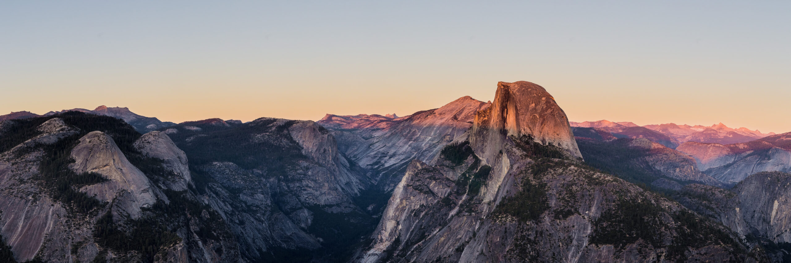
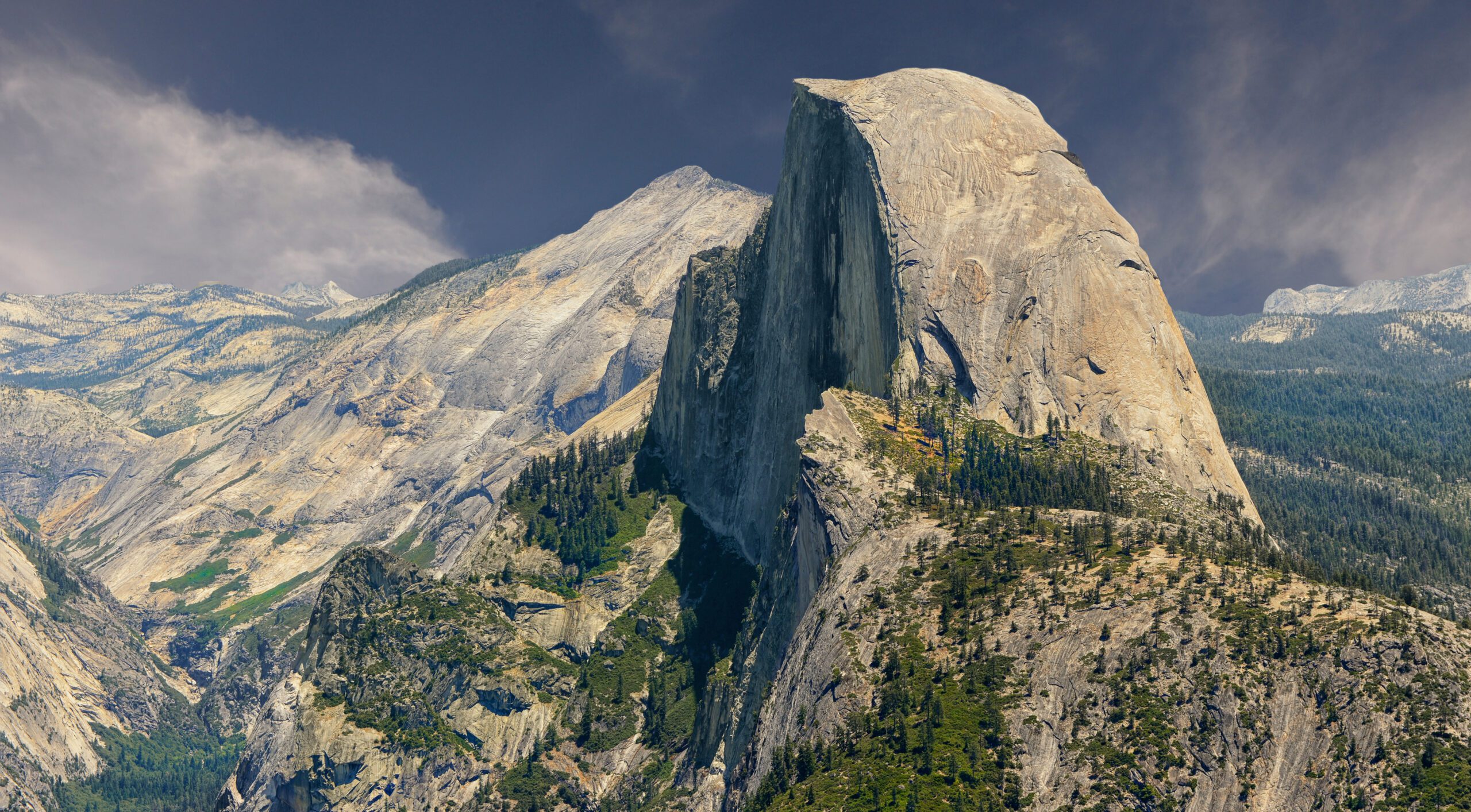
Half Dome: Yosemite’s Granite Icon
Half Dome rises to 8,839 feet (2,694 meters) above Yosemite Valley, its distinctive split granite dome formed by glacial action and exfoliation. Generally, the peak is one of the most photographed mountains on Earth and the visual icon of Yosemite National Park. Specifically, the standard hiking route ascends from the Yosemite Valley floor at approximately 4,000 feet, gaining roughly 4,800 feet over 14-16 miles round trip depending on the specific route variation (Mist Trail via Vernal/Nevada Falls is shorter and more scenic; John Muir Trail is longer with gentler grade).
What makes Half Dome distinctive among California day hikes is the cables section. Generally, the final 400 vertical feet of the ascent climb the steep granite subdome at approximately 45-60 degree angles using two parallel steel cables installed each year from late May through early October. Specifically, the cables make Half Dome the only major California hiking destination where a “hike” includes a section that genuinely feels like climbing — wooden 2×4 cross-boards every 10-15 feet provide foot rests, but the exposure is real and the consequences of a slip are severe. Notably, this combination of accessible hiking (most of the trail) with one focused technical-feeling challenge (the cables) defines the Half Dome experience.
The Half Dome Cables Explained
The Half Dome cables are the most famous feature of any California day hike and the defining challenge of Half Dome. Generally, understanding the cables — how they work, when they’re installed, what they feel like to climb, and how to manage the exposure safely — is essential for anyone planning a Half Dome attempt. Specifically:
What Are the Half Dome Cables?
The Half Dome cables are two parallel steel cables installed up the steep granite face of the Half Dome subdome, allowing hikers to ascend the final 400 feet to the summit without rock climbing equipment. Generally, the cables run from the base of the subdome (approximately 8,440 feet) to the summit plateau (8,839 feet), covering roughly 400 vertical feet at slopes ranging from 45 to 60 degrees. Specifically, the cables are attached to vertical metal poles drilled into the granite at regular intervals, with wooden 2×4 cross-boards laid across the rock every 10-15 feet to provide foot rests against the smooth granite.
When Are the Half Dome Cables Up?
| Period | Cable Status | Hiking Status |
|---|---|---|
| Late May (Memorial Day weekend) | Cables installed | Hiking with cables begins; permit required |
| June – September | Cables up | Peak hiking season |
| Early October (Columbus Day weekend) | Cables removed | Last weekend of cabled hiking |
| October – May | Cables down | Summit access requires technical climbing skills, ropes, harness, gear |
How to Climb the Half Dome Cables Safely
- Wait for dry conditions: Wet or icy granite + cables is extremely dangerous. Never attempt in rain or with storms approaching
- Bring grippy gloves: The cables wear smooth in places; gloves dramatically improve grip security. Many hikers bring gardening gloves or grip-coated work gloves
- Use the two-cable technique: Hold one cable with each hand for stability; do not hold only one cable
- Take regular rest stops: Pause between wooden cross-boards to rest arms and reset grip
- Time your ascent for low traffic: Early morning (before 10 AM) typically has lower cable traffic than midday
- Wait for upward/downward etiquette: Generally, descending hikers have right of way; communicate with hikers in your section
- Turn back if uncomfortable: There is no shame in reaching the cables base and choosing not to ascend
- Never attempt with lightning in the area: Granite and steel cables are dangerous lightning targets
The cables section has been the site of most Half Dome fatalities, with deaths typically occurring in three scenarios. First, wet/storm conditions — hikers attempting the cables in rain or with thunderstorms approaching face dramatically increased fall risk. Second, lightning strikes — granite plus steel cables creates serious lightning danger. Third, falls during descent — descending the cables is often harder than ascending due to fatigue, sun exposure, and the psychological challenge of facing downhill exposure. Notably, the Park Service installed a permit system (in 2010) partly to reduce crowding-related accidents on the cables. Generally, when in doubt about conditions or your readiness, turn back at the cables base — the summit will be there next year.
Can a Beginner Climb Half Dome?
A beginner can climb Half Dome with proper preparation, but “beginner” needs careful definition. Generally, Half Dome is appropriate for hikers who have completed several substantial day hikes (10+ miles with 2,000+ feet of elevation gain) and have basic comfort with elevated trail sections — not for someone whose previous hiking experience is limited to short flat trails. Specifically, the prerequisites for a Half Dome beginner attempt:
- Hiking endurance base: Multiple 10+ mile day hikes with substantial elevation gain completed comfortably in the prior 6-12 months
- Fitness benchmark: Ability to climb 2,000+ feet of stairs or steep trail in 2 hours without exhaustion
- Honest exposure assessment: Comfort with heights or willingness to confront moderate fear; significant acrophobia is genuinely disqualifying
- Equipment readiness: Proper hiking shoes (broken in), trekking poles, layers, sufficient food and water (3-4 liters)
- Permit secured: Half Dome cables permit obtained via Recreation.gov lottery
- Realistic timing: Pre-dawn start (4-6 AM) and willingness to hike 10-14 hours
- Group support: Hiking with experienced companions or a guide is strongly recommended for first-timers
Generally, hikers without prior multi-mile hiking experience should build up to Half Dome with shorter hikes first. Specifically, a typical progression: 6-mile day hikes with 1,500 ft gain (easy day hikes), 10-mile day hikes with 2,500 ft gain (moderate day hikes), 14-16 mile day hikes with 4,000+ ft gain (Half Dome-equivalent training), then Half Dome itself. Notably, attempting Half Dome as a true first big hike is statistically associated with higher abort rates and increased risk on the cables — the energy reserves needed for the cables section come from being comfortable with the approach distance, which requires prior hiking experience.
Detailed Difficulty Comparison
The standard “which is harder” question has different answers depending on which dimension matters most. Generally, both peaks are demanding day hikes that require respect; specifically, here’s how they compare across the difficulty dimensions that matter:
| Difficulty Dimension | Half Dome | Mount Whitney | Winner (Harder) |
|---|---|---|---|
| Distance | 14-16 mi | 22 mi | Whitney (+6 mi) |
| Elevation gain | 4,800 ft | 6,100 ft | Whitney (+1,300 ft) |
| Time on trail | 10-14 hrs | 12-18 hrs | Whitney |
| Altitude challenge | Minimal | Significant | Whitney (decisively) |
| Endurance demand | High | Very high | Whitney |
| Exposure / heights | Severe (cables) | Minimal | Half Dome (decisively) |
| Psychological challenge | High (cables) | Moderate (altitude + endurance) | Half Dome for many |
| Technical demand | Class 3+ on cables | Class 1 throughout | Half Dome |
| Weather window risk | Lightning on cables = severe | Lightning on summit = severe | Tie |
| Fitness barrier | High | Very high | Whitney |
| Permit difficulty | ~30% lottery success | ~30-40% lottery success | Similar |
Altitude Sickness Considerations
Altitude sickness is one of the most important differentiators between Half Dome and Mount Whitney. Generally, Half Dome’s 8,839-foot summit is below the typical AMS clinical threshold of approximately 8,200 feet for sensitive individuals — the vast majority of hikers experience no altitude effects. Specifically, AMS prevalence at Half Dome’s altitude is low (single-digit percentage among unacclimatized visitors), and the brief time at maximum altitude (typically 30-60 minutes on the summit) limits exposure even for sensitive hikers.
Mount Whitney is fundamentally different. Generally, Mount Whitney’s 14,505-foot summit places it in the very high altitude zone where AMS becomes common. Specifically, peer-reviewed studies show approximately 25-50% of unacclimatized hikers experience AMS symptoms (headache, nausea, fatigue, dizziness) at Mount Whitney’s elevation. Notably, more serious altitude illnesses (HAPE, HACE) are rare but possible — there are documented Mount Whitney cases of climbers requiring evacuation for high-altitude pulmonary edema.
Altitude Sickness Pillar Guide → AMS Risk Calculator →For Mount Whitney attempts, spend 1-2 nights at moderate altitude (8,000-10,000 feet) before the hike. Generally, the simple strategy is camping in the Whitney Portal area (8,360 ft) for 1-2 nights before the climb, or spending time at Mammoth Lakes (7,900 ft) or June Lake (7,650 ft) in the days before. Specifically, this pre-acclimatization reduces AMS risk significantly. Notably, climbers can also consider acetazolamide (Diamox) 125mg twice daily starting 24 hours before the climb under physician guidance — particularly for those with prior AMS history. Both strategies are far more effective than trying to power through altitude effects on summit day.
Best Season for Each Peak
| Month | Half Dome Conditions | Mount Whitney Conditions |
|---|---|---|
| January-April | Cables down; only technical climbers | Winter conditions; ice axe/crampons required |
| May | Cables installed late May; high water on Mist Trail | Permit season begins; snow on switchbacks |
| June | Cables up; conditions improving; high water still | Snow conditions on switchbacks; cool temps |
| July | Optimal cables conditions; afternoon thunderstorms | Excellent conditions; afternoon thunderstorms common |
| August | Peak season; crowded; afternoon thunderstorms | Peak season; most stable summit weather |
| September | Excellent conditions; reduced crowds | Excellent conditions; cool nights |
| October | Cables removed early October; brief shoulder season | Permit season ends; early storms possible |
| November-December | Cables down; technical climbers only | Winter mountaineering required |
Gear Requirements
| Gear Item | Half Dome | Mount Whitney |
|---|---|---|
| Hiking boots / shoes | Sturdy hiking shoes | Sturdy hiking boots (more support) |
| Trekking poles | Recommended | Strongly recommended |
| Grippy gloves | REQUIRED (cables) | Not needed |
| Headlamp | Recommended | REQUIRED (pre-dawn start) |
| Sun protection | Hat, sunglasses, sunscreen | CRITICAL (altitude UV exposure) |
| Water capacity | 3-4 liters | 4-5 liters + filter |
| Calories | 2,500-3,500 calories | 3,500-5,000 calories |
| Layers | Light layers; warm layer for summit | Full layers; warm jacket for summit |
| Emergency gear | First aid, emergency blanket | First aid, emergency blanket, satellite messenger |
| Permit | Half Dome permit (printed) | Mount Whitney permit (printed) |
| Bear canister | Required if camping overnight | Required if overnight at Trail Camp |
Which Prepares You for the Other?
Both peaks build skills that transfer, but they emphasize different competencies. Generally:
What Half Dome Teaches That Transfers to Mount Whitney
- Long-day hiking endurance: 10-14 hours of continuous hiking is good preparation for Whitney’s 12-18 hour day
- Big elevation gain comfort: 4,800 ft of vertical builds the legs for Whitney’s 6,100 ft
- Pre-dawn start logistics: Early start, headlamp use, breakfast timing
- Granite trail experience: Both peaks involve substantial granite hiking
- Mental endurance: Pushing through fatigue late in the hike
What Mount Whitney Teaches That Transfers to Half Dome
- Altitude tolerance baseline: If you climbed Whitney, Half Dome’s altitude is trivial
- Long-trail conditioning: 22 miles makes 14-16 miles feel manageable
- Permit lottery experience: Same Recreation.gov system, similar timing
- Higher fitness baseline: Whitney’s demands exceed Half Dome’s; Whitney finishers have Half Dome fitness
What Neither Fully Prepares You For
- Half Dome cables exposure: Nothing on Whitney prepares for this; you confront it directly
- Whitney altitude effects: Nothing on Half Dome prepares for AMS symptoms
Choose Half Dome First If…
- You have minimal altitude experience — Half Dome’s 8,839 ft is below AMS risk threshold
- You’re comfortable with heights and exposure — the cables won’t be a psychological barrier
- You can train for a 14-16 mile day hike — but find 22 miles intimidating
- You live closer to Yosemite (Bay Area, Central CA) — driving is shorter
- You’re drawn to Yosemite Valley specifically — Half Dome is the icon
- You want a “scary but doable” challenge — the cables provide the adrenaline factor
- You can secure a Half Dome permit — preseason lottery March 1-31
- You want the “California classic” experience visually — Half Dome is the more photogenic hike
- You’re at lower-elevation home base — sea level dwellers benefit from skipping altitude
- This is a one-time bucket-list hike — Half Dome is more iconic as a singular objective
Choose Mount Whitney First If…
- You have significant fear of heights — Whitney’s Class 1 trail has minimal exposure
- You have altitude experience — past 12,000+ ft hikes mean Whitney is achievable
- You’re working on the 50 State Highpoints — Mount Whitney is California’s state highpoint
- You’re collecting Lower 48 14ers — Whitney is one of the most popular
- You can train for 22-mile days — distance is the primary challenge
- You live closer to Eastern Sierra (LA, Vegas) — driving is shorter
- You want the highest peak in the Lower 48 specifically — Whitney offers this distinction
- You prefer endurance challenges over technical challenges — Whitney rewards conditioning
- You’re considering future technical mountaineering — Whitney is a stepping stone to Rainier, Hood, etc.
- You can secure a Mount Whitney permit — preseason lottery February 1 – March 15
Common Mistakes on Both Hikes
(1) Starting too late — both hikes require pre-dawn starts; mid-morning starts leave you in the dark or in thunderstorms. (2) Inadequate water — both hikes require 3-5 liters; running out in summer heat is dangerous. (3) Underestimating Mount Whitney altitude — fit hikers regularly fail at Whitney’s altitude despite excellent endurance. (4) Half Dome cables in wet conditions — the leading fatality factor on Half Dome; never attempt in rain or storms. (5) No grippy gloves on Half Dome cables — bare hands lose grip rapidly; gardening gloves dramatically improve safety. (6) Wrong shoes — both hikes destroy trail runners and casual hiking shoes; sturdy hiking boots needed for Whitney especially. (7) Insufficient calorie intake — long-day hikes burn 3,500-5,000 calories; eating enough during the hike prevents bonking. (8) Skipping the Mount Whitney permit lottery and trying walk-up — walk-ups are extremely rare; plan ahead. (9) Hiking solo without communication — both hikes are in cell-dead zones for portions; satellite messenger or trip leader notification essential. (10) Ignoring weather forecasts — afternoon thunderstorms on either peak’s exposed sections are deadly; weather assessment is essential.
California Big Hike Progression
For hikers building toward both peaks (or considering them as part of broader California hiking development), here’s a typical progression pathway:
| Stage | Suggested Hikes | Why |
|---|---|---|
| Stage 1: Foundation | 6-8 mile day hikes with 1,500-2,500 ft gain | Basic hiking endurance and gear comfort |
| Stage 2: Build distance | 10-12 mile day hikes with 2,500-3,500 ft gain | Build to half-day hiking duration |
| Stage 3: Half Dome equivalent training | 14-16 mile day hikes with 4,000+ ft gain (Mt Tallac, San Jacinto, Cucamonga Peak) | Build to Half Dome distance |
| Stage 4: Altitude introduction | San Gorgonio (11,503 ft), San Jacinto Peak (10,834 ft) | Build altitude tolerance before Whitney |
| Stage 5: Half Dome | Half Dome via Mist Trail or JMT | First big iconic California day hike |
| Stage 6: Whitney altitude preparation | White Mountain Peak (14,252 ft) as practice 14er | Test altitude tolerance at 14er elevation |
| Stage 7: Mount Whitney | Mount Whitney via Mt Whitney Trail | Lower 48 highpoint |
| Stage 8: Mountaineering progression | Mount Rainier, Orizaba | Move from hiking to mountaineering |
Frequently Asked Questions About Half Dome vs Mount Whitney
Which is harder, Half Dome or Mount Whitney?
The answer depends on which type of difficulty matters most to you. Mount Whitney is harder overall because of its much higher elevation (14,505 ft vs 8,839 ft), longer distance (22 miles vs 14-16 miles), greater elevation gain (6,100 ft vs 4,800 ft), and altitude sickness risk above 12,000 feet. However, Half Dome is harder for hikers afraid of heights because of the famous cables section — a 400-foot near-vertical climb up exposed granite using steel cables that is genuinely intimidating regardless of altitude. Half Dome is a more technical hike (Class 3+ on the cables) while Mount Whitney is essentially a long Class 1 trail hike with altitude as its primary difficulty. Hikers without altitude experience often find Mount Whitney harder; hikers afraid of heights find Half Dome harder.
How long does it take to hike Mount Whitney?
Most hikers take 12-18 hours to hike Mount Whitney as a day hike via the standard Mount Whitney Trail from Whitney Portal, covering 22 miles round trip with 6,100 feet of elevation gain. Fit hikers in good condition typically complete the round trip in 12-14 hours; average fit hikers take 15-18 hours; less-conditioned hikers may take 18+ hours and risk being on the trail in darkness. The typical day-hike timing is approximately 3-4 hours from Whitney Portal to Outpost Camp, 2-3 hours from Outpost Camp to Trail Camp, 3-4 hours from Trail Camp through the 99 switchbacks to the summit, and 5-7 hours back down. Most successful day hikes start between 2-4 AM to ensure summit by mid-morning and complete descent by sunset.
Is Mount Whitney difficult to climb?
Yes, Mount Whitney is difficult to climb — but it is a hike, not a technical climb on the standard route. The difficulty comes from three factors combining: extreme distance (22 miles), substantial elevation gain (6,100 feet), and high altitude (14,505 feet summit). Mount Whitney is rated Class 1 — the standard Mount Whitney Trail is a non-technical walking path with no scrambling, no exposed sections requiring hands, and no rope or technical gear needed. What makes it genuinely hard is the cumulative challenge over 12-18 hours: distance, elevation gain, altitude effects above 12,000 feet, sun exposure, weather windows, and mental endurance. Approximately 65-75% of permitted day hikers reach the summit; the rest turn back at Trail Camp or Trail Crest.
How do you get Mount Whitney permits?
Mount Whitney permits are required May 1 through November 1 and are distributed via a Recreation.gov preseason lottery running February 1 through March 15 each year. The application fee is $6, and if awarded, the reservation fee is $15 per person. Daily quotas are 100 day hike permits and 60 overnight permits. Typical success rates are 25-40% for popular weekend dates in July-August, and 60-80% for off-peak weekday dates. Lottery results are announced in late March. Unclaimed permits and cancellations are released through Recreation.gov throughout the season. Walk-up permits at the Eastern Sierra Interagency Visitor Center in Lone Pine are rare but possible for last-minute cancellations.
Should I do Half Dome or Mount Whitney first?
Most hikers should do Half Dome first if choosing between them. Half Dome is shorter (14-16 miles vs 22 miles), at lower elevation (8,839 ft vs 14,505 ft), and presents one specific challenge (the cables section) that you can mentally prepare for. Completing Half Dome builds the long-day-hike endurance, big-elevation-gain experience, and granite exposure familiarity that transfer to Mount Whitney. The exception is for hikers with significant fear of heights — for them, Mount Whitney (a non-exposed Class 1 trail) is the better first big hike, and altitude conditioning can be addressed through pre-hike acclimatization. Both peaks require Recreation.gov lottery permits so plan applications 6+ months ahead.
Can a beginner climb Half Dome?
A beginner can climb Half Dome with proper preparation, but “beginner” needs careful definition. Half Dome is appropriate for hikers who have completed several substantial day hikes (10+ miles with 2,000+ feet of elevation gain) and have basic comfort with elevated trail sections — not for someone whose previous hiking experience is limited to short flat trails. Prerequisites for a Half Dome beginner attempt include: multiple 10+ mile day hikes completed in prior 6-12 months, fitness to climb 2,000+ feet in 2 hours without exhaustion, honest assessment of comfort with heights (significant acrophobia is disqualifying), proper gear (broken-in boots, trekking poles, layers, 3-4 liters water), a secured permit, and a 4-6 AM pre-dawn start. Hiking with experienced companions or a guide is strongly recommended for first-timers.
What are the Half Dome cables and are they dangerous?
The Half Dome cables are two parallel steel cables installed on the final 400 feet of the Half Dome ascent, allowing hikers to climb the steep granite subdome (45-60 degree slope) by gripping the cables. The cables are installed from late May through early October each year and are removed in winter. Wooden 2×4 boards across the granite provide foot rest points every 10-15 feet. The cables section is the defining challenge of Half Dome — hundreds of feet of exposed granite with significant fall consequences. Fatalities occur on the cables most years, typically when hikers attempt the cables in wet/lightning conditions or with inadequate grip. Recommendations: skip the cables in any wet conditions, bring gloves for grip, do not attempt with any lightning in the area, and turn back if uncomfortable with the exposure.
When are the Half Dome cables up?
The Half Dome cables are typically installed Memorial Day weekend (late May) and removed Columbus Day weekend (early October) each year, weather and conditions permitting. During this window — approximately late May through early October — hikers can use the cables to ascend the final 400 feet to the summit. Outside this window, the cables are removed and the summit can only be reached by technical climbing routes requiring ropes, harness, and rock climbing skills. The exact installation and removal dates vary year to year based on weather and Park Service decisions. Even when cables are installed, they should not be attempted in wet, snowy, or lightning conditions. The peak hiking season with cables is July-September when weather is most stable.
Do you need permits for both Half Dome and Mount Whitney?
Yes, both Half Dome and Mount Whitney require permits via Recreation.gov, both use lottery systems, and both are separate application processes. Half Dome permits: preseason lottery March 1-31 for the May-October season, $10 application fee, $10 reservation fee per person if awarded, daily quota approximately 225 day hikers + 75 backpacker permits. Mount Whitney permits: preseason lottery February 1 through March 15 for the May 1 – November 1 season, $6 application fee, $15 reservation fee per person if awarded, daily quota 100 day hikers + 60 overnighters. Both lotteries are competitive — apply early and have flexible date ranges to improve odds. Both also have last-minute releases of unclaimed permits and cancellations throughout the season.
Which is more scenic, Half Dome or Mount Whitney?
Both peaks offer spectacular scenery but in different ways. Half Dome’s scenery centers on the iconic Yosemite Valley views: the Mist Trail past Vernal Falls and Nevada Falls, the views back into the valley from the cables section, and the famous summit views over Yosemite Valley with El Capitan, Cathedral Rocks, and the Sierra in the distance. Mount Whitney’s scenery emphasizes high-alpine character: the dramatic Eastern Sierra escarpment, the famous views from the summit at 14,505 feet showing the Owens Valley to the east and the Great Western Divide to the west, and the alpine landscapes of Trail Camp basin. The photographic icon factor favors Half Dome (one of the most photographed mountains on Earth), while the alpine vastness factor favors Mount Whitney. Many California hikers eventually do both peaks specifically because they offer such different but complementary scenic experiences.
Methodology & Editorial Standards
How This Comparison Was Built
1. Editorial Approach: Research-Based Comparison
This Half Dome vs Mount Whitney comparison is built on extensive cross-referenced research rather than personal first-hand ascent. Neither peak is in our editorial team’s direct hiking experience to date — both are objectives outside the peaks we have personally climbed. Our team’s direct hiking and mountaineering experience includes Mount Kilimanjaro, Pico de Orizaba, Iztaccíhuatl, Mount Rainier-class peaks, and Utah peaks including Kings Peak.
2. Yosemite Half Dome Data: National Park Service
Half Dome statistics including permit quotas, trail conditions, cables installation dates, and fatality data are sourced from the Yosemite National Park Service official information for Half Dome.
3. Mount Whitney Data: USFS Inyo National Forest
Mount Whitney statistics including permit quotas, trail conditions, and seasonal data are sourced from the Inyo National Forest management of the Mount Whitney Trail and Sequoia National Park summit area.
4. Permit System: Recreation.gov
Permit application details, fee structures, and lottery timing are sourced from Recreation.gov — the federal permit reservation system for both peaks.
5. Editorial Independence
No affiliate partnerships with guide services, tour operators, or gear brands influence recommendations. Cost ranges and operational details are presented from public information. The article generates revenue only through Google AdSense display ads when applicable.
6. Update Cycle
This comparison is reviewed quarterly. Next scheduled review: September 2026. Permit fees, lottery dates, and quota allocations change year to year; verify current information with Recreation.gov and the National Park Service before applying.
Sources and References
Numbered Source References
This Half Dome vs Mount Whitney comparison synthesizes data from authoritative U.S. land management sources and established hiking community resources.
- Yosemite National Park Service · https://www.nps.gov/yose/ — Half Dome trail information, permit data, safety statistics.
- Inyo National Forest · https://www.fs.usda.gov/inyo — Mount Whitney Trail management.
- Sequoia National Park · https://www.nps.gov/seki/ — Mount Whitney summit area within park boundary.
- Recreation.gov · https://www.recreation.gov/ — Federal permit reservation system for both peaks.
- U.S. Geological Survey · Elevation data and topographic mapping for both peaks.
- Sierra Club · Trip reports and historical hiking data for California peaks.
- American Alpine Club · American Alpine Journal expedition reports.
- California State Parks · Sierra Nevada hiking resources.
- Wilderness Medical Society · 2024 altitude sickness consensus guidelines.
- Global Summit Guide internal research — Cross-referenced from existing state highpoints coverage, altitude pillar, and Cascade Volcanoes hub.
Methodology note. Quarterly review cycle — next review September 2026. Permit fees, lottery dates, and trail conditions update annually; verify current information with Recreation.gov and the National Park Service before trip planning.
About the Author
Continue Your California Hiking Research
Plan Your California Big Day Hike
Half Dome and Mount Whitney are two of the most rewarding day hikes in North America — both demand respect and preparation, but both are achievable for motivated hikers willing to do the conditioning work and navigate the permit lottery. Generally, most hikers benefit from starting with Half Dome (shorter, lower altitude, more iconic) and progressing to Mount Whitney as their fitness and altitude experience grow. Specifically, the most important next step is securing your permit — both lotteries open early in the year and miss-it-by-a-week timing is the most common reason hikers postpone their first big California hike.
Recreation.gov Permit System → Altitude Prep for Whitney →