Mount Hood expedition update
One of the most-climbed glaciated peaks on the continent, and one of the most underestimated. This page tracks the new year-round permit, the South Side hazards, why it is a spring climb with a midnight start, and a go or no-go checklist. A single-mountain page in our Expedition Updates directory. Heights in feet (metres).
An accessible mountain is not the same as an easy one.
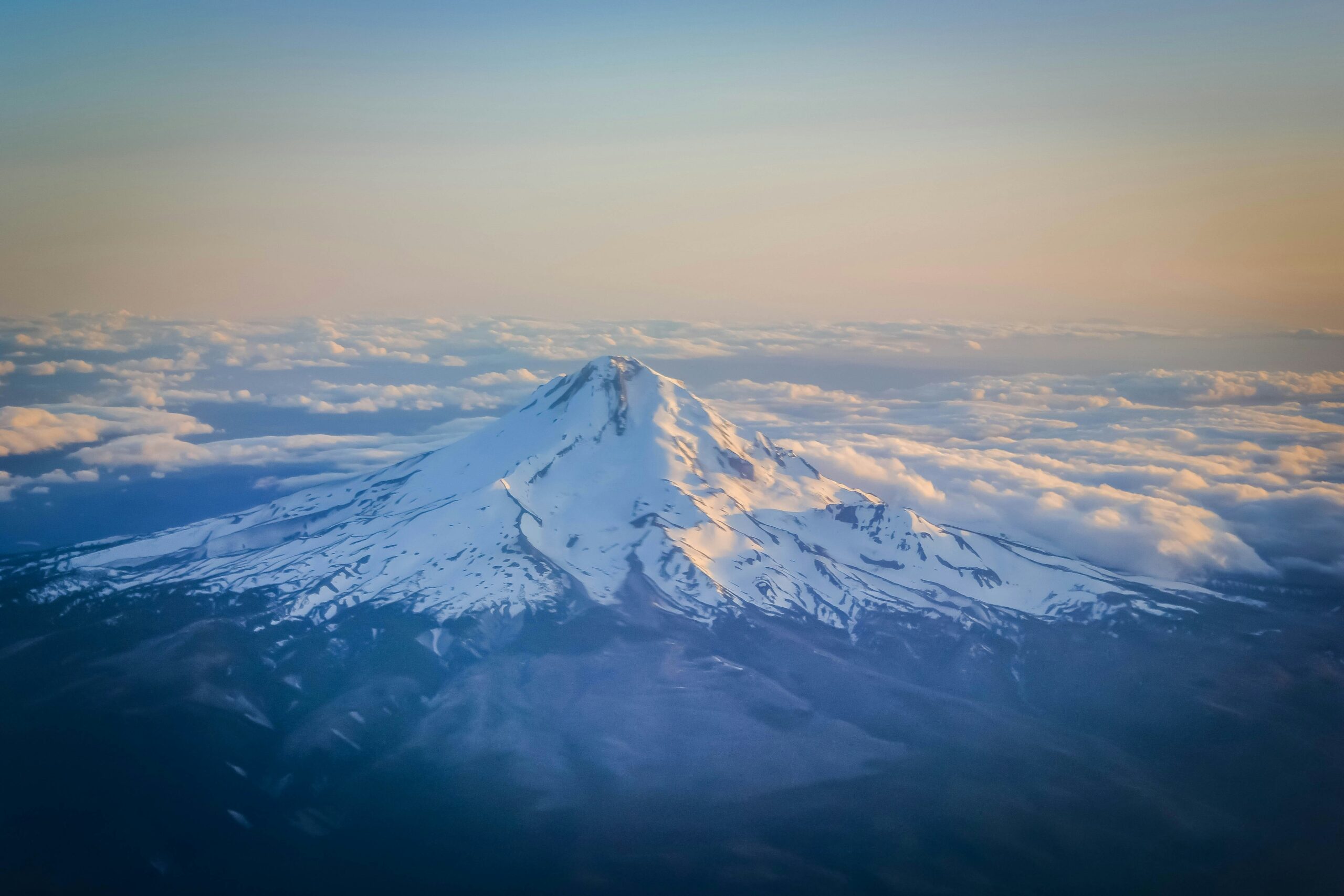
Mount Hood is Oregon’s highest peak and one of the most-climbed glaciated volcanoes in North America, an hour from Portland with a lodge at 6,000 feet. That accessibility is exactly why it is so underestimated: it is a real technical snow climb, with steep icy chutes, a crevasse below the summit, toxic fumaroles, rockfall, and fast weather, and it has a serious accident record.
Two current-state points matter most. A climbing permit is now required year-round above 9,500 feet, and Hood is a spring climb with a near-midnight start, not a summer stroll. For the full route detail, see our Mount Hood climb guide.
Summit (3,429 m)
Oregon’s highest; a glaciated Cascade volcano.
Prime season
A spring climb, not a summer one.
Above 9,500 ft
New year-round; $20 for 3 days or $50 a year.
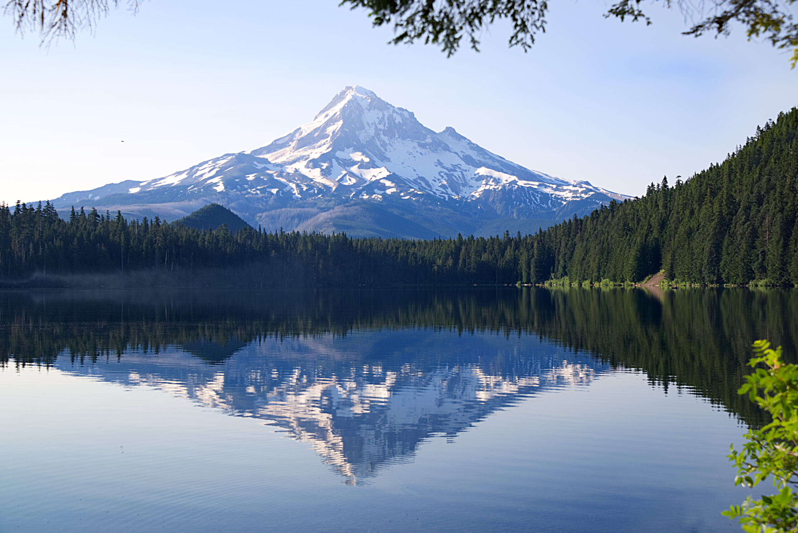
Mount Hood is a potentially active stratovolcano with eleven named glaciers, about 50 miles east-southeast of Portland, monitored by the USGS. Its standard South Side route from Timberline Lodge is short and non-technical by alpine standards, which draws thousands of climbers a year, from first-timers to those training for bigger peaks. This page owns the current picture, the permit, the timing, and the honest hazards. For the full South Side route, the Pearly Gates and Old Chute variations, gear, and guide companies, see our Mount Hood climb guide.
Season and status
A spring snow climb, best before summer melts it out.
Mount Hood is climbed year-round, but the prime window is roughly May to early July, with early May to late June the best for solid snow and ice. It is a spring mountain: by mid-summer the snow melts back, rockfall picks up, and the summit chutes can turn to bare ice or loose rock. The mountain is open and busy through the season, with the main current change being the year-round climbing permit now required above 9,500 feet. Whatever the month, conditions on the upper mountain shift from year to year, so current information matters more than any fixed description.
Most-climbed, most-underestimated
The gap between how it looks and what it is.
Few big mountains are as easy to reach as Mount Hood. A paved road runs to Timberline Lodge at 6,000 feet, the standard route is under three miles to the summit, and the peak sits an hour from a major city, so it draws thousands of climbers a year and a reputation as a walk-up. The reputation is misleading. Above the Hogsback the route steepens into snow and ice chutes of 35 to 45 degrees with serious exposure, past a crevasse and active fumaroles, and the weather can turn from clear to whiteout in an hour. Hood has a long accident and fatality record, and most of it comes down to climbers treating an accessible mountain as an easy one.
The new year-round permit
The current-state change many climbers have missed.
Mount Hood used to be a free self-registration. It is not anymore. A Mount Hood Climbing Permit is now required year-round for all travel above 9,500 feet, bought on Recreation.gov, and on the South Side route the three-day permit doubles as the required wilderness permit. There is also a new free uphill travel pass for moving within the Timberline ski area. It is a small cost, but an easy one to overlook, and rangers do check.
| Item | Cost | Notes |
|---|---|---|
| Climbing Permit, 3-day | $20 | Required above 9,500 ft, year-round, via Recreation.gov; on the South Side it also serves as the wilderness permit. |
| Climbing Permit, annual | $50 | Annual holders complete the wilderness permit requirement separately. |
| Timberline uphill travel pass | Free | New for the 2025/2026 winter season, for travel within the ski area. |
| Parking | Sno-Park or NW Forest Pass | Seasonal, for the Timberline Lodge lot. |
The South Side hazards
Three things the upper mountain will test you on.
The Devil’s Kitchen fumaroles, on the upper mountain, vent toxic, oxygen-depleting gas, and climbers have fallen into them; move through quickly and do not linger or breathe the fumes. The Bergschrund, a large crevasse below the summit headwall, must be crossed, and its snow bridges weaken and collapse as the day warms. Above it, the Pearly Gates and Old Chute finishes are steep snow or ice at 35 to 45 degrees, exposed to rock and ice fall from the buttresses above.
The choice between the two chutes is made on the mountain from the day’s conditions, and either can be bare ice in a lean year. Wear a helmet, move fast through the fall zones, keep spacing so you do not endanger climbers below, and watch for the summit cornice on the far side. Our climb guide covers the variations in detail. This page is educational and is not a substitute for training.
Timing and the alpine start
Why you leave the lodge near midnight.
The single most important tactic on Mount Hood is the early start, closer to midnight than to dawn. The mountain grows more dangerous as it warms: the sun loosens rock in the chutes above the Hogsback, softens the snow, and weakens the snow bridges over the Bergschrund. A midnight or 1am departure lets a party climb and descend the hazardous upper sections while everything is still frozen, and the standard advice is to be clear of the rockfall zones by around 10am. Climbing late, or lingering on the summit into a warm afternoon, is how people get hurt.
Difficulty and the Cascades progression
A fine first glaciated peak, with a warning attached.
Mount Hood is often a climber’s first glaciated summit, and it is a good one for it: short, accessible, and a real introduction to steep snow, crampon work, and glacier hazards. But it belongs in the same conversation as Mount Baker and Mount Rainier, not below them, because its hazards are real and its accident record is long. Many climbers use it alongside Mount Baker to build glacier skills before the bigger commitment of Mount Rainier. Test your base against our fitness standards, and brush up on glacier travel and avalanche awareness before you go.
Weather and timing
A mountain that makes its own fast weather.
Mount Hood builds cloud and storm quickly, and whiteouts on the featureless upper snowfields have led climbers astray on descent, a factor in some of its worst accidents. A settled, clear forecast and a hard turnaround time matter as much as fitness. The live map below shows current conditions; rely on a mountain forecast and current route reports for the summit-day call.
Go or no-go checklist
Work through these before you go.
Before you go
- Buy the climbing permit – it is required year-round above 9,500 ft; get it on Recreation.gov before you leave.
- Time it for spring – May to June is prime; summer melts the route out and raises rockfall.
- Start near midnight – be off the rockfall zones and across the Bergschrund by mid-morning.
- Carry axe, crampons, and helmet – all are effectively mandatory on the upper mountain.
- Avoid the fumaroles – do not linger in or breathe the Devil’s Kitchen gases.
- Respect the weather – whiteouts on descent have killed here; set a hard turnaround time.
Cascades expedition updates
Mount Hood’s neighbours across the range, each with its own update page. Back to the full Expedition Updates dashboard.
Mount Hood update FAQ
The questions climbers ask most about the permit, the hazards, and the timing.
Do you need a permit to climb Mount Hood?
Yes, and the rule is recent. A Mount Hood Climbing Permit is now required year-round for all travel above 9,500 feet, costing $20 for three days or $50 for an annual pass, bought on Recreation.gov. On the South Side route the three-day permit also serves as the required wilderness permit, while annual holders complete the wilderness permit separately. There is also a new free uphill travel pass for the Timberline ski area. Confirm the current rules before you go, as they have changed from the old free self-registration.
How hard is it to climb Mount Hood?
It is a technical snow climb, not a hike. The standard South Side route gains about 5,000 feet from Timberline Lodge and finishes with steep snow or ice chutes of 35 to 45 degrees with serious exposure, on top of glacier hazards, volcanic fumaroles, and rockfall. An ice axe, crampons, and a helmet are mandatory. It suits climbers with basic mountaineering skills and is often a first glaciated peak, but its accessibility leads many people to underestimate it.
Why is Mount Hood dangerous if it is so popular?
Because accessibility and difficulty are not the same thing. Hood is one of the most-climbed glaciated volcanoes in North America, an hour from Portland with a lodge at 6,000 feet, so many people arrive treating it as an easy day. The upper mountain, though, has real hazards, the Bergschrund, the fumaroles, steep icy chutes, rockfall, and fast-moving weather, and it carries a serious accident and fatality record. The danger on Hood is underestimating it.
What are the main hazards on the South Side route?
Three stand out. The Devil’s Kitchen fumaroles emit toxic, oxygen-depleting gas, and climbers have fallen into them. The Bergschrund is a large crevasse below the summit headwall whose snow bridges collapse as the day warms. And the Pearly Gates and Old Chute finishes are steep snow or ice with rock and ice fall from above. The choice between the two chutes is made on the mountain according to the day’s conditions.
When is the best time to climb Mount Hood?
Roughly May to early July, with early May to late June the prime window for solid snow and ice. It is a spring climb, not a summer one. By mid-summer the route melts out, rockfall increases, and the chutes can turn to bare ice or rock. Whatever the date, start extremely early, closer to midnight than dawn, to be off the rockfall zones by around 10am while the mountain is still frozen.
Why do you start so early on Mount Hood?
Because the mountain grows more dangerous as the day warms. The sun loosens rock in the chutes above the Hogsback, softens the snow underfoot, and weakens the snow bridges over the Bergschrund. A midnight or 1am start lets a party climb and descend the hazardous upper sections while everything is still frozen and stable, which is why the standard advice is to be clear of the rockfall zones by mid-morning.
Pearly Gates or Old Chute, which finish should I take?
Both are steep snow or ice at 35 to 45 degrees, and the choice is made on the day from conditions rather than in advance. The Pearly Gates is the most direct line but can be a wall of ice, or congested with other climbers; the Old Chute is the common alternative when the Gates are in poor shape. Either way you must navigate around the Bergschrund. Our Mount Hood climb guide covers the route and the variations in full.
How high is Mount Hood and where is it?
Mount Hood is 11,249 feet (3,429 m), the highest mountain in Oregon, a glaciated and potentially active Cascade stratovolcano about 50 miles east-southeast of Portland. It has eleven named glaciers and perennial snowfields, and it is monitored by the USGS as a potentially active volcano, with the Devil’s Kitchen fumaroles a visible reminder of the heat still beneath it.
📋 How this update is built
This page is compiled by Travis Ludlow, Founder and Head of Research at Global Summit Guide, from US Forest Service and Recreation.gov permit rules, Mazamas and Mountaineers route information, and USGS volcano monitoring, with sources named below. It was reviewed for safety by Dawson Ludlow, our Climbing and Mountaineering Lead (Wilderness First Aid), whose highest first-hand summit is Kilimanjaro.
Our team has not climbed Mount Hood, so we report official rules and route information rather than personal experience, and we review this page for the spring climbing season. Permit rules and route conditions change from year to year, so confirm the current requirements on Recreation.gov and check recent route reports before you go.
Sources and further reading
- US Forest Service and Recreation.gov – the year-round Mount Hood Climbing Permit and wilderness permit.
- The Mazamas and The Mountaineers – South Side route and seasonal conditions.
- USGS Cascades Volcano Observatory – Mount Hood volcanic monitoring and the fumaroles.
- Our own Mount Hood climb guide.
- We report official rules and route information; our team has not climbed Mount Hood.
Planning a Mount Hood climb?
Start with our Mount Hood climb guide for the full route and gear, build glacier skills alongside our Mount Baker and Mount Rainier updates, and choose a team in the operator directory. Most climbers stage through Portland, so for flights and lodging, browse travel on Expedia.
Disclosure: the Expedia link above is a sponsored affiliate link. We may earn a commission at no extra cost to you.