
Last updated September 18, 2026
Climbing Jebel Toubkal, Morocco: The Complete Guide
North Africa’s highest peak is one of the most accessible big mountains in the world — a non-technical two-to-three-day trek from a Berber village a couple of hours from Marrakesh. But since 2018 you can’t climb it alone: a guide is mandatory, and it’s checked at police posts along the way. Here’s how it works.
Jebel Toubkal (4,167 m) is the highest mountain in North Africa and one of the easiest major peaks to reach — a fit hiker’s summit, non-technical in summer, done in 2–3 days from the village of Imlil. Fly into Marrakesh, drive up, and you can be on top within a long weekend.
The one rule you must plan around: since 2019 a licensed local guide is mandatory on the Imlil–Toubkal trail, enforced at police checkpoints. You cannot legally climb the standard route independently. Hire a guide in Imlil, allow a day to acclimatize if you can, and save winter (snow and ice) for experienced mountaineers.
On this page
Where it is & the approach
High Atlas, a couple of hours south of Marrakesh — everything starts at Imlil.
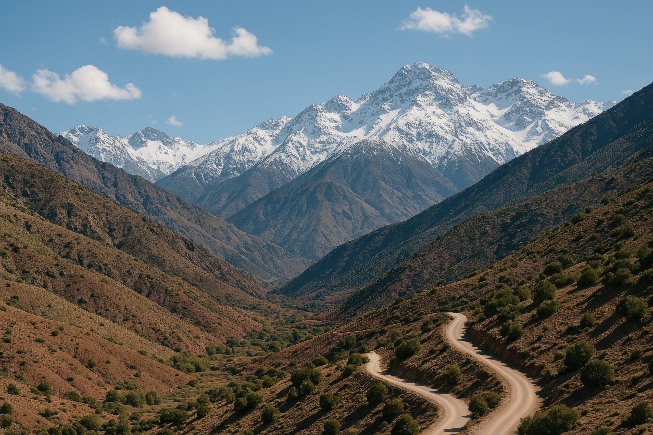
Jebel Toubkal sits in the High Atlas of southern Morocco, about 63 km south of Marrakesh in Toubkal National Park. Every ascent begins at the Berber village of Imlil (~1,740 m), reached in roughly 1.5–2 hours by grand taxi or private car from the city. From Imlil the trail climbs the Ait Mizane valley through Aroumd and the Sidi Chamarouch shrine to the Toubkal refuges (~3,207 m), then up scree to the summit.
The mountain, in brief
A giant with a gentle route and a fierce summit.
At 4,167 m (13,671 ft), Toubkal is the highest point in North Africa, in Morocco, in the entire Atlas range, and in the Arab world — with no higher ground for more than 2,000 km in any direction, which makes it one of the most isolated major peaks on the planet. Locally it’s Adrar Toubkal in the Berber (Tamazight) language. It anchors a cluster of 4,000-metre neighbours — Ouanoukrim, Timesguida, Ras, and Afella — all visible from the top.
What draws climbers is the rare mix of real altitude and easy access. The standard route is a walk-up in summer, yet the summit sits high enough that thin air and cold are serious factors. On a clear day the view stretches from the Marrakesh plain to the edge of the Sahara. And the approach threads authentic High Atlas villages, mule trains, and mint-tea stops — a cultural trek as much as a peak.
The mandatory-guide rule
The single most important thing to know before you book.
Since 2019, following the December 2018 murder of two young hikers near Imlil, Morocco has required every foreign climber on the Imlil–Toubkal trail to be accompanied by a licensed local guide. This is enforced, not nominal. Gendarmerie Royal checkpoints — typically just outside Aroumd, at Sidi Chamarouch, and at the Toubkal refuge — check your passport and your guide’s credentials. Without a guide, you’re turned back.
The rule is both a safety measure — a visible police presence and accounted-for trekkers — and economic support for the Berber guiding community that the Imlil valley depends on. It only applies to the Toubkal ascent itself; many lower Atlas trails elsewhere remain open to independent walkers.
The routes
One standard climb, plus a long circuit and a winter version.
The Imlil Normal Route
About nine in ten climbers take this line. From Imlil (1,740 m) the trail climbs the Ait Mizane valley through Aroumd and the Sidi Chamarouch shrine to the Toubkal refuges at ~3,207 m, where you overnight. A pre-dawn summit day climbs scree in the south cirque to the summit ridge and the 4,167 m top, then reverses all the way down — often back to Imlil the same day. No ropes or crampons in summer, but the ascent is long and the altitude is real.
The Toubkal Circuit (5–7 days)
One of the finest multi-day treks in Africa: a loop through several Atlas valleys and high passes with the Toubkal summit folded in, staying at Berber village guesthouses (gîtes) and mountain refuges. It trades the quick summit hit for scenery, culture, and better acclimatization. A common line runs Imlil → Tacheddirt → Likemt Pass → Azib Likemt → Lac d’Ifni → refuges → summit → Imlil.
Winter mountaineering (Nov–April)
The same Imlil line becomes a true winter climb once snow arrives. The upper scree turns to snow and ice, the summit ridge can be verglassed, and temperatures with wind chill drop far below zero. It demands crampons, an ice axe, self-arrest skill, and a winter-experienced guide who can read avalanche conditions. January–February hold the deepest snow; December and March are often mixed.
The approach, waypoint by waypoint
| Imlil | ~1,740 m · trailhead · hire guide, start |
| Aroumd | ~1,900 m · village · first checkpoint |
| Sidi Chamarouch | ~2,310 m · shrine + tea stalls · checkpoint |
| Refuge du Toubkal / Les Mouflons | ~3,207 m · overnight · checkpoint |
| Summit | 4,167 m · the top of North Africa |
Day-by-day itinerary
The classic two-day climb — with a strong case for adding a third.
Day 1 — Imlil to the refuge (~11 km, ~1,460 m up, 4–5 hrs)
Leave Imlil late morning, climb through Aroumd and the walnut groves to Sidi Chamarouch (mint-tea break), then up increasingly alpine terrain to the Toubkal refuges (~3,207 m). Passports checked at the Aroumd and Sidi Chamarouch posts. Dinner and an early night at the refuge.
Day 2 — Summit & descent (9–12 hrs)
Pre-dawn start (~04:30) by headlamp up the south cirque scree, reaching the summit ridge and the 4,167 m top in roughly 3–4 hours. Cold and very windy even in summer, so keep it short. Descend to the refuge, then continue all the way to Imlil the same day if you have the legs.
Optional Day 3 — Acclimatize / recover
Adding a night — either an extra day at altitude before summiting, or an overnight at the refuge after the top — cuts the risk of altitude sickness that catches people who rush from Marrakesh (~500 m) to the refuge in one push. If your schedule allows, take the three-day version.
7-day mountain weather
Live forecast for the Toubkal summit area — updates automatically.
High Atlas weather is settled through summer but can turn fast in the shoulder seasons, and afternoon cloud and wind build most days. Aim to summit early. The live forecast below refreshes each time the page loads.
Jebel Toubkal area — 7-day forecast
Loading live data…What it costs in 2026
One of the most affordable major peaks anywhere.
| Option | Days | 2026 price (per person) | Includes |
|---|---|---|---|
| Standard climb (group of 2–4) | 2–3 | $200–$350 | Mandatory guide, mule support, refuge, meals, Marrakesh logistics |
| Solo climber | 2–3 | $350–$500 | Full guide cost without group cost-sharing |
| Premium / certified guide | 2–3 | $400–$700 | Higher-quality guide, smaller group, upgraded arrangements |
| Toubkal Circuit | 5–7 | $500–$1,200 | Extended trek, village stays, muleteer support |
| Winter climb | 2–3 | $350–$700 | Winter-experienced guide, equipment guidance |
A full trip including flights to Marrakesh typically lands around $800–$2,500, and a European long weekend can be done for $500–$1,200 on budget flights. That’s a fraction of a guided Kilimanjaro ($2,800–$6,500+) for real 4,000-metre altitude. Bring cash in Moroccan dirham for tips, refuge extras, and tea stalls — card acceptance in Imlil is limited — and budget a tip for your guide and muleteers.
When to climb
A long, forgiving summer season — and a serious winter.
| Window | Conditions | Verdict |
|---|---|---|
| Jun–Sep | Warm, dry, snow-free trail; reliable summit views; busiest | Peak season |
| May & Oct | Mild, quieter; some lingering or early snow up high | Excellent |
| April & Nov | Transition; variable, possible snow on the upper mountain | Shoulder |
| Dec–Mar | Full snow and ice; crampons, axe, avalanche awareness | Winter climb |
July and August bring the most stable weather but also the biggest crowds and real heat in the valley — the summit itself stays cold. Whatever the month, afternoon cloud and wind tend to build, so the pre-dawn start isn’t just tradition; it’s how you get the view and stay ahead of the weather.
What to bring
Modest in summer, mountaineering kit in winter.
Summer Toubkal needs no technical equipment — just solid hiking gear for big temperature swings between the hot valley and the frozen summit. Mules carry your overnight bag to the refuge, so you climb with a light daypack.
- Broken-in hiking boots or trail shoes + trekking poles for the scree descent.
- Layers — base layer, fleece or light insulated jacket, and a windproof/waterproof shell; a warm hat and gloves for the summit.
- Sun protection — high-SPF sunscreen, lip balm, sunglasses; the UV at altitude is fierce.
- 3 litres of water plus purification, and energy snacks — resupply is limited above the refuge.
- Headlamp (essential for the pre-dawn start), sleeping-bag liner for the refuge, passport for the checkpoints, and cash in dirham.
Frequently asked questions
How high is Jebel Toubkal?
4,167 m (13,671 ft) — the highest mountain in North Africa, Morocco, the Atlas range, and the Arab world, with no higher ground for over 2,000 km, making it one of Earth’s most isolated peaks.
Do you need a guide?
Yes. Since 2019 a licensed local guide is mandatory on the Imlil–Toubkal trail, checked at police posts (Aroumd, Sidi Chamarouch, the refuge). You can’t legally climb the standard route alone. Hire in Imlil via the Bureau des Guides or an operator (~€50/day; two guides for groups of 6+).
How long does it take?
2–3 days from Imlil: a half-day to the refuge, then a pre-dawn summit day. The 3-day version adds acclimatization and is safer. The 6-day Toubkal Circuit extends the trip through the wider massif.
How much does it cost in 2026?
Roughly $200–$500 per person for a guided 2–3 day climb including guide, mule, refuge, and meals; the official guide rate is about €50/day. A full trip with flights is typically $800–$2,500; the Circuit is $500–$1,200.
When is the best time?
May–October for non-technical summer trekking (June–September driest and busiest). November–April is winter mountaineering. The summit is cold and windy year-round.
Is it a technical climb?
In summer, no — a demanding but non-technical trek on trails and scree, ~2,400 m of ascent, no ropes or crampons. In winter it’s a technical route with snow, ice, and avalanche hazard.
How we built this
Research-based. This guide is compiled from the Imlil Bureau des Guides and licensed operators, Toubkal National Park information, standard route references, and current 2026 trip reports, cross-checked for elevations, costs, and the mandatory-guide rule (confirmed still in force and enforced at checkpoints this season).
Guide rules, refuge pricing, and winter conditions change, and prices move with exchange rates and season. Treat every figure here as a planning starting point and confirm current details with a licensed Imlil guide before you travel.
Plan your Toubkal climb
Toubkal is a fit hiker’s summit with one firm rule — you need a licensed guide. Book with an Imlil guide, allow time to acclimatize, and check the forecast before your summit day.
Africa’s Highest Peaks →Toubkal vs Kilimanjaro →Choose the Version of Toubkal That Fits Your Trip
The mountain is often described as a simple 2-day trek, but that hides the most useful planning choice: whether you want the fastest summit, better acclimatization, a deeper High Atlas journey, or a winter mountaineering objective.
2-Day Summer Ascent
Imlil → refuge on Day 1, summit and return on Day 2. Efficient, but it compresses the altitude gain and creates the longest second day.
Best for: fit hikers with recent altitude exposure.3-Day Toubkal
Add a night in Imlil/Aroumd, an acclimatization day, or a second refuge night. The extra day improves recovery and gives more flexibility.
Best for: most first-time 4,000 m trekkers.5–7 Day Toubkal Circuit
Use the summit as one objective inside a longer High Atlas journey through villages, passes and gîtes rather than treating Morocco as a summit sprint.
Best for: scenery, culture and gradual altitude exposure.Snow & Ice Ascent
Once snow and ice cover the upper mountain, crampons, ice-axe skills, cold management and avalanche judgment become part of the objective.
Best for: experienced winter climbers with the right guide.| Decision | Summer Toubkal | Winter Toubkal | What changes the answer |
|---|---|---|---|
| Technical level | Normally a non-technical high-altitude trek. | Snow / ice mountaineering skills may be required. | Snowline, ice, freeze-thaw and recent storms. |
| Footwear | Supportive trekking footwear is commonly sufficient in dry conditions. | Boot choice must match crampon system and temperature. | Surface hardness, cold and snow depth. |
| Traction | Often unnecessary on dry summer trail. | Crampons may be required on frozen upper terrain. | Current conditions—not the calendar alone. |
| Primary challenge | Altitude, endurance, sun, wind and summit-day length. | Altitude plus snow, ice, cold and avalanche terrain. | Weather window and guide assessment. |
| Itinerary | 2–3 days standard; longer circuit available. | Allow more flexibility for conditions and slower movement. | Acclimatization, weather and route condition. |
Three Things to Verify Again Even After Reading the Guide
Toubkal is logistically simple by big-mountain standards, but guide rules, refuge arrangements and winter conditions are exactly the kind of details that can change after an article is published.
1. Verify the current licensed-guide rule.
Current 2026 sources continue to report that foreign trekkers on the Toubkal summit route are expected to travel with a licensed local guide, with controls on the Imlil approach. The Imlil Bureau des Guides remains the local professional guide association. Confirm the current rule and your guide’s credentials before travel rather than relying only on an old forum post.
2. Confirm the refuge directly.
Refuge availability, meal plans and prices can move with season and demand. If your operator is not handling the booking, verify the actual refuge reservation rather than assuming a bed will be available.
3. Treat winter as a different mountain.
Do not convert a summer trekking itinerary into a winter plan simply by adding crampons to the packing list. Snowpack, avalanche exposure, frozen scree, summit wind and self-arrest competence change the skill requirement.
CTR opportunity: Toubkal is a “which version?” mountain.
The biggest planning mistake is treating every Toubkal trip as the same 2-day climb. A fast summer ascent, a 3-day acclimatized trip, a full Atlas circuit and a winter snow climb have very different fitness, equipment and experience requirements.
Jebel Toubkal: The Questions That Change the Trip
The existing guide answers the basics. These five questions are the decision layer to settle before choosing dates or paying a deposit.
Is two days enough for Jebel Toubkal?
Two days is the classic fast itinerary and can work for fit, healthy trekkers, but it compresses the jump from Marrakech/Imlil to a 3,000 m+ refuge and then a 4,167 m summit. A third day gives more room for acclimatization, recovery or a less rushed descent.
Do I need technical climbing experience in summer?
In normal dry summer conditions, the standard Imlil route is generally a trekking objective rather than a technical climb. Altitude, loose terrain, endurance and summit weather remain meaningful. Snow or ice can change the equipment and skill requirement.
Is Jebel Toubkal a good first 4,000-meter mountain?
It can be. The standard summer route has comparatively simple terrain and straightforward access, making it a useful introduction to high-altitude trekking. The key is not to confuse easy access with guaranteed acclimatization.
Is winter Toubkal suitable for beginners?
Not as an ordinary trekking trip. When the upper mountain is snow-covered or icy, crampons, ice-axe use, winter clothing and condition-specific judgment become relevant. Beginners should treat that as an instructed or guided winter mountaineering objective.
Should I choose Toubkal or Kilimanjaro first?
Toubkal is shorter, lower and less expedition-like, making it useful for learning international mountain logistics and testing yourself above 4,000 meters. Kilimanjaro is much higher and longer, so acclimatization becomes a larger part of the challenge.
Jebel Toubkal: Atlas Context, African Peaks & Preparation
Use the regional parents for the bigger picture, then compare Toubkal with the African objectives and preparation resources that make sense as the next step.
This peak is one of Africa’s highest and most notable mountains
Africa’s highest peaks span four regions and host some of the most diverse mountaineering objectives in the world. See the complete collection covering Africa’s Triple Crown (the only three 5,000m+ peaks), all 11 major African peaks with elevations and first ascents, regional groupings, volcanic peaks, and a 6-step climbing progression order from Toubkal through Kilimanjaro.
View All Africa’s Highest Peaks →🏔 Part of Africa’s Highest Peaks
One of Africa’s 11 major climbing peaks across 4 regions. See the full collection with Triple Crown, volcanic peaks, and costs.
View All Africa’s Peaks →Mount Kilimanjaro belongs to both the Seven Summits and Africa’s Highest Peaks
As Africa’s highest peak (5,895m) and the world’s tallest free-standing mountain, Kilimanjaro is the headline summit of two iconic mountaineering collections. The Seven Summits requires climbing the highest peak on every continent; Africa’s Highest Peaks covers all 11 major African peaks across 4 regions including the Triple Crown.
Seven Summits → Africa’s Peaks →Was this helpful?
🏔Related peaks nearby
🧭Explore & compare
Global Summit Guide is an independent mountaineering resource founded in 2026. The team combines first-hand trekking and climbing experience with in-depth research and professional health and nutrition review to help climbers choose objectives, prepare properly, and stay safe.
Health, altitude, and nutrition content is reviewed by Taylor Ludlow (Registered Nurse) and Brigg Hoopes (Nutritionist).
What We Don't Know Yet
Mountain information changes quickly. This box explains the limits of what this page can responsibly promise.
- Route conditions, trailhead access, crevasse exposure, stream crossings, and rescue access may vary from published planning guidance.
- Total trip cost can change with flights, lodging, guide pricing, permits, gear rentals, transportation, and exchange rates.
- Visa, passport, vaccination, border, insurance, and local transportation rules may change before your trip.
Verify current conditions with official land managers, guide services, local forecasts, and current route reports before booking or climbing.
Mountaineering, rock and ice climbing, glacier travel, and high-altitude activity are inherently dangerous and can result in serious injury or death. The information on Global Summit Guide is provided for general informational and educational purposes only and is not a substitute for professional instruction, qualified guiding, proper equipment, or your own judgment and experience.
Route conditions, weather, snowpack, permits, regulations, and hazards change constantly and may differ from what is described here. Details may be incomplete, out of date, or contain errors. Always verify current information with local authorities, certified guides, and official sources before making any decision in the mountains.
Nothing on this site is medical, legal, or financial advice. Our fitness, acclimatization, altitude, and nutrition content is general in nature; consult a qualified physician before beginning any strenuous exercise program or exposing yourself to high altitude.
You are solely responsible for your own safety and decisions. To the fullest extent permitted by law, Global Summit Guide and its team accept no liability for any loss, injury, damage, or expense arising from use of, or reliance on, this information. By using this site you acknowledge these risks and accept these terms.
Some links on this site may be affiliate links. If you buy through them we may earn a small commission at no extra cost to you; this never affects our recommendations.
Global Summit Guide recommendation path
Next Best Mountain to Research
Use these recommendations to continue the right planning path instead of stopping on one page.
Use current permit, weather, route, and operator information before booking or climbing.