web analytics

Author: Travis Ludlow

  • The History of the Sentinel Range: Discovery, Antarctic Exploration & the First Ascent of Mount Vinson

    The Sentinel Range and Mount Vinson rising above the Antarctic ice sheet
    Antarctic history · Ellsworth Mountains · Polar exploration

    The History of the Sentinel Range: Antarctic Exploration and the First Ascent of Mount Vinson

    For most of recorded history, one of Earth’s greatest mountain ranges was absent from every map. The Sentinel Range entered human knowledge first as a distant line of peaks beneath an aircraft wing—and only three decades later as the setting for one of twentieth-century mountaineering’s most unusual first ascents.

    The short history

    The Sentinel Range was discovered from the air, understood from the ground, and opened by a ten-person expedition.

    Lincoln Ellsworth saw and named the northern Sentinel Range on November 23, 1935 during a trans-Antarctic flight in the Polar Star. He did not appear to see the highest southern peaks. Those were identified through the International Geophysical Year era of aerial reconnaissance, oversnow travel, surveying, and photography in 1958–1959.

    On December 18, 1966, Pete Schoening, Bill Long, Barry Corbet, and John Evans made the first ascent of Mount Vinson. The remaining six members of Nicholas Clinch’s American Antarctic Mountaineering Expedition followed on December 19 and 20. In a matter of weeks, the same expedition also made first ascents of other major Sentinel Range peaks.

    1935Range discovered
    1958Vinson identified
    1959Aerial mapping
    1966Vinson first ascent
    4,892 mMount Vinson today
    Geographic setting: The Sentinel Range forms the northern half of the Ellsworth Mountains in interior West Antarctica. The Heritage Range lies to the south, separated by the Minnesota Glacier.

    One of Earth’s last great geographic discoveries

    The range remained unknown not because it was small, but because Antarctica was vast enough to hide it.

    Standing beneath the Sentinel Range, it is hard to accept how recently these mountains entered recorded geography. The Alps had been crossed for trade and war for centuries. Surveyors had calculated the height of Everest in the nineteenth century. Expeditions had penetrated the Andes, Rockies, and Alaska Range. Yet a chain containing Antarctica’s highest mountain remained absent from maps until the 1930s.

    The explanation is scale. Antarctica covers roughly 14 million square kilometers, and its interior is sealed behind the Southern Ocean, coastal ice, enormous glaciers, and an ice sheet that erases ordinary landmarks. The Sentinel Range lies in West Antarctica, far from the coastal routes followed by ships and far from the best-known sledging corridors of the Heroic Age.

    Reaching the South Pole did not reveal every major feature of the continent. Roald Amundsen and Robert Falcon Scott approached the pole through different mountain gateways hundreds of kilometers from the Ellsworth Mountains. Ernest Shackleton’s proposed transcontinental line also belonged to another geographic problem. The interior was not one white room in which every feature could be seen. It was a continent large enough for entire mountain systems to remain beyond the horizon.

    Why the name “Sentinel” fitsEllsworth’s name captured the impression of the peaks standing like guards above the ice. The northern range presents long walls, sharp summits, and isolated massifs rising abruptly from glacier systems. It looks less like a gradual upland than a line of stone sentries.

    The airplane changed the map

    Antarctic exploration moved from the pace of a dog team to the reach of an aircraft.

    Before aviation, explorers learned Antarctica one hard mile at a time. Ships mapped coasts. Sledging parties crossed glaciers and plateaus. Surveyors fixed positions with instruments that depended on clear skies, stable observations, and patient calculation. Every new valley required weeks of travel and the transport of food, fuel, tents, and scientific equipment.

    An aircraft did not remove Antarctic risk. Early polar flying introduced new forms of it: engine failure over terrain without landing fields, uncertain fuel calculations, primitive weather information, whiteout, and navigation across a nearly featureless surface. What aviation changed was perspective. From altitude, a crew could identify a mountain front, follow a glacier, photograph several ranges, and cross hundreds of kilometers before a ground party had moved camp.

    The Sentinel Range belongs to that transition. It was not approached first by climbers or geologists. It was revealed through a cockpit window.

    Roped climbers moving through Antarctic ice formations near the Sentinel Range
    From blank map to climbing ground. Modern teams move through an environment that was unknown to outside geography until aerial exploration exposed the Ellsworth Mountains in the twentieth century.

    Lincoln Ellsworth and the flight of the Polar Star

    On November 23, 1935, a line of mountains appeared beneath one of polar aviation’s boldest crossings.

    Lincoln Ellsworth

    American explorer · polar aviator · geographic pioneer

    Ellsworth had already participated in Arctic aviation with Roald Amundsen before turning his attention south. His Antarctic objective was not a sightseeing flight. He wanted to cross a large section of the continent, record new terrain, and prove that aircraft could transform polar geography.

    Ellsworth and pilot Herbert Hollick-Kenyon departed Dundee Island near the Antarctic Peninsula in the single-engine Polar Star. Their intended trans-Antarctic flight aimed toward Admiral Richard Byrd’s Little America base on the Ross Ice Shelf. The journey was beset by uncertain weather, difficult navigation, forced landings, and eventually a loss of radio contact that made the outside world fear the men had disappeared.

    During the flight on November 23, Ellsworth saw the northern part of the mountain system now called the Ellsworth Mountains. USGS historical research records that he named the Sentinel Range and several visible features, including Mount Lymburner, Polarstar Peak, Mount Ulmer, and Mount Wyatt Earp. The names preserved people and equipment connected to the expedition: his pilot, his aircraft, his wife, and his expedition ship.

    The distinction matters: Ellsworth discovered the mountain system, but he apparently did not see its highest southern summits. Vinson Massif lies farther south in the Sentinel Range. The mountain that later became the continent’s highest known point would require another generation of exploration.

    A correction to a common oversimplificationIt is often said that Lincoln Ellsworth “discovered Mount Vinson” in 1935. More precisely, he discovered and named the northern Sentinel Range. The Vinson area was identified during later U.S. aerial and ground-survey work in the International Geophysical Year period.

    How the Ellsworth Mountains took shape on paper

    First came isolated names. The full structure of the range emerged through later survey work.

    The Ellsworth Mountains are now understood as two major segments: the Sentinel Range in the north and the Heritage Range in the south. The Minnesota Glacier separates them. That clean geographic description was not available to Ellsworth. From the air, through uncertain weather and limited time, he saw only part of a system whose dimensions, drainage, and highest points were still unknown.

    Later cartographers honored Ellsworth by applying his name to the larger mountain system. The choice recognized more than a single sighting. His flight changed the geographic problem. What had been blank space became a range requiring photographs, ground observations, rock samples, elevations, and formal names.

    NameWhat it identifiesHistorical origin
    Ellsworth MountainsThe full West Antarctic mountain systemNamed for Lincoln Ellsworth and his polar discoveries
    Sentinel RangeThe northern, higher segmentNamed by Ellsworth after his 1935 flight
    Heritage RangeThe southern segmentLater mapped and named through U.S. Antarctic survey programs
    Minnesota GlacierThe glacier separating the two segmentsNamed in connection with University of Minnesota geological work
    Vinson MassifThe broad high massif containing Mount VinsonNamed for U.S. Representative Carl G. Vinson

    The International Geophysical Year reaches the Ellsworth Mountains

    The next chapter belonged to scientists, surveyors, Navy air crews, and oversnow traverses.

    The International Geophysical Year of 1957–1958 brought an unprecedented concentration of scientific effort to Antarctica. Nations established stations, launched traverses, expanded aerial photography, measured ice, recorded weather and seismic activity, and turned enormous areas of uncertain geography into surveyable terrain.

    On January 12, 1958, an oversnow traverse led by geophysicist Charles R. Bentley saw the Ellsworth Mountains. The party visited two outlying nunataks, collected rock samples, and established positions for major peaks through ground surveying. The encounter was important because the range was no longer only an aerial impression. Scientists had reached its margins and begun tying the visible peaks to measured ground control.

    U.S. Navy aircraft also observed the high massif during this period. Vinson Massif was identified in January 1958, bringing the highest southern section of the Sentinel Range into formal geographic knowledge. Early elevation estimates changed as measurements improved, but the larger conclusion held: the Sentinel Range contained the highest ground in Antarctica.

    Why ground control matteredAerial photographs can show shape and relative position, but accurate topographic maps require known points. Surveyors established positions and elevations on the ground so photogrammetrists could convert overlapping images into measurable terrain.

    From trimetrogon photography to USGS maps

    By the early 1960s, the mountains had moved from scattered observations to usable topographic sheets.

    On December 14, 1959, U.S. Navy Squadron VX-6 photographed the Sentinel Range using trimetrogon aerial coverage. The system used three cameras: one pointing downward and two looking obliquely to either side. Together they captured broad terrain strips suited to mapping vast areas where ordinary ground survey networks were sparse.

    Combined with subsequent field observations, these photographs produced a series of 1:250,000-scale U.S. Geological Survey maps. The Newcomer Glacier, Nimitz Glacier, and Vinson Massif sheets were published in 1962. Additional photography of the Heritage Range in 1962 supported later Liberty Hills and Union Glacier sheets.

    Those maps changed what was possible. A mountain expedition could now discuss actual glaciers and passes rather than a vague white space. Geologists could design traverses. Pilots could relate landing possibilities to named terrain. Peaks could be compared, measured, and approached as part of a connected system.

    Nov. 23, 1935

    Lincoln Ellsworth discovers the northern Sentinel Range during the trans-Antarctic flight of the Polar Star.

    Jan. 12, 1958

    Charles Bentley’s IGY traverse sees the Ellsworth Mountains, visits outlying nunataks, collects rock, and establishes survey positions.

    Jan. 1958

    Vinson Massif is identified by U.S. aerial reconnaissance in the southern Sentinel Range.

    Dec. 14, 1959

    U.S. Navy VX-6 photographs the Sentinel Range with trimetrogon aerial coverage.

    1961–1962

    University of Minnesota geological fieldwork traverses much of the western Sentinel Range and parts of the Heritage Range.

    1962

    USGS topographic sheets are published for the Vinson Massif and neighboring glacier systems.

    Dec. 18, 1966

    The first four climbers reach Mount Vinson’s summit.

    Vinson: from unnamed high ground to Antarctica’s summit

    The continent’s highest peak was recognized only after the range itself had been surveyed.

    Vinson Massif was named for Carl G. Vinson, the long-serving U.S. representative from Georgia who supported funding for American Antarctic research. The naming followed a common Antarctic pattern: remote geographic features often honored the public officials, scientists, military personnel, pilots, and field workers who made exploration possible.

    For decades, “Vinson Massif” served as both the name of the broad mountain body and, informally, its highest point. Modern place-name usage distinguishes Mount Vinson, the 4,892-meter summit, from Vinson Massif, the larger elevated block around it. That distinction helps separate the precise summit from the whole mountain complex.

    The elevation also evolved with measurement. Early figures were higher. Better surveying, satellite geodesy, and GPS work eventually established the accepted elevation of 4,892 meters (16,050 feet). The changing number is not evidence that the mountain shrank. It records the history of improving instruments.

    A mountain can be “discovered” several timesFirst it is seen. Then it is photographed. Then its position is fixed. Then its height is measured. Then geologists interpret its rock. Then climbers find a route. Vinson passed through each stage within about three decades.

    The American Antarctic Mountaineering Expedition of 1966–1967

    Ten climbers arrived with Navy support, scientific objectives, and a plan larger than one summit.

    By the early 1960s, Mount Vinson had become the obvious unclimbed prize of the continent. Two groups within the American Alpine Club began seeking support for an expedition. The efforts eventually merged, and Nicholas Clinch was selected to lead what became the American Antarctic Mountaineering Expedition, commonly abbreviated AAME.

    The expedition was sponsored by the American Alpine Club and the National Geographic Society, with field support from the U.S. Navy and the National Science Foundation’s Antarctic program. That combination was essential. Private climbers could not simply book an aircraft into the Sentinel Range. The team depended on the polar aviation and logistics infrastructure of the U.S. Antarctic program.

    The ten members were:

    Expedition memberRole in the historical record
    Nicholas ClinchExpedition leader and organizer
    Barry CorbetFirst-ascent party; later first ascent of Mount Tyree with John Evans
    John EvansFirst-ascent party; geologist and later Mount Tyree first ascensionist
    Eiichi FukushimaExpedition climber; associated with the first ascent of Mount Shinn
    Charles HollisterScientist and mountaineer
    William “Bill” LongFirst-ascent party
    Brian MartsExpedition mountaineer
    Peter “Pete” SchoeningFirst-ascent party; renowned American climber
    Samuel SilversteinPhysician and mountaineer
    Richard WahlstromExpedition mountaineer

    The U.S. Navy transported the party first to McMurdo Station and then across the continent in a ski-equipped LC-130 Hercules. The aircraft delivered the team and its equipment into the Sentinel Range—a striking contrast with Ellsworth’s uncertain 1935 crossing. Aviation had progressed from discovery to sustained field support.

    The expedition’s objectives extended beyond planting a flag on the highest summit. The team intended to climb several of the range’s major peaks, collect observations, and demonstrate what organized mountaineering could accomplish in the Antarctic interior.

    December 18, 1966: the first ascent of Mount Vinson

    The summit was reached not by the expedition leader alone, but by a four-man team moving through the range’s first established climbing campaign.

    Pete Schoening, Bill Long, Barry Corbet, and John Evans reached the summit of Mount Vinson on December 18, 1966. The date places the ascent late in mountaineering history compared with the world’s other continental high points. Everest had been climbed in 1953. Denali’s first ascent dated to 1913. Aconcagua had been climbed in 1897. Vinson remained untouched until aircraft and institutional logistics made a serious attempt possible.

    The remaining expedition members did not stop below. Three more reached the summit on December 19, and the final three followed on December 20. All ten members stood on Antarctica’s highest mountain.

    The collective success says something about the expedition’s design. This was not a rushed dash by a small summit pair while others supported from below. It was a broad mountaineering program whose entire membership reached the primary objective.

    The first summit teamPete Schoening, Bill Long, Barry Corbet, and John Evans—December 18, 1966. Nicholas Clinch led the expedition, but the first four summiters should be named individually when recounting the ascent.

    The modern route, flight schedule, commercial camp structure, and equipment have changed profoundly. The historical meaning has not. The 1966 climbers proved that a major Antarctic range could support a sustained alpine expedition and that its highest summit was attainable through careful logistics and disciplined fieldwork.

    More than Vinson: a season of first ascents

    The expedition did not leave after the continental high point. It turned to the harder mountains around it.

    The American Antarctic Mountaineering Expedition made first ascents of six of Antarctica’s highest peaks. That broader record is often overshadowed by Vinson’s Seven Summits status. In mountaineering terms, however, the neighboring objectives gave the expedition much of its depth.

    Mount Shinn was climbed soon after Vinson. Mount Tyree—the second-highest mountain in Antarctica and a far more technical objective—was first climbed by John Evans and Barry Corbet in January 1967. Other summits added to an extraordinary season in which a team moved through a previously unclimbed high range and solved one route after another.

    This is one reason the 1966–1967 expedition deserves to be remembered as more than “the Vinson trip.” It was the opening survey of Sentinel Range mountaineering.

    Do not confuse elevation with difficultyMount Vinson became famous because it is the continental high point. Mount Tyree, only about 40 meters lower, is a much more serious technical climb. The first expedition’s move from Vinson to Tyree showed that its ambition extended beyond list completion.

    Explore the range’s broader climbing geography in the Antarctic peaks collection, which includes Mount Tyree, Mount Shinn, Mount Gardner, Mount Epperly, and other objectives beyond Vinson.

    What exploration revealed beneath the ice

    The Sentinel Range was not only a climbing discovery. Its rocks preserved a record of vanished seas, moving continents, and ancient life.

    Early geological teams found that the Ellsworth Mountains contain thick sequences of sedimentary and metamorphosed sedimentary rock. In the Vinson area, resistant quartz-rich sandstone and related rocks form steep ridges and summit crests. Fossils—including trilobites and younger Paleozoic material in the wider range—help geologists reconstruct environments that existed long before Antarctica became an ice-covered continent.

    The range also carries evidence relevant to continental drift. The orientation and history of the Ellsworth Mountains have been studied as part of West Antarctica’s complicated tectonic development. Rocks now locked in polar ice formed under conditions radically different from the modern climate and were displaced as the southern continents assembled and separated.

    For a climber, the landscape looks permanent: dark walls, blue ice, wind-carved snow. For a geologist, it is evidence of motion over hundreds of millions of years.

    The mountain is younger as a human idea than as a landformVinson entered maps in the twentieth century, but its rocks preserve a history hundreds of millions of years old. “Discovery” marks the beginning of outside documentation, not the beginning of the mountain.

    From state-supported exploration to modern expeditions

    The infrastructure changed. The continent’s control over every journey did not.

    After 1966, ascents remained rare because access was the dominant obstacle. The second ascent did not occur until years later. There was no regular commercial air bridge, no established Union Glacier camp, and no predictable schedule for private climbing teams.

    The development of private Antarctic logistics in the 1980s changed that pattern. Aircraft, blue-ice runway operations, ski-plane transfers, field communications, environmental systems, and established base camps allowed guided expeditions to reach Vinson on a regular seasonal basis. The mountain became the Antarctic member of the Seven Summits circuit.

    That modern access should not blur the historical sequence. Today’s climber stands on layers of work:

    Discovery

    Ellsworth’s aircraft reveals the northern range.

    Survey

    IGY traverses and Navy aircraft establish positions and collect photographs.

    Mapping

    USGS sheets turn photographs and ground control into usable topography.

    Field science

    Geologists traverse the range and interpret its rocks.

    Mountaineering

    The AAME makes the first ascents of Vinson and neighboring peaks.

    Commercial access

    Private polar aviation opens a regular seasonal path for modern climbers.

    The complete modern planning process belongs in the canonical Mount Vinson climbing guide. That page covers flights, the Branscomb Shoulder route, camps, skills, weather, gear, cost, and safety. This post stops where that planning guide begins.

    Why the Sentinel Range still matters

    The history is not finished simply because the highest peak has a boot track.

    The Sentinel Range remains important in three distinct ways.

    It records the transformation of polar exploration

    The range was discovered by an aircraft, mapped through military and scientific aviation, reached by oversnow traverses, and climbed with state-supported logistics. Its history compresses the twentieth-century evolution of Antarctic fieldwork into one place.

    It is a geological archive

    The exposed rock above the ice provides rare windows into West Antarctica’s deep history. Fossils, sedimentary layers, folds, and structural relationships help scientists reconstruct ancient environments and continental movement.

    It remains a serious alpine range

    Vinson is now a standardized guided objective, but the Sentinel Range is not “solved.” Peaks such as Tyree, Gardner, and Epperly retain technical seriousness, sparse visitation, and expedition-level consequences. Beyond the best-known lines, the range still holds the scale and remoteness that first defined it.

    Broad glaciated peaks of the Sentinel Range in interior Antarctica
    A range larger than one summit. Mount Vinson is the headline, but the Sentinel Range contains a dense concentration of Antarctica’s highest and most technically demanding peaks.

    Frequently asked questions

    Direct answers to the historical questions most often confused in short mountain summaries.

    Who discovered the Sentinel Range?

    Lincoln Ellsworth discovered the northern Sentinel Range on November 23, 1935, during his trans-Antarctic flight in the Polar Star. He named the range and several visible peaks.

    Did Lincoln Ellsworth discover Mount Vinson?

    Not in the precise sense. Ellsworth saw the northern Sentinel Range but apparently did not see the highest southern massifs. Vinson was identified through U.S. aerial and survey work during the International Geophysical Year era in 1958.

    When was the Sentinel Range first visited on the ground?

    An IGY oversnow traverse led by Charles R. Bentley reached outlying features of the Ellsworth Mountains in January 1958, collected rock samples, and established survey positions. Later geological teams worked extensively in the range.

    Who made the first ascent of Mount Vinson?

    Pete Schoening, Bill Long, Barry Corbet, and John Evans reached the summit on December 18, 1966. They were members of the ten-person American Antarctic Mountaineering Expedition led by Nicholas Clinch. Every expedition member summited by December 20.

    Why is the mountain named Vinson?

    Vinson Massif was named for U.S. Representative Carl G. Vinson of Georgia, who supported funding for American Antarctic research and exploration.

    Why are the Ellsworth Mountains divided into two ranges?

    The Sentinel Range forms the northern and higher segment, while the Heritage Range lies to the south. The Minnesota Glacier separates the two.

    Was Vinson the only mountain climbed by the 1966 expedition?

    No. The expedition made first ascents of six major Antarctic peaks, including Mount Vinson. Its members also opened important routes on neighboring mountains such as Mount Shinn and Mount Tyree.

    Why was Mount Vinson climbed so late?

    Access, not lack of climbing ability, was the central barrier. The mountain is deep in the Antarctic interior. A serious attempt required accurate maps, long-range ski aircraft, polar logistics, communications, and institutional support.

    Sources and historical method

    The chronology was checked against the USGS paper Craddock Massif and Vinson Massif Remeasured, which summarizes the discovery of the Ellsworth Mountains, the 1958 traverse, 1959 aerial photography, subsequent mapping, and early scientific work. The 1966 expedition roster and six-peak first-ascent record were checked against the American Alpine Club’s historical exhibit. First-ascent details were cross-checked with Antarctic Logistics & Expeditions and established expedition histories.

    Primary and institutional references: U.S. Geological Survey; American Alpine Club; U.S. Antarctic place-name records; Antarctic Logistics & Expeditions; International Association of Antarctica Tour Operators.

    Historical names and elevations can change as naming authorities refine definitions and survey technology improves. This article distinguishes Mount Vinson from Vinson Massif and uses the accepted modern elevation of 4,892 meters.

    Why we wrote this guide

    Mountains are more useful when they are understood as places rather than products. The Sentinel Range cannot be reduced to an expedition price and a summit itinerary. Its story belongs to pilots, surveyors, scientists, mapmakers, military air crews, and climbers who worked in sequence to reveal a range that had been invisible to the outside world. This post preserves that history while the separate Mount Vinson guide handles practical expedition planning.

    Travis Ludlow

    Founder & Head of Research, Global Summit Guide

    Travis develops research-based mountain resources from Nephi, Utah. Global Summit Guide separates history, geography, route planning, equipment, cost, and operator selection into distinct articles so each page can answer one job thoroughly without repeating the same mountain overview.

    Read the Global Summit Guide editorial approach →

    Ready to move from history to expedition planning?

    Follow the Sentinel Range story into the complete Mount Vinson guide, where modern aviation, camps, the standard route, weather, skills, equipment, cost, and safety are covered in detail.

    Plan a Mount Vinson climb Explore Antarctica’s peaks

    Was this helpful?

    Yes
    No
    Thanks for your feedback!
  • Nanga Parbat 2026 Season Wrap: Summits, Records & Ski Descent

    Nanga Parbat in Pakistan, focus of the 2026 season wrap
    2026 season record · Pakistan · Diamir & Rupal · updated August 11

    Nanga Parbat 2026 Season Wrap: Who Summited & What Happened

    Nanga Parbat opened Pakistan’s 8,000-metre summer with a concentrated commercial summit wave, delivered a historic ski descent and a 14×8000 completion, then stayed active into August through an ambitious Rupal Face project.

    Major summit waves verifiedMilestones sourced separatelyCommercial + alpine season distinguishedUncertainty disclosed

    Published July 11, 2026 · Updated August 11, 2026 · By Travis Ludlow

    8,126 mNanga Parbat
    Jun 30First Major Summit Wave
    Jul 18K Summit Wave
    Jul 314×8000 Completion
    Jun 30Bargiel Ski Descent
    Aug 6Rupal Project Ends
    By Travis Ludlow · Global Summit Guide Research
    Season retrospective · not a live dispatch
    Why this page changed after July 11: the original wrap was published while confirmations were still arriving and before the late Rupal Face project had finished. This August 11 version treats the page as a retrospective 2026 season record, not an early-July live update.
    The direct answer

    What Defined Nanga Parbat’s 2026 Season?

    The commercial season was concentrated on the Kinshofer Route on the Diamir Face, with the key summit activity clustered around June 30 through July 3. The season included Pakistan’s first 8,000m summit wave of the summer, Andrzej Bargiel’s historic ski descent, Kili Pemba Sherpa’s completion of all fourteen 8,000ers, an oldest-woman summit record, and a later alpine-style Rupal Face attempt that continued into August.

    • Main commercial route: Kinshofer / Diamir Face.
    • Major summit period: June 30–July 3.
    • Historic ski event: Andrzej Bargiel summited June 30 and skied the mountain without supplemental oxygen.
    • 14×8000 milestone: Kili Pemba Sherpa completed all fourteen on July 3.
    • Season character: relatively quiet, warm and strongly shaped by heat, soft snow and route timing.
    The season in sequence

    Nanga Parbat 2026 Timeline

    The commercial Diamir season and the later Rupal alpine project were related by weather, but they were very different climbing operations.

    1

    Early June — a quieter Pakistan season takes shape

    Pakistan’s 8,000m summer was lighter than some recent years. Several large international outfitters had reduced or skipped Pakistan programs, while Seven Summit Treks, 8K Expeditions, Imagine Nepal and independent/alpine teams still fielded Nanga Parbat projects.

    2

    June — route fixing and heat become central

    Commercial teams worked the Diamir side and standard Kinshofer line. Warm conditions slowed progress at times and increased concern about soft snow, rockfall and lower-route timing.

    3

    June 30 — first major summit wave

    A Seven Summit Treks team reached 8,126m after seasonal rope-fixing work. The summit group included Tao Hu, Antonina Samoilova, Mindaugas Satkauskas, Abbas Ali Mehdi and Nepali guides, and was reported as Pakistan’s first 8,000m summit wave of the summer.

    4

    June 30 — Andrzej Bargiel skis Nanga Parbat

    Andrzej Bargiel summited with Janusz Golab and then descended the mountain on skis without supplemental oxygen. Reporting by Red Bull and ExplorersWeb described it as the first continuous ski descent of Nanga Parbat.

    5

    July 1 — 8K Expeditions summit wave

    8K Expeditions documented a large summit group that included Liliya Ianovskaia, Naoko Watanabe, Iryna Karagan, Saori Eragaki, Valentyn Sypavin, Pavlo Sydrenko, Danylo Yasnyuk, Muhammad Ali, Keizo Konishi and a team of Nepali high-altitude guides.

    6

    July 3 — Kili Pemba completes all 14 eight-thousanders

    Imagine Nepal reported Kili Pemba Sherpa on the summit with Lakpa Chhiri Sherpa and Wang Zhong. The ascent completed Kili Pemba’s set of all fourteen 8,000-metre peaks.

    7

    July–August — the Rupal project continues

    Marek Holecek and Tomas Petrecek pursued an alpine-style project on the Rupal Face after the main commercial summit wave. Warmth, rain, avalanches, meltwater and rock movement repeatedly complicated the line.

    8

    August 6 — Rupal project ends

    The pair’s annual project ended without a new route. This matters because it shows the 2026 Nanga Parbat season did not truly end when the Diamir commercial teams began leaving in early July.

    Documented summit waves

    Who Summited Nanga Parbat in 2026?

    The strongest public record is operator-by-operator rather than one centralized official final list.

    Date / waveOperator / projectDocumented climbersWhy it mattered
    June 30Seven Summit Treks / KinshoferTao Hu, Antonina Samoilova, Mindaugas Satkauskas, Abbas Ali Mehdi, Dawa Sherpa, Dendi Sherpa, Lakpa Temba SherpaReported as Pakistan’s first 8,000m summit wave of the 2026 summer
    June 30Andrzej Bargiel projectAndrzej Bargiel, summit with Janusz GolabSummit followed by historic continuous ski descent; no supplemental oxygen
    July 18K ExpeditionsLiliya Ianovskaia, Naoko Watanabe, Iryna Karagan, Saori Eragaki, Valentyn Sypavin, Pavlo Sydrenko, Danylo Yasnyuk, Muhammad Ali, Keizo Konishi and Nepali guidesLarge multinational commercial summit wave; included oldest-woman record claim
    July 3Imagine NepalKili Pemba Sherpa, Lakpa Chhiri Sherpa, Wang ZhongKili Pemba completed all fourteen 8,000m peaks

    This table intentionally does not claim to be the official final person-by-person total for the season. Operator posts, expedition dispatches and specialist reporting document the major summit waves well, but there is no single centralized public record that resolves every duplicate, spelling variant, guide role and late confirmation in one place.

    That distinction makes the page more useful, not less. Readers can see the best-documented summit events without Global Summit Guide pretending that a provisional tally is an audited registry.

    Diamir Face of Nanga Parbat, setting for the 2026 commercial season and ski descent
    June 30 · one of the season’s defining stories

    Andrzej Bargiel Summited — Then Skied Nanga Parbat.

    The ski descent turned an already important summit day into one of the defining mountaineering stories of Pakistan’s 2026 summer.

    A different style from the commercial wave

    Why Bargiel’s Descent Belongs in the Season Record

    The achievement was not simply another summit on the Kinshofer traffic calendar.

    Andrzej Bargiel reached Nanga Parbat’s summit on June 30 with Janusz Golab and then descended the mountain on skis without supplemental oxygen. Red Bull described the descent as the first fully continuous ski line recorded on Nanga Parbat, while ExplorersWeb also reported the complete ski descent.

    The significance is partly stylistic. A commercial summit wave depends on fixed lines, team logistics and shared infrastructure; a high-altitude ski project must also solve snow quality, continuity, route transitions and descent timing. The same warm season that complicated climbing conditions could create both opportunities and hazards for a skier depending on aspect and hour.

    Do not let the ski story displace the route context.

    Use the Nanga Parbat route comparison and Nanga Parbat routes guide to understand how Diamir, Rupal and historic lines differ. This page owns the 2026 event record, not the technical route encyclopedia.

    Beyond the summit count

    Records and Milestones from 2026

    The season produced several achievements that matter independently of the raw number of successful climbers.

    14×8000

    Kili Pemba Sherpa

    Imagine Nepal reported Kili Pemba Sherpa on Nanga Parbat’s summit July 3 with Lakpa Chhiri Sherpa and Wang Zhong, completing all fourteen 8,000-metre peaks.

    Women’s age record

    Liliya Ianovskaia

    8K Expeditions and specialist reporting identified Ianovskaia as the oldest woman to summit Nanga Parbat during the July 1 wave. Sources differ on the exact age published, so this page preserves the record claim without forcing a disputed number.

    Ski mountaineering

    Andrzej Bargiel

    A no-supplemental-oxygen summit followed by a full ski descent added a major ski-mountaineering milestone to what otherwise might have been remembered mainly as a short commercial summit window.

    Climber preparing beneath Nanga Parbat during a high-altitude expedition
    Nanga Parbat’s commercial season is short, but the mountain can remain active after the main summit wave through independent, alpine-style and technical projects.
    The recurring 2026 theme

    Warm Conditions Changed the Character of the Season

    Heat showed up differently on the Diamir commercial route and the Rupal alpine project.

    Season signalDiamir / Kinshofer implicationRupal implication
    Warm temperaturesSoftening snow and greater attention to early movement on the lower mountainRain, meltwater and thawing rock/ice systems complicated a new-route project
    Rockfall / instabilityLower-route timing became more important as the day warmedRock movement added to avalanche and water hazards on steep terrain
    Short usable windowsCommercial teams concentrated summit activity into a small number of daysAlpine climbers needed a much longer stable sequence to commit to a major face
    Route styleFixed-line Kinshofer climbing allowed multiple teams to use the same openingNew-route climbing had no equivalent commercial infrastructure buffer

    For the evergreen climate and seasonal-planning question, move into the underlinked Nanga Parbat Weather guide. That page should own normal summer patterns, monsoon-edge uncertainty, temperature and forecast planning. This page should remain anchored to what actually happened in 2026.

    The commercial season was not the whole season

    The Rupal Face Project Continued into August

    This is the most important update missing from the original July 11 wrap.

    Marek Holecek and Tomas Petrecek established a separate alpine-style project on Nanga Parbat’s Rupal Face after the main Diamir summit wave. Their objective belonged to a different category from commercial Kinshofer climbing: a new-line problem on one of the world’s largest mountain faces.

    As the project developed, warm weather and unusual rain became major obstacles. Reporting described repeated avalanches, meltwater and rock movement. The conditions made it increasingly difficult to justify a committing push into terrain where retreat options could shrink rapidly.

    By August 6 the project had ended without a new route. That changes the season summary in an important way: the commercial Diamir season largely wound down in early July, but meaningful alpine activity on Nanga Parbat continued into August.

    Commercial season ≠ mountain season.

    That distinction is worth preserving on future season-wrap pages. A commercial summit list can be mostly settled while alpine-style, ski or new-route projects are still active elsewhere on the mountain.

    What carries forward

    What the 2026 Season Means for 2027 Planning

    A retrospective is most useful when it improves the next decision instead of merely listing names.

    Timing

    Early movement matters more in warm cycles

    Soft snow, rockfall and thaw-related instability can make predawn movement and conservative turnaround discipline increasingly important on lower exposed terrain.

    Route choice

    Diamir and Rupal are different sports

    The Kinshofer line can support coordinated commercial climbing; a Rupal new-route project requires a much larger stable-weather commitment and far fewer infrastructure assumptions.

    Operator system

    Rope fixing remains central to the commercial window

    The 2026 summit wave followed coordinated fixing and camp establishment. Climbers comparing 2027 companies should ask who fixes, who supports high camps and how the operator handles a short weather window.

    Training

    A short window punishes slow recovery

    A climber who needs too long to recover after rotations can miss the only viable summit period. The training target is not simply strength; it is repeatable high-altitude work and recovery.

    Forecasting

    Base Camp warmth is not a summit forecast

    The lower mountain and high mountain can respond differently. Teams need wind, snow and temperature information at the elevations that determine the summit decision.

    Decision discipline

    No summit is a normal outcome

    Nanga Parbat’s history and 2026 conditions reinforce the need to treat retreat as a legitimate expedition result when snow, heat, avalanche or timing removes the margin.

    Parent-child architecture

    The Nanga Parbat Planning Library

    This season-wrap URL owns the 2026 retrospective. The surrounding cluster owns evergreen planning questions.

    Parent guide

    Nanga Parbat Climb Guide

    Evergreen planning for the Killer Mountain: history, main routes, difficulty, access and expedition structure.

    Open guide →
    Orphan #1

    Nanga Parbat Operators

    A hard-orphan commercial child in the earlier audit. Compare expedition companies, support models and Pakistan logistics.

    Open guide →
    Orphan #2

    Nanga Parbat Weather

    The underlinked evergreen weather child: monsoon edge, summer heat, snow loading and timing by season.

    Open guide →
    Route comparison

    Nanga Parbat Route Comparison

    Diamir/Kinshofer vs Rupal vs Rakhiot: different hazards, styles and expedition systems.

    Open guide →
    Route atlas

    Nanga Parbat Routes

    Detailed Kinshofer, Rupal and historic route architecture.

    Open guide →
    Permits & logistics

    Nanga Parbat Permits & Logistics

    Pakistan permit, local operator and approach planning without mixing the season-wrap intent.

    Open guide →
    Difficulty

    Nanga Parbat Difficulty & Safety

    Objective hazards, Kinshofer Wall, descent risk and responsible readiness.

    Open guide →
    Equipment

    Nanga Parbat Gear List

    8,000m clothing, boots, technical kit, oxygen compatibility and redundancy.

    Open guide →
    Training

    Nanga Parbat Training Plan

    Prepare for long rotations, fixed lines, steep terrain, recovery and the compressed summit window.

    Open guide →
    Outcome data

    Nanga Parbat Summit Success Rate

    Understand modern and historical success before comparing a single season with the long record.

    Open guide →
    Risk data

    Nanga Parbat Death Rate

    Separate historical death-to-summit ratios from individual per-attempt risk.

    Open guide →
    8,000m collection

    All 14 Eight-Thousanders

    Place the 2026 Nanga Parbat milestones inside the wider 8,000m landscape.

    Open guide →
    Search-intent coverage

    Nanga Parbat 2026 Season FAQ

    These answers separate confirmed season events from the broader evergreen mountain guide.

    Who summited Nanga Parbat in 2026?

    Multiple teams reached the summit during the main commercial wave around June 30 to July 3. Documented summiters included climbers and guides from Seven Summit Treks, 8K Expeditions and Imagine Nepal. Because there is no single official centralized person-by-person season register, this page separates well-documented summit waves and milestone ascents from any claim of a final exhaustive total.

    What was the main Nanga Parbat route in 2026?

    Commercial teams primarily used the Kinshofer Route on the Diamir Face, the standard modern line on the western side of the mountain. The season also included a separate alpine-style project on the Rupal Face, which continued into August but ended without a new route.

    When were the main Nanga Parbat summits in 2026?

    The principal commercial summit activity clustered around June 30 through July 3. Seven Summit Treks reported Pakistan’s first 8,000-metre summit wave of the summer, 8K Expeditions documented a July 1 summit group, and Imagine Nepal’s Kili Pemba Sherpa, Lakpa Chhiri Sherpa and Wang Zhong summited on July 3.

    Did Andrzej Bargiel ski Nanga Parbat in 2026?

    Yes. On June 30, 2026, Andrzej Bargiel summited Nanga Parbat with Janusz Golab and then skied down the mountain without supplemental oxygen. Red Bull and ExplorersWeb described the descent as the first continuous ski descent of Nanga Parbat.

    Who completed all 14 eight-thousanders on Nanga Parbat in 2026?

    Kili Pemba Sherpa of Imagine Nepal reached Nanga Parbat’s summit on July 3, 2026, with Lakpa Chhiri Sherpa and Wang Zhong, completing all fourteen 8,000-metre peaks.

    Was there a Rupal Face attempt in 2026?

    Yes. Marek Holecek and Tomas Petrecek established an alpine-style project on the Rupal Face after the main commercial Diamir summit wave. Warm temperatures, rain, avalanches, meltwater and rock movement complicated the attempt, and the project ended in early August without a new route.

    What did the 2026 season reveal about Nanga Parbat conditions?

    Warm conditions were a recurring theme. Commercial teams on the Diamir side dealt with softening snow and increased lower-route instability, while the Rupal project later reported rain, avalanches, meltwater and rock movement. The season reinforced how strongly timing, route choice and early movement affect Nanga Parbat.

    Is this page the main Nanga Parbat climbing guide?

    No. This URL is the retrospective record of the 2026 season. The Nanga Parbat parent page owns evergreen route, history, difficulty and expedition planning; separate children cover weather, operators, permits, routes, training, gear and safety.

    Source hierarchy and uncertainty

    Methodology and Known Limits

    A season wrap needs stricter event verification than an evergreen mountain guide.

    How We Verified 2026

    • Operator summit announcements for commercial summit waves.
    • Imagine Nepal’s dated July 3 record for Kili Pemba Sherpa.
    • 8K Expeditions’ July 1 summit list and record announcement.
    • Specialist climbing reporting and Red Bull project reporting for Andrzej Bargiel.
    • Specialist climbing reporting for the late Rupal Face project.

    What Remains Imperfect

    • No single official centralized final person-by-person summit registry was located.
    • Operator spellings and guide-role labels can vary between reports.
    • Sources differ on Liliya Ianovskaia’s exact age, so we preserve the oldest-woman record claim without asserting one disputed number.
    • Weather descriptions are qualitative unless tied to a specific forecast archive.
    • Commercial season closure and all-mountain season closure occurred at different times.
    Confidence: high for the major summit waves, Bargiel’s ski descent, Kili Pemba’s 14×8000 completion and the existence/outcome of the Rupal project; medium for any claim of a complete final season-wide summit count because no single audited centralized list was found.
    The 2026 season was short—but not simple

    A Concentrated Diamir Summit Wave, a Historic Ski Descent, and a Rupal Project That Lasted into August.

    Use the season wrap as the historical record, then move into the Nanga Parbat parent, weather, route and operator pages for 2027 planning.

    Was this helpful?

    Yes
    No
    Thanks for your feedback!
  • Mont Blanc Conditions This Week: Grand Couloir Heat & Rockfall Watch

    Mont Blanc, the highest peak in Western Europe, above the Chamonix valley
    🇫🇷 Mont Blanc · Conditions Watch · Jul 2026

    Mont Blanc Conditions This Week: Grand Couloir Heat & Rockfall Watch

    The Goûter route is open and busy — but mid-summer heat is loading the dice in the Grand Couloir, the most dangerous section of the normal route. Here’s where conditions stand this week, why the heat matters, and exactly what to do about it.

    Conditions watch · Jul 12, 2026

    The Goûter route is in peak season and open — and this is exactly the window when heat drives rockfall. Mid-July sits in the busiest, warmest part of the Mont Blanc season, and warm, dry spells sharply raise the risk in the Grand Couloir, the route’s notorious “corridor of death.” Refuge dismantling work on the old Goûter hut continues through the summer but does not close the route.

    The dominant hazard right now isn’t technical difficulty — it’s timing and temperature. Teams are crossing the couloir in the pre-dawn cold and moving fast. On hot days, the risk climbs through the morning and afternoon, and during past heatwaves the prefecture has asked climbers to postpone the ascent entirely.

    This is a dated watch. Alpine conditions change day to day — always confirm the latest with the Chamonix Office de Haute Montagne and the Haute-Savoie prefecture before you go. We refresh this page through the season.

    📌 This is the this-week watch — the full guide is the pillarThis page covers the current picture. For the complete, evergreen reference — 2026 season dates, refuge reservations, cost, cable status, and the camp-by-camp route — see our Mont Blanc Goûter route conditions guide, with the full itinerary in the Goûter route expedition breakdown.
    4,808 m
    Summit (15,774 ft)
    3,340 m
    Grand Couloir crossing
    Before 06:00
    Cross the couloir
    ~May–Oct
    2026 season

    Where it is

    The highest point in Western Europe, above Chamonix and Saint-Gervais.

    Mont Blanc rises to 4,808 m on the France–Italy border, above the Chamonix valley. The standard Goûter route starts from Saint-Gervais / Les Houches, climbs via the Nid d’Aigle, the Tête Rousse hut (3,167 m), across the Grand Couloir at about 3,340 m, up to the Goûter Refuge (3,835 m), then along the Bosses Ridge to the summit. The couloir crossing sits early on summit day — which is why where you sleep the night before decides when you cross it.

    Summit: Mont Blanc (4,808 m) Grand Couloir: ~3,340 m crossing Base: Chamonix / Saint-Gervais

    Why heat is the story this week

    Warm days don’t just make you sweat — they bring the mountain down.

    The Grand Couloir is a natural funnel for falling rock, and what holds that rock in place is ice and permafrost. When a warm, dry spell hits — exactly the mid-summer pattern — that frozen glue melts, and the couloir starts shedding stones, sometimes day and night. Research on the couloir found that the majority of rockfall happens through the middle of the day, which is why the entire safety strategy is built around crossing before the rock warms up.

    This isn’t theoretical. Hot summers have produced the worst conditions on record: during the 2015 heatwave the Goûter hut was temporarily closed by prefectural order, and in other dry years the authorities have publicly asked climbers to postpone. A hot forecast, in other words, is a direct rockfall signal — and the reason a “conditions this week” check matters more on Mont Blanc than on almost any peak in the Alps.

    Climbers on the snow slopes of Mont Blanc high on the Goûter route
    Timing beats fitness here. The Goûter route is graded PD — not technically hard — but the Grand Couloir turns the ascent into a problem of when, not whether. The strongest climbers on the mountain are the ones across the couloir before first light.

    The Grand Couloir, by the numbers

    One of the deadliest spots in the Alps — and unavoidable on the normal route.

    The couloir’s reputation is earned. French mountain police recorded 347 rescue operations, 102 deaths, and 230 injuries in the Grand Couloir between 1990 and 2017 — a toll that has made “couloir de la mort” a genuine local name, not tabloid hyperbole. A 2020 Petzl Foundation study even examined whether an alternative path could replace the crossing and concluded any alternative would be more dangerous. The couloir is the route.

    The hazardFalling rock funnelled down a ~40 m-wide gully; a single stone can be fatal.
    The driverHeat and drought melt the permafrost binding the rock — warm afternoons are worst.
    The defenceCross before dawn, move fast (2–5 minutes), helmet on, never linger.
    The alternativeThe Trois Monts route avoids the couloir entirely — more technical, but no couloir.

    Mont Blanc’s overall toll is part of why it ranks among the most dangerous mountains in Europe despite its modest grade — context we cover in our death rates by mountain analysis.

    What to do this week

    If you’re climbing in the next few days, this is the checklist.

    None of this replaces a qualified guide or the official advisory, but it’s the discipline that keeps climbers alive in the couloir during the hot months:

    1 · Sleep low, cross earlyStart from the Tête Rousse hut so you cross the couloir in the pre-dawn cold, ideally before 06:00.
    2 · Read the forecast as a rockfall gaugeHot, dry days = higher risk. If a heatwave is forecast, consider postponing or switching routes.
    3 · Check the official advisoryOffice de Haute Montagne (Chamonix) and the Haute-Savoie prefecture publish current conditions and any closures.
    4 · Consider the Trois MontsIf the Goûter is shedding, the Aiguille du Midi / Cosmiques approach avoids the couloir.
    5 · Helmet, crampons, speedHelmet non-negotiable; crampons required from the Goûter upward all season; cross fast and don’t stop.
    🎒 Prepare properly (deep-dive guides)

    Live conditions & heat watch

    On this route, the temperature forecast is a safety forecast.

    The 7-day outlook below is modelled data for the Mont Blanc / Chamonix region — a general indicator, not a summit-day forecast. Read it as a rockfall gauge: warm, dry days push the Grand Couloir risk up, cool spells and fresh snow settle it down. For summit-day planning, pair this with a dedicated alpine forecast and the Office de Haute Montagne bulletin.

    Mont Blanc / Chamonix region

    Loading live data…
    Fetching the latest forecast…
    Read heat as risk. This is valley-and-massif model data; the freezing level and how hot the rock gets matter as much as the summit temperature. When it’s warm, cross the couloir earlier and be ready to turn back.

    Planning to climb this season?

    Beyond this week — the full picture for a Mont Blanc attempt.

    If Mont Blanc is on your list for this summer, the conditions watch is only the starting point. Get the season logistics and the honest difficulty from the guides below, and see where Mont Blanc sits among Europe’s great peaks:

    🏔️ Your Mont Blanc planning shelf

    Mont Blanc is one of 500+ peaks in our mountain database — compare it, and find your next objective.

    Frequently asked questions

    Is Mont Blanc safe to climb this week?

    The Goûter route is open and in peak season, but mid-summer heat drives Grand Couloir rockfall — the route’s biggest hazard. Whether it’s advisable on a given day depends on temperature and the current advisory. Cross before dawn, check the Office de Haute Montagne and prefecture, and be ready to turn back. Full detail in our Goûter conditions guide.

    Is the Goûter route open right now?

    Yes — the 2026 season runs roughly late May to early October, and mid-July is peak window. Old-hut dismantling work continues through summer but doesn’t close the route. Confirm refuge bookings and any short-notice closures with FFCAM and the prefecture.

    What time should I cross the Grand Couloir?

    Before dawn — ideally before 06:00, when the rock is coldest and rockfall is lowest. Most rockfall happens through the middle of the day. Starting from Tête Rousse lets you cross in the dark.

    Does heat really increase rockfall?

    Yes, sharply. Heat and drought melt the permafrost binding the rock above the couloir. Hot summers have produced the worst conditions on record, and in 2015 the Goûter hut was closed during a heatwave.

    Can I avoid the couloir?

    The Trois Monts route (via the Aiguille du Midi and Cosmiques hut) avoids the Grand Couloir entirely. It’s more technical but sidesteps the rockfall — the usual alternative when the Goûter is in poor shape.

    How dangerous is the Grand Couloir?

    It’s one of the deadliest spots in the Alps: 347 rescues, 102 deaths, and 230 injuries between 1990 and 2017. The danger is objective — falling rock in a narrow gully — so timing and discipline matter most.

    How we compiled this

    This watch draws on the Chamonix Office de Haute Montagne, the Haute-Savoie prefecture, FFCAM refuge information, and published rockfall research (UIAA, the Petzl Foundation, and the EDYTEM–ISTerre study), cross-checked against our own Goûter route conditions guide. Conditions are described in general, dated terms rather than as day-specific guarantees.

    Alpine conditions change quickly. This page is an educational planning aid, not a substitute for the official advisory — always confirm the current situation with the Office de Haute Montagne and the prefecture, and climb with a qualified guide if you lack alpine experience.

    Travis Ludlow

    Founder & Head of Research, Global Summit Guide

    Travis leads research at Global Summit Guide, where the team tracks conditions on the world’s major peaks and maintains guides to more than 500 mountains, with safety content reviewed by Taylor Ludlow, RN. This is a dated conditions watch; for full route and planning detail, it points you to our evergreen Mont Blanc guides.

    Climb it in the right window

    The Goûter route rewards good timing more than raw strength. Get the full season picture and the camp-by-camp plan before you go — and cross the couloir before the sun hits the rock.

    Full Goûter conditions → The expedition breakdown →

    Was this helpful?

    Yes
    No
    Thanks for your feedback!
  • Broad Peak & Gasherbrum: First Summit Pushes of the Karakoram Season

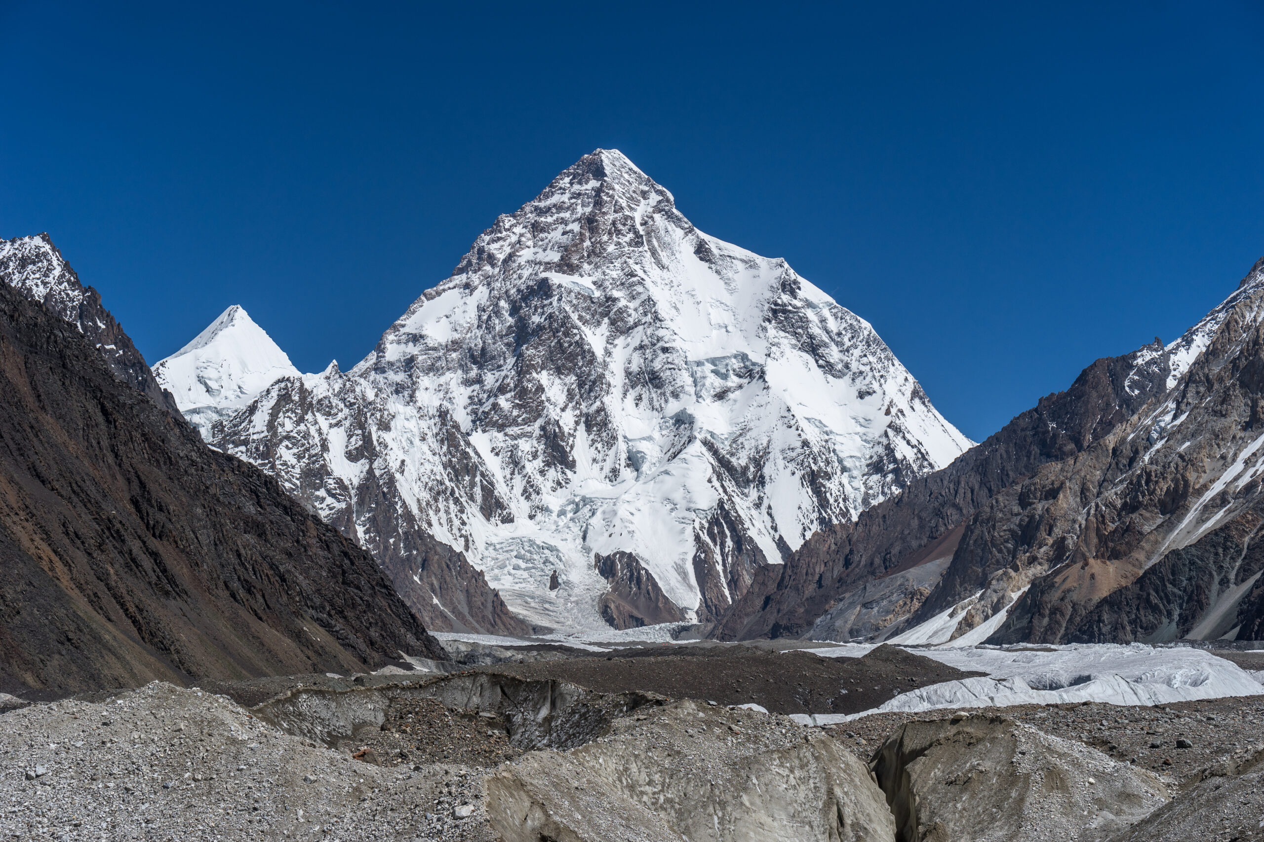
    Broad Peak, the 12th-highest mountain in the world, in Pakistan's Karakoram
    🇵🇰 Karakoram · Season Dispatch · 2026

    Broad Peak & Gasherbrum: First Summit Pushes of the Karakoram Season

    Before K2 takes the spotlight, its neighbours go first. Three of the Baltoro’s 8,000ers — Broad Peak, Gasherbrum I, and Gasherbrum II — are where the 2026 Karakoram season opens. Here’s who’s on the mountains, where the ropes are, and when the first summits are likely.

    Where things stand · Jul 11, 2026

    The 2026 Karakoram season is opening on Broad Peak and the Gasherbrums — quietly. It’s a lighter summer than usual in Pakistan, but teams are in position. On Broad Peak, rope-fixing had pushed high on the standard route and a first summit push was poised, only to be postponed by strong wind and fresh snow while teams wait for a cleaner window.

    On the Gasherbrums, commercial and alpine teams have been establishing at base camp after the long Baltoro trek, with a notable number of climbers going without supplemental oxygen. No confirmed 8,000m summits yet — the first of the season would be expected with the next stable weather window, typically mid-to-late July. Meanwhile the Nanga Parbat season over on the Diamir side has been wrapping up.

    This is a live dispatch. Karakoram conditions change by the day; we refresh it as the pushes develop.

    📌 This is the live dispatch — the deep guides are one click awayThis page tracks the 2026 season. For routes, difficulty, cost, and planning on each peak, go straight to the full guides: Broad Peak, Gasherbrum I, and Gasherbrum II — and see where all three sit in our 8,000ers ranked by difficulty.
    8,080 m
    Gasherbrum I (11th)
    8,051 m
    Broad Peak (12th)
    8,035 m
    Gasherbrum II (13th)
    Jul–Aug
    Summit window

    Where they are

    Four of the world’s fourteen 8,000ers, clustered around one glacial junction.

    Broad Peak, Gasherbrum I, Gasherbrum II, and K2 all sit within about 20 km of Concordia, the confluence of the Baltoro and Godwin-Austen glaciers — one of the greatest concentrations of high peaks on Earth. Climbers reach them the same way: fly to Skardu, drive to Askole, then trek roughly a week up the Baltoro. Broad Peak’s base camp sits on the Godwin-Austen Glacier near K2’s; the Gasherbrums share a base camp further up the South Gasherbrum Glacier.

    Broad Peak: 8,051 m Gasherbrum I & II: 8,080 / 8,035 m K2: 8,611 m (nearby) Concordia: Baltoro junction

    Broad Peak: first to move

    The 12th-highest mountain — and often the season’s opening act.

    At 8,051 m, Broad Peak is the 12th-highest mountain in the world, standing about 8 km from K2. First climbed in June 1957 by an Austrian team — Marcus Schmuck, Fritz Wintersteller, Kurt Diemberger, and the legendary Hermann Buhl, who died on nearby Chogolisa days later — it’s long been considered one of the more approachable 8,000ers. That reputation comes with an asterisk: its summit is reached via a long, deceptive ridge with a notorious false summit that repeatedly turns climbers back short of the true top.

    In 2026, Broad Peak has been the pace-setter. Rope-fixing pushed high on the standard route, and a first summit push was ready to go before wind and fresh snow forced a postponement. It’s the familiar Karakoram waiting game — everything set, held back by the sky.

    Full Broad Peak guideRoutes, camps, cost, permits, and the false-summit trap are covered in depth in our complete Broad Peak climb guide.
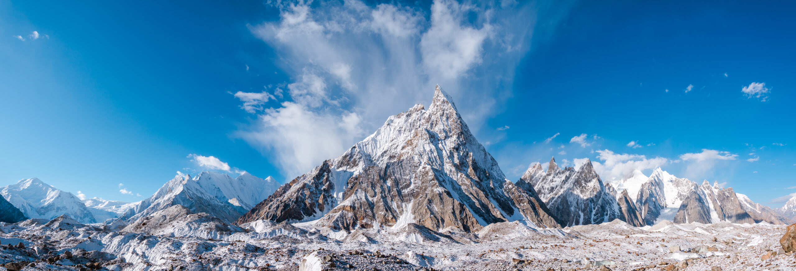
    The Gasherbrum group in Pakistan's Karakoram range
    The Gasherbrum group. “Gasherbrum” comes from the Balti rgasha brum — “beautiful mountain.” Two of the massif’s peaks are 8,000ers: Gasherbrum I (the Hidden Peak) and Gasherbrum II, both climbed from a shared base camp up the South Gasherbrum Glacier.

    The Gasherbrums: I & II

    Two 8,000ers, one massif — and very different climbs.

    The Gasherbrum massif holds two of the fourteen 8,000ers, and they’re often confused despite being quite different objectives:

    PeakHeight / rankCharacterFirst ascent
    Gasherbrum I (Hidden Peak)8,080 m · 11thSteeper, more technical; Japanese Couloir from Gasherbrum La1958 (American)
    Gasherbrum II8,035 m · 13thOne of the most accessible 8,000ers; a common first eight-thousander1956 (Austrian)

    In 2026, the Gasherbrums have drawn both commercial groups and elite alpinists. Teams have been establishing at base camp for standard-route attempts, while small alpine parties eye harder objectives on the massif. As on Broad Peak, the first summits hinge entirely on the next weather window.

    🏔️ Go deeper on the Gasherbrums

    Why they share one window

    Same glacier, same weather, same waiting game as K2.

    These peaks don’t just sit next to each other — they run on the same clock. The Karakoram summer offers shorter, less reliable weather windows than Nepal’s Himalaya, so teams across Broad Peak, the Gasherbrums, and K2 all watch the same forecasts and often move within days of one another. Typically the sequence runs Gasherbrum II and Broad Peak first, Gasherbrum I alongside, and K2 last, in its late-July to early-August window.

    That’s also why many climbers pair these peaks with bigger goals: Gasherbrum II and Broad Peak are common stepping stones toward K2. You can follow the top of that pyramid in our 2026 K2 season tracker — the companion to this dispatch — and see the season’s other Pakistan giant in our Nanga Parbat guide.

    Where they rank

    Accessible by 8,000er standards — but never easy.

    It’s tempting to file Broad Peak and Gasherbrum II under “easier 8,000ers,” and by standard-route difficulty they are among the more approachable of the fourteen — well below K2, Annapurna, or Nanga Parbat. But “accessible 8,000er” still means extreme altitude, real objective hazard, and Karakoram weather. Gasherbrum I sits a clear notch harder than GII, and Broad Peak’s false summit has ended more attempts than its grade suggests.

    We don’t re-rank them here — that’s the pillar’s job. For the full hardest-to-easiest picture, with fatality rates and technical grades:

    📊 See the full ranking

    Live Karakoram conditions

    The forecast is the story — these summits wait on the window.

    Every summit push on this page depends on one thing: a stable weather window. The 7-day outlook below is modelled data for the Concordia / Baltoro region — a general indicator, not a summit-day forecast (expedition teams buy specialist high-altitude forecasts before committing). It’s a useful read on whether the next window is building or breaking down.

    Karakoram summit region (~Concordia / Baltoro)

    Loading live data…
    Fetching the latest forecast…
    A general indicator only. This is modelled data near glacier/base-camp altitude — the 8,000m summits are colder and far windier. Teams launch only when a multi-day window of light wind lines up with the route being fixed to the top.

    Frequently asked questions

    Has anyone summited Broad Peak or Gasherbrum in 2026 yet?

    Not as of this update (July 11, 2026). Broad Peak was fixed high with a first push poised but weather-delayed; Gasherbrum teams were still establishing at base camp. The season’s first summits usually come mid-to-late July with the first stable window. We refresh this dispatch as pushes develop.

    When are these peaks climbed?

    In the Karakoram summer only — roughly June through August, with most summits in July and August. Gasherbrum II often sees the season’s first 8,000m summits, followed by Broad Peak and Gasherbrum I, with K2 last.

    Which is easiest — Broad Peak, GI or GII?

    Gasherbrum II is one of the most accessible 8,000ers and a common first eight-thousander. Broad Peak is approachable but has a deceptive false summit. Gasherbrum I is meaningfully steeper and more technical. See our 8,000ers ranked by difficulty.

    How do they relate to K2’s season?

    They share the same Baltoro region, weather, and summer window as K2, and many climbers use Broad Peak or GII to build Karakoram experience before K2. First summits here usually precede K2’s late-July window — follow it in our K2 2026 tracker.

    Are Broad Peak and GII good first 8000ers?

    GII is one of the more common first eight-thousanders, and Broad Peak is often a K2-region acclimatizer. Both are serious expeditions with real hazards, but their moderate grade makes them a genuine step into 8,000m climbing.

    How we track this

    This dispatch is compiled from expedition dispatches, operator updates, and specialist mountaineering coverage (including ExplorersWeb), cross-checked against the standard Karakoram climbing calendar. Fast-moving details — rope-fixing progress, summit pushes, casualties — are reported cautiously and dated, because early base-camp information is often incomplete and evolves.

    Conditions change daily during the season. For the current state of any climb, follow the operators directly; for routes, cost, and planning, our full mountain guides are the authoritative reference.

    Travis Ludlow

    Founder & Head of Research, Global Summit Guide

    Travis leads research at Global Summit Guide, where the team tracks the world’s major climbing seasons and maintains guides to more than 500 peaks. This Karakoram dispatch is updated through the summer; for full route, cost, and difficulty detail, we always point you to the individual mountain guides.

    The Karakoram season is just getting started

    Broad Peak and the Gasherbrums open the summer; K2 closes it. See where these giants rank among the world’s highest, then follow the whole season as it unfolds.

    8,000ers by difficulty → Follow the K2 season →

    Was this helpful?

    Yes
    No
    Thanks for your feedback!
  • How Much Do Sherpas Get Paid in 2026? What Everest Guides Actually Earn This Season

    { “@context”: “https://schema.org”, “@type”: “Article”, “headline”: “How Much Do Sherpas Get Paid in 2026? What Everest Guides Actually Earn This Season”, “description”: “A 2026 snapshot of Sherpa pay: this season’s base wages, summit bonuses, tips, insurance minimums, and the $15,000 Everest permit – plus where every dollar of an expedition fee actually goes.”, “author”: { “@type”: “Person”, “name”: “Travis Ludlow”, “jobTitle”: “Founder & Head of Research, Global Summit Guide”, “url”: “https://globalsummitguide.com/about/” }, “publisher”: { “@type”: “Organization”, “name”: “Global Summit Guide”, “url”: “https://globalsummitguide.com/”, “logo”: { “@type”: “ImageObject”, “url”: “https://globalsummitguide.com/wp-content/uploads/2026/02/global-logo-new-2.png” } }, “datePublished”: “2026-07-11”, “dateModified”: “2026-07-11”, “mainEntityOfPage”: “https://globalsummitguide.com/sherpa-pay-2026/”, “articleSection”: “Climbing News” } { “@context”: “https://schema.org”, “@type”: “ItemList”, “name”: “Sherpa Pay 2026 at a Glance”, “itemListElement”: [ { “@type”: “ListItem”, “position”: 1, “name”: “A personal climbing Sherpa’s base is roughly $2,500-$4,500 per expedition in 2026” }, { “@type”: “ListItem”, “position”: 2, “name”: “Summit bonuses run about $1,500-$3,500, with tips adding more” }, { “@type”: “ListItem”, “position”: 3, “name”: “An elite Khumbu Sherpa can clear $10,000+ in a single season, far more across a full year” } ] } { “@context”: “https://schema.org”, “@type”: “FAQPage”, “mainEntity”: [ { “@type”: “Question”, “name”: “How much do Sherpas get paid in 2026?”, “acceptedAnswer”: { “@type”: “Answer”, “text”: “In 2026, a personal climbing Sherpa on Everest typically earns a base of roughly $2,500-$4,500 for the expedition, plus a summit bonus of about $1,500-$3,500 and a share of client tips. An experienced Khumbu Sherpa can clear $10,000 or more in a single season, and considerably more across a full year of expeditions once tips are counted. Support roles – base-camp crew and porters – earn less. For the full breakdown of where every dollar of an expedition fee goes, see our Sherpa Wage Economy analysis.” } }, { “@type”: “Question”, “name”: “What is the difference between base salary and total season pay?”, “acceptedAnswer”: { “@type”: “Answer”, “text”: “Base salary is the guaranteed wage for the expedition, roughly $2,500-$4,500 for a veteran climbing Sherpa in 2026. Total season pay adds summit bonuses, load or performance bonuses, and tips, which together can double or more the take-home figure. Because tips and summit bonuses are conditional, actual earnings vary a lot by year, client, and how the season goes.” } }, { “@type”: “Question”, “name”: “How big is the summit bonus in 2026?”, “acceptedAnswer”: { “@type”: “Answer”, “text”: “The standard Everest summit bonus in 2026 is roughly $1,500-$3,500 when a Sherpa’s client reaches the top. Elite lead Sherpas who fix ropes and manage the route command the higher end. Bonuses are a major part of why the summit-day incentive is so strong – and part of why turnaround discipline matters so much.” } }, { “@type”: “Question”, “name”: “Do tips really make a difference to Sherpa pay?”, “acceptedAnswer”: { “@type”: “Answer”, “text”: “Yes. Tips are the part of compensation climbers control directly, and they are real income, not a courtesy. Standard practice adds several thousand dollars per climber to the Sherpa team at the base-camp tipping ceremony. Across a full year of expeditions, tip income alone can reach $25,000-$40,000 for a busy senior Sherpa. Our Sherpa Wage Economy breakdown covers how tipping fits the wider pay structure.” } }, { “@type”: “Question”, “name”: “How does Sherpa pay compare to Western guides?”, “acceptedAnswer”: { “@type”: “Answer”, “text”: “There is a large gap. While an elite Sherpa might earn around $10,000 in a season, a Western lead guide from a US or European operator can earn $30,000-$50,000 for the same roughly two months – despite the Sherpas doing more trips through the most dangerous terrain. The gap has narrowed since 2014 as Sherpa labor has grown to 32-38 percent of the operator fee, but it remains substantial.” } }, { “@type”: “Question”, “name”: “Is Sherpa pay enough, given the risk?”, “acceptedAnswer”: { “@type”: “Answer”, “text”: “It is high pay by Nepali standards and a vital source of household income in the Khumbu, but low for the risk involved – Sherpa climbing is among the most dangerous jobs in the world. Post-2014 reforms raised wages and insurance minimums (now $15,000-$20,000 of mandatory cover, with many operators paying more), but the debate over fair compensation is ongoing. See our death rates by mountain analysis for the risk context.” } } ] } { “@context”: “https://schema.org”, “@type”: “BreadcrumbList”, “itemListElement”: [ { “@type”: “ListItem”, “position”: 1, “name”: “Home”, “item”: “https://globalsummitguide.com/” }, { “@type”: “ListItem”, “position”: 2, “name”: “Climbing News” }, { “@type”: “ListItem”, “position”: 3, “name”: “Sherpa Pay 2026” } ] } @import url(‘https://fonts.googleapis.com/css2?family=Outfit:wght@300;400;500;600;700&family=DM+Serif+Display:ital@0;1&display=swap’); .shpa-page { font-family: ‘Outfit’, sans-serif; color: #122a44; line-height: 1.65; margin: 0 auto; padding: 0; } .shpa-page h1, .shpa-page h2, .shpa-page h3, .shpa-page h4 { font-family: ‘DM Serif Display’, serif; font-weight: 400; color: #0a1929; line-height: 1.15; } .shpa-page p { font-size: 1.02rem; margin-bottom: 1.1em; } .shpa-page a { color: #2e5986; text-decoration: none; border-bottom: 1px solid #c8d4e0; } .shpa-page a:hover { color: #d4913a; border-bottom-color: #d4913a; } .shpa-hero { position: relative; padding: 0; color: #f5e4c8; overflow: hidden; background: #0a1929; border-radius: 12px; margin-bottom: 0; } .shpa-hero-image { width: 100%; height: auto; display: block; max-width: 100%; } .shpa-hero-text { padding: 40px 36px; background: linear-gradient(135deg, rgba(10,25,41,0.90), rgba(46,89,134,0.80)); } .shpa-hero-tag { font-size: 0.84rem; color: #d4913a; text-transform: uppercase; letter-spacing: 2px; font-weight: 700; margin-bottom: 14px; } .shpa-hero h1 { color: #f5e4c8 !important; font-size: 2.05rem; line-height: 1.1; margin: 0 0 16px; } .shpa-hero h1 em { color: #d4913a; font-style: italic; } .shpa-hero p { color: #f5e4c8; font-size: 1.06rem; line-height: 1.5; margin: 0; } .shpa-byline { background: #f8f4ec; padding: 14px 22px; font-size: 0.85rem; color: #5a4f30; border: 1px solid #e8d8ad; border-radius: 8px; margin: 18px 0; } .shpa-byline-top { display: flex; justify-content: space-between; flex-wrap: wrap; gap: 10px; align-items: center; margin-bottom: 8px; } .shpa-byline-author { font-weight: 600; color: #0a1929; font-size: 0.94rem; } .shpa-byline-author a { color: #2e5986; border-bottom: none; } .shpa-byline-meta { color: #7a6f50; font-size: 0.82rem; } .shpa-byline-credentials { font-size: 0.82rem; color: #5a4f30; line-height: 1.45; padding-top: 6px; border-top: 1px solid #e8d8ad; font-style: italic; } .shpa-byline-credentials strong { color: #0a1929; font-style: normal; } /* Quick answer (blue) */ .shpa-answer { background: linear-gradient(135deg, #14395e 0%, #2e5986 100%); color: #fff; padding: 30px 36px; margin: 26px 0; border-radius: 14px; box-shadow: 0 8px 24px rgba(20,57,94,0.35); border: 4px solid #d4913a; } .shpa-answer h2 { margin: 0 0 14px !important; font-size: 1.5rem !important; color: #fff !important; padding-bottom: 0 !important; border-bottom: none !important; } .shpa-answer p { margin: 0 0 12px; font-size: 1.06rem; color: #fff; line-height: 1.55; } .shpa-answer p:last-child { margin-bottom: 0; } .shpa-answer strong { color: #ffe6a3; font-weight: 700; } .shpa-answer em { color: #ffe6a3; font-style: italic; } .shpa-answer .shpa-answer-tag { display: inline-block; background: #d4913a; color: #0a1929; padding: 4px 12px; border-radius: 4px; font-size: 0.78rem; font-weight: 700; text-transform: uppercase; letter-spacing: 0.6px; margin-bottom: 12px; } .shpa-answer a { color: #ffe6a3; border-bottom: 1px solid rgba(255,230,163,0.5); } .shpa-answer a:hover { color: #fff; border-bottom-color: #fff; } .shpa-stat-grid { display: grid; grid-template-columns: repeat(4, 1fr); gap: 12px; padding: 22px; background: linear-gradient(135deg, #0a1929 0%, #122a44 100%); color: #f5e4c8; border-radius: 10px; margin: 22px 0; } .shpa-stat { background: #1a3354; border: 1px solid #d4913a; border-radius: 8px; padding: 14px 12px; text-align: center; } .shpa-stat-num { font-family: ‘DM Serif Display’, serif; font-size: 1.3rem; color: #d4913a; line-height: 1; margin-bottom: 4px; } .shpa-stat-label { font-size: 0.7rem; color: #f5e4c8; text-transform: uppercase; letter-spacing: 0.5px; } .shpa-toc { background: #f8f4ec; border: 1px solid #e8d8ad; border-radius: 10px; padding: 18px 24px; margin: 22px 0; } .shpa-toc .shpa-toc-label { margin: 0 0 12px; font-size: 1.08rem; font-weight: 700; color: #0a1929; font-family: ‘DM Serif Display’, serif; } .shpa-toc ol { margin: 0; padding-left: 22px; columns: 2; column-gap: 28px; font-size: 0.92rem; } .shpa-toc li { margin-bottom: 5px; line-height: 1.4; } .shpa-inline-image { margin: 32px 0; border-radius: 10px; overflow: hidden; box-shadow: 0 4px 14px rgba(212,200,168,0.5); } .shpa-inline-image img { width: 100%; height: auto; display: block; max-width: 100%; } .shpa-inline-image figcaption { padding: 14px 22px; background: #f8f4ec; font-size: 0.88rem; color: #5a4f30; font-style: italic; line-height: 1.5; } .shpa-inline-image figcaption strong { color: #0a1929; font-style: normal; } .shpa-section-header { background: linear-gradient(135deg, #122a44 0%, #2e5986 100%); color: #f5e4c8; padding: 28px 34px; margin: 40px 0 24px; border-radius: 12px; border-left: 8px solid #d4913a; box-shadow: 0 6px 18px rgba(18,42,68,0.4); } .shpa-section-header h2 { color: #d4913a !important; font-size: 1.8rem !important; margin: 0 0 6px !important; padding: 0 !important; border: none !important; } .shpa-section-header h2 em { color: #fdd47a; font-style: italic; } .shpa-section-header p { color: #f5e4c8; font-size: 0.96rem; margin: 0; line-height: 1.5; } .shpa-content { padding: 24px 0 0; } .shpa-content h2 { font-size: 1.9rem; margin-top: 48px; margin-bottom: 18px; padding-bottom: 11px; border-bottom: 2px solid #d4913a; } .shpa-content h2:first-of-type { margin-top: 0; } .shpa-content h2 em { color: #d4913a; font-style: italic; } .shpa-content h3 { font-size: 1.34rem; margin-top: 28px; margin-bottom: 12px; color: #0a1929; } .shpa-callout-info { background: #e8f0f7; border-left: 5px solid #2e5986; padding: 16px 22px; border-radius: 6px; margin: 20px 0; font-size: 0.95rem; color: #0a1929; } .shpa-callout-info .shpa-callout-title { font-weight: 700; color: #2e5986; font-size: 0.98rem; margin-bottom: 6px; display: block; } .shpa-callout-warning { background: #fdf3e8; border-left: 5px solid #b86a15; padding: 16px 22px; border-radius: 6px; margin: 20px 0; font-size: 0.95rem; color: #0a1929; } .shpa-callout-warning .shpa-callout-warning-title { font-weight: 700; color: #b86a15; font-size: 0.98rem; margin-bottom: 6px; display: block; } .shpa-callout-danger { background: #fbe5e2; border-left: 5px solid #a83a2b; padding: 16px 22px; border-radius: 6px; margin: 20px 0; font-size: 0.95rem; color: #0a1929; } .shpa-callout-danger .shpa-callout-danger-title { font-weight: 700; color: #a83a2b; font-size: 0.98rem; margin-bottom: 6px; display: block; } .shpa-pillar { background: #e8f0d8; border-left: 5px solid #5a8a2e; padding: 18px 22px; border-radius: 6px; margin: 22px 0; font-size: 0.95rem; color: #0a1929; } .shpa-pillar .shpa-pillar-title { font-weight: 700; color: #4a7a1e; font-size: 0.98rem; margin-bottom: 6px; display: block; } .shpa-pillar ul { margin: 8px 0 0; padding-left: 20px; } .shpa-pillar li { margin-bottom: 5px; } .shpa-table-wrap { overflow-x: auto; margin: 18px 0; } .shpa-cmp { width: 100%; border-collapse: collapse; font-size: .86rem; background: #fff; border: 1px solid #e5d9bd; border-radius: 12px; overflow: hidden; min-width: 640px; } .shpa-cmp th { background: #0a1929; color: #f5e4c8; text-align: left; padding: 11px 12px; font-family: ‘Outfit’, sans-serif; font-weight: 700; font-size: .75rem; } .shpa-cmp td { padding: 10px 12px; border-top: 1px solid #efe6cf; color: #3a4a5a; line-height: 1.4; vertical-align: top; } .shpa-cmp td.shpa-role { font-weight: 700; color: #0a1929; background: #faf6ec; white-space: nowrap; } .shpa-cmp td.shpa-h { color: #b86a15; font-weight: 600; white-space: nowrap; } .shpa-cmp tr:nth-child(even) td { background: #fbf8f0; } .shpa-cmp tr:nth-child(even) td.shpa-role { background: #f5efe1; } .shpa-mini { width: 100%; border-collapse: collapse; font-size: .85rem; background: #fff; border: 1px solid #e5d9bd; border-radius: 10px; overflow: hidden; margin: 12px 0; } .shpa-mini td { padding: 8px 12px; border-top: 1px solid #efe6cf; color: #3a4a5a; line-height: 1.35; } .shpa-mini td:first-child { font-weight: 700; color: #0a1929; background: #faf6ec; white-space: nowrap; } .shpa-mini tr:first-child td { border-top: none; } .shpa-faq-item { background: #f8f4ec; border-radius: 8px; margin-bottom: 11px; } .shpa-faq-item summary { padding: 14px 20px; cursor: pointer; font-family: ‘DM Serif Display’, serif; font-size: 1.04rem; color: #0a1929; list-style: none; } .shpa-faq-item summary::-webkit-details-marker { display: none; } .shpa-faq-item summary::after { content: ‘+’; float: right; color: #d4913a; font-size: 1.4rem; line-height: 0.8; } .shpa-faq-item[open] summary::after { content: ‘-‘; } .shpa-faq-item div { padding: 0 20px 16px; font-size: 0.93rem; color: #0a1929; } .shpa-methodology { background: #f8f4ec; border: 2px solid #2e5986; padding: 22px 26px; border-radius: 10px; margin: 26px 0; } .shpa-methodology h3 { margin: 0 0 12px; font-size: 1.18rem; color: #2e5986; } .shpa-methodology p { font-size: 0.92rem; line-height: 1.55; margin: 0 0 8px; color: #0a1929; } .shpa-author-bio { background: linear-gradient(135deg, #f8f4ec 0%, #fbf7ef 100%); border: 2px solid #d4913a; padding: 26px 30px; border-radius: 12px; margin: 32px 0 18px; display: flex; gap: 22px; align-items: flex-start; } .shpa-author-bio-image { flex-shrink: 0; width: 100px; height: 100px; border-radius: 50%; background: #d4913a url(‘https://globalsummitguide.com/wp-content/uploads/2026/03/561db5f8-15bb-43d8-9eba-251a8c35f89f.jpg’) center/cover; border: 3px solid #d4913a; } .shpa-author-bio-content { flex: 1; } .shpa-author-bio h3 { margin: 0 0 4px; font-size: 1.26rem; color: #0a1929; } .shpa-author-bio .shpa-author-title { font-size: 0.9rem; color: #b86a15; font-weight: 700; margin-bottom: 11px; font-style: italic; } .shpa-author-bio p { margin: 0 0 9px; font-size: 0.92rem; line-height: 1.55; color: #0a1929; } .shpa-related { background: #f8f4ec; padding: 22px; border-radius: 10px; margin: 22px 0; } .shpa-related h3 { margin-top: 0; margin-bottom: 13px; color: #0a1929; font-size: 1.1rem; } .shpa-related h3.shpa-related-sub { margin-top: 18px; } .shpa-final-cta { background: linear-gradient(135deg, #122a44 0%, #1e3a5f 100%); color: #f5e4c8; padding: 36px 30px; border-radius: 14px; margin: 32px 0 0; text-align: center; border: 3px solid #d4913a; box-shadow: 0 8px 22px rgba(18,42,68,0.4); } .shpa-final-cta h3 { color: #d4913a; margin: 0 0 12px; font-size: 1.6rem; } .shpa-final-cta > p { color: #f5e4c8; font-size: 1.02rem; margin: 0 auto 22px; max-width: 620px; line-height: 1.55; } .shpa-cta-button { display: inline-block; background: transparent; color: #f5e4c8 !important; padding: 13px 24px; border-radius: 6px; font-weight: 600; border: 2px solid #d4913a !important; margin: 0 5px 8px; text-decoration: none !important; transition: all 0.15s; } .shpa-cta-button:hover { background: #d4913a; color: #0a1929 !important; } @media (max-width: 768px) { .shpa-page { padding: 0 4px; } .shpa-stat-grid { grid-template-columns: repeat(2, 1fr); } .shpa-toc ol { columns: 1; } .shpa-hero-text { padding: 28px 18px; } .shpa-hero h1 { font-size: 1.5rem; } .shpa-hero p { font-size: 0.96rem; } .shpa-byline, .shpa-answer, .shpa-section-header { padding: 18px 20px; } .shpa-answer h2 { font-size: 1.3rem !important; } .shpa-section-header h2 { font-size: 1.5rem !important; } .shpa-final-cta { padding: 26px 20px; } .shpa-final-cta h3 { font-size: 1.35rem; } .shpa-author-bio { flex-direction: column; align-items: center; text-align: center; } .shpa-content h2 { font-size: 1.55rem; } .shpa-content h3 { font-size: 1.2rem; } .shpa-cmp { font-size: 0.78rem; } }
    Sherpa climbers and high-altitude workers on a Himalayan expedition
    🇳🇵 Everest · Sherpa Economy · 2026 Snapshot

    How Much Do Sherpas Get Paid in 2026? What Everest Guides Actually Earn This Season

    The people who fix the ropes, carry the loads, and cross the Khumbu Icefall dozens of times a season are the engine of every Everest expedition. Here’s what they earn in 2026 — base wages, summit bonuses, tips, and what changed this year — with the full economics linked throughout.

    💰 The 2026 answer, fast

    In 2026, a personal climbing Sherpa on Everest earns a base of roughly $2,500–$4,500 for the expedition, plus a summit bonus of about $1,500–$3,500 and a share of client tips. Put together, an experienced Khumbu Sherpa can clear $10,000 or more in a single season, and considerably more across a full year once tips are counted. Base-camp crew and porters earn less; elite rope-fixing sirdars earn the top of the range.

    That’s the headline. Where every dollar of a $90,000 expedition actually goes — and why Sherpa labour has grown to 32–38% of the operator fee — is mapped in our Sherpa Wage Economy breakdown.

    📌 This is the 2026 snapshot — the pillar is the deep diveThis page answers “what do Sherpas earn this year” and covers what changed in 2026. For the full economics — the ten payment categories, the post-2014 reform, the operator-margin shift, and the year-round income picture — our Sherpa Wage Economy analysis is the definitive reference, and everything below links back to it.
    $2.5–4.5K
    Base per expedition
    $1.5–3.5K
    Summit bonus
    $10K+
    Elite season total
    $15,000
    Nepal Everest permit

    What changed in 2026

    New this season: a higher permit, tighter rules, and a labour share that keeps climbing.

    The single biggest recent shift reached the government line, not the Sherpa line: Nepal raised the standard spring Everest permit to $15,000 per foreign climber (up from $11,000), the first increase in roughly a decade. That doesn’t go to Sherpas directly, but it reshapes the total cost climbers budget — the wider picture is in our Everest permits and fees guide.

    On the labour side, the 2026 season continues a decade-long trend: Sherpa-related pay has grown to roughly 32–38% of the operator fee, up from about 22% before 2014. Alongside that, Nepal has been tightening the rules around high-altitude workers — moves toward stricter guide-to-climber ratios, mandatory medical certificates for staff, and a push for lead guides to be Nepali nationals. Insurance minimums, raised sharply after the 2014 disaster, now sit at $15,000–$20,000 of mandatory life cover per climbing Sherpa, with many operators voluntarily providing more.

    The number that matters when you bookWages and insurance are one of the clearest signals of an ethical operator. Climbing Sherpas should earn several thousand dollars for the season plus bonuses, and carry at least $15,000–$20,000 of life insurance. Our operator comparison walks through exactly how to check an operator’s staffing model, wages, and cover before you pay a deposit.

    The 2026 pay snapshot

    Representative ranges by role — a summary, not the full methodology.

    Pay varies widely by role, experience, summit count, and certification. These are representative 2026 ranges for the Nepal side; the detailed derivation lives on the wage-economy pillar.

    RoleBase (per expedition)BonusesTypical 2026 season take
    Base-camp crew / porters$500–$1,000MinimalLower; seasonal support work
    High-altitude porter (load carrier)$1,500–$3,000Per-load / carry bonusesVaries with number of carries
    Personal climbing Sherpa$2,500–$4,500$1,500–$3,500 summit + tipsSeveral thousand up to ~$10K
    Elite / sirdar / rope-fixer (IFMGA, 10+ summits)Top of rangeHighest bonuses + largest tips$10,000+ in a season

    For the most experienced Sherpas, the full-year figure is what really matters. A senior climber working multiple expeditions across the year — Everest in spring, plus other Nepalese peaks — can see tip income alone of $25,000–$40,000, on top of wages and bonuses. That’s high by Nepali standards and is a major reason competition for the best Sherpas has driven base wages up so quickly since 2014.

    High-altitude expedition work in the Everest region
    Paid by the season, not the year. A Sherpa’s earning window is a short, intense sprint — roughly eight to ten weeks in spring to make what has to support a family for twelve months. It’s why summit bonuses and tips matter so much, and why the incentive to push on summit day is so strong.

    How the pay is built

    Three moving parts: base, bonus, and the tip climbers control.

    Sherpa compensation isn’t a single flat rate — it stacks up from three pieces:

    Base wageThe guaranteed pay for the expedition. Steady, but the smaller part of a good season.
    BonusesSummit bonuses (~$1,500–$3,500) plus load or performance bonuses. Conditional — they depend on the season going well.
    TipsThe part climbers control directly, paid at the base-camp tipping ceremony. Real income, often several thousand per climber to the team.

    Because two of the three pieces are conditional, take-home pay swings hard from year to year. That’s exactly why the “how much do Sherpas make” question has no single answer — and why our pillar maps the full cash path of a representative expedition rather than quoting one figure. If you’re budgeting your own climb, the tipping line is covered in our full Everest cost breakdown.

    The most dangerous job on the mountain

    High pay for Nepal — low pay for the risk.

    Here’s the context the salary numbers can’t show on their own. While a Western climber crosses the Khumbu Icefall a handful of times, the Sherpas supporting them cross it again and again — fixing ropes, stocking camps, ferrying oxygen. Sherpa climbing is consistently ranked among the most dangerous jobs in the world, and the 2014 Icefall avalanche that killed sixteen Nepali workers is what triggered the wage and insurance reforms still shaping pay today.

    So the honest read on 2026 pay is two-sided: it’s genuinely high income by Nepali standards and a pillar of the Khumbu economy, yet low for the risk carried. For the hard numbers behind the risk, see our death rates by mountain analysis and the Everest death map.

    The pay gap in one lineAn elite Sherpa might earn around $10,000 in a season. A Western lead guide from a US or European operator can earn $30,000–$50,000 for the same two months — while doing fewer trips through the most dangerous terrain. The gap has narrowed since 2014, but it hasn’t closed.

    Sherpa pay beyond Everest

    The same labour, different mountains and different rules.

    “Sherpa pay” is really shorthand for high-altitude expedition labour, and it looks different from range to range. Right now, during the live Karakoram season, Pakistani high-altitude porters are doing the same brutal work on K2 and Broad Peak — often for less than Nepali Sherpas, and with porter welfare a recurring issue. You can follow that season in our K2 2026 tracker, with the labour and operator detail in the full K2 climb guide.

    Elsewhere the frameworks differ: on Kilimanjaro, the Kilimanjaro Porters Assistance Project sets minimum wage and tipping standards; on Denali, the US National Park Service concessionaire system standardises guide wages. The common thread — and the thing worth checking before you book any peak — is how the operator treats its local staff. That’s the fourth of the eight criteria in our operator comparison.

    K2, Everest, Denali and the rest are all in our database of 500+ mountains — compare the peaks and the expeditions that run on them.

    Frequently asked questions

    How much do Sherpas get paid in 2026?

    A personal climbing Sherpa on Everest earns roughly $2,500–$4,500 base for the expedition, plus a $1,500–$3,500 summit bonus and a share of tips. An experienced Khumbu Sherpa can clear $10,000+ in a season, and more across a full year. The full breakdown is in our Sherpa Wage Economy analysis.

    Base salary vs total season pay — what’s the difference?

    Base is the guaranteed wage (~$2,500–$4,500 for a veteran). Total season pay adds bonuses and tips, which can double the take-home. Because bonuses and tips are conditional, actual earnings vary a lot year to year.

    How big is the summit bonus in 2026?

    Around $1,500–$3,500 when a Sherpa’s client summits, with elite rope-fixers at the higher end. It’s a major part of the total and a strong summit-day incentive.

    Do tips really matter?

    Yes — tips are real income, not a courtesy, paid at the base-camp tipping ceremony. Across a full year, tip income alone can reach $25,000–$40,000 for a busy senior Sherpa. See how it fits the wider structure in our wage-economy breakdown.

    How does it compare to Western guides?

    There’s a large gap: ~$10,000 for an elite Sherpa vs $30,000–$50,000 for a Western lead guide in the same season. It has narrowed since 2014 as Sherpa labour grew to 32–38% of the operator fee, but remains substantial.

    Is it enough, given the risk?

    It’s high pay for Nepal but low for the danger — Sherpa climbing is among the world’s most hazardous jobs. Post-2014 reforms raised wages and insurance ($15,000–$20,000 minimum), but the fair-pay debate continues. See our death rates by mountain for context.

    How we compiled this

    This 2026 snapshot draws on operator disclosures, Nepal Department of Tourism data, and published Sherpa-community wage benchmarks, cross-checked against our own Sherpa Wage Economy analysis. Figures are representative ranges, not fixed rates — real pay depends on role, experience, operator, summit success, and tips, all of which vary by season.

    Permit fees, insurance minimums, and staffing rules change from year to year. For the current requirements, consult the Nepal Department of Tourism and your operator; for the full economics, our pillar is the definitive reference.

    Travis Ludlow

    Founder & Head of Research, Global Summit Guide

    Travis leads research at Global Summit Guide, where the team tracks the economics and logistics of the world’s major expeditions and maintains guides to more than 500 peaks. This is a current-season snapshot of Sherpa pay; for the full cash path of an Everest expedition, it defers to our in-depth Sherpa Wage Economy analysis.

    Where does the rest of the money go?

    Sherpa pay is one line in a much bigger ledger. See exactly how a $90,000 Everest expedition splits into ten payment categories — and how much reaches the people doing the most dangerous work.

    The full Sherpa wage economy → What Everest really costs →

    Was this helpful?

    Yes
    No
    Thanks for your feedback!
  • K2 2026 Season Tracker: No Summits as Season Ends

    K2 rising above the Karakoram glaciers under a clear blue sky
    Season Final · August 26, 2026 · Karakoram Summer Closed

    K2 2026 Season Tracker: No Summits as Karakoram Season Ends

    K2’s 2026 summer season is over without a successful summit. Repeated high winds, heavy snow, unstable conditions and rockfall kept the upper mountain difficult through July. A late summit push finally began near the end of the month, but the July 30 avalanche on neighboring Broad Peak changed the season: K2 teams abandoned remaining summit plans and joined the response. For evergreen route, cost, permit and preparation research, use the complete K2 climbing guide.

    Season outcome confirmed Contemporary expedition reporting checked Evergreen K2 planning kept separate Archive status: final
    0K2 summer summits
    8,611 mK2 summit
    ~7,000 mRopes reported Jul 24
    Jul 30Broad Peak turning point
    Closed2026 summer season
    By Travis Ludlow · Global Summit Guide Research
    Published July 11, 2026 · Final season update August 26, 2026
    The final answer

    K2 Went Unsummited in the 2026 Summer Season.

    By mid-August, reporting from Gilgit-Baltistan confirmed that the Karakoram summer climbing season had closed with climbers returning from K2 without a summit. That final result was not the product of one failed summit day. It was the end point of a difficult season in which wind, fresh snow, unstable snow, rockfall and repeated weather delays kept narrowing the margin for an upper-mountain push.

    The season still came close to a decisive attempt. On July 24, specialist coverage reported fixed ropes at roughly 7,000 metres. On July 27, a forecast change put K2 teams in motion for a possible July 31 summit. Then the July 30 avalanche on Broad Peak killed 10 climbers. K2 teams abandoned summit pushes and redirected people and resources toward the search and recovery effort.

    The outcome is simple even if the season was not: the 2026 K2 summer closed with no successful summit.

    Final outcomeNo K2 summer summit
    Primary routeAbruzzi Spur
    Season patternWind + snow + delays
    Late pushTargeted end of July
    Turning pointBroad Peak avalanche
    Page statusSeason-final archive
    Respectful context: the Broad Peak avalanche was not merely a “weather event” in the K2 timeline. Ten climbers lost their lives. This page discusses the tragedy only where it directly affected K2’s remaining summit plans and the wider Karakoram season.
    August 26 final status

    The Season Is Closed. The Result Is No K2 Summit.

    These are the points that matter now that the live summit-window phase has ended.

    Final

    0 Summits

    The 2026 summer season closed without a successful K2 ascent.

    Route

    Abruzzi Spur

    The supported season centered on K2’s standard Pakistan-side line.

    Upper progress

    ~7,000 m+

    Ropes were reported around 7,000 m by July 24; at least one late push reached Camp 3.

    Conditions

    Repeated Delays

    High winds, heavy snow, unstable conditions and rockfall repeatedly reduced the usable window.

    Archive

    Final Record

    This page now preserves the 2026 season outcome rather than pretending to be a live forecast.

    Search-intent split: this URL owns what happened on K2 in 2026. The K2 season and weather guide owns the evergreen question of when K2 is normally climbed, while the main K2 guide owns expedition planning.
    The season, in sequence

    How K2 2026 Moved From Base Camp to a Closed Season

    The timeline matters because “no summit” hides how close the season came to a late push—and why that push disappeared.

    Early July

    A Quieter Karakoram Season Takes Shape

    Teams established themselves at K2 Base Camp and began normal acclimatization rotations. Contemporary coverage described 2026 as unusually quiet, with smaller teams and fewer large commercial groups than in many recent seasons.

    Jul 11

    The Original GSG Tracker: Progress Around Camp 2

    When this tracker was first published, rope fixing had reached roughly Camp 2 and teams were still waiting for the upper route to develop. The page correctly treated the summit window as still ahead—but that is now historical context, not current status.

    Jul 16–24

    Weather Keeps Slowing the Upper Mountain

    Specialist reports continued to describe poor weather and high winds. By July 24, fixed ropes were reported around 7,000 metres, with more rope staged higher. The season was progressing, but more slowly than teams needed for a clean, comfortable summit cycle.

    Jul 27

    A Forecast Change Triggers the Late Push

    After prolonged waiting, a more optimistic forecast put K2 teams in motion. ExplorersWeb reported a surprise summit push with July 31 identified as the hoped-for summit day. At that point, the season was no longer simply stalled; climbers were finally committing upward.

    Jul 30

    The Broad Peak Avalanche Changes Everything

    An avalanche struck a 10-person team on neighboring Broad Peak. The accident quickly became a search-and-recovery emergency across the shared climbing community in the Baltoro. K2 teams abandoned remaining summit plans and descended or redirected resources to assist.

    Aug 16–22

    The Karakoram Summer Closes

    Dawn reported on August 16 that the summer season had closed with no K2 or Gasherbrum I summit. Alan Arnette’s August 22 season wrap likewise recorded no K2 summit and described a year of rockfall, high winds and heavy snow, estimating about 50 K2 attempts.

    K2 rising above dark moraine and surrounding Karakoram peaks
    A narrow window never becomes a guarantee

    K2 Can Have Teams, Fixed Ropes and a Forecast—And Still Produce No Summit.

    The 2026 season is a clean reminder that expedition infrastructure does not control the mountain. Route progress, acclimatization and a forecast all have to align with snow stability, wind, visibility, team margin and enough time to descend.

    Why K2 went unsummited

    There Was No Single Failure Point.

    The stronger explanation is a stack of constraints that kept shrinking the usable margin until the final summit plan disappeared.

    Constraint 1

    High Winds

    Wind repeatedly stalled upper-mountain progress in July. On K2, a forecast that is tolerable at Base Camp can still be unusable on the Shoulder, Bottleneck and summit ridge. That difference is why the mountain-weather framework matters more than a single forecast icon.

    Constraint 2

    Heavy Snow & Unstable Conditions

    Late-season reporting from Gilgit-Baltistan described heavy snowfall, unstable snow and elevated avalanche danger across the Karakoram. Fresh loading does not merely slow climbing; it can change whether a route is acceptable at all.

    Constraint 3

    Rockfall

    Rockfall was another repeated 2026 problem in season coverage. On a steep mountain with long fixed-line sections, debris hazard can affect both movement and the willingness to keep teams exposed while waiting for better upper conditions.

    Constraint 4

    Slow Route Development

    Ropes were still being reported around 7,000 metres on July 24. That does not mean the route “failed,” but it does mean the final summit cycle was being compressed toward the back end of the normal Karakoram window.

    Constraint 5

    A Very Late Summit Commitment

    Teams moved only when a more favorable forecast appeared near the end of July. Once the push started, there was limited calendar left for another complete cycle if conditions deteriorated or priorities changed.

    Constraint 6

    The Broad Peak Emergency

    The July 30 avalanche was the decisive human event. K2 climbers were part of the same Karakoram community, and teams abandoned summit plans to support the response. At that point, the season’s remaining summit logic changed completely.

    Important distinction: this article is reporting the season, not diagnosing the Broad Peak avalanche. For general background on how snow loading, wind and terrain interact, use GSG’s avalanche awareness guide. It should not be used to retroactively assign blame for a specific accident.
    The decisive late-season event

    How the Broad Peak Tragedy Affected K2

    Broad Peak and K2 are different mountains, but their expedition communities share the Baltoro, Base Camp networks, high-altitude workers and rescue realities.

    On July 30, an avalanche struck a 10-person international expedition on Broad Peak. Subsequent reporting confirmed that all 10 climbers died. The tragedy included highly experienced high-altitude climbers and guides and triggered a difficult search and recovery effort that continued into August.

    For the K2 season, the immediate consequence was direct. ExplorersWeb reported on July 31 that most K2 teams had aborted their summit pushes to help on Broad Peak. Alan Arnette’s later season wrap reported that the remaining team hoping to summit K2 had been at Camp 3 when it learned of the avalanche, abandoned its summit plan and descended to assist.

    That is why the final K2 story should not be reduced to “bad weather prevented a summit.” Weather created the narrow margin. The Broad Peak disaster changed what the remaining K2 climbers were doing with that margin.

    Editorial boundary: Global Summit Guide has not climbed K2 or Broad Peak and does not claim first-hand knowledge of the July 30 accident. The account above is based on published reporting from the Alpine Club of Pakistan, Dawn, ExplorersWeb, Associated Press and specialist season coverage.
    K2 partly hidden by cloud and evening weather in the Karakoram
    The 2026 lesson

    Weather Window Is Not the Same Thing as Summit Window.

    A summit window exists only when the forecast, route, snow, team readiness, support system and descent margin line up at the same time. K2’s 2026 season never produced that complete combination.

    Route context—not a route tutorial

    How Far Did the 2026 K2 Route Progress?

    The tracker should explain what happened on the route without duplicating the complete K2 route atlas.

    Season pointReported progressWhat it meant
    Early JulyTeams acclimatizing on the Abruzzi SpurNormal lower-mountain rotations; summit phase still ahead.
    July 11Rope fixing roughly around Camp 2The original tracker correctly treated the upper route as unfinished.
    July 24Ropes reported around 7,000 m; additional rope staged around Camp 3Progress was moving above the lower ridge, but the summit route still needed time and favorable wind.
    July 27–30Late summit push underway; at least one team later reported at Camp 3The season had entered its decisive summit cycle.
    July 31 onwardK2 summit pushes abortedTeams shifted to the Broad Peak response; no successful K2 summit followed.

    Use the complete K2 routes guide for the Abruzzi Spur, camps, Bottleneck and major route families →

    Compare Abruzzi vs Cesen vs the North Ridge without mixing route-choice intent into this season archive →

    What the result does—and does not—prove

    Do Not Turn One Unsummited Season Into a Fake K2 Trend.

    2026 is meaningful, but one year cannot by itself prove that K2 has permanently become more difficult, more dangerous or less climbable.

    What 2026 shows

    Commercial Infrastructure Has Limits

    Fixed ropes, oxygen, experienced staff and forecasting can improve expedition systems. They cannot guarantee stable snow, light wind, low rockfall, a safe enough route or a rescue-capable mountain.

    What 2026 shows

    The Calendar Can Compress Fast

    When route work and weather delays push the summit cycle late, one more storm or emergency can consume the rest of the practical season.

    What 2026 does not show

    No New “Success Rate” Yet

    A zero-summit season should be added carefully to long-term datasets. Do not turn one year into a personal probability or use it to overwrite the methodology on the separate K2 summit success page.

    What 2026 does not show

    No New Personal Death Probability

    K2 risk metrics require clear denominators. The K2 death-rate analysis separates deaths-to-summits from the probability faced by one climber on one attempt.

    Snow-covered Karakoram peaks and glacier terrain under a bright blue sky
    Archive the season, then move back to planning

    The 2026 Tracker Is Finished. K2 Research Is Not.

    If you are researching a future expedition, this archive is one season of evidence. Route choice, operator structure, weather, readiness, rescue planning and contract detail belong in the evergreen K2 planning system.

    Climber Journey · Dream → Prepare → Plan → Book → Final Prep

    Save K2 as a Long-Range Objective—Then Build the Evidence Around It.

    K2 is not a mountain to choose from one dramatic season report. Use My Climb to keep the objective, readiness gaps, prior 8,000-metre experience, operator research, equipment, budget and final-prep decisions in one place. The 2026 season belongs in that record as a reminder that turning around—or losing a summit window entirely—is part of K2 planning.

    Dream Prepare Plan Book Final Prep Climb
    Sources & editorial limits

    How We Closed the 2026 K2 Record

    This page separates dated season reporting from evergreen K2 route and planning information.

    Editorial limits

    What This Archive Does Not Claim

    • Global Summit Guide did not climb K2 in 2026.
    • Approximate route-fixing elevations are season reports, not permanent route coordinates.
    • This page does not reconstruct or assign fault for the Broad Peak avalanche.
    • One zero-summit season does not establish a permanent K2 trend.
    • Weather, snow and route conditions from 2026 should not be used as a forecast for a future expedition.
    • Long-term risk and success statistics stay on their dedicated methodology pages.
    Archive policy: as of August 26, 2026, the summer season is closed. Keep this URL indexed as the historical K2 2026 owner. Update it again only if authoritative reporting changes the final summit record or materially corrects a season detail.
    Direct final answers

    K2 2026 Season FAQ

    These answers refer to the completed 2026 Karakoram summer climbing season.

    Did anyone summit K2 in the 2026 summer season?

    No. The Karakoram summer climbing season closed without a successful K2 summit in 2026. Persistent weather and mountain-condition problems delayed progress, and the remaining K2 summit effort was abandoned after the July 30 Broad Peak avalanche as climbers shifted to search and recovery support.

    Why was K2 not summited in 2026?

    There was no single cause. Reporting through the season described high winds, heavy snowfall, unstable snow, rockfall and repeated weather delays. Teams eventually moved for a late-July summit push, but the Broad Peak avalanche on July 30 changed priorities and the remaining K2 push was abandoned.

    How far did climbers get on K2 in 2026?

    By July 24, specialist season reporting placed fixed ropes at roughly 7,000 metres, with additional rope positioned around Camp 3. By July 30, at least one summit team had reached Camp 3 before abandoning the push and descending to assist the Broad Peak response.

    What happened on Broad Peak and how did it affect K2?

    A July 30 avalanche on neighboring Broad Peak killed 10 climbers. K2 teams abandoned summit pushes and redirected climbers and resources toward the search and recovery effort. The tragedy became the decisive end-of-season event for the remaining K2 summit plans.

    What route were K2 teams using in 2026?

    The supported climbing effort centered on the Abruzzi Spur, K2’s standard Pakistan-side route. For route geography, camps, the Bottleneck and alternative lines, use the separate K2 routes guide.

    Is this still a live K2 tracker?

    No. The 2026 summer season is closed, so this page is now a season-final archive rather than a daily live tracker. It should be updated again only if authoritative reporting materially changes the final K2 season record.

    The 2026 verdict

    No Summit. A Season Still Worth Studying.

    K2’s 2026 summer ended without a summit, but the value of the season is not a zero in a results table. It shows how route progress, weather, snow, time, emergency response and judgment interact on one of the world’s most committing mountains. Keep this page as the record of what happened—then use the evergreen K2 system to plan what comes next.

    Was this helpful?

    Yes
    No
    Thanks for your feedback!
  • Mount Kazbek Fixed Ropes: Gergeti Glacier & Summit Slope

    Mount Kazbek (5,033 m) above the Gergeti Glacier in the Caucasus, Georgia
    🧗 Mount Kazbek · Gergeti Glacier & Bergschrund · Route Detail · Updated July 2026

    Are There Fixed Ropes on Mount Kazbek?

    It’s one of the most common questions climbers ask before Kazbek — and the answer isn’t a simple yes or no. Kazbek is not a fixed-rope mountain the way Everest is, but a fixed rope does sometimes appear in one specific place. Here’s exactly where, when, and what it means for your climb.

    ⚡ The short answer

    No — not as a fixed system. The standard Gergeti Glacier route is never permanently fixed; the glacier shifts daily, so guides re-read the line on every climb. You travel roped as a team for crevasse protection, which is not the same as clipping fixed lines. The one exception: on the steep 35–45° final summit slope and the bergschrund below it, a guide will often fix a short rope if the snow or ice is hard — but it is situational, not guaranteed. Build the skills to climb that slope without one.

    “Fixed rope” means different things to different climbers, and that’s the root of the confusion around Kazbek. Before you plan, it helps to separate three very different things — because Kazbek involves two of them, and specifically does not involve the third.

    Three kinds of “rope” on a mountain

    • A fixed-line system (Everest-style): continuous ropes pre-installed up the route that you clip and ascend with a jumar. Kazbek does not have this.
    • Rope-team / glacier travel: your own party roped together so a crevasse fall can be arrested and the climber rescued. Kazbek requires this across the Gergeti Glacier.
    • A situational fixed rope: a short line a guide anchors on one steep section when conditions demand it. Kazbek sometimes has this on the summit slope and bergschrund.

    The Gergeti Glacier: roped, but never fixed

    The heart of the standard route is the crossing of the Gergeti Glacier from the Betlemi (Meteo Station) hut up onto the plateau at around 4,400 metres. This is glaciated terrain with real crevasse exposure, and there is no fixed rope and no reliable fixed path across it. The reason is simple: the glacier is alive. New crevasses open daily and snow bridges collapse without warning, so even experienced guides don’t trust a previous track — they route-find fresh each time based on the day’s conditions.

    What protects you here is rope-team travel. Your group ropes together at correct spacing so that if one climber breaks through a snow bridge, the others can arrest the fall and haul them out. That’s why competence with roped glacier travel and crevasse rescue is non-negotiable for Kazbek — it’s the protection system the mountain actually uses, and it’s entirely different from clipping a fixed line.

    The bergschrund and the steep summit slope

    This is where fixed ropes actually enter the picture. Above the plateau and the saddle (around 4,900 m), the route steepens into the final summit slope — roughly 35–45° of snow and ice — and at its base you cross the bergschrund, the crevasse where the moving glacier pulls away from the steeper headwall. This crossing and the slope above it are the technical crux of the standard route.

    When the snow here is soft and stable, a strong roped team simply climbs it. But when it’s icy or hard — which is common early in the season, late in the day, or in a cold year — a guide will commonly fix a short rope across the bergschrund and up the steep slope to secure the crossing. So the honest answer to “is there a fixed rope at the Kazbek bergschrund?” is: sometimes, when conditions call for it. It is a judgement the guide makes on the day, not a permanent installation you can count on.

    What this means for your climb

    The practical takeaway is straightforward: prepare as if there will be no fixed rope, and treat any fixed rope as a bonus. The skills that actually get you up Kazbek are roped glacier travel, crevasse rescue, confident cramponing, ice-axe self-arrest, and the ability to climb a 35–45° snow-and-ice slope. If your guide fixes a rope at the bergschrund, you should be comfortable using it — but your safety cannot depend on one being there, because on any given day it may not be.

    If fixed-rope security on the steep ground matters to you, ask your operator directly how they handle the summit slope and bergschrund in the conditions expected for your dates. And before you commit, read the full picture of the route, seasons, and skill requirements in our complete Mount Kazbek climbing guide.

    Frequently asked questions

    Are there fixed ropes on Mount Kazbek?

    Not as a permanent system. The Gergeti Glacier route is never fixed — the glacier changes constantly, so guides re-assess the line every climb. You travel roped as a team for crevasse protection. The one place a fixed rope may appear is the steep final summit slope (about 35–45°) and the bergschrund below it, where a guide will sometimes fix a short rope if the snow or ice is hard — but it’s situational, not guaranteed.

    Is there a fixed rope on the Gergeti Glacier?

    No. The Gergeti Glacier is crossed using rope-team travel, not fixed ropes. Your party ropes together so a crevasse fall can be arrested and the climber rescued. Because the crevasses shift daily, there’s no fixed line and no reliable fixed path — route-finding is done fresh each time.

    Is there a fixed rope at the Kazbek bergschrund?

    Sometimes. The bergschrund sits at the base of the 35–45° summit slope, the crux of the standard route. When conditions there are icy or hard, guides commonly fix a short rope across the bergschrund and up the slope. In good soft snow it may not be fixed at all — never assume one will be in place.

    Do you need fixed-rope skills for Mount Kazbek?

    You need glacier and steep-snow skills more than fixed-rope skills: roped glacier travel, crevasse rescue, crampons, ice axe, self-arrest, and the ability to climb a 35–45° slope. If a guide fixes a rope you should be comfortable using it, but you can’t rely on one being there.

    Is Mount Kazbek technical like Everest with fixed lines?

    No. Kazbek has no continuous fixed-line system like Everest’s commercial routes. It’s a glaciated alpine ascent where you travel roped as a team, with at most a short situational fixed rope on the summit slope. “Non-technical” only means no rock or ice pitches — it still demands real glacier travel and steep-snow competence.

    How we built this

    This is a research-based detail page — our team has not climbed Kazbek. It synthesizes current operator route documentation and established descriptions of the standard Gergeti Glacier route, focusing on how rope protection is actually used on the mountain. Safety content is reviewed by Dawson Ludlow. Glacier conditions, the bergschrund, and the summit slope change constantly and year to year — always confirm the current situation with your guide before you climb.

    Planning a Kazbek climb?

    Get the full route, season, gear, and safety picture — and go prepared to climb that summit slope with or without a fixed rope.

    Read the full Mount Kazbek guide →

    Was this helpful?

    Yes
    No
    Thanks for your feedback!
  • 5 Mountains That Are Actually Harder Than They Look

    Mount Fuji rising above the clouds, the deceptively gentle-looking peak climbers most often underestimate
    ⛰ Difficulty Ratings · The Mountains People Underestimate

    5 Mountains That Are Actually Harder Than They Look

    The most dangerous mountains aren’t always the ones that look hardest. Some of the deadliest peaks on Earth are famous, photogenic, or sold as “walk-ups” — and that gentle reputation is exactly what gets people into trouble. Here are five mountains climbers routinely underestimate, and the hidden reasons each is tougher than it seems.

    ⚡ The Thesis

    Reputation is not difficulty. A mountain can be famous, beautiful, or technically “easy” and still be lethal — because of altitude, weather, objective hazard, or sheer endurance. The five below all hide a hard mountain behind a gentle face, and underestimating them is the single biggest mistake climbers make on each.

    5
    Underrated peaks
    3,776→6,961 m
    The altitude range
    “Easy”
    The dangerous myth
    Altitude
    The hidden killer

    Why “Easy-Looking” Mountains Catch People Out

    Climbers and hikers tend to judge a mountain by two things: how steep and technical it looks, and how famous it is. Both are misleading. A peak with no ropework can still sit at an altitude where the body fails; a gentle-looking glacier can hide crevasses; a postcard volcano can be raked by rockfall; a “bucket-list” tourist mountain can be brutally cold and crowded. The danger isn’t just the terrain — it’s the gap between what people expect and what the mountain actually delivers.

    That gap is where accidents happen. Underestimation leads to the wrong gear, too few acclimatisation days, a forecast ignored, a turnaround time blown. None of the five mountains below is the “hardest” in the world — and that’s the point. They are dangerous precisely because they don’t look it. Read each alongside our mountain difficulty ratings guide, which exists to replace reputation with something measurable.

    1. Mount Fuji — The Tourist Trap

    Mount Fuji's symmetrical cone, the world's most-climbed mountain
    Mount Fuji, 3,776 m. The world’s most-climbed mountain looks like a gentle bucket-list hike — which is exactly the problem.

    The reputation: Japan’s sacred icon, the most-climbed mountain on the planet, and a near-mandatory photo for visitors. Hundreds of thousands walk up it each summer, many with no mountain experience at all — it’s widely treated as a long but casual hike in trainers.

    Why it’s actually harder: Fuji is non-technical, but at 3,776 m the altitude is high enough to make a meaningful share of climbers ill, and the summit is genuinely cold — below freezing with wind, even at the height of summer. The classic ascent is done overnight, to catch sunrise from the top, so people climb tired, in the dark, in the cold, on crowded trails where a slow queue can leave you stationary and chilling for hours. Every season brings altitude sickness, hypothermia, and exhaustion cases among the unprepared.

    The reality check: the crowds and casualties got serious enough that Japan introduced a climbing fee and daily caps for 2026, along with gate hours to stop reckless overnight “bullet climbing.” Fuji rewards the same respect as any high mountain: warm layers, a head torch, a sensible pace, and ideally a night in a mountain hut to break the altitude gain. Treat it as a hike and it bites; treat it as a small mountain and it’s a wonderful climb. See our Fuji routes guide and best-time-to-climb guide, or the head-to-head in Fuji vs Kilimanjaro.

    2. Mount Rainier — The Pretty Volcano

    The reputation: a glorious, glaciated cone looming over Seattle — the kind of mountain that looks like a scenic weekend objective for any fit hiker, and draws huge numbers of day visitors to its meadows and viewpoints.

    Why it’s actually harder: Rainier is a serious, heavily glaciated mountaineering climb, not a hike. Its standard routes cross crevassed glaciers that demand rope teams, crampons, and ice-axe skills; they’re exposed to rockfall and serac danger; and the weather can swing from sunshine to whiteout in an hour. The altitude (4,392 m) and the sheer vertical gain — over 2,700 m from the usual trailhead — wear climbers down. Tellingly, only around half of those who set out for the summit actually make it.

    The reality check: Rainier is so genuinely demanding that it’s a recognised training ground for Denali and Everest — climbers use it to rehearse glacier travel and altitude before the world’s biggest peaks. That should tell you everything: a mountain elite expeditions use as practice is not a casual outing. Compare it honestly in Rainier vs Denali and check the odds in our Rainier summit success rate breakdown.

    3. Mont Blanc — The Deadly “Walk-Up”

    The reputation: the highest mountain in the Alps, and one routinely marketed as an accessible “walk-up” — a fit hiker’s trophy that can be bagged in a long weekend with a guide. Thousands attempt it every summer.

    Why it’s actually harder: the popular Goûter route crosses the notorious Grand Couloir, a gully so frequently swept by rockfall that it has earned the grim nickname the “Couloir of Death.” Beyond it, the climb is a true high-alpine undertaking: glaciated terrain with hidden crevasses, altitude nearing 4,808 m, fast-moving storms that strand climbers, and heavy crowds that slow everything down at exactly the wrong moments. None of this is “technical” in the extreme sense — and yet people die here regularly.

    The reality check: Mont Blanc has one of the highest death tolls of any mountain in the Alps, the accumulated price of so many under-prepared parties on an objectively hazardous route. The word “walk-up” does it a dangerous disservice. Anyone heading up should treat it as the serious glaciated climb it is — see our Goûter route conditions and the full expedition breakdown, and weigh it against its sharper neighbour in Mont Blanc vs Matterhorn.

    4. Mount Kilimanjaro — The Altitude Trap

    On the summit of Mount Kilimanjaro at Uhuru Peak
    Uhuru Peak, 5,895 m — the roof of Africa. No ropes required, but the altitude turns back a large share of those who try.
    First-hand: a member of our team has summited Kilimanjaro via the Lemosho route, so the notes here come from the mountain itself, not just the data — and the single biggest factor in summiting was acclimatisation days, not fitness.

    The reputation: the highest mountain in Africa and the world’s most famous “walk-up” — the big peak that, the story goes, anyone reasonably fit can climb because it needs no ropes, crampons, or technical skill. That reputation pulls in tens of thousands of trekkers a year.

    Why it’s actually harder: the lack of technical difficulty is real — and almost beside the point. At 5,895 m, Kilimanjaro is high enough that altitude is the great equaliser, and it humbles the fit and unfit alike. A large share of climbers never reach the summit, plenty are evacuated with altitude sickness, and people genuinely die here each year from HACE and HAPE — the high-altitude brain and lung emergencies. The cruel twist is that strong, fit people sometimes fare worse, because they push too fast for their bodies to adapt.

    The reality check: on Kilimanjaro, the variable that most predicts success isn’t fitness — it’s how many days you take to go up. Rushed five-day itineraries have far lower summit and safety rates than seven- or eight-day routes that build in acclimatisation. The mountain is absolutely climbable by ordinary people; it just demands respect for altitude that its “anyone can do it” billing actively discourages. Start with our Kilimanjaro climbing guide and understand the physiology in acclimatisation explained.

    5. Aconcagua — “Non-Technical” ≠ Easy

    Aconcagua, the highest peak outside Asia, with climbers on its slopes
    Aconcagua, 6,961 m — the highest “non-technical” mountain on Earth, and one of the most dangerously underestimated.

    The reputation: at 6,961 m, Aconcagua is the highest peak outside the Himalaya and Karakoram, and it’s famous as the highest non-technical mountain in the world — a summit you can reach, by the normal route, without ever roping up. To many that reads as “the easiest way to climb really high,” and the mountain draws crowds of climbers chasing their first big altitude.

    Why it’s actually harder: “non-technical” describes the climbing, not the difficulty. Aconcagua is nearly 7,000 m — deep into serious altitude — and it sits in the path of brutal, sustained wind and cold, including the infamous Viento Blanco, a white-out storm that can pin or kill a team. Summit day is enormously long and punishing, and the summit success rate is often only around a third. People die on Aconcagua most years, frequently from altitude illness, cold, or exhaustion brought on by treating a near-7,000 m peak as a walk.

    The reality check: Aconcagua may be the most dangerously underestimated mountain on this list, precisely because “non-technical” gets mistaken for “safe.” It demands genuine acclimatisation, real cold-weather kit, and the judgement to turn around in the wind. Get the full picture in our Aconcagua climbing guide, the odds in our success-rate analysis, and the conditions in normal route conditions.

    The Common Thread

    Line these five up and the pattern is impossible to miss. Three of them — Fuji, Kilimanjaro, Aconcagua — are non-technical, and it’s the altitude that does the damage. Two — Rainier and Mont Blanc — look like scenic outings but are real glaciated climbs with hidden, lethal hazards. In every case, the danger lives in the gap between a gentle reputation and a serious reality.

    🟠 The lesson for your own plans
    • Judge the mountain, not its fame. “Walk-up,” “non-technical,” and “bucket-list” tell you nothing about altitude, weather, or hazard.
    • Respect altitude above all. On the non-technical giants, acclimatisation days beat fitness every time.
    • Read the hidden hazards. Rockfall couloirs, crevasses, and storms kill more people on these peaks than hard climbing does.
    • Use a real difficulty rating. Replace reputation with something measurable before you commit.

    That last point is the whole reason difficulty ratings exist. Our Mountain Difficulty Ratings Guide breaks down how the grading systems actually work — technical grade, altitude, hazard, and commitment — so you can size up any peak honestly instead of trusting its reputation. If you take one link from this article, take that one.

    How We Picked Them

    Our method.

    • Selection favoured mountains with a wide gap between public reputation and real difficulty – famous “walk-ups” and photogenic peaks that data and experience show to be seriously demanding.
    • Informed by real search behaviour: these are peaks people actively compare and question (“is X harder than Y,” “non-technical mountain climbs”), confirming the reputation-versus-reality gap is real.
    • Figures are approximate – summit success rates, fatality counts, and altitudes vary by source, route, and season; treat them as honest ballparks, not precise statistics.
    • Research-based, with first-hand Kilimanjaro experience on the team. Last verified July 3, 2026.

    Underrated Mountains FAQ

    What is the most underrated difficult mountain?

    Aconcagua. Billed as the highest non-technical peak on Earth, it’s widely read as ‘easy’ – but at nearly 7,000 m, with ferocious wind and a summit success rate often around a third, it kills several climbers a year. ‘Non-technical’ means no ropework, not low difficulty.

    Is Kilimanjaro actually hard to climb?

    Yes – harder than its ‘anyone can do it’ billing. It needs no technical skill, but at 5,895 m the altitude is the real test: many climbers don’t summit, evacuations are common, and deaths from HACE and HAPE happen yearly. Acclimatisation days matter more than fitness.

    Why is Mont Blanc dangerous if it’s not technical?

    Its standard Gouter route crosses the rockfall-raked Grand Couloir – the ‘Couloir of Death’ – and adds altitude near 4,800 m, crevasses, storms, and crowds. It has one of the highest death tolls of any Alpine mountain despite its accessible reputation.

    Is Mount Fuji a hard climb?

    Harder than tourists expect. It’s a non-technical walk, but at 3,776 m altitude affects many, the summit is freezing even in summer, the classic climb is overnight, and trails are crowded – which is why Japan added fees and caps for 2026.

    What makes a mountain ‘harder than it looks’?

    A gap between reputation and reality. A peak can look gentle, be a famous ‘walk-up,’ or carry no technical grade and still be deadly through altitude, weather, rockfall, crevasses, or endurance. Underestimating a mountain is itself a major hazard.

    How do mountain difficulty ratings work?

    They combine technical grade, altitude, objective hazard, and commitment into a comparable scale so you can judge a peak against your experience. Our Mountain Difficulty Ratings Guide explains the systems and compares the major peaks.

    About the Author

    Travis Ludlow — Editor, Global Summit Guide

    Travis edits Global Summit Guide from Nephi, Utah, with first-hand high-altitude experience on glaciated 5,000 m volcanoes, and draws on the team’s Kilimanjaro summit experience. This article is research-based, informed by summit-success and safety data and the site’s own mountain difficulty ratings; figures are given as approximate ranges.

    Don’t Let a Mountain’s Reputation Fool You

    The peaks that catch people out are rarely the scary-looking ones — they’re the friendly-sounding ones. Before you pick your next objective, judge it on the facts, not the postcard.

    Read the Difficulty Ratings Guide → Which mountain should you climb? →

    Was this helpful?

    Yes
    No
    Thanks for your feedback!
  • Ice Axe Self-Arrest: The Most Critical Mountaineering Skill

    Mountaineering ice axe and crampons on snow representing self-arrest training equipment
    ⛏ Skills Cluster · Mountaineering Safety · 2026 Field Guide

    Ice Axe Self-Arrest: The Most Critical Mountaineering Skill

    The complete 2026 guide to stopping a slide on snow. Step-by-step technique for all four falling positions, equipment selection, training progression, and field-tested guidance from Dawson Ludlow’s Mount Hood May 2026 training with Timberline Mountain Guides plus Kilimanjaro Lemosho 2024 experience.

    📋 Editorial Standards & Source Verification

    This skills guide cross-references five primary source categories: (1) Dawson Ludlow’s first-hand Mount Hood training (May 2026, Timberline Mountain Guides) and Mount Kilimanjaro experience (2024); (2) Established mountaineering instruction programs including American Alpine Institute, NOLS Wilderness Medicine, RMI Expeditions, and Mountain Madness curricula; (3) Published mountaineering reference texts including “Mountaineering: The Freedom of the Hills” (9th edition) and “Glacier Travel and Crevasse Rescue” by Andy Selters; (4) AMGA (American Mountain Guides Association) technical standards for snow climbing skills; (5) Internal Global Summit Guide research cross-referenced with our mountaineering and skills content.

    Critical safety note: Self-arrest cannot be learned safely from text alone. This guide explains the technique and informs decision-making but is not a substitute for hands-on instruction from a qualified mountaineering guide or course.

    ◆ FIRST-HAND Editorial Framing

    Dawson Ludlow completed self-arrest training as part of two mountaineering expeditions: Mount Kilimanjaro via the Lemosho Route (2024) which included basic snow technique briefings, and Mount Hood South Side Hogsback (May 2026) which included one full day of intensive self-arrest drills with Timberline Mountain Guides on the Palmer Snowfield. The technique sequences below reflect the specific instruction received from AMGA-certified guides during that training, not generic online content.

    For climbers planning to learn self-arrest, the recommendation is unambiguous: take a formal course before attempting unsupervised practice. Cost is $300-1,200 depending on location and duration — substantially less than a single mountaineering injury or rescue cost.

    ⚡ Quick Verdict — Featured Snippet Target

    What Is an Ice Axe Self-Arrest?

    An ice axe self-arrest is the technique used to stop an uncontrolled slide on a snow slope using an ice axe. The mountaineer rotates into a face-down position with the axe head near the shoulder, drives the pick into the snow surface, and applies maximum body weight pressure on the axe until the slide stops. Self-arrest is considered the single most important mountaineering safety skill because uncontrolled slides on snow are among the most common causes of mountaineering injury and death. Proper technique requires 1-2 days of supervised practice and cannot be safely learned from videos or text alone.

    ⚠ Critical Safety Warning

    This article is educational content — not a substitute for hands-on instruction. Attempting self-arrest practice without proper supervision risks serious injury including broken bones, lacerations from the ice axe pick, and crampon punctures. Self-arrest training requires a safe practice environment with appropriate slope angle, snow consistency, and runout — conditions that vary substantially across terrain.

    The Mountaineers, American Alpine Institute, NOLS, and other established programs offer 1-2 day snow skills courses that include supervised self-arrest practice. This is the only safe path to learning the skill. Use this guide to inform your decision to take a course, prepare for the curriculum, and reinforce learning afterward — not as a primary instruction source.

    4
    Falling positions
    6
    Technique steps
    45°
    Reliability threshold
    $300+
    Course cost (avg)

    Why Self-Arrest Matters

    Self-arrest is the most important safety skill in mountaineering because uncontrolled slides on snow are among the most common causes of injury and death in alpine environments. Unlike technical rock or ice climbing where protection systems prevent falls, snow travel often involves moderate slopes where mountaineers move unroped — and a single slip can develop into a sliding fall that accelerates rapidly.

    The statistics are sobering. American Alpine Club accident data shows uncontrolled slides as a leading cause of mountaineering fatalities in North America, particularly on Mount Hood, Mount Rainier, Mount Shasta, and similar moderate-snow objectives. Most of these incidents involve climbers who either lacked self-arrest training or were unable to execute the technique fast enough when the slide began.

    The technique itself is straightforward. The challenge is reaction time. On a 30-40 degree snow slope, a falling body can reach 30+ mph within 3-4 seconds. Self-arrest must be initiated within the first 1-2 seconds of a fall to be reliable — which is why repetitive practice to build muscle memory matters more than understanding the theory.

    ◆ Why Practice Matters More Than Theory

    A mountaineer who has practiced self-arrest 100 times over 2-3 days reacts in 1-2 seconds. A mountaineer who has only read about the technique reacts in 4-6 seconds — typically too slow to arrest before reaching dangerous speeds. The difference is muscle memory built through repetition, not knowledge. This is why no amount of reading replaces a formal course.

    Equipment You Need

    Self-arrest requires specific equipment. The ice axe is the primary tool, but secondary equipment affects both training safety and real-world effectiveness.

    The Ice Axe

    You need a mountaineering walking axe — not an ice climbing tool. The distinction matters. Walking axes have straight or slightly curved shafts 50-70cm long with a relatively flat pick angle suitable for dragging across snow during arrest. Ice climbing tools (45-55cm with aggressively curved shafts and steep pick angles) are designed for swinging into vertical ice and perform poorly in self-arrest. Confirm you’re buying a “general mountaineering axe” or “walking axe” rather than an “ice tool” or “technical climbing axe.”

    Axe length depends on your height. The traditional method is to hold the axe head with arm hanging at your side — the spike should reach the ankle bone. Modern mountaineering tends toward slightly shorter axes (60-65cm for most adults) than the traditional sizing suggested.

    The Head Components

    The head of the axe contains four functional parts: the pick (the pointed end, used for arrest and traction), the adze (the flat shovel-like end, used for chopping steps and platforms), the shaft (the long handle), and the spike (the metal point at the bottom of the shaft, used for walking and self-belay). Understanding which part does what is essential for proper grip during arrest.

    Boots and Crampons

    Mountaineering boots with stiff soles are required for crampon use and provide secondary friction during arrest via boot toes pressed into snow. Crampons should be removed for self-arrest practice on training slopes — the points can catch and cause violent rotation. For real-world arrest with crampons on, technique requires raising your knees to keep crampons off the snow during the arrest.

    Helmet

    A helmet is mandatory for self-arrest practice. Falls during training are common, and the ice axe pick is a sharp implement that can cause head injuries if it strikes you during a botched arrest attempt.

    Clothing

    Long-sleeved layers protect against snow burn during practice. Waterproof pants prevent getting soaked during repetitive falls. Gloves with reasonable grip on the axe head are important — bare hands stick to cold metal and can be injured during practice.

    Alpine mountain landscape representing the snow terrain where self-arrest skills become essential
    Self-arrest becomes essential on moderate snow slopes (20-45 degrees) where mountaineers travel unroped. These are the conditions where most slip-and-slide incidents occur — gentle enough to feel safe, steep enough that an uncontrolled slide develops dangerous speed within seconds.

    The 6-Step Technique

    The standard self-arrest sequence works from any falling position. The fundamental steps are the same; what varies is the starting position and the rotation required to reach the standard arrest position.

    Step 1 of 6

    Grip the Ice Axe Correctly

    Foundation: Wrong grip = no arrest possible

    Hold the ice axe with your dominant hand wrapping around the head. The adze (flat side) faces forward (away from you); the pick faces backward (toward you); the spike points down toward your feet. Your thumb wraps under the adze; fingers grip the pick side. This is sometimes called the “self-arrest grip” — distinct from the “walking grip” used for general travel.

    The grip enables the pick to engage the snow when you roll over for arrest. With a reversed grip (adze facing back, pick facing forward), the arrest is impossible — the pick can’t engage. Practice the grip until it’s automatic. The transition from walking grip to arrest grip must happen reflexively during a fall.

    Many mountaineers carry the axe in the walking grip during normal travel and switch to the arrest grip only when entering steep terrain. This transition itself is a skill — practice it on flat ground before applying on slopes.

    Step 2 of 6

    Identify Your Fall Position

    Sequence: Recognition determines what comes next

    The moment you start sliding, identify which of four positions you’re in: head-first on stomach, head-first on back, feet-first on back, or feet-first on stomach. Each position requires a slightly different sequence to reach the standard arrest position (face-down, feet-down, axe across chest with pick engaged).

    The “feet-first on stomach” position is the easiest — you’re already partially in arrest position and only need to drive the pick into the snow. The “head-first on back” position is the hardest — you must rotate 180 degrees to reach standard arrest while gaining speed throughout the rotation.

    Recognition happens in milliseconds. This is why practice matters: trained mountaineers move directly to the appropriate recovery sequence based on muscle memory, while untrained climbers waste 2-3 critical seconds processing what’s happening.

    Step 3 of 6

    Roll Toward the Pick

    Direction: Wrong roll causes injury, not arrest

    If you’re on your back, roll toward the side where you hold the axe — never the opposite direction. Rolling away from the pick would drag it across your arm or face, potentially causing serious injury. The roll is initiated with hip drive and arm position; your dominant arm (holding the axe head) pulls toward your chest while your hips rotate.

    For head-first falls, the rolling motion is the foundation of getting into position. A head-first slide must be rotated to feet-first before arrest is reliable — attempting to arrest head-first risks face injury and provides much less stopping power. The rotation uses arm position and body twist combined with the friction created by the partially-engaged pick.

    The roll direction depends on which hand holds the axe. Right-handed mountaineers typically hold the axe in the right hand and roll right. Left-handed mountaineers do the opposite. Confirm which hand you’ll hold the axe in during the planning stage of any climb — this isn’t a decision to make mid-fall.

    Step 4 of 6

    Drive the Pick into the Snow

    Power: Shoulder pressure, not hand pressure

    Position the axe diagonally across your chest with the head near your shoulder and the spike near your hip. Drive the pick into the snow surface using shoulder and chest pressure — not just hand force. The point of contact should be your shoulder pressing down on the axe head, with your full body weight transferring through the shoulder into the pick.

    Hand grip alone provides nowhere near enough force to arrest a fall at speed. Your hand stabilizes the axe; your shoulder and chest provide the pressure. This is counterintuitive — beginners often try to “push” the axe down with their hands, which gives them about 10% of the force they could apply with proper body positioning.

    The pick enters the snow at approximately a 60-70 degree angle relative to the slope surface. Too shallow and the pick skips across the snow without biting. Too steep and the pick digs straight down without creating the friction needed to slow you.

    Step 5 of 6

    Raise Your Knees and Dig In

    Stability: Boots and knees create secondary friction

    Bend your knees and press the front of your boots into the snow. The boot toes provide secondary friction — supplementing but not replacing the pick. With knees bent and toes pressed in, you create three points of contact with the slope: the axe pick (primary), and two boot toes (secondary).

    If you’re wearing crampons, raise your knees enough to keep the crampon points off the snow during the arrest. Crampon points catching during a slide cause violent cartwheeling — the climber’s body rotates around the catch point, often resulting in serious injury or loss of axe control. This is the single most dangerous mistake during self-arrest with crampons.

    Practice both with and without crampons. The knee-raise required to keep crampons off is significant and counterintuitive — many trained mountaineers fail this on first crampon attempts because the muscle memory is for “press toes in” rather than “raise knees and press boot front in.”

    Step 6 of 6

    Maintain the Arrest Position

    Discipline: Premature release causes continued slide

    Hold the arrest position with full body pressure on the axe head until you stop completely. Even after slowing, maintain pressure — the slope may have variable hardness, and partial release can cause continued sliding. The classic mistake is feeling the deceleration and prematurely lifting body weight off the axe before friction has fully stopped you.

    Once stopped, secure the axe with both hands before attempting to stand. Many secondary falls occur immediately after a successful arrest because the climber attempts to stand or move before fully stabilizing. From a stopped self-arrest position, you must: (1) Confirm you’ve stopped; (2) Both hands on axe; (3) Test the snow surface for stability; (4) Slowly move to a controlled stance.

    If you’ve slid into terrain different from where you fell (different slope angle, different snow consistency, nearby crevasse or rock), reassess the entire situation before moving. The arrest stopped you; the next decision determines whether you stay safe.

    Mountain ranges at sunset representing the alpine terrain where self-arrest training applies
    Self-arrest training conditions matter as much as the technique itself. Practice slopes need to be steep enough to generate real sliding, soft enough that the pick engages well, and have safe runouts (no rocks, cliffs, or crevasses). Find a qualified course at a suitable venue — Mount Hood’s Palmer Snowfield is one of the most popular training locations in North America.

    The Four Falling Positions

    Self-arrest must work from any starting position because real falls happen unpredictably. The four positions are defined by two variables: head-first vs feet-first, and stomach-down vs back-down. Each requires a different recovery sequence.

    PositionDifficultyRecovery SequenceWhy It’s Hard
    Feet-first on stomach★ EasiestDrive pick → bend knees → holdAlready in arrest orientation
    Feet-first on back★★ ModerateRoll toward axe → drive pick → bend knees → holdRequires 180° roll mid-slide
    Head-first on stomach★★★ HardPick out perpendicular to slope → rotate body 180° around pick → drive pick → bend kneesRequires rotation while accelerating
    Head-first on back★★★★ HardestRoll to head-first stomach → rotate 180° around pick → drive pick → bend kneesTwo-step rotation while accelerating

    The Head-First Rotation

    Head-first falls are the hardest scenarios. The recovery uses a technique called the “pivot arrest” — instead of trying to drag the pick from a head-first orientation, you reach the axe out to the side perpendicular to the slope, plant the pick firmly, and use it as a pivot point to rotate your body 180 degrees so your feet point downhill. After the rotation completes, drive the pick fully and complete the standard arrest sequence.

    This rotation technique is the most counterintuitive part of self-arrest training. The instinct is to put the axe straight ahead (in the direction of slide), but that doesn’t create the leverage needed to rotate. Reaching out perpendicular creates a fixed point that the body rotates around.

    ⚠ Practice in This Order

    Standard course curriculum practices the four positions in difficulty order: feet-first stomach → feet-first back → head-first stomach → head-first back. Skipping ahead before mastering each level builds bad muscle memory. The head-first techniques specifically should not be practiced unsupervised — falls from a head-first orientation can cause neck injuries even on training slopes.

    How to Learn Self-Arrest

    Self-arrest cannot be safely learned from text, videos, or unsupervised practice. The progression below outlines the standard learning path used by reputable mountaineering programs.

    Step 1: Take a Formal Course

    The starting point is a 1-3 day mountaineering skills course that includes supervised self-arrest practice. Reputable providers include American Alpine Institute (Washington, Colorado, Alaska), NOLS (multiple locations), RMI Expeditions (Mount Rainier), Mountain Madness (Pacific Northwest), Northwest Alpine Guides (Cascades), and similar programs at glacier-accessible mountains worldwide.

    Course costs range from $300 (1-day Mount Hood basic course) to $1,200+ (3-day comprehensive snow skills). Look for AMGA-certified instructors and venues with appropriate practice terrain — gradual snow slopes with safe runouts.

    Step 2: Repetitive Practice in the Course

    During the course, expect to practice each falling position 15-30 times. Yes, that’s a lot of falls. The repetition builds the reflexive muscle memory that distinguishes trained mountaineers from beginners during real falls. Don’t shortcut this — the value of the course is in the volume of practice, not just the information delivered.

    Step 3: Refresher Before Each Season

    Self-arrest is a perishable skill. Mountaineers who practiced in spring 2024 are not fully proficient by spring 2026 without practice in between. A half-day refresher before each climbing season — typically conducted on a local snowfield with a partner — maintains the skill at deployable level. The refresher can be self-directed once initial proficiency is established.

    Step 4: Practice on Each Trip

    On any mountaineering trip with snow travel, conduct a brief self-arrest practice session in the first day’s snow contact. Five to ten falls on local snow conditions calibrates your reactions to the specific snow consistency of that trip — firn snow, neve, wet spring snow, and packed powder all require slightly different technique.

    Common Mistakes

    Most self-arrest failures result from a small number of recurring mistakes. Awareness of these reduces the chance of repeating them.

    MistakeWhat HappensThe Fix
    Wrong grip on axePick can’t engage snow when neededPractice arrest grip until automatic
    Hand pressure instead of shoulder pressureInsufficient force to slow slideDrive with shoulder; hand stabilizes only
    Rolling wrong directionPick drags across arm/faceAlways roll toward your axe-hand side
    Crampon points engaged during arrestCatches and cartwheels climberRaise knees; keep crampons off snow
    Attempting arrest head-firstFace injury, weak arrest forceRotate to feet-first first using pivot
    Premature release after slowingSlide continues; secondary fallHold pressure until fully stopped
    Pick angle too shallowPick skips across snow surface60-70° angle to slope; check during practice
    Standing up before stableSecondary fall after successful arrestConfirm stop, both hands on axe, test snow
    Snow-covered mountain range at dawn representing winter alpine conditions where self-arrest matters most
    Snow conditions vary enormously across alpine terrain. Firn snow (hard, granular, compressed) accepts pick engagement well. Wet spring corn snow grips easily. Powder is harder to arrest in. Hard ice resists pick penetration substantially. Calibrate your technique to the snow you’re actually traveling on.

    When Self-Arrest Won’t Work

    Self-arrest has limits. Understanding when the technique becomes unreliable is as important as knowing how to execute it.

    Above 45 Degree Slopes

    Self-arrest reliability degrades rapidly above approximately 45 degrees of slope angle. On gentle slopes (20-30 degrees), self-arrest from any falling position is highly reliable for trained mountaineers. On moderate slopes (30-45 degrees), self-arrest remains feasible but requires faster reactions. Above 45 degrees, self-arrest becomes unreliable and mountaineers should be using protection systems (belays, fixed lines, running protection) rather than depending on arrest as primary safety.

    On Hard Ice

    The pick of a standard mountaineering walking axe penetrates softer firn snow well but skips on water ice. Hard ice surfaces and refrozen snow that has lost surface texture (sometimes called “boilerplate”) resist pick engagement. Self-arrest on these surfaces is unreliable even on moderate slopes. Mountaineers traveling icy terrain should use crampons aggressively and either rope up or use protection systems.

    At High Speeds

    Self-arrest must be initiated within the first 1-2 seconds of a fall. After 3-5 seconds of acceleration on moderate slopes, the body reaches speeds (25-35 mph) where pick engagement may not generate enough friction to overcome momentum. Once you’re moving fast, the arrest becomes less about technique and more about luck.

    With Heavy Pack Loads

    Heavy packs (50+ lbs) significantly change the body mechanics of self-arrest. The center of mass shifts, the rotation required for head-first recovery becomes harder, and the pack may bunch into the back of the head during arrest. Mountaineers carrying heavy loads should treat self-arrest as marginal protection and use rope systems on any terrain where falls are possible.

    On Exposed Terrain Above Cliffs

    Self-arrest stops a slide, but it doesn’t reverse the slide that already happened. On terrain where the runout below contains cliffs, crevasses, or rocks, even successful self-arrest may not prevent serious consequences if you slide far enough before stopping. On exposed terrain, mountaineers should either avoid the route entirely or use protection systems that prevent the initial fall.

    ⚠ The Safety Hierarchy

    Self-arrest is the third line of defense, not the first. The mountaineering safety hierarchy is: (1) Don’t fall (good technique, conservative decisions); (2) If you fall, have protection (rope, anchors, running protection); (3) If protection fails, self-arrest. Climbers who treat self-arrest as primary safety are operating below standard mountaineering practice.

    Frequently Asked Questions

    What is an ice axe self-arrest?

    An ice axe self-arrest is the technique used to stop an uncontrolled slide on a snow slope using an ice axe. The technique involves rotating into a face-down position with the axe head near the shoulder, driving the pick into the snow surface, and using body weight to apply maximum pressure on the axe until the slide stops. Self-arrest is considered the single most important mountaineering safety skill because uncontrolled slides on snow are among the most common causes of mountaineering injury and death.

    How long does it take to learn self-arrest?

    Basic self-arrest from the standard feet-first-on-back position can be learned in 2-3 hours of focused practice. Full proficiency across all four falling positions requires 1-2 full days of repetitive practice with a qualified instructor. Most mountaineering training programs include 1-2 days of self-arrest drills as a core part of their curriculum. Practice should occur on slopes with safe runouts that allow falls without serious consequences.

    Can you self-arrest on hard ice?

    Self-arrest is substantially more difficult on hard ice than on snow and may not be possible above certain steepness thresholds. The pick of a standard mountaineering walking axe penetrates softer firn snow well but skips on water ice. On hard ice or steep snow above about 45 degrees, self-arrest reliability drops dramatically. Mountaineers traveling on icy terrain typically rope up and use running protection rather than depending solely on self-arrest.

    Do you need crampons to self-arrest?

    Crampons are not used in the self-arrest technique itself — pressing crampon points into snow during a slide can cause the crampons to catch and cartwheel you violently. Standard self-arrest technique uses the axe pick as primary arrest force, with bent knees and boot toes providing secondary friction. Crampons remain on for general travel but should not be actively used during the arrest. Practice self-arrest both with and without crampons to develop the muscle memory for real-world scenarios.

    What is the difference between an ice axe and an ice tool?

    An ice axe (walking axe, mountaineering axe) is the 50-70cm long-handled tool used for general mountaineering, glacier travel, and snow climbing. Ice tools (or ice climbing axes) are shorter (45-55cm) with aggressively curved shafts designed specifically for vertical ice climbing. For self-arrest training and general mountaineering, you need an ice axe — not an ice tool. Ice tools do not perform self-arrest reliably because their curved shafts and aggressive pick angles are optimized for swinging into ice rather than dragging across snow.

    When should you wear a leash on an ice axe?

    Most modern mountaineering training discourages leashes on the ice axe because they create entanglement risk during a fall and can pull the axe across your face during arrest. Some traditional climbers still use wrist leashes for security. The current consensus from American Alpine Institute, AMGA, and major mountaineering programs is that leashless travel is preferred for general mountaineering, with the axe held loosely and dropped if needed during a fall. Practice both leashed and leashless to understand the tradeoffs.

    How steep can you self-arrest on?

    Self-arrest reliability degrades rapidly above approximately 45 degrees of slope angle. On gentle slopes (20-30 degrees), self-arrest from any falling position is highly reliable for trained mountaineers. On moderate slopes (30-45 degrees), self-arrest remains feasible but requires faster reactions. Above 45 degrees, self-arrest becomes unreliable and mountaineers should be using protection systems (belays, fixed lines, running protection). On 50-degree-plus terrain, self-arrest should be considered a backup rather than a primary safety system.

    Should I take a mountaineering course before attempting self-arrest?

    Yes. Self-arrest cannot be learned safely from videos or text alone. Without proper instruction, common mistakes including improper grip, wrong roll direction, and crampon catches can cause serious injury during practice. American Alpine Institute, NOLS, Mountain Madness, RMI Expeditions, and most regional mountaineering programs offer dedicated snow skills courses that include 1-2 days of supervised self-arrest practice. Course costs range from $300-1,200 depending on duration and location. This investment is the single most cost-effective safety expenditure in mountaineering.

    Methodology + Editorial Standards

    How This Guide Was Built

    Author Credentials

    Dawson Ludlow is Wilderness First Aid certified with first-hand mountaineering experience on Mount Kilimanjaro via the Lemosho Route (2024, African Walking Company) and Mount Hood via the South Side Hogsback route (May 2026, Timberline Mountain Guides). Self-arrest training was conducted as part of the Mount Hood expedition specifically — one full day on the Palmer Snowfield with AMGA-certified instructors.

    Source Categories

    This guide cross-references five primary source categories: (1) Dawson Ludlow’s first-hand training at Mount Hood (May 2026) and basic snow technique briefings at Kilimanjaro (2024); (2) Established mountaineering instruction programs including American Alpine Institute, NOLS Wilderness Medicine, RMI Expeditions, and Mountain Madness curricula; (3) Published mountaineering reference texts including “Mountaineering: The Freedom of the Hills” (9th edition, The Mountaineers Books) and “Glacier Travel and Crevasse Rescue” by Andy Selters; (4) AMGA (American Mountain Guides Association) technical standards for snow climbing skills; (5) Internal Global Summit Guide research cross-referenced with our existing mountaineering content.

    Editorial Approach

    This guide focuses on technique fundamentals rather than advanced edge cases. The goal is to inform climbers preparing for or supplementing formal courses — not to replace courses. Where technique varies between teaching programs (leash use, specific grip variations), we describe the modern consensus position while noting alternatives where relevant.

    Update Cycle

    This guide is reviewed annually. The next scheduled review is June 2027. Self-arrest technique itself is stable, but equipment recommendations and course availability change. Confirm current course options and equipment models within weeks of training.

    About The Author

    DL

    Dawson Ludlow

    Safety & Mountaineering Contributor · Wilderness First Aid Certified · Edited by Travis Ludlow

    Dawson Ludlow covers mountaineering safety and technical skills for Global Summit Guide. First-hand experience includes Mount Kilimanjaro via the Lemosho Route (2024) with African Walking Company and Mount Hood via the South Side Hogsback route (May 2026) with Timberline Mountain Guides. Self-arrest training was conducted as part of the Mount Hood expedition with AMGA-certified instructors.

    Wilderness First Aid certified. The Global Summit Guide editorial team includes Travis Ludlow (Editor, first-hand experience on Pico de Orizaba, Iztaccíhuatl, Mount Fuji, and Ludlow family Patagonia January 2025) and Walker Ludlow (gear coverage).

    Ready to Build Your Skills?

    The next steps after reading this guide: book a 1-3 day mountaineering skills course with a reputable provider, practice the falling positions in the order outlined, and complete a refresher before each climbing season. Self-arrest is one skill in a broader mountaineering safety toolkit — explore our growing skills cluster for more.

    Crampons Buyer’s Guide 8000m Peaks Ranked Meet the Team

    Ice Axe Self-Arrest: The Most Critical Mountaineering Skill · Skills Cluster Build #1 · v4.0 build · Last verified June 24, 2026 · Dawson Ludlow Author · Travis Ludlow Editor · 4 schemas + 4 images · FIRST-HAND framing (Mount Hood May 2026 + Kilimanjaro 2024)

    Was this helpful?

    Yes
    No
    Thanks for your feedback!
  • What Mountain Was Your Biggest Mistake?

    Snow-covered mountain ridge at dawn — pre-dawn starts are the answer to most summer mountain mistakes
    💬 Reader Stories · Tier A Engagement · Wasatch Wisdom

    What Mountain Was Your Biggest Mistake?

    I made a serious mistake on a Wasatch peak a few years back. Here’s what happened, what I learned, and the question I want you to answer in the comments.

    It was 1:47pm when I realized I had made a serious mistake.

    The sky over the Wasatch had been clear blue all morning — and then, in the span of about twenty minutes, it wasn’t anymore. Cumulus clouds piled up over the summit ridge while I was still a quarter mile below it, and I could already feel the static in the air. The kind of static that means lightning is building somewhere I couldn’t yet see.

    I had three choices. Turn around and descend. Push hard for the summit and gamble on outrunning the storm. Find shelter and wait it out.

    I made the wrong choice.

    The Mistake

    I started Mount Timpanogos from the Aspen Grove trailhead that morning at 7am. The standard advice for Timp in summer is a 4am or 5am start — get to the summit by 10am, off the ridge by noon. I knew this rule. Every Utah hiker knows this rule. But the weather forecast looked clean, my friend and I had been talking about climbing Timp for months, and we figured a 7am start would still get us to the top by 11am or noon.

    We were wrong about the time. The Aspen Grove route is about 15 miles round trip with nearly 5,000 feet of gain — and we were both more tired than we expected. By 1pm we were still half a mile below the summit ridge.

    That’s when the clouds started building.

    Alpine landscape with clouds building over a summit ridge — the visual signal of an approaching storm
    Cumulus clouds over a Wasatch summit ridge are not “maybe” thunderstorms. They are “definitely, within the next hour” thunderstorms. The discipline most Utah climbers eventually learn is to treat a single cumulus cloud over the ridge as a turnaround signal — not a “let me push another 15 minutes and see” signal.

    What Summit Fever Sounds Like in Your Head

    Here’s the part I want to be honest about. When you’re 500 feet below the summit of a peak you’ve been planning for months, your brain stops thinking clearly. It starts running internal arguments that sound reasonable but aren’t:

    “We’re so close — just push to the top.”

    “The storm might not actually break here.”

    “We can outrun it on the descent.”

    “This far up, turning around feels worse than the risk.”

    None of these arguments are real arguments. They are summit fever — the cognitive bias that makes climbers throw away good judgment because they’ve invested time and effort and want the reward. Summit fever has killed more people than any other psychological factor in mountaineering. It killed climbers on Everest in 1996. It kills hikers in the Wasatch every summer. And it almost cost me that day.

    We pushed on. We made the summit at 1:30pm. By 1:47pm we were on the descent and the first real thunder cracked maybe two ridges to our north.

    ⚠ The Storm — What Happened Next

    We got caught above treeline on the exposed ridge for about 25 minutes. The storm itself was brief but intense — hail, wind, lightning striking somewhere I couldn’t see but could feel in the static and hear in the thunder cracks 4-7 seconds away. We hunkered down behind a cluster of boulders, crouched low with feet together, kept distance from each other. The storm moved through. We descended fast. We got down safely.

    It could have ended very differently. The standard fatality scenario in the Wasatch is one I narrowly avoided. People die on these peaks every summer doing exactly what I did.

    What I Should Have Done

    Lesson 1

    Started Three Hours Earlier

    A 4am start with headlamps for the first hour would have put us on the summit at 9am — well before the cloud buildup began. Headlamps are uncomfortable. Storms are dangerous. The trade is obvious in retrospect.

    Lesson 2

    Turned Around at the First Cloud

    The Wasatch summer thunderstorm cycle is one of the most predictable weather patterns in North American mountaineering. When cumulus clouds appear over the ridge, you have maybe 60-90 minutes before the storm breaks. Treat the first cloud as a hard turnaround signal — not a “let me see how the next 20 minutes goes” signal.

    Lesson 3

    Recognized Summit Fever as a Bias

    The “we’re so close” argument is the most dangerous sentence in mountaineering. The mountain will be there next weekend. The mountain will be there next year. There is no mountain worth dying for, and there is no summit worth crossing the line where a 25-minute thunderstorm above treeline could end the climb permanently.

    Lesson 4

    Built in a Hard Turnaround Time

    The discipline I now apply is to set a turnaround time before the climb starts. If we haven’t summited by 11am on a Wasatch peak, we turn around no matter how close we are. Hard rule. No exceptions for “I feel fine” or “the weather looks ok.” Turnaround times work because they remove the decision from the moment when summit fever is loudest. The decision was made hours earlier when you were thinking clearly.

    Mountain ranges at sunset where time discipline determines whether the climb ended safely or did not
    Pre-dawn starts mean watching the sunrise from a high vantage instead of from below. The discipline trade-off in Wasatch climbing is a few hours of sleep against the lightning that builds three to four hours later. The trade favors the early starters every single time.

    Five Common Mountain Mistakes I See Other Climbers Making

    My Timpanogos mistake fits a pattern. Talk to enough climbers and you start hearing the same handful of mistakes repeated across different mountains, different conditions, and different experience levels. Here are five I’ve seen most often:

    1. Starting Too Late

    The universal beginner mistake. Especially in the Wasatch, the Colorado Rockies, and any peak with predictable afternoon weather. The fix is the cheapest one in mountaineering: set the alarm earlier.

    2. Ignoring the First Weather Signal

    The first cumulus cloud. The first wind shift. The first temperature drop. Experienced climbers treat early signals as hard data. Newer climbers treat them as “we’ll see how this develops.” The data wins more often than the wait-and-see approach.

    3. Underestimating Water and Food

    Most people carry about 30% less water than they actually need. Bonking at 12,000 feet on a Wasatch peak turns a manageable climb into a desperate descent. Carry more than you think you need. Drink more than you think you should.

    4. Going Without a Map and Compass

    Phones run out of battery. GPS apps lose signal in canyon shadows. Smartwatch trails disappear behind a cracked screen. A paper map and a compass weigh almost nothing and don’t fail. Carry both. Know how to use them.

    5. Climbing With the Wrong Partner

    The partner who pushes when you should turn around. The partner whose ego won’t accept a retreat. The partner whose fitness level is so different from yours that one of you suffers the whole way up. Climbing partners matter more than gear, more than fitness, sometimes more than experience. Choose carefully.

    Climber with crampons and ice axe in alpine terrain where preparation and discipline determine the outcome
    Most mountain mistakes are not gear mistakes — they are judgment mistakes. The five common patterns above repeat across every range, every difficulty level, and every experience tier. Climbers who learn to recognize their own patterns improve faster than climbers who blame their equipment.

    A Word From Dawson

    I asked my brother Dawson (the Wilderness First Aid certified one in our family, with first-hand Kilimanjaro Lemosho 2024 and Mount Hood 2026) what his biggest mountain mistake was. His answer:

    — Dawson Ludlow, on Kilimanjaro

    “My mistake on Kilimanjaro was pushing through mild AMS symptoms on Day 4 instead of telling the guides. I had a headache and some nausea but figured I could tough it out. I summited, but I felt worse than I had to for the next two days. The smarter move would have been a quick word to the guide, an extra dose of Diamox earlier in the day, and slower pacing on the next climb segment. AMS is a system you negotiate with, not a system you tough out.”

    Two very different mistakes — mine was time and judgment, his was communication and ego. Both classic. Both fixable. Both stories thousands of other climbers will recognize from their own climbs.

    Now — What’s Your Story?

    What was your biggest mountain mistake? The peak that nearly broke you. The bad call you got away with. The lesson you learned the hard way.

    Drop it in the comments below. Specific is better than general. Honest is better than polished. The best comments here will become an entire follow-up post in two weeks — and we want yours in it.

    📝 Tell us: the mountain, what happened, what you should have done, and what you learned. Two paragraphs is plenty.

    Common Questions

    What is the biggest mistake beginners make on mountains?

    The single biggest mistake beginners make is starting too late. Afternoon weather windows close fast on alpine peaks — Wasatch summer thunderstorms typically build between noon and 2pm, and getting caught above treeline with lightning building is the most dangerous situation a Utah hiker can be in. Pre-dawn starts solve most of this. The second biggest mistake is summit fever: continuing toward the summit when conditions clearly say turn around. Mountains will be there next weekend. Climbers who develop the discipline to turn around live longer than climbers who do not.

    Why are Utah Wasatch peaks dangerous in summer afternoons?

    Utah Wasatch peaks are dangerous in summer afternoons because of the predictable thunderstorm cycle. Warm air rises from the valley floor through the morning hours. By late morning, cumulus clouds start building over the Wasatch crest. Between noon and 2pm those cumulus clouds become thunderstorms with lightning, hail, and sometimes brief but intense rainfall. Hikers caught above treeline (around 10,000 feet in the Wasatch) face direct lightning exposure with limited shelter. The standard discipline is summit by 10am, off the ridge by noon. Climbers who ignore this rule sometimes get away with it. Sometimes they do not.

    How early should I start a Wasatch peak in summer?

    Start a Wasatch peak between 4am and 6am in summer depending on the route length. Mount Timpanogos via Aspen Grove (about 15 miles round trip with 4,900 feet of gain) demands a 4am-5am start to summit by 10am. Mount Nebo (about 8 miles with 3,500 feet of gain via North Peak) can start at 5am-6am. Pfeifferhorn from White Pine trailhead (about 10 miles with 4,000 feet of gain) needs a 5am start. The principle is consistent: be off the exposed ridge before noon. Headlamps for the first hour of the climb are a small inconvenience compared to the alternative.

    What should I do if I get caught in a thunderstorm on a mountain?

    If you get caught in a thunderstorm above treeline, immediately descend below ridgelines and summits. Lightning strikes the highest point in the area — your job is to no longer be that point. Find a low spot if possible. Crouch low with feet together to minimize ground contact in case of a nearby strike. Stay away from metal objects (trekking poles, ice axes, climbing gear). Do not shelter under isolated trees, in shallow caves, or against rock walls. Spread out from your group so that a single strike cannot incapacitate everyone. Wait for the storm to pass — most Wasatch summer thunderstorms move through in 20-40 minutes — then descend immediately. Do not attempt to resume the climb.

    About The Author

    Travis Ludlow

    Editor, Global Summit Guide · Nephi, Utah · First-hand: Pico de Orizaba 5,636m + Iztaccíhuatl 5,230m + Utah-Wasatch alpine

    Travis Ludlow edits Global Summit Guide from Nephi, Utah, where the Wasatch and surrounding ranges have provided most of his first-hand climbing education — including the mistake described in this post. He has first-hand mountaineering experience on Pico de Orizaba (Mexico’s highest peak, 5,636m), Iztaccíhuatl (5,230m), and Utah-Wasatch alpine rock and snow climbing. The editorial team includes Dawson Ludlow (Wilderness First Aid certified, Kilimanjaro Lemosho 2024 first-hand, Mount Hood South Side 2026 first-hand) and Walker Ludlow (gear reviewer), plus the Ludlow family Torres del Paine W Trek east-to-west 2025 first-hand Patagonia coverage.

    Related Reading

    What Mountain Was Your Biggest Mistake? · Tier A engagement post · v4.0 build · Published July 1, 2026 · Travis Ludlow, Editor · First-person voice with reader comment invitation · Plan a follow-up post in 2 weeks featuring the best reader stories from this comment thread

    Was this helpful?

    Yes
    No
    Thanks for your feedback!
Language »