
Last updated May 28, 2026
Mount Ararat (Ağrı Dağı) Complete Guide 2026 — The 5,137m Turkey Volcano, Noah’s Ark Mountain, Friedrich Parrot’s October 9, 1829 First Ascent, the July 2, 1840 Catastrophic Eruption, $50 USD Permit System, and the Çevirme South Route Standard Climb
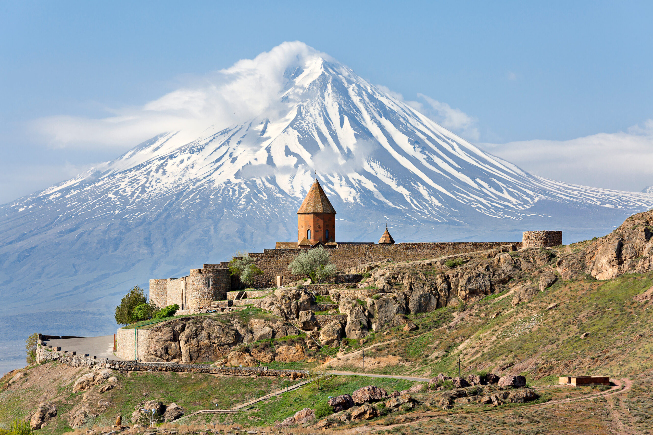
Mount Ararat rises 5,137 m (16,854 ft) in extreme eastern Turkey as the country’s highest peak and one of the most historically resonant mountains on Earth. Generally, the mountain anchors the tripartite border where Turkey, Iran, and Armenia converge. Specifically, the dormant compound stratovolcano consists of two cones — Greater Ararat (5,137 m) and Little Ararat (3,896 m) — and rises 4,300 meters above the surrounding Aras River plain. Notably, Mount Ararat is the traditional landing place of Noah’s Ark according to Christian, Jewish, and Islamic traditions. Friedrich Parrot completed the first recorded ascent on October 9, 1829 with Armenian writer Khachatur Abovian. The July 2, 1840 catastrophic phreatic eruption combined with a magnitude 7.4 earthquake killed up to 10,000 people. Turkey requires a USD 50 climbing permit, a mandatory licensed Turkish guide, and entry through the restricted military zone. The standard Çevirme South Route handles over 95% of modern commercial climbing traffic.
Mount Ararat rises 5,137 m in extreme eastern Turkey as the country’s highest peak and across the entire Armenian Highland. Generally, the mountain combines genuine 5,000-meter altitude with non-technical terrain accessible to fit beginners — a rare combination among major peaks. Specifically, the mountain holds supreme religious significance as the traditional landing place of Noah’s Ark in Christian, Jewish, and Islamic traditions. Notably, Mount Ararat anchors the tripartite border where Turkey, Iran, and Armenia converge — a geographic crossroads between the Anatolian plateau and the Caucasus.
This guide answers what serious climbers ask about Mount Ararat. How does the standard South Route really compare with Damavand or Elbrus? What 2026 permits and costs apply? What’s the actual history behind the Noah’s Ark connection? Notably, we’ll cover several concrete topics. First, the October 9, 1829 Parrot and Abovian first ascent with four named companions. Then the catastrophic July 2, 1840 eruption that killed 10,000 and destroyed Akhuri village. Also three route categories including the Çevirme South Route, the historic Northwestern (Parrot’s 1829 line), and the Southeast Ridge (Chodzko 1856). Plus Turkish Ministry permits, licensed guide requirements, and TÜRSAB verification. Plus five cost tiers from EUR 490 budget through USD 3,500 private programs. Finally, seasonal planning for the June through September main climbing window.
Mount Ararat At a Glance
| Specification | Value | Context |
|---|---|---|
| Summit elevation | 5,137 m / 16,854 ft | USGS standard · alternative 5,165 m citation |
| Turkish name | Ağrı Dağı | “Mountain of Pain” · official designation |
| Armenian name | Masis / Ararat | On Armenia’s coat of arms despite political border |
| Kurdish name | Çiyayê Agirî | Local language designation |
| Location | Ağrı Province, eastern Anatolia | Turkey-Iran-Armenia tripartite convergence |
| Coordinates | 39.70°N, 44.30°E | 32 km from Yerevan, Armenia |
| Rank | Turkey’s highest peak | Highest in entire Armenian Highland |
| Geology | Dormant compound stratovolcano | Greater Ararat (5,137 m) + Little Ararat (3,896 m) |
| Massif width | 35 km / 22 mi at base | One of widest mountain bases in West Asia |
| Prominence | 3rd in West Asia | 4,300 m above surrounding Aras River plain |
| First ascent | October 9, 1829 | Friedrich Parrot, Khachatur Abovian + 4 companions |
| Last eruption | July 2, 1840 | Phreatic explosion + M7.4 quake · ~10,000 dead |
| Standard route | South Route from Çevirme | 95%+ of climbers · Russian-grade equivalent F+ |
| Climbing season | June – September main | March-April ski season · winter avoid |
| 2026 permit cost | USD 50 per climber | Turkish Ministry of Culture and Tourism |
| Expedition duration | 6-8 days standard | 4-5 days actually on mountain |
| 2026 cost range | EUR 490 – USD 3,500 | Budget group to private custom expedition |
Eight Reasons Climbers Target Mount Ararat
Mount Ararat holds a unique position as one of the most historically resonant 5,000-meter summits in the world. Generally, the reasons climbers target this peak combine cultural significance, religious tradition, non-technical accessibility, and affordability. Specifically, each motivation carries an associated responsibility for safe execution at the Turkey-Iran-Armenia border convergence. Notably, no other 5,000-meter peak combines such religious depth with such physical accessibility.
Find Hotels, Flights & Trips for the World’s Best Hiking Destinations
The Global Summit Guide Travel Shop on Expedia — curated for outdoor adventurers, mountaineers, and serious hikers. Patagonia to the Alps. Nepal to the Rockies. Curated lodging for every region we cover.
Explore Travel Shop on Expedia →| # | Reason | Key Detail |
|---|---|---|
| 1 | Turkey’s Highest Summit | 5,137 m · highest in entire Armenian Highland · 4,300 m prominence above plain |
| 2 | Noah’s Ark Tradition | Traditional landing site · Christian, Jewish, Islamic religious significance |
| 3 | Non-Technical 5,000-Meter Summit | No rock climbing required · crampons only above 4,900 m |
| 4 | Spectacular Triple-Border Panorama | Views across Turkey, Iran, Armenia · Lesser Caucasus visible |
| 5 | Friedrich Parrot’s 1829 First Ascent | October 9, 1829 · with Khachatur Abovian · Russian Empire era |
| 6 | Cultural Depth in Doğubayazıt | 17th-century Ishak Pasha Palace · Durupınar Site · Lake Van |
| 7 | Reliable Summer Weather Window | June-September stable conditions · 70%+ success rates with operators |
| 8 | Affordable 5,000-Meter Expedition | From EUR 490 budget · USD 1,100-1,500 standard · one of cheapest 5,000m peaks |
Who Can Climb Mount Ararat
Mount Ararat suits climbers with strong hiking fitness, comfort with multi-day camping, and tolerance for altitudes above 4,000 meters. Generally, no prior mountaineering experience is required for the standard South Route, though familiarity with crampons provides notable advantage on summit day. Specifically, the mountain’s non-technical character makes it accessible to fit beginners — a rare combination at 5,000+ meters. Notably, the standard 6-8 day itinerary remains physically demanding even without technical demands.
Physical preparation matters more than technical skill on Mount Ararat. Generally, guides recommend the ability to hike 10-15 kilometers with a light daypack at moderate pace, sustained over 5-7 consecutive days. Specifically, cardiovascular conditioning through running, cycling, or hill walking for 3-4 months before departure reduces altitude-related risks dramatically. Notably, regular work above 2,000-3,000 m during training amplifies acclimatization efficiency.
Age is rarely a barrier on Mount Ararat. Notably, operators regularly guide climbers from 18 to 70+ years old to the summit, provided they hold doctor-cleared fitness certificates. The standard itinerary includes one full acclimatization day at Camp 1 (3,200 m) — critical for safe altitude adjustment. Travel insurance covering high-altitude rescue to at least 5,500 m remains a non-negotiable requirement for permit approval. Standard travel policies typically exclude mountaineering above 4,000 m, so climbers must specifically purchase extreme-sports coverage from providers like Truetraveller, Global Rescue, or World Nomads Explorer Plus.
Success factor insight from licensed operators. Generally, operators consistently report that climbers who train for 3-4 months beforehand, arrive with properly broken-in B2 mountaineering boots, and complete the full acclimatization day at Camp 1 achieve the highest summit rates. Conversely, rushed itineraries skipping the 4,200 m practice hike correlate strongly with altitude-related failures. Additionally, climbers who arrive 1-2 days early in Doğubayazıt (1,625 m) for initial adjustment report fewer AMS symptoms at Camp 2. Notably, budget extra pre-climb days rather than compressing the schedule.
Mount Ararat in Regional Mountaineering Context
Mount Ararat occupies a unique geological and cultural crossroads. Generally, it anchors the eastern limit of the Anatolian plateau while opening toward the Lesser Caucasus and the Iranian highlands. Specifically, nearby peaks share its volcanic origins but none match its prominence above the surrounding terrain. Notably, the regional summit network creates natural multi-peak itinerary opportunities for climbers traveling to eastern Turkey.
| Regional Peak | Elevation | Location | Comparison to Ararat |
|---|---|---|---|
| Mount Ararat (Ağrı Dağı) | 5,137 m | Turkey · eastern Anatolia | Reference peak · Turkey’s highest · Noah’s Ark tradition |
| Mount Damavand | 5,610 m | Iran · Alborz Range | Asia’s highest volcano · similar non-technical profile |
| Mount Elbrus | 5,642 m | Russia · Caucasus | Europe’s highest · Seven Summits · more technical glacier |
| Mount Kazbek | 5,033 m | Georgia · Caucasus | Where Parrot first saw Ararat in 1811 · natural twin |
| Mount Kilimanjaro | 5,895 m | Tanzania · East Africa | Africa’s highest · similar non-technical profile |
| Süphan Dağı | 4,058 m | Turkey · near Lake Van | Turkey’s 2nd highest · pre-Ararat acclimatization peak |
| Mount Artos | 3,537 m | Turkey · near Lake Van | Common acclimatization peak before Ararat |
For climbers planning regional trips, Mount Ararat pairs logically with several nearby summits. Generally, Mount Kazbek (5,033 m) in Georgia sits 500 km north across the Caucasus — notably the peak where Parrot first glimpsed Ararat in 1811 before his 1829 ascent. Specifically, Mount Damavand (5,610 m) in Iran lies 1,200 km east, offering a similar non-technical volcanic summit experience. Notably, both Süphan Dağı (4,058 m, Turkey’s second highest) and Mount Artos (3,537 m) near Lake Van provide ideal pre-Ararat acclimatization opportunities accessible from the same Doğubayazıt-Van travel corridor.
Mount Ararat History — From Urartu to Modern Mountaineering
Mount Ararat’s recorded history spans four millennia. Generally, few peaks on Earth carry such dense layers of religious tradition, political significance, and scientific inquiry. Specifically, the mountain appears in Assyrian inscriptions, biblical texts, medieval missionary journals, Russian military surveys, and contemporary mountaineering literature. Notably, the historical depth makes Ararat a pilgrimage destination rather than merely a climbing objective.
| Period | Event | Significance |
|---|---|---|
| 9th-7th c. BCE | Urartu kingdom flourishes | Iron Age Armenian Highland · gives Ararat its name |
| Genesis 8:4 | “Mountains of Ararat” reference | Hebrew Bible · region rather than specific peak |
| 13th century | William of Rubruck records local belief | “Many have tried to climb it, but none has been able” |
| Medieval era | Monastery of St. Jacob built | Armenian monastery at 1,943 m on northern slope |
| 1811 | Parrot first sees Ararat from Kazbek | Future first ascensionist glimpses goal from Caucasus |
| 1828 | Treaty of Turkmenchay | Region transfers from Persia to Russian Empire |
| October 9, 1829 | Parrot and Abovian first ascent | 3:15 p.m. summit · 6-person team · mercury barometer measurement |
| 1831 | Abovian testifies at Dorpat courthouse | Formal verification of 1829 ascent under oath |
| 1834 | Parrot’s Journey to Ararat published | Berlin · German account · later English translation |
| 1834 | Spassky-Avtonomov verification climb | With Aivazian (original Armenian guide) · vindicates 1829 |
| July 2, 1840 | Catastrophic phreatic eruption + M7.4 quake | ~10,000 dead · Akhuri destroyed · Monastery obliterated |
| 1845 | Otto von Abich geological survey | With Abovian · first detailed geological summit research |
| 1846 | Henry Danby Seymour climbs with Abovian | Abovian’s third and final ascent · English participant |
| 1850 | Chodzko Russian survey | Southeast Ridge line · Russian military mapping |
| 1856 | General Robert Stuart 5-person ascent | British military verification |
| 1876 | James Bryce vindication climb | Oxford academic · authoritative published accounts |
| 1918-1920 | First Republic of Armenia includes Ararat | Briefly returns to Armenian sovereignty |
| Early 1920s | Border rearrangement transfers Ararat to Turkey | Geopolitical settlement after WWI |
| 1988 | Willis GPR ark search expedition | Eastern summit plateau radar survey · no ark found |
| 1989 | Willis follow-up western plateau survey | Ice depth determination · further ark searches limited |
| 2015 | Permit system decentralization | Doğubayazıt local issuance · processing drops to 10-15 days |
| Current 2026 | $50 USD permit system · TÜRSAB operators | Standard infrastructure · 95%+ South Route traffic |
Ancient Origins and the Urartu Kingdom
The Biblical Hebrew name “Ararat” derives directly from “Urartu” — the Assyrian-Babylonian name for the Iron Age kingdom that flourished between the 9th and 7th centuries BCE in the Armenian Highland. Generally, Archibald Sayce proposed the name meant “highlands” in Urartian. Specifically, “Ayrarat,” the central province of ancient Armenia, derives from the same root. Notably, Genesis 8:4 references the “mountains of Ararat” as a broader region rather than this specific peak.
European traditions associated this particular summit with Noah’s Ark only during the Middle Ages. Generally, Robert W. Thomson suggested the mountain was called Ararat “by confusion with Ayrarat, the name of the province.” Specifically, Persian traditions referred to Ararat as the cradle of the human race. Notably, local Armenians maintained that the Ark still lay on the summit but remained invisible by divine command. Above the village of Akhuri on the northern slope, Armenians built a monastery to commemorate St. Jacob — who reportedly tried repeatedly but failed to reach the summit in search of the Ark.
The October 9, 1829 First Ascent
Friedrich Parrot of the University of Dorpat (modern Tartu, Estonia) arrived at Etchmiadzin in mid-September 1829, nearly two years after the Russian capture of Yerevan. Generally, the Treaty of Turkmenchay (1828) had finally transferred the region from Persia to the Russian Empire, making Christian travel possible. Specifically, Catholicos Yeprem, head of the Armenian Church, assigned 20-year-old deacon Khachatur Abovian as interpreter and guide. Notably, the expedition included two Russian soldiers (Aleksei Zdorovenko and Matvei Chalpanov) and two Armenian villagers from Akhuri (Hovhannes Aivazian and Murad Poghosian).
The team established a base camp at the Armenian Monastery of St. Jacob at 1,943 m on the northern slope. Generally, after two failed attempts, they reached the summit at 3:15 p.m. on October 9, 1829 — September 27 in the Old Style Julian calendar. Specifically, Parrot measured the elevation at 5,250 m using a mercury barometer — the first recorded high-altitude elevation measurement by scientific instrument. Notably, Abovian dug a hole in the ice on the summit and erected a wooden cross facing north. He carried a chunk of summit ice down in a bottle, treating it as holy water. Parrot’s account was published in German as Journey to Ararat (Berlin, 1834) and later translated into English.
Nineteenth-Century Verification
Parrot’s ascent was initially doubted across the Russian Empire. Generally, local Armenians insisted Ararat remained unconquerable despite eyewitness testimony from the six expedition members. Specifically, in 1831 Abovian formally testified at the Dorpat courthouse — when asked whether he had personally been on the summit with Parrot on October 9, 1829, he emphatically answered “Yes.” Notably, Spassky-Avtonomov climbed in 1834 with Aivazian (one of Parrot’s original Armenian guides), confirming the first ascent’s success.
German mineralogist Otto Wilhelm Hermann von Abich climbed Ararat with Abovian in 1845, conducting the first detailed geological survey of the summit region. Generally, Abovian’s third and final ascent accompanied Englishman Henry Danby Seymour in 1846. In 1856 General Robert Stuart led a party of five to the summit. Notably, British historian James Bryce’s 1876 ascent published authoritative accounts that finally silenced European doubts. Bryce’s credentials as an Oxford academic carried decisive weight in Western mountaineering circles.
The July 2, 1840 Catastrophe
On July 2, 1840, Mount Ararat experienced its most devastating event in recorded history. Generally, a phreatic (steam) eruption triggered pyroclastic flow from radial fissures on the upper north flank. Specifically, a magnitude 7.4 earthquake struck the region simultaneously. Notably, the combined seismic and volcanic event triggered a massive landslide and debris flow that destroyed the village of Akhuri.
Up to 10,000 people died in the catastrophe. Generally, approximately 1,900 villagers in Akhuri (modern Yenidoğan) perished under the debris flow. Specifically, the disaster obliterated the ancient Monastery of St. Jacob, the chapel of St. James, the town of Aralik, several villages, and Russian military barracks. Notably, the combined landslide temporarily dammed the Sevjur (Metsamor) River. The volcano has remained dormant since 1840 with no confirmed eruptive activity.
Twentieth-Century Border Politics
Mount Ararat fell within the First Republic of Armenia from 1918-1920. Generally, the geopolitical rearrangements of the early 1920s transferred the mountain to Turkish control. Specifically, the Soviet-Turkish border remained largely closed throughout the Cold War, restricting climbing access major. Notably, the Armenian Coat of Arms nevertheless retains Mount Ararat prominently — symbolizing historical continuity and cultural connection to the sacred peak despite the political border. Mount Ararat remains the central visual landmark from Yerevan, just 32 kilometers away across the closed frontier.
Climbing Routes on Mount Ararat
Mount Ararat offers three primary approaches, though the South Route dominates modern expedition traffic. Generally, this route handles over 95% of all commercial climbing. Specifically, military access restrictions on the northern and eastern slopes effectively eliminate those approaches for foreign climbers. Notably, all three routes require Turkish Ministry permits and TÜRSAB-registered guides regardless of approach.
| Route | Starting Point | Difficulty | Duration | Traffic |
|---|---|---|---|---|
| South Route (Standard) | Çevirme Village (2,200 m) | Non-technical at altitude | 4-5 days on mountain | 95%+ |
| Northwestern Route | Historic Akhuri area | Moderate, longer | 5-6 days | <2% |
| Southeast Ridge | Sardarbulakh saddle | Longer, steeper final | 5-7 days | <3% |
South Route — The Çevirme Village Standard
The South Route starts from Çevirme Village (also spelled Çarme) at 2,200 m elevation, approximately one hour by vehicle from Doğubayazıt. Generally, this is the default approach used by virtually every licensed operator including Two Ararat, TAF Travel, Ararat Adventures, and Penguin Travel. Specifically, mules carry all equipment to Base Camp on the first day, making the approach physically manageable. Notably, the route grades non-technical despite the 5,137 m summit elevation.
From the trailhead, climbers trek approximately five hours to Base Camp (Green Camp) at 3,200 m. Generally, the camp takes its name from the seasonal vegetation appearing during spring months. Specifically, operators maintain established camping areas with kitchen tents and security guards from mid-June through mid-October. Notably, the standard schedule includes one full acclimatization day at Camp 1 — essential for altitude adjustment.
The move to High Camp at 4,200 m takes approximately four hours across rocky terrain. Generally, this camp features significantly colder conditions with frequent strong winds. Specifically, summit day begins at 1-2 a.m. with headlamps. Notably, crampons become essential from 4,900 m where the Ararat glacier line begins. The summit ridge involves 25-30 degree slopes on firm névé before reaching the 5,137 m cairned summit.
Northwestern Route — Parrot’s 1829 Approach
Parrot’s 1829 expedition ascended from the Armenian village of Akhuri on the northern slope at 1,220 m. Generally, they established their base camp at the Monastery of St. Jacob at 1,943 m. Specifically, the 1840 eruption and landslide destroyed both Akhuri and the monastery — leaving no historical infrastructure. Notably, the route crosses the Parrot Glacier ice flow in the final section. It has longer approach logistics and complex access arrangements compared to the South Route. Proximity to the Armenian border triggers military access restrictions that make foreign permits nearly impossible to obtain in practice. This historically major line sees almost no modern climbing traffic. No commercial operator currently offers scheduled ascents via this approach.
Southeast Ridge — The Chodzko 1856 Approach
General Chodzko’s 1850 Russian survey party used this line from the Sardarbulakh saddle area between Greater and Little Ararat. Generally, the saddle marks the historic meeting point of Turkish, Persian, and Russian imperial frontiers. Specifically, early American expeditions of the 1850s-1860s followed similar terrain. Notably, the Southeast Ridge features a steeper final section than the South Route and a longer overall ascent profile. It connects to Little Ararat (3,896 m) territory on the eastern shoulder. Current commercial operators do not offer this route because of the South Route’s efficiency and established infrastructure.
Mount Ararat Permits & Regulations 2026
Every foreign climber requires a formal climbing permit issued by the Turkish Ministry of Culture and Tourism. Generally, since 2015 local authorities in Doğubayazıt process these applications directly — significantly faster than the previous Ankara-routed system. Specifically, the 2026 fee remains set at USD 50 per person. Notably, processing times have dropped from 1-2 months to just 10-15 business days since the decentralization reform.
| Permit / Requirement | 2026 Cost | Notes |
|---|---|---|
| Turkish Ministry climbing permit | USD 50 per climber | Required for all foreign climbers · processed via licensed agency |
| Tourist visa | Visa-free for most Western nationals | 90-day visa-free entry · check current rules per nationality |
| Travel insurance | Mandatory · USD 200-800 | Must cover high-altitude rescue to 5,500 m with helicopter evacuation |
| TÜRSAB-licensed Turkish guide | Included in operator packages | Mandatory · solo climbing prohibited |
| Permit application timeline | 10-15 business days (since 2015) | Apply 3-4 weeks ahead for peak July-August dates |
| Group size limits | 1-15 climbers typical | Larger groups split to manage environmental and security checks |
| Army checkpoint verification | Multiple checks during ascent | Carry printed permit copies plus passport at all times |
Avoid unauthorized operators. Generally, pirate businesses sometimes offer “cheap” climbs without paying the official $50 Ministry fee. Specifically, permits without proper payment are legally invalid and expose climbers to fines or arrest at army checkpoints. Notably, the Association of Turkish Travel Agencies (TÜRSAB) and the Ministry of Tourism maintain an online verification system for all legal operators. Verify your agency’s registration before booking to ensure compliance. Mount Ararat’s slopes constitute a restricted military area bordering Iran and Armenia — army checkpoints near the trailhead routinely verify permits, guide credentials, and passport details.
Required Documentation for 2026
For 2026 permit applications, each climber must provide several documents through their licensed agency. Generally, the documentation requirements are straightforward and largely standard. Specifically, the agency handles all Ministry submissions on the climber’s behalf. Notably, advance preparation of these documents prevents processing delays:
- High-resolution passport scan — valid at least 6 months beyond entry date
- Completed application form — your agency supplies the official template
- Proof of travel insurance — covering high-altitude rescue to at least 5,500 m
- Flight or overland itinerary — showing arrival and departure dates
- USD 50 payment — to the Ministry of Tourism official account
- Passport-style photo — some operators require one copy
Access Logistics to Doğubayazıt
Mount Ararat is accessible via three regional airports serving eastern Turkey. Generally, the journey from any of these airports to Doğubayazıt takes 1-3 hours by road. Specifically, operators coordinate all transfers as part of their packages. Notably, Doğubayazıt itself sits at 1,625 m — providing useful pre-climb acclimatization to elevation.
| Gateway | Code | Distance to Doğubayazıt | Notes |
|---|---|---|---|
| Iğdır Airport | IGD | ~50 km north | Closest airport · domestic flights from Istanbul |
| Van Airport (Ferit Melen) | VAN | ~180 km southwest | Largest regional airport · access via Lake Van |
| Ağrı Airport (Ahmed-i Hani) | AJI | ~100 km west | Provincial capital · domestic flights only |
| Istanbul connections | IST/SAW | ~1,200 km west | Turkish Airlines, Pegasus, AnadoluJet domestic flights |
Mount Ararat Climbing Costs in 2026
Mount Ararat remains one of the most affordable 5,000-meter summits in the world. Generally, licensed operators in Doğubayazıt offer competitive 2026 pricing across several tiers based on group size and inclusions. Specifically, most packages bundle the permit, guide, camps, meals, mules, and transfers into a single all-inclusive price. Notably, the cost spread between budget group tours and private expeditions is wider than for most 5,000m peaks.
| Cost Tier | 2026 Price | Best For |
|---|---|---|
| Tier 1 — Budget 6-Day Programs | From EUR 490 per person | Budget travelers · TAF Travel entry-level · verify permit inclusion |
| Tier 2 — Standard Group Tour | USD 1,100-1,500 per person | Most popular tier · 6-12 climbers · 7-8 day standard program |
| Tier 3 — Small Group Tour | USD 1,400-1,900 per person | 2-5 climbers · better acclimatization · personalized attention |
| Tier 4 — Private Expedition | USD 2,200-3,500 per person | 1-2 climbers · custom dates · maximum flexibility |
| Tier 5 — Ski Mountaineering (Mar-Apr) | EUR 1,200-1,800 per person | Backcountry ski experience required · Two Ararat scheduled departures |
What 2026 Packages Include
Standard 2026 expedition packages include several core components across all tiers. Generally, the inclusions standardize across licensed operators thanks to TÜRSAB regulations. Specifically, climbers should expect these elements as baseline package contents. Notably, helicopter rescue and emergency oxygen are typically separate (covered by mandatory travel insurance):
- Climbing permit: USD 50 per person (Turkish Ministry of Culture and Tourism)
- Licensed Turkish guide: Included in all packages — mandatory
- Mules or horses to Camp 1: Included for 20 kg equipment per climber
- Meals on mountain: Cook prepares all hot meals and hot drinks
- Tent accommodation: 2-person tents with mattresses (premium tiers)
- Crampons: Often included as standard equipment
- Doğubayazıt hotel (pre/post climb): €40-80 per night for 3-star accommodations
- Airport transfers: €30-50 from Van, Iğdır, or Ağrı airports
- Ishak Pasha Palace entry: Approximately €5 per person (included in some tours)
Essential Gear for Mount Ararat
Gear requirements for Mount Ararat combine trekking essentials with technical glacier equipment. Generally, licensed operators supply tents, mattresses, crampons, and ice axes in most packages. Specifically, climbers remain responsible primarily for personal clothing, boots, sleeping bags, and specialty items. Notably, the cold summit temperatures and 1-2 a.m. start times demand expedition-quality gear despite the moderate altitude.
| Category | Required Equipment | Recommended Models |
|---|---|---|
| Footwear (Essential) | B2 or B3 rated mountaineering boots (broken in) · 3+ pairs thick socks · gaiters | La Sportiva Trango Cube, Scarpa Charmoz |
| Layered clothing | Merino base layers · fleece mid-layer · insulated puffy · hardshell | Patagonia, Arc’teryx standard kits |
| Head and hands | Category 4 UV glacier sunglasses · balaclava · warm beanie · insulated gloves + mittens | Julbo Vermont, Black Diamond Mercury |
| Technical gear (Essential) | 12-point crampons (often provided) · ice axe (often provided) · trekking poles · helmet | Petzl Vasak crampons, Black Diamond Raven Pro |
| Sleep system | Sleeping bag rated to -15°C minimum · inflatable or foam pad · silk liner | Mountain Hardwear Phantom 15, Therm-a-Rest NeoAir |
| Pack and lighting | 50-60 L expedition pack · 15-20 L summit daypack · headlamp + spare batteries | Osprey Aether, Petzl Actik Core |
| Hydration and nutrition | 1-2 L insulated water bottles · thermos for hot drinks · high-calorie trail snacks | Nalgene insulated, Thermos King |
| Health and sun (Essential) | SPF 50+ sunscreen · lip balm with SPF · Diamox/Acetazolamide · personal first aid kit | Doctor-prescribed Diamox · individual setup |
Hazards on Mount Ararat
Mount Ararat is non-technical but not risk-free. Generally, climbers must understand and prepare for several specific hazards that cause most rescues and aborted summit attempts. Specifically, most incidents trace back to altitude, weather, or unprepared climbers rather than technical terrain. Notably, six hazard categories deserve attention before any Mount Ararat expedition.
| Hazard | Severity | Mitigation |
|---|---|---|
| Altitude sickness (AMS) above 4,000 m | Major | Full acclimatization day at Camp 1 · Diamox · descend if HAPE/HACE symptoms appear |
| Cold exposure (-10 to -20°C summit) | Major | Expedition-grade layers · windproof shell · frostbite prevention on summit day |
| Glacier travel above 4,900 m | Moderate | Crampons from glacier line · ice axe self-arrest skills · roped travel sections |
| Weather volatility | Major | Reserve days built into itinerary · operator weather monitoring · turnaround discipline |
| Water scarcity above 3,200 m | Moderate | Operators transport sealed water · summer glacial melt supplementation · extra capacity |
| Border security and military checkpoints | Significant | Multiple printed permit copies · passport accessible · no photos of military installations |
Ararat is non-technical but lies in a restricted military zone. Generally, the mountain combines accessible terrain with serious geopolitical sensitivity. Specifically, the slopes constitute a restricted military area bordering Iran and Armenia where army patrols regularly check climbers and documentation. Notably, climbers without proper permits face immediate removal from the mountain and potential fines. Always keep passport and permit copies accessible during the climb. Avoid photographing military installations anywhere in the region. The combination of altitude (5,137 m), cold (-10 to -20°C summit), and remoteness demands serious preparation despite the non-technical classification.
Season & Weather Planning
The Mount Ararat climbing calendar divides clearly into four distinct seasons, each offering different experiences and challenges. Generally, the main summer window dominates commercial traffic, with specialized ski operations extending into spring. Specifically, the season runs from mid-June through mid-September for standard climbs. Notably, the famous October 9, 1829 Parrot first ascent occurred late in the modern climbing season — pushing into early October still works for experienced parties.
| Window | Period | Conditions | Notes |
|---|---|---|---|
| Spring Ski Season | March – April | Snow conditions ideal for ski mountaineering | Two Ararat scheduled departures · backcountry ski experience required |
| Early Season | Mid to late June | Emerging summer · heavier snow above 3,500 m | Fewer crowds · cooler temperatures · operator services ramping up |
| Peak Window | July to August | Most stable weather · highest success rates 70%+ | Crowded trails · permit sellouts common · book 3-4 weeks ahead |
| Late Season | Early to mid September | Stable weather · cooler temperatures | Reduced crowds · 1829 FA occurred October 9 historically |
| Off-Season | October – February | Snow, cold, storms, avalanche risk | Operator services close · winter attempts strongly discouraged |
Frequently Asked Questions About Mount Ararat
How tall is Mount Ararat?
Mount Ararat rises to 5,137 m (16,854 ft) in extreme eastern Turkey, making it the highest peak in Turkey and across the entire Armenian Highland. The mountain is a dormant compound stratovolcano consisting of two major cones — Greater Ararat (5,137 m) and Little Ararat (3,896 m). The massif rises approximately 4,300 meters above the surrounding Aras River plain in dramatic isolation, creating one of the most prominent peaks in all of West Asia. The peak anchors the tripartite border where Turkey, Iran, and Armenia converge. Turks know the peak as Ağrı Dağı (Mountain of Pain), Armenians call it Masis or Ararat, and Kurds know it as Çiyayê Agirî.
Where is Mount Ararat located?
Mount Ararat sits in Ağrı Province in extreme eastern Turkey, near the tripartite border where Turkey, Iran, and Armenia converge. The coordinates are 39.70°N, 44.30°E in the easternmost part of Anatolia. The mountain rises just 32 kilometers from Yerevan, Armenia’s capital, across a closed political border. Access requires entry through Turkey via Van, Iğdır, or Ağrı airports, then road transfer to Doğubayazıt (1,625 m) which serves as the climbing gateway town. The trailhead at Çevirme Village (2,200 m) sits approximately one hour from Doğubayazıt by vehicle.
Who first climbed Mount Ararat?
Friedrich Parrot of the University of Dorpat made the first recorded ascent on October 9, 1829 with Armenian deacon Khachatur Abovian and four companions. The team included two Russian soldiers (Aleksei Zdorovenko and Matvei Chalpanov) and two Armenian villagers from Akhuri (Hovhannes Aivazian and Murad Poghosian). They reached the summit at 3:15 p.m. on the third attempt after two earlier failures. Parrot measured the elevation at 5,250 m using a mercury barometer — the first recorded high-altitude elevation measurement by scientific instrument. Abovian dug a hole in the ice and erected a wooden cross facing north, then carried a chunk of summit ice down as holy water. Parrot’s account was published in German as Journey to Ararat in Berlin in 1834.
When did Mount Ararat last erupt?
Mount Ararat last erupted on July 2, 1840 in a catastrophic phreatic (steam) explosion combined with a magnitude 7.4 earthquake. The combined seismic and volcanic event triggered a massive landslide and pyroclastic flow from radial fissures on the upper north flank. Up to 10,000 people died in the catastrophe — approximately 1,900 villagers in Akhuri (modern Yenidoğan) perished under the debris flow. The disaster obliterated the ancient Armenian Monastery of St. Jacob, the chapel of St. James, Russian military barracks, and the town of Aralik. The combined landslide temporarily dammed the Sevjur (Metsamor) River. The volcano has remained dormant since 1840 with no confirmed eruptive activity.
Is Mount Ararat where Noah’s Ark landed?
Mount Ararat traditionally represents the resting place of Noah’s Ark according to Christian, Jewish, and Islamic traditions. However, Genesis 8:4 references the “mountains of Ararat” as a broader region rather than this specific peak. The identification with Greater Ararat emerged in Western sources during the Middle Ages. The name Ararat derives from Urartu, the Assyrian-Babylonian name for the Iron Age kingdom that flourished in the region from the 9th to 7th centuries BCE. Multiple modern expeditions including the 1988 Willis ground-penetrating radar survey have searched the summit ice cap without finding verifiable Ark remains. The disputed Durupınar Site 30 km south remains debated among researchers.
How difficult is climbing Mount Ararat?
Mount Ararat is technically non-technical but physically demanding because of its 5,137 m altitude. Beginners with good fitness can reach the summit using the standard South Route. Crampons and ice axe become essential above 4,900 m where the glacier begins, and the final 100-200 m ridge involves 25-30 degree slopes on firm névé. No rock climbing or advanced alpine skills are required. However, altitude acclimatization, long hiking days, and cold exposure demand serious preparation. Summit day typically runs 12-14 hours round trip from High Camp. Cardiovascular conditioning through 3-4 months of hiking, running, or cycling significantly improves success rates.
How much does the Mount Ararat permit cost in 2026?
The 2026 Mount Ararat climbing permit costs USD 50 per person, set by the Turkish Ministry of Culture and Tourism. Local authorities in Doğubayazıt issue permits within 10-15 business days since the 2015 decentralization reform. All climbers must travel with a certified Turkish mountain guide registered with TÜRSAB — solo climbing is strictly prohibited. Peak-season slots (July-August) fill fast, so booking 3-4 weeks ahead is essential. Pirate operators sometimes offer cheap climbs without paying the official Ministry fee — these permits are legally invalid and expose climbers to fines at army checkpoints. Mount Ararat lies within a restricted military zone bordering Iran and Armenia where army patrols routinely verify documentation.
How much does a Mount Ararat expedition cost in 2026?
Expedition costs vary by group size and inclusions. Entry-level 6-day programs start around EUR 490 through operators like TAF Travel. Standard group tours of 6-12 people typically run USD 1,100-1,500 per person including permit, guide, camps, meals, mules, and transfers. Small group tours of 2-5 people cost USD 1,400-1,900 per person with better acclimatization pacing. Private expeditions for 1-2 climbers range USD 2,200-3,500 per person for fully customized dates. Packages exclude flights, personal gear, travel insurance, and tips. Ski mountaineering tours in March-April typically cost EUR 1,200-1,800 per person.
What is the standard route up Mount Ararat?
The standard route is the South Route from Çevirme Village (also spelled Çarme) at 2,200 m elevation, approximately one hour by vehicle from Doğubayazıt. This route handles over 95% of all commercial climbing traffic. Climbers trek five hours from the trailhead to Base Camp (Green Camp) at 3,200 m where mules carry supplies. The standard schedule includes one full acclimatization day at Camp 1 with a hike to 4,200 m and return. The move to High Camp at 4,200 m takes four hours across rocky terrain. Summit day begins at 1-2 a.m. with crampons required from 4,900 m where the glacier line begins. The final 100-200 m involves 25-30 degree slopes on firm névé before reaching the 5,137 m cairned summit.
When is the best time to climb Mount Ararat?
The optimal climbing window runs from mid-June through mid-September, with July and August offering the most stable weather. Agencies operate established base camps from the second week of June to mid-October. March and April work for ski-mountaineering ascents on the upper snowfields. Winter attempts face severe cold, deep snow, and technical hazards that commercial operators avoid. Summer daytime temperatures at Camp 1 range 10-20°C, while summit night temperatures drop to -10 to -20°C with major wind chill. Peak-season July-August dates can sell out 3-4 months in advance, so early booking protects your preferred window. The famous October 9, 1829 Parrot first ascent demonstrates that late-season climbs into early October remain feasible for prepared parties.
Mount Ararat Related Resources
Sources & Verified References
- Turkish Ministry of Culture and Tourism — 2026 Mount Ararat climbing permit fee schedule
- Two Ararat (twoararat.com) — 2026 South Route camp coordinates, schedule, and pricing
- TAF Travel (taftravel.com) — 2026 Ararat climbing tour pricing from EUR 490
- Ararat Peak Travel (araratpeak.com) — 2026 permit application procedures
- Ararat Adventures (araratadventures.com) — South Route itinerary details
- Penguin Travel — 8-day Ararat climbing program structure and inclusions
- The Natural Adventure — 2026 group climb dates and logistics
- Friedrich Parrot, Journey to Ararat (Berlin, 1834) — first ascent primary source
- Edward Peck, “Ararat: Another Controversial First Ascent” — Alpine Journal Vol. 107 (2002)
- Philip P. Ketchian, “Ararat Redux: Abovian, Prof. Parrot and First Ascent” — Armenian Mirror-Spectator (2011)
- Encyclopedia Britannica — Mount Ararat entry for historical and geological data
- USGS elevation data for Greater Ararat summit (5,137 m standard)
- Wikipedia — Mount Ararat comprehensive overview article
- TÜRSAB (Association of Turkish Travel Agencies) — Licensed operator verification system
Last updated: May 27, 2026. Next scheduled update: October 2026 (post-season update incorporating 2026 climbing season summit data, updated Turkish Ministry permit fees, and any new TÜRSAB operator regulations).
Plan Your 2026 Mount Ararat Expedition
Mount Ararat rewards thorough preparation with one of mountaineering’s most historically resonant summits. Generally, the mountain combines genuine 5,000-meter altitude with non-technical terrain accessible to fit beginners. Notably, the standard 6-8 day Çevirme South Route handles 95%+ of climbers and requires the $50 USD Ministry permit plus a TÜRSAB-registered Turkish guide. Apply your permit at least three weeks ahead and train seriously for the altitude.
Compare with Damavand Iran →Was this helpful?
🏔Related peaks nearby
🧭Explore & compare
Global Summit Guide is an independent mountaineering resource founded in 2026. The team combines first-hand trekking and climbing experience with in-depth research and professional health and nutrition review to help climbers choose objectives, prepare properly, and stay safe.
Health, altitude, and nutrition content is reviewed by Taylor Ludlow (Registered Nurse) and Brigg Hoopes (Nutritionist).
What We Don't Know Yet
Mountain information changes quickly. This box explains the limits of what this page can responsibly promise.
- Visa, passport, vaccination, border, insurance, and local transportation rules may change before your trip.
- Route conditions, snowpack, closures, and weather can change quickly after this page is updated.
- Permit rules, fees, quotas, and reservation windows may change between review cycles.
- Operator availability, pricing, guide ratios, and cancellation terms can change by season.
- Your fitness, altitude response, risk tolerance, and experience level may change what is safe or realistic.
Verify current conditions with official land managers, guide services, local forecasts, and current route reports before booking or climbing.
Mountaineering, rock and ice climbing, glacier travel, and high-altitude activity are inherently dangerous and can result in serious injury or death. The information on Global Summit Guide is provided for general informational and educational purposes only and is not a substitute for professional instruction, qualified guiding, proper equipment, or your own judgment and experience.
Route conditions, weather, snowpack, permits, regulations, and hazards change constantly and may differ from what is described here. Details may be incomplete, out of date, or contain errors. Always verify current information with local authorities, certified guides, and official sources before making any decision in the mountains.
Nothing on this site is medical, legal, or financial advice. Our fitness, acclimatization, altitude, and nutrition content is general in nature; consult a qualified physician before beginning any strenuous exercise program or exposing yourself to high altitude.
You are solely responsible for your own safety and decisions. To the fullest extent permitted by law, Global Summit Guide and its team accept no liability for any loss, injury, damage, or expense arising from use of, or reliance on, this information. By using this site you acknowledge these risks and accept these terms.
Some links on this site may be affiliate links. If you buy through them we may earn a small commission at no extra cost to you; this never affects our recommendations.
Global Summit Guide recommendation path
Next Best Mountain to Research
Use these recommendations to continue the right planning path instead of stopping on one page.
Use current permit, weather, route, and operator information before booking or climbing.