
Last updated June 14, 2026
Thabana Ntlenyana: Complete Guide to Climbing Southern Africa’s Highest Peak
The definitive 2026 guide to climbing Thabana Ntlenyana — Southern Africa’s highest peak at 3,482m in Lesotho’s Maloti Mountains. Complete coverage of the legendary Sani Pass 4×4 access, border crossing logistics (passport required), 2-3 day hiking itinerary from Sani Mountain Lodge, difficulty (non-technical but altitude-affected), best season (May-September), and how the “Beautiful Little Mountain” compares to Kilimanjaro and other major African peaks.
This Thabana Ntlenyana climbing guide synthesizes authoritative sources covering Southern Africa’s highest peak: Drakensberg Hiker (premier regional 4×4 + hiking operator); Lesotho on Track (local Lesotho tour operator with Thabana Ntlenyana programs); SummitPost mountaineering documentation; SA Hikes; SA Country Life expedition reports; Wikivoyage Sani Pass entry; verified Sani Mountain Lodge information; and the Lesotho Tourism Development Corporation. Specifically, all elevation data, route distances, timing estimates, and border crossing requirements are cross-referenced against these sources.
Specifically, this guide reflects 2026 conditions including Sani Pass road status, border post operations, Sani Mountain Lodge accommodation, and Lesotho visa policies. This page contains no affiliate revenue from any guide services, transportation operators, or accommodation providers mentioned.
📚 Mixed Experience Content — Honest Framing
This Thabana Ntlenyana guide combines first-hand African mountaineering experience with research-based content. Travis Ludlow has personally climbed Mount Kilimanjaro (Tanzania), providing direct first-hand experience with African high-altitude mountains, acclimatization protocols, and East African mountain logistics applicable to the altitude considerations for any African peak. However, Thabana Ntlenyana specifically and Lesotho/Drakensberg climbing are outside our editorial team’s direct experience to date. Specifically, the Sani Pass logistics, border crossing details, and Lesotho-specific information synthesize authoritative published sources rather than personal experience. Generally, we believe this honest framing is more useful than pretending uniform experience across all African peaks.
Find Hotels, Flights & Trips for the World’s Best Hiking Destinations
The Global Summit Guide Travel Shop on Expedia — curated for outdoor adventurers, mountaineers, and serious hikers. Patagonia to the Alps. Nepal to the Rockies. Curated lodging for every region we cover.
Explore Travel Shop on Expedia →⚡ Thabana Ntlenyana — The Verdict in One Sentence
Thabana Ntlenyana (3,482m / 11,424 ft) is the highest peak in all of Southern Africa — a non-technical 2-3 day hike from the top of Sani Pass (2,874m) that combines the legendary Sani Pass 4×4 border crossing, the famous “Highest Pub in Africa” at Sani Mountain Lodge, and a moderate high-altitude trek through the rolling Maloti Mountains of Lesotho. Specifically, the climb itself requires no technical skills, but the entire experience involves substantial logistics: 4×4 vehicle for Sani Pass; passport for the international border crossing into Lesotho; appropriate gear for high-altitude conditions; and ideally a local guide due to the unmarked trails.
The two most important context points: First, Sani Pass is an INTERNATIONAL BORDER CROSSING from South Africa into the Kingdom of Lesotho — passport is mandatory and 4×4 is strictly enforced. Second, while non-technical, the 3,482m altitude affects unacclimatized hikers significantly — fly-in international visitors should plan acclimatization time at Sani Mountain Lodge (2,874m) before the summit attempt.
📑 On This Page
- What Is Thabana Ntlenyana?
- What Does Thabana Ntlenyana Mean?
- Location, Map & Weather
- Sani Pass — The Standard Approach
- Do You Need a 4×4 for Sani Pass?
- Do You Need a Passport?
- Sani Pass Border Crossing Checklist
- Thabana Ntlenyana Difficulty: How Hard Is It?
- The Hike — Routes & Itinerary
- Best Time to Climb
- Required Gear
- Sani Mountain Lodge — Highest Pub in Africa
- Accommodation Options
- Thabana Ntlenyana vs Kilimanjaro & Other African Peaks
- FAQ
- Methodology + Sources
⚡ Quick Answer: Thabana Ntlenyana Essentials
What is Thabana Ntlenyana? The highest peak in Southern Africa at 3,482m (11,424 ft), located in Lesotho’s Maloti Mountains. Name meaning: “Beautiful Little Mountain” in Sesotho. How to reach: Drive Sani Pass (4×4 required) from Underberg, South Africa across the Lesotho border. Passport? YES — Sani Pass is an international border crossing. 4×4? YES — strictly enforced by SA border post.
Difficulty: Non-technical hike but altitude (3,482m) and unmarked trails make it moderate-to-challenging. Duration: 8 hours minimum day hike from Sani Mountain Lodge; 2-3 days with overnight (most popular). Best season: May to September (Southern Hemisphere winter — dry season). Base: Sani Mountain Lodge at 2,874m (famous “Highest Pub in Africa”). Closest SA town: Underberg (KwaZulu-Natal). Cost: $500-1,500 for guided 3-day trip; $200-500 self-organized.
Highest in: Lesotho · Southern Africa · Drakensberg/Maloti range. Higher than: Mafadi (3,450m), Champagne Castle (3,377m), all peaks in South Africa, Zimbabwe, Zambia, Mozambique, Botswana, Namibia. Authoritative sources: Drakensberg Hiker, Lesotho on Track, SummitPost, Sani Mountain Lodge.
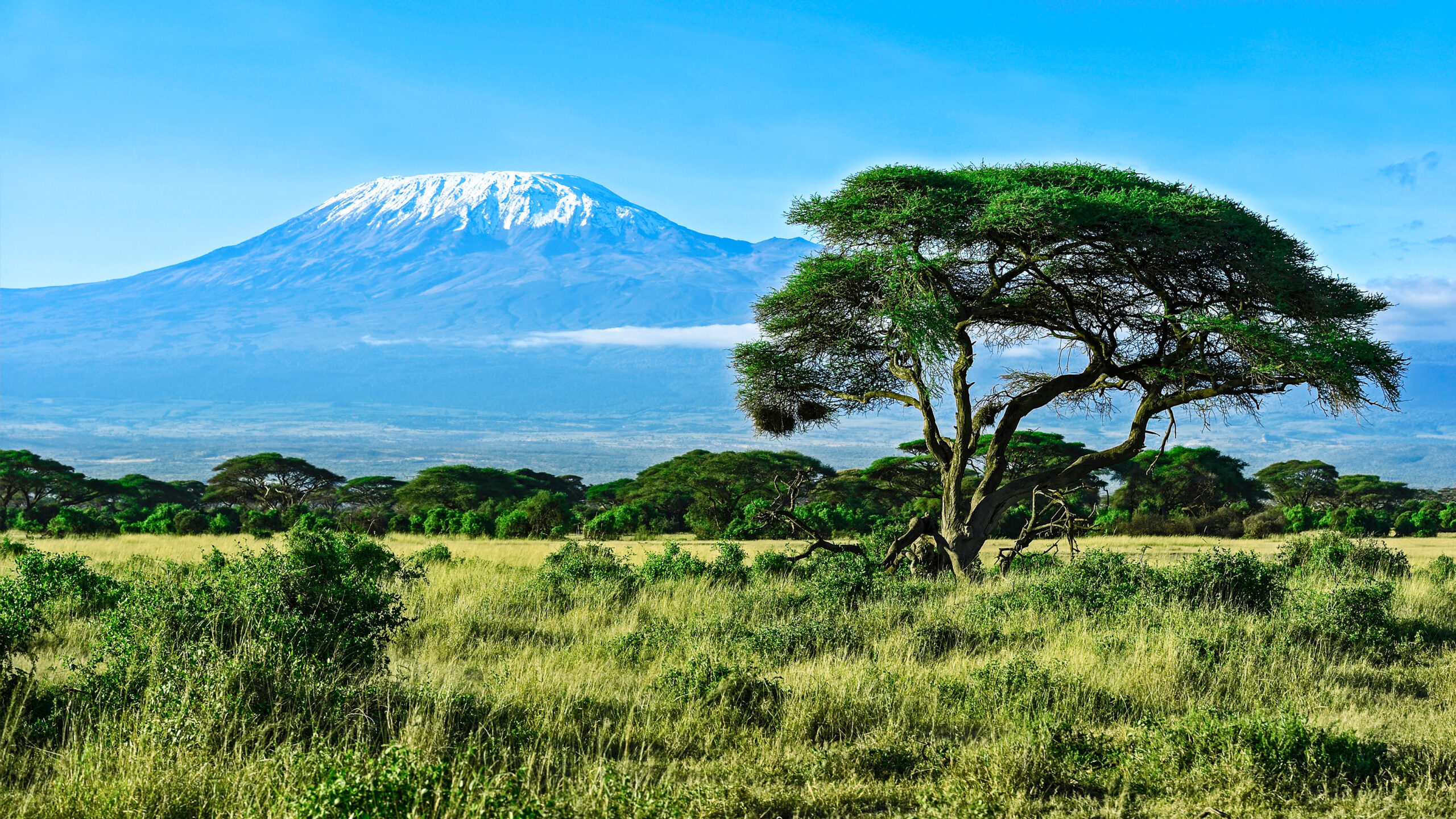
Thabana Ntlenyana is the highest mountain in Southern Africa — a 3,482m (11,424 ft) summit in the Maloti Mountains of Lesotho, accessed via the legendary Sani Pass 4×4 route from KwaZulu-Natal, South Africa. Specifically, the name translates from Sesotho as “Beautiful Little Mountain” or “Pretty Little Mountain” — somewhat ironic given that it stands as the highest peak in the entire Drakensberg range and the highest mountain in all of Africa south of Kilimanjaro and Mount Meru in Tanzania. Generally, Thabana Ntlenyana is unusual among major African peaks for its accessibility: a non-technical hike requiring no climbing skills, no expensive permits, and no expedition-style logistics — though the Sani Pass 4×4 border crossing and the 3,482m altitude make it a more substantial trip than typical day hikes. Notably, the mountain is classified as an Ultra peak (prominence over 1,500m, with Thabana Ntlenyana’s prominence at 2,392m) and ranks as the 11th most isolated peak in the world with 3,003km of separation from the next higher peak (Mount Loolmalasin in Tanzania). Specifically, the standard climbing approach involves: driving 4×4 up Sani Pass from Underberg, South Africa; clearing both South African exit and Lesotho entry border posts; staying at Sani Mountain Lodge (2,874m, featuring the famous “Highest Pub in Africa”); then completing a 2-3 day hike to the summit and back.
Key Takeaways
- 3,482m / 11,424 ft — Highest peak in Southern Africa.
- “Beautiful Little Mountain” in Sesotho language.
- NO climbing skills required — non-technical hike.
- Sani Pass 4×4 required — strictly enforced by SA border.
- Passport mandatory — international border crossing.
- Sani Mountain Lodge — base camp at 2,874m, “Highest Pub in Africa.”
- 2-3 days standard — most popular itinerary.
- Best season: May-September — dry winter months.
- Lesotho is the highest country — entirely above 1,400m.
- Higher than every peak in SA, Zimbabwe, Zambia, etc.
✓ Editorial Trust Signals
- Mixed framing: Travis = Kilimanjaro first-hand
- Primary source: Drakensberg Hiker
- Local operators: Lesotho on Track
- Authoritative: SummitPost documentation
- WFA reviewed: Dawson Ludlow
- Honest framing: Thabana outside team experience
- Last verified: June 14, 2026
- Annual review: Border + access updates
📍 Thabana Ntlenyana Location, Map & Weather
Thabana Ntlenyana is located in the Maloti Mountains of Lesotho, at coordinates approximately 29.467°S, 29.267°E. Specifically, the peak sits in the Mokhotlong District of Lesotho, approximately 8 km from the top of Sani Pass and roughly 35 km from the South African border town of Underberg in KwaZulu-Natal. Generally, the entire region is sparsely populated high-altitude grassland with Basotho mountain villages, sheep herders, and the famous Sani Mountain Lodge providing the only major tourist infrastructure.
🗺 Interactive Map — Thabana Ntlenyana & Sani Pass Region
Map centered on Thabana Ntlenyana (29.467°S, 29.267°E) showing the Maloti Mountains, Sani Pass border crossing to the east, the nearby Mokhotlong region of Lesotho, and the KwaZulu-Natal Drakensberg Park in South Africa. Generally, Sani Pass is approximately 8 km east of the peak.
🌤 Thabana Ntlenyana Weather (Live Windy.com)
Live Windy.com weather visualization for the Thabana Ntlenyana / Maloti Mountains region. Specifically, summit conditions at 3,482m are typically 15-20°C cooler than valley temperatures with significantly higher wind exposure. Generally, summer months (December-February) bring afternoon thunderstorms while winter (June-August) brings cold but stable conditions with snow possible.
🌦 Mountain Forecasts
Multi-Elevation Forecast
3,482m summit forecast with detailed elevation breakdowns. Essential for Drakensberg/Maloti planning since weather can shift dramatically by elevation band.
Thabana Ntlenyana →Drakensberg Mountain Forecast
Official South African Weather Service (SAWS) forecasts for the Drakensberg region. Generally reliable for the South African side of Sani Pass.
SAWS Drakensberg →Weather at 3,482m in the Maloti Mountains can shift dramatically with little warning. Specifically, summer months (December-February) bring daily afternoon thunderstorms with lightning risk above 3,000m — climbers above tree line during electrical storms face severe lightning danger. Generally, winter months (June-August) bring cold but stable conditions with snow possible on Thabana Ntlenyana even in mid-summer. Notably, the absence of marked trails combined with low visibility in storm conditions creates a serious navigation hazard — many sources recommend hiring a local Basotho guide specifically because of route-finding challenges. Specifically, hikers should always check forecasts and conditions reports the day before any climb attempt, and turn back if conditions deteriorate.
What Is Thabana Ntlenyana?
Thabana Ntlenyana is the highest mountain in all of Southern Africa — a 3,482m (11,424 ft) summit in the Maloti Mountains of Lesotho. Generally, the peak holds the title of highest mountain in Africa south of Kilimanjaro and Mount Meru in Tanzania, meaning Thabana Ntlenyana is taller than every mountain in South Africa, Zimbabwe, Zambia, Mozambique, Botswana, Namibia, Angola, and every other Southern African country. Specifically, Thabana Ntlenyana sits in the Mokhotlong District of Lesotho, approximately 8 km from the top of the legendary Sani Pass and roughly 35 km from the South African border town of Underberg in KwaZulu-Natal.
Generally, Thabana Ntlenyana is one of the most accessible major peaks in Africa for non-mountaineers — the climb itself is a non-technical hike on grassland and rocky alpine terrain requiring no climbing skills, no expensive permits, and no expedition-style logistics. Specifically, the entire experience can be completed in 2-3 days from Johannesburg or Durban with appropriate logistics: drive to Underberg, take a 4×4 up Sani Pass (international border crossing into Lesotho), overnight at Sani Mountain Lodge, hike to the summit, and return. Notably, despite this accessibility, the 3,482m altitude is substantial — affecting unacclimatized hikers significantly and requiring proper preparation.
Specifically, Thabana Ntlenyana is classified as an Ultra peak (prominence over 1,500m, with Thabana Ntlenyana’s actual prominence being 2,392m) and ranks as the 11th most isolated peak in the world. Generally, this isolation means the next higher peak (Mount Loolmalasin in Tanzania) is over 3,000 km away — a striking statistic that emphasizes how dominant Thabana Ntlenyana is over all of Southern Africa’s mountains. Notably, Lesotho itself is geographically unique: it is the only independent country in the world that lies entirely above 1,400m elevation, and over 80% of the country sits above 1,800m — making the entire kingdom the “highest country” by lowest point on land.
What Does Thabana Ntlenyana Mean?
Thabana Ntlenyana translates as “Beautiful Little Mountain” or “Pretty Little Mountain” from Sesotho, the official language of Lesotho. Specifically, the name is somewhat ironic — Thabana Ntlenyana is anything but little at 3,482 meters (11,424 feet), making it the highest peak in all of Southern Africa.
In English phonetic transcription, Thabana Ntlenyana is pronounced approximately tah-BAH-nə in-TLAY-nyə-nə. Specifically, the consonant cluster “ntl” at the start of “Ntlenyana” represents a sound common in Bantu languages but uncommon in English — pronounced something like the “ntl” in “international”. Generally, “Thabana” simply means “little mountain” (a diminutive of “thaba” meaning mountain) and “Ntlenyana” means “beautiful” or “pretty”. Notably, Basotho mountain culture frequently uses diminutive forms affectionately, even for objects that are anything but small.
Generally, the name reflects the deep Basotho cultural relationship with the Maloti Mountains — these peaks are sacred to Lesotho’s heritage, and giving the highest peak an affectionate diminutive name suggests familiarity and reverence rather than dominance. Specifically, the entire country of Lesotho is sometimes called the “Mountain Kingdom” or “Kingdom in the Sky” due to its uniquely high elevation — Lesotho’s name itself means “the land of the people who speak Sesotho.”
Sani Pass — The Standard Approach
The Sani Pass is the legendary 4×4 mountain road that provides the primary access route to Thabana Ntlenyana from South Africa. Specifically, Sani Pass climbs from approximately 1,544m at the bottom (South African side, near Underberg in KwaZulu-Natal) to 2,874m at the top (Lesotho border, adjacent to Sani Mountain Lodge) — a vertical gain of 1,330m over winding switchbacks. Generally, the pass has been famous for over a century as one of Southern Africa’s most dramatic mountain roads, originally built as a trade route between South African farms and Basotho mountain communities.
Sani Pass Key Facts
| Parameter | Detail |
|---|---|
| Bottom elevation | ~1,544m (SA side, near Underberg) |
| Top elevation | 2,874m (Lesotho side, Sani Mountain Lodge) |
| Vertical gain | 1,330m over the pass |
| Distance (one way) | ~33 km from Underberg to top |
| Vehicle requirement | 4×4 strictly enforced by SA border post |
| Passport requirement | Mandatory — international border |
| Border posts | SA at bottom of unpaved section; Lesotho at top |
| Border hours | Typically 6 AM – 6 PM (verify before trip) |
| Drive time | 1.5-2 hours up; 1.5-2 hours down |
| Lower section | Partially paved as of 2026; ongoing road works |
| Upper section | Unpaved, rocky, steep switchbacks (requires 4×4) |
Do You Need a 4×4 to Drive the Sani Pass?
Yes — a 4×4 vehicle is required to drive the full Sani Pass from South Africa into Lesotho. Specifically, the South African border post at the bottom of Sani Pass strictly enforces this requirement — they will not let 2-wheel-drive vehicles proceed up the unpaved upper section to the Lesotho border post at the top.
The 4×4 requirement is NOT a suggestion — it is enforced by the South African border post officials. Specifically, attempting to drive Sani Pass in a 2WD vehicle (including most SUVs that lack actual 4WD capability) will result in being turned around at the SA border post. Generally, the requirement reflects road conditions: the steep upper section from the South African border post to the Lesotho border post (approximately 1,330m of vertical gain over winding switchbacks) is unpaved, rocky, and includes steep grades that demand 4×4 traction and high clearance. Notably, the Sani Pass road has long been planned for full paving but the steep upper section remains rugged 4×4 terrain in 2026.
Sani Pass 4×4 Options
| Option | Cost (approx 2026) | Best For |
|---|---|---|
| Rent a 4×4 (Durban/Pietermaritzburg) | R 1,200-2,500/day (~$65-135 USD) | Independent travelers; multi-day trips; flexibility |
| Guided Sani Pass day tour | R 1,500-2,500 per person (~$80-135 USD) | Day trip experience; no Thabana Ntlenyana hike |
| Drakensberg Hiker 4×4 + hike | R 6,000-12,000 (~$325-650 USD) | Full 2-3 day Thabana Ntlenyana program |
| Lesotho on Track package | Variable; book direct | Lesotho-based operator; full logistics |
| Your own 4×4 | Self-organized costs only | Experienced 4×4 drivers familiar with steep terrain |
Generally, the easiest option for international visitors is to book with an established Sani Pass + Thabana Ntlenyana operator like Drakensberg Hiker (drakensberghiker.co.za) or Lesotho on Track (lesothoontrack.com). Specifically, these operators handle: (1) 4×4 vehicle and driver; (2) border crossing logistics; (3) accommodation; (4) guides who know the unmarked Thabana Ntlenyana trails; (5) all meals; (6) Lesotho tourism levies and fees. Notably, booking with a guided operator eliminates the navigation challenges that make Thabana Ntlenyana more difficult than its non-technical terrain would suggest.
Do You Need a Passport to Go Up Sani Pass?
Yes — a valid passport is mandatory to travel up Sani Pass because it is an international border crossing from South Africa into the Kingdom of Lesotho. Specifically, two border posts must be cleared:
- South Africa exit border post — at the bottom of Sani Pass (in KwaZulu-Natal), where SA exit stamps are issued and 4×4 vehicle verification occurs.
- Lesotho entry border post — at the top of Sani Pass (at 2,874m elevation, adjacent to Sani Mountain Lodge), where Lesotho entry stamps and any applicable visa is issued.
Generally, both passport stamps are required for legal entry — visitors who attempt to drive partway up the pass without intending to cross into Lesotho are not permitted past the South African border post since the entire pass from that point is considered Lesotho transit territory.
Most international visitors do NOT need a pre-arranged visa for Lesotho. Specifically, citizens of the US, UK, EU member states, Canada, Australia, New Zealand, South Africa, and most Commonwealth countries are issued visas on arrival at the Lesotho border post for stays of 14-30 days. Generally, the visa is free or carries a minimal fee depending on nationality. Notably, the passport must have at least one blank page available for stamps. Specifically, visitors should always verify current visa requirements with the Lesotho Embassy or High Commission in their country before travel — policies can change.
Sani Pass Border Crossing Checklist
This complete checklist covers everything required for the Sani Pass border crossing to Thabana Ntlenyana — print or screenshot before your trip:
The Complete Sani Pass Border Crossing Checklist
- Valid Passport with at least one blank page — required for both South African exit stamp and Lesotho entry stamp. Verify passport is valid for at least 30 days beyond your trip dates.
- 4×4 Vehicle with High Clearance — South African border officials will turn away 2WD vehicles. Confirm your rental is 4WD-capable (not just AWD).
- Vehicle Registration Documents — Original vehicle registration must be presented at the South African border post. Rental car papers acceptable if you’re renting.
- Border Crossing Cash — Bring South African Rand (ZAR) for any fees on the SA side and Lesotho Loti (LSL, equivalent to ZAR) for the Lesotho side. Most fees are minimal but cash is preferred over cards.
- South African Border Exit Stamp — Obtained at the SA border post at the bottom of the steep section of Sani Pass. Allow 15-30 minutes for processing.
- Lesotho Border Entry Stamp — Obtained at the Lesotho border post at the top of Sani Pass (2,874m). Allow 15-30 minutes plus any visa processing.
- Travel Insurance — Recommended for international travel; ensure your policy covers Lesotho specifically and includes medical evacuation if you’ll be hiking at altitude.
Border hours: Both border posts typically operate from 6 AM to 6 PM local time. Specifically, exact hours should be verified with current sources before your trip as schedules occasionally change.
Thabana Ntlenyana Difficulty: How Hard Is It?
Thabana Ntlenyana is NOT technically difficult to climb — it is a non-technical hike on grassland and rocky alpine terrain with no climbing skills required. Specifically, the challenges come from three sources rather than technical difficulty:
The 3 Sources of Thabana Ntlenyana Difficulty
(1) ALTITUDE — at 3,482m, the thin air affects unacclimatized hikers significantly, particularly those flying in from sea level. Generally, hikers staying overnight at Sani Mountain Lodge (2,874m) acclimatize before the summit attempt. (2) NAVIGATION — there is no marked trail to the summit, making route-finding tricky in the featureless high-plateau terrain. Specifically, this is the most underrated challenge — local sources strongly recommend hiring a guide because route-finding can be genuinely confusing in low-visibility conditions. (3) WEATHER — afternoon storms and rapid weather changes are common, with snow possible even in summer months. Notably, weather can shift from clear to blizzard in less than an hour.
Thabana Ntlenyana Difficulty Rating
| Aspect | Rating | Notes |
|---|---|---|
| Technical climbing skill | ★☆☆☆☆ None required | Pure hiking, no scrambling |
| Physical fitness | ★★★☆☆ Moderate | 8 hours sustained hiking at altitude |
| Altitude challenge | ★★★☆☆ Moderate | 3,482m affects unacclimatized hikers |
| Navigation difficulty | ★★★★☆ Significant | No marked trail, easy to get lost |
| Weather risk | ★★★☆☆ Moderate | Rapid changes possible; lightning summer |
| Logistical complexity | ★★★☆☆ Moderate | 4×4 + border + lodging required |
| Overall rating | ★★★☆☆ Moderate | Accessible to fit hikers with proper logistics |
Multiple authoritative sources emphasize that route-finding is the most underrated Thabana Ntlenyana challenge. Specifically, SA Country Life expedition reports state: “Although it’s a straightforward hike with no technical difficulties, I’d strongly recommend taking a guide as there is no marked path, route finding is tricky, and the weather can change rapidly.” Generally, the rolling Maloti grassland creates a deceptively featureless landscape where minor route errors can lead hikers significantly off course. Notably, this is why most experienced Thabana Ntlenyana climbers — including very experienced South African hikers — hire local Basotho guides who know the unmarked trails.
The Hike — Routes & Itinerary
Generally, three timing options exist for climbing Thabana Ntlenyana from the top of Sani Pass, varying from a long day-hike to a full 3-day expedition. Specifically:
| Itinerary | Duration | Format | Best For |
|---|---|---|---|
| Day Hike | 8+ hours | Sani Lodge → summit → Sani Lodge | Acclimatized fit hikers; early start essential |
| 2-Day Trek | 2 days, 1 night | Lodge → camp → summit + return | Most popular; balances time + comfort |
| 3-Day Expedition | 3 days, 2 nights | Drive up + 2-hr hike → summit → return | International visitors; weather buffer; cultural immersion |
Standard 3-Day Guided Itinerary
| Day | Activity | Distance/Time |
|---|---|---|
| Day 1 Morning | Meet in Underberg/Himeville; lunch en route | — |
| Day 1 Afternoon | Drive Sani Pass (4×4); border crossing; arrive Sani Mountain Lodge ~1 PM | ~33 km drive |
| Day 1 Late Afternoon | 2-hour hike from Sani Lodge to first camp (mountain stream area) | ~5 km hike |
| Day 2 Morning | Summit push to Thabana Ntlenyana (3,482m) | ~5 hours up |
| Day 2 Afternoon | Descend to second camp in Lesotho | ~3-4 hours |
| Day 3 Morning | Hike back to Sani Mountain Lodge | ~3-4 hours |
| Day 3 Midday | Lunch at “Highest Pub in Africa”; drive down Sani Pass | 1.5-2 hours |
Best Time to Climb Thabana Ntlenyana
The best time to climb Thabana Ntlenyana is May through September — the Southern Hemisphere dry winter season when weather is most stable. Specifically, the seasonal breakdown:
| Period | Conditions | Recommendation |
|---|---|---|
| December-February (summer) | Warm but daily thunderstorms; lightning risk above tree line | Generally avoided despite SA school holiday demand |
| March-April (autumn) | Declining storms; pleasant temperatures | Excellent — less crowded, stable weather |
| May-June (early winter) | Ideal weather window; clear skies; cold but stable | Often the best months overall |
| July-August (mid-winter) | Peak winter; potential snow on peak; cold nights | Popular due to SA school holidays; very cold nights |
| September (spring) | Spring transition; milder; generally good weather | Excellent — pleasant temperatures |
| October-November (late spring) | Increasing thunderstorm activity | Variable — check forecasts carefully |
Required Gear for Thabana Ntlenyana
Thabana Ntlenyana requires standard high-altitude hiking gear rather than technical mountaineering equipment. Specifically:
Essential Gear List
| Category | Items |
|---|---|
| Footwear | Mid-weight hiking boots (waterproof) with good ankle support; broken-in before trip |
| Hydration | 2-3 liters water capacity; water filter or treatment tablets (mountain streams require treatment) |
| Clothing layers | Base layer (synthetic), insulating mid-layer (fleece/down), waterproof outer shell |
| Cold weather | Beanie, gloves, neck buff/balaclava; nights drop below freezing even in summer |
| Sun protection | Sunglasses (essential at altitude — high UV exposure), sunscreen SPF 30+, hat |
| Navigation | GPS app (AllTrails/Maps.me with offline maps); paper map; compass; route description |
| Safety | Headlamp + spare batteries; first aid kit; whistle; emergency bivy/space blanket |
| Food | 2,500-3,500 calories per day; high-energy snacks; hot drinks for camp |
| Sleeping (overnight) | Down sleeping bag rated 0°F/-18°C or warmer; sleeping pad; tent if not lodging |
| Backpack | 40-60L for 2-3 day trips; rain cover essential |
| Documents | Passport; vehicle registration; cash; travel insurance details |
Sani Mountain Lodge — The “Highest Pub in Africa“
The Sani Mountain Lodge is the legendary mountain hotel located at 2,874 meters elevation at the top of Sani Pass, on the Lesotho side of the international border. Specifically, the lodge is famous for hosting the “Highest Pub in Africa” — a tourist attraction that draws visitors who drive up Sani Pass just for the experience of having a drink at this elevation.
Sani Mountain Lodge Key Facts
| Parameter | Detail |
|---|---|
| Elevation | 2,874m / 9,429 ft |
| Location | Top of Sani Pass, Lesotho side |
| Claim to fame | “Highest Pub in Africa” |
| Accommodation types | Backpacker dormitories; private rondavels; en-suite rooms |
| Restaurant | Full meals; famous for hearty Drakensberg fare |
| Booking | Recommended in advance for peak seasons |
| Role for climbers | Primary base camp and acclimatization point |
| Vehicle parking | Secure parking included for guests |
| Peak booking seasons | December-January (SA Christmas holidays); July-August (SA winter school holidays) |
Accommodation Options
| Location | Best For | Approx Cost/Night |
|---|---|---|
| Underberg / Himeville (SA) | South African base; pre/post trip; B&Bs | R 800-2,000 ($45-110) |
| Sani Mountain Lodge (Lesotho) | Top of pass; primary climbing base; famous pub | R 500-1,800 ($25-100) |
| Sani Pass Hotel (SA side) | Premium pre-trip accommodation; closer to border | R 1,500-3,500 ($80-190) |
| Mokhotlong (Lesotho) | For Lesotho-side exploration; basic lodging | Variable; basic options |
| Camping in Lesotho | 2-3 day expedition style; remote experience | Free wild camping permitted |
| Drakensberg lodges | South African side; combined Drakensberg trips | R 1,000-4,000 ($55-220) |
Thabana Ntlenyana vs Kilimanjaro & Other African Peaks
How does Thabana Ntlenyana compare to other major African peaks? Generally, Thabana Ntlenyana is the highest peak in Southern Africa but significantly shorter than the East African giants. Specifically:
African Peaks Comparison Table
| Peak | Elevation | Country | Days Required | Permit Cost |
|---|---|---|---|---|
| Kilimanjaro | 5,895m | Tanzania | 6-9 days | $800-1,500+ (mandatory) |
| Mount Kenya (Batian) | 5,199m | Kenya | 4-6 days (technical) | $60-150/day |
| Mount Stanley | 5,109m | Uganda/DRC | 7-10 days | $700-1,100 |
| Mount Meru | 4,562m | Tanzania | 3-4 days | $350-600 |
| Ras Dashen | 4,550m | Ethiopia | 4-6 days | $100-200 |
| Mount Karisimbi | 4,507m | Rwanda | 2 days | $400-500 |
| Mount Cameroon | 4,040m | Cameroon | 2-3 days | $80-150 |
| Thabana Ntlenyana | 3,482m | Lesotho | 2-3 days | FREE |
Thabana Ntlenyana offers several unique advantages compared to other major African peaks: (1) NO PERMITS — free access (vs $400-1,500 for Kilimanjaro and other East African peaks); (2) SHORTEST DURATION — 2-3 days vs 6-9 days for Kilimanjaro; (3) NO GUIDE MANDATORY — guides optional (vs mandatory for Kilimanjaro and Mount Kenya); (4) LOW TECHNICAL DIFFICULTY — non-technical hiking (vs Mount Kenya Batian summit which requires technical rock climbing); (5) LOWEST ALTITUDE RISK — at 3,482m, AMS risk is significantly lower than Kilimanjaro’s 5,895m. Generally, this combination makes Thabana Ntlenyana an excellent introduction to high-altitude African mountains or a quick goal-tick for peak-baggers. Notably, the unique aspect of Thabana Ntlenyana is the Sani Pass + border crossing experience itself — arguably as memorable as the summit itself.
Frequently Asked Questions About Thabana Ntlenyana
What does Thabana Ntlenyana mean?
Thabana Ntlenyana translates as “Beautiful Little Mountain” or “Pretty Little Mountain” from Sesotho, the official language of Lesotho. The name is somewhat ironic — Thabana Ntlenyana is anything but little at 3,482 meters (11,424 feet), making it the highest peak in all of Southern Africa (the entire region south of Kilimanjaro and Mount Meru in Tanzania). The name reflects the Basotho cultural relationship with these mountains — the Maloti range is sacred to Lesotho’s heritage, and giving the highest peak an affectionate diminutive name suggests deep familiarity rather than dominance. The pronunciation is approximately tah-BAH-nə in-TLAY-nyə-nə in English phonetic transcription. Lesotho itself is referred to as the “Kingdom in the Sky” and the “Mountain Kingdom” due to its uniquely high elevation — Lesotho is the only independent country in the world that lies entirely above 1,400m elevation, and over 80% of the country sits above 1,800m.
How high is Thabana Ntlenyana?
Thabana Ntlenyana is 3,482 meters high — equivalent to 11,424 feet above sea level. This makes it: (1) the highest peak in Lesotho; (2) the highest mountain in Southern Africa (the entire region south of Tanzania); (3) the highest peak in the Drakensberg/Maloti mountain range; (4) the 11th most isolated peak in the world (3,003 km to the next higher peak, Mount Loolmalasin in Tanzania); (5) an Ultra peak (with prominence over 1,500m — Thabana Ntlenyana’s prominence is 2,392m). Thabana Ntlenyana is significantly higher than the highest peaks of: South Africa’s Drakensberg Park (Mafadi at 3,450m and Champagne Castle at 3,377m); Zimbabwe (Mount Nyangani at 2,592m); Zambia (Mafinga Central at 2,329m); and most other Southern African countries. Only Kilimanjaro (5,895m), Mount Kenya (5,199m), Mount Stanley/Margherita Peak (5,109m in Uganda/DRC), Mount Meru (4,562m), and a few other East African peaks exceed Thabana Ntlenyana in elevation across the African continent.
Where is Thabana Ntlenyana located?
Thabana Ntlenyana is located in the Maloti Mountains of Lesotho, near the eastern border with South Africa, at coordinates approximately 29°28’S, 29°16’E. The peak sits in the Mokhotlong District of Lesotho, approximately 8 km from the top of the famous Sani Pass — the primary access route used by virtually all visitors. Lesotho is a small landlocked country entirely surrounded by South Africa, sometimes called the “Mountain Kingdom” or “Kingdom in the Sky” due to its uniquely high elevation. The closest South African town providing logistics access is Underberg in KwaZulu-Natal, approximately 35 km from the bottom of Sani Pass. The closest Lesotho settlement is Mokhotlong, approximately 100 km north of the peak via mountain roads. The entire region around Thabana Ntlenyana is sparsely populated with traditional Basotho mountain villages, sheep herders, and the famous Sani Mountain Lodge at the top of Sani Pass.
Do you need a 4×4 to drive the Sani Pass?
Yes — a 4×4 vehicle is required to drive the full Sani Pass from South Africa into Lesotho. The South African border post at the bottom of Sani Pass strictly enforces this requirement — they will not let 2-wheel-drive vehicles proceed up the unpaved upper section to the Lesotho border post at the top. The requirement reflects road conditions: the lower South African section is currently being paved or has paved sections, but the steep upper section from the South African border post to the Lesotho border post (approximately 1,330m of vertical gain over winding switchbacks) is unpaved, rocky, and includes steep grades that demand 4×4 traction and high clearance. The Sani Pass road has long been planned for full paving but the steep upper section remains rugged 4×4 terrain in 2026. Two practical options for visitors without their own 4×4: (1) rent a 4×4 from Durban, Pietermaritzburg, or major South African rental agencies; (2) book a guided Sani Pass 4×4 tour from operators based in Underberg, Himeville, or Sani Top — these typically include the round-trip drive plus border crossing logistics and lunch at the Sani Mountain Lodge.
Do you need a passport to go up Sani Pass?
Yes — a valid passport is mandatory to travel up Sani Pass because it is an international border crossing from South Africa into the Kingdom of Lesotho. Two border posts must be cleared: (1) South Africa exit border post at the bottom of Sani Pass (in KwaZulu-Natal); (2) Lesotho entry border post at the top of Sani Pass (at 2,874m elevation, adjacent to Sani Mountain Lodge). Both passport stamps are required for legal entry — visitors who attempt to drive partway up the pass without intending to cross into Lesotho are not permitted past the South African border post since the entire pass from that point is considered Lesotho transit territory. Most nationalities (US, UK, EU, Canada, Australia, etc.) do NOT require a pre-arranged visa for Lesotho — visas are typically issued on arrival at the Lesotho border post for up to 14-30 days. The passport must have at least one blank page for stamps. While the border crossing is straightforward, allow 30-60 minutes for processing time at each border post — Sani Pass is a busy crossing during peak season.
Is Thabana Ntlenyana difficult to climb?
Thabana Ntlenyana is NOT technically difficult to climb — it is a non-technical hike on grassland and rocky alpine terrain with no climbing skills required. The challenges come from three sources rather than technical difficulty: (1) ALTITUDE — at 3,482m, the thin air affects unacclimatized hikers significantly, particularly those flying in from sea level; (2) NAVIGATION — there is no marked trail to the summit, making route-finding tricky in the featureless high plateau terrain; (3) WEATHER — afternoon storms and rapid weather changes are common, with snow possible even in summer months. The recommended difficulty rating is “moderate to challenging” for the standard 2-3 day hike from the top of Sani Pass. The lack of marked paths is the most underrated challenge — local sources strongly recommend hiring a guide because route-finding can be genuinely confusing in low visibility conditions. Hikers should be reasonably fit (capable of 8+ hours of high-altitude hiking with elevation gain) and prepared for sudden weather changes. No special technical skills (climbing, glacier travel, technical scrambling) are required — Thabana Ntlenyana is one of the most accessible 3,000m+ peaks for fit hikers without mountaineering experience.
How long does it take to climb Thabana Ntlenyana?
Climbing Thabana Ntlenyana takes 8 hours minimum as a long day hike from Sani Mountain Lodge — though most hikers and guided tours complete the climb as a 2-3 day expedition with overnight camping or lodge stays. The timing options: (1) DAY HIKE — minimum 8 hours from Sani Mountain Lodge at 2,874m to the 3,482m summit and back; requires fit acclimatized hikers and early start; (2) 2-DAY OVERNIGHT — Day 1: drive Sani Pass + 2 hours hike to camp; Day 2: summit (~5 hours up) + return to Sani Top; (3) 3-DAY GUIDED EXPEDITION — Day 1: drive Sani Pass + 2-hour hike to first camp; Day 2: summit Thabana Ntlenyana; Day 3: return hike to Sani Top + drive back down. The 3-day option is most popular for non-acclimatized international visitors since it provides better adaptation to the altitude and allows for weather flexibility. The 8-hour day-hike option requires starting hiking by 6-7 AM to complete the round trip in daylight and avoid afternoon storms. The actual summit push from the closest camp typically takes 3-5 hours one-way depending on weather and pace.
What is the Sani Mountain Lodge?
The Sani Mountain Lodge is a famous mountain hotel and lodge located at 2,874 meters elevation at the top of Sani Pass, on the Lesotho side of the international border with South Africa. The lodge features the famous “Highest Pub in Africa” — a major tourist attraction that draws visitors who drive up Sani Pass just for the experience of having a drink at this elevation. The lodge offers various accommodation options ranging from backpacker dormitories to private rondavels (traditional round huts), making it suitable for budget travelers as well as those wanting more comfort. Sani Mountain Lodge serves as the primary base for Thabana Ntlenyana climbs — most guided expeditions and independent hikers stay here for at least one night either before or after their summit attempt. The lodge provides: restaurant meals, the famous pub, secure parking for vehicles while you hike, basic supplies, and connection with local Basotho guides for the Thabana Ntlenyana hike. Advance booking is recommended for peak season (December-January Christmas holidays and July-August South African school holidays) when the lodge fills with tourists doing the Sani Pass day trip.
What is the best time to climb Thabana Ntlenyana?
The best time to climb Thabana Ntlenyana is May through September — the Southern Hemisphere dry winter season when weather is most stable, though cold temperatures and possible snow require preparation. The seasonal breakdown: (1) MAY-JUNE: ideal weather window with clear skies, cold but stable conditions, manageable trail conditions; (2) JULY-AUGUST: peak winter with potential snow on the peak, can be very cold at night (below freezing) but clear daytime conditions; (3) SEPTEMBER: spring transition with milder temperatures, generally good weather; (4) OCTOBER-NOVEMBER: spring with increasing thunderstorm activity; (5) DECEMBER-FEBRUARY (summer): warm temperatures but daily afternoon thunderstorms with lightning risk above tree line — generally avoided by serious hikers despite being South African school holiday season; (6) MARCH-APRIL: autumn with declining storm activity and pleasant temperatures. July-August is the most popular booking period despite cold temperatures because South African school holidays drive demand. The most experienced Drakensberg hikers prefer May-June or September for the best combination of stable weather and manageable temperatures. Regardless of season, weather can change rapidly at altitude — hikers should be prepared for snow, rain, wind, and sun in any month.
How does Thabana Ntlenyana compare to Kilimanjaro?
Thabana Ntlenyana (3,482m) and Kilimanjaro (5,895m) are very different mountains despite both being major African summits — Kilimanjaro is significantly higher at 5,895m and significantly more demanding logistically. Key comparisons: (1) ELEVATION — Kilimanjaro is 2,413m taller (5,895m vs 3,482m), a substantial difference for altitude effects; (2) DURATION — Kilimanjaro requires 6-9 days minimum; Thabana Ntlenyana is 2-3 days; (3) COST — Kilimanjaro $2,000-5,000+ all-in; Thabana Ntlenyana $500-1,500 (much cheaper); (4) PERMITS — Kilimanjaro requires expensive Tanzania National Parks permits and mandatory guide; Thabana Ntlenyana has no permit and guides are optional (though recommended for navigation); (5) ALTITUDE RISK — Kilimanjaro has significant AMS, HAPE, and HACE risk above 4,000m; Thabana Ntlenyana has mild altitude effects but generally safe for fit hikers; (6) EXPERIENCE — Kilimanjaro requires 8+ days off work and substantial training; Thabana Ntlenyana fits in a long weekend with relatively modest preparation. Thabana Ntlenyana is an excellent introduction to high-altitude hiking and provides a “taste” of African mountain adventure for travelers who can’t commit to the Kilimanjaro experience. Climbing Thabana Ntlenyana can be useful preparation for a future Kilimanjaro attempt since it provides initial altitude exposure.
Methodology and Editorial Standards
How This Thabana Ntlenyana Guide Was Built
1. Mixed Experience Approach (Honest Framing)
This Thabana Ntlenyana guide combines first-hand African mountaineering experience with research-based content. Travis Ludlow has personally climbed Mount Kilimanjaro (Tanzania), providing direct first-hand experience with African high-altitude mountains, acclimatization, and African mountain logistics. However, Thabana Ntlenyana specifically and Lesotho/Drakensberg climbing are outside our editorial team’s direct experience to date. Generally, we believe this honest framing — acknowledging where we have direct experience and where we synthesize research — is more useful than pretending uniform expertise across all African peaks.
2. Authoritative Sources
Primary sources include: Drakensberg Hiker (premier regional operator combining 4×4 + Thabana Ntlenyana hiking); Lesotho on Track (local Lesotho tour operator with established Thabana Ntlenyana programs); SummitPost Thabana Ntlenyana documentation; SA Hikes guides; SA Country Life expedition reports; Wikivoyage Sani Pass entry; Sani Mountain Lodge information; Lesotho Tourism Development Corporation; verified Sani Pass border post operations.
3. 2026 Verification
All route information, Sani Pass border crossing requirements, 4×4 enforcement, accommodation status, and access conditions are verified as of June 2026. Generally, border policies and 4×4 requirements can change — climbers should always verify current conditions with their guide operator or the Lesotho Embassy before any trip.
4. Editorial Independence
No affiliate partnerships with Drakensberg/Lesotho guide services, 4×4 rental companies, accommodation providers, or tourism boards influence this content. Specifically, GSG does not earn commission from guide bookings, accommodation reservations, or any logistics arrangements. The article generates revenue only through Google AdSense display ads when applicable.
5. Update Cycle
This guide is updated annually to reflect changes in Sani Pass road status, border post operations, Lesotho visa policies, Sani Mountain Lodge accommodation, and guide operator availability. Specifically, the next scheduled review is May 2027.
Sources and References
Numbered Source References
This Thabana Ntlenyana guide synthesizes data from the most authoritative sources covering Southern Africa’s highest peak.
- Drakensberg Hiker · drakensberghiker.co.za — Premier regional operator combining Sani Pass 4×4 + Thabana Ntlenyana hiking programs.
- Lesotho on Track · lesothoontrack.com — Local Lesotho tour operator with established Thabana Ntlenyana expedition programs.
- SummitPost · Thabana-Ntlenyana — Mountaineering community documentation.
- SA Hikes · sahikes.com — South African hiking authority.
- SA Country Life · countrylife.co.za — Expedition reports and field guides.
- Wikivoyage Sani Pass · Sani Pass travel guide — Community-maintained logistics information.
- Sani Mountain Lodge — Top of pass accommodation, “Highest Pub in Africa”, primary climber base.
- Lesotho Tourism Development Corporation — Official Lesotho tourism authority.
- South African Weather Service (SAWS) · weathersa.co.za — Official SA meteorological service.
- Mountain-Forecast.com · Elevation-specific Thabana Ntlenyana forecasts.
Methodology note. Annual review cycle — next review May 2027. Sani Pass road status, border post operations, and visa requirements may change between updates. Always verify current conditions with your chosen guide operator before driving to Underberg.
About the Author
Continue Your African Mountain Research
Plan Your Thabana Ntlenyana Adventure
Thabana Ntlenyana offers a unique African mountain experience — Southern Africa’s highest peak, the legendary Sani Pass 4×4 border crossing, and a non-technical hike accessible to fit travelers without mountaineering experience. Generally, the keys to a successful Thabana Ntlenyana trip are: (1) book a 4×4 + guide operator OR ensure you have proper 4×4 capability and Lesotho navigation; (2) bring valid passport and prepare for two border crossings; (3) climb between May-September for stable weather; (4) overnight at Sani Mountain Lodge to acclimatize; (5) start hiking early to avoid afternoon weather changes. Specifically, for first-time Thabana Ntlenyana climbers, the guided 3-day expedition is recommended.
Africa’s Highest Peaks → Kilimanjaro Comparison →This peak is one of Africa’s highest and most notable mountains
Africa’s highest peaks span four regions and host some of the most diverse mountaineering objectives in the world. See the complete collection covering Africa’s Triple Crown (the only three 5,000m+ peaks), all 11 major African peaks with elevations and first ascents, regional groupings, volcanic peaks, and a 6-step climbing progression order from Toubkal through Kilimanjaro.
View All Africa’s Highest Peaks →🏔 Part of Africa’s Highest Peaks
One of Africa’s 11 major climbing peaks across 4 regions. See the full collection with Triple Crown, volcanic peaks, and costs.
View All Africa’s Peaks →Mount Kilimanjaro belongs to both the Seven Summits and Africa’s Highest Peaks
As Africa’s highest peak (5,895m) and the world’s tallest free-standing mountain, Kilimanjaro is the headline summit of two iconic mountaineering collections. The Seven Summits requires climbing the highest peak on every continent; Africa’s Highest Peaks covers all 11 major African peaks across 4 regions including the Triple Crown.
Seven Summits → Africa’s Peaks →Was this helpful?
🏔Related peaks nearby
🧭Explore & compare
Global Summit Guide is an independent mountaineering resource founded in 2026. The team combines first-hand trekking and climbing experience with in-depth research and professional health and nutrition review to help climbers choose objectives, prepare properly, and stay safe.
Health, altitude, and nutrition content is reviewed by Taylor Ludlow (Registered Nurse) and Brigg Hoopes (Nutritionist).
What We Don't Know Yet
Mountain information changes quickly. This box explains the limits of what this page can responsibly promise.
- Guide-company prices, departure dates, guide ratios, included services, and cancellation rules can change without notice.
- Weather, snowpack, avalanche risk, road access, and route conditions can change quickly and may be different on your climbing dates.
- Route conditions, trailhead access, crevasse exposure, stream crossings, and rescue access may vary from published planning guidance.
- Fitness and altitude response vary by person; no guide, itinerary, or training plan can guarantee acclimatization or summit success.
- Visa, passport, vaccination, border, insurance, and local transportation rules may change before your trip.
Verify current conditions with official land managers, guide services, local forecasts, and current route reports before booking or climbing.
Part of this Global Summit Guide cluster
Explore the complete Mountains guide for more context, routes, planning links, and related resources.
Mountaineering, rock and ice climbing, glacier travel, and high-altitude activity are inherently dangerous and can result in serious injury or death. The information on Global Summit Guide is provided for general informational and educational purposes only and is not a substitute for professional instruction, qualified guiding, proper equipment, or your own judgment and experience.
Route conditions, weather, snowpack, permits, regulations, and hazards change constantly and may differ from what is described here. Details may be incomplete, out of date, or contain errors. Always verify current information with local authorities, certified guides, and official sources before making any decision in the mountains.
Nothing on this site is medical, legal, or financial advice. Our fitness, acclimatization, altitude, and nutrition content is general in nature; consult a qualified physician before beginning any strenuous exercise program or exposing yourself to high altitude.
You are solely responsible for your own safety and decisions. To the fullest extent permitted by law, Global Summit Guide and its team accept no liability for any loss, injury, damage, or expense arising from use of, or reliance on, this information. By using this site you acknowledge these risks and accept these terms.
Some links on this site may be affiliate links. If you buy through them we may earn a small commission at no extra cost to you; this never affects our recommendations.
Global Summit Guide recommendation path
Next Best Mountain to Research
Use these recommendations to continue the right planning path instead of stopping on one page.
Use current permit, weather, route, and operator information before booking or climbing.