
Last updated October 4, 2026

East African Mountains: The Great Rift Valley Collection
The complete 2026 guide to the major mountains of the East African Rift system — covering both the Eastern Branch (Kenya, Tanzania, Ethiopia) and the Western Branch / Albertine Rift (Uganda, DRC, Rwanda). 11 major peaks including Mount Kilimanjaro (5,895m, highest in Africa), Mount Kenya (5,199m), the Rwenzori range, Ras Dashen, the Virunga volcanoes, and Mount Cameroon. The densest concentration of major peaks on the African continent.
This collection guide synthesizes data from UNESCO World Heritage Centre documentation (Mount Kilimanjaro 1987, Rwenzori Mountains 1994, Simien Mountains 1978, Virunga National Park 1979), official Tanzania National Parks (TANAPA), Kenya Wildlife Service, Uganda Wildlife Authority, Rwanda Development Board, and Ethiopian Wildlife Conservation Authority records, peer-reviewed glacial retreat studies, and personal field research. No affiliate partnerships influence recommendations. See full methodology and editorial standards below.
⚡ Quick Answer: East African Mountains by Country
Tanzania: Mount Kilimanjaro (5,895m), Mount Meru (4,562m). Kenya: Mount Kenya (5,199m, technical peaks Batian/Nelion + trekking peak Point Lenana). Uganda/DRC border: Mount Stanley (5,109m, Rwenzori range), Mount Speke (4,890m), Mount Baker (4,844m).
Uganda/Kenya border: Mount Elgon (4,321m). Ethiopia: Ras Dashen (4,550m, Simien Mountains, fourth-highest in Africa). Rwanda/DRC border: Mount Karisimbi (4,507m, highest Virunga). DRC: Mount Nyiragongo (3,470m, active lava lake). Cameroon (related, Cameroon Volcanic Line): Mount Cameroon (4,040m).
About This Collection — Field Experience Foundation
This collection guide is built on direct personal climbing experience on Mount Kilimanjaro plus extensive route research and cross-referencing with our existing detailed guides for Mount Kilimanjaro, Mount Kenya, Mount Stanley, Mount Meru, Mount Elgon, and Mount Cameroon.
Specifically, 5 of the 11 mountains in this collection have dedicated Global Summit Guide pages with comprehensive route, gear, season, and logistics information. The remaining 6 peaks (Ras Dashen, Mount Speke, Mount Baker, Mount Karisimbi, Mount Nyiragongo, and selected sub-peaks) will receive dedicated coverage in the coming months. Notably, this collection page serves as the integration hub — bringing together the existing detailed coverage with overview information on the peaks awaiting dedicated treatment.
🌍 East African Mountains Framework
The East African Rift system contains the densest concentration of major mountains on the African continent. First, the rift system spans approximately 6,000 km from northern Ethiopia south to Mozambique, dividing into two branches around Lake Victoria. Second, the Eastern Branch (Gregory Rift) through Ethiopia, Kenya, and Tanzania contains predominantly volcanic mountains including Kilimanjaro, Mount Kenya, Meru, and Elgon plus the Simien range.
Third, the Western Branch (Albertine Rift) through Uganda, DRC, Rwanda contains mixed volcanic and non-volcanic mountains including the non-volcanic Rwenzori range and the volcanic Virunga chain. Fourth, the related Cameroon Volcanic Line (West/Central Africa, not East African Rift) contains Mount Cameroon as the highest peak. Fifth, all African glaciers are concentrated in this region and are in rapid retreat — expected to disappear within 20-30 years.
The East African Rift system is a continental rift zone running approximately 6,000 kilometers from the Afar Triple Junction in northern Ethiopia south through Kenya, Tanzania, Uganda, Rwanda, Burundi, and into Mozambique. Generally, the rift system formed by tectonic divergent plate boundary activity beginning approximately 25 million years ago as the Somalian Plate began separating from the larger African Plate. Specifically, the rifting produced both extensive volcanic activity (creating peaks like Kilimanjaro, Mount Kenya, and the Virunga chain) and tectonic uplift creating non-volcanic mountains (the Rwenzori range). Notably, the system is geologically active — Mount Nyiragongo had major eruptions in 2002 and 2021, the Rwenzori range continues to uplift at measurable rates, and the rift is widening by approximately 6-7 millimeters per year. Eventually (in 5-10 million years), eastern Africa is projected to separate completely from the continent.
Key Takeaways
- 11 major peaks across 7 countries: Tanzania, Kenya, Uganda, DRC, Rwanda, Ethiopia, Cameroon.
- Mount Kilimanjaro (5,895m) is Africa’s highest peak and one of the Seven Summits.
- Mount Kenya (5,199m) requires technical rock climbing for the twin summits Batian and Nelion.
- Mount Stanley (5,109m) in the Rwenzori range is Africa’s third-highest, requiring 7-9 day Central Circuit.
- Ras Dashen (4,550m) is Ethiopia’s highest peak in the Simien Mountains UNESCO World Heritage Site.
- Mount Karisimbi (4,507m) is the highest of the Virunga Mountains spanning Rwanda, DRC, and Uganda.
- Mount Nyiragongo (3,470m) has one of the world’s largest persistent lava lakes.
- Mount Cameroon (4,040m) is highest in West/Central Africa — Cameroon Volcanic Line, not Rift.
- All African glaciers are concentrated in this region and retreating rapidly (lost 50-90% since 1900s).
- Best climbing seasons: June-October (long dry) and December-February (short dry), varies by mountain.
The East African Rift: Geology & Geography
The East African Rift system is the most active continental rift on Earth — a tectonic divergent plate boundary that runs approximately 6,000 km from the Afar Triple Junction in northern Ethiopia south through Kenya, Tanzania, Uganda, Rwanda, Burundi, Malawi, and into Mozambique. Generally, the rift formed by tectonic divergence beginning approximately 25 million years ago as the Somalian Plate began separating from the larger African Plate. Specifically, the rift produces both extensive volcanic activity (creating peaks like Kilimanjaro, Mount Kenya, and the Virunga chain) and tectonic uplift (creating the non-volcanic Rwenzori range). Notably, the system is widening by approximately 6-7 millimeters per year, and geologists project that eastern Africa will separate completely from the continent in 5-10 million years, creating a new ocean basin.
The Two Branches of the Rift
Around Lake Victoria (the world’s second-largest freshwater lake by surface area), the East African Rift divides into two branches:
The Eastern Branch (Gregory Rift) runs through Ethiopia, Kenya, and Tanzania containing predominantly volcanic mountains. Generally, this is the older, more geologically established branch with prominent volcanic peaks dating back 1-3 million years. Specifically, the Eastern Branch contains Mount Kilimanjaro (formed approximately 1 million years ago), Mount Kenya (extinct volcano ~3 million years old), Mount Meru (still active stratovolcano), Mount Elgon (one of the largest volcanic massifs in the world by base area), and the Simien Mountains of Ethiopia. Notably, the Eastern Branch sees more rainfall on its western side and drier conditions on its eastern side due to the Indian Ocean monsoon patterns.
The Western Branch (Albertine Rift) runs through Uganda, DRC, Rwanda, and Burundi containing a mix of volcanic and non-volcanic mountains. Generally, this is the younger branch but contains some of the world’s most spectacular mountain scenery. Specifically, the Albertine Rift contains the non-volcanic Rwenzori range (formed by tectonic uplift, with Mount Stanley as Africa’s third-highest peak) and the volcanic Virunga chain (eight major volcanoes including Karisimbi, Nyiragongo, and Bisoke). Notably, the Albertine Rift is famous for its biodiversity — home to mountain gorillas, golden monkeys, and approximately 50% of Africa’s bird species.
Eastern Branch Peaks: The Gregory Rift
The Eastern Branch of the East African Rift contains the most-visited and best-known African mountains. Generally, these are predominantly volcanic peaks distributed across Tanzania, Kenya, Uganda, and Ethiopia. Specifically, this section covers Mount Kilimanjaro (Tanzania), Mount Kenya (Kenya), Mount Meru (Tanzania), Mount Elgon (Uganda/Kenya), and Ras Dashen (Ethiopia).
Mount Kilimanjaro — 5,895m / 19,341 ft
Tanzania · Eastern Branch · Free-standing volcanic massif
Africa’s highest peak. One of the Seven Summits. The most-climbed major mountain in the world.
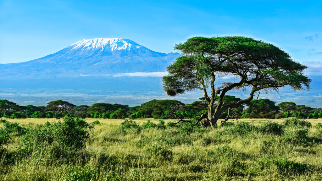
Mount Kilimanjaro is the highest peak in Africa and one of the Seven Summits, rising 4,900m from the surrounding plain to 5,895m at Uhuru Peak. Generally, Kilimanjaro is the most famous African mountain and the entry-level Seven Summit, drawing approximately 50,000 climbers annually. Specifically, the standard routes — Marangu (5 days), Machame (6-7 days), Lemosho (7-8 days), Rongai (6 days), Northern Circuit (8-9 days), Umbwe (6 days) — offer different difficulty profiles, scenery, and success rates. Notably, Kilimanjaro requires no technical skills but does require physical fitness, mental endurance, and proper acclimatization.
Summit success rates: Marangu approximately 35-50%, Machame approximately 65-85%, Lemosho approximately 70-90%, Northern Circuit approximately 85-95%. Generally, longer routes with better acclimatization profiles have substantially higher success rates.
Mount Kenya — 5,199m / 17,057 ft
Kenya · Eastern Branch · Extinct stratovolcano
Twin technical summits Batian and Nelion + trekking summit Point Lenana
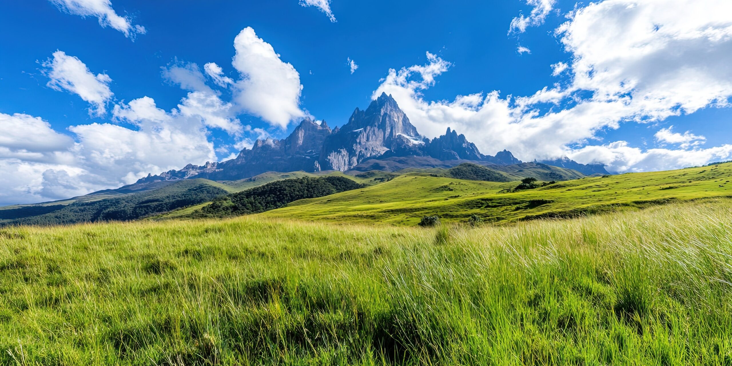
Mount Kenya is the second-highest peak in Africa and the most technically challenging of the major East African peaks for the highest summit. Generally, Mount Kenya is an extinct stratovolcano approximately 3 million years old, with the original volcanic cone eroded by glaciers to expose the central volcanic plug. Specifically, the mountain has three summits: Batian (5,199m) and Nelion (5,188m) are technical rock climbing peaks rated UIAA III-V, while Point Lenana (4,985m) is achievable by trekking. Notably, the technical summits require rope, harness, helmet, and rock climbing skills — most international visitors target Point Lenana instead.
The standard trekking route to Point Lenana takes 3-5 days via the Sirimon, Chogoria, or Naro Moru routes. Generally, Mount Kenya offers a quieter alternative to Kilimanjaro with similar high-altitude experience but fewer crowds.
Mount Meru — 4,562m / 14,968 ft
Tanzania · Eastern Branch · Active stratovolcano
Tanzania’s second-highest peak. Popular Kilimanjaro acclimatization climb.
Mount Meru is the second-highest peak in Tanzania and a popular Kilimanjaro acclimatization climb. Generally, Meru is an active stratovolcano located in Arusha National Park, with its last major eruption in 1910. Specifically, the standard Momella Route is a 3-4 day trek with overnight at Miriakamba Hut (2,500m) and Saddle Hut (3,570m) before the summit push. Notably, Meru is significantly less crowded than Kilimanjaro and offers excellent wildlife viewing en route — visitors regularly encounter giraffes, buffalo, and warthogs on the lower trails.
Mount Elgon — 4,321m / 14,177 ft
Uganda/Kenya border · Eastern Branch · Extinct volcanic massif
One of the largest volcanic massifs in the world by base area
Mount Elgon is an extinct volcanic massif on the Uganda-Kenya border, distinguished by being one of the largest volcanic massifs in the world by base area (approximately 80 km diameter). Generally, the mountain consists of an eroded caldera with several distinct peaks: Wagagai (4,321m, the highest) in Uganda, Sudek (4,302m) and Koitobos (4,222m) on the Kenya side, and Mubiyi (4,210m). Specifically, the standard climbing routes are the Sasa Trail (Uganda, 4-5 days), the Piswa Trail (Uganda, 5 days), and the Chogoria-Sirimon Combination (Kenya).
Notably, Mount Elgon is famous for its elephant caves — large lava tube caves where wild elephants enter at night to consume mineral-rich rocks. Generally, Elgon is far less crowded than Kilimanjaro or Mount Kenya, making it a strong choice for those seeking a quieter East African mountain experience.
Ras Dashen — 4,550m / 14,928 ft
Ethiopia · Eastern Branch · Simien Mountains National Park
Highest peak in Ethiopia. Fourth-highest in Africa. UNESCO World Heritage Site.
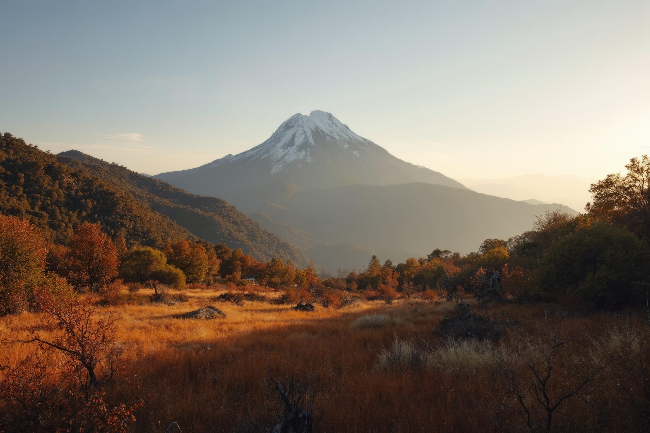
Ras Dashen is the highest peak in Ethiopia and the fourth-highest mountain in Africa, located in the Simien Mountains National Park (a UNESCO World Heritage Site since 1978). Generally, Ras Dashen sits at the northeastern edge of the Ethiopian Highlands, accessed from the gateway town of Debark via a 7-10 day trek through Sankaber and Geech high camps. Specifically, the trek crosses dramatic escarpments and the famous Simien plateau with views of the Limalimo escarpment and the deeply incised gorges below.
The Simien Mountains are home to three iconic Ethiopian endemic species: the gelada baboon (the world’s only grass-eating primate), the Walia ibex (a rare wild goat species found only in this range), and the Ethiopian wolf (Africa’s rarest and most endangered carnivore with fewer than 500 individuals worldwide). Notably, despite Ras Dashen’s status as Ethiopia’s highest peak, the climb itself is a trekking expedition rather than a technical climb — no special skills required beyond high-altitude fitness.
Dedicated Ras Dashen complete guide coming soon. Subscribe for notifications.
Western Branch Peaks: The Albertine Rift
The Western Branch (Albertine Rift) contains the densest concentration of major peaks in East Africa. Generally, the Albertine Rift is the African Great Lakes region — the western shore of Lake Victoria, Lake Albert, Lake Kivu, Lake Tanganyika, and other rift lakes. Specifically, this section covers the Rwenzori range (Mount Stanley, Speke, Baker) and the Virunga chain (Karisimbi, Nyiragongo, etc.).
Mount Stanley / Margherita Peak — 5,109m / 16,762 ft
Uganda/DRC border · Western Branch · Non-volcanic granite/gneiss
Africa’s third-highest peak. The highest of the Rwenzori range. Glaciated technical climb.
Mount Stanley is the highest peak of the Rwenzori range and Africa’s third-highest mountain. Generally, Stanley is a non-volcanic mountain formed by tectonic uplift — granite and gneiss bedrock rather than volcanic rock. Specifically, the mountain has multiple summits, with Margherita Peak (5,109m) as the highest, accessed via the Central Circuit Trail (7-9 days round-trip from the Mubuku River trailhead). Notably, Mount Stanley is substantially more difficult than Kilimanjaro despite being lower — requiring glacier travel, rope team work, basic crampon and ice axe skills, and a remote multi-day approach through dramatically wet terrain.
The Rwenzori range — often called the “Mountains of the Moon” — was first described by Ptolemy in the 2nd century AD and is one of the wettest mountain ranges in the world with over 2,000mm annual rainfall. Generally, the trail crosses dramatic bog terrain, dense bamboo forests, and surreal Afro-alpine zones with giant lobelia and senecio plants. Notably, summit success rates on Margherita are approximately 40-50% versus Kilimanjaro’s 65-85% — driven by weather variability and technical demands.
Mount Speke — 4,890m / 16,043 ft
Uganda · Western Branch · Non-volcanic Rwenzori range
Second-highest peak in the Rwenzori. Vanessa Peak is the summit.
Mount Speke is the second-highest peak of the Rwenzori range and Africa’s fifth-highest mountain overall. Generally, Speke is named after John Hanning Speke, the British explorer who first sighted the Rwenzori range from the Lake Victoria region in the 1860s. Specifically, the highest summit is Vanessa Peak (4,890m), accessed via a glaciated route similar to Mount Stanley. Notably, Speke is typically climbed as part of the Rwenzori Central Circuit alongside Mount Stanley — most climbers combining both summits in a single 9-12 day expedition.
Dedicated Mount Speke complete guide coming soon.
Mount Baker / Mount Kiyanja — 4,844m / 15,892 ft
Uganda · Western Branch · Non-volcanic Rwenzori range
Third-highest peak in the Rwenzori. Edward Peak is the summit.
Mount Baker (locally Mount Kiyanja) is the third-highest peak of the Rwenzori range and Africa’s sixth-highest mountain. Generally, the highest summit is Edward Peak (4,844m). Specifically, like Mount Stanley and Mount Speke, Mount Baker requires technical glacier travel and is typically climbed as part of the Rwenzori Central Circuit. Notably, the local Bakonzo name “Kiyanja” is increasingly preferred to honor the indigenous people of the Rwenzori region.
Dedicated Mount Baker complete guide coming soon.
Mount Karisimbi — 4,507m / 14,787 ft
Rwanda/DRC border · Western Branch · Active stratovolcano · Virunga
Highest of the Virunga Mountains chain across Rwanda, DRC, and Uganda.
Mount Karisimbi is the highest of the Virunga Mountains — the chain of eight major volcanoes that span the Rwanda-DRC-Uganda border region. Generally, the Virunga chain is part of the Albertine Rift volcanic field and includes Karisimbi (4,507m), Mikeno (4,437m), Muhabura (4,127m), Sabyinyo (3,669m), Bisoke (3,711m), Nyiragongo (3,470m), and Nyamuragira (3,058m). Specifically, Karisimbi is climbed via Rwanda Volcanoes National Park with permits through the Rwanda Development Board (RDB) — typically a 2-day climb with overnight at Karisimbi Hut at 3,700m.
Mountain gorilla habitat: The Virunga region is the famous habitat of the endangered mountain gorillas (Gorilla beringei beringei) studied by Dian Fossey and described in her book “Gorillas in the Mist.” Generally, gorilla tracking permits (separate from mountain climbing permits) cost approximately $1,500 USD per day in Rwanda — among the most expensive wildlife experiences in the world. Notably, many international visitors combine Mount Karisimbi climbing with gorilla tracking and visits to other Virunga peaks.
Dedicated Mount Karisimbi complete guide coming soon.
Mount Nyiragongo — 3,470m / 11,385 ft
Democratic Republic of the Congo · Western Branch · Active stratovolcano
One of the world’s largest persistent lava lakes. Recent eruptions in 2002 and 2021.
Mount Nyiragongo is one of the most active volcanoes in the world and contains one of the largest persistent lava lakes ever documented. Generally, Nyiragongo’s lava is unusually fluid due to its low silica content (alkaline composition) — flowing at speeds up to 60 km/h, much faster than typical lava flows. Specifically, the volcano has had several catastrophic eruptions: 1977 (massive lava flow killed approximately 70 people), 2002 (covered much of Goma city with lava, displaced 400,000 people), and 2021 (smaller eruption with 32 fatalities and tens of thousands displaced).
Tourism climbs operate through Virunga National Park (DRC) when volcanic activity is assessed as stable by the Goma Volcano Observatory. Generally, the climb is a 5-6 hour ascent with mandatory overnight at the rim cabins to view the lava lake — one of the most dramatic wildlife/landscape experiences available in Africa. Notably, the security situation in eastern DRC has affected tourism availability — verify current status before booking.
Dedicated Mount Nyiragongo complete guide coming soon.
Related: The Cameroon Volcanic Line
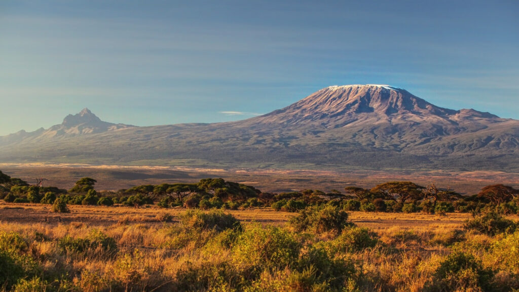
While not part of the East African Rift system, Mount Cameroon belongs to the related Cameroon Volcanic Line — a chain of volcanoes extending from the Gulf of Guinea inland through Cameroon. Generally, the Cameroon Volcanic Line is a separate geological feature from the East African Rift but shares volcanic origin and includes the highest peak in West/Central Africa.
East African Mountains Comparison Table
| Mountain | Country | Elevation | Difficulty | Duration | Status |
|---|---|---|---|---|---|
| Kilimanjaro | Tanzania | 5,895 m | Trekking | 5-9 days | Guide live |
| Mount Kenya | Kenya | 5,199 m (Batian) / 4,985 m (Lenana) | Technical / Trekking | 3-7 days | Guide live |
| Mount Stanley | Uganda/DRC | 5,109 m | Technical glaciated | 7-9 days | Guide live |
| Mount Speke | Uganda | 4,890 m | Technical glaciated | 9-12 days (combined) | NEW page coming |
| Mount Baker | Uganda | 4,844 m | Technical glaciated | 9-12 days (combined) | NEW page coming |
| Mount Meru | Tanzania | 4,562 m | Trekking | 3-4 days | Guide live |
| Ras Dashen | Ethiopia | 4,550 m | High-altitude trek | 7-10 days | NEW page coming |
| Mount Karisimbi | Rwanda/DRC | 4,507 m | Trekking (altitude) | 2 days | NEW page coming |
| Mount Elgon | Uganda/Kenya | 4,321 m | Trekking | 4-5 days | Guide live |
| Mount Cameroon | Cameroon | 4,040 m | Trekking | 2-3 days | Guide live |
| Mount Nyiragongo | DRC | 3,470 m | Trekking | 2 days | NEW page coming |
Climbing Seasons by Mountain & Region
East African climbing seasons vary by region due to the equatorial rainfall pattern — most mountains have two dry seasons (long dry June-October and short dry December-February) and two rainy seasons (long rains April-May and short rains November). Generally, the climbing windows align with the dry seasons.
| Mountain | Best Season | Acceptable | Avoid |
|---|---|---|---|
| Kilimanjaro | Jun-Oct, Jan-Mar | Nov, early Dec | Apr-May (long rains) |
| Mount Kenya | Jan-Feb, Jul-Oct | Dec, Nov | Apr-May, Mar (variable) |
| Mount Stanley / Rwenzori | Dec-Feb, Jun-Aug | Mar, Sep | Apr-May, Oct-Nov |
| Mount Meru | Jun-Oct, Dec-Feb | Nov | Apr-May |
| Mount Elgon | Jun-Aug, Dec-Mar | Sep-Oct | Apr-May (heavy rains) |
| Ras Dashen / Ethiopia | Oct-Mar | Apr, Sep | Jul-Aug (kremt rains) |
| Karisimbi / Virunga | Jun-Aug, Dec-Feb | Mar, Sep | Apr-May, Oct-Nov |
| Mount Nyiragongo | Jun-Aug, Dec-Feb | Mar, Sep | Apr-May, Oct-Nov + volcanic alerts |
| Mount Cameroon | Nov-Mar | Apr, Oct | Jun-Sep (heavy rains) |
Cultural Context: East African Mountains
The East African mountains have profound cultural significance for the indigenous peoples of the region. Generally, these mountains were sacred ancestral homes long before European exploration. Specifically, this cultural context includes the Chagga of Kilimanjaro, the Maasai of the Eastern Rift, the Bakonzo of the Rwenzori, the Tutsi-Hutu cultural groups of the Virunga region, the Amhara and Tigrinya of the Ethiopian highlands, and the Bantu peoples of the broader region.
The Rwenzori range was first mentioned in writing by Ptolemy in the 2nd century AD in his Geographia. Generally, Ptolemy referred to the range as “Lunae Montes” (Latin for “Mountains of the Moon”), describing them as the source of the Nile River. Specifically, Ptolemy’s source was likely earlier Greek and Phoenician traders who had heard accounts of snow-capped mountains in the African interior. Notably, the Rwenzori range remained essentially unexplored by Europeans until Henry Morton Stanley first sighted the mountains in 1888 — confirming Ptolemy’s 1,700-year-old description as remarkably accurate. The Bakonzo people of the Rwenzori call the range “Rwenjura” meaning “rainmaker.”
The most extensive cultural mountain tradition is the Chagga people of Kilimanjaro. Generally, the Chagga have lived on Kilimanjaro’s southern slopes for over 1,000 years, developing sophisticated terraced agriculture and a complex political organization of independent chiefdoms. Specifically, the Chagga traditional name for the mountain was “Oldoinyo Oibor” (meaning “White Mountain”) referring to the summit glaciers. Notably, modern Kilimanjaro porter and guide labor is overwhelmingly drawn from Chagga communities, who pass mountaineering knowledge across generations.
The Virunga region’s culture includes the famous association with mountain gorillas. Generally, the Bisa, Tutsi, and Hutu peoples of the region historically shared the mountains with the gorilla populations. Specifically, Dian Fossey’s Karisoke Research Center (founded 1967 between Mount Karisimbi and Mount Bisoke) established the conservation foundation that has saved the mountain gorilla population from extinction. Notably, gorilla tourism now generates approximately $200 million USD annually across Rwanda, Uganda, and DRC — a substantial portion of these countries’ tourism revenues.
Glaciers and Climate Change
The East African mountains contain the last remaining glaciers in Africa, all of which are in rapid retreat. Generally, only three African mountains still have glaciers in 2026: Kilimanjaro, Mount Kenya, and the Rwenzori range. Specifically, all three have lost the majority of their ice cover over the past century and are projected to lose remaining glaciers within 20-30 years based on current trajectory.
| Mountain | 1900 Ice Area | 2026 Ice Area | % Lost | Projected Loss |
|---|---|---|---|---|
| Kilimanjaro | ~12 km² | ~1.5 km² | ~85% | 2030-2040 (complete) |
| Mount Kenya (Lewis) | ~0.5 km² | ~0.05 km² | ~90% | 2030 (complete) |
| Rwenzori range | ~7.5 km² | ~1.0 km² | ~87% | 2030-2050 |
If experiencing African glaciers is a goal, plan your trip within the next 10-15 years. Generally, the glaciers on Kilimanjaro and Mount Kenya are projected to disappear by 2030-2040 based on current trajectory. Specifically, the Lewis Glacier on Mount Kenya may disappear by 2030. Notably, the Rwenzori range glaciers are projected to persist slightly longer (2030-2050) due to the higher latitude and persistent cloud cover, but they are equally in retreat. For visitors planning to experience the iconic African glaciers, the window is closing — climb sooner rather than later.
Travel Logistics by Country
Tanzania: Visa-on-arrival or pre-arranged (Tanzania eVisa). Major airports: Kilimanjaro International (JRO, primary for Kilimanjaro/Meru), Dar es Salaam (DAR). Currency: Tanzanian Shilling (TZS). Climbing permits issued through Tanzania National Parks (TANAPA) via licensed operators.
Kenya: Visa via Kenya eTA. Major airports: Nairobi (NBO, JKIA international). Currency: Kenyan Shilling (KES). Mount Kenya permits via Kenya Wildlife Service through licensed operators.
Uganda: Visa via Uganda eVisa. Major airports: Entebbe (EBB). Currency: Ugandan Shilling (UGX). Rwenzori and Mount Elgon permits via Uganda Wildlife Authority.
Rwanda: Visa-on-arrival or via Rwanda eVisa. Major airports: Kigali (KGL). Currency: Rwandan Franc (RWF). Volcanoes National Park permits via Rwanda Development Board (RDB).
Democratic Republic of the Congo: Visa required in advance. Major airports: Kinshasa (FIH) far from Virunga; Goma (GOM) is the relevant entry point. Currency: Congolese Franc (CDF), USD widely accepted. Virunga National Park permits via visitvirunga.org. Verify current security conditions before travel.
Ethiopia: Visa via Ethiopia eVisa. Major airports: Addis Ababa (ADD). Currency: Ethiopian Birr (ETB). Simien Mountains National Park permits via Ethiopian Wildlife Conservation Authority.
Cameroon: Visa required (apply at Cameroon embassies abroad). Major airports: Douala (DLA), Yaoundé (NSI). Currency: Central African CFA Franc (XAF). Mount Cameroon permits via the Bakingili-Buea local guides association.
Frequently Asked Questions About East African Mountains
What are the major mountains of the East African Rift?
The major mountains include Mount Kilimanjaro (5,895m Tanzania, highest in Africa), Mount Kenya (5,199m Kenya), Mount Stanley with Margherita Peak (5,109m Uganda/DRC), Mount Speke (4,890m Uganda), Mount Baker (4,844m Uganda), Mount Meru (4,562m Tanzania), Ras Dashen (4,550m Ethiopia), Mount Karisimbi (4,507m Rwanda/DRC), Mount Elgon (4,321m Uganda/Kenya), and Mount Nyiragongo (3,470m DRC). The related Mount Cameroon (4,040m) is highest in West/Central Africa but belongs to the Cameroon Volcanic Line.
What is the difference between the Eastern Rift and the Western Rift?
The East African Rift divides into two branches around Lake Victoria. The Eastern Branch (Gregory Rift) runs through Ethiopia, Kenya, and Tanzania containing predominantly volcanic mountains including Kilimanjaro, Mount Kenya, Meru, Elgon, and Ras Dashen. The Western Branch (Albertine Rift) runs through Uganda, DRC, Rwanda, and Burundi containing a mix including the non-volcanic Rwenzori range (Mount Stanley, Speke, Baker) and the volcanic Virunga chain (Karisimbi, Nyiragongo). The Eastern Branch is geologically older; the Western Branch is younger but contains the world’s most active volcano.
Which East African mountain is best for first-time mountaineers?
Mount Kilimanjaro is the best for first-timers because of its well-developed climbing infrastructure, multiple route options of varying difficulty, the ability to summit without technical skills, and comprehensive guide and porter systems. Marangu and Rongai are most accessible for first-timers; Machame and Lemosho offer better acclimatization for higher success rates. Mount Meru is a strong second choice as a 3-4 day acclimatization climb. Mount Kenya’s Point Lenana (4,985m) is also achievable by trekking.
When is the best time to climb East African mountains?
The best time is during the dry seasons. The two main dry seasons are January-February (short dry) and June-October (long dry). Kilimanjaro and Mount Meru are best January-March and June-October avoiding the long rains April-May. Mount Kenya follows similar pattern. The Rwenzori range (Mount Stanley, Speke, Baker) is best December-February and June-August. Ras Dashen in Ethiopia’s Simien Mountains is best October-March. The Virunga volcanoes follow the East African pattern.
How dangerous is Mount Nyiragongo?
Mount Nyiragongo is one of the world’s most dangerous active volcanoes due to its persistent lava lake (one of the world’s largest), the extreme fluidity of its lava (causing devastating fast-moving flows), and its location near Goma city. Major eruptions in 2002 and 2021 caused significant casualties and displacement. Tourism climbs operate only during stable periods and are subject to volcanic activity assessment by the Goma Volcano Observatory. Climbs require Virunga National Park guides and rangers. The climb itself is a 5-6 hour trek with overnight at rim cabins to view the lava lake.
Do you need technical climbing skills for East African mountains?
Most East African mountains can be climbed without technical mountaineering skills, but several specific peaks require technical rock or ice climbing. Kilimanjaro (all standard routes), Mount Meru, Mount Elgon, Ras Dashen, Mount Cameroon, Mount Nyiragongo, and Point Lenana on Mount Kenya are achievable as walking/trekking climbs. Technical skills ARE required for: Batian and Nelion on Mount Kenya (UIAA III-V rock), Margherita Peak on Mount Stanley (glacier travel and crampons), Vanessa Peak on Mount Speke, Edward Peak on Mount Baker.
What is the highest peak in Ethiopia?
Ras Dashen at 4,550 meters is the highest peak in Ethiopia and fourth-highest in Africa overall. Located in the Simien Mountains National Park (UNESCO World Heritage Site since 1978) in northern Ethiopia, accessed from Debark via Sankaber and Geech high camps. The Simien Mountains are home to endemic species including the Walia ibex, Ethiopian wolf (Africa’s rarest carnivore), and gelada baboon. The trek typically takes 7-10 days round-trip from Debark with several high-altitude camps above 3,500m.
Can you climb the Virunga volcanoes?
Yes, several Virunga volcanoes are open to climbers under regulated tourism programs. Mount Karisimbi (4,507m, highest Virunga) is accessible via Rwanda Volcanoes National Park with permits through Rwanda Development Board — typically 2-day climb. Mount Bisoke (3,711m) is a popular day climb with crater lake. Mount Nyiragongo (3,470m, active lava lake) is accessible through Virunga National Park in DRC when activity allows. The region is shared by Rwanda, Uganda, and DRC, and the same volcanoes are sometimes accessible from different countries. The region is also home to the famous mountain gorilla population.
Is Mount Stanley harder than Kilimanjaro?
Yes, Mount Stanley is substantially more difficult than Kilimanjaro despite being lower. Kilimanjaro is a walking/trekking climb with no technical skills required and extensive support infrastructure. Mount Stanley’s Margherita Peak requires glacier travel, rope team work, basic crampon and ice axe skills, and a 7-9 day Central Circuit approach through remote terrain with limited infrastructure. Weather on Stanley is much more variable — the Rwenzori range receives over 2,000mm annual rainfall. Summit success rate on Margherita is approximately 40-50% versus Kilimanjaro’s 65-85%.
Are East African mountains affected by climate change?
Yes, the glaciers of East African mountains are among the most dramatic examples of climate-change-driven glacial retreat globally. Mount Kilimanjaro’s glaciers have lost approximately 85% of their ice cover since 1912 and are projected to disappear entirely by 2030-2040. Mount Kenya’s glaciers have similarly retreated with the Lewis Glacier losing approximately 90% of its mass since 1934. Rwenzori range glaciers have retreated approximately 50% since 1906. All African glaciers are expected to disappear within the next 20-30 years based on current trajectory.
Methodology & Editorial Standards
How This Collection Was Compiled
1. Primary Research
This collection synthesizes data from Travis Ludlow’s personal Kilimanjaro climbing experience plus extensive route research across the 11 mountains covered. Cross-referenced with our 6 existing detailed mountain guides (Kilimanjaro, Mount Kenya, Mount Stanley, Mount Meru, Mount Elgon, Mount Cameroon) which together exceed 60,000 words of original content.
2. Authoritative Source Verification
Elevations, geological data, and historical records verified against UNESCO World Heritage Centre documentation (Kilimanjaro 1987, Rwenzori 1994, Simien 1978, Virunga 1979), Tanzania National Parks (TANAPA), Kenya Wildlife Service, Uganda Wildlife Authority, Rwanda Development Board, and Ethiopian Wildlife Conservation Authority records.
3. Glacier Retreat Data
Glacial extent statistics verified against peer-reviewed sources including the U.S. Geological Survey, NASA Earth Observatory, and published research in the Journal of Glaciology and Cryosphere journals.
4. Editorial Independence
No affiliate partnerships influence recommendations. Specific operator and brand mentions reflect documented track records, not endorsements. Travis Ludlow’s personal Kilimanjaro climb informed the section on route comparisons.
5. Update Cycle
This collection is reviewed quarterly. Next scheduled review: September 2026. Dedicated peak guides for Ras Dashen, Mount Speke, Mount Baker, Mount Karisimbi, and Mount Nyiragongo are planned for publication over the coming 6-12 months.
Sources and References
Numbered Source References
This East African mountains collection synthesizes data from UNESCO World Heritage Centre documentation, national park authorities, peer-reviewed glacial retreat studies, and original Global Summit Guide field research.
- UNESCO World Heritage Centre — Kilimanjaro National Park · https://whc.unesco.org/en/list/403/ — Inscribed 1987. Source for Kilimanjaro elevation, geology, and conservation context.
- UNESCO World Heritage Centre — Rwenzori Mountains National Park · https://whc.unesco.org/en/list/684/ — Inscribed 1994. Source for Mount Stanley, Speke, Baker geological and ecological data.
- UNESCO World Heritage Centre — Simien Mountains National Park · https://whc.unesco.org/en/list/9/ — Inscribed 1978. Source for Ras Dashen elevation and Simien biodiversity.
- UNESCO World Heritage Centre — Virunga National Park · https://whc.unesco.org/en/list/63/ — Inscribed 1979. Source for Mount Nyiragongo and Virunga ecological data.
- Tanzania National Parks (TANAPA) · https://www.tanzaniaparks.go.tz/ — Official Kilimanjaro and Meru climbing data and permit requirements.
- Kenya Wildlife Service · https://www.kws.go.ke/ — Official Mount Kenya climbing data and permits.
- Uganda Wildlife Authority · https://ugandawildlife.org/ — Official Rwenzori and Mount Elgon climbing data.
- Rwanda Development Board (RDB) · https://www.rdb.rw/ — Volcanoes National Park (Karisimbi, Bisoke) permits and tourism data.
- Virunga National Park (DRC) · https://visitvirunga.org/ — Mount Nyiragongo tourism status and volcanic activity assessment.
- Global Summit Guide internal research — Cross-referenced from existing detailed mountain guides (Kilimanjaro, Mount Kenya, Mount Stanley, Mount Meru, Mount Elgon, Mount Cameroon) plus personal field experience on Kilimanjaro.
Methodology note. Quarterly review cycle — next review September 2026. Climbing permits, fees, and security conditions evolve; verify current information directly with national park authorities and licensed operators within 4-8 weeks of trip booking.
About the Author
Explore the Collection
Climb the East African Rift
The East African Rift contains the most diverse mountaineering destinations on the continent — from the trekkable Kilimanjaro to the technical Mount Kenya twin peaks and the remote Rwenzori range. Generally, start with Kilimanjaro as your entry point; progress to Mount Stanley as your connoisseur’s mountain. Notably, all African glaciers are retreating rapidly — climb the glaciated peaks within the next 20 years.
Start with Kilimanjaro →Mount Stanley Guide →East African Mountains at a Glance
For trip planning, separate the true East African Rift objectives from nearby African mountains that are geologically different. The core list below keeps the Rift and East African highland objectives together, while treating Mount Cameroon separately as a related West/Central African comparison.
| Mountain | Country / region | Elevation | Trip style | Typical structure | Planning status |
|---|---|---|---|---|---|
| Mount Kilimanjaro | Tanzania | 5,895 m | High-altitude trek | 5–9 days | Full guide → |
| Mount Kenya | Kenya | 5,199 m Batian / 4,985 m Lenana | Technical rock or trekking | 3–7+ days | Full guide → |
| Mount Stanley | Uganda / DRC · Rwenzori | 5,109 m | Glaciated mountaineering | 7–9+ days | Rwenzori objective |
| Mount Speke | Uganda · Rwenzori | 4,890 m | Technical / glaciated | Usually extended circuit | Rwenzori cluster |
| Mount Baker | Uganda · Rwenzori | 4,844 m | Technical / glaciated | Usually extended circuit | Rwenzori cluster |
| Mount Meru | Tanzania | 4,562 m | High-altitude trek | 3–4 days | Strong Kili pairing |
| Ras Dashen | Ethiopia · Simien Mountains | 4,550 m | High-altitude trekking | 6–10 days | Full guide → |
| Mount Karisimbi | Rwanda / DRC · Virunga | 4,507 m | Volcano trek | 2 days | Full guide → |
| Mount Elgon | Uganda / Kenya | 4,321 m | Longer trekking objective | 4–5 days | Quieter alternative |
| Mount Nyiragongo | DRC · Virunga | 3,470 m | Active-volcano trek | Historically overnight | Official trek closed · verify |
Where does Mount Cameroon fit?
Mount Cameroon is not part of the East African Rift. It belongs to the separate Cameroon Volcanic Line in West/Central Africa. It is still useful as a volcanic comparison, but keeping it outside the core Rift table makes this collection geographically cleaner.
Which East African Mountain Fits the Trip You Want?
The strongest choice is not always the highest mountain. Technical skill, trip length, altitude tolerance, wildlife, remoteness and current access can matter more than elevation.
Kilimanjaro
The clearest entry point for hikers who want a major 5,000-meter summit without technical climbing. The key planning variable is acclimatization time, not rope skill.
Open Kilimanjaro guide →Mount Kenya
Choose Batian or Nelion when the goal is real technical climbing. Choose Point Lenana when you want the Mount Kenya environment without committing to the technical summits.
Open Mount Kenya guide →Mount Stanley / Rwenzori
The strongest fit for climbers who want wet equatorial alpine terrain, glacier travel and a remote multi-day circuit rather than a single famous cone.
Compare Africa’s highest peaks →Mount Meru
A compact 3–4 day high-altitude trek that pairs naturally with Kilimanjaro and offers wildlife, volcanic terrain and a less crowded mountain experience.
See the Africa ranking →Ras Dashen
Best treated as a full Simien Mountains expedition rather than a quick summit grab. Strong fit for trekkers who value escarpments, wildlife and a longer cultural landscape.
Open Ras Dashen guide →Mount Karisimbi
A demanding two-day volcano trek in Rwanda’s Virunga Mountains, with forest, mud, altitude and an overnight camp giving it more expedition character than its duration suggests.
Open Karisimbi guide →Nyiragongo is a research objective, not a current booking recommendation.
Virunga National Park’s current tourism notice says gorilla and Nyiragongo treks are closed until further notice. Keep Nyiragongo in the collection for geographic and volcanic context, but verify the official Virunga visitor site before presenting it as an available trip.
East African Mountains: Collections, Peaks & Planning
Use the parent collections for the broad comparison, then move into the mountain-specific guides that own routes, difficulty, cost, season and logistics.
The Mountains of the East African Rift
The Rift Valley holds Africa’s great glaciated equatorial peaks. Explore them and the wider collection below.
Was this helpful?
🏔Related peaks nearby
🧭Explore & compare
Global Summit Guide is an independent mountaineering resource founded in 2026. The team combines first-hand trekking and climbing experience with in-depth research and professional health and nutrition review to help climbers choose objectives, prepare properly, and stay safe.
Health, altitude, and nutrition content is reviewed by Taylor Ludlow (Registered Nurse) and Brigg Hoopes (Nutritionist).
What We Don't Know Yet
Mountain information changes quickly. This box explains the limits of what this page can responsibly promise.
- Permit availability, reservation windows, quotas, and official fee rules may change after this page is updated.
- Route conditions, trailhead access, crevasse exposure, stream crossings, and rescue access may vary from published planning guidance.
- Fitness and altitude response vary by person; no guide, itinerary, or training plan can guarantee acclimatization or summit success.
- Visa, passport, vaccination, border, insurance, and local transportation rules may change before your trip.
Verify current conditions with official land managers, guide services, local forecasts, and current route reports before booking or climbing.
Mountaineering, rock and ice climbing, glacier travel, and high-altitude activity are inherently dangerous and can result in serious injury or death. The information on Global Summit Guide is provided for general informational and educational purposes only and is not a substitute for professional instruction, qualified guiding, proper equipment, or your own judgment and experience.
Route conditions, weather, snowpack, permits, regulations, and hazards change constantly and may differ from what is described here. Details may be incomplete, out of date, or contain errors. Always verify current information with local authorities, certified guides, and official sources before making any decision in the mountains.
Nothing on this site is medical, legal, or financial advice. Our fitness, acclimatization, altitude, and nutrition content is general in nature; consult a qualified physician before beginning any strenuous exercise program or exposing yourself to high altitude.
You are solely responsible for your own safety and decisions. To the fullest extent permitted by law, Global Summit Guide and its team accept no liability for any loss, injury, damage, or expense arising from use of, or reliance on, this information. By using this site you acknowledge these risks and accept these terms.
Some links on this site may be affiliate links. If you buy through them we may earn a small commission at no extra cost to you; this never affects our recommendations.
Global Summit Guide recommendation path
Next Best Mountain to Research
Use these recommendations to continue the right planning path instead of stopping on one page.
Use current permit, weather, route, and operator information before booking or climbing.