
Last updated September 6, 2026
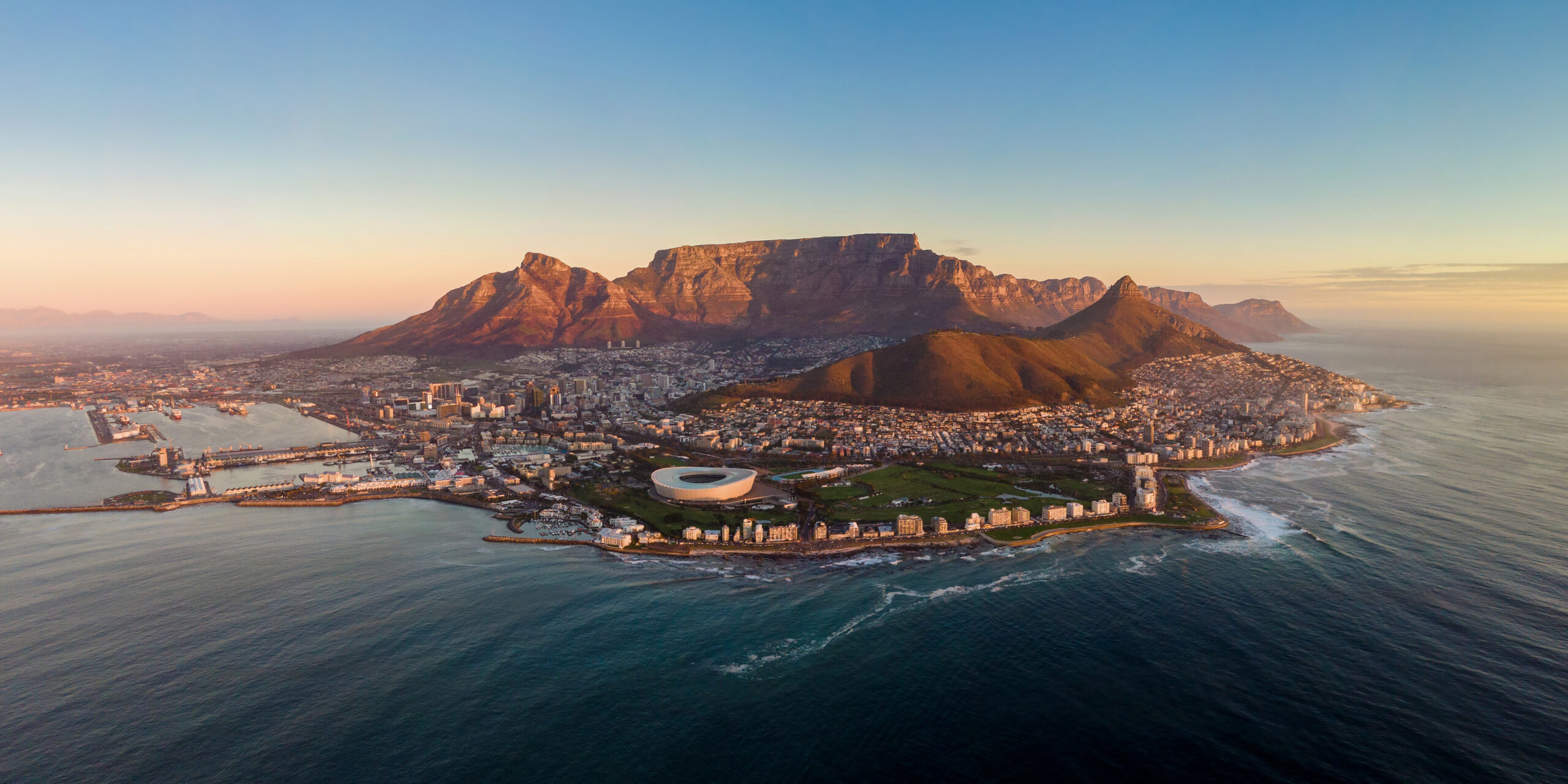
Table Mountain: Hiking Cape Town’s Flat-Topped Icon
Rising sheer above Cape Town, its level summit often draped in the famous “tablecloth” of cloud, Table Mountain is one of the most recognisable mountains on Earth and a New7Wonder of Nature. You can ride a cable car to the top in five minutes — or earn it on foot up a relentless gorge. This is the complete guide: the routes, the cableway, the remarkable nature on top, why it catches so many hikers out, and how to plan your day, with a live map and forecast.
Table Mountain is wonderfully accessible but routinely underestimated. Anyone can reach the summit by cableway, and fit walkers can hike it in a morning — but the plateau sits at 1,086 m, the weather flips fast, and the park logs over a hundred rescues in a typical half-year. Come prepared, start early, watch the wind and cloud, and you’ll have one of the great urban mountain experiences anywhere.
📑 On This Page
The Mountain
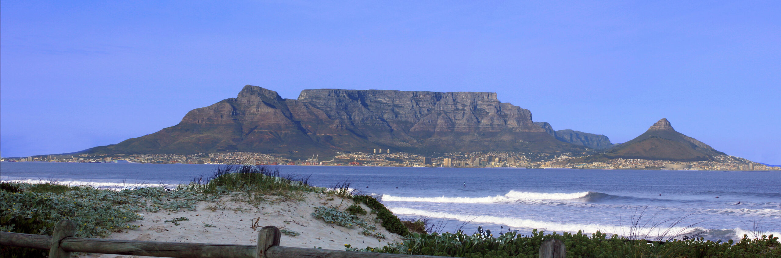
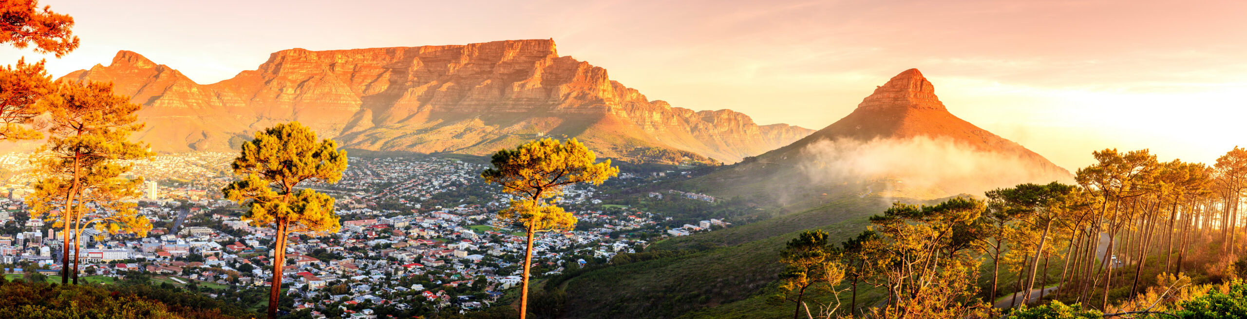
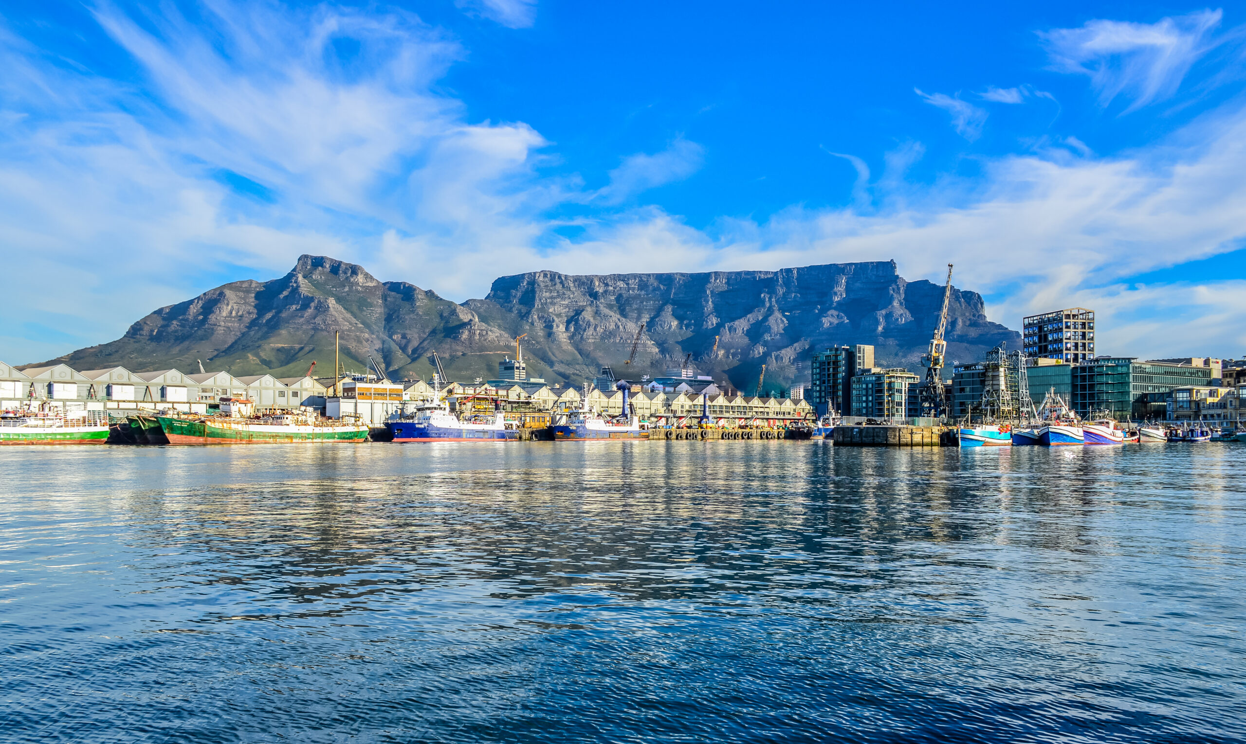
Table Mountain (Afrikaans Tafelberg; Khoekhoe Huriǂoaxa, “sea-emerging”) is the flat-topped massif that forms the unmistakable backdrop to Cape Town. Its highest point, Maclear’s Beacon, stands at 1,086 m (3,563 ft) towards the eastern end of a level plateau roughly three kilometres across, edged on all sides by steep cliffs. Flanked by Devil’s Peak to the east and Lion’s Head to the west, with the Twelve Apostles trailing down its Atlantic flank, it forms the natural amphitheatre that cradles the city’s “City Bowl” and Table Bay.
It is the centrepiece of Table Mountain National Park — the most-visited national park in South Africa, drawing around 4.2 million people a year — and a UNESCO World Heritage Site within the Cape Floral Region. In November 2011 it was named one of the New7Wonders of Nature. The mountain is built of ancient quartzitic Table Mountain Sandstone, laid down hundreds of millions of years ago atop an even older granite base, and its flat summit is the product of aeons of erosion.
What truly sets it apart is life. Table Mountain hosts well over 2,200 plant species — more than the entire United Kingdom — roughly 80% of them fynbos, the fine-leaved Cape shrubland of proteas, ericas, and restios, much of it found nowhere else on Earth. Add the curious dassies (rock hyrax) basking on the summit rocks, the red Disa orchid on wet cliffs, and the ever-shifting “tablecloth” cloud, and the mountain is as much a natural wonder as a landmark.
Location & 7-Day Forecast
Where the mountain sits above Cape Town, and a live look at conditions. The forecast below is an automatically updated 7-day outlook for the summit plateau (33.96°S, 18.40°E) — remember the top can be many degrees colder and far windier than the city below, and the south-easterly that brings the “tablecloth” can also close the cableway.
Why It’s Harder Than It Looks
Because a cable car runs to the top and the city is right there, many visitors treat Table Mountain as a casual stroll. It is not. At 1,086 m it stands only about 260 m lower than Ben Nevis, the highest mountain in Britain — and it behaves like a real mountain.
The weather flips in minutes. A clear, postcard morning can vanish into thick, disorienting fog — the famous “tablecloth” — as the south-easterly wind drives moist air up the slopes. On the open plateau it is genuinely easy to lose the path and your bearings when cloud rolls in, which is exactly when navigation matters most.
The cableway is not a guaranteed way down. High winds close it without much warning, sometimes stranding people who hiked up expecting an easy ride down. The standing advice is to always be prepared and equipped to walk down, ideally via Platteklip Gorge.
Heat, cold, and exhaustion. The standard Platteklip route is a shadeless, sun-baked staircase where heat exhaustion and dehydration are common in summer — while the summit itself can be cold and wind-blasted even in January. The contrast catches people out in both directions.
In the first six months of 2023 alone, Table Mountain National Park logged over 100 rescue callouts — overwhelmingly hikers who were lost, exhausted, dehydrated, benighted, or caught out by weather, rather than victims of dramatic falls. The lesson is simple: carry water, layers, and a charged phone, tell someone your plan, check the wind and cloud forecast, and turn back if the tablecloth comes down.
History & First Ascent
Table Mountain has watched over one of the world’s great sea routes for centuries. Its first recorded ascent came remarkably early: in 1503, the Portuguese explorer António de Saldanha climbed it — by the line of what is now Platteklip Gorge — to get his bearings on the coastline, and is said to have named the bay below. Long before that, the Khoe-speaking peoples of the Cape knew the mountain intimately, and its Khoekhoe name Huriǂoaxa means “sea-emerging.”
The summit’s true high point, Maclear’s Beacon, is a stone cairn built in 1865 by Sir Thomas Maclear for a trigonometrical survey; at 1,086 m it sits about 19 m above the western plateau where the cableway now arrives. That Aerial Cableway opened on 4 October 1929, transforming access to the top; its rotating “Rotair” cars, introduced in a 1997 rebuild, turn a full circle during the five-minute ride so every passenger gets the panorama. Among the mountain’s walkers was statesman Jan Smuts, a keen hiker for whom the Skeleton Gorge route — the “Smuts Track” — is named.
Then there is the folklore. The “tablecloth” cloud that pours over the rim has its own Cape legend: smoke from a pipe-smoking contest between the devil and a local pirate named Van Hunks. The mountain is even commemorated in the night sky — the constellation Mensa (“the Table”) is named after it, the only earthly landmark so honoured. (First-hand note: living in Cape Town, our editor came to read the tablecloth as the city’s weather signal — when it spills over the edge, the south-easter is up and the mountain means business.)
The Standard Route: Platteklip Gorge
If you want to climb Table Mountain on foot, Platteklip Gorge (“Flat Stone Gorge”) is the classic and most direct line — the same cleft de Saldanha used in 1503. It splits the great front face (the “Africa face”) right up the middle, and it is best summed up as a giant, relentless staircase.
The walk starts on Tafelberg Road, a short way along the contour path, then turns up into the gorge for a sustained climb of around 600 m to the plateau. The path is well built with stone steps and erosion gabions and is not technically difficult at any point — but it is steep and unrelenting, and because it faces north it bakes in summer sun with almost no shade. Allow roughly 2 to 3 hours up, take it slowly, and carry plenty of water.
At the top of the gorge you reach a junction on the plateau. Turn right and it is a 10-15 minute walk (about 0.8 km) to the upper cable station; turn left and a marked path of roughly 1.8 km leads east across the tabletop to Maclear’s Beacon, the true summit. Many hikers climb Platteklip and then ride the cableway down — a great plan, but only when the wind forecast is calm, since the cableway closes in high wind and you may have to descend the gorge on foot instead.
However you reach the plateau, the top itself is a destination, not just a viewpoint. Boardwalks and marked paths thread across the windswept tabletop past the historic Hely-Hutchinson Reservoir, the upper-station café and curio shop, and dassies sunning on the warm rocks, with the city, Table Bay, and the Atlantic spread out far below. Give yourself time to wander the rim paths rather than turning straight around.
The Other Routes & the Cableway
Platteklip is the default, but Table Mountain has a whole network of routes of very different character.
India Venster is the most direct hiking line beside the cableway, but it is a proper scramble with exposed sections and short rock-climbing moves; it should only be attempted by sure-footed hikers comfortable with heights, in good weather. Skeleton Gorge (the Smuts Track) and the neighbouring Nursery Ravine climb from the lush Kirstenbosch Botanical Garden on the eastern side, through shaded Afromontane forest with wooden ladders and steps, before emerging onto the Back Table near Maclear’s Beacon — beautiful, but slippery when wet and best avoided after heavy rain. Kasteelspoort threads up through proteas and boulders to the celebrated “Diving Board” rock viewpoint, while the gentler Pipe Track contours the Atlantic flank beneath the Twelve Apostles for big sea views without a summit push.
The Aerial Cableway remains the great equaliser: a five-minute ride from 302 m up to the plateau at 1,067 m, in rotating cars, with curio shops, a café and easy walking paths at the top. It makes the summit accessible to almost everyone — but it is entirely weather-dependent and shuts down in strong wind, so always have a backup plan. From the upper station, a chained, marked path leads across to Maclear’s Beacon for those who want to stand on the true top.
Beyond the table itself, the wider park invites more walking. Neighbouring Lion’s Head offers a famous spiralling path to a 360-degree viewpoint — and a hugely popular full-moon hike — while the Contour Path circumnavigates the massif for those who want big views without a summit climb. The mountain’s sheer sandstone faces are also a celebrated rock-climbing arena, with hundreds of established routes; for all its cable-car ease, Table Mountain has a serious vertical side that demands proper skills, ropes, and experience.
The Setting & Getting There
One of Table Mountain’s great virtues is how close it is to the city — this is genuinely urban wilderness. The trailheads sit minutes from central Cape Town, so a serious mountain hike can be done in a half-day without leaving town.
The Platteklip Gorge and lower cableway trailheads are on Tafelberg Road, reached via Kloof Nek above the city; the Skeleton Gorge and Nursery Ravine routes start from Kirstenbosch National Botanical Garden on the eastern, Southern-Suburbs side; and the Pipe Track begins near Kloof Nek above Camps Bay. The MyCiTi public bus runs to the Table Mountain Aerial Cableway stop from the city centre, so you can reach the mountain without a car at all.
There is no entrance fee to hike in the national park itself, which adds to the appeal — your only unavoidable cost is the cableway ticket if you choose to ride. Because the mountain rises straight out of the city, you’ll have Cape Town, Table Bay, Robben Island, and the Atlantic laid out beneath you for almost the entire climb.
Logistics & Planning
Table Mountain needs travel planning more than expedition planning, but a few specifics make or break the day:
The cableway. Check operating hours, which vary by season, and book online to skip the often very long queues at the lower station. Crucially, the cableway closes in high wind — frequently and sometimes at short notice — so never rely on it as your only way down. If you hike up intending to ride down, buy your ticket at the top and watch the forecast.
More than people expect for a “city” mountain: at least 1.5-2 litres of water (Platteklip is shadeless), warm and windproof layers for the summit even in summer, sun protection, proper shoes with grip, a charged phone, and a basic idea of your route and a backup descent. A small map or offline GPS helps enormously if the tablecloth rolls in.
Guides. You can hike the main routes independently, but a registered local guide adds real value on the scrambly lines like India Venster, for first-time visitors, and for reading the day’s weather window — well worth it if you’re unsure. Several reputable Cape Town outfits guide the mountain daily.
Safety basics. Tell someone your plan and expected return, hike with others where you can, start early, and turn around if cloud or strong wind sets in. Keep the national park’s emergency number to hand. None of this is alarmism — it is simply what the park’s rescue statistics quietly recommend.
When to Climb
Table Mountain can be climbed year-round, but the seasons feel very different. Summer (November-March) brings long, warm days and the best chance of stable conditions — but also the strong south-easterly wind that drapes the tablecloth over the summit and closes the cableway, plus real heat on the exposed Platteklip route and occasional afternoon thunderstorms. Winter (June-August) is cooler and wetter, with the forested gorge routes slippery and sometimes dangerous after rain, but clear winter days can be still and beautiful. Spring rewards hikers with the fynbos in flower.
Whatever the season, the single best habit is to start early: mornings are cooler, quieter, and far less likely to be clouded in than afternoons. And in every month, the deciding factor is the day’s wind and cloud — a calm, clear forecast is worth more than the calendar. Watch the mountain itself: if the tablecloth is already pouring over the edge, it is a day for a lower walk or a café, not the summit.
Who It’s For
Few mountains span such a range of visitors. At one end, the cableway makes the summit and its café accessible to almost anyone, including those who can’t hike. At the other, the cliffs draw serious rock climbers, and the scrambly lines like India Venster test confident, sure-footed hikers. In between sits the great majority: reasonably fit walkers tackling Platteklip Gorge or Skeleton Gorge for the deep satisfaction of earning the view.
The honest guidance is to match the route to your fitness and the weather, and to take any on-foot ascent seriously. If you want a gentle introduction, ride up and stroll the plateau paths, or walk the contouring Pipe Track; if you want the climb, choose Platteklip on a cool, calm morning. Either way, respect the mountain’s changeable moods — that respect is exactly what turns a Table Mountain day from a rescue statistic into one of the best mountain experiences a city can offer. To weigh it against other objectives, see our difficulty ratings guide and which mountain should you climb?
Fast Facts
| Elevation | 1,086 m (3,563 ft) at Maclear’s Beacon |
| Location | Table Mountain National Park, Cape Town, Western Cape, South Africa |
| Coordinates | 33.9577° S, 18.4037° E |
| First recorded ascent | 1503 — António de Saldanha, via Platteklip Gorge |
| Standard route | Platteklip Gorge — steep, non-technical hike, ~2-3 hours, ~600 m climb |
| Other routes | India Venster (scramble), Skeleton Gorge/Smuts Track, Nursery Ravine, Kasteelspoort, Pipe Track |
| Cableway | Aerial Cableway since 1929 — 302 m to 1,067 m in ~5 min; closes in high wind |
| Status | New7Wonders of Nature (2011); UNESCO World Heritage (Cape Floral Region) |
| Nature | 2,200+ plant species (~80% fynbos); dassies, Disa orchid; the ‘tablecloth’ cloud |
| Key hazards | Sudden fog/weather, cableway closures, heat & dehydration, getting lost |
| Best time | Year-round; early morning; calm, clear days (watch the south-easter) |
| Park fee | No fee to hike; cableway ticket extra (book online) |
How We Researched This
Our method.
- First-hand familiarity: our editor climbed Table Mountain and lived in Cape Town for two years, which informs the route character, weather, and safety notes.
- Routes, cableway & access cross-checked against SANParks (Table Mountain National Park) trail information and the Table Mountain Aerial Cableway.
- Elevation, history & nature from Wikipedia, the New7Wonders record, and Cape Floristic Region sources; rescue figures from 2023 Table Mountain National Park reporting.
- Fees, hours, and conditions change constantly, and weather here is genuinely unpredictable — always verify current information and forecasts before you set out. Last verified July 3, 2026.
Table Mountain FAQ
How do you get to the top of Table Mountain?
Either ride the Aerial Cableway (about five minutes) or hike. The standard hike is Platteklip Gorge, roughly 2-3 hours up a steep, direct path. Many hike up and ride down – but only when the wind forecast is calm, as the cableway closes in high wind.
How hard is the Table Mountain hike?
Harder than it looks. Platteklip Gorge is non-technical but a relentless, shadeless staircase climbing ~600 m, hot in summer and windy and cold on top. India Venster is a genuine scramble with exposure. Treat any ascent as a real mountain hike.
How tall is Table Mountain?
Its highest point, Maclear’s Beacon, is 1,086 m (3,563 ft) – only about 260 m lower than Ben Nevis, the UK’s highest mountain, so it’s a real mountain despite its city setting.
Is Table Mountain dangerous?
It can be, mainly through underestimation. Weather turns to thick fog fast, the cableway closes in wind and can strand hikers, and heat and dehydration are common. The park logged over 100 rescue callouts in the first half of 2023 – prepare and check the forecast.
What is the best route up Table Mountain?
Platteklip Gorge for a direct climb with views, Skeleton Gorge (Smuts Track) from Kirstenbosch for shade and forest, and India Venster for confident scramblers. Many ascend on foot and descend by cableway when the wind allows.
Is there an entrance fee for Table Mountain?
No fee to hike in the national park, and trailheads are close to the city. The cableway is a paid ticket – book online to skip queues, and note it closes in high wind.
When is the best time to climb Table Mountain?
Early morning, year-round, before cloud and crowds build. Summer is warm but brings the south-easterly ‘tablecloth’ wind; winter is wetter; spring brings the fynbos flowers. Always check the wind and cloud forecast.
Who first climbed Table Mountain, and why is it famous?
Antonio de Saldanha made the first recorded ascent in 1503 via Platteklip Gorge. It’s famous as Cape Town’s flat-topped emblem, a New7Wonders of Nature (2011), and one of Earth’s most plant-diverse places – with more species than the entire UK.
About the Author
Cape Town’s Mountain — Done Right
Whether you ride the cable car or earn the summit up Platteklip, Table Mountain rewards an early start, a calm forecast, and a little respect for its moods. Watch the tablecloth, carry water and a warm layer, and enjoy one of the great views on Earth.
Mountains harder than they look → Which mountain should you climb? →Table Mountain & the Peaks of Africa
Cape Town’s icon is one face of African mountaineering. Explore the continent’s high peaks and ranges below.
Was this helpful?
🏔Related peaks nearby
🧭Explore & compare
Global Summit Guide is an independent mountaineering resource founded in 2026. The team combines first-hand trekking and climbing experience with in-depth research and professional health and nutrition review to help climbers choose objectives, prepare properly, and stay safe.
Health, altitude, and nutrition content is reviewed by Taylor Ludlow (Registered Nurse) and Brigg Hoopes (Nutritionist).
What We Don't Know Yet
Mountain information changes quickly. This box explains the limits of what this page can responsibly promise.
- Permit availability, reservation windows, quotas, and official fee rules may change after this page is updated.
- Weather, snowpack, avalanche risk, road access, and route conditions can change quickly and may be different on your climbing dates.
- Route conditions, trailhead access, crevasse exposure, stream crossings, and rescue access may vary from published planning guidance.
- Gear requirements can change by season, route variation, weather window, personal cold tolerance, and guide-service requirements.
- Fitness and altitude response vary by person; no guide, itinerary, or training plan can guarantee acclimatization or summit success.
Verify current conditions with official land managers, guide services, local forecasts, and current route reports before booking or climbing.
Mountaineering, rock and ice climbing, glacier travel, and high-altitude activity are inherently dangerous and can result in serious injury or death. The information on Global Summit Guide is provided for general informational and educational purposes only and is not a substitute for professional instruction, qualified guiding, proper equipment, or your own judgment and experience.
Route conditions, weather, snowpack, permits, regulations, and hazards change constantly and may differ from what is described here. Details may be incomplete, out of date, or contain errors. Always verify current information with local authorities, certified guides, and official sources before making any decision in the mountains.
Nothing on this site is medical, legal, or financial advice. Our fitness, acclimatization, altitude, and nutrition content is general in nature; consult a qualified physician before beginning any strenuous exercise program or exposing yourself to high altitude.
You are solely responsible for your own safety and decisions. To the fullest extent permitted by law, Global Summit Guide and its team accept no liability for any loss, injury, damage, or expense arising from use of, or reliance on, this information. By using this site you acknowledge these risks and accept these terms.
Some links on this site may be affiliate links. If you buy through them we may earn a small commission at no extra cost to you; this never affects our recommendations.
Global Summit Guide recommendation path
Next Best Mountain to Research
Use these recommendations to continue the right planning path instead of stopping on one page.
Use current permit, weather, route, and operator information before booking or climbing.
Explore Travel Options for Your Destination
Once your mountain, dates and route are taking shape, compare flights, hotels and other travel options that fit the trip.
Affiliate link. We may earn a commission at no additional cost to you.