
Last updated October 15, 2026
Pico Bolívar Climbing Guide 2026: Routes, Cable Car, Difficulty and Planning
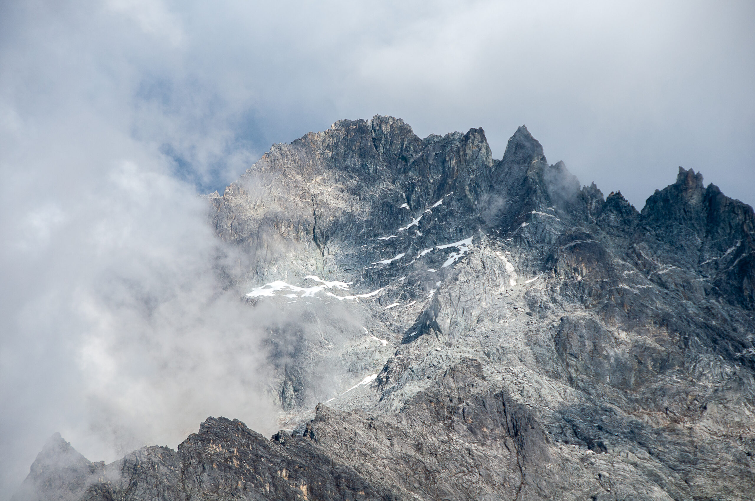
Pico Bolívar is Venezuela’s 4,978 m high point and a technical rock summit above Mérida. The modern planning problem is unusually dependent on Mukumbarí: the cable system reopened on August 19, 2026, but local reporting on September 1–2 says public service is currently stopping at Loma Redonda while the final section to Pico Espejo remains under maintenance. Plan the climb around the highest station that is actually operating—not the station shown in an old guidebook.
Pico Bolívar Is a Short Technical Summit With a Long List of Dependencies.
Best route for most visiting climbers: the Weiss Route with a current Mérida guide and a deliberately staged acclimatization plan.
Current access reality: Mukumbarí officially reopened August 19 after maintenance, but Mérida reporting on September 1–2 says tourists are currently being carried only to Loma Redonda, the fourth station, while the fifth station at Pico Espejo remains unavailable during maintenance. That means the classic “ride to 4,765 m and climb” model should not be assumed today.
Technical reality: the mountain is no longer a glacier climb in the historic sense. It is primarily high-altitude rock and mixed-condition climbing. A July 14, 2026 ascent reported snow, rime, verglas, several roped sections, bolted rappel anchors, a short cable and an upper crux estimated around YDS 5.6.
Travel reality: the U.S. State Department currently lists Venezuela at Level 3 — Reconsider Travel. Resolve entry, insurance, banking/payment, ground transport and evacuation questions before paying for the summit.
What Mukumbarí Is Doing Matters More Than the Old “Cable Car Route” Description
This page distinguishes the official reopening from the most recent local operating report.
Venezuela’s Tourism Ministry announced that Mukumbarí resumed public operations after maintenance.
Local Mérida reporting says visitors are currently ascending only to the fourth station.
The fifth station is reported unavailable while the upper section remains in maintenance.
Ask both the current guide and teleférico operator before fixing camp, porter, ticket or summit-day logistics.
Choose the Access Reality, Then Build the Mountain Plan
The tool does not predict what Mukumbarí will be doing on your trip date. It shows how the itinerary changes under each operating mode.
Partial Service to Loma Redonda
Current local reporting says tourists are being turned around here while Pico Espejo remains under maintenance. This creates a longer high-altitude approach than the classic full-cable model and may require different overnight and gear-haul logistics.
Pico Bolívar’s 4,978 m Elevation Has a Measurement Story
A 2002 scientific GPS campaign replaced a long-running twentieth-century value that still appears in older books and signs.
Use 4,978 m for modern planning.
The Bolívar 2002 campaign used GPS observations combined with a Venezuelan geoid model to calculate an orthometric height of 4,978.4 ±0.4 m. The result was 28.6 m lower than the 5,007 m official value that had been used since 1928.
The practical consequence is small—the climb is still a near-5,000 m technical summit—but the research story explains why older references disagree.
From Access Point to Summit: Where the Climb Changes Character
This is an educational schematic, not a navigation topo. Click each stage to see the route problem.
Access / Staging
The Weiss Route has no single permanent modern trailhead. Full cable service can put climbers near Pico Espejo; partial service changes the approach; a closure can turn the same summit into a multi-day foot-based climb.
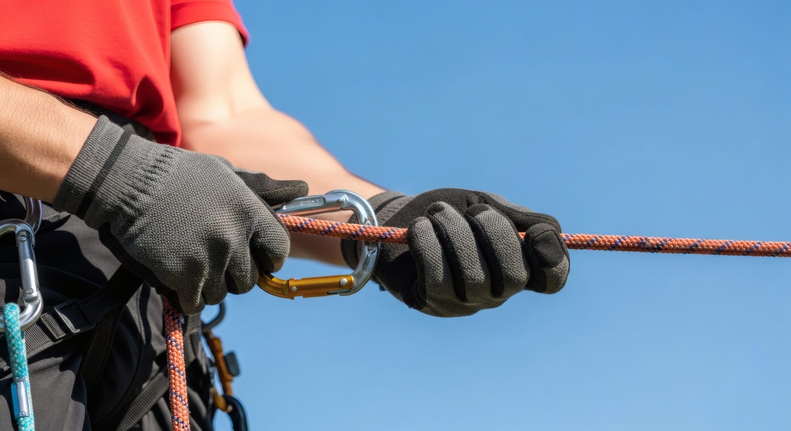
The Cable Car Does Not Turn Pico Bolívar Into a Hike.
The climber still needs a helmet, harness, rope system and a controlled rappel descent. Short distance from an upper station can hide the seriousness of exposed climbing at nearly 5,000 m.
July 14, 2026: What One Recent Climb Actually Observed
Eric Gilbertson’s July 11–15 trip provides unusually recent field evidence. It is a snapshot, not a permanent condition report.
The team approached on foot because the cable system was closed for repairs, spent a weather day at camp, then climbed the Weiss Route on July 14.
Snow, rime and verglas were present. The south side was especially icy in places.
Several roped pitches plus scrambling and a short exposed cable traverse were reported.
The final technical pitch was estimated at about YDS 5.6 for roughly 20 m.
Bolted rappel anchors made the descent efficient, but their future condition should never be assumed.
The report says a local guide was legally required and rangers photographed the team’s permit. Direct official confirmation is still needed for the current rule.
One wet-season climb does not define dry-season rock, exact pitch count, current cable access or future hardware condition.
Six Factors That Make Pico Bolívar Serious
A short route can still combine technical rock, exposure, loose stone, altitude and a mandatory rope descent.
Historic framing around UIAA III–III+ / YDS 5.4–5.6.
Narrow upper terrain and a traverse near La Ventana.
Loose blocks and team spacing matter.
Technical movement occurs close to 5,000 m.
Fatigue and weather arrive before the route is finished.
Dry rock can become snow, rime or verglas.
How Aggressive Is Your Altitude Plan?
This tool does not predict altitude illness. It shows whether your access plan is compressing the elevation gain too quickly for a technical summit.
Use the partial access as a staged climb.
A partial cable ride still creates a large jump from Mérida, but three acclimatization days plus a staged approach gives the body more information before technical climbing.
Build the Schedule Around Access and Acclimatization
The shortest itinerary is not automatically the best one. Select the access pattern that actually applies.
Pico Bolívar Is Glacier-Free—But It Is Not Ice-Free
Older route descriptions can mislead modern equipment choices because the Sierra Nevada’s glacier system has changed dramatically.
Permanent Snow and Glacier Language
Older descriptions reference glaciers and persistent ice around Timoncito and the high Sierra Nevada. These were real features of earlier climbing eras.
More Rock, Less Permanent Ice
Glacier loss exposed broken rock, altered water sources and changed the balance between rockfall, seasonal snow and true glacier travel.
Seasonal Snow, Rime and Verglas
NASA reported Venezuela effectively glacier-free by 2024, yet the July 2026 Pico Bolívar ascent still encountered snow, rime and verglas. “No glacier” does not mean “dry rock.”
Do Not Pack for the Glacier That Used to Exist
Start with the rock-and-rappel system. Add snow equipment only when current conditions justify it.
Prioritize the Climbing and Descent System.
Rock-shoe/approach-footwear choice, light gloves, full rappel system.
Crampon / axe decision: Crampons and axe may not be needed if the current guide confirms dry conditions.
What Glacier Retreat Leaves Behind Is Not Automatically Easier.
More exposed rock can mean loose blocks, changing water access and greater dependence on current-condition knowledge. Seasonal snow can then cover that broken terrain without recreating a stable glacier route.
December–March Is the Dry-Season Focus—Not a Guarantee of Dry Climbing
The July 2026 report is useful precisely because it shows how different Pico Bolívar can become outside the drier part of the year.
Usually the simplest period for planning the Weiss Route. Expect cold nights, wind and occasional snow even when rainfall is lower. Current guide activity and cable operations still matter.
More frequent cloud and rain can make the rock slick and reduce the value of a nominally easy technical grade. Verify recent ascents rather than relying on the calendar.
The July 2026 ascent encountered heavy rain, rime, snow and verglas. Afternoon deterioration and lightning around the broader Mérida region can complicate timing and descent.
Conditions may improve, but an early dry spell does not guarantee that route surfaces, huts, cable sections or local guide schedules have shifted into a stable dry-season pattern.
Alternative Routes Exist—but Glacier Retreat Makes Old Descriptions Less Reliable
The Weiss Route should remain the default planning reference for visiting climbers. Other lines are specialist objectives, not casual backups when the Weiss Route is wet.
The Modern Standard
South-side technical rock with exposed upper terrain and a rappel descent. Historic descriptions place it around UIAA III–III+ / YDS 5.4–5.6, while modern surface conditions can add snow, rime and verglas.
Harder Historic Alpine Terrain
Older sources describe more difficult rock and mixed terrain on the north side. Because permanent ice has disappeared, old references to snowfields and ice features may no longer describe the modern line accurately.
More Technical Rock
Historically described as a more difficult direct rock objective. Current protection, grades and exact line should be treated as local specialist information rather than copied from an old route table.
Los Nevados / Foot-Based Systems
A longer approach can improve acclimatization and reduce dependence on the teleférico. It also adds transport, camp, mule/porter, weather and security variables that a short cable-supported itinerary largely hides.
The Best Candidate Is a Rock Climber Who Respects Altitude and Uncertain Logistics
You Already Own the Basic Technical Skills
- Comfortable following moderate multi-pitch rock.
- Can rappel without learning the system on summit day.
- Calm on exposed traverses and broken alpine rock.
- Has useful prior experience above 4,000 m.
- Can inspect personal/rental climbing equipment.
- Accepts a weather, cable or access failure without summit pressure.
You Expect a Cable-Assisted Trekking Summit
- Never worn a harness or rappelled.
- Uncomfortable with loose rock and exposed movement.
- Plans to ride rapidly to 4,700+ m after arriving near sea level.
- Needs fixed airline, banking and access assumptions to hold exactly.
- Insurance excludes the country or technical climbing.
- Must summit on one predetermined day.
Five Reasons to Turn Around on Pico Bolívar
The mountain is compact enough that climbers can feel pressure to “just finish the last pitches.” That is exactly when judgment matters.
Coordination, vomiting, confusion or breathlessness at rest are moving the wrong direction.
The team brought a dry-rock plan but current friction and protection no longer support it.
A bolt, cable or rappel station is damaged, missing or cannot be backed up appropriately.
Continuing increases the chance that technical rappels occur in worsening weather or darkness.
Cable timing, porter movement or route-camp logistics no longer support a controlled descent.
Every exposed pitch must still be reversed, often by rappel, with less energy and potentially worse weather.
What to Confirm Before Paying a Mérida Guide
The July 2026 field report says a guide was legally required and park rangers checked the team’s permit. Treat that as strong current evidence—but verify the present official rule directly.
Which Mukumbarí Stations Are Actually Operating?
- Highest public station on your date?
- Tickets / baggage limits?
- Alternative if Pico Espejo remains closed?
- Foot approach, mule or camp implications?
When Did You Last Climb the Weiss Route?
- Current surface: dry, snow, rime, verglas?
- Pitch and rappel count?
- Anchor condition?
- Rope length and protection supplied?
- Any fixed cable/hardware currently usable?
What Park Permit and Guide Rule Applies Now?
- Who obtains the permit?
- Is guide use mandatory for all technical climbs?
- Are IDs or ranger check-ins required?
- What changes if the cable car is unavailable?
What Happens When Access or Weather Fails?
- Reserve day?
- Refund / reschedule policy?
- Cash vs card / transfer payment?
- Emergency communication?
- Ground evacuation plan?
Use Live Quotes Instead of Pretending Venezuela Has a Stable Online Summit Price
Enter your real quotes. The page calculates mountain-only and full-trip planning totals without hardcoding volatile local prices.
Mountain-only planning total
$0Full-trip total including the mountain inputs above.
- Do not treat a low guide quote as the complete trip.
- Check whether cable closure changes porter/camp costs.
- Confirm Venezuela and technical-climbing exclusions in insurance.
- Keep cash/payment contingency separate from the headline budget.
1935 or 1936: Who First Reached the True Summit?
Venezuelan historical sources and specialist mountaineering literature use different levels of certainty.
The mountain, previously known as La Columna, was formally named for Simón Bolívar.
Fundación Empresas Polar credits Domingo Peña, Enrique Bourgoin and H. Márquez Molina with reaching the summit and placing a bust and Venezuelan flag.
Frank/Fritz Weiss reached the summit by another route. Some specialist mountaineering sources call this the first confirmed or undisputed ascent of the true highest point.
The responsible approach is to preserve the Venezuelan record while acknowledging why specialist route histories attach special certainty to Weiss.
Resolve Venezuela Before You Resolve the Summit
The mountain can be technically manageable while the trip remains logistically unsuitable.
Level 3 — Reconsider Travel
The June 27, 2026 advisory cites crime, kidnapping or hostage taking, terrorism, poor health infrastructure and natural-disaster risk. It also identifies higher-risk areas within the country.
Check the current advisory →Verify Visa and Border Rules for Your Passport
Do not rely on a 2026 trip report as an entry-rule reference. Requirements can change rapidly and can differ by nationality and point of entry.
Have More Than One Payment Plan
Confirm what the guide, hotels and local transport will actually accept. Separate the ability to transfer a deposit from the ability to pay unexpected local costs after an access failure.
Read Country + Technical-Climbing Exclusions
A general travel policy may exclude Venezuela, technical climbing, altitude, rescue or evacuation. Written confirmation is more useful than assuming the word “adventure” covers the trip.
What to Recheck Before the Climb
Elevation history is stable. Cable operations, park procedure, route surface and travel feasibility can change within days.
Mintur — Aug. 19 Reopening
Official announcement that Mukumbarí resumed operations after maintenance.
Open source →Diario Frontera — Sep. 1–2 Status
Recent local reporting that tourists are currently reaching Loma Redonda while Pico Espejo remains under maintenance.
Open Sep. 2 report →Bolívar 2002 GPS Study
Scientific elevation result of 4,978.4 ±0.4 m.
Open study →Country Highpoints — July 2026
Current field evidence for foot approach, permit check, snow/rime/verglas, technical pitches, anchors, crux estimate and 11-hour summit day.
Open report →NASA — Venezuela’s Final Glacier
Regional glacier-loss context and the 2024 reclassification of Humboldt’s final ice remnant.
Open NASA →U.S. State Department
Current Level 3 travel advisory and identified risk categories.
Open advisory →Move From Pico Bolívar Into the Right Andes Decision
Andes High-Altitude Giants
Compare Pico Bolívar with larger glaciated and volcanic peaks across South America.
Explore the Andes →Country highpointsHighest Mountain in Every Country
Pico Bolívar stands out because Venezuela’s national high point is a technical rock summit.
Compare country highpoints →Venezuela comparisonMount Roraima
Compare the technical Andes summit with Venezuela’s remote tepui trekking experience.
Open Roraima →Technical gearGear & Safety
Use the inspection framework for rope, helmet, harness and rented technical equipment.
Review gear →Trip systemsAndes Expedition Planning
Altitude, flights, logistics and contingency planning across South American climbing trips.
Plan Andes logistics →Regional comparisonGreatest Peaks of the Andes
Place Pico Bolívar in the wider climbing geography of the range.
Compare Andes peaks →Pico Bolívar FAQ
How high is Pico Bolívar?
A 2002 GPS campaign measured 4,978.4 ±0.4 m. This guide rounds the modern planning elevation to 4,978 m / 16,332 ft.
Is the cable car currently reaching Pico Espejo?
Do not assume it is. Mukumbarí officially reopened August 19, 2026, but local Mérida reports from September 1–2 say public operations are currently stopping at Loma Redonda while the Pico Espejo section remains under maintenance.
What is the normal route?
The Weiss Route is the standard technical route. It uses the south-side rock system, an exposed upper traverse and a technical rappel descent.
How hard is the Weiss Route?
Historic descriptions commonly place it around UIAA III–III+ or YDS 5.4–5.6. The July 2026 team estimated the final technical pitch near 5.6 for about 20 m. Snow, rime or verglas can raise the practical difficulty.
Does Pico Bolívar still have a glacier?
No flowing glacier remains. Venezuela’s final glacier remnant on nearby Pico Humboldt became too small to flow by 2024. Seasonal snow, rime and verglas still occur on Pico Bolívar.
Do I need crampons and an ice axe?
Not automatically. The modern base route is a high-altitude rock climb. Crampons and an axe are condition-dependent additions when current snow, rime or ice justify them.
Do I need a guide?
A July 2026 climber reported that local guides were legally required and that park rangers checked the team’s permit. Because a current easily accessible official public rule defining all cases was not located, verify the current requirement directly in Mérida before the climb.
What is the best season?
December through March is the usual dry-season focus. Wet rock, cloud, wind and seasonal snow remain possible, and current access status matters as much as the calendar.
How many days should I plan?
A balanced trip needs roughly five to seven mountain days depending on cable access, prior acclimatization and whether a foot approach is required, plus international travel buffers outside the mountain schedule.
Is Venezuela safe for a climbing trip?
The U.S. State Department currently lists Venezuela at Level 3 — Reconsider Travel. Travelers should consult their own government’s guidance and confirm entry, insurance, payment and local transport conditions before making nonrefundable commitments.
Confirm Access First. Acclimatize Second. Then Commit to the Weiss Route.
The summit is technically compact, but the trip is not. Cable operations, altitude, route surface, park procedure, guide availability and Venezuela travel conditions can all change the correct itinerary. Build the climb around current reality rather than the shortest line on an old map.
2026 Weiss Route Status, Access Checks and Technical Schematic
This addendum summarizes the newest documented field information without treating one July ascent as permanent route condition. Verify cable-car service, park access, guide requirements, weather and equipment immediately before travel.
Pico Bolívar Route Atlas
| Route or approach | Character | Approximate historic grade | Best planning use | Important limitation |
|---|---|---|---|---|
| Weiss Route | South-side rock route with slabs, gullies, exposed upper terrain and rappels | UIAA III–III+ / roughly YDS 5.4–5.6 | Standard option for most guided teams | Snow, rime and verglas can make it substantially harder |
| Vinci / North Face | Steeper historic mixed and rock line | Often described around YDS 5.8 | Advanced alternative | Older glacier and ice descriptions may be obsolete |
| El Pote variation | More direct technical climbing | Historically around YDS 5.10 | Specialist objective | Current protection and exact line require local verification |
| La Travesía / longer approach | Multi-day trek before the technical summit section | Trekking plus roped climbing | Better acclimatization or cable-car backup | Longer exposure to weather, camps and park logistics |
Cable-car access
The Mukumbarí system reaches Pico Espejo at approximately 4,765 metres, but operating periods change. Confirm stations, hours, tickets and expedition-baggage rules before relying on it.
Glacier reality
Pico Bolívar no longer has a true glacier. Venezuela’s final glacier, on nearby Pico Humboldt, was reclassified as an ice field in 2024. Seasonal snow and ice can still create real mixed-climbing conditions.
Travel decision
The U.S. State Department listed Venezuela at Level 3—Reconsider Travel on June 27, 2026. Resolve visas, banking, insurance, transport and emergency limitations before nonrefundable deposits.
Continue through the Pico Bolívar content cluster
These supporting pages should also link back to the main Pico Bolívar guide using descriptive anchors such as “Pico Bolívar climbing guide,” “Venezuela’s highest mountain,” and “Pico Bolívar Weiss Route.”
Sources for this 2026 addendum
- Country Highpoints: July 11–15, 2026 Pico Bolívar ascent report — shelter, verglas, pitches, anchors, crux estimate and timing.
- U.S. Department of State: Venezuela Travel Advisory — Level 3, dated June 27, 2026.
- NASA Earth Observatory: Humboldt Glacier’s Demise — Venezuela’s last glacier and regional ice-loss context.
- Global Summit Guide Pico Bolívar parent guide — elevation, Weiss Route range and conservative itinerary.
Editorial boundary: route grades and July 2026 conditions are reported observations, not guarantees. Cable-car operation, park rules and anchor condition are time-sensitive.
Was this helpful?
🏔Related peaks nearby
🧭Explore & compare
Global Summit Guide is an independent mountaineering resource founded in 2026. The team combines first-hand trekking and climbing experience with in-depth research and professional health and nutrition review to help climbers choose objectives, prepare properly, and stay safe.
Health, altitude, and nutrition content is reviewed by Taylor Ludlow (Registered Nurse) and Brigg Hoopes (Nutritionist).
What We Don't Know Yet
Mountain information changes quickly. This box explains the limits of what this page can responsibly promise.
- Visa, passport, vaccination, border, insurance, and local transportation rules may change before your trip.
- Route conditions, snowpack, closures, and weather can change quickly after this page is updated.
- Permit rules, fees, quotas, and reservation windows may change between review cycles.
- Operator availability, pricing, guide ratios, and cancellation terms can change by season.
- Your fitness, altitude response, risk tolerance, and experience level may change what is safe or realistic.
Verify current conditions with official land managers, guide services, local forecasts, and current route reports before booking or climbing.
Mountaineering, rock and ice climbing, glacier travel, and high-altitude activity are inherently dangerous and can result in serious injury or death. The information on Global Summit Guide is provided for general informational and educational purposes only and is not a substitute for professional instruction, qualified guiding, proper equipment, or your own judgment and experience.
Route conditions, weather, snowpack, permits, regulations, and hazards change constantly and may differ from what is described here. Details may be incomplete, out of date, or contain errors. Always verify current information with local authorities, certified guides, and official sources before making any decision in the mountains.
Nothing on this site is medical, legal, or financial advice. Our fitness, acclimatization, altitude, and nutrition content is general in nature; consult a qualified physician before beginning any strenuous exercise program or exposing yourself to high altitude.
You are solely responsible for your own safety and decisions. To the fullest extent permitted by law, Global Summit Guide and its team accept no liability for any loss, injury, damage, or expense arising from use of, or reliance on, this information. By using this site you acknowledge these risks and accept these terms.
Some links on this site may be affiliate links. If you buy through them we may earn a small commission at no extra cost to you; this never affects our recommendations.
Global Summit Guide recommendation path
Next Best Mountain to Research
Use these recommendations to continue the right planning path instead of stopping on one page.
Use current permit, weather, route, and operator information before booking or climbing.
Explore Travel Options for Your Destination
Once your mountain, dates and route are taking shape, compare flights, hotels and other travel options that fit the trip.
Affiliate link. We may earn a commission at no additional cost to you.