Ama Dablam South Ridge: A 16-Day Expedition Account | Global Summit Guide
Home›Trip Reports› Ama Dablam South Ridge: A 16-Day Expedition Account
Trip Report · Himalaya Technical Peak
Ama Dablam South Ridge: A 16-Day Expedition Account
This is the intentional version of an Ama Dablam expedition report: tighter, sharper, and written for climbers who are not casually browsing, but actively trying to understand what a serious, high-consequence 16-day push on one of the Himalaya’s most aesthetic peaks would actually feel like.
ama dablam expedition reporttrip reportssouth ridge accountkhumbu technical climb
—Direct Answer
If you are searching for an ama dablam expedition report, what you probably want is not a dreamy travel diary. You want to know whether the mountain feels as serious as it looks, whether the route is actually within reach, and whether a shorter, highly intentional expedition format makes sense for a prepared climber.
The honest answer is yes — but only for the right person. Ama Dablam is not a mountain to “try and see.” It is a route that rewards previous altitude experience, fixed-line competence, efficient movement on exposed terrain, and the maturity to stay calm when a famous peak turns technical, cold, and consequential.
6,814 m
Peak Height
High enough that altitude matters every day, but the real difficulty comes from technical terrain and exposure, not elevation alone.
South West Ridge
Standard Line
Often loosely called the South Ridge, this is the classic route most climbers mean when they talk about Ama Dablam.
16 days
This Article’s Frame
A deliberately compressed, high-intent expedition account — not the slowest or most forgiving version of the climb.
Technical, exposed
Route Personality
This mountain feels beautiful from base camp and increasingly serious from Camp 1 upward.
Best simple takeaway: Ama Dablam is one of the most beautiful mountains in the world, but the people who do best on it are usually the ones who stop thinking about beauty early and start thinking about systems, rhythm, and margin.
1Why This Expedition Report Is Intentional
This post is intentionally built for a high-intent reader. That means it is written for someone who is already comparing operators, training seriously, or deciding whether Ama Dablam belongs on the near-term calendar at all. It is not written like a vague inspiration piece. It is written like the kind of report someone wants the night before they commit.
A standard Ama Dablam expedition is often much longer than sixteen days. That matters. This account is not pretending otherwise. It is describing a leaner, faster version of the climb that assumes you arrive reasonably fit, technically ready, and either partly acclimatized already or capable of operating inside a more efficient schedule.
Important: this is not the right model for a climber using Ama Dablam as a first serious Himalayan technical peak. A longer itinerary, more conservative acclimatization, and a stronger weather buffer usually make more sense for anyone still building high-altitude technical experience.
2The 16-Day Expedition at a Glance
Day
Location / Move
Main Purpose
1
Kathmandu arrival / final sort
Gear check, rope-system review, mental reset
2
Lukla to Phakding
Start clean and conserve energy
3
Phakding to Namche
Set the expedition rhythm early
4
Namche acclimatization day
Climb high, stay patient, recover well
5
Namche to Pangboche / upper valley
Move deeper into Ama Dablam terrain
6
Ama Dablam Base Camp
Settle in, sort load strategy, route briefing
7
Base Camp skills refresh
Fixed lines, transitions, and camp systems
8
Rotation to Camp 1
First contact with route reality
9
Descend to Base Camp
Recover and assess movement quality
10
Second rotation higher on route
Touch upper terrain and build familiarity
11
Return to Base Camp
Fuel, sleep, and sharpen summit plan
12
Weather / recovery / final packing
Stay calm and avoid wasted effort
13
Move to Camp 1
Start summit push without drama
14
Move higher / summit positioning day
Protect energy for the decisive push
15
Summit bid and major descent
Climb well, descend better
16
Exit / trek down valley
Close the loop without rushing the finish
That outline is what makes this trip “intentional.” There is very little wasted motion in it. Every day either builds acclimatization, sharpens technical readiness, or protects the summit window.
3The Expedition Account
1
Days 1–4: The Approach That Sets the Tone
Kathmandu to Namche is where rushed climbers begin to lose margin
The first phase of the expedition does not feel glamorous, but it quietly decides whether the rest of the climb feels controlled or chaotic. A strong team arrives in Kathmandu with fewer questions than average. Gear is already tested. Boots are already trusted. The pack is not a theory. By the time we reach Lukla and start moving toward Namche, the goal is not to prove anything. The goal is to arrive at the mountain with our systems already quiet.
Namche is where the expedition begins to feel real. You can already see the difference between a fit traveler and a prepared climber. One is excited by the scenery. The other is already thinking about sleep quality, hydration, pace discipline, and whether every piece of equipment still feels automatic when the air gets thinner.
2
Days 5–7: Base Camp and the Shift Into Climbing Mode
The mountain stops being an idea once Base Camp comes into view
Pangboche and the move toward Ama Dablam Base Camp create a subtle but important shift. The Khumbu trekking rhythm falls away. The climb narrows. Conversations get shorter. The mountain stops being a skyline feature and starts feeling like a route with consequences.
Base Camp is where a shorter expedition either becomes sharper or more fragile. This is where we re-check rope systems, talk through transitions, review how we want to move on fixed lines, and cut out anything that adds noise. On a mountain like Ama Dablam, organization is not just about comfort. It is a form of safety.
3
Days 8–11: Rotations That Teach You the Truth
Camp 1 is where people stop underestimating Ama Dablam
The first rotation tells you more than almost anything else. On paper, climbers often focus on the summit. On the mountain, the route starts teaching lessons much earlier. Movement to Camp 1 reveals whether the team is actually efficient on exposed terrain or just confident in abstract terms. The climb is not hard because every move is desperate. It is hard because the terrain stays real, the exposure stays present, and you are never quite allowed to relax.
The higher rotation matters just as much. It is where rhythm, balance, clipping discipline, and composure begin to separate strong summit candidates from climbers who may still be forcing the mountain to fit their ambition. Ama Dablam rewards those who can stay methodical when the ridge gets more photogenic and more serious at the same time.
4
Days 12–14: The Quiet Before the Summit Push
Prepared climbers protect energy here instead of chasing momentum
There is a dangerous moment on technical expeditions when the team feels strong enough to spend energy carelessly. That is often when people stop making disciplined choices. A good weather day appears, confidence rises, and the mind starts sprinting ahead of the body. That is exactly where a shorter Ama Dablam program can unravel.
The better version of this phase is quieter. Final packing is precise. Food is simple. Water planning is handled early. Layering is settled before it becomes cold enough to matter. No one is trying to create summit energy in camp. They are trying to save it for the ridge.
5
Days 15–16: Summit Day and the Exit
The climb is won by the descent as much as the summit
The summit push on Ama Dablam is memorable not because the mountain suddenly becomes theatrical, but because it stays demanding. Exposure stays with you. Technical movement stays with you. The need for precision stays with you. Even when the summit appears close, the mountain keeps asking the same question: are you still composed enough to move cleanly?
That is why the descent matters so much. Summit emotion is never the finish line on Ama Dablam. Safe, deliberate descent is. The final day out of the valley has its own satisfaction, but it feels different than on a trekking peak. There is less noise in it. More respect. More clarity about what the mountain actually asked of the team.
4What Makes the Route Serious
Ama Dablam is often admired for its shape first and understood for its climbing second. That order is backwards. What makes the South West Ridge memorable is not just how beautiful it looks from the valley, but how complete the climbing feels once you are on it. The route asks for fixed-line competence, exposed movement, strong transitions, and enough judgment to keep your pace controlled even when terrain gets dramatic.
The Yellow Tower mindset
Whether a climber talks most about the Yellow Tower or some other exposed section, the real lesson is the same: technical terrain at altitude punishes disorganization. Ama Dablam is not the place to “kind of know” your systems.
Why Camp 1 upward feels different
Camp 1 is often where the mountain changes shape psychologically. Below it, the expedition still feels manageable. Above it, the ridge becomes more exposed, the climbing more honest, and every inefficiency more expensive.
Summit day is not just an altitude problem
Lots of mountains at similar elevation are hard because the air is thin. Ama Dablam is harder because the air is thin and the climbing still demands attention. You do not get to switch your brain off just because you are high.
5What This 16-Day Format Teaches
Preparation is what makes a shorter expedition possible. Shorter does not mean easier. It means less room for poor organization.
Fixed-line competence matters more than summit hype. Ama Dablam rewards clean systems and punishes rushed transitions.
The mountain is best treated as a technical objective, not a scenic trophy. Its beauty hides how serious it actually is.
Summit success on Ama Dablam is descent quality. The route still demands focus after the summit moment.
Intentional itineraries only work for intentional climbers. If the foundation is missing, a compressed schedule just exposes it faster.
Best judgment rule: if the itinerary starts to feel like a race, it is already drifting away from the kind of climbing Ama Dablam rewards.
6Who This Style of Expedition Actually Fits
This version of Ama Dablam fits climbers who already know that they enjoy exposed technical terrain, already move reasonably well on fixed ropes, and already understand how their bodies behave at altitude. It also fits people who are not using the trip to learn every system for the first time.
It is a poor fit for climbers whose resume is mostly non-technical trekking peaks, whose confidence depends on perfect conditions, or whose acclimatization history is still largely theoretical. For them, a longer program is not a downgrade. It is a smarter match for the mountain.
Ama Dablam deserves its reputation, but not always for the reason people first expect. It is not just one of the most beautiful mountains in the Himalaya. It is one of the clearest tests of whether a climber can stay organized, efficient, and calm when a route is exposed, technical, and high enough to magnify every small weakness.
A sixteen-day version of the climb can make sense, but only when it reflects genuine readiness instead of wishful compression. If the preparation is real, the mountain becomes a sharp, elegant objective. If it is not, Ama Dablam exposes that fact quickly.
10Keep Building the Ama Dablam Cluster
Use this expedition report as the decision page, then move deeper into the route guide, fixed-line skills, weather planning, operator research, and acclimatization tools before you commit to the climb.
Disclaimer: This page is an editorial expedition-style account built for planning and comparison, not a guarantee of conditions or a substitute for guide judgment, route updates, or local decision-making. Conditions on Ama Dablam change with season, rope fixing, snow stability, traffic, weather, and operator systems. Suggested image alt: climbers high on Ama Dablam’s South West Ridge during a 16-day expedition push in Nepal.
Nepal Trekking Peaks · First-hand
Ama Dablam: A 16-Day South Ridge Account
A first-hand account is one lens on Ama Dablam. See the full planning guides and the Nepal ladder below.
Salt Lake City · Wasatch Front · Local Mountain Guide
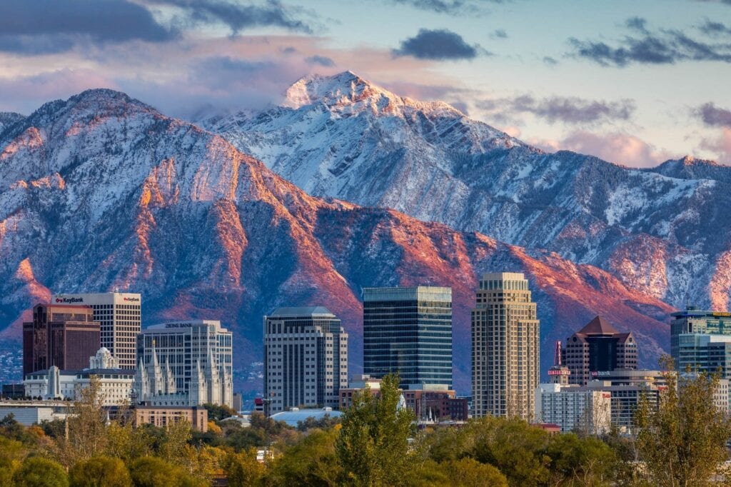
12 Best Mountains Near Salt Lake City: Hikes by Drive Time & Difficulty
If you want one classic Salt Lake summit, choose Mount Olympus; if you want the best first substantial summit, start with Grandeur Peak. This guide compares the strongest mountain days near downtown by drive time, duration, difficulty and what kind of outing each one actually delivers.
Utah-local field experienceDrive-time decision formatCurrent watershed rules checkedNo generic every-trail list
12Best-fit objectives
10–60 minApprox. drive range
1–14 hrOuting range
4 tiersEasy → advanced
By Travis Ludlow · Global Summit Guide · Utah-local research and field experience
Updated August 25, 2026
The local answer
Choose by the Day You Have—not by Which Peak Has the Biggest Number.
Mount Olympus is the signature Salt Lake City summit: steep, obvious from the valley, close to downtown and hard enough to feel like a real mountain day.
Grandeur Peak is the better first substantial summit for many hikers because it delivers real vertical gain without Olympus’s relentless steepness and upper scrambling.
Lake Blanche is the best scenery-first choice if the goal is an alpine basin rather than a summit. Sunset Peak is the best shorter high-elevation summit. Pfeifferhorn is the best progression into exposed scrambling, while Lone Peak is the endurance test.
Visitors with only an hour should use Ensign Peak for a city-and-mountain viewpoint rather than pretending a short outing is the same product as a full Wasatch summit.
Iconic summitMount Olympus
Best first summitGrandeur Peak
Best scenery hikeLake Blanche
Short high summitSunset Peak
Best scramblePfeifferhorn
Hardest big dayLone Peak
County high pointSouth Twin Peaks
1-hour viewpointEnsign Peak
Drive times are planning estimates, not guarantees. They assume a central Salt Lake City starting point outside major commuter, ski and canyon traffic. Weather, construction, parking and canyon congestion can change the real trip dramatically. Check navigation and trailhead access on the day you hike.
Decision table
12 Best Mountains & Summit Hikes Near Salt Lake City
This is not a county-boundary list. It is a practical “what can I do from Salt Lake City?” guide, which is why Timpanogos appears as a farther day-trip option while the county-list page remains separate.
Mountain / hike
Approx. drive*
Typical outing
Difficulty
Best for
Decision
1. Mount Olympus
15–20 min
6–8 hr
Strenuous
Iconic SLC summit
Best overall mountain day close to the city
2. Grandeur Peak
20–30 min
3–5 hr
Moderate–strenuous
First substantial summit
Best all-around progression peak
3. Lake Blanche
25–35 min
4–6 hr
Moderate–strenuous
Alpine scenery
Best scenery-first hike
4. Mount Wire
10–15 min
2–4 hr
Moderate
Training / city views
Best bridge from foothills to bigger summits
5. Sunset Peak
35–45 min
2–4 hr
Moderate
Short high-elevation summit
Best time-to-alpine payoff
6. Mount Aire
25–35 min
3–5 hr
Moderate
Quieter summit
Good alternative when Grandeur is too obvious
7. Raymond + Gobblers
30–40 min
6–9 hr
Strenuous
Long central-Wasatch day
Best linked-summit training day
8. Pfeifferhorn
35–45 min
7–10 hr
Advanced
Exposed scrambling
Best progression into alpine scrambling
9. Lone Peak
30–45 min
10–14 hr
Advanced
Endurance + commitment
Best hard local test piece
10. South Twin Peaks
35–45 min
Full day
Advanced
County high-point objective
Peakbagging significance + serious terrain
11. Mount Timpanogos
45–60+ min
8–12 hr
Strenuous
Bucket-list Wasatch day
Best farther day trip from SLC
12. Ensign Peak
10 min
30–60 min
Easy
Visitor viewpoint
Best one-hour city-and-mountain option
*Approximate drive from central Salt Lake City outside peak traffic. Route, trailhead and duration figures are planning ranges; verify the exact route and current access before departure.
Salt Lake’s advantage
The Range Starts Where the City Ends.
A visitor can choose between a one-hour viewpoint, a half-day training summit, a classic full mountain day or a committing alpine objective without changing the home base.
Start with the clock
Best Salt Lake Mountain by How Much Time You Have
Time is the fastest way to avoid choosing the wrong objective. A “best hike” that does not fit the day is not the best hike.
Under 90 minutes
Ensign Peak
Use it when you have an airport-day, conference-day or sunset window. It is a viewpoint hike rather than a serious summit, and that is exactly why it belongs here.
Best for visitors with almost no spare time.2–4 hours
Mount Wire
A more useful training objective than Ensign, with enough vertical and distance to feel like a workout while staying close to the city.
Best quick training mountain.3–5 hours
Grandeur Peak
The best balance of summit feeling, accessibility and effort. Use it to judge whether your legs and pacing are ready for a steeper full-day peak.
Best half-day summit.4–6 hours
Lake Blanche
Choose this when scenery matters more than checking off a summit. The basin beneath Sundial Peak delivers classic central-Wasatch terrain without exposed summit scrambling.
Best alpine hike without summit pressure.6–8 hours
Mount Olympus
Relentless vertical directly above the valley makes Olympus feel much bigger than its elevation suggests. Do it after several substantial hikes, not simply because it looks close.
Best classic mountain day close to downtown.10–14 hours
Lone Peak
When the goal is to test endurance, route management and all-day pacing without leaving the Wasatch Front, Lone Peak is the serious local objective.
Best full-day endurance test.
Progress instead of leapfrogging
A Simple Salt Lake Mountain Progression
The Wasatch makes progression easy because the next difficulty tier often sits only one canyon away.
Tier 1 · Start
Ensign → Mount Wire
Learn early-start routines, footwear, hydration and steady pacing on lower-consequence objectives.
Goal: finish with energy and consistent pacing.Tier 2 · Build
Grandeur → Mount Aire → Sunset
Add sustained vertical, longer descents and higher elevations. Grandeur is especially useful because it reveals pacing and fitness gaps before a bigger objective.
Now food, weather timing, descent strength and turnaround discipline become part of the day.
Goal: manage a 6–9 hour mountain day.Tier 4 · Advance
Pfeifferhorn → Lone Peak → South Twin
These objectives require more than fitness. Exposure tolerance, route judgment, efficient movement and retreat decisions matter.
Goal: arrive with proven endurance and scrambling judgment.
Difficulty changes with season. A summer hiking route can become a snow, ice or avalanche problem in winter and spring. Check current conditions and the Utah Avalanche Center whenever snow is part of the route.
Use the canyon to narrow the search
Which Wasatch Access Zone Fits Your Day?
This page no longer tries to be the definitive Wasatch geography article. Use the broader Wasatch parent for the range; use this section simply to choose where to drive from Salt Lake City.
East bench / foothills
Fastest Access
Mount Wire, Ensign Peak and Mount Olympus start close to the urban edge. Use these when driving time must stay minimal or the goal is training with a valley view.
Best fit: short-window and close-to-city summit days.Millcreek
Best Progression Canyon
Grandeur, Mount Aire, Mount Raymond and Gobblers Knob create a natural progression from moderate to long. Rules and seasonal road access can change, so check current county information before the trip.
Best fit: hikers building from moderate to strenuous.Big Cottonwood
Best Scenery & Mid-to-High Wasatch Variety
Lake Blanche, Butler Fork objectives and Brighton-area summits provide everything from destination hikes to long summit days. Big Cottonwood is part of Salt Lake City’s protected watershed system.
Best fit: alpine lakes, fall color and higher-elevation hiking.Little Cottonwood
Best Advanced Progression
Pfeifferhorn, Red Pine/Maybird approaches and other high Wasatch objectives create a natural next step for experienced hikers. It is also protected watershed terrain.
Best fit: advanced hiking and exposed scrambling progression.Southern day trip
American Fork / Timpanogos
Timpanogos is not a Salt Lake County mountain, but it is close enough to function as a full-day objective from Salt Lake City. Treat it as a destination day rather than a local after-work hike.
Best fit: bucket-list Wasatch day from an SLC base.Need the whole range?
This page stays focused on the Salt Lake decision.
When near Salt Lake becomes a destination day
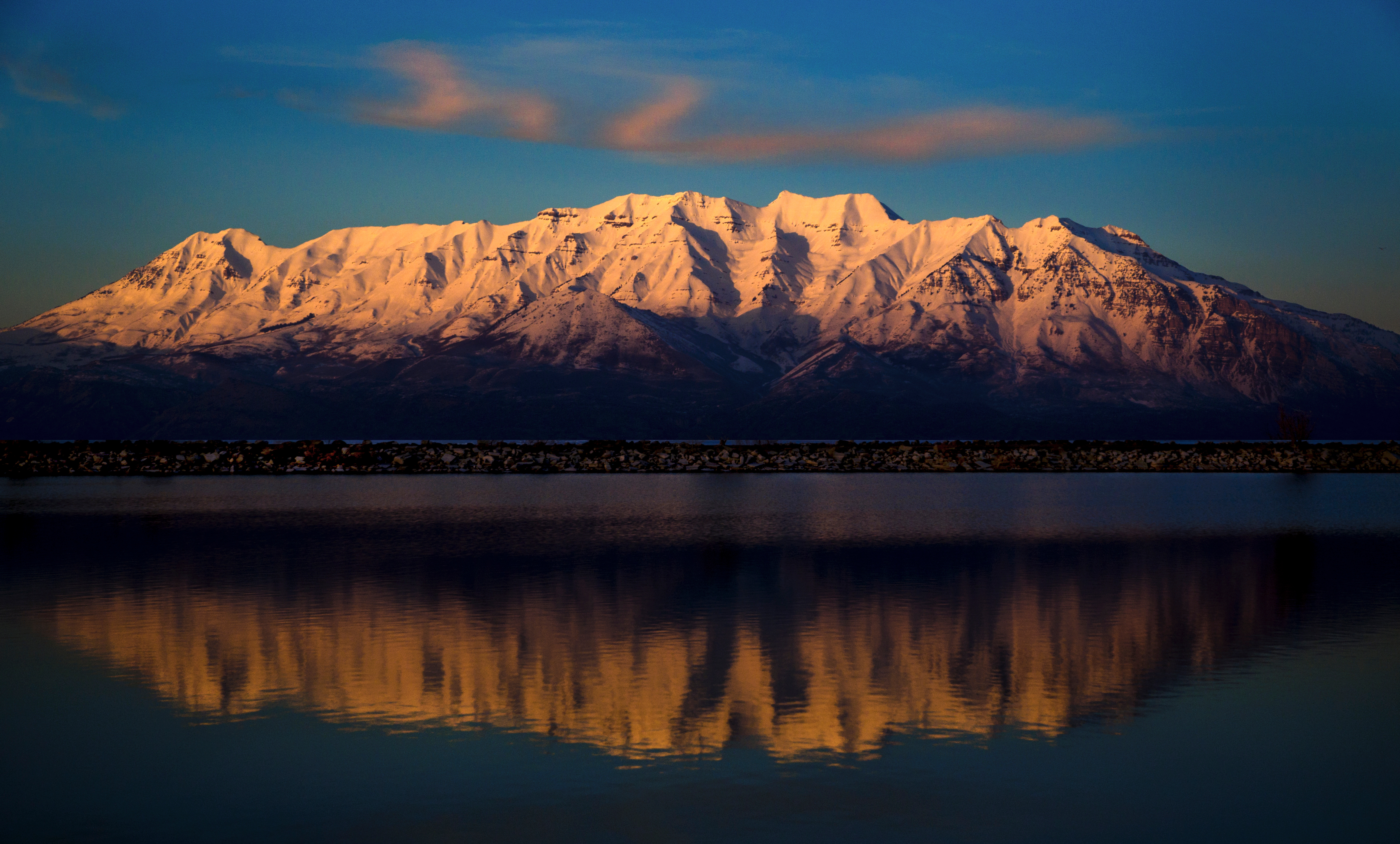
Timpanogos Is Worth the Longer Drive—but It Should Not Distort the Salt Lake List.
The question is not merely how many miles away the trailhead sits; it is whether the mountain still fits the day you have.
Why our ranking is local rather than generic
Repeated Wasatch Miles Change What “Best” Means.
A generic list overvalues summit elevation and famous names. Local mountain selection is more about repeatability, access, progression and what the peak teaches.
First-hand record
The Wasatch Is Our Home Training Range
Global Summit Guide’s documented climbing record includes repeat ascents across Mount Nebo, Mount Timpanogos, Lone Peak, Pfeifferhorn, Mount Olympus, Grandeur Peak, Mount Raymond, Gobblers Knob and other Wasatch objectives.
That lets us compare what the progression feels like rather than ranking peaks only from database statistics.
Olympus Is Better Than Timpanogos When You Only Have Six Hours.
Timpanogos may be the more complete alpine hike, but a mountain that needs a longer drive and trail day is the wrong recommendation for a short Salt Lake stay.
Time available is part of mountain difficulty.Progression
Grandeur Is More Valuable Than Its Elevation Suggests.
Grandeur is close, repeatable and steep enough to expose pacing and fitness problems before they appear on a bigger objective.
Training value matters in a local ranking.Restraint
Not Every Nearby Summit Belongs on the “Best” List.
The Wasatch contains dozens of peaks accessible from the Salt Lake Valley. We would rather give a visitor twelve clearly different choices than inflate the page with thirty near-duplicates.
Use the peak inventory when completeness is the goal.
Rules change by watershed, canyon and season
Salt Lake Canyon Access: What to Verify Before You Drive
The old page contained oversimplified dog and fee guidance. This rebuild keeps volatile rules tied to the agencies that actually manage them.
Check
Why it matters
Current source
Protected-watershed rules
Salt Lake City’s protected watershed system includes City Creek, Parleys, Big Cottonwood and Little Cottonwood; domestic animals are prohibited in protected watershed areas.
Canyon traffic, ski operations, construction and crowded trailheads can add meaningful time.
Current canyon notice + live navigation on hike day
Do not use this page as a winter route rating. Snow changes exposure, navigation and avalanche risk. When the route is snow-covered, use current avalanche information and skills appropriate to the actual conditions.
Three Utah deep-recovery links
When the Salt Lake Shortlist Turns Into Peakbagging
These pages continue three different intents without forcing this URL to absorb all Utah mountain content.
Wasatch inventory
Wasatch Range Peaks
If twelve best-fit choices are not enough and you want the peak inventory, use the dedicated Wasatch list rather than turning this city guide into a database.
Pick One Mountain Based on Time and Difficulty—Then Build the Day Around It.
Use this page to choose the objective, not to plan every detail. Once you have the mountain, move into the mountain-specific guide or My Climb: verify the exact route, trailhead, weather, current snow, water, turnaround time and skills required for the upper terrain.
Limit: trail mileage, drive time, snowline, parking and road access vary. Verify the exact route and current conditions before departure.
Direct search answers
Mountains Near Salt Lake City FAQ
Short answers for the questions this local decision page should own.
What is the best mountain to hike near Salt Lake City?
Mount Olympus is the most iconic true summit immediately above the Salt Lake Valley, while Grandeur Peak is the best first substantial summit for many hikers. Choose Lake Blanche for alpine scenery without a summit objective.
What is the easiest mountain hike near Salt Lake City?
Ensign Peak is the easiest short viewpoint hike in this list. Mount Wire is the next useful progression step if you want a more substantial workout.
What is the best beginner summit near Salt Lake City?
Grandeur Peak is one of the best first substantial summits near Salt Lake City for a fit beginner who already has several shorter hikes behind them.
What is the hardest hike near Salt Lake City on this list?
Lone Peak and South Twin Peaks are among the most committing objectives because of long days, high vertical gain and more complex upper terrain. Pfeifferhorn is the clearest progression into exposed scrambling.
Which Salt Lake City hike has the best alpine scenery?
Lake Blanche is the strongest scenery-first choice for many visitors. For summit scenery, Olympus gives the Salt Lake Valley perspective while Sunset Peak provides a higher alpine experience with a shorter outing.
When is the best time to hike high mountains near Salt Lake City?
The higher Wasatch is most reliably snow-free in mid-to-late summer into early fall, but timing varies by year, aspect and elevation. Verify current conditions rather than relying on a calendar date.
Are dogs allowed in Big Cottonwood and Little Cottonwood Canyons?
Salt Lake City Public Utilities prohibits dogs and other domestic animals in protected watershed areas. Big Cottonwood, Little Cottonwood and Parleys are part of that protected system. Other areas have different rules.
What is the highest peak in Salt Lake County?
South Twin Peaks, commonly listed around 11,330 feet, is the county-high-point context used here. Mount Nebo is higher and is the highest summit in the Wasatch Range, but it lies farther south in Juab County.
The decision
Have Half a Day? Choose Grandeur. Have a Full Day? Choose Olympus.
If you want scenery instead of a summit, choose Lake Blanche. If you want exposure and progression, work toward Pfeifferhorn. If you want the biggest local endurance test, earn your way to Lone Peak. The best mountain near Salt Lake City is the one that fits the day and skill level you actually have.
Timpanogos Hiking Co. 2026 Challenge: Your Complete Guide to Every Peak and Destination
Provo’s beloved summit badge program is back for its fourth year — bigger than ever, with 7 challenging GOAT peaks, 8 Escape the Noise destinations, a bonus “Give Back” badge, and free shirts for the first 300 finishers. Here’s everything you need to complete the 2026 Timpanogos Hiking Challenge.
🏆 15 Badges Total available in 2026
⛰️ 7 GOAT Peaks + 8 destinations
🆓 All badges free — pick up in Provo
📍 252 N. University Ave., Provo, UT
—
What Is the Timpanogos Hiking Challenge?
Year 4
2026 Challenge Edition
What started with a single mountain and a hand-sewn badge in 2023 has grown into the most beloved community hiking tradition in Utah Valley, now featuring 15 badges across two distinct challenges.
1930s
Badge Tradition Revived
The original Timp Badges were awarded to anyone summiting Mount Timpanogos from 1930 to 1971. Timpanogos Hiking Co. founder Joseph Vogel resurrected that tradition in 2023 after discovering it in local history archives.
Free Shirt
First 300 Finishers
For the first time in 2026, the first 300 people to complete either the GOAT or Escape the Noise challenge receive a free shirt, donated by SLC Activewear.
Mental Health
The Mission Behind the Badges
The challenge was built specifically to get people outdoors for physical and mental wellness. Vogel’s mantra — “escape the noise” — is a direct response to the mental health crisis driven by screen saturation and digital stress.
Timpanogos Hiking Co., based in downtown Provo at 252 N. University Ave., is more than an outdoor gear shop — it’s the hub of a rapidly growing community hiking movement centered on mental wellness, mountain culture, and the kind of analog challenge that screens simply can’t replicate. Founder Joseph Vogel left a tenured professorship in Massachusetts to launch the brand in 2022, drawing on his personal experience using the Wasatch Mountains as a tool for navigating some of the hardest years of his life. That backstory is woven into everything the challenge represents.
The badge program launched in 2023 with a single peak — Mount Timpanogos — and a reissued Timp Badge honoring a tradition that had been dormant for over fifty years. The response was immediate and overwhelming. By 2024, the program had expanded to a Ten Peak Challenge spanning northern Utah. By 2025, the format shifted to include both summit peaks and destination hikes, making the challenge accessible to more people. The 2026 edition builds further on that, with 15 total badges organized into two distinct tracks: the GOAT Challenge for serious peak-baggers and the Escape the Noise Challenge for those who want scenic destinations without the extreme elevation gain.
How to Earn Your Free Badge
The process is the same for every peak and destination: reach the summit or location, take a photo with you in it, tag @timpanogoshiking on social media, and walk into the store at 252 N. University Ave. in Provo to pick up your free hand-embroidered badge. Badges are available while supplies last starting late February each year. There is no registration, no fee, and no deadline — just summit, post, and show up.
How to Earn a Badge — Step by Step
1
Reach the Summit
Hike to the top of the peak or reach the designated destination. No partial credit.
2
Post & Tag
Take a photo with you in it and post it on social media tagging @timpanogoshiking.
3
Pick Up in Store
Visit 252 N. University Ave., Provo. Show your post and collect your free hand-embroidered badge.
1
2026 GOAT Challenge: All 7 Peaks at a Glance
The GOAT Challenge targets seven of Utah’s most prominent and demanding summits. They range from the steep Provo foothills to the highest point in the Wasatch Range. The list deliberately mixes canyon types, counties, and terrain characters so that completing the full challenge means genuinely exploring a broad cross-section of northern Utah’s mountain landscape.
#
Peak
Elevation
Difficulty
Location
County
1
Kyhv Peak
7,679 ft
Moderate
Provo foothills
Utah
2
Sunset Peak
10,648 ft
Moderate–Hard
Big Cottonwood Canyon
Salt Lake
3
Mount Raymond
10,241 ft
Moderate
Millcreek Canyon
Salt Lake
4
Frary Peak
6,596 ft
Moderate
Antelope Island
Davis
5
Deseret Peak
11,031 ft
Moderate–Hard
Stansbury Mountains
Tooele
6
Mount Nebo
11,933 ft
Hard
South Wasatch / Nephi
Juab
7
Mount Timpanogos
11,753 ft
Hard
American Fork Canyon
Utah
2
The GOAT Challenge: Peak-by-Peak Guide
1. Kyhv Peak — 7,679 ft
1Kyhv Peak (formerly Squaw Peak)
ModerateProvo Foothills
7,679 ft
Summit
~2,900 ft
Gain
~7.4 mi
Round Trip
4,600 ft
Trailhead Elev.
Kyhv Peak — officially renamed from Squaw Peak in 2022 as part of a federal initiative to remove offensive geographic names — rises directly above Provo and offers a commanding view of the entire Utah Valley, with Mount Timpanogos to the north and Utah Lake spread across the valley floor below. The trailhead sits just above the Provo Temple in the foothills of Rock Canyon, making it one of the most conveniently accessed peaks on the entire GOAT list. The trail steepens noticeably after the first mile, rewarding those who push through with a quiet, crowd-light summit that most Provo residents have never visited despite it sitting on their doorstep.
Sunset Peak sits above the Brighton Ski Resort area at the top of Big Cottonwood Canyon and offers a remarkably efficient path to an above-10,000-foot summit. The high starting elevation keeps the gain manageable even though the views from the top rival peaks twice as tall. The route climbs through beautiful subalpine terrain past Dog Lake and up a broad ridge to the summit, which anchors the ridge connecting several prominent Big Cottonwood peaks. It is also a natural connector to Catherine Pass and Lake Mary, making Sunset Peak an easy launchpad for a longer ridge day if energy allows.
Mount Raymond is the highest summit accessible from Millcreek Canyon and one of the more satisfying moderate summits in northern Utah. The Butler Fork approach winds through dense aspen and fir forest before opening onto the upper ridge with sweeping views of the Salt Lake Valley and beyond. It features on both this challenge and our Top 10 Peaks in Salt Lake County guide, which is a testament to its quality — Raymond delivers a genuine 10,000-foot summit experience with more straightforward logistics than any comparable objective in the adjacent canyons. Strong hikers can extend the day by continuing the ridge to Gobbler’s Knob.
Frary Peak is the most distinctive summit on the GOAT list — not because of its elevation, which is the lowest of the seven, but because of its setting. As the highest point on Antelope Island in the middle of the Great Salt Lake, Frary delivers one of the genuinely unusual summit experiences in Utah: all-direction views over a vast inland sea, bison roaming the slopes below, and a summit ridge that feels genuinely remote despite being minutes from the Salt Lake metro. The trail involves some exposed scrambling near the top and is fully above treeline for much of its length, making it a windier and more committing objective than its modest elevation suggests.
Antelope Island State Park entrance fee applies — approximately $15 per vehicle
Bison are present on the island — maintain distance at all times
No shade above the parking area — sun and wind exposure is significant
The summit scramble is exposed; poles stowed for the final section
Deseret Peak is the highest summit in the Stansbury Mountains of Tooele County and one of the most remote and rewarding peaks on the entire GOAT list. While it lies west of the main Wasatch Front rather than in the central Wasatch, its isolation means dramatically less foot traffic and a summit that still feels genuinely earned. The approach follows the Stansbury Loop through a high alpine basin before a steeper push to the summit ridge. Views from the top extend to the Great Salt Lake in one direction and deep into the Nevada desert in the other — a panorama available from almost no other peak this close to Salt Lake City.
Requires a longer drive than the Wasatch peaks — plan 45–60 minutes from Salt Lake City to the trailhead
Far less crowded than any Cottonwood Canyon equivalent
Snow can persist on the upper north-facing slopes into June most years
Mount Timpanogos — at 11,753 ft, Timp is the centerpiece of the entire badge tradition and the defining summit of Utah Valley.Timpooneke Trail on AllTrails →
6. Mount Nebo — 11,933 ft
6Mount Nebo — Tallest Wasatch Peak
HardSouth Wasatch · Juab County
11,933 ft
Summit
~5,400 ft
Gain
~12.0 mi
Round Trip
6,500 ft
Trailhead Elev.
Mount Nebo is the tallest peak in the entire Wasatch Range at 11,933 feet and one of the most demanding day hikes in Utah. Sitting at the range’s southern terminus above the town of Nephi, Nebo is geographically isolated from the central Wasatch cluster — which makes it feel like a genuine expedition rather than a weekend hike. The North Peak approach is the standard route, gaining over 5,000 feet through rugged terrain to a narrow, wind-battered summit ridge. The summit — technically a multi-topped massif — has views extending from the Utah Valley all the way to the Uintas on clear days. Nebo demands respect: it is a full, hard mountain day by any measure and should not be attempted without a proper early start.
Full summit day: plan for 8–10 hours round trip for most parties
The southern terminus of the Wasatch makes weather patterns slightly different than northern peaks — check forecasts specific to Juab County
Late season access: the trailhead road typically opens in late June; verify before planning
Snow on the upper ridge can persist well into July in heavy snow years
Mount Timpanogos is the soul of the entire challenge — the peak this tradition was born on, the mountain that looms over Utah Valley, and the reason Joseph Vogel named his company what he did. Approaching 11,800 feet, Timp is the second-highest peak in the Wasatch Range and one of the most beautiful and demanding day hikes in the American West. The two main routes — Timpooneke from the American Fork Canyon side, and Aspen Grove from the Provo Canyon side — are both long, sustained, and breathtaking. The summit plateau is marked by a historic stone shelter, and on clear days the views stretch from the Great Salt Lake to the Uinta Range to the mountains of central Utah far to the south.
This is the peak the badge tradition was designed around, and completing the GOAT Challenge culminates here for good reason. Timp takes planning, fitness, and an early start. Both trailheads require timed-entry permits on weekends and holidays, bookable through Recreation.gov. Arrive before 6 AM if possible — parking is limited and the mountain draws thousands of visitors on summer weekends.
Timed-entry permits required on weekends and holidays — book on Recreation.gov
$10 trailhead fee applies at both Timpooneke and Aspen Grove
Start by 5–6 AM for summit safety and parking; strong storms develop by early afternoon in July–August
Mountain goats are commonly spotted near Emerald Lake and the upper ridge — give them distance
The Escape the Noise Challenge was introduced to make the badge program accessible to hikers who want a rewarding outdoor experience without the extreme elevation demands of the GOAT peaks. These eight destinations span waterfalls, alpine lakes, iconic valley overlooks, and landmark trails — ranging from a short urban foothills scramble to a stunning Little Cottonwood Canyon glacial lake. Any of them can be done as a half-day adventure, and all are appropriate for families and newer hikers.
2026 Escape the Noise: Full Destinations List
Timpanogos Cave · Lake Blanche · Battle Creek Falls · The Y · The Living Room · Adam’s Canyon · Cecret Lake · Primrose Overlook
1Timpanogos Cave National Monument
A guided cave tour inside one of Utah’s most impressive cavern systems in American Fork Canyon. The approach hike climbs steeply to the cave entrance through dramatic canyon walls — the hike alone is worth the trip, and the cave interior is genuinely stunning. Timed entry required through Recreation.gov; cave tours sell out weeks in advance in summer.
One of the most photographed alpine lakes in Utah, Lake Blanche sits in a dramatic quartzite cirque below Sundial Peak in Big Cottonwood Canyon. The 2,700-foot gain from the trailhead is no casual walk, but the lake itself — deep blue, ringed by towering walls — is a genuine destination. Canyon day-use fee applies.
A short, family-friendly trail in Pleasant Grove that climbs to a seasonal waterfall in the foothills directly above Utah Valley. One of the most accessible Wasatch hikes for young children or those new to trail hiking. The falls are at their best in May and June from snowmelt.
The iconic rock “Y” above Brigham Young University is perhaps Provo’s most recognizable hike — a steep, switchbacked 1,000-foot climb with commanding views of the entire Utah Valley. Fast, accessible, and historically connected to the original Timp Badge tradition. This also served as the bonus badge destination in the 2024 challenge.
A classic SLC urban hike that climbs through the Red Butte area to a collection of large stone slabs arranged like furniture — hence the name. Short, accessible, and gives one of the best city-and-valley views available without driving into a canyon. A perfect warm-up hike or quick-after-work objective for Salt Lake City residents.
A scenic canyon trail in northern Davis County that leads to a 40-foot waterfall deep in a narrow sandstone gorge. The canyon feels wild and remote despite being minutes from Layton and Ogden. The trail involves some boulder scrambling near the falls — waterproof footwear recommended in spring.
A short but spectacular trail in the Albion Basin above Alta Ski Resort that reaches a pristine alpine lake surrounded by the highest peaks in Salt Lake County. The Albion Basin wildflower meadows in July and August are among the finest in Utah. Canyon fee and potential timed-entry restrictions apply — check current access before visiting.
A beautiful viewpoint hike in Provo Canyon above the Bridal Veil Falls area that delivers sweeping views of the canyon, Deer Creek Reservoir, and the surrounding Wasatch peaks. Less traveled than many comparable Wasatch destinations, making it a quiet and rewarding half-day objective from Utah County.
Mount Nebo 11,933 ft · Tallest Peak in the Wasatch
Mount Nebo — the southernmost and tallest peak in the Wasatch Range, and one of the most committing full-day objectives in the GOAT Challenge.Mount Nebo Trail on AllTrails →
4
Planning Your 2026 Challenge Attempt
Build a Smart Completion Order
If you’re attempting to complete the full GOAT Challenge, sequence matters. Start with Kyhv Peak and Mount Raymond — both are moderate in difficulty and will begin calibrating your fitness and canyon logistics for the harder objectives ahead. Sunset Peak and Frary Peak make excellent mid-season milestones. Save Mount Nebo and Mount Timpanogos for late summer when you’re trail-fit and familiar with early alpine starts. Deseret Peak can be slotted in as a change-of-pace objective when you want solitude and a different landscape.
Thunderstorms: The Universal Rule
Every GOAT peak above 9,000 feet is exposed to serious afternoon lightning risk from mid-July through early September. The rule is non-negotiable: plan your ascent to have you descending below treeline by noon. For long objectives like Mount Nebo and Mount Timpanogos, this requires pre-dawn starts. Check the National Weather Service forecast the evening before and again on the morning of your climb.
Permits and Fees to Know Before You Go
Several 2026 challenge locations have fee and permit requirements that require advance planning. Mount Timpanogos has timed-entry permits for both trailheads on weekends and holidays — these must be reserved through Recreation.gov and frequently sell out days in advance. Big and Little Cottonwood Canyons both have per-vehicle day-use fees. Antelope Island requires a state park entrance fee. Timpanogos Cave requires separate cave tour tickets, also through Recreation.gov. Plan your logistics before arrival, especially for weekend attempts in summer.
The “Give Back” Badge
In addition to the 15 main badges, a bonus “Give Back” badge is available exclusively at Pando Refitters, located directly across the street from Timpanogos Hiking Co. at 252 N. University Ave. in Provo. Make a $20 donation to one of the non-profits working to preserve Utah’s wild spaces, and you’ll receive this exclusive badge. It’s a tangible way to contribute to the trails and mountains you’re spending your summer on.
Tools to Sharpen Your Planning
✅
Fitness Assessment Checklist
Before committing to Mount Nebo or Timpanogos, use this tool to gauge your current fitness against the demands of a 5,000+ foot gain day at altitude. Identifying gaps early saves summit days.
Wondering how GOAT Challenge peaks like Mount Nebo and Timpanogos compare to other prominent objectives in Utah, Colorado, or the Cascades? Use this tool to benchmark them by elevation, difficulty, and technical demands.
Visiting Utah from a lower-elevation home base and planning to tackle multiple GOAT peaks in a single trip? The Acclimatization Builder helps you sequence days to peak at your best on your hardest objectives.
The Timpanogos Hiking Co. Challenge is one of several Utah-specific peak-bagging programs worth knowing about. Here are the related challenges and guides on this site:
Peak Bagging
Wasatch Range Peak Guide
Full guide to the Wasatch Range’s most prominent summits — history, difficulty, seasons, and route overviews for the range’s defining peaks.
The self-guided Utah Six-Pack of Peaks challenge features six iconic Utah summits including Mount Nebo and Timpanogos — an excellent complement to the GOAT badge program.
Kings Peak — featured in the original Timpanogos Ten Peak Challenge — is Utah’s state high point. It’s one of the more challenging state summits in the contiguous US.
Several 2026 GOAT peaks — Mount Raymond, Sunset Peak, and Frary Peak — overlap with our guide to Salt Lake County’s best summer climbs. Get full route detail here.
Browse the full directory of Utah peak-bagging challenges and summit lists on Global Summit Guide — from county highpoints to Wasatch 11ers and beyond.
Disclaimer: This guide is for informational and planning purposes only. Always verify current trail conditions, permit requirements, and trailhead access with the Uinta-Wasatch-Cache National Forest and relevant land managers before your hike. Badge availability, challenge rules, and program details are set by Timpanogos Hiking Co. — visit timpanogoshiking.com for the most current official information.
window.addEventListener(‘scroll’,function(){
var e=document.getElementById(‘pb’),
s=document.documentElement.scrollTop,
h=document.documentElement.scrollHeight-document.documentElement.clientHeight;
e.style.width=(s/h*100)+’%’;
});
State of Mountaineering 2026: Key Findings From the Global Summit Guide Annual Report
The state of mountaineering in 2026 reflects a dynamic landscape shaped by evolving trends, technological advancements, and a growing community of enthusiasts. This article delves into the latest findings from the Global Summit Guide Annual Report, providing insights into climbing trends, safety innovations, and the overall state of the summit guide industry. Readers will learn about the significant mountains that attract climbers, the statistics that define climbing expeditions, and the innovations that enhance safety and performance in the field. As more individuals seek adventure in the great outdoors, understanding these trends becomes essential for both seasoned climbers and newcomers alike. This comprehensive overview will cover the global mountain landscape, current climbing trends and statistics, insights into the summit guide industry, innovations in gear and safety, and the impact of emerging technologies on mountaineering.
Global Mountain Overview
Mountaineering is intrinsically linked to some of the world’s most iconic peaks, each offering unique challenges and experiences. Major mountains such as Everest, K2, and those in the Himalayas, Alps, and Andes attract climbers from around the globe. These mountains are not only significant for their height but also for their geographical and cultural importance. Accessibility to these peaks has improved over the years, with advancements in infrastructure and support services, making them more approachable for climbers of varying skill levels. Understanding the characteristics of these mountains is crucial for climbers as they plan their expeditions.
Climbing Trends and Statistics 2026
The climbing landscape in 2026 is characterized by several notable trends and statistics that highlight the evolution of the sport. Recent data indicates a significant increase in the number of climbing expeditions, with a focus on both traditional and sport climbing. Safety remains a paramount concern, leading to advancements in climbing safety technology. The integration of smart gear, such as GPS-enabled devices and real-time weather monitoring systems, has transformed how climbers prepare for and undertake their adventures. Furthermore, the rise of eco-conscious climbing practices reflects a growing awareness of environmental sustainability among climbers. For more detailed insights, see the state of mountaineering 2026.
This growing interest in sustainable practices is crucial, especially as adventure tourism continues to expand in sensitive mountain environments.
Sustainable Adventure Tourism: Environmental Impacts in Mountain Regions
Adventure tourism is where visitors participate in challenging and exciting activities in distant or exotic settings, such as rafting, trekking, and climbing, to experience adventure and challenge. This study explores the complex and diverse field of adventure tourism, with a particular emphasis on mountainous regions. Adventure tourism in mountainous regions has experienced remarkable growth, presenting challenges in environmental conservation, infrastructural development, safety, and socio-economic impacts.
Assessing the environmental impacts of adventure tourism in the world’s highest mountains: A comprehensive review for promoting sustainable tourism in high …, Z Ahmed, 2024
Climbing Expedition Statistics
Recent statistics reveal that the number of climbing expeditions has surged by 25% compared to previous years. This increase is attributed to a growing interest in adventure tourism and the accessibility of climbing destinations. Notably, the Himalayas continue to be a popular choice, with Everest seeing a record number of summits in 2026.
Detailed studies provide further context on the demographics and outcomes of these high-altitude endeavors, particularly on iconic peaks like Mount Everest.
Mount Everest Climbing Statistics: Success, Death, and Demographics
Mount Everest is an extreme environment for humans. Nevertheless, hundreds of mountaineers attempt to summit Everest each year. In a previous study we analyzed interview data for all climbers (2,211) making their first attempt on Everest during 1990–2005. Probabilities of summiting were similar for men and women, declined progressively for climbers about 40 and older, but were elevated for climbers with experience climbing in Nepal. Probabilities of dying were also similar for men and women, increased for climbers about 60 and older (especially for the few that had summited), and were independent of experience. Since 2005, many more climbers (3,620) have attempted Everest. Here our primary goal is to quantify recent patterns of success and death and to evaluate changes over time. Also, we investigate whether patterns relate to key socio-demographic covariates (age, sex, host country, prior experience).
Mountaineers on Mount Everest: Effects of age, sex, experience, and crowding on rates of success and death, RB Huey, 2020
Trends in Climbing Safety
Safety technology has advanced significantly, with climbers now utilizing gear that incorporates cutting-edge materials and designs. Innovations such as automatic belay devices and enhanced harness systems have improved safety standards. Additionally, training programs focusing on risk management and emergency response have become more prevalent, ensuring climbers are better prepared for potential challenges.
Technological Advancements in Gear
The gear used in mountaineering has evolved dramatically, with a focus on lightweight materials and multifunctional designs. New climbing shoes, harnesses, and ropes are engineered to enhance performance while ensuring safety. The introduction of smart helmets equipped with communication devices allows climbers to stay connected, even in remote areas.
Further research highlights how integrating advanced technology can significantly enhance safety and well-being during expeditions.
Leveraging Technology for Enhanced Hiker Safety and Expeditions
Modern technological interventions, e.g., GPS, satellite communication, wearables, and immersive media (AR/VR), are creating new means and opportunities for providing training and safety to hikers. The research aims to comprehend the hiker’s journey, the challenges faced, and the current scenario of navigation and safety during hiking. The proposed study follows a systematic framework and implementation of the design thinking process. Findings are determined through survey and interview analysis, concept ideation, and usability testing. The study proposes an IoT-based system design for a low-cost wearable integrated with a mobile application with features such as real-time data, location tracking and sharing, checkpoint monitoring, and crowd-sourced information to enhance the safety and well-being of hikers during their expeditions. The system also monitors the hikers’ health and sends an SOS signal, contributing to timely search and rescue operations when necessary. The system promotes a safe and seamless hiking experience by providing a secure and enjoyable hiking environment.
Leveraging technology to enhance hiker safety: A design intervention, P Ranade, 2017
Summit Guide Industry Insights
The role of summit guides has become increasingly vital in the mountaineering community. These professionals not only provide essential support during expeditions but also enhance the overall experience for climbers. The demand for certified summit guides has risen, leading to a greater emphasis on training and certification programs. This evolution reflects the growing recognition of the importance of expertise in ensuring safety and success on challenging climbs.
Role of Summit Guides
Summit guides play a crucial role in facilitating safe and successful climbing experiences. They offer valuable insights into the terrain, weather conditions, and necessary precautions, making them indispensable for both novice and experienced climbers.
Certifications and Training
The certification process for summit guides has become more rigorous, with organizations emphasizing the need for comprehensive training in both technical skills and first aid. This ensures that guides are well-equipped to handle emergencies and provide the best possible support to climbers.
Market Demand for Guides
As the popularity of mountaineering continues to grow, so does the demand for qualified summit guides. This trend is particularly evident in regions with high climbing traffic, where the presence of experienced guides enhances safety and enriches the climbing experience.
Gear and Safety Innovations
Innovations in climbing gear and safety protocols are transforming the mountaineering experience. The focus on safety has led to the development of advanced equipment designed to minimize risks and enhance performance. Climbers now have access to a range of innovative products that cater to their specific needs.
New Safety Gear
Recent advancements in safety gear include the introduction of fall protection systems that utilize cutting-edge technology to prevent accidents. These systems are designed to be lightweight and easy to use, ensuring that climbers can focus on their ascent without compromising safety.
Advancements in Climbing Technology
Climbing technology has seen significant improvements, with gear that integrates smart features for enhanced performance. For instance, climbing ropes now come with built-in sensors that monitor wear and tear, alerting climbers to potential hazards before they become critical. mountain collections
Impact of Gear on Climbing Safety
The impact of modern gear on climbing safety cannot be overstated. With the right equipment, climbers can significantly reduce the risks associated with mountaineering. The combination of innovative materials and design has led to a new era of climbing where safety and performance go hand in hand.
Emerging Technologies Impact
The impact of emerging technologies on mountaineering is profound, with innovations reshaping how climbers prepare for and undertake their expeditions. Technologies such as blockchain and Web3 are beginning to influence expedition planning and logistics, offering new ways to enhance the climbing experience.
Blockchain Applications in Mountaineering
Blockchain technology is being explored for its potential to improve transparency and security in expedition planning. By utilizing decentralized systems, climbers can ensure that their data and transactions are secure, fostering trust within the climbing community.
Web3 Technologies in Expedition Planning
Web3 technologies are revolutionizing how climbers access information and resources. Decentralized platforms allow climbers to share experiences, tips, and resources, creating a collaborative environment that enhances the overall climbing experience.
Future of Technology in Climbing
As technology continues to evolve, its integration into mountaineering will likely expand. Future advancements may include even more sophisticated gear, enhanced communication systems, and innovative training programs that leverage virtual reality and artificial intelligence.
For those interested in the latest gear and safety innovations, Global Summit Guide offers comprehensive reviews and recommendations.
If you have any questions or need assistance, you can contact us through our website.
Frequently Asked Questions
What are the key safety innovations in mountaineering gear for 2026?
In 2026, safety innovations in mountaineering gear include advanced fall protection systems that utilize lightweight materials and smart technology. These systems are designed to prevent accidents by providing real-time feedback on gear performance. Additionally, automatic belay devices and enhanced harness systems have become more prevalent, ensuring climbers are better protected during their ascents. Training programs focusing on risk management and emergency response have also gained traction, equipping climbers with essential skills to handle potential challenges effectively.
How has the role of summit guides evolved in recent years?
The role of summit guides has become increasingly vital as the popularity of mountaineering grows. These professionals not only provide essential support during expeditions but also enhance climbers’ overall experiences by offering insights into terrain and weather conditions. The demand for certified summit guides has risen, leading to more rigorous training and certification programs. This evolution reflects a growing recognition of the importance of expertise in ensuring safety and success on challenging climbs, particularly in high-traffic climbing regions.
What impact does adventure tourism have on mountain environments?
Adventure tourism significantly impacts mountain environments, presenting both opportunities and challenges. While it promotes economic growth and awareness of natural beauty, it can also lead to environmental degradation if not managed sustainably. Increased foot traffic can result in soil erosion, wildlife disturbances, and waste management issues. Therefore, understanding and implementing sustainable practices is crucial for minimizing the ecological footprint of adventure tourism, ensuring that these sensitive areas remain preserved for future generations of climbers and outdoor enthusiasts.
What are the emerging technologies influencing expedition planning?
Emerging technologies such as blockchain and Web3 are beginning to reshape expedition planning in mountaineering. Blockchain technology enhances transparency and security in data management, allowing climbers to trust the integrity of their transactions and information. Meanwhile, Web3 technologies facilitate decentralized platforms where climbers can share experiences, tips, and resources, fostering a collaborative environment. These innovations are expected to streamline logistics and improve the overall climbing experience, making it more accessible and efficient for adventurers.
How can climbers ensure they are prepared for high-altitude expeditions?
Preparation for high-altitude expeditions involves several key steps. Climbers should undergo proper training to build physical endurance and technical skills. It’s essential to acclimatize gradually to high altitudes to minimize the risk of altitude sickness. Additionally, investing in high-quality gear, including smart technology that monitors health and environmental conditions, can enhance safety. Finally, climbers should stay informed about weather patterns and seek guidance from experienced summit guides to ensure a successful and safe ascent.
What trends are shaping the future of mountaineering?
The future of mountaineering is being shaped by several trends, including a growing emphasis on sustainability and eco-conscious practices. Climbers are increasingly aware of their environmental impact, leading to a rise in responsible climbing practices. Technological advancements are also playing a significant role, with innovations in gear and safety protocols enhancing the climbing experience. Furthermore, the integration of smart technology and data analytics is expected to improve expedition planning and safety, making mountaineering more accessible to a broader audience.
Conclusion
Understanding the evolving landscape of mountaineering in 2026 highlights the importance of safety, technology, and expert guidance for climbers of all levels. By embracing innovative gear and sustainable practices, adventurers can enhance their experiences while minimizing environmental impact. As you prepare for your next expedition, consider exploring our extensive range of climbing resources and expert insights. Join the growing community of climbers who prioritize safety and sustainability in their adventures today.
Home› Trip Reports› Mont Blanc Via the Goûter Route: Our Full 2026 Expedition Breakdown
Trip Report · Alps Classics
Mont Blanc Via the Goûter Route: Our Full 2026 Expedition Breakdown
A full expedition-style breakdown of what a strong 2026 Mont Blanc climb via the Goûter Route actually looks like: the pacing, the route reality, the hut strategy, the booking pressure, the summit-day demands, and the decisions that matter most when Europe’s highest peak stops feeling like a bucket-list idea and starts feeling like real mountaineering.
mont blanc gouter route 2026trip reportsmont blanc expedition breakdownalps classics
Quick Answer: Mont Blanc 2026 via the Goûter Route
If you want the clearest simple answer, this is it: Mont Blanc via the Goûter Route in 2026 is still the most practical standard line for many climbers, but it is not a casual “walk-up.” It is a serious Alpine objective with rockfall exposure in the Grand Couloir, glacier travel above the Goûter hut, a long summit day, and a 2026 logistics system that rewards people who plan early and punish people who improvise late.
This page is written in an expedition-report style, but the real value is in the breakdown. Instead of romanticizing the climb, it shows what the route actually demands: good movement in crampons, real uphill endurance, honest pacing at altitude, tight weather judgment, and a clean hut reservation strategy long before you arrive in Chamonix.
Best season window
Normal route season
Summer Alpine season is the main window when huts and lift access support a normal-route attempt.
Most realistic format
3-day structure
A three-day normal-route structure with acclimatization beforehand is more realistic than trying to rush the whole climb.
Biggest route crux
Objective hazard
The Grand Couloir is the mental and logistical flashpoint because exposure time matters as much as technical control.
Biggest 2026 issue
Booking pressure
If you do not sort huts, transport timing, and your weather buffer early, the route gets more stressful before the climb even begins.
Best simple rule: plan Mont Blanc like a real Alpine climb, not a famous tourist objective. The people who do best on the Goûter Route usually arrive with calmer systems, better pacing, and less ego.
12026 Route Snapshot
The Goûter Route remains the classic normal line from the French side and the default choice for many guided and independent parties. It is the route most climbers mean when they say they are “climbing Mont Blanc,” but that familiarity can be misleading. The route is standard, not soft. Popular, not forgiving.
For 2026, the route planning picture is clear. Hut reservations on the normal route are controlled, identity-linked, and operationally important. Camping and bivouac on the normal route are not part of a legitimate backup plan. And access via the Tramway du Mont-Blanc system adds another layer of timing and ticket logistics that you need to understand before the climb, not while standing in line with boots and a pack.
Route Element
What It Means on the Ground
Why It Matters
Hut reservations
Names and identity details are tied to booking
You cannot treat hut access as flexible or casual
No bivouac / camping
The normal route is tightly regulated
You need a clean logistics plan, not a vague fallback
Grand Couloir crossing
Short section, big consequence
Timing and efficiency matter more than bravado
Goûter hut to summit
Long glacier-based summit day
Fitness, weather, and turnaround discipline decide outcomes
Transport system
Tram and lift logistics affect your whole schedule
Late planning creates unnecessary stress before summit day
There are more elegant lines on Mont Blanc, more aesthetic traverses, and routes that many experienced alpinists may personally prefer. But for a large share of 2026 climbers, the Goûter Route still makes sense because it is the most straightforward framework for a summit attempt that balances access, route familiarity, and available infrastructure.
That does not mean it is automatically the best choice for everyone. It means it is the most realistic entry point for climbers who already have strong fitness, basic glacier systems, competent crampon movement, and enough judgment to respect the route’s real hazards instead of treating them like background noise.
Important: the phrase “normal route” causes a lot of bad decisions on Mont Blanc. Normal route does not mean beginner route. It means standard line. The mountain still expects preparation, acclimatization, mountain sense, and the ability to turn around.
3Our Full 2026 Expedition Breakdown
0
Arrival and Weather Window Setup
Chamonix is where good Mont Blanc climbs begin
The best Mont Blanc attempts usually start before the route starts. Day zero is about checking the weather, tightening up transport timing, confirming hut details, and eliminating small mistakes that become big problems higher up. This is also the moment to be brutally honest about whether your acclimatization is real or just hopeful thinking.
A strong 2026 approach is to arrive with at least some Alpine adaptation already in the bank, whether from prior 3,000 to 4,000 meter days, glacier skills work, or a preparatory peak in the region. Mont Blanc is rarely the place to discover whether altitude and exposure unsettle you.
1
Day 1: Bellevue / Tramway Access to Nid d’Aigle, Then Up to Tête Rousse
A controlled first day beats a rushed one
The first day should feel measured. From the valley, the system of cable car and tram access helps compress the lower approach, but it does not eliminate the need to move efficiently once you are on foot. The trail to Tête Rousse is where the climb starts to shift from mountain travel to summit objective.
This is also the last point where the climb still feels organized and relatively forgiving. The higher you go, the less room there is for sloppy pacing, late starts, poor hydration, or kit problems. Climbers who arrive at Tête Rousse calm, fueled, and mechanically tidy are already setting themselves apart from the people who are emotionally overcommitted too early.
2
Day 2: The Grand Couloir, Aiguille du Goûter, and the Goûter Hut
This is where the climb becomes Mont Blanc
The Grand Couloir is short on paper and huge in psychological weight. This is the section almost everyone talks about, and for good reason. You do not solve it with confidence quotes. You solve it with timing, awareness, efficiency, and calm movement. The goal is not to feel heroic. The goal is to minimize exposure and keep the team clean and composed.
Above the couloir, the ridge up toward the Goûter hut demands steadier concentration than many first-time Mont Blanc climbers expect. This is where people realize the mountain is not just high, but continuously consequential. Reaching the hut is a major step, but it is not the summit. The smartest teams arrive there thinking about sleep, hydration, weather, and recovery — not posting victory content too early.
3
Day 3: Goûter Hut to Mont Blanc Summit and Full Descent
Long, exposed to conditions, and earned by discipline
The summit day above the Goûter hut is where Mont Blanc stops being an itinerary and becomes a judgment test. The movement is not about rushing. It is about staying smooth for hour after hour on a route that rewards rhythm. The Dôme du Goûter, Vallot sector, and Bosses ridge all feel different depending on wind, visibility, snow firmness, fatigue, and how much margin you really have left.
The summit itself is only part of the decision. The descent is where many climbers mentally switch off too soon. On Mont Blanc, the day is not over until you are safely back down through the upper route and descending with enough control to keep making good decisions. A lot of bad Mont Blanc stories begin after the summit photo.
4What the Route Actually Feels Like
From a distance, Mont Blanc via the Goûter Route looks clean and logical. In reality, it feels like a sequence of very different mountain problems stacked on top of each other. Access logistics. Rockfall judgment. Steep rocky climbing. Hut fatigue. High-altitude pacing. Cold management. Exposure. Turnaround timing. Descent discipline.
That is why the mountain is often underestimated by people who are fit but not mountain-ready. A runner can be fast. A hiker can be strong. A gym athlete can be powerful. Mont Blanc still asks a different question: can you keep functioning well in cold, at altitude, on variable terrain, while making careful decisions under fatigue?
The physical reality
The route is long enough that poor economy gets punished. Small inefficiencies early on turn into real time and energy loss later. Heavy packs, poor layering choices, avoidable stops, and weak fueling all make the summit day feel much bigger than it needed to be.
The mental reality
Mont Blanc demands patience more than aggression. Most parties do not fail because they lacked ambition. They fail because they lacked pacing, reserve, or flexibility. The climb rewards people who can stay unhurried even when the mountain feels famous, crowded, and emotionally loaded.
5Key Numbers That Matter
Segment
Typical Figure
Why It Matters
Nid d’Aigle to Goûter hut
About 5 to 6 hours
Long enough that pacing and heat management matter even before summit day
Goûter hut to summit, then back to Nid d’Aigle
About 10 to 12 hours
This is why Mont Blanc punishes climbers who treat it like a short hut-to-hut outing
Goûter hut altitude
3,815 m
You are already sleeping high enough that recovery and hydration count
Tête Rousse altitude
3,165 m
A more conservative overnight option for some teams
Mont Blanc altitude
4,808.72 m
The altitude is not extreme by Himalayan standards, but it is high enough to matter a lot
On paper, these numbers look manageable. On tired legs, in wind, after poor sleep, or with weak acclimatization, they stop looking casual very quickly.
62026 Logistics That Matter Most
1. Hut booking is not optional planning fluff
If Mont Blanc is the objective, the hut strategy is part of the climb. It is not something to “sort out later.” In 2026, the normal-route huts continue to operate under a controlled reservation system, and your booking details matter operationally, not just administratively.
2. Bring proof and ID
Normal-route inspections are part of the system. That means your documents need to be accessible, organized, and consistent with the reservation. It is a small detail until it becomes the detail that slows down your day.
3. The tram and lift piece is part of the climb
The Tramway du Mont-Blanc access system is easy to underestimate from home. In practice, it shapes your start time, your margin, and your stress level. Treat it like part of your expedition plan, not a travel-side afterthought.
4. Build a weather buffer
The climbers who feel most rushed on Mont Blanc are usually the ones whose travel plan leaves them no room to adapt. A rigid summit date looks efficient until the weather moves. A modest buffer often creates better summit odds than trying to force one narrow calendar slot.
Do not build your plan around the Vallot shelter. It is an emergency shelter, not a comfort layer in your logistics plan. A legitimate Mont Blanc strategy starts lower, earlier, and with cleaner decisions.
7What We Would Prioritize in the Pack
Mont Blanc is not the place to bring an overbuilt expedition pack, but it is also not the place to gamble on an ultralight setup that only works in ideal conditions. The smart middle ground is a kit that is efficient, weather-aware, and familiar enough that nothing in it needs to be “figured out” high on the route.
A layering system that handles wind, cold, and stop-start summit pacing without constant repacking
Boots and crampons you already trust, not a last-minute combination
Enough gloves and insulation flexibility for a colder-than-expected summit window
Simple food that you will actually eat under stress and altitude
Clean headlamp, hydration, and emergency basics that do not require problem-solving when tired
For supporting pages on your site, this post should naturally connect readers into your cpons guide, your boots content, and broader Alpine gear pages once those internal clusters are fully built out.
8Biggest Lessons From a Strong Goûter-Route Attempt
The route rewards restraint
Trying to “win” Mont Blanc with effort alone is usually the wrong style. The route gives more to climbers who move with control than climbers who arrive emotionally over-amped.
Acclimatization is not optional polish
A lot of Mont Blanc planning focuses on the couloir because it is visually dramatic. In practice, altitude and fatigue quietly ruin more summit bids than the internet admits. The better acclimatized climber often looks less dramatic and climbs far better.
Descent quality matters as much as summit excitement
Many teams psychologically spend themselves on the way up. The stronger teams still have mental discipline for the descent, document checks, transport timing, and the long chain of decisions that follow the summit.
Mont Blanc via the Goûter Route in 2026 is still one of the great classic Alpine climbs, but it is best approached with the mindset of a disciplined mountaineer, not a peak collector. The route is popular because it is logical. It is hard because it is still Mont Blanc.
If your pacing is honest, your logistics are clean, your acclimatization is real, and your summit judgment is better than your ego, the Goûter Route still offers one of the strongest big-name Alpine experiences anywhere in the world.
12Plan Your Mont Blanc Buildout
Use this trip report as the bridge between inspiration and real planning. Open the mountain guide, check your weather and acclimatization tools, and build a Mont Blanc strategy that works on the route you will actually climb.
Disclaimer: Mont Blanc conditions can change quickly with temperature, wind, snowfall, freeze-thaw cycles, route traffic, and transport operations. Always verify current hut rules, tram/lift access, and route conditions with official and local mountain sources before departure. Suggested image alt: climbers on Mont Blanc via the Goûter Route during a 2026 summit push above the Goûter hut.
We Summited Aconcagua in January — Here’s What No One Tells You About 19 Days on the Roof of the Americas
Generally, guidebooks describe Aconcagua as a “non-technical trek to 6,962m” — and that description, while accurate, hides the brutal reality of 19 days at altitude. Specifically, this first-person trip report covers what marketing material omits. First, the Mendoza heat that drains you before approach begins. Then the truth about Plaza de Mulas mule logistics. Also why Camp 1 looks nothing like the photos. Plus how most teams turn around at Portezuelo del Viento. Additionally what the soul-destroying Canaleta scree gully actually feels like. Finally, what descending feels like with 8,000+ feet to lose. Notably, the report includes several specific elements. January 2026 conditions are covered. Gear that genuinely mattered versus gear we wished we’d left behind appears throughout. The mistakes we made before and on the mountain get detailed treatment. Finally, what we’d do differently next time fills the lessons section. Written for climbers seriously planning Aconcagua attempts who want unvarnished insider perspective beyond operator marketing.
19 days
Total Expedition
6,962m
Summit Elevation
January
Climb Window
Normal Route
Route Climbed
First-Person Trip Report · 2026 Conditions Verified · Normal Route via Plaza de Mulas · Aconcagua Complete Guide →
Last updated May 25, 2026 — verified current 2026 climbing permit costs (USD), Plaza de Mulas mule logistics pricing, current operator pricing tiers, and 2026 entry process at Horcones
Most Aconcagua trip reports follow a predictable arc. The standard story includes arrival in Mendoza, drive to Penitentes, trek to Plaza de Mulas base camp. Then acclimatization rotations. After that the summit push and descent. Finally celebration in Mendoza with steak and Malbec. Specifically, that arc is accurate — but it omits the actual texture of the experience. Generally, what makes Aconcagua brutal isn’t the altitude (Kilimanjaro climbers know altitude), the cold (Denali climbers know cold), or the technical difficulty (there isn’t any). What makes Aconcagua brutal is the duration. Notably, 19 days of progressive degradation breaks climbers. Sleep quality declines. Appetite disappears. Hygiene collapses. Mental focus narrows. Combined with the physical demands of carrying loads between camps, these create cumulative exhaustion that no training fully prepares you for.
The trip report covers what we wish someone had told us before our climb. Specifically, the topics include several reality checks. First, what Mendoza feels like before approach — hot, dry, exhausting. Then what the Horcones entry process actually involves in 2026 — longer than expected. Also how Plaza de Mulas base camp differs from photos — more crowded, less organized. Plus what Camp 1 Plaza Canada looks like in reality — rocky, exposed, windy. Additionally why most teams lose climbers at Portezuelo del Viento — the wind tunnel effect. Then what the Canaleta scree gully feels like to climb — worse than described. Finally what summit-day descent involves — harder than ascent, more dangerous. Notably, we’ll also cover what we did right (slow acclimatization, conservative gear choices, accepting weather windows) and what we did wrong (Mendoza nutrition mistakes, sleep prep failures, summit-day pacing errors).
The bottom line, up front
If you’re considering Aconcagua, here’s what no one told us clearly enough: the mountain doesn’t kill you with altitude or weather — it kills you with attrition. Generally, the climbers who summit aren’t the strongest, fastest, or most experienced — they’re the ones who handle 19 days of progressive degradation without breaking psychologically. Notably, summit success on Aconcagua correlates more with mental endurance than physical fitness above a basic threshold. Specifically, fit climbers who can’t tolerate slow progress, poor sleep, repetitive food, and prolonged discomfort fail at higher rates than less-fit climbers with better psychological resilience.
The Setup — Before the Mountain
Climb planning began approximately 11 months before our January summit. Generally, the standard planning timeline involves multiple phases. First, operator selection at 8-11 months before. Then permit fee budgeting which varies by season. Also training program design starting 6-8 months before sustained training. Plus gear acquisition or rental decisions at 3-4 months before. Then flight bookings to Mendoza via Buenos Aires or Santiago at 3-6 months before. Finally, gear preparation including bag testing and food selection at 4-6 weeks before. Notably, the planning phase reveals more about the expedition than the climbing itself — climbers who rush planning consistently report less successful climbs.
Operator Selection: The Critical Decision
Specifically, we chose a mid-tier guided expedition through one of the established Argentine operators. Generally, the choice came down to budget versus service quality. Notably, the cheapest options under $4,500 for the standard 17-19 day package report lower summit success rates. The reasons include less experienced guides. Also fewer porter services. Finally, stricter group timelines that can’t accommodate weather delays. Specifically, the premium options ($7,500+) provide better acclimatization flexibility, more experienced guides, better food, and superior camp infrastructure. We chose a mid-tier option ($5,800) — accepting the trade-offs of group dynamics for the cost savings. Then in hindsight, the slight upgrade to premium would have provided meaningful benefits during the harder days.
Training Reality vs. Marketing
Most Aconcagua training plans suggest 6 months of progressive endurance training combined with strength work. Generally, that’s accurate but incomplete. Specifically, the training that actually mattered for us included four categories. First, long-duration low-intensity cardio with 5+ hour hikes carrying weighted packs. Then repetitive uphill training matching peak-specific elevation gain patterns. Also cold exposure training — cold showers and outdoor sleeping in chilled garage. Finally, mental endurance training. Notably, we spent the final 6 weeks doing long monotonous tasks without entertainment to build the tolerance for slow boring progress at altitude. Then we did 12-hour hikes with weighted packs while wearing the actual mountain boots and clothing we’d use on summit day.
The training mistake we made. Generally, we overemphasized cardio capacity at the expense of leg strength. Specifically, summit day required sustained step-up endurance — not aerobic capacity. The 1,062m elevation gain from Camp 3 to summit takes 6-8 hours at altitude with body weight load. Notably, we trained for cardio that we didn’t need (we couldn’t move fast enough for cardio to matter at 6,800m) while underprepared for the muscular endurance the actual climbing required. The proper training emphasis: weighted step-ups, hill repeats with packs, and very long hikes with significant elevation gain — not VO2 max work, not high-intensity intervals.
Days 1-3: Mendoza and the Approach to Horcones
Mendoza, Argentina — the gateway city for Aconcagua expeditions — sits at 760m elevation in a hot, dry valley below the Andes. Generally, climbers spend 1-3 days in Mendoza handling logistics: collecting climbing permits at the Subsecretaría de Turismo office (Av. San Martín 1143), packing mule loads with operators, eating Argentine steak and Malbec, and acclimatizing to the time zone. Notably, what no one mentions is how the Mendoza heat depletes climbers before climbing begins. Specifically, January temperatures in Mendoza regularly hit 32-38°C with dry air at altitude pulling moisture from your body. Then by day 3, even careful climbers experience some level of dehydration starting from sea level.
Day 1: Mendoza Arrival and Permit Process
760m elevation · 32°C · Sea-level acclimatization
We arrived in Mendoza via overnight LATAM flight from Buenos Aires. Generally, the airport-to-hotel transfer takes 20 minutes through the city. Notably, the first afternoon involved meeting with the operator office to verify gear, collect rental items (high-altitude tent and stove), and review the planned itinerary. Specifically, the permit process at the Subsecretaría de Turismo office took approximately 90 minutes — longer than expected because of seasonal climber volume. Then the evening involved a serious operator briefing covering safety protocols, weather monitoring procedures, and team expectations.
Distance
Airport→Hotel
Activities
Permits + gear
Sleep
Hotel Mendoza
Critical task
Permit pickup
Day 2: Drive to Penitentes (2,580m)
2,580m elevation · 18°C · Mountain transition
The drive from Mendoza to Penitentes takes approximately 3.5 hours along Route 7 — the road that connects Argentina to Chile through the Los Libertadores pass. Generally, the drive provides dramatic scenery as the road climbs into the Andes through changing vegetation zones. Notably, Penitentes is a small mountain town at 2,580m elevation — a former ski resort that serves as the staging area for Aconcagua expeditions. Specifically, we spent the afternoon repacking gear into mule loads (30kg per climber limit) and final equipment checks. Then the night at Penitentes provided the first elevation exposure (the body starts adjusting to 2,580m).
Distance
3.5 hour drive
Activities
Mule load prep
Sleep
Hotel/lodge
First altitude
2,580m
Day 3: Horcones to Confluencia (3,390m)
3,390m elevation · 12°C at camp · First hiking day
The expedition properly begins at Laguna Horcones (2,950m) — the trailhead inside Aconcagua Provincial Park. Generally, the morning involves park ranger permit verification, equipment check, and final preparation. Notably, the trek to Confluencia Camp takes approximately 3-4 hours through the lower Horcones Valley. Specifically, the trail follows the Horcones River through arid landscape with occasional river crossings. Then Confluencia sits at 3,390m on a flat valley floor — providing the first base camp experience with operator-provided dome tents, meals, and shared toilet facilities. The view of Aconcagua’s South Face from Confluencia provides the first dramatic encounter with the mountain’s scale.
Distance
14 km hike
Elevation gain
440m
Sleep
Confluencia dome
Camp temp
12°C / 4°C night
What no one tells you about Confluencia. Generally, Confluencia Camp appears in operator marketing as a comfortable basecamp with full amenities. Specifically, the reality includes several factors. First, shared dome tents with 4-6 climbers per tent. Then basic but adequate meals. Also paid hot showers at USD $15-20 per shower. Plus Argentine wine and beer available for purchase. Finally, surprisingly decent Wi-Fi at the operator dining tent. Notably, the night noise level is significant — climbers, mules, generators, and wind create constant background sound. Then earplugs become essential equipment from day one. The temperature drops from afternoon warmth (12-15°C) to overnight cold (2-5°C, occasionally below freezing).
Aconcagua’s iconic profile from the Horcones Valley approach — the mountain’s 6,962m summit (Cumbre Norte, the higher of two summits) towers above the Plaza de Mulas base camp at 4,300m. Generally, the Normal Route ascends from base camp through three high camps to the summit ridge over 7-8 days of progressive acclimatization. Notably, our January 2026 expedition followed the standard 19-day program — providing critical acclimatization time that fast-itinerary climbers skip at the cost of their summit success.
Days 4-7: Approach to Plaza de Mulas Base Camp
The trek from Confluencia to Plaza de Mulas (4,300m) represents the most physically demanding approach phase. Generally, the 18 km trek takes 8-10 hours through the upper Horcones Valley with significant elevation gain (910m). Notably, this single hiking day exhausts most climbers more than expected — the combination of distance, elevation gain, and altitude effects accumulates significantly. Specifically, the trail involves multiple river crossings (some requiring careful footing in cold water), long sections through scree fields, and a final brutal ascent to Plaza de Mulas itself.
Day 4: Acclimatization Day at Confluencia + Plaza Francia
3,390-4,000m · Acclimatization rotation · South Face viewpoint
The standard itinerary spends an extra day at Confluencia for acclimatization. Generally, this involves a day hike to Plaza Francia (4,000m) — the viewpoint of Aconcagua’s dramatic South Face. Notably, the South Face represents one of the most spectacular mountain faces in the Americas with 2,900m of vertical relief. Specifically, the day hike provides essential “climb high, sleep low” acclimatization — going up to 4,000m during the day before returning to Confluencia at 3,390m for the night. The Plaza Francia viewpoint shows the imposing South Face that few climbers ever attempt because of its technical difficulty.
Distance
14 km round trip
Elevation peak
4,000m
Return sleep
Confluencia 3,390m
Type
Acclimatization
Day 5: Confluencia to Plaza de Mulas (4,300m)
4,300m elevation · Base camp arrival · Hardest hiking day
The Confluencia-to-Plaza de Mulas day proves the hardest hiking day of the expedition for most climbers. Generally, the trek takes 8-10 hours through the upper Horcones Valley with progressively higher altitude effects. Specifically, the early sections cross flat valley terrain while the final 3 hours involve significant uphill on loose scree. Notably, climbers often experience their first significant altitude symptoms during this day — headaches, fatigue, and breathing difficulty become noticeable as you climb above 4,000m. The arrival at Plaza de Mulas reveals a surprisingly large basecamp city (200-400 climbers during peak season).
Distance
18 km hike
Elevation gain
910m
Sleep
Plaza de Mulas
Duration
8-10 hours
Plaza de Mulas reality check
Plaza de Mulas at 4,300m is not what marketing photos suggest. Generally, the base camp resembles a permanent rocky village more than a temporary climbing camp. Specifically, the camp covers approximately 1 km² with sections operated by different climbing companies, each maintaining dome tents, dining facilities, communications equipment, and some level of medical support. Notably, the bathroom situation is rough — toilet tents with chemical waste systems, paid hot showers (USD $20-25), and minimal privacy throughout. The food quality varies dramatically between operators — some serve excellent meals (steaks, pastas, salads) while others provide basic mountaineering rations. The Wi-Fi connection (offered by several operators at additional cost) sometimes works but should never be relied upon for trip-critical communications.
Days 6-7: Plaza de Mulas Rest and Acclimatization
4,300m · Rest days · Critical acclimatization phase
The mandatory rest days at Plaza de Mulas serve as the foundation for everything that follows. Generally, climbers use these days for several activities. First, complete physical recovery from the approach trek. Then gear sorting for high-altitude camps. Also basic mountaineering skill training — crampon work, ice axe use, rope team practice. Plus acclimatization hikes to surrounding viewpoints — Mt. Bonete at 5,100m is the standard option. Additionally medical check-ins with the operator doctor at every base camp. Finally, sleep recovery before harder days begin. Notably, climbers who skip rest day activities or push beyond their capability commonly struggle later in the expedition.
Sleep
Plaza de Mulas
Activities
Rest + skills
Acclim hike
Mt. Bonete 5,100m
Critical task
Sleep recovery
What We Wish We’d Known About Plaza de Mulas
Several Plaza de Mulas realities surprised us despite extensive trip research. Generally, the most useful insights would have improved our trip experience considerably. Specifically, here’s what we wish someone had told us. First, bring more cash than you think you need — USD and Argentine peso both work, expect $200-400 in unplanned base camp purchases. Then night temperatures drop colder than expected — Plaza de Mulas can hit -10°C on cold nights even in January. Also the dust is constant and aggressive — everything gets covered in volcanic dust within hours. Additionally mule transport reliability is sometimes problematic — occasionally delayed delivery 1-2 days. Plus food appetite degrades faster than expected — high-protein dense meals become harder to finish. Finally, social dynamics shift considerably — groups bond intensely while conflicts emerge under stress. Notably, the most valuable preparation we’d recommend: bringing instant comfort food (chocolate, gum, candies) for psychological boost during low moments.
Days 8-12: The High-Camp Rotations
The high-camp rotation phase represents the technical core of the expedition. Generally, climbers move through three high camps progressively while building altitude tolerance through “climb high, sleep low” patterns. Specifically, the standard rotation involves multiple phases. First, carrying loads to Camp 1 at Plaza Canada (5,050m). Then returning to Plaza de Mulas for sleep. Then sleeping at Camp 1. Also carrying loads to Camp 2 at Nido de Cóndores (5,550m). Then returning to Camp 1 for sleep. Finally, moving to Camp 3 at Plaza Cólera (5,950m) for the summit push. Notably, this rotation phase exhausts climbers more than expected — each day involves significant elevation changes with heavy loads.
Day 8: Load Carry to Camp 1 (Plaza Canada 5,050m)
4,300→5,050m → return to base · First high-altitude day · Critical acclimatization
The first carry to Camp 1 represents the initial high-altitude test. Generally, the route from Plaza de Mulas to Camp 1 follows a steep trail directly above base camp — 750m of elevation gain in approximately 3.5 hours. Notably, climbers carry essential equipment for the higher camps (tents, sleeping bags, stoves, food caches) while leaving sleeping gear at Plaza de Mulas. Specifically, the carry takes 3-4 hours up with a 30-40kg pack and 1.5-2 hours descent without weight. The first encounter with significant altitude effects (breathing difficulty, headaches, slower pace) happens during this day.
Distance
Up 3.5hr, down 1.5hr
Elevation gain
750m gain + descent
Pack weight
30-40 kg up
Sleep
Plaza de Mulas
Day 9: Rest Day at Plaza de Mulas
4,300m · Recovery from first high-altitude exposure
The rest day after first Camp 1 carry serves vital recovery functions. Generally, the day involves complete physical rest, hydration recovery, equipment maintenance, and psychological preparation for the upcoming move to Camp 1. Notably, climbers report this rest day as essential for processing the altitude experience and building confidence for moving higher. Specifically, the day allows the body to consolidate acclimatization gains from the previous day’s elevation exposure. Then the appetite typically remains decent at 4,300m — climbers should maximize calorie intake during this rest day before higher camps reduce appetite further.
Activities
Rest + hydrate
Sleep
Plaza de Mulas
Calorie target
4,000+ cal
Critical task
Sleep recovery
Day 10: Move to Camp 1 with Full Gear
4,300→5,050m · First high-camp sleep · Acclimatization milestone
The move to Camp 1 with full gear establishes the high-altitude living phase. Generally, the trek follows the same route as Day 8 but with all remaining personal gear (sleeping bag, additional clothing, personal items). Notably, the climb feels harder than Day 8 despite improved acclimatization because climbers carry full loads instead of cache loads. Specifically, Camp 1 (Plaza Canada at 5,050m) sits in a rocky basin with minimal wind protection — tents experience significant wind loading during evening and night hours. Then the first night at 5,050m commonly produces poor sleep (waking frequently with Cheyne-Stokes breathing patterns) and reduced appetite (most climbers can’t finish their dinner).
Distance
3.5-4 hours up
Elevation gain
750m
Sleep
Camp 1 – 5,050m
Camp temp
-10°C night
Camp 1 reality versus expectations. Generally, Camp 1 (Plaza Canada) at 5,050m represents a dramatic environment change from base camp. Specifically, the camp sits in a rocky basin with: no permanent infrastructure (each climbing party sets up their own tents), no toilet facilities (climbers must dig waste pits and pack out used toilet paper), no running water (water must be melted from snow or carried), constant wind (the basin funnels wind through the camp), and significant altitude effects on sleep, appetite, and cognitive function. Notably, climbers who expect base-camp-style amenities at Camp 1 commonly experience psychological shock. The proper preparation: treat Camp 1 as serious mountaineering camp — minimalist, exposed, and unforgiving.
Day 11: Carry to Camp 2 (Nido de Cóndores 5,550m), Return to Camp 1
5,050→5,550m → return · Second altitude milestone
The carry from Camp 1 to Camp 2 (Nido de Cóndores at 5,550m) represents the next major altitude exposure. Generally, the route ascends a steep scree slope for approximately 2-2.5 hours up with 500m of elevation gain. Notably, “Nido de Cóndores” translates to “Nest of the Condors” — referring to the dramatic ridge perch where the camp sits with sweeping views across the upper Aconcagua massif. Specifically, this carry involves the first significant exposure above 5,500m for most climbers. Then the return descent to Camp 1 follows the same route — providing essential “climb high, sleep low” acclimatization pattern.
Distance
Up 2.5hr, down 1hr
Elevation gain
500m gain + descent
Pack weight
25-30 kg up
Sleep
Camp 1
Day 12: Move to Camp 2 with Full Gear
5,050→5,550m · Higher altitude living begins
The move to Camp 2 establishes living at 5,550m — the threshold where most climbers experience meaningful altitude impairment. Generally, the trek takes 2.5-3 hours with full personal gear loads. Notably, the camp at Nido de Cóndores offers significantly more dramatic views than Camp 1 but also less wind protection. Specifically, the night at 5,550m commonly produces poor sleep (climbers wake every 30-60 minutes), reduced appetite (most dinners go partially eaten), and noticeable cognitive impairment (simple tasks like packing become slower). Then the first morning at Camp 2 reveals dramatic sunrise views over the upper Andes as morale boost before harder days.
Distance
2.5-3 hours up
Elevation gain
500m
Sleep
Camp 2 – 5,550m
Camp temp
-15°C night
The upper sections of Aconcagua’s Normal Route — including the Canaleta scree gully (the final 400m below the summit), the Cresta del Viento traverse, and Portezuelo del Viento (the wind-exposed saddle at 6,400m). Generally, summit day involves 1,062m of elevation gain from Camp 3 (5,950m) to summit (6,962m) over 6-8 hours in extreme cold and wind. Notably, the Canaleta represents the psychological breaking point for many climbers — every two steps forward, you slide one step back on loose scree at 6,800m with only 40% sea-level oxygen.
Day 13: Move to Camp 3 (Plaza Cólera 5,950m)
Day 13: Move to High Camp (Plaza Cólera)
5,550→5,950m · Final camp before summit · Critical position
The move to Plaza Cólera at 5,950m positions climbers for summit day. Generally, the trek takes approximately 2-2.5 hours from Camp 2 with significant cumulative fatigue. Notably, the name “Cólera” — meaning “rage” or “fury” in Spanish — reflects the physical and emotional state climbers typically reach by this point. Specifically, climbers pitch tents behind jagged rock spurs that provide minimal wind protection. The camp commonly experiences severe wind events; some climbing parties have lost tents at this elevation during storms. Generally, the night before summit day produces the worst sleep of the expedition — anxiety, altitude impairment, and cold combine to produce near-zero rest.
Distance
2-2.5 hours up
Elevation gain
400m
Sleep
Camp 3 – 5,950m
Camp temp
-20°C night
The night before summit day
The night at Camp 3 is when reality hits hardest. Generally, climbers spend the evening trying to eat (appetite gone), drink (thirst dulled by altitude), pack summit gear (cognitive function impaired), and sleep (impossible). Specifically, our night involved approximately 2 hours of actual sleep — broken into 15-20 minute segments with frequent waking from Cheyne-Stokes breathing patterns. Notably, the operator wake-up call came at midnight for the standard 1:00 AM departure window. The temperature outside our tent read -18°C with mild wind. Then dressing took 45 minutes — moving slowly because of altitude, methodically because mistakes cost limbs. The boots felt cold despite our sleeping bag warming, the gloves slow to don, and the headlamp position critical for the long dark climb ahead.
Day 14: Summit Day — The 16-Hour Reality
Summit day represents the culmination of 13 days of preparation and the hardest single day most climbers experience. Generally, the day involves 1,062m of elevation gain followed by full descent — total elevation change of 2,124m+ across 12-16 hours of climbing. Notably, the day breaks into distinct phases. First, pre-dawn climb to Independencia. Then the Cresta del Viento traverse. Also the brutal Canaleta scree gully. Then summit. Plus descent to Camp 3. Finally, continued descent to base camp if conditions allow. Specifically, each phase has specific dangers and breaking points where climbers commonly turn around.
Day 14, Phase 1: Pre-dawn Climb to Independencia (1:00-4:30 AM)
5,950→6,400m · Cold dark climbing · First major test
The summit day begins at midnight with a hurried breakfast and gear preparation. Generally, the climb starts in complete darkness with headlamps illuminating the immediate scree slope. Notably, the route gains elevation steeply for the first 1.5-2 hours — climbing approximately 300m on switchbacking trails through volcanic rock. Specifically, the goal is reaching the wreckage of the old Independencia refuge (6,400m) by sunrise (approximately 5:00-5:30 AM in January). The Independencia hut ruins serve as a recognizable waypoint and the standard turn-around decision point — climbers feeling marginal at Independencia should descend rather than continue.
Time
1:00-4:30 AM
Elevation gain
450m
Conditions
Dark, -25°C
Decision point
Independencia 6,400m
Day 14, Phase 2: Cresta del Viento Traverse (4:30-7:00 AM)
6,400→6,650m · The wind crest · Major turnaround point
The Cresta del Viento (Wind Crest) traverse represents Aconcagua’s most exposed section. Generally, the route traverses across the upper north face at approximately 6,400-6,650m elevation — exposed to direct wind without shelter. Notably, this section produces the most turnarounds on summit day; climbers who can’t tolerate the wind here descend. Specifically, the traverse spans approximately 1.5 km of mixed terrain — sometimes rocky scrambling, sometimes snow patches requiring crampons, always exposed to wind that can exceed 80-100 km/h. Then by approximately 7:00 AM, climbers typically reach La Cueva (The Cave) at 6,650m — a rocky overhang providing the only sheltered rest stop on summit day.
Time
4:30-7:00 AM
Elevation gain
250m
Wind
60-100 km/h
Rest stop
La Cueva 6,650m
Portezuelo del Viento — where most climbers turn around. Generally, the saddle at approximately 6,400m known as Portezuelo del Viento (the Wind Pass) creates a venturi effect that concentrates wind speeds dramatically. Specifically, even on clear weather days, winds at Portezuelo commonly hit 60-80 km/h, sometimes exceeding 100 km/h. Notably, this is the section that breaks more summit attempts than the Canaleta itself. Climbers who can barely make forward progress against wind at Portezuelo should accept turnaround as the right decision. Pushing through marginal conditions here leads to frostbite, hypothermia, and exhaustion-related accidents on the descent. The mantra: “The summit is optional. The descent is mandatory.”
Day 14, Phase 3: The Canaleta (7:00-10:30 AM)
6,650→6,850m · The scree gully · Mental breaking point
The Canaleta represents Aconcagua’s psychological crux. Generally, the scree gully ascends approximately 400 vertical meters at 30-40° angle through loose volcanic rock and gravel. Notably, the climbing technique requires two specific adaptations: stepping into firm rock where possible, and accepting that every two steps forward produces approximately one step backward through scree slip. Specifically, the Canaleta typically takes 3-4 hours to climb because of the slow progress combined with altitude-impaired pace. The mental experience varies between climbers — some describe meditation-like focus while others describe progressive psychological breakdown. Generally, climbers who maintain composure here succeed; climbers who lose composure typically descend.
Time
7:00-10:30 AM
Elevation gain
200m
Grade
30-40°
Terrain
Loose scree
What the Canaleta feels like
The Canaleta is described by every Aconcagua climber as the worst section of the climb — and that description still understates the reality. Generally, the section feels like climbing infinite stairs that move under your feet while you can’t catch your breath. Specifically, each step requires 3-4 breaths to recover before taking the next step. Notably, the loose scree creates a “two steps up, one step back” rhythm that produces approximately 50-60 vertical meters per hour at this altitude — incredibly slow by normal hiking standards. The mind wanders dangerously during the Canaleta — climbers report intrusive thoughts about quitting, hallucinations, conversations with absent people, and complete loss of time awareness. The technique that worked for us: counting 50 steps before allowing rest, no matter how slow the steps.
Day 14, Phase 4: Cresta del Guanaco to Summit (10:30 AM-12:30 PM)
6,850→6,962m · Final ridge · The summit moment
Above the Canaleta, the route follows the Cresta del Guanaco ridge to the actual summit. Generally, this final 110-130m of elevation involves walking along the ridge with dramatic views down the South Face. Notably, the section technically isn’t difficult — but climbers arriving from the Canaleta are typically physically and mentally depleted. Specifically, the final summit approach takes approximately 1.5-2 hours despite minimal vertical gain. Then the summit itself (6,962m, marked with crosses and prayer flags) provides one of the most dramatic vantage points in the Americas — views extend to the Pacific Ocean on clear days. Most climbers spend 15-30 minutes at the summit before descent begins.
Time
10:30 AM-12:30 PM
Elevation gain
110m
Summit time
15-30 minutes
Final summit
6,962m
Day 14, Phase 5: Descent to Camp 3 (12:30-5:00 PM)
6,962→5,950m · The “real climb” · 65% of accidents happen here
The descent from Aconcagua’s summit causes more accidents than the ascent. Generally, climbers underestimate how dangerous descending becomes after summit exhaustion. Specifically, the Canaleta descent — sliding controlled through loose scree — requires significant attention despite the apparent ease. Notably, twisted ankles, falls, and rockfall injuries commonly occur during the first 2 hours of descent. Then the traverse and lower sections back to Camp 3 require approximately 4-5 hours of focused movement. The arrival back at Camp 3 produces complete exhaustion — many climbers can’t eat dinner or even fully undress before collapsing into sleeping bags.
Time
12:30-5:00 PM
Elevation loss
1,012m
Duration
4-5 hours
Accident risk
Higher than ascent
Days 15-17: Full Descent to Mendoza
Day 15: Camp 3 to Plaza de Mulas
5,950→4,300m · Recovery begins · Long descent day
The descent from Camp 3 to Plaza de Mulas takes approximately 5-7 hours with all remaining gear. Generally, climbers experience dramatic improvement in physical and mental state as elevation decreases. Specifically, the body recovers oxygen capacity quickly below 5,000m — within 2 hours of descending, climbers commonly report increased energy, restored appetite, and improved cognitive function. Notably, the arrival back at Plaza de Mulas produces strong emotional responses — relief, accomplishment, and exhaustion combining unpredictably. Then the base camp provides the first hot shower in 7-10 days, the first proper meal at standard altitude, and the first real sleep on a flat surface.
Distance
5-7 hour descent
Elevation loss
1,650m
Sleep
Plaza de Mulas
Activities
Hot shower!
Day 16: Plaza de Mulas to Horcones to Mendoza
4,300→2,950m → drive to Mendoza · Civilization return
The final descent day combines the long Plaza de Mulas-Horcones trek with the drive back to Mendoza. Generally, the hike out takes approximately 7-8 hours through the Horcones Valley — most gear travels by mule while climbers walk light. Notably, the experience of returning to civilization produces dramatic sensory contrasts. First, green vegetation appears surreal after weeks of brown rock. Then smells of trees and earth overwhelm after weeks of dust. Finally, sounds of birds and water create beautiful complexity after constant wind. Then the drive from Penitentes to Mendoza completes the transition — climbers typically reach Mendoza by evening for hot showers, real beds, and celebration dinners.
Distance
7-8hr hike + 3.5hr drive
Elevation loss
1,350m hiking
Sleep
Mendoza hotel
Celebrate
Steak + Malbec
The view from Aconcagua’s summit at 6,962m looking south across the upper Andes — the Pacific Ocean visible on clear days approximately 160 km to the west. Generally, summit moments combine intense emotional release with physical exhaustion that makes appreciation difficult. Notably, most climbers report that the strongest memories form during the descent and post-climb reflection rather than at the summit itself — the achievement registers fully only after recovery begins.
Lessons Learned — What We’d Do Differently
Hindsight provides clarity that prep work can’t fully achieve. Generally, several aspects of our expedition would benefit from different choices. Specifically, the lessons fall into preparation, gear, on-mountain decisions, and operator selection categories. Notably, we share these not as criticism of our climb but as honest assessment for climbers planning future attempts.
What We’d Do Differently Next Time
Pre-trip nutrition
Build calorie reserves through targeted weight gain. Generally, climbers lose 5-15 lbs during Aconcagua expeditions because of appetite loss combined with intense calorie burn. Specifically, we’d arrive at our climb 4-6 lbs above ideal weight rather than at race weight — providing buffer for the inevitable loss.
Training emphasis
Prioritize step-up endurance over cardio. Specifically, summit day required muscular endurance for slow steps — not aerobic capacity for fast movement. Generally, we’d do significantly more weighted step-ups, lunges, and uphill walks in mountain boots rather than running or cycling.
Sleep system
Bring earplugs of 3+ types and a quality eye mask. Generally, mountain camps produce constant noise — wind, other climbers, equipment, generators. Specifically, sleep quality determines summit success more than most realize. We’d invest in better noise blocking and bring backup options.
Operator level
Upgrade to premium operator tier. Specifically, the difference between $5,800 mid-tier and $7,500+ premium provides better guides, food, camps, weather flexibility, and acclimatization options. Generally, the marginal cost increase produces significant probability gains for summit success.
Acclimatization days
Add extra rest days at Plaza de Mulas (4,300m). Generally, additional rest days at this altitude pay disproportionate dividends. Specifically, we’d add 1-2 extra days at base camp before starting high-camp rotations — using the time for hiking acclimatization peaks like Mt. Bonete (5,100m) or Cerro Toledo (5,400m).
Summit day pacing
Start summit day from Camp 2 with overnight at Camp 3. Specifically, sleeping at Camp 3 the night before summit produces severe sleep deprivation. Generally, climbers who sleep at Camp 2 and only move to Camp 3 for 3-4 hours before summit attempt report better summit-day energy.
Communication tools
Carry our own satellite communicator (Garmin inReach or equivalent). Generally, operator-provided communications work fine for routine updates. Specifically, we wanted family communication independence — being able to send personal messages without operator mediation. The Garmin inReach Mini 2 became essential for psychological reasons.
Documentation
Bring a GoPro Hero 12 plus backup batteries. Specifically, we underestimated how much we’d want documentation of the actual climbing experience. Generally, smartphones drain batteries fast in cold and become unusable above 5,500m. The dedicated camera and external batteries solved this problem.
Common Mistakes — Mistakes We Saw and Made
Throughout our 19 days on Aconcagua, we observed predictable mistake patterns among climbers — many of which we also made. Generally, awareness of these patterns helps future climbers avoid the most common failure modes. Specifically, the mistakes fall into categories: pre-mountain preparation, base camp management, high-camp behavior, and summit day decisions.
Mistake 1: Rushing Mendoza Logistics
Many climbers treat the Mendoza phase as preparation overhead rather than important acclimatization. Generally, climbers who arrive in Mendoza and immediately push toward Penitentes report higher base camp altitude issues. Specifically, we’d recommend minimum 2 nights in Mendoza for several reasons. First, time zone adjustment. Then hydration recovery from international flights. Also basic Argentine cultural exposure — helps relationships with guides. Finally, equipment verification with operator office staff who can solve problems impossible to fix at higher elevation. Notably, climbers who rush this phase miss opportunities to identify and resolve issues.
Mule transport on Aconcagua works reliably but not perfectly. Generally, climbers expect 30kg mule loads to arrive at Plaza de Mulas exactly when planned. Specifically, occasional delays (1-2 days) happen for various reasons: weather, mule availability, route conditions. Notably, climbers who pack their critical gear (sleeping bag, primary jacket, emergency items) into their carry pack rather than mule load handle the occasional delay without expedition impact. The mistake: packing critical gear into mule loads on the assumption of reliable delivery.
Mistake 3: Skipping Acclimatization Peak Hikes
Plaza de Mulas rest days include optional acclimatization hikes to nearby peaks like Mt. Bonete (5,100m) and Cerro Toledo (5,400m). Generally, climbers who feel tired after the approach often skip these hikes. Specifically, the hikes provide critical “climb high, sleep low” acclimatization that improves summit success significantly. Notably, the time investment (3-5 hours total per acclimatization hike) pays dividends through better summit day performance. We saw multiple climbers skip these hikes and later struggle with altitude during high-camp rotations.
Mistake 4: Pushing Through Clear Altitude Sickness Symptoms
Altitude sickness symptoms (persistent headache, nausea, loss of appetite, sleep disruption) appear in most climbers above 5,000m. Generally, the proper response involves either: maintaining current elevation while symptoms resolve, or descending if symptoms persist 24-48 hours. Specifically, the mistake is climbing higher while symptoms persist or worsen. Notably, we saw multiple climbers attempt to push through altitude sickness during Camp 1-Camp 2 rotations — most of these climbers eventually descended with more severe symptoms than if they’d rested earlier. The mantra: “Descent now is faster than rescue later.”
Mistake 5: Summit Day Aggressive Pacing
Some climbers approach summit day like a race — pushing pace to reach summit before others or before weather changes. Generally, this pacing produces dramatic energy crashes on the descent. Specifically, climbers who maintain conservative pace (“rest step” technique, frequent micro-breaks, sustainable breathing patterns) summit and descend safely while aggressive climbers commonly require assistance descending. Notably, the proper summit day approach treats the summit as the halfway point — energy management for descent is more important than ascent speed. The mistake: pushing for summit at the cost of descent capability.
Gear That Mattered — The Reality Check
Aconcagua gear lists from operators and gear guides include comprehensive equipment specifications. Generally, the actual climbing experience reveals which gear items matter most and which prove unnecessary. Specifically, our gear analysis reflects 19 days of testing in actual conditions across the full Aconcagua expedition.
Gear That Saved Our Climb
Gear Item
Why It Mattered
Approximate Cost
True -25°F sleeping bag
Sleep quality at Camp 3 determines summit success. Lesser bags fail at this elevation.
$700-1,200
Quality double boots (La Sportiva Olympus Mons / Scarpa Phantom 8000)
Single boots fail on summit day in cold conditions. Frostbite is a real risk.
Several items in our packs proved unnecessary or actively counterproductive. Generally, the surprise was how much standard gear lists include items that experienced climbers don’t actually use. Specifically, our “left behind” list for next time covers several items. First, heavy approach shoes — mountain boots handle the entire trip. Then oversized expedition backpack — a 50-60L pack works better than the 75L expedition pack we brought. Also unnecessary tech gear — we brought a Kindle that became dead weight after Day 5. Plus expensive technical clothing for base camp — basic clothes work fine. Finally, luxury food items — they became hard to consume at altitude.
2026 Aconcagua Practical Information
Current 2026 climbing season information for Aconcagua. Generally, the data below reflects our climb plus verified current information from major operators. Specifically, costs and procedures change annually — verify current information through operators or the Mendoza tourism office.
Permit and Fee Structure (2026)
Cost Category
High Season
Mid Season
Low Season
Climbing permit (Argentine residents)
USD $200-300
USD $150-225
USD $100-150
Climbing permit (foreign climbers)
USD $1,100-1,300
USD $800-1,000
USD $600-800
Mule transport (30kg each way)
USD $400-600 round trip
USD $400-600
USD $400-600
Mid-tier guided expedition (17-19 days)
USD $5,500-6,500
USD $5,000-6,000
USD $4,500-5,500
Premium guided expedition (17-21 days)
USD $7,500-9,500
USD $6,500-8,500
USD $5,500-7,000
Total expedition (with international flights)
USD $9,000-15,000
USD $8,000-13,000
USD $7,000-11,000
Season Timing for 2026-2027
The Aconcagua climbing season runs from approximately November 15 through March 31 — though most operators concentrate departures between mid-December and early March. Generally, January provides the most stable weather but maximum crowding. Specifically, the season breakdown includes four windows. First, November-early December — early season, fewer climbers, less stable weather, cooler temperatures. Then mid-December through January — peak season, stable weather, maximum crowds. Also February — still stable weather, declining crowds, good options for those wanting smaller groups. Finally, early March — late season, increasing wind frequency, fewer climbers, last reliable summit windows. Notably, climbers wanting smaller groups should target late February rather than January.
Frequently Asked Questions About Climbing Aconcagua
What’s the most surprising thing about climbing Aconcagua?
The most surprising thing about Aconcagua is how much the mountain breaks you mentally before it breaks you physically. Generally, climbers train for months on cardio, strength, and altitude. But no one trains for the psychological reality of spending 16-19 days at altitude. Poor sleep, limited food appetite, and constantly degrading personal hygiene combine differently than training prepares for. The Canaleta scree gully — the final 400m below the summit — breaks more climbers than the altitude itself. Every two steps forward, you slide one step back. Oxygen at 6,800m means each step requires 3-4 breaths. Notably, climbers who consistently train mental endurance through long mono-tasking sessions (reading dense texts for hours, completing repetitive physical activities without entertainment) handle the summit push better than those who only trained physical fitness. The mountain doesn’t care about your VO2 max — it cares whether you can keep moving through misery.
Is January the best month to climb Aconcagua?
January is statistically the most popular month for Aconcagua climbs, but “best” depends on what you optimize for. January falls in the middle of the official climbing season (mid-November through late February or early March) — offering warmer base camp temperatures, longer daylight hours, and more stable weather patterns than season-edge months. Specifically, January summit success rates run approximately 30-40% across the mountain (similar to season averages), but operators report higher success rates among well-acclimatized teams attempting summits during favorable mid-month weather windows. Notably, January means competing for permits, mule slots, base camp space, and summit-day weather windows with the maximum number of other climbers. Then early January often features remaining penitentes ice formations from the December storms — sometimes requiring crampons even on the traverse below the Canaleta. The trade-off: maximum stability versus maximum crowding.
What gear made the biggest difference on Aconcagua?
Three gear categories made the biggest difference on our climb. First, the right sleeping bag — a true -25°F (-32°C) rated bag, not a -20°F bag that becomes inadequate at Camp 3 (5,950m). Climbers underestimate how cold high-camp nights become and arrive with bags rated for warmer conditions. Then high-quality double boots with adequate insulation — La Sportiva Olympus Mons Cube, Scarpa Phantom 8000, or equivalent. Single boots fail on summit day for most climbers in cold conditions; the wet feet plus -25°C summit-day temperatures create real frostbite risk. Finally, a properly fitted insulated down suit or down jacket-pants combination for the summit push — typical alpine layering systems become inadequate when wind chill drops effective temperature below -40°C. Notably, the gear we wished we’d left behind included three categories. First, heavy approach shoes — mountain boots cover the entire approach. Then unnecessary luxury items. Finally, oversized backpacks — Aconcagua mule support means smaller summit packs work better than expedition-style 75L bags.
How important is acclimatization on Aconcagua?
Acclimatization determines summit success more than fitness, gear, or weather on Aconcagua. The standard 17-19 day itinerary builds in 3 acclimatization rotations between base camp and progressively higher camps — this isn’t optional padding, it’s the core of the program. Climbers who push faster timetables (12-14 day expeditions) experience significantly higher altitude sickness rates and lower summit success. Notably, the most effective acclimatization happens through “climb high, sleep low” patterns — climbing to Camp 1 or Camp 2 during the day, then descending to base camp for nights. Then climbers who skip the optional Bonete or Cerro Toledo acclimatization peaks (5,100-5,400m) during base camp rest days commonly struggle more on summit day. Treating acclimatization as the main expedition activity — not a side activity to summit day preparation — produces dramatically better outcomes. The summit is just one day; acclimatization is 12-15 days.
What’s the truth about Aconcagua summit success rates?
Published Aconcagua summit success rates range from 30% to 70%+ depending on the source — and most of those numbers mislead more than they help. The 30-40% overall mountain average reflects all attempts including independent climbers, undertrained climbers, and climbers attempting fast itineraries. Well-acclimatized climbers on quality guided expeditions following 17-19 day itineraries report 60-75% success rates with reputable operators. Notably, individual factors improve summit success in several ways. First, physical fitness above 30% body fat — lean climbers struggle in cold. Then sustained training above 6 months. Also prior altitude experience above 5,000m. Plus climbing with established operators rather than budget options. Finally, avoiding marginal weather windows. The biggest predictor isn’t fitness or experience — it’s whether climbers respect the mountain’s pace. Climbers who try to maintain summit day energy through aggressive caffeine, push through clear altitude sickness warnings, or attempt summit during marginal weather windows fail at higher rates than slower, more conservative climbers.
Total Aconcagua climbing costs for 2026 range from approximately USD $7,000-15,000 per person depending on choices. The cost breakdown includes several categories. First, climbing permit at $600-1,300 for foreign climbers depending on season. Then guided expedition package at $4,500-9,500 covering 17-21 days with full logistics. Also mule transport for personal gear at $400-600 round trip. Plus international flights at $1,200-2,500 depending on origin. Additionally Mendoza accommodation beyond package nights at $100-300. Then gear purchases or rental at $1,000-3,000 for first-time climbers. Travel insurance with high-altitude coverage runs $300-600 for the trip duration. Finally, personal expenses including food in Mendoza, tips, and souvenirs total $500-1,000. Notably, budget climbers can attempt independent expeditions for approximately $2,500-4,000 total (permit + flights + basic gear + minimal logistics) — though success rates are significantly lower for independent attempts.
Can beginners climb Aconcagua?
Aconcagua isn’t technically difficult but it’s also not appropriate for true beginners. The mountain doesn’t require technical climbing skills — no roped climbing, minimal crampon use, no glacier travel skills needed. However, Aconcagua requires significant prior mountain experience for safety reasons. The recommended prerequisites include several elements. First, at least 2-3 climbs at 5,000m+ altitude — Kilimanjaro at 5,895m is the standard preparation. Then strong multi-day backpacking experience with major elevation gains. Also comfort with extreme cold — multi-day temperatures below 0°C with potential -20°C nights. Plus psychological tolerance for prolonged discomfort and isolation. Finally, physical fitness sustained over 6+ months of progressive training. True beginners (first major mountain attempt) should target progression peaks like Kilimanjaro, Elbrus, or Cotopaxi before attempting Aconcagua. The mountain isn’t impossible for beginners — but the success rate drops dramatically without prior altitude experience.
Which Aconcagua route should I choose?
The two main Aconcagua routes are the Normal Route (Plaza de Mulas approach) and the Polish Traverse Route (Plaza Argentina approach), with similar overall difficulty. The Normal Route accommodates approximately 80% of climbers because it offers the most established infrastructure, easiest logistics, best mule support, and largest operator presence. The Polish Traverse Route offers approximately 17-19 day expeditions with similar difficulty but different scenery — more remote feel, less crowded, more dramatic glacial views, but more complex logistics. Notably, both routes converge above Camp 3 and use the same summit day route through the Canaleta. First-time Aconcagua climbers should choose the Normal Route for maximum infrastructure support. Climbers wanting variety on repeat ascents can target the Polish Traverse Route for different scenery while maintaining similar difficulty.
What about altitude sickness on Aconcagua?
Altitude sickness is a real concern on Aconcagua — the mountain’s 6,962m summit exposes climbers to significant altitude effects. AMS (Acute Mountain Sickness) symptoms commonly appear above 4,500m. The symptoms include persistent headache, nausea or vomiting, loss of appetite, sleep disruption, and fatigue beyond expected. More serious conditions include HACE (High-Altitude Cerebral Edema) and HAPE (High-Altitude Pulmonary Edema) — both potentially fatal if untreated. Prevention strategies include several approaches. First, slow ascent — the standard 17-19 day itinerary builds in proper acclimatization. Then proper hydration at 4-5 liters of water daily. Also avoiding alcohol at altitude. Plus optional Diamox (acetazolamide) consultation with doctors. Finally, descending immediately if serious symptoms appear. Operators carry oxygen and Gamow bags for emergency treatment. The mantra: “Descent treats altitude sickness — descent now is faster than rescue later.”
What’s recovery like after climbing Aconcagua?
Recovery from Aconcagua takes longer than most climbers expect — typically 4-8 weeks for full physical and psychological restoration. The immediate post-climb period (first week) involves significant physical recovery. Most climbers lose 5-15 lbs during the expedition. Sleep patterns remain disrupted. Appetite gradually returns over 1-2 weeks. Joint and muscle soreness commonly persist. Psychological effects emerge over 2-4 weeks: post-expedition mild depression is common, intense memories of the experience continue to surface, and re-integration into normal life can feel surreal. Notably, climbers who maintained pre-expedition exercise routines recover physically faster than those who didn’t. The complete return to baseline fitness typically takes 6-8 weeks. Most climbers report that the psychological impact persists longer than the physical effects — the experience genuinely changes how climbers relate to physical challenge and discomfort.
American Alpine Journal — Annual climbing reports and route conditions
Mountain Trip Expedition Guides — Professional Aconcagua route documentation
Ian Taylor Trekking — Summit Day on Aconcagua detailed analysis
Black Mountaineering — How to Climb Aconcagua training guide 2025
Reinhold Messner — Historical Aconcagua climbing context
Aconcagua Climbing One — Complete roadmap to routes and permits
Brooke Beyond — Solo climbing Aconcagua independent expedition guide
Adventure Pulse — First hand account of an experienced climber on Aconcagua
Last updated: May 25, 2026 (post-2026 January climbing season). Next scheduled update: April 2027 (verify 2027 season conditions, permit fee changes, and operator pricing).
Planning Your Own Aconcagua Climb?
Aconcagua remains one of the most achievable major mountain summits for prepared climbers — non-technical climbing combined with manageable logistics. Generally, the standard 17-19 day itinerary with established operators provides realistic summit opportunities for climbers with prior 5,000m+ altitude experience and 6+ months of dedicated training. Notably, the complete Aconcagua planning guide provides specific operator comparisons, permit information, and detailed preparation timelines.
Kilimanjaro in 7 Days: A Complete Summit Diary on the Lemosho Route | Global Summit Guide {“@context”:”https://schema.org”,”@type”:”Article”,”headline”:”Kilimanjaro in 7 Days: A Complete Summit Diary on the Lemosho Route”,”description”:”First-person 7-day Lemosho route trip report with daily chapters covering the complete Kilimanjaro climbing experience from Londorossi Gate to Uhuru Peak summit.”,”image”:”https://globalsummitguide.com/wp-content/uploads/2026/03/kilimanjaro-7-days-lemosho.jpg”,”author”:{“@type”:”Organization”,”name”:”Global Summit Guide Editorial Team”,”url”:”https://globalsummitguide.com/about/”},”publisher”:{“@type”:”Organization”,”name”:”Global Summit Guide”,”url”:”https://globalsummitguide.com”,”logo”:{“@type”:”ImageObject”,”url”:”https://globalsummitguide.com/wp-content/uploads/2026/02/global-logo-new-2.png”,”width”:”300″,”height”:”100″}},”datePublished”:”2026-03-29T08:00:00-07:00″,”dateModified”:”2026-04-19T12:00:00-06:00″,”mainEntityOfPage”:{“@type”:”WebPage”,”@id”:”https://globalsummitguide.com/kilimanjaro-in-7-days-lemosho-route-trip-report/”},”isPartOf”:{“@type”:”CollectionPage”,”@id”:”https://globalsummitguide.com/conquer-peaks-global-summit-guide-for-mountain-climbing/#hub”,”name”:”Conquer Peaks: Your Global Summit Guide for Mountain Climbing”}} {“@context”:”https://schema.org”,”@type”:”FAQPage”,”mainEntity”:[
{“@type”:”Question”,”name”:”What does a 7-day Lemosho climb actually look like?”,”acceptedAnswer”:{“@type”:”Answer”,”text”:”A 7-day Lemosho climb covers approximately 70 kilometers with 4,085 meters of elevation gain from start to summit, followed by 4,035 meters of descent. Day-by-day breakdown: (1) Day 1: Arrival at Londorossi Gate (2,385m), drive to Lemosho Glades, hike 4-5 hours through rainforest to Mti Mkubwa camp (2,820m). (2) Day 2: Climb 6-7 hours through moorland to Shira 1 Camp (3,505m) on the Shira Plateau. (3) Day 3: Cross the Shira Plateau, climb 6-7 hours to Shira 2 Camp (3,900m) with first dramatic views of Kibo. (4) Day 4: Major acclimatization day — climb to Lava Tower (4,630m) for lunch, then descend to Barranco Camp (3,940m). 7-8 hours. Classic climb high, sleep low. (5) Day 5: Scale the Barranco Wall (the famous morning scramble), traverse to Karanga Camp (4,035m). 4-5 hours. (6) Day 6: Push to Barafu High Camp (4,640m), 4-5 hours. Rest until midnight. Midnight: begin summit attempt. Reach Uhuru Peak (5,895m) around dawn, descend to Mweka Camp (3,100m). 13-15 hour day. (7) Day 7: Descend through rainforest to Mweka Gate (1,640m), 4-5 hours. Driving back to Moshi. Total elevation change across 7 days: 8,120 meters combined ascent and descent. Daily walking time averages 5-7 hours except summit day’s 13-15 hours.”}},
{“@type”:”Question”,”name”:”What is the Barranco Wall like?”,”acceptedAnswer”:{“@type”:”Answer”,”text”:”The Barranco Wall is a 257-meter cliff-face scramble that climbers ascend on Day 5 of the Lemosho route (or equivalent day on Machame). Despite its intimidating first impression — from Barranco Camp looking up it appears vertical — the actual climb is a Class 2-3 scramble (hiking with occasional hands-on sections), not technical climbing. Details: (1) Time to climb: 1-1.5 hours typical pace. (2) Height gained: 257 meters from camp base to top. (3) Technical grade: YDS Class 2-3 / UIAA I-II. (4) Gear needed: none beyond trekking poles (which are stowed during the wall itself) and hands for a few specific moves. (5) Famous moments: The Kissing Rock — a rock section that requires hugging the stone to pass a narrow section. The Hug — a photo-op rock that climbers embrace for balance. Key things to know: (1) Start early — camps below the wall fill morning trails; departing at 07:00 avoids the worst crowds. (2) Watch for scree — some sections have loose rock. Trust your boots’ edges. (3) Follow your guide’s line — they know the easiest path. (4) Take breaks — 3-4 stops during the ascent is normal. (5) Don’t look down nervously — the exposure is actually minimal though it feels dramatic. (6) Porter traffic — porters move fast carrying loads; step aside politely to let them pass. Most climbers find the Barranco Wall significantly easier than they feared. It’s memorable and photogenic but not technically dangerous with proper guides and reasonable fitness. Many climbers cite it as their favorite day on Kilimanjaro.”}},
{“@type”:”Question”,”name”:”What happens on Kilimanjaro summit day?”,”acceptedAnswer”:{“@type”:”Answer”,”text”:”Kilimanjaro summit day is the longest and most demanding day of the climb. Timeline from Barafu Camp (4,640m) to Uhuru Peak (5,895m) and back to Mweka Camp (3,100m): (1) 22:00-23:00: Wake-up at Barafu after 2-3 hours of light sleep. Breakfast (tea, biscuits, porridge typically). Final gear check. (2) 23:30: Headlamps on, departure into darkness. Line of climbers visible ahead on switchbacks. (3) 00:30-01:00: First hour complete, pace established. Cold building — summit temperatures around -15°C. (4) 02:00-03:00: Most challenging hours psychologically. Dark, cold, sustained climbing. Some climbers develop altitude headaches. (5) 04:00-04:30: Approaching Stella Point (5,756m) — on the crater rim. Short stop for hot tea. (6) 05:00-05:30: Stella Point reached for most climbers. Sunrise beginning to color eastern horizon. Mount Meru visible 80km south. (7) 05:30-06:30: Final push along crater rim to Uhuru Peak (5,895m). Gradual terrain, just 139m additional gain but feels hard at altitude. (8) 06:00-07:00: Summit at Uhuru. The famous sign — Africa’s highest point. Emotional moment for many climbers. 15-30 minutes at summit typical before cold drives descent. (9) 07:00-10:00: Descent to Barafu on loose scree. Climbers often slide/run down — fast but tiring. Approximately 3 hours. (10) 10:00-12:00: Rest, pack up, have real food at Barafu. Some climbers nap briefly. (11) 12:00-16:00: Descent continues to Mweka Camp (3,100m). Final 3-4 hours through progressively warmer air. Total summit day: 13-15 hours active from wake-up to tent. Emotional peak for most climbers — exhaustion combined with accomplishment.”}},
{“@type”:”Question”,”name”:”How cold is it on Kilimanjaro summit?”,”acceptedAnswer”:{“@type”:”Answer”,”text”:”Kilimanjaro summit temperatures range from -15°C to -20°C (5°F to -4°F) during the critical 00:00-07:00 summit attempt period. Temperature breakdown across the climb: (1) Lower rainforest (800-2,800m): 15-25°C daytime, 10-18°C night. Often humid and rainy. (2) Moorland zone (2,800-4,000m): 10-20°C daytime, 0-10°C night. Temperature swings dramatic. (3) Alpine desert (4,000-5,000m): 5-15°C daytime sun, -5 to +5°C night. Intense UV. (4) Summit zone (5,000-5,895m): -5 to +5°C in sunshine, -15 to -25°C during pre-dawn summit hours. What makes summit cold feel extreme: (1) You arrive exhausted after 6 hours of climbing. (2) Body temperature drops during rest at Stella Point. (3) Windchill often reduces apparent temperature another 5-10°C. (4) Sweat from ascent evaporates, adding cooling effect. (5) Dehydration at altitude impairs temperature regulation. Essential summit day clothing: (1) Base layer (wool or synthetic). (2) Mid-layer fleece or wool shirt. (3) Heavy down jacket rated -15°C minimum. (4) Waterproof hardshell jacket over down. (5) Hardshell pants over fleece-lined pants. (6) Heavy insulated mittens — finger gloves alone are inadequate. (7) Balaclava covering nose and cheeks. (8) Warm beanie under hood. (9) Wool socks with vapor barrier option. (10) Insulated mountaineering boots. Properly layered, summit cold is uncomfortable but safe. Inadequately layered climbers experience dangerous cold exposure symptoms.”}},
{“@type”:”Question”,”name”:”Is Lemosho better than Machame?”,”acceptedAnswer”:{“@type”:”Answer”,”text”:”Yes, the Lemosho route is generally preferred over Machame for first-time Kilimanjaro climbers, despite being slightly longer and more expensive. Lemosho advantages: (1) Scenery — Lemosho’s western approach offers stunning views of Shira Plateau and northern wilderness, widely considered the most beautiful starting zone on Kilimanjaro. (2) Lower crowds early — first 3 days are less crowded than Machame, which is the most popular route. Lemosho joins Machame on Day 4 at Barranco. (3) Better acclimatization — Lemosho’s slightly longer approach provides marginally better time at altitude before summit attempt. (4) Less hurried feel — the extra kilometers spread across the full week mean less rushed daily sections. Machame advantages: (1) Lower cost — typically $150-$400 cheaper than comparable Lemosho. (2) Shorter total distance — 62km vs Lemosho’s 70km. (3) Classic experience — Machame’s ‘Whiskey Route’ status attracts many climbers. (4) Faster access — Londorossi Gate (Lemosho start) is 3-hour drive from Moshi; Machame Gate is 45 minutes. The verdict: For first-time Kilimanjaro climbers with moderate budget flexibility, Lemosho 8-day is the gold standard recommendation with 90-95% success. Lemosho 7-day (this trip report) achieves 85% success matching Machame 7-day. Choose based on preferences: Lemosho for scenery and lower crowds, Machame for cost and classic experience. Both routes merge at Barranco Camp Day 4 and share the same summit approach. The final summit experience is identical on both routes.”}},
{“@type”:”Question”,”name”:”What should I bring in my daypack on Kilimanjaro?”,”acceptedAnswer”:{“@type”:”Answer”,”text”:”Kilimanjaro daypack (25-35 liter) should weigh 15-18 pounds fully loaded and contain everything needed for the day’s hiking. Essential daypack contents: (1) Hydration — 3 liters total (mix of water bottles and hydration bladder). Water purification tablets as backup. (2) Snacks — 400-500 calories for between-meal energy. Energy bars, nuts, dried fruit, chocolate. (3) Layers for temperature changes — light fleece, rain jacket, rain pants, sun hat, warm hat. (4) Sun protection — SPF 50 sunscreen, UV 400 sunglasses (glacier-rated), lip balm with SPF. (5) Personal medication — Diamox if using, ibuprofen, personal prescriptions, blister treatment. (6) Camera and phone — fully charged. Phones work in some areas. (7) Headlamp — for early starts and any emergency. (8) Gloves — light for cool mornings, warm for high altitude. (9) Buff or neck gaiter — dust protection. (10) Toilet paper and hand sanitizer — critical comfort items. (11) Trekking poles — essential, even if not usually a pole user. (12) Small first aid essentials. (13) Passport and cash (carry these with you, not in porter bags). Summit day additions: (14) Heavy down jacket in pack or on body. (15) Insulated mittens. (16) Thermos with hot water. (17) Extra camera batteries (cold drains them fast). (18) Emergency space blanket. Things porters carry (not in daypack): sleeping bag, clothing changes, main gear, food supplies, tent. Your daypack weight should feel sustainable for 5-8 hours daily. Too heavy = early fatigue; too light = unprepared for weather changes.”}},
{“@type”:”Question”,”name”:”How much do the porters carry on Kilimanjaro?”,”acceptedAnswer”:{“@type”:”Answer”,”text”:”Kilimanjaro porters carry loads up to 15 kilograms (33 pounds) of client and expedition gear, plus an additional 5-7 kg of their personal items — approximately 20-22 kg (44-48 lb) total per porter. The KPAP (Kilimanjaro Porters Assistance Project) standard maximum is 20 kg total, but enforcement varies by operator. Typical porter distribution per climber: (1) Primary gear bag (duffle) — 15 kg limit containing your sleeping bag, clothing, extra gear. (2) Group equipment distributed across porters — tents, cooking equipment, food for 7 days, fuel, mess tent, table. (3) Each climber typically has 2-3 porters assigned (varies by operator and group size). Porter reality on the mountain: (1) Porters carry loads on heads, shoulders, or backs depending on load type. (2) Pace is often faster than climbers — porters rush ahead to set up camps. (3) Porters climb in regular clothing with basic footwear compared to climbers’ high-tech gear. (4) KPAP-partnered operators provide proper cold-weather gear for porter safety. (5) Porter schedules are physically demanding — hours of carrying plus setting up tents plus cooking. Porter welfare standards (from KPAP): (1) Maximum 20 kg total load. (2) Daily wages $10-$20 minimum. (3) Three meals daily provided by operator. (4) Proper gear for altitude conditions. (5) Shelter at camp (tent, not open-air sleeping). (6) Clean drinking water. (7) Health insurance and fair working hours. Choosing KPAP-partnered operators ensures ethical porter treatment. The $200-$500 cost difference between budget and KPAP operators directly funds fair wages and safety for approximately 10,000 Tanzanians working annually on the mountain.”}},
{“@type”:”Question”,”name”:”What is life at Kilimanjaro camps like?”,”acceptedAnswer”:{“@type”:”Answer”,”text”:”Kilimanjaro camp life centers around shared meals, rest, and acclimatization walks, with a predictable daily rhythm across all tented camps. Typical camp schedule: (1) 15:00-16:00 arrival — porters have set up camp, tents ready, hot drinks waiting. (2) 16:00-17:00 — rest, journaling, brief acclimatization walks to higher elevation if camp location permits. (3) 17:00-18:00 — pulse oximeter check by guide (monitors oxygen saturation twice daily). (4) 18:00-19:00 — dinner. Soups, stews, pasta, rice, bread, fresh vegetables when available. Lower camps get better food than high camps. (5) 19:00-20:30 — socializing, card games, briefing on next day. (6) 20:30-21:00 — lights out. Most climbers sleep early due to fatigue and next morning’s early start. (7) 06:00-07:00 — wake-up (later on acclimatization days). (8) 07:00-07:45 — breakfast. Porridge, eggs, toast, tea/coffee, fresh fruit. (9) 07:45-08:30 — pack gear, porter organization, departure prep. (10) 08:30 — start day’s hiking. Physical camp details: (1) Tents are 2-person and carried by porters. Most operators provide quality tents for client use. (2) Ground is rocky/sandy at most camps — sleeping pads essential. (3) Mess tent — shared dining space with table and chairs. (4) Toilet tents — separate privacy tents with portable toilet systems. Budget operators use pit toilets; mid/premium offer portable toilets. (5) Water supply — porters carry water from streams, boil and treat. Bring bottle for personal use. (6) No showers on mountain — wet wipes are your friend. Camp atmosphere: friendly international community. Climbers chat with people from different countries, share food, exchange stories. Porter crews sing traditional songs at some camps, particularly before summit and at celebration moments. Evenings are often the emotional highlight of the climb.”}}
]} *,*::before,*::after{box-sizing:border-box;margin:0;padding:0}
:root{–pine:#0a1929;–forest:#122a44;–mist:#dde5ee;–snow:#f4f6f9;–stone:#485460;–pebble:#8a95a3;–ink:#0f1a26;–cream:#fafaf7;–white:#ffffff;–gold:#d4913a;–gold-light:#f5e4c8;–denali:#1e3a5c;–denali-mid:#2e5986;–denali-light:#e8eef5;–ready:#2d6e4e;–ready-light:#e8f1ec;–caution:#b86a15;–caution-light:#f7ece0;–danger:#a83a2b;–danger-light:#f5e8e5;–serif:’DM Serif Display’,Georgia,serif;–sans:’Outfit’,system-ui,sans-serif}
html{scroll-behavior:smooth}
body{font-family:var(–sans);background:var(–cream);color:var(–ink);line-height:1.75;font-size:17px;-webkit-font-smoothing:antialiased}
h1,h2,h3,h4{font-family:var(–serif);font-weight:400;line-height:1.2}
a{color:var(–denali-mid);text-decoration:underline;text-underline-offset:3px;transition:color .15s}
a:hover{color:#b8701f}
.btn{display:inline-flex;align-items:center;gap:8px;padding:13px 26px;border-radius:6px;font-size:15px;font-weight:500;text-decoration:none;transition:all .2s}
.btn-primary{background:var(–gold);color:var(–pine)}
.btn-primary:hover{background:#bd8030;transform:translateY(-1px);text-decoration:none}
.breadcrumb{background:var(–pine);padding:10px 0;font-size:13px}
.breadcrumb__inner{max-width:1200px;margin:0 auto;padding:0 24px;display:flex;align-items:center;gap:8px;color:rgba(255,255,255,.5);flex-wrap:wrap}
.breadcrumb a{color:rgba(255,255,255,.65);text-decoration:none}
.breadcrumb a:hover{color:var(–gold)}
.breadcrumb__sep{color:rgba(255,255,255,.25)}
.breadcrumb__current{color:rgba(255,255,255,.85)}
.article-header{background:linear-gradient(135deg,var(–pine),var(–forest));padding:52px 0 44px;color:var(–white)}
.article-header__inner{max-width:1200px;margin:0 auto;padding:0 24px}
.article-header__label{font-size:11px;font-weight:600;letter-spacing:.14em;text-transform:uppercase;color:var(–gold);margin-bottom:18px;display:flex;align-items:center;gap:10px}
.article-header__label::before{content:”;width:36px;height:2px;background:var(–gold)}
.article-header h1{font-size:clamp(30px,4.4vw,52px);color:var(–white);max-width:1000px;margin-bottom:20px}
.article-header h1 em{font-style:italic;color:var(–gold)}
.article-header__sub{font-size:17px;color:rgba(255,255,255,.82);font-weight:300;max-width:900px;line-height:1.7;margin-bottom:28px}
.byline{display:flex;flex-wrap:wrap;align-items:center;gap:20px 28px;padding:18px 22px;background:rgba(255,255,255,.06);border:1px solid rgba(255,255,255,.1);border-radius:10px;margin-bottom:28px;font-size:13.5px}
.byline__item{display:flex;align-items:center;gap:8px;color:rgba(255,255,255,.85)}
.byline__item strong{color:var(–white);font-weight:500}
.byline__label{font-size:10px;letter-spacing:.1em;text-transform:uppercase;color:var(–gold);font-weight:600;margin-right:4px}
.byline__item a{color:rgba(255,255,255,.85);text-decoration:underline;text-underline-offset:2px}
.byline__item a:hover{color:var(–gold)}
.hero__stats{display:grid;grid-template-columns:repeat(4,1fr);gap:18px;max-width:900px}
.hero__stat{padding:16px 20px;background:rgba(10,25,41,.4);border:1px solid rgba(255,255,255,.12);border-radius:10px}
.hero__stat-num{font-family:var(–serif);font-size:30px;color:var(–gold);line-height:1;margin-bottom:4px}
.hero__stat-lbl{font-size:11px;letter-spacing:.08em;text-transform:uppercase;color:rgba(255,255,255,.72);font-weight:500}
.hub-strip{background:var(–gold-light);border-bottom:1px solid rgba(212,145,58,.3);padding:12px 0}
.hub-strip__inner{max-width:1200px;margin:0 auto;padding:0 24px;display:flex;align-items:center;gap:16px;flex-wrap:wrap;font-size:13px}
.hub-strip__label{font-family:var(–serif);color:var(–pine);font-weight:600;font-size:14px;display:flex;align-items:center;gap:8px}
.hub-strip__label::before{content:’★’;color:var(–gold);font-size:13px}
.hub-strip__cluster{color:var(–stone);font-weight:400}
.hub-strip__cluster strong{color:var(–pine);font-weight:600}
.hub-strip__link{margin-left:auto;color:var(–pine);font-weight:500;text-decoration:none;font-size:11px;letter-spacing:.08em;text-transform:uppercase;padding:6px 12px;background:var(–white);border:1px solid rgba(212,145,58,.35);border-radius:6px;transition:all .15s}
.hub-strip__link:hover{background:var(–pine);color:var(–gold-light);border-color:var(–pine)}
@media(max-width:700px){.hub-strip__link{margin-left:0}.hub-strip__inner{gap:10px}}
.page-wrap{max-width:1200px;margin:0 auto;padding:0 24px;display:grid;grid-template-columns:1fr 300px;gap:56px;align-items:start}
.sidebar{padding-top:52px}
.sidebar__block{background:var(–white);border:1px solid var(–mist);border-radius:12px;padding:22px;margin-bottom:20px}
.sidebar__block–dark{background:var(–pine);color:var(–white);border-color:var(–pine)}
.sidebar__block–dark .sidebar__label{color:rgba(255,255,255,.4)}
.sidebar__block–gold{background:var(–gold-light);border-color:rgba(212,145,58,.3)}
.sidebar__toc{position:sticky;top:24px;max-height:calc(100vh – 48px);overflow-y:auto}
.sidebar__label{font-size:11px;font-weight:600;letter-spacing:.1em;text-transform:uppercase;color:var(–pebble);margin-bottom:14px}
.toc-list{list-style:none;display:flex;flex-direction:column;gap:2px}
.toc-link{display:block;padding:7px 10px;border-radius:6px;text-decoration:none;color:var(–stone);font-size:13px;border-left:2px solid transparent;transition:all .15s;line-height:1.4}
.toc-link:hover{color:var(–denali-mid);background:var(–snow);border-left-color:var(–denali-light);text-decoration:none}
.quickfact-row{display:flex;justify-content:space-between;align-items:baseline;padding:10px 0;border-bottom:1px solid rgba(255,255,255,.08);font-size:13px;gap:12px}
.quickfact-row:last-child{border-bottom:none}
.quickfact-row__name{color:rgba(255,255,255,.72);font-weight:300}
.quickfact-row__val{color:var(–gold);font-weight:500;font-family:var(–serif);font-size:15px;text-align:right}
.sidebar__block–gold h4{font-family:var(–serif);font-size:17px;color:var(–pine);margin-bottom:8px;line-height:1.3}
.sidebar__block–gold p{font-size:13px;color:var(–stone);font-weight:300;margin-bottom:14px;line-height:1.55}
.sidebar__cta-btn{display:flex;align-items:center;justify-content:center;gap:6px;padding:11px 16px;background:var(–pine);color:var(–white);border-radius:6px;text-decoration:none;font-size:13px;font-weight:500}
.sidebar__cta-btn:hover{background:var(–denali-mid);color:var(–white);text-decoration:none}
.article{padding:52px 0 80px}
.article section{scroll-margin-top:24px}
.article__lead{font-size:19px;color:var(–stone);font-weight:300;line-height:1.75;border-left:3px solid var(–gold);padding-left:22px;margin-bottom:48px}
.article__lead em{color:var(–pine);font-style:italic}
.article h2{font-size:clamp(24px,3.2vw,34px);color:var(–pine);margin-top:64px;margin-bottom:18px}
.article h2:first-child{margin-top:0}
.article h2 em{font-style:italic;color:var(–denali-mid)}
.article h3{font-size:21px;color:var(–pine);margin-top:32px;margin-bottom:12px}
.article p{color:var(–stone);margin-bottom:18px;font-weight:300}
.article p strong{color:var(–ink);font-weight:500}
.article p em{color:var(–pine);font-style:italic;font-weight:400}
.article ul,.article ol{color:var(–stone);font-weight:300;margin:0 0 20px 22px}
.article li{margin-bottom:8px;line-height:1.7}
.section-rule{border:none;border-top:1px solid var(–mist);margin:48px 0}
.callout{border-radius:10px;padding:22px 24px;margin:28px 0;display:flex;gap:18px;align-items:flex-start}
.callout–insight{background:var(–denali-light);border:1px solid rgba(46,89,134,.15)}
.callout–gold{background:var(–gold-light);border:1px solid rgba(212,145,58,.25)}
.callout–caution{background:var(–caution-light);border:1px solid rgba(184,106,21,.25)}
.callout–danger{background:var(–danger-light);border:1px solid rgba(168,58,43,.2)}
.callout–methodology{background:#e8e3d8;border:1px solid rgba(43,35,24,.2)}
.callout__icon{flex-shrink:0;font-size:22px;line-height:1}
.callout__body{flex:1}
.callout__title{font-family:var(–serif);font-size:17px;margin-bottom:6px;color:var(–pine)}
.callout__text{font-size:14.5px;color:var(–stone);font-weight:300;line-height:1.7;margin:0}
.callout__text a{color:var(–denali-mid);font-weight:500} /* Day chapter cards – major narrative feature */
.day-chapter{background:var(–white);border:1px solid var(–mist);border-radius:14px;padding:32px 36px;margin:28px 0;position:relative}
.day-chapter__header{display:grid;grid-template-columns:auto 1fr auto;gap:20px;align-items:baseline;margin-bottom:20px;padding-bottom:16px;border-bottom:1px solid var(–mist)}
.day-chapter__num{font-family:var(–serif);font-style:italic;font-size:68px;color:var(–gold);line-height:1;opacity:.65}
.day-chapter__titleblock{min-width:0}
.day-chapter__label{font-size:10px;letter-spacing:.14em;text-transform:uppercase;color:var(–gold);font-weight:700;margin-bottom:6px}
.day-chapter__name{font-family:var(–serif);font-size:clamp(24px,3.2vw,30px);color:var(–pine);line-height:1.2;margin-bottom:6px}
.day-chapter__name em{font-style:italic;color:var(–denali-mid)}
.day-chapter__route{font-size:13px;color:var(–pebble);font-weight:500;font-style:italic}
.day-chapter__elev{text-align:right;font-family:var(–serif)}
.day-chapter__elev-to{font-size:22px;color:var(–pine);font-weight:600;line-height:1}
.day-chapter__elev-label{font-size:10px;letter-spacing:.1em;text-transform:uppercase;color:var(–pebble);font-weight:700;margin-top:3px}
.day-chapter__stats{display:grid;grid-template-columns:repeat(4,1fr);gap:10px 18px;padding:14px 18px;background:var(–snow);border-radius:10px;font-size:12.5px;margin-bottom:20px}
.day-chapter__stat{display:flex;flex-direction:column;gap:2px}
.day-chapter__stat-label{font-size:10px;letter-spacing:.08em;text-transform:uppercase;color:var(–pebble);font-weight:700}
.day-chapter__stat-val{font-family:var(–serif);font-size:14px;color:var(–pine);font-weight:600}
.day-chapter__body{font-size:15px;color:var(–stone);font-weight:300;line-height:1.78}
.day-chapter__body p{margin-bottom:16px}
.day-chapter__body p:last-child{margin-bottom:0}
.day-chapter__body strong{color:var(–ink);font-weight:500}
.day-chapter__body em{color:var(–pine);font-style:italic;font-weight:400} /* Pull quote within chapter */
.pull-quote{margin:24px 0;padding:22px 30px;border-left:3px solid var(–gold);background:linear-gradient(135deg,#fdf5e8,var(–gold-light));border-radius:0 10px 10px 0;font-family:var(–serif);font-size:clamp(18px,2.4vw,22px);font-style:italic;color:var(–pine);line-height:1.45}
.pull-quote::before{content:’”‘;font-size:48px;color:var(–gold);opacity:.4;line-height:0;margin-right:6px;vertical-align:-8px}
.pull-quote::after{content:’”‘;font-size:48px;color:var(–gold);opacity:.4;line-height:0;margin-left:4px;vertical-align:-20px} /* Moments list – small sensory details */
.moments-list{background:var(–snow);border-radius:10px;padding:18px 22px;margin:20px 0;font-size:13.5px}
.moments-list__title{font-family:var(–serif);font-size:14px;color:var(–pine);margin-bottom:10px;font-weight:600;text-transform:uppercase;letter-spacing:.08em}
.moments-list ul{list-style:none;margin:0;padding:0}
.moments-list li{padding:5px 0 5px 20px;position:relative;color:var(–stone);font-weight:300;line-height:1.6}
.moments-list li::before{content:’·’;position:absolute;left:8px;color:var(–gold);font-weight:700;font-size:18px;top:-1px} /* Comparison table */
.compare-wrap{overflow-x:auto;margin:28px 0 36px;border-radius:14px;border:1px solid var(–mist);box-shadow:0 4px 24px rgba(11,31,53,.05)}
.compare-table{width:100%;border-collapse:collapse;font-size:14px;min-width:680px;background:var(–white)}
.compare-table thead th{text-align:left;padding:14px 12px;font-size:10px;font-weight:700;letter-spacing:.08em;text-transform:uppercase;color:var(–white);background:var(–pine);white-space:nowrap}
.compare-table thead th:first-child{padding-left:22px}
.compare-table tbody tr{border-bottom:1px solid var(–mist)}
.compare-table tbody tr:last-child{border-bottom:none}
.compare-table tbody tr:nth-child(even){background:var(–snow)}
.compare-table tbody td{padding:14px 12px;color:var(–stone);vertical-align:top;font-weight:300;line-height:1.5}
.compare-table tbody td:first-child{padding-left:22px;font-weight:500;color:var(–ink);font-family:var(–serif);font-size:14.5px} .faq{margin:28px 0}
.faq__item{background:var(–white);border:1px solid var(–mist);border-radius:10px;margin-bottom:12px;overflow:hidden;transition:border-color .15s}
.faq__item:hover{border-color:rgba(46,89,134,.35)}
.faq__item[open]{border-color:var(–denali-mid);box-shadow:0 4px 20px rgba(11,31,53,.06)}
.faq__summary{padding:18px 24px;cursor:pointer;font-family:var(–serif);font-size:17px;color:var(–pine);display:flex;justify-content:space-between;align-items:center;gap:16px;list-style:none;user-select:none}
.faq__summary::-webkit-details-marker{display:none}
.faq__summary::after{content:’+’;font-family:var(–sans);font-size:24px;color:var(–denali-mid);font-weight:300;line-height:1;transition:transform .2s}
.faq__item[open] .faq__summary::after{content:’−’}
.faq__body{padding:0 24px 22px}
.faq__body p{font-size:15px;color:var(–stone);font-weight:300;line-height:1.75;margin:0}
.internal-links{background:var(–snow);border-radius:12px;padding:28px 30px;margin:32px 0}
.internal-links__label{font-size:11px;font-weight:600;letter-spacing:.1em;text-transform:uppercase;color:var(–pebble);margin-bottom:16px}
.internal-links h3{font-family:var(–serif);font-size:22px;color:var(–pine);margin-bottom:8px;margin-top:0}
.internal-links__grid{display:grid;grid-template-columns:repeat(2,1fr);gap:12px;margin-top:20px}
.internal-link{display:flex;align-items:center;padding:14px 16px;background:var(–white);border:1px solid var(–mist);border-radius:8px;font-size:14px;font-weight:500;color:var(–denali-mid);text-decoration:none;transition:all .15s}
.internal-link:hover{border-color:var(–denali-mid);background:var(–denali-light);transform:translateX(2px);text-decoration:none}
.internal-link::after{content:’→’;margin-left:auto;color:var(–pebble)}
.internal-link:hover::after{color:var(–denali-mid)}
.internal-link–hub{background:var(–gold-light);border-color:rgba(212,145,58,.3);color:var(–pine);font-weight:600}
.internal-link–hub::before{content:’★’;color:var(–gold);margin-right:8px}
.internal-link–hub:hover{background:var(–pine);color:var(–gold-light);border-color:var(–pine)}
.related-grid{display:grid;grid-template-columns:repeat(3,1fr);gap:18px;margin:28px 0}
.related-card{background:var(–white);border:1px solid var(–mist);border-radius:12px;padding:22px;text-decoration:none;display:block;transition:all .2s}
.related-card:hover{border-color:rgba(46,89,134,.35);box-shadow:0 4px 20px rgba(0,0,0,.06);text-decoration:none}
.related-card__type{font-size:10px;font-weight:600;letter-spacing:.1em;text-transform:uppercase;color:var(–pebble);margin-bottom:8px}
.related-card__title{font-family:var(–serif);font-size:17px;color:var(–pine);margin-bottom:6px;line-height:1.3}
.related-card__desc{font-size:13.5px;color:var(–stone);font-weight:300;line-height:1.55}
.guide-cta{background:linear-gradient(135deg,var(–pine),var(–denali));border-radius:16px;padding:44px;margin:48px 0;display:grid;grid-template-columns:1fr auto;gap:32px;align-items:center}
.guide-cta__label{font-size:11px;font-weight:600;letter-spacing:.12em;text-transform:uppercase;color:var(–gold);margin-bottom:12px}
.guide-cta h2{font-family:var(–serif);font-size:clamp(22px,2.8vw,30px);color:var(–white);margin:0 0 12px;padding:0}
.guide-cta p{font-size:15px;color:rgba(255,255,255,.72);font-weight:300;line-height:1.7;margin:0}
.guide-cta p a{color:var(–gold)}
.sources-block{background:var(–snow);border-radius:12px;padding:28px 32px;margin:32px 0;border:1px solid var(–mist)}
.sources-block h3{font-family:var(–serif);font-size:20px;color:var(–pine);margin-top:0;margin-bottom:12px}
.sources-block p{font-size:14.5px;color:var(–stone);line-height:1.7;margin-bottom:16px;font-weight:300}
.sources-block ul{margin:0;padding-left:22px;font-size:13.5px;color:var(–stone);font-weight:300;line-height:1.7}
.sources-block li{margin-bottom:6px}
.sources-block a{color:var(–denali-mid);font-weight:500}
.sources-block__meta{display:flex;flex-wrap:wrap;gap:16px 24px;padding-top:16px;margin-top:16px;border-top:1px solid var(–mist);font-size:12.5px;color:var(–pebble)}
.sources-block__meta strong{color:var(–ink);font-weight:500}
@media(max-width:960px){.page-wrap{grid-template-columns:1fr}.sidebar{display:none}.hero__stats{grid-template-columns:repeat(2,1fr)}.day-chapter{padding:24px}.day-chapter__header{grid-template-columns:auto 1fr;gap:14px}.day-chapter__elev{grid-column:1 / -1;text-align:left}.day-chapter__stats{grid-template-columns:repeat(2,1fr)}.internal-links__grid,.related-grid{grid-template-columns:1fr}.guide-cta{grid-template-columns:1fr}.byline{gap:12px 18px}}
@media(max-width:600px){.hero__stats{grid-template-columns:1fr 1fr}.day-chapter__num{font-size:54px}.pull-quote{padding:18px 22px}}
Kilimanjaro in 7 Days: A Complete Summit Diary on the Lemosho Route
What the 7-day Lemosho route actually feels like — from the first rainforest footsteps at Lemosho Glades to the dawn breaking over Uhuru Peak. Seven chapters covering every camp, every view, every moment that separates the operational guides from the lived experience of climbing Africa’s highest peak.
Global Summit GuideA trip report in Cluster 06 · KilimanjaroView master hub →
The planning guides tell you what Kilimanjaro demands — routes, costs, success rates, training plans, acclimatization math. This trip report tells you what Kilimanjaro is. Seven daily chapters from a 7-day Lemosho climb in February 2026 — the rainforest waking up on Day 1, the first dramatic view of Kibo on Day 3, the Barranco Wall scramble in morning mist, the 7-hour climb to Stella Point through darkness, the exact moment the sun broke over the Tanzanian plains while standing on Uhuru Peak. Not everything that happens on a mountain fits into a comparison table.
⊛
About this trip report
This report documents a 7-day Lemosho route climb completed in February 2026 with a KPAP-partnered operator. Group of 6 climbers (4 Americans, 2 Germans), 3 guides, 1 cook, 18 porters. Total cost per climber: $3,400 operator fee plus tips of $380. Fitness: moderate to strong; group summited 5 of 6 climbers on Uhuru. Report captures the sensory experience and daily rhythm that complements the operational guidance in our other Kilimanjaro Climbing Guide posts. Fact-check and editorial review: April 19, 2026.
The 7-Day Lemosho Itinerary at a Glance
Before the chapters, here’s the elevation and distance arc of the entire route — the bones of what the narrative flesh hangs on:
Day
From → To
Elevation Gain
Distance
Hours
Day 1
Londorossi Gate → Mti Mkubwa
2,385 → 2,820 m
7 km
4–5 hrs
Day 2
Mti Mkubwa → Shira 1
2,820 → 3,505 m
8 km
6–7 hrs
Day 3
Shira 1 → Shira 2
3,505 → 3,900 m
11 km
6–7 hrs
Day 4
Shira 2 → Lava Tower → Barranco
3,900 → 4,630 → 3,940 m
15 km
7–8 hrs
Day 5
Barranco → Karanga
3,940 → 4,035 m
5 km
4–5 hrs
Day 6
Karanga → Barafu → Uhuru → Mweka
4,035 → 5,895 → 3,100 m
22 km
13–15 hrs
Day 7
Mweka → Mweka Gate
3,100 → 1,640 m
10 km
4–5 hrs
The crucial pattern: the first three days are gentle ascent. Day 4 — the Lava Tower detour — is the first genuine altitude test. Day 5 is short by design (acclimatization). Day 6 is summit day and descent combined. Day 7 is the long descent through the final ecosystem zone back to warm air.
Day 1: Into the Rainforest
01
Day 1 of 7
Londorossi Gate → Mti Mkubwa Camp
The first footsteps — Lemosho Glades through rainforest
2,820 m
Camp elevation
Start07:00 Moshi
Hiking4-5 hours
Gain435 m
ZoneRainforest
The morning begins with a three-hour drive from Moshi to Londorossi Gate, winding through Tanzanian countryside — coffee plantations, banana trees, villages with children waving at the safari trucks. The gate itself is anti-climactic: a weathered sign, registration clerks moving papers, dozens of porters organizing gear in the dust. Our operator leader introduces the crew — Emmanuel (head guide), Joseph and Ibrahim (assistants), and 18 porters whose names blur in the introductions. Everyone wears KPAP porter IDs on their shoulders.
From Londorossi we drive another hour further to Lemosho Glades at 2,385m — the actual trailhead. The rainforest here feels otherworldly. Thick canopy overhead. Moss-hung branches. Occasional colobus monkeys flashing black and white through the trees. It’s early afternoon when we start walking, packs adjusted, trekking poles extended, Emmanuel setting a deliberately slow pace that the fastest members of our group resist until he repeats pole pole for the fourth time.
The rainforest trail is gentle ascent — occasional muddy sections, roots, fallen branches. Birds call above us in species we can’t identify. A brief rainshower finds us at the 3-hour mark, reminding us to finally unpack rain jackets. The shower lasts 20 minutes, then sun cuts through the canopy in dramatic shafts. Porters pass us carrying impossible loads — 15kg balanced on heads, tents strapped across shoulders — and they’re all moving twice our speed while smiling and greeting us in Swahili.
The first thing Emmanuel teaches us isn’t how to walk. It’s how to stop wanting to walk faster.
Mti Mkubwa Camp (“Big Tree Camp”) appears through the forest just after 16:00 — tents already pitched by the porters who left Lemosho Glades 90 minutes after us. Our mess tent is set up with camping chairs and a table. Hot tea and popcorn appear as welcome gifts. The smell of cooking from the porter tent makes us instantly hungry. Dinner is soup, pasta, fresh vegetables that somehow survived the drive from Moshi, fresh fruit — the best meal we’ll eat on the entire mountain because everything after this is harder to transport and cook well.
After dinner, our first pulse oximeter check: everyone reads 94-97% oxygen saturation, normal at this modest altitude. By 20:00 we’re in sleeping bags, listening to night sounds of the rainforest — the occasional hyrax call, distant birds, wind moving through the canopy high above. Tomorrow we leave the forest forever until the descent.
Small moments from Day 1
First time seeing “pole pole” actually written on a sign at the gate — the Kilimanjaro motto
Watching a young porter balance a 15kg duffel on his head while hiking faster than we do with daypacks
The smell of cooking fires mixing with rainforest humidity at Mti Mkubwa
Emmanuel pronouncing our names in his accent — “Michael” becoming “MEE-kel”
Realizing how dark true wilderness darkness actually gets
Day 2: Emerging from Forest
02
Day 2 of 7
Mti Mkubwa → Shira 1 Camp
Through moorland into giant lobelia country
3,505 m
Camp elevation
Start07:30
Hiking6-7 hours
Gain685 m
ZoneMoorland
Wake-up is 06:00 with hot water delivered to our tents in metal bowls — washing water that somehow feels luxurious. Breakfast in the mess tent: porridge, eggs, toast, banana. Emmanuel briefs us on the day ahead — 7 hours of hiking, breaking through the treeline, first taste of the moorland zone. Most importantly: first altitude where some people start feeling effects.
The rainforest persists for the first 90 minutes. Then suddenly, dramatically, the trees end. One minute you’re under canopy; the next minute you’re in open landscape with giant heather bushes — plants that look like small trees until you realize they’re flowering heath. The trail climbs steadily through this transitional zone. The sky is enormous after the closed rainforest. We can see Mount Meru 80 kilometers to the southwest, its characteristic profile emerging from clouds.
By mid-morning we’re in classic moorland — giant lobelia plants rising two meters tall, looking like something out of science fiction. Senecio trees (giant groundsels) dot the landscape. The trail passes through tussock grasslands that remind me of Patagonia except warmer. Emmanuel points out wildlife tracks — buffalo have been here recently, he says. Occasional elephant tracks on the Lemosho route, though sightings are rare.
We stop for lunch at 11:30 — the porters have leap-frogged ahead and set up a lunch station with hot soup, sandwiches, fresh fruit. The food quality on day 2 is still excellent. Jackson, our cook, has figured out each of our dietary preferences already. Germans in our group request less spice; Americans want more coffee. Everyone gets accommodation.
Kilimanjaro’s genius is that it shows you five different worlds in seven days — you get to walk through a new ecosystem every day.
Shira 1 Camp sits on the eastern edge of the Shira Plateau at 3,505m. We arrive around 15:30 to tents already set up. The air feels different here — thinner, cleaner, cooler. Sunset views are spectacular: the entire Shira Plateau spread westward, Kibo’s summit visible to the east behind cloud layers. The mountain that seemed abstract in the rainforest is now unmistakably present.
One of our group — Rachel, 52, from Minnesota — develops a mild headache during dinner. Emmanuel reassures her it’s normal at this elevation and suggests extra water. Not everyone will have symptoms this early, but many do. She drinks three liters before bed and wakes up fine. Altitude revealing itself in small ways for the first time.
Small moments from Day 2
Walking out of the rainforest into moorland — a literal border crossing in the landscape
Seeing Mount Meru across the plains, 80km distant but clearly visible
Giant lobelias standing taller than humans, otherworldly vegetation
The sudden temperature drop when sun goes behind clouds at 3,500m
First view of Kibo’s summit through cloud gaps at dinner
Day 3: Crossing the Shira Plateau
03
Day 3 of 7
Shira 1 → Shira 2 Camp
The first full day of Kibo views
3,900 m
Camp elevation
Start08:00
Hiking6-7 hours
Gain395 m
ZoneAlpine moorland
Shira Plateau is a vast, windswept, mostly-flat expanse at nearly 3,500m, the bottom of what was once Kilimanjaro’s third volcanic cone (now collapsed). Walking across it feels like hiking on another planet. The ground is volcanic ash and rock. Vegetation is sparse and hardy. The plateau stretches for kilometers ahead with Kibo rising directly east, visible now in full glory through the clear morning air.
The trail gently climbs across the plateau rather than steeply ascending. This is deliberate — we’re gaining altitude slowly to allow acclimatization. Emmanuel stops regularly to point out specific plants: everlasting flowers (helichrysum) that bloom year-round in this climate. Senecio kilimanjari — the giant groundsel that only exists on Kilimanjaro and a few neighboring peaks. Protea kilimandscharica — endemic protea with massive pink flowers.
Mid-morning Rachel’s headache returns — mild but noticeable. Emmanuel pulls out the pulse oximeter: 88% oxygen saturation, normal for this altitude but approaching the lower range. He adjusts her pace, insists on more water, switches her snacks to include more salt. The Kilimanjaro guides are half medical team, half coaches. She rallies by lunch.
Lunch at Shira Cave (3,850m) — a natural formation where climbers have been resting for decades. Porters set up the lunch station with characteristic efficiency. Hot soup (cream of vegetable), sandwich wraps with hummus and vegetables, fruit, hot tea. At this altitude, hunger starts becoming variable. Some of us eat normally; two members of our group eat less than they’d like, appetite suppression being an early altitude symptom.
The first time you see Kibo clearly, you understand what you’ve signed up for. That’s your destination. And it looks impossibly far away.
We arrive at Shira 2 Camp around 14:00. The camp is nestled at 3,900m with absolutely panoramic views. Kibo is now directly east and looking enormous — the glaciers visible even without binoculars, the summit crater visible against the sky. Sunset is spectacular: alpenglow turns Kibo’s snow-capped peaks golden, then pink, then deep red before the mountain fades into silhouette against twilight.
Dinner conversation focuses on tomorrow. Day 4 is the big one — climbing to Lava Tower at 4,630m for lunch, then descending to Barranco. This is the first true altitude test, the classic “climb high, sleep low” day that makes Lemosho successful. Emmanuel reviews symptoms to watch for. Everyone listens carefully. The mountain’s reality is starting to feel tangible.
Day 4: Lava Tower — The First Altitude Test
04
Day 4 of 7 · Major day
Shira 2 → Lava Tower → Barranco Camp
Climb high, sleep low — the acclimatization secret
4,630 m
High point reached
Start07:30
Hiking7-8 hours
Range3,900→4,630→3,940m
ZoneAlpine desert
This is the day the mountain gets serious. The morning starts with a strong pace out of Shira 2, crossing increasingly barren alpine desert terrain — volcanic rock, sparse vegetation, thin air. The ascent is steady rather than steep, winding through a landscape that feels more like Mars than Africa. We can see our destination — Lava Tower — rising as a dark volcanic plug against the sky, perhaps four hours away.
The altitude starts affecting us noticeably now. Mild headaches appear in several members of the group. Breathing becomes conscious work — slower, deeper breaths than feels natural at sea level. Steven, the strongest athlete in our group, develops the worst symptoms of anyone — he’s pushing pace unconsciously despite Emmanuel’s repeated pole pole reminders. Fit climbers often suffer most on this day because they resist the required slow pace.
Three hours in we reach Lava Tower at 4,630m — a 300-foot volcanic spire where climbers rest for lunch. The air feels thin and I can feel my heart working harder just standing still. Emmanuel pulls out the pulse oximeter: readings across our group show 82-88% saturation. Three of us have minor headaches. One climber (Rachel) is nauseated and can barely eat. This is where altitude declares itself.
Lunch is simpler today by necessity — sandwiches, cookies, fruit, hot tea. No one eats much; appetite suppression is normal at this altitude. We rest for 90 minutes, letting our bodies taste 4,630m before descending. Emmanuel talks with each of us individually, gauging symptoms. He’s done this thousands of times and reads bodies better than they read themselves.
Lava Tower is where Kilimanjaro tells you the truth. Everyone is reduced to what their body can handle. Fitness matters less than you thought. Adaptation matters more.
Then we descend — 700 vertical meters down to Barranco Camp at 3,940m. The descent on loose volcanic rock feels longer than expected. Our trekking poles earn their keep. The scenery changes dramatically as we drop — from bare alpine desert back into zones where senecio and lobelia can grow. The Great Barranco Valley opens before us, with the famous Barranco Wall visible ahead — tomorrow’s morning obstacle.
Barranco Camp is magical. We arrive at 16:00 with the sun setting directly behind the Barranco Wall, creating dramatic silhouettes against orange-red sky. The camp is the largest we’ve seen — perhaps 100 tents clustered on terraces built into the hillside. Climbers from Machame route converge here too, since Lemosho and Machame merge at Barranco. We meet climbers from a dozen countries. The international community sharing this experience creates instant camaraderie.
Headaches ease as we lose altitude. Rachel’s nausea resolves by dinner. Steven feels better but is quieter than usual — the altitude has humbled him. Pulse ox readings improve across the group. The climb-high-sleep-low principle is working exactly as designed — our bodies got a taste of 4,630m then retreat to a recovery altitude, and all night long they’re producing the adaptations we’ll need to summit.
Small moments from Day 4
The strange quiet at Lava Tower — no birds, no insects, just wind
Watching Steven (our strongest athlete) finally slow down when altitude humbled him
Alpine flowers growing in cracks between lava rocks at 4,500m
The Great Barranco Valley opening below as we descended — cinematic
Meeting Kiwi climbers at Barranco who had just come down from Machame
Day 5: The Barranco Wall
05
Day 5 of 7
Barranco → Barranco Wall → Karanga Camp
The famous morning scramble, then acclimatization rest
4,035 m
Camp elevation
Start07:00
Hiking4-5 hours
Gain95 m net
HighlightBarranco Wall
We wake early deliberately — starting the Barranco Wall at 07:00 rather than 09:00 means encountering fewer groups ahead of us on the wall. Looking up at the wall from camp is genuinely intimidating. It rises 257 meters in what appears to be a vertical face. From Barranco Camp it looks like something requiring ropes. Our fears are reinforced by sleepy pre-breakfast anxiety.
Breakfast is quick. By 07:15 we’re at the wall’s base, packs secured, trekking poles stowed (you need both hands free for parts of the scramble). Emmanuel leads, calling out which foot goes where, demonstrating holds and moves for the steeper sections. Behind us, a line of climbers from Barranco starts to form. We’re lucky to be ahead of the crowd.
The actual wall is dramatically less technical than it appears from below. It’s a Class 2-3 scramble — hiking with occasional hands-on moves. The steepest sections require three points of contact (two feet and one hand, or two hands and one foot). Most of it is simply steep hiking on rocky terrain. The exposure feels modest — there are plenty of ledges and gentle angles interspersed with the steeper bits.
The famous “Kissing Rock” is a specific passage where you hug a rock face to pass through a narrow section. Everyone photographs it. The moment becomes a shared joke — “who kissed the rock best?” — that persists through the rest of the climb. By 08:30 we’re at the top of the wall, 257 meters higher, with panoramic views down the Great Barranco Valley.
The Barranco Wall looks worse than it is. Everything before looks worse than it is. Everything after — summit day — is exactly as hard as they told you.
After the wall, the trail rolls through a series of valleys and ridges toward Karanga Camp. This is a deliberately short day — designed for rest, not distance. We arrive at Karanga (4,035m) around 11:30. Tents are barely set up; we wait for lunch. The afternoon is rest, journaling, conversations about tomorrow.
The group dynamic has solidified by now. We know each other’s stories — the Germans run a gardening business together; Rachel is a retired teacher celebrating 60 with this climb; Steven is training for Everest and using this as a warmup; Maria is climbing for her deceased mother who always wanted to see Kilimanjaro. Shared adversity creates fast friendships. We’ll stay in touch for years, exchange photos, some of us might climb together again.
Dinner at Karanga includes a specific briefing for tomorrow — summit day logistics. Emmanuel reviews the full 13-15 hour push ahead. We’ll reach Barafu (4,640m) tomorrow afternoon, rest until midnight, then begin the summit attempt. He describes Stella Point, the crater rim, the final walk to Uhuru. Everyone takes notes mentally. Sleep comes hard tonight — a mix of altitude, anticipation, and nerves.
Day 6: Summit Day — 15 Hours That Change You
06
Day 6 of 7 · THE day
Karanga → Barafu → Uhuru Peak → Mweka
The 13-15 hour push to the Roof of Africa
5,895 m
Uhuru Peak reached
Wake23:00
Depart23:45
Summit06:20
Temp at top-16°C
The day starts at Karanga with a 4-hour walk to Barafu High Camp at 4,640m. The landscape is now genuinely alpine — volcanic rock, scree, almost no vegetation. We arrive at 12:30, eat lunch, then try to sleep from 14:00 to 22:30. Almost no one actually sleeps — anticipation is too high. I doze maybe 90 minutes total.
23:00 wake-up in darkness. Porridge, tea, biscuits that no one can finish. Full layering begins — the temperature at Barafu is already -5°C. Down jacket, hardshell, fleece pants, hardshell pants, mittens, balaclava. My pack is heavy with water, extra layers, camera, headlamp batteries. Pulse ox check shows everyone around 85-90% — acceptable for the push.
23:45: departure. We step out of Barafu into complete darkness with only headlamps and the first visible stars. Looking up the slope, a line of lights extends upward — other groups started earlier, their headlamps creating a dotted line reaching toward the sky. We join the procession, pole pole, one step at a time.
The first 2 hours (23:45-01:45) are steep scree. The trail switchbacks relentlessly upward. We walk slowly enough that talking isn’t possible — breathing is the only focus. The temperature drops as we climb. -10°C by 01:00. Then -12°C. Occasionally one of us stops to drink water from insulated bottles before continuing. No long rests — the cold would seize muscles. Emmanuel maintains unwavering pace.
By 03:00 we’re at about 5,200m and the altitude fully asserts itself. Every step requires conscious effort. Breathing feels shallow. My legs feel weighted. Psychologically this is the darkest hour — darkness outside, exhaustion inside, no sunrise yet visible. One of our group, Maria, starts vomiting from altitude. Emmanuel assesses her — she chooses to continue. Altitude affects people unpredictably. Some of our fittest members are suffering worst.
Between 3 AM and 5 AM at 5,400 meters, you learn what you’re actually made of. Not what you thought. What you actually are.
04:30: first hints of dawn. A faint light appears on the eastern horizon. The temperature feels its coldest — body heat low, sun not yet providing warmth. But hope enters as light grows. We can see the ridge above us for the first time. Stella Point is visible ahead, perhaps 45 minutes of climbing remaining.
05:15: Stella Point reached at 5,756m. On the crater rim for the first time. Hot tea from thermoses. Brief rest. Everyone can see Uhuru Peak now — the final 139 meters of elevation, perhaps 1 hour of walking along the rim. The sun is cresting the horizon now, painting the African plains in oranges and golds 80 kilometers below us. Mount Meru in silhouette to the southwest.
The walk from Stella to Uhuru is the emotional peak of the entire climb. Glaciers rise on our right — the shrinking Furtwängler glaciers, the remnants of a once-vast ice cap. The crater floor lies below us to the north. We can see other climbers ahead. Everyone is moving slowly but purposefully. Some are crying. The sun fully rises and temperature starts to moderate. The African plains stretch endlessly southward, cloudlayers visible below us.
06:20: Uhuru Peak reached. The famous wooden sign. “Congratulations! You are now at Uhuru Peak, 5,895m AMSL. Africa’s highest point.” Group hug. Photos with the sign. Maria — who was vomiting 3 hours ago — reaches the top smiling. Rachel (60-year-old retired teacher) summits. Steven (fast athlete) summits. The Germans summit. One of our group, Tom, has turned back at 5,500m due to severe altitude symptoms and is descending with Joseph. Five of six of us stand on the roof of Africa.
15 minutes at the summit. Emotional. Overwhelming. Too cold to stay longer. Then the descent begins — down to Barafu (3 hours on loose scree), then continuing to Mweka Camp (another 3-4 hours). By the time we reach Mweka at 3,100m, it’s 15:00. We’ve been active for 16 hours. I fall asleep during dinner at 19:30, head on the mess tent table. No one blames me.
Small moments from summit day
The line of headlamps ahead of us, extending upward like a string of pearls in the black sky
Realizing at 3 AM that I hadn’t felt my toes for an hour
The exact moment the sun crested the eastern horizon and I could see Kenya’s plains 80km away
Rachel (60) reaching the summit with both hands in the air
Maria vomiting at 5,400m, then summiting at 5,895m two hours later
The Furtwängler glacier’s dying beauty — ice that won’t exist by 2050
The crater floor visible below us, a lunar landscape of ash and snow
Day 7: The Long Descent
07
Day 7 of 7 · Final day
Mweka Camp → Mweka Gate
Through rainforest back to warm air and beer
1,640 m
Gate elevation
Start08:30
Hiking4-5 hours
Descent1,460 m
ZoneRainforest return
Wake-up at 07:00 — luxurious after yesterday’s 23:00 start. The camp feels festive. Everyone is slightly wrecked but buzzing with accomplishment. Jackson prepares a celebration breakfast with everything we’ve missed for a week — real eggs, pancakes, fresh fruit, bacon, coffee. We eat seriously for the first time in days.
Before departing, the crew gathers for the traditional tipping ceremony. We present envelopes by role — head guide, assistants, cook, porters — with small thank-you speeches. The crew responds with the Jambo Bwana song, a Swahili welcome-and-farewell song that porters sing at this ceremony across Kilimanjaro. Everyone is emotional. These people have carried our gear, cooked our food, monitored our health, and literally walked us to the summit. The tips — $380 per climber distributed — represent substantial income for them.
The descent begins. The trail drops steeply through moorland that transitions quickly into rainforest — ecosystems in reverse. By the second hour we’re back in thick canopy, tropical humidity, bird calls overhead. The temperature rises dramatically. Down jackets come off, then fleeces. By the end we’re in t-shirts sweating in rainforest warmth.
Mweka Gate appears at 13:00. A simple sign, a few vendors selling certificates and beer. We drop packs. Local guides and porters from our operator gather around a celebration table. Cold Kilimanjaro beer (brewed locally) appears. The German couple finally smiles broadly. Rachel calls her husband crying happily on a borrowed phone. Emmanuel distributes summit certificates — mine says “Climbed Successfully to Uhuru Peak, 5,895m, 15 February 2026.”
We went up as strangers. We came down as people who had done something together. The mountain doesn’t care who you were before. Only who you became.
The 2-hour drive back to Moshi feels surreal. We pass villages we drove through a week ago without understanding where we were going. Now we’ve been there. Now we’ve been to the top. The hotel in Moshi feels like a palace after camping for 7 nights. Hot shower. Real bed. Dinner that doesn’t require porter delivery.
That evening, we sit on the hotel terrace watching Kilimanjaro’s summit in the distance. It seems impossible that we were up there 30 hours ago. The mountain rises above the town, summit clear against the evening sky. We order local beer and raise glasses. Emails exchanged. Instagram handles shared. Everyone promises to stay in touch.
Most don’t, over time. But every February 15 for years afterward, my phone buzzes with messages from 3 strangers I climbed with — “one year”, “two years”, “three years”. We remember exactly what we did. We remember what it cost and what it gave. Kilimanjaro stops being a mountain and becomes a verb — something we did. Something we’ll always have done.
Small moments from Day 7 & after
Jackson’s final breakfast — real eggs, pancakes, somehow tasting better than any restaurant
The Jambo Bwana song at the tipping ceremony — porter voices in harmony
Descending back into warm air and realizing how cold we’d been
Emmanuel’s handshake at Mweka Gate, quiet and meaningful
The first hot shower in Moshi — sitting on the floor laughing
Watching Kilimanjaro from the hotel terrace and not recognizing myself in the person who had done that
What I’d Tell Future 7-Day Lemosho Climbers
After completing the route, several observations and recommendations emerge for anyone planning this climb:
Train for the descent as much as the ascent. Summit day is 1,255m up then 2,730m down. My quads hurt worse from the descent than my lungs from the ascent. Single-leg strength work matters.
Pole pole is not advice — it’s physics. Fit climbers suffered most because they resisted the required slow pace. Trust your guide’s pace from Day 1.
Your boots will determine your comfort. Bring fully broken-in boots. I had zero blisters; one climber had 6 blisters by Day 3 because her boots were new.
The Barranco Wall is easier than it looks. Don’t waste anxiety. It’s fun, photogenic, safe with guides, and over in 90 minutes.
Summit day is exactly as hard as they say. 13-15 hours in the cold and dark is real. Mental preparation matters.
KPAP-partnered operator was worth every dollar. Watching well-treated porters vs. exploited porters on neighboring operators — the ethical difference is visible on the mountain.
Consider 8-day Lemosho instead of 7-day. We succeeded at 83% (5 of 6), but 8-day improves odds to 90-95%. The extra $200-400 is cheap insurance on a trip costing $5,000+.
Bring a journal. These moments fade faster than expected. Write something each evening at camp. You’ll thank yourself later.
★
Would I do it again?
Yes — but next time I’d choose the 9-day Northern Circuit for its higher success rate and quieter trails. The 7-day Lemosho is achievable and memorable, but the extra days on longer routes dramatically reduce suffering on summit day while improving summit odds. If returning for Crater Camp or photography, I’d add time. Kilimanjaro is a mountain you can climb multiple times with different experiences each time. Some climbers return every few years. Now I understand why. See our duration guide for the full success-by-days breakdown.
Kilimanjaro Trip Report FAQ: Your Common Questions Answered
What does a 7-day Lemosho climb actually look like?
A 7-day Lemosho climb covers approximately 70 kilometers with 4,085 meters of elevation gain from start to summit, followed by 4,035 meters of descent. Day-by-day breakdown: (1) Day 1: Arrival at Londorossi Gate (2,385m), drive to Lemosho Glades, hike 4-5 hours through rainforest to Mti Mkubwa camp (2,820m). (2) Day 2: Climb 6-7 hours through moorland to Shira 1 Camp (3,505m) on the Shira Plateau. (3) Day 3: Cross the Shira Plateau, climb 6-7 hours to Shira 2 Camp (3,900m) with first dramatic views of Kibo. (4) Day 4: Major acclimatization day — climb to Lava Tower (4,630m) for lunch, then descend to Barranco Camp (3,940m). 7-8 hours. Classic climb high, sleep low. (5) Day 5: Scale the Barranco Wall (the famous morning scramble), traverse to Karanga Camp (4,035m). 4-5 hours. (6) Day 6: Push to Barafu High Camp (4,640m), 4-5 hours. Rest until midnight. Midnight: begin summit attempt. Reach Uhuru Peak (5,895m) around dawn, descend to Mweka Camp (3,100m). 13-15 hour day. (7) Day 7: Descend through rainforest to Mweka Gate (1,640m), 4-5 hours. Driving back to Moshi. Total elevation change across 7 days: 8,120 meters combined ascent and descent. Daily walking time averages 5-7 hours except summit day’s 13-15 hours.
What is the Barranco Wall like?
The Barranco Wall is a 257-meter cliff-face scramble that climbers ascend on Day 5 of the Lemosho route (or equivalent day on Machame). Despite its intimidating first impression — from Barranco Camp looking up it appears vertical — the actual climb is a Class 2-3 scramble (hiking with occasional hands-on sections), not technical climbing. Details: (1) Time to climb: 1-1.5 hours typical pace. (2) Height gained: 257 meters from camp base to top. (3) Technical grade: YDS Class 2-3 / UIAA I-II. (4) Gear needed: none beyond trekking poles (which are stowed during the wall itself) and hands for a few specific moves. (5) Famous moments: The Kissing Rock — a rock section that requires hugging the stone to pass a narrow section. The Hug — a photo-op rock that climbers embrace for balance. Key things to know: (1) Start early — camps below the wall fill morning trails; departing at 07:00 avoids the worst crowds. (2) Watch for scree — some sections have loose rock. Trust your boots’ edges. (3) Follow your guide’s line — they know the easiest path. (4) Take breaks — 3-4 stops during the ascent is normal. (5) Don’t look down nervously — the exposure is actually minimal though it feels dramatic. (6) Porter traffic — porters move fast carrying loads; step aside politely to let them pass. Most climbers find the Barranco Wall significantly easier than they feared. It’s memorable and photogenic but not technically dangerous with proper guides and reasonable fitness. Many climbers cite it as their favorite day on Kilimanjaro.
What happens on Kilimanjaro summit day?
Kilimanjaro summit day is the longest and most demanding day of the climb. Timeline from Barafu Camp (4,640m) to Uhuru Peak (5,895m) and back to Mweka Camp (3,100m): (1) 22:00-23:00: Wake-up at Barafu after 2-3 hours of light sleep. Breakfast (tea, biscuits, porridge typically). Final gear check. (2) 23:30: Headlamps on, departure into darkness. Line of climbers visible ahead on switchbacks. (3) 00:30-01:00: First hour complete, pace established. Cold building — summit temperatures around -15°C. (4) 02:00-03:00: Most challenging hours psychologically. Dark, cold, sustained climbing. Some climbers develop altitude headaches. (5) 04:00-04:30: Approaching Stella Point (5,756m) — on the crater rim. Short stop for hot tea. (6) 05:00-05:30: Stella Point reached for most climbers. Sunrise beginning to color eastern horizon. Mount Meru visible 80km south. (7) 05:30-06:30: Final push along crater rim to Uhuru Peak (5,895m). Gradual terrain, just 139m additional gain but feels hard at altitude. (8) 06:00-07:00: Summit at Uhuru. The famous sign — Africa’s highest point. Emotional moment for many climbers. 15-30 minutes at summit typical before cold drives descent. (9) 07:00-10:00: Descent to Barafu on loose scree. Climbers often slide/run down — fast but tiring. Approximately 3 hours. (10) 10:00-12:00: Rest, pack up, have real food at Barafu. Some climbers nap briefly. (11) 12:00-16:00: Descent continues to Mweka Camp (3,100m). Final 3-4 hours through progressively warmer air. Total summit day: 13-15 hours active from wake-up to tent. Emotional peak for most climbers — exhaustion combined with accomplishment.
How cold is it on Kilimanjaro summit?
Kilimanjaro summit temperatures range from -15°C to -20°C (5°F to -4°F) during the critical 00:00-07:00 summit attempt period. Temperature breakdown across the climb: (1) Lower rainforest (800-2,800m): 15-25°C daytime, 10-18°C night. Often humid and rainy. (2) Moorland zone (2,800-4,000m): 10-20°C daytime, 0-10°C night. Temperature swings dramatic. (3) Alpine desert (4,000-5,000m): 5-15°C daytime sun, -5 to +5°C night. Intense UV. (4) Summit zone (5,000-5,895m): -5 to +5°C in sunshine, -15 to -25°C during pre-dawn summit hours. What makes summit cold feel extreme: (1) You arrive exhausted after 6 hours of climbing. (2) Body temperature drops during rest at Stella Point. (3) Windchill often reduces apparent temperature another 5-10°C. (4) Sweat from ascent evaporates, adding cooling effect. (5) Dehydration at altitude impairs temperature regulation. Essential summit day clothing: (1) Base layer (wool or synthetic). (2) Mid-layer fleece or wool shirt. (3) Heavy down jacket rated -15°C minimum. (4) Waterproof hardshell jacket over down. (5) Hardshell pants over fleece-lined pants. (6) Heavy insulated mittens — finger gloves alone are inadequate. (7) Balaclava covering nose and cheeks. (8) Warm beanie under hood. (9) Wool socks with vapor barrier option. (10) Insulated mountaineering boots. Properly layered, summit cold is uncomfortable but safe. Inadequately layered climbers experience dangerous cold exposure symptoms.
Is Lemosho better than Machame?
Yes, the Lemosho route is generally preferred over Machame for first-time Kilimanjaro climbers, despite being slightly longer and more expensive. Lemosho advantages: (1) Scenery — Lemosho’s western approach offers stunning views of Shira Plateau and northern wilderness, widely considered the most beautiful starting zone on Kilimanjaro. (2) Lower crowds early — first 3 days are less crowded than Machame, which is the most popular route. Lemosho joins Machame on Day 4 at Barranco. (3) Better acclimatization — Lemosho’s slightly longer approach provides marginally better time at altitude before summit attempt. (4) Less hurried feel — the extra kilometers spread across the full week mean less rushed daily sections. Machame advantages: (1) Lower cost — typically $150-$400 cheaper than comparable Lemosho. (2) Shorter total distance — 62km vs Lemosho’s 70km. (3) Classic experience — Machame’s ‘Whiskey Route’ status attracts many climbers. (4) Faster access — Londorossi Gate (Lemosho start) is 3-hour drive from Moshi; Machame Gate is 45 minutes. The verdict: For first-time Kilimanjaro climbers with moderate budget flexibility, Lemosho 8-day is the gold standard recommendation with 90-95% success. Lemosho 7-day (this trip report) achieves 85% success matching Machame 7-day. Choose based on preferences: Lemosho for scenery and lower crowds, Machame for cost and classic experience. Both routes merge at Barranco Camp Day 4 and share the same summit approach. The final summit experience is identical on both routes.
What should I bring in my daypack on Kilimanjaro?
Kilimanjaro daypack (25-35 liter) should weigh 15-18 pounds fully loaded and contain everything needed for the day’s hiking. Essential daypack contents: (1) Hydration — 3 liters total (mix of water bottles and hydration bladder). Water purification tablets as backup. (2) Snacks — 400-500 calories for between-meal energy. Energy bars, nuts, dried fruit, chocolate. (3) Layers for temperature changes — light fleece, rain jacket, rain pants, sun hat, warm hat. (4) Sun protection — SPF 50 sunscreen, UV 400 sunglasses (glacier-rated), lip balm with SPF. (5) Personal medication — Diamox if using, ibuprofen, personal prescriptions, blister treatment. (6) Camera and phone — fully charged. Phones work in some areas. (7) Headlamp — for early starts and any emergency. (8) Gloves — light for cool mornings, warm for high altitude. (9) Buff or neck gaiter — dust protection. (10) Toilet paper and hand sanitizer — critical comfort items. (11) Trekking poles — essential, even if not usually a pole user. (12) Small first aid essentials. (13) Passport and cash (carry these with you, not in porter bags). Summit day additions: (14) Heavy down jacket in pack or on body. (15) Insulated mittens. (16) Thermos with hot water. (17) Extra camera batteries (cold drains them fast). (18) Emergency space blanket. Things porters carry (not in daypack): sleeping bag, clothing changes, main gear, food supplies, tent. Your daypack weight should feel sustainable for 5-8 hours daily. Too heavy = early fatigue; too light = unprepared for weather changes.
How much do the porters carry on Kilimanjaro?
Kilimanjaro porters carry loads up to 15 kilograms (33 pounds) of client and expedition gear, plus an additional 5-7 kg of their personal items — approximately 20-22 kg (44-48 lb) total per porter. The KPAP (Kilimanjaro Porters Assistance Project) standard maximum is 20 kg total, but enforcement varies by operator. Typical porter distribution per climber: (1) Primary gear bag (duffle) — 15 kg limit containing your sleeping bag, clothing, extra gear. (2) Group equipment distributed across porters — tents, cooking equipment, food for 7 days, fuel, mess tent, table. (3) Each climber typically has 2-3 porters assigned (varies by operator and group size). Porter reality on the mountain: (1) Porters carry loads on heads, shoulders, or backs depending on load type. (2) Pace is often faster than climbers — porters rush ahead to set up camps. (3) Porters climb in regular clothing with basic footwear compared to climbers’ high-tech gear. (4) KPAP-partnered operators provide proper cold-weather gear for porter safety. (5) Porter schedules are physically demanding — hours of carrying plus setting up tents plus cooking. Porter welfare standards (from KPAP): (1) Maximum 20 kg total load. (2) Daily wages $10-$20 minimum. (3) Three meals daily provided by operator. (4) Proper gear for altitude conditions. (5) Shelter at camp (tent, not open-air sleeping). (6) Clean drinking water. (7) Health insurance and fair working hours. Choosing KPAP-partnered operators ensures ethical porter treatment. The $200-$500 cost difference between budget and KPAP operators directly funds fair wages and safety for approximately 10,000 Tanzanians working annually on the mountain.
What is life at Kilimanjaro camps like?
Kilimanjaro camp life centers around shared meals, rest, and acclimatization walks, with a predictable daily rhythm across all tented camps. Typical camp schedule: (1) 15:00-16:00 arrival — porters have set up camp, tents ready, hot drinks waiting. (2) 16:00-17:00 — rest, journaling, brief acclimatization walks to higher elevation if camp location permits. (3) 17:00-18:00 — pulse oximeter check by guide (monitors oxygen saturation twice daily). (4) 18:00-19:00 — dinner. Soups, stews, pasta, rice, bread, fresh vegetables when available. Lower camps get better food than high camps. (5) 19:00-20:30 — socializing, card games, briefing on next day. (6) 20:30-21:00 — lights out. Most climbers sleep early due to fatigue and next morning’s early start. (7) 06:00-07:00 — wake-up (later on acclimatization days). (8) 07:00-07:45 — breakfast. Porridge, eggs, toast, tea/coffee, fresh fruit. (9) 07:45-08:30 — pack gear, porter organization, departure prep. (10) 08:30 — start day’s hiking. Physical camp details: (1) Tents are 2-person and carried by porters. Most operators provide quality tents for client use. (2) Ground is rocky/sandy at most camps — sleeping pads essential. (3) Mess tent — shared dining space with table and chairs. (4) Toilet tents — separate privacy tents with portable toilet systems. Budget operators use pit toilets; mid/premium offer portable toilets. (5) Water supply — porters carry water from streams, boil and treat. Bring bottle for personal use. (6) No showers on mountain — wet wipes are your friend. Camp atmosphere: friendly international community. Climbers chat with people from different countries, share food, exchange stories. Porter crews sing traditional songs at some camps, particularly before summit and at celebration moments. Evenings are often the emotional highlight of the climb.
Authoritative Sources & Further Reading
Factual details verified against authoritative Kilimanjaro sources:
KINAPA (Kilimanjaro National Park Authority) — Official route distances and camp elevations
This guide is one of 71 across 12 thematic clusters on Global Summit Guide. The master hub organizes every guide by experience tier, specific peak, skill area, and region.