web analytics

Tag: 8000ers

  • Cho Oyu Expedition Update 2026: The Easiest 8000er – When Tibet Is Open

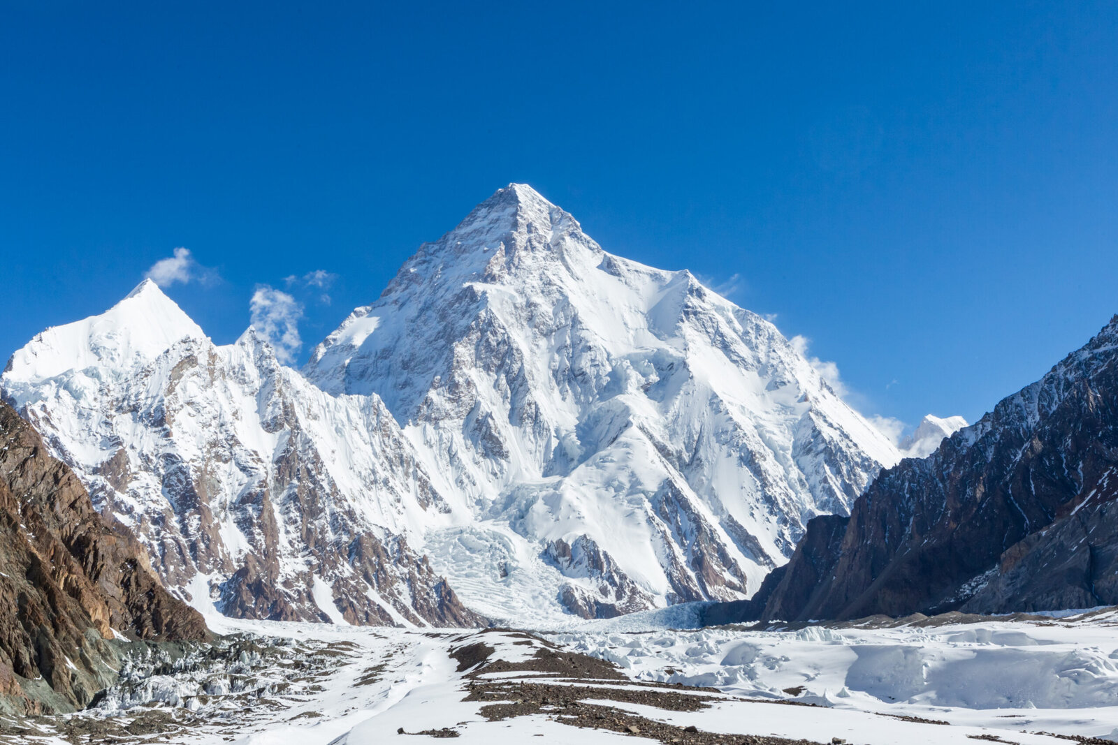
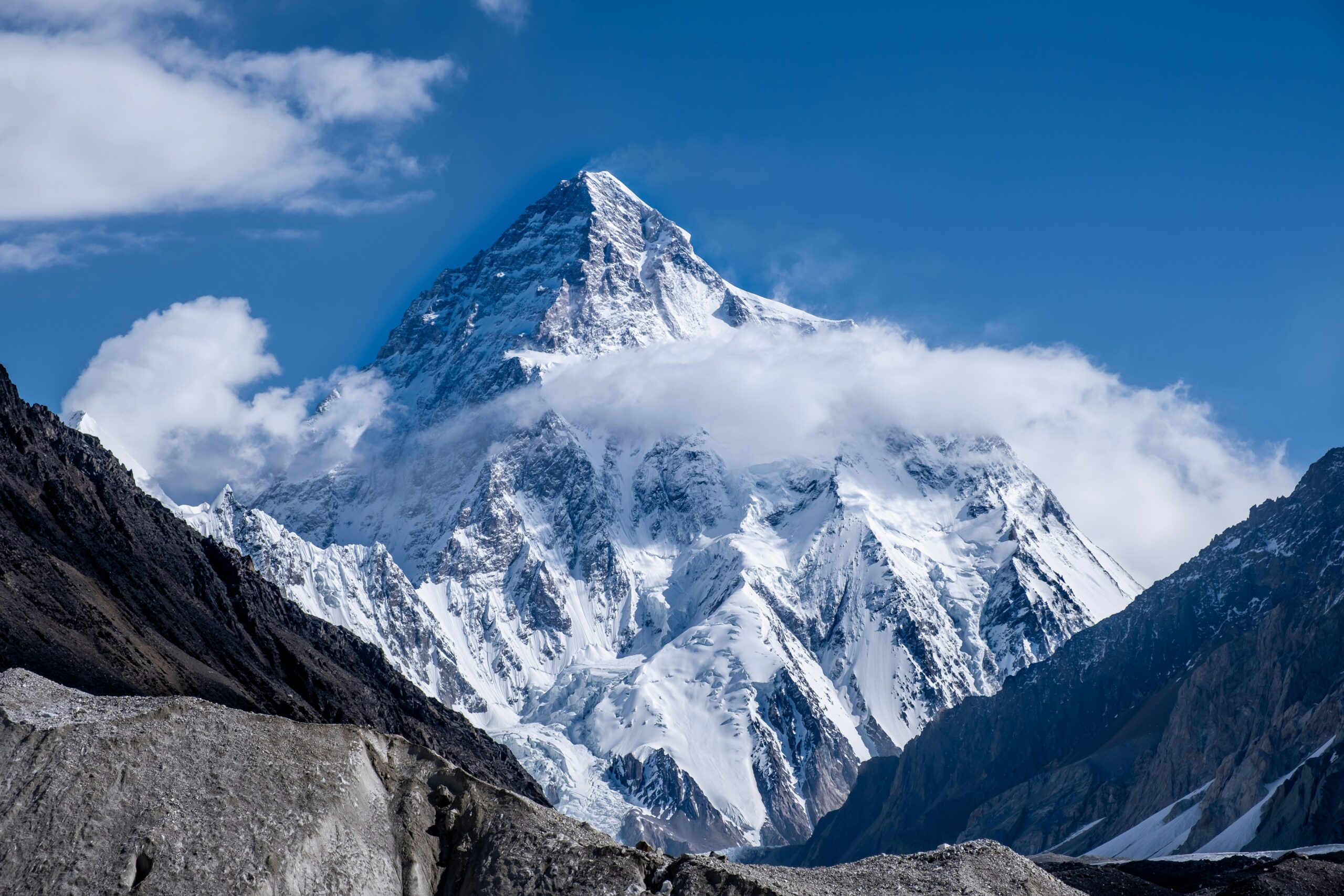
    Cho Oyu, the Turquoise Goddess, rising in gentle snow slopes on the Nepal-Tibet border
    8,188 m (26,864 ft) · Nepal-Tibet border · Sixth-highest on Earth

    Cho Oyu: the easiest 8000er, when Tibet is open

    The Turquoise Goddess is the most accessible and safest of the fourteen 8,000-metre peaks, and the classic first 8000er by the gentle Northwest Ridge from Tibet. But its whole appeal rests on Chinese access, which has closed for most recent seasons. This update covers the route, the access problem, the emerging Nepal side, and an honest readiness view. Heights in metres (feet).

    Research-based updateSafety and medical reviewReviewed each Himalayan seasonOur team has not climbed Cho Oyu

    Updated 27 July 2026 · Compiled by Travis Ludlow · Safety review by Dawson Ludlow · Medical review by Taylor Ludlow, RN

    8,188 mSummit (26,864 ft)
    6thHighest on Earth
    ~1.3%Fatality – lowest 8000er
    NW RidgeStandard route (Tibet)
    Apr-May / Sep-OctSeasons
    1954First ascent, no oxygen

    Single-mountain expedition update, compiled from China Tibet Mountaineering Association access reporting, operator route and pricing information, and published expedition records. Our team has not climbed Cho Oyu; the only first-hand summit anyone on our team claims is Kilimanjaro. This is a planning briefing for experienced climbers, not a how-to and not a substitute for training or a guide.

    The most forgiving 8000er – if you can get to it.

    Cho Oyu earns its reputation: a drive-to base camp, gentle snow slopes, one fixed-roped serac band, the lowest fatality rate of the 8000ers, and the highest success rates in open seasons. It is the classic first 8,000-metre peak and a common step toward Everest. The catch is access. It is climbed almost entirely from Tibet, and China has closed that side to foreign teams for most seasons since the pandemic.

    • Standard route: Northwest Ridge, from Tibet.
    • Safest 8000er: fatality around 1.3 percent.
    • Success: 50 to 90 percent in open seasons.
    • The catch: Tibet access, closed most recent springs.
    • First climbed 1954, without supplemental oxygen.
    The mountain

    What Cho Oyu involves

    The gentlest 8,000-metre climb there is, staged from a road-head, with a single technical obstacle and one large caveat.

    Cho Oyu, the Turquoise Goddess, is the sixth-highest mountain on Earth at 8,188 m, standing on the Nepal-Tibet border about 20 km west of Everest. Its normal route, the Northwest Ridge from the Tibetan side, is the most accessible way up any 8000er: a vehicle reaches Chinese base camp near 4,900 m, advanced base sits at about 5,650 m, and above that the climb is mostly gentle snow near 30 degrees. The one real obstacle is a fixed-roped serac and ice-cliff band near 6,600 m.

    That gentleness, and the lowest fatality rate of the fourteen 8000ers, make Cho Oyu the classic first 8,000-metre peak and a common rehearsal for Everest. But the word easy is relative. This is still a death-zone climb of 30 to 40 days, in temperatures of -15 to -30 C, where the gentle slopes hide real objective danger and people still die. And the whole proposition depends on Chinese access to Tibet, which is where the current story lies. For the full route, permit, and cost detail, see our Cho Oyu climb guide.

    The current story

    The Tibet access problem

    Cho Oyu’s reputation as the easy 8000er assumes you can reach the easy side. Lately, often, you cannot.

    Almost every commercial Cho Oyu ascent uses the Northwest Ridge from Tibet, which means a permit from the China Tibet Mountaineering Association. Since the pandemic, China has kept the Tibetan side closed to foreign commercial expeditions for most seasons, with occasional exceptions such as spring 2023. Spring 2025 was formally closed, along with neighbouring Shishapangma. Autumn has more often opened than spring, but the decision is made by Chinese authorities and can change from one season to the next.

    The closures have two practical effects. First, climbers pursuing the fourteen 8000ers, or a first 8000er, increasingly pivot to Manaslu in Nepal as the accessible alternative. Second, Nepali teams have worked since 2022 to open a commercial route on the Nepal side of Cho Oyu, and a few expeditions have fixed ropes and summited that way. That Nepal-side line is far harder than the Tibetan trade route and is not yet an established commercial option. The single most important planning question for Cho Oyu is therefore not when, but whether: confirm current access with your operator before committing.

    Verify access first

    Do not book flights or gear around Cho Oyu until an operator confirms Tibet access for your specific season. Build in a backup objective, and understand the cost consequences if China closes the peak late.

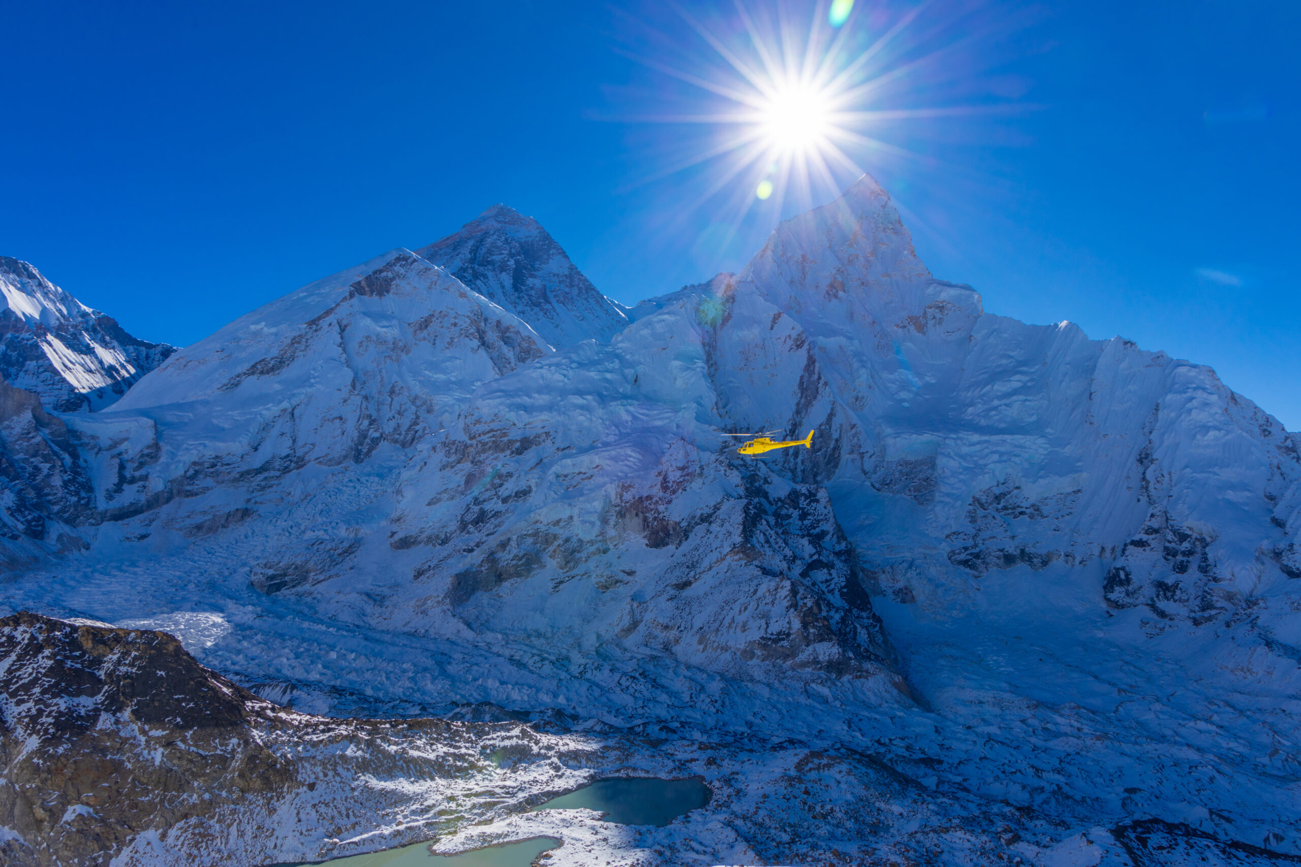
    A helicopter above a high Himalayan glacier, a reminder that rescue is remote

    Gentle is not the same as safe

    Cho Oyu is the safest 8000er by the numbers, but the numbers still record deaths. A serac band that has killed climbers, heavy snow loading after storms, and the simple arithmetic of the death zone all remain. The easy reputation is exactly what makes it easy to push too far.

    Honest self-assessment

    Are you ready for Cho Oyu?

    It is the most forgiving 8000er, not a beginner’s mountain. These are the prerequisites operators expect.

    Altitude record

    Proven Above 6,000 m

    Operators expect prior high-altitude experience. Cho Oyu is a first 8000er, not a first big mountain, and the death zone is unforgiving of gaps.

    Evidence: a solid 6,000 m-plus record.
    Fixed-rope skill

    Up And Down, Alone

    You must move confidently up and down fixed ropes and manage yourself between camps. The route is roped, but no one climbs it for you.

    Evidence: efficient ascender and rappel work.
    Self-sufficiency

    Care For Yourself High

    Eat, drink, manage oxygen, and solve small problems at 7,000 m and above. Guides cannot do everything for a hypoxic client.

    Evidence: prior self-reliance at altitude.
    Access realism

    Plan For Closures

    The single biggest variable is whether Tibet is open. Build flexibility, and a backup objective, into the plan from the start.

    Evidence: a plan that survives a closure.
    RequirementBaselineWhy it matters
    Altitude experiencePrior success above 6,000 mThe death zone punishes anyone who has not tested it lower first.
    Fixed-rope competenceFluent ascender and rappel workThe route is fixed but demands reliable movement while hypoxic.
    Self-careIndependent between campsGuides support, but cannot perform every task for a hypoxic client.
    FitnessStrong for a 30 to 40 day tripThe expedition is long, cold, and cumulative even on gentle ground.
    Access flexibilityA plan that survives a closureTibet access can vanish for a season; a backup protects the trip.
    Turnaround disciplineWilling to descendAn easy reputation makes it easy to push too far in bad conditions.

    If you are building toward this as a first 8000er, our what to climb before Everest progression puts Cho Oyu in context, and the acclimatization guide prepares your body for the death zone.

    The two sides

    The Tibetan trade route and the Nepal side

    One mountain, two very different climbs, separated by a border and a wide gap in difficulty.

    The trade route

    Northwest Ridge – from Tibet

    The normal route and the reason for Cho Oyu’s reputation. A drive-to base camp, an advanced base at 5,650 m, and mostly gentle snow slopes near 30 degrees, with one fixed-roped serac band near 6,600 m as the only technical obstacle. It depends entirely on Chinese access to the Tibetan side.

    • Gentle snow, around 30 degrees
    • One fixed-roped serac and ice-cliff band
    • Drive-to base camp on the Tibetan side
    • Needs Tibet open; closed most recent springs
    Best fit: a first 8000er for experienced high-altitude climbers.
    The hard alternative

    The Nepal Side

    A very different mountain. The Nepal side is technical, rarely climbed, and success is uncommon. Because Tibet keeps closing, Nepali teams have worked since 2022 to fix a commercial route from Nepal, and a few have summited that way, but it remains an expert undertaking rather than a trade route.

    • Technical and rarely climbed
    • An emerging, not established, commercial line
    • Fixed and summited by a few recent teams
    • An expert objective, not the easy 8000er
    Best fit: expert alpinists, or when Tibet is closed.
    FactorNorthwest Ridge (Tibet)The Nepal side
    CharacterGentle snow, one serac bandTechnical and sustained
    AccessDrive-to base camp; needs China openFrom Nepal; no Chinese permit needed
    DifficultyThe easiest 8000erAn expert undertaking
    StatusClosed most recent springsEmerging, not established
    Who it suitsA first 8000er, when openExpert alpinists, or when Tibet is shut

    The Cho Oyu climb guide covers the Northwest Ridge camps, permit, and gear in full.

    Route profile

    The Northwest Ridge, camp by camp

    An overview of the Tibetan trade route, from the road-head to the broad summit plateau. For the full detail, see the climb guide.

    Drive-in

    Chinese Base Camp ~4,900 m

    Reached by vehicle on the Tibetan side, a rare luxury among 8000ers.

    The real start

    Advanced Base Camp ~5,650 m

    A short walk up the moraine; the working base for the climb.

    Camp 1 ~6,400 m

    Onto The Mountain

    Above ABC the route gains the lower slopes toward the serac band.

    The one crux

    Serac Band ~6,600 m

    A fixed-roped ice cliff, the only technical obstacle on the normal route.

    Camp 2 ~7,100 m

    Gentle Snow

    Broad, moderate slopes near 30 degrees lead higher up the ridge.

    Camp 3 ~7,450 m

    Last Camp

    The high camp for the summit push in cold, thin air.

    Summit plateau

    The Broad Top

    A wide summit plateau, deceptively flat, marks the true summit at 8,188 m.

    Descent

    Reverse The Ropes

    Retrace the fixed lines; most incidents happen tired, on the way down.

    The one obstacle

    On a route this gentle, the serac and ice-cliff band near 6,600 m is the single place that demands real care. It is fixed with ropes, but timing and exposure through it are what a good team manages closely.

    How a trip runs

    A Cho Oyu expedition timeline

    A commercial Cho Oyu expedition runs about 30 to 40 days, most of it acclimatization and waiting rather than climbing.

    1

    Kathmandu and permits

    Gather in Kathmandu, complete Tibet visa and Chinese permit formalities, and check gear.

    2

    Cross into Tibet

    Travel to the Tibetan plateau and the drive-to Chinese base camp near 4,900 m.

    3

    Establish ABC

    Move up the moraine to Advanced Base Camp at about 5,650 m, the real start.

    4

    Acclimatization rotations

    Climb to Camps 1 and 2, sleep high, and descend to recover across several rounds.

    5

    Cross the serac band

    Pass the fixed-roped ice cliff near 6,600 m, the route’s one real obstacle.

    6

    Wait for a window

    Rest at base and watch the forecast for a settled summit period.

    7

    Summit push

    Move through the high camps and up the gentle plateau to the summit, then descend.

    8

    Exit to Kathmandu

    Clear the mountain and return across Tibet to Kathmandu.

    Money

    Cost and operators

    Cho Oyu is the affordable 8000er, and the most operator-rich after Everest, but tier choice matters more here than route choice.

    ComponentFigureNote
    Operator fee~$20,000-$45,000Premium Western to budget Nepali; the tier affects success rate.
    All-in trip cost~$35,000-$65,000Adds travel, insurance, gear, and tips; still far below Everest.
    Chinese permit and logisticsIncluded by operatorThe CTMA permit and Tibet logistics are handled by the operator.
    InsuranceOften $90,000+ cover requiredHigh-altitude rescue and evacuation cover is mandatory.
    DurationAbout 30 to 40 daysA full expedition, long even on relatively gentle terrain.

    Compare the field, tier by tier, in our Cho Oyu operators comparison, and see how the numbers are built in summit success rates.

    Choosing a team

    Choosing a Cho Oyu operator

    On Cho Oyu the operator tier affects success more than the route does. These are the questions that separate them.

    Access status

    Tibet, Confirmed

    The first question: is the operator confident of Tibet access for your season?

    Backup plan

    If It Closes

    Ask what happens, and what it costs, if China closes the peak late.

    Sherpa ratio

    Support Up High

    Clarify the climbing-Sherpa ratio and oxygen plan for the summit push.

    Success definition

    How They Count

    Ask which seasons and clients are in their quoted success rate.

    Serac management

    The One Hazard

    How the team manages timing and exposure through the serac band.

    Screening

    Right Experience

    A serious operator checks your altitude record before accepting you.

    How to choose an expedition operator covers the vetting in full, and the Cho Oyu operators comparison ranks the field.

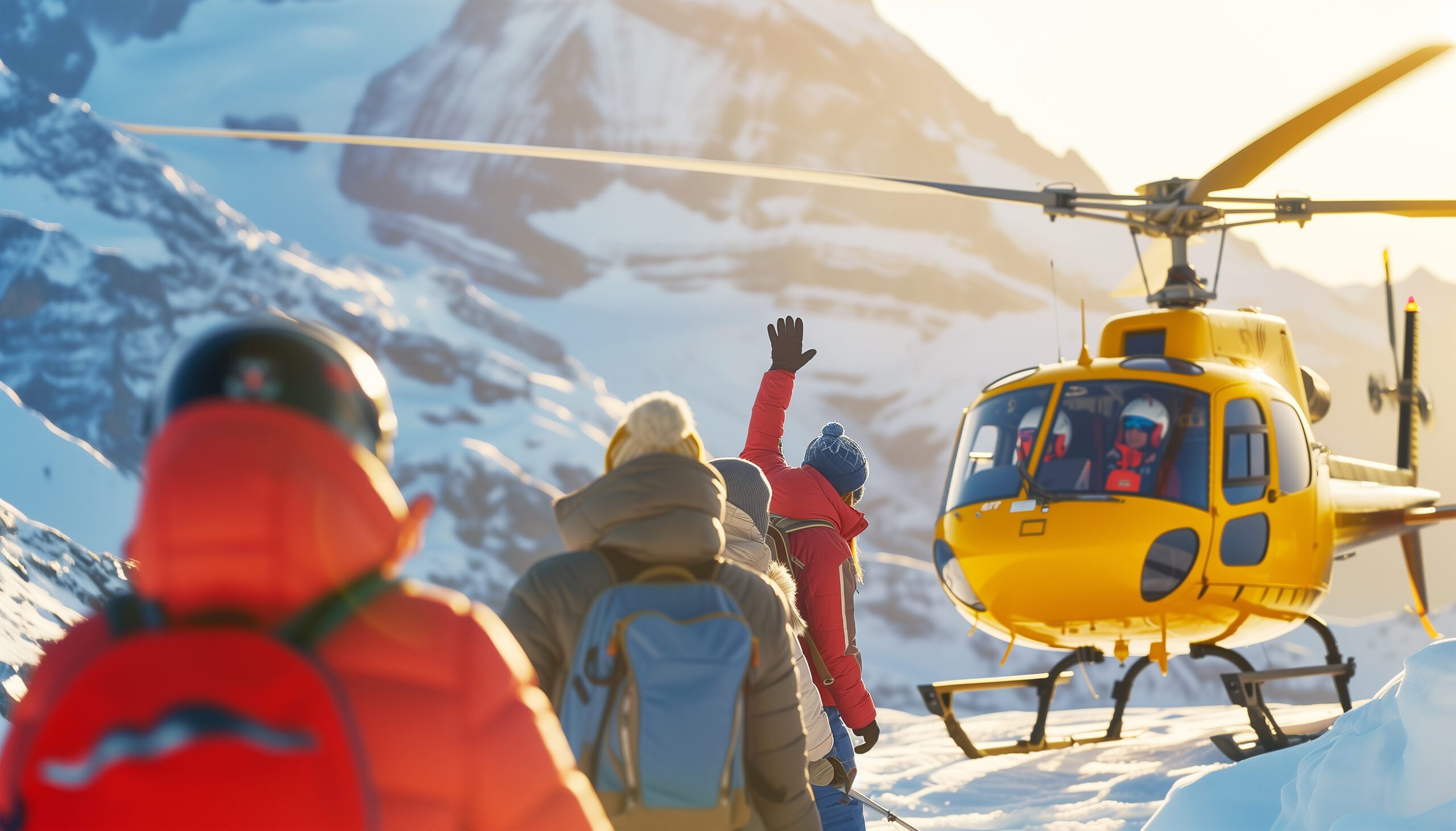
    A rescue helicopter against a cold high-altitude sky

    The safest 8000er is still an 8000er

    A low fatality rate is a statistic, not a guarantee. Above 7,000 m the margins are thin, rescue is slow and weather-bound, and the descent, tired and hypoxic, is when most incidents happen. Treat Cho Oyu with the respect any death-zone peak demands.

    The numbers

    Safety and success, honestly

    Cho Oyu’s figures are the friendliest of the 8000ers, but only when you read what is inside them.

    StatisticWhat it measuresHow to use it
    ~1.3% fatalityLowest of the 8000ersThe safest 8000er, but not a safe mountain.
    50-90% success (open)In good seasonsAmong the highest 8000er success rates when Tibet is open.
    ~35% headlineIncludes closed seasonsLong-run figures fold in the permit closures; read the denominator.
    The serac bandThe recurring killerGentle slopes, but the ice cliff and post-storm snow are real hazards.

    Our summit success rates analysis explains why the headline rate is lower than what open-season operators report.

    Timing

    Season and conditions

    Cho Oyu has two seasons, but access matters more than the calendar in deciding when you can actually go.

    Spring (Apr-May)

    One Window

    Climbed when open, though Tibet has often stayed shut in recent springs.

    Autumn (Sep-Oct)

    The Classic Season

    The traditional Cho Oyu season, and more often open in recent years.

    Access

    The Real Variable

    Whether Tibet is open matters more than the month you choose.

    Cold

    -15 to -30 C

    Thin, cold air makes even routine tasks a serious effort up high.

    Storms

    Snow Loading

    Heavy precipitation raises avalanche risk on the accumulation slopes.

    Live wind and weather for Cho Oyu. Source: Windy.com. For how to read a mountain forecast, see our weather guide.
    Cho Oyu, on the Nepal-Tibet border about 20 km west of Everest. Map: OpenStreetMap contributors.
    History

    A short history of Cho Oyu

    From a lightweight 1954 first ascent to the most-climbed 8000er after Everest.

    Cho Oyu was first climbed on 19 October 1954 by Herbert Tichy, Sepp Joechler, and Pasang Dawa Lama, on a small, lightweight Austrian expedition and without supplemental oxygen. It was one of the earliest 8,000-metre summits, and unusual for its style at a time when the great peaks were being climbed by large siege expeditions. That lightweight ascent set the tone for a mountain that would become known for accessibility rather than extremity.

    Since then Cho Oyu has become the most-climbed 8000er after Everest, with thousands of ascents, most by the Tibetan Northwest Ridge in autumn. Its role as the standard first 8000er is well established, which is why the recent Chinese access closures matter so much: they have disrupted the single most common on-ramp to 8,000-metre climbing, and pushed both climbers and Nepali operators to look for alternatives.

    Questions

    Cho Oyu FAQ

    The questions climbers ask most about the difficulty, the access, the cost, and the season.

    How high is Cho Oyu, and where is it?

    Cho Oyu is 8,188 m (26,864 ft), the sixth-highest mountain on Earth. It sits on the Nepal-Tibet border about 20 km west of Everest, in the Mahalangur Himalaya. Its Tibetan name, Cho Oyu, is usually translated as Turquoise Goddess. Almost all commercial ascents climb the Northwest Ridge from the Tibetan side.

    Why is Cho Oyu called the easiest 8000er?

    Because its normal route asks less of a climber than any other 8,000-metre peak. The Northwest Ridge from Tibet is a mostly gentle snow climb of around 30 degrees, with a drive-to base camp and only one serious obstacle, a fixed-roped serac and ice-cliff band near 6,600 m. It has the lowest fatality rate of the fourteen 8000ers, around 1.3 to 1.4 percent, and the highest success rate. It is the classic first 8000er and a common step toward Everest. Easiest, though, is relative: it is still a death-zone peak.

    Is Cho Oyu open right now?

    That is the central question, and it changes. Cho Oyu is climbed almost entirely from Tibet, and China has kept the Tibetan side closed to foreign commercial expeditions for most seasons since the pandemic, with occasional exceptions such as spring 2023. Spring 2025 was formally closed. Autumn seasons have sometimes opened. Because access is set by the China Tibet Mountaineering Association and can change season to season, verify the current status with an operator before you plan around it.

    Can you climb Cho Oyu from Nepal?

    Yes, but it is a very different and much harder climb. The Nepal side is technical and rarely done, and success is uncommon. Because Tibet access keeps closing, Nepali teams have worked since 2022 to establish a viable commercial route from the Nepal side, and a few expeditions have fixed ropes and summited that way. For now, though, the Nepal side is an expert undertaking, not the accessible trade route that made Cho Oyu famous.

    What is the success rate on Cho Oyu?

    In open seasons with strong operators, summit rates commonly run 50 to 90 percent, among the highest of any 8000er. Headline long-run figures are lower, near 35 percent, because they fold in seasons disrupted or closed by Chinese permit decisions. Operator tier matters: premium teams report higher rates than budget ones. See our summit success rates analysis for how these numbers are built.

    How much does a Cho Oyu expedition cost?

    Operator fees in 2026 commonly run about $20,000 to $45,000, with all-in trip costs often $35,000 to $65,000 once travel, insurance, gear, and tips are included. It is far cheaper than Everest, which is part of its appeal as a first 8000er. Costs include the Chinese permit and Tibet logistics handled by the operator. A trip runs about 30 to 40 days.

    When is the season?

    Both spring (April to May) and autumn (September to October) are climbed, and autumn has long been the classic Cho Oyu season. Access, though, is the bigger variable than the calendar: in recent years the Tibetan side has more often opened in autumn than spring, but this is set by Chinese authorities and must be checked for the year you intend to climb.

    Do you need supplemental oxygen or prior experience?

    Cho Oyu is often climbed with supplemental oxygen on the commercial route, though a fit, experienced minority climb it without. It was first climbed in 1954 without oxygen. Either way, it is not a first big mountain: operators expect prior experience above 6,000 m, competence moving up and down fixed ropes, and the self-sufficiency to look after yourself between camps in the death zone.

    Is Cho Oyu actually safe?

    It is the safest of the 8000ers by fatality rate, but safe is the wrong word for any 8,000-metre peak. Its gentle slopes hide real objective danger: a serac zone that has killed climbers, and heavy snow accumulation that raises avalanche risk after storms. People die on Cho Oyu. Treat it as the most forgiving 8000er, not a guaranteed one.

    Transparency

    How we built this update

    What this page is based on, who reviewed it, and what we do not claim to know.

    Sources

    • China Tibet Mountaineering Association access decisions and current-season reporting.
    • Operator route, itinerary, and 2026 pricing information for the Northwest Ridge.
    • Published expedition records for the 1954 first ascent and Nepal-side attempts.
    • Fatality and success-rate datasets for the fourteen 8000ers.
    • Our own Cho Oyu climb guide and operators comparison for the detail.

    Review and standards

    Compiled by Travis Ludlow and reviewed for safety by Dawson Ludlow, our Climbing and Mountaineering Lead (Wilderness First Aid), whose highest first-hand summit is Kilimanjaro. Health and medical points were reviewed by Taylor Ludlow, RN. We do not fabricate summit experience, quotes, or credentials, and we say plainly when we are reporting rather than recounting.

    What we do not claim to know

    Access and conditions on Cho Oyu change, and no web page can replace a current operator confirmation and forecast. In particular:

    • Tibet access is set season by season by Chinese authorities; confirm it before planning.
    • The Nepal-side route is developing; its status and difficulty may change year to year.
    • Success and fatality figures vary by source, season, and how open seasons are counted.
    • Our team has not climbed Cho Oyu, so we report official access, records, and operator data, not personal experience.
    Global Summit Guide research team

    Global Summit Guide research

    We compile mountain updates from official access decisions, operator data, and published records, review them for safety and medical accuracy, and refresh them each season. We are transparent about what we have and have not climbed, and Cho Oyu is a research-based briefing, not a personal account.

    About our team and standards ->
    Plan your first 8000er

    Confirm access first. Then build the plan.

    Start with the full route in our Cho Oyu climb guide, compare teams in the operators comparison, and weigh the alternative in the Manaslu guide in case Tibet stays shut. Expeditions gather in Kathmandu, so for flights and lodging there, browse travel on Expedia.

    Disclosure: the Expedia link above is a sponsored affiliate link, and we may earn a commission at no extra cost to you. It is the only affiliate link on this page; our route, access, and safety guidance is independent.

    Was this helpful?

    Yes
    No
    Thanks for your feedback!
  • Gasherbrum I (Hidden Peak) Expedition Update 2026: The Harder Gasherbrum Twin

    Gasherbrum I, Hidden Peak, the eleventh-highest mountain in the world, in the Karakoram of Pakistan
    Gasherbrum I is 8,080 m (26,509 ft), the eleventh-highest mountain on earth. Known as Hidden Peak, it is the harder and less-visited of the two Gasherbrum 8000ers.
    Expedition Updates · Karakoram

    Gasherbrum I expedition update

    Hidden Peak, the harder of the Gasherbrum twins. This page tracks why it earned the name, how it compares to Gasherbrum II, the Japanese Couloir route, its honest safety record, the Karakoram summer season, and a go or no-go checklist. A single-mountain page in our Expedition Updates directory. Elevations in metres (feet).

    Current status Karakoram summer 8,080 m (26,509 ft)

    The hidden one, and the harder one.

    Gasherbrum I is the eleventh-highest mountain in the world, tucked so deep in the Karakoram that a British surveyor named it Hidden Peak in 1892. It is the harder of the two Gasherbrum 8000ers, steeper and more technical than its twin Gasherbrum II, and the least-visited of all fourteen 8000-metre peaks.

    It carries history out of proportion to its fame: the only 8000er first climbed by an American team, in 1958, and the site of the first alpine-style ascent of an 8000er, in 1975. For the full route, camps, and cost, see our Gasherbrum I climb guide.

    8,080 m

    Summit (26,509 ft)

    Eleventh-highest in the world; Hidden Peak, or K5.

    Jun to Aug

    Karakoram season

    Summer, the opposite of the Himalayan seasons.

    Least-visited

    Of the 8000ers

    Remote, technical, and for experienced climbers.

    Gasherbrum I stands at the head of the Baltoro Glacier, on the Pakistan and China border, part of a cluster of high peaks that includes its twin Gasherbrum II. It is a serious mountaineer’s objective rather than a commercial trophy, drawing far fewer climbers than K2 or Everest, and rewarding those who make the long journey with solitude as well as difficulty. This page owns the current picture, the twins comparison, and the honest safety record. For the Japanese Couloir route detail, camps, gear, and cost breakdown, see our Gasherbrum I climb guide.

    Season and status

    A Karakoram summer peak.

    Gasherbrum I is climbed from June to August, the Karakoram summer, which is the opposite of the spring and autumn seasons used across the Nepalese Himalaya. Every one of Pakistan’s 8000ers is a summer peak. A full expedition runs 45 to 60 days, taking in the trek, several acclimatization rotations, and a long wait at base camp for a safe summit window. Each year the mountain hosts only a handful of teams, often alongside climbers on its twin, so the status that matters is simply whether a season’s weather opens a window at all.

    Why it is called Hidden Peak

    A name earned by remoteness.

    The British surveyor William Martin Conway gave Gasherbrum I the name Hidden Peak in 1892, because the mountain is set so far back in the range, screened behind Gasherbrum IV and II, that it cannot be seen from the lower Baltoro Glacier where expeditions approach. Its survey label was K5. The word Gasherbrum, often mistranslated as shining wall, actually comes from the Balti rgasha, meaning beautiful, and brum, meaning mountain. Hidden and beautiful is a fair description of a peak most people, even many climbers, would struggle to point to.

    The Gasherbrum twins

    Two 8000ers, one base camp, very different climbs.

    Gasherbrum I against its twin, Gasherbrum II. The two share a base camp and Camp 1.
    AspectGasherbrum IGasherbrum II
    Height8,080 m (26,509 ft), 11th-highest8,035 m (26,362 ft), 13th-highest
    DifficultySteeper and more technicalThe easier, safer twin
    Normal routeThe Japanese Couloir, north-east faceThe south-west ridge
    Typical roleThe harder prizeOften a climber’s first 8000er
    Objective hazardRelatively low, few seracsLow
    Base campShared with Gasherbrum IIShared with Gasherbrum I

    The two Gasherbrum 8000ers sit side by side and share the same base camp, but they are not the same climb. Gasherbrum II is one of the more approachable 8000ers and is often a climber’s first, while Gasherbrum I is steeper, more technical, and the bigger prize. Because they share the lower mountain, many strong climbers attempt both in a single season, a challenge known as the Gasherbrum Double, first achieved as a traverse by Reinhold Messner and Hans Kammerlander in 1984. If you are eyeing GI, its twin is worth understanding too.

    The Japanese Couloir route

    A direct line, but a technical one.

    From the Gasherbrum La to the summit

    The normal route climbs the north-east face via the Japanese Couloir, reached from the Gasherbrum La, the col between GI and GII. It shares base camp and Camp 1 with Gasherbrum II, then works up crevassed glacial slopes to the col before the steeper couloir and face above, with three high camps to reach the summit. It is a direct line to the top, but the couloir and the upper face are genuine technical climbing at extreme altitude. For the full camp-by-camp detail, see our Gasherbrum I climb guide.

    How dangerous it really is

    A low death rate that needs explaining.

    ⚠ Hard, not safe

    Gasherbrum I carries one of the lower fatality records among the 8000ers, which sounds reassuring until you look at why. Part of the reason is that only experienced climbers attempt a peak this technical and this remote, so the pool is self-selected. The other part is that the normal route has relatively few of the objective hazards, such as collapsing seracs, that make neighbours like K2 and Broad Peak so lethal.

    In other words, the statistic reflects who climbs Gasherbrum I and the character of its route, not a forgiving mountain. Crevasses, avalanches, severe storms, extreme cold, and altitude remain ever-present. Treat the low death rate as a fact about the climbers, not an invitation to underestimate the peak. This page is educational and is not a substitute for experience.

    Access, cost and the Baltoro trek

    The great glacier highway, away from the K2 crowds.

    The approach is one of the finest in mountaineering. From Islamabad you fly to Skardu, drive to the village of Askole, then trek six to eight days up the Baltoro Glacier, past Paiju and Urdukas to Concordia, before branching away from the K2 crowds into the quieter Gasherbrum sanctuary and base camp. A guided expedition runs roughly $15,000 to $25,000, less than K2, and the permit sits in Pakistan’s 8000er band below K2, broadly in line with Broad Peak and Gasherbrum II; climbers doing the Gasherbrum Double often arrange a custom combined royalty. Confirm the current figures with your operator, and vet teams with how to choose an operator.

    Weather and timing

    A live look at the Gasherbrum massif.

    Karakoram weather is fierce and fast-moving, and a summit push depends on a settled window in the short summer season. The live map below shows current conditions for the massif; a real attempt relies on expedition forecasting for every move above base camp.

    Live wind and weather for Gasherbrum I. Source: Windy.com. For how to read a mountain forecast, see our weather guide.
    Gasherbrum I, at the head of the Baltoro Glacier on the Pakistan-China border. Map: OpenStreetMap contributors.

    Go or no-go checklist

    Work through these before you commit.

    Before you go

    • Bring 8000er experience – GI expects solid 7,000 m ability and ideally a previous 8000er, not a first trip to extreme altitude.
    • Respect the couloir – the Japanese Couloir and upper face are technical ground high on the mountain.
    • Do not misread the low death rate – it reflects who climbs it, not a safe peak; the hazards are real.
    • Consider the Double – if strong, pairing GII from the shared base camp is efficient, but plan the royalty and time.
    • Plan the long trek – six to eight days up the Baltoro before the climb, and 45 to 60 days total.
    • Carry proper cover – helicopter evacuation and high-altitude rescue insurance are essential in this remote range.

    Gasherbrum I update FAQ

    The questions climbers ask most about the name, the twins, and the difficulty.

    Why is Gasherbrum I called Hidden Peak?

    The British surveyor William Martin Conway gave it the name in 1892 because the mountain is tucked deep in the Karakoram, hidden behind Gasherbrum IV and II and not visible from the lower Baltoro Glacier. Its survey designation was K5. The name Gasherbrum itself comes from the Balti words rgasha, meaning beautiful, and brum, meaning mountain, so it means beautiful mountain, not shining wall as is often wrongly claimed.

    How does Gasherbrum I compare to Gasherbrum II?

    They are twins that share a base camp, but Gasherbrum I is the harder of the two. Gasherbrum II, at 8,035 m, is regarded as one of the easier and safer 8000ers and is often a climber’s first, taken on the south-west ridge. Gasherbrum I, at 8,080 m, is steeper and more technical, the bigger prize of the pair. Many strong climbers attempt both in a single season from the shared base camp, a challenge known as the Gasherbrum Double.

    What is the normal route on Gasherbrum I?

    Most climbers take the Japanese Couloir on the north-east face, reached from the Gasherbrum La, the col that separates Gasherbrum I and II. The route shares base camp and Camp 1 with Gasherbrum II, then climbs crevassed glacial slopes up to the col before the steeper couloir and face above, with three high camps used to reach the summit. It is a direct line, but a technical one at extreme altitude.

    How dangerous is Gasherbrum I?

    It is technically demanding and remote, yet it carries one of the lower fatality records among the 8000ers, and the reason matters. Part of it is that only experienced climbers attempt a peak this hard and this far from help, and part of it is that the normal route has relatively few objective hazards such as seracs. So the low death rate reflects who climbs it and the character of the route, not that the mountain is forgiving. It is hard, not safe.

    When is the Gasherbrum I climbing season?

    June to August, the Karakoram summer, which is the opposite of the spring and autumn seasons used in the Nepalese Himalaya. All of Pakistan’s 8000ers are summer peaks. A full expedition usually runs 45 to 60 days including the trek in, acclimatization rotations, and waiting at base camp for a safe summit window, so it is a long commitment as well as a hard one.

    What experience do you need for Gasherbrum I?

    Prior high-altitude experience is essential: solid ability on 7,000 m peaks and ideally a previous 8000er. Gasherbrum I is an advanced expedition peak, not a first 8000er, and its steeper, more technical ground at extreme altitude is unforgiving of climbers who arrive underprepared. It is often climbed by mountaineers working through the fourteen 8000ers rather than by those new to the death zone.

    How do you get there, and what does it cost?

    From Islamabad you fly to Skardu, drive to the village of Askole, then trek six to eight days up the Baltoro Glacier past Concordia to base camp, branching away from the K2 crowds into the quieter Gasherbrum sanctuary. A guided expedition runs roughly $15,000 to $25,000, less than K2, and the Gasherbrum Double with GII is a popular value option, often arranged with a custom combined royalty.

    How high is Gasherbrum I and where is it?

    Gasherbrum I is 8,080 m (26,509 ft), the 11th-highest mountain in the world and the second-highest in the Karakoram after K2, on the Pakistan-China border at the head of the Baltoro Glacier. It was first climbed in 1958 by an American team, the only 8000er with an American first ascent, and in 1975 it became the first 8000er climbed in pure alpine style, by Reinhold Messner and Peter Habeler.

    📋 How this update is built

    This page is compiled by Travis Ludlow, Founder and Head of Research at Global Summit Guide, from Pakistan Ministry of Tourism permit rules, route guides for the Japanese Couloir, and operator-published expedition records, with sources named below. It was reviewed for safety by Dawson Ludlow, our Climbing and Mountaineering Lead (Wilderness First Aid), whose highest first-hand summit is Kilimanjaro.

    Our team has not climbed Gasherbrum I, so we report official rules and expedition records rather than personal experience, and we review this page before each Karakoram season. Permit fees and rules change, so confirm the current royalty and requirements with your operator and the Ministry of Tourism before planning around them.

    Planning a Gasherbrum expedition?

    Start with our Gasherbrum I climb guide for the full route and cost, compare the giant next door in our K2 climb guide and K2 update, and follow the range live in the K2 2026 season tracker. Every expedition stages through Islamabad and Skardu, so for flights and hotels, browse travel on Expedia.

    Disclosure: the Expedia link above is a sponsored affiliate link. We may earn a commission at no extra cost to you.

    Was this helpful?

    Yes
    No
    Thanks for your feedback!
  • Makalu Expedition Update 2026: The Fifth-Highest & One of the Hardest 8000ers

    Makalu, the four-sided pyramid of the world's fifth-highest mountain, in the Mahalangur Himalaya
    Makalu is 8,485 m (27,838 ft), the fifth-highest mountain on earth. Its four-sided pyramid, 19 km from Everest, is one of the hardest of the 8000ers to climb.
    Expedition Updates · Himalaya

    Makalu expedition update

    The fifth-highest mountain in the world, and one of the hardest. This page tracks why Makalu is a technical 8000er, the permit-and-difficulty mismatch, the French Couloir, the wild Barun approach, and a go or no-go checklist. A single-mountain page in our Expedition Updates directory. Elevations in metres (feet).

    Current status Technical 8000er 8,485 m (27,838 ft)

    Fifth by height, near the top for difficulty.

    Makalu is the world’s fifth-highest mountain, a clean four-sided pyramid 19 km from Everest, but its rank undersells it. Where Everest, Cho Oyu, and Manaslu are fixed-line climbs within reach of well-supported commercial teams, Makalu is a technical mountain, with a summit pyramid that demands real rock and ice climbing above 8,400 m and a summit rate near 30 percent.

    Its permit tells the opposite story: at around $3,000 for spring, a fifth of Everest’s $15,000, it looks like a bargain. It is not. On Makalu the barrier is not the price, it is the climbing. For the full route and cost detail, see our Makalu climb guide.

    8,485 m

    Summit (27,838 ft)

    Fifth-highest in the world, 19 km from Everest.

    ~30%

    Summit success

    One of the hardest of the 8000ers.

    Spring

    Main season

    And autumn; permit around $3,000.

    Makalu stands in the Mahalangur Himalaya, on the Nepal and China border in Makalu-Barun National Park, an isolated giant whose name comes from a Sanskrit word for the great black one. It was first climbed in 1955 by a French team on which every member reached the summit, and it has stayed a climber’s mountain ever since, far from the commercial crowds. This page owns the current picture and the honest difficulty. For the Northwest Ridge route detail, camps, gear, and cost breakdown, see our Makalu climb guide.

    Season and status

    A spring and autumn 8000er, for experienced teams.

    Makalu is climbed in spring, from April to May, and in a shorter autumn window in September and October, the same seasons as the other Himalayan 8000ers. It sees a small number of serious expeditions rather than the crowds of Everest, and in any given season the mountain may host only a handful of teams. Summit pushes hinge on catching a calm, clear weather window on an exposed, wind-scoured summit, and the short list of successful climbers each year reflects how often the mountain simply does not allow it.

    Fifth-highest, one of the hardest

    Why the height rank misleads.

    Height is the headline, but it is a poor guide to difficulty among the 8000ers. Makalu is far harder than Everest, Cho Oyu, or Manaslu, not because it is taller, it is not, but because its normal route keeps a genuine technical challenge to the very top. The upper mountain is a steep pyramid of rock and ice, graded around III to IV, climbed at an altitude where every move is slow and the margin for error is thin. That is why its summit rate sits near 30 percent while the commercial giants run far higher, and why Makalu is grouped with the hardest 8000ers rather than the accessible ones.

    The permit and difficulty mismatch

    Cheap to permit, hard to climb.

    Makalu against Everest, to show how permit price and rank hide the real difficulty. Figures for spring; confirm current permit costs.
    AspectMakaluEverest
    Height rankFifth in the worldFirst in the world
    Spring permitAround $3,000 (2025 revision)$15,000
    Summit successRoughly 30%Much higher, heavily supported
    Summit terrainTechnical: the French Couloir, Grade III to IVFixed-line snow and ice
    CrowdsRemote and uncommercialHeavily commercial
    Typical climberExperienced 8000er mountaineersA broad commercial range

    Under Nepal’s 2025 fee revision, the spring permit for Makalu is around $3,000, up from $1,800, and still a fraction of Everest’s $15,000. A climber comparing only the permit might conclude Makalu is the easier, cheaper option. The opposite is true. Everest’s higher price buys a fixed-line trade route and heavy commercial support; Makalu’s lower price comes with a technical summit, a remote approach, and far thinner infrastructure. Read the low permit as a warning, not an invitation.

    The French Couloir and summit pyramid

    Where the climb is won or lost.

    ⚠ The crux is at the very top, at the worst possible altitude

    The final barrier on the normal route is the French Couloir, a steep gully on the summit pyramid named for the 1955 first-ascent team, leading to a narrow, exposed summit ridge. It is real technical climbing at over 8,400 m, in extreme cold and wind, where a body is already failing from lack of oxygen. Many attempts end here, turned back by the difficulty, the weather, or the clock.

    This is what separates Makalu from the fixed-line 8000ers: the hardest climbing comes last, when climbers have least to give. It demands technical skill that carries over to the summit, not just endurance. Brush up on the systems in our fixed lines and jumars guide, though Makalu asks for more than a trade-route skill set. This page is educational and is not a substitute for experience.

    The wild Barun approach

    One of the last uncrowded expeditions in Nepal.

    Reaching Makalu is an expedition in itself. Base camp lies at the end of an 18 to 22 day trek through the Barun valley in Makalu-Barun National Park, one of the most isolated and unspoiled corners of Nepal, with camping, high passes, dense forest, and almost none of the lodges or crowds of the Everest and Annapurna trails. For many climbers the wildness of the approach is a large part of the appeal, a throwback to how Himalayan expeditions once felt. It also means self-sufficiency and time, well before the climbing begins.

    Who should attempt it

    An experienced climber’s 8000er.

    Makalu is not a first 8000er. It is usually climbed by mountaineers who have already succeeded on peaks such as Manaslu, Cho Oyu, Lhotse, or Everest, and it is widely used as Everest preparation and as an early objective in a fourteen-eight-thousanders project, because its technical terrain and extreme altitude build directly transferable skills. Arriving without that background is how climbers end up turning around low on the mountain, or worse. Weigh your experience honestly against our fitness standards, plan acclimatization with our acclimatization guide, and see where Makalu sits among the giants in our Nepal peaks gateway.

    Weather and timing

    A live look at the Mahalangur.

    Makalu’s summit is high enough to sit in the jet stream outside the short seasonal windows, and even in spring a summit push depends on a break in the wind. The live map below shows current conditions for the massif; a real attempt relies on expedition forecasting for every move above base camp.

    Live wind and weather for Makalu. Source: Windy.com. For how to read a mountain forecast, see our weather guide.
    Makalu, in the Mahalangur Himalaya on the Nepal-China border, 19 km southeast of Everest. Map: OpenStreetMap contributors.

    Go or no-go checklist

    Work through these before you commit.

    Before you go

    • Bring 8000er experience – Makalu expects a technical and high-altitude background, not a first attempt at extreme altitude.
    • Respect the summit pyramid – the French Couloir is real technical climbing above 8,400 m, and it decides most attempts.
    • Do not be lured by the permit – the low fee reflects demand, not difficulty; budget the full $25,000 to $45,000 expedition.
    • Plan for the approach – the Barun trek is 18 to 22 days of remote, self-sufficient travel before the climb.
    • Carry proper cover – helicopter evacuation and high-altitude rescue insurance are essential and often required.
    • Wait for the window – the summit is exposed to the jet stream; patience beats ambition.

    Makalu update FAQ

    The questions climbers ask most about the difficulty, the permit, and the approach.

    How hard is Makalu compared to other 8000ers?

    It is one of the hardest. Despite ranking fifth by height, Makalu is far more technical than the fixed-line commercial 8000ers such as Everest, Cho Oyu, or Manaslu. The summit pyramid involves real rock and ice climbing, around Grade III to IV, through the French Couloir and along an exposed summit ridge above 8,400 m, and summit success rates sit near 30 percent. It is usually attempted only by climbers who have already succeeded on easier 8000ers.

    What is the French Couloir on Makalu?

    The French Couloir is the steep, technical gully on Makalu’s summit pyramid, named after the 1955 French team that made the first ascent. It leads to a narrow, exposed summit ridge and is the crux of the normal route, demanding real technical climbing at extreme altitude in fierce cold and wind. It is the single feature that makes Makalu so much harder than its taller, more commercial neighbours, and it is where most summit attempts are decided.

    How much does the Makalu permit cost?

    Nepal’s climbing royalty for Makalu falls in the other-8000ers tier, around $3,000 for the spring season under the 2025 fee revision, up from $1,800, and a fraction of Everest’s $15,000. But the low permit price is misleading. The barrier to Makalu is not the cost, it is the difficulty, and a cheap permit does not make it an easier mountain. Fees change, so confirm the current figure with the Department of Tourism or your operator.

    How much does a Makalu expedition cost?

    A full guided Makalu expedition runs roughly $25,000 to $45,000, less than Everest but still a major undertaking, reflecting the remote approach, the technical support required, and the long duration on the mountain. Far fewer operators run Makalu than Everest, and the expeditions tend to be smaller and more serious. Our Makalu climb guide breaks the costs down in detail.

    What is the approach to Makalu like?

    Wild and remote. Makalu base camp is reached by an 18 to 22 day trek through the Barun valley in Makalu-Barun National Park, one of Nepal’s most isolated and unspoiled regions, a long way from the lodges and crowds of Everest or Annapurna. It is a genuine wilderness expedition rather than a teahouse trek, with camping, high passes, and minimal services, which is part of the mountain’s appeal to experienced climbers.

    When is the Makalu climbing season?

    Spring, from April to May, is the main climbing season, with a shorter autumn window in September and October. The seasons match the other Himalayan 8000ers, and summit pushes still depend on catching a calm, clear weather window on an exposed, wind-blasted summit. Winter ascents have been made, but they are an extreme undertaking reserved for elite alpinists.

    Who should attempt Makalu?

    Experienced high-altitude climbers, typically after peaks such as Manaslu, Cho Oyu, Lhotse, or Everest. Makalu is widely used as Everest preparation and as an early objective in a fourteen-eight-thousanders project, because its technical terrain and extreme altitude build skills that transfer directly to harder peaks. It is emphatically not a first 8000er, and arriving without a technical and high-altitude background is a recipe for turning back or worse.

    How high is Makalu and where is it?

    Makalu is 8,485 m (27,838 ft), the fifth-highest mountain in the world, in the Mahalangur Himalaya on the border of Nepal and China, 19 km southeast of Everest. It is a striking, isolated four-sided pyramid, first climbed in 1955 by a French team on which, remarkably, every member reached the summit, one of the most successful first ascents of any 8000er.

    📋 How this update is built

    This page is compiled by Travis Ludlow, Founder and Head of Research at Global Summit Guide, from Nepal Department of Tourism permit rules, the 2025 fee revision, and operator-published expedition records, with sources named below. It was reviewed for safety by Dawson Ludlow, our Climbing and Mountaineering Lead (Wilderness First Aid), whose highest first-hand summit is Kilimanjaro.

    Our team has not climbed Makalu, so we report official rules and expedition records rather than personal experience, and we review this page before each Himalayan season. Permit fees and rules change, so confirm the current royalty and requirements with the Department of Tourism or your operator before planning around them.

    Planning a Makalu expedition?

    Start with our Makalu climb guide for the full route, camps, and cost, compare the neighbours in our Everest and Lhotse updates, and vet specialist teams in the operator directory. Every expedition stages through Kathmandu, so for flights and hotels there, browse travel on Expedia.

    Disclosure: the Expedia link above is a sponsored affiliate link. We may earn a commission at no extra cost to you.

    Was this helpful?

    Yes
    No
    Thanks for your feedback!
  • Lhotse Expedition Update 2026: Permit, Season, the Everest Connection & Route

    Lhotse, the fourth-highest mountain in the world, rising beside Everest in the Nepal Himalaya
    Lhotse is 8,516 m (27,940 ft), the fourth-highest mountain on earth. It shares Everest’s route to Camp 3, then breaks off into the Lhotse Couloir.
    Expedition Updates · Himalaya

    Lhotse expedition update

    The 8000er next door to Everest, at a fraction of the permit. This page tracks the spring season, the 2026 Nepal permit, the shared Everest route, the Lhotse Couloir crux, full expedition cost, and a go or no-go checklist. A single-mountain page in our Expedition Updates directory. Elevations in metres (feet).

    Current status Spring season 8,516 m (27,940 ft)

    Everest’s neighbour, at one-fifth the permit, but not an easy Everest.

    Lhotse shares Everest’s line through the Khumbu Icefall, the Western Cwm, and up the Lhotse Face to around Camp 3 and Camp 4, in the same spring season, before the routes split. You climb a genuine 8000er with far less crowding high on the mountain.

    The 2026 spring permit is $3,000 per person, against $15,000 for Everest. That gap is the draw. The honest caveat is that Lhotse is still a full death-zone expedition, and its summit crux, the steep Lhotse Couloir, is a serious climb in its own right.

    8,516 m

    Summit (27,940 ft)

    The fourth-highest mountain on earth, south of Everest.

    $3,000

    Spring permit

    One-fifth of Everest’s $15,000 royalty for 2026.

    Apr to May

    Prime season

    Spring, on the same rhythm as Everest.

    Lhotse sits immediately south of Everest, joined to it by the South Col, and for much of the climb the two mountains are the same route. That connection is the key to understanding Lhotse: it offers a true Himalayan 8000er in Everest’s shadow, sharing its approach and its season but not its price or its crowds. This page owns the current picture, the season, the permit and rules, the cost, and the route. For the full history, the deeper route detail, and gear, see our Lhotse climb guide and its best-time-to-climb breakdown.

    Season and status

    Spring, and tied to Everest’s rhythm.

    Lhotse is a spring mountain, climbed in April and May, with summit pushes timed to the settled weather windows that usually open in May. Because it shares the route, the whole Lhotse season moves in step with Everest: the same teams fix the same lines through the Khumbu Icefall, the same forecasts govern the summit windows, and Base Camp is the shared Everest Base Camp. Autumn attempts happen but are uncommon, and winter or monsoon climbs are rare and far more serious.

    The Everest connection

    Why Lhotse is best understood as Everest’s neighbour.

    From Base Camp, the Lhotse route is the Everest route: up through the Khumbu Icefall, along the Western Cwm, and up the Lhotse Face toward the high camps. The two only part company high on the mountain, where Everest climbers traverse toward the South Col and southeast ridge, and Lhotse climbers head into the couloir that splits the face to the summit. This shared line is why combined Everest and Lhotse expeditions exist, with strong climbers attempting both within a day or two.

    The comparison that matters: same icefall, same cwm, same season, same objective hazards up to the high camps, but a $3,000 permit against Everest’s $15,000, and a fraction of the summit-ridge traffic. That is the honest case for Lhotse. The equally honest caveat is that everything dangerous about the shared route applies to Lhotse too, and the couloir adds its own difficulty on top.

    The 2026 permit and Nepal rules

    Higher than it was, but still far below Everest.

    Nepal revised its climbing royalties effective September 1, 2025, the first change in a decade. For Lhotse and the other 8000m peaks, the spring fee rose from $1,800 to $3,000 per person, with lower rates in the quieter seasons. Everest rose further, to $15,000 in spring, which is what opened the price gap that now defines Lhotse’s appeal.

    Lhotse climbing royalty by season, 2026, per person. Confirm current rates with your operator, who arranges the permit.
    SeasonLhotse royaltyNotes
    Spring (Mar to May)$3,000 per personUp from $1,800. The main Lhotse season, shared with Everest.
    Autumn (Sep to Nov)$1,500 per personUp from $900. A quieter, less common window.
    Winter and monsoon$750 per personUp from $450. Rarely attempted.
    Garbage deposit$3,000, refundableStandard for 8000m peaks, returned when waste is brought out.
    Everest, spring, for comparison$15,000Five times the Lhotse spring fee.
    New rules to know for 2026. Permit validity was cut from 75 to 55 days, and Nepal no longer allows solo or fully independent alpine-style attempts, so you must climb through a registered operator with support. Expeditions must carry out human waste in biodegradable bags, and death-repatriation insurance and higher cover for high-altitude workers are now required. Your operator handles most of this; vet them with our how to choose an operator guide, and confirm your own cover in our mountaineering insurance guide.

    Full expedition cost

    Cheaper than Everest, still a major commitment.

    The permit is only a small slice of the total. A guided Lhotse expedition typically runs in the region of $20,000 to $35,000 or more, depending on the operator, the level of support, oxygen, and Sherpa ratios. That sits well below a comparable Everest expedition, which commonly runs $45,000 to $65,000 or higher, and the lower permit is one reason, but the bulk of the cost on either mountain is logistics, staff, oxygen, and time. Budget for international flights to Kathmandu, the flight to Lukla, gear, and tips on top.

    The route and the Lhotse Couloir

    Shared hazards below, a distinct crux above.

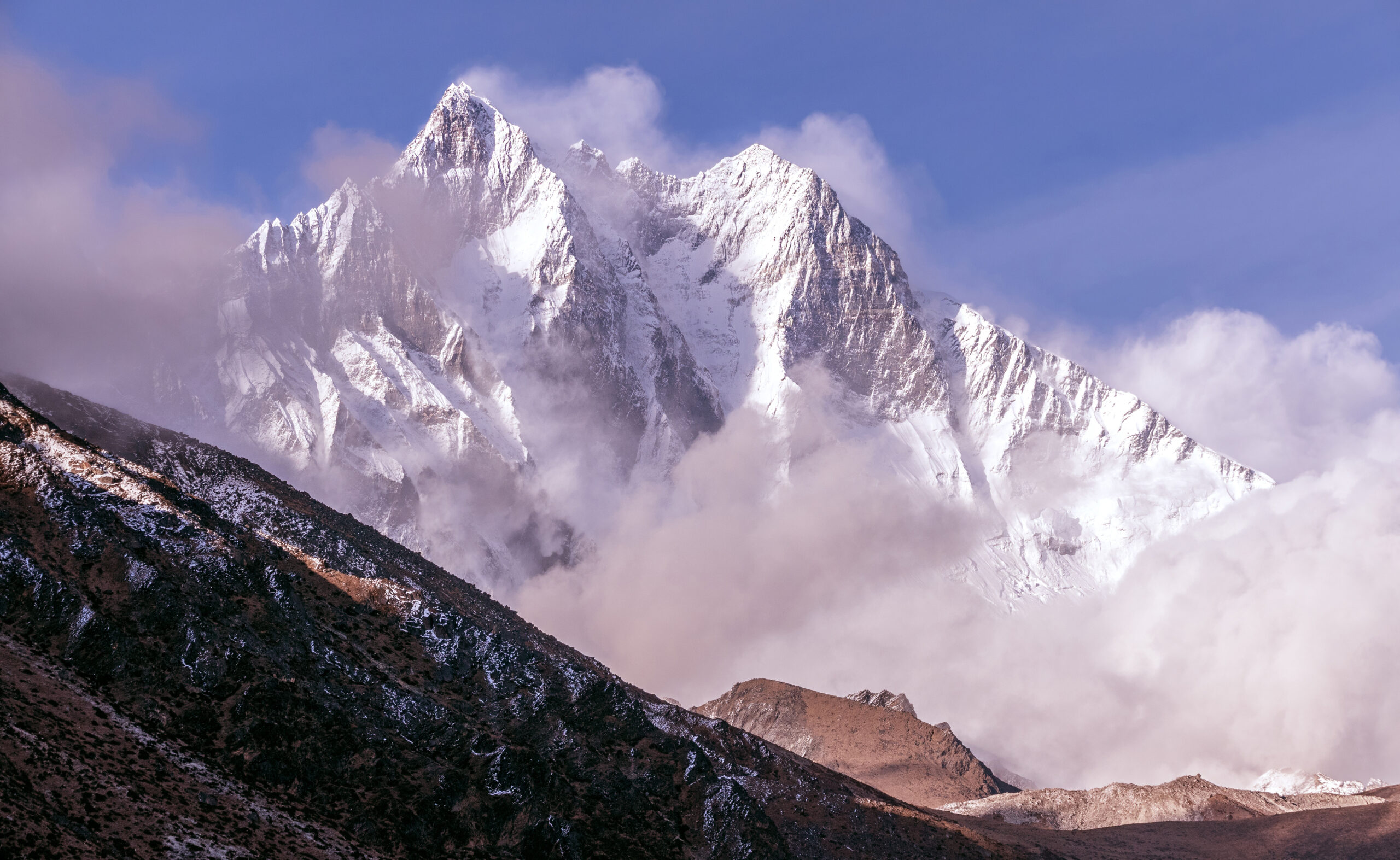
    The steep upper face and couloir of Lhotse high in the Nepal Himalaya
    High on Lhotse, the route enters the couloir that splits the face to the summit. It is a steep snow and ice gully, narrowing near the top, with a short, exposed final section.

    The normal route

    From Everest Base Camp the climb follows the Khumbu Icefall, the Western Cwm, and the Lhotse Face through the high camps, the same ground as Everest. Above the high camps it enters the Lhotse Couloir, a steep snow and ice gully of roughly 40 to 50 degrees that leads to the summit, narrowing toward the top with a short, exposed final section. Fixed lines are in place in season, and supplemental oxygen is standard. The climbing is not extreme in isolation, but it is sustained, at extreme altitude, with the same objective hazards as Everest on the shared lower route. See fixed lines and jumars explained for the techniques.

    Altitude and the death zone

    Above 8,000 m, the environment is the hazard.

    ⚠ A full 8000m expedition, not a discount Everest

    Lhotse’s summit is deep in the death zone above 8,000 m, where the body deteriorates and clear thinking is hard. The shared lower route carries the Khumbu Icefall, one of the most dangerous stretches in Himalayan climbing, and the couloir adds steep, exposed climbing at altitude. The lower permit does not make it a lower risk.

    It expects prior high-altitude experience, strong acclimatization, and disciplined turnaround judgment. Read our acclimatization guide and check your base against our fitness standards. This page is educational and is not medical advice.

    Weather and timing

    The same windows that govern Everest.

    Lhotse lives and dies by the spring jet stream, exactly as Everest does. For most of April the winds are too high on the summit, and teams acclimatize and wait; the climbable windows open when the jet lifts, usually in May, and everyone moves at once. The live map below shows current conditions for the massif; rely on your expedition’s forecasting for the actual summit call.

    Live wind and weather for Lhotse and the Everest massif. Source: Windy.com. For how to read a mountain forecast, see our weather guide.
    Lhotse, on the Nepal and Tibet border immediately south of Everest, in the Khumbu Himalaya. Map: OpenStreetMap contributors.

    Go or no-go checklist

    Work through these before you commit.

    Before you book

    • Have the 8000m base – prior high-altitude experience and strong acclimatization are expected, not optional.
    • Budget the whole expedition – the $3,000 permit is minor next to logistics, oxygen, staff, flights, and tips.
    • Choose a registered operator – solo and independent attempts are no longer allowed; vet the team’s Icefall and oxygen protocols.
    • Confirm the required insurance – death-repatriation cover is now mandatory; check the fine print.
    • Respect the couloir – the steep, exposed summit gully is a real crux at extreme altitude.
    • Decide on Everest-plus-Lhotse honestly – the combined climb is only for the strongest, most acclimatized climbers.

    Lhotse update FAQ

    The questions climbers ask most about the permit, the Everest link, and the climb.

    How much is the Lhotse climbing permit in 2026?

    The spring royalty is $3,000 per person, up from $1,800 after Nepal’s revision that took effect on September 1, 2025. Autumn is $1,500 and the winter and monsoon rate is $750. On top of that, expeditions post a refundable garbage deposit of $3,000 for an 8000m peak. For comparison, the spring Everest royalty is now $15,000, five times the Lhotse fee, which is a large part of why Lhotse draws climbers who want a Himalayan 8000er without the Everest price tag.

    Why climb Lhotse instead of Everest?

    Because for much of the climb they are the same mountain. Lhotse shares Everest’s approach through the Khumbu Icefall, the Western Cwm, and up the Lhotse Face to around Camp 3 and Camp 4, in the same spring season, before the two routes split. You get a genuine 8000m Himalayan expedition at roughly a fifth of the Everest permit and with far less crowding high on the mountain. What you do not get is an easy Everest, because Lhotse is still a full death-zone climb with its own steep summit crux.

    Can you climb Everest and Lhotse together?

    Yes, and combined Everest and Lhotse expeditions are a well-established option. Because the routes share the same line to the South Col area, climbers can attempt both within a day or two, going up the southeast ridge for Everest and into the Lhotse Couloir for Lhotse. It is a serious undertaking that only strong, acclimatized climbers should consider, but it is far more efficient than two separate trips.

    How hard and technical is Lhotse?

    Lhotse carries the same objective hazards as Everest on the shared lower route, the Khumbu Icefall and the death zone above 8,000 m, where supplemental oxygen is standard. Its distinct crux is the Lhotse Couloir, a steep snow and ice gully of roughly 40 to 50 degrees leading to the summit, narrowing near the top with a short, exposed final section. It is a demanding climb that expects prior high-altitude experience.

    When is the Lhotse climbing season?

    Spring, essentially April and May, matching Everest, with the summit pushes timed to the calm weather windows that usually open in May. The whole mountain runs on the same rhythm as Everest because they share the route. Autumn attempts happen but are uncommon, and winter or monsoon climbs are rare and far more dangerous.

    What are the 2026 Nepal climbing rules?

    Alongside the higher royalties, Nepal cut permit validity from 75 to 55 days, and it no longer allows solo or fully independent alpine-style attempts, so climbers must go through a registered operator with support. Expeditions must carry out human waste in biodegradable bags, and rules now require death-repatriation insurance and higher cover for high-altitude workers. Your operator handles most of the paperwork, but the requirements are stricter than they were a couple of years ago.

    How much does a full Lhotse expedition cost?

    A guided Lhotse expedition typically runs in the region of $20,000 to $35,000 or more, depending on the operator, the level of support, oxygen, and Sherpa ratios. That is well below a comparable Everest expedition, which commonly runs $45,000 to $65,000 or higher, but it is still a major financial commitment, and the permit is only a small slice of the total.

    How high is Lhotse and where is it?

    Lhotse is 8,516 m (27,940 ft), the fourth-highest mountain on earth, on the border of Nepal and Tibet immediately south of Everest and connected to it by the South Col. It was first climbed in 1956 by a Swiss team, and its main summit sits above two lower subsidiary tops, Lhotse Middle and Lhotse Shar.

    📋 How this update is built

    This page is compiled by Travis Ludlow, Founder and Head of Research at Global Summit Guide, from Nepal Department of Tourism royalty rules, reporting on the 2025 permit revision, and operator-published logistics, with sources named below. It was reviewed for safety by Dawson Ludlow, our Climbing and Mountaineering Lead (Wilderness First Aid), whose highest first-hand summit is Kilimanjaro.

    Our team has not climbed Lhotse, so we report official rules and operator logistics rather than personal experience, and we review this page before each spring season. Permit rates and rules change, so treat every figure here as a starting point and confirm current costs and requirements with your operator and the Department of Tourism before committing.

    Planning a Lhotse expedition?

    Start with our Lhotse climb guide, weigh it against its big neighbour in our Everest guide and the Everest expedition update, and compare teams in the operator directory. Every climb starts in Kathmandu, so for flights and hotels there, browse travel on Expedia.

    Disclosure: the Expedia link above is a sponsored affiliate link. We may earn a commission at no extra cost to you.

    Was this helpful?

    Yes
    No
    Thanks for your feedback!
  • K2 Climbing Season 2026–27: Best Time, Summit Window & Permits

    K2 in Pakistan during the Karakoram summer climbing season
    K2 climbing season · Karakoram summer · summit windows · permits · access

    K2 Climbing Season: Best Time, Summit Window, Conditions & Permits

    K2’s practical climbing season is late June through August, but the true summit opportunity is much narrower—usually a few days in late July or early August. A usable window exists only when wind, snow, route fixing, acclimatization and descent time align.

    Evergreen season reference2026 permit rules checkedLive tracker separatedNo summit guarantee

    Updated August 11, 2026 · By Travis Ludlow · Safety review: Dawson Ludlow

    Jun–AugCommercial Season
    Late Jul–Early AugPrimary Summit Window
    8,611 mK2 Summit
    ~5,150 mBase Camp
    ~$3,5002026 Royalty Reference*
    55+ daysPermit Lead-Time Reference
    By Travis Ludlow · Global Summit Guide Research
    Evergreen planning reference · Live conditions remain on the K2 Season Tracker
    *Permit caution: the K2 royalty has been disputed and changed in recent seasons. Global Summit Guide currently uses about US$3,500 per foreign climber as a 2026 planning reference, but Gilgit-Baltistan’s Tourism Department is the permit authority and climbers should verify the live tariff through their registered Pakistani operator before payment.
    The direct answer

    When Is the Best Time to Climb K2?

    The practical K2 expedition season is the Karakoram summer, roughly late June through August. Most teams spend June and early July approaching Base Camp, acclimatizing and establishing the route. The decisive summit opportunity usually arrives in late July or early August and may last only a few days.

    • Mid–late June: Baltoro approach, Base Camp setup and lower-route assessment.
    • Early July: rotations, camp establishment and rope fixing.
    • Mid–late July: recovery, upper-route fixing and weather watch.
    • Late July–early August: historically strongest summit period when the forecast and route align.
    • After the window: the correct decision may be descent, even after weeks of investment.
    The season is a sequence, not a date

    K2 Climbing Season Calendar

    A commercial expedition can last nearly two months even though the mountain may offer only one short high-altitude opportunity.

    PeriodTypical expedition workMain uncertaintyWhat must be true before moving on
    Mid–late JuneIslamabad/Skardu logistics, Askole road, Baltoro trek, Base Camp establishmentFlights, road access, porter logistics, early snow and glacier conditionsTeam reaches Base Camp healthy enough to begin rotations
    Late June–early JulyLower-route reconnaissance, Camp 1/2 rotations, rope fixing and load carriesRockfall, snow, heat, route condition and team acclimatizationLower route is sufficiently established and climbers recover between rotations
    Early–mid JulyHigher rotations, Camp 3 exposure, oxygen/camp staging, Black Pyramid workNew snow, upper wind, fixing delays and illnessUpper mountain progresses without exhausting the team
    Mid–late JulyRecovery at Base Camp, upper-route fixing, forecast monitoring, summit logisticsJet stream, avalanche loading, serac exposure, oxygen and congestionA multi-day forecast aligns with a completed route and rested climbers
    Late July–early AugustPrimary summit push and descentWind, temperature, crowding, turnaround time and afternoon deteriorationConditions remain acceptable for both ascent and retreat
    AugustSecond chance only if the route, weather and team remain viableClosing season, deteriorating weather, fatigue and logisticsThe team still has a defensible margin—not simply sunk-cost pressure
    A summit window is an intersection

    Five Conditions Must Align at the Same Time

    “Good weather” alone is not enough to make K2 climbable.

    01 · Wind

    The jet stream must move away

    Upper-level wind is one of the main reasons K2 is effectively a one-season mountain. Forecast summit wind, not pleasant weather at Base Camp, determines whether the top of the mountain is usable.

    02 · Snow

    Fresh loading must stabilize

    A calm forecast after heavy snowfall can still be unacceptable. Snow loading affects avalanche exposure, trail breaking, fixed lines and the speed of the summit push.

    03 · Route

    Ropes and camps must be high enough

    Commercial summit traffic depends on seasonal route work through the Black Pyramid, upper snow slopes, Bottleneck and Traverse. A forecast window that arrives before fixing is complete may be unusable.

    04 · Team

    Climbers must be acclimatized and recovered

    The calendar does not matter if the team is still exhausted from rotations, sick at Base Camp or unable to maintain the required pace high on the mountain.

    05 · Descent

    The window must cover the return

    K2’s summit is the midpoint. A forecast that looks acceptable for the top but collapses during descent can be the wrong window. Turnaround planning must protect the Bottleneck, Black Pyramid and lower ridge return.

    Human factor

    The mountain creates deadline pressure

    One shared window compresses teams into the same dates. Waiting weeks for a chance can make a marginal forecast feel better than it is. A disciplined operator treats sunk cost as irrelevant to the no-go decision.

    K2 upper mountain and Abruzzi Spur during the Karakoram climbing season
    The forecast does not climb the route

    Weather, Rope Fixing and Team Readiness Must Peak Together.

    A five-day calm spell is worthless if fresh snow has buried the route, fixing has stalled below the Bottleneck or the team is not recovered from its final rotation.

    Conditions change with altitude

    What “K2 Conditions” Actually Means

    Base Camp weather, lower-ridge conditions and summit weather are three different problems.

    ZoneCondition questionsWhy it matters
    Baltoro approachRoad status, bridges, heat, glacial streams, porter movement and precipitationA team can lose schedule margin before reaching Base Camp
    Base CampSnow/rain, temperature, rest quality, forecast communicationComfort at Base Camp says little about 8,000m wind but determines recovery quality
    Lower AbruzziRockfall, snow cover, fixed-line condition and heat cycleEarly-season warmth and unstable rock can slow traffic before technical altitude becomes the problem
    Black PyramidMixed-terrain condition, rope integrity, ice/snow coverage and congestionSlow movement compounds cold and oxygen consumption
    Camp 4 / ShoulderWind, snow loading, tent integrity, oxygen caches and departure timingThis is where a promising summit plan can unravel before the Bottleneck
    Bottleneck / TraverseSerac condition, avalanche debris, fixed ropes, queue length and temperatureTime exposed beneath objective hazard matters as much as technical ability
    Summit + descentWind trend, cloud, cold, turnaround clock and remaining oxygenThe descent through the same technical ground is the decisive half of the summit day
    Permit authority matters more than old blog numbers

    K2 Permits, Royalty and Access Rules

    The current official message from Gilgit-Baltistan is simple: no expedition should begin without its permit and registered-company relationship.

    Gilgit-Baltistan’s Tourism Department states that it is the sole authority responsible for official climbing permits in the region and that expeditions must be associated with a registered tour company. The Department also states that permit fees and insurance amounts are determined and approved by the Department in consultation with relevant authorities.

    Because the K2 royalty has been disputed and revised in recent years, Global Summit Guide uses about US$3,500 per foreign climber only as a 2026 planning reference—not as a promise of the invoice you will receive. The proposed individual US$5,000 structure generated operator and legal challenges. Verify the live tariff directly through your registered Pakistani operator and, when necessary, the Tourism Department before final payment.

    One current Pakistani operator, Apricot Tours, tells K2 clients that permit applications—passport copies, photographs and supporting documents included—should be submitted at least 55 days before arrival. That is a useful commercial lead-time reference, but not a substitute for the operator confirming the current government deadline for your nationality and expedition.

    Access itemPlanning ruleTop question to ask
    Climbing permitIssued through Gilgit-Baltistan Tourism authorityIs my named permit actually approved, and what exact royalty was paid?
    Registered Pakistani operatorRequired operating relationship for foreign expeditionsWhich company legally holds and administers our expedition permission?
    Peak coverageDo not assume one climbing permit covers a second 8,000erIf we add Broad Peak, what separate permit and royalty are required?
    InsuranceCurrent GB policy requires valid insurance documentation for local high-altitude workersWho is insured, to what amount, and who processes a claim?
    Environmental / waste obligationsSeparate from the headline royaltyWhich fees or deposits are included in my operator quote?
    Briefing / administrationGovernment and operator processes occur before the expedition proceedsWhat must be completed in Islamabad, Skardu or GB tourism offices before Askole?

    Do not let this page compete with the dedicated permit child.

    This URL owns the season + summit-window + access query. The K2 Permits & Fees guide owns the detailed royalty, paperwork, insurance and application workflow. That separation should be reflected in internal links and headings across the cluster.

    K2 above the Karakoram glaciers in Pakistan, showing the remote approach and expedition access context
    K2 access is a chain: international arrival → Islamabad/Skardu administration → Askole roadhead → Baltoro Glacier → Concordia → Godwin-Austen Glacier → Base Camp. A delay anywhere in that chain consumes summit-window margin.
    The approach is part of the season

    Skardu, Askole and Baltoro Access

    K2 has no road to Base Camp. The expedition clock starts long before anyone clips a fixed line.

    Islamabad → Skardu

    Domestic weather can consume schedule margin

    Skardu flights are highly valuable but weather-sensitive. Operators often maintain a road fallback. A late arrival can cascade into missed porter arrangements, delayed permit administration and a compressed acclimatization plan.

    Skardu → Askole

    Road and bridge status matter

    The roadhead logistics sit inside the Shigar/Braldu access corridor. Heavy rain, landslides, bridge damage or vehicle problems can delay the trek even when K2 itself has clear skies.

    Askole → Base Camp

    The Baltoro approach is not a warm-up walk

    The multi-day trek passes Paiju, Urdukas, Goro and Concordia before reaching the Godwin-Austen Glacier. Teams arrive at Base Camp with accumulated fatigue and altitude exposure that must be managed before rotations begin.

    A K2 itinerary therefore needs schedule slack before and after the mountain. The strongest expedition plan is not the one that reaches Base Camp fastest; it is the one that preserves enough flexibility to absorb access delays without stealing the recovery and acclimatization days that the summit push requires.

    The weather window can arrive before the route is ready

    Route Fixing, Shared Lines and Congestion

    The modern K2 season is partly a coordination problem among multiple commercial teams.

    Most commercial traffic follows the Abruzzi Spur. Seasonal fixed ropes and high camps must progress through the lower ridge, House’s Chimney, Black Pyramid, Shoulder, Bottleneck and Traverse. The Cesen route can change the lower mountain, but it converges with the Abruzzi high on the route.

    The timing problem is obvious: if fixing is slow, the usable forecast may arrive before the route is established. If fixing goes well but the weather deteriorates, dozens of climbers may wait for the same next window. When that window finally appears, queueing can increase time beneath the Bottleneck serac and push turnaround times later.

    Use the underlinked complete K2 routes guide for the terrain that creates those fixing bottlenecks, and the Abruzzi vs Cesen comparison for route-choice implications.

    Steep Karakoram climbing terrain illustrating how snow, wind and access can close a K2 season
    A season can end without a summit attempt

    “No Window” Is a Normal K2 Outcome.

    Permit approval and six weeks at Base Camp do not create a right to attempt. A defensible K2 plan includes the possibility that weather, snow, fixing progress, illness or team fatigue never produce an acceptable summit cycle.

    Why the schedule breaks

    Seven Ways a K2 Season Can Fail

    These are the reasons the “best month” answer is never enough.

    1

    Access delay

    Skardu flights, Askole roads, bridges or porter logistics consume days before Base Camp and compress acclimatization.

    2

    Persistent upper wind

    The jet stream never produces a long enough break for a safe summit and descent.

    3

    Fresh snow and avalanche loading

    A calm forecast follows a storm but the mountain remains structurally unsafe or too slow.

    4

    Rope fixing stalls

    Teams cannot establish the upper route before the best forecast window appears.

    5

    Climber or staff illness

    GI illness, respiratory infection, altitude problems or injury reduce the roster available for the summit cycle.

    6

    Oxygen / camp failure

    Lost cylinders, damaged tents, stove failures, buried caches or incomplete carries change the margin above Camp 3.

    7

    Sunk-cost pressure wins

    Teams accept a marginal day because time, money and effort have already been spent. This is precisely when a disciplined no-go system matters most.

    Keep evergreen and live intent separate

    This Page Is Not the Live K2 Tracker

    That separation is important for both readers and Google.

    This URL should remain the durable reference for K2 climbing season, normal summit window, permit/access structure and seasonal condition logic. It should not be rewritten every few days with temporary rope-fixing reports.

    The K2 2026 Season Tracker owns current-season reporting: who is at Base Camp, how far the ropes have progressed, current delays and active summit-window developments. That keeps temporary news from destabilizing the evergreen page that is already ranking for season intent.

    Recommended cluster rule: Season & Conditions = evergreen timing/access reference. Weather child = month-by-month climate and forecast framework. Permits child = detailed fee/application workflow. Tracker = temporary current-season reporting. Parent = complete K2 decision.
    Complete parent-child architecture

    The K2 Planning Library

    Each URL owns one clear intent so the cluster builds authority instead of cannibalizing itself.

    Parent guide

    Complete K2 Climbing Guide

    Routes, difficulty, operators, cost, permit context, gear, risk and progression in one parent resource.

    Open guide →
    Live season

    K2 2026 Season Tracker

    Temporary team, rope-fixing and summit-window developments belong on the live tracker—not this evergreen page.

    Open guide →
    Permit depth

    K2 Permits & Fees

    Detailed royalty verification, paperwork, operator role, insurance and Baltoro-access workflow.

    Open guide →
    Weather depth

    Best Time to Climb K2

    Month-by-month Karakoram weather, jet-stream behavior, snow loading and summit-window context.

    Open guide →
    Orphan #1

    All K2 Routes Explained

    Abruzzi, Cesen, North Ridge, Magic Line, Polish Line and the historic route systems behind access and fixing decisions.

    Open guide →
    Route decision

    K2 Route Comparison

    Compare Abruzzi and Cesen by camp system, lower-hazard profile, fixing and upper-route convergence.

    Open guide →
    Orphan #2

    K2 Training Plan

    Build the endurance, fixed-line efficiency, technical durability and recovery capacity needed before the one-window season.

    Open guide →
    Operators

    K2 Expedition Companies

    Compare leadership, team size, Sherpa/HAP support, oxygen, fixing, contracts and rescue terms.

    Open guide →
    Outcome data

    K2 Summit Success Rate

    Separate member success, expedition success, summit events and historical success claims.

    Open guide →
    Risk data

    K2 Death Rate

    Understand the difference between death-to-summit ratios and personal per-attempt risk.

    Open guide →
    Gear

    K2 Gear List

    8,000m boots, down suit, oxygen compatibility, technical hardware and redundancy.

    Open guide →
    8,000m context

    All 14 Eight-Thousanders

    Place K2 inside a responsible 8,000m progression and compare access, difficulty and support systems.

    Open guide →
    Snippet-ready answers

    K2 Climbing Season FAQ

    These are the durable season, permit and access questions most useful before an expedition is booked.

    When is the K2 climbing season?

    The practical commercial climbing season is the Karakoram summer, roughly late June through August. Teams normally arrive, trek the Baltoro, establish Base Camp and rotate in June and early July; the decisive summit push usually comes much later.

    What is the best time to summit K2?

    Historically and commercially, the strongest summit opportunity is usually a short weather window in late July or early August. That is not a guaranteed date range. The route must also be fixed high enough, the team must be acclimatized, and wind, new snow and avalanche conditions must line up.

    Why does K2 have such a short summit window?

    K2 combines extreme altitude, Karakoram weather, strong upper-level winds, snow loading and a route that must be established through technical terrain. The useful window is therefore not simply the warmest part of summer; it is the brief overlap between acceptable wind, stable snow, fixed ropes, acclimatized climbers and enough time for a safe descent.

    How much is a K2 climbing permit in 2026?

    The current Global Summit Guide planning reference is about US$3,500 per foreign climber for the summer season, but the recent fee structure has been disputed and changed. Gilgit-Baltistan’s Tourism Department states that it is the sole authority issuing climbing permits and that fees are determined by the Department. Confirm the live tariff through your registered Pakistani operator before budgeting or paying.

    Can a foreign climber apply for a K2 permit independently?

    Gilgit-Baltistan’s Tourism Department says expeditions must have proper official permits and be associated with a registered tour company. In practice, foreign climbing teams use a licensed Pakistani operator to handle the permit and expedition-access process.

    How early should a K2 permit application start?

    Do not leave the process until the expedition month. One current Pakistani operator, Apricot Tours, advises that climbing-permit applications with passport copies, photographs and supporting documents should be submitted at least 55 days before arrival. Treat that as a minimum planning reference and confirm the live requirement with your operator.

    Does a K2 permit also cover Broad Peak?

    Do not assume that it does. K2 and Broad Peak are separate climbing objectives with separate expedition permissions and commercial arrangements. If you are considering a combined expedition, get the permit and royalty treatment in writing from the operator.

    How do I follow live K2 conditions?

    Use Global Summit Guide’s separate K2 Season Tracker for temporary information such as team arrivals, rope-fixing progress and active summit-window reporting. This page is the evergreen season, access and permit reference.

    Source hierarchy and uncertainty

    Methodology and Known Limits

    Season patterns are durable; live weather, rope fixing and tariff details are not.

    What Must Be Re-Checked

    • Current climbing royalty and any court/administrative changes.
    • Permit paperwork and lead time for the climber’s nationality.
    • Road, bridge and Skardu-flight access.
    • Rope-fixing progress and high-camp status.
    • Snow loading, wind and summit forecast.
    • Operator staffing, rescue capacity and oxygen caches.
    Confidence: high that commercial K2 climbing is concentrated in the Karakoram summer and that the strongest summit opportunity usually falls in late July to early August; high that Gilgit-Baltistan Tourism is the permit authority and requires proper permits/registered-company association; medium on the current royalty reference because the tariff has been disputed and must be verified before payment.
    The date does not create the window

    Plan for Late July. Earn the Right to Wait. Be Ready to Walk Away.

    The strongest K2 expedition arrives early enough to absorb access delays, acclimatizes without burning the team out, verifies permits before departure and treats the late-July/early-August period as an opportunity—not a deadline that must be forced.

    Was this helpful?

    Yes
    No
    Thanks for your feedback!
  • Mount Everest Expedition Update 2026: Season, Routes, Permits & Conditions

    Mount Everest and its neighbouring peaks under snow
    Everest is 8,849 m (29,032 ft), the highest point on earth, on the Nepal to Tibet border. This page tracks its season, and links to live weather below.
    Expedition Updates · Himalaya

    Mount Everest expedition update

    Where Everest stands this season, plus routes, weather windows, the new permit rules, and what the 2026 spring season told us. A single-mountain page in our Expedition Updates directory. Elevations in metres (feet).

    Current status Off-season 8,849 m (29,032 ft)

    Off-season now. The spring 2026 season has closed.

    July is the monsoon in the Nepal Himalaya, so Everest is off-season and quiet. The main climbing window is spring (April to May); a smaller autumn window runs September to November. The next real opportunity is a minor autumn 2026 season, then the main spring 2027 season.

    Spring 2026 was, by the reckoning of season chroniclers, a fairly normal year despite early delays and erratic winds. The detail is below, and live weather sits further down the page.

    8,849 m

    Summit (29,032 ft)

    The highest point on earth, in the death zone above 8,000 m.

    Apr to May

    Main season

    Spring pre-monsoon, when the jet stream lifts off the summit.

    South Col

    Standard route

    The Nepal side line; the Tibet North Ridge was closed to foreigners in 2026.

    Everest sits on the border of Nepal and Tibet at the head of the Khumbu, and it is the most watched mountain on earth each spring. This page is the update view: where the mountain is in its calendar right now, what the last season showed, and the practical rules that changed. For the full background guide to routes, history, and preparation, see our Everest guide, and for the wider picture across ranges, the Expedition Updates dashboard.

    Current status and next window

    Where the mountain is today, and when the next real climbing window opens.

    Right now Everest is out of season. The summer monsoon brings heavy snow and unstable conditions to the Nepal Himalaya, and no commercial expeditions run on the standard route in July. The mountain reopens in stages: a modest autumn window (September to November), which sees far fewer climbers than spring, and then the main event, the spring pre-monsoon season (April to May), when the great majority of ascents happen. If you are planning, spring 2027 is the season to build toward, with autumn 2026 an option for those who want a quieter mountain and can accept a lower success rate.

    Planning horizon. Most operators open spring bookings a year or more ahead, and Nepal now caps permit validity at 55 days, so build your acclimatization and travel schedule around a late-April arrival for a mid-to-late-May summit push. Start with altitude acclimatization and fitness standards.

    The 2026 spring season

    The most recent completed season, and what it tells planners.

    The 2026 spring season closed as what independent chroniclers called a fairly normal year, even though the headlines were dramatic. It opened with a problem in the Khumbu Icefall, where a large, unstable serac blocked the route below Camp I and held up operations for weeks while the icefall doctors reworked the line. Winds were awkward through much of May, with an erratic jet stream that kept the summit forecast shifting. Once a window opened, the crowds moved fast: around 1,000 summits were recorded for the season, with roughly 80 percent of them falling between May 17 and 26, and one day alone seeing well over 250 people top out. Those totals are preliminary, and the Himalayan Database publishes the definitive figures later in the year.

    Two access stories shaped the season. Nepal’s higher permit fee, in force since September 2025, took effect for a full season for the first time, and permit numbers held steady while revenue set a record. On the other side of the mountain, China closed the Tibet approach to foreign climbers, which pushed nearly all foreign expeditions onto the Nepal South Col route. A rapid-ascent method using xenon gas to speed acclimatization also drew scrutiny after a small team completed the climb in a matter of days.

    Mount Everest, at the head of the Khumbu on the Nepal to Tibet border. Map: OpenStreetMap contributors.

    Routes and conditions

    The two standard lines, and where each stood this year.

    South Col, Southeast Ridge (Nepal)

    The standard commercial route and the line of the 1953 first ascent. It climbs through the Khumbu Icefall, the Western Cwm, and the Lhotse Face to the South Col at about 7,900 m (25,900 ft), then up past the Balcony and the Hillary Step to the summit. In 2026 this carried nearly all foreign traffic. The Icefall serac early in the season was the main conditions story.

    North Ridge, Northeast Ridge (Tibet)

    The other standard line, from the Tibetan side via the North Col and the ridge above. It avoids the Khumbu Icefall but is colder and more exposed to wind. For the 2026 season China closed this side to foreign climbers, so plan around the Nepal route and confirm the Tibet position before counting on it.

    Weather and summit windows

    How the window works, plus a live forecast for the summit area.

    Everest’s season is dictated by the jet stream. Through winter, jet-stream winds scour the summit at speeds no climber can survive. In spring, as the monsoon approaches from the south, that wind lifts away for short spells, opening the summit windows teams wait for at high camp. Those windows are brief and often bunched, which is why the 2026 summits clustered so tightly in the second half of May. The live map below shows current wind and conditions for the summit area; treat it as a starting point and rely on a dedicated expedition forecast for any real decision.

    Live wind and weather for the Everest summit area. Source: Windy.com. For how to read it, see our mountain-weather guide.

    For a fuller explanation of jet-stream timing, pressure, and reading a mountain forecast, see mountain weather for climbers.

    Permits and access

    The rules changed in 2025. Here is what a foreign climber pays and needs now.

    Nepal raised its Everest royalty on September 1, 2025, the first increase since 2015. For a foreign climber on the standard south route, the spring fee rose from $11,000 to $15,000 per person, with the other seasons increased in step. The royalty is the government fee only; it is separate from operator, Sherpa, oxygen, and logistics costs, which bring a full expedition to roughly $45,000 at the budget end and well over $200,000 for a luxury service.

    Nepal Everest royalty, foreign climber, standard south route, per person (from Sep 1, 2025).
    SeasonRoyalty
    Spring (Mar to May) – main season$15,000
    Autumn (Sep to Nov)$7,500
    Winter (Dec to Feb)$3,750
    Monsoon (Jun to Aug)$3,750

    What else changed

    • Permit validity cut to 55 days – down from 75, so plan a tighter schedule.
    • Guide mandate above 8,000 m – a licensed guide is required, at a ratio of one per two climbers.
    • Waste rules – climbers must carry out their own waste, with biodegradable bags checked at base camp.
    • Tibet side – closed to foreign climbers for the 2026 season; confirm the current position before planning that route.

    Safety and rescue

    What the 2026 season showed about where the risk really sits.

    Season chroniclers recorded around five fatalities on Everest in spring 2026, with a sixth unconfirmed as the season closed, within a normal range for a busy year. Reported causes included a fall on the Lhotse Face below Camp 3 and illness striking a climber during the descent after a successful summit. That pattern is the enduring lesson of the mountain: the descent, when climbers are exhausted, low on oxygen, and past their summit goal, is the highest-risk phase, and most trouble happens on the way down rather than up.

    ⚠ The death zone is not a place to improvise

    Everything above 8,000 m sits in the death zone, where the body cannot acclimatize and every hour without supplemental oxygen erodes judgment and strength. Turn-around times, oxygen planning, and a guide who will enforce both matter more than summit fever. This page is not medical advice; build your altitude plan with our acclimatization guide and a physician.

    Climbers on a high snow slope in the Everest region
    Summit windows on Everest are brief and often bunched, which concentrates traffic on a handful of days each May.

    Everest by the numbers

    The context behind a single season, from grounded records.

    1953

    First ascent

    Tenzing Norgay and Edmund Hillary, May 29, via the South Col.

    9,800+

    Ascents from Nepal

    Total summits from the Nepal side since 1953, per the Department of Tourism.

    ~1,000

    Summits in 2026

    Preliminary spring total; the Himalayan Database confirms figures later.

    For how Everest fits a longer climbing progression, and what to build toward before attempting it, our guide to the mountains to climb before the Seven Summits maps a sensible path, and the first-summit training plan is where most climbers start. The Nepal trekking peaks are the usual proving ground for Himalayan altitude before a big objective.

    Everest and the surrounding Himalayan peaks at altitude
    The Everest massif sits among the highest peaks on earth, several of which share its approaches and seasons.

    Everest update FAQ

    The questions planners ask most about timing, cost, and conditions.

    When is the best time to climb Everest?

    Spring pre-monsoon (April to May) is the main season, when the jet stream lifts to open summit windows. Roughly 80 percent of the 2026 summits fell between May 17 and 26, a normal pattern. A smaller autumn window (September to November) exists. July is the monsoon, so the mountain is off-season.

    How much does an Everest permit cost now?

    Since September 1, 2025, Nepal’s royalty for a foreign climber on the standard south route is $15,000 in spring, up from $11,000. Autumn is $7,500 and winter or monsoon is $3,750. Permits are valid for 55 days. With logistics, a full expedition runs from about $45,000 to over $200,000.

    Can you climb Everest from the Tibet side in 2026?

    For the 2026 season China closed its side of Everest to foreign climbers, so nearly all foreign expeditions used the Nepal South Col route. Access on the Tibet side changes year to year, so confirm the current position with your operator and the authorities before planning around it.

    How high is Everest and where is it?

    Everest is 8,849 m (29,032 ft), on the Nepal to Tibet border at the head of the Khumbu. The summit and the upper camps sit in the death zone above 8,000 m, where the body cannot acclimatize and time without oxygen is limited.
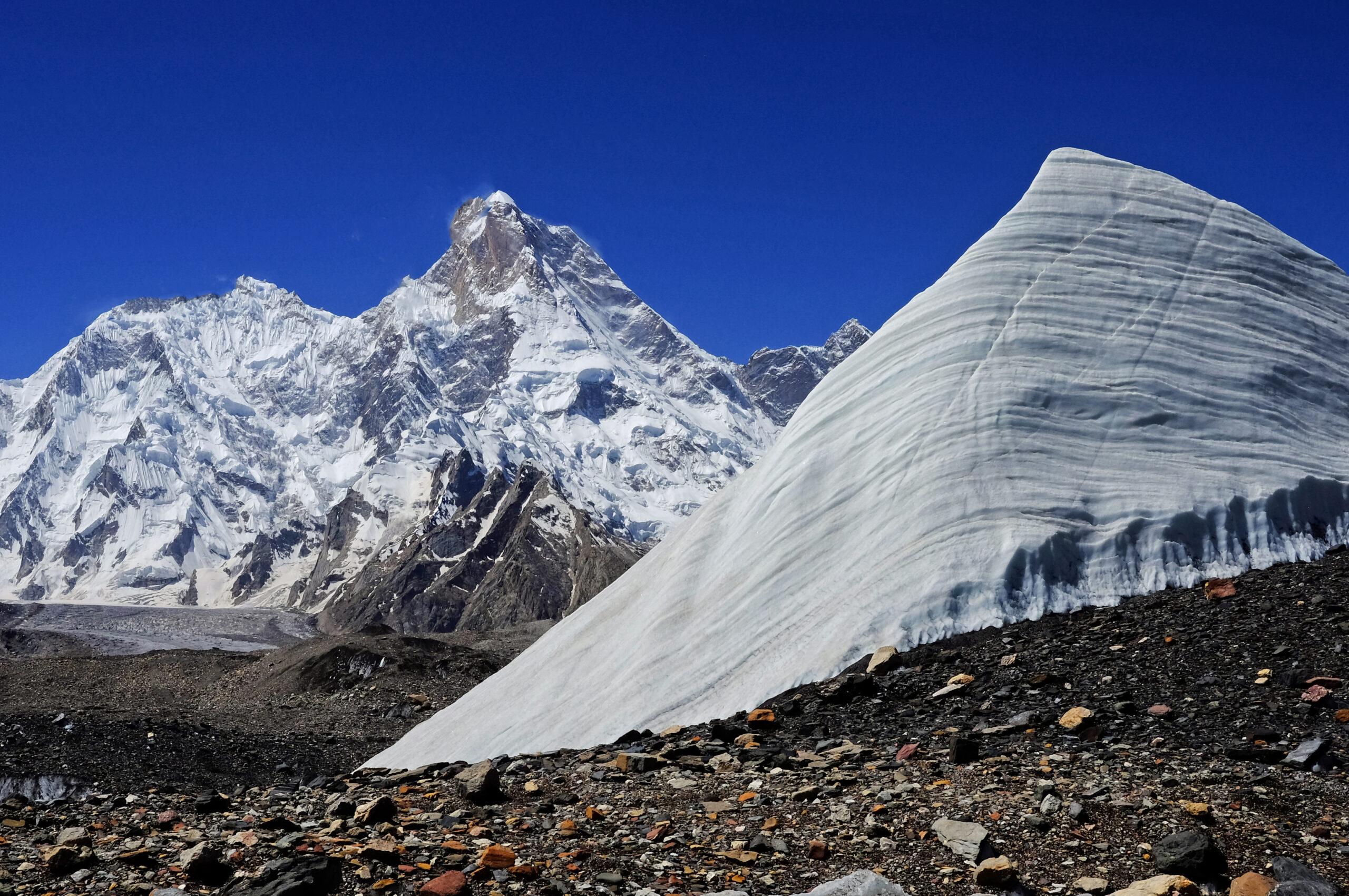
    How dangerous was the 2026 spring season?

    Season chroniclers recorded around five fatalities in spring 2026, with a sixth unconfirmed as the season closed, within a normal range for the mountain. Reported causes included a fall on the Lhotse Face and illness during descent. As on most 8000ers, the descent after the summit is the highest-risk phase.

    What is the current status of Everest?

    As of July the mountain is off-season under the monsoon, and the spring 2026 season has closed. The next window is a minor autumn season, then the main spring 2027 season. Check this page and the linked sources for the latest before planning.

    📋 How this update is built

    This page is compiled by Travis Ludlow, Founder and Head of Research at Global Summit Guide, from Nepal Department of Tourism figures, the Himalayan Database, and independent season reporting, with sources named below. It was reviewed for safety by Dawson Ludlow, our Climbing & Mountaineering Lead (Wilderness First Aid), whose highest first-hand summit is Kilimanjaro. Where our team has no first-hand experience of Everest, we report the cited records rather than personal anecdote, and we mark preliminary figures as preliminary.

    Sources and further reading

    • Nepal Department of Tourism, Mountaineering Section – climbing permits, royalty rates, and regulations.
    • The Himalayan Database – the definitive record of Everest ascents and fatalities, published after each season.
    • Kathmandu Post – reporting on the 2025 royalty revision and 2026 permit figures.
    • Alan Arnette – independent Everest season coverage and by-the-numbers analysis for 2026.
    • Sagarmatha Pollution Control Committee – Khumbu waste management and season operations.
    • We report published figures and named sources rather than posting unverified live conditions.

    Planning an Everest expedition?

    Choosing the right team is the biggest decision you will make. Read how to choose an expedition operator and compare teams in our operator directory. For flights and lodging around Kathmandu and Lukla, browse travel on Expedia.

    Disclosure: the Expedia link above is a sponsored affiliate link. We may earn a commission at no extra cost to you.

    Was this helpful?

    Yes
    No
    Thanks for your feedback!
  • Autumn Himalaya 2026 Preview: The Season, Peaks & Permits

    Ama Dablam, the iconic technical peak of the autumn Himalaya climbing season
    Climbing News · Season Preview · Autumn 2026

    Autumn Himalaya 2026 Preview: The Season, Peaks & Permits

    As the Karakoram season winds down, the Himalaya’s second act is coming into view. Post-monsoon autumn brings stable skies, quieter mountains, and a very different cast of peaks — Manaslu, Cho Oyu, Dhaulagiri, and the technical jewel Ama Dablam. Here’s what the autumn 2026 season looks like and how to plan for it.

    The season, in brief

    Post-monsoon Sept–Nov: Manaslu leads the 8000ers, Ama Dablam owns the technical scene.

    Autumn is Nepal’s second major season. The monsoon clears in late September, October delivers the most stable weather, and November turns cold and clear. Manaslu (8,163 m) is the autumn 8,000er of choice — now the season’s most popular expedition and a common Everest warm-up — while Ama Dablam (6,812 m) is the iconic November technical peak.

    Cho Oyu and Dhaulagiri round out the 8,000m options. Permits vary sharply by peak and a licensed guide is mandatory in Nepal — the full fee-by-peak detail is in our permits & fees guide.

    Sep–NovAutumn season
    8,163 mManaslu (lead 8000er)
    6,812 mAma Dablam (technical)
    OctoberMost stable weather
    2ndOf Nepal’s two seasons

    Autumn 2026 Season Snapshot

    As of Jul 17, 2026 · forward-looking · confirm permits before booking
    Lead 8000er

    Manaslu most popular; Everest prep

    Technical classic

    Ama Dablam November prime window

    Also in season

    Cho Oyu · Dhaulagiri serious 8000m options

    Rule

    Guide mandatory in Nepal since Apr 2023

    When the season runs

    Post-monsoon — the mirror image of spring.

    The autumn season opens as the summer monsoon retreats, usually in late September, and runs through November. October is the sweet spot: the air is washed clean, skies are stable, and the peaks are in good condition. By November the weather stays clear but turns colder with shorter days — perfect for technical peaks like Ama Dablam, tougher for the big 8,000ers as winter approaches. It’s Nepal’s second climbing season, and for several peaks it’s the best one.

    The peaks in play

    A different cast from the spring Everest circus.

    PeakHeightAutumn role
    Manaslu8,163 m (8th)The season’s headline 8,000er — most popular autumn expedition, common Everest prep
    Cho Oyu8,188 m (6th)Traditional autumn 8,000er, mostly from the Tibet side (access can vary year to year)
    Dhaulagiri8,167 m (7th)Serious, quieter, avalanche-exposed — a step up in commitment
    Ama Dablam6,812 mThe technical jewel — “the Matterhorn of the Himalaya,” prime in November

    Autumn Everest and Lhotse attempts do happen but are rare next to the spring season, when most of the commercial machine operates. If spring is about Everest, autumn is about Manaslu and Ama Dablam. See where these peaks rank in our 8,000ers ranked by difficulty and the full 14 eight-thousanders guide.

    Mount Manaslu, the 8,163 m eighth-highest peak and the headline 8000er of the autumn season
    The autumn 8,000er. Manaslu (8,163 m) has become the most popular autumn expedition peak, widely used as an Everest warm-up. Its accessibility relative to Everest and K2 — and an autumn permit far cheaper than Everest’s — make it the anchor of the post-monsoon season.

    Permits & costs

    Wildly different by peak — and a guide is mandatory.

    Autumn permit and cost planning is peak-specific. As a rough guide, expedition royalties run to roughly Cho Oyu ~$5,500, Manaslu ~$1,800, and Annapurna ~$3,600, with Everest at about $11,000 — all separate from guide, operator, and logistics costs. Since April 2023, Nepal has required a licensed local guide for foreign climbers, and major expedition peaks must be booked through registered operators.

    Full fee breakdown lives on the permits page. These are headline figures for orientation only. For the complete, peak-by-peak permit and fee detail — including trekking-peak permits, conservation fees, and the guide rules — see our mountaineering permits & fees guide. Confirm current rates with your operator before booking.

    What to watch in 2026

    Three storylines heading into the season.

    StorylineWhy it matters
    Manaslu crowdsAs the go-to Everest warm-up, Manaslu draws big autumn numbers — expect fixed-rope traffic and a busy Base Camp
    Cho Oyu accessCho Oyu is climbed mainly from Tibet; China-side access and permit conditions can shift year to year, so confirm early
    Ama Dablam volumeNovember’s technical classic keeps growing in popularity — book huts, permits, and guides well ahead
    This is a preview, not a live report. Published mid-July ahead of the season, this page previews what autumn 2026 is shaping up to be. Summit results, conditions, and any permit changes will firm up from September — we’ll refresh as the season opens. Always verify current permits, operator terms, and access with your operator before committing.

    Planning your autumn climb

    Book early, match the peak to your experience.

    Autumn’s popularity means the best operators, guides, and Ama Dablam permits go early — plan several months out. Match the objective honestly to your experience: Manaslu is an accessible-but-serious 8,000er and a logical Everest stepping stone; Ama Dablam is a genuine technical climb despite its lower height; Dhaulagiri is a step up in commitment and objective hazard. Whatever you choose, build the altitude and skills first.

    Planning a Nepal trip? Compare flights and lodging via the Global Summit Guide Expedia travel shop. Disclosure: affiliate link; we may earn a small commission at no extra cost to you. Permits and guides are booked directly with registered Nepali operators.

    Autumn Himalaya FAQ

    The questions people search heading into the autumn season.

    When is the autumn Himalaya season?

    Roughly September to November, after the monsoon. October brings the most stable weather; November is colder and clearer. It’s Nepal’s second major season and prime time for Manaslu and Ama Dablam.

    Which 8000ers are climbed in autumn?

    Mainly Manaslu (the headline peak), Cho Oyu, and Dhaulagiri. Autumn Everest attempts are rare compared with spring. See our 8,000ers ranked by difficulty.

    Why is Ama Dablam so popular in autumn?

    At 6,812 m it offers serious, exposed technical climbing without 8,000m altitude, with November its prime window and stable weather above the Everest trekking route. It’s the season’s iconic technical objective.

    How much do autumn permits cost?

    By peak: roughly Cho Oyu ~$5,500, Manaslu ~$1,800, Annapurna ~$3,600, Everest ~$11,000 — plus guide and logistics. Full detail in our permits & fees guide.

    Is autumn better than spring?

    Different. Spring is the main 8,000m and Everest season; autumn is more stable early, quieter, and ideal for Manaslu and Ama Dablam, but colder heading into winter.

    How we built this preview

    • The standard Himalayan season calendar (post-monsoon timing and weather patterns)
    • Nepal Department of Tourism permit structures and the April 2023 guide requirement
    • Operator reporting on autumn peak popularity and typical itineraries
    • Headline permit figures cross-checked against our permits & fees guide (detailed tables there)
    • Forward-looking preview — to be refreshed with conditions and results from September

    Last updated: July 17, 2026. Next update: season open (September 2026). A planning preview, not a live conditions report — verify permits and access with your operator.

    About the author

    Travis Ludlow · Founder & Head of Research · Research: Walker Ludlow

    Travis leads research at Global Summit Guide, tracking the world’s climbing seasons across the year. This autumn preview complements our live Karakoram summer dispatches — as one season closes, it points you toward the next.

    Read the editorial mission and team background.

    One season ends, the next begins

    As the Karakoram summer closes, the autumn Himalaya opens. Line up your peak, permit, and window now — and follow the season with us as it unfolds.

    Permits & Fees 8,000ers by Difficulty

    Was this helpful?

    Yes
    No
    Thanks for your feedback!
  • Karakoram Weather Window Explained: How Teams Time a Summit Push

    K2 wrapped in cloud in the Karakoram, where the summit window opens for only a few days each summer
    🇵🇰 Karakoram · Explainer · Summit Window

    Karakoram Weather Window Explained: How Teams Time a Summit Push

    On the 8,000ers of Pakistan, the whole season comes down to a handful of days. Here’s what opens that window, why it’s so short and unreliable, and how expedition teams read the sky to time a summit push on K2 and its neighbours.

    🌦️ The window, in brief

    Every Karakoram 8,000m season hinges on one thing: a short, unreliable weather window in late July. Two giant weather systems — the retreating monsoon and the migrating jet stream — briefly align to drop the wind and precipitation over the peaks. Statistically, nearly all K2 summits fall between about July 20 and August 10, and the true window is often just a few days inside that.

    Right now, in mid-July 2026, teams across K2, Broad Peak, and the Gasherbrums are doing exactly what this article describes: acclimatizing, pre-positioning, and watching the forecast. Follow the live picture in our K2 2026 tracker and Broad Peak & Gasherbrum dispatch.

    Jul 20–Aug 10
    Prime window
    ~−20 °C
    Summit temp (in window)
    39%
    Years with no K2 summits (’86–’16)
    1954
    First K2 summit (Jul 31)

    Why the window exists

    Two weather systems, one brief truce.

    The Karakoram sits further north and deeper inland than the Himalaya, which makes its climate more continental and more violent. For most of the year, the peaks are scoured by jet-stream winds — hurricane-force gusts that make the upper mountain unclimbable and drive off-season summit temperatures toward −60 °C. The season is defined by the brief period when those winds lift.

    Two systems govern it. First, the South Asian monsoon: through June and July, warm, moist air drives north, bringing rain low and heavy snow high. Then, near the end of July, the polar jet stream migrates north and the monsoon slides north with it toward the Tibetan highlands, while the subtropical jet shifts well south of the Karakoram. For a short spell, the peaks are left in relative calm — lower wind, less precipitation, and “manageable” cold around −20 °C on the summit. That truce is the window.

    When it opens

    The last two weeks of July, give or take.

    The best Karakoram climbing weather is typically the last two weeks of July, sometimes starting as early as mid-July and running into early August. It’s not a new discovery — the Italians made the first ascent of K2 on July 31, 1954, squarely inside it, and the pattern has held ever since. Statistically, nearly every K2 summit in history has landed between roughly July 20 and August 10.

    Early–mid JulyMonsoon still active — snow high, rain low. Teams trek in, acclimatize, and fix the lower route.
    ~July 20 onwardJet stream lifts, monsoon retreats. The prime window opens — a few stable days at a time.
    Into early AugustWindow can persist, but warming raises rockfall and instability. Later is riskier.

    Why it’s short & unreliable

    Two systems have to line up — and often don’t.

    Because the window depends on two large systems briefly aligning, it’s fragile. If the monsoon lingers or the jet stream dips back, the window slams shut. The numbers are sobering: between 1986 and 2016, 39% of years — 12 of 30 — produced no K2 summits at all because the weather never cooperated in the back half of July. A whole season of effort can end without a single summit.

    Why forecasts fail hereThe Karakoram is a forecaster’s nightmare: remote, high, and crowded with giant peaks that spin up local wind tunnels and microclimates — including the notorious localized “K2 cloud” that can trap climbers in the high camps. Global models struggle at this altitude and resolution, so forecasts several days out are frequently wrong. Teams buy specialist high-altitude forecasts and still treat any window as provisional until it actually arrives.
    Snow-plastered Karakoram peaks, where deep snow above the high camps must be broken before a summit push
    The trail-breaking problem. A window in the sky isn’t enough — someone still has to open the route. After heavy monsoon snow, rope-fixers must break trail through deep snow above the high camps before anyone can push to the top, which can eat the first day or two of a precious window.

    How teams time a push

    Acclimatize early, wait, then move fast.

    The choreography is remarkably consistent across the Karakoram’s big peaks:

    1 · AcclimatizeComplete rotations to the high camps early in the season, sleeping progressively higher to adapt — done before the window, not during it.
    2 · Pre-position & watchReturn to Base Camp, rest, and monitor multi-model forecasts, waiting for a stable multi-day window to appear.
    3 · Fix the routeRope-fixers break trail and fix lines through the upper mountain — the deep-snow section above the high camps is the crux of opening the route.
    4 · The pushWhen the window and the fixed route align, teams move fast to the high camps and launch a night-time summit bid, aiming to top out in the morning and descend before it closes.
    Who the window punishes mostAs on Everest, the climbers with the least margin are those going without supplemental oxygen. They benefit from fixed ropes and a broken trail, but they must move fast and avoid the traffic jams that form when everyone launches into the same narrow window — lingering high and cold without oxygen is how no-O2 attempts turn dangerous. It’s one reason the compressed, single-window nature of the Karakoram season carries real risk. See where these peaks rank in our 8,000ers ranked by difficulty.

    Live Karakoram conditions

    The window, in real time — watch it build or break.

    Here’s the concept in action. The 7-day outlook below is modelled data for the K2 region — a general indicator, not a summit-day forecast (teams pay for specialist high-altitude models before committing). Watch for a run of calm, dry days: that’s the shape of a window forming.

    K2 region (~Base Camp, Karakoram)

    Loading live data…
    Fetching the latest forecast…
    A general indicator only. This is modelled data near Base Camp altitude; the 8,000m summits are colder and far windier. The window is defined at the summit, not the valley — which is exactly why teams pay for specialist high-altitude forecasts.

    Reading the window yourself

    What experienced climbers actually watch.

    You don’t need to be a meteorologist, but you do need to know what matters. On the 8,000ers, the two variables that define a window are summit-altitude wind (ideally dropping below ~30–40 km/h) and precipitation (none, ideally, with settled snow). Temperature matters less than wind — it’s the wind that kills. Climbers cross-reference several models rather than trusting one, and treat a forecast more than three or four days out as a rough guide, not a promise.

    🧭 Go deeper

    Frequently asked questions

    When is the Karakoram summit window?

    Roughly the last two weeks of July into early August — statistically nearly all K2 summits fall between about July 20 and August 10, opened by the monsoon retreating and the jet stream migrating north.

    Why is the window so short?

    It depends on two big systems briefly aligning. When the monsoon slides north and the jet stream lifts off the peaks, wind and precipitation drop; when either shifts back, the window closes — often after just a few days.

    Why are forecasts unreliable?

    The Karakoram is remote, high, and full of giant peaks that create local wind tunnels and microclimates like the “K2 cloud.” Global models struggle at this resolution, so multi-day forecasts are often wrong. See mountain weather for climbers.

    How do climbers time a push?

    Acclimatize early, then wait at Base Camp for a stable multi-day window with the route fixed high, then move fast to the high camps for a night-time summit bid — topping out in the morning and descending before it closes.

    How cold is it in the window?

    Around −20 °C on the summit — harsh but survivable — versus about −60 °C off-season, when jet-stream winds make the peak unclimbable.

    About this explainer

    The mechanics here — the monsoon and jet-stream interaction, the late-July window, and the historical summit statistics — are drawn from meteorological analysis of Karakoram summer weather and long-run summit records, and are evergreen. The current-season notes and the live widget reflect conditions as they change; for the day-to-day picture, follow our season trackers.

    This is an educational overview, not operational guidance. Real summit-push decisions rely on specialist high-altitude forecasts and experienced judgment on the ground.

    Travis Ludlow

    Founder & Head of Research, Global Summit Guide

    Travis leads research at Global Summit Guide, where the team tracks the world’s major climbing seasons and maintains guides to more than 500 peaks. This explainer sits alongside our live Karakoram dispatches — the theory here, the day-to-day reality there.

    Watch the window with us

    The theory is here; the drama is on the mountain. Follow the 2026 Karakoram season as teams read the sky and time their push on K2 and its neighbours.

    Follow the K2 season → Broad Peak & Gasherbrum →

    Was this helpful?

    Yes
    No
    Thanks for your feedback!
  • Nanga Parbat 2026 Season Wrap: Summits, Records & Ski Descent

    Nanga Parbat in Pakistan, focus of the 2026 season wrap
    2026 season record · Pakistan · Diamir & Rupal · updated August 11

    Nanga Parbat 2026 Season Wrap: Who Summited & What Happened

    Nanga Parbat opened Pakistan’s 8,000-metre summer with a concentrated commercial summit wave, delivered a historic ski descent and a 14×8000 completion, then stayed active into August through an ambitious Rupal Face project.

    Major summit waves verifiedMilestones sourced separatelyCommercial + alpine season distinguishedUncertainty disclosed

    Published July 11, 2026 · Updated August 11, 2026 · By Travis Ludlow

    8,126 mNanga Parbat
    Jun 30First Major Summit Wave
    Jul 18K Summit Wave
    Jul 314×8000 Completion
    Jun 30Bargiel Ski Descent
    Aug 6Rupal Project Ends
    By Travis Ludlow · Global Summit Guide Research
    Season retrospective · not a live dispatch
    Why this page changed after July 11: the original wrap was published while confirmations were still arriving and before the late Rupal Face project had finished. This August 11 version treats the page as a retrospective 2026 season record, not an early-July live update.
    The direct answer

    What Defined Nanga Parbat’s 2026 Season?

    The commercial season was concentrated on the Kinshofer Route on the Diamir Face, with the key summit activity clustered around June 30 through July 3. The season included Pakistan’s first 8,000m summit wave of the summer, Andrzej Bargiel’s historic ski descent, Kili Pemba Sherpa’s completion of all fourteen 8,000ers, an oldest-woman summit record, and a later alpine-style Rupal Face attempt that continued into August.

    • Main commercial route: Kinshofer / Diamir Face.
    • Major summit period: June 30–July 3.
    • Historic ski event: Andrzej Bargiel summited June 30 and skied the mountain without supplemental oxygen.
    • 14×8000 milestone: Kili Pemba Sherpa completed all fourteen on July 3.
    • Season character: relatively quiet, warm and strongly shaped by heat, soft snow and route timing.
    The season in sequence

    Nanga Parbat 2026 Timeline

    The commercial Diamir season and the later Rupal alpine project were related by weather, but they were very different climbing operations.

    1

    Early June — a quieter Pakistan season takes shape

    Pakistan’s 8,000m summer was lighter than some recent years. Several large international outfitters had reduced or skipped Pakistan programs, while Seven Summit Treks, 8K Expeditions, Imagine Nepal and independent/alpine teams still fielded Nanga Parbat projects.

    2

    June — route fixing and heat become central

    Commercial teams worked the Diamir side and standard Kinshofer line. Warm conditions slowed progress at times and increased concern about soft snow, rockfall and lower-route timing.

    3

    June 30 — first major summit wave

    A Seven Summit Treks team reached 8,126m after seasonal rope-fixing work. The summit group included Tao Hu, Antonina Samoilova, Mindaugas Satkauskas, Abbas Ali Mehdi and Nepali guides, and was reported as Pakistan’s first 8,000m summit wave of the summer.

    4

    June 30 — Andrzej Bargiel skis Nanga Parbat

    Andrzej Bargiel summited with Janusz Golab and then descended the mountain on skis without supplemental oxygen. Reporting by Red Bull and ExplorersWeb described it as the first continuous ski descent of Nanga Parbat.

    5

    July 1 — 8K Expeditions summit wave

    8K Expeditions documented a large summit group that included Liliya Ianovskaia, Naoko Watanabe, Iryna Karagan, Saori Eragaki, Valentyn Sypavin, Pavlo Sydrenko, Danylo Yasnyuk, Muhammad Ali, Keizo Konishi and a team of Nepali high-altitude guides.

    6

    July 3 — Kili Pemba completes all 14 eight-thousanders

    Imagine Nepal reported Kili Pemba Sherpa on the summit with Lakpa Chhiri Sherpa and Wang Zhong. The ascent completed Kili Pemba’s set of all fourteen 8,000-metre peaks.

    7

    July–August — the Rupal project continues

    Marek Holecek and Tomas Petrecek pursued an alpine-style project on the Rupal Face after the main commercial summit wave. Warmth, rain, avalanches, meltwater and rock movement repeatedly complicated the line.

    8

    August 6 — Rupal project ends

    The pair’s annual project ended without a new route. This matters because it shows the 2026 Nanga Parbat season did not truly end when the Diamir commercial teams began leaving in early July.

    Documented summit waves

    Who Summited Nanga Parbat in 2026?

    The strongest public record is operator-by-operator rather than one centralized official final list.

    Date / waveOperator / projectDocumented climbersWhy it mattered
    June 30Seven Summit Treks / KinshoferTao Hu, Antonina Samoilova, Mindaugas Satkauskas, Abbas Ali Mehdi, Dawa Sherpa, Dendi Sherpa, Lakpa Temba SherpaReported as Pakistan’s first 8,000m summit wave of the 2026 summer
    June 30Andrzej Bargiel projectAndrzej Bargiel, summit with Janusz GolabSummit followed by historic continuous ski descent; no supplemental oxygen
    July 18K ExpeditionsLiliya Ianovskaia, Naoko Watanabe, Iryna Karagan, Saori Eragaki, Valentyn Sypavin, Pavlo Sydrenko, Danylo Yasnyuk, Muhammad Ali, Keizo Konishi and Nepali guidesLarge multinational commercial summit wave; included oldest-woman record claim
    July 3Imagine NepalKili Pemba Sherpa, Lakpa Chhiri Sherpa, Wang ZhongKili Pemba completed all fourteen 8,000m peaks

    This table intentionally does not claim to be the official final person-by-person total for the season. Operator posts, expedition dispatches and specialist reporting document the major summit waves well, but there is no single centralized public record that resolves every duplicate, spelling variant, guide role and late confirmation in one place.

    That distinction makes the page more useful, not less. Readers can see the best-documented summit events without Global Summit Guide pretending that a provisional tally is an audited registry.

    Diamir Face of Nanga Parbat, setting for the 2026 commercial season and ski descent
    June 30 · one of the season’s defining stories

    Andrzej Bargiel Summited — Then Skied Nanga Parbat.

    The ski descent turned an already important summit day into one of the defining mountaineering stories of Pakistan’s 2026 summer.

    A different style from the commercial wave

    Why Bargiel’s Descent Belongs in the Season Record

    The achievement was not simply another summit on the Kinshofer traffic calendar.

    Andrzej Bargiel reached Nanga Parbat’s summit on June 30 with Janusz Golab and then descended the mountain on skis without supplemental oxygen. Red Bull described the descent as the first fully continuous ski line recorded on Nanga Parbat, while ExplorersWeb also reported the complete ski descent.

    The significance is partly stylistic. A commercial summit wave depends on fixed lines, team logistics and shared infrastructure; a high-altitude ski project must also solve snow quality, continuity, route transitions and descent timing. The same warm season that complicated climbing conditions could create both opportunities and hazards for a skier depending on aspect and hour.

    Do not let the ski story displace the route context.

    Use the Nanga Parbat route comparison and Nanga Parbat routes guide to understand how Diamir, Rupal and historic lines differ. This page owns the 2026 event record, not the technical route encyclopedia.

    Beyond the summit count

    Records and Milestones from 2026

    The season produced several achievements that matter independently of the raw number of successful climbers.

    14×8000

    Kili Pemba Sherpa

    Imagine Nepal reported Kili Pemba Sherpa on Nanga Parbat’s summit July 3 with Lakpa Chhiri Sherpa and Wang Zhong, completing all fourteen 8,000-metre peaks.

    Women’s age record

    Liliya Ianovskaia

    8K Expeditions and specialist reporting identified Ianovskaia as the oldest woman to summit Nanga Parbat during the July 1 wave. Sources differ on the exact age published, so this page preserves the record claim without forcing a disputed number.

    Ski mountaineering

    Andrzej Bargiel

    A no-supplemental-oxygen summit followed by a full ski descent added a major ski-mountaineering milestone to what otherwise might have been remembered mainly as a short commercial summit window.

    Climber preparing beneath Nanga Parbat during a high-altitude expedition
    Nanga Parbat’s commercial season is short, but the mountain can remain active after the main summit wave through independent, alpine-style and technical projects.
    The recurring 2026 theme

    Warm Conditions Changed the Character of the Season

    Heat showed up differently on the Diamir commercial route and the Rupal alpine project.

    Season signalDiamir / Kinshofer implicationRupal implication
    Warm temperaturesSoftening snow and greater attention to early movement on the lower mountainRain, meltwater and thawing rock/ice systems complicated a new-route project
    Rockfall / instabilityLower-route timing became more important as the day warmedRock movement added to avalanche and water hazards on steep terrain
    Short usable windowsCommercial teams concentrated summit activity into a small number of daysAlpine climbers needed a much longer stable sequence to commit to a major face
    Route styleFixed-line Kinshofer climbing allowed multiple teams to use the same openingNew-route climbing had no equivalent commercial infrastructure buffer

    For the evergreen climate and seasonal-planning question, move into the underlinked Nanga Parbat Weather guide. That page should own normal summer patterns, monsoon-edge uncertainty, temperature and forecast planning. This page should remain anchored to what actually happened in 2026.

    The commercial season was not the whole season

    The Rupal Face Project Continued into August

    This is the most important update missing from the original July 11 wrap.

    Marek Holecek and Tomas Petrecek established a separate alpine-style project on Nanga Parbat’s Rupal Face after the main Diamir summit wave. Their objective belonged to a different category from commercial Kinshofer climbing: a new-line problem on one of the world’s largest mountain faces.

    As the project developed, warm weather and unusual rain became major obstacles. Reporting described repeated avalanches, meltwater and rock movement. The conditions made it increasingly difficult to justify a committing push into terrain where retreat options could shrink rapidly.

    By August 6 the project had ended without a new route. That changes the season summary in an important way: the commercial Diamir season largely wound down in early July, but meaningful alpine activity on Nanga Parbat continued into August.

    Commercial season ≠ mountain season.

    That distinction is worth preserving on future season-wrap pages. A commercial summit list can be mostly settled while alpine-style, ski or new-route projects are still active elsewhere on the mountain.

    What carries forward

    What the 2026 Season Means for 2027 Planning

    A retrospective is most useful when it improves the next decision instead of merely listing names.

    Timing

    Early movement matters more in warm cycles

    Soft snow, rockfall and thaw-related instability can make predawn movement and conservative turnaround discipline increasingly important on lower exposed terrain.

    Route choice

    Diamir and Rupal are different sports

    The Kinshofer line can support coordinated commercial climbing; a Rupal new-route project requires a much larger stable-weather commitment and far fewer infrastructure assumptions.

    Operator system

    Rope fixing remains central to the commercial window

    The 2026 summit wave followed coordinated fixing and camp establishment. Climbers comparing 2027 companies should ask who fixes, who supports high camps and how the operator handles a short weather window.

    Training

    A short window punishes slow recovery

    A climber who needs too long to recover after rotations can miss the only viable summit period. The training target is not simply strength; it is repeatable high-altitude work and recovery.

    Forecasting

    Base Camp warmth is not a summit forecast

    The lower mountain and high mountain can respond differently. Teams need wind, snow and temperature information at the elevations that determine the summit decision.

    Decision discipline

    No summit is a normal outcome

    Nanga Parbat’s history and 2026 conditions reinforce the need to treat retreat as a legitimate expedition result when snow, heat, avalanche or timing removes the margin.

    Parent-child architecture

    The Nanga Parbat Planning Library

    This season-wrap URL owns the 2026 retrospective. The surrounding cluster owns evergreen planning questions.

    Parent guide

    Nanga Parbat Climb Guide

    Evergreen planning for the Killer Mountain: history, main routes, difficulty, access and expedition structure.

    Open guide →
    Orphan #1

    Nanga Parbat Operators

    A hard-orphan commercial child in the earlier audit. Compare expedition companies, support models and Pakistan logistics.

    Open guide →
    Orphan #2

    Nanga Parbat Weather

    The underlinked evergreen weather child: monsoon edge, summer heat, snow loading and timing by season.

    Open guide →
    Route comparison

    Nanga Parbat Route Comparison

    Diamir/Kinshofer vs Rupal vs Rakhiot: different hazards, styles and expedition systems.

    Open guide →
    Route atlas

    Nanga Parbat Routes

    Detailed Kinshofer, Rupal and historic route architecture.

    Open guide →
    Permits & logistics

    Nanga Parbat Permits & Logistics

    Pakistan permit, local operator and approach planning without mixing the season-wrap intent.

    Open guide →
    Difficulty

    Nanga Parbat Difficulty & Safety

    Objective hazards, Kinshofer Wall, descent risk and responsible readiness.

    Open guide →
    Equipment

    Nanga Parbat Gear List

    8,000m clothing, boots, technical kit, oxygen compatibility and redundancy.

    Open guide →
    Training

    Nanga Parbat Training Plan

    Prepare for long rotations, fixed lines, steep terrain, recovery and the compressed summit window.

    Open guide →
    Outcome data

    Nanga Parbat Summit Success Rate

    Understand modern and historical success before comparing a single season with the long record.

    Open guide →
    Risk data

    Nanga Parbat Death Rate

    Separate historical death-to-summit ratios from individual per-attempt risk.

    Open guide →
    8,000m collection

    All 14 Eight-Thousanders

    Place the 2026 Nanga Parbat milestones inside the wider 8,000m landscape.

    Open guide →
    Search-intent coverage

    Nanga Parbat 2026 Season FAQ

    These answers separate confirmed season events from the broader evergreen mountain guide.

    Who summited Nanga Parbat in 2026?

    Multiple teams reached the summit during the main commercial wave around June 30 to July 3. Documented summiters included climbers and guides from Seven Summit Treks, 8K Expeditions and Imagine Nepal. Because there is no single official centralized person-by-person season register, this page separates well-documented summit waves and milestone ascents from any claim of a final exhaustive total.

    What was the main Nanga Parbat route in 2026?

    Commercial teams primarily used the Kinshofer Route on the Diamir Face, the standard modern line on the western side of the mountain. The season also included a separate alpine-style project on the Rupal Face, which continued into August but ended without a new route.

    When were the main Nanga Parbat summits in 2026?

    The principal commercial summit activity clustered around June 30 through July 3. Seven Summit Treks reported Pakistan’s first 8,000-metre summit wave of the summer, 8K Expeditions documented a July 1 summit group, and Imagine Nepal’s Kili Pemba Sherpa, Lakpa Chhiri Sherpa and Wang Zhong summited on July 3.

    Did Andrzej Bargiel ski Nanga Parbat in 2026?

    Yes. On June 30, 2026, Andrzej Bargiel summited Nanga Parbat with Janusz Golab and then skied down the mountain without supplemental oxygen. Red Bull and ExplorersWeb described the descent as the first continuous ski descent of Nanga Parbat.

    Who completed all 14 eight-thousanders on Nanga Parbat in 2026?

    Kili Pemba Sherpa of Imagine Nepal reached Nanga Parbat’s summit on July 3, 2026, with Lakpa Chhiri Sherpa and Wang Zhong, completing all fourteen 8,000-metre peaks.

    Was there a Rupal Face attempt in 2026?

    Yes. Marek Holecek and Tomas Petrecek established an alpine-style project on the Rupal Face after the main commercial Diamir summit wave. Warm temperatures, rain, avalanches, meltwater and rock movement complicated the attempt, and the project ended in early August without a new route.

    What did the 2026 season reveal about Nanga Parbat conditions?

    Warm conditions were a recurring theme. Commercial teams on the Diamir side dealt with softening snow and increased lower-route instability, while the Rupal project later reported rain, avalanches, meltwater and rock movement. The season reinforced how strongly timing, route choice and early movement affect Nanga Parbat.

    Is this page the main Nanga Parbat climbing guide?

    No. This URL is the retrospective record of the 2026 season. The Nanga Parbat parent page owns evergreen route, history, difficulty and expedition planning; separate children cover weather, operators, permits, routes, training, gear and safety.

    Source hierarchy and uncertainty

    Methodology and Known Limits

    A season wrap needs stricter event verification than an evergreen mountain guide.

    How We Verified 2026

    • Operator summit announcements for commercial summit waves.
    • Imagine Nepal’s dated July 3 record for Kili Pemba Sherpa.
    • 8K Expeditions’ July 1 summit list and record announcement.
    • Specialist climbing reporting and Red Bull project reporting for Andrzej Bargiel.
    • Specialist climbing reporting for the late Rupal Face project.

    What Remains Imperfect

    • No single official centralized final person-by-person summit registry was located.
    • Operator spellings and guide-role labels can vary between reports.
    • Sources differ on Liliya Ianovskaia’s exact age, so we preserve the oldest-woman record claim without asserting one disputed number.
    • Weather descriptions are qualitative unless tied to a specific forecast archive.
    • Commercial season closure and all-mountain season closure occurred at different times.
    Confidence: high for the major summit waves, Bargiel’s ski descent, Kili Pemba’s 14×8000 completion and the existence/outcome of the Rupal project; medium for any claim of a complete final season-wide summit count because no single audited centralized list was found.
    The 2026 season was short—but not simple

    A Concentrated Diamir Summit Wave, a Historic Ski Descent, and a Rupal Project That Lasted into August.

    Use the season wrap as the historical record, then move into the Nanga Parbat parent, weather, route and operator pages for 2027 planning.

    Was this helpful?

    Yes
    No
    Thanks for your feedback!
  • Broad Peak & Gasherbrum: First Summit Pushes of the Karakoram Season

    Broad Peak, the 12th-highest mountain in the world, in Pakistan's Karakoram
    🇵🇰 Karakoram · Season Dispatch · 2026

    Broad Peak & Gasherbrum: First Summit Pushes of the Karakoram Season

    Before K2 takes the spotlight, its neighbours go first. Three of the Baltoro’s 8,000ers — Broad Peak, Gasherbrum I, and Gasherbrum II — are where the 2026 Karakoram season opens. Here’s who’s on the mountains, where the ropes are, and when the first summits are likely.

    Where things stand · Jul 11, 2026

    The 2026 Karakoram season is opening on Broad Peak and the Gasherbrums — quietly. It’s a lighter summer than usual in Pakistan, but teams are in position. On Broad Peak, rope-fixing had pushed high on the standard route and a first summit push was poised, only to be postponed by strong wind and fresh snow while teams wait for a cleaner window.

    On the Gasherbrums, commercial and alpine teams have been establishing at base camp after the long Baltoro trek, with a notable number of climbers going without supplemental oxygen. No confirmed 8,000m summits yet — the first of the season would be expected with the next stable weather window, typically mid-to-late July. Meanwhile the Nanga Parbat season over on the Diamir side has been wrapping up.

    This is a live dispatch. Karakoram conditions change by the day; we refresh it as the pushes develop.

    📌 This is the live dispatch — the deep guides are one click awayThis page tracks the 2026 season. For routes, difficulty, cost, and planning on each peak, go straight to the full guides: Broad Peak, Gasherbrum I, and Gasherbrum II — and see where all three sit in our 8,000ers ranked by difficulty.
    8,080 m
    Gasherbrum I (11th)
    8,051 m
    Broad Peak (12th)
    8,035 m
    Gasherbrum II (13th)
    Jul–Aug
    Summit window

    Where they are

    Four of the world’s fourteen 8,000ers, clustered around one glacial junction.

    Broad Peak, Gasherbrum I, Gasherbrum II, and K2 all sit within about 20 km of Concordia, the confluence of the Baltoro and Godwin-Austen glaciers — one of the greatest concentrations of high peaks on Earth. Climbers reach them the same way: fly to Skardu, drive to Askole, then trek roughly a week up the Baltoro. Broad Peak’s base camp sits on the Godwin-Austen Glacier near K2’s; the Gasherbrums share a base camp further up the South Gasherbrum Glacier.

    Broad Peak: 8,051 m Gasherbrum I & II: 8,080 / 8,035 m K2: 8,611 m (nearby) Concordia: Baltoro junction

    Broad Peak: first to move

    The 12th-highest mountain — and often the season’s opening act.

    At 8,051 m, Broad Peak is the 12th-highest mountain in the world, standing about 8 km from K2. First climbed in June 1957 by an Austrian team — Marcus Schmuck, Fritz Wintersteller, Kurt Diemberger, and the legendary Hermann Buhl, who died on nearby Chogolisa days later — it’s long been considered one of the more approachable 8,000ers. That reputation comes with an asterisk: its summit is reached via a long, deceptive ridge with a notorious false summit that repeatedly turns climbers back short of the true top.

    In 2026, Broad Peak has been the pace-setter. Rope-fixing pushed high on the standard route, and a first summit push was ready to go before wind and fresh snow forced a postponement. It’s the familiar Karakoram waiting game — everything set, held back by the sky.

    Full Broad Peak guideRoutes, camps, cost, permits, and the false-summit trap are covered in depth in our complete Broad Peak climb guide.
    The Gasherbrum group in Pakistan's Karakoram range
    The Gasherbrum group. “Gasherbrum” comes from the Balti rgasha brum — “beautiful mountain.” Two of the massif’s peaks are 8,000ers: Gasherbrum I (the Hidden Peak) and Gasherbrum II, both climbed from a shared base camp up the South Gasherbrum Glacier.

    The Gasherbrums: I & II

    Two 8,000ers, one massif — and very different climbs.

    The Gasherbrum massif holds two of the fourteen 8,000ers, and they’re often confused despite being quite different objectives:

    PeakHeight / rankCharacterFirst ascent
    Gasherbrum I (Hidden Peak)8,080 m · 11thSteeper, more technical; Japanese Couloir from Gasherbrum La1958 (American)
    Gasherbrum II8,035 m · 13thOne of the most accessible 8,000ers; a common first eight-thousander1956 (Austrian)

    In 2026, the Gasherbrums have drawn both commercial groups and elite alpinists. Teams have been establishing at base camp for standard-route attempts, while small alpine parties eye harder objectives on the massif. As on Broad Peak, the first summits hinge entirely on the next weather window.

    🏔️ Go deeper on the Gasherbrums

    Why they share one window

    Same glacier, same weather, same waiting game as K2.

    These peaks don’t just sit next to each other — they run on the same clock. The Karakoram summer offers shorter, less reliable weather windows than Nepal’s Himalaya, so teams across Broad Peak, the Gasherbrums, and K2 all watch the same forecasts and often move within days of one another. Typically the sequence runs Gasherbrum II and Broad Peak first, Gasherbrum I alongside, and K2 last, in its late-July to early-August window.

    That’s also why many climbers pair these peaks with bigger goals: Gasherbrum II and Broad Peak are common stepping stones toward K2. You can follow the top of that pyramid in our 2026 K2 season tracker — the companion to this dispatch — and see the season’s other Pakistan giant in our Nanga Parbat guide.

    Where they rank

    Accessible by 8,000er standards — but never easy.

    It’s tempting to file Broad Peak and Gasherbrum II under “easier 8,000ers,” and by standard-route difficulty they are among the more approachable of the fourteen — well below K2, Annapurna, or Nanga Parbat. But “accessible 8,000er” still means extreme altitude, real objective hazard, and Karakoram weather. Gasherbrum I sits a clear notch harder than GII, and Broad Peak’s false summit has ended more attempts than its grade suggests.

    We don’t re-rank them here — that’s the pillar’s job. For the full hardest-to-easiest picture, with fatality rates and technical grades:

    📊 See the full ranking

    Live Karakoram conditions

    The forecast is the story — these summits wait on the window.

    Every summit push on this page depends on one thing: a stable weather window. The 7-day outlook below is modelled data for the Concordia / Baltoro region — a general indicator, not a summit-day forecast (expedition teams buy specialist high-altitude forecasts before committing). It’s a useful read on whether the next window is building or breaking down.

    Karakoram summit region (~Concordia / Baltoro)

    Loading live data…
    Fetching the latest forecast…
    A general indicator only. This is modelled data near glacier/base-camp altitude — the 8,000m summits are colder and far windier. Teams launch only when a multi-day window of light wind lines up with the route being fixed to the top.

    Frequently asked questions

    Has anyone summited Broad Peak or Gasherbrum in 2026 yet?

    Not as of this update (July 11, 2026). Broad Peak was fixed high with a first push poised but weather-delayed; Gasherbrum teams were still establishing at base camp. The season’s first summits usually come mid-to-late July with the first stable window. We refresh this dispatch as pushes develop.

    When are these peaks climbed?

    In the Karakoram summer only — roughly June through August, with most summits in July and August. Gasherbrum II often sees the season’s first 8,000m summits, followed by Broad Peak and Gasherbrum I, with K2 last.

    Which is easiest — Broad Peak, GI or GII?

    Gasherbrum II is one of the most accessible 8,000ers and a common first eight-thousander. Broad Peak is approachable but has a deceptive false summit. Gasherbrum I is meaningfully steeper and more technical. See our 8,000ers ranked by difficulty.

    How do they relate to K2’s season?

    They share the same Baltoro region, weather, and summer window as K2, and many climbers use Broad Peak or GII to build Karakoram experience before K2. First summits here usually precede K2’s late-July window — follow it in our K2 2026 tracker.

    Are Broad Peak and GII good first 8000ers?

    GII is one of the more common first eight-thousanders, and Broad Peak is often a K2-region acclimatizer. Both are serious expeditions with real hazards, but their moderate grade makes them a genuine step into 8,000m climbing.

    How we track this

    This dispatch is compiled from expedition dispatches, operator updates, and specialist mountaineering coverage (including ExplorersWeb), cross-checked against the standard Karakoram climbing calendar. Fast-moving details — rope-fixing progress, summit pushes, casualties — are reported cautiously and dated, because early base-camp information is often incomplete and evolves.

    Conditions change daily during the season. For the current state of any climb, follow the operators directly; for routes, cost, and planning, our full mountain guides are the authoritative reference.

    Travis Ludlow

    Founder & Head of Research, Global Summit Guide

    Travis leads research at Global Summit Guide, where the team tracks the world’s major climbing seasons and maintains guides to more than 500 peaks. This Karakoram dispatch is updated through the summer; for full route, cost, and difficulty detail, we always point you to the individual mountain guides.

    The Karakoram season is just getting started

    Broad Peak and the Gasherbrums open the summer; K2 closes it. See where these giants rank among the world’s highest, then follow the whole season as it unfolds.

    8,000ers by difficulty → Follow the K2 season →

    Was this helpful?

    Yes
    No
    Thanks for your feedback!
Language »