
Last updated September 12, 2026
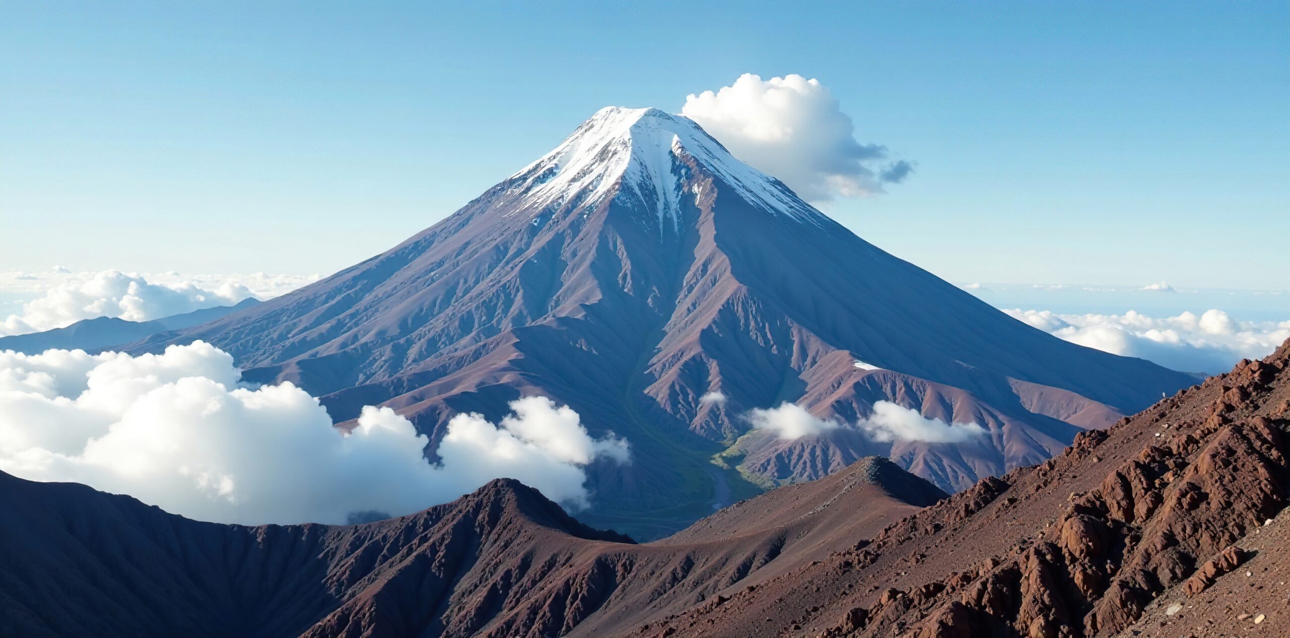
Climbing Ojos del Salado 2026: The World’s Highest Volcano, the Atacama-Tejos Route & the Andes’ Second Summit
Ojos del Salado is a high-altitude expedition disguised as an accessible volcano. The Chilean Normal Route is mostly walking, scree and snow, but the summit sits at 6,893 m, the final rocks require real rope competence, and 4×4 access can move climbers upward much faster than their bodies can acclimatize. A strong plan uses the road to save energy—not to skip altitude adaptation.
Ojos del Salado Is Technically Modest—and Physiologically Serious.
The standard Chilean ascent is not a sustained technical climb like an alpine face. Most of the mountain is a long, cold ascent on volcanic terrain with variable snow. Near the top, climbers encounter a short rock section that may be protected with fixed rope. At almost 6,900 meters, easy moves can feel difficult simply because the air is so thin.
The unusual part is access. Chile’s official tourism site describes a 240 km approach from Copiapó on Route 31-CH, requiring a robust 4×4 and careful acclimatization. Once on the high plateau, expeditions can continue very high by vehicle when the road is open. That reduces load carrying, but it creates the central planning problem: your vehicle can acclimatize faster than you can.
For most climbers, the best version of Ojos is not the shortest itinerary. It is the itinerary that spends enough nights between roughly 3,700 and 5,300 m, includes one or two acclimatization climbs, rotates to Tejos before sleeping there, and keeps a weather day for the summit.
The Route Is an Altitude Staircase Across the Atacama.
The summit is only the final step. The expedition begins hundreds of kilometers earlier, where the road starts climbing from Copiapó into the puna.
Copiapó to the High Plateau
Chile Travel gives roughly 240 km from Copiapó to the Ojos area via Route 31-CH, generally four to five hours before expedition detours and staging. The road crosses remote high-desert terrain where fuel, mechanical self-sufficiency and 4×4 capability matter.
Do not treat this as a normal highway transfer.Laguna Santa Rosa & Laguna Verde
These lower high-altitude camps are where a good expedition starts to slow down. Santa Rosa sits around 3,760 m; Laguna Verde around 4,300–4,340 m. The goal is not to rush toward Ojos, but to give the body nights at progressively higher sleeping elevations.
These nights are part of the climb.Atacama & Tejos
Atacama Refuge sits around 5,200–5,300 m. Tejos is commonly listed around 5,800–5,850 m. Road conditions can determine how high vehicles can reach. Strong programs often hike to Tejos and descend before later moving up to sleep.
A rotation is more valuable than a shortcut.Choose the Acclimatization Profile Before You Choose the Price.
Short itineraries can be legitimate for already-acclimatized climbers. They are not a substitute for acclimatization for someone arriving from low elevation.
Standard profile: build the mountain before the summit.
Use Santa Rosa and Laguna Verde for sleeping altitude, climb Mulas Muertas or a similar 5,000 m peak, make a major acclimatization ascent such as San Francisco, move to Atacama, rotate to Tejos, rest, then make the summit attempt with a reserve day. This resembles the logic used by longer international programs.
Ten days can work—but it must still contain progression.
A typical ten-day structure from a local operator still uses Laguna Santa Rosa, a 4,800 m outing, Laguna Verde, a major 6,000 m acclimatization climb, then Ojos. The schedule gets compressed by efficient 4×4 logistics, not by pretending acclimatization is optional.
For a climber arriving from sea level with no recent altitude exposure, the 10-day plan is much less forgiving than a 12–15 day program.
Sleeping elevation rises gradually.
Driving high for a day is not the same as sleeping high. Look for a program that gives the body multiple nights at progressively higher camps.
At least one real acclimatization peak.
Mulas Muertas, San Francisco or another high outing adds useful exposure before Ojos. A schedule made entirely of vehicle transfers is a warning sign.
Tejos is rotated before it is slept.
Hike high, descend, recover, then return. This is one of the most useful ways to convert easy road access into a sensible altitude plan.
There is a spare summit day.
Ojos is a wind mountain. If the itinerary has no weather reserve, the schedule can start making the decision instead of the conditions.
The Crux Is Not One Rock Step. It Is the Whole 6,893-Meter System.
Andeshandbook describes the Normal Route as a clear walking route overall, but its community difficulty ratings show physical demand far above technical demand.
What “non-technical” actually means here
It means the standard route is not defined by sustained difficult climbing. It does not mean a fit trekker should arrive without mountain systems, cold-weather competence, crampon familiarity when snow is present, or the ability to use the rope setup chosen by the guide at the summit rocks.
The final summit section is often described as a short rock climb or scramble, commonly protected by fixed rope. Its technical grade is modest; the altitude is not.
For context, Andeshandbook’s current community ratings put physical difficulty around 5.4/7 and technical difficulty around 2.7/7.
Tejos to the Crater: A Thousand Vertical Meters at Extreme Altitude.
Exact timing varies enormously with acclimatization, snow, wind, where the vehicle stops and team speed. Treat published times as planning ranges, not promises.
Leave the Tejos high-camp zone
Teams usually start in darkness. Wind, surface snow, route condition and the exact vehicle/hut position can change the first hour. Cold management starts before anyone begins moving.
Scree, volcanic benches and snow patches
The route trends upward across broad volcanic terrain. Under dry conditions it can feel like a high trekking ascent; after snow, crampons and an ice axe may become much more central to the day.
The mountain becomes sharper
Near the crater, the terrain narrows and the summit rocks become the focus. Fatigue and altitude slow transitions, rope management and simple decisions.
Short rock climbing at almost 6,900 m
Andeshandbook specifically warns climbers to be cautious with fixed ropes on the final rock section. Guide teams may use a fixed line, belay or other protection depending on conditions and the group.
Summit—then the descent still counts
Ojos has closely spaced summit points on the international border. The descent reverses the rock step and the long high-altitude terrain. A summit photo is the midpoint of the operational day, not the end.
DIFROL Is Based on Where You Live, Not Your Passport.
This is one of the most frequently oversimplified Ojos permit rules.
Domiciled outside Chile
DIFROL states that all people domiciled abroad—Chileans or foreigners—who want to conduct mountaineering expeditions in Chilean border zones require DIFROL authorization.
The key test is domicile, not nationality.
Use DIFROL’s “cumbres frecuentes” expedition process.Permits + accredited guide
Chile Travel’s January 2026 Ojos page says the ascent requires permits and that an accredited guide is fundamental. Its March 2026 Seismiles guidance likewise says Ojos demands permits, an accredited guide and excellent physical preparation.
Do not rely on older blog posts saying simply “no permit.”
Have the operator confirm the complete current package.| Item | What is current | What to verify before departure |
|---|---|---|
| DIFROL border authorization | Required for people domiciled outside Chile planning mountaineering in the Chilean border zone. | Application status, group details, dates, peak and documents. |
| Guide requirement | Chile Travel’s current visitor guidance says an accredited guide is required/fundamental for the Ojos ascent. | Guide accreditation, guide-to-client ratio and who handles paperwork. |
| Local / protected-area access | The approach travels through Nevado de Tres Cruces National Park and the Ruta de los Seismiles high-altitude corridor. | Current CONAF access, road status, any local fees or registrations and camping rules. |
| 4×4 access | Official tourism guidance calls a robust 4×4 indispensable. | Road condition, snow, recovery gear, fuel range and backup vehicle plan. |
The Best Window Is the Austral Summer—but Wind Still Runs the Schedule.
Chile Travel’s current Seismiles material recommends November through March. Andeshandbook’s route activity also shows normal-route climbing concentrated in the warm season, with winter ascents being specialist undertakings.
Increasing daylight and warming temperatures. More snow or road uncertainty can linger high.
The deepest commercial schedule. Still expect hard wind and severe summit cold.
Viable with shortening days and colder trends. Operators begin closing schedules.
Extreme cold and more serious road/snow logistics. A June 2026 new-route report described roughly -40°C conditions.
Wind is often the decision.
The Atacama’s aridity can mislead climbers into thinking weather is simple. High wind can make movement, balance, exposed rock and frostbite management much harder even under clear skies.
Upper conditions can change the equipment.
2025 and 2026 route reports include both dry/fast conditions and snow-covered ascents. Crampon and ice-axe decisions belong to the conditions actually found, not to the mountain’s desert reputation.
What Climbers Actually Reported This Year
These are dated observations, not permanent route facts. The normal route can look very different after the next storm.
Normal-route summit
Andeshandbook records a successful normal-route summit with little wind and cold conditions. It is evidence of a good February window, not a promise that February is always calm.
Snowy late-season summit
A summit report described the mountain as heavily snow-covered, with little wind and cold conditions, effectively closing that climber’s season.
New winter NE route
A reported first ascent of a northeast line to the Argentine summit described approximately -40°C cold with relatively little wind. This is specialist winter alpinism, not normal commercial-season conditions.
Ojos Costs Anywhere From Lean Local Logistics to Premium International Support.
Price makes sense only after you normalize the number of days, acclimatization peaks, guide ratio, vehicle support, hotels and reserve days.
| Published program | Length | Current listed price | What stands out |
|---|---|---|---|
| High Mountain Chile | 14 days | US$3,650 on multiple 2026/27 dates | Regional operator; long itinerary at a comparatively low published price. |
| Andes Specialists | 14 days | US$3,980 confirmed-group price | December 2026 / 2027 departures; customizable service structure. |
| Adventure Consultants | 15 days | US$7,990 listed for Feb–Mar 2027 | Long staged acclimatization including Mulas Muertas and San Francisco. |
| Madison Mountaineering | 12 days | US$9,850 for Dec 2026 | Premium international package with hotel, 4×4 and full expedition logistics. |
Acclimatization days
A $3,400 nine-day program and a $3,650 fourteen-day program are not the same product. The extra days may be more valuable than a hotel upgrade.
Vehicle system
Ask how many climbers share each 4×4, what recovery equipment is carried, whether there is redundancy and where the team expects vehicles to reach.
Summit contingency
A program without a reserve day can be cheap because it transfers weather risk back to you. Compare the number of genuine summit opportunities, not just the brochure price.
Only 68 Meters Apart—and Very Different Expeditions.
For climbers choosing their first major high-Andes objective, the more useful question is not “which is easier?” but “which expedition problem matches my experience?”
| Factor | Ojos del Salado | Aconcagua |
|---|---|---|
| Elevation | 6,893 m | 6,961 m |
| Normal-route style | 4×4-supported high desert; walking/scree/snow; short summit rock section. | Long expedition trek and camp progression; non-technical Normal Route. |
| Acclimatization risk | Easy to gain altitude too fast because of vehicle access. | Longer approach naturally forces more gradual progress. |
| Technical demand | Short rope-protected rock crux near summit; condition-dependent snow equipment. | Normal Route is less technical but still severe high-altitude terrain. |
| Logistics | Remote 4×4 system from Copiapó, sparse high-desert infrastructure. | Large commercial expedition ecosystem via Mendoza / Horcones. |
| Trip length | Commonly 9–15 days; shorter only with prior acclimatization. | Usually longer, often around 18–21 days in commercial programs. |
| Best reason to choose it | Highest volcano, Atacama expedition, quieter and more unusual logistics. | Highest mountain in the Americas and the classic high-Andes expedition. |
Read the full Aconcagua climbing guide and the Aconcagua Normal Route conditions page if you are choosing between the two.
Pack for Wind, Altitude, Snow Variability and the Summit Rocks.
A useful Ojos list is organized by what the mountain does to you—not by a generic checklist copied from every expedition page.
Summit wind is the test.
- Expedition-weight insulated parka
- Layered base/mid/shell system
- Warm mitts plus spare glove system
- Face protection and goggles
- Double boots or operator-approved extreme-cold footwear
Conditions decide the tools.
- Crampons compatible with boots
- General mountaineering ice axe
- Trekking poles for long scree sections
- Helmet for summit rocks
- Harness and personal attachment system specified by guide
Remote high plateau changes the kit.
- High-capacity sun protection
- Insulated bottles / hydration redundancy
- Dust-resistant storage
- Satellite communication managed by team
- Repair kit and 4×4 recovery equipment on independent trips
Use the site’s mountain gear planner for a full system, and review the ice axe guide if Ojos will be your first trip carrying one.
A Good Ojos Candidate Has More Altitude Experience Than Technical Ambition.
This is not a medical screen or a guarantee of suitability. It is a way to compare your background with the mountain’s actual demands.
You already know how your body behaves above 5,000 m.
You have completed a serious altitude objective—ideally a 5,500–6,000 m summit or expedition—without needing the Ojos trip to teach you what altitude feels like for the first time. You can manage cold layers, crampons when needed, long pre-dawn starts and a basic rope-assisted rock section.
Good progression examples include Cotopaxi, Pico de Orizaba or another 5,500–6,000 m peak with comparable expedition discipline.
Your plan depends on the road making the mountain easy.
If the appeal is “I can drive to nearly 6,000 m, so I do not need much expedition experience,” the mountain’s defining logistical advantage has become your biggest risk factor. Ojos rewards climbers who deliberately refuse to use vehicle access as an acclimatization shortcut.
Before booking, use the Mountain Readiness Assessment and review how acclimatization works.
From the 1937 Polish Ascent to a 2026 Marathon at 6,893 Meters.
The mountain’s history is more interesting when it is concise and verifiable.
First recorded ascent
Polish climbers Jan Alfred Szczepański and Justyn Wojsznis reached the summit during the celebrated Polish exploration of the high Atacama.
Normal-route development from Chile
Andeshandbook credits a Chilean team with the first ascent of the route it documents as today’s Normal Route.
4×4 access changes the expedition model
Road access turned Ojos into a highly unusual 6,800 m expedition: less load carrying and fewer approach days, but a far greater temptation to climb too high too fast.
Highest marathon record
Guinness recorded a 43 km continuous descent marathon beginning from the 6,893 m summit after an 11.5-hour ascent, a modern reminder that this mountain’s extremes attract unusual high-altitude projects far beyond standard climbing.
Use These Before You Leave for Copiapó.
Official rules and current field reports matter more than a static article when the road, snow or border paperwork changes.
- Chile Travel — Volcán Ojos del Salado: 6,893 m, Copiapó access, 240 km road approach, 4×4, acclimatization and current visitor guidance.
- DIFROL — Expediciones: official border-zone expedition authorization rules, including the domicile-based requirement.
- Andeshandbook — Normal Route: route description, difficulty, equipment and current route reports.
- Andeshandbook — Ojos del Salado activity: dated 2026 summit and route reports.
- Smithsonian Global Volcanism Program: geologic classification, fumarolic activity and eruption chronology.
- Guinness World Records — Highest active volcano: 6,893 m record listing.
- High Mountain Chile, Andes Specialists, Madison Mountaineering and Adventure Consultants: current itinerary and pricing examples.
Ojos del Salado Planning Questions
How high is Ojos del Salado?
Chile Travel and Guinness World Records use 6,893 m (22,615 ft), the figure used throughout this guide. The Smithsonian Global Volcanism Program currently lists 6,879 m in its volcano profile. Both refer to the same Ojos del Salado volcanic massif; the difference reflects source/survey conventions.
Do I need a permit to climb from Chile?
If you are domiciled outside Chile, DIFROL says you need authorization for mountaineering expeditions in the Chilean border zone. Chile Travel’s current Ojos guidance also says the ascent requires permits and an accredited guide. Have your operator confirm every current local and protected-area requirement before departure.
How technical is the Normal Route?
Most of the Normal Route is high-altitude walking over scree and variable snow. Near the summit there is a short rock-climbing/scrambling section that is commonly rope-protected. The technical difficulty is modest; altitude, cold, wind and duration create most of the seriousness.
Can a 4×4 really drive to Tejos?
In favorable road and snow conditions, high-clearance 4×4 vehicles can reach the Tejos high-camp area. That reduces carrying, but it can also let climbers gain elevation too quickly. A sound itinerary uses vehicle access while still building acclimatization nights and rotations.
What is the best time to climb?
November through March is the main expedition window, with December through February the deepest part of the commercial season. Wind can stop summit attempts even in prime summer. Winter is much colder and belongs to specialist teams.
How much does a guided expedition cost?
Current published 2026/27 examples range from roughly US$3,650–3,980 for 14-day regional programs to US$9,850 for a premium 12-day international program. The right comparison is days, acclimatization, guide ratio, 4×4 system, hotels, meals and reserve days—not the headline number alone.
Do I need prior 6,000 m experience?
It is not a universal legal requirement, but prior high-altitude experience is one of the strongest indicators that Ojos is a sensible next objective. A climber who has never been above 5,000 m is learning too much at once on a 6,893 m summit. If Ojos is your first very high mountain, choose a long itinerary and discuss your experience frankly with the guide.
Is Ojos del Salado an active volcano?
Guinness and Chile Travel call it the world’s highest active volcano. The Smithsonian Global Volcanism Program documents Holocene activity, active fumaroles and a last known eruption dated around 750 CE, while noting that no historical eruptions have been recorded.
Use Ojos for What It Is: A Serious 6,893-Meter Expedition With Unusually Efficient Access.
The strongest plan does not race the truck uphill. It spends the saved approach energy on acclimatization, weather flexibility and a controlled summit day.
Which Ojos del Salado Route Should You Plan?
For almost every climber researching a normal Ojos expedition, the Chilean Normal Route remains the relevant route. New and historical alternatives exist, but they should not be treated as equal commercial choices.
| Route | Current character | Route / grade signal | Crux | Objective hazard | Camp / refuge system | Best fit | Current access note |
|---|---|---|---|---|---|---|---|
| Standard choice Chilean Normal Route | North-side high-altitude walking route with volcanic scree, variable snow and a short summit rock section. | Andeshandbook currently describes it as a clear, marked route and a simple hike in overall character. Community ratings: physical 5.4/7, technical 2.7/7, exposure 3.3/7. | Short rock-climbing / scrambling section near the summit. Existing fixed ropes should not automatically be trusted. | Extreme altitude, severe wind and cold, snow variability, remoteness and overly rapid ascent by vehicle. | Laguna Verde → Atacama → Tejos high-camp system, with acclimatization climbs before the final move high. | Almost every first Ojos expedition. This is the route commercial itineraries and most planning resources are built around. | Main operating window is generally November-April. Chilean border-zone authorization and current access rules must be confirmed before travel. |
| Specialist / new Northeast Face to East Tower | Newly documented line to the Argentine East Tower, first climbed in 2026. Andeshandbook lists no established trail. | Published as PD / Poco Difícil. Approximately 1,128 m of route vertical. Current user grading indicates greater physical and exposure demand than the Normal Route. | Northeast couloir / upper snow terrain and navigation to the Argentine tower; the line can connect toward the Chilean summit through the summit col. | Untracked terrain, snow, very high altitude, cold, route finding and much less accumulated route information. | The documented itinerary still uses the broader Laguna Verde, Atacama and Tejos acclimatization system before leaving the normal-route corridor. | Experienced independent or specialist teams. It is not a substitute for the Normal Route simply because the published technical grade is modest. | First ascent completed in 2026 under winter conditions. Andeshandbook reports deep snow and temperatures near -40 C. Current commercial availability should not be assumed. |
| Documented alternate Polish Route | Andeshandbook currently lists a Polish Route among Ojos del Salado’s established alternatives. | Do not infer a grade from the Normal Route. Route-specific current information should be obtained before using it in an expedition plan. | Verify against a current route description and the guide or team proposing the line. | High-altitude and Atacama hazards remain, but route-specific exposure must be evaluated independently. | Do not assume that the standard Atacama / Tejos camp progression transfers directly to every alternative. | Climbers with a specific historical or technical reason to choose an alternate line. | Treat as a specialist alternative unless a current operator or route report provides a complete contemporary plan. |
Finish the Ojos Plan With These Four Decisions
Once the Normal Route is selected, most planning risk shifts away from route finding and toward altitude, wind, equipment and emergency coverage.
Build the Acclimatization Plan
Ojos is unusually easy to approach too quickly because the 4×4 can climb much faster than the human body adapts.
Review acclimatization → WeatherRead Wind and Summit Weather
Clear Atacama skies do not mean safe summit conditions. Wind and cold can become the day’s controlling variables.
Open mountain weather guide → EquipmentBuild the Ojos Gear System
Match cold protection, boots, crampons, axe and summit-rock equipment to the conditions your guide expects.
Open gear planner → InsuranceVerify Coverage Above 6,000 m
Confirm the named activity, 6,893 m summit altitude, Chile, evacuation wording and any mountaineering exclusions.
Compare high-altitude insurance →What Changed Since the Main Ojos Guide Was Built?
The existing guide was comprehensively rebuilt on September 4, 2026, so very little needs to be added. The main new route-development item worth surfacing is the newly documented 2026 Northeast Face route to the Argentine East Tower.
Andeshandbook updated its Normal Route information on July 29, 2026 and published the Northeast route in July, with a later August update. The current information reinforces the existing page’s central conclusion: the Normal Route remains technically modest relative to its enormous altitude burden.
Route conditions, snow cover, road access, border authorization and refuge access should still be checked immediately before travel.
Build the High-Andes Progression Around Ojos del Salado
Ojos sits in an unusual place in the Andes progression: technically modest on the Normal Route, but nearly 6,900 metres high. Compare it with nearby and complementary objectives before deciding what should come before or after it.
Was this helpful?
🏔Related peaks nearby
🧭Explore & compare
Global Summit Guide is an independent mountaineering resource founded in 2026. The team combines first-hand trekking and climbing experience with in-depth research and professional health and nutrition review to help climbers choose objectives, prepare properly, and stay safe.
Health, altitude, and nutrition content is reviewed by Taylor Ludlow (Registered Nurse) and Brigg Hoopes (Nutritionist).
What We Don't Know Yet
Mountain information changes quickly. This box explains the limits of what this page can responsibly promise.
- Route conditions, trailhead access, crevasse exposure, stream crossings, and rescue access may vary from published planning guidance.
- Total trip cost can change with flights, lodging, guide pricing, permits, gear rentals, transportation, and exchange rates.
- Route conditions, snowpack, closures, and weather can change quickly after this page is updated.
- Permit rules, fees, quotas, and reservation windows may change between review cycles.
- Operator availability, pricing, guide ratios, and cancellation terms can change by season.
Verify current conditions with official land managers, guide services, local forecasts, and current route reports before booking or climbing.
Mountaineering, rock and ice climbing, glacier travel, and high-altitude activity are inherently dangerous and can result in serious injury or death. The information on Global Summit Guide is provided for general informational and educational purposes only and is not a substitute for professional instruction, qualified guiding, proper equipment, or your own judgment and experience.
Route conditions, weather, snowpack, permits, regulations, and hazards change constantly and may differ from what is described here. Details may be incomplete, out of date, or contain errors. Always verify current information with local authorities, certified guides, and official sources before making any decision in the mountains.
Nothing on this site is medical, legal, or financial advice. Our fitness, acclimatization, altitude, and nutrition content is general in nature; consult a qualified physician before beginning any strenuous exercise program or exposing yourself to high altitude.
You are solely responsible for your own safety and decisions. To the fullest extent permitted by law, Global Summit Guide and its team accept no liability for any loss, injury, damage, or expense arising from use of, or reliance on, this information. By using this site you acknowledge these risks and accept these terms.
Some links on this site may be affiliate links. If you buy through them we may earn a small commission at no extra cost to you; this never affects our recommendations.
Global Summit Guide recommendation path
Next Best Mountain to Research
Use these recommendations to continue the right planning path instead of stopping on one page.
Use current permit, weather, route, and operator information before booking or climbing.
Search Flights, Hotels & Rental Cars
Have the mountain or destination picked? Use Expedia to compare the flights, lodging and rental cars that fit your actual trip dates. For mountain travel, consider arriving early enough for delays and adding a buffer night after the climb before a fixed flight home.
Compare current flight, hotel and car options.
Affiliate disclosure: Global Summit Guide may earn a commission if you book through this link, at no additional cost to you.