web analytics

Tag: NPS permit

  • Mount Rainier Expedition Update 2026: Season, Disappointment Cleaver, Permits & Conditions

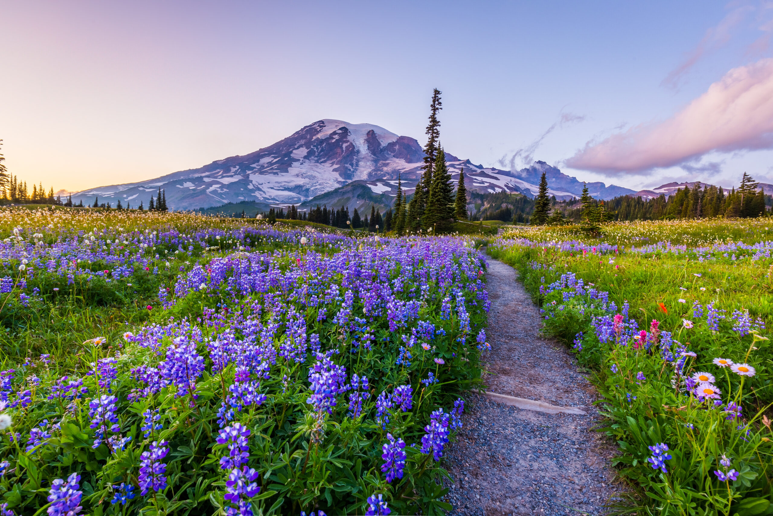
    Mount Rainier, a glaciated volcano rising above the Cascades
    Mount Rainier is 14,411 ft (4,392 m), the most heavily glaciated peak in the contiguous US. This page tracks its season, with live weather below.
    Expedition Updates · Cascades

    Mount Rainier expedition update

    Where Rainier stands this season, plus the Disappointment Cleaver route, the NPS climbing permit, glacier hazards, and safety. A single-mountain page in our Expedition Updates directory. Elevations in feet (metres).

    Current status In season 14,411 ft (4,392 m)

    In season now. Peak summer conditions.

    Rainier’s climbing season runs late June through early September, and late July sits in the prime window. The standard Disappointment Cleaver route is being climbed and guided daily, though the exact line shifts week to week as crevasses open, so late-July conditions differ from late August.

    Rainier is a serious glacier climb, not a walk-up: a summit success rate near 50 percent, about 9,000 ft of gain, and its own violent weather. It is the classic first big glacier climb for American mountaineers, and the training ground for Denali and beyond.

    14,411 ft

    Summit (4,392 m)

    The most heavily glaciated peak in the contiguous US.

    Jun to Sep

    Climbing season

    In season now; the peak window is July and August.

    ~50%

    Summit rate

    Weather and crevasse conditions turn many teams back.

    Rainier rises alone above the Cascades southeast of Seattle, an active, ice-clad stratovolcano with more than two dozen glaciers. This page is the update view: where the mountain sits in its season, the route, and the rules that matter. For the full how-to on operators, cost, gear, and preparation, see our Mount Rainier climb guide and routes guide, and for the wider picture, the Expedition Updates dashboard.

    Current status and the season

    Where the mountain is today, and how the window works.

    Right now Rainier is in the heart of its season. Guide services are running Disappointment Cleaver programs daily, and independent teams are moving through Camp Muir for midnight summit pushes. The window runs from late June, once the upper mountain has consolidated, through early September, when opening crevasses, rockfall, and retreating snow bridges make the standard route harder and guide services begin winding down. The catch on Rainier is that the route is a living thing: the exact line through the Ingraham Glacier and over the Cleaver changes across the summer, so a report from late July is not a description of late August.

    Planning horizon. Reserve your climbing permit and any overnight camps through recreation.gov well ahead, and build glacier skills and fitness first. Start with our Rainier progression plan, fitness standards, and glacier travel basics.

    The Disappointment Cleaver

    The standard route, and the main alternative.

    Disappointment Cleaver (standard)

    From Paradise at 5,400 ft, the route climbs the Muir Snowfield to Camp Muir at 10,080 ft (3,072 m), where teams rest before a midnight start. Above Muir it crosses the Cowlitz Glacier, traverses the Ingraham Glacier, and climbs the rocky Cleaver rib to the upper mountain and the crater rim. Summit day is roughly 4,500 to 5,500 ft of gain. This is the most climbed and most guided line, and the exact path shifts as crevasses open through the season.

    Emmons Glacier (main alternative)

    On the northeast side, the Emmons-Winthrop route climbs from the White River trailhead to Camp Schurman, then up the broad Emmons Glacier. It is less crowded than the Cleaver and a fine objective for teams with solid glacier skills. For the full route breakdown, see the Mount Rainier routes guide.
    Climbers roped up on a glacier high on Mount Rainier
    Rainier is roped, crevassed glacier travel from Camp Muir up: crampons, ice axe, and rope-team skills are the price of entry.

    Weather and conditions

    Rainier makes its own weather. Here is a live read.

    Rainier is tall enough and close enough to the Pacific to generate its own storms, and the summit can be socked in while the lowlands are clear. Cloud caps over the peak are a classic warning sign. Even in peak season, a forecast window can close fast, which is one reason the summit rate stays near half. The live map below shows current wind and conditions for the massif; use it as a starting point and rely on the National Park Service ranger blog and a dedicated forecast for any real decision.

    Live wind and weather for the Mount Rainier massif. Source: Windy.com. For how to read it, see our mountain-weather guide.
    Mount Rainier, southeast of Seattle in the Washington Cascades. Map: OpenStreetMap contributors.

    For a fuller explanation of reading a mountain forecast, see mountain weather for climbers, and check avalanche awareness for climbers for early and late-season snow.

    Permits and access

    The NPS rules every Rainier climber works within.

    Mount Rainier is a national park, and climbing above the glaciers is permitted and reserved. A climbing permit is required for glacier travel or travel above about 10,000 ft, booked through recreation.gov, and overnight camps such as Camp Muir are managed through the wilderness reservation system. The permit funds the ranger and rescue program on the mountain.

    Mount Rainier climbing costs, 2026 (indicative; confirm current rates via recreation.gov).
    Item2026 cost
    Climbing permit (per climber)~$61
    Park entrance feeAdditional, per vehicle
    Guided Disappointment Cleaver program~$1,400 to $2,800

    What you need to climb

    • Climbing permit – reserved on recreation.gov for glacier travel or above ~10,000 ft.
    • Overnight reservation – Camp Muir, Ingraham Flats, or Camp Schurman via the wilderness system.
    • Glacier competence – crampons, ice-axe self-arrest, a rope team of three or more, and crevasse rescue.
    • A helmet – rockfall on the Cleaver is a real hazard, especially later in the day.

    Safety and hazards

    Why Rainier is respected, and where the risk sits.

    Rainier’s hazards are glacier and weather driven: crevasse falls, collapsing snow bridges, serac fall on the Disappointment Cleaver, rockfall as the day warms, avalanches early and late in the season, and storms that build fast. The mountain has caused around 100 deaths since 1897, averaging four to six climbers a year, and the 1981 serac collapse on the Cleaver killed 11, still the worst single mountaineering accident in US history. The protective habits are the usual ones: move early, rope up, carry rescue gear and know it, and turn around when the weather or the clock says so.

    ⚠ A glacier climb, not a hike

    Above Camp Muir, Rainier is crevassed glacier the whole way, with overhead serac hazard on the Cleaver. Roped travel and practiced crevasse rescue are non-negotiable, and helmets matter. This page is not medical or safety advice; build your skills with our glacier travel basics and acclimatization guides and a qualified guide.
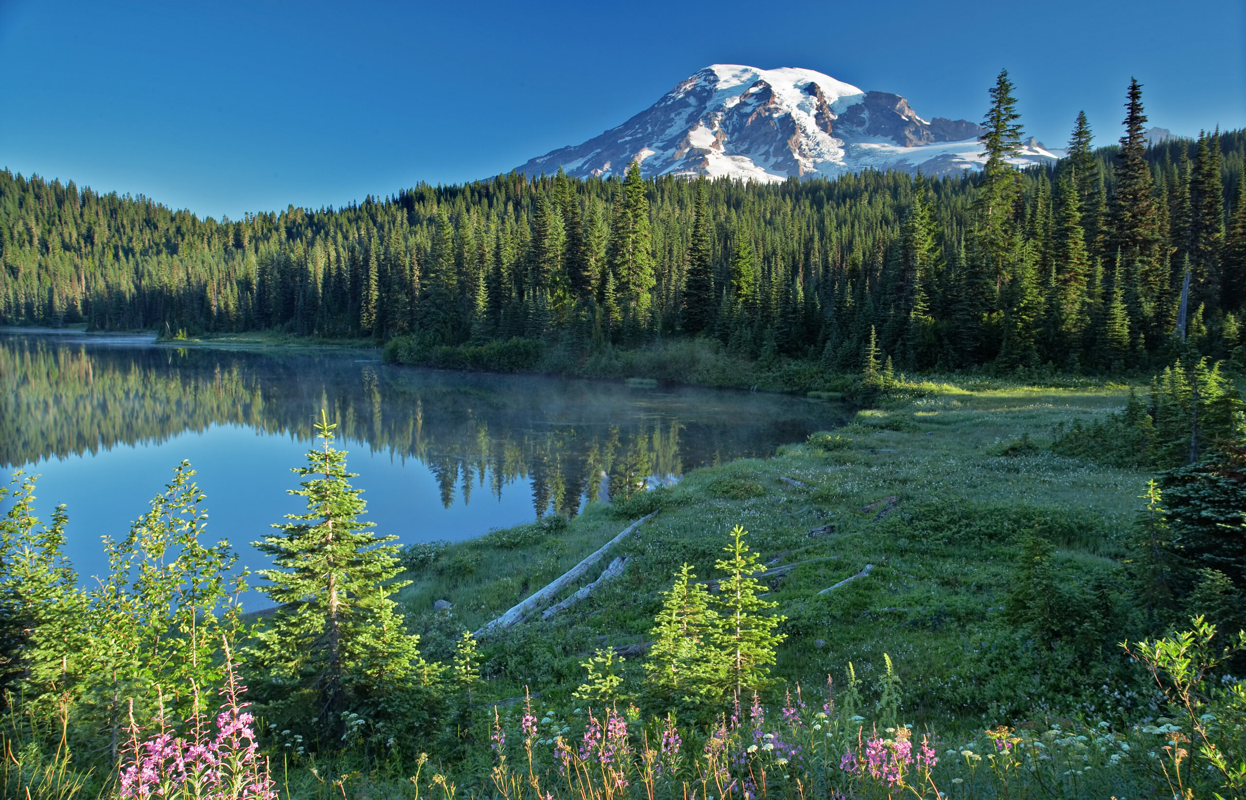
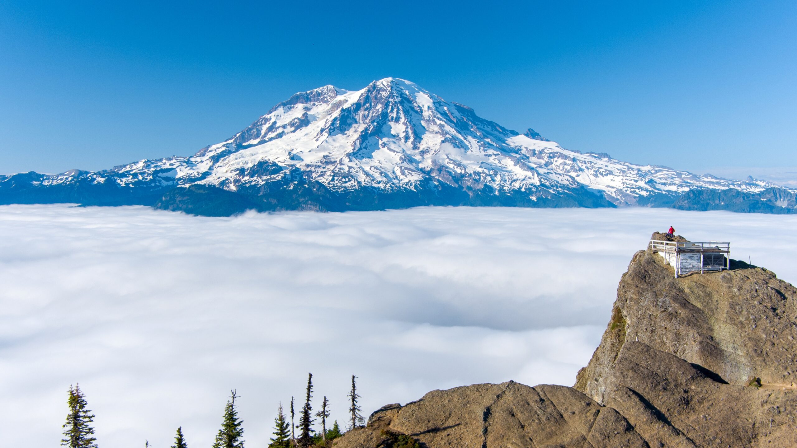
    Mount Rainier at dawn above a sea of clouds and forest
    Rainier stands alone above the Cascades and is the standard first big glacier climb for American mountaineers, and a proving ground for bigger peaks.

    Rainier by the numbers

    The context behind a single season, from grounded records.

    1870

    First verified ascent

    Hazard Stevens and Philemon Van Trump, August 17.

    ~9,000 ft

    Route gain

    Paradise to summit via Camp Muir and the Cleaver.

    25+

    Glaciers

    The most heavily glaciated peak in the contiguous US.

    Rainier is the standard training peak for bigger glaciated objectives. Our Rainier progression plan lays out the build-up, the Cascade Volcanoes collection covers its neighbours, and for climbers eyeing Alaska, Rainier is the classic step before Denali.

    Rainier update FAQ

    The questions climbers ask most about timing, permits, and conditions.

    When is the Mount Rainier climbing season?

    Late June through early September, with July and August the peak window, and the mountain is in season now. The Disappointment Cleaver line shifts through the summer as crevasses open and guides re-route, so conditions in late July differ from late August. Early and late in the season carry more avalanche and rockfall risk.

    Do I need a permit to climb Mount Rainier?

    Yes. A climbing permit is required for glacier travel or travel above about 10,000 ft, reserved through recreation.gov, and it runs around $61 per climber for 2026 plus the park entrance fee. Overnight camps such as Camp Muir are managed through the wilderness reservation system. Fees and reservation rules change, so confirm current details with the National Park Service.

    What is the standard route on Rainier?

    The Disappointment Cleaver, climbed from Paradise at 5,400 ft up the Muir Snowfield to Camp Muir at 10,080 ft (3,072 m), then across the Cowlitz and Ingraham Glaciers and up the Cleaver to the crater rim. It is the most climbed and most guided line. The Emmons Glacier via Camp Schurman is the main alternative on the northeast side.

    How hard is Mount Rainier to climb?

    It is a serious glacier climb, not a hike: roughly 9,000 ft of gain over about 15 miles round trip, with a summit success rate near 50 percent because weather and conditions turn many teams back. It demands crampons, practiced ice-axe self-arrest, rope-team travel, and crevasse-rescue skill, which is why it is the classic first big glacier climb for American mountaineers.

    Do I need a guide for Mount Rainier?

    First-time climbers are strongly advised to go with a guide service such as RMI, IMG, or Alpine Ascents, or with an experienced team. Guided Disappointment Cleaver programs run three to five days and cost roughly $1,400 to $2,800, including guiding, group gear, and hut access. Independent climbers need proven glacier skills and their own rescue capability.

    What is the current status of Rainier?

    As of late July the 2026 season is in full swing and the mountain is in season. Conditions on the Disappointment Cleaver change week to week as crevasses open through the summer. Check the National Park Service ranger climbing blog and the Northwest Avalanche Center, plus this page, before you commit to a plan.

    📋 How this update is built

    This page is compiled by Travis Ludlow, Founder and Head of Research at Global Summit Guide, from US National Park Service data, the ranger climbing blog, and published season reporting, with sources named below. It was reviewed for safety by Dawson Ludlow, our Climbing & Mountaineering Lead (Wilderness First Aid), whose highest first-hand summit is Kilimanjaro. Where our team has no first-hand experience of Rainier, we report the cited records rather than personal anecdote, and we confirm fees and rules against the NPS.

    Sources and further reading

    • US National Park Service, Mount Rainier – climbing permits, the ranger climbing blog, and route conditions.
    • Recreation.gov – Mount Rainier climbing permit and wilderness camp reservations.
    • Northwest Avalanche Center – Cascade snowpack and avalanche forecasts.
    • Our own Mount Rainier climb guide and Mount Rainier routes guide.
    • We report published figures and named sources rather than posting unverified live conditions.

    Planning a Rainier climb?

    Start with the full Mount Rainier climb guide, work through the Rainier progression plan, and read how to choose an expedition operator before you book a guide service. For flights and lodging around Seattle and Ashford, browse travel on Expedia.

    Disclosure: the Expedia link above is a sponsored affiliate link. We may earn a commission at no extra cost to you.

    Was this helpful?

    Yes
    No
    Thanks for your feedback!
  • Denali Expedition Update 2026: Season, West Buttress, Permits & Conditions

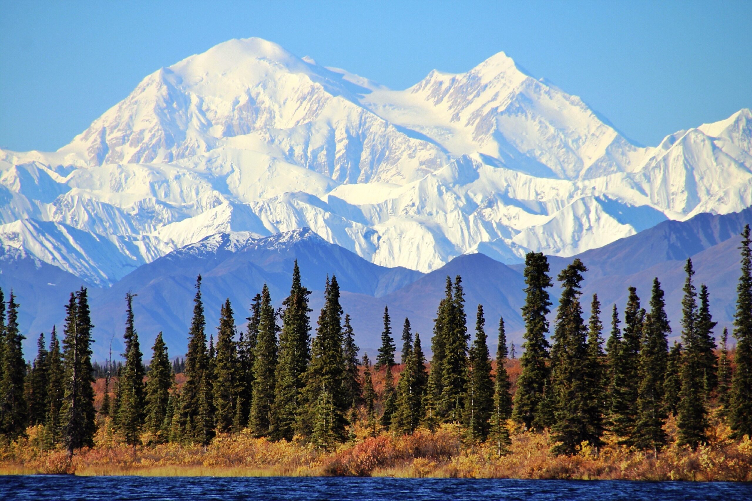
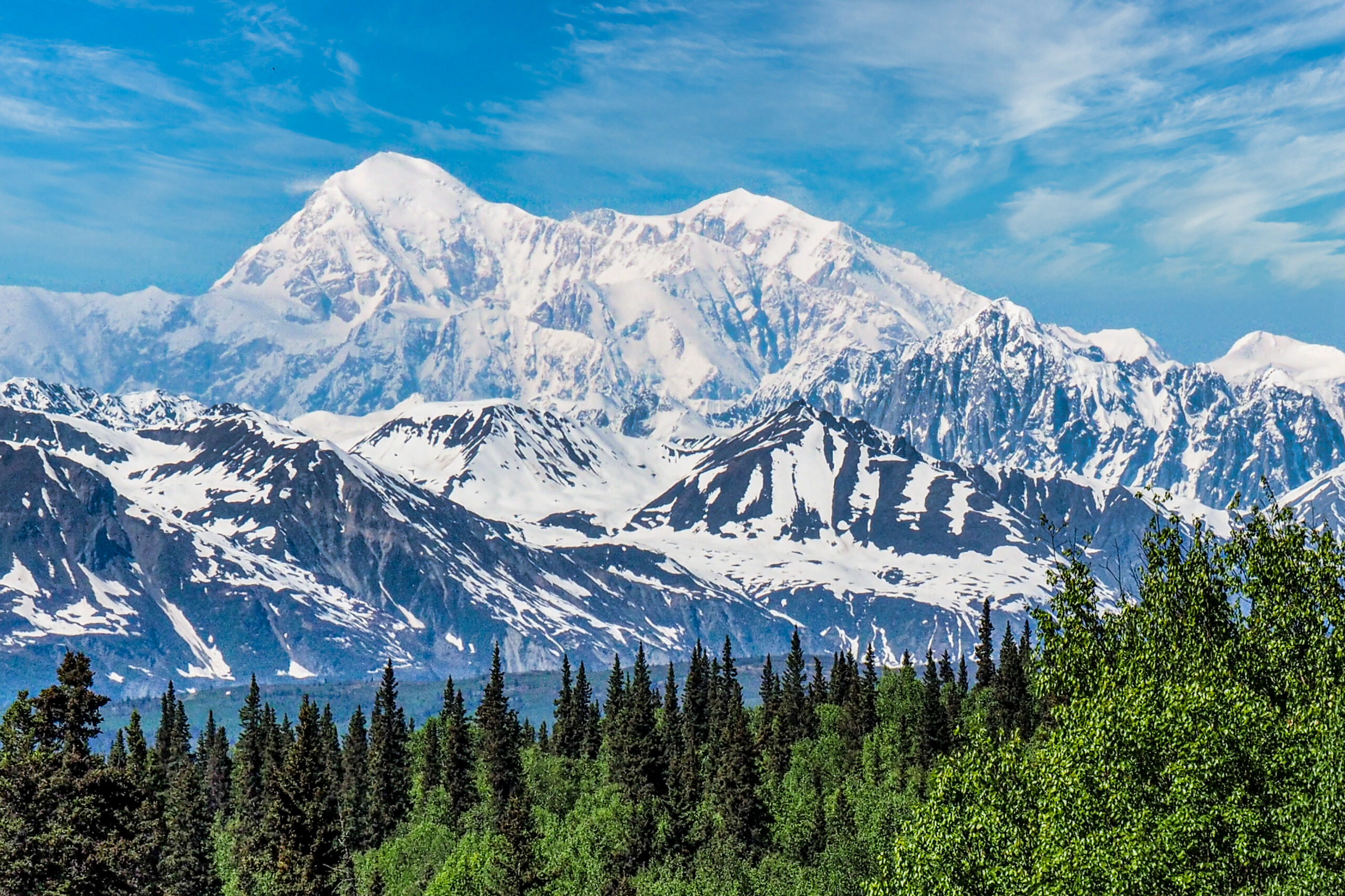
    Denali, the highest peak in North America, under snow
    Denali is 20,310 ft (6,190 m), the highest peak in North America. This page tracks its season, with live weather below.
    Expedition Updates · Alaska

    Denali expedition update

    Where Denali stands this season, plus the West Buttress route, arctic weather, the NPS permit rules, and safety. A single-mountain page in our Expedition Updates directory. Elevations in feet (metres).

    Current status Winding down 20,310 ft (6,190 m)

    Season winding down. The 2026 window is closing.

    Denali’s climbing window runs May to early July, with most summits in late May and June. By late July the lower glacier softens, crevasses open, and the last teams come off, so the mountain is now near the end of its year. The next real window is spring 2027.

    Denali’s difficulty is arctic, not just high: a 63-degree-north latitude makes the air thinner than the same height near the equator, and the cold and storms are among the worst on any major peak. That is why the summit rate sits near 51 percent.

    20,310 ft

    Summit (6,190 m)

    The highest point in North America, and one of the coldest big peaks.

    May to Jul

    Climbing season

    Most summits fall in late May and June; the window closes by mid-July.

    ~51%

    Summit rate

    Driven by weather and cold far more than by altitude alone.

    Denali rises from the Alaska Range north of Talkeetna, and it is the classic North American expedition: a two-to-three-week, self-sufficient glacier climb where you haul and sled your own loads between camps. This page is the update view, with where the mountain sits in its calendar, the route, and the rules that matter. For the full how-to on operators, cost, and itinerary, see our Denali climb guide, and for the wider picture across ranges, the Expedition Updates dashboard.

    Current status and next window

    Where the mountain is today, and when it reopens.

    Right now Denali is at the tail of its season. The bulk of teams register for May and June, when the snowpack is firm and the glacier is easier to travel, and by mid-to-late July warming days weaken snow bridges on the Kahiltna and the flow of climbers drops off. There is no autumn or winter commercial season here: the cold and short daylight later in the year put the mountain out of reach for all but a handful of specialists. If you are planning, spring 2027 is the season to build toward, with registration opening well ahead of a May or June start.

    Planning horizon. Register with the NPS at least 60 days before your start date, and build fitness and glacier skills long before that. Start with our Denali progression plan, fitness standards, and first glacier-climb training.

    The 2026 season

    The window, the numbers, and what it means for planners.

    The 2026 season followed Denali’s usual arc: teams flew from Talkeetna onto the Kahiltna through May, worked up the West Buttress in load-carrying rotations, and waited out storms for the weather windows that make or break a summit. As always, the mountain’s summit rate reflects arctic weather more than altitude, hovering around the long-run figure near 51 percent, well below warmer peaks of similar height. Definitive registration and summit totals come from the National Park Service after the season, and we report those rather than early estimates. For the full statistical picture and how conditions drive it, see our Denali summit success rate analysis.

    Denali, in the Alaska Range north of Talkeetna. Map: OpenStreetMap contributors.

    Route and conditions

    The standard line, and the harder alternatives.

    West Buttress (standard)

    Used by roughly 85 to 90 percent of climbers and first climbed in 1951. From the Kahiltna Base Camp at about 7,200 ft (2,200 m), teams move through camps near 7,800, 11,200, and the 14,200 ft (4,330 m) basin, then up the headwall and fixed lines to high camp at 17,200 ft (5,240 m) and the summit ridge. It is a glacier and snow expedition, not a technical climb, but the altitude, cold, and load-hauling make it hard work.

    West Rib, Cassin Ridge and beyond

    The West Rib and the Cassin Ridge are far harder, committing technical lines climbed by a small number of experienced parties each year rather than guided teams. They demand a different level of skill and self-reliance than the West Buttress. For the full route breakdown, see the Denali climb guide.

    Weather and cold

    The real crux on Denali, plus a live forecast.

    Weather, not altitude, is what turns most Denali teams around. The mountain sits far enough north that storms roll in off the Gulf of Alaska with little warning, temperatures at the high camps can fall well below minus 30 degrees, and wind can pin climbers in their tents for days. Because the atmosphere is thinner at this latitude, 20,310 ft feels physiologically higher than the number suggests. The live map below shows current wind and conditions for the massif; treat it as a starting point and rely on a dedicated expedition forecast for any real decision.

    Live wind and weather for the Denali massif. Source: Windy.com. For how to read it, see our mountain-weather guide.

    For a fuller explanation of reading a mountain forecast, see mountain weather for climbers.

    Permits and access

    The NPS rules every Denali climber works within.

    Denali is managed by the National Park Service, and the mountaineering rules are strict and enforced. Every climber registers in advance, pays a use fee, attends an orientation, and packs out their own waste. The fee funds the ranger patrols and rescue infrastructure that have cut the fatality rate over the decades.

    NPS Denali mountaineering fee, per climber, 2026 (confirm current rates via Pay.gov).
    Climber ageMountaineering fee
    25 and over~$450
    24 and under~$350

    What the NPS requires

    • Register at least 60 days ahead – through Pay.gov, with an experience questionnaire.
    • Ranger orientation in Talkeetna – a mandatory briefing before you fly to the glacier.
    • Clean Mountain Cans – all human waste is carried out; the CMC is issued by the park.
    • Self-sufficiency – carry crevasse-rescue gear, know the skills, and be ready to manage emergencies; rescue is never guaranteed.

    Safety on Denali

    Where the risk sits on a glaciated arctic peak.

    Denali’s hazards are cold injury, weather, altitude, and crevasses, in roughly that order. Frostbite and hypothermia are the most common serious problems, driven by the extreme cold and wind. The lower Kahiltna and the route between camps cross crevassed glacier, so roped travel and crevasse-rescue competence are non-negotiable. Altitude illness affects climbers who move up too fast in the thinner northern air. The single most protective habit is patience: acclimatize properly, keep margin for weather, and be willing to turn around.

    ⚠ Cold and crevasses, not just height

    More Denali trips end in frostbite, exhaustion, and weather retreats than in altitude alone, and the glacier below camp is a real crevasse-fall risk. Rope up, carry rescue gear, and know how to use it. This page is not medical or safety advice; build your skills with our crevasse-rescue basics and acclimatization guides and a qualified guide.

    Climbers moving across a glacier below Denali under a clear sky
    Denali is a self-sufficient glacier expedition: teams haul and sled their own loads between camps over two to three weeks.

    Denali by the numbers

    The context behind a single season, from grounded records.

    1913

    First ascent

    Walter Harper led the first party to the summit on June 7, 1913.

    ~50%

    Climb unguided

    About half of Denali climbers organise their own expedition.

    6 operators

    NPS-permitted guides

    A small set of concessionaires run the guided West Buttress trips.

    Denali is one of the Seven Summits, and it fits a longer progression toward the world’s high peaks. Our Denali progression plan lays out the five stages to the summit, Denali operators compares the permitted guide services, and the mountains to climb before the Seven Summits guide shows where Denali sits in a sensible build-up.

    Denali update FAQ

    The questions planners ask most about timing, permits, and conditions.

    When is the Denali climbing season?

    May to early July, with most summits in late May and June. By late July, warming snow and opening crevasses on the lower glacier make travel harder and the season winds down. Denali is not climbed commercially in winter, when cold and darkness are extreme.

    How much is a Denali permit?

    The National Park Service mountaineering fee for 2026 is about $450 per climber aged 25 and over, and $350 for those 24 and under, paid through Pay.gov. Every climber must register at least 60 days before the start date. Fees change, so confirm the current figure with the NPS.

    What is the standard route on Denali?

    The West Buttress, used by roughly 85 to 90 percent of climbers and first climbed in 1951 by a team led by Bradford Washburn. It is a long glacier and snow route rather than a technical climb. The West Rib and Cassin Ridge are far harder and rarely guided.

    Why is Denali hard for its height?

    Its 20,310 ft (6,190 m) summit sits at 63 degrees north, so the air is thinner than the same height nearer the equator and the effective altitude feels higher. Combined with some of the coldest, stormiest weather of any major peak, that is why the summit rate sits near 51 percent.

    Do I need a guide for Denali?

    About half of Denali climbers go unguided, but that demands real prior glacier travel, crevasse rescue, and expedition experience. A guided team handles logistics and improves summit odds, and most first-timers benefit from one. Either way, the NPS registration and skills bar is the same.

    What is the current status of Denali?

    As of late July the 2026 season is winding down and most teams are off the mountain. The next window is spring 2027, from May to early July. Check this page for the season summary and the current picture before you plan.

    📋 How this update is built

    This page is compiled by Travis Ludlow, Founder and Head of Research at Global Summit Guide, from US National Park Service data and published season reporting, with sources named below. It was reviewed for safety by Dawson Ludlow, our Climbing & Mountaineering Lead (Wilderness First Aid), whose highest first-hand summit is Kilimanjaro. Where our team has no first-hand experience of Denali, we report the cited records rather than personal anecdote, and we confirm fees and rules against the NPS.

    Sources and further reading

    • US National Park Service, Denali National Park – mountaineering permits, fees, and regulations.
    • NPS annual Denali mountaineering summary – registration and summit statistics.
    • Denali air-taxi and NPS-permitted guide operators – logistics and season reporting.
    • Our own Denali climb guide and Denali summit success rate analysis.
    • We report published figures and named sources rather than posting unverified live conditions.

    Planning a Denali expedition?

    Choosing the right approach is the biggest decision you will make. Compare the permitted teams in our Denali operators guide, read how to choose an expedition operator, and work through the Denali progression plan. For flights and lodging around Anchorage and Talkeetna, browse travel on Expedia.

    Disclosure: the Expedia link above is a sponsored affiliate link. We may earn a commission at no extra cost to you.

    Was this helpful?

    Yes
    No
    Thanks for your feedback!
Language »