<

Category: Mountain Guide

  • Nepal’s Technical Peaks: Himalayan Climbing Collection

    Nepal’s Technical Peaks: Himalayan Climbing Collection

    Nepal’s Technical Peaks: The Himalayan Climbing Collection (2026) | Global Summit Guide
    Cluster 03 · Technical & Expert · Updated April 2026

    Nepal’s Technical Peaks: The Himalayan Climbing Collection

    The middle tier of Himalayan climbing — Nepal’s technical peaks between trekking status and 8,000er expedition peaks. Ama Dablam, Island Peak, Mera, Pumori, Baruntse, and the collection that defines Himalayan climbing progression for serious but not elite climbers.

    12
    Technical peaks
    profiled
    5,800–7,200 m
    Altitude
    range
    $250–$500
    NMA permit
    range
    Oct–Nov
    Primary
    season
    Global Summit Guide A guide in Cluster 03 · Technical & Expert View master hub →

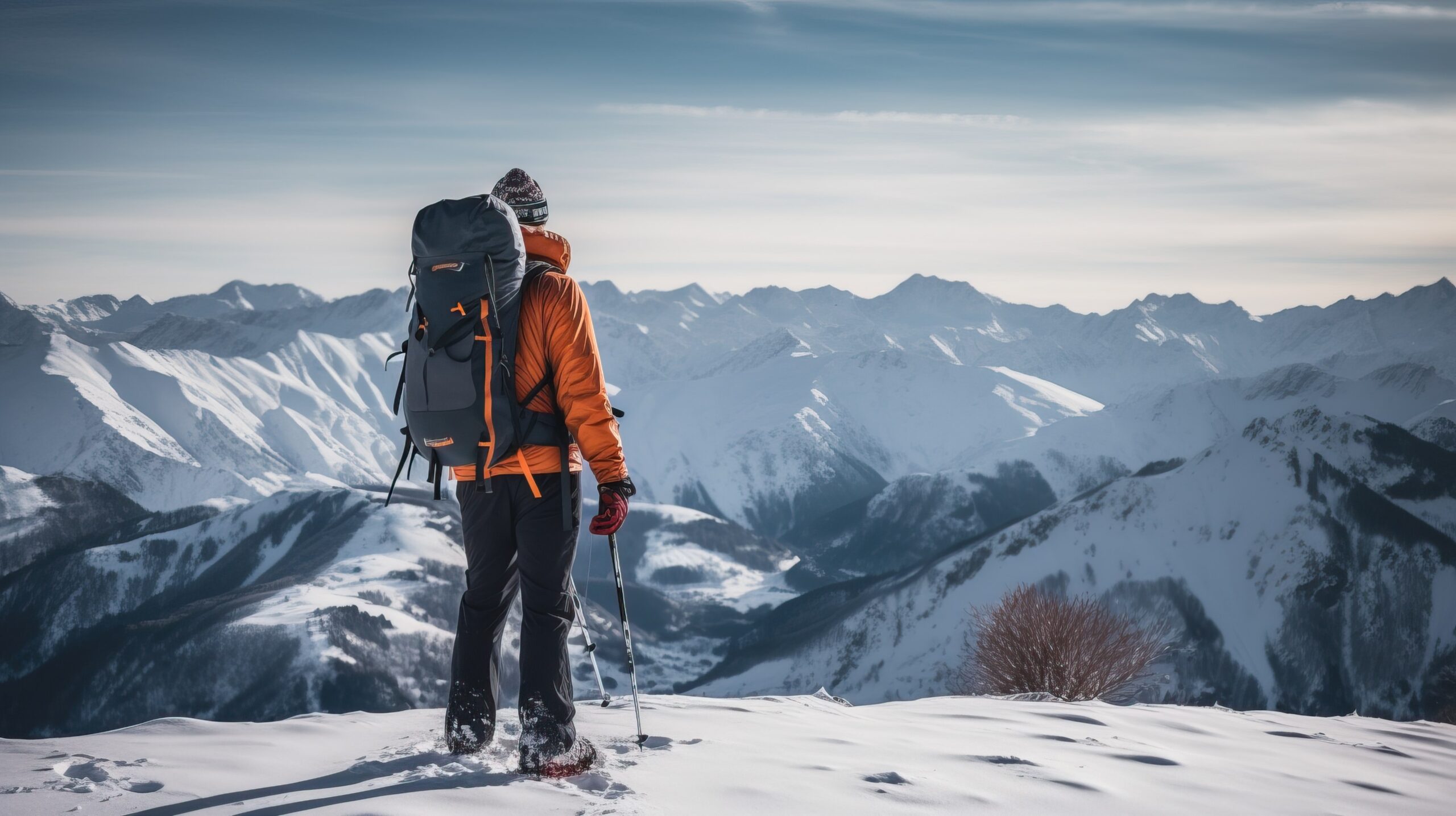
    Nepal’s mountains divide into three coherent tiers: trekking peaks for mountaineering introduction, 8,000er expedition peaks for elite high-altitude climbing, and the technical middle — the collection of peaks between 5,800 m and 7,200 m that form Nepal’s real alpinism curriculum. Ama Dablam, Baruntse, Pumori, Cholatse, Thamserku, Island Peak, Mera Peak, and their siblings teach the actual skills of Himalayan climbing — fixed rope ascending, mixed terrain movement, extended altitude endurance, and expedition logistics — without the $75K+ cost or extreme consequence of 8,000er work. This is the tier that produces the next generation of serious climbers.

    How this collection was built

    Peak grades use International French Adjectival System (IFAS) alongside Nepal Mountaineering Association (NMA) classifications. Permit fees and regulations reflect the Nepal Ministry of Tourism September 2025 update. Cost estimates reflect current 2026 operator pricing across Nepal-based and Western operators. Summit rate and incident data draw from the Himalayan Database. Reviewed by Nepal-licensed climbing guides with direct operational experience. Fact-check date: April 19, 2026.

    Understanding Nepal’s Peak Tier Structure

    Before the collection profiles, a grounding in how Nepal organizes its peaks into three regulatory and experience tiers. This structure determines permit requirements, cost, guide requirements, and where each peak sits in climber progression.

    Tier 1

    NMA Trekking Peaks

    Group B · Under 6,500 m

    27 peaks licensed by the Nepal Mountaineering Association. Island Peak, Mera, Lobuche East, Kwangde, Pokalde, Naya Kanga, and others. Permits $250–$400. Most introductory climbs — PD to AD grade. Guided climbs $1,500–$3,500.

    Tier 2

    Technical Peaks

    Various · 5,800–7,200 m

    The middle tier covered in this guide — Ama Dablam, Baruntse, Pumori, Cholatse, Thamserku, Kyajo Ri, Chulu West, Himlung Himal. NMA or Ministry of Tourism permits depending on peak. Expedition-style climbs $6,500–$20,000.

    Tier 3

    8,000er Expedition Peaks

    Ministry of Tourism · Above 8,000 m

    8 peaks in Nepal (Everest, Kanchenjunga, Lhotse, Makalu, Cho Oyu, Dhaulagiri, Manaslu, Annapurna). Ministry of Tourism permits $3,000–$15,000. Full expedition logistics $35,000–$230,000.

    The critical distinction

    Trekking peaks serve as acclimatization and introduction. 8,000ers demand specialized expedition capability. The technical middle tier is where Nepal teaches climbers to become real Himalayan alpinists — climbing fixed-rope routes with guide support, developing multi-week expedition endurance, and operating in the 6,000–7,000 m range that forms the majority of interesting peaks worldwide. Skipping this tier is the most common mistake in Himalayan progression.


    Flagship Peak: Ama Dablam

    01
    The definitive Nepal technical peak

    Ama Dablam

    Khumbu Region · Eastern Nepal
    6,812 m22,349 ft

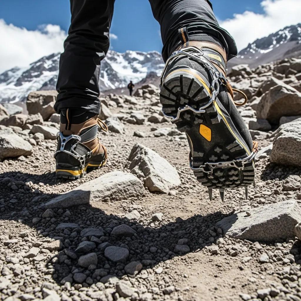
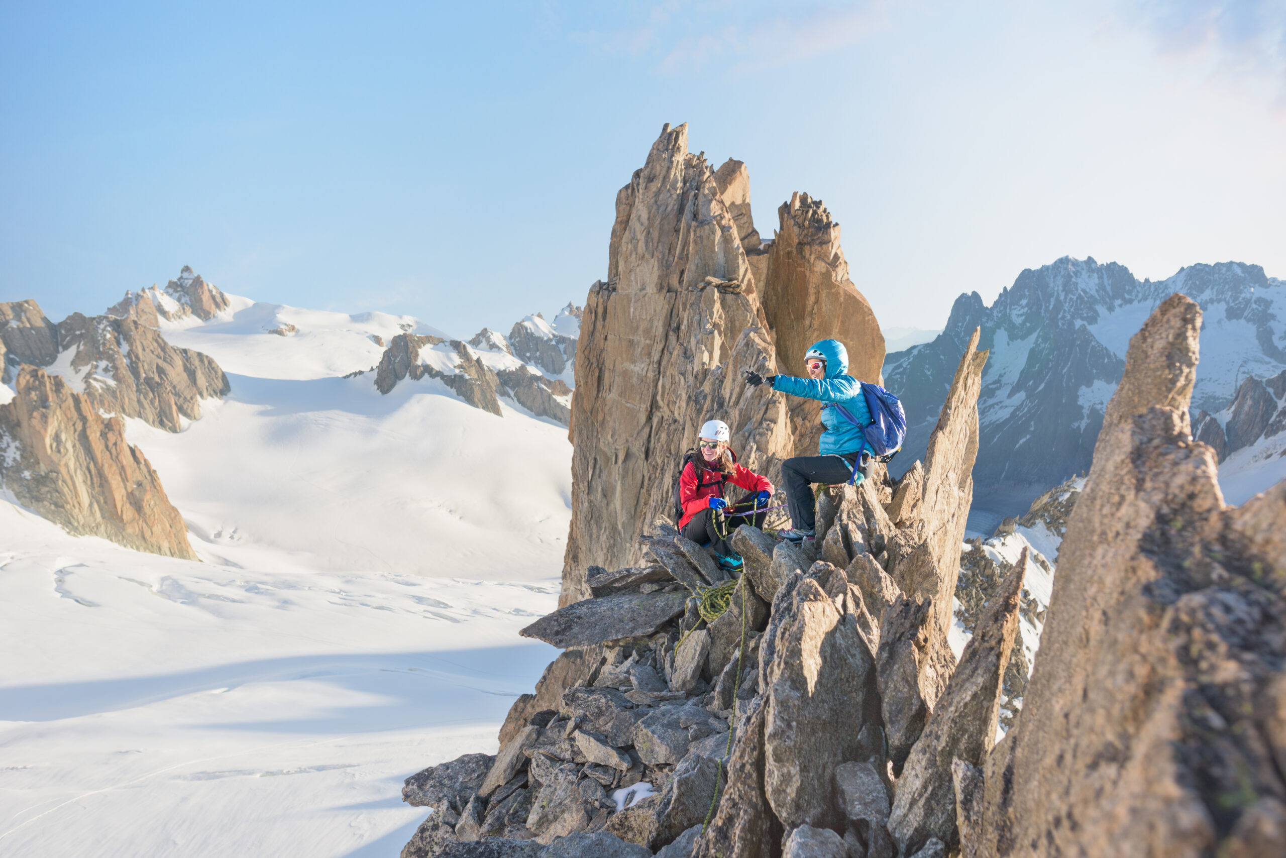
    Ama Dablam (“Mother’s Necklace”) is the most iconic peak in the Khumbu region and the definitive technical objective in Nepal outside the 8,000ers. Its distinctive pyramid shape dominates the approach to Everest Base Camp, making it one of the most photographed peaks in the world. The Southwest Ridge (standard route) is graded D (Difficile) — requiring technical rock to 5.7, sustained fixed-rope climbing, and extended exposure on narrow ridges above 6,000 m.

    The peak is typically attempted as the culmination of a Nepal technical peak progression — climbers often do Island Peak or Lobuche East first for 6,000 m experience, then tackle Ama Dablam. Base camp sits at 4,600 m with two higher camps (Camp 1 at 5,700 m and Camp 2 at 6,000 m) used during summit pushes. Summit day from Camp 2 takes 10–14 hours.

    Operators include Alpine Ascents International ($12,000–$15,000), Nepal Alpine Expeditions ($6,500–$9,000), 8K Expeditions ($7,500–$10,000), and Seven Summit Treks ($8,000–$11,000). Summit rate is approximately 70% in favorable weather; fatality rate around 2%. Expedition duration is 25–30 days from Kathmandu arrival.

    GradeD (IFAS) / 5.7
    Permit typeMoT Expedition
    Typical cost$6,500–$15,000
    Duration25–30 days

    Gateway Technical Peaks: Island Peak and Mera Peak

    The two most-climbed gateway peaks in Nepal — both technically accessible but serving different purposes. Island Peak for technical practice, Mera Peak for altitude experience. Most serious climbers eventually do both.

    02
    Technical practice + Everest views

    Island Peak (Imja Tse)

    Khumbu Region · Eastern Nepal
    6,189 m20,305 ft

    Island Peak gets its English name from its island-like appearance rising from the Imja Valley. The standard route is graded PD+ with a steep headwall ice section requiring fixed rope and jumar, plus a summit ridge traverse on snow and ice. This makes it the preferred introductory 6,000 m peak for climbers who want to practice technical skills before bigger objectives.

    The peak is commonly combined with the Everest Base Camp trek — adding 3–4 days for the summit attempt after reaching EBC. Approach via Chhukhung, high camp at 5,600 m, summit day 8–12 hours. Guided climbs cost $1,800–$3,500 including permit, guide, gear, and porters. Fatality rate approximately 1%.

    GradePD+ (IFAS)
    Permit typeNMA Trekking
    Typical cost$1,800–$3,500
    Duration16–20 days
    03
    Altitude experience without technical demands

    Mera Peak

    Hinku Valley · Eastern Nepal
    6,476 m21,247 ft

    Mera Peak is Nepal’s highest-altitude trekking peak — taller than Island Peak but technically easier, rated F/PD. The climb is primarily glacier travel with gentle snow slopes, culminating in a short steep section (30–40°) just below the summit. The approach through the Hinku Valley avoids the Everest trekking route’s crowds.

    The peak is the preferred first 6,000 m experience for climbers without prior technical climbing background — its forgiving terrain lets climbers focus on altitude adaptation without managing complex technical moves. Summit views from 6,476 m include five 8,000ers (Everest, Lhotse, Makalu, Cho Oyu, Kanchenjunga). Guided climbs cost $1,800–$3,200.

    GradeF / PD (IFAS)
    Permit typeNMA Trekking
    Typical cost$1,800–$3,200
    Duration18–22 days
    The “Three Peaks” combination

    A popular 4-week progression combines Mera Peak + Island Peak + Lobuche East in a single expedition. Mera first for acclimatization, Island Peak for technical practice, Lobuche East for additional altitude experience. Total cost $3,500–$5,500 guided. Many climbers do this as their entry into serious Nepal climbing before moving on to Ama Dablam or Himlung Himal.


    Serious Technical Peaks: Baruntse, Pumori, and Cholatse

    The graduate-level technical peaks in Nepal — objectives that require prior 6,000 m experience, strong technical skills, and serious expedition commitment. Pumori in particular rivals Ama Dablam for technical demand.

    04
    7,000m training ground

    Baruntse

    Mahalangur Himal · Eastern Nepal
    7,129 m23,389 ft

    Baruntse is the natural stepping stone to 8,000 m peaks. At 7,129 m, it delivers full expedition-style altitude experience without the extreme costs of 8,000ers. The Southeast Ridge standard route is graded AD+ with sustained snow and ice to 60°, several technical sections, and a committing summit day.

    Baruntse is popular with climbers preparing for Everest or other 8,000ers as proof of 7,000 m capability. Expedition duration 25–28 days, operator costs $7,500–$15,000. The approach through the Hongu Valley is remote and spectacular, distinct from the Khumbu traffic patterns.

    GradeAD+ (IFAS)
    Permit typeMoT Expedition
    Typical cost$7,500–$15,000
    Duration25–28 days
    05
    Everest-view technical peak

    Pumori

    Khumbu Region · Eastern Nepal
    7,161 m23,494 ft

    Pumori sits directly across from Everest Base Camp and is known for its technical Southeast Ridge — graded D+ with sustained steep ice and mixed terrain. The peak’s fatality rate around 4% is notably higher than Ama Dablam due to avalanche hazard on the standard routes. Pumori is less commonly attempted than Ama Dablam but considered more technical.

    Pumori requires substantial prior technical experience — not an appropriate first Nepal peak. Most climbers attempt it after Ama Dablam or a 7,000 m peak elsewhere. Expedition cost $9,000–$16,000, duration 25–30 days.

    GradeD+ (IFAS)
    Permit typeMoT Expedition
    Typical cost$9,000–$16,000
    Duration25–30 days
    06
    The Khumbu’s hidden technical gem

    Cholatse

    Khumbu Region · Eastern Nepal
    6,440 m21,129 ft

    Cholatse is a connoisseur’s peak — less famous than Ama Dablam but equally technical in its own way. The Southwest Ridge is graded D with sustained mixed climbing and exposed ridge traverses. The peak sees far fewer ascents than Ama Dablam but offers similar technical challenge.

    Cholatse suits climbers who want Ama Dablam-level technical difficulty without the crowds. Expedition cost $6,000–$10,000, duration 20–24 days. Best climbed in October-November.

    GradeD (IFAS)
    Permit typeMoT Expedition
    Typical cost$6,000–$10,000
    Duration20–24 days

    Lesser-Known but Excellent Peaks (Kyajo Ri, Chulu West, Himlung)

    Beyond the famous peaks, Nepal offers remarkable technical objectives that see far fewer climbers. These peaks reward climbers who want real Himalayan experience without tourist-route congestion.

    07
    Technical peak near Namche

    Kyajo Ri

    Khumbu Region · Eastern Nepal
    6,186 m20,295 ft

    Kyajo Ri is a newer NMA trekking peak (opened 2003) that combines technical rock and mixed climbing in a less-visited valley. The standard Southwest Face route is graded AD with genuine rock climbing sections. A good alternative to the crowded Island Peak/Mera circuit.

    GradeAD (IFAS)
    Permit typeNMA Trekking
    Typical cost$2,500–$4,500
    Duration18–22 days
    08
    Annapurna region trekking peak

    Chulu West

    Manang District · Central Nepal
    6,419 m21,060 ft

    Chulu West combines excellent altitude experience with access from the Annapurna Circuit trek. Graded PD+ with moderate snow slopes and a short technical section near the summit. Strong choice for Annapurna-region climbers wanting to combine trekking and climbing.

    GradePD+ (IFAS)
    Permit typeNMA Trekking
    Typical cost$2,200–$4,000
    Duration20–24 days
    09
    7,000m peak with moderate difficulty

    Himlung Himal

    Manang District · Central Nepal
    7,126 m23,379 ft

    Himlung is increasingly popular as a 7,000 m objective with moderate technical demands. Graded PD+ with mostly snow and ice slopes. Excellent 8,000er preparation without the extreme commitment of Baruntse or more technical 7,000ers. Remote location near Tibet border adds cultural appeal.

    GradePD+ (IFAS)
    Permit typeMoT Expedition
    Typical cost$6,500–$11,000
    Duration28–32 days

    NMA Permits and Climbing Logistics for Nepal Peaks

    Nepal’s permit system, updated in September 2025, distinguishes trekking peaks (NMA) from expedition peaks (Ministry of Tourism). Understanding the permit structure affects cost, timeline, and what operators can legally offer.

    Permit costs by peak type and season

    Peak / TypeSpring (Mar–May)Autumn (Sep–Nov)Winter/SummerAuthority
    Group A NMA (Ama Dablam, Baruntse, Pumori)$400–$500$400–$500$200–$250MoT
    Group B NMA (Island, Mera, Lobuche)$250–$400$250–$400$125–$200NMA
    8,000m peaks (Everest)$15,000$7,500$3,750MoT
    Other 8,000ers (Cho Oyu, Manaslu)$1,800$900$450MoT

    What the 2025 regulatory update changed

    Key changes from September 2025 that affect technical peak climbers:

    • Mandatory guide requirements reinforced — no solo or unsupported climbing on permitted peaks
    • Insurance requirements now verified at permit application — high-altitude rescue coverage required
    • GPS tracking required on some expedition peaks (8,000 m+ mandatory, technical 7,000ers encouraged)
    • Biodegradable waste management required on all peaks — operators must provide waste collection systems
    • Climber-to-guide ratios codified — most technical peaks require 1:1 to 2:1 climber-to-guide

    See our Mountain Climbing Insurance guide for specific coverage requirements and our Mountain Climbing Costs framework for the complete budget picture.


    When to Climb Nepal’s Technical Peaks: Seasonal Planning

    Nepal’s seasons strongly determine climbing feasibility on technical peaks. Post-monsoon (October-November) is the prime season for most peaks; pre-monsoon (April-May) is the secondary window. Winter and summer climbing requires specialized planning.

    Post-Monsoon

    Oct–Nov
    Primary Season

    Clear, cold, stable weather. Minimal precipitation. Longer daylight than winter. Best for Ama Dablam, Baruntse, Pumori.

    Pre-Monsoon

    Apr–May
    Good Season

    Warmer temperatures. More afternoon storms. Higher avalanche risk. Works for most peaks but less stable than autumn.

    Winter

    Dec–Feb
    Specialized

    Extreme cold but stable weather. Short days limit summit windows. Only for experienced cold-weather climbers.

    Monsoon

    Jun–Sep
    Avoid

    Constant precipitation. High avalanche hazard. Poor visibility. Not suitable for most technical peaks.


    Nepal Technical Peaks FAQ: Your Common Questions Answered

    What are Nepal’s technical climbing peaks?

    Nepal’s technical climbing peaks are mountains between trekking peaks (Group B, under 6,500 m) and the 8,000-meter expedition peaks. They include Ama Dablam (6,812 m), Baruntse (7,129 m), Pumori (7,161 m), Cholatse (6,440 m), Thamserku (6,623 m), Island Peak (6,189 m), Mera Peak (6,476 m), Lobuche East (6,119 m), Kyajo Ri (6,186 m), and Chulu West (6,419 m). These peaks require real climbing skills — technical ice, mixed terrain, fixed rope use, and glacier travel — but not the expedition-style logistics or altitude of 8,000ers. They are issued under Nepal Mountaineering Association (NMA) permits at $250–$400 for the typical NMA-classified peaks, plus expedition peaks like Ama Dablam and Baruntse requiring Ministry of Tourism permits at $400–$500. Most climbers approach these peaks during dedicated 3–4 week expeditions, often combined with a trek.

    How hard is Ama Dablam to climb?

    Ama Dablam (6,812 m) is graded D (Difficile) on the IFAS scale and is considered one of Nepal’s most technical peaks for its size. The standard Southwest Ridge route requires: (1) Technical rock climbing on the yellow tower (up to 5.7). (2) Sustained fixed-rope ascending on steep snow and ice. (3) Extended exposure on narrow ridge sections above 6,000 m. (4) Acclimatization to 6,800 m over typically 3–4 weeks. Ama Dablam has approximately a 2% fatality rate — safer than most 8,000ers but significantly more dangerous than trekking peaks. It is typically attempted after climbers complete Island Peak or Mera Peak and want a serious technical objective before 8,000 m work. Guided expeditions cost $6,500–$15,000 with operators like Asian Trekking, Nepal Alpine Expeditions, and Alpine Ascents International. The November-December season is preferred for stable weather.

    What is the difference between Mera Peak and Island Peak?

    Mera Peak (6,476 m) and Island Peak (6,189 m) are Nepal’s most popular NMA trekking peaks but serve different purposes. Mera Peak is taller but technically easier — rated F/PD (Facile to Peu Difficile) with mostly glacier travel and one short ice face near the summit. It is the better choice for first 6,000 m experience as introduction to altitude climbing. Island Peak is shorter but more technical — rated PD+ with a steep ice section requiring fixed rope and jumar, plus a summit ridge traverse. It is the better choice for climbers who want to practice technical skills before Ama Dablam or Himalayan expedition peaks. Both peaks cost similar ($250–$400 NMA permit plus $1,500–$3,500 for guided climb). Many expeditions combine them — Mera first for acclimatization and altitude, Island Peak second for technical practice. The combined “Three Peaks” itinerary (Mera, Island, and Lobuche East) is a popular 4-week objective.

    How much does it cost to climb Ama Dablam?

    A guided Ama Dablam expedition in 2026 costs $6,500–$15,000 depending on operator, group size, and included services. Typical cost breakdown: (1) Nepal Ministry of Tourism permit $400–$500. (2) Guide fees and Sherpa support $2,500–$4,000. (3) Base camp and porterage logistics $1,200–$2,000. (4) Food, tents, fixed rope, and oxygen (optional) $800–$1,500. (5) International flight to Kathmandu $1,200–$2,500. (6) Travel insurance with high-altitude rescue coverage $200–$500. Budget Nepali operators run at the lower end ($6,500–$9,000); Western operators like Alpine Ascents run $12,000–$15,000 for more services. Total trip cost including flights and pre/post trek is typically $8,000–$18,000. The peak typically takes 3–4 weeks from Kathmandu arrival to Kathmandu departure, making it one of the more time-committing objectives relative to altitude.

    When is the best time to climb Nepal’s technical peaks?

    The two best seasons for climbing Nepal’s technical peaks are post-monsoon (October-November) and pre-monsoon (April-May). Post-monsoon October-November is preferred for most technical peaks including Ama Dablam, Pumori, and Baruntse — clear, cold, stable weather with minimal precipitation and longer daylight than winter. Pre-monsoon April-May also works for most peaks but brings warmer temperatures, more afternoon storm activity, and avalanche hazard from winter snowpack warming. Winter climbing (December-February) is possible on lower peaks but brings extreme cold and shorter days. Monsoon season (June-September) is unsuitable for most technical peaks due to constant precipitation, avalanche hazard, and poor visibility. Island Peak and Mera Peak see climbers in all four seasons; technical objectives like Ama Dablam are strongly seasonal. Plan 3–4 weeks for most technical peak expeditions including approach trek, acclimatization, summit push, and weather contingency.

    Do I need a guide for Nepal trekking peaks?

    Yes, Nepal requires all climbers on NMA-permitted trekking peaks and Ministry of Tourism expedition peaks to use registered guides. The September 2025 regulatory update reinforced existing rules requiring licensed sirdar/guide and appropriate Sherpa support for all climbing activities above trekking peak status. Independent climbing is not legally permitted on these peaks. Climber-to-guide ratios vary by peak: (1) NMA trekking peaks like Island Peak and Mera Peak — typical ratios are 4:1 or 2:1 climber-to-guide. (2) Expedition peaks like Ama Dablam and Baruntse — 1:1 or 2:1 depending on experience. (3) Highly technical routes or winter climbs — typically 1:1. The guide requirement adds $1,500–$4,000 to expedition cost but provides essential local knowledge, rescue capability, and regulatory compliance. Attempting to climb without proper permits risks permit seizure, fines, and future restrictions on return visits.

    What is the NMA permit for Nepal climbing peaks?

    The Nepal Mountaineering Association (NMA) permit system regulates climbing on designated trekking peaks in Nepal. NMA categorizes peaks into Group A (27 peaks above 6,500 m requiring Ministry of Tourism permits) and Group B (peaks under 6,500 m requiring NMA permits). NMA trekking peak permits cost $250–$400 depending on peak and season, with spring (March-May) being the highest fee. Permit application requires: (1) Certified climbing resume showing relevant experience. (2) Medical certificate. (3) Licensed Nepali guide and climbing crew. (4) Proof of travel insurance including high-altitude rescue coverage. (5) $2,000+ refundable security deposit in some cases. Applications are submitted through registered trekking agencies in Kathmandu. Processing time is 2–7 days for most peaks. Permit revenue supports Nepal’s mountaineering infrastructure and conservation programs. The NMA system distinguishes trekking peaks from full expedition peaks (Ministry of Tourism) to accommodate different climbing levels within a coherent regulatory framework.

    Which Nepal peak is best for first 6000m climb?

    Mera Peak (6,476 m) is widely considered the best first 6,000 m peak for climbers progressing beyond trekking. Reasons: (1) Technically moderate — mostly glacier travel and gentle snow slopes with one short ice section near the summit. (2) Excellent acclimatization profile — the approach takes 10–12 days of steady altitude gain before summit push. (3) Full Himalayan experience — base camp and high camp structure, guide-led teams, fixed rope where needed. (4) Strong commercial infrastructure — many operators run Mera Peak expeditions year-round. (5) Affordable — total trip cost $1,800–$3,500 including permits and guides. Island Peak (6,189 m) is the alternative with more technical demands — better for climbers with prior mountaineering experience. Lobuche East (6,119 m) combines nicely with the Everest Base Camp trek for climbers wanting to add a peak to a trekking trip. Avoid Ama Dablam as a first 6,000 m peak — its technical demands exceed what novice climbers can handle without prior 6,000 m experience.


    Authoritative Sources & Further Reading

    Content reflects current Nepal regulatory framework and verified 2026 operator information:

    • Nepal Mountaineering Association (NMA) — nepalmountaineering.org — Trekking peak permits and regulations
    • Nepal Ministry of Tourism, Culture & Civil Aviation — tourism.gov.np — Expedition peak permits and September 2025 regulations
    • The Himalayan Database — himalayandatabase.com — Summit statistics and fatality data
    • Trekking Agencies’ Association of Nepal (TAAN) — taan.org.np — Operator licensing and standards
    • Alan Arnette — alanarnette.com — Current season coverage and statistics
    • Operator websites: Asian Trekking, 8K Expeditions, Seven Summit Treks, Nepal Alpine Expeditions, Imagine Nepal, Pioneer Adventure, Alpine Ascents International, Mountain Professionals, Climbing the Seven Summits
    • Reference texts: Trekking Peaks of Nepal (O’Connor), Nepal: A Trekker’s Guide (McGuinness), Freedom of the Hills (The Mountaineers)
    • Climbing association records from the Nepal Mountaineering Association Alpine Club and international climbing federations
    Published: February 15, 2026
    Last updated: April 19, 2026
    Next review: July 2026
    Part of the Global Summit Guide

    Back to the Master Hub

    This guide is one of 71 across 12 thematic clusters on Global Summit Guide. The master hub organizes every guide by experience tier, specific peak, skill area, and region.

    View the Hub →
  • Top 50 Technical Mountaineering Objectives

    Top 50 Technical Mountaineering Objectives

    Top 50 Technical Mountaineering Objectives: Expert Ranked Guide (2026) | Global Summit Guide
    Anchor Guide · Cluster 03 · Updated April 2026

    Top 50 Technical Mountaineering Objectives: Expert Ranked Guide

    The definitive ranking of 50 technical climbing objectives worldwide — organized by difficulty tier, with route grade, summit rate, fatality statistics, and operator guidance. Written for serious alpinists progressing past standard mountaineering into genuine technical terrain.

    50
    Technical
    objectives
    PD–ED+
    Grade
    range
    6
    Major
    regions
    8,849 m
    Highest
    objective
    Global Summit Guide A guide in Cluster 03 · Technical & Expert View master hub →

    Technical mountaineering opens a different sport than standard guided climbing. These are objectives where the route is the challenge — not just the altitude, not just the approach, but sustained technical difficulty that demands years of deliberate preparation. This guide ranks 50 objectives across six major regions, tiers them by the International French Adjectival System (IFAS) plus regional grades, and delivers the data you need to plan a progression through them. Meant for climbers who’ve already summited standard 7,000 m peaks and are asking what’s next.

    How this ranking was built

    Grades use the International French Adjectival System (IFAS) as primary, with regional grades (NCCS in North America, Yosemite Decimal System for rock, Water Ice for ice) as supplements. Summit rate and fatality data draw from the Himalayan Database (Nepal), American Alpine Journal, Alpine Club of Canada, and peer-reviewed climbing statistics from national alpine associations. Route selection reflects both historical significance and current relevance to modern climbers. Reviewed by IFMGA-certified guides with extensive experience on the objectives listed. Fact-check date: April 19, 2026.

    How to Read Alpine Climbing Grades: The Difficulty System

    Before the rankings, a grounding in the grading system these objectives use. The International French Adjectival System (IFAS) is the standard for alpine climbing worldwide, running from F (Easy) to ABO (Abominable — beyond Grade VII). Each grade represents increasing commitment, technical difficulty, and objective hazard.

    PD
    Peu Difficile
    (Slightly Difficult)
    Easy routes
    AD
    Assez Difficile
    (Fairly Difficult)
    Classic alpine
    D
    Difficile
    (Difficult)
    Serious alpine
    TD
    Très Difficile
    (Very Difficult)
    Expert
    ED/ABO
    Extremely/
    Abominably Difficult
    Elite

    Beyond the letter grade

    Alpine grades combine technical difficulty + altitude + objective hazard + commitment. A PD route on Denali is more serious than a PD route in the Alps because altitude and cold amplify every difficulty. Modern climbers should also consider:

    • Rock grade (YDS): 5.5 through 5.12+ — the free-climbing difficulty of rock sections
    • Ice grade (WI): WI 2 through WI 6 — the water ice difficulty
    • Mixed grade (M): M4 through M8 — rock and ice combined
    • Commitment grade (I–VII): length and remoteness of the route
    • Serac/avalanche hazard: Often unwritten but critical

    The Six Major Regions for Technical Alpine Climbing

    The 50 objectives below span six climbing regions, each with distinctive character. Understanding regional differences helps climbers plan progressions that build relevant experience — Patagonia’s weather prepares you for similar patterns in Alaska, while Himalayan altitude demands transfer little to Alpine-style climbs.

    European Alps

    15 objectives · France/Switzerland/Italy

    The cradle of modern alpine climbing. Dense peak concentration, excellent hut network, reliable weather forecasting. Mont Blanc, Matterhorn, Eiger headline. Access ranges from cable cars to multi-day approaches.

    Himalaya & Karakoram

    12 objectives · Nepal/Pakistan/India

    The 8,000 m peaks plus technical 6,000-7,000 m objectives. Everest, K2, Annapurna, Nanga Parbat, Ama Dablam. Expedition logistics, altitude physiology, and serac hazards define the region.

    Patagonia

    6 objectives · Argentina/Chile

    The weather crucible. Cerro Torre, Fitz Roy, Torre Egger. Short summit windows demand waiting, technical rock and ice, and commitment. Storm-blown season of November–March.

    Alaska

    8 objectives · USA

    Cold and commitment. Denali, Mount Huntington, Mount Hunter, Ruth Gorge walls. Remote access via bush plane, extreme weather, classic ridges and steep faces. May-July climbing season.

    Andes

    5 objectives · Peru/Bolivia/Argentina

    Technical snow and ice at altitude. Alpamayo, Huascarán, Pisco, Salcantay. Cordillera Blanca concentration allows multiple objectives per trip. May-August dry season.

    Rockies & Other

    4 objectives · Canada/North America

    Robson, Columbia, Temple, plus select Pacific Northwest technical lines. Accessible training ground for North American climbers preparing for bigger ranges. Varied seasonal windows.


    Tier 1: European Alps (15 Objectives)

    The Alps concentrate more classic technical climbing than any equivalent range on Earth. The 15 objectives below span accessible classics (Matterhorn, Mont Blanc) to elite test pieces (Eiger North Face, Grandes Jorasses). Most require 2–3 days of climbing; approach via hut network allows compressed timelines unavailable in remote ranges.

    #Peak / RouteCountryHeightGradeDays
    Mont Blanc Massif · France/Italy
    1Mont Blanc · Goûter RouteFrance4,810 mPD+2–3
    2Grandes Jorasses · Walker SpurFrance4,208 mED12–3
    3Mont Blanc du Tacul · NE FaceFrance4,248 mD+1–2
    4Aiguille du Dru · West FaceFrance3,754 mTD+2–4
    Valais & Bernese Alps · Switzerland
    5Matterhorn · Hörnli RidgeSwitzerland4,478 mAD1–2
    6Matterhorn · North FaceSwitzerland4,478 mTD1–2
    7Eiger · Heckmair Route (North Face)Switzerland3,967 mED22–3
    8Eiger · Mittellegi RidgeSwitzerland3,967 mD2
    9Weisshorn · East RidgeSwitzerland4,506 mAD+2
    10Monte Rosa · Dufourspitze NormalItaly/CH4,634 mPD+2
    Dolomites & Eastern Alps · Italy/Austria
    11Cima Grande di Lavaredo · North FaceItaly2,999 mTD1
    12Tre Cime · Comici RouteItaly2,999 mD+1
    13Marmolada · South FaceItaly3,343 mD1–2
    14Piz Badile · NE FaceItaly/CH3,308 mTD1–2
    15Grossglockner · Normal RouteAustria3,798 mPD+2

    For detailed route comparisons see our Greatest Alps Mountains Compared guide and the Mont Blanc Climbing Guide.


    Tier 2: Himalaya & Karakoram (12 Objectives)

    The 8,000 m peaks plus the most technical 6,000–7,000 m objectives in Nepal and Pakistan. These objectives combine extreme altitude with sustained technical difficulty — the hardest combination in mountaineering. Most require expedition-style logistics, multiple weeks on approach, and $35,000–$230,000 operator costs.

    #Peak / RouteCountryHeightGradeFatality
    8,000 m Peaks · Himalaya/Karakoram
    16Mt Everest · South ColNepal8,849 mD~1.3%
    17K2 · Abruzzi SpurPakistan8,611 mTD~20%
    18Kangchenjunga · North FaceNepal/India8,586 mTD~15%
    19Lhotse · West FaceNepal8,516 mD+~3%
    20Annapurna I · North FaceNepal8,091 mTD+~28%
    21Nanga Parbat · Diamir FacePakistan8,126 mTD~22%
    22Makalu · NW RidgeNepal/China8,485 mD+~8%
    Technical Lower Peaks · Nepal/Pakistan
    23Ama Dablam · SW RidgeNepal6,812 mD~2%
    24Thamserku · South RidgeNepal6,623 mD~3%
    25Pumori · SE RidgeNepal7,161 mD+~4%
    26Laila Peak · SW RidgePakistan6,096 mTD~2%
    27Spantik · SW RidgePakistan7,027 mAD+<1%

    Fatality rates reflect historical averages through 2024. Modern rates on commercially supported peaks (Everest, Lhotse) have improved substantially; rates on less-supported peaks remain close to historical values. See our Nepal’s Technical Peaks Collection for deeper peak-specific coverage.


    Tier 3: Patagonia (6 Objectives)

    The weather crucible of technical mountaineering. Patagonian peaks are famous for requiring enormous patience for brief weather windows — climbers can wait weeks for conditions. When the windows arrive, sustained technical rock, ice, and mixed climbing at moderate altitude make these some of the world’s finest pure climbing.

    #Peak / RouteCountryHeightGradeDays
    Fitz Roy & Cerro Torre Group
    28Fitz Roy · California RouteArgentina3,405 mED12–4
    29Cerro Torre · Compressor RouteArgentina3,128 mED+3–5
    30Cerro Torre · Ragni RouteArgentina3,128 mTD+2–4
    31Torre Egger · Via dei RagniArgentina2,850 mED13–4
    32Aguja Poincenot · Whillans RouteArgentina3,002 mTD+1–2
    33Cerro Murallón · SE FaceArgentina2,831 mED23–5

    Patagonian climbing season runs November through March with peak summit windows typically in January. Plan for 4-6 week expeditions given the weather-waiting reality. Most climbers attempt 1–2 objectives per trip.


    Tier 4: Alaska (8 Objectives)

    Alaska delivers cold-weather committing climbing in some of the world’s most remote terrain. Bush plane access, extreme weather, and sustained technical difficulty define the range. Many of the Ruth Gorge walls offer Grade VI+ objectives that remain among the hardest mixed routes in the world.

    #Peak / RouteLocationHeightGradeDays
    Alaska Range
    34Denali · West ButtressAlaska6,190 mAD+14–21
    35Denali · Cassin RidgeAlaska6,190 mED110–14
    36Denali · South ButtressAlaska6,190 mTD+14–18
    37Mount Huntington · Harvard RouteAlaska3,731 mED12–4
    38Mount Hunter · North ButtressAlaska4,442 mED+4–7
    39Moose’s Tooth · Ham & EggsAlaska3,150 mTD+1–2
    40Mt Foraker · Sultana RidgeAlaska5,304 mTD10–14
    41Mount Dickey · The Wine BottleAlaska2,909 mED22–4

    Alaska climbing season runs mid-April through early July. Bush plane access via Talkeetna (Kahiltna Glacier for Denali/Foraker/Hunter) or other glacier landings. Weather forecasting critical given jet-stream exposure.


    Tier 5: Andes (5 Objectives)

    The Cordillera Blanca of Peru concentrates more technical snow-and-ice objectives than any other dense region on Earth. Classic peaks offer AD to TD+ climbing at accessible altitudes, making Peru an ideal stepping stone between Alpine and Himalayan climbing.

    #Peak / RouteCountryHeightGradeDays
    Peru & Bolivia
    42Alpamayo · Ferrari Route (SW Face)Peru5,947 mTD2–3
    43Huascarán Sur · Normal RoutePeru6,768 mAD+5–7
    44Artesonraju · SE FacePeru6,025 mD+2–3
    45Pisco · Normal RoutePeru5,752 mPD+2
    46Illimani · Normal RouteBolivia6,438 mAD4–5

    Peruvian climbing season runs May through August (dry season). Huaraz is the primary basing town, with excellent logistics and affordable local guiding. Most climbers attempt 2–3 peaks per trip, making Peru a cost-effective technical training ground.


    Tier 6: Rockies & Other North America (4 Objectives)

    North American climbers’ training ground for bigger ranges. Accessible approach and logistics make these peaks valuable for building technical skills before committing to Himalayan or Patagonian expeditions.

    #Peak / RouteLocationHeightGradeDays
    Canadian Rockies & Pacific NW
    47Mount Robson · Kain FaceBC, Canada3,954 mAD+3–4
    48Mt Temple · East RidgeAB, Canada3,543 mD2
    49Liberty Ridge · Mt RainierWA, USA4,392 mD3
    50Mount Columbia · NE RidgeAB, Canada3,747 mD+3

    North American technical climbing sees concentrated summer seasons (July–September) with brief shoulder windows. Canadian Rockies offer some of the best mixed climbing terrain on the continent; Cascades concentrate alpine ice opportunities.


    How to Prepare for Technical Alpine Climbing: The Progression

    Technical alpine climbing requires 3–5 years of systematic progression across four distinct skill domains. Climbers who skip tiers have dramatically higher accident rates and frequently fail on objectives that were within their physical capability but outside their skill ceiling.

    The four skill domains

    1. Rock climbing: 5.10 sport/trad proficiency on multi-pitch routes. Commit to building rack management and efficiency.
    2. Ice climbing: WI 4 in various conditions. The hardest modern alpine objectives require WI 5+ performance.
    3. Alpine mixed: Combining rock, ice, and snow on actual peaks. This is where the sport lives.
    4. High altitude: 4,000–6,000 m with expedition-style logistics. Physiological preparation can’t be skipped.

    Typical prerequisite progression

    • Year 1–2: AMGA Alpine Mountaineering courses, local alpine rock climbing, Mont Blanc or equivalent PD/AD objectives.
    • Year 2–3: Intermediate AD/D peaks — Matterhorn Hörnli, Mont Blanc harder routes, Mount Baker, Mount Hood advanced routes.
    • Year 3–4: First D+/TD objectives — Ama Dablam, Alpamayo, Huntington. First 6,000+ m peak.
    • Year 4–5: Serious TD/TD+ — Denali West Buttress, first 8,000er attempt, Patagonian shoulder season.
    • Year 5+: ED objectives if progression continues — Eiger North Face, Fitz Roy, Cassin Ridge.

    Most climbers plateau at the Grade V (TD) level where skills, physical demands, and risk tolerance align. Moving beyond requires genuine alpine-climbing commitment, often at the expense of other life priorities. See our Mountaineering for Beginners guide for earlier-stage progression and High-Altitude Training Program for physiological preparation.

    The peer-partnership reality

    Beyond Grade IV/D, most technical climbing is done with peer partners, not commercial guides. The skill progression up to TD often runs through professional guiding, but ED-level objectives are typically climbed in 2-person teams of equal expertise. This transition — from guided climber to independent partner — is itself a major psychological and skill shift that defines what technical alpinism actually is. Partners matter as much as peaks at this level.


    Technical Mountaineering FAQ: Your Common Questions Answered

    What is the hardest mountain in the world to climb?

    K2 (8,611 m) is widely considered the hardest major mountain in the world to climb. It has a historical fatality rate of approximately 20% among summiters, compared to Everest’s 1.3% modern rate. K2 demands sustained technical difficulty above 7,500 m including the infamous Bottleneck couloir, extreme weather exposure, and no commercial rescue infrastructure above Camp 2. Annapurna I (8,091 m) actually has the highest fatality rate of all 8,000 m peaks at approximately 28%, making it statistically deadlier though less technically demanding than K2. For shorter alpine peaks, routes like the Eiger North Face, Cerro Torre’s Compressor Route, and Fitz Roy’s harder lines represent the world’s most technical moderate-altitude objectives. Difficulty depends heavily on which metric matters: pure technical grade, altitude, exposure duration, or fatality statistics.

    What is grade VI alpine climbing?

    Grade VI in the International French Adjectival System (IFAS) represents expert-level alpine climbing objectives — typically multi-day routes with sustained technical difficulty, severe objective hazards, and major commitment. Grade VI routes include the Eiger North Face, the Walker Spur on Grandes Jorasses, and the North Face of Les Droites. These climbs require expert skills in rock climbing (5.10+), ice climbing (WI 5+), mixed terrain, glacier travel, and weather judgment. The French Alpine grading system runs from F (Facile/Easy) through Grade VII (extremely difficult) with additional technical sub-grades. IFAS Grade V objectives include major alpine routes like the Matterhorn’s Hörnli Ridge; Grade VII includes the hardest new routes in the Alps and Patagonia. Most commercial guided climbing operates at Grade III to V; Grade VI and above requires independent expert-level climbing teams.

    How many people die climbing K2?

    K2 has historically had a fatality rate of approximately 20–25% among summiters, compared to Everest’s modern 1.3% rate. Through 2024, approximately 700+ people had summited K2 with over 90 deaths on the mountain. The 2008 disaster alone killed 11 climbers in a single summit push, the deadliest day in K2’s history. Key fatality factors include: extreme altitude (8,611 m), the Bottleneck couloir with its active serac hazards above Camp 4, extreme weather exposure on narrow summit ridges, inability to helicopter rescue above Camp 2, and Pakistani rescue infrastructure that lacks Nepal’s Sherpa team capability. Modern commercial K2 expeditions run $35,000 to $55,000 and have improved summit rates to around 50% when weather permits, but the peak’s fundamental character as the world’s most technically demanding 8,000er remains unchanged. K2 is categorically different from Everest despite both being 8,000 m peaks.

    What is the Eiger North Face?

    The Eiger North Face is a 1,800-meter vertical wall in the Bernese Alps of Switzerland, considered one of the most famous and storied climbing objectives in alpine history. First successfully climbed in 1938, the face features named passages including the Difficult Crack, Hinterstoisser Traverse, Swallow’s Nest, Flat Iron, Ramp, Traverse of the Gods, White Spider, Exit Cracks, and Summit Icefield. Grading the classic Heckmair Route is IFAS D+ / 5.9 / WI 4 / 60° snow — sustained technical difficulty over multi-day climbs. The face has killed over 60 climbers since the first successful ascent, including the 1936 Kurz-Rainer party featured in the film ‘North Face’. Modern climbers typically complete the face in 1–3 days depending on conditions; speed ascents under 8 hours exist. The Eiger’s stone-fall hazard and notorious storm potential make it dangerous even for expert climbers with ideal conditions. It remains one of alpine climbing’s iconic objectives.

    What are the 14 eight-thousanders?

    The 14 eight-thousanders are all mountains on Earth exceeding 8,000 meters (26,247 feet), located entirely in the Himalaya and Karakoram ranges. The complete list: Mount Everest (8,849 m), K2 (8,611 m), Kangchenjunga (8,586 m), Lhotse (8,516 m), Makalu (8,485 m), Cho Oyu (8,188 m), Dhaulagiri (8,167 m), Manaslu (8,163 m), Nanga Parbat (8,126 m), Annapurna I (8,091 m), Gasherbrum I (8,080 m), Broad Peak (8,051 m), Gasherbrum II (8,034 m), and Shishapangma (8,027 m). As of 2025, approximately 50 climbers have completed all 14 eight-thousanders. The project typically spans 10–20 years and costs $500,000+ when done across multiple expeditions. Nirmal Purja’s ‘Project Possible’ in 2019 demonstrated all 14 could be completed in under 7 months with modern logistics; Kristin Harila broke speed records again in 2023. The 8,000ers project remains the apex of high-altitude mountaineering.

    What makes Annapurna so dangerous?

    Annapurna I (8,091 m) holds the highest fatality rate of the 14 eight-thousanders at approximately 28% through most of its climbing history — roughly one climber dies for every 3–4 who summit. Primary dangers include: (1) Extreme avalanche hazard on all routes, particularly the South Face. (2) Serac falls from massive hanging glaciers that commercial routes pass beneath. (3) Monsoon-influenced weather patterns that close summit windows rapidly. (4) Avalanche-prone fluted faces with no reliable safe passage. (5) Historically limited rescue infrastructure compared to Everest’s Khumbu region. The South Face ascent in 1970 by Chris Bonington’s team was groundbreaking but exemplified the mountain’s dangers. Modern commercial Annapurna expeditions have improved safety with better forecasting and logistics, but the mountain’s fundamental avalanche hazard cannot be fully mitigated. The peak is part of the 14 8,000ers project for completing climbers but almost always left for later in the journey — few climbers attempt Annapurna as their first 8,000er.

    What is the Matterhorn’s Hörnli Ridge difficulty?

    The Matterhorn’s Hörnli Ridge is graded IFAS AD (Assez Difficile / Fairly Difficult) — IFAS Grade III to IV with 5.5 rock climbing and sustained exposure on mixed terrain over approximately 1,200 m of elevation gain from the Hörnli Hut to the 4,478 m summit. It is the standard and most climbed route on the Matterhorn, typically completed in 8–12 hours round trip by fit, experienced climbers. The route features: fixed ropes in key sections (though reliance on them varies by guide), sustained scrambling on rock, several short steep sections requiring confident movement, and significant exposure throughout. Weather can turn the route dangerous rapidly. Approximately 500 climbers have died on the Matterhorn since its first ascent in 1865, primarily from falls and storms. Mont Blanc and Matterhorn together cause more climbing fatalities than any other European peak. See our Alps comparison guide for detailed Matterhorn route assessment.

    How do I prepare for technical alpine climbing?

    Preparing for technical alpine climbing requires 3–5 years of systematic progression across four skill domains: (1) Rock climbing to 5.10 sport and trad proficiency on multi-pitch routes. (2) Ice climbing to WI 4 in various conditions. (3) Alpine mixed climbing combining rock, ice, and snow terrain. (4) High-altitude experience at 4,000–6,000 m with expedition-style logistics. Formal courses are essential: AMGA Alpine Mountaineering certification, IFMGA guide programs in Europe, and university mountaineering clubs provide structured progression. Typical prerequisites for serious technical objectives: (a) Intermediate peaks like Mont Blanc, Weisshorn, or the Matterhorn’s Hörnli Ridge first. (b) North American alpine rock like Liberty Ridge on Rainier. (c) First 8,000er or similarly committing altitude experience. (d) Winter mountaineering experience in Patagonia or Alaska. The progression isn’t optional — climbers who skip tiers have dramatically higher accident rates. Most Grade V and above technical objectives require 5+ years of dedicated alpine progression.


    Authoritative Sources & Further Reading

    Route grading and summit statistics reflect primary climbing databases and authoritative alpine clubs:

    • The Himalayan Database (HDB) — himalayandatabase.com — Primary source for Himalaya/Karakoram summit and fatality statistics
    • American Alpine Club / American Alpine Journal — americanalpineclub.org — North American climbing records and accident analysis
    • Alpine Club of Canada — alpineclubofcanada.ca — Canadian Rockies route information
    • Club Alpin Français — ffcam.fr — French Alps route grades and conditions
    • Swiss Alpine Club (SAC) — sac-cas.ch — Swiss and Italian Alps route documentation
    • Alan Arnette — alanarnette.com — Annual Everest and 8,000 m peak coverage
    • American Mountain Guides Association (AMGA) — amga.com — North American technical climbing certification
    • IFMGA (UIAGM) — ifmga.info — International mountain guide certification standards
    • Kurt Diemberger archives and historical accounts for Karakoram climbing context
    • Reference texts: Freedom of the Hills (The Mountaineers), Extreme Alpinism (Mark Twight), Alpine Climbing: Techniques to Take You Higher (Houston & Cosley), K2: Life and Death on the World’s Most Dangerous Mountain (Viesturs)
    Published: February 15, 2026
    Last updated: April 19, 2026
    Next review: July 2026
    Part of the Global Summit Guide

    Back to the Master Hub

    This guide is one of 71 across 12 thematic clusters on Global Summit Guide. The master hub organizes every guide by experience tier, specific peak, skill area, and region.

    View the Hub →

  • Best Sleeping Bags for High Altitude Camping 2026

    Best Sleeping Bags for High Altitude Camping 2026

    Best Sleeping Bags for High Altitude Camping 2026: Expert Reviews and Safety-Focused Buying Guide

    When it comes to high altitude camping, selecting the right sleeping bag is crucial for ensuring a comfortable and safe experience. High altitude environments present unique challenges, including extreme temperatures and unpredictable weather conditions. This guide will explore the essential features of sleeping bags designed for high altitude camping, helping you make an informed decision. You will learn about temperature ratings, insulation types, and the best-rated sleeping bags for 2026. Additionally, we will discuss the benefits of ultralight sleeping bags and how leading brands compare in terms of quality and performance. By the end of this article, you will be equipped with the knowledge to choose the perfect sleeping bag for your next alpine adventure.

    What Are the Essential Features of High Altitude Sleeping Bags?

    High altitude sleeping bags are specifically designed to provide warmth and comfort in extreme conditions. The essential features include insulation type, temperature rating, and weight considerations. Insulation is critical as it determines how well the bag retains heat. Temperature ratings indicate the lowest temperature at which the bag will keep you warm, while weight is a significant factor for backpackers who need to minimize their load.

    FeatureDescriptionImportance
    Insulation TypeDown or synthetic materialsAffects warmth and packability
    Temperature RatingComfort and limit ratingsEnsures safety in cold conditions
    WeightTotal weight of the bagCritical for backpacking and climbing

    These features collectively ensure that a sleeping bag can withstand the rigors of high altitude camping, providing safety and comfort.

    How Do Temperature Ratings Affect Sleeping Bag Selection?

    Different sleeping bags with temperature rating tags in a snowy mountain setting

    Temperature ratings are a vital aspect of selecting a sleeping bag for high altitude camping. They are typically categorized into three ratings: comfort, limit, and extreme. The comfort rating indicates the lowest temperature at which a sleeper can expect to be comfortable, while the limit rating is the lowest temperature at which a sleeper can expect to survive. The extreme rating is the temperature at which the bag will keep a user alive for a limited time.

    Understanding these ratings helps campers choose the right sleeping bag based on the expected weather conditions. For instance, if you plan to camp in areas where temperatures can drop below freezing, selecting a bag with a lower limit rating is essential for safety and comfort.

    Further research underscores the critical link between accurate temperature ratings and preventing hypothermia, especially when selecting sleeping bags for challenging conditions.

    Sleeping Bag Thermal Comfort & Hypothermia Risk

    Six models for determining air temperatures for thermal comfort of people using sleeping bags were reviewed. These models were based on distinctive metabolic rates and mean skin temperatures. All model predictions of air temperatures are low when the insulation values of the sleeping bag are high. Nevertheless, prediction variations are greatest for the sleeping bags with high insulation values, and there is a high risk of hypothermia if an inappropriate sleeping bag is chosen for the intended conditions of use.

    Prediction of air temperature for thermal comfort of people using sleeping bags: a review, 2008

    What Insulation Types Are Best for Extreme Cold Conditions?

    When it comes to insulation types for extreme cold conditions, there are two primary options: down insulation and synthetic insulation.

    1. Down Insulation: Known for its excellent warmth-to-weight ratio, down insulation is highly compressible and provides superior insulation. However, it loses its insulating properties when wet, making it less suitable for damp conditions unless treated with water-resistant coatings.
    2. Synthetic Insulation: This type of insulation retains its insulating properties even when wet, making it a reliable choice for unpredictable weather. While generally heavier than down, synthetic options have improved significantly in terms of warmth-to-weight ratios.

    Choosing between these insulation types depends on the specific conditions you expect to encounter during your high altitude camping trip.

    Which Sleeping Bags Are Top-Rated for High Altitude Camping in 2026?

    Several sleeping bags stand out for high altitude camping in 2025, offering a combination of warmth, weight, and durability. Here are some top-rated options:

    1. The North Face Summit Series: Renowned for its down insulation and lightweight design, this bag is generally reviewed as perfect for extreme conditions.
    2. Marmot Lithium: This sleeping bag features a high warmth-to-weight ratio and is designed for sub-zero temperatures, making it ideal for high altitude.
    3. Mountain Hardwear Ghost Whisperer: Known for its ultralight design, this bag is praised by backpackers who prioritize weight without sacrificing warmth.

    These options have been highly rated by users for their performance in extreme conditions, making them excellent choices for high altitude camping.

    For those seeking high-quality sleeping bags, Information Hub offers a selection of top-rated options that cater to various needs and preferences.

    What Are the Benefits of Ultralight Sleeping Bags for Mountaineering?

    Hiker carrying an ultralight sleeping bag on a mountain trail

    Ultralight sleeping bags are specifically designed for mountaineering and long treks where every ounce counts. The primary benefits include:

    1. Weight Savings: Ultralight bags are significantly lighter than traditional options, making them easier to carry during long hikes.
    2. Packability: These bags compress down to a small size, allowing for more efficient packing in your backpack.
    3. Comfort in Extreme Conditions: Despite their lightweight design, many ultralight bags still provide excellent insulation, ensuring warmth during cold nights.

    These advantages make ultralight sleeping bags a popular choice among serious mountaineers and backpackers.

    How Do Leading Brands Compare: The North Face, Marmot, and Mountain Hardwear?

    When comparing leading brands like The North Face, Marmot, and Mountain Hardwear, several factors come into play, including brand reputation, product range, and customer satisfaction.

    • The North Face: Known for its innovative designs and high-quality materials, The North Face offers a wide range of sleeping bags suitable for various conditions.
    • Marmot: This brand is celebrated for its commitment to performance and durability, with many bags featuring advanced insulation technologies.
    • Mountain Hardwear: Focused on the needs of serious adventurers, Mountain Hardwear provides sleeping bags that excel in extreme conditions.

    Each brand has its strengths, making it essential for campers to consider their specific needs when choosing a sleeping bag.

    How to Choose Between Down and Synthetic Sleeping Bags for Mountain Camping?

    Choosing between down and synthetic sleeping bags involves weighing the pros and cons of each type.

    • Down Sleeping Bags:Pros: Lightweight, compressible, and excellent warmth-to-weight ratio.Cons: Expensive and loses insulation when wet.
    • Synthetic Sleeping Bags:Pros: Retains warmth when wet, generally more affordable.Cons: Heavier and bulkier compared to down.

    Ultimately, the choice depends on the expected weather conditions and personal preferences regarding weight and insulation performance.

    What Are the Durability and Maintenance Differences?

    Durability and maintenance are crucial factors to consider when selecting a sleeping bag. Down sleeping bags require more careful handling and maintenance, as they can be damaged by moisture and require special washing techniques. In contrast, synthetic bags are generally more durable and easier to clean, making them a practical choice for frequent use.

    To ensure longevity, it is essential to follow the manufacturer’s care instructions, including proper washing and storage techniques.

    How Does Moisture Impact Insulation Performance?

    Moisture can significantly impact the performance of insulation in sleeping bags. When down insulation becomes wet, it loses its ability to trap heat, leading to a cold and uncomfortable experience. Synthetic insulation, while more resistant to moisture, can also suffer in terms of insulation efficiency when saturated.

    To mitigate moisture issues, it is advisable to use a waterproof stuff sack and consider the weather conditions when choosing a sleeping bag.

    What Packing and Maintenance Tips Ensure Sleeping Bag Longevity at High Altitudes?

    Proper packing and maintenance are essential for ensuring the longevity of your sleeping bag, especially in high altitude conditions. Here are some tips:

    1. Use a Compression Sack: This helps reduce the bag’s volume for easier packing.
    2. Store Loosely: When not in use, store your sleeping bag in a loose cotton sack to maintain loft.
    3. Regular Cleaning: Follow the manufacturer’s instructions for cleaning to prevent buildup of dirt and oils.

    These practices will help maintain the performance and lifespan of your sleeping bag.

    How Should You Properly Store and Clean Your Sleeping Bag?

    Proper storage and cleaning of your sleeping bag are vital for maintaining its insulation properties.

    • Storage: Always store your sleeping bag in a cool, dry place, preferably in a loose storage sack to avoid compression.
    • Cleaning: Use a front-loading washing machine on a gentle cycle with mild detergent. Avoid fabric softeners, and dry the bag on low heat with dryer balls to restore loft.

    Following these guidelines will help keep your sleeping bag in optimal condition for your next adventure.

    What Are Essential Packing Strategies for Alpine Expeditions?

    Packing for alpine expeditions requires careful consideration to ensure you have all necessary gear while minimizing weight. Here are some essential strategies:

    1. Prioritize Gear: Focus on essential items that provide the most utility.
    2. Use Multi-Functional Items: Choose gear that serves multiple purposes to save space and weight.
    3. Organize Efficiently: Use packing cubes or dry bags to keep your gear organized and accessible.

    These strategies will help you pack efficiently for your alpine adventure.

    What Safety Considerations Should You Know When Using Sleeping Bags in Extreme Conditions?

    Safety is paramount when using sleeping bags in extreme conditions. Here are some key considerations:

    1. Choose the Right Bag: Ensure your sleeping bag is rated for the temperatures you expect to encounter.
    2. Use Insulated Pads: An insulated sleeping pad can provide additional warmth and comfort.
    3. Stay Hydrated: Dehydration can lead to increased heat loss, so ensure you drink enough water.

    By following these safety tips, you can enhance your comfort and reduce risks during high altitude camping.

    How to Assess Risk and Choose Appropriate Temperature Ratings?

    Assessing risk and choosing the right temperature ratings involves understanding the conditions you will face. Consider factors such as altitude, expected weather, and personal comfort levels.

    • Research Conditions: Look into the typical weather patterns for your camping location.
    • Personal Comfort: Some individuals may require warmer bags than others based on their comfort levels.

    By carefully evaluating these factors, you can select a sleeping bag that meets your needs.

    What Are Common Mistakes to Avoid in High Altitude Camping Gear?

    When preparing for high altitude camping, avoiding common mistakes can enhance your experience. Here are some pitfalls to watch out for:

    1. Overpacking: Bringing too much gear can weigh you down and complicate your journey.
    2. Ignoring Weather Conditions: Failing to check the weather can lead to inadequate gear choices.
    3. Neglecting Gear Maintenance: Not maintaining your gear can lead to failures when you need them most.

    By being aware of these mistakes, you can better prepare for your high altitude adventure.

    Where Can You Find Reliable User Reviews and Structured Data for Sleeping Bags?

    Finding reliable user reviews and structured data is essential for making informed purchasing decisions. Look for reviews on reputable outdoor gear websites, forums, and social media platforms. Structured data can often be found on product pages, providing insights into user experiences and product specifications.

    How Do User Ratings Influence Sleeping Bag Selection?

    User ratings play a significant role in selecting sleeping bags. High ratings often indicate a product’s reliability and performance, while low ratings can highlight potential issues.

    • Research Reviews: Look for detailed reviews that discuss specific features and user experiences.
    • Consider the Volume of Reviews: A product with many reviews may provide a more accurate picture of its performance.

    By considering user ratings, you can make a more informed choice when selecting a sleeping bag.

    What Role Does Schema.org Markup Play in Gear Information Accuracy?

    Schema.org markup is essential for enhancing the accuracy of gear information online. It helps search engines understand the content of product pages, leading to better visibility and more accurate search results.

    • Improved Indexing: Proper markup can enhance how products are indexed by search engines.
    • Enhanced User Experience: Users benefit from structured data that provides clear and concise information about products.

    Utilizing Schema.org markup can significantly improve the quality of information available to consumers.

    To further enhance your trip planning, consider visiting Global Summit Guide’s trip planning resources.

    When it comes to high altitude camping, selecting the right sleeping bag is crucial for ensuring a comfortable and safe experience. High altitude environments present unique challenges, including extreme temperatures and unpredictable weather conditions. This guide will explore the essential features of sleeping bags designed for high altitude camping, helping you make an informed decision. You will learn about temperature ratings, insulation types, and the best-rated sleeping bags for 2025. Additionally, we will discuss the benefits of ultralight sleeping bags and how leading brands compare in terms of quality and performance. By the end of this article, you will be equipped with the knowledge to choose the perfect sleeping bag for your next alpine adventure.

    For more information on gear and safety, Global Summit Guide offers valuable insights.

    For those seeking high-quality sleeping bags, Information Hub offers a selection of top-rated options that cater to various needs and preferences. To explore various mountain destinations, check out Global Summit Guide.

    If you have any questions or need further assistance, don’t hesitate to contact us at Global Summit Guide.

    Conclusion

    Choosing the right sleeping bag for high altitude camping is essential for ensuring warmth, comfort, and safety in extreme conditions. By understanding key features such as insulation types and temperature ratings, you can make an informed decision that enhances your outdoor experience. Explore our curated selection of top-rated sleeping bags to find the perfect fit for your next adventure. For more insights and gear recommendations, visit Global Summit Guide today.

  • Mountain Weather: How to Read Forecasts and Stay Safe

    Mountain Weather: How to Read Forecasts and Stay Safe

    Mountain Weather: How to Read Forecasts and Stay Safe (2026 Guide) | Global Summit Guide
    Cluster 12 · Planning, Safety & Weather · Updated April 2026

    Mountain Weather: How to Read Forecasts and Stay Safe

    The single most important non-fitness skill in mountaineering — reading forecasts accurately, recognizing warning signs, and making safe summit-day decisions. This is the guide climbers consistently wish they’d read before their first expedition.

    5
    Forecast
    elements
    40 km/h
    Everest
    summit threshold
    24–72h
    Most reliable
    forecast range
    85–90%
    24-hour forecast
    accuracy
    Global Summit Guide A guide in Cluster 12 · Planning, Safety & Weather View master hub →

    Fitness gets you to base camp; weather judgment gets you to the summit and back. Most climbing fatalities at altitude involve weather decisions made with incomplete information or incorrect interpretation — not catastrophic terrain errors or sudden illness. This guide covers the weather skills every serious climber needs: reading forecasts accurately, recognizing warning signs, and making summit-day go/no-go decisions that keep you climbing for years rather than ending a promising career on one bad call.

    How this weather guide was built

    Content reflects standard meteorological practice as applied to mountaineering by professional expedition forecasters including Michael Fagin (West Coast Weather) and Chris Tomer (Tomer Weather Solutions), alongside published guidance from the American Alpine Club, the Wilderness Medical Society, and the American Mountain Guides Association (AMGA). Forecast source reviews reflect 2026 app capabilities and expedition-service pricing. Fact-check date: April 19, 2026.

    How to Read a Mountain Weather Forecast: The 5 Elements

    A mountain weather forecast contains far more information than a city forecast, and the elements matter in a specific order. Reading them correctly separates climbers who use forecasts effectively from climbers who glance at summaries and miss what’s coming.

    01
    Pressure Trend
    Rising = stable. Falling = incoming system. Watch 3-hour changes.
    02
    Wind at Summit
    500 mb or 300 mb winds. Summit-level, not base.
    03
    Temperature + Wind Chill
    At your camp elevation, with wind chill calculated.
    04
    Precipitation
    Type, amount, freezing level. Snow above vs rain below.
    05
    Confidence Interval
    How certain the forecast is. Check model agreement.

    Why pressure matters most

    Pressure is the leading indicator — it changes before clouds form, before winds rise, before precipitation arrives. A rapidly falling barometer (3 millibars or more drop in 3 hours) predicts incoming weather 12–24 hours before visual signs appear. Every expedition should carry a barometric altimeter or a satellite device with pressure tracking (Garmin inReach, Suunto altimeter watches). Watch the trend, not just the current reading.

    The altitude problem with wind speeds

    Surface winds are nearly irrelevant for summit decisions. What matters is wind at your actual climbing elevation. Professional forecasts provide winds at pressure levels: 850 mb (~1,500 m), 700 mb (~3,000 m), 500 mb (~5,500 m), and 300 mb (~9,000 m). For Everest, check 500 mb for Camp 2 and Camp 3, and 300 mb for summit day. Apps like Mountain-Forecast.com automatically provide summit-elevation wind — this is the single most important number on the page.


    Best Weather Apps and Forecast Sources for Mountaineers

    Weather source selection matters — free apps cover basic monitoring, but professional expedition services deliver the summit-window confidence that justifies $90K expedition investments. Use both.

    Tier 1 · Free Tools

    Mountain-Forecast.com

    Free · Web + mobile
    Best for

    Daily monitoring of most major peaks worldwide. Provides summit-elevation forecasts, 6-day outlooks, and separate forecasts for different elevations on the same peak. The default free tool used by most self-guided climbers and many commercial operators for routine monitoring.

    Tier 1 · Free Tools

    Windy.com

    Free · Premium $20/year
    Best for

    Wind pattern visualization and multi-model comparison. Lets you switch between ECMWF, GFS, and ICON models to identify forecast agreement. Premium tier unlocks higher-resolution data and extended forecast ranges.

    Tier 1 · Free Tools

    Meteoblue

    Free · Premium available
    Best for

    Strong European coverage and multi-model consensus forecasting. Particularly valuable for Alps climbing where local terrain effects are significant. Meteoblue Expedition service offers custom summit forecasts for major peaks.

    Tier 2 · Professional

    West Coast Weather (Michael Fagin)

    $200–$1,500 per expedition
    Best for

    Summit-window decisions on major expeditions. Daily expert-interpreted briefings, satellite-delivered to base camp, with confidence intervals and specific summit-day go/no-go recommendations. Used by Alpine Ascents, IMG, and Madison Mountaineering.

    Tier 2 · Professional

    Tomer Weather Solutions (Chris Tomer)

    $200–$1,500 per expedition
    Best for

    Alternative to West Coast Weather with strong reputation on Everest and 8,000 m peaks. Multi-model consensus forecasting with explicit confidence intervals. Many operators subscribe to both services for independent confirmation on summit decisions.

    Tier 2 · Professional

    Garmin inReach Weather

    $15–$65/month subscription
    Best for

    Satellite-delivered forecasts beyond cell coverage. Essential for any expedition operating above base camp where internet access fails. Request forecasts from anywhere on the mountain, including emergency condition updates.

    For any climb above 5,000 m, combine daily free-app monitoring during expedition prep with professional expedition forecasting during summit-window decisions. The $500 invested in professional forecasting on a $90K Everest expedition is well spent.


    Warning Signs of Bad Mountain Weather You Can See

    Forecast data is powerful but limited — visual weather signs add real-time information that apps can’t deliver. These signs have saved countless lives when climbers recognized them and turned around despite forecasts that hadn’t yet updated.

    Lenticular Clouds
    Lead time: 12–24 hours

    Lens-shaped clouds forming over or downwind of peaks. Indicate strong winds aloft (often 80+ km/h) even when surface conditions feel calm. Classic warning that a weather system is approaching or has already established jet-stream winds over the summit. Never start a summit push when lenticulars are forming.

    Halo Around Sun or Moon
    Lead time: 12–36 hours

    Bright ring caused by cirrus clouds at high altitude, typically the leading edge of an approaching warm front. Often appears 24+ hours before deteriorating conditions reach the surface. Particularly valuable at night when other signs are harder to observe.

    Rapidly Falling Barometer
    Lead time: 6–24 hours

    A pressure drop of 3 millibars or more in 3 hours predicts incoming weather. The faster and steeper the drop, the more intense the system. Barometric altimeters make this trivially observable — check your watch regularly during summit window periods.

    Humidity & Temperature Rising Together
    Lead time: 6–12 hours

    Counterintuitive but important — a warm front approach brings moisture and rising temperatures before precipitation. If it’s unexpectedly warm and humid at high elevation, weather is deteriorating, not improving. Most climbers misread this as a “nice day” signal.

    Anvil-Shaped Cumulonimbus
    Immediate hazard

    Thunderstorm cells with flat tops and towering bodies. Signal immediate severe weather including lightning, hail, extreme winds. Common on afternoon climbs in summer alpine conditions. Descend immediately and aggressively — don’t wait to see where the cell goes.

    Sudden Wind Direction Shift
    Lead time: 1–4 hours

    Wind that suddenly shifts direction, particularly from west to south/southwest in North America, signals a frontal passage. Often accompanied by temperature change and increased gusts. Expect deteriorating conditions within hours.

    Unusual Calm Before Wind
    Lead time: Minutes to hours

    A strange, abrupt calm in normally breezy conditions — the “calm before the storm” effect. Can precede violent downslope winds, severe thunderstorms, or sudden front arrivals. Rare but extremely dangerous when it occurs.

    Snow Plumes From Summit Ridges
    Current conditions

    Visible snow plumes streaming off summit ridges indicate wind speeds typically 40+ km/h at elevation even if base camp is calm. Good proxy for summit-level wind when forecast data is unavailable. Plume length correlates roughly with wind speed.


    What Wind Speed Is Too Dangerous for Climbing?

    Wind speed thresholds are context-dependent, but general guidelines hold across most mountaineering. These thresholds assume summit-elevation winds, not base camp winds — check your forecast carefully for which elevation the number represents.

    < 30 km/h
    Safe
    Ideal climbing conditions
    30–50 km/h
    Moderate
    Manageable with experience
    50–70 km/h
    Challenging
    Exposed terrain dangerous
    70–90 km/h
    Dangerous
    Most teams abort summits
    > 90 km/h
    Fatal Risk
    Evacuate to lower camps

    Everest’s 40 km/h threshold

    On Everest, professional expedition forecasters typically recommend under 40 km/h at summit for summit-day attempts. The South Col to summit traverse is highly exposed, and the combination of -30°C temperatures with even moderate winds produces severe wind chill that defeats most layering systems. Most commercial operators won’t send climbers to the summit when forecasts predict over 45 km/h sustained. The 2019 “summit queue” deaths occurred partly because teams rushed marginal windows rather than waiting for better conditions.

    Wind chill amplifies the danger

    Temperature and wind interact multiplicatively, not additively. At -30 °C, adding 40 km/h wind produces an effective temperature around -45 °C. At 60 km/h wind, the same temperature feels like -52 °C. Most expedition-grade clothing systems start failing above 50 km/h sustained wind — the gear manages either extreme cold OR high wind, not both simultaneously for extended periods.


    Understanding Weather Windows and Summit Timing

    A weather window is a period of forecasted clear conditions long enough to safely execute your climb. Finding them, evaluating their reliability, and committing at the right moment is the defining expedition skill.

    Summit windows by region

    Each major climbing region has a predictable summit-window pattern driven by jet stream behavior, monsoon patterns, and seasonal transitions.

    Region / PeakPrimary windowSecondary windowDefining factor
    Everest & Himalayan 8,000ersMay 15–23Late Sept–OctJet stream lift + pre/post monsoon
    AconcaguaDec 15–Feb 15NoneSouthern Hemisphere summer
    DenaliMay 15–Jul 5NonePost-winter, pre-rain season
    KilimanjaroJan–Feb, Jun–OctN/A — monthly windowsDry seasons between rains
    Mont Blanc / MatterhornJun 15–Sep 15NoneAlpine summer conditions
    Cascades / RockiesJul 1–Sep 10NoneStable summer high pressure
    Antarctica (Vinson)Nov 15–Jan 31NonePolar summer logistics window
    Patagonia (Fitz Roy)Nov 15–Mar 15NoneBrief summer weather breaks

    Window length requirements

    Different climbs need different window durations. An alpine day route might need 8–12 hours of clear weather. Rainier’s summit push needs 18–24 hours. Aconcagua’s typical summit day needs 14–18 hours. Everest’s summit push from Camp 4 back to Camp 2 needs 36–48 hours of low winds and no precipitation. Always check whether the forecast window is long enough for your objective before committing.

    Early-morning summit strategy

    Most summits happen in early morning — typically 2 AM to 8 AM with summit reached by 6–11 AM. Three reasons: (1) Afternoon thunderstorm development is the most common weather hazard in summer alpine climbing. (2) Wind intensification through the day due to solar heating creates late-morning wind buildup. (3) Snow conditions deteriorate with sun exposure — harder to climb, higher avalanche risk, softer cornices. Summit-day starts of 10 PM to 2 AM are standard for expedition-style climbs.

    The “false window” trap

    Expeditions consistently get fooled by false windows — apparent weather breaks that don’t actually materialize or close early. Signs of false windows: short duration (under 36 hours), low forecast confidence, models disagreeing, or the window appearing only in one forecast source. Wait for windows confirmed by multiple sources with high confidence ratings. The climbers who died in 2019’s Everest queue were partly victims of a false window that teams committed to before waiting for better confirmed conditions.


    Summit-Day Go/No-Go Decisions: A Framework

    The decision to attempt or abort a summit is typically made 12–24 hours before the summit push. A disciplined framework replaces gut decisions that tend to fail under the pressure of sunk-cost thinking.

    01

    Check forecast data 24–48 hours ahead

    Review your primary forecast source plus at least one independent source. For expedition climbs, your professional forecaster’s briefing. For independent climbs, cross-reference Mountain-Forecast, Windy, and Meteoblue. Disagreement between sources is itself a signal — lower confidence forecasts require more conservative decisions.

    02

    Apply explicit thresholds

    Write down your thresholds before the summit day. Don’t negotiate them during the push. Typical thresholds: summit winds under X km/h, no precipitation forecast, confidence above 70%, storm timing at least Y hours after expected descent. If any threshold is violated, default to abort.

    03

    Observe current conditions at your camp

    Visual signs override forecasts when they conflict. If you see lenticular clouds, falling pressure, or unusual wind patterns — these trump what the app says. Apps have the past and predicted future; your eyes have the present, which is usually more accurate than the forecast at that moment.

    04

    Assess team readiness honestly

    Weather is one factor; team condition is another. Even perfect weather doesn’t save a climber with HAPE symptoms, frostbitten fingers, or severe exhaustion. Aborting for weather is routine; aborting for health is the right call even more often. Integrate both into the decision.

    05

    Set a turnaround time — and honor it

    Every summit push needs an absolute turnaround time regardless of progress. Typical turnaround: 11 AM on alpine climbs, 1–2 PM on big mountains. Climbers who missed the summit by an hour but returned alive made the right decision. Climbers who continued past turnaround to summit and died didn’t. The mountain will be there next year.

    06

    Accept that patience beats ambition

    The hardest decision in mountaineering is waiting. Sitting at Camp 4 for another day while weather clears tests every climber. But summit-window discipline is what separates long climbing careers from short, spectacular, tragic ones. Budget for patience in every expedition — the financial cost of waiting is always less than the cost of disasters.


    When Is the Best Time to Summit a Mountain?

    Summit timing works at two scales: seasonal timing (which month or year), and daily timing (what hour of the specific day). Both matter.

    Seasonal summit timing

    As shown in the regional windows table above, each major peak has its own seasonal summit calendar driven by hemisphere position, monsoon patterns, and jet stream behavior. Plan expeditions 12–18 months ahead to align with these windows — trying to climb Aconcagua in July (Southern Hemisphere winter) or Everest in August (peak monsoon) doesn’t work regardless of individual fitness or determination.

    Daily summit timing

    Within any summit day, start between 10 PM and 2 AM with the goal of summiting by 6–11 AM and being below the summit by noon. This pattern optimizes for: afternoon thunderstorm avoidance (peaks form in afternoon heat), wind minimization (winds typically build through the day), snow condition management (stable overnight snow softens rapidly with sun), and turnaround-time discipline (forces early decisions before sunk-cost bias accumulates).

    Multi-day summit windows

    Big-peak summit windows on Everest, Aconcagua, Denali, and Vinson typically involve multi-day staged pushes rather than single-day attempts. Climbers move up through camps over 3–5 days with summit day being the final push from the highest camp. Weather decisions apply to each camp move, not just the final summit day — aborting at Camp 2 is always preferable to aborting at Camp 4 because descent is far less dangerous.


    Mountain Weather FAQ: Your Common Questions Answered

    How do you read a mountain weather forecast?

    Reading a mountain weather forecast requires looking at five critical elements in order: (1) Pressure trends — rising pressure generally signals stable weather, falling pressure signals incoming systems. (2) Wind speed at summit elevation, not just base level — most mountain forecasts provide wind speeds at 500 mb (around 5,500 m) or 300 mb (around 9,000 m). (3) Temperature at altitude including wind chill calculation. (4) Precipitation type and amount, with attention to freezing levels. (5) Storm timing including the confidence interval of the forecast. Professional climbing weather services like Michael Fagin’s West Coast Weather or Chris Tomer provide these elements in expedition-formatted briefings. For self-service forecasting, Mountain-Forecast.com, Windy.com, and Meteoblue are the most reliable free tools.

    What is the best weather app for mountaineering?

    The best weather apps for mountaineering in 2026 are: (1) Mountain-Forecast.com — free, covers most major peaks worldwide with summit-elevation forecasts and 6-day outlooks. (2) Windy.com — free with premium tier, excellent wind and pressure visualization, multiple weather model comparison. (3) Meteoblue — strong European coverage, multi-model consensus forecasts, premium expedition packages. (4) inReach Weather — satellite-delivered forecasts for expeditions beyond cell coverage. (5) Professional services like West Coast Weather (Michael Fagin) or Tomer Weather Solutions (Chris Tomer) for major expeditions — $200–$1,500 per expedition for expert-interpreted daily briefings. For serious expeditions, combine a free app for daily monitoring with a professional service for summit-window decisions.

    What are the warning signs of bad mountain weather?

    Key warning signs of approaching bad mountain weather include: (1) Rapidly falling barometric pressure — a drop of 3 mb or more in 3 hours indicates an incoming storm. (2) Lenticular clouds (lens-shaped clouds over peaks) — signal high winds aloft and often precede storm systems by 12–24 hours. (3) Halo around the sun or moon — caused by high cirrus clouds, often the first sign of an approaching warm front. (4) Sudden wind shifts, especially from west to south or southwest in North America. (5) Increasing humidity and warmer temperatures at altitude (counterintuitive but a warm front signal). (6) Anvil-shaped cumulonimbus clouds — immediate thunderstorm hazard. (7) Sudden silence or unusual calm before wind — can precede severe systems. Combined with forecast data, these visual signs add critical real-time information that apps miss.

    What is a weather window for climbing?

    A weather window is a period of forecasted clear, stable conditions long enough to complete a specific climb or summit push. On large expeditions like Everest, a typical summit window requires 36–48 hours of low winds (under 40 km/h at summit) and no precipitation. On shorter alpine routes, a weather window might be 8–12 hours. Weather windows are identified by monitoring multi-day forecasts and watching for patterns where jet stream winds lift off the summit. Everest’s spring summit window typically falls May 15–23 when the jet stream briefly moves north before monsoon arrival. False windows — apparent breaks that don’t actually materialize — are common, which is why professional expedition forecasters build confidence intervals into their predictions.

    How accurate are mountain weather forecasts?

    Mountain weather forecast accuracy degrades significantly with forecast distance and elevation. At 24 hours, forecasts from quality services (Mountain-Forecast, Meteoblue, professional forecasters) are approximately 85–90% accurate for general conditions and 70–80% accurate for specific timing. At 3–5 days, accuracy drops to 60–70%. Beyond 7 days, mountain forecasts become increasingly unreliable. Forecast accuracy is worse in complex terrain where local effects dominate — summit-specific forecasts for peaks like Denali or the Eiger are harder than large-valley forecasts. This is why professional expeditions use multi-model consensus forecasting (comparing ECMWF, GFS, and ICON model outputs) and why summit-window decisions are typically made on 48–72 hour forecasts rather than longer-range predictions.

    What wind speed is too dangerous for climbing?

    Wind speed safety thresholds depend on terrain exposure, altitude, and climber experience. General guidelines: (1) Under 30 km/h (19 mph) at summit — ideal conditions, most climbers can proceed safely. (2) 30–50 km/h (19–31 mph) — challenging but manageable with full expedition gear and experienced climbers. (3) 50–70 km/h (31–43 mph) — dangerous on exposed ridges, standing upright becomes difficult, frostbite risk elevated. (4) 70–90 km/h (43–56 mph) — extremely dangerous, most commercial expeditions abort summit attempts. (5) Above 90 km/h — fatal risk, cannot safely move above 7,000 m, evacuate to lower camps. On Everest specifically, 40 km/h at summit is the common upper threshold for go/no-go decisions. Wind chill compounds the danger — -30°C with 40 km/h wind feels like -45°C.

    When is the best time to summit a mountain based on weather?

    The best summit timing varies by region and altitude. Major peak windows: (1) Everest and Himalayan 8,000ers — mid-to-late May (pre-monsoon) or late September–October (post-monsoon). (2) Aconcagua — December to February (Southern Hemisphere summer). (3) Denali — May to early July. (4) Kilimanjaro — January–February and June–October (dry seasons). (5) European Alps (Mont Blanc, Matterhorn) — mid-June to mid-September. (6) Cascades and Rockies — July to early September. Within a season, most summits happen in the early morning (2–8 AM) to avoid afternoon thunderstorm development, wind-intensification, and deteriorating snow conditions. Summit-day starts typically begin 10 PM to 2 AM with the goal of summiting by 8–11 AM and being below the summit by noon.

    How far in advance can you predict mountain weather?

    Reliable mountain weather prediction extends approximately 3–5 days for specific events and 7–10 days for general pattern identification. Beyond 10 days, forecasts become educational rather than actionable. For climbing decisions: (1) Summit-day decisions are made on 24–48 hour forecasts with the highest confidence. (2) Expedition start-date decisions are made on 5–7 day pattern forecasts. (3) Season selection is based on climatological averages and long-range pattern indicators but not specific predictions. Modern ensemble forecasting (running multiple model scenarios) helps identify forecast confidence — when all ensemble members agree, the prediction is more reliable; when they diverge significantly, weather is less predictable. Professional expedition forecasters provide both the prediction and its confidence interval.


    Authoritative Sources & Further Reading

    Weather forecasting content reflects standard meteorological practice as applied to mountaineering by recognized experts and organizations:

    • Michael Fagin — West Coast Weather (westcoastweather.com) — Professional expedition weather forecasting, Everest summit-window analysis
    • Chris Tomer — Tomer Weather Solutions — Professional mountain weather forecasting, multi-model consensus analysis
    • American Mountain Guides Association (AMGA) — Guide certification standards including weather competency requirements
    • American Alpine Club / American Alpine Journal — Accident reports with weather-incident analysis
    • Wilderness Medical Society — Practice guidelines for weather-related wilderness emergencies
    • European Centre for Medium-Range Weather Forecasts (ECMWF) — Primary global forecasting model used in expedition forecasting
    • NOAA / National Weather Service — US mountain-region forecasting standards
    • Reference texts: Mountain Weather (Dunlop), Mountain Weather and Climate (Barry), Freedom of the Hills (The Mountaineers)
    • Apps and services: Mountain-Forecast.com, Windy.com, Meteoblue, Garmin inReach Weather
    Published: February 15, 2026
    Last updated: April 19, 2026
    Next review: July 2026
    Part of the Global Summit Guide

    Back to the Master Hub

    This guide is one of 71 across 12 thematic clusters on Global Summit Guide. The master hub organizes every guide by experience tier, specific peak, skill area, and region.

    View the Hub →
  • Kilimanjaro Climbing Guide: Routes, Costs, & Difficulty

    Kilimanjaro Climbing Guide: Routes, Costs, & Difficulty

    Kilimanjaro Climbing Guide: Routes, Costs, Difficulty & Everything You Need to Know (2026)

    Climbing Mount Kilimanjaro is a dream for many adventure seekers, offering breathtaking views and a unique experience. This comprehensive guide will provide you with essential information on how to climb Kilimanjaro, including the various routes, associated costs, and the difficulty levels you can expect. Many climbers face challenges in choosing the right route and understanding the financial commitments involved. This guide aims to simplify your planning process by detailing everything you need to know about climbing this iconic mountain. We will explore the different climbing routes, the costs and permits required, the difficulty of the climb, essential gear and safety tips, and how to effectively plan your trip.

    Routes

    Illustration of Kilimanjaro climbing routes: Machame, Marangu, and Lemosho, showcasing diverse landscapes

    Mount Kilimanjaro offers several distinct routes for climbers, each with unique characteristics and challenges. Understanding these routes is crucial for selecting the best option for your climbing experience. The primary routes include the Machame route, Marangu route, and Lemosho route, each varying in terms of scenery, difficulty, and duration.

    1. Machame Route: Known as the “Whiskey Route,” this path is popular for its scenic views and varied landscapes. It typically takes 6-7 days to complete, allowing for proper acclimatization. The route is considered moderately difficult, making it suitable for climbers with some experience.
    2. Marangu Route: Often referred to as the “Coca-Cola Route,” this is the only route with hut accommodations. It is generally considered the easiest route, taking about 5-6 days to reach the summit. However, its shorter duration may lead to a higher risk of altitude sickness.
    3. Lemosho Route: This route is favored for its stunning scenery and lower traffic. It usually takes 7-8 days, providing ample time for acclimatization. The Lemosho route is considered moderately difficult and is ideal for those seeking a less crowded experience.

    Understanding the differences between these routes will help you choose the best option based on your experience level and preferences.

    Costs and Permits

    Climbing Kilimanjaro involves various costs, including permits, guide fees, and equipment rentals. Below is a breakdown of the essential costs associated with your climb.

    Cost TypeEstimated Cost (USD)
    Climbing Permit$1,100 – $1,500
    Guide Fees$300 – $700
    Equipment Rental$150 – $300
    Additional Expenses$200 – $400

    The climbing permit is a mandatory requirement for all climbers, and it varies based on the route chosen. Guide fees can fluctuate depending on the level of service and experience of the guides. Equipment rental costs will depend on the quality and type of gear you need for the climb. It’s essential to budget for additional expenses such as food, tips, and transportation to and from the mountain.

    For those planning to climb Kilimanjaro, it’s advisable to book with a reputable company that can provide comprehensive packages, including all necessary permits and experienced guides. Planning to climb Kilimanjaro ensures that climbers have a safe and enjoyable experience.

    Difficulty

    The difficulty of climbing Kilimanjaro can vary significantly based on the chosen route, individual fitness levels, and acclimatization strategies. Factors affecting the difficulty include altitude, weather conditions, and personal health.

    Climbers should prepare physically by engaging in cardiovascular training and strength exercises to build endurance. Acclimatization is crucial, as the altitude can lead to Acute Mountain Sickness (AMS). It is recommended to take the climb slowly, allowing your body to adjust to the increasing elevation.

    Additionally, understanding the signs of altitude sickness and having a plan for descent if symptoms arise is vital for safety. Proper preparation and awareness of these factors can significantly enhance your climbing experience.

    Gear and Safety

    Essential climbing gear for Mount Kilimanjaro, including boots, clothing layers, and sleeping bag

    Having the right gear is essential for a successful and safe climb of Kilimanjaro. Here are some recommended items to consider:

    1. Climbing Boots: Sturdy, waterproof boots with good ankle support are crucial for navigating the rugged terrain.
    2. Clothing Layers: Dress in layers to adapt to changing weather conditions, including thermal base layers, insulating mid-layers, and waterproof outer layers.
    3. Sleeping Bag: A high-quality sleeping bag rated for cold temperatures is necessary for comfortable rest at higher altitudes.

    Safety protocols should also be a priority. Always climb with a guide, stay hydrated, and monitor your health closely. Familiarize yourself with emergency procedures and ensure you have a first aid kit on hand.

    To ensure you have the right gear and are prepared for any situation, it’s important to plan ahead and pack accordingly.

    Trip Planning

    Effective trip planning is key to a successful Kilimanjaro climb. Here are some important considerations:

    1. Best Time to Climb: The ideal months for climbing are January to March and June to October, when the weather is generally more stable.
    2. Travel Arrangements: Plan your travel to Tanzania well in advance, including flights and accommodations before and after the climb.
    3. Accommodation Options: Choose accommodations that suit your budget and preferences, whether it’s hotels in Moshi or camping near the mountain.

    By carefully planning your trip, you can ensure a smooth and enjoyable climbing experience on Kilimanjaro.

    For more information on climbing mountains and other adventures, visit Global Summit Guide.

    Kilimanjaro Climbing Guide: Routes

    Frequently Asked Questions

    What is the best time of year to climb Kilimanjaro?

    The best time to climb Kilimanjaro is during the dry seasons, which typically occur from January to March and June to October. During these months, the weather is more stable, with less rainfall and clearer skies, making for a more enjoyable climbing experience. However, it’s essential to consider that these peak times can also mean more climbers on the mountain. If you prefer a quieter experience, consider climbing just outside these peak months, but be prepared for potentially less favorable weather conditions.

    How physically fit do I need to be to climb Kilimanjaro?

    While climbing Kilimanjaro does not require technical climbing skills, a good level of physical fitness is essential. Climbers should engage in cardiovascular training, strength exercises, and endurance activities in the months leading up to the climb. It’s advisable to be comfortable with long hikes and to have experience with altitude, as the climb can be strenuous, especially at higher elevations. Preparing your body through training will help you acclimatize better and reduce the risk of altitude sickness.

    What should I pack for my Kilimanjaro climb?

    Packing for Kilimanjaro requires careful consideration of the weather and terrain. Essential items include sturdy, waterproof climbing boots, layered clothing to adapt to temperature changes, a high-quality sleeping bag rated for cold conditions, and a reliable backpack. Additionally, bring personal items like sunscreen, a first aid kit, and hydration systems. It’s also wise to pack snacks and energy bars for quick energy boosts during the climb. Proper packing can significantly enhance your comfort and safety on the mountain.

    Can I climb Kilimanjaro without a guide?

    Climbing Kilimanjaro without a guide is not permitted. The Tanzanian government requires all climbers to be accompanied by a licensed guide for safety and environmental protection. Guides are knowledgeable about the mountain, its routes, and the challenges climbers may face, including altitude sickness. Hiring a guide not only ensures compliance with regulations but also enhances your experience by providing support, local insights, and assistance in navigating the terrain.

    What are the signs of altitude sickness I should watch for?

    Altitude sickness can affect climbers at high elevations, and it’s crucial to recognize its symptoms early. Common signs include headaches, nausea, dizziness, fatigue, and difficulty sleeping. More severe symptoms can include confusion, shortness of breath, and loss of coordination. If you or someone in your group experiences these symptoms, it’s essential to descend to a lower altitude immediately and seek medical attention if necessary. Staying hydrated and ascending gradually can help mitigate the risk of altitude sickness.

    Are there age restrictions for climbing Kilimanjaro?

    While there are no strict age restrictions for climbing Kilimanjaro, most tour operators recommend that climbers be at least 10 years old. Younger climbers should be accompanied by a responsible adult and should be physically fit enough to handle the demands of the climb. It’s essential to assess the individual child’s health and fitness level before attempting the climb. Older climbers, particularly those over 60, should also consult with a healthcare provider to ensure they are fit for the physical challenges of the ascent.

    Conclusion

    Climbing Mount Kilimanjaro offers an unparalleled adventure, combining breathtaking scenery with the thrill of reaching new heights. By understanding the various routes, costs, and preparation strategies, you can ensure a safe and enjoyable experience tailored to your needs. Embrace the challenge and take the first step towards your Kilimanjaro journey today. For more insights and resources, explore our comprehensive guides on climbing adventures.

  • Torres del Paine Trek: W Circuit vs O Circuit C

    Torres del Paine Trek: W Circuit vs O Circuit C

    Torres del Paine Trek: W Circuit vs O Circuit — Complete 2026 Comparison | Global Summit Guide
    Cluster 04 · Non-Technical Treks · Updated April 2026

    Torres del Paine: W Circuit vs O Circuit Complete Comparison

    The definitive 2026 comparison of Chilean Patagonia’s two legendary trekking circuits — the 5-day, 80 km W Circuit hitting the three main highlights, and the 7-10 day, 130 km O Circuit adding the backside wilderness loop. Both traverse Torres del Paine National Park but deliver radically different experiences. This guide answers the question every first-time Patagonia trekker asks.

    2
    Main
    circuits
    4–10
    Trek
    days
    80–130
    Distance
    km
    ~250K
    Annual
    visitors
    Global Summit Guide A guide in Cluster 04 · Non-Technical Treks View master hub →

    Torres del Paine National Park in Chilean Patagonia’s Magallanes Region is home to two of the world’s most famous multi-day trekking routes — the W Circuit and the O Circuit. They share the same iconic destinations (the three granite towers, the French Valley amphitheater, Grey Glacier), but they differ fundamentally in scope, duration, and character. The W Circuit is the popular classic — 80 km in 4-5 days hitting all three W-shaped ground-plan highlights. The O Circuit is the complete experience — 130 km in 7-10 days that adds the remote backside wilderness loop including the dramatic Paso John Gardner pass crossing with views over the Southern Patagonian Ice Field. This guide walks through both in detail and helps you decide which fits your time, experience, and expectations.

    How this guide was built

    Route and logistics data verified against CONAF (Chile’s National Forest Corporation) official park management records. Cost and infrastructure information confirmed with Fantastico Sur and Vertice refugio operators, Chile Nativo, Quetralahue, and Knowmad Adventures (2026 rates). Distance and elevation statistics cross-referenced with Lonely Planet’s Trekking in the Patagonian Andes and Rudolf Abraham’s Torres del Paine Cicerone guide. Weather protocols reference Chilean Alpine Club guidelines. Reviewed by practicing Patagonia trekking guides with 2024-2025 season experience on both circuits. Fact-check date: April 19, 2026.

    Torres del Paine: Patagonia’s Crown Jewel

    Torres del Paine National Park is a 250,000 hectare UNESCO Biosphere Reserve in southern Chile’s Magallanes Region. The park centers on the Paine Massif — a dramatic granite range dominated by the three signature Torres del Paine (“Blue Towers” in Tehuelche language) that give the park its name. Designated a national park in 1959, it has become one of South America’s premier trekking destinations, attracting approximately 250,000 visitors annually.

    Key Torres del Paine facts

    • Location: Magallanes Region, Chilean Patagonia (southernmost Chile)
    • Park size: 227,298 hectares (561,662 acres)
    • UNESCO designation: Biosphere Reserve (1978)
    • Annual visitors: ~250,000 (all activities)
    • Highest peak: Paine Grande (3,050 m / 10,007 ft)
    • Torres elevation: Torre Central 2,850 m, Torre Norte 2,248 m, Torre Sur 2,500 m
    • Main trekking routes: W Circuit (4-5 days) and O Circuit (7-10 days)
    • Best season: December through March (Patagonian summer)
    • Entrance point: Laguna Amarga / Pudeto from Puerto Natales (2.5 hour bus)
    • Access: Puerto Natales (gateway town) via Punta Arenas (PUQ airport)
    • Permits: CONAF park entry ~$35 USD for multi-day foreigners
    • Wildlife: Guanacos, pumas, Andean condors, foxes, rheas
    Why Torres del Paine defines Patagonia trekking

    While Patagonia spans across Chile and Argentina from 40°S to Cape Horn, Torres del Paine has become the region’s iconic trekking symbol for specific reasons. The park concentrates Patagonia’s most dramatic landscapes — granite spires, glaciers, turquoise lakes, Patagonian steppe — within a manageable area. Infrastructure is developed enough for self-guided trekking but wild enough to feel like genuine expedition. The W and O Circuit options allow flexibility for different time windows. And the iconic three-tower sunrise at Mirador Las Torres remains one of trekking’s most photographed moments. For Patagonia’s broader context including Argentine options, see our Patagonia trekking guide.


    The Two Circuits: Side-by-Side Introduction

    Torres del Paine’s W and O Circuits share iconic landmarks but deliver fundamentally different expeditions. Choosing between them depends on time available, experience level, and desired character.

    01
    Classic · 90% of Trekkers

    W Circuit (The Classic)

    80 km · 4-5 days · All three main highlights · Infrastructure
    ~90%
    of trekkers

    The W Circuit follows a W-shaped ground plan that connects Torres del Paine’s three main valleys: the Ascencio Valley leading to Mirador Las Torres (the iconic three granite towers), the French Valley with its dramatic Mirador Britanico amphitheater, and the Grey Valley ending at Glacier Grey. Each “leg” of the W requires hiking in and out of its respective valley, with connecting sections along Lake Nordenskjöld and Lake Pehoé.

    This is Patagonia’s most accessible major multi-day trek. Well-developed refugios with dormitory beds and meals, clearly marked trails, catamaran service across Lake Pehoé, and abundant guided tour options make the W Circuit achievable for fit first-time Patagonia trekkers. 90% of Torres del Paine multi-day hikers choose the W, and it’s overwhelmingly the right choice for most international visitors.

    The downsides are crowds during peak season (December-February) and the feeling of being on a popular route. But the W hits all three of Torres del Paine’s marquee features, and for most trekkers, the iconic three-towers sunrise makes any crowd completely worth it.

    Distance~80 km
    Duration4-5 days
    Max altitude~1,000 m
    Success rate85-90%
    02
    Complete · 10% of Trekkers

    O Circuit (The Full Loop)

    130 km · 7-10 days · Includes W + backside wilderness · Paso John Gardner
    ~10%
    of trekkers

    The O Circuit is a complete circumnavigation of the Paine Massif — it includes all W Circuit highlights plus an additional backside wilderness loop that takes in Seron, Dickson, and Los Perros camps before crossing the dramatic Paso John Gardner (1,241 m) with sweeping views of the Southern Patagonian Ice Field. The pass descent rejoins the Grey Glacier area and you then complete the standard W route back to the start.

    This is Patagonia trekking for experienced multi-day hikers. The backside section sees maybe 10% of park visitors, meaning long stretches of solitude through glaciated valleys and lenga forests. Paso John Gardner’s crossing day is the trek’s physical and emotional climax — 9-11 hours of hiking culminating in the panoramic ice field view that has become one of Patagonia’s most famous vistas. The O Circuit delivers the complete Torres del Paine experience, but requires significantly more time, fitness, and advanced planning.

    Trade-offs: the backside camps (Seron, Dickson, Los Perros) are more basic than W Circuit refugios. Weather can close Paso John Gardner for days. Reservations are tighter due to limited capacity on the backside. But for trekkers with 8-10 days and prior multi-day experience, the O Circuit offers an experience that W-only trekkers can never fully appreciate.

    Distance~130 km
    Duration7-10 days
    Max altitude1,241 m (Gardner)
    Success rate75-80%

    Side-by-Side Detailed Comparison

    AttributeW CircuitO Circuit
    Total distance~80 km (50 miles)~130 km (80 miles)
    Standard duration4-5 days7-10 days (standard 8)
    Daily hiking15-20 km, 5-8 hours15-20 km, 6-11 hours (Paso day longest)
    Maximum altitude~1,000 m at viewpoints1,241 m at Paso John Gardner
    Cumulative elevation~3,000-4,000 m~4,500-5,500 m
    Signature highlightsTorres base, French Valley, Grey GlacierAll W highlights + Paso John Gardner + backside wilderness
    InfrastructureWell-developed refugios + campsW-side refugios + basic backside camps
    Crowd densityModerate-heavy on peak seasonHeavy on W section, light on backside
    Weather exposureModerateHigh (Paso crossing)
    Reservation difficulty3-6 months ahead for peak6-12 months ahead (backside limited)
    Typical cost$800-$2,500$1,200-$3,800
    DirectionEast-to-West or West-to-EastTypically counter-clockwise
    Success rate85-90%75-80%
    Ideal forFirst-time Patagonia, 5-7 days availableExperienced trekkers, 8-12 days available

    Pros and Cons of Each Circuit

    W Circuit

    Advantages

    Why W Circuit Works

    • Hits all three main Torres del Paine highlights
    • 4-5 days fits most travel schedules
    • Well-developed refugio infrastructure
    • Easier advance booking than O
    • Strong guide service network
    • Higher success rate 85-90%
    • Lower total cost than O Circuit
    • More flexibility with reservation changes
    • Catamaran shortcuts save time
    • Easier physical commitment
    Disadvantages

    W Circuit Downsides

    • Crowded during peak season (Dec-Feb)
    • Missing the backside wilderness experience
    • No Paso John Gardner pass crossing
    • No Southern Patagonian Ice Field view
    • Feels popular rather than remote
    • Limited solitude compared to O
    • Can feel too short for serious trekkers
    • Out-and-back sections repetitive

    O Circuit

    Advantages

    Why O Circuit Works

    • Complete circumnavigation — full loop experience
    • Includes all W Circuit highlights
    • Paso John Gardner dramatic pass crossing
    • Southern Patagonian Ice Field panoramic view
    • Backside wilderness with minimal crowds
    • Dickson camp on remote lake
    • Deep Patagonia immersion
    • Authentic expedition feel
    • More wildlife viewing opportunities
    • Exclusive trek experience — only 10% of visitors
    Disadvantages

    O Circuit Downsides

    • Lower success rate 75-80%
    • Paso John Gardner weather-dependent
    • Backside camp infrastructure more basic
    • Requires 8-10 days commitment
    • Reservations tight 9-12 months ahead
    • Higher total cost than W
    • Higher fitness demands
    • Weather exposure on high pass
    • More complex logistics
    • Remote sections — slower rescue response

    Which Circuit Should You Choose?

    The decision between W and O Circuits depends on specific factors about your time, experience, and goals. Here’s a practical framework:

    Choose W

    First Patagonia Trek

    W Circuit is correct. All three main highlights included. Established infrastructure. Higher success rate. Easier reservations. Less intimidating first experience.

    Choose W

    5-7 Day Schedule

    W fits tight schedules. 4-5 day trek plus Puerto Natales travel = 6-7 days total. O requires minimum 10-11 day window including travel buffers.

    Choose W

    Moderate Fitness

    W appropriate for reasonably fit hikers. 15-20 km per day, 5-8 hour days, no major pass crossings. Achievable without expedition-level fitness.

    Choose O

    Experienced Multi-Day Trekker

    O rewards experience. Prior multi-day treks (EBC, TMB, Appalachian sections) build the foundation. Remote sections and Paso crossing demand maturity.

    Choose O

    Wilderness Priority

    Solitude and backside wilderness. Dickson, Los Perros camps sees ~10% of park visitors. Paso John Gardner ice field view is life-list moment.

    Both Circuits

    Return Patagonia Visitors

    Best approach for repeat visitors. Do W first on initial visit. Return for O on second Patagonia trip. Different seasons (one summer, one shoulder) adds variety.

    The first-timer recommendation

    If this is your first Patagonia experience, the W Circuit is almost certainly the right choice. It delivers all three of Torres del Paine’s iconic destinations — the three towers, French Valley, and Grey Glacier — with manageable difficulty and well-developed infrastructure. The O Circuit’s backside adds genuine wilderness character but demands significantly more time, fitness, and planning. Most trekkers return for the O on a second Patagonia trip — after building confidence on the W. Don’t let the W’s popularity deter you — it’s a world-class trek by any measure. The three-towers sunrise alone justifies the trip.


    Logistics and Practical Considerations

    Getting there

    • Gateway city: Puerto Natales (Chile) — 2.5 hour bus to park entrance.
    • Closest airport: Punta Arenas (PUQ) — 3 hours bus to Puerto Natales.
    • Santiago to Punta Arenas: Domestic flight $100-$250 (LATAM, Sky Airline).
    • Alternative: El Calafate (Argentina, FTE) — international border crossing for those combining with Argentine Patagonia.
    • Puerto Natales accommodation: Budget hostels $15-$40, mid-range $60-$150, boutique $150-$350.

    Park entry and permits

    • Park entrance fee: CLP 32,000 (~$35 USD) for foreigners multi-day, ~$20/day single day.
    • Booking: CONAF website (book online) or at entrance.
    • Validity: Multi-day ticket valid 3-5 days depending on trek.

    Accommodation types

    • Refugio (mountain hut): Dormitory rooms with beds, blankets, and shared bathrooms. $60-$180/night with meals.
    • Camping: Designated campsites. Bring own tent or rent. $15-$40/night.
    • Platform camping: Tents provided on wooden platforms. $40-$60/night.
    • Refugio operators: Fantastico Sur (W Circuit east side) and Vertice (W west side + backside O).

    Booking timeline

    • Peak season (December-February): W Circuit — 6-9 months ahead. O Circuit — 9-12 months ahead.
    • Shoulder season (November, March): 3-6 months ahead.
    • Booking websites: Fantastico Sur (fantasticosur.com), Vertice (verticepatagonia.com), or through tour operators.

    Torres del Paine FAQ: Your Common Questions Answered

    Which is better, the W Circuit or O Circuit in Torres del Paine?

    The choice between W Circuit and O Circuit depends on available time, fitness level, and desired experience — W Circuit for first-timers and shorter schedules, O Circuit for experienced trekkers wanting full wilderness experience. Why W Circuit is better for most trekkers: 4-5 days fits tight schedules, 80 km more manageable, hits all three main W highlights (Torres Base, French Valley, Grey Glacier), better infrastructure, more flexibility with reservations, easier logistics, 90% of Torres del Paine trekkers choose W Circuit, success rate 85-90%. Why O Circuit is better for experienced trekkers: 7-10 days delivers deeper Patagonia immersion, 130 km includes backside wilderness, Paso John Gardner (1,241 m) pass crossing with Southern Patagonian Ice Field view, remote Dickson and Los Perros camps, full circumnavigation, much less crowded on backside, only ~10% of trekkers choose O, success rate 75-80%. When to choose W: first Patagonia trek, 5-7 day available time window, budget-conscious ($200-$400 less than O), prefer infrastructure comfort, not confident with full wilderness camping. When to choose O: prior multi-day trek experience (ideally 7+ days), 8-12 day available time window, want wilderness/remote sections, comfortable with variable weather, repeat Patagonia visitor wanting beyond W, strong physical fitness. Decision matrix: 5 days = W, 7-10 days = O, first time = W, experienced seeking wilderness = O. Realistic progression: do W first, return for O on second Patagonia visit. Reservations: O requires 6-9 months advance booking, W 3-6 months.

    How long is the W Circuit in Torres del Paine?

    The W Circuit is approximately 80 km (50 miles) and typically takes 4-5 days, with variations 3-6 days. Standard 5-day itinerary: Day 1 Arrive Puerto Natales, bus to park entrance, hike to Refugio Las Torres area. Day 2 Pre-dawn hike to Mirador Las Torres (the famous three granite towers). 4-5 hour round trip, then descend and transfer to Los Cuernos or Frances camp. Long day. Day 3 Hike into French Valley from Frances camp. 4-6 hour round trip to Mirador Britanico viewpoint. Move to Paine Grande camp. Day 4 Hike to Grey Glacier area. Visit Glacier Grey viewpoint. Stay at Paine Grande or Refugio Grey. Day 5 Return to catamaran at Paine Grande, ferry across Lake Pehoé, bus to Puerto Natales. Variations: Classic 4-day W compressed version, comfortable 5-day W standard, extended 6-day W adds rest day, 3-day W covers only Torres Base Camp and French Valley. Trek covers W-shaped ground plan starting at Torres Base, across to French Valley, then up to Grey Glacier. Maximum altitude ~1,000 m at various mirador viewpoints. Daily hiking 4-9 hours. Distance per day 10-15 km. Cumulative elevation gain ~3,000-4,000 m over 5 days. Difficulty moderate — not altitude-challenging but endurance-demanding. Weather windows determine pace. Conservative planning: budget 6-7 days total including Puerto Natales arrival and departure. Book refugios/camping 6-9 months in advance for peak season.

    How long is the O Circuit in Torres del Paine?

    The O Circuit is approximately 130 km (80 miles) and typically takes 7-10 days with 8 days standard. Includes all W Circuit landmarks plus backside wilderness loop. Standard 8-day itinerary: Day 1 Laguna Amarga entrance to Seron camp — 15 km, 6-7 hours. Day 2 Seron to Dickson camp — 18 km, 7-8 hours. Day 3 Dickson to Los Perros camp — 12 km, 5-6 hours. Los Perros has Perros Glacier. Day 4 Los Perros to Grey camp via Paso John Gardner (1,241 m) — 15 km, 9-11 hours. LONGEST and HARDEST day. Pass crossing with dramatic Southern Patagonian Ice Field view. Can be weather-closed. Day 5 Grey to Paine Grande — 11 km, 4-5 hours. Now on W section. Day 6 Paine Grande to French Valley and Los Cuernos. ~6-7 hours. Day 7 Los Cuernos to Chileno and pre-dawn Torres Base hike next day. Full day 6-8 hours. Day 8 Pre-dawn Torres Base viewpoint, descend to park exit, bus to Puerto Natales. Variations: Comfortable 9-10 day O adds rest days, fast 7-day O for very fit trekkers. Total distance 130 km. Maximum altitude 1,241 m at Paso John Gardner. Cumulative elevation gain ~4,500-5,500 m over 8 days. Weather considerations: Paso John Gardner can close for days. Dickson and Los Perros camps remote with limited exits. Back section generally experiences more weather than W. Plan 10-11 day total trip window. Book 6-9 months in advance.

    When is the best time to hike Torres del Paine?

    Best time is December through March — Chilean Patagonia’s summer. Monthly breakdown: May-September winter, refugios and camps closed, trails snow-covered. October spring beginning, some refugios opening. November spring, wildflowers beginning, refugios open. December summer begins, PEAK season, long daylight (17+ hours), advance reservations essential. January peak summer, warmest temperatures, most crowded. February continued peak season, similar to January. March late summer, fewer crowds, cooler temperatures. April fall, temperatures dropping. Daily conditions: summer high 60-75°F, lows 40-55°F at valley level, wind constant factor. Rain possible any day. Daylight 17+ hours December, 13-14 hours March. Wind — the Patagonia signature — can exceed 100 km/h (60 mph) any day, especially Paso John Gardner on O. Why December-March peak: all refugios and camps operating, warmest temperatures, longest daylight, catamaran services running, bus transfers reliable. Peak season challenges: reservations required months ahead, crowded on W especially, higher prices, lines at popular viewpoints. Shoulder considerations: November fewer crowds but some reservations, March good balance of weather and fewer crowds, book W 6-9 months ahead, book O 9-12 months ahead. Weather windows: Torres del Paine wind can delay viewpoints. The classic three towers sunrise viewpoint requires calm pre-dawn weather — sometimes takes 2-3 attempts.

    How hard is the Torres del Paine trek?

    Torres del Paine treks are moderately strenuous — not technically difficult but physically demanding. W Circuit difficulty: 80 km over 4-5 days (16-20 km/day), maximum altitude ~1,000 m (no altitude illness), cumulative elevation ~3,000-4,000 m, daily hiking 5-9 hours, well-maintained paths with steep sections, variable weather, good infrastructure, success rate 85-90%. O Circuit difficulty: 130 km over 7-10 days (15-20 km/day), maximum altitude 1,241 m Paso John Gardner, cumulative elevation ~4,500-5,500 m, daily hiking 6-11 hours, Paso John Gardner 9-11 hour day, remote Dickson and Los Perros camps, weather challenges at Paso particularly, backside infrastructure more basic than W, success rate 75-80%. Physical challenges both circuits: wind (Patagonia famously windy, exceeds 100 km/h), weather exposure, cumulative fatigue, descent stress (steep downhills hard on knees), weight (pack 8-15 kg typical). Comparative difficulty: W Circuit comparable to Tour du Mont Blanc in distance, easier in altitude and infrastructure. O Circuit more challenging due to remote sections and pass crossing. Much easier than high-altitude treks (EBC, K2BC). Preparation: 3-6 months regular hiking, weighted pack training, broken-in boots, knee/leg strengthening, wind/weather gear conditioning. Who can do Torres del Paine: W for fit hikers with some multi-day experience, O for experienced trekkers comfortable with remote sections. Age range 18-75 seen regularly. Preparation makes the difference — both circuits reward training and penalize overconfidence. See our training guide.

    What is the best viewpoint on the W Circuit?

    The W Circuit’s three definitive viewpoints are Mirador Las Torres (the iconic three granite towers), Mirador Britanico in French Valley, and Grey Glacier. Mirador Las Torres (the iconic towers): elevation 890 m at viewpoint, pre-dawn hike from Chileno camp or Torres Base Camp, 4-5 hours round trip, highlight three granite towers (Torre Central, Torre Norte, Torre Sur) — symbol of Torres del Paine, best timing sunrise when towers glow pink/orange (amanecer), weather-dependent (30-50% of trekkers get clear sunrise view first attempt). Mirador Britanico (French Valley): elevation ~900 m, day trip from Frances camp or Los Cuernos, 5-7 hour round trip, amphitheater of Paine Grande (3,050 m) glacier face and hanging glaciers, French Valley dramatic granite walls, less visited than Torres but equally spectacular. Grey Glacier area: varies ~100 m at lake, Paine Grande or Refugio Grey area, 2-6 hours depending on chosen viewpoint, Grey Glacier 28 km long 1,200 m deep flowing from Southern Patagonian Ice Field, iceberg photography blue icebergs in Lago Grey, optional kayaking or boat tour. Rankings by trekker consensus: most photographed Mirador Las Torres, most immersive French Valley amphitheater, most serene Grey Glacier area, all three essential for complete W experience. Best strategy: plan Torres Base Camp for multiple sunrise attempts if weather uncertain, French Valley full day hike, Grey Glacier day trip with boat option. Each viewpoint offers distinct character — Torres for iconic peaks, French for amphitheater drama, Grey for glacier sublime.

    How much does the Torres del Paine trek cost?

    Torres del Paine treks cost $500-$2,500 depending on route (W vs O), accommodation choices, and whether self-guided or tour-booked. Park entry: Torres del Paine National Park entrance fee CLP 32,000 (~$35 USD) for foreigners multi-day. Accommodation (W, 4-5 nights): Camping only $15-$30/night, Refugio dormitory $60-$100/night, Refugio with half-board $120-$180/night, Full refugio with full board $180-$250/night, Platform camping $40-$60/night. Accommodation (O, 7-9 nights): same per-night rates, total accommodation $400-$1,500. Food: Refugio meals $20-$35/meal, self-cooked with stove $10-$15/meal, total 5-10 days $100-$350. Transportation: Bus Puerto Natales to Torres del Paine $15-$25 each way, catamaran across Lake Pehoé $30-$40 one way, bus Punta Arenas to Puerto Natales $25-$40 each way, domestic flight Santiago to Punta Arenas $100-$250, international flight to Santiago $800-$1,800. Gear: camping gear rental in Puerto Natales $15-$30/day, personal gear if buying $300-$800. Tours vs self-guided: self-guided W camping $500-$800, self-guided W refugios with meals $1,200-$1,800, self-guided O camping $700-$1,000, self-guided O refugios with meals $1,800-$2,500, guided W tour $1,500-$3,000, guided O tour $2,500-$4,500. Major operators: Chile Nativo, Fantastico Sur, Quetralahue, Vertice, Knowmad Adventures, REI Adventures. Total realistic budget: budget W $800-$1,200 with flights, mid-range W $1,800-$2,800, budget O $1,200-$1,800, mid-range O $2,500-$3,800, premium guided $4,000-$6,500. See our complete mountain climbing costs guide.

    Do I need a guide for Torres del Paine?

    No, you do not legally need a guide for Torres del Paine — both W and O Circuits can be hiked independently with proper planning. Approximately 70-80% of Torres del Paine trekkers do self-guided treks. Self-guided considerations: trails well-marked with painted markers and signs, Torres del Paine infrastructure well-established for international hikers, Spanish language basic but English widely spoken at refugios, maps and GPS apps available, CONAF park rangers monitor trails. Self-guided requires: advance reservation of refugios/camps 6-12 months ahead for peak season, park entry permit booking online, catamaran reservations for Lake Pehoé crossing, bus reservations between Puerto Natales and park entrance, navigation skills, self-sufficiency for emergency response, comfort with variable weather. When to consider guided tours: first Patagonia trek experience, group travel preferences, want logistics handled, need English-speaking support, family with children, concerned about navigation or safety, limited Spanish language skills. Guided tours provide: all refugio and camping reservations pre-booked, daily meal planning, professional guides with expertise, gear provided or rental coordination, transportation from Puerto Natales, group hiking, safety and emergency response. Major operators: Chile Nativo, Fantastico Sur, Quetralahue, Knowmad Adventures, REI Adventures. Baggage transfer services available between refugios for additional cost — allows day-pack hiking. Cost comparison: self-guided camping $500-$1,000, self-guided refugios with meals $1,500-$2,500, guided tour $2,500-$4,500. For most trekkers, self-guided Torres del Paine is easily feasible with 3-6 months advance reservation planning. The park’s developed infrastructure makes self-guided trekking much more practical than Nepal (guide required since 2023) or Pakistan K2BC (operator required).


    Authoritative Sources & Further Reading

    Content reflects authoritative Torres del Paine and Patagonia trekking sources:

    • CONAF (Chile’s National Forest Corporation) — conaf.cl — Official park management
    • Torres del Paine National Park — Park rangers and visitor information
    • Fantastico Sur — fantasticosur.com — W Circuit east side refugio operator
    • Vertice Patagonia — verticepatagonia.com — W Circuit west side and O Circuit operator
    • Rudolf Abraham, Torres del Paine: Trekking in Chile’s Premier National Park (Cicerone) — Authoritative English reference
    • Lonely Planet, Trekking in the Patagonian Andes — Regional reference
    • Chilean Alpine Club (Club Andino de Chile) — Patagonia trekking protocols
    • Guide services: Chile Nativo, Quetralahue, Knowmad Adventures, REI Adventures
    Published: March 10, 2026
    Last updated: April 19, 2026
    Next review: July 2026
    Part of the Global Summit Guide

    Back to the Master Hub

    This guide is one of 71 across 12 thematic clusters on Global Summit Guide. The master hub organizes every guide by experience tier, specific peak, skill area, and region.

    View the Hub →
  • Best Mountaineering Boots: Complete Guide and Reviews 2025

    Best Mountaineering Boots: Complete Guide and Reviews 2025

    Best Mountaineering Boots: Complete Guide and Reviews 2025

    Choosing the right mountaineering boots is crucial for any climber, as they directly impact performance, safety, and comfort on the mountain. In 2025, the market offers a variety of options, each designed to meet specific needs and conditions. This comprehensive guide will explore the key types and materials of mountaineering boots, how they affect performance, and the latest technologies in insulation and waterproofing. Additionally, we will review the best practices for fit and sizing, ensuring that you find the perfect pair for your next adventure. By understanding the nuances of mountaineering boots, you can make an informed decision that enhances your climbing experience.

    This article will cover essential topics, including the types of mountaineering boots available, the impact of materials on performance, and the latest advances in insulation and waterproofing technologies. We will also discuss how to choose the right boot size and care for your boots to extend their lifespan. Finally, we will review the top brands and models in 2025, providing insights into their features and user experiences.

    The rigorous evaluation of such equipment under real-world conditions has long been a cornerstone of ensuring reliability and safety for climbers.

    Mountaineering Equipment Testing & Performance Evaluation

    Pursuant to a request from US Army Natick Laboratories, the Arctic Institute of North America carried out testing and evaluation of certain commercially available mountaineering equipment, considered by the project investigator to be the best available on the commercial market today. This equipment was tested under varying climatic conditions and extremes in the St. Elias Mountains of the southwestern Yukon Territory, Canada.

    Mountaineering Equipment Evaluation, 1972

    What Are the Key Types and Materials of Mountaineering Boots in 2025?

    Mountaineering boots are categorized into several types based on their intended use and the materials used in their construction. The primary types include:

    1. Alpine Boots: Designed for technical climbing, these boots offer a stiff sole for optimal support and precision.
    2. Expedition Boots: Built for extreme conditions, these boots provide insulation and are compatible with crampons for ice climbing.
    3. Approach Shoes: These versatile shoes are suitable for hiking to climbing routes, offering comfort and grip on varied terrain.

    The materials used in mountaineering boots significantly influence their performance and durability. Common materials include leather, synthetic fabrics, and rubber. Leather offers excellent durability and water resistance, while synthetic materials are lighter and often provide better breathability. Rubber soles, such as those made from Vibram, enhance traction on rocky surfaces.

    How Do Boot Materials Affect Performance and Durability?

    Different mountaineering boot materials including leather, synthetic fabric, and rubber, highlighting their textures and colors

    The choice of materials in mountaineering boots directly impacts their performance and longevity. For instance, leather boots tend to be more durable and provide better insulation, making them ideal for cold weather conditions. However, they can be heavier and less breathable than synthetic options.

    Synthetic materials, on the other hand, are often lighter and dry faster, which can be advantageous in wet conditions. They also tend to be more flexible, allowing for greater comfort during long hikes. However, they may not offer the same level of insulation as leather boots.

    Ultimately, the best choice depends on the specific conditions you expect to encounter and your personal preferences regarding weight, comfort, and durability.

    Which Boot Types Suit Different Mountaineering Activities?

    Selecting the right boot type is essential for various mountaineering activities. Here’s a breakdown of which boots are best suited for specific climbing scenarios:

    1. Alpine Climbing: Stiff alpine boots are recommended for technical ascents, providing the necessary support and precision for challenging climbs.
    2. Ice Climbing: Insulated expedition boots are ideal for ice climbing, as they offer warmth and compatibility with crampons.
    3. Mixed Terrain: For routes that involve both hiking and climbing, approach shoes or flexible boots can provide the comfort and grip needed for varied surfaces.

    Understanding the specific requirements of your climbing activity will help you choose the most suitable boot type.

    How Do Insulation and Waterproofing Technologies Enhance Mountaineering Boots?

    Insulation and waterproofing are critical features in mountaineering boots, enhancing their performance in harsh conditions. Insulation technologies, such as Thinsulate, provide warmth without adding excessive weight, making them ideal for cold weather climbs. These materials trap heat while allowing moisture to escape, keeping your feet warm and dry.

    Further research highlights the critical role of advanced polymeric materials in optimizing both the thermal and ergonomic properties of mountaineering footwear.

    Polymeric Materials for Mountaineering Boot Comfort & Insulation

    The study of the influence on mechanical, thermal and ergonomic properties of advanced polymeric materials used to produce outdoors gear and footwear has been the topic of the present PhD thesis. The study has addressed several aspects of ergonomics, safety and mechanical properties of sport equipment: – The evaluation of thermo-physiological comfort of soft-shell back protectors, investigating how design and materials can affect moisture management and heat loss. Heat retention has been identified using infrared thermography. Testers have answered a questionnaire to take into account their subjective sensations.- The effect of liners used in ski boots. Three different ski boot liners have been tested to evaluate the insulating behaviour and the moisture management capability of the materials used.

    High Performance Polymeric Materials for Sport Equipment, Functional Clothing and Footwear: Interactions of Materials, Human Body and Environment in Terms of …, 2017

    Waterproofing technologies, such as Gore-Tex, create a barrier against water while maintaining breathability. This is essential for keeping feet dry during wet conditions, which can significantly impact comfort and safety on the mountain. The combination of insulation and waterproofing ensures that climbers can focus on their ascent without being hindered by cold or wet feet.

    The continuous evolution of functional finishes further underscores their importance in enhancing the overall comfort and protective capabilities of outdoor footwear.

    Functional Finishes for Outdoor Footwear Comfort & Performance

    Outdoor textiles provide protection, comfort, and functionality during various outdoor activities. This chapter explores the importance of functional treatments in enhancing outdoor textiles’ performance to meet consumers’ evolving demands and the challenges of modern lifestyles. Functional treatments such as moisture-wicking, thermoregulation, UV protection, antimicrobial properties, and durable water-repellent (DWR) coatings are crucial for creating high-performance fabrics that offer environmental protection, improved comfort, and enhanced user experience.

    Enhancing Comfort Through Functional Finishes in Outdoor Textiles, 2025

    What Are the Latest Advances in Lightweight Insulation?

    Recent advancements in lightweight insulation technologies have transformed the design of mountaineering boots. Innovations such as Aerogel and advanced synthetic fibers provide exceptional warmth-to-weight ratios, allowing for lighter boots that do not compromise on insulation. These materials are designed to trap air effectively, providing warmth while minimizing bulk.

    Additionally, manufacturers are increasingly focusing on sustainable materials, which not only reduce environmental impact but also enhance the overall performance of the boots. As technology continues to evolve, climbers can expect even more efficient and effective insulation options in the coming years.

    How Does Waterproofing Impact Safety and Comfort?

    Waterproofing plays a vital role in ensuring both safety and comfort during mountaineering. A well-designed waterproof boot prevents water from entering while allowing moisture from sweat to escape. This balance is crucial for maintaining foot health and comfort during long climbs.

    Inadequate waterproofing can lead to wet feet, increasing the risk of blisters and frostbite in cold conditions. Furthermore, wet boots can become heavy and cumbersome, affecting overall performance. Therefore, investing in high-quality waterproofing technologies is essential for any serious mountaineer.

    What Are the Best Practices for Fit and Sizing of Mountaineering Boots?

    Achieving the right fit and sizing for mountaineering boots is crucial for comfort and performance. Here are some best practices to consider:

    1. Try Before You Buy: Always try on boots with the socks you plan to wear while climbing. This ensures a more accurate fit.
    2. Check for Toe Space: Your toes should lightly touch the front of the boot when standing, but not be cramped. This allows for proper circulation and comfort during descents.
    3. Heel Fit: Ensure that your heel is snug in the boot to prevent slipping, which can lead to blisters.

    A proper fit is essential for maximizing performance and minimizing discomfort on the mountain.

    How to Measure and Choose the Right Boot Size for Alpine Conditions?

    Measuring your foot accurately is the first step in choosing the right boot size. Here’s how to do it:

    1. Foot Length: Stand on a piece of paper and trace your foot. Measure the longest distance from heel to toe.
    2. Width Measurement: Measure the widest part of your foot to determine the width.
    3. Sizing Charts: Use the measurements to consult sizing charts provided by manufacturers, as sizes can vary between brands.

    Choosing the right size is particularly important for alpine conditions, where a snug fit can enhance control and reduce the risk of injury.

    What Are Common Fit Issues and How to Address Them?

    Common fit issues in mountaineering boots include:

    1. Heel Slippage: This can be addressed by trying different lacing techniques or using thicker socks.
    2. Toe Cramping: If your toes feel cramped, consider a half size up or a different model with a wider toe box.
    3. Arch Support: If you experience discomfort in the arch, custom insoles can provide additional support.

    Addressing these fit issues early can prevent discomfort and enhance your climbing experience.

    Which Mountaineering Boots Are Compatible with Crampons and Why Does It Matter?

    Compatibility with crampons is a crucial factor when selecting mountaineering boots. Crampons are essential for providing traction on ice and snow, and not all boots are designed to accommodate them. Here are the key considerations:

    1. Rigid Soles: Boots with stiffer soles are generally more compatible with crampons, providing better support and stability.
    2. Attachment Points: Ensure that the boot has the necessary attachment points for the type of crampon you plan to use.
    3. Fit: A snug fit is essential to ensure that the crampon remains securely attached during use.

    Choosing boots that are compatible with crampons enhances safety and performance on icy terrain.

    What Types of Crampons Are Available and Their Compatibility Features?

    Crampons come in various types, each designed for specific conditions and boot compatibility:

    1. 12-Point Crampons: Ideal for general mountaineering and mixed terrain, providing good traction on snow and ice.
    2. 10-Point Crampons: Suitable for less technical climbs, offering a balance between weight and performance.
    3. Automatic Crampons: Designed for rigid-soled boots, these crampons provide a secure fit and are ideal for technical climbing.

    Understanding the different types of crampons and their compatibility with your boots is essential for safe climbing.

    How to Ensure Secure Crampon Attachment for Safety?

    To ensure a secure attachment of crampons, follow these guidelines:

    1. Check Fit: Ensure that the crampon fits snugly against the boot sole without any gaps.
    2. Tighten Straps: Make sure all straps are tightened properly to prevent movement during use.
    3. Regular Inspections: Regularly inspect the crampons for wear and tear, replacing any damaged components.

    A secure attachment is vital for safety, especially on steep or icy terrain.

    How Should You Care for and Maintain Your Mountaineering Boots?

    Person cleaning mountaineering boots outdoors, demonstrating care and maintenance practices

    Proper care and maintenance of mountaineering boots can significantly extend their lifespan. Here are some best practices:

    1. Cleaning: After each use, clean the boots with a damp cloth to remove dirt and debris. Avoid using harsh chemicals that can damage materials.
    2. Drying: Allow boots to dry naturally at room temperature. Avoid direct heat sources, as they can warp the materials.
    3. Storage: Store boots in a cool, dry place, and consider using boot trees to maintain their shape.

    Regular maintenance not only prolongs the life of your boots but also ensures optimal performance on the mountain.

    What Cleaning and Storage Practices Extend Boot Lifespan?

    To extend the lifespan of your mountaineering boots, consider the following cleaning and storage practices:

    1. Use a Soft Brush: Gently brush off dirt and mud after each use to prevent buildup.
    2. Waterproofing Treatments: Apply waterproofing treatments periodically to maintain water resistance.
    3. Avoid Compression: Store boots upright and avoid stacking heavy items on top to prevent deformation.

    Implementing these practices will help keep your boots in top condition for many climbs to come.

    How to Perform Repairs and When to Replace Boots?

    Knowing how to perform basic repairs can save your boots from premature retirement. Here are some tips:

    1. Sole Repairs: If the sole begins to separate, use a strong adhesive designed for footwear to reattach it.
    2. Upper Repairs: Small tears in the upper can often be patched with specialized repair tape.
    3. Replacement Signs: If the boots show significant wear, such as deep cracks or loss of insulation, it may be time to replace them.

    Regularly assessing the condition of your boots will help you determine when repairs are necessary and when it’s time for a new pair.

    Which Are the Top Mountaineering Boot Brands and Models in 2025?

    In 2025, several brands stand out for their quality and performance in mountaineering boots. Here are some of the top brands and their notable models:

    1. La Sportiva: Known for their durable and high-performance boots, models like the Nepal Cube GTX are favored by serious climbers.
    2. Scarpa: The Phantom 8000 is a popular choice for high-altitude expeditions, offering excellent insulation and support.
    3. Salewa: Their Raven 3 GTX model is praised for its versatility and comfort, making it suitable for various climbing activities.

    These brands have established themselves as leaders in the mountaineering boot market, providing options for every type of climber.

    What Are the Features and Reviews of Leading Brands Like La Sportiva and Scarpa?

    La Sportiva and Scarpa are renowned for their innovative designs and high-quality materials.

    • La Sportiva Nepal Cube GTX: This boot features a Gore-Tex lining for waterproofing, a Vibram sole for traction, and a lightweight design that does not compromise on warmth. Users praise its comfort and performance in technical climbs.
    • Scarpa Phantom 8000: Designed for extreme conditions, this boot offers exceptional insulation and a secure fit. Reviews highlight its durability and effectiveness in high-altitude environments.

    Both brands continue to receive positive feedback for their commitment to quality and performance, making them top choices for mountaineers.

    How Do Price, Weight, and Performance Compare Across Models?

    When comparing mountaineering boots, it’s essential to consider price, weight, and performance. Here’s a breakdown of how these factors vary among popular models:

    BrandModelPriceWeightPerformance
    La SportivaNepal Cube GTX$5991,560gExcellent for technical climbs
    ScarpaPhantom 8000$7491,300gIdeal for high-altitude expeditions
    SalewaRaven 3 GTX$3991,500gVersatile for various terrains

    This comparison illustrates the trade-offs between price, weight, and performance, helping climbers make informed decisions based on their specific needs.

    How Do Mountaineering Conditions Influence Boot Selection?

    Mountaineering conditions play a significant role in boot selection. Factors such as temperature, terrain, and weather conditions should be considered:

    1. Cold Weather: Insulated boots are essential for maintaining warmth during frigid temperatures.
    2. Wet Conditions: Waterproof boots are crucial for keeping feet dry in rainy or snowy environments.
    3. Rocky Terrain: Stiffer soles provide better support and traction on rocky surfaces.

    Understanding the conditions you will face allows you to choose the most appropriate boots for your climbing adventures.

    What Boots Are Best for Cold Weather and High Altitude?

    For cold weather and high-altitude climbing, the following boots are highly recommended:

    1. Scarpa Phantom 8000: Offers superior insulation and is designed for extreme conditions.
    2. La Sportiva Spantik: Known for its warmth and lightweight design, making it suitable for high-altitude climbs.
    3. Mammut Kento High GTX: Provides excellent waterproofing and insulation, ideal for cold and wet conditions.

    These boots are specifically engineered to handle the challenges of cold weather and high-altitude environments, ensuring climbers remain comfortable and safe.

    How to Choose Boots for Different Terrain and Climate Challenges?

    Selecting the right boots for varying terrain and climate challenges involves considering several factors:

    1. Terrain Type: For rocky or technical terrain, opt for boots with a stiffer sole for better support.
    2. Climate Conditions: In wet climates, prioritize waterproof boots to keep your feet dry.
    3. Weight Considerations: Lighter boots are preferable for long hikes, while heavier boots may be necessary for technical climbs.

    By assessing the specific challenges of your climbing environment, you can choose boots that enhance your performance and comfort.

    What Are Frequently Asked Questions About Mountaineering Boots in 2025?

    As climbers prepare for their adventures, several common questions arise regarding mountaineering boots:

    1. How long do mountaineering boots last?: With proper care, high-quality mountaineering boots can last several years, depending on usage and conditions.
    2. Are insulated boots necessary for all alpine climbs?: Insulated boots are recommended for cold weather climbs, but may not be necessary for warmer conditions.
    3. Can I use regular hiking boots for mountaineering?: While some hiking boots may be suitable for light mountaineering, specialized mountaineering boots provide better support and safety for technical climbs.

    These FAQs address common concerns and help climbers make informed decisions about their footwear.

    How to Choose Mountaineering Boots for Specific Needs?

    When selecting mountaineering boots, consider your specific needs based on the following criteria:

    1. Type of Climbing: Determine whether you will be doing technical climbing, ice climbing, or general mountaineering.
    2. Foot Shape: Different brands offer various fits, so it’s essential to try on multiple options to find the best fit for your foot shape.
    3. Budget: Set a budget that aligns with your climbing goals, as prices can vary significantly among brands and models.

    By evaluating these factors, you can choose boots that meet your unique climbing requirements.

    Are Insulated Boots Necessary for All Alpine Climbs?

    Insulated boots are not necessary for all alpine climbs, but they are highly recommended for specific conditions. Here are some considerations:

    1. Cold Weather: If you expect to encounter freezing temperatures, insulated boots will help maintain warmth and prevent frostbite.
    2. High Altitude: At higher elevations, temperatures can drop significantly, making insulation crucial for comfort and safety.
    3. Personal Preference: Some climbers may prefer the added warmth of insulated boots, while others may opt for lighter, uninsulated options in milder conditions.

    Ultimately, the decision to use insulated boots should be based on the expected conditions and personal comfort preferences.

    For those planning their next adventure, trip planning is essential to ensure a safe and enjoyable experience.

    Before embarking on any mountaineering journey, it’s crucial to understand the gear and safety considerations to mitigate potential risks.

    To further enhance your mountaineering knowledge and skills, consider exploring resources like mountain guides and educational materials.

    For any inquiries or assistance with your mountaineering endeavors, feel free to contact us for expert guidance and support.

    For a comprehensive overview of mountaineering, visit Global Summit Guide, your ultimate resource for all things related to climbing and exploration.

    Conclusion

    Choosing the right mountaineering boots is essential for enhancing your climbing experience, ensuring safety, comfort, and performance on the mountain. By understanding the various types, materials, and technologies available, you can make an informed decision that meets your specific needs. Explore our curated selection of top-rated mountaineering boots to find the perfect fit for your next adventure. Start your journey today and elevate your climbing experience with the right footwear.

  • How to Climb Mount Everest: Cost, Permits, Routes,

    How to Climb Mount Everest: Cost, Permits, Routes,

    How to Climb Mount Everest: Cost, Permits, Routes (2026 Guide) | Global Summit Guide
    Anchor Guide · Cluster 05 · Updated April 2026

    How to Climb Mount Everest: Cost, Permits, Routes (2026 Guide)

    The complete 2026 Everest planning guide — the two viable routes, the new $15,000 permit cost, operator tiers from $33K to $230K, the realistic 55-to-70 day timeline, the acclimatization strategy that determines whether you summit, and what the mountain actually demands of climbers arriving at 8,849 m.

    8,849 m
    Summit
    elevation
    $15,000
    2026 permit
    (up from $11K)
    ~1.3%
    Modern
    fatality rate
    13,737
    Total recorded
    summits
    Global Summit Guide A guide in Cluster 05 · Everest View master hub →

    Everest is the most consequential climb on Earth — not the most technical, but the one where the largest gap opens between what climbers imagine and what the mountain actually demands. In 2026, Nepal raised the permit fee 36% to $15,000, shortened permit validity to 55 days, and made a licensed guide mandatory for every two climbers on any 8,000 m peak. This guide covers every cost, every route decision, and the acclimatization strategy that separates the ~70% who summit from the ~30% who don’t — written for climbers serious enough to want the current version, not the decade-old version.

    How this 2026 guide was researched

    Costs, permits, and regulations reflect Nepal’s September 2025 regulatory update as implemented for the 2026 spring season. Summit and death statistics are drawn from the Himalayan Database (free, updated through December 2025). Operator pricing reflects published 2026 expedition rates from Alpine Ascents, International Mountain Guides, Madison Mountaineering, Mountain Professionals, Furtenbach Adventures, Climbing the Seven Summits, Seven Summit Treks, 8K Expeditions, and Imagine Nepal. Route analysis draws on Alan Arnette’s 2026 Everest coverage and AAC accident records. Fact-check date: April 19, 2026.

    01 · What Climbing Everest Actually Involves

    Everest sits at 8,849 m on the border of Nepal and Tibet. Two routes accept commercial traffic: the Southeast Ridge from Nepal (also called the South Col) and the Northeast Ridge from Tibet. Both are technically moderate by elite alpine standards — what makes Everest consequential isn’t the climbing grade, it’s the altitude, the exposure duration, the cold, and the consequence of any mistake above 8,000 m.

    The current landscape

    In 2025, 731 climbers summited from Nepal and 120 from Tibet. For spring 2026, projected totals are 900 to 1,000 summits combined, exceeding 2019’s previous high-water mark of 877. China has restricted 2026 spring climbing on its three 8,000ers (Everest, Cho Oyu, Shishapangma), concentrating most commercial traffic on the Nepal side. Nepal has issued 544 climbing permits to 69 teams across 23 peaks as of mid-April 2026.

    Everest has become markedly safer despite the traffic. The 2000–2025 fatality rate is approximately 1.3% (169 deaths against 12,567 summits above base camp), compared to 14.5% for 1923–1999. Safer, but not safe — 23 of 26 Everest fatalities in 2023–2024 occurred on expeditions operating at or below the median price, highlighting the correlation between operator resources and outcomes.

    Total recorded summits
    13,737
    Through Dec 2025 (HDB)
    Modern death rate
    ~1.3%
    2000–2025, above base camp
    Spring 2026 projected
    900–1,000
    Both sides combined

    02 · The Two Viable Routes

    Non-standard Everest routes (Kangshung Face, West Ridge, Southwest Face) have produced 21% of all Everest deaths despite only 2% of ascents. The last new route was completed in 2009. For commercial climbers, two routes are effectively available:

    Standard · 57% of ascents

    Southeast Ridge (South Col, Nepal)

    The route Hillary and Tenzing climbed in 1953. Most climbed by a wide margin.

    The standard commercial route. Approach via the Khumbu Icefall to Camp 1 (6,065 m), up the Western Cwm to Camp 2 (6,500 m), the Lhotse Face to Camp 3 (7,200 m), then across to the South Col at Camp 4 (7,950 m) and the summit ridge. Fixed ropes are installed by the Icefall Doctors and rope-fixing teams each season. Rescue access is practical; infrastructure is established; most guide services concentrate here.

    Base camp5,364 m
    Permit cost$15,000 (spring)
    Duration55–70 days
    Summit windowMay 15–23 typical
    Alternative · Often colder

    Northeast Ridge (Tibet/China)

    Historically colder and windier; currently under Chinese spring 2026 restrictions.

    Accessed via Tibet with Chinese permits. Route follows the North Col (7,000 m), the North Ridge, and a traverse to the summit via the Three Steps. Currently complicated — China closed climbing on Everest, Cho Oyu, and Shishapangma for spring 2026. Historically colder and windier than the South Col due to exposure, but with less icefall risk on the approach. When open, climbers access via Tibet permits typically bundled into operator pricing.

    Base camp5,150 m
    Permit cost~$15–20K (bundled)
    Duration55–65 days
    2026 statusSpring restricted

    Most 2026 commercial climbers will use the South Col route. Climbers committed to the North Ridge typically plan for autumn seasons or future years when Chinese access reopens. For a detailed route comparison see our South Col vs North Ridge guide.


    03 · Cost: Three Operator Tiers

    Everest expedition pricing in 2026 spans roughly $33,000 to $230,000 with a median of approximately $55,000. The tier you choose determines oxygen supply, Sherpa support ratio, summit-day guide ratio, and the resources available if something goes wrong at 8,000 m.

    Tier 1 · Budget
    Nepali Sherpa-supported
    $33,000–$55,000

    Nepali-owned operators with experienced Sherpa staff. Larger team sizes (often 15–30+ members). Lower cost reflects fewer Western guides, lower support ratios, and minimum-spec oxygen allotments.

    Operators: 8K Expeditions · Elite Expeditions · Imagine Nepal · Pioneer · Seven Summit Treks · 14 Peaks · Asian Trekking
    Tier 2 · Standard
    Western-guided
    $65,000–$95,000

    IFMGA/AMGA-certified Western guides, small team sizes (typically under 20), generous oxygen allotments, low guide-to-client ratios, established base camp infrastructure. Safety premium shows in incident data.

    Operators: Alpine Ascents · International Mountain Guides · Madison Mountaineering · Mountain Professionals · Climbing the Seven Summits
    Tier 3 · Premium
    Signature / Flash
    $130,000–$230,000

    Pre-acclimatization in hypoxic tents, reduced expedition duration (30–40 days), enhanced oxygen systems, highest Sherpa-to-client ratios, helicopter support where permitted. Appeals to time-constrained climbers.

    Operators: Furtenbach Adventures (Signature) · Climbing the Seven Summits (Flash) · Specialized Western operators

    What’s included vs. additional

    Operator pricing typically includes: permit fee, Sherpa support, oxygen allotment (usually 4–7 bottles per climber), base camp infrastructure, meals, Kathmandu-to-EBC logistics, and guide services. Typically excluded: international flights to Kathmandu ($1,500–$5,000), personal gear ($8,000–$15,000 for a full expedition kit), travel insurance with high-altitude rescue coverage ($800–$2,500 — non-negotiable), tips for Sherpa and staff ($1,500–$3,500), pre-expedition training trips, and contingency budget for failed summit attempts. Total realistic all-in cost: operator price + $15,000 to $25,000 in additional expenses.

    For complete cost breakdowns by tier including hidden costs, see our dedicated Everest cost guide and the broader Mountain Climbing Costs by Level framework.


    04 · The New 2026 Permit & Regulations

    September 2025 brought the most significant Everest regulatory changes in over a decade. Every 2026 climber needs to understand what changed.

    The seven key regulatory updates

    • Spring permit fee: $15,000 per foreign climber (up from $11,000 — a 36% increase). The increase reflects Nepal’s push to reduce overcrowding and fund safety/environmental programs.
    • Autumn permit: $7,500 (up from $5,500). Winter/monsoon: $3,750 (up from $2,750). For Nepali citizens, spring permit doubled from NPR 75,000 to NPR 150,000.
    • Permit validity reduced to 55 days (previously 75 days). This compresses expedition timelines and leaves less flexibility for extended weather waits.
    • Mandatory 1:2 guide ratio on all peaks above 8,000 m. Every two climbers must have one licensed guide. This directly raises cost floors for solo-style attempts.
    • GPS tracking required for all climbers — supports rescue coordination but adds logistical overhead.
    • Biodegradable waste bags mandatory. All human waste must be carried back to base camp. Responds to 85 tonnes of waste (including 28 tonnes of human waste) collected from the Everest region in spring 2024.
    • Experience requirement under review. Nepal has discussed requiring applicants to have previously summited a 7,000 m peak in Nepal before Everest. This is under parliamentary review and not yet enforced.

    Mandatory additional fees

    Beyond the climbing permit, every expedition pays: $4,000 garbage deposit per team (refundable on proof of waste removal), ~$3,000 liaison officer fee per team, and guide fees bundled into operator pricing. Expect roughly $6,000–$8,000 in mandatory non-permit government fees per team beyond the $15,000 individual climbing permit.

    97 free peaks: the alternative Nepal is promoting

    Nepal has waived permit fees for 97 peaks in the Karnali and Sudurpaschim provinces for the 2025–2026 and 2026–2027 climbing seasons. Some of these peaks exceed 7,000 m. The free peaks are remote (complicated access via flights and challenging roads) but represent a legitimate alternative for climbers who want 7,000 m+ Himalayan experience before committing to Everest’s new $15K permit. This is also a natural pathway if the 7,000 m summit prerequisite becomes mandatory. See our Nepal free peaks 2026 guide.


    05 · The Realistic 55-to-70 Day Timeline

    A standard Everest expedition spans 55–70 days from Kathmandu arrival to summit-and-return. The schedule is built around progressive altitude exposure — skip the acclimatization rotations and your summit chances collapse regardless of fitness.

    Days 1–3 · Kathmandu
    Arrival, gear check, briefings

    Team assembly in Kathmandu. Equipment check, operator briefings, permit finalization, satellite phone and GPS setup. Some operators include a cultural day in the Thamel district before flying to Lukla.

    Days 4–13 · Approach trek
    Lukla to Everest Base Camp

    Fly to Lukla (2,860 m), trek through Namche Bazaar (3,440 m) with acclimatization days, on to Dingboche (4,410 m) and Lobuche (4,940 m), finally reaching Everest Base Camp (5,364 m). Most teams now add a Lobuche East acclimatization climb (6,119 m) en route.

    Days 14–25 · First rotation
    Base Camp to Camp 2 acclimatization

    Through the Khumbu Icefall to Camp 1 (6,065 m), up the Western Cwm to Camp 2 (6,500 m). Sleep at progressive altitudes. Return to base camp for recovery. Icefall Doctors fix the route each season; in 2026, drones are being increasingly used to ferry ropes and ladders, reducing Sherpa exposure.

    Days 26–35 · Second rotation
    Lhotse Face exposure

    Second rotation takes climbers up the Lhotse Face to Camp 3 (7,200 m). Sleep at 7,200 m. This rotation is critical — climbers who tolerate Camp 3 overnight have substantially higher summit-day success rates than those who don’t.

    Days 36–50 · Rest & weather watch
    Recovery and waiting for summit window

    Descend to base camp. Rest, eat, recover. Some teams drop to lower villages (Pheriche, Namche) for better oxygen and food. Watch weather forecasts obsessively. Most teams summit between May 15–23. The jet stream typically lifts off Everest briefly in this window.

    Days 51–60 · Summit push
    Base Camp to summit and return

    Four to six day push: BC → C2 → C3 → C4 (South Col, 7,950 m) → summit (8,849 m) → descent. Summit day starts at 10 PM from C4 with headlamps. Summit reached typically 5–9 AM. 33% of member fatalities occur on descent when exhaustion overtakes strength.

    Days 61–70 · Return
    Trek out, fly home

    Trek back to Lukla, fly to Kathmandu, decompress. Some operators include post-expedition medical checks. Plan for substantial weight loss (typically 4–9 kg) and 4–8 weeks of physical recovery at home.


    06 · Acclimatization: The Most Important Factor

    Physical fitness matters on Everest. But acclimatization matters more. Climbers who ignore the rotation schedule, try to compress acclimatization, or arrive with insufficient prior altitude exposure consistently fail — regardless of how fit they were at sea level.

    Why acclimatization is non-negotiable

    At 8,849 m, atmospheric pressure is approximately one-third of sea level. Your blood carries one-third the oxygen it does in a training gym. The physiological response to this — increased red blood cell production, improved oxygen transport, cardiovascular adaptation — takes weeks of progressive altitude exposure. There is no supplement, drug, or training protocol that shortcuts this process. Supplemental oxygen helps at the summit; it doesn’t acclimatize you.

    The three-rotation strategy

    Standard acclimatization involves three overlapping exposures: the approach trek (gradual altitude gain to 5,364 m over 8–10 days), Rotation 1 (sleeps at Camp 1 and Camp 2, 6,065 m and 6,500 m), and Rotation 2 (sleeps at Camp 3, 7,200 m). Each rotation is followed by recovery at base camp. By the time climbers begin the summit push, their bodies have adapted to sustained exposure above 6,000 m.

    Pre-acclimatization alternatives

    Premium operators offer hypoxic tent pre-acclimatization — climbers sleep in hypoxia simulators at home for weeks before the expedition, arriving pre-adapted and reducing on-mountain time to 30–40 days. This works but costs significantly more and isn’t universally accepted as equivalent to on-mountain rotations. The physiological research is still evolving.

    For the physiology foundation see our Altitude Acclimatization Explained and Altitude Sickness guides.


    07 · Prerequisites: What You Need Before Everest

    Everest should be climbed after a substantial mountaineering foundation — not as a first major peak, not as an ambitious second climb. Summit rates correlate directly with prior accumulated altitude experience.

    The expected climbing resume

    • Minimum 4–6 years of serious mountaineering experience
    • Formal skills training from an AMGA- or IFMGA-certified program
    • Kilimanjaro (5,895 m) or similar — confirmed altitude tolerance to 5,500 m+
    • Aconcagua (6,961 m) or Denali (6,190 m) — confirmed summit above 6,000 m with expedition-style logistics
    • At least one 7,000 m peak — Aconcagua qualifies. Nepalese trekking peaks (Island Peak, Mera Peak) provide 6,000 m calibration but not 7,000 m.
    • Strong cold-weather expedition experience — Denali is the gold standard here
    • 12–18 months of structured training beyond your baseline fitness

    The experience requirement question

    Nepal has discussed (but not yet enforced) a requirement that Everest applicants have previously summited a 7,000 m peak in Nepal. This rule is under parliamentary review as of spring 2026. If enforced, it would make previous Aconcagua or Denali climbs insufficient on paper — climbers would need a Nepalese 7,000 m peak. The 97 free peaks initiative in Karnali and Sudurpaschim provinces is partly positioning for this rule, offering climbers a cost-effective way to build the qualifying climbs.

    Climbers who skip prerequisites fail at elevated rates

    The strongest single predictor of Everest summit success is prior altitude experience above 6,500 m. Climbers with documented Aconcagua or Denali summits have summit rates approaching 80% on reputable Western operator expeditions. Climbers without prior 6,000 m+ experience see summit rates fall to 40–50%, and incident rates rise substantially. This is not a guidance you can outwork — altitude physiology responds to exposure, not effort. See our Seven Summits Guide for the canonical progression.


    08 · Essential Gear & Training

    An Everest expedition requires the most specialized gear kit in climbing. Many items are single-use (you’ll buy them for Everest, use them once, and never need them again at that spec). Build the kit over months, not weeks.

    The big four gear investments

    • 8,000 m boots ($900–$1,400) — La Sportiva Olympus Mons, Millet Everest Summit, or equivalent. Triple boots with integrated gaiter and overboot compatibility.
    • Down suit ($1,500–$2,200) — Feathered Friends Expedition Down Parka and Pants, or equivalent. 850+ fill down, full zipper systems for ventilation and function at 8,000 m.
    • Sleeping bag ($800–$1,500) — Rated to −40 °C minimum. Western Mountaineering Kodiak MF, Mountain Hardwear Phantom −40, or equivalent.
    • Oxygen system (supplied by operator) — Masks, regulators, and 4–7 bottles per climber. Budget $3,000–$7,000 if sourced independently (rare; most operators include).

    For the full expedition gear list see our master gear list, the boots guide, and the sleeping bags guide.

    Training commitment

    12–18 months of structured Everest-specific training: sustained aerobic base (60–120 minute efforts 4× weekly), weighted pack hikes (20+ kg, steep terrain), leg strength endurance, and minimum 2–3 altitude training trips within the prep year (Aconcagua in January, European alpine peaks in summer, altitude tents at home). See our complete high-altitude training program.


    09 · Your Concrete Next Steps

    If you’ve read this far and Everest still fits, the actual execution path:

    1. Confirm your prerequisite climbs. Without Aconcagua or Denali (or equivalents), book those first — plan 2–3 years of prerequisite climbing before your Everest attempt.
    2. Book your operator 12–18 months ahead. Reputable operators fill their teams early. Alpine Ascents, IMG, and Madison Mountaineering often have waitlists for spring seasons.
    3. Start the training program today. 12–18 months is the realistic minimum. Our training program guide has the structured plan.
    4. Budget conservatively. Operator cost + $15K–$25K in additional expenses + contingency for a failed summit requiring a re-attempt. The minimum realistic all-in budget for a reputable operator is $85K.
    5. Secure insurance with high-altitude rescue coverage. Global Rescue or Ripcord are the standards. Budget $800–$2,500. Non-negotiable above 6,000 m.
    6. Acquire gear progressively. 8,000 m boots, down suit, and sleeping bag are the three large investments. Buy for your prerequisite Denali or Aconcagua climbs first; those items transfer to Everest.
    7. Document your climbing resume. Some operators request proof of prior summits. Keep photos, logs, and summit certifications from every major peak.

    Everest rewards patience more than any other mountain. Climbers who build the foundation properly and approach Everest in year 5 or 6 of their mountaineering career consistently succeed. Climbers who try to compress the project into 2–3 years frequently don’t.


    Frequently Asked Questions

    How much does it cost to climb Mount Everest in 2026?

    Climbing Everest in 2026 costs approximately $45,000 to $230,000 depending on operator tier and expedition style. The median price is around $55,000. The Nepal government permit alone is $15,000 per climber as of September 2025 (up from $11,000). Budget Nepali operators start around $33,000–$45,000; reputable Western operators (Alpine Ascents, International Mountain Guides, Madison Mountaineering, Mountain Professionals) charge $65,000–$95,000; premium operators like Furtenbach Adventures charge up to $230,000 for signature expeditions with pre-acclimatization and enhanced oxygen. Add $8,000–$15,000 for gear, flights, insurance, and training trips not included in operator pricing.

    What’s the permit fee for Mount Everest?

    The Nepal government Everest climbing permit costs $15,000 per foreign climber during the spring (March–May) season, effective September 2025. This is a 36% increase from the previous $11,000 fee. Autumn permits cost $7,500 (up from $5,500) and winter/monsoon permits cost $3,750 (up from $2,750). Permits are now valid for 55 days (reduced from 75 days). On the Tibet/China side, permits are typically bundled into operator pricing and cost approximately $15,000–$20,000 effectively. Additional mandatory costs include a $4,000 garbage deposit per team, liaison officer fees (~$3,000 per team), and guide fees.

    Which route is best for climbing Everest?

    The Southeast Ridge (South Col route) from Nepal is the most-climbed route by a wide margin — accounting for over 57% of all Everest ascents. It’s the standard commercial route, technically moderate, with established infrastructure, fixed ropes, and rescue access. The Northeast Ridge from Tibet is the second option — technically similar but with different logistical challenges, historically colder, and operating under Chinese permit restrictions. For 2026, China has restricted spring climbing on Everest. Most commercial climbers choose the South Col. Non-standard routes (Kangshung Face, West Ridge, Southwest Face) have produced 21% of Everest deaths despite only 2% of ascents and are not appropriate for commercial climbing.

    What are the new 2026 Everest regulations?

    Major 2026 regulations include: (1) Permit fee raised to $15,000 per foreign climber for spring season. (2) Permit validity reduced from 75 to 55 days. (3) Mandatory guide ratio of 1 licensed guide per 2 climbers on all peaks above 8,000 m. (4) Mandatory GPS tracking for all climbers. (5) Biodegradable waste bags required — all human waste must be carried back to base camp. (6) Discussion of requiring applicants to have summited a 7,000 m peak in Nepal before Everest, though this rule remains under parliamentary review. (7) $4,000 garbage deposit per team, refundable upon proof of waste removal. The regulations aim to address overcrowding and environmental damage.

    How long does it take to climb Everest?

    A complete Everest expedition typically takes 55–70 days from arrival in Kathmandu to summit and return. The climb itself follows a phased acclimatization schedule: approach trek to Everest Base Camp (8–10 days), first acclimatization rotation to Camp 2 (5–7 days), second acclimatization rotation higher on the mountain (5–7 days), rest at base camp (5–10 days), and summit push once a weather window opens (5–8 days). Most summits occur between May 15–23 during the spring season. Express or flash expeditions using pre-acclimatization in hypoxic tents can reduce total time to 30–40 days but cost significantly more. The full commitment including training, travel, and recovery spans 6–12 months.

    What’s the death rate on Mount Everest?

    Everest has become significantly safer despite increased traffic. From 2000 to 2025, there were 12,567 summits with 169 deaths above base camp — a fatality rate of approximately 1.3%. This compares to 14.5% from 1923–1999. The Southeast Ridge (standard route) accounts for 57% of all deaths, and approximately 33% of member fatalities occur during descent when climbers are most exhausted. Elevated-death years include 1996, 2014, 2015, 2019, and 2023. Death rates correlate strongly with operator pricing — in 2023 and 2024, 23 of 26 fatalities occurred on expeditions operating at or below the median price point, highlighting the safety premium of well-resourced operators.


    Authoritative Sources & Further Reading

    2026 Everest data reflects primary authoritative sources, updated for the current regulatory environment:

    • Nepal Ministry of Culture, Tourism & Civil Aviation — September 2025 permit fee revisions and mandatory guide regulations
    • Nepal Department of Tourism — 2026 permit issuance data and climbing statistics
    • The Himalayan Database (HDB) — Authoritative summit and fatality statistics through December 2025
    • Alan Arnette — Everest 2026 Coverage (alanarnette.com) — Primary independent reporting on current-season developments
    • American Alpine Club & American Alpine Journal — Accident reporting and historical statistics
    • UIAGM/IFMGA — International mountain guide certification standards
    • Operator 2026 expedition publications: Alpine Ascents International, International Mountain Guides (IMG), Madison Mountaineering, Mountain Professionals, Climbing the Seven Summits, Furtenbach Adventures, Seven Summit Treks, 8K Expeditions, 14 Peaks Expedition, Imagine Nepal, Pioneer, Elite Expeditions, Asian Trekking
    • Wilderness Medical Society — Practice guidelines for high-altitude illness
    • High Altitude Medicine & Biology journal — Peer-reviewed altitude physiology research
    Published: February 15, 2026
    Last updated: April 19, 2026
    Next review: July 2026
    Part of the Global Summit Guide

    Back to the Master Hub

    This guide is one of 71 across 12 thematic clusters on Global Summit Guide. The master hub organizes every guide by experience tier, specific peak, skill area, and region.

    View the Hub →

  • 10 Best Mountains to Climb for Beginners

    10 Best Mountains to Climb for Beginners

    Mountaineering for Beginners: Complete Getting Started Guide (2026) | Global Summit Guide
    Anchor Guide · Cluster 02 · Updated April 2026

    Mountaineering for Beginners: Complete Getting Started Guide

    The honest starter guide to mountaineering — what it actually is, whether it’s right for you, the core skills you’ll need to build, a realistic first-year progression, how to buy gear without wasting money, and where to find reputable instruction. Written for someone who hikes confidently but has never roped up or used crampons.

    8
    Core
    sections
    6–9
    Core skills
    to master
    $3.5–6.5K
    Realistic
    year-1 budget
    12 mo
    To your first
    major peak
    Global Summit Guide A guide in Cluster 02 · Beginner Progression View master hub →

    Most beginner mountaineering content tries to excite you. This guide tries to calibrate you. If you’ve spent a decade hiking and are now drawn to something harder — the high alpine, peaks that require equipment and skills — the honest question isn’t whether you can start mountaineering (you probably can). The question is whether the commitment the sport actually requires — skills, time, money, risk tolerance — fits your life. If it does, here’s the framework for starting well. If it doesn’t, better to know now than five thousand dollars into an expedition that goes wrong.

    How this guide was built

    Skills progression and course recommendations reflect AMGA (American Mountain Guides Association) certification standards, IFMGA/UIAGM international guide curricula, and pre-course briefings from major US mountaineering schools — Alpine Ascents, RMI Expeditions, American Alpine Institute, Mountain Madness, and Mountain Trip. Training guidance is drawn from peer-reviewed altitude physiology research and the American Alpine Club‘s educational materials. Fact-check date: April 19, 2026.

    01 · What Mountaineering Actually Is

    Mountaineering is ascending peaks using technical techniques and equipment — rope work, crampons, ice axes, harnesses, and route-finding on snow, ice, or steep rock. The boundary that separates mountaineering from hiking isn’t elevation or distance. It’s whether the terrain requires specialized gear and skills to move safely.

    A Colorado 14er on a non-technical trail — even at 14,000 ft — is hiking. A 3,000 m Cascade volcano via a glaciated route is mountaineering. The difference is that the glaciated route crosses crevasses, demands crampons for icy sections, and requires roped team movement to protect against a fall into a hidden crevasse. Those demands are what define the sport.

    The continuum of outdoor objectives

    Most climbers progress through a rough sequence: hiking (established trails) → trekking (multi-day hiking, sometimes at altitude) → scrambling (off-trail but hands-free, no gear) → mountaineering (technical equipment and skills required). Our dedicated hiking vs trekking vs mountaineering guide covers these distinctions in detail. You don’t have to move through every stage — some climbers transition straight from hiking to mountaineering through a formal course — but understanding where you are on that continuum clarifies what you need to learn next.

    Why the distinction matters

    Mountaineering’s technical requirements exist because the terrain is genuinely more consequential than hiking. A fall on a steep snow slope without an ice axe can accelerate into an uncontrolled slide; a fall into a crevasse without rope protection can be fatal; a summit-day storm without weather-reading skills can trap you above the safe descent window. Every piece of gear and every skill in mountaineering exists to manage a specific category of risk that hiking doesn’t produce. Understanding this from day one shapes how seriously you’ll take the skills-learning phase.


    02 · Is Mountaineering Right for You?

    Before committing to courses or gear, the honest self-assessment matters. Mountaineering asks for specific things — not all of them physical — and climbers who don’t have them tend to wash out quickly.

    The commitments the sport actually requires

    • Physical base. Can you hike 6–8 hours with a 10–15 kg pack over 2,000+ ft of gain without needing a recovery day? If not, that’s the first milestone — and it’s achievable in 3–6 months of consistent training, not a lifetime.
    • Financial flexibility. $3,500–$6,500 for your first year, primarily in a skills course and essential gear. $2,000–$5,000 per year for subsequent years depending on goals. Not trivial, but nowhere near the Seven Summits tier.
    • Time commitment. 4–8 hours per week of training during active prep periods, plus 1–2 weeks per year for actual climbing objectives. Weekend training is the baseline for most committed beginners.
    • Risk tolerance. Mountaineering produces consequential injuries and occasional fatalities every season, even among well-trained climbers. If any level of real risk is unacceptable, mountaineering may not be the right sport.
    • Comfort with discomfort. Cold, wet, tired, hungry, slightly scared, above your comfort zone — this is most of what mountaineering feels like most of the time. The summit moments are brief; the discomfort is the medium.
    • Judgment and humility. The mountaineering skill that matters most isn’t physical or technical — it’s knowing when to turn around. Climbers who summit at all costs don’t last long in the sport.
    The simplest fit test

    Spend one long weekend hiking in adverse conditions — cold, wind, rain, heavier pack than usual — and see if you enjoyed the hard parts afterward. Mountaineers who thrive in the sport come back from Type 2 fun days energized; mountaineers who wash out remember only the discomfort. That internal reaction is the best predictor of whether the sport will stick, regardless of your current fitness level.


    03 · The Core Skills You’ll Build First

    Beginner mountaineering rests on a defined set of foundational skills. A competent introductory course will teach most of them in 5–7 days. These are the skills that make every subsequent climb safer, and the skills gaps that cause most beginner incidents.

    01
    Snow travel technique

    Kick-stepping efficiently on firm snow, French technique (flat-footing) on moderate slopes, plunge-stepping on descent, and controlled glissading when appropriate. Foundation for every glaciated climb.

    02
    Ice axe & self-arrest

    Proper grip orientations (cane, piolet, dagger), self-arrest from four body positions, self-belay on moderate slopes. This is the skill that prevents a slip from becoming a slide.

    03
    Crampon technique

    Fitting crampons correctly, French technique on moderate slopes, front-pointing on steeper ground, the critical transitions between techniques. Catching a crampon on your pants is how most beginners fall.

    04
    Basic rope skills

    Figure-eight knot, clove hitch, rewoven figure-eight, tying into a harness, basic belaying with a device, rappelling. The foundation for every roped climb and crevasse rescue.

    05
    Glacier travel

    Roped team spacing, short-roping on easy ground, reading crevasse patterns, basic crevasse rescue systems (Z-pulley or drop-loop). Non-negotiable before any glaciated climb.

    06
    Navigation

    Map and compass, altimeter use, GPS as backup not primary, maintaining orientation in whiteout conditions. You’ll navigate back down in weather you didn’t expect when you started up.

    07
    Weather reading

    Pressure trends, cloud formations that predict deterioration, mountain-specific forecasts (vs valley forecasts), recognizing the signs a summit window is closing. See our mountain weather guide for deeper coverage.

    08
    Decision-making

    Setting turnaround times and actually honoring them, assessing risk honestly when tired, recognizing summit fever in yourself and teammates. The most consequential skill in the sport, and the hardest to teach.

    Avalanche awareness is a ninth skill that becomes essential as soon as you climb outside formal course environments on winter or snow-covered objectives. Our avalanche safety guide covers terrain evaluation, conditions assessment, rescue fundamentals, and the specific avalanche training courses (Level 1/AIARE) every climber should take before backcountry snow travel.


    04 · Your First Year: A Realistic Progression

    A committed first-year beginner, training consistently and climbing with appropriate guides, can go from zero to a non-technical 5,000 m peak in about 12 months. Here’s what that looks like month by month.

    Months 1–3 · Foundation
    Physical base & research

    Build hiking fitness with weighted pack work 2–3× per week. Start reading broadly — trip reports, skills manuals (Mountaineering: The Freedom of the Hills is the classic text), this site’s altitude and gear guides. No climbs yet; you’re calibrating your body and your knowledge base.

    Months 4–5 · Skills course
    Formal introductory course

    5–7 day introductory course on a peak like Mount Baker or Mount Rainier. Covers all eight foundational skills in an actual alpine environment with certified instruction. Cost: $1,500–$3,000 including gear rental. This is the most important investment of your first year.

    Months 6–8 · First objectives
    Your first moderate peaks

    Guided or semi-guided attempts on accessible peaks — Mount Adams, Mount Hood, Glacier Peak, Mount Saint Helens. These are 2–3 day climbs that let you apply course skills on real objectives. Build a portfolio of 2–4 moderate summits over this period.

    Months 9–12 · First big peak
    Your first 5,000 m+ objective

    By month 12, you’re ready for a first major altitude objective — Kilimanjaro (5,895 m, non-technical), Mexico’s Pico de Orizaba (5,636 m), or Mount Rainier (4,392 m) if you want a technically demanding cap to the year. This is the peak that demonstrates you’ve completed the beginner progression.

    See our 10 Best Mountains to Climb for Beginners guide for specific first-peak recommendations with routes and logistics. If you’re curious about where a structured progression leads, the Seven Summits for Beginners guide covers the next major objective most committed beginners set their sights on.


    05 · Gear: Buy in Phases, Not All at Once

    The most expensive beginner mistake is buying $5,000 of gear before you know what you need. Introductory courses rent boots, crampons, ice axes, and harnesses — letting you try equipment before committing. Build your kit in phases, keyed to when you’ll actually use each item.

    Phase 1 · Year 1
    Buy now
    • Hiking boots (day hikes + training)
    • Waterproof shell jacket
    • Waterproof shell pants
    • Mid-weight layering system
    • Down jacket
    • Headlamp + backup
    • Sunglasses (Cat 3 or 4)
    • Trekking poles
    • Sun hat + warm hat
    • Daypack (30–40 L)
    • Water bottles + hydration
    • First-aid kit
    Phase 2 · First climb
    Rent first, buy if committed
    • Mountaineering boots (single)
    • Crampons (12-point)
    • Ice axe (general mountaineering)
    • Climbing harness
    • Helmet
    • Larger pack (50–65 L)
    • Expedition-rated sleeping bag
    • Sleeping pad (R-4+)
    • Locking carabiners (2–3)
    • Belay device
    • Climbing rope (50 m half)
    • Gaiters
    Phase 3 · Year 2+
    Add as goals expand
    • Double boots (for 5,000 m+)
    • Down suit (for 7,000 m+)
    • Expedition bag (−29 °C)
    • Satellite communicator
    • Crevasse rescue kit
    • Ice screws (if alpine ice)
    • Technical ice tools (if ice climbing)
    • Skis or snowshoes (approach)
    • Specialized harness (alpine)
    • Expedition tent
    • Bigger pack (75 L+)
    • Vapor barrier liner

    For detailed buyer’s guides on specific gear, see our master mountain climbing gear list, the mountaineering boots guide, the crampons buyer’s guide, and the sleeping bags guide. For budgeting, the mountain climbing costs guide breaks down spending by level.


    06 · Finding Reputable Instruction

    Your first mountaineering course matters more than any gear decision. Good instruction compresses months of trial-and-error into a week; bad instruction teaches habits you’ll spend years unlearning. Use certification standards and reputable schools to find the right fit.

    Certification matters

    In the United States, look for guides certified by the American Mountain Guides Association (AMGA). Internationally, the IFMGA/UIAGM designation (International Federation of Mountain Guides Associations) is the gold standard — a fully-certified IFMGA guide has passed rigorous alpine, rock, and ski assessments. Not every good guide is IFMGA-certified, but the credential reliably filters for quality. AMGA-certified guides meet a similar standard for North American terrain.

    Major US mountaineering schools

    What to ask before signing up

    The course instructor’s specific experience on your objective (not just mountaineering broadly), the student-to-instructor ratio (1:4 is typical, 1:6 is pushing it), what’s included vs what you pay extra for, the cancellation and weather policies, and references from recent clients in your experience bracket. A good school will answer all of these clearly; a sketchy one will evade them.

    Our How to Use Global Summit Guides Effectively walks through operator research in more detail.


    07 · Training for a Beginner Climb

    Mountaineering fitness is specific. Pure runners get crushed by weighted pack hikes; pure lifters run out of endurance at hour 4; pure rock climbers don’t have the leg-endurance base. The right training builds the exact profile the sport rewards: long-duration aerobic capacity, leg strength under load, and the ability to keep moving when tired.

    The four training pillars

    1. Aerobic base (3–4 sessions/week). Long, slow efforts — 60–120 minutes of moderate-effort hiking, cycling, or running. This builds the mitochondrial density and cardiovascular base that lets you sustain 8-hour summit days.
    2. Weighted pack hikes (1–2 sessions/week). Steep trails with a pack gradually increasing from 10 kg to 20+ kg. Simulates actual climbing loads. The single most specific training for mountaineering.
    3. Leg strength (2 sessions/week). Squats, lunges, step-ups, single-leg deadlifts, and calf raises. Not bodybuilding — endurance-strength work in moderate-rep ranges (8–15 reps).
    4. Stairs and hill repeats (1 session/week). Sustained vertical effort, ideally with a pack. Simulates the continuous uphill work of summit days when you can’t hike hills outdoors.

    A beginner climber training 4–5 hours per week across these four pillars for 4–6 months will arrive at a beginner mountaineering course physically prepared. More ambitious objectives require more training — our complete high-altitude training program covers structured schedules for specific peaks. The altitude acclimatization guide covers the physiology that fitness alone can’t solve.


    08 · Common Beginner Mistakes

    Patterns in how beginners get into trouble are remarkably consistent. Knowing them in advance doesn’t make you immune — but it helps you recognize when you’re making one.

    Buying gear before taking a course
    Fix: Rent or borrow for your first course. Let the course itself reveal what fits your body and style before spending $2,000+ on boots and hardware you might regret.
    Skipping the formal skills course
    Fix: YouTube is not a mountaineering school. Book a 5–7 day AMGA-certified course. Self-taught beginners consistently miss foundational skills that cause later incidents.
    Jumping to altitude too fast
    Fix: Respect the progression. Your body’s altitude response is only partially predictable from fitness. Climb something at 5,000 m before committing to a 6,000 m peak.
    Climbing solo too early
    Fix: Stay with guides, courses, or experienced partners for your first 5–10 climbs. Solo mountaineering requires judgment that only comes from accumulated partnered experience.
    Ignoring weather forecasts
    Fix: Check mountain-specific forecasts (not valley forecasts) for 5–7 days before every climb. Be willing to cancel. Most climbing incidents correlate with climbers pushing into bad weather they had warning about.
    Refusing to turn around
    Fix: Set a hard turnaround time before you leave high camp. Honor it even if the summit looks close. The mountain will still be there next season; injuries may not heal fully.

    09 · Your Next Steps

    If you’ve read this far and the sport still fits, here’s the concrete next action. Not someday — this week.

    1. This week: Start the baseline fitness test. Plan a weighted pack hike on the steepest local terrain you have access to. 10 kg pack, 2,000 ft gain, measure your time and how you feel at the top.
    2. This month: Book a reputable introductory course 3–6 months out. Having the date on the calendar focuses training in a way that vague intention doesn’t.
    3. This quarter: Start the 4-pillar training routine above. Consistency matters more than peak intensity — 4 hours a week every week beats 10 hours a week once a month.
    4. Across the year: Use this hub’s other clusters. Altitude physiology, gear strategy, weather, and avalanche safety each deserve focused reading.
    5. Year-end: Book your first 5,000 m peak. Kilimanjaro is the default choice; our first-peak decision guide walks through alternatives.

    The climbers who make it in mountaineering aren’t the strongest or the bravest. They’re the ones who start slow, learn properly, build consistently, and stay humble about what the sport asks of them. That’s entirely a choice, and it’s the choice that opens the whole pipeline of what’s possible.


    Frequently Asked Questions

    What’s the difference between hiking and mountaineering?

    Hiking happens on established trails with minimal technical demands — sturdy shoes and basic fitness are enough. Mountaineering involves ascending peaks using technical techniques: rope work, crampons, ice axes, glacier travel, and route-finding on snow, ice, or steep terrain. The distinction isn’t about elevation or difficulty — it’s about whether the terrain requires specialized equipment and skills to move safely. A Colorado 14er via a non-technical trail is hiking (even at 14,000 ft); a 3,000 m alpine peak via a glaciated route is mountaineering. Most climbers progress from hiking to scrambling (off-trail but non-technical) to mountaineering over 1–3 years as skills develop.

    How do I start mountaineering as a complete beginner?

    Start with a formal skills course before attempting any technical climb. Reputable mountaineering schools (AMGA-certified in the US, IFMGA/UIAGM internationally) run week-long introductory courses on peaks like Mount Baker, Mount Rainier, or the Cascade volcanoes that teach the foundational skills: crampon use, ice axe technique, self-arrest, roped glacier travel, and crevasse rescue. These courses typically cost $1,500–$3,000. Starting with a course rather than trying to self-teach dramatically shortens the learning curve and builds the safety foundations you’ll need for every future climb. Most successful mountaineers can trace their start to a specific introductory course.

    What mountaineering skills do beginners need first?

    The foundational mountaineering skill set covers six areas, typically learned in order: snow travel (kick-stepping, French technique, glissading), ice axe use (proper grip, self-arrest, self-belay), crampon technique (front-pointing vs French technique, transitions), basic rope skills (figure-eight, clove hitch, basic knots, belaying), glacier travel (roped team movement, crevasse detection, basic crevasse rescue), and decision-making (weather assessment, turnaround calls, risk evaluation). Most formal courses teach these in 5–7 days. Additional skills like technical rock climbing, ice climbing, and avalanche assessment come later based on your specific climbing goals.

    How fit do I need to be to start mountaineering?

    Baseline fitness for beginner mountaineering is the ability to hike 6–8 hours carrying a 10–15 kg pack over significant elevation gain (2,000+ ft) without exhaustion — a level most committed recreational hikers can reach in 3–6 months of structured training. More demanding objectives require more fitness, but you don’t need to be an elite athlete to start. The fitness most mountaineering rewards is endurance-based: sustained aerobic capacity, leg strength under load, and the ability to keep moving when tired. Pure runners and pure lifters both struggle initially; the balanced profile develops with practice. Our complete altitude training program guide covers structured training schedules.

    How much does it cost to start mountaineering?

    Total first-year cost for a committed beginner is approximately $3,500–$6,500 including a formal skills course ($1,500–$3,000), essential gear you’ll actually need ($1,500–$2,500), and one or two guided peak attempts ($500–$1,500 depending on peak). You do NOT need $5,000 of gear on day one — most introductory courses rent boots, crampons, ice axes, and harnesses, letting you experience these items before buying. Year 1 gear purchases should focus on layering, a quality pack, headlamp, and basic safety items. Boots and hardware can wait until you know you’re committing to the sport. Our mountain climbing costs guide has full budget frameworks by level.

    How long before I can climb a major peak?

    Realistic timelines: 6–12 months of training and 2–3 guided day-climbs before attempting a peak like Mount Baker (3,286 m) or Mount Hood (3,429 m). 1–2 years before Kilimanjaro (5,895 m) or Elbrus (5,642 m). 2–4 years before Aconcagua (6,961 m) or Denali (6,190 m). 5–10 years before an 8,000 m peak or Everest. These are average paths — motivated climbers with strong fitness bases and good instruction can move faster; climbers balancing limited training time move slower. The timeline matters less than the progression logic: each peak builds skills needed for the next. Skipping steps dramatically increases risk and often failure rates.


    Authoritative Sources & Further Reading

    This beginner’s guide reflects the curricula and standards established by North American and international mountaineering certification bodies:

    • American Mountain Guides Association (AMGA) — US certification standards and instructor curricula
    • IFMGA/UIAGM — International Federation of Mountain Guides Associations, gold-standard international certification
    • American Alpine Club — Educational materials, Climbing magazine, annual accident reports
    • Mountaineering: The Freedom of the Hills (The Mountaineers, current edition) — The foundational instructional text for the sport
    • Wilderness Medical Society — Practice guidelines for altitude illness, cold injury, and wilderness first aid
    • AIARE (American Institute for Avalanche Research and Education) — Level 1/2 avalanche certification standards
    • Course curricula and pre-course briefings: Alpine Ascents International, RMI Expeditions, American Alpine Institute, Mountain Madness, Mountain Trip, International Mountain Guides
    • Peer-reviewed sports physiology research on mountaineering-specific training programming
    • Outdoor Industry Association — Participation and safety statistics
    Published: February 15, 2026
    Last updated: April 19, 2026
    Next review: July 2026
    Part of the Global Summit Guide

    Back to the Master Hub

    This guide is one of 71 across 12 thematic clusters on Global Summit Guide. The master hub organizes every guide by experience tier, specific peak, skill area, and region — return anytime to navigate to your next topic.

    View the Hub →

  • Conquer Peaks: Global Summit Guide for Mountain Climbing

    Conquer Peaks: Global Summit Guide for Mountain Climbing

    Positive femele mountain climbers having a break on Aiguille d’Entreves mountain ridge

    Conquer Peaks: Your Global Summit Guide for Mountain Climbing — The Complete Hub
    Master Hub · Updated April 2026

    Conquer Peaks: Your Global Summit Guide for Mountain Climbing

    The master index for every guide on Global Summit Guide — 71 in-depth guides organized into 12 thematic clusters covering beginner progression, the Seven Summits, Everest, Kilimanjaro, altitude physiology, gear, technical mountaineering, and regional expeditions. Whether you’re researching your first 5,000 m peak or planning an 8,000 m project, this is the starting point.

    71
    In-depth
    guides
    12
    Thematic
    clusters
    24+
    Major peaks
    covered
    4
    Progression
    tiers

    Mountain climbing rewards careful preparation more than almost any other adventure pursuit. The peaks are demanding, the conditions unpredictable, and the difference between a memorable summit and a serious incident usually comes down to decisions made weeks — sometimes months — before you ever set foot on the mountain. This hub is the orientation document we wish every climber had before their first major objective: a complete index of every guide on Global Summit Guide, organized so you can find what you need without wading through a 200-post blog archive.

    How the hub is organized

    Every guide on Global Summit Guide is built from primary climbing databases — the Himalayan Database, American Alpine Club / American Alpine Journal, UIAA standards, regional park authorities (NPS, TANAPA, Argentine Provincial Parks), and current operator publications. Guides are grouped into 12 thematic clusters matching how climbers actually research: by experience tier, by specific peak, by skill area, and by region. Every cluster has an anchor guide (marked ★) that serves as the natural entry point if you’re new to that cluster’s topic. Fact-check date: April 19, 2026.

    What This Hub Actually Is

    Most mountaineering sites are organized chronologically — latest blog post at the top, older posts buried below. That works for news. It doesn’t work for climbers researching a specific peak or skill.

    Global Summit Guide is built differently. The 71 guides indexed below are organized by how climbers actually use them: by current experience level, by the peak you’re targeting, by the skill you’re trying to build. If you’re planning Kilimanjaro, you don’t need to wade through Everest content to find what you need. If you’re training for altitude, the physiology guides live together. If you’re debating which 6,000 m peak should be your first, the Seven Summits and Beginner Progression clusters sit next to each other.

    Three design principles shape the hub:

    • Every guide stands alone — you can land on any one of the 71 guides without reading anything else and still get a complete answer.
    • Every guide links back here — no orphan pages, no dead ends. Wherever you land, you can navigate up to this hub and laterally to sibling guides.
    • Clusters reflect real use cases — not arbitrary categories. A climber planning Everest reads differently than a beginner choosing their first climb; the hub reflects that.

    If you’re brand new to the site, scroll to the Progression Ladder below — it maps the natural reading sequence from complete beginner to expedition-level climber. If you’re researching a specific topic, use the sidebar Table of Contents or jump directly to the relevant cluster in Section 03.


    The 12 Clusters at a Glance

    Each cluster is a coherent research area — a set of guides that belong together because climbers use them together. The table below summarizes all 12; the detailed cluster sections follow.

    #ClusterGuidesPrimary tierAnchor guide
    01Seven Summits & Flagship3Intermediate → ExpertSeven Summits Guide
    02Beginner Progression5BeginnerMountaineering for Beginners
    03Technical & Expert5ExpertTop 50 Technical Objectives
    04Non-Technical Treks8All levelsTop 50 Non-Technical Peaks
    05Everest3ExpertHow to Climb Everest
    06Kilimanjaro7Beginner → IntermediateKilimanjaro Climbing Guide
    07Other Seven Summits Peaks7Intermediate → AdvancedDenali / Mont Blanc / Aconcagua
    08Altitude, Training & Physiology10All levelsAltitude Acclimatization Explained
    09Gear & Equipment7All levelsMountain Climbing Gear List
    10Regional Guides6VariesGreatest Alps Compared
    11Japan & Local (Fuji, Utah)6BeginnerMount Fuji Climb Guide
    12Planning, Safety & Weather4All levelsMountain Climbing Costs

    Total: 71 guides across 12 clusters. Every guide appears in exactly one cluster.


    Every Guide, Organized by Cluster

    The anchor guide for each cluster (marked ★) is the best starting point if you’re new to the cluster’s topic. All other guides can be read in any order.

    02
    Beginner · 5 guides

    Beginner Progression

    Starting from zero — terminology, first peaks, and how to use this site.

    For climbers just entering the sport. These guides answer the foundational questions: what’s the difference between hiking and mountaineering, which peak should I attempt first, and how do I actually use a guide to plan a climb. Start here if you haven’t yet completed a 4,000 m+ objective.

    05
    Peak-specific · 3 guides

    Everest

    The world’s highest mountain — permits, costs, routes, and current-season updates.

    Mount Everest (8,849 m) is the most consequential climb on Earth. These guides cover everything from current 2026 season changes through complete cost breakdowns to route-by-route selection. For training and EBC trekking, see Clusters 04 and 08.

    08
    Skill area · 10 guides

    Altitude, Training & Physiology

    The biggest single factor in high-altitude success — managing your body above 3,000 m.

    Every 6,000 m+ climber needs to master altitude. These guides cover the physiology of acclimatization, the full spectrum of altitude illness (AMS, HACE, HAPE), structured training programs, frostbite and breathing techniques — the skills that separate people who make it to the summit from those who turn around sick.

    11
    Local & accessible · 6 guides

    Japan & Local Peaks (Fuji, Utah)

    High-quality peaks close to home — Japan’s iconic volcano and Utah’s Wasatch range.

    Not every great climb requires international travel. Japan’s Mount Fuji is a classic cultural summit accessible to fit hikers; Utah’s Wasatch and Timpanogos ranges offer genuine alpine experience within two hours of Salt Lake City. These guides cover the peaks that let you build skills close to home.

    12
    Planning · 4 guides

    Planning, Safety & Weather

    The cross-cutting skills: budgeting, avalanche awareness, forecasting, industry trends.

    These guides don’t belong to a single peak or region — they’re the cross-cutting decisions every climber faces. How to budget a multi-year project, how to read a mountain forecast, how to stay out of avalanche terrain, and what’s changed in the broader mountaineering landscape this season.


    Progression: From Beginner to Expert

    Most climbers work through these tiers sequentially, though some skip ahead with proven prior experience. Each tier lists the handful of guides we’d read first if we were starting at that level today.

    Tier 1 · Beginner
    01
    First Peaks

    Hiking experience, no technical skills. Looking for first 4,000–5,000 m objectives.

    Tier 2 · Intermediate
    02
    Altitude & Glacier

    2–4 prior trips. Comfortable with crampons. Targeting 5,000–6,000 m peaks like Kilimanjaro or Aconcagua.

    Tier 3 · Advanced
    03
    Expedition Level

    Proven 6,000 m+ experience. Pursuing Denali, Aconcagua, Mont Blanc, and the Seven Summits project.

    Tier 4 · Expert
    04
    Extreme & Technical

    7,000 m+ summits and technical climbing. 8,000 m expeditions, Nepal’s technical peaks, polar objectives.

    Match your goals to your timeline

    Progression is measured in years, not months. Most climbers spend 1–2 years at Tier 1, 2–3 years at Tier 2 before their first major 6,000 m peak, 3–5 years at Tier 3 completing progressively harder Seven Summits, and ongoing years at Tier 4 for technical or 8,000 m objectives. Skipping tiers dramatically elevates risk — the progressions exist for sound physiological and skills-building reasons.


    Frequently Asked Questions

    What is the Global Summit Guide hub?

    The Global Summit Guide hub is the master index page that organizes every guide on the site — 71 in total — into 12 thematic clusters. It serves as the starting point for climbers researching a specific peak, planning their first major climb, or progressing through a multi-year mountaineering project. Every other guide on the site links back to this hub, and the hub links forward to every guide.

    Which guide should I start with?

    Start with the cluster that matches your current goal. Complete beginners should start with the Beginner Progression cluster — specifically Mountaineering for Beginners and 10 Best Mountains to Climb for Beginners. Climbers planning a first major peak should look at the Seven Summits & Flagship cluster, then drill into the relevant peak-specific cluster (Kilimanjaro, Everest, or Other Seven Summits Peaks). Climbers building skills should read the Altitude & Physiology cluster alongside the Gear cluster.

    How are the 12 clusters organized?

    Clusters are organized by the way climbers actually use guides: by experience level (Beginner Progression, Technical & Expert), by specific peak (Everest, Kilimanjaro, Other Seven Summits Peaks), by skill area (Altitude & Physiology, Gear), by objective type (Non-Technical Treks, Seven Summits & Flagship), and by region (Regional Guides, Japan & Local). A single guide may naturally touch multiple clusters but is listed once, in its primary cluster.

    Do I need to read the guides in any particular order?

    No. Each guide is written to stand alone. That said, most climbers benefit from working broad-to-narrow: start with a flagship overview (Seven Summits Guide or Mountaineering for Beginners), then read the peak-specific guide for your target climb, then drill into the skill-specific guides (Altitude Acclimatization, Gear List, Training for High Altitude). The Progression Ladder section above maps a typical reading sequence by experience tier.

    How often are the guides updated?

    Every guide is reviewed at least twice per year. Peak-specific guides (Everest, Kilimanjaro, Aconcagua, Denali) are updated each climbing season to reflect current permit fees, operator pricing, route changes, and season-specific trends. Gear guides are refreshed annually. The most recent update date for each guide is shown on the guide itself, and every guide cites its source databases (Himalayan Database, AAJ, UIAA, national park authorities) for fact-checking.

    Where can I find information about a specific peak not listed?

    The 71 guides in this hub cover the most-climbed and most-searched peaks. If you’re researching a lesser-known peak, check the Regional Guides cluster first — it covers the Alps, Andes, Atlas, Nepal’s technical peaks, Oceania, and culturally significant summits. The Peak Profile Template in the Technical & Expert cluster is also useful for structuring your own research on any peak not covered.


    Authoritative Sources & Further Reading

    Every guide in this hub is researched and fact-checked against the primary databases and authorities that document mountaineering activity, route information, and expedition statistics:

    • The Himalayan Database — Authoritative source for 8,000 m peak statistics, originally compiled by Elizabeth Hawley
    • American Alpine Club & American Alpine Journal — Annual record of North American and international climbing expeditions
    • UIAA (International Mountaineering and Climbing Federation) — Global climbing standards, route grading, and stewardship
    • NPS Denali National Park — Official Denali permits, route data, and seasonal statistics
    • TANAPA (Tanzania National Parks Authority) — Kilimanjaro regulations and fee structure
    • Argentine Provincial Park Authority — Aconcagua permitting and seasonal summit data
    • Wilderness Medical Society — Practice guidelines for altitude illness diagnosis and treatment
    • Leave No Trace Center for Outdoor Ethics — Backcountry stewardship principles for alpine environments
    • Peer-reviewed altitude physiology research (acclimatization, hydration, supplemental oxygen)
    • Operator pre-trip briefings: International Mountain Guides, RMI Expeditions, Mountain Madness, Alpine Ascents
    Published: February 15, 2026
    Last updated: April 19, 2026
    Next review: July 2026
    Start Your Climbing Journey

    Choose Your Mountain — Plan Your Next Climb

    This hub is the navigation layer. When you’re ready to commit to a specific objective, start with the Beginner Progression cluster if you’re new, the Seven Summits cluster if you’re planning a multi-year project, or the peak-specific clusters (Everest, Kilimanjaro, Other Seven Summits Peaks) for your target climb.

    Browse the 12 Clusters →
Language »