
Last updated September 16, 2026
Gannett Peak: Wyoming’s Highest Mountain — Complete Climbing Guide
The definitive 2026 guide to Gannett Peak — Wyoming’s highest peak at 13,809 feet in the Wind River Range. Complete coverage of Gannett Peak elevation, the standard Gooseneck Glacier climbing route, the Pole Creek and Glacier Trail approach hikes, difficulty assessment, gear requirements, best season, and everything you need to know about one of the most demanding US state high points.
This Gannett Peak guide is editorial content from Global Summit Guide. It is not sponsored, paid, or affiliated with the US Forest Service, Bridger-Teton National Forest, Shoshone National Forest, or any guide operator. We do not maintain affiliate partnerships that influence Gannett Peak content recommendations.
Specifically, elevation data references USGS official records. Route information cross-references Mountain Project, the American Alpine Journal, and established Wind River guide operators. Cost estimates are current as of June 2026 and update annually. Notably, climbing conditions on Gannett Peak vary significantly by year and season — always verify current conditions via Bridger-Teton ranger stations before planning trips.
📚 Research-Based Content — Honest Framing
This Gannett Peak guide is research-based. While our editorial team has substantial mountaineering experience (Kilimanjaro, Pico de Orizaba, Iztaccíhuatl, Rainier-class peaks, Utah peaks), Gannett Peak is outside our direct climbing experience to date. Specifically, this guide synthesizes authoritative sources rather than first-hand observations — USFS official information, USGS data, Mountain Project route databases, and established Wind River Range guide operators. Generally, we believe this honest framing is more useful than pretending first-hand experience we don’t have.
⚡ The Gannett Peak Verdict in One Sentence
Gannett Peak is Wyoming’s highest peak at 13,809 feet in the Wind River Range — a serious multi-day mountaineering objective combining a 20-25 mile backcountry approach with technical glacier travel on the Gooseneck Glacier and Class 3-4 summit ridge scrambling. Specifically, the trip takes 4-6 days typical, requires mountaineering equipment (rope, harness, crampons, ice axe), and ranks among the harder US state high points.
The two most important things to know: First, the standard route requires glacier travel skills and gear — this is not a hiking objective. Second, no permit lottery is required, making Gannett Peak more logistically accessible than many state high points despite being one of the harder climbs.
📑 On This Page
- About Gannett Peak
- Location, Map & Weather
- Gannett Peak Elevation
- Gannett Peak Hike — Route Overview
- How Hard Is Gannett Peak?
- Do You Need Ropes to Climb Gannett Peak?
- Climbing Routes
- Approach Trails
- Best Season
- Training & Preparation
- Gear & Equipment
- Logistics & Permits
- Comparison to Other State High Points
- Common Mistakes
- FAQ
- Methodology + Sources
⚡ Quick Answer: Gannett Peak Essentials
Elevation: 13,809 feet (4,209 m) — Wyoming’s highest peak. Location: Wind River Range, Bridger-Teton + Shoshone National Forests. Coordinates: 43.1842°N, 109.6541°W. Standard route: Pole Creek approach to Gooseneck Glacier summit.
Trip duration: 4-6 days typical. Round trip distance: 40-50 miles depending on approach. Technical demands: Class 3-4 + glacier travel (rope, harness, crampons, ice axe mandatory). Best season: Mid-July through early September. Permits: None required for climbing (Wilderness regs apply).
Difficulty: One of the harder US state high points — ranked alongside Denali, Rainier, Granite Peak, and Mount Hood. Day hike? Not feasible — requires multi-day expedition. Closest airport: Jackson Hole (JAC, 90 mi); Salt Lake City (SLC, 5 hr drive).
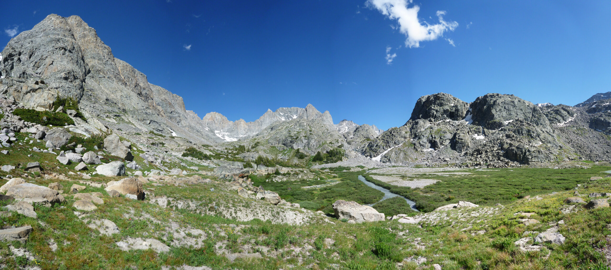
Gannett Peak is the highest peak in Wyoming at 13,809 feet (4,209 m) above sea level, located in the Wind River Range in the Bridger-Teton National Forest and Shoshone National Forest of western Wyoming. Generally, Gannett Peak sits along the Continental Divide and forms part of the spine of the Wind River Range — one of the most extensive alpine wilderness areas in the contiguous United States. Specifically, the peak rises approximately 7,000 feet above the surrounding valleys, with the famous Gooseneck Glacier descending from its upper slopes on the standard climbing route. The peak’s prominence is 2,594 feet, and it ranks 5th among the western US state high points by elevation. Notably, the standard climb of Gannett Peak combines a serious multi-day backcountry approach (20-25 miles one-way from Pole Creek trailhead near Pinedale, Wyoming) with technical alpine climbing including glacier travel on the Gooseneck Glacier and Class 3-4 scrambling on the summit ridge. Generally, this makes Gannett Peak one of the most technically demanding US state high points — typically ranked in the top 5 hardest alongside Denali (Alaska), Mount Rainier (Washington), Granite Peak (Montana), and Mount Hood (Oregon). Specifically, climbers without glacier travel experience and crevasse rescue training should not attempt Gannett Peak without a guide. Notably, the peak does not require special climbing permits — unlike many state high points that require lottery permits.
Key Takeaways
- 13,809 feet (4,209 m) elevation — Wyoming’s highest peak.
- Wind River Range location — Bridger-Teton + Shoshone National Forests.
- Multi-day expedition — 4-6 days standard, 40-50 mi round trip.
- Glacier travel required — Gooseneck Glacier crevasse hazards mandate rope team travel.
- No permit lottery — significantly more logistics-accessible than peaks like Half Dome or Whitney.
- Best season July-early September — mid-July to mid-August optimal.
- Class 3-4 summit scrambling + glacier — combines hiking, climbing, mountaineering.
- One of the hardest state high points — top 5 most difficult.
- Standard equipment: rope, harness, crampons, ice axe, helmet, crevasse rescue gear.
- Pinedale, Wyoming is the standard staging town (Pole Creek trailhead).
✓ Editorial Trust Signals
- USFS sourced: Bridger-Teton + Shoshone
- USGS verified: 13,809 ft elevation
- Mountain Project: Route info
- American Alpine Club: Climbing records
- WFA certified review: Dawson Ludlow
- Research-based: Honest framing
- Last verified: June 9, 2026
- Review cycle: Quarterly
📍 Location, Map & Current Weather
Gannett Peak sits at approximately 43.1842°N latitude and 109.6541°W longitude in the Wind River Range of western Wyoming. Generally, the peak is in remote backcountry — the closest road access is via Pinedale (50 miles southwest) or Dubois (45 miles northeast). Specifically, weather conditions on Gannett Peak are highly variable due to the peak’s high elevation and exposure — always check current conditions before planning trips.
🗺 Interactive Map
Map view of Gannett Peak in the Wind River Range, Wyoming. Click and drag to explore the surrounding wilderness, Pole Creek trailhead area, and approach routes.
🌤 Interactive Weather Map & Forecast
Interactive weather map for the Gannett Peak area powered by Windy.com — showing current conditions plus 10-day forecast. Generally, weather can vary significantly between the trailhead elevation (~9,000 ft) and the summit (13,809 ft) — temperatures at the summit are typically 15-25°F cooler than at trailhead level with significantly higher wind exposure. Toggle the overlay (top right) to view temperature, wind, clouds, precipitation, or snow.
📊 Detailed Alpine Forecasts (Elevation-Specific)
For mountain climbers, the most useful forecasts are elevation-specific — showing different conditions at the trailhead, mid-mountain, and summit. Specifically, summit weather can be dramatically different from valley weather on the same day. Generally, the gold standard for mountain-specific forecasts is Mountain-Forecast.com:
Mountain-Forecast.com
3 separate forecasts at base, mid, and summit elevations. Used by climbers worldwide.
View Forecast →NWS Point Forecast
Official National Weather Service 7-day forecast for the Gannett Peak coordinates.
View NWS →Generally, mountain weather changes rapidly — always check forecasts within 24 hours of summit attempts. Specifically, for Gannett Peak: (1) Check Mountain-Forecast.com for elevation-specific conditions; (2) Cross-reference with NOAA NWS for the official forecast; (3) Watch the Windy map for synoptic patterns 2-3 days out; (4) Call the Bridger-Teton ranger station for current trail and trailhead conditions. Notably, afternoon thunderstorms are common in July-August — most climbers plan summit days starting at 2-4 AM to be off exposed terrain by noon.
About Gannett Peak — Wyoming’s Highest Mountain
Gannett Peak is the highest peak in Wyoming at 13,809 feet (4,209 meters), located in the Wind River Range in the Bridger-Teton National Forest and Shoshone National Forest of western Wyoming. Generally, the peak sits along the Continental Divide and forms part of the spine of the Wind River Range — one of the most extensive alpine wilderness areas in the contiguous United States. Specifically, Gannett Peak rises approximately 7,000 feet above the surrounding valleys, with its famous Gooseneck Glacier descending from the upper slopes on the standard climbing route.
What makes Gannett Peak distinctive among US state high points is the combination of remote backcountry approach with technical alpine climbing. Generally, most US state high points are either (a) drive-up summits with short trail walks, or (b) serious mountaineering objectives like Denali requiring weeks of expedition logistics. Specifically, Gannett Peak occupies an unusual middle ground — it requires a serious 4-6 day backcountry expedition with technical mountaineering skills but doesn’t reach the expedition scale of Denali or Rainier. Notably, this combination makes Gannett Peak one of the climbs that prevents many US high-pointers from completing all 50 state summits.
Additionally, Gannett Peak holds significance within the Wind River Range — a mountain range that contains 7 of Wyoming’s top 10 highest peaks and is considered the premier mountaineering range in Wyoming. Specifically, while the Grand Teton (13,775 ft) is more famous globally due to its dramatic profile and accessible road approach, Gannett Peak exceeds the Grand Teton by 34 feet and offers a fundamentally different climbing experience — wilderness backcountry rather than alpine technical climbing from a road base. Generally, both Gannett Peak and the Grand Teton are important objectives for serious Wyoming mountaineers.
Gannett Peak Elevation — How High Is Wyoming’s Tallest Mountain?
Gannett Peak Elevation: 13,809 Feet (4,209 Meters)
Gannett Peak elevation is 13,809 feet (4,209 meters) above sea level — making it the highest peak in Wyoming and one of the 50 US state high points. Specifically, this elevation places Gannett Peak 5th among the western US state high points and ranks it just behind Mount Rainier (Washington, 14,411 ft) and ahead of Mauna Kea (Hawaii, 13,803 ft) in the official USGS elevation ranking.
Notably, the Gannett Peak summit elevation has been officially confirmed by USGS surveys and is consistent across all authoritative sources. Generally, the peak rises approximately 7,000 feet above the surrounding valley floors with prominence (the vertical distance from the summit to the lowest contour that separates it from any higher peak) of 2,594 feet.
Gannett Peak Elevation in Context — US State High Points Ranking
Gannett Peak ranks 5th among western US state high points by elevation. Generally, here’s how Wyoming’s tallest mountain compares to the rest of the high points:
| Rank | State High Point | State | Elevation | Difficulty |
|---|---|---|---|---|
| #1 | Denali (Mt. McKinley) | Alaska | 20,310 ft | Very serious mountaineering |
| #2 | Mount Whitney | California | 14,505 ft | Long day hike or 2-day backpacking |
| #3 | Mount Elbert | Colorado | 14,440 ft | Long day hike (non-technical) |
| #4 | Mount Rainier | Washington | 14,411 ft | Serious mountaineering (glacier travel) |
| #5 | Gannett Peak | Wyoming | 13,809 ft | Multi-day expedition (glacier + class 3-4) |
| #6 | Mauna Kea | Hawaii | 13,803 ft | Drive-up summit (acclimatization required) |
| #7 | Kings Peak | Utah | 13,528 ft | Long day hike or 2-day backpacking |
| #8 | Wheeler Peak | Nevada | 13,065 ft | Long day hike |
| #9 | Granite Peak | Montana | 12,807 ft | Technical climbing (class 4) |
| #10 | Borah Peak | Idaho | 12,662 ft | Class 3 scrambling (Chicken Out Ridge) |
Generally, many people are surprised to learn that Gannett Peak (13,809 ft) is higher than the more famous Grand Teton (13,775 ft) by 34 feet. Specifically, this elevation comparison is one of the most-asked questions about Wyoming peaks. Notably, the Grand Teton’s far greater fame is due to its dramatic profile (rising 7,000+ feet from the Jackson Hole valley floor with no foothills), road-accessible approach (allowing one-day attempts), and famous technical climbing routes — not because of its elevation. Gannett Peak is higher but requires multi-day backcountry expedition, which makes it less famous despite being the actual highest point in Wyoming.
Gannett Peak Hike — Route Overview & Distance
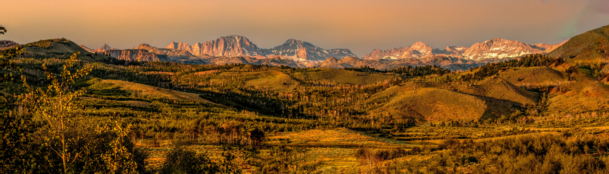
The Gannett Peak hike is a multi-day backcountry expedition rather than a day hike — typically requiring 4-6 days round trip with 40-50 miles of total distance depending on the approach chosen. Generally, this fundamentally distinguishes Gannett Peak from most state high points that can be done as long day hikes. Specifically, the Gannett Peak hike combines a 20-25 mile one-way backcountry approach with technical alpine climbing on the upper mountain — meaning the experience is essentially a backpacking trip plus a mountaineering climb combined.
Gannett Peak Hike — Standard Itinerary (Pole Creek Approach)
| Day | Activity | Distance | Camp Location |
|---|---|---|---|
| Day 1 | Hike from Pole Creek trailhead through Bridger Wilderness | ~9-12 mi | Lower meadows / Photographers Point area |
| Day 2 | Continue to high camp area; Titcomb Basin | ~10-12 mi | Titcomb Basin or below Bonney Pass (~10,500 ft) |
| Day 3 | Establish high camp; rest or acclimatize | ~3-5 mi | High camp below Gooseneck Glacier (~11,800 ft) |
| Day 4 (SUMMIT) | Pre-dawn start; Gooseneck Glacier; summit ridge; return | ~6-8 mi RT | Return to high camp |
| Day 5 | Pack out partway back toward trailhead | ~10-12 mi | Lower elevation camp |
| Day 6 | Final hike to trailhead | ~6-9 mi | Pole Creek trailhead / drive home |
Gannett Peak Hike — Distance and Time Breakdown
| Metric | Pole Creek Approach | Glacier Trail Approach |
|---|---|---|
| Trailhead | Pole Creek (near Pinedale) | Glacier Trail (near Dubois) |
| One-way distance | ~20-22 miles | ~24-27 miles |
| Round trip distance | ~40-44 miles | ~48-54 miles |
| Total elevation gain | ~7,000 ft (cumulative) | ~7,500 ft (cumulative) |
| Approach difficulty | Moderate (trail well-defined) | Moderate-Hard (less developed) |
| Typical trip duration | 4-6 days | 5-7 days |
| Aesthetic experience | Titcomb Basin alpine grandeur | Northeast face approach; Dinwoody Glacier |
| Crowds | Higher (popular) | Lower (less popular) |
Generally, the Pole Creek approach is the most popular Gannett Peak route because it’s shorter (~40 miles round trip vs ~50), has a more developed trail, and passes through the spectacular Titcomb Basin — one of the most iconic alpine landscapes in Wyoming. Specifically, the Glacier Trail (Dubois) approach is longer but offers a quieter, less crowded experience for climbers wanting solitude. Notably, both approaches converge at the upper glaciers and have similar technical demands on the summit day.
How Hard Is Gannett Peak to Climb?
Gannett Peak is widely considered one of the harder US state high points to climb — typically ranked in the top 5 most difficult state high points alongside Denali (Alaska), Mount Rainier (Washington), Granite Peak (Montana), and Mount Hood (Oregon). Generally, the difficulty comes from the combination of multiple challenging factors rather than any single extreme element. Specifically, the difficulty assessment:
| Difficulty Factor | Gannett Peak Rating | Why |
|---|---|---|
| Backcountry approach | Hard (4-6 days) | 20-25 mile one-way approach is substantial commitment |
| Technical climbing | Moderate (Class 3-4) | Summit ridge requires confident scrambling on exposed terrain |
| Glacier travel | Required | Gooseneck Glacier has crevasse hazards requiring rope team |
| Altitude | Moderate (13,809 ft) | High enough to affect unacclimatized climbers; AMS possible |
| Weather sensitivity | High | Wind River weather variable; thunderstorms common July-August |
| Self-sufficiency | High | Remote location; Search and Rescue 12+ hours away |
| Equipment complexity | High | Full mountaineering kit + 4-6 day backpacking kit |
| Logistics complexity | Moderate | No permit lottery; but remote trailhead access |
Gannett Peak Difficulty vs Other State High Points
Generally, Gannett Peak ranks among the top 5 hardest US state high points by overall difficulty:
| Difficulty Rank | State High Point | Why Harder/Easier |
|---|---|---|
| #1 hardest | Denali (Alaska, 20,310 ft) | 3-week expedition; severe cold; serious altitude |
| #2 hardest | Mount Rainier (Washington, 14,411 ft) | Major glacier travel; technical climbing |
| #3 hardest | Gannett Peak (Wyoming, 13,809 ft) | Multi-day approach + glacier + Class 3-4 |
| #4 hardest | Granite Peak (Montana, 12,807 ft) | Class 4 climbing; remote approach |
| #5 hardest | Mount Hood (Oregon, 11,239 ft) | Glacier travel; technical climbing; rockfall hazard |
| Tier above (Easier than top 5): | ||
| Tier 2 | Mount Whitney (California, 14,505 ft) | Long day hike but non-technical |
| Tier 2 | Borah Peak (Idaho, 12,662 ft) | Class 3 Chicken Out Ridge |
| Tier 2 | Mount Elbert (Colorado, 14,440 ft) | Long day hike, non-technical |
| Tier 2 | Kings Peak (Utah, 13,528 ft) | Long day hike, scrambling |
Gannett Peak is not a hike — it is a multi-day mountaineering expedition. Specifically, climbers attempting Gannett Peak should have: (1) prior multi-day backpacking experience (50+ miles minimum); (2) glacier travel experience including crevasse rescue training; (3) Class 3-4 scrambling experience on exposed terrain; (4) altitude experience at 12,000-14,000 ft; (5) full mountaineering equipment proficiency. Generally, climbers without these prerequisites should either hire a guide or build the prerequisite experience on smaller objectives first. Notably, Search and Rescue calls on Gannett Peak typically involve climbers who attempted the peak without adequate preparation for one or more of these dimensions.
Do You Need Ropes to Climb Gannett Peak?
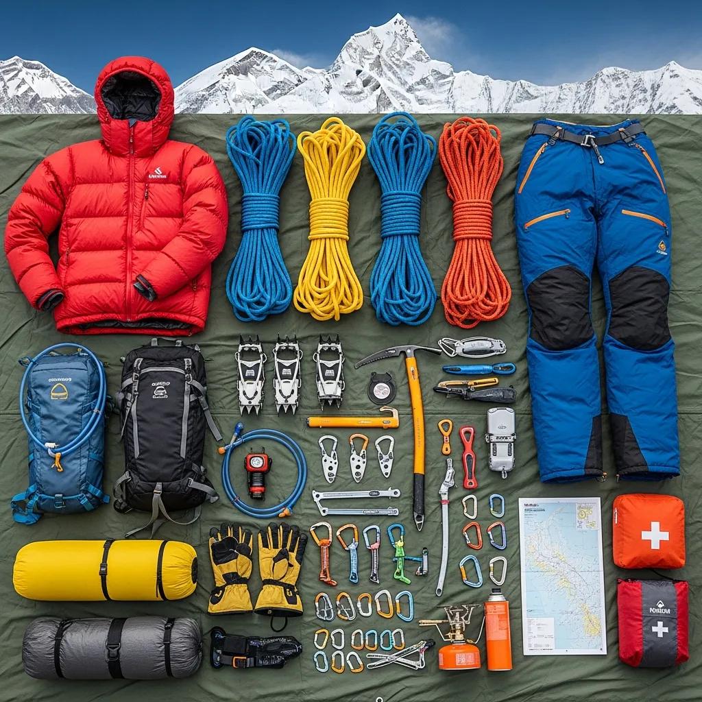
Yes, you typically need ropes to climb Gannett Peak via the standard route. Specifically, the Gooseneck Glacier section of the standard route includes crevasse hazards that require rope team travel for safety. Generally, the standard mountaineering equipment required for Gannett Peak includes:
| Equipment | Purpose | Specifications |
|---|---|---|
| Climbing rope | Rope team travel on Gooseneck Glacier | 30-50m dynamic mountaineering rope (single or twin) |
| Harness | Rope team connection | Climbing harness or mountaineering harness |
| Crampons | Glacier travel and snow ascent | 10-12 point steel crampons; semi-automatic or strap-on |
| Ice axe | Self arrest, snow climbing | General mountaineering axe, 60-70cm typical |
| Helmet | Rockfall protection on summit ridge | Climbing helmet UIAA certified |
| Snow protection | Crevasse rescue anchor | 1-2 snow pickets (24 inch typical) |
| Crevasse rescue kit | Self/companion rescue | Prusiks, ascenders, double sling, locking carabiners |
| Belay device | Belay system | ATC Guide or Munter hitch capable |
| Carabiners | Anchor and rope systems | 4-6 locking + 4-6 non-locking |
Generally, some experienced parties have soloed the Gooseneck Glacier in periods of minimal crevasse exposure (late season, low snow years), but this is not the standard recommendation. Specifically, the National Forest Service, Wind River guide operators, and the American Alpine Club uniformly recommend rope team travel as the safe standard for Gannett Peak. Notably, climbers without glacier travel experience and crevasse rescue training should not attempt Gannett Peak without a guide — the consequences of unroped crevasse falls are typically fatal.
Climbing Gannett Peak — Standard Routes
Generally, Gannett Peak has two main approach routes that lead to the standard Gooseneck Glacier summit route, plus alternative summit variations for experienced climbers. Specifically, the standard climbing routes are:
Gooseneck Glacier Route (Standard)
The Gooseneck Glacier is the standard summit route on Gannett Peak. Specifically, climbers ascend from high camp (~11,800 ft) onto the Gooseneck Glacier, navigate the crevasse field via rope team travel, then transition to Class 3-4 scrambling on the summit ridge to reach the 13,809 ft summit. Generally, summit day is 8-12 hours round trip from high camp depending on conditions and fitness. Notably, this route requires full mountaineering equipment including rope, harness, crampons, ice axe, helmet, and crevasse rescue gear.
Bonney Pass / Dinwoody Glacier Route
The Bonney Pass variation crosses over Bonney Pass (12,800 ft) and descends to the Dinwoody Glacier before ascending Gannett Peak from the northeast. Specifically, this route is sometimes used by climbers approaching from the Glacier Trail (Dubois) side or as a variation by climbers wanting to complete a route loop. Generally, this route involves more glacier travel and is less direct than the Gooseneck Glacier standard.
Gooseneck Pinnacle Direct
For experienced climbers seeking a more technical line, the Gooseneck Pinnacle Direct involves Class 4-5 rock climbing on the summit pyramid. Specifically, this is a variation rather than a separate route, accessed via the standard Gooseneck Glacier approach but with the technical summit pitches. Generally, this is for climbers with confident multi-pitch rock climbing experience in mountaineering boots.
Winter Ascent of Gannett Peak
Winter ascents of Gannett Peak are exceptionally rare and require ski touring approach, full winter mountaineering equipment, and acceptance of significant avalanche risk. Specifically, the approach trails are not maintained in winter and require breaking trail through 20+ miles of backcountry skiing terrain. Generally, this is an objective for elite winter mountaineers with substantial Wind River winter experience.
Approach Trails to Gannett Peak
Pole Creek Approach (Most Popular)
The Pole Creek approach is the most popular route to Gannett Peak, starting from the Pole Creek trailhead approximately 40 miles north of Pinedale, Wyoming. Specifically, the trailhead is reached via Pinedale → Half Moon Lake Road → Pole Creek Road (the final 10-15 miles is unpaved). Generally, the approach takes 2 days to reach high camp:
- Day 1: Trailhead → Photographers Point area → Hobbs Lake or vicinity (~9-12 mi)
- Day 2: Continue past Island Lake → Titcomb Basin → high camp area (~10-12 mi)
- Day 3: Final approach to high camp below Gooseneck Glacier (~3-5 mi)
Glacier Trail Approach (Alternative)
The Glacier Trail approach starts from the Glacier Trail trailhead approximately 30 miles southwest of Dubois, Wyoming. Specifically, this approach is longer (~24-27 miles one-way) but offers different scenery and significantly less crowding. Generally, the trail passes through Dinwoody Creek drainage and approaches Gannett from the northeast.
| Approach | Distance | Pros | Cons |
|---|---|---|---|
| Pole Creek | ~20-22 mi one-way | Shorter; well-traveled; Titcomb Basin scenery | More crowded; some sections rough |
| Glacier Trail | ~24-27 mi one-way | Less crowded; different aesthetic | Longer; less developed; longer drive from Pinedale |
Best Season for Climbing Gannett Peak
| Month | Conditions | Recommendation |
|---|---|---|
| January-May | Deep snow; winter mountaineering only | Avoid unless winter expert |
| Early June | Snow on approaches; deep glaciers; high water crossings | Too early for most |
| Late June | Some snow on approaches; postholing common | Marginal; experienced parties only |
| Early July | Trails becoming reliable; glaciers stable | Good window opening |
| Mid-July | ★ Optimal conditions begin | Best month — peak season |
| Late July | Peak season; afternoon thunderstorms | Excellent; expect crowds at Titcomb Basin |
| August | ★ Stable conditions; lower water; cool nights | ★ Best overall month |
| Early September | Stable weather; reducing crowds | Excellent |
| Mid-September | Glaciers more open; cooler temps | Good for experienced parties |
| Late September | Early winter possible; smaller weather windows | Marginal; experienced only |
| October-December | Winter conditions; approach closed | Winter mountaineering only |
Training & Preparation for Gannett Peak
Gannett Peak preparation requires 6-12 months of progressive training building toward the unique combination of multi-day backpacking endurance plus technical mountaineering skills. Generally, the training framework:
| Timeframe | Training Focus | Sample Activities |
|---|---|---|
| 9-12 months before | Foundation aerobic + strength | 3-4x cardio + 2x strength + weekly hikes |
| 6-9 months before | Volume building + glacier skills | Long weekend hikes + glacier travel course |
| 3-6 months before | Specific training | Multi-day backpacking trips with weight |
| 1-3 months before | Peak specificity | 15-20 mile hikes with full pack; crevasse rescue practice |
| 2 weeks before | Taper + acclimatization plan | Reduced volume; arrival in mountains 2-3 days early |
Cross-reference our complete training pillar: Mountain Training Program →
Complete Gannett Peak Gear List
| Category | Item | Notes |
|---|---|---|
| Footwear | Mountaineering boots (crampon compatible) | B2/B3 rated; sturdy support; broken in |
| Technical climbing | 30-50m rope, harness, helmet | Per rope team requirements |
| Glacier travel | Crampons, ice axe, snow pickets | 10-12 point steel crampons; 60-70cm axe |
| Crevasse rescue | Prusiks, ascenders, mechanical advantage | Full rescue kit per climber |
| Backpack | 65-75L pack | Multi-day capacity |
| Shelter | 3-season tent + groundsheet | Wind-resistant for high camp |
| Sleep system | Sleeping bag (15-30°F rating) + pad | Cold nights at high camp |
| Cooking | Stove + fuel for 4-6 days | Whitebox or canister stove |
| Food | ~12,000-15,000 calories total | Mountain House, bars, snacks |
| Hydration | 2-3L capacity + purification | Sawyer Squeeze or Aquamira |
| Clothing | Full layering system | Base + mid + insulating + shell |
| Navigation | Map + compass + GPS | Gaia GPS recommended |
| Emergency | PLB or satellite messenger | Garmin inReach essential |
| First aid | Wilderness-specific kit | Multi-day capability |
| Sun protection | Glacier glasses + sunscreen | Snow blindness real at altitude |
| Bear protection | Bear canister | Required in Bridger-Teton |
Logistics & Permits
Permits and Regulations
One of the significant logistics advantages of Gannett Peak is that no climbing or backpacking permits are required. Generally, the Bridger-Teton National Forest and Shoshone National Forest do not require permits for Gannett Peak — making it significantly easier from a logistics standpoint than peaks like Half Dome (lottery) or Mount Whitney (lottery).
Specifically, the requirements are:
- Standard Wilderness regulations including Leave No Trace
- Bear-resistant food storage (bear canisters required in most Wind River Range areas)
- Campfire restrictions per current fire status (often complete bans in summer)
- Voluntary trip registration encouraged with local Search and Rescue
- Commercial guide services require special use permits
Trailhead Access
| Trailhead | Access | Drive Time | Notes |
|---|---|---|---|
| Pole Creek | Pinedale → Half Moon Lake Rd → Pole Creek Rd | 1.5 hours from Pinedale | 10-15 mi unpaved; rough at end |
| Glacier Trail | Dubois → Trail Lake Rd | 1 hour from Dubois | Unpaved final access |
| From Jackson Hole (JAC) | Jackson → Pinedale (90 mi) or Dubois (75 mi) | 2-2.5 hr | Closest commercial airport |
| From Salt Lake City (SLC) | SLC → Pinedale via I-80 + US-191 | 5 hours | Major airport option |
Gannett Peak vs Other State High Points
| Comparison | Gannett Peak | Compared Peak | Difficulty Difference |
|---|---|---|---|
| vs Kings Peak (Utah) | 13,809 ft / glacier + Class 3-4 | 13,528 ft / scrambling | Gannett significantly harder (glacier travel) |
| vs Granite Peak (Montana) | 13,809 ft / Class 3-4 + glacier | 12,807 ft / Class 4 scrambling | Comparable; Granite more technical climbing, Gannett more glacier |
| vs Mount Whitney (California) | 13,809 ft / multi-day expedition | 14,505 ft / long day hike | Gannett significantly harder logistics |
| vs Mount Elbert (Colorado) | 13,809 ft / 4-6 days mountaineering | 14,440 ft / 1-day non-technical hike | Gannett dramatically harder |
| vs Mount Rainier (Washington) | 13,809 ft / 4-6 day expedition | 14,411 ft / 2-3 day expedition | Rainier more concentrated; Gannett longer approach |
| vs Borah Peak (Idaho) | 13,809 ft / multi-day backcountry | 12,662 ft / day hike (Class 3) | Gannett significantly harder |
Common Gannett Peak Mistakes
(1) Attempting without glacier travel experience — Gooseneck Glacier crevasses can be fatal for unprepared parties. (2) Underestimating the approach — 20-25 miles one-way is more than most weekend backpackers have done. (3) Inadequate weight management — heavy packs over 5+ days exhaust climbers before summit day. (4) Going too early in season — June attempts often fail due to snow and high water on approaches. (5) Solo glacier travel — Wind River guide operators strongly discourage soloing the Gooseneck. (6) Skipping crevasse rescue practice — having the gear without knowing how to use it doesn’t help. (7) No bear canister — Bridger-Teton requires food storage; rangers check. (8) Late summit day starts — afternoon thunderstorms common; start summit day at 3-4 AM. (9) Insufficient food — multi-day expeditions burn 4,000+ calories/day; pack 12,000-15,000 total. (10) No emergency communication — Search and Rescue is 12+ hours away; PLB or satellite messenger essential.
Frequently Asked Questions About Gannett Peak
What is the elevation of Gannett Peak?
Gannett Peak elevation is 13,809 feet (4,209 meters) above sea level — making it the highest peak in Wyoming and one of the 50 US state high points. Gannett Peak is located in the Wind River Range in the Bridger-Teton and Shoshone National Forests of western Wyoming. The peak rises approximately 7,000 feet above the surrounding valleys, with its prominence (the vertical distance from the summit to the lowest contour that separates it from any higher peak) being 2,594 feet. Gannett Peak ranks 5th among the western US state high points by elevation, sitting between Mount Rainier (Washington, 14,411 ft) and Mauna Kea (Hawaii, 13,803 ft) in the official USGS ranking. The Gannett Peak summit is among the most technically demanding state high points to reach — requiring glacier travel skills and a multi-day backcountry approach.
How hard is Gannett Peak to climb?
Gannett Peak is widely considered one of the harder US state high points to climb — typically ranked in the top 5 most difficult state high points alongside Denali (Alaska), Mount Rainier (Washington), Granite Peak (Montana), and Mount Hood (Oregon). The climbing difficulty rates Class 3-4 with mandatory glacier travel including crevasse hazards on the Gooseneck Glacier on the standard route. The technical demands are: (1) the long backcountry approach — 20-25 miles one-way from the Pole Creek trailhead to base camp; (2) glacier travel requiring crampons, ice axe, rope team coordination, and crevasse rescue knowledge; (3) Class 3-4 scrambling on the summit ridge with significant exposure; (4) altitude factor (13,809 ft can cause symptoms in unacclimatized climbers); (5) weather variability — Wind River Range mountain weather is highly variable; (6) multi-day commitment (4-6 days typical) requiring full expedition logistics. Climbers without glacier travel experience should not attempt Gannett Peak — either hire a guide or build glacier travel skills on accessible peaks first.
How long is the Gannett Peak hike?
The Gannett Peak hike is typically 40-50 miles round trip depending on route choice, with the standard Pole Creek approach being approximately 40 miles round trip and the alternative Glacier Trail approach being approximately 50 miles round trip. This is a multi-day backpacking expedition rather than a day hike — most climbers complete Gannett Peak in 4-6 days. The route breakdown is: Day 1 hike from trailhead to first camp (8-12 miles); Day 2 hike to high camp near Dinwoody Glacier or below Gooseneck Glacier (8-12 miles); Day 3 summit day with technical climbing (10-15 hours round trip from high camp); Day 4-5 descent and return to trailhead. The Gannett Peak hike is unlike most other state high point hikes — it combines a serious multi-day backpacking trip with technical alpine climbing on the same expedition. The total elevation gain is approximately 7,000+ feet depending on route.
Do you need ropes to climb Gannett Peak?
Yes, you typically need ropes to climb Gannett Peak via the standard route. The Gooseneck Glacier section of the standard route includes crevasse hazards that require rope team travel for safety. The standard mountaineering equipment required for Gannett Peak includes: a glacier travel rope (typically 30-50 meter dynamic mountaineering rope), harness, crampons, ice axe, helmet, snow protection (pickets), and crevasse rescue gear (prusiks, ascenders, mechanical advantage system). While some experienced parties have soloed the Gooseneck Glacier in periods of minimal crevasse exposure (late season, low snow years), the National Park Service and established Wind River guide operators uniformly recommend rope team travel as the safe standard. Climbers without glacier travel experience and crevasse rescue training should not attempt Gannett Peak without a guide. Alternative routes (Bonney Pass to Dinwoody Glacier) involve similar glacier travel and similar gear requirements.
What is the best route to climb Gannett Peak?
The most popular route to climb Gannett Peak is the Pole Creek approach via the Gooseneck Glacier, which is considered the standard route. This route involves: (1) hiking approximately 20-25 miles from the Pole Creek trailhead near Pinedale, Wyoming, through the Wind River Range; (2) establishing high camp at Bonney Pass area (~11,800 ft) or below Gooseneck Glacier; (3) summit day involving Gooseneck Glacier traverse with rope team travel and Class 3-4 summit ridge scrambling. The alternative Glacier Trail approach (Dubois side) is longer (approximately 50 miles round trip) but offers different aesthetic and approaches the peak from the northeast via the Dinwoody Glacier. Both routes converge at the upper glacier sections and have similar technical demands. The Pole Creek route is generally more popular among climbers because the trailhead is closer to typical entry points and the approach is somewhat shorter, though both routes are committed multi-day undertakings.
How tall is Gannett Peak compared to other Wyoming peaks?
Gannett Peak at 13,809 feet is the tallest peak in Wyoming, exceeding the Grand Teton (13,775 ft) by 34 feet. The Wyoming high peaks rankings are: (1) Gannett Peak 13,809 ft (Wind River Range); (2) Grand Teton 13,775 ft (Teton Range, more famous but technically lower); (3) Fremont Peak 13,749 ft (Wind River Range); (4) Mount Warren 13,720 ft (Wind River Range); (5) Helen Peak 13,620 ft (Wind River Range). The Wind River Range contains the majority of Wyoming’s high peaks, including 7 of the state’s top 10 — making it the premier mountaineering range in Wyoming. The Grand Teton is far more famous than Gannett Peak globally despite being lower because Grand Teton has dramatic technical climbing routes accessible from a road, while Gannett Peak requires a multi-day backcountry approach. Both peaks are important objectives for serious Wyoming mountaineers.
When is the best time to climb Gannett Peak?
The best time to climb Gannett Peak is July through early September, with mid-July to mid-August being optimal. This window provides: (1) snow-free or minimal-snow approach trails; (2) glacier conditions that have stabilized but before late-season crevasse opening; (3) generally stable weather with reduced afternoon thunderstorm intensity; (4) warmer temperatures for backcountry camping. The climbing season breakdown is: June (early season, deep snow on approaches, glacier crevasses well-bridged but heavy postholing); July-August (peak season, best overall conditions); September (late season, more open crevasses requiring more careful navigation, cooler temperatures, smaller crowds); October-May (winter conditions, deep snow, technical winter mountaineering only). Weather windows for the summit attempt are critical — afternoon thunderstorm risk increases significantly in July-August, so most climbers plan summit days starting at 2-4 AM to be off exposed terrain before noon.
Where is Gannett Peak located?
Gannett Peak is located in the Wind River Range of western Wyoming, in the Bridger-Teton National Forest and Shoshone National Forest. The exact coordinates are approximately 43.1842° N latitude, 109.6541° W longitude. The peak sits along the Continental Divide and forms the boundary between Fremont County and Sublette County in Wyoming. The closest towns are: Pinedale, Wyoming (50 miles southwest, primary access for Pole Creek trailhead); Dubois, Wyoming (45 miles northeast, primary access for Glacier Trail trailhead); Jackson, Wyoming (90 miles west, regional airport access via Jackson Hole Airport); Lander, Wyoming (60 miles southeast). The closest cities with major airports are Jackson Hole Airport (JAC, 90 miles) and Salt Lake City International (SLC, 5 hours by car). The trailhead access requires driving through remote roads — the final approach to Pole Creek trailhead is approximately 40 miles of forest service roads from Pinedale.
What permits do you need to climb Gannett Peak?
You do not need special permits to climb Gannett Peak — Bridger-Teton National Forest and Shoshone National Forest do not require climbing or backpacking permits for Gannett Peak. This makes Gannett Peak significantly easier from a logistics standpoint than peaks requiring lottery permits (like Half Dome or Mount Whitney). The requirements are: (1) standard Wilderness regulations including Leave No Trace; (2) bear-resistant food storage (Bridger-Teton requires bear canisters in most of the Wind River Range); (3) campfire restrictions per current fire status; (4) registration is encouraged but not required; (5) commercial guide services require special use permits. Climbers should: (a) register their trip with someone reliable who knows their detailed itinerary; (b) consider voluntary trip registration with local Search and Rescue; (c) check current fire restrictions before trips; (d) follow established Wilderness Leave No Trace protocols.
How does Gannett Peak compare to other state high points?
Gannett Peak is one of the harder US state high points to climb, typically ranked in the top 5 most difficult alongside Denali (Alaska, 20,310 ft), Mount Rainier (Washington, 14,411 ft), Granite Peak (Montana, 12,807 ft), and Mount Hood (Oregon, 11,239 ft). By elevation Gannett Peak ranks 5th among western state high points: Denali #1 (20,310 ft), Mount Whitney California #2 (14,505 ft), Mount Elbert Colorado #3 (14,440 ft), Mount Rainier Washington #4 (14,411 ft), Gannett Peak Wyoming #5 (13,809 ft), Mauna Kea Hawaii #6 (13,803 ft), Kings Peak Utah #7 (13,528 ft), and so on. By climbing difficulty (technical demands + approach commitment), Gannett ranks higher than its elevation suggests because it combines a multi-day backcountry approach with glacier travel — making it harder than higher peaks like Mount Elbert (which is essentially a long day hike). The State High Pointers organization (Highpointers Club) tracks completions of all 50 state high points, and Gannett Peak is consistently cited as one of the climbs that prevents many high-pointers from completing the list.
Methodology & Editorial Standards
How This Guide Was Built
1. Research-Based Approach (Honest Framing)
This Gannett Peak guide is research-based — Gannett Peak is outside our editorial team’s direct climbing experience to date. Specifically, while Travis Ludlow has climbed Mount Kilimanjaro (Tanzania), Pico de Orizaba and Iztaccíhuatl (Mexico), Rainier-class peaks, and has direct experience with Utah peaks, Wind River Range peaks have not yet been included. Generally, we believe this honest framing is more useful than pretending first-hand experience we don’t have.
2. US Forest Service (USFS) Official Sources
Land management, regulations, and trail information cross-references the Bridger-Teton National Forest and Shoshone National Forest official publications.
3. USGS Elevation Records
Elevation data (13,809 ft) and geographic coordinates reference USGS official records and the United States Geological Survey topographic map series.
4. Mountain Project + American Alpine Journal
Technical climbing route information (Gooseneck Glacier, Bonney Pass, Pinnacle variations) cross-references Mountain Project and the American Alpine Journal.
5. Highpointers Club
State high points context and comparative difficulty assessments reference the Highpointers Club — the established US state high pointing organization.
6. Established Wind River Guide Operators
Trip logistics, route specifics, and operator-recommended approaches are cross-referenced with established Wind River Range guide operators including Exum Mountain Guides, Jackson Hole Mountain Guides, and Cleve Williams’ guides.
7. Editorial Independence
No affiliate partnerships with Wind River guide services, gear brands, or tour operators influence recommendations. Cost ranges are presented from public information across multiple operators. The article generates revenue only through Google AdSense display ads when applicable.
8. Update Cycle
This guide is reviewed quarterly. Next scheduled review: September 2026. Trail conditions and permit requirements update annually — verify current information at the Bridger-Teton ranger station before planning.
Sources and References
Numbered Source References
This Gannett Peak guide synthesizes data from authoritative US Forest Service sources, USGS records, established climbing databases, and Wind River Range guide operators.
- Bridger-Teton National Forest (USFS) · https://www.fs.usda.gov/btnf — Official land management.
- Shoshone National Forest (USFS) · https://www.fs.usda.gov/shoshone — East side land management.
- USGS Topographic Maps · 7.5-minute quadrangle Gannett Peak series — elevation and geographic data.
- Mountain Project · https://www.mountainproject.com/ — Climbing route database.
- American Alpine Journal · AAJ archive — Historical climbing records.
- Highpointers Club · https://highpointers.org/ — State high points organization.
- Wind River Range climbing guidebooks · Joe Kelsey “Climbing and Hiking in the Wind River Mountains”.
- Mountain-Forecast.com · Mountain-specific weather forecasts.
- National Weather Service (NOAA) · forecast.weather.gov — Regional weather forecasts.
- Established Wind River guide operators · Trip logistics references.
Methodology note. Quarterly review cycle — next review September 2026. Trail conditions update with USFS announcements. Always verify current trail and route conditions via Bridger-Teton ranger stations before trips.
About the Author
Continue Your Gannett Peak Research
Start Planning Your Gannett Peak Expedition
Gannett Peak is one of the most rewarding multi-day mountaineering objectives in the contiguous United States — and with proper preparation, climbing Wyoming’s highest peak is accessible to fit mountaineers with glacier travel experience. Generally, the most important step is to honestly assess your prerequisites: have you done multi-day backpacking with 30+ pound packs? Do you have glacier travel and crevasse rescue training? Are you comfortable with Class 3-4 scrambling on exposed terrain? Specifically, if any of these answers is “no,” your right next step is building that skill on a more accessible objective before Gannett Peak. Notably, alternative paths include hiring a Wind River guide for Gannett Peak (recommended for first-time backcountry mountaineers) or building skills on easier state high points first.
Bridger-Teton NF → Gannett Peak Routes →Gannett Peak & the US State Highpoints
Wyoming’s highest is one of the tougher state highpoints. Compare it with the other US highpoints below.
Was this helpful?
🏔Related peaks nearby
🧭Explore & compare
Global Summit Guide is an independent mountaineering resource founded in 2026. The team combines first-hand trekking and climbing experience with in-depth research and professional health and nutrition review to help climbers choose objectives, prepare properly, and stay safe.
Health, altitude, and nutrition content is reviewed by Taylor Ludlow (Registered Nurse) and Brigg Hoopes (Nutritionist).
What We Don't Know Yet
Mountain information changes quickly. This box explains the limits of what this page can responsibly promise.
- Weather, snowpack, avalanche risk, road access, and route conditions can change quickly and may be different on your climbing dates.
- Route conditions, trailhead access, crevasse exposure, stream crossings, and rescue access may vary from published planning guidance.
- Gear requirements can change by season, route variation, weather window, personal cold tolerance, and guide-service requirements.
- Fitness and altitude response vary by person; no guide, itinerary, or training plan can guarantee acclimatization or summit success.
Verify current conditions with official land managers, guide services, local forecasts, and current route reports before booking or climbing.
Mountaineering, rock and ice climbing, glacier travel, and high-altitude activity are inherently dangerous and can result in serious injury or death. The information on Global Summit Guide is provided for general informational and educational purposes only and is not a substitute for professional instruction, qualified guiding, proper equipment, or your own judgment and experience.
Route conditions, weather, snowpack, permits, regulations, and hazards change constantly and may differ from what is described here. Details may be incomplete, out of date, or contain errors. Always verify current information with local authorities, certified guides, and official sources before making any decision in the mountains.
Nothing on this site is medical, legal, or financial advice. Our fitness, acclimatization, altitude, and nutrition content is general in nature; consult a qualified physician before beginning any strenuous exercise program or exposing yourself to high altitude.
You are solely responsible for your own safety and decisions. To the fullest extent permitted by law, Global Summit Guide and its team accept no liability for any loss, injury, damage, or expense arising from use of, or reliance on, this information. By using this site you acknowledge these risks and accept these terms.
Some links on this site may be affiliate links. If you buy through them we may earn a small commission at no extra cost to you; this never affects our recommendations.
Global Summit Guide recommendation path
Next Best Mountain to Research
Use these recommendations to continue the right planning path instead of stopping on one page.
Use current permit, weather, route, and operator information before booking or climbing.
Search Flights, Hotels & Rental Cars
Have the mountain or destination picked? Use Expedia to compare the flights, lodging and rental cars that fit your actual trip dates. For mountain travel, consider arriving early enough for delays and adding a buffer night after the climb before a fixed flight home.
Compare current flight, hotel and car options.
Affiliate disclosure: Global Summit Guide may earn a commission if you book through this link, at no additional cost to you.