
Last updated September 16, 2026
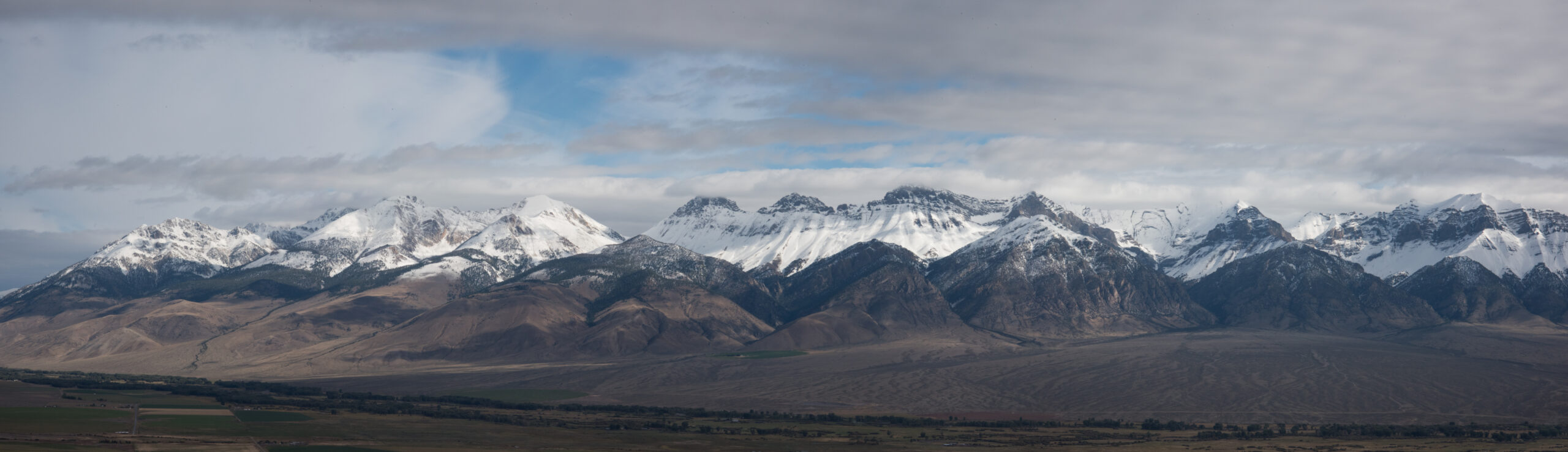
How to Climb Borah Peak: Idaho’s Highest Point & Chicken-Out Ridge
At 12,662 ft (3,859 m), Borah Peak is the roof of Idaho – a serious Class 3 scramble that gains over 5,200 ft in under four miles, crosses the infamous Chicken-Out Ridge, and rises straight out of the fault line that produced the state’s largest recorded earthquake.
Borah Peak is one of the great state-highpoint challenges of the lower 48 – a big, exposed Class 3 day, not a walk-up. From the Birch Springs trailhead (~7,400 ft) you climb over 5,200 ft in roughly 3.5 miles to the 12,662 ft summit, with the crux being Chicken-Out Ridge: airy scrambling and a short downclimb where a slip would be serious, plus an early-season snow bridge that can demand an ice axe.
No permit, no fee, no crowds like Colorado’s 14ers – but real commitment. Come fit, come in the mid-July-to-September window when the ridge is dry, start before dawn, and Idaho’s roof is one of the most rewarding summits in the West.
On this page
Why Borah Peak is Idaho’s great summit
A highly prominent Ultra, an active glacier, and a mountain still being built by earthquakes.
Borah Peak – also called Mount Borah or Beauty Peak – is the highest point in Idaho at 12,662 ft (3,859 m) and the 11th-highest of the 50 US state highpoints. It anchors the Lost River Range in central Idaho’s Custer County, inside the Salmon-Challis National Forest between the small towns of Mackay and Challis. The mountain was nameless until surveyors found it higher than Hyndman Peak; the USGS named it in 1934 for William Borah, the long-serving Idaho US Senator. Three things make it stand out beyond its height.
It’s one of the most prominent peaks in the country. With 5,982 ft of topographic prominence, Borah is an “Ultra” – it rises far above everything around it, which is why it feels so much bigger than its elevation number suggests. It holds Idaho’s only active glacier, a small ice body high on the peak that the USGS officially recognized in February 2021. And it is still being built: Borah sits on the Lost River Fault in the Basin and Range, and the 1983 earthquake that struck its base literally lifted the range while dropping the valley – geology you can see from the trailhead road.
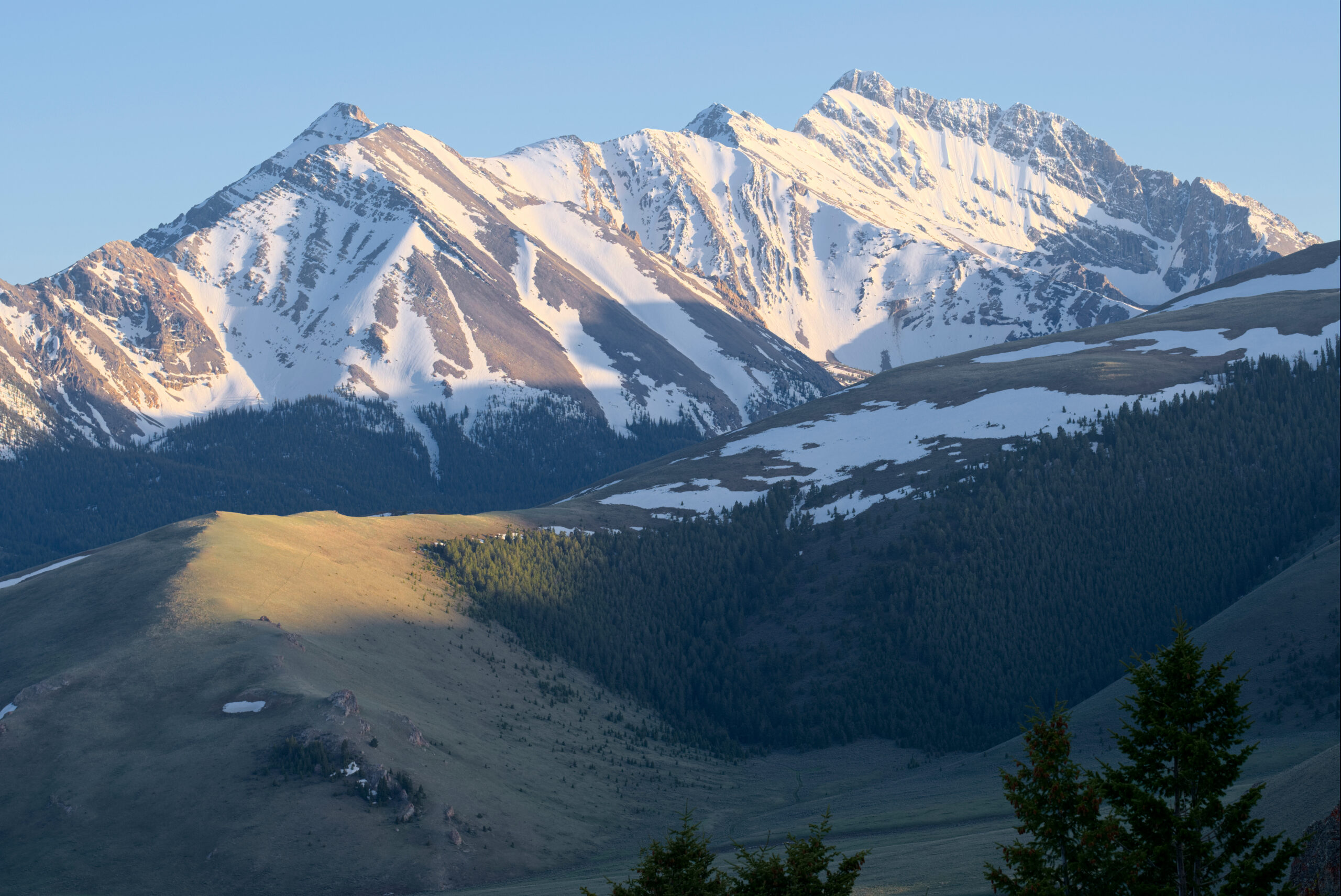
The Southwest Ridge route
The one standard line – short in distance, huge in vertical, with a real scrambling crux.
Almost everyone climbs Borah by the Southwest Ridge (the “Borah Peak Trail” or “Chicken-Out Ridge route”) from the Birch Springs trailhead. It’s deceptively short on the map – about 3.5 miles to the summit – but it climbs relentlessly, gaining over 5,200 ft, and the trail turns to Class 2–3 scrambling on the upper ridge. There is almost no flat ground and no reliable water above the trailhead.
The lower trail: relentless forest climb
From the trailhead the path climbs immediately and never really eases, switchbacking up through pine and fir, then open slopes. It’s a straightforward but brutal grind – you gain most of the day’s elevation here. Pace yourself; the scrambling above rewards fresh legs.
Chicken-Out Ridge: the crux
At roughly 11,800 ft the ridge narrows into Chicken-Out Ridge – a rocky, exposed crest with real drop-offs, a short downclimb into a notch, and (early season) a snow bridge. This is where the climb becomes mountaineering and where many parties turn back. It’s covered in full in the next section.
The summit ridge & top
Past the ridge, a final push up scree and blocky slopes leads to the summit. The views are enormous – the Lost River Range’s other 12,000 ft peaks (Leatherman, Mount Idaho), the Big Lost River Valley far below, and, on a clear day, ranges across central Idaho. Sign the summit register and don’t linger if weather is building.
Chicken-Out Ridge, up close
The reason Borah has a reputation – and the reason to respect it.
Chicken-Out Ridge earns its name: it’s where hikers expecting a walk-up meet real exposure and, often, decide the summit isn’t worth it. In dry mid-summer conditions it’s a Class 3 scramble with one brief harder move – hands-on climbing along a narrow rock crest with big drop-offs on both sides, followed by a short downclimb into a notch before the terrain eases toward the summit ridge. For a confident scrambler in good conditions, it’s exhilarating rather than desperate. For someone uneasy with heights or loose rock, it can be truly frightening.
Summit day, hour by hour
A dry-conditions day from the Birch Springs trailhead.
The 1983 earthquake at Borah’s feet
The most instructive fault scarp in the American West – and you drive past it to the trailhead.
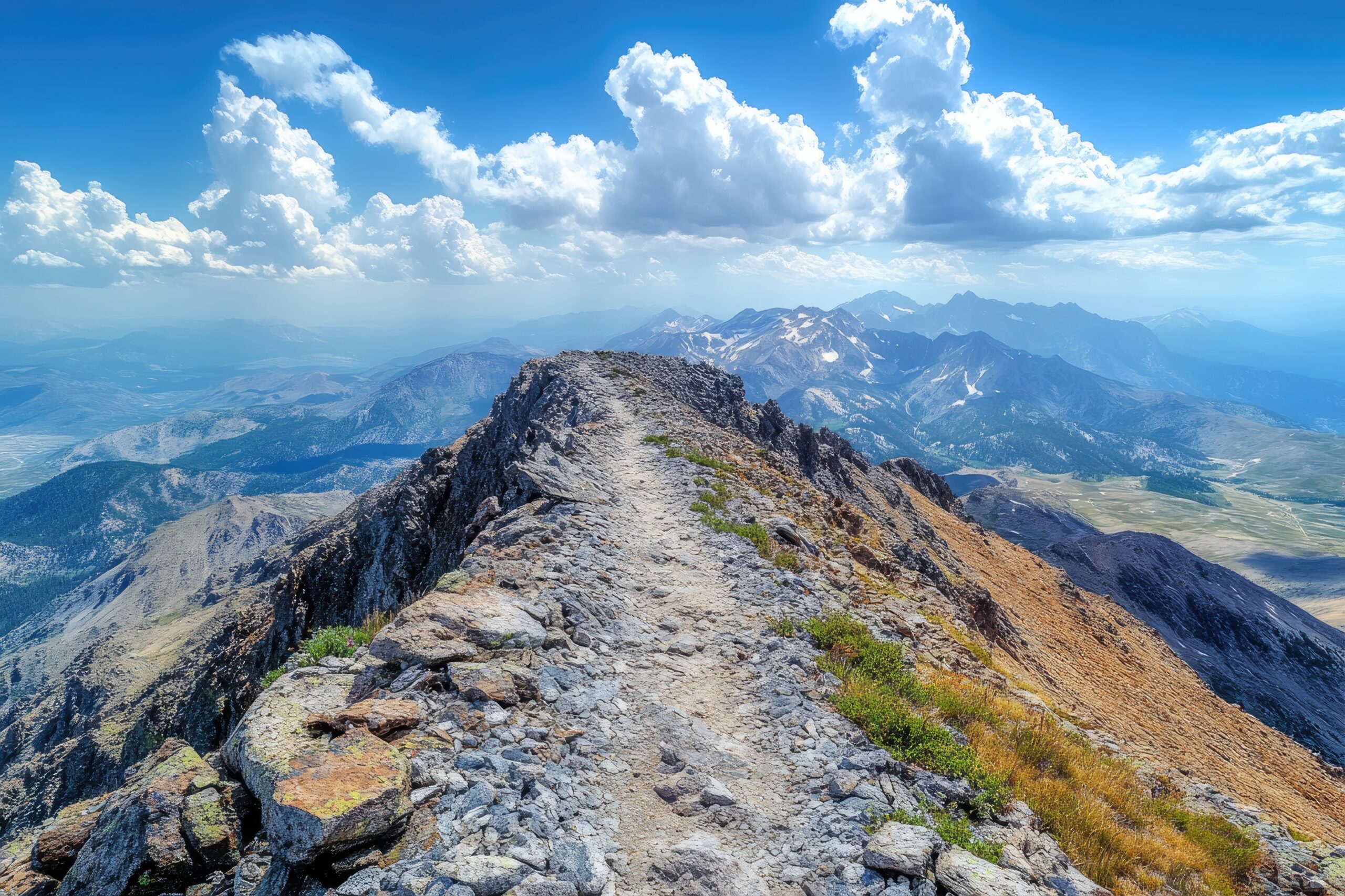
On October 28, 1983, at 8:06 a.m., a magnitude 6.9 earthquake (7.3 on the older Richter scale) struck along the Lost River Fault at the base of Borah Peak – the largest recorded earthquake in Idaho’s history. It killed two children in nearby Challis when a storefront collapsed and caused about $12.5 million in damage across the Challis–Mackay area, with shaking felt across eight states.
For climbers and geologists, its legacy is written into the landscape. The quake produced a fault scarp running about 21 miles along the base of the Lost River Range, up to roughly 9 feet high in places: in a single event, the valley floor dropped several feet while the range rose – the mountains and valley pulled apart by as much as 14 feet in spots. This is textbook Basin-and-Range normal faulting, the very process that has built Borah and the ranges around it over millions of years. The scarp is still clearly visible from the road to the Birch Springs trailhead – a rare chance to see, in one afternoon, the mechanism that raises a mountain you’re about to climb.
When to climb
The dry Class 3 window is short – get the conditions right.
Jun–early Jul · Snow
Chicken-Out Ridge often holds a corniced snow bridge. Ice axe, crampons, and self-arrest skill required – a real mountaineering step up.
Mid-Jul–Aug · Prime
The sweet spot: dry Class 3 scrambling, long days, stable mornings. Start pre-dawn to beat afternoon thunderstorms.
Sep · Excellent
Cooler, quieter, usually snow-free early in the month. Watch for the first autumn storms and shorter daylight.
Oct–May · Mountaineering
Snow and cold turn Borah into a full winter/spring climb. For experienced parties only, with the right kit.
Gear checklist
Light for mid-summer; serious if the snow bridge is in.
Standard summer day
- Sturdy hiking boots or approach shoes with good edging on rock
- Helmet (rockfall and the exposed scramble)
- Trekking poles (huge help on the steep descent)
- 3+ liters of water – no reliable water on route
- Wind/rain shell, warm layer, hat and gloves (summit is cold/windy)
- Headlamp for the pre-dawn start, sun protection, first-aid kit
Add if the snow bridge is in
- Ice axe + practiced self-arrest
- Crampons or aluminum mountaineering crampons
- Helmet (already on the list – now essential)
- Optional: short rope + basic protection for the notch, for less experienced parties
- Honest assessment: if you don’t have these skills, wait for melt-out
For the layering system and footwear, see our layering guide and boots guide.
Safety essentials
Borah’s hazards are exposure, weather, and water – plan for all three.
Frequently asked questions
How hard is Borah Peak?
A serious Class 3 scramble: ~7.5–8 miles round trip, ~5,200 ft of gain to 12,662 ft, 8–12 hours. No rope needed in dry mid-summer, but Chicken-Out Ridge is seriously exposed, and an early-season snow bridge can require an ice axe and crampons. One of the more demanding US state highpoints.
What is Chicken-Out Ridge?
The crux at ~11,800 ft – a narrow, exposed Class 3 rock crest with a short downclimb into a notch, named because many hikers turn back there. Early season it carries a corniced snow bridge. Falls here have caused serious accidents; attempt it only in good conditions.
Do you need a permit?
No permit and no fee – Borah is on Salmon-Challis National Forest land. Just drive to the Birch Springs trailhead and climb. Register in the trailhead logbook.
When should I climb it?
Mid-July through September, once the snow bridge has melted and the ridge is dry Class 3. June and early July often require snow gear. Start pre-dawn to beat afternoon storms.
How high is Borah and where is it?
12,662 ft (3,859 m), the highest point in Idaho and 11th-highest US state highpoint, in the Lost River Range of Custer County, central Idaho. It’s also an Ultra (5,982 ft of prominence) and holds Idaho’s only active glacier.
Is Borah harder than other state highpoints?
Harder than most walk-up highpoints, easier than the true mountaineering ones. It’s tougher than Kings Peak (Utah) or Wheeler Peak (New Mexico) because of the exposed scramble, but well below Granite Peak (Montana), Gannett Peak (Wyoming), or Denali. A strong Class 3 scrambler’s objective.
Sources & methodology
Elevation, prominence, and first-ascent data from USGS and standard peak databases; route detail from Idaho: A Climbing Guide, Salmon-Challis National Forest information, and highpointer trip reports. The 1983 earthquake facts (magnitude, date, fault scarp, casualties) are drawn from the USGS, the Idaho Office of Emergency Management, and published earthquake-spectra summaries. Idaho’s active-glacier recognition follows the 2021 USGS determination.
Elevations are feet-first with metric in parentheses for a US audience. Snow conditions on Chicken-Out Ridge, trailhead access, and weather change constantly — confirm current conditions with the forest and recent trip reports within a week or two of your climb.
Next state highpoints
Borah is a rung on the state-highpointing ladder — here’s where it fits.
Borah Peak sits in the sweet spot of the 50 state highpoints challenge: harder than the walk-ups, but a step below the technical giants. If Borah’s Class 3 scramble suits you, two neighboring Western highpoints are the natural next objectives — both a notch more committing. Granite Peak (Montana, 12,807 ft) is often called the second-hardest lower-48 highpoint after Denali, with exposed Class 4 rock and tricky route-finding. Kings Peak (Utah, 13,528 ft) trades technical difficulty for remoteness — a long ~29-mile Uinta backpack with a Class 2–3 finish. Together with Borah, they form a classic Northern Rockies highpoint progression.
The roof of Idaho awaits
No permit, no crowds, no rope in mid-summer — just 5,200 vertical feet, one exposed ridge, and one of the West’s most rewarding state highpoints. Come fit, come in season, start before dawn, and respect Chicken-Out Ridge.
The 50 state highpoints → Browse all mountains →Borah Peak & the US State Highpoints
Idaho’s highpoint and its Chicken-Out Ridge is one of the 50 state highpoints. Compare the others below.
Was this helpful?
🏔Related peaks nearby
🧭Explore & compare
Global Summit Guide is an independent mountaineering resource founded in 2026. The team combines first-hand trekking and climbing experience with in-depth research and professional health and nutrition review to help climbers choose objectives, prepare properly, and stay safe.
Health, altitude, and nutrition content is reviewed by Taylor Ludlow (Registered Nurse) and Brigg Hoopes (Nutritionist).
What We Don't Know Yet
Mountain information changes quickly. This box explains the limits of what this page can responsibly promise.
- Route conditions, snowpack, closures, and weather can change quickly after this page is updated.
- Permit rules, fees, quotas, and reservation windows may change between review cycles.
- Operator availability, pricing, guide ratios, and cancellation terms can change by season.
- Your fitness, altitude response, risk tolerance, and experience level may change what is safe or realistic.
- Use this page for planning guidance, then verify current information with official sources and qualified local experts before committing.
Verify current conditions with official land managers, guide services, local forecasts, and current route reports before booking or climbing.
Mountaineering, rock and ice climbing, glacier travel, and high-altitude activity are inherently dangerous and can result in serious injury or death. The information on Global Summit Guide is provided for general informational and educational purposes only and is not a substitute for professional instruction, qualified guiding, proper equipment, or your own judgment and experience.
Route conditions, weather, snowpack, permits, regulations, and hazards change constantly and may differ from what is described here. Details may be incomplete, out of date, or contain errors. Always verify current information with local authorities, certified guides, and official sources before making any decision in the mountains.
Nothing on this site is medical, legal, or financial advice. Our fitness, acclimatization, altitude, and nutrition content is general in nature; consult a qualified physician before beginning any strenuous exercise program or exposing yourself to high altitude.
You are solely responsible for your own safety and decisions. To the fullest extent permitted by law, Global Summit Guide and its team accept no liability for any loss, injury, damage, or expense arising from use of, or reliance on, this information. By using this site you acknowledge these risks and accept these terms.
Some links on this site may be affiliate links. If you buy through them we may earn a small commission at no extra cost to you; this never affects our recommendations.
Global Summit Guide recommendation path
Next Best Mountain to Research
Use these recommendations to continue the right planning path instead of stopping on one page.
Use current permit, weather, route, and operator information before booking or climbing.
Search Flights, Hotels & Rental Cars
Have the mountain or destination picked? Use Expedia to compare the flights, lodging and rental cars that fit your actual trip dates. For mountain travel, consider arriving early enough for delays and adding a buffer night after the climb before a fixed flight home.
Compare current flight, hotel and car options.
Affiliate disclosure: Global Summit Guide may earn a commission if you book through this link, at no additional cost to you.